
U.S. 50 West - Daviess & Knox Counties


 West
West
Inside Daviess County, U.S. 50/150 west travel through farm land toward Washington. This stretch of highway connects Loogootee to Interstate 69. The Indiana-Michigan interstate was extended from Indianapolis southwestward to Evansville during the 2010s into the 2020s.
06/06/12
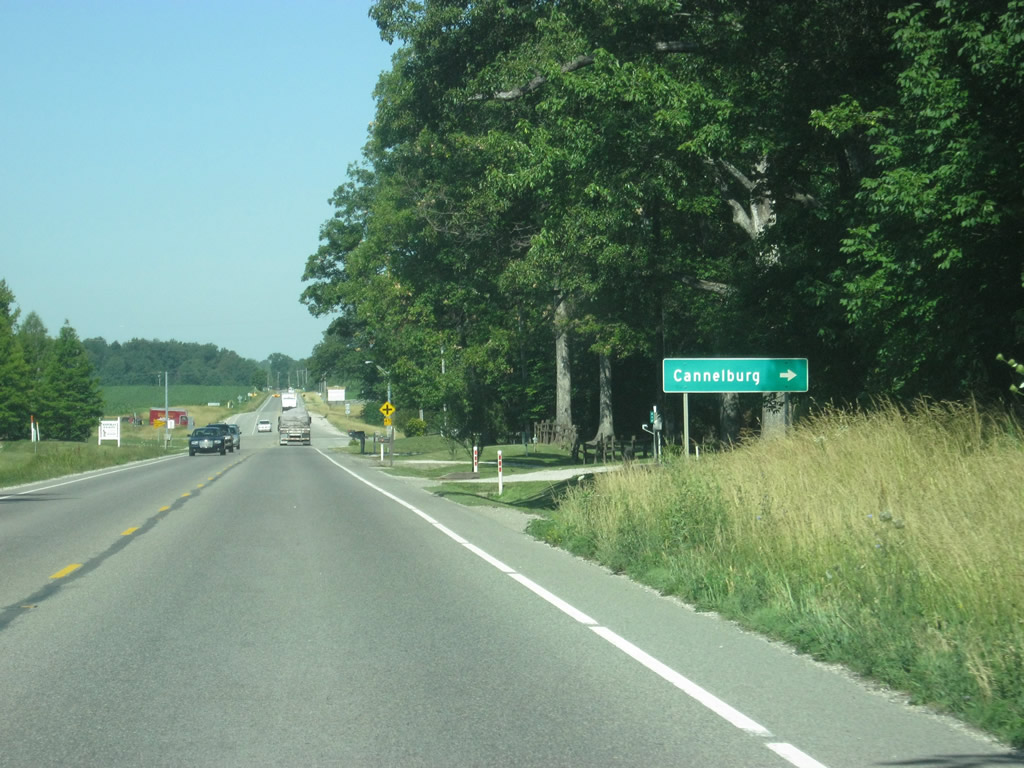
The two U.S. highways prepare to cross the intersection with County Road 900 East, which heads north to the town of Cannelburg. The local road continues north connecting with SR 58 near Odom. South of U.S. 50/150, County Road 900 East intersects with County Road 100 South, a former alignment of U.S. 50/150.
06/06/12
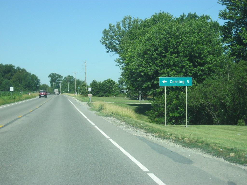
County Road 825 East heads south from U.S. 50/150 where it becomes County Road 800 West en route to the town of Corning five miles away.
06/06/12
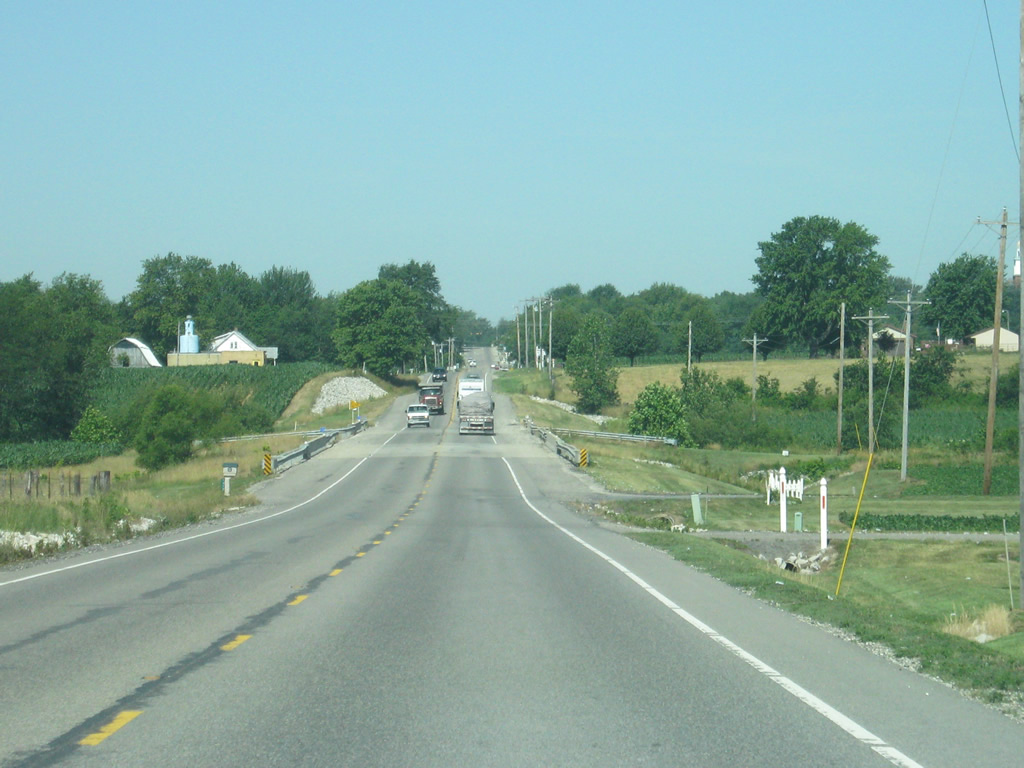
U.S. 50/150 span Prairie Creek and one of its tributaries just east of Montgomery in this westbound scene.
06/06/12
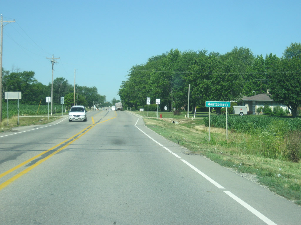
U.S. 50/150 west enter the town of Montgomery. The highway briefly gains a center turn lane as it heads through the small town.
06/06/12
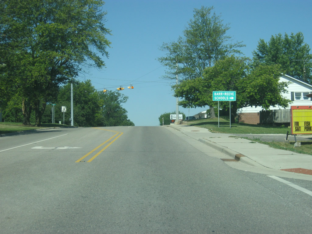
3rd Street heads north U.S. 50/150 (National Highway) to the Barr-Reeve Schools at County Road 100 North.
06/06/12
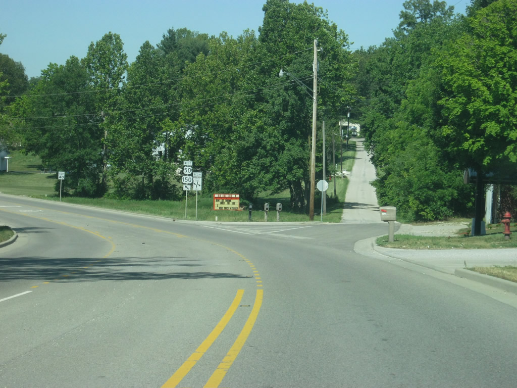
Leaving Montgomery, Washington (county seat of Daviess County) is now only seven miles away.
06/06/12
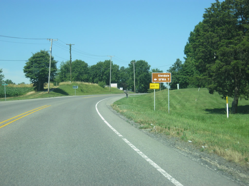
County Road 550 East heads seven miles south from U.S. 50/150 to the Glendale State Fish and Wildlife Area.
06/06/12
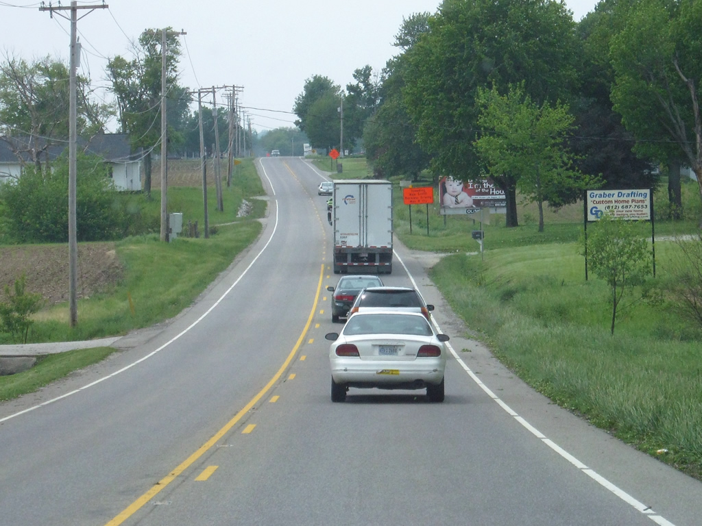
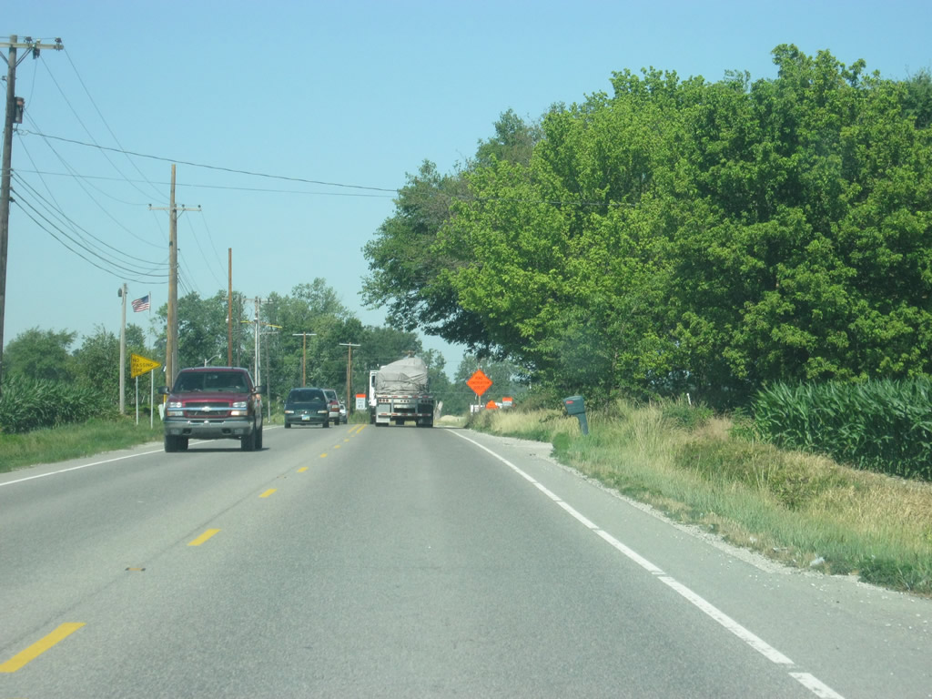
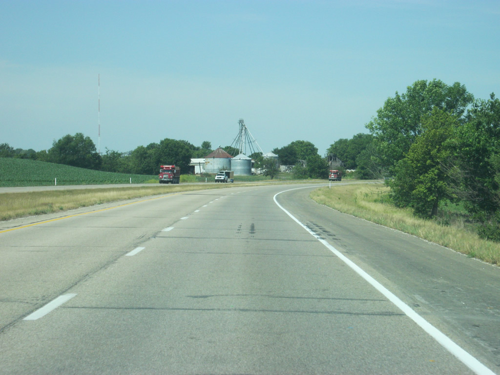
Westbound U.S. 50/150 travel due west along a section line between Old U.S. 50 (County Road 100 South) and County Road 300 East. A handful of homes and agricultural land make up the landscape in this scene after County Road 450 East.
04/29/12
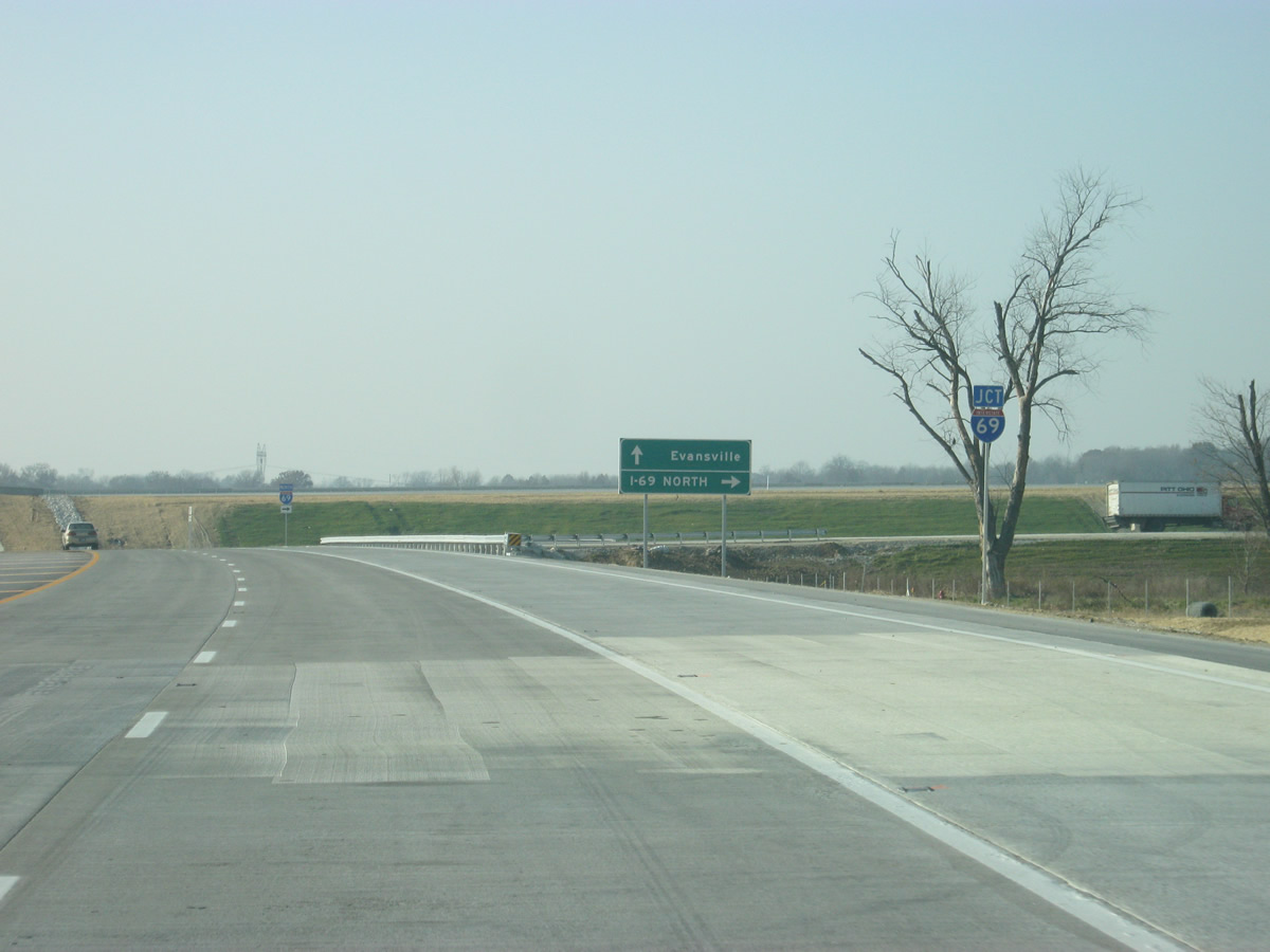
U.S. 50/150 west ahead of Interstate 69. A diamond interchange joins the U.S. highways I-69, which that opened on November 19, 2012.
06/06/12
As part of the I-69 project, U.S. 50/150 was widened to four lanes from just east of the freeway to its existing four lane section that bypasses Washington. I-69 continues northeastward to Bloomington and Martinsville.
11/21/12
Southward, Interstate 69 travels toward the communities of Petersburg and Oakland City, providing a high-speed link between those population centers. Around a 65 mile trip awaits motorists bound for the city of Evansville from this location.
11/21/12
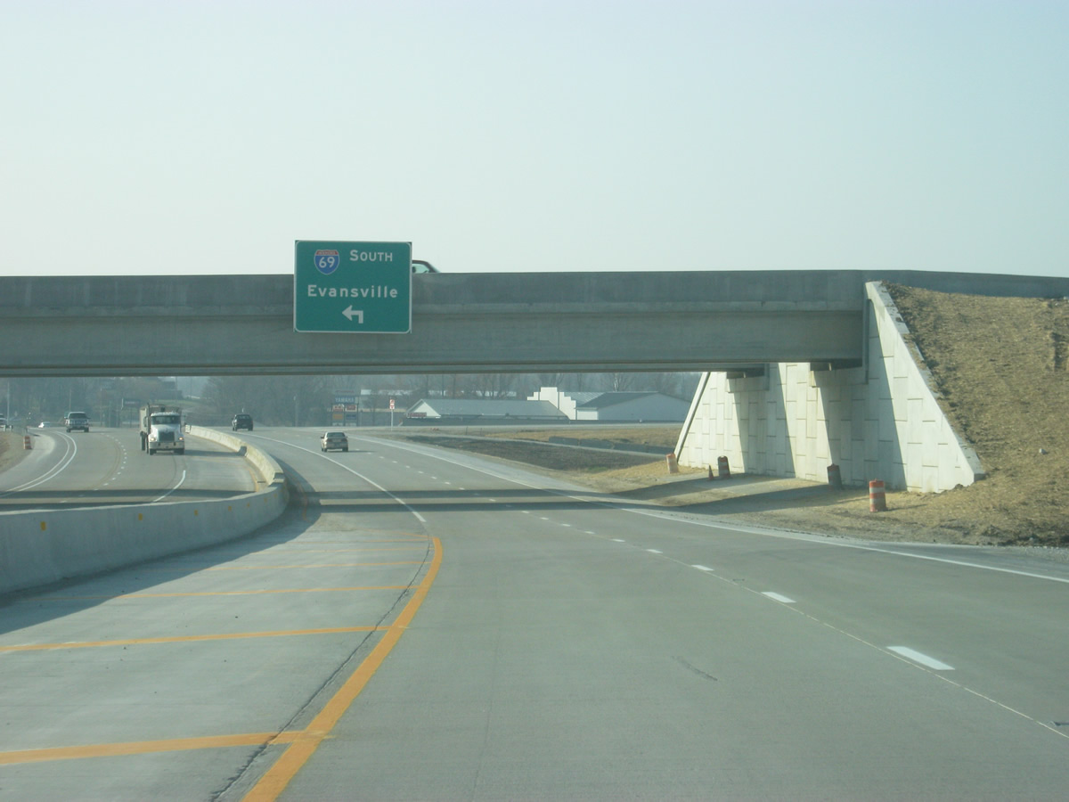
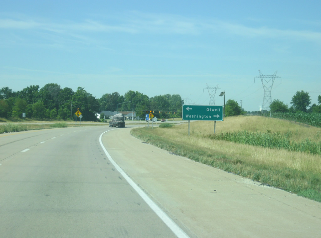
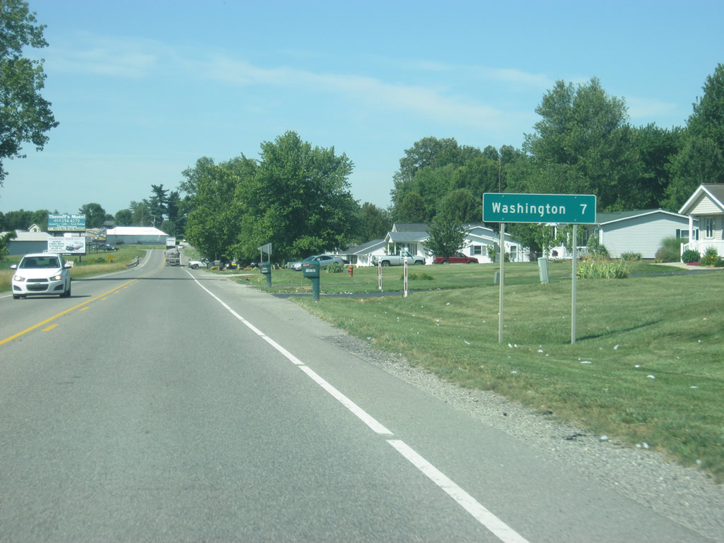
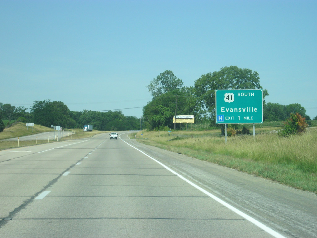
West of Interstate 69, U.S. 50/150 near the intersection with U.S. 50 Business (National Highway). National Highway (former U.S. 50/150) leads west into the business district of Washington (population 11,509) while the two U.S. highways bypass it to the south.
11/21/12
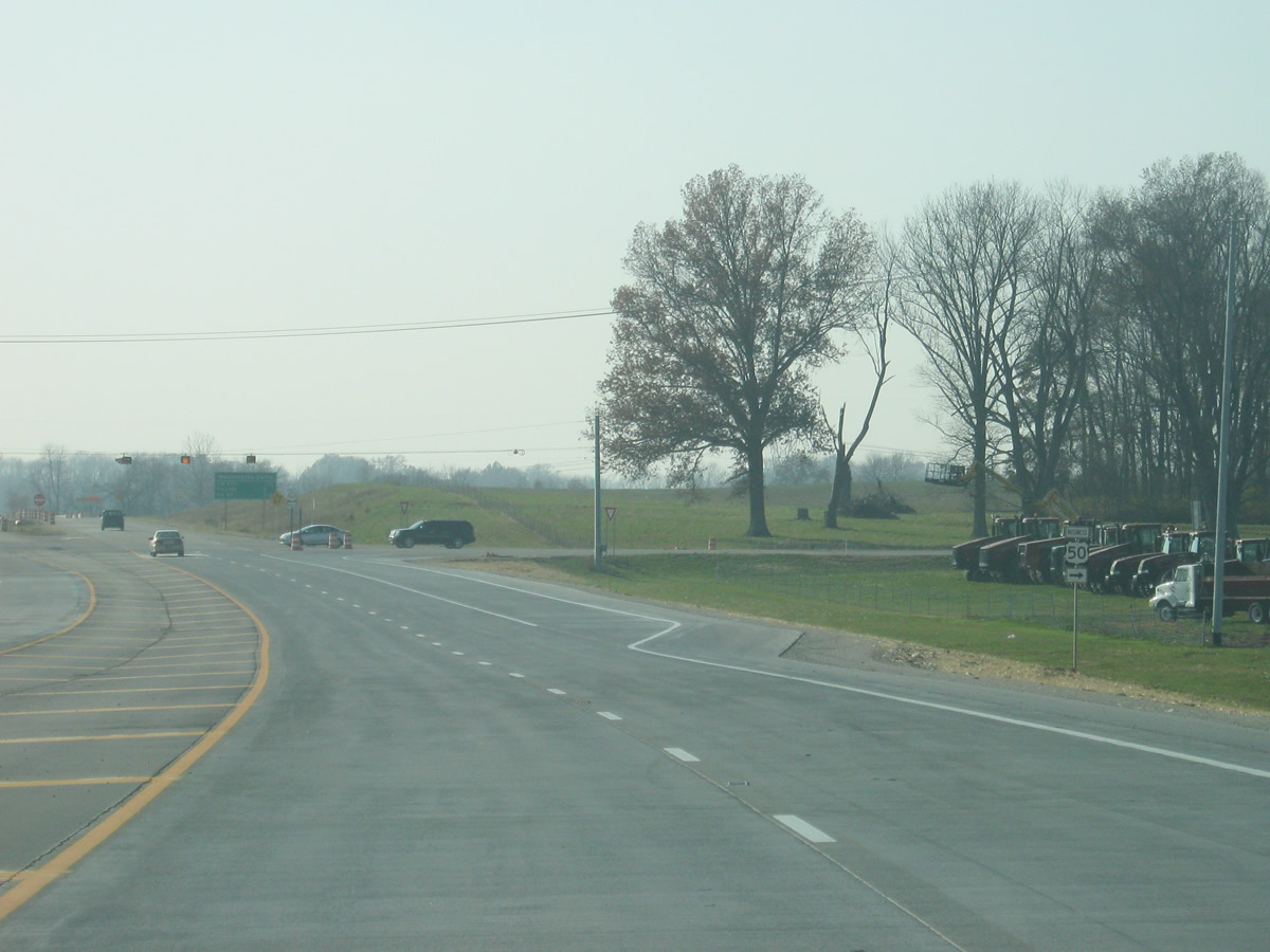
Motorists prepare to depart for U.S. 50 Business (National Highway) and Washington. As with any business route in Indiana, the designation is purely local.
11/21/12
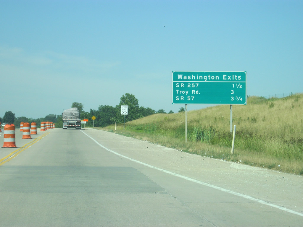
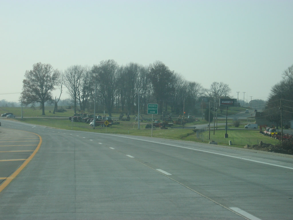
Beyond National Highway, U.S. 50/150 west continue. There have been two previous alignments of both highways across Washington, but today, it makes a wide arc to the south bypassing the city along the newer four lane facility. Ahead are the three major exits for Washington, at SR 257 (1.5 miles), Troy Road (3 miles), and SR 57 (3.75 miles). However, none of these are actual interchanges, only at-grade intersections with the highway.
06/06/12
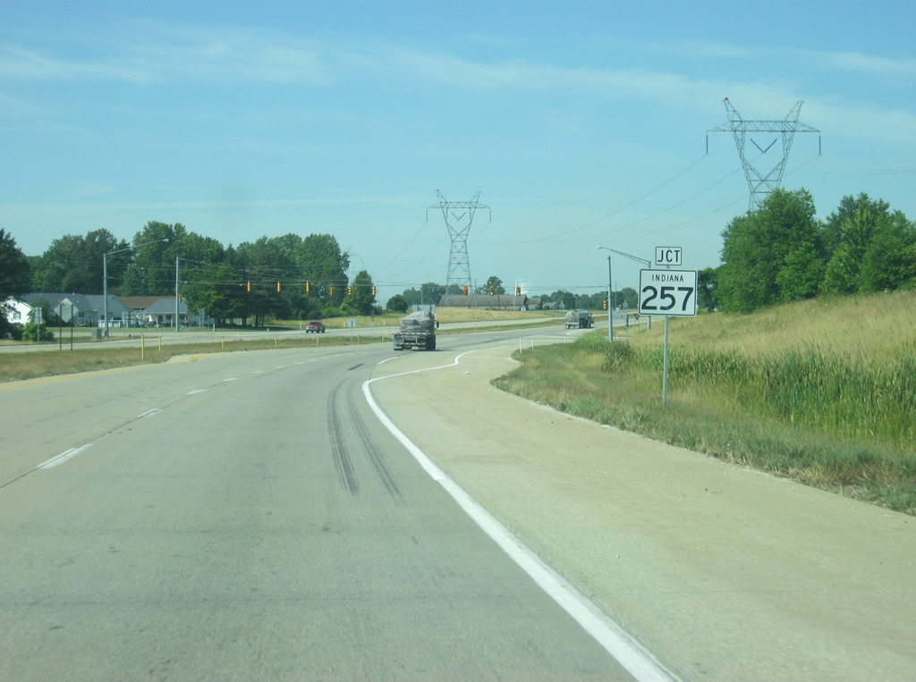
U.S. 50/150 west approach the signalized intersection of SR 257. The state highway stretches 31.3 miles south from downtown Washington to Stendal, passing through Otwell on the way.
06/06/12

SR 257 north extends 1.2 miles to end at National Highway east of downtown Washington. South, the state highway continues another 30.1 miles to the town of Stendal. Notably, SR 257 currently terminates on both ends at local roads and not state or U.S. highways, as route designations have been realigned over the years.
06/06/12
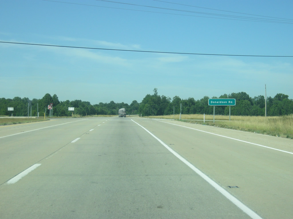
Ahead is the intersection with Donaldson Road. U.S. 50/150 around Washington is the only known place in Indiana where minor intersections are marked by this type of guide sign.
06/06/12
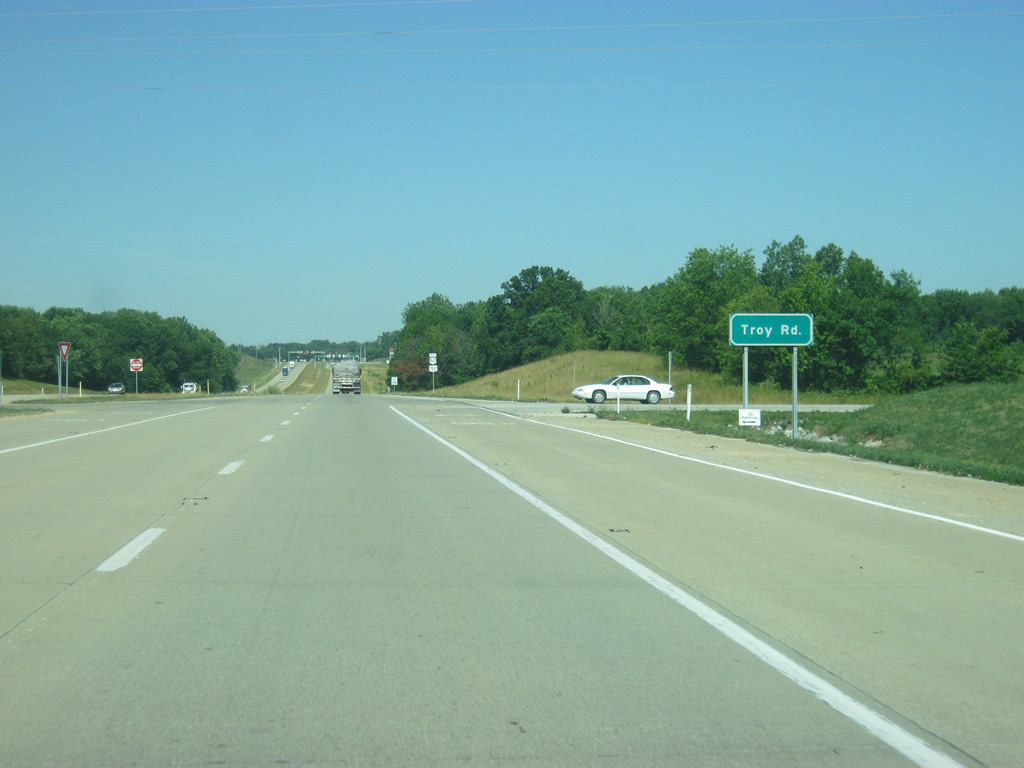
Troy Road represents the next crossing along the U.S. 50/150 bypass of Washington. The intersection with SR 57 looms in the distance.
06/06/12
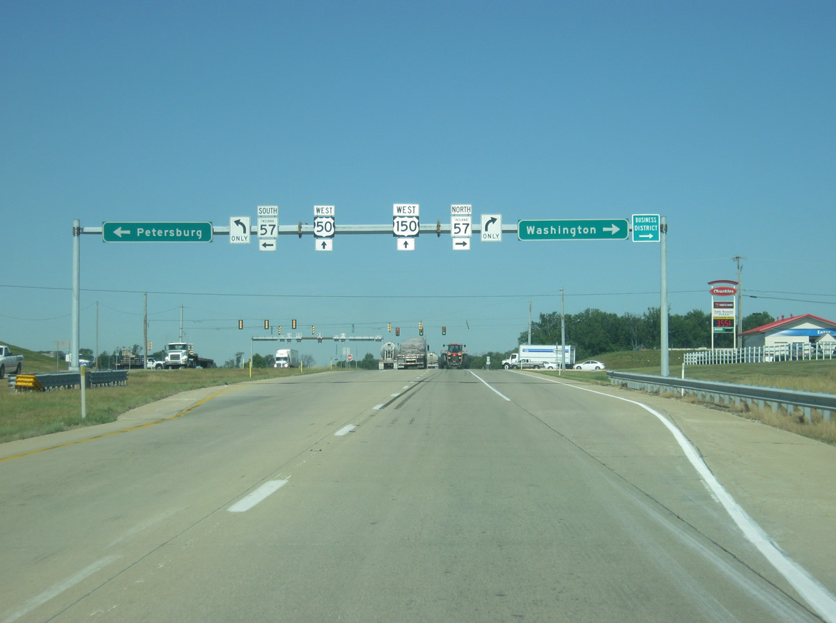
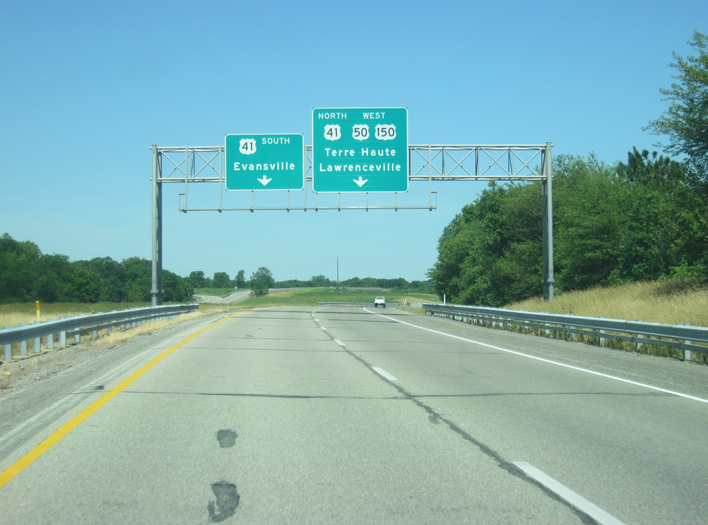
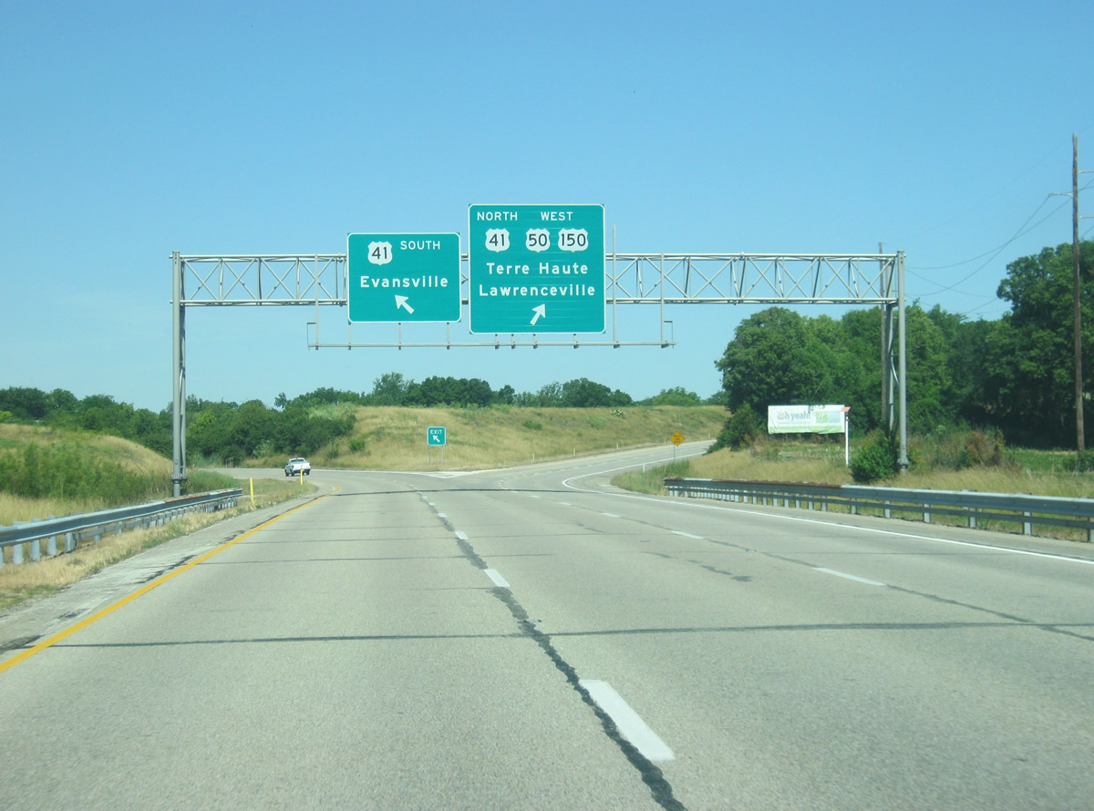
Approaching the intersection with SR 57 to the south of Washington. SR 57 goes for 80 miles from Worthington in Greene County to Evansville in Vanderburgh County. The new Interstate 69 follows the SR 57 corridor from Interstate 64 north into Daviess County.
06/06/12
In Washington, SR 57 passes near the Central Business District before continuing north to Plainville and Elnora and an end at U.S. 231 in Greene County. To the south, the highway heads southwest toward Petersburg, Oakland City and finally Evansville.
06/06/12
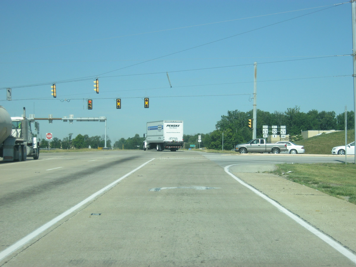
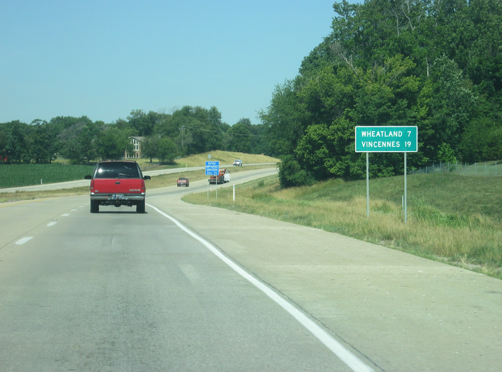
U.S. 50/150 shields posted west of the SR 57 intersection. The town of Wheatland is seven miles away with the Knox County seat of Vincennes now at 19 miles.
06/06/12
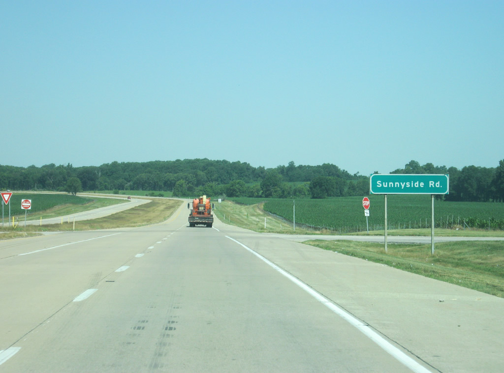
Curving northward, the US highway pair next intersect Sunnyside Road, which heads east across the south side of Washington.
06/06/12
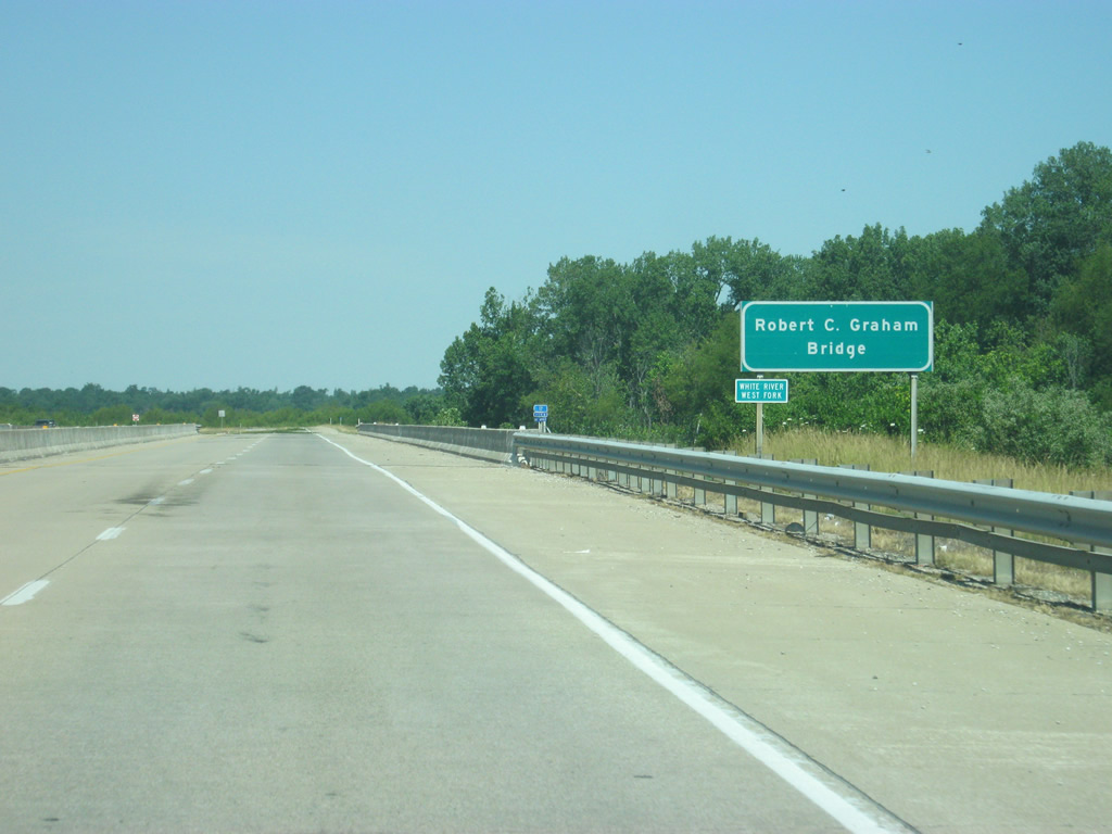
U.S. 50/150 crosses the West Fork of the White River over the Robert C. Graham Bridge.
06/06/12
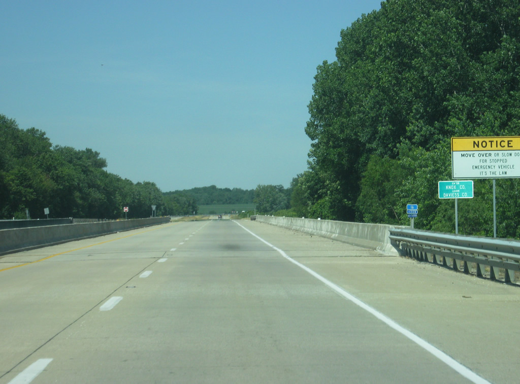
U.S. 50/150 enter Knox County (population 33,440) over a small creek that represents an older course of the West Fork of the White River. The current river lies a little further to the east. Presumably, the county boundary follows the older alignment of the river.
Knox County is the oldest county in Indiana and was one of the two created in the Northwest Territory in 1790. When it was originally created, the county spanned into present-day Ohio, Michigan, and Illinois, as well as all of Indiana.
06/06/12
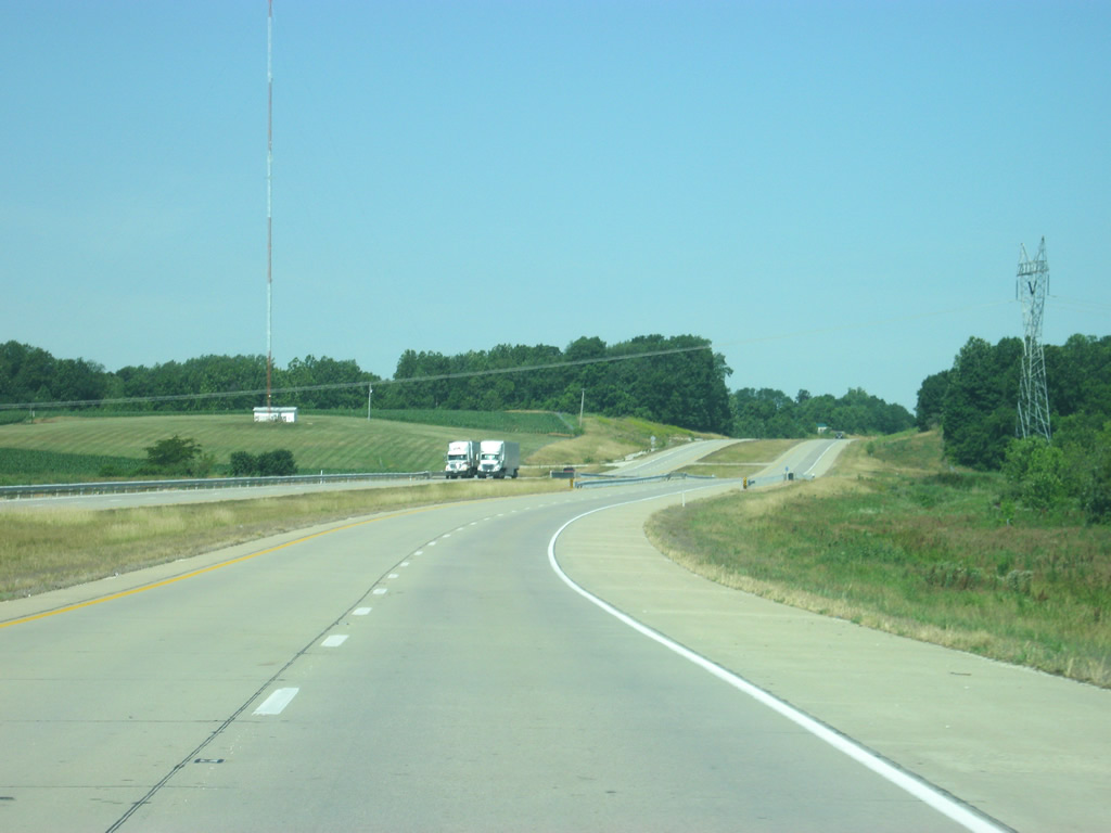
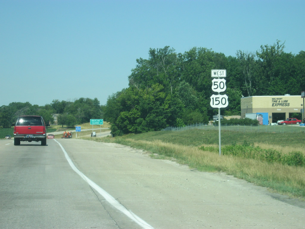
A view of U.S. 50/150 as the highway heads northwest toward the community of Wheatland. This stretch of highway will likely get busier as the main connector between Interstate 69 and the city of Vincennes.
06/06/12

U.S. 50/150 enters the intersection with SR 241. SR 291 angles southwest through Monroe City and Decker on its 16.7 mile journey to U.S. 41 in southern Knox County.
06/06/12
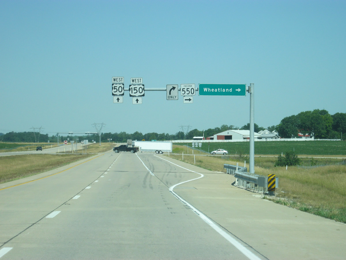
U.S. 50/150 at the intersection with SR 550. SR 550 exists in two small segments, both connected to U.S. 50/150 with the previous being in Martin County. This segment goes for 14 miles to the northwest from U.S. 50/150 near Wheatland north to U.S. 41.
06/06/12
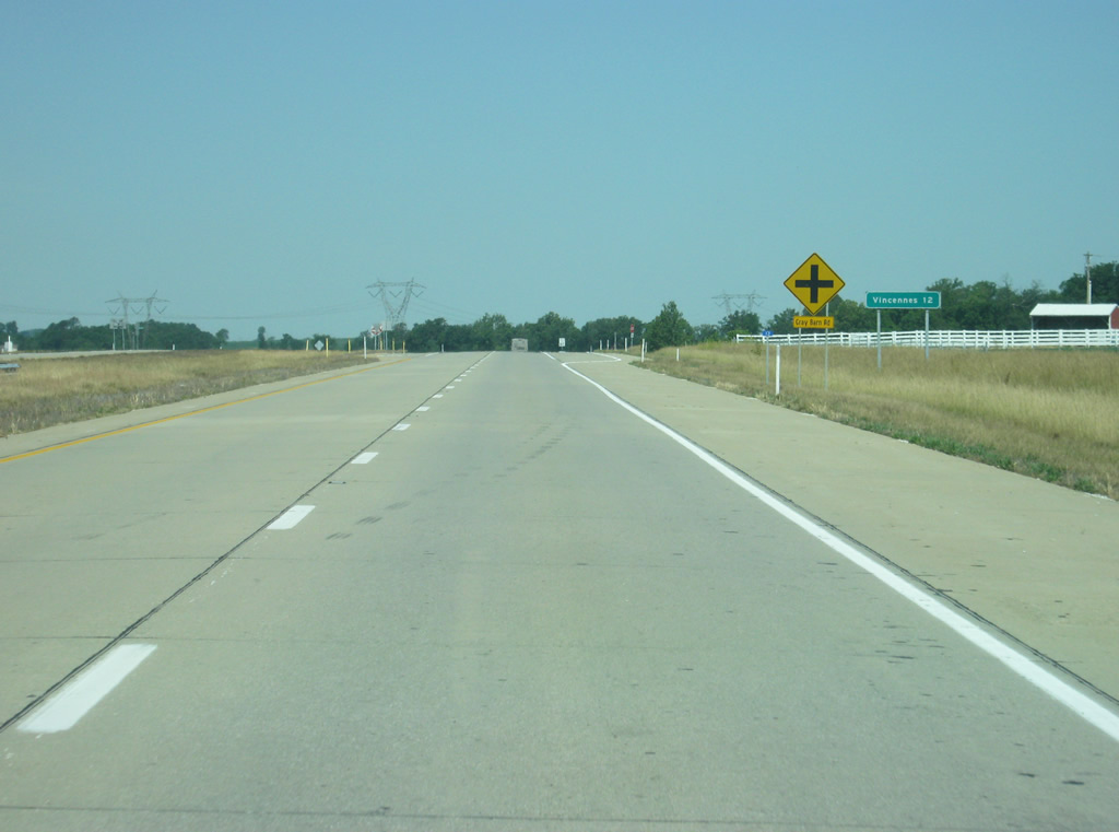
Vincennes now lies 12 miles away along U.S. 50/150.
06/06/12

U.S. 50/150 is the only major highway that flows generally east-west across the county, where the other county roads and state highways cross at 45 degree angles, mirroring the street grid of Vincennes that orientates to the Wabash River.
06/06/12
The former routing of U.S. 50 turns off near Frichton and heads west into Vincennes, while U.S. 50 bypasses the city.
06/06/12
U.S. 50/150 is one mile away from the interchange with U.S. 41. U.S. 41 comprises a major north-south highway spanning 280 miles from Hammond, outside of Chicago, south toward Terre Haute before reaching Vincennes and Evansville.
06/06/12
The left lane becomes the exit ramp for U.S. 41 south while U.S. 50/150 west join U.S. 41 north as part of the bypass around Vincennes. The Vincennes bypass, a freeway carrying all three of those U.S. highways at certain times, was originally conceived as part of the future interstate from Louisville to St. Louis. That freeway was never realized, but the Vincennes bypass remains in place and continues U.S. 50 westward into Illinois.
06/06/12
A three-level stack interchange forms the location where U.S. 50/150 join U.S. 41 north. Traffic to southbound U.S. 41 heads off to the left. From this spot, the city of Evansville lies 50 miles to the south of Vincennes as U.S. 50 begins its bypass of Vincennes (population 18,701). Originally founded in 1732 as a French Trading Post, Vincennes is the oldest settlement in Indiana. As a result, the city was home to the first school, newspaper, and bank in the state.
06/06/12
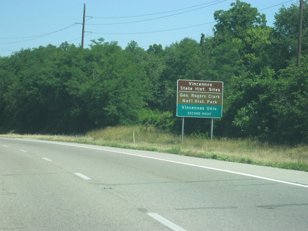
Vincennes is best known for the George Rogers Clark National Historic Park, site of the 1779 Battle of Vincennes during the American Revolutionary War. Numerous historic sites for the state are also located in the city center, as part of the Indiana Territory State Historic Site. Vincennes University, the oldest college in Indiana, is also located within in the city. The interchange along U.S. 50 for 6th Street provides access to all major sites in Vincennes.
06/06/12
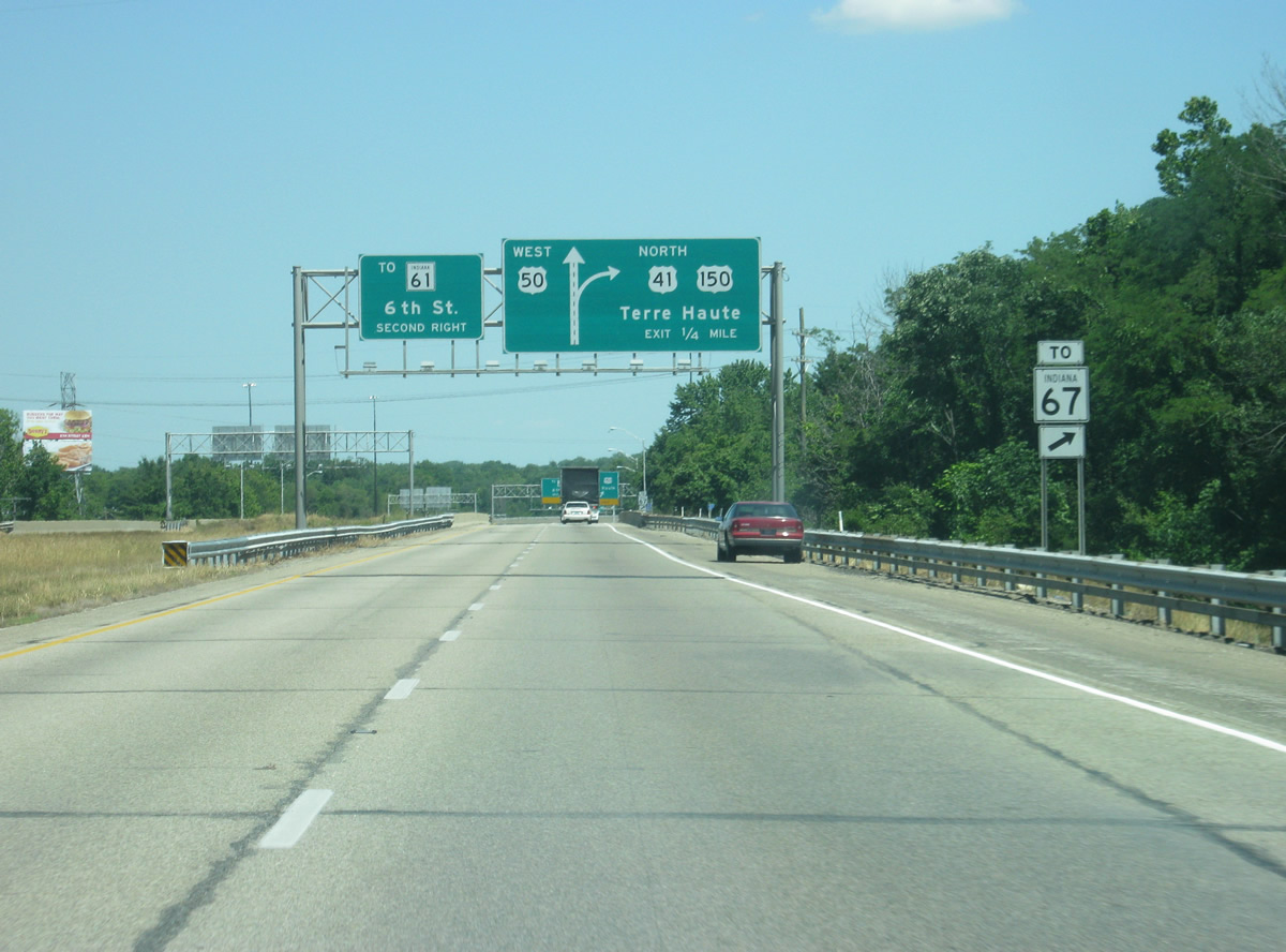
The next interchange along U.S. 50 is a cloverleaf with 6th Street to the south and U.S. 41/150 to the north. 6th Street heads in a southwesterly direction from the freeway through Vincennes and contains several motorists' services. SR 61, a 64 mile state highway from Vincennes south through Petersburg and Newburgh to the Ohio River, begins at the point where the highway passes underneath the U.S. 41 freeway bypass at the city limits to Vincennes, which is currently not an interchange. Traffic bound for SR 67 to the north should use the first exit onto U.S. 41/150 north.
06/06/12

Entering the cloverleaf interchange with 6th Street and U.S. 41/150. At this interchange, U.S. 41 north and U.S. 150 east departs for the 56 mile trip to the Vigo County seat of Terre Haute. The ramp concludes a 50 mile overlap of U.S. 150 with U.S. 50 west.
06/06/12
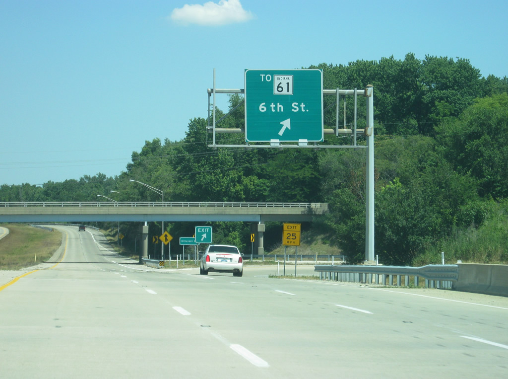
SR 61 is not directly served by the 6th Street exit, but can be reached via the loop ramp onto the street west. Originally, the highway began at the cloverleaf interchange with U.S. 50 and went southwest on 6th Street to St. Clair Street where it turned southeast to Wabash Avenue. That part of the highway was turned back to Vincennes city maintenance in 1999. 6th Street otherwise is a busy commercial thoroughfare that connects the freeway bypass with the heart of Vincennes to the southwest.
06/06/12
The first lone U.S. 50 shield since before Shoals greets motorists west of the interchange with 6th Street and U.S. 41/150. This is also the last U.S. 50 shield in Indiana.
06/06/12
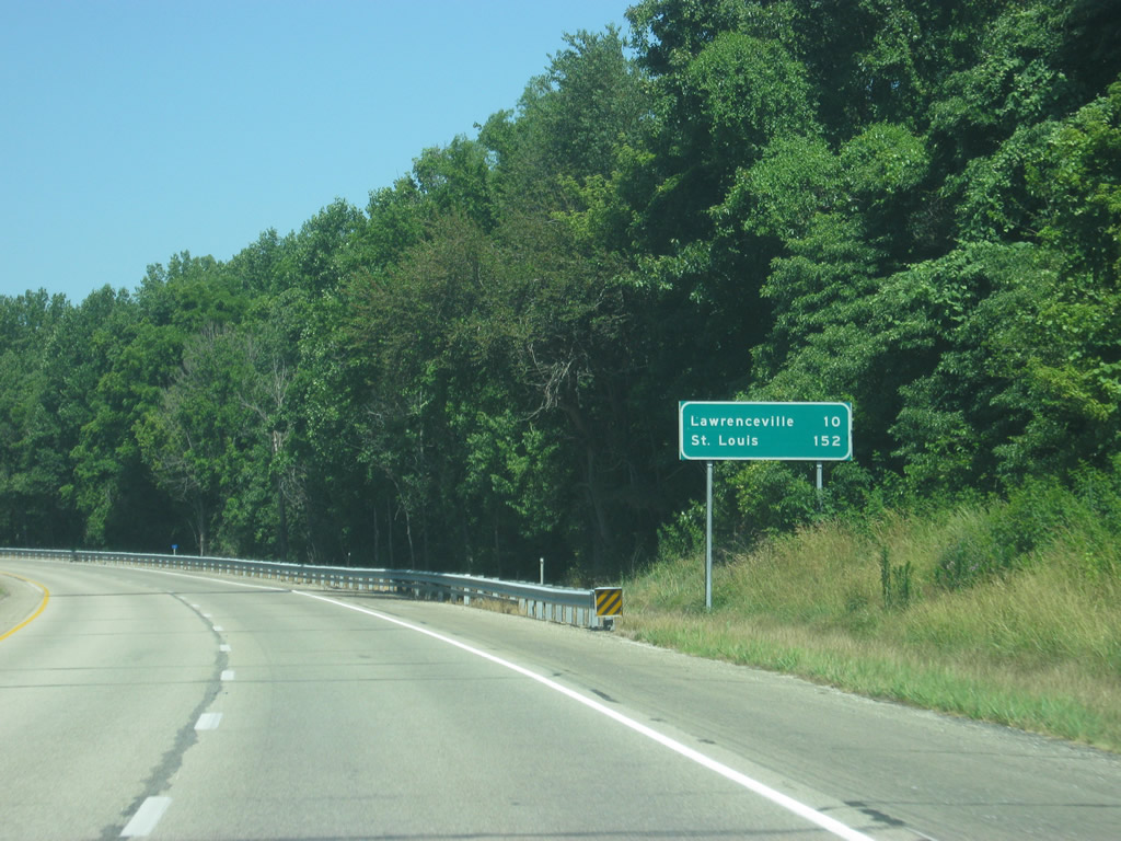
The Illinois community of Lawrenceville is ten miles away, while St. Louis, Missouri lies 152 miles away.
06/06/12
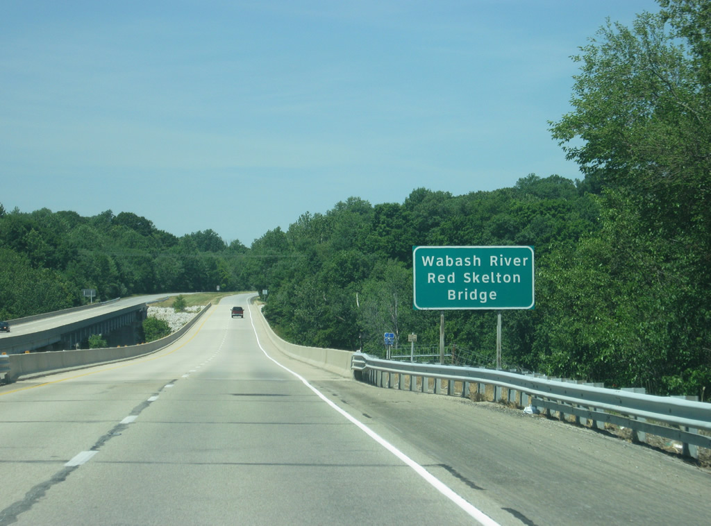
U.S. 50 finally leaves the state of Indiana as it crosses the Red Skelton Bridge over the Wabash River. Interestingly, a Clearview-typeface sign marks the bridge and river. Despite being on the Indiana side of the river, the sign is an IDOT (Illinois Department of Transportation) sign.
06/06/12
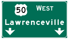

Photo Credits:
- Thomas Decker: 04/29/12, 06/06/12, 11/21/12
Connect with:
Page Updated Thursday November 29, 2012.