
U.S. 74 East - Mooresboro to Kings Mountain

 East
East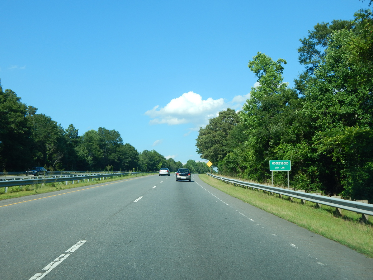
U.S. 74 transitions to an at-grade highway east into the town of Mooresboro.
06/09/17
U.S. 74 Business (Ellenboro Road) merges with U.S. 74 (Dixon Boulevard) at a wye intersection preceding Academy Street south into Mooresboro.
06/09/17
Academy Street north intersects U.S. 74 (Dixon Boulevard) opposite Lattimore Road (SR 1168) southwest from the town of Lattimore.
06/09/17
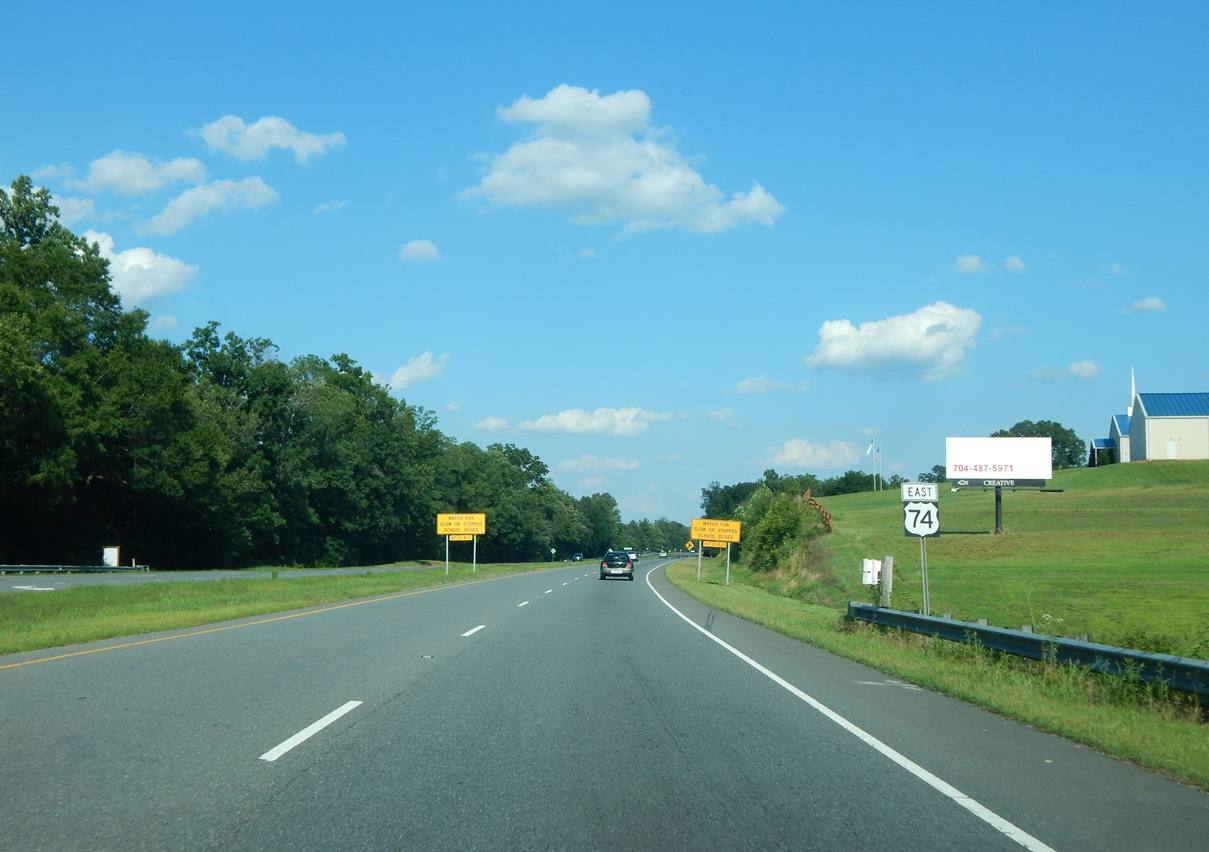
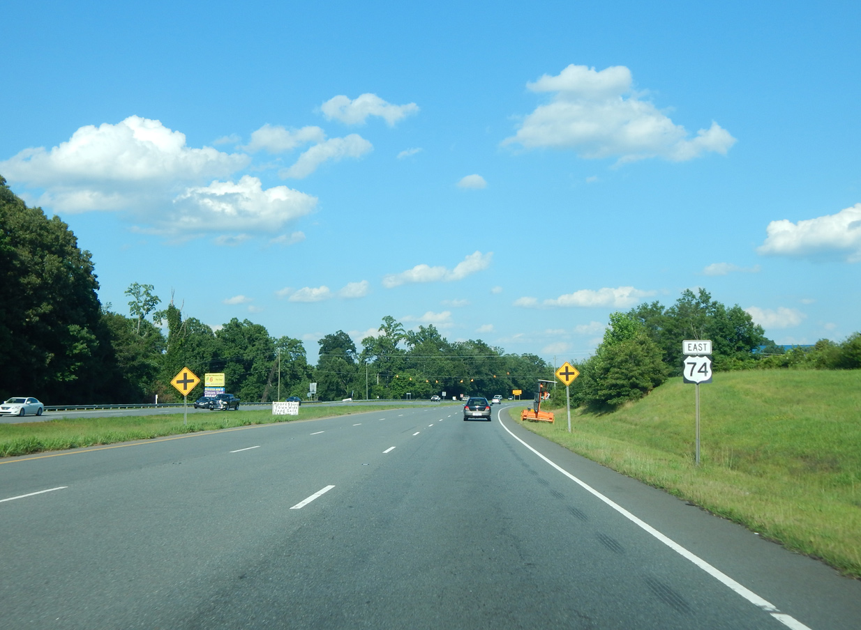
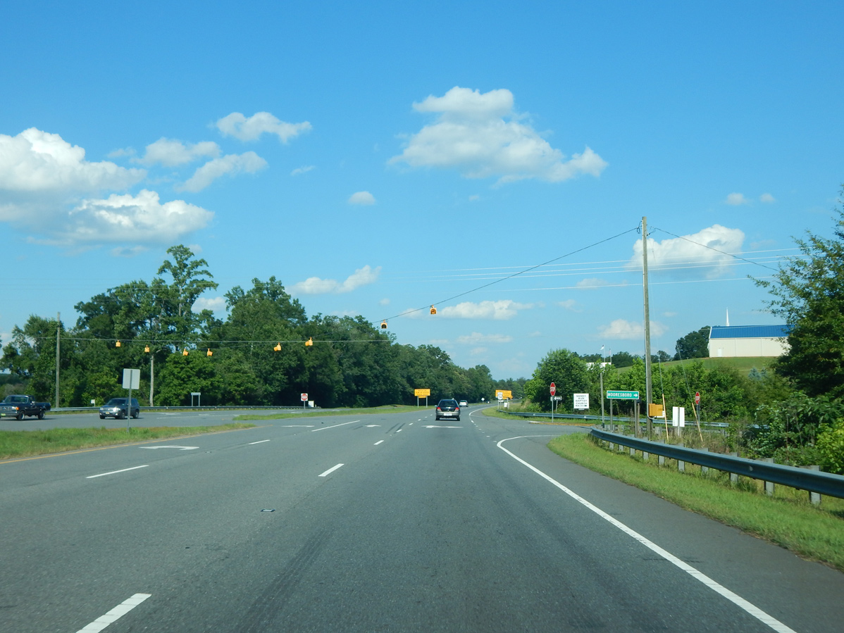
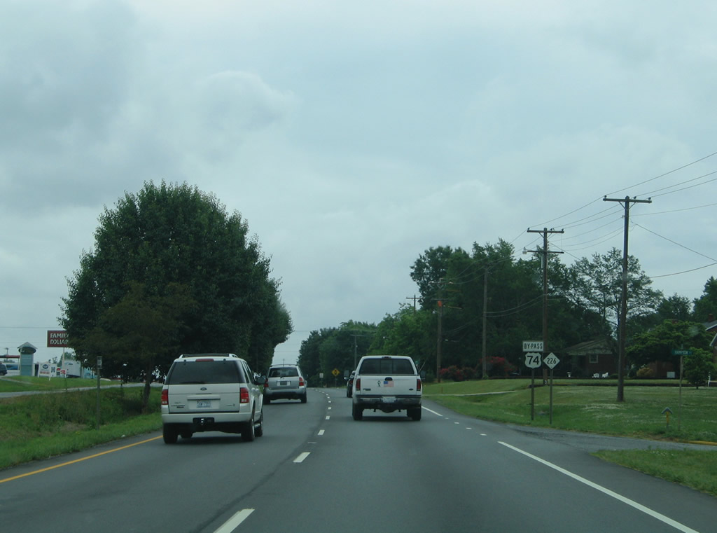
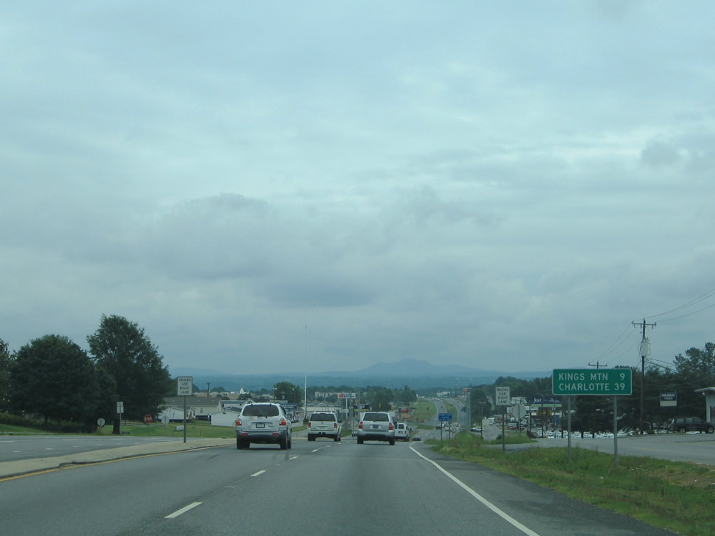
Continuing east from Lattimore Road north and Academy Street south on U.S. 74. Regulatory signs advise motorists to watch for slow or stopped school buses over the next 23 miles.
06/09/17
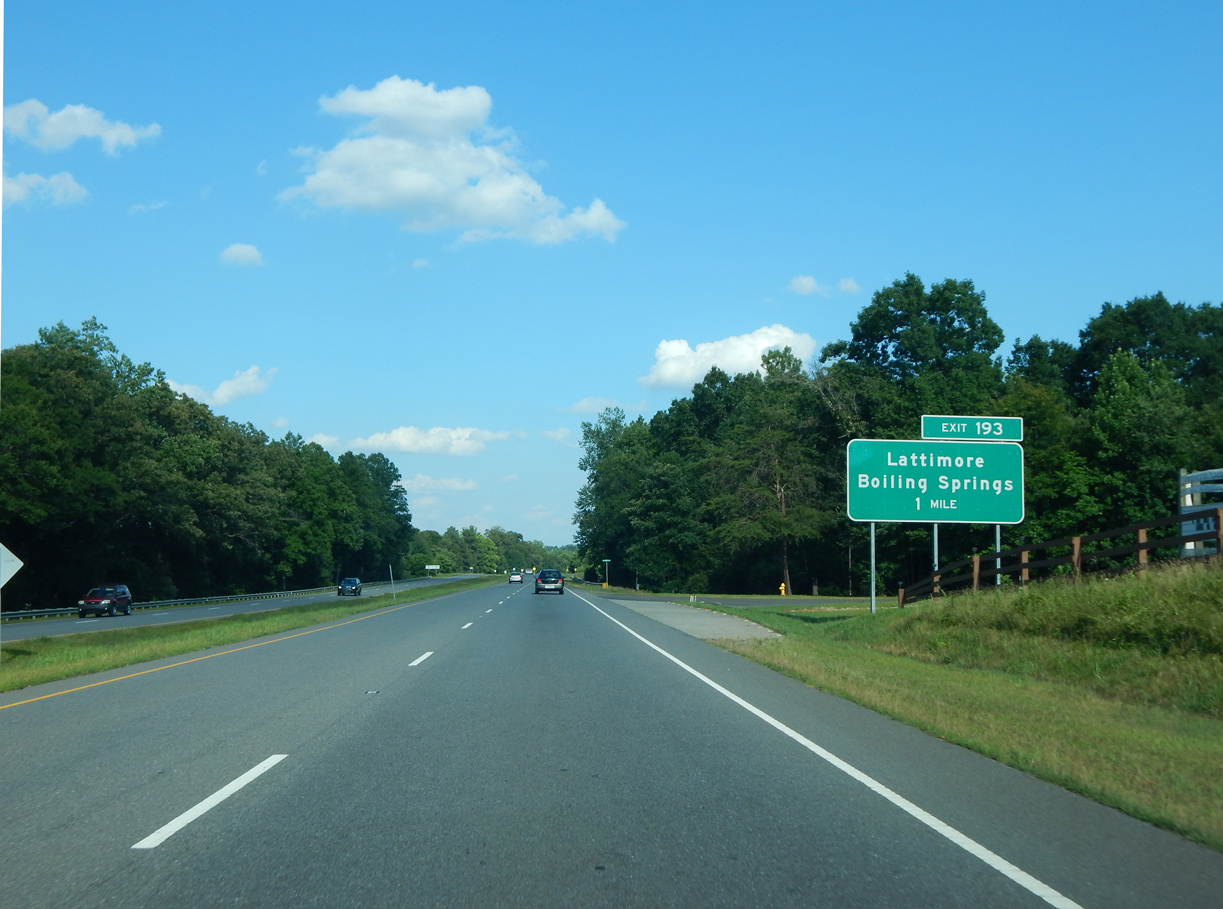
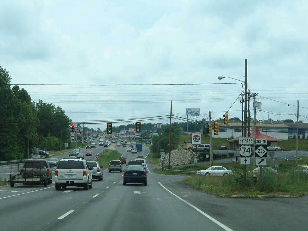
Section AA of the U.S. 74 Shelby Bypass included upgrading U.S. 74 along Dixon Boulevard to a freeway east of Sandy Run. Work from July 2013 to September 2016 replaced the at-grade intersection with Peachtree Road north and McBrayer Homestead Road south with a folded diamond interchange (Exit 193).
06/09/17
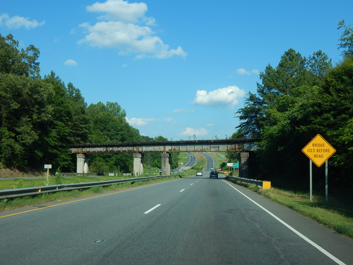
An abandoned Seaboard Coast Line Railroad bridge spans U.S. 74 (Dixon Boulevard) just ahead of Sandy Run.
06/09/17
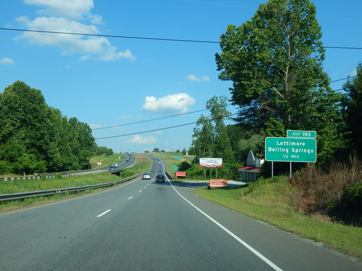
U.S. 74 crosses Sandy Run on a 1925-built bridge eastbound and a 1965-bridge westbound. Both spans were rehabilitated in 1999. Exit 193 follows in a half mile for McBrayer Homestead Road south to the town of Boiling Springs and Gardner Webb University.
06/09/17
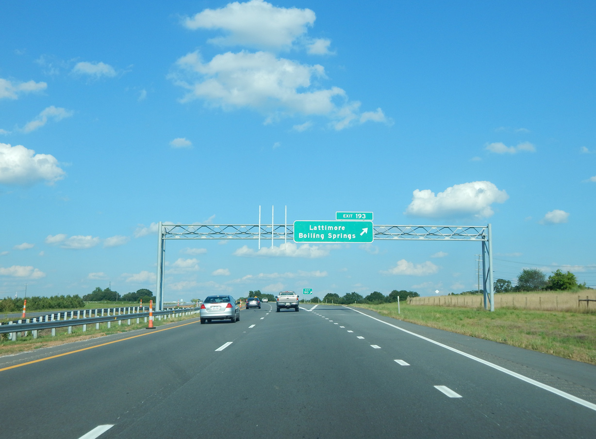
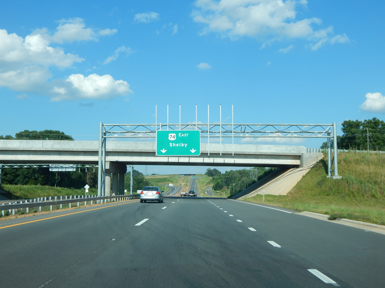
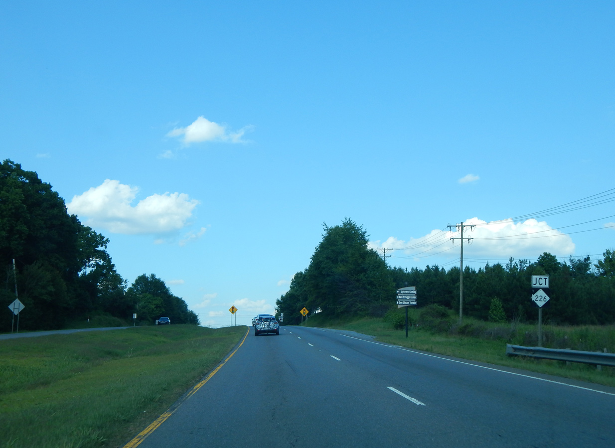
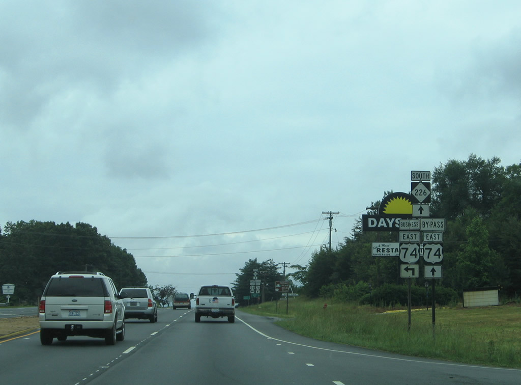
Exit 193 leaves U.S. 74 east for Peachtree Road (SR 1162) north to Lattimore. The Shelby Bypass separates from Dixon Boulevard next at a trumpet interchange. The 5.6 mile segment of the bypass opened from Peachtree Road to NC 226 on April 13, 2020.
06/09/17
Section AA construction of the Shelby Bypass included a realignment of U.S. 74 northward to accommodate a new trumpet interchange with Dixon Boulevard at Swainsville. The former alignment along Sunset Boulevard acts as a service road to the south.
06/09/17

The realignment of U.S. 74 rejoins Dixon Boulevard east at Westlee Street north and Bradley Road south.
06/09/17
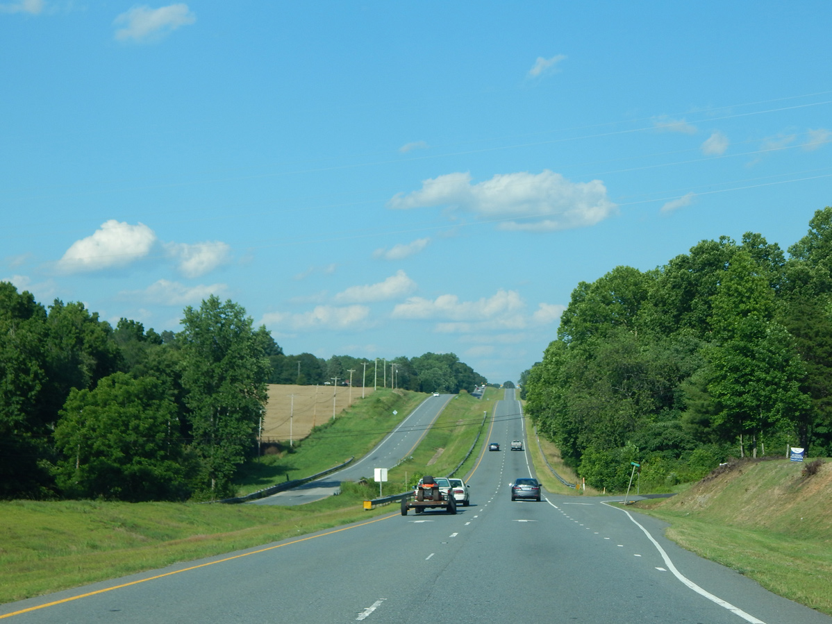
Advancing east from Swainsville, U.S. 74 travels by rural subdivisions and agricultural areas on the western outskirts of Shelby. Dixon Boulevard lowers to cross Beaverdam Creek in this scene at Debby Drive.
06/09/17
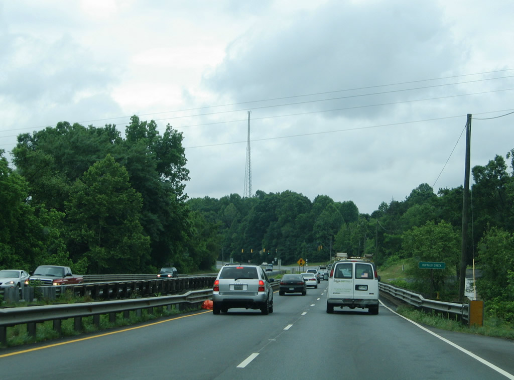
U.S. 74 lowers from Old Boiling Springs Road to span Brushy Creek along bridges built in 1963 for eastbound and 1926 for westbound.1
05/30/05
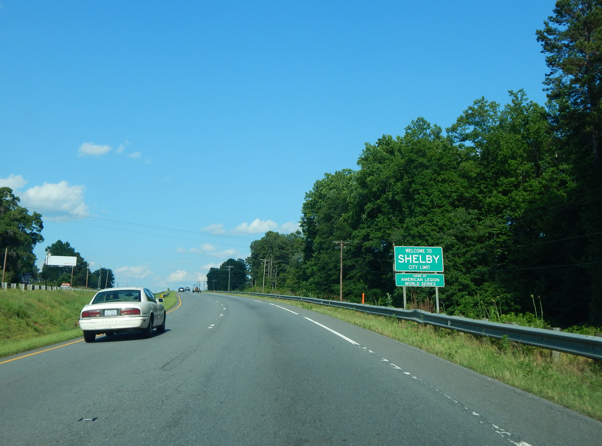
Dixon Boulevard eastbound crosses the Shelby city line between Creek Road and Poplar Springs Church Road (SR 1151).
06/09/17
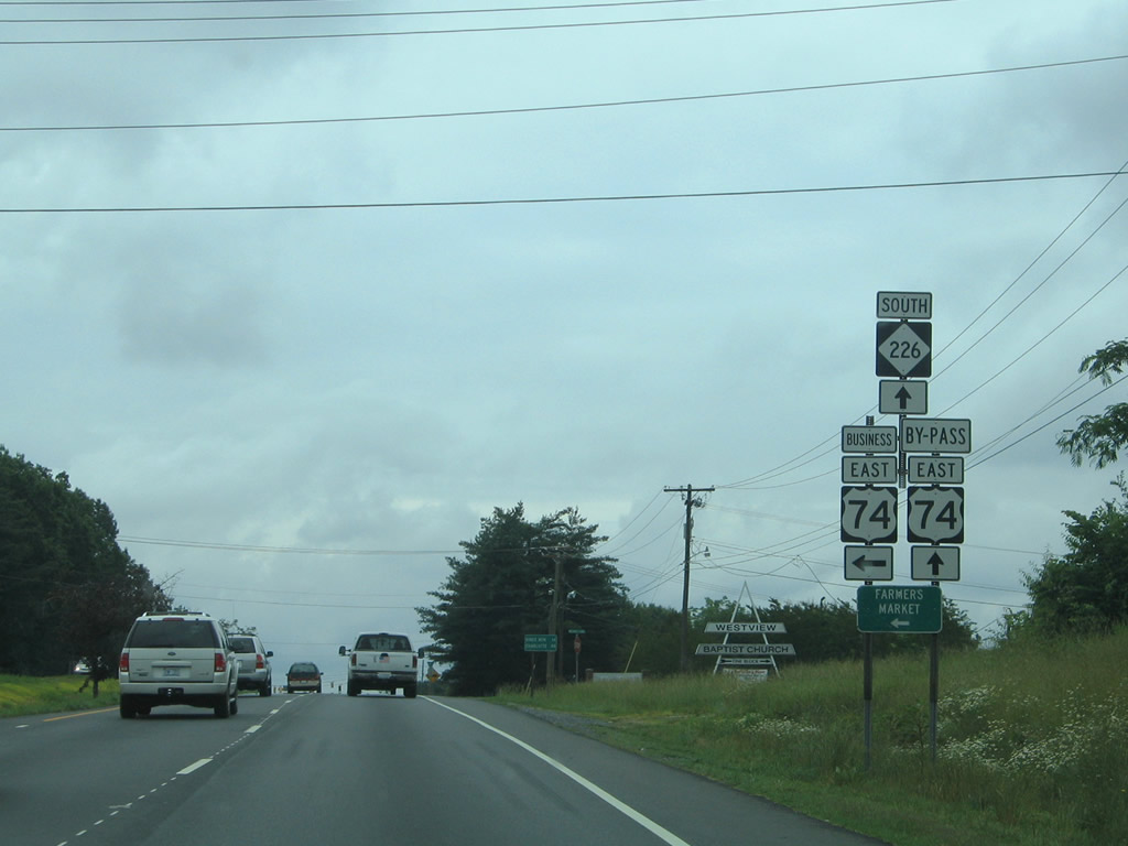
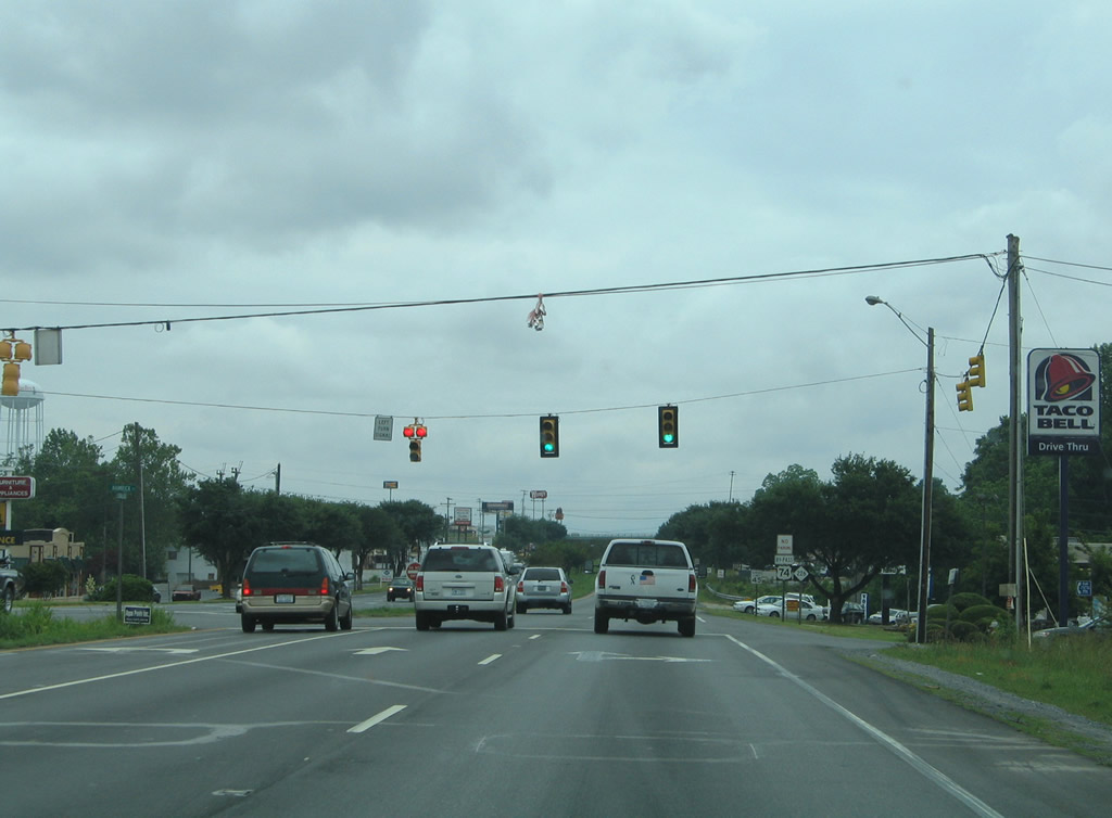
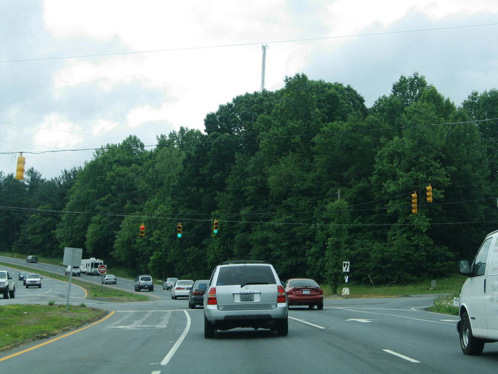
NC 226 enters Shelby from Polkville 13 miles northwest of U.S. 74. The state route accompanies U.S. 74 east across the south side of the city.
06/09/17
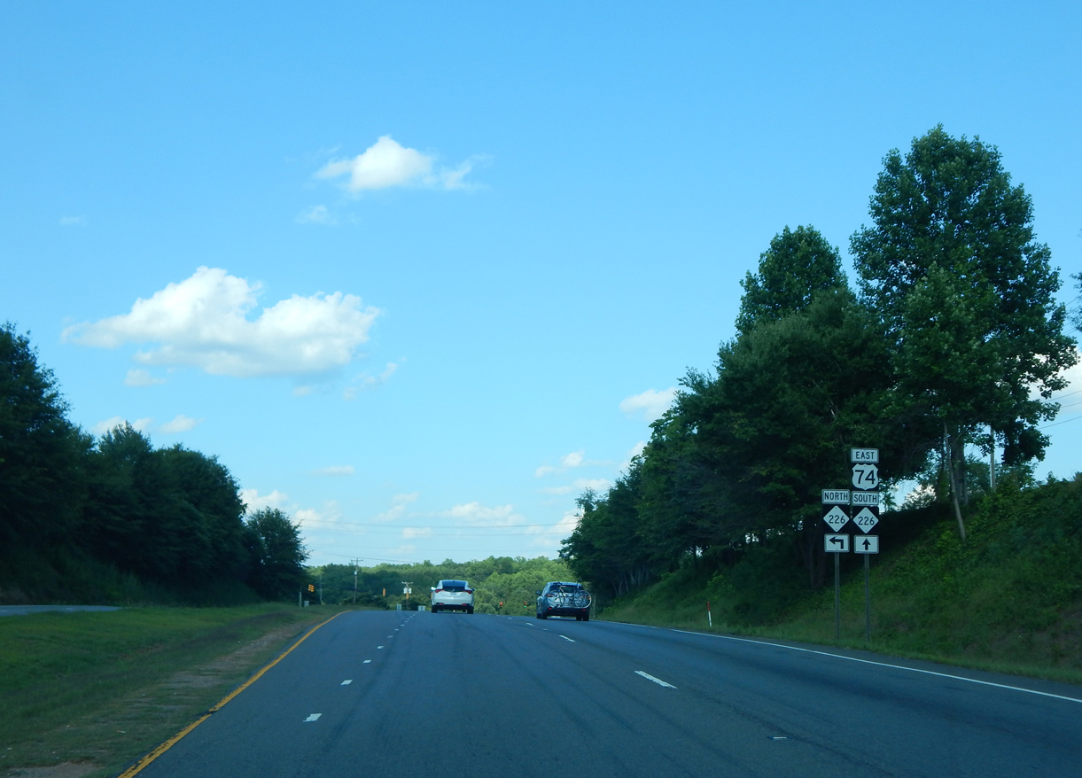
Heading north, NC 226 continues from Polkville 18 miles to U.S. 64 on the 45 mile drive to Interstate 40 and Marion. The state route extends northward to the Tennessee state line.
06/09/17
East 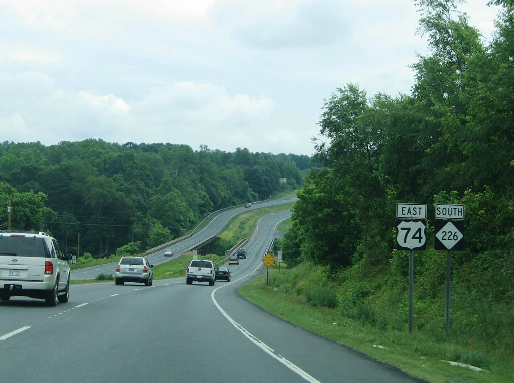
U.S. 74/NC 226 combine ahead of the First Broad River. The 1936-built eastbound span includes a weight restriction for the left lane. The westbound span dates back to 1936.1
05/30/05
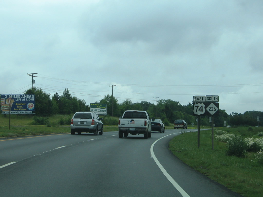
Turning southeast after the wye intersection with Marion Street (U.S. 74 Business west) on U.S. 74/NC 226 (Dixon Boulevard).
05/30/05
U.S. 74 partitions into business and bypass branches through Shelby. U.S. 74 Business east follows Warren Street through Downtown while U.S. 74 Bypass/NC 226 remain along Dixon Boulevard. Most of the bypass route comprises a commercialized arterial.
05/30/05
Through Downtown Shelby, U.S. 74 Business navigates along a couplet of Warren Street east and Marion Street west. The separate directions combine along Marion Street with NC 150 for 1.54 miles between Dekalb Street and Cherryville Road.
05/30/05
 East
East 
Charles Road (SR 1253) stems south from U.S. 74 Business (Warren Street) east to the ensuing traffic light along U.S. 74 Bypass/NC 226 (Dixon Boulevard) east.
05/30/05
U.S. 74 Bypass/NC 226 reassurance shield assembly posted at West Elm Street.
05/30/05
Dixon Boulevard continues east from the J-turn intersection with Mark Drive south and Gold Street by this assembly at Hampton Street.
05/30/05
Fast food chains and other establishments line U.S. 74 Bypass east / NC 226 (Dixon Boulevard) south in this scene at Hamrick Street.
05/30/05
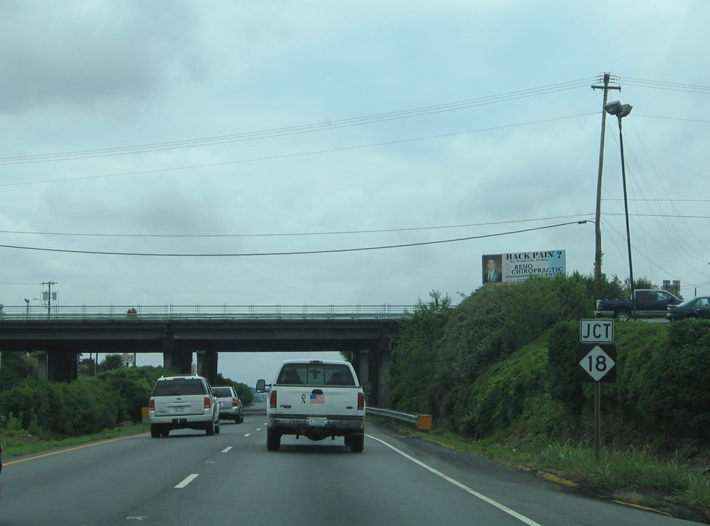
Bridges Morgan Street and NC 18 (Lafayette Street) over Dixon Boulevard ahead of NC 150 (Dekalb Street).
05/30/05
Pine Street and Earl Road connect U.S. 74 Bypass (Dixon Boulevard) with NC 18 (Lafayette Street) in a configuration similar to a folded diamond interchange.
05/30/05
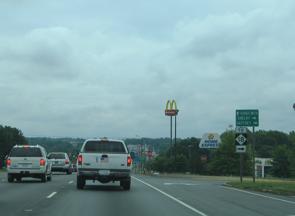
NC 18 heads south eight miles to South Carolina 18 en route to Gaffney. Northward, the state route links Downtown with northern reaches of Cleveland County and Morganton.
05/30/05
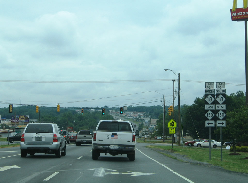
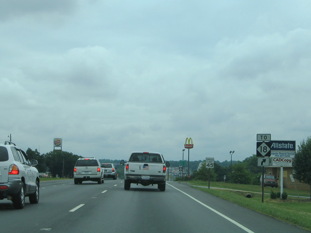
The succeeding traffic light along U.S. 74 Bypass/NC 226 joins Dixon Boulevard with NC 150 at Dekalb Street. Leading north from NC 18 and College Avenue to U.S. 74 Business (Marion Street), NC 150 provides a truck bypass for Downtown. Traveling north to Winston-Salem, NC 150 is part of a multi state route with S.C. 150 south to Gaffney.
05/30/05
Leading away from NC 150 (Dekalb Street), U.S. 74 Bypass east / NC 226 south lower to cross Hickory Creek.
05/30/05
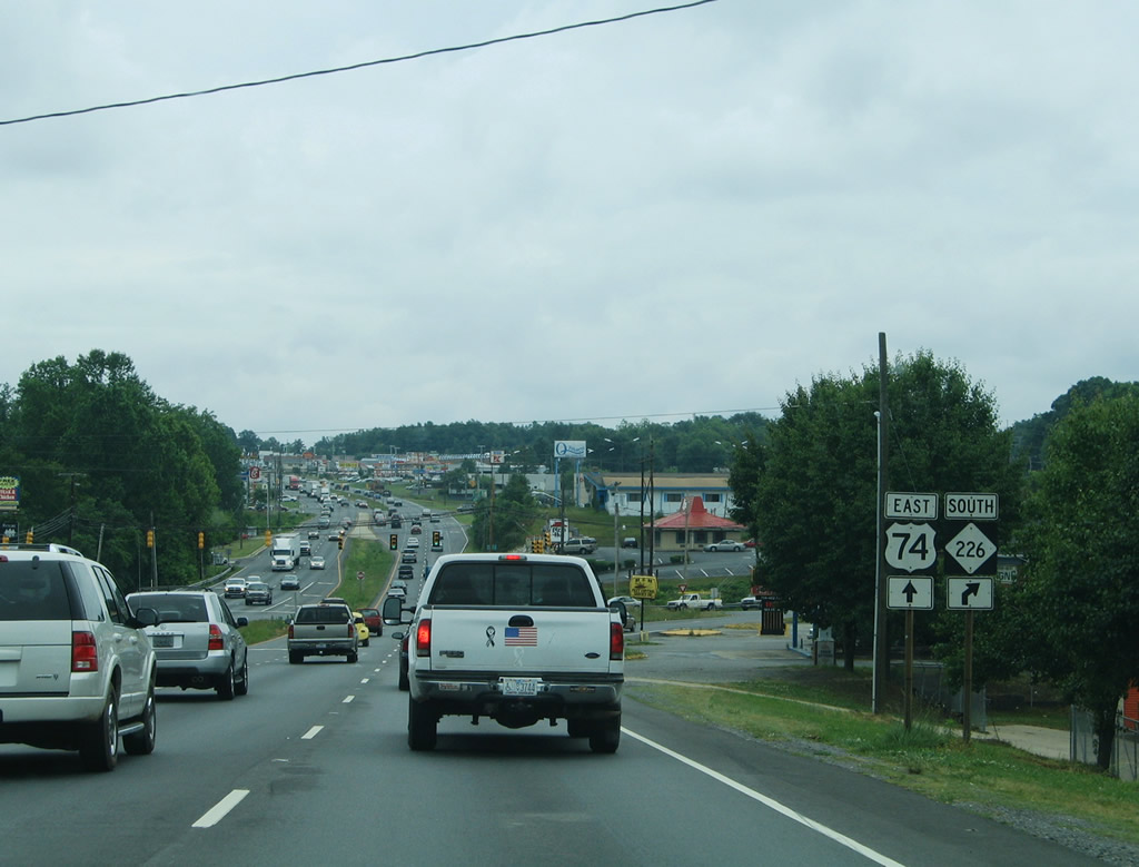
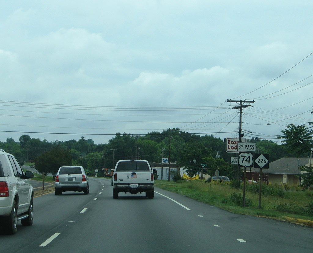
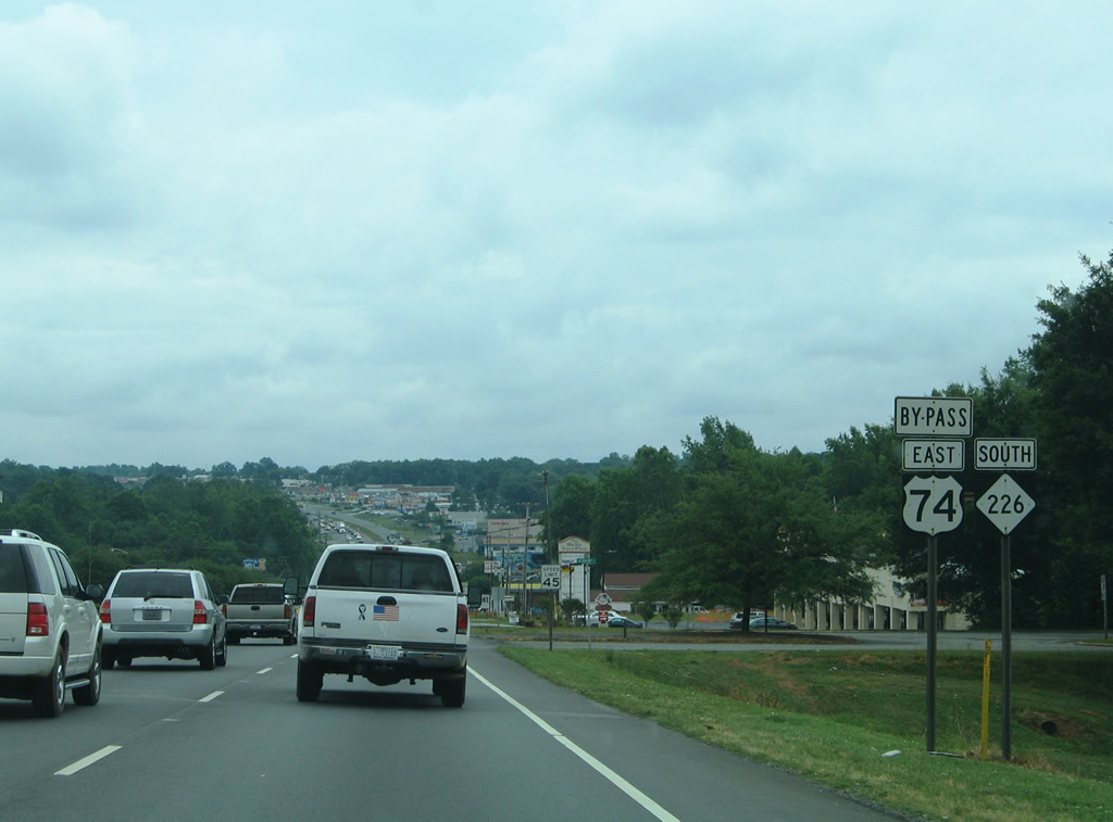
NC 226 branches southeast along Earl Road from a wye intersection with U.S. 74 Bypass (Dixon Boulevard). Earl Road leads the state route 2.18 miles south to its overlap with NC 180 along Post Road.
05/30/05
Eastbound at the split with NC 226 (Earl Road) south. NC 226 ends ten miles to the southeast at U.S. 29 in Grover.
05/30/05
East 
NC 180 (Post Road) ventures north from NC 226 (Earl Road) to a commercialized intersection with U.S. 74 Bypass (Dixon Boulevard). A 12 mile route, NC 180 encircles Shelby east from NC 18 through the town of Patterson Springs.
05/30/05
NC 180 provides a north-south bypass around Shelby for NC 18 north to Morganton and south to Gaffney, South Carolina.
05/30/05
NC 180 connects Dixon Boulevard with Cleveland Community College and NC 150 west of Stubbs.
05/30/05
Kings Mountain comes into view beyond NC 180. U.S. 74 Bypass continues nine miles to the city of Kings Mountain.
05/30/05
Service roads separate business entrances from Dixon Boulevard through east Shelby. A signalized intersection connects with the frontage roads 0.3 miles east of NC 180.
05/30/05
U.S. 74 Business (East Marion Street) returns to U.S. 74 Bypass just beyond Cleveland Mall.
05/30/05
 East
East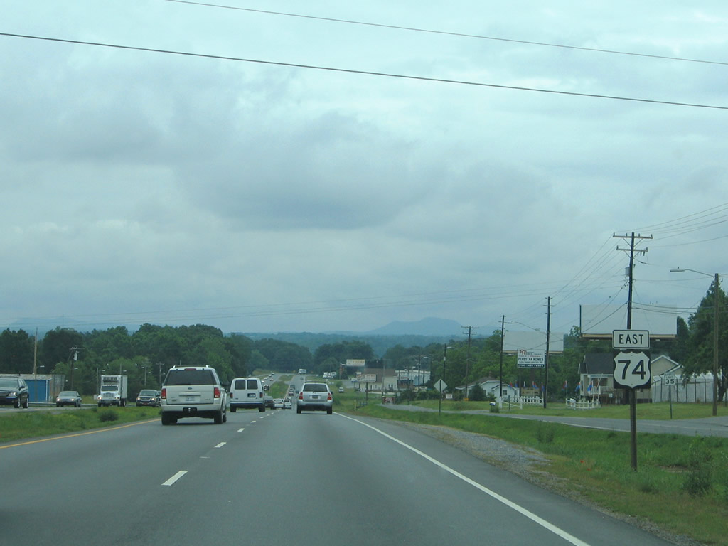
Frontage roads continue alongside U.S. 74 (Dixon Boulevard) east from Marion Street. Adjacent Hoey Church Road (SR 2325) represents a former alignment of U.S. 74 east to Buffalo Creek.
05/30/05
Navigating southeast through a broad S-curve, U.S. 74 crosses Buffalo Creek along a pair of vintage spans (1957 eastbound, 1922 westbound).
Section D of the Shelby Bypass will both replace the crossing add a trumpet interchange just to the west with the new freeway.
05/30/05
Long Branch Road meanders south 6.1 miles from the ensuing eastbound traffic light to U.S. 29 (Battleground Avenue) near NC 216 and I-85.
This intersection will be eliminated with work on Section E of the Shelby Bypass.
05/30/05
Section E of the Shelby Bypass will add a dumbbell interchange with Anthony, Bethlehem and Potts Creek Roads. Upgrades will continue east to the preexisting freeway bypass around Kings Mountain. U.S. 74 Business (Shelby Road) follows the former alignment east from the forthcoming parclo interchange.
05/30/05
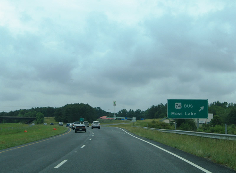
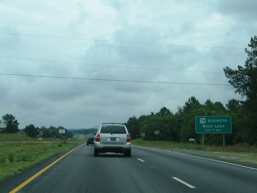
U.S. 74 Business follows Shelby Road east to King Street through the city of Kings Mountain. Moss Lake lies north of the freeway via Stony Point Road (SR 1001).
05/30/05
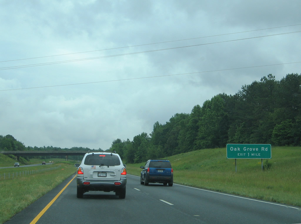
The next three interchanges serve Kings Mountain from the north. Oak Grove Road (SR 2033) stems north from Waco Road to a diamond interchange with U.S. 74. SR 2033 arcs northwest to Moss Lake.
05/30/05
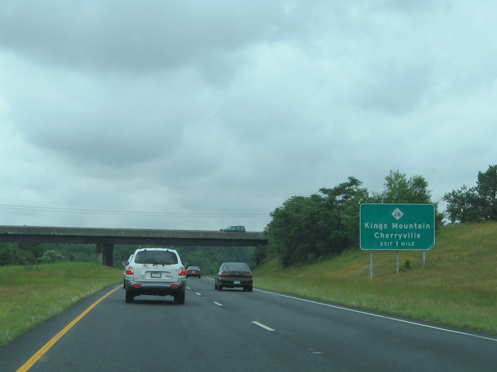
NC 216 (Piedmont Avenue) crosses paths with U.S. 74 at a diamond interchange. The state route follows the pre-freeway alignment of U.S. 29. U.S. 29 was relocated east of Kings Mountain in 1956 along what is now Interstate 85.2
05/30/05
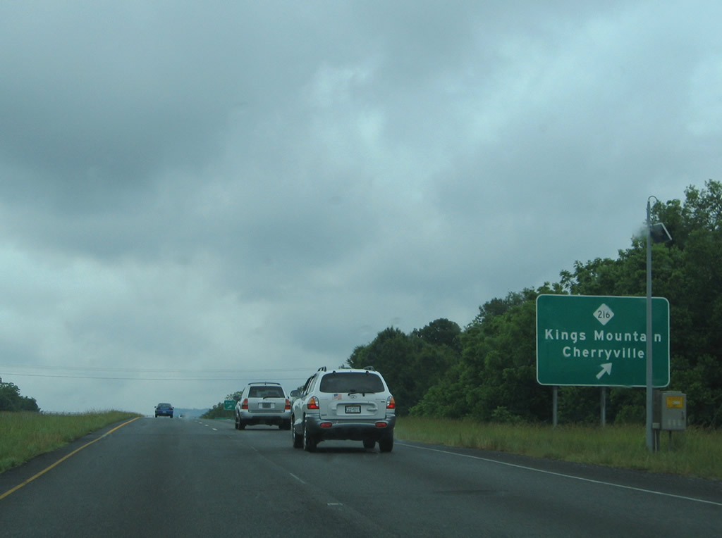
NC 216 heads 5.3 miles south from U.S. 74 along Piedmont Avenue to connect with Battleground Avenue through Downtown Kings Mountain. The state route converges with U.S. 29 beyond its separation with I-85 south at Archdale.
05/30/05
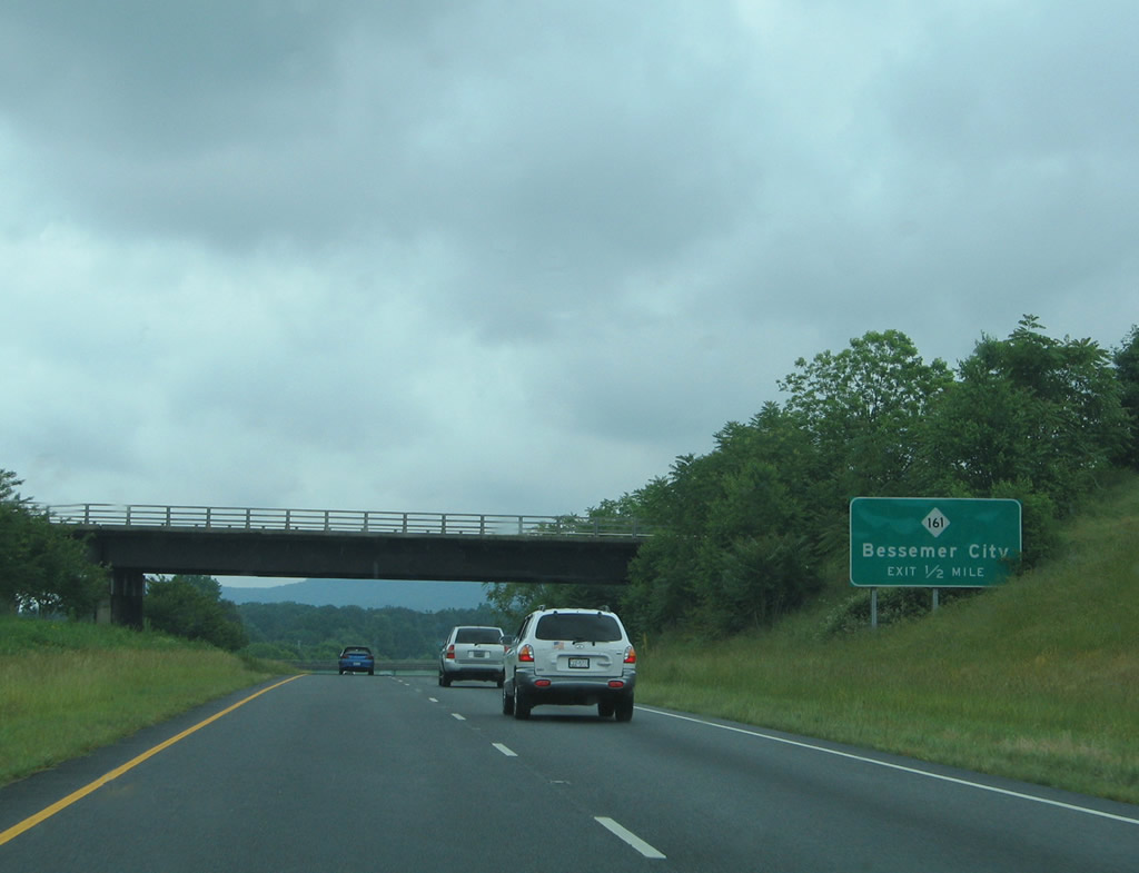
A Norfolk-Southern Railroad line passes over U.S. 74 one half mile west of the diamond interchange with NC 161 (Cleveland Avenue).
05/30/05
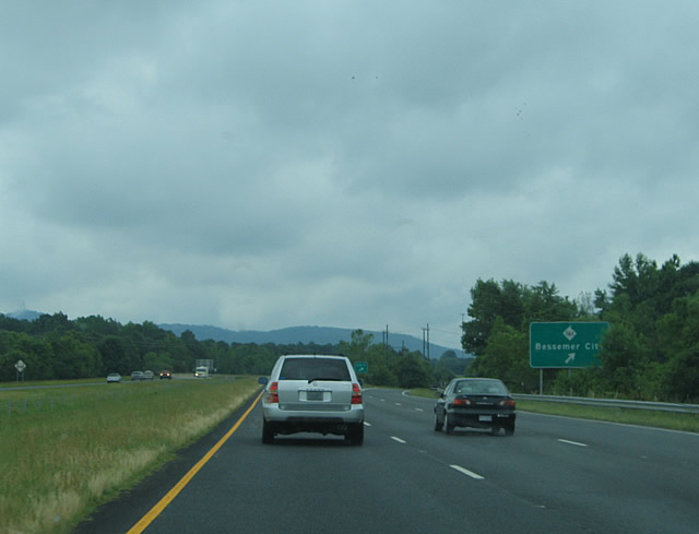
NC 161 forms a multi state route with S.C. 161 north from Filbert and Bethany to Cleveland Avenue in Kings Mountain. Continuing north from U.S. 74, the state route concludes in five miles at NC 274 in Bessemer City.
05/30/05
U.S. 74 Business (King Street) returns to U.S. 74 via a wye interchange just ahead of Interstate 85 and the Gaston County line.
05/30/05
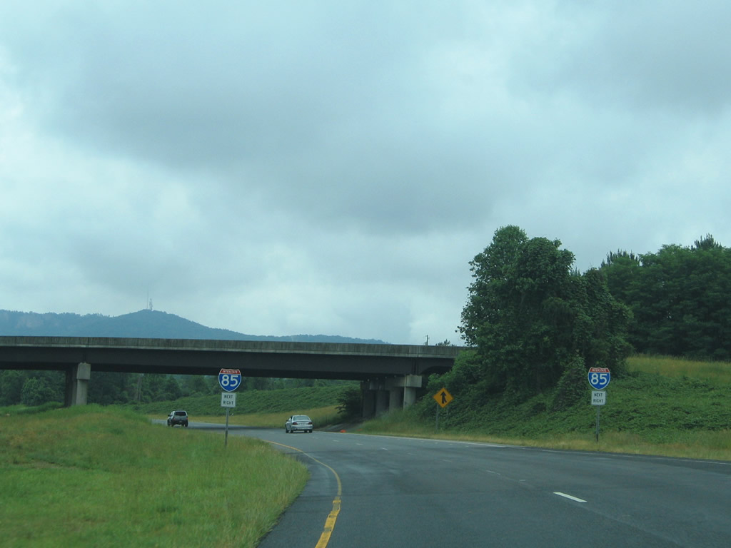
Traffic from King Street merges onto U.S. 74 east, with four lanes advanceing east to a ramp split for I- 85 and U.S. 29 south and the continuation of U.S. 29/74 east (Kings Mountain Highway) into Gastonia.
05/30/05
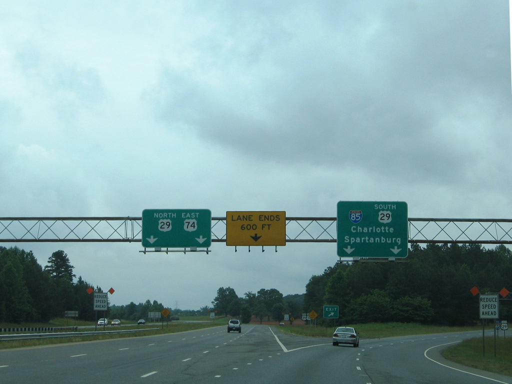
Ramps for I-85/U.S. 29 south to Spartanburg and I-85 north to Charlotte depart in unison from U.S. 74 east. The eastbound roadway for U.S. 74 emerges from an ensuing overpass to run between the north and south roadways for I-85. U.S. 29 combines with the route east along Kings Mountain Highway to Gastonia.
05/30/05

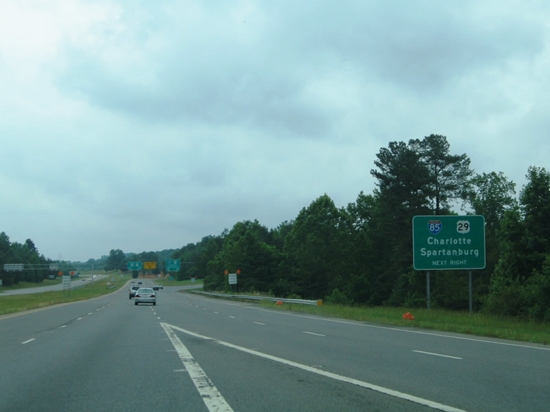
Two lanes join I-85 north from U.S. 74 east, taking motorists from Kings Mountain, Shelby and points west to Charlotte. A single lane ramp connects with the I-85/U.S. 29 overlap south around Kings Mountain. Spartanburg lies 44 miles to the southwest.
05/30/05
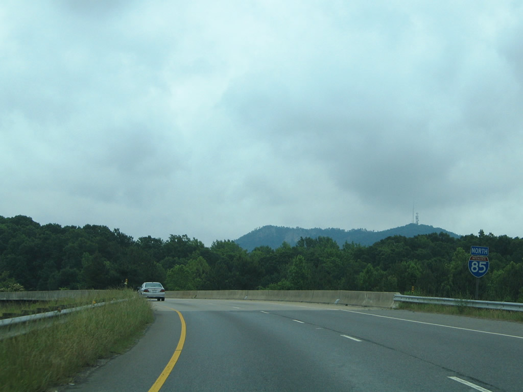
The ramp for I-85 north joins a collector distributor roadway north to U.S. 29/74 (Kings Mountain Highway) east and U.S. 74 west.
05/30/05

References:
- North Carolina Bridge Information. North Carolina Department of Transportation (NCDOT).
- NCRoads.com: N.C. 216.
Photo Credits:
- Carter Buchanan: 06/09/17
- Alex Nitzman: 05/30/05
Connect with:
Page Updated Monday October 08, 2018.