
U.S. 78 extends 142.20 miles southeast into South Carolina, from North Augusta to Charleston. U.S. 1 enters the state alongside U.S. 1/25/278. U.S. 1/78 overlap 15.96 miles east to Burnettown and Aiken. U.S. 78 heads south from there to Williston in Barnwell County.
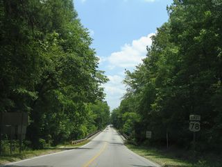
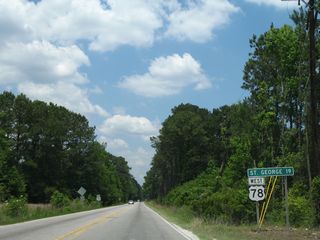
Following a rural route, U.S. 78 continues east from Blackville to Denmark and Bamberg in Bamberg County. Crossing the Edisto River, U.S. 78 enters southern Orangeburg County, where it joins U.S. 21 for 0.20 miles through the town of Branchville. Accompanying a Norfolk Southern Railroad line, U.S. 78 advances east to Reevesville, I-95 and Saint George in northern Dorchester County.
Through the South Carolina's LowCountry, U.S. 78 parallels Interstate 26, from the south end of U.S. 178 to Summerville. U.S. 78 shifts east of the freeway to Goose Creek, where it combines with U.S. 52. U.S. 52/78 overlap 9.47 miles south by Hanahan and into the city of North Charleston. The two separate ahead of Charleston, with U.S. 78 lining King Street south to Line Street just beyond the elevated ramps linking U.S. 17 with the east end of I-26.


U.S. 78 (Heritage Highway) meets U.S. 321/S.C. 70 (Carolina Highway) just east of the CSX Railroad crossing by the Denmark AMTRAK station.
04/10/16

S.C. 70 combines with U.S. 321 for 0.68 miles through the city of Denmark between Barnwell and Orangeburg. U.S. 321 runs south to Govan and north to Norway.
04/10/16

U.S. 21/78 overlap 0.20 miles north along Freedom Road. U.S. 21 continues 17 miles north to Orangeburg while U.S. 78 turns east along Dorange Road 12.8 miles to I-95 in St. George.
12/10/16

U.S. 78 (Badham Drive) parallels a Norfolk Southern Railroad line east to the town of St. George, where a folded diamond interchange joins the four lane highway with Interstate 95.
10/13/14

Previously U.S. 178 ended at a wye intersection with U.S. 78. Part of a 2019-21 widening project along U.S. 78 east to S.C. 27, U.S. 178 was realigned to meet U.S. 78 at a 90 degree angle.
05/26/07

Forthcoming S.C. 27 (Ridgeville Road) connects U.S. 78 with Interstate 26 at a diamond interchange 0.98 miles to the north.
05/26/07

U.S. 17 ALT provides a long distance bypass of U.S. 17 around Charleston from Walterboro northeast to Moncks Corner and Georgetown.
11/12/06


Removed by 2014, the lone shields marking the upcoming split of U.S. 52 from U.S. 78 (Rivers Avenue) east at Carner Avenue referenced a Truck Detour for U.S. 78.
12/27/06

Paralleling U.S. 78 (Rivers Avenue / King Street Extension) just to the east, U.S. 52 shifts onto Carner Avenue to Meeting Street ahead of the Windsor Place and Union Heights neighborhoods in North Charleston.
12/27/06


Road 39 Connector links adjacent Meeting Street (Road 39) with U.S. 78 (Rivers Avenue) ahead of the viaduct spanning the CSX Railroad.
12/27/06

Previously referenced as a Truck Detour for U.S. 78, Road 1382 links U.S. 78 (King Street Extension) with adjacent U.S. 52 (Meeting Street).
12/27/06

U.S. 78 (King Street) shifts to the west of I-26 ahead of San Souci Street in Charleston. Cypress Street (Road 114) follows in two blocks to the adjacent freeway eastbound.
12/27/06

The eastbound entrance ramp for I-26 from Cypress Street leads southward to U.S. 17 and Downtown Charleston.
12/27/06

What was the last sign referencing U.S. 78 along King Street south into Charleston was posted at Romney Street (Road 126).
12/27/06

Carolina Street west to Rutledge Avenue (Road 46) south connects U.S. 78 (King Street) with U.S. 17 (Septima P. Clark Parkway) southbound.
12/27/06

Line Street east to Meeting Street (U.S. 52) north links the east end of U.S. 78 (King Street) with U.S. 17 north across the Arthur Ravenel, Jr. Bridge.
12/27/06

U.S. 78 concludes at the intersection of King and Line Streets. An end shield was added here by 2014.
12/27/06

Removed due to adjacent development in 2019, a trailblazer directed motorists from King Street south onto Spring Street (Road 3) west for U.S. 17 southbound.
12/27/06


U.S. 78 (University Boulevard) branches west from U.S. 52 by North Charleston Wannamaker County Park.
05/26/07

U.S. 78 (E 5th Street N) west enters the town of Summerville ahead of S.C. 165 (Berlin G. Myers Parkway).
05/26/07

S.C. 165 north provides a cutoff from U.S. 78 west to U.S. 17 ALT (N Main Street) to Moncks Corner.
05/26/07

U.S. 17 ALT runs across Summerville along Main Street west to Walterboro and northeast to Moncks Corner.
05/26/07

U.S. 78 (W 5th Street N) at Bryan Street (Road 187) south and Iris Street north in Summerville.
05/26/07

The flashers at N Maple Street (Road 131) and U.S. 78 (W 5th Street N) were upgraded to traffic lights by 2011.
05/26/07

Shifting west to parallel a Norfolk Southern Railroad line, U.S. 78 (W 5th Street N) converges with W Richardson Avenue (Road 65) at Auburn Hill Road.
05/26/07

Jedburg Road (Road 58) south and Mallard Road (Road 58) north come together at a signalized intersection with U.S. 78 (W 5th Street N) in Jedburg.
05/26/07

Running northwest from Cypress Swamp, U.S. 78 meets S.C. 173 (School Street) west at Myers Mayo Road (Road 182).
05/26/07

A 1.57 mile long route, S.C. 173 joins U.S. 78 with S.C. 27 (Church Street) in the town of Ridgeville.
05/26/07

S.C. 27 (Church Street) travels 7.84 miles southwest from U.S. 78 to Ridgeville and S.C. 61.
05/26/07


Widening of U.S. 78, from 0.35 miles southeast of S.C. 35 to 0.8 miles west of U.S. 178, ran from 2019 to an anticipated completion of August 12, 2021.
05/26/07

The construction of Ridgeville Commerce Park along the south side of U.S. 78 in 2013/14 included realigning S.C. 27 westward to a signalized intersection with the new entrance.
05/26/07


U.S. 78 continues north from S.C. 27 as both a hurricane evacuation route and South Carolina Heritage Corridor Discovery Route.
02/17/19

U.S. 78 crosses Four Hole Swamp over a pair of bridges. The first span was replaced by 2018.
05/26/07

U.S. 178 previously commenced north from U.S. 78 at a wye intersection beyond the Minus Bridge over Four Hole Swamp.
05/26/07

Road work expanding U.S. 78 west included realigning U.S. 178 to meet the route at a new intersection perpendicular.
02/17/19

Sandhill Road (Road 248) connects U.S. 78 at Dorchester with U.S. 178 (E Main Street) north to Harleyville in 1.67 miles.
02/17/19

U.S. 78 (Memorial Boulevard) meets U.S. 15 (Parler Avenue) at the St. George business district.
02/17/19

Shields for U.S. 15, U.S. 78 and I-95 at Memorial Boulevard and Parler Avenue were removed when span wire traffic lights were changed to mast arms in 2013.
02/17/19

The St. George town limits extend along U.S. 78 (Jim Bilton Boulevard) west to the folded diamond interchange (Exit 77) with Interstate 95.
02/17/19

U.S. 78 dog legs south alongside U.S. 21 (Freedom Road) 0.20 miles from Dorange Road to Edward Street in Branchville.
02/17/19


![]() |
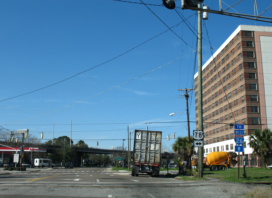
Mount Pleasant Street (Road 49) extends 0.06 miles west from U.S. 52 (Meeting Street) and U.S. 52 Spur (Morrison Drive) to U.S. 78 (King Street) in Charleston. 12/27/06 |
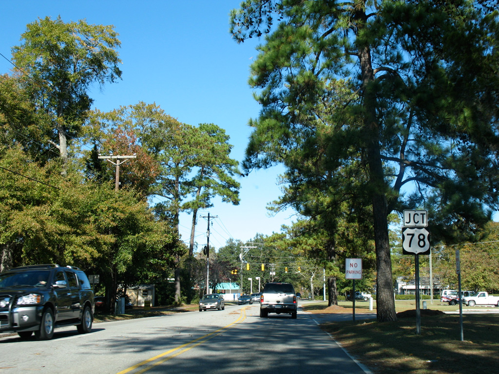
N Cedar Street (Road 13) north at U.S. 78 (W 5th Street N) in the town of Summerville. 11/12/06 |
Photo Credits:
- 11/12/06 by AARoads and Justin Cozart. 12/27/06 by AARoads.
Connect with:
Interstate 26
Interstate 95
Interstate 520 - Palmetto Parkway
Interstate 526
U.S. 1
U.S. 21
U.S. 25
U.S. 176
U.S. 178
U.S. 278
U.S. 321
U.S. 601
Page Updated 09-25-2021.