
U.S. 90 East - Beulah to Pensacola

 East
East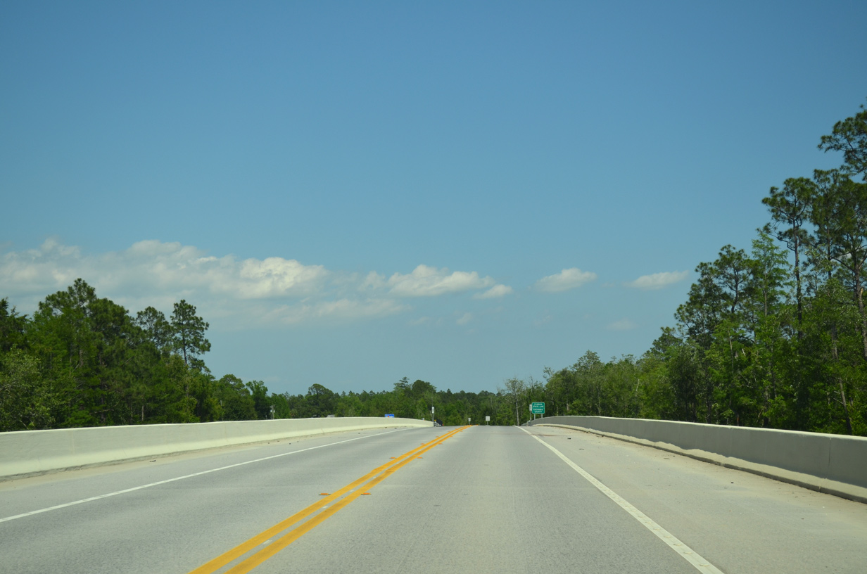
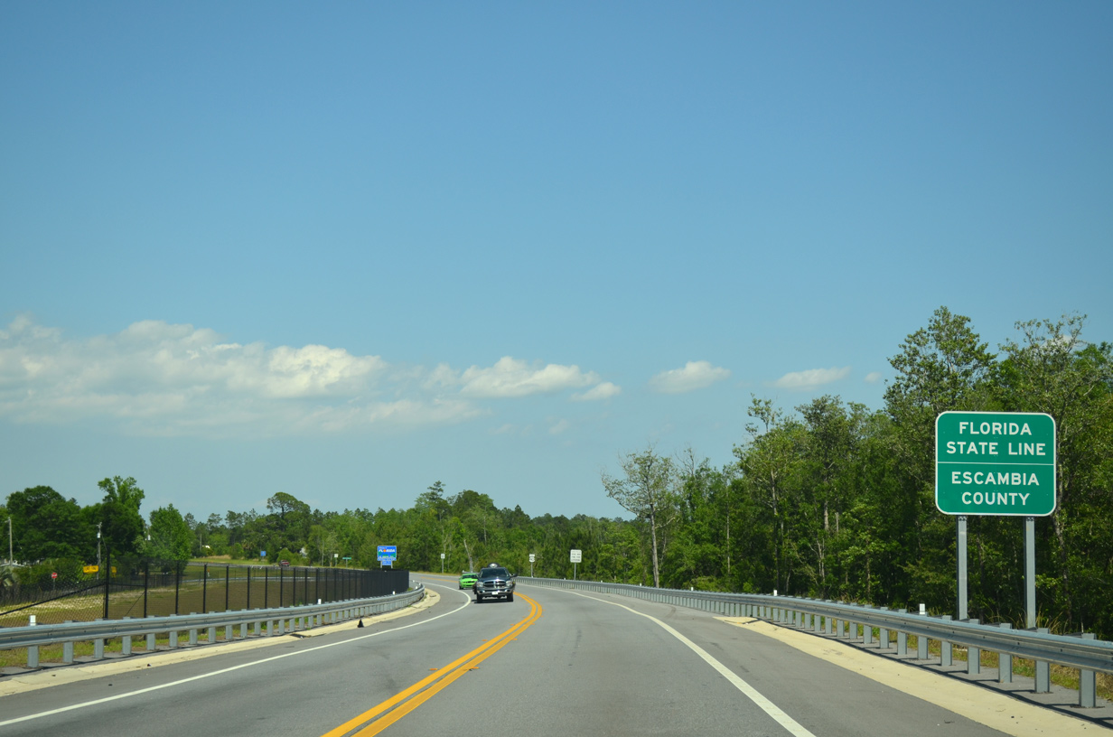
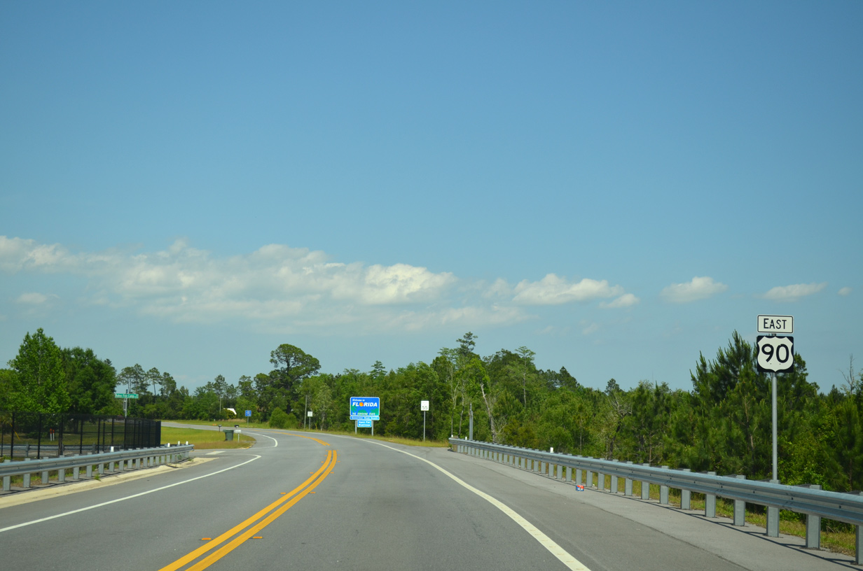
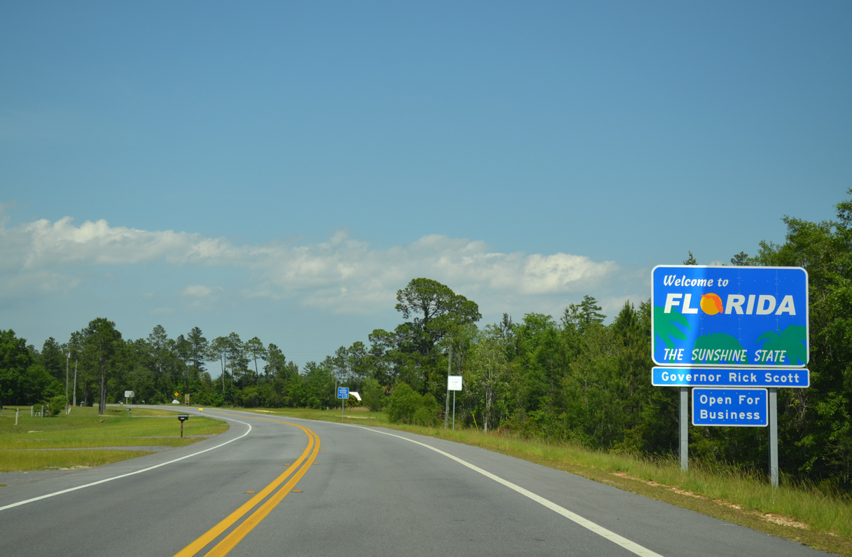
U.S. 90 crosses into the Sunshine State midway across the bridge spanning the Perdido River.
05/17/14
U.S. 90 intersects Ruby's Camp Road to Rubys Fish Camp and boat ramp along the initial stretch in Escambia County.
05/17/14
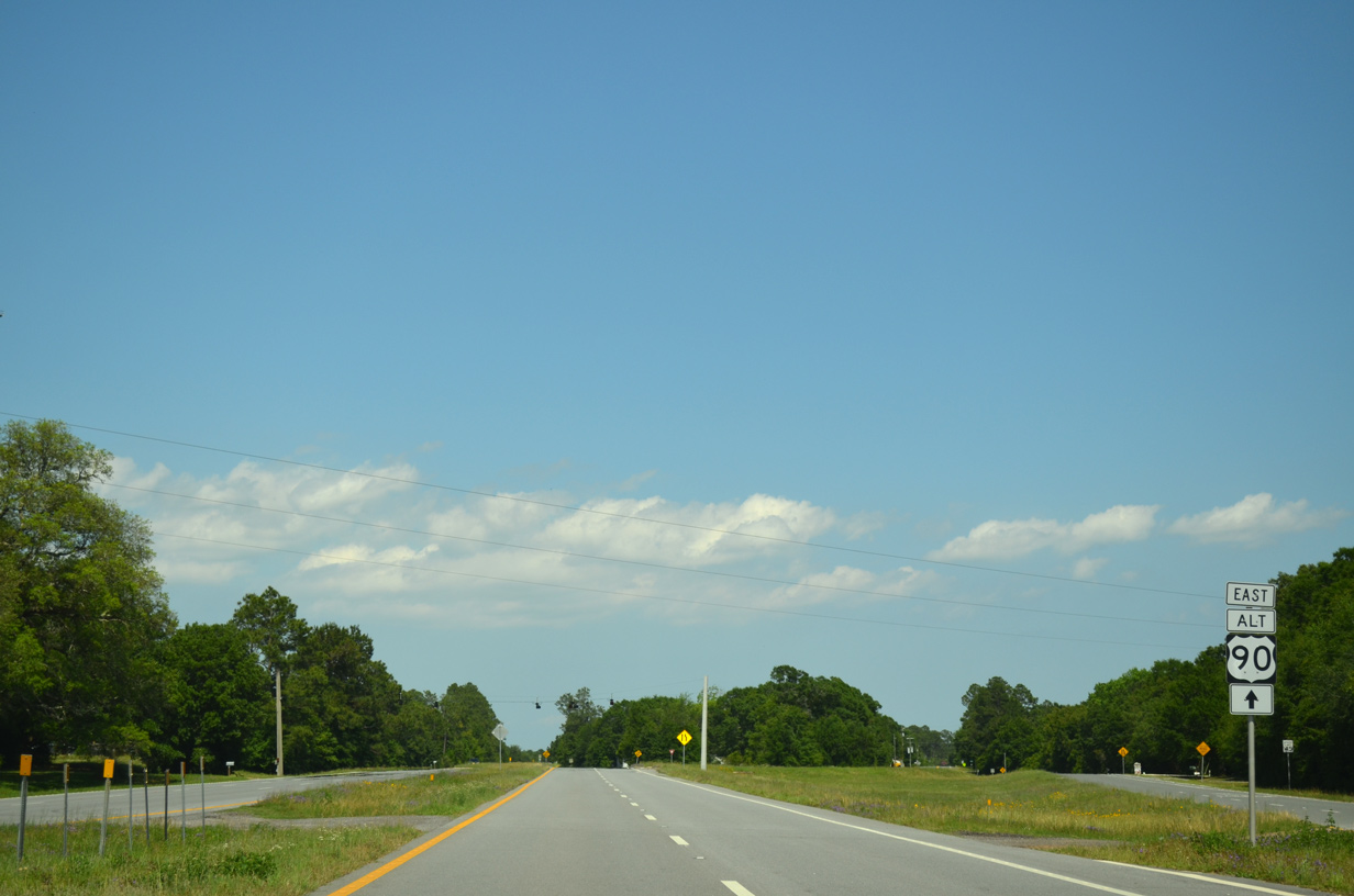
The first confirming marker for U.S. 90 east in Florida. State Road 10 accompanies the US highway east to U.S. 90 Alternate (Nine Mile Road).
05/17/14
Replacement of the Peridido River Bridge along U.S. 90 in 2011/12 included shifting the alignment of roadway southward to the welcome sign east of Rubys Camp Road.
05/17/14
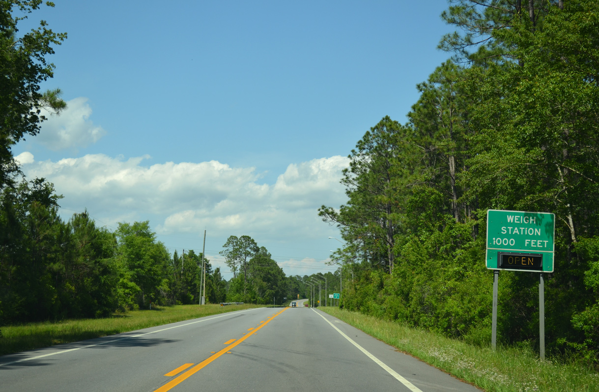
A weigh station lines the south side of U.S. 90 (Mobile Highway) midway between the Alabama line and Westernway Drive near Beulah. Used for both directions of U.S. 90, this facility was reconstructed in the mid-2000s.
05/17/14
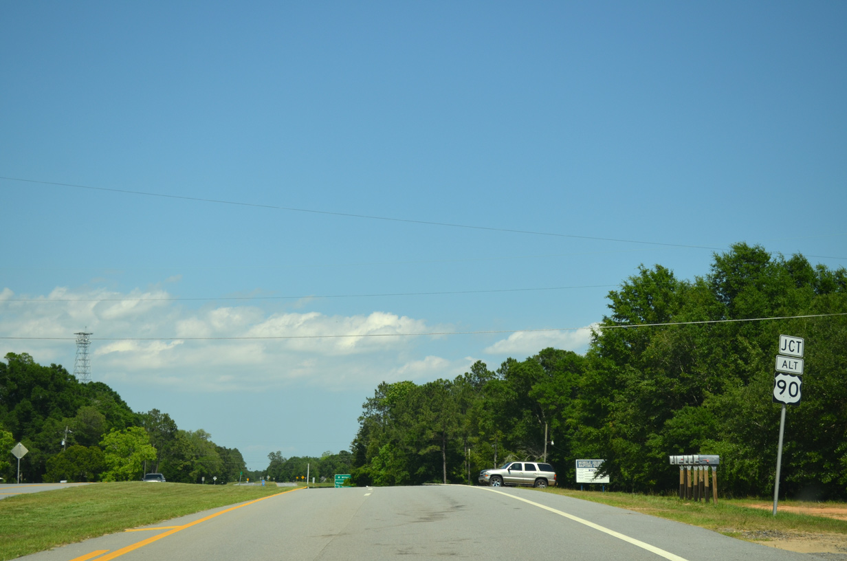
Advancing into the rural community of Beulah, U.S. 90 (Mobile Highway) approaches the split with U.S. 90 Alternate (Nine Mile Road).
05/17/14
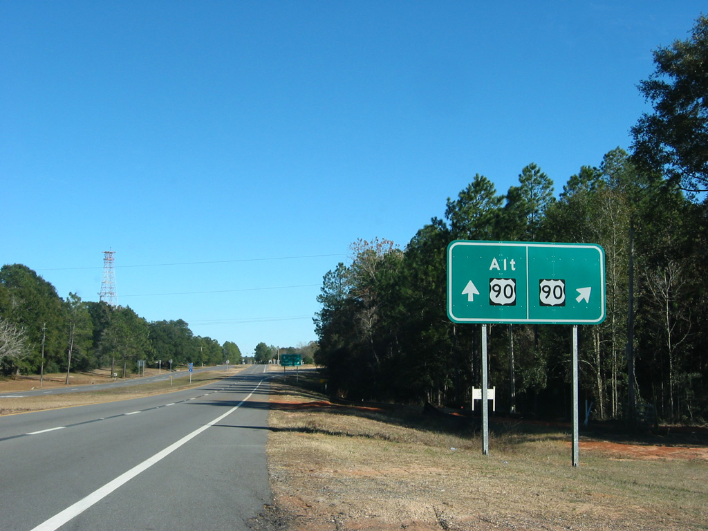
U.S. 90 expands to four lanes leading into the wye intersection with Nine Mile Road. Removed by 2006, this guide sign for U.S. 90/90A was installed in Fall 2003.
12/20/03
Nine Mile Road bypasses Pensacola to the north, carrying the SR 10 designation east to Ensley and U.S. 90 (Scenic Highway) near the Santa Rosa County line. U.S. 90 (Mobile Highway) loops southeast from Beulah as SR 10A.
05/17/14
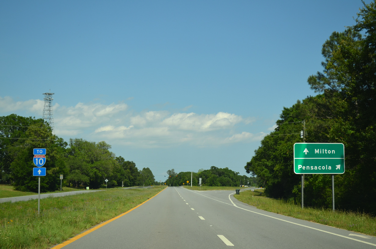
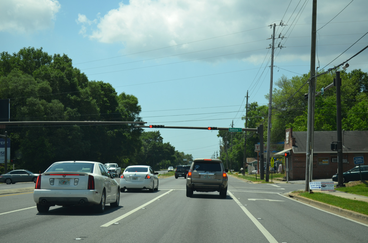
Nine Mile Road runs east through suburban areas to Interstate 10 while U.S. 90 angles southeast to Bellview.
05/17/14
U.S. 90 narrows back to two lanes beyond Nine Mile Road. A mixture of forest, rural subdivisions and mobile home parks line Mobile Highway from Beulah to Bellview.
12/20/03
Nearing a 7.604 mile segment of Escambia County Road 99 (Beulah Road) on U.S. 90 (Mobile Highway) east. CR 99 exists in three segments in western Escambia County.
02/01/06
The intersection U.S. 90 and Beulah Road (CR 99) as seen from the Mobile Highway eastbound. Beulah Road is a rural highway linking U.S. 90 with CR 184 (Muscogee Road) near Farm Hill to the north and Hurst Hammock to the south. Traffic calming devices are used along Beulah Road between U.S. 90 and U.S. 90 Alternate (Nine Mile Road).
02/01/06
Continuing from Beulah and County Road 99 on U.S. 90 (Mobile Highway) east.
05/17/14
Eastbound reassurance marker posted between Beulah School Road and Woodside Road.
02/01/06
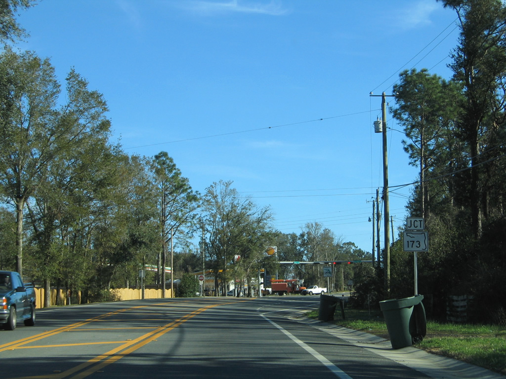
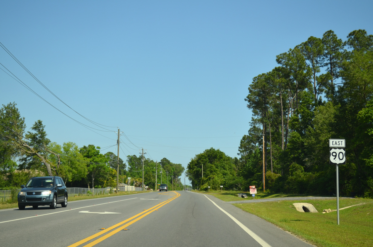
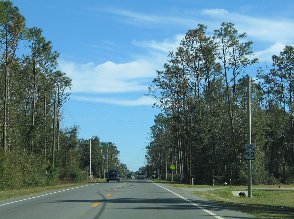
Nearing the signalized intersection of SR 173 (Blue Angel Parkway / Longleaf Drive) on U.S. 90 eastbound. Measuring 12.71 miles overall, SR 173 links U.S. 90 with Saufley Field (via CR 296) two miles to the south.
02/01/06
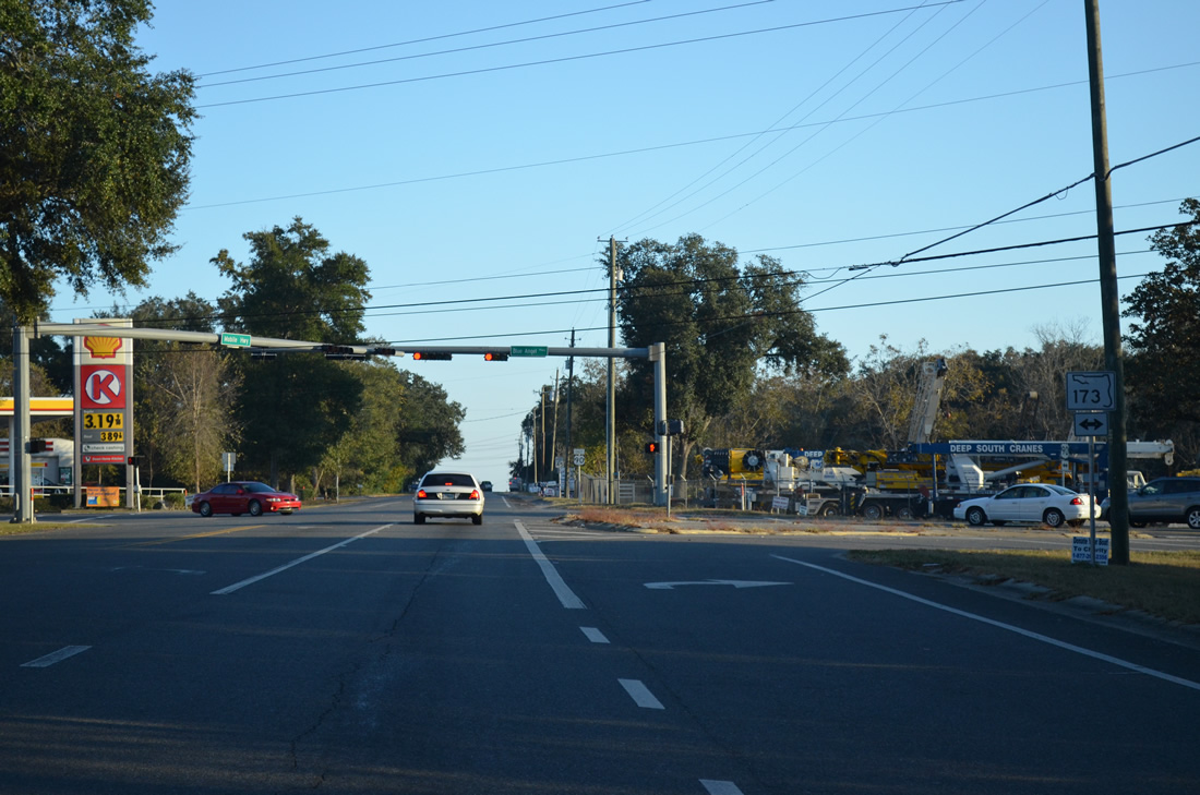
Blue Angel Parkway leads south from U.S. 90 (Mobile Highway) to Pleasant Grove and the west gate of Pensacola Naval Air Station. SR 173 extends eastward along Longleaf Drive to end at SR 297 (Pine Forest Road) in two thirds of a mile.
11/17/12
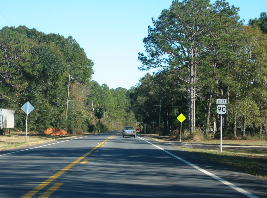
Confirming marker posted south of SR 173 (Blue Angel Parkway).
05/17/14
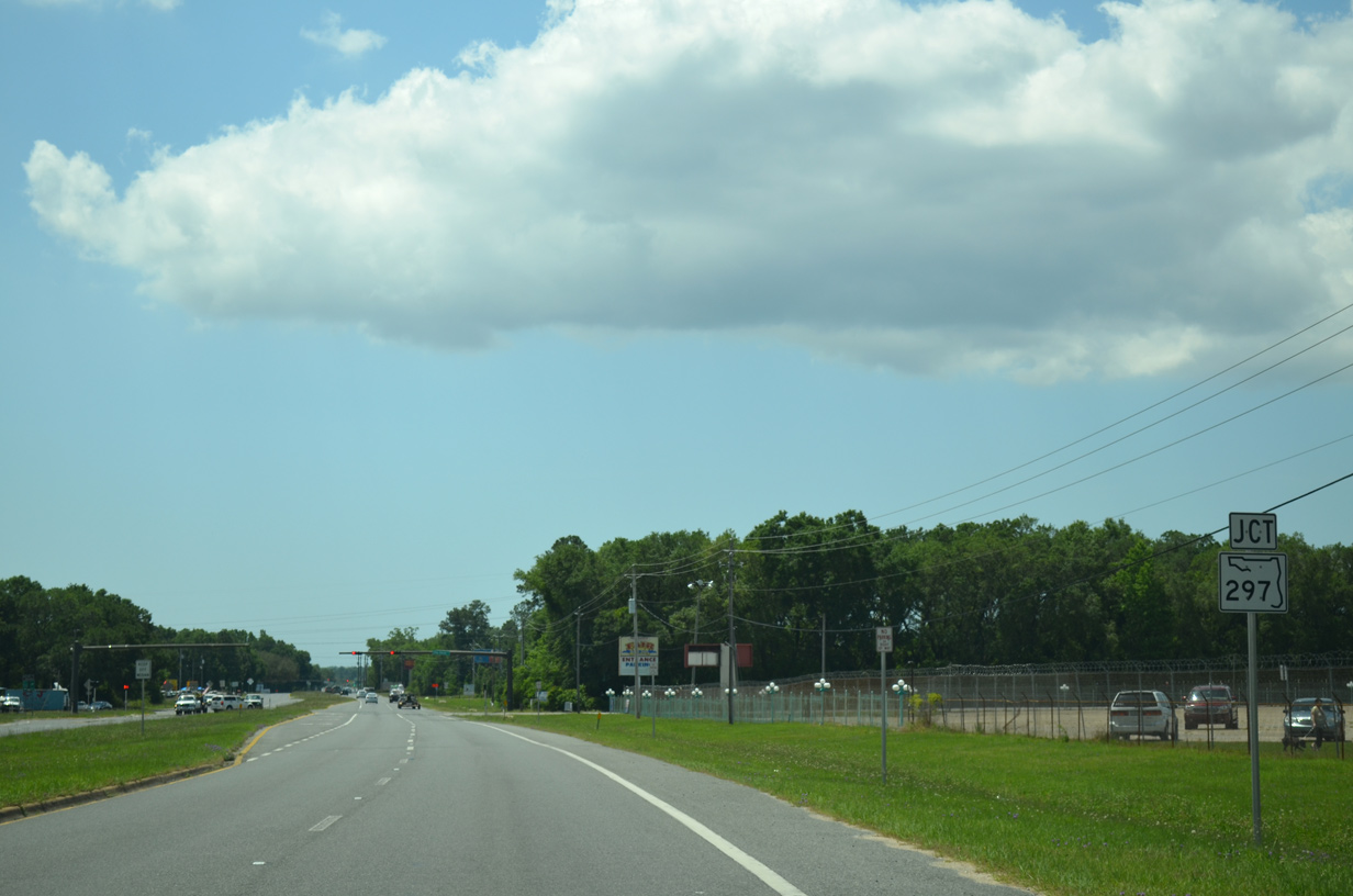
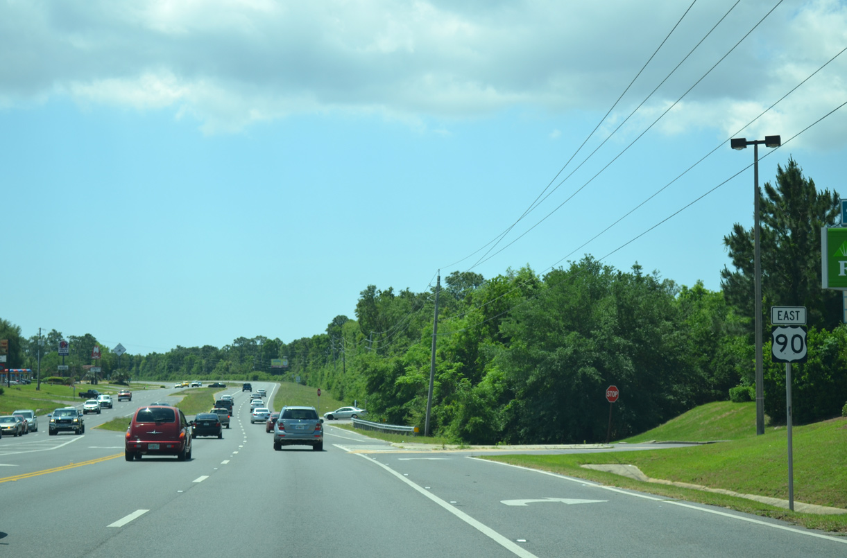
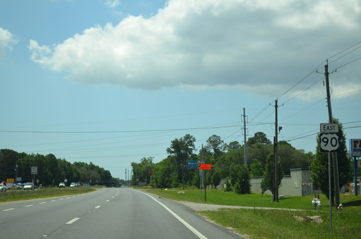
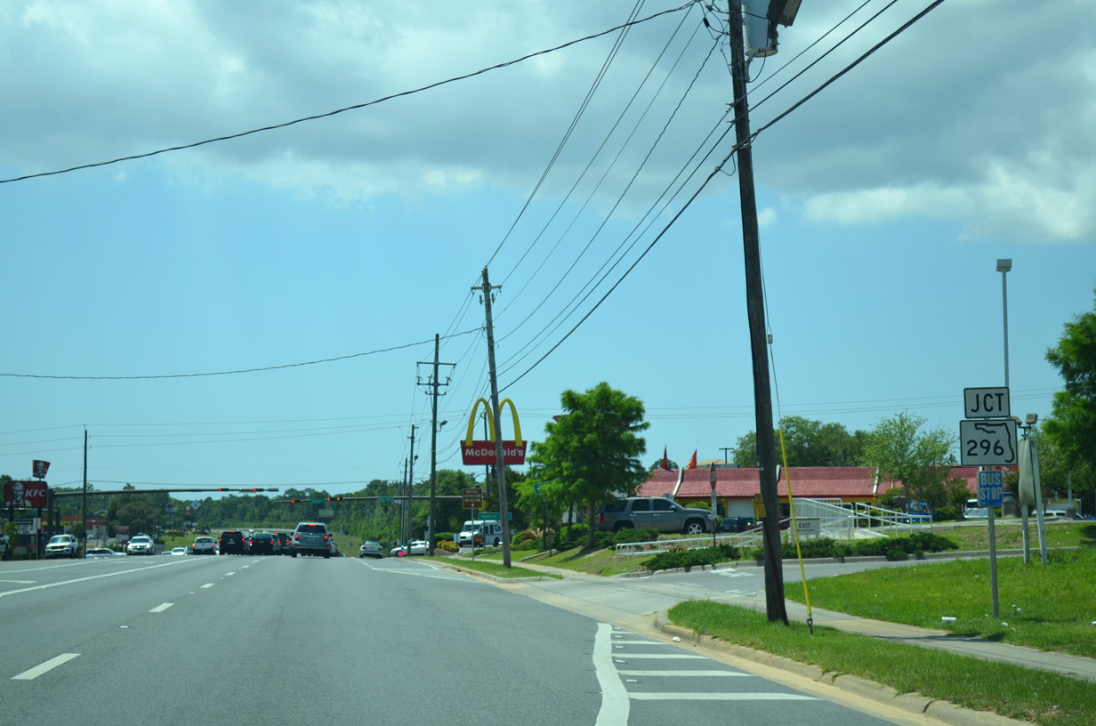
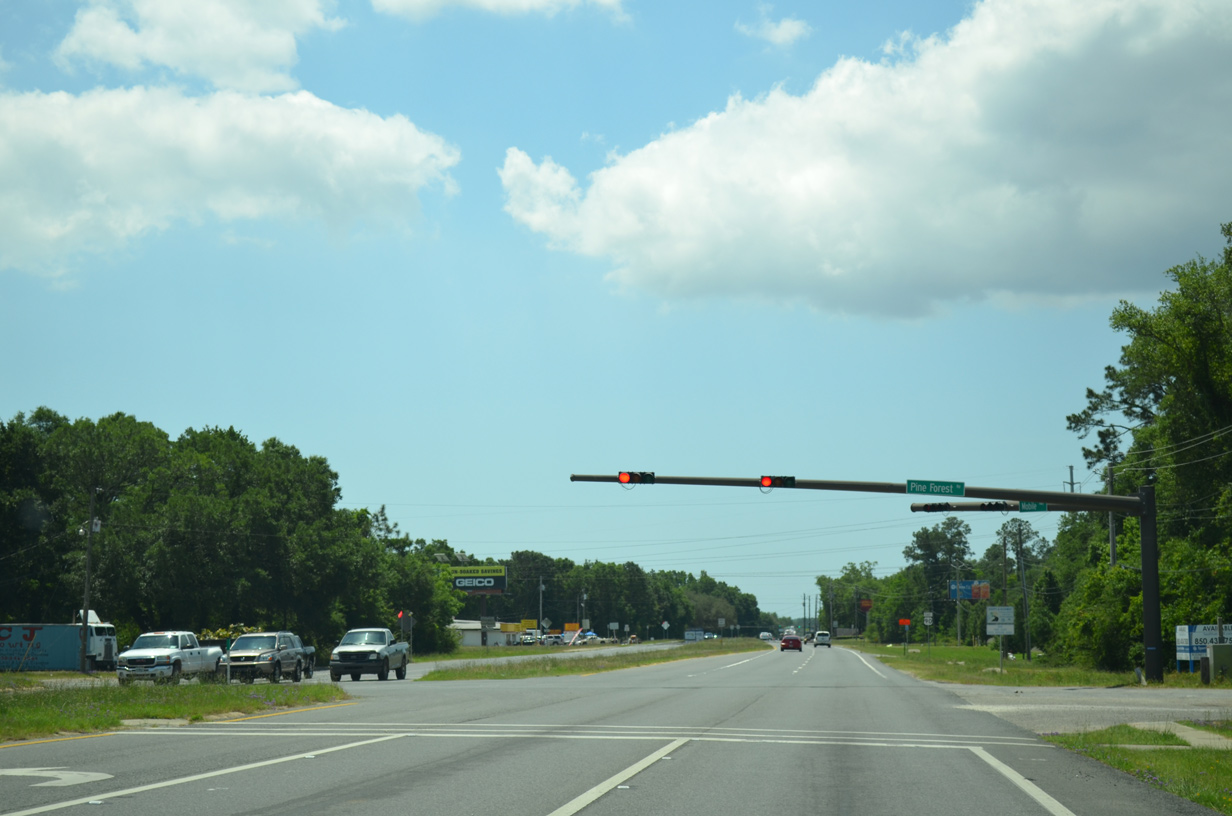
U.S. 90 (Mobile Highway) intersects the south end of SR 297 (Pine Forest Road) by the Pensacola Interstate Fairgrounds.
05/17/14
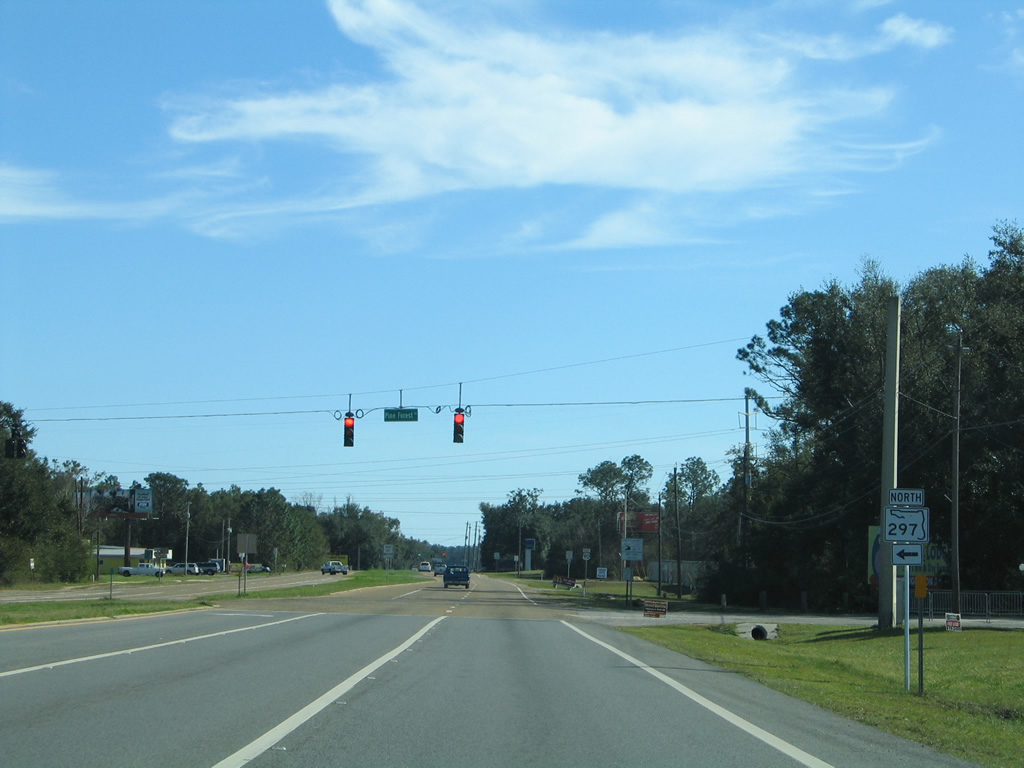
SR 297 (Pine Forest Road) comprises a multi lane arterial northward from Bellview to Interstate 10 (Exit 7) and Nine Mile Road (U.S. 90 Alternate) at Pine Forest.
02/01/06
05/17/14
Heading southward through Bellview along U.S. 90 (Mobile Highway) near Bellview Avenue.
05/17/17
Bellview Avenue leads west from U.S. 90 to Fence Road at Saufley Field and east to Memphis Avenue through residential areas of Bellview.
05/17/14
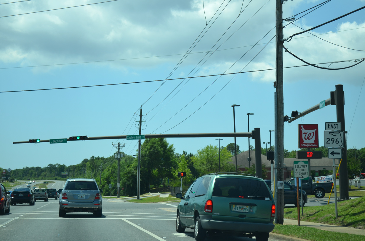
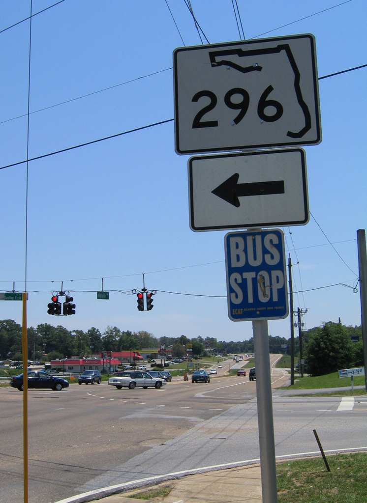
Less than a mile south of the Pensacola Interstate Fairgrounds, U.S. 90 reaches the busy intersection with Michigan Avenue (SR 296 east) and Saufley Field Road (CR 296 west).
05/17/14
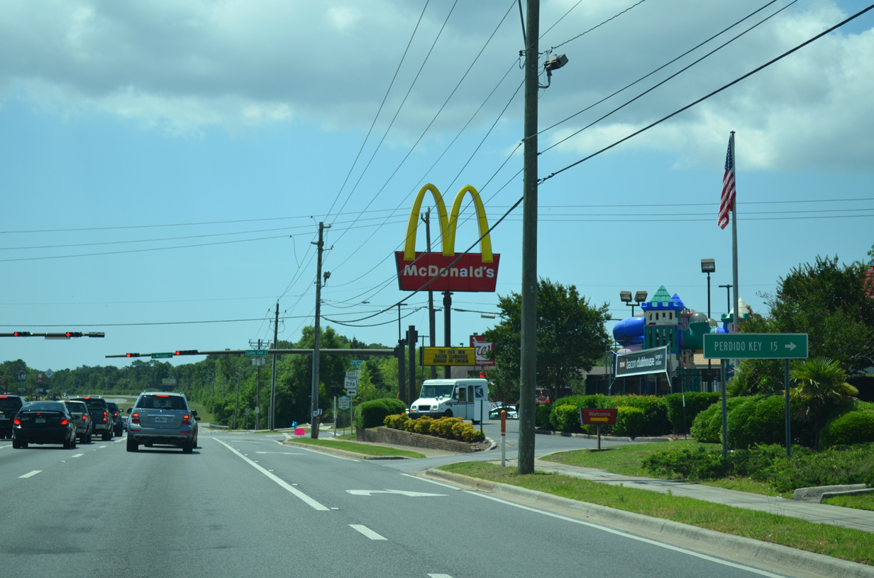
CR 296 (Saufley Field Road) connects with SR 173 (Blue Angel Parkway) 1.3 miles to the west. SR 173 south to SR 292 leads to Perdido Key. CR 296 concludes at the Naval Education Training Professional Development Technology Center (Saufley Field).
05/17/14
SR 296 extends eastward along Michigan Avenue from U.S. 90 and CR 296 (Saufley Field Road) 3.7 miles to U.S. 29 (Palafox Street) at Brent. SR 296 converges with U.S. 90 again in 9.66 miles by Bayou Texar in Pensacola.
05/17/14
05/07/04
South of SR 296, U.S. 90 (Mobile Highway) runs alongside undeveloped areas by Turners Creek.
05/17/14
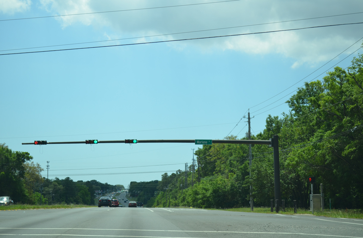
Marlane Drive and Cerny Road form a collector west from U.S. 90 (Mobile Highway) to SR 173 (Blue Angel Parkway) through areas of south Bellview.
05/15/14
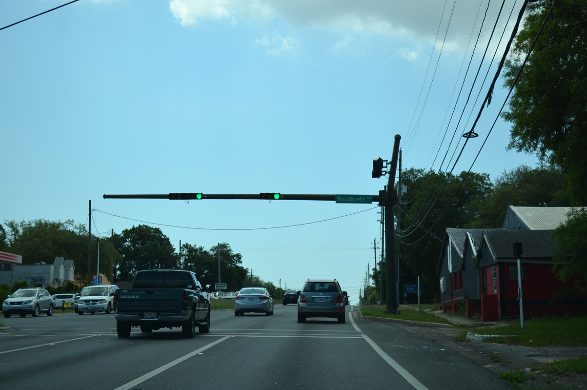
Massachusetts Avenue stems east from U.S. 90 (Mobile Highway) to SR 292 (Pace Boulevard) and U.S. 29 (Palafox Street) at Brent. The road serves several subdivisions including Westernmark and Montclair.
05/15/14
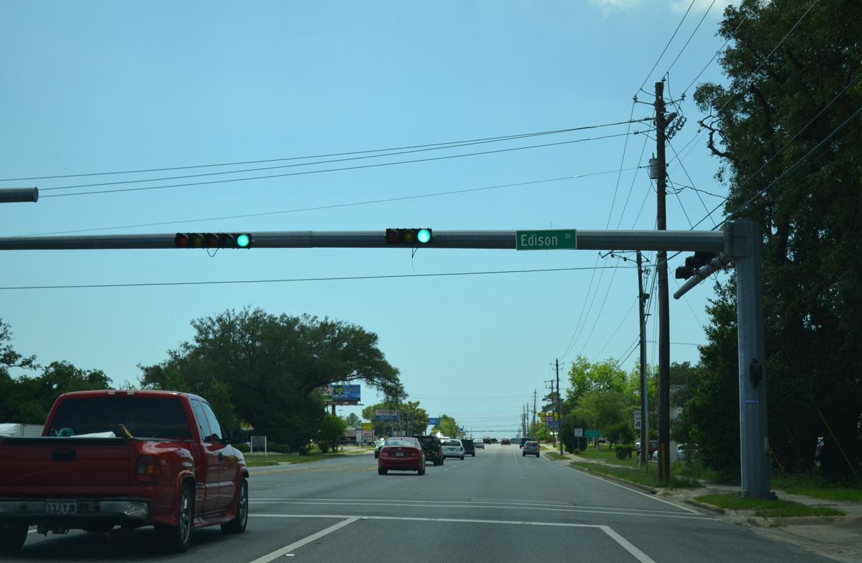
Edison Drive is the main entrance to the Mayfair and Live Oak Terrace neighborhoods, located east of U.S. 90 and north of SR 295.
05/15/14
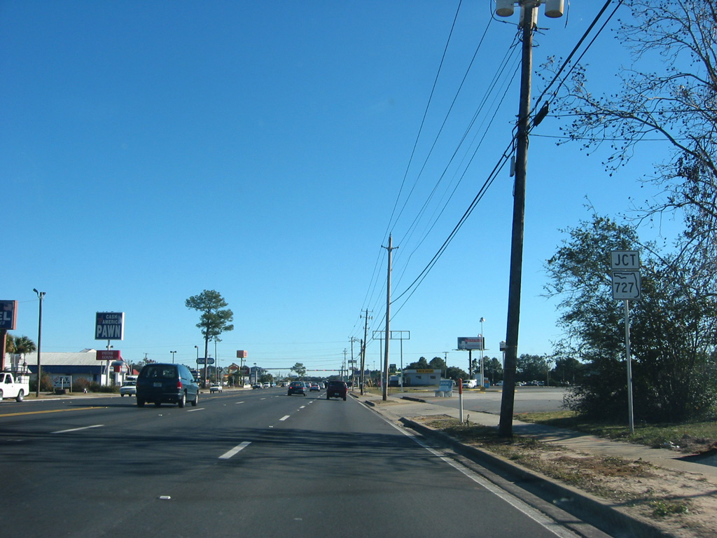
The lone shield for forthcoming SR 727 (Fairfield Drive) on U.S. 90 east was removed after 2003. Preceding Fairfield Drive, traffic lights were added at the intersection with Cherokee Trail for big box retail.
12/20/03
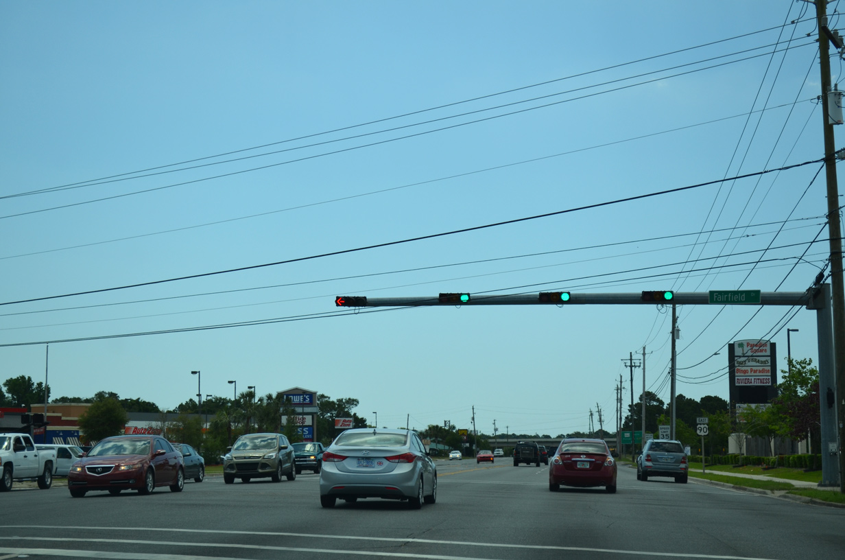
U.S. 90 (Mobile Highway) east at SR 727 (Fairfield Drive). The 6.83 mile route forms an arc around Myrtle Grove and West Pensacola from SR 292 (Gulf Beach Highway) to SR 295 (New Warrington Spur).
05/15/14
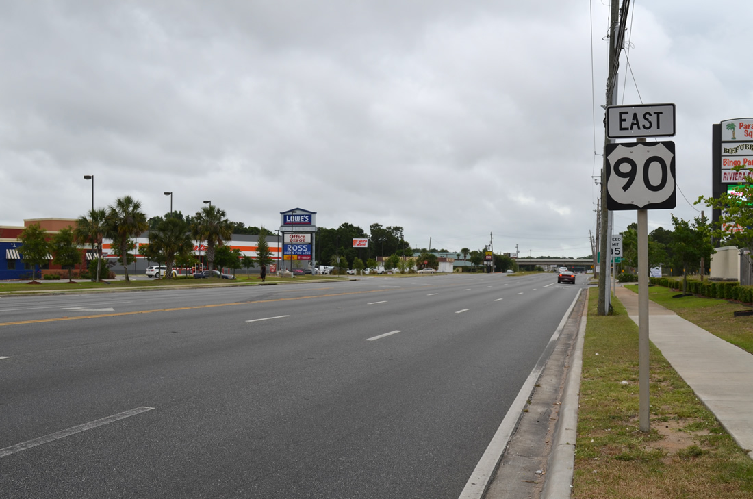
A reassurance shield for U.S. 90 follows Fairfield Drive (SR 727) along Mobile Highway eastbound.
06/01/13
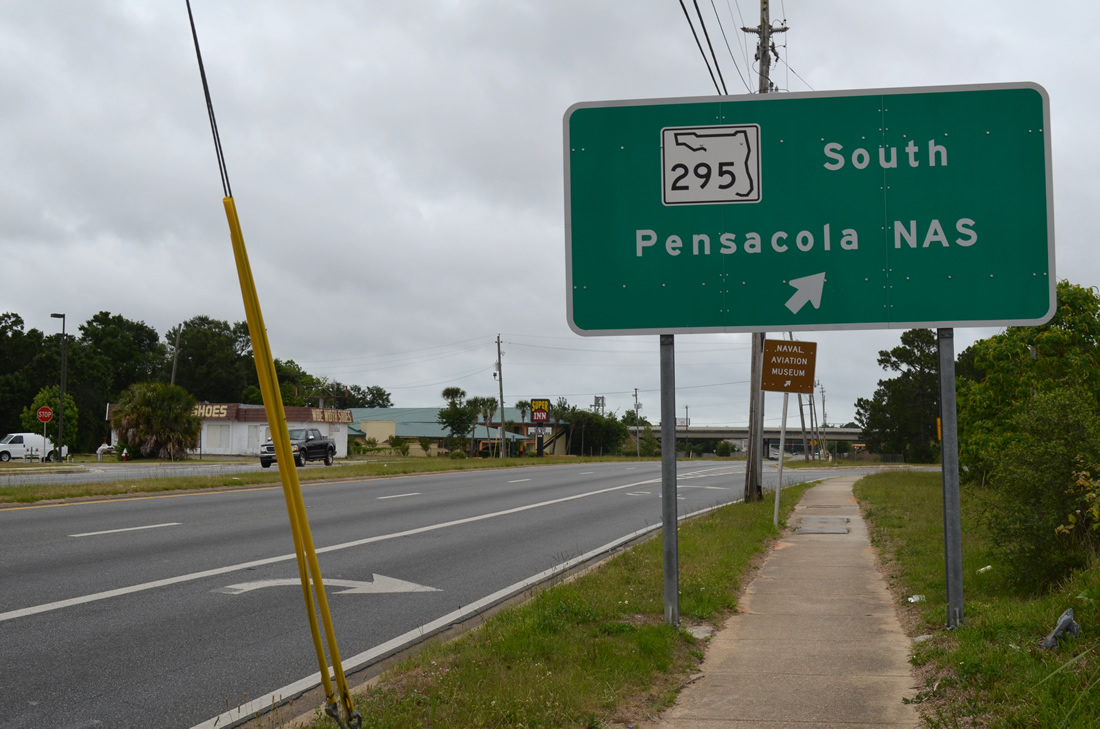
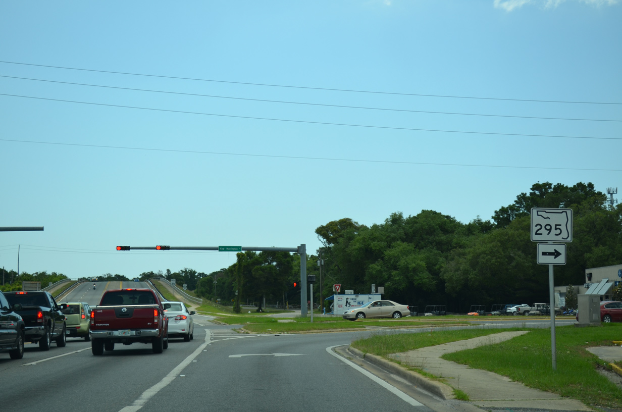
SR 295 (New Warrington Spur) follows a short expressway between SR 727 (Fairfield Drive) and New Warrington Road. U.S. 90 east meets SR 295 at a parclo B2 interchange.
06/01/13
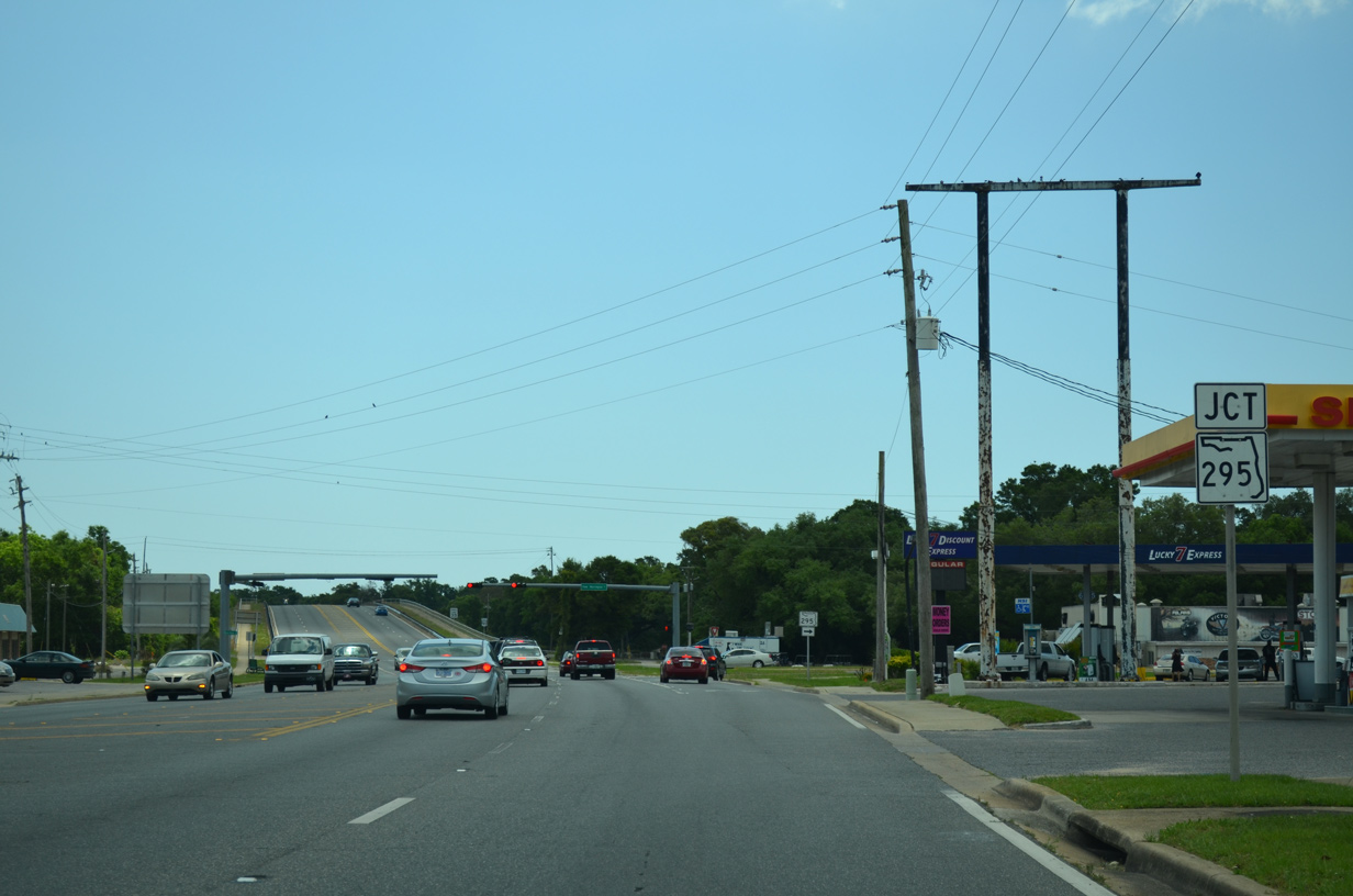
U.S. 90 (Mobile Highway) advances east to the SR 295 branch along New Warrington Road. With the expressway portion of SR 295 bypassing to the west, New Warrington Road acts as a connector for the remaining movements with U.S. 90.
05/15/14
SR 295 (New Warrington Road) south links U.S. 90 with SR 298 (Lillian Highway) adjacent to Pensacola Plaza shopping center. SR 298 concludes nearby at Old Corry Field Road (CR 295A), but historically met U.S. 90 directly.
05/15/14
The service road linking U.S. 90 with Lillian Highway ahead of the Alabama and Gulf Coast Railway (AGR) underpass represents an original segment of Mobile Highway. Including a section of twin-slab concrete, the ramp joins U.S. 90 with Lillian Highway and Border Street.
05/16/14
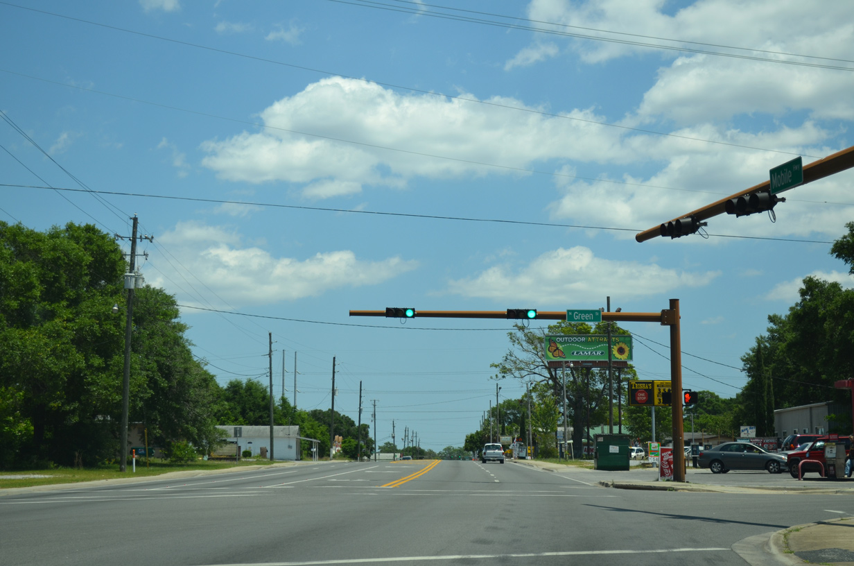
U.S. 90 (Mobile Highway) east at Green Street in West Pensacola.
05/16/14
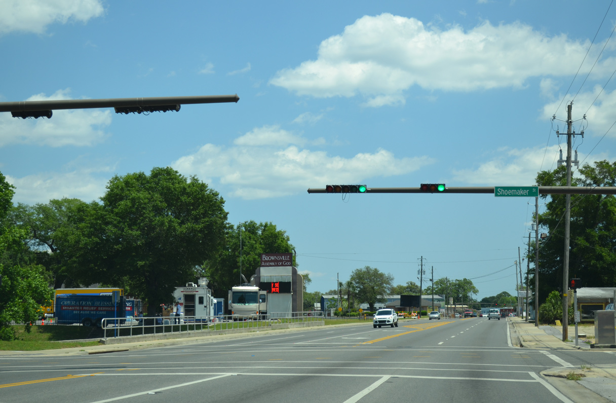
Shoemaker Street joins U.S. 90 with residential neighborhoods in West Pensacola.
05/16/14

Entering the Brownsville community, U.S. 90 (Mobile Highway) intersects W Street (County Road 453).
05/16/14
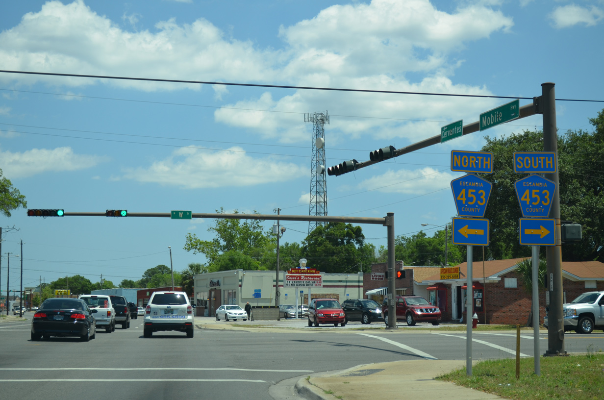
CR 453 travels 5.30 miles north from U.S. 98 (Navy Boulevard) to U.S. 29 (Palafox Street) near Brent. The multi lane boulevard comprises one of the primary streets through western reaches of Pensacola.
05/16/14
U.S. 90 shifts onto Cervantes Street east beyond CR 453 (W Street). The highway passes through older residential and commercial strips on the ensuing stretch toward the Garden District of Pensacola.
05/16/04
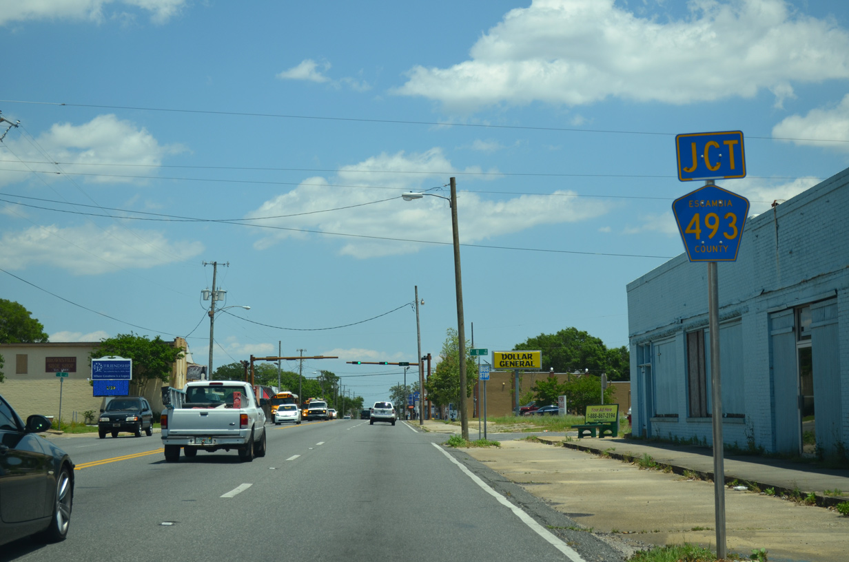
Continuing into the Pensacola city limits, U.S. 90 approaches T Street (CR 493). Sparsely signed, CR 493 parallels CR 453 between Jackson Street (unsigned CR 298A) and SR 295 (Fairfield Drive).
05/16/14
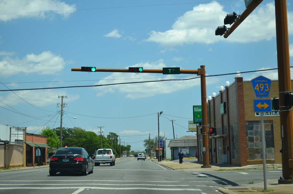
U.S. 90 (Cervantes Street) eastbound at T Street (County Road 493). T Street extends five blocks south to Wright Street.
05/16/14
Cervantes Street progresses five blocks east from T Street to U.S. 98 at SR 292 (Pace Boulevard).
05/16/14

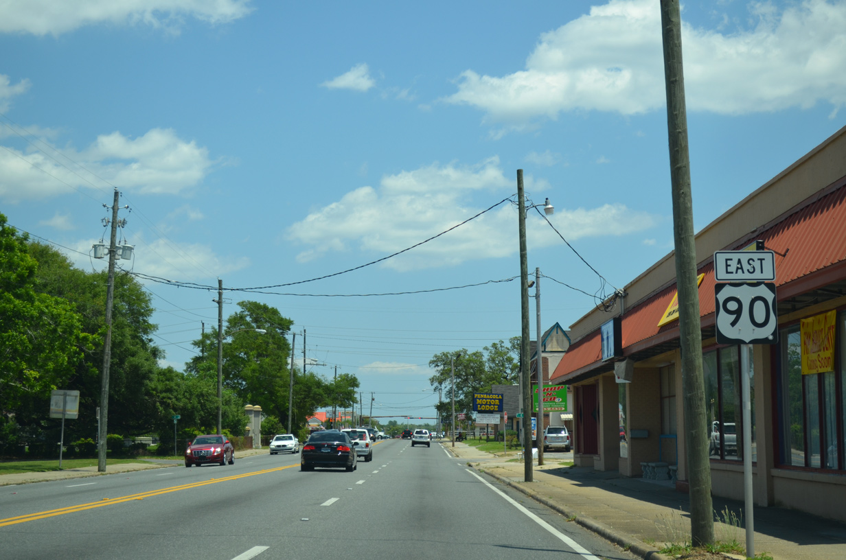
U.S. 98 joins U.S. 90 (Cervantes Street) eastbound from an overlap with SR 292 (Pace Boulevard) to the south. SR 292 continues northward along Pace Boulevard to SR 295 (Fairfield Drive) and U.S. 29 (Palafox Street) at Brent.
05/16/14
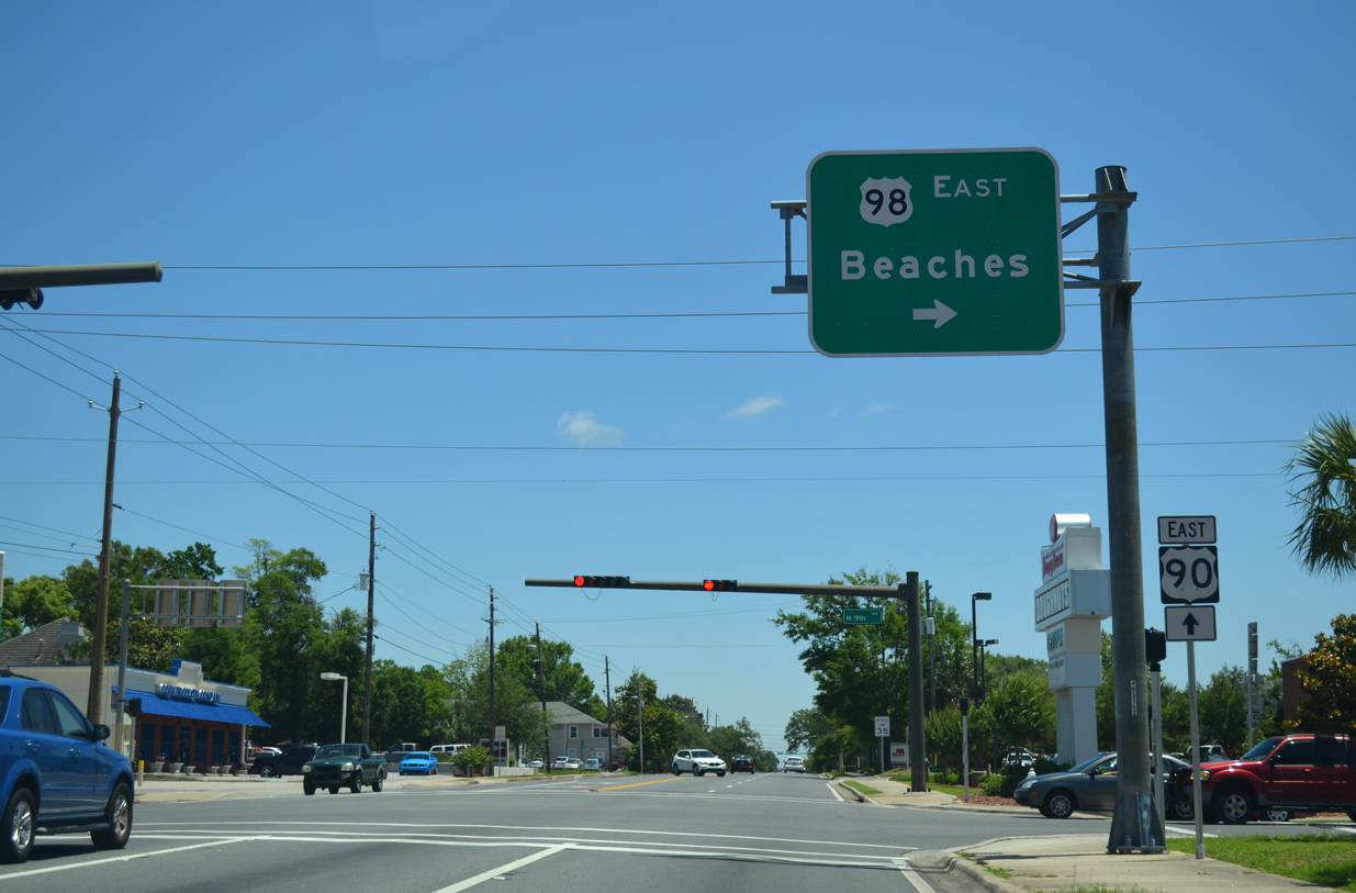
U.S. 90 (Cervantes Street) and U.S. 98 part ways at Ninth Avenue (SR 289). U.S. 98 shifts southward to coastal areas along the Emerald Coast between Gulf Breeze and Panama City. U.S. 90 stays well inland, paralleling I-10 to Milton, Crestview and Mariana.
05/15/14

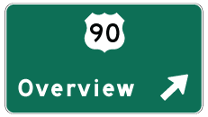
Photo Credits:
- ABRoads: 11/17/12, 05/15/14, 05/16/14, 05/17/14, 05/17/17
- Alex Nitzman: 12/20/03, 05/07/04, 05/16/04, 02/01/06
- AARoads: 06/01/13
Connect with:
Page Updated Monday October 14, 2019.