
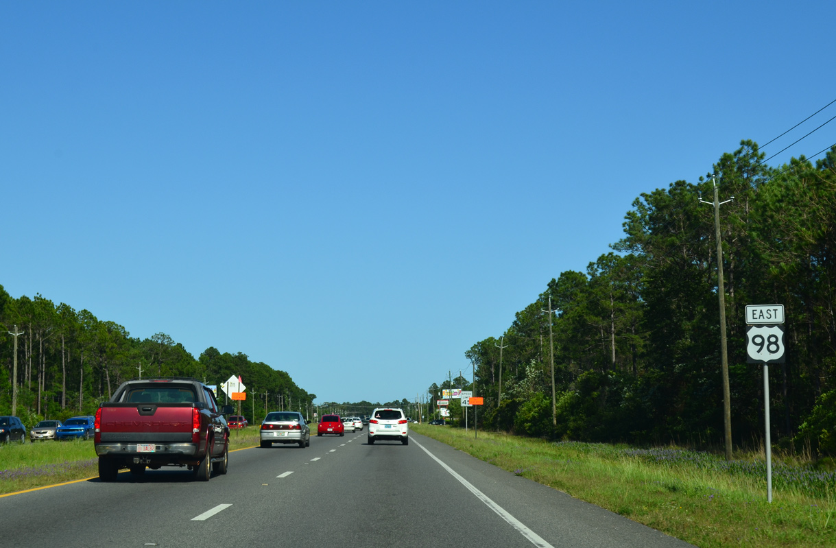
U.S. 98 East - Perdido Bay to Pensacola

 East
East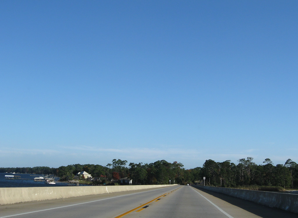
Cresting over Perdido Bay along U.S. 98 (Seneca Parkway) eastbound by the Alabama state line. The Perdido River, a waterway comprising the east-west state border between Escambia and Baldwin Counties, feeds Perdido Bay. Brackish waters of the bay flow south of the 1981-built bridge carrying U.S. 98 to Old River and the Intracoastal Waterway.
01/31/06
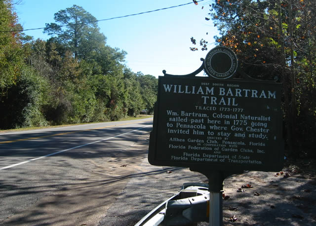
William Bartram Trail sign posted just east of Perdido Bay along U.S. 98.
12/21/03
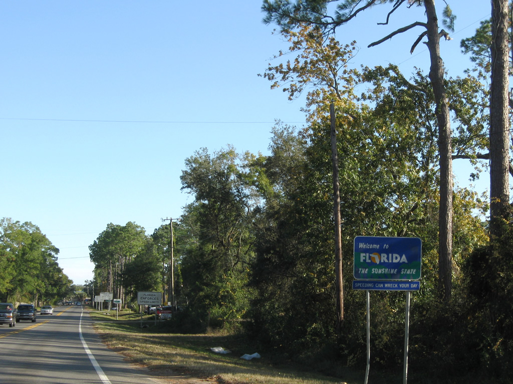
The welcome to Florida sign appears beyond the Perdido Bay bridge at Paradise Beach.
11/30/08
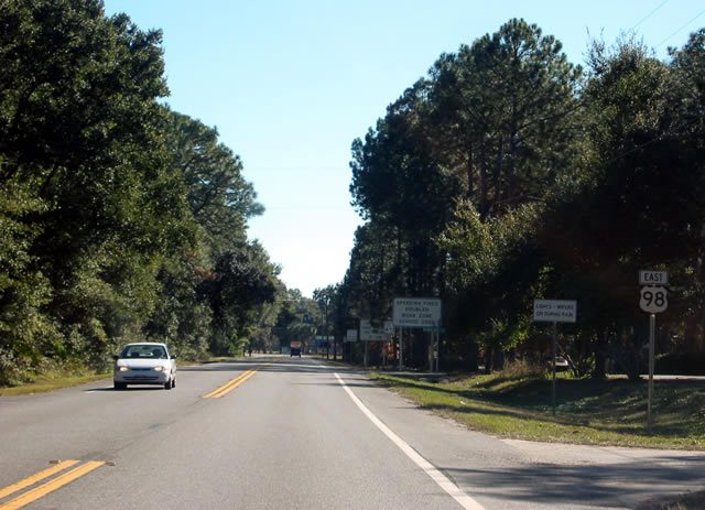
The first U.S. 98 shield in Florida precedes a number of signs outlining state motor vehicle laws.
12/21/03
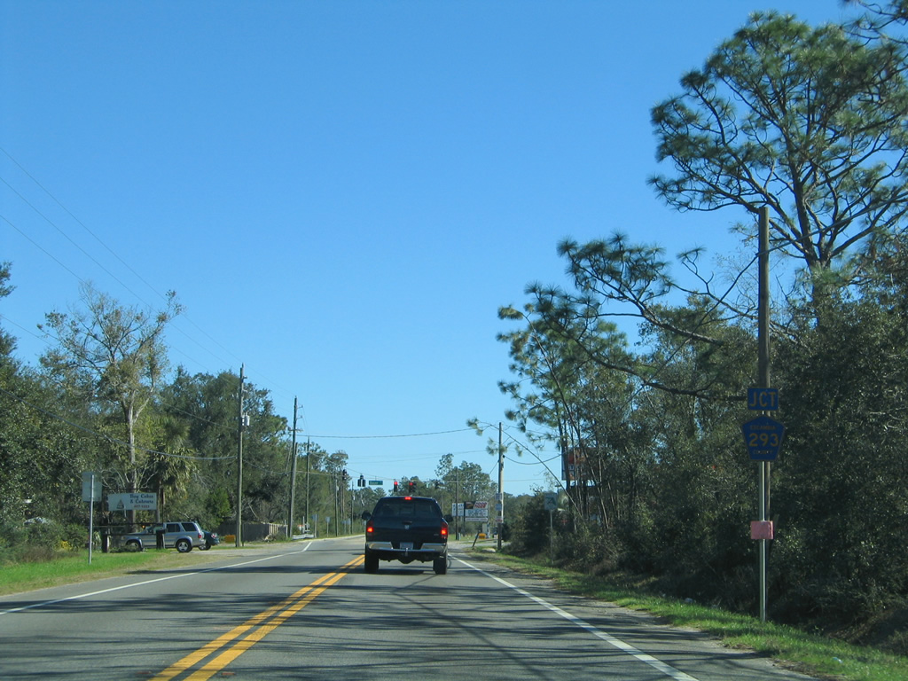
U.S. 98 (Lillian Highway) first meets County Road 293 (Bauer Road) southbound to Tarkiln Bayou Preserve State Park and Perdido Key.
01/31/06
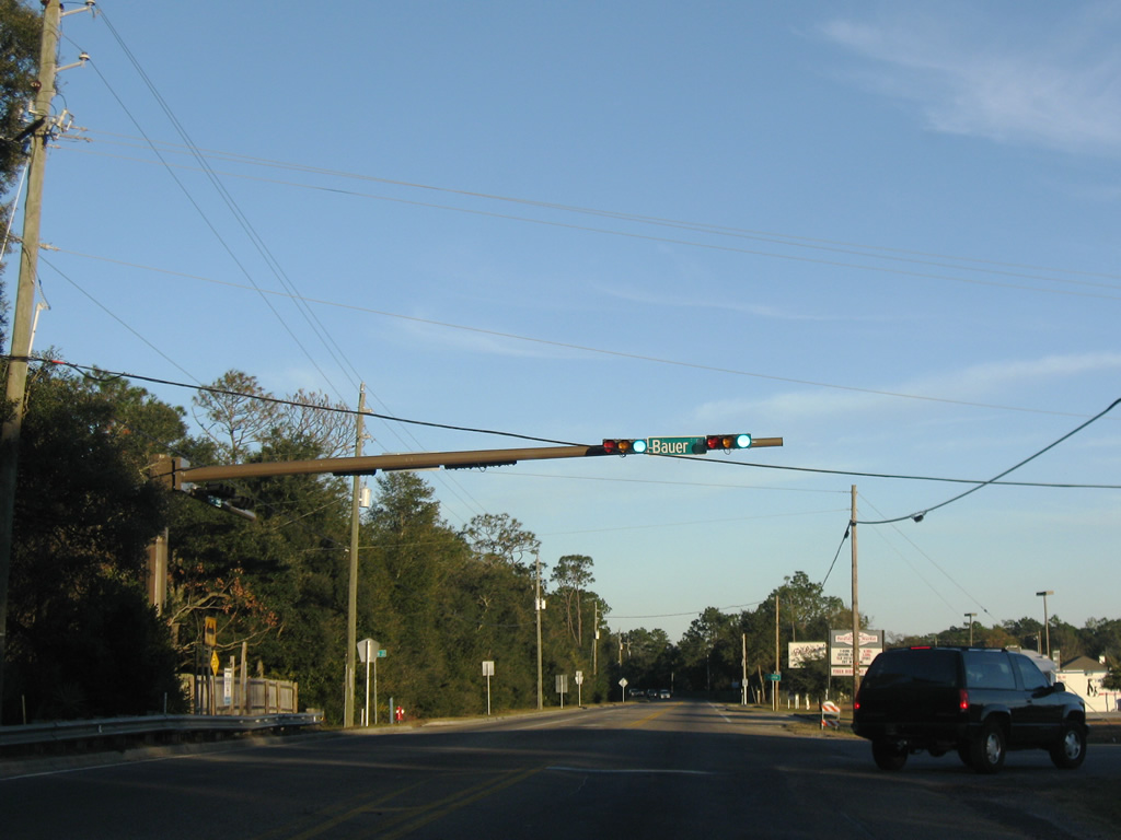
Bauer Road leads southward 3.936 miles from U.S. 98 at Paradise Beach to SR 292 (Sorrento Road) near Tarkiln Bay. SR 292 continues southwest from there to Perdido Key while Bauer Road continues south to County Road 292A (Gulf Beach Highway) at Big Lagoon State Park.
01/03/10
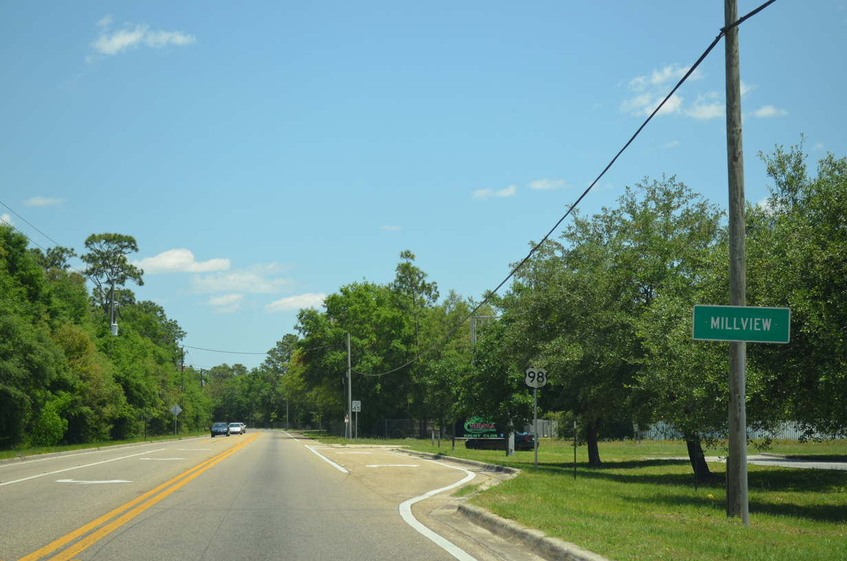
U.S. 98 (Lillian Highway) advances east from Bauer Road into the community of Millview.
05/16/14
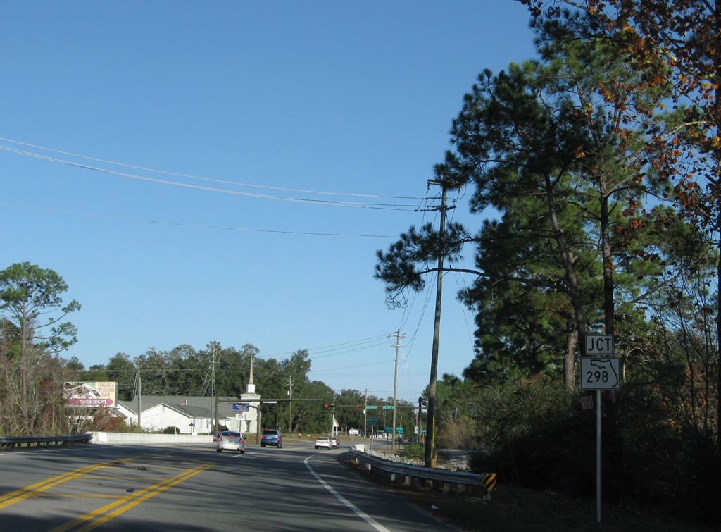
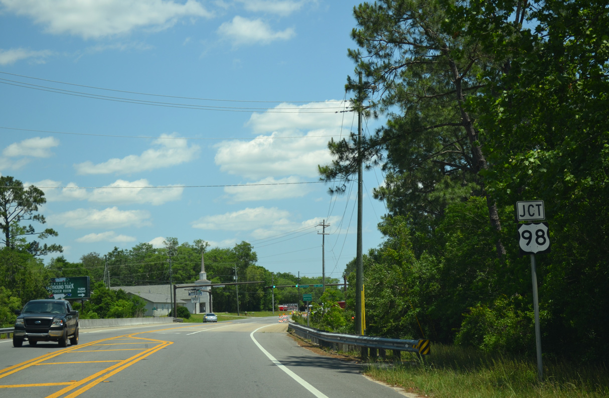
Crossing Heron Bayou, U.S. 98 (Lillian Highway) approaches the west end of SR 298 and north end of County Road 297. Lillian Highway shifts onto SR 298 eastward from Millview to Myrtle Grove and West Pensacola.
11/30/08
A sign change erroneously switched the SR 298 marker with a shield for U.S. 98. CR 297 follows Dog Track Road southeast 3.262 miles to SR 292 (Gulf Beach Highway) at Pleasant Grove.
05/16/14
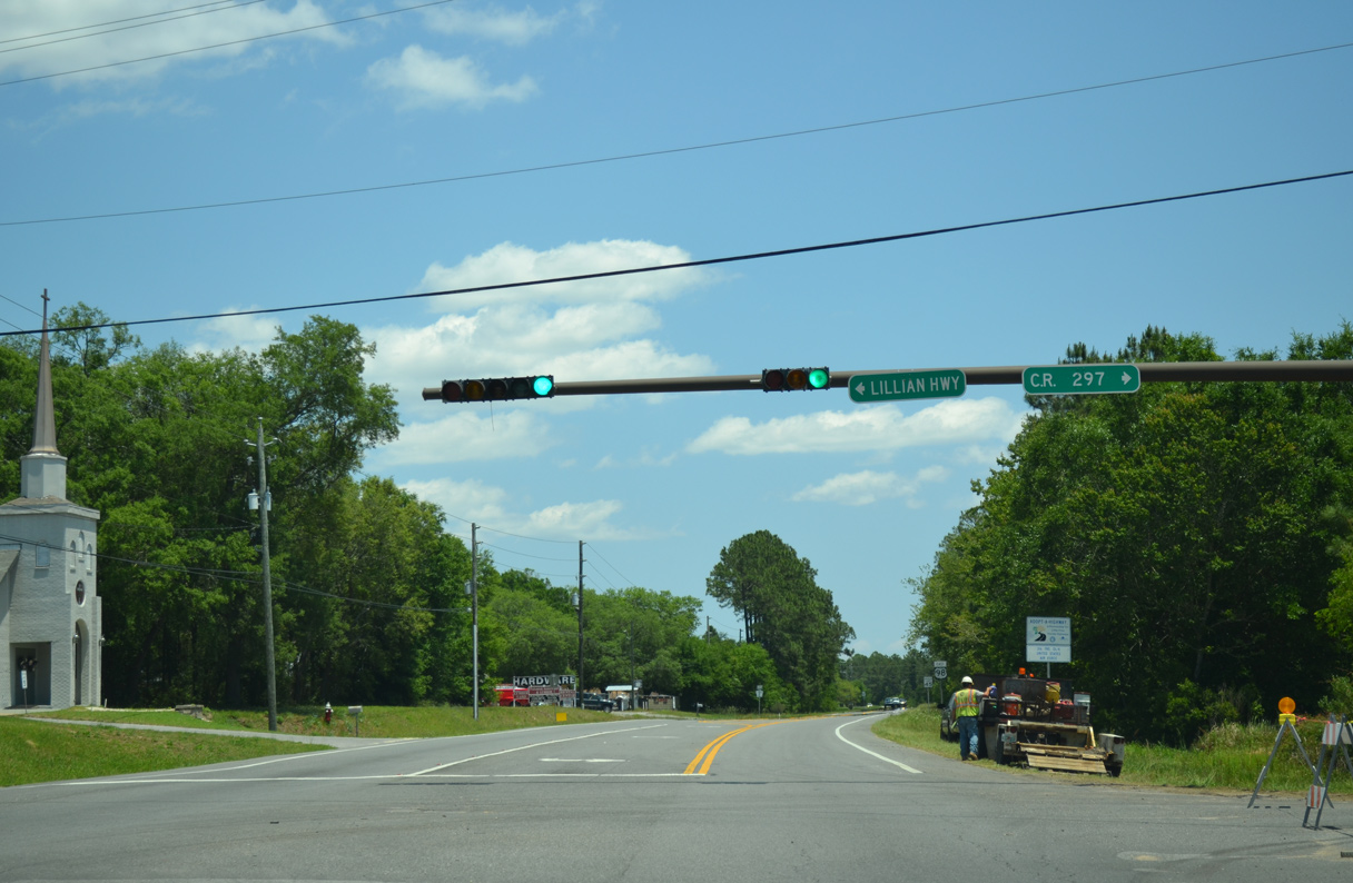
Shields for both SR 298 east and County Road 297 south are absent from the U.S. 98 intersection with Dog Track Road and Lillian Highway east. Originally U.S. 98 continued along Lillian Highway to West Pensacola.
05/16/14
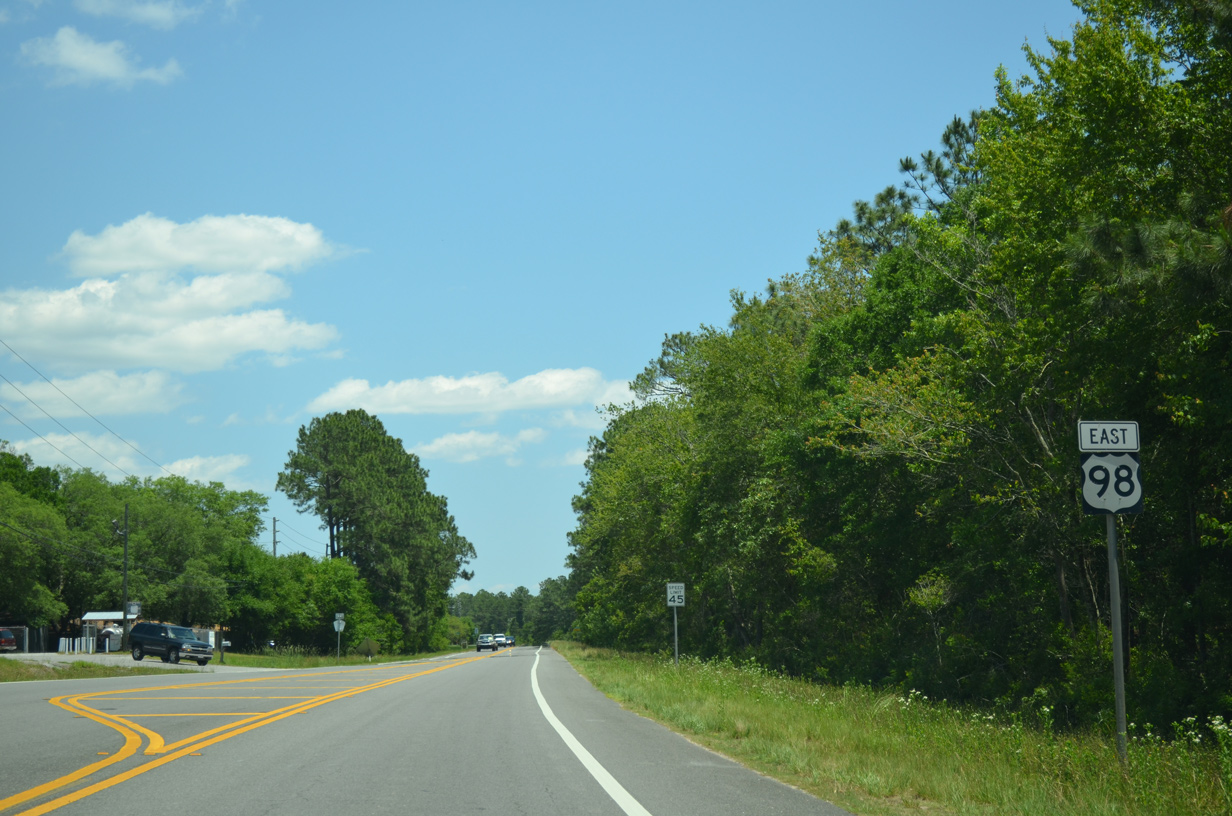
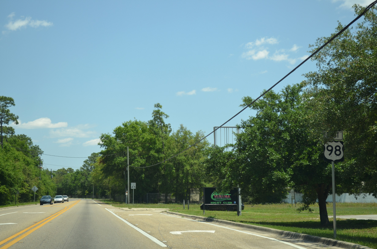
Continuing east from Lillian Highway and Millview, U.S. 98 travels another 1.75 miles before expanding into a four lane divided highway.
05/16/14
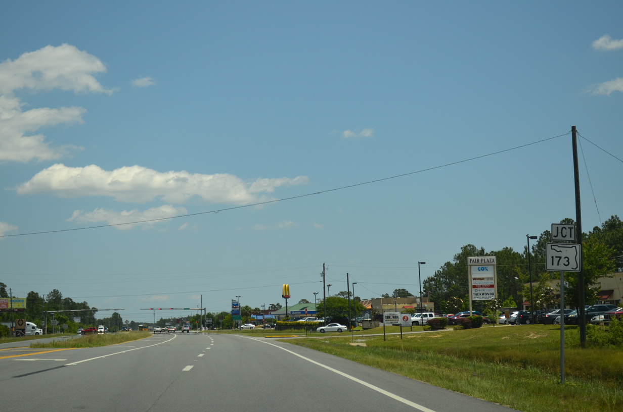
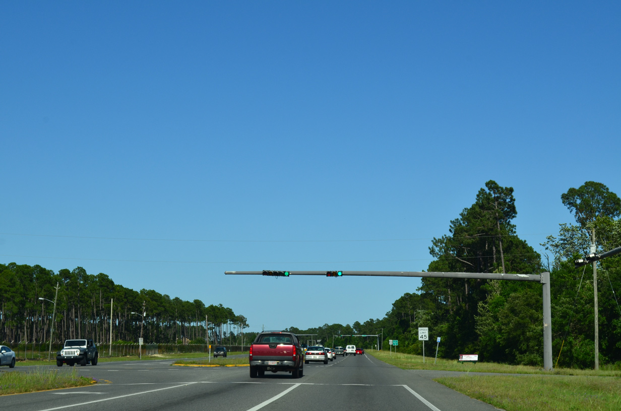
SR 173 (Blue Angel Parkway) crosses paths with U.S. 98 at the upcoming traffic light.
05/16/14
State Road 173 travels 12.71 miles overall between SR 297 (Pine Forest Road) near Bellview and the West Gate of Pensacola Naval Air Station.
05/16/14
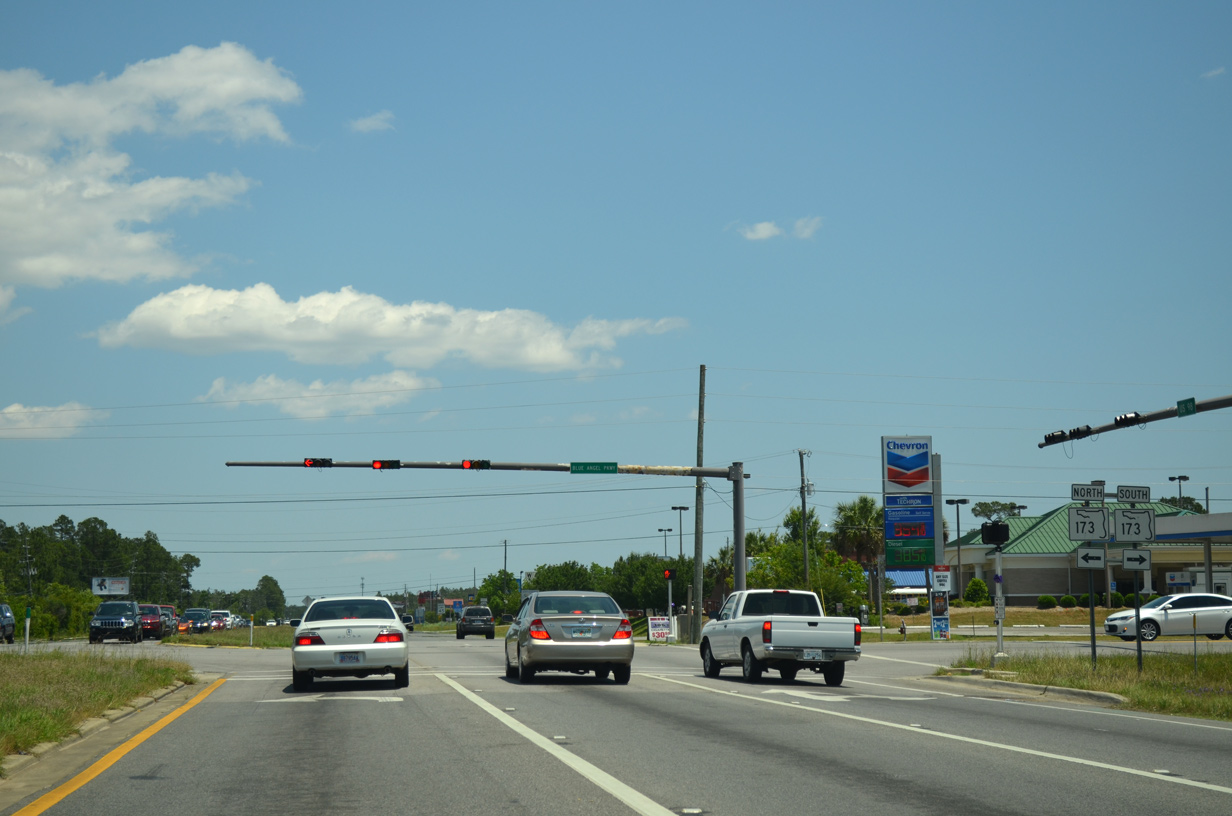
Reassurance marker posted after SR 173 on U.S. 98 east. A number of fast food eateries and small businesses line the arterial on this stretch.
05/15/14
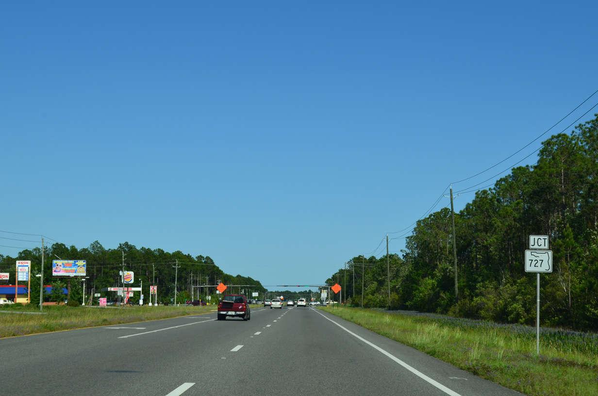
U.S. 98 meets SR 727 (Fairfield Drive) at the community of Myrtle Grove.
05/15/14
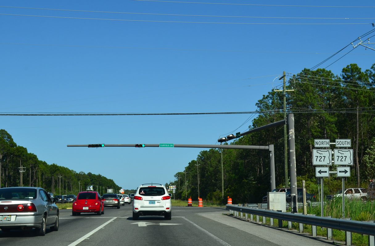
SR 727 constitutes a 6.83 mile loop around Myrtle Grove from SR 292 (Gulf Beach Highway) near Bayou Grande to SR 295 near West Pensacola and Brownsville.
05/15/14
A 2001-2002 widening project resulted in a four lane U.S. 98 between SR 173 and SR 295 (Navy Boulevard). This expansion upgraded a previously congested two lane route.
05/15/14
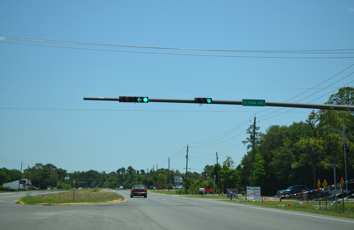
72nd Avenue ties into U.S. 98 at the succeeding traffic light from residential areas of Myrtle Grove south from Jackson Street (CR 298A).
05/16/14
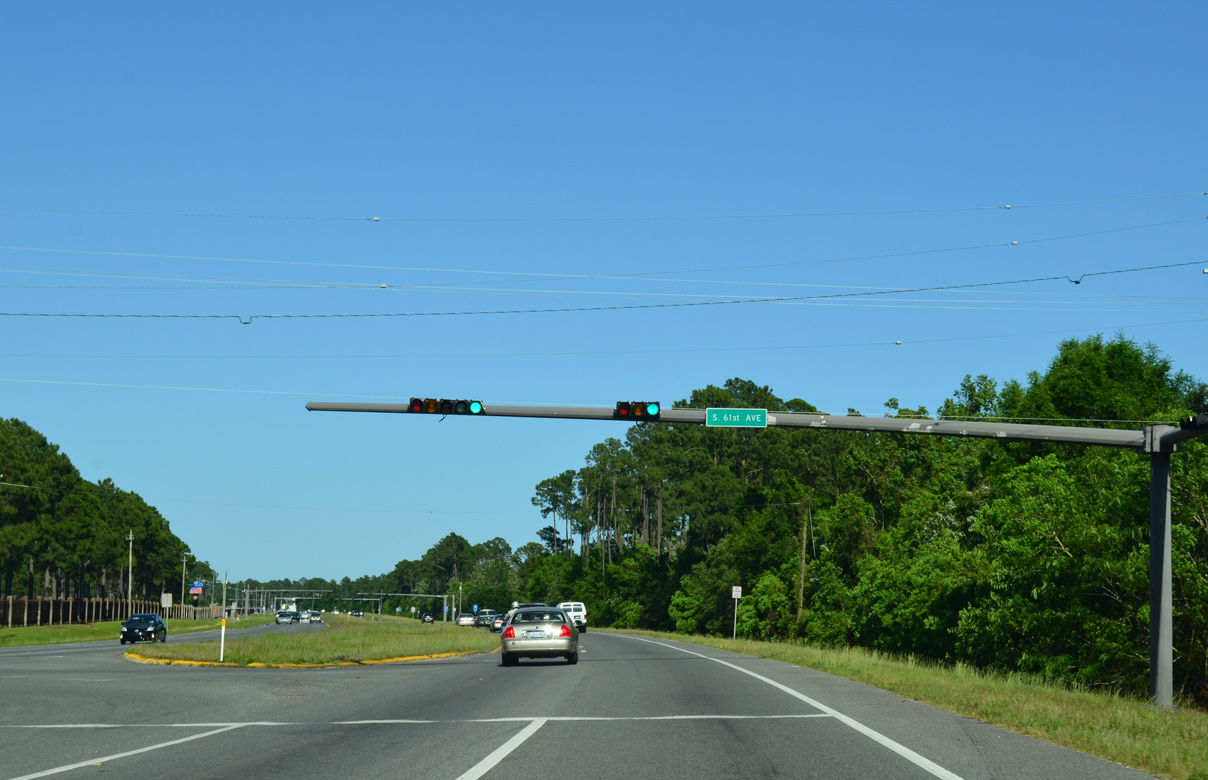
61st Avenue stems north from U.S. 98 to Lake Joanne Drive along the western boundary of Naval Hospital Pensacola.
05/15/14
The main entrance to Naval Hospital Pensacola follows along U.S. 98 east at the ensuing traffic light.
05/15/14
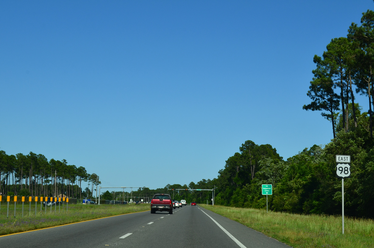
Reassurance marker posted ahead of Veterans Way north to the V.A. Outpatient Clinic at Corry Station.
05/15/14
Navy Exchange Road intersects U.S. 98 south from Naval Technical Training Center Corry Station opposite the Warrington Campus of Pensacola State College.
05/15/14
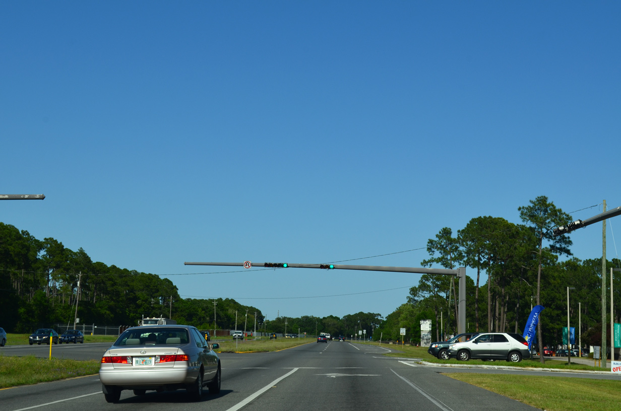
U.S. 98 merges with SR 295 (Navy Boulevard) north at Warrington.
05/15/14
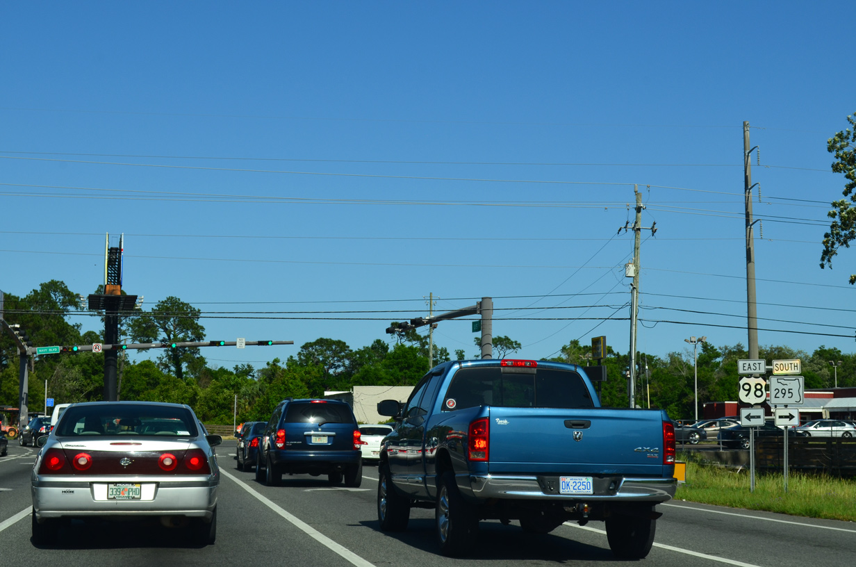
Navy Boulevard carries SR 295 southward from U.S. 98 (Dr. Farin Drive) to Warrington and the Main Gate of Pensacola Naval Air Station. Northward, the state road joins U.S. 98 briefly to New Warrington Road.
05/15/14
East  North
North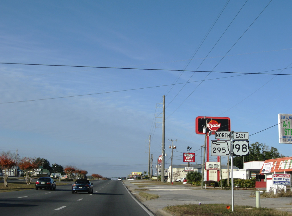
U.S. 98 east & SR 295 northbound shield assembly posted at the beginning of their 0.3 mile overlap.
11/30/08
SR 295 continues north to West Pensacola and a short expressway at U.S. 90 (Mobile Highway). U.S. 98 (Navy Boulevard) branches east toward Downtown Pensacola.
05/15/14
East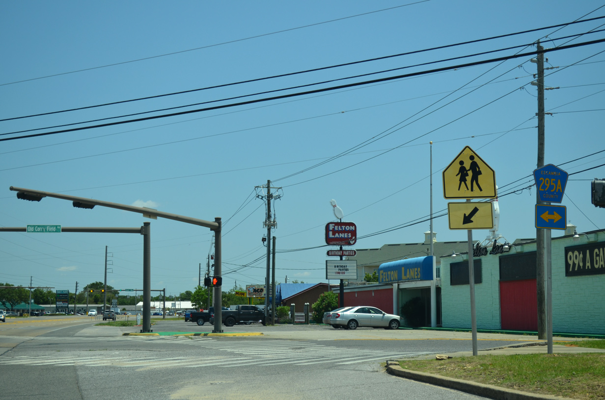
Old Corry Field Road crosses paths with U.S. 98 (Navy Boulevard) on the eastward curve toward Bayou Chico from SR 295. Signed as County Road 295A only at U.S. 98, the 2.724 mile route leads north to West Pensacola (Lillian Highway) and south to SR 292 (Barrancas Avenue) at Warrington.
05/16/14
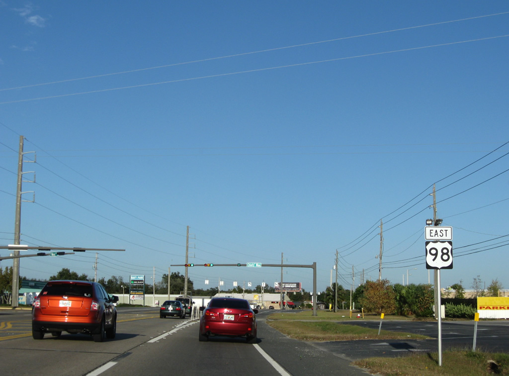
U.S. 98 eastbound shield posted between County Road 295A (Old Corry Field Road) and Chiefs' Way (SR 294). SR 294 constitutes a 0.22 mile connector between U.S. 98 west to SR 295, east of the Corry Field Main Gate.
11/30/08
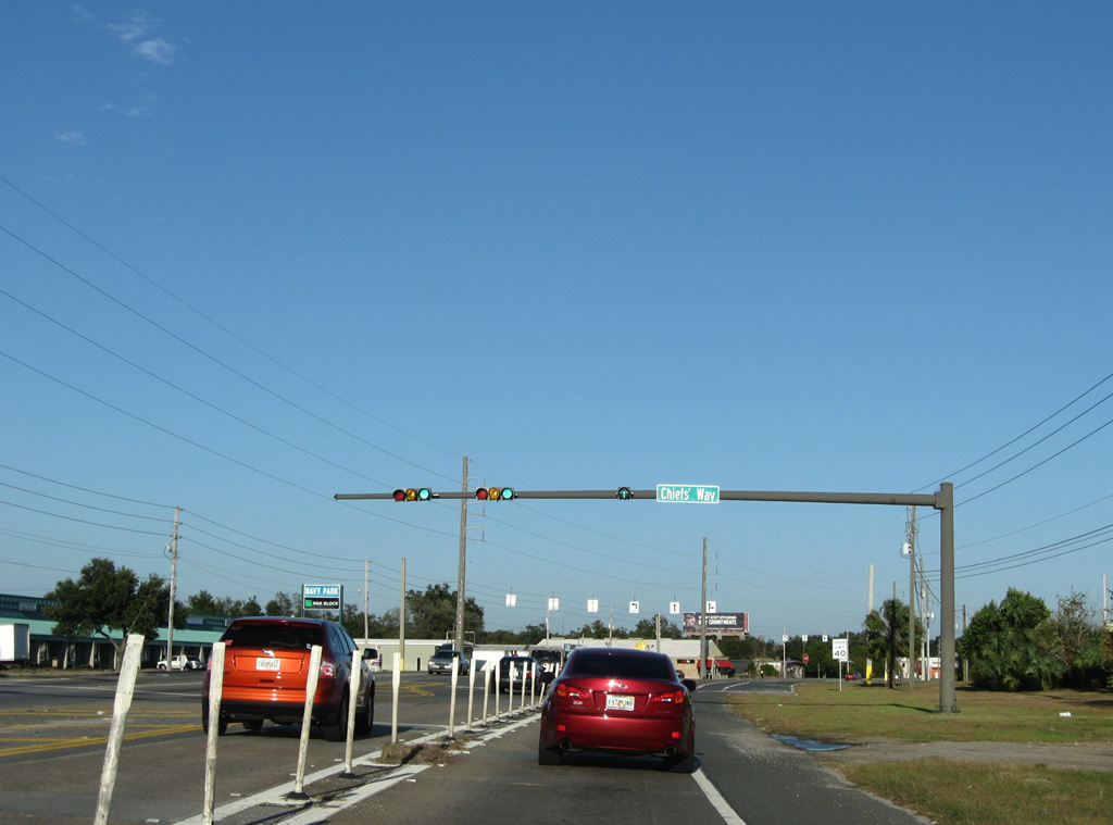
Pylons separate traffic from the end of SR 294 from the eastbound mainline of U.S. 98. SR 294 becomes the hidden state road number of U.S. 98 eastward to Pace Boulevard.
11/30/08
U.S. 98 nears a crossing of Bayou Chico along a short stretch of concrete roadway.
05/16/14
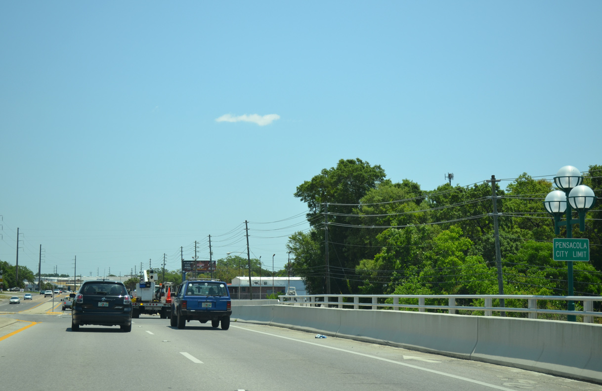
Bayou Chico represents the Pensacola city line across U.S. 98 eastbound.
05/16/14
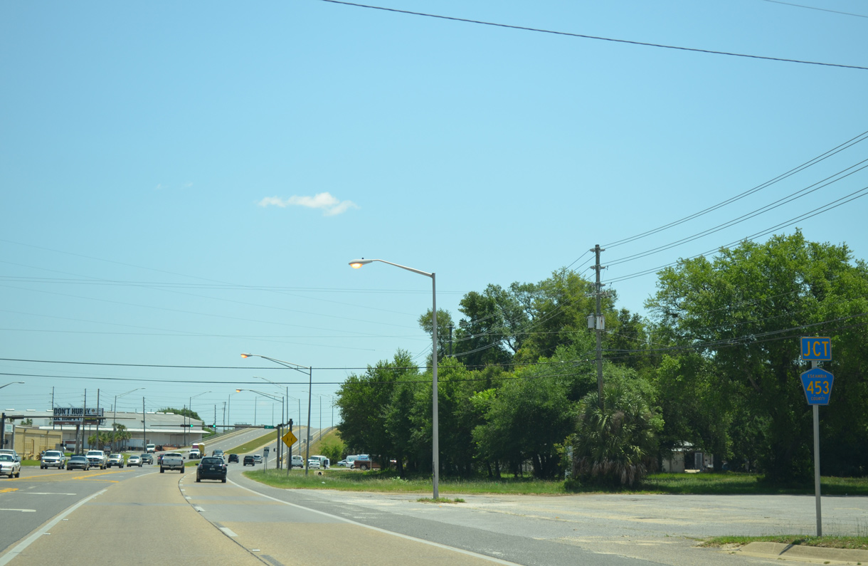
Navy Boulevard eastbound nears the south end of Escambia County Road 453 (W Street). County Road 453 represents one of the remaining 400 series of county roads in Escambia County. These roads were numbered in the 400s to avoid replicating existing 200 series routes.
05/16/14
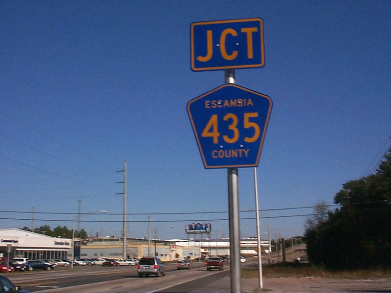
The junction shield for County Road 453 was briefly signed as County Road 435 in 2000. This error was quickly replaced.
12/03/00
CR 453 ventures 5.30 miles northward along W Street to U.S. 29 (Pensacola Boulevard) near Brent. A CR 453 shield posted at W Street was taken down by 2008.
05/16/14
U.S. 98 rises to pass over a Alabama & Gulf Coast Railway spur immediately after W Street. This bridge was reconstructed in 2002.
05/15/14
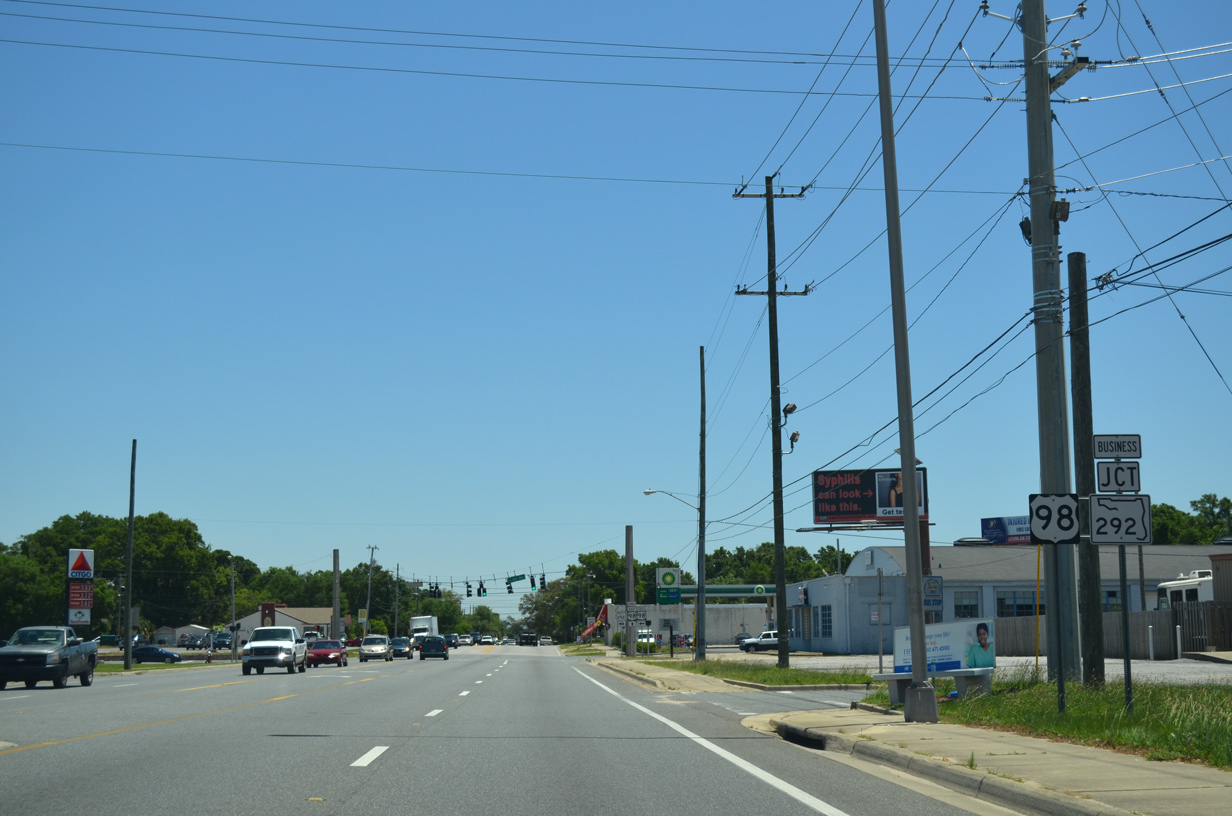
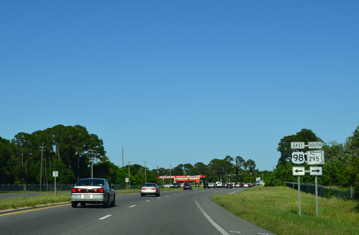
U.S. 98 (Navy Boulevard) eastbound approaches SR 292 (Pace Boulevard) and U.S. 98 Business (Garden Street). U.S. 98 turns northbound with SR 292 for an eight block overlap to U.S. 90 (Cervantes Street). Business U.S. 98 begins and carries the unsigned SR 30 designation via Garden Street to Downtown Pensacola.
05/15/14
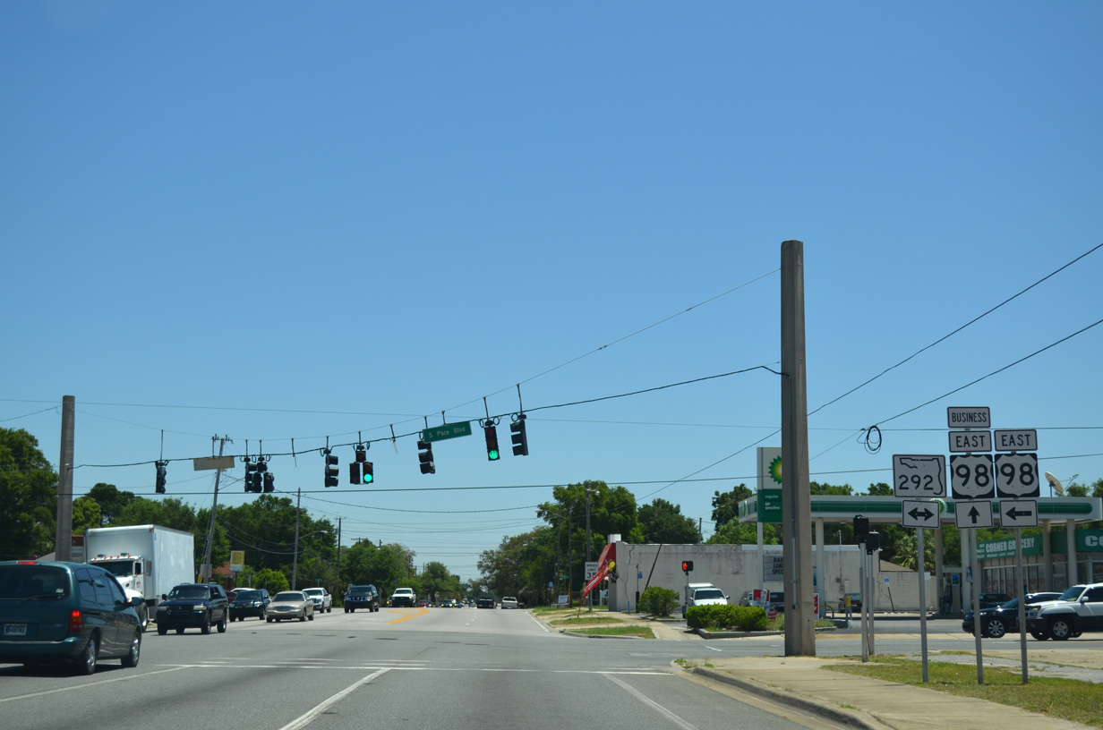
Pace Boulevard travels north from Bayou Chico to U.S. 29 (Palafox Street) near Brent. Southward, SR 292 heads to Warrington and Perdido Key, completing a 24.75 mile route as Alabama 182 near Orange Beach.
U.S. 98 Business was commissioned in 1981 when U.S. 98 bypassed Downtown via Pace Boulevard and Cervantes Street. The business loop travels east to the Garden District, returning to U.S. 98 by Pensacola Bay Center and Interstate 110.
05/15/14
East  North
North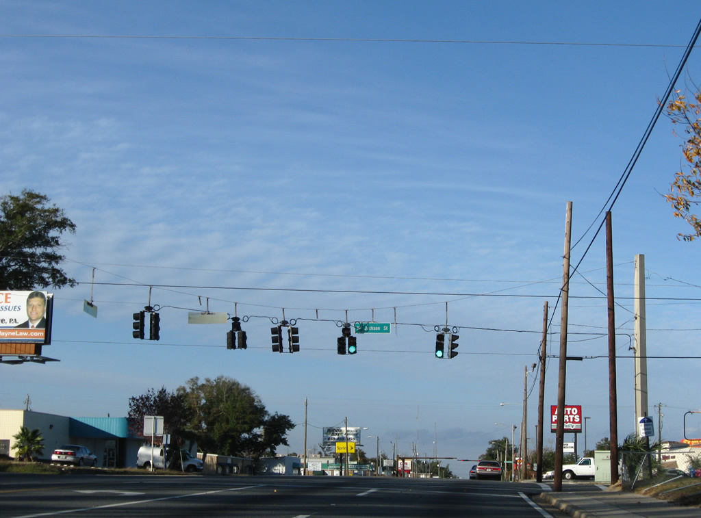
Jackson Street (unsigned County Road 298A) leads west from Pace Boulevard 4.554 miles to SR 727 at Myrtle Grove.
11/30/08
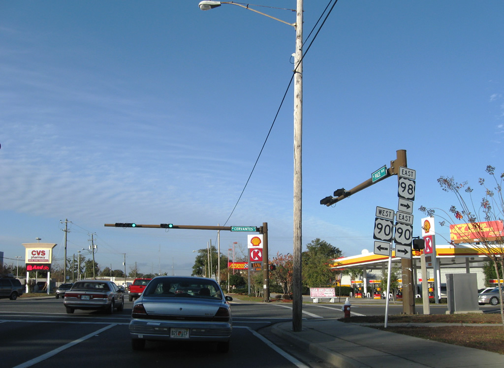
U.S. 90 follows Cervantes Street east from Mobile Highway to Bayou Texar in central Pensacola. Westward, U.S. 90 continues from West Pensacola to Bellview, Beulah and Seminole, Alabama.
11/30/08


Photo Credits:
- Alex Nitzman: 12/03/00, 12/21/03, 01/31/06
- ABRoads: 11/30/08, 01/03/10, 05/15/14, 05/16/14
Connect with:
Page Updated Tuesday August 28, 2018.