
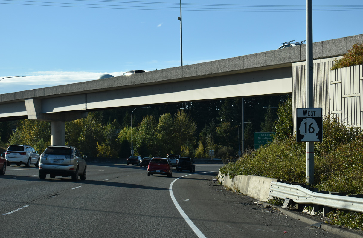
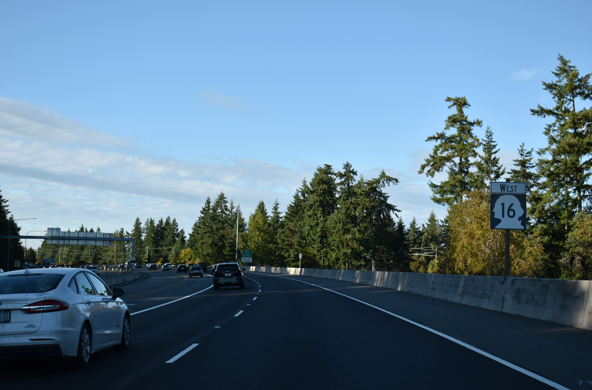
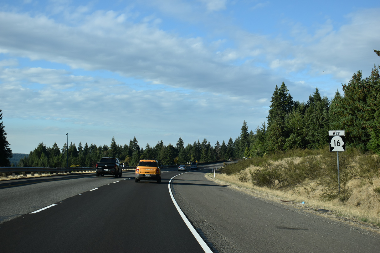
State Route 16 West

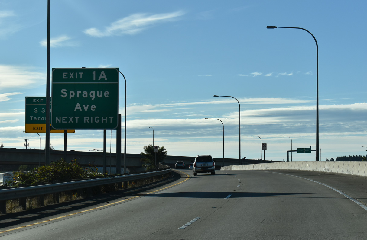
Separate ramps departs from each flyover linking Interstate 5 with SR 16 at Exit 1 A to Sprague Avenue north.
09/27/25
09/27/25
Sprague Avenue stems north from Exit 1 A below S 25th Street to S 19th Street. The five lane boulevard extends north from SR 16 to Division / 6th Avenues.
09/27/25
09/27/25
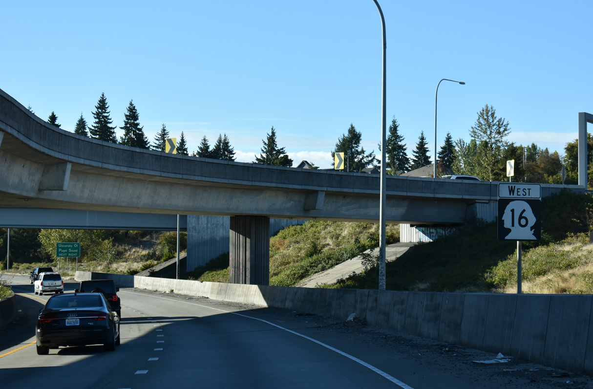
SR 16 confirming marker posted ahead of the flyover for the ramp linking I-5 northbound with SR 16 west at Exit 1 A.
09/27/25
09/27/25
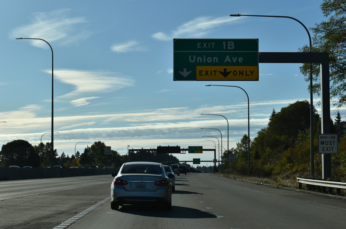
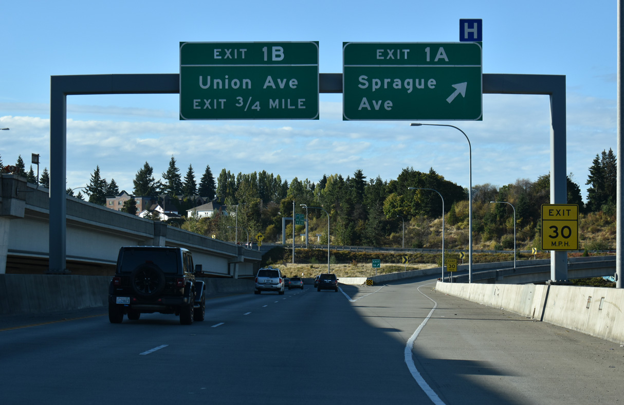
A diamond interchange (Exit 1 B) joins SR 16 with Union Avenue just west of S Pine Street.
09/27/25
09/27/25
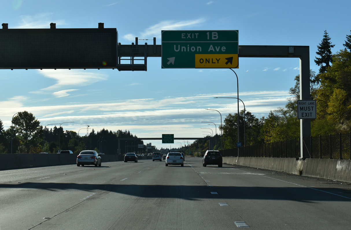
Union Avenue heads south from the Oakland section of Tacoma to an interchange with Tacoma Way (historic U.S. 99) and north from Exit 1 B to the University of Puget Sound.
09/27/25
09/27/25
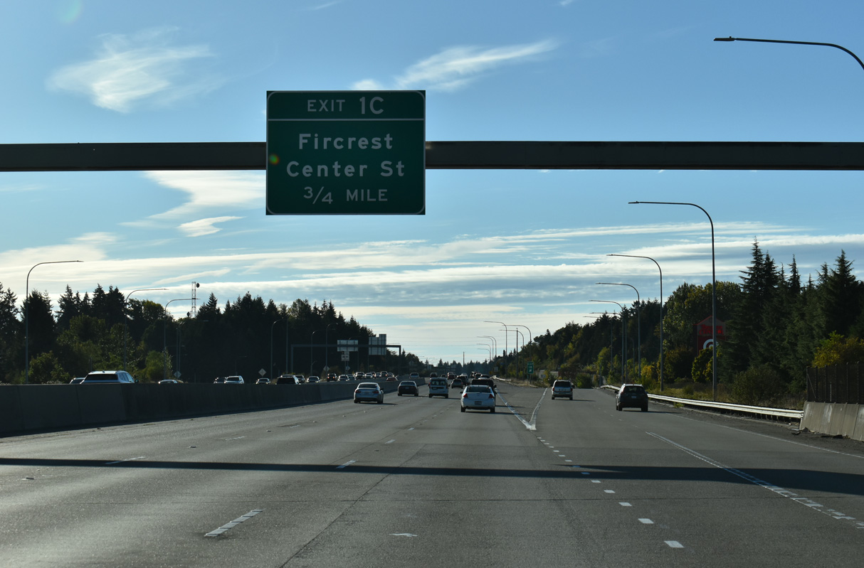
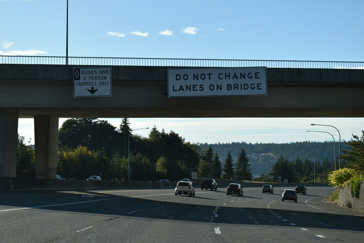
The I-5 - SR 16 Tacoma/Pierce County HOV Program also added a wye interchange (Exit 1 C) to SR 16 after the bridge over Tyler Street and Snake Lake to Center Street at Mullen Street.
09/27/25
09/27/25
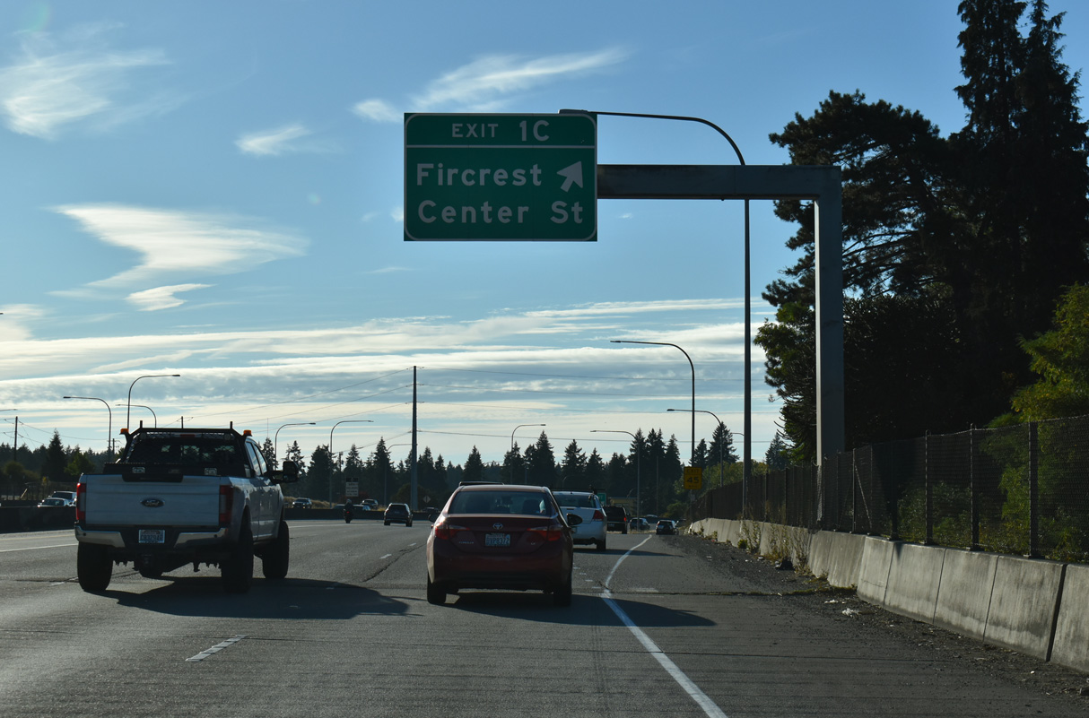
Center Street meets Orchard Street at the Fircrest city line.
09/27/25
09/27/25
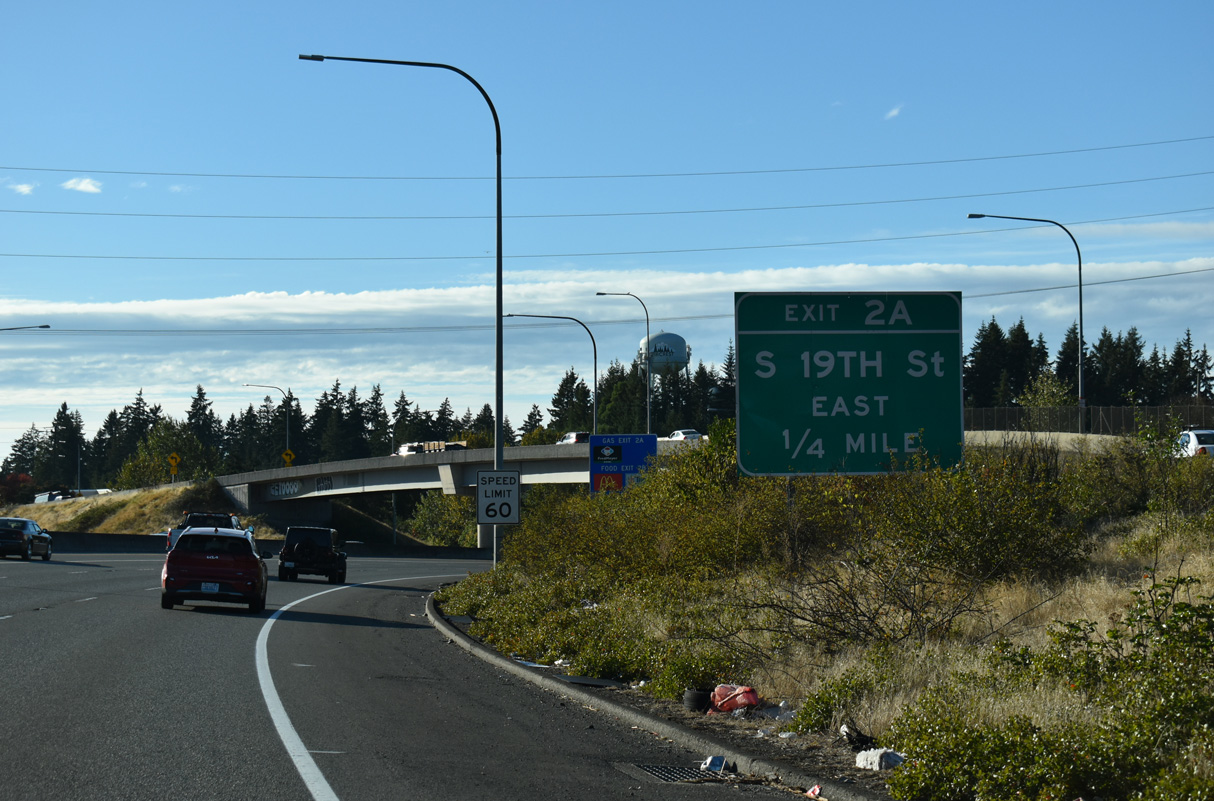
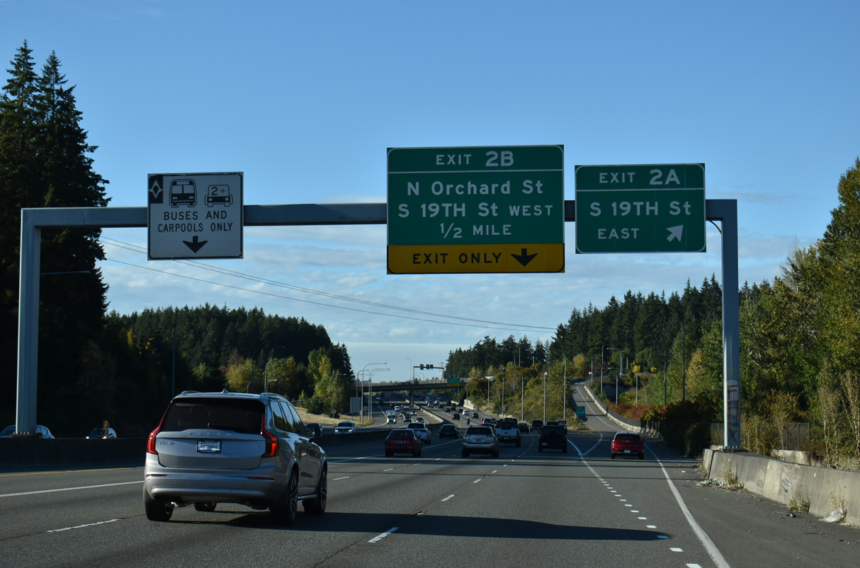
Turning north, SR 16 enters a six-ramp parclo interchange (Exits 2 A/B) with S 19th Street at Orchard Street.
09/27/25
09/27/25
09/27/25
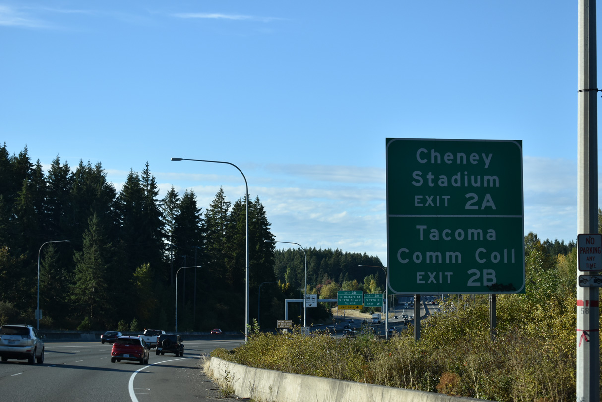
Exit 2 A leads onto S 19th Street east to Cheney Stadium, home of the Class AAA Tacoma Rainiers Minor League Baseball club.
09/27/25
09/27/25
S 19th Street follows the Tacoma and Fircrest city line west from Exit 2 A to Tacoma Community College and University Place.
09/27/25
09/27/25
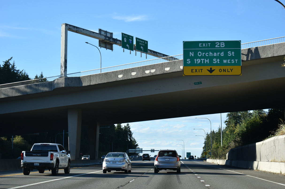
Exit 2 B leaves SR 16 north for parallel Orchard Street midway between S 12th and 19th Streets.
09/27/25
09/27/25
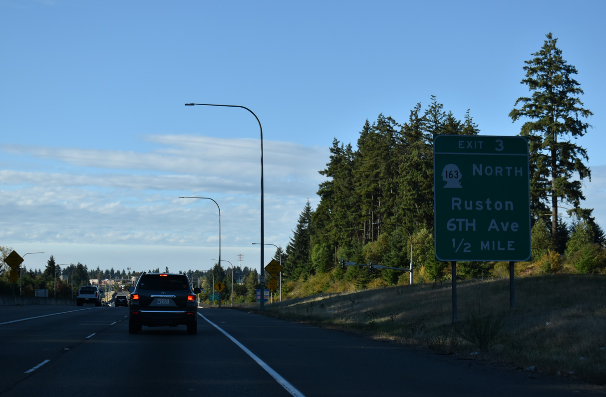
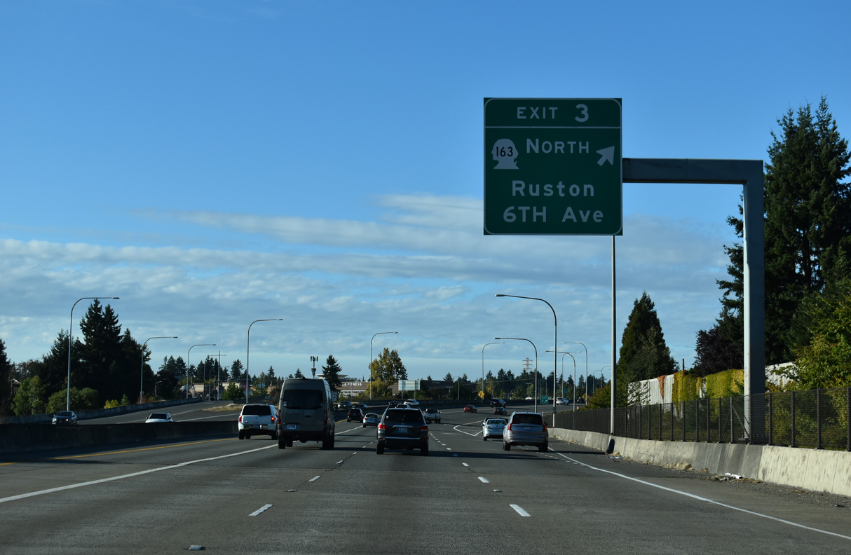
SR 163 stems north from the forthcoming parclo interchange (Exit 3) with Pearl Street to Ruston and the WSDOT Ferry Point Defiance Terminal.
09/27/25
09/27/25
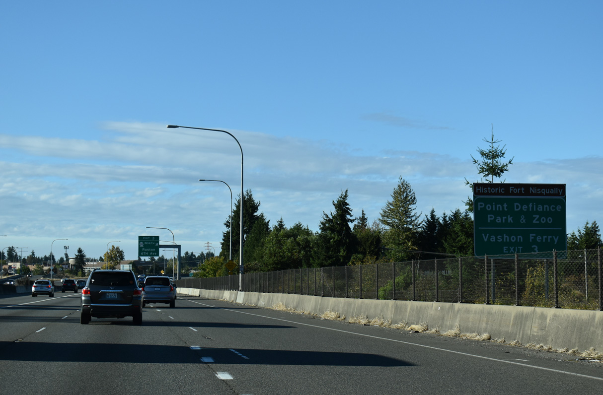
Exit 3 connects SR 16 north with 6th Avenue and Bantz Boulevard north to SR 163 for Point Defiance Park.
09/27/25
09/27/25
SR 163 travels 3.37 miles to the WSDOT Ferry terminal to Vashon Island.
09/27/25
09/27/25
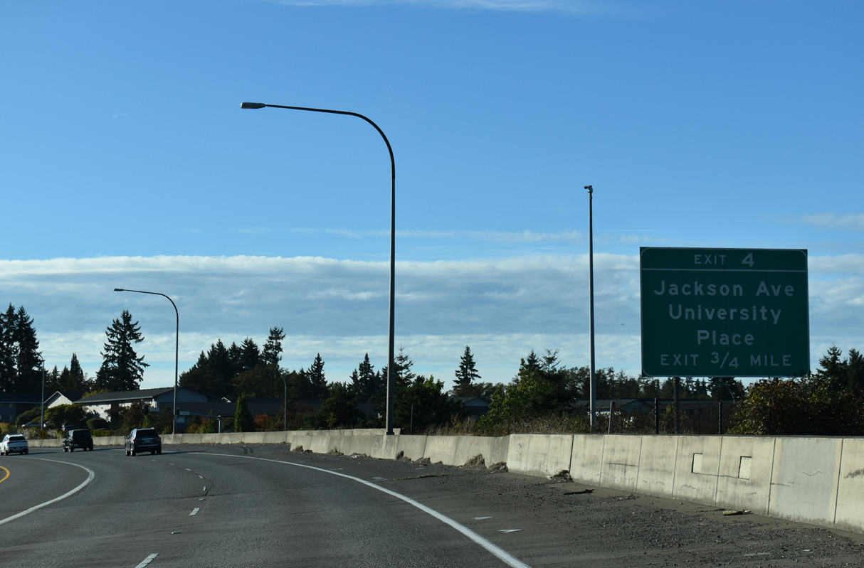
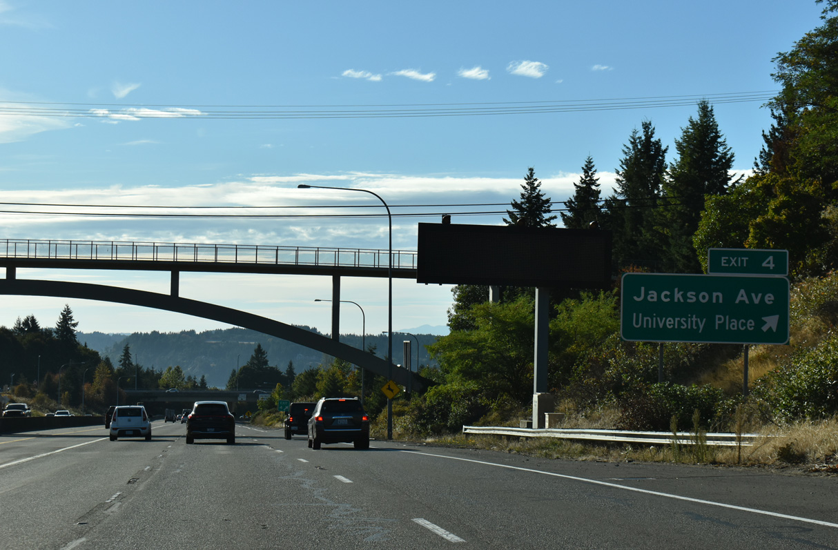
Turning west below grade, SR 16 advances 0.75 miles to Exit 4 for Jackson Avenue.
09/27/25
09/27/25
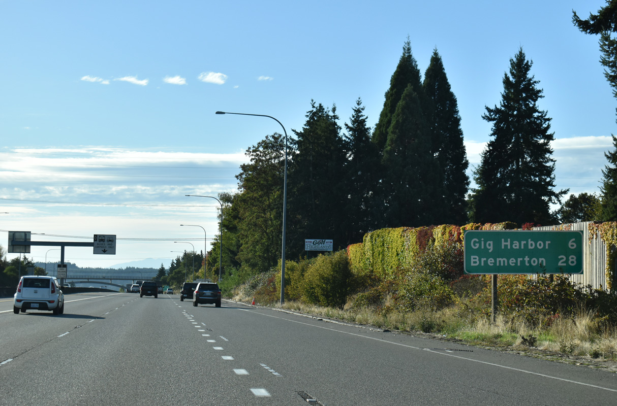
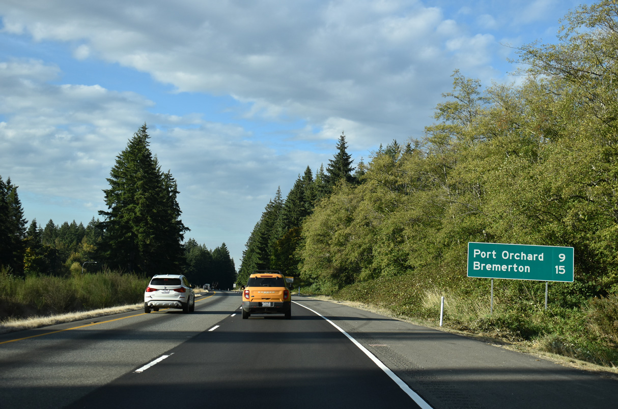
Beyond Jackson Avenue and Tacoma, SR 16 continues six miles to Gig Harbor and 28 miles to Bremerton (via connections with SR 3).
09/27/25
09/27/25
A pedestrian arch bridge links sections of Skyline Drive over SR 16 ahead of the parclo interchange (Exit 4) with Jackson Avenue.
09/27/25
09/27/25
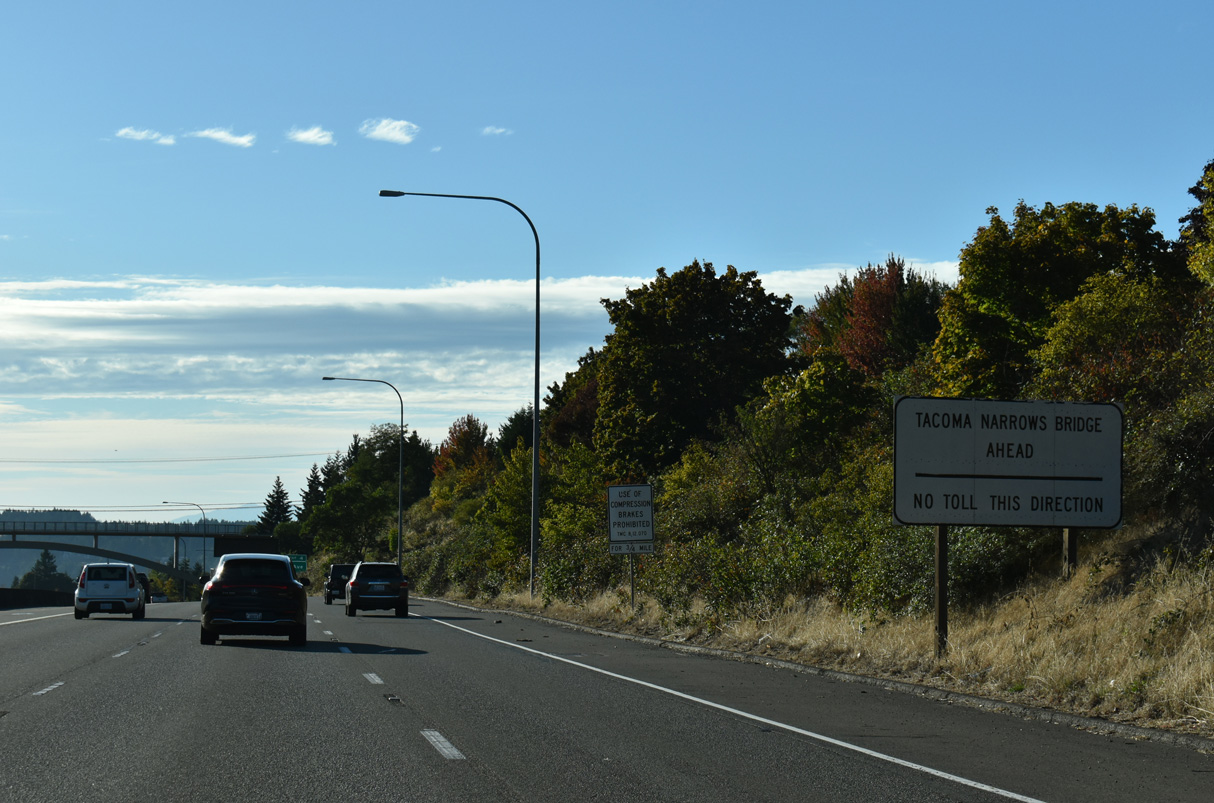
SR 16 curves northwest from Exit 4 to the Tacoma Narrows Bridge. Tolls are only charged along the span in the eastbound direction.
09/27/25
09/27/25
Jackson Avenue travels north to Narrows Drive and south from SR 16 to Bridgeport Way in University Place.
09/27/25
09/27/25
09/27/25
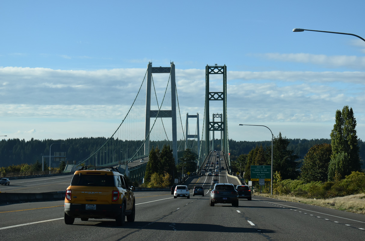
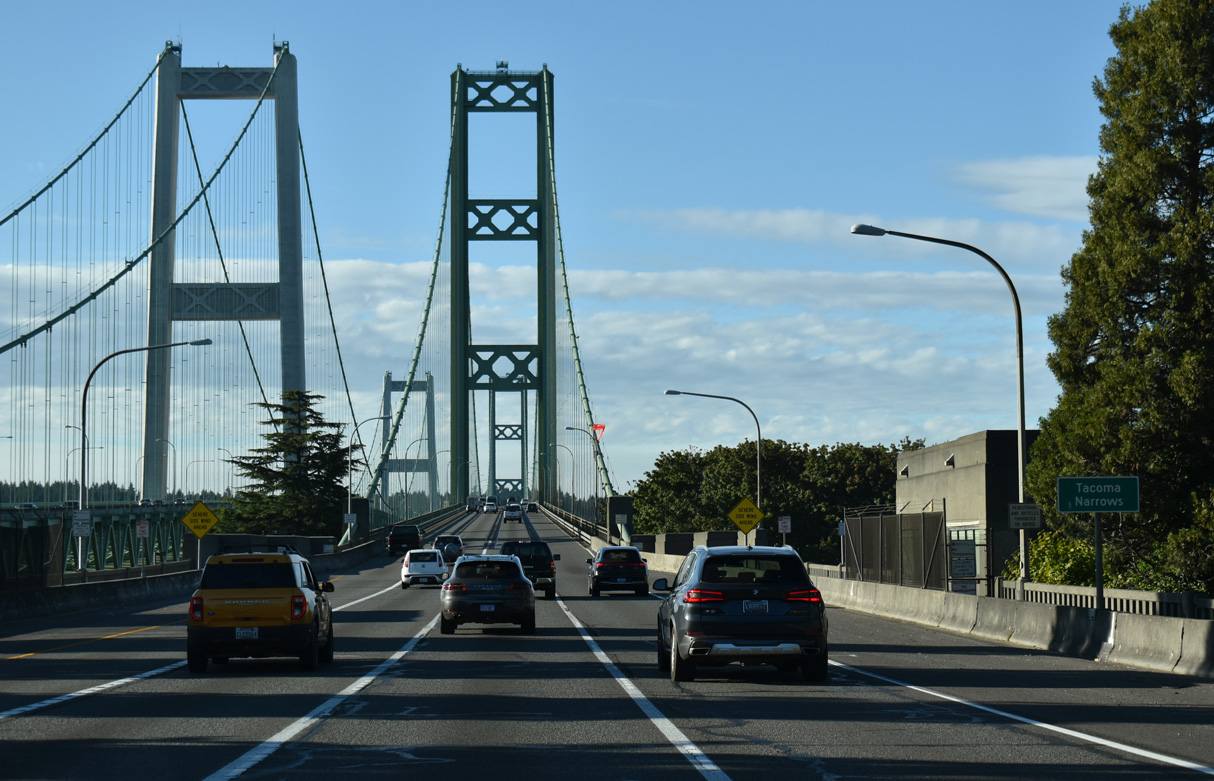
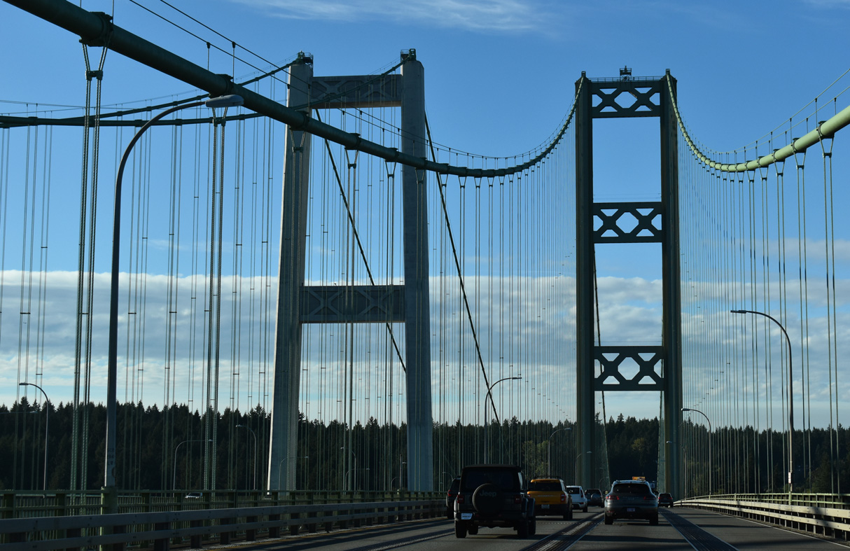
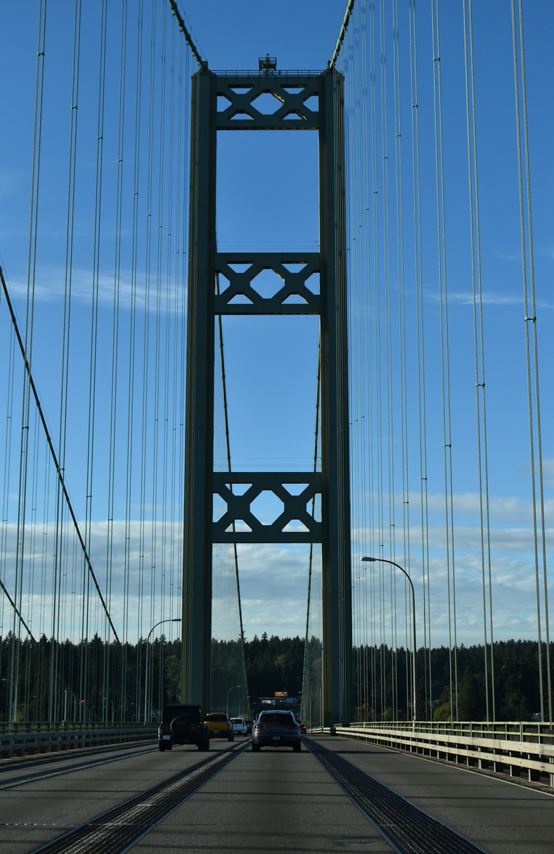
SR 16 crosses The Narrows between Tacoma and Gig Harbor. Westbound SR 16 spans the suspension bridge built in 1950. Eastbound traffic crosses The Narrows over the companion suspension bridge opened in July 2007.
09/27/25
09/27/25
09/27/25
SR 16 previously crossed the 1950-bridge with two-way traffic. Tolls were collected for the 5,979 foot long span until 1965 ("Tacoma Narrows Bridge", 2010).
09/27/25
09/27/25
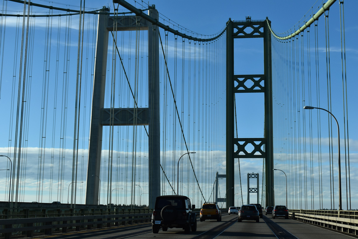
Tolling of the Tacoma Narrows Bridge was reinstituted in 2007 for the eastbound bridge at a rate of $4.00 for cash transactions ("Tacoma Narrows Bridge", 2010).
09/27/25
09/27/25
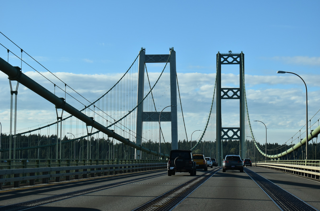
The Tacoma Narrows Bridge provides 187.5 feet of vertical clearance ("Tacoma Narrows Bridge", 2010).
09/27/25
09/27/25
09/27/25
09/27/25
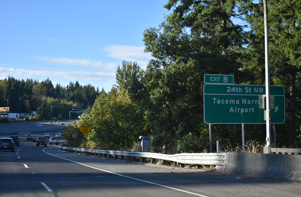
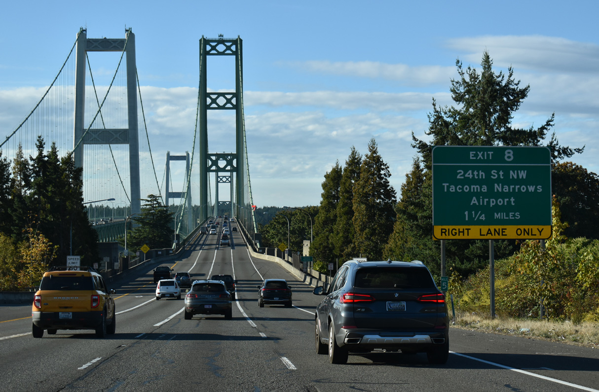
Exit 8 departs SR 16 west for 24th Street NW. 24th Street connects the freeway with Jahn Avenue SW and Stone Drive NW to Tacoma Narrows Airport (TIW), Wollochet, and Point Fosdick.
09/27/25
09/27/25
09/27/25
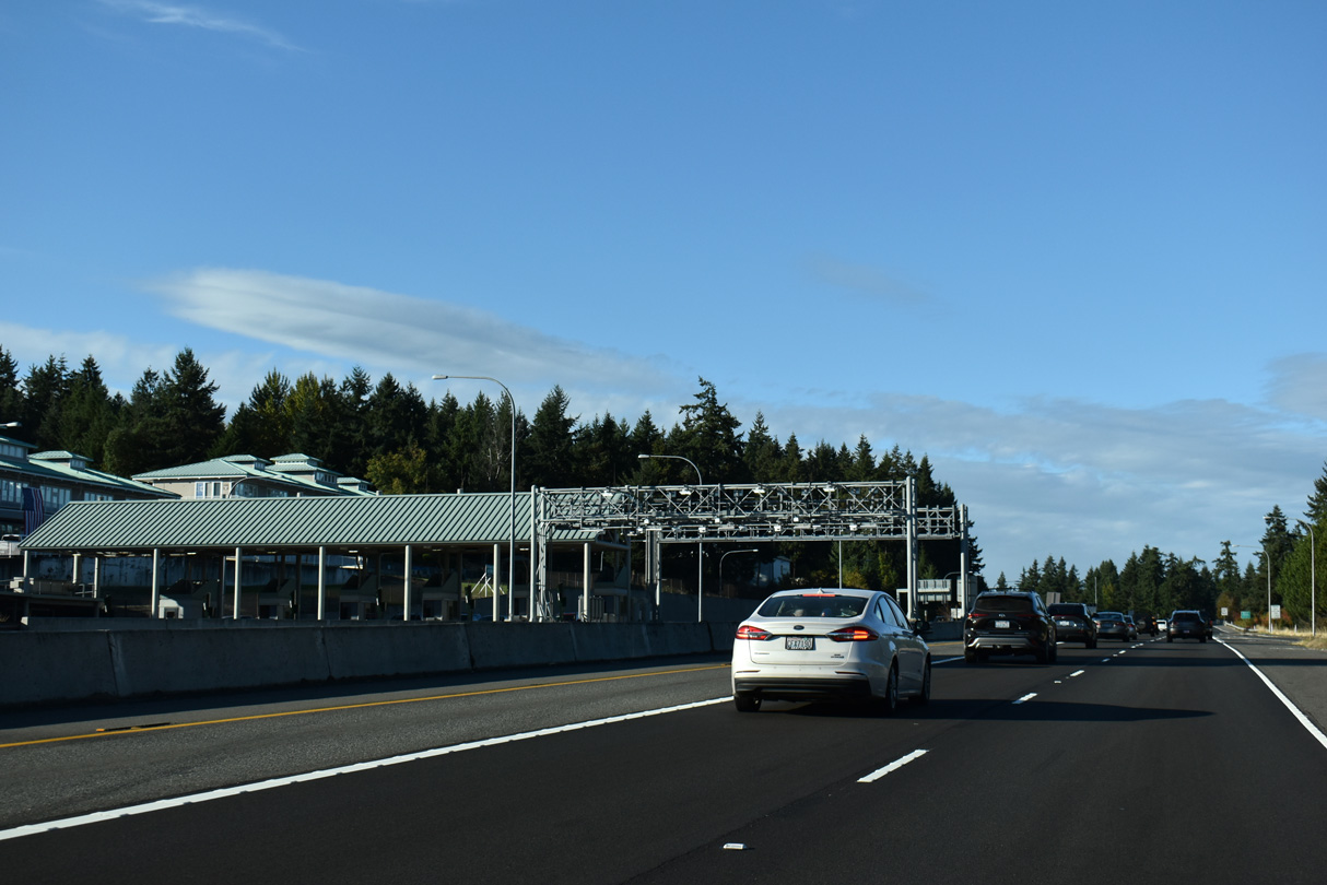
The toll plaza for the Tacoma Narrows Bridge eastbound is north of the 24th Street NW overpass.
09/27/25
09/27/25
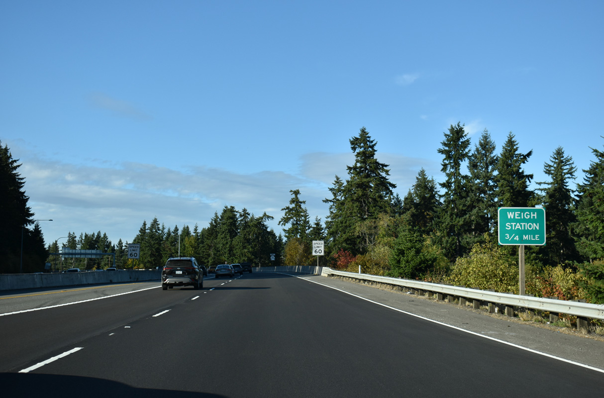
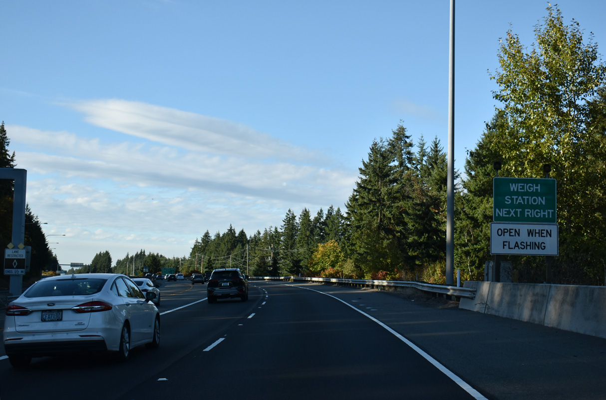
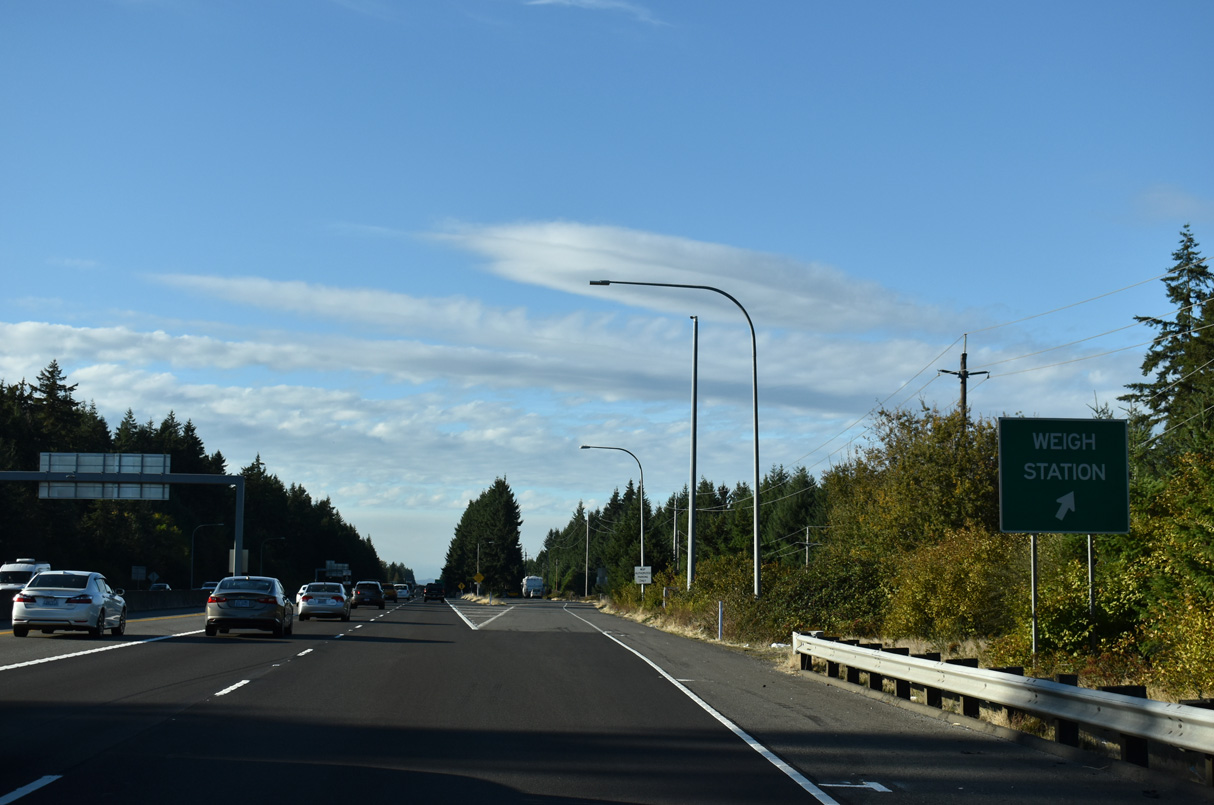
A weigh station follows the entrance ramp from 24th Street NW along SR 16 west.
09/27/25
09/27/25
09/27/25
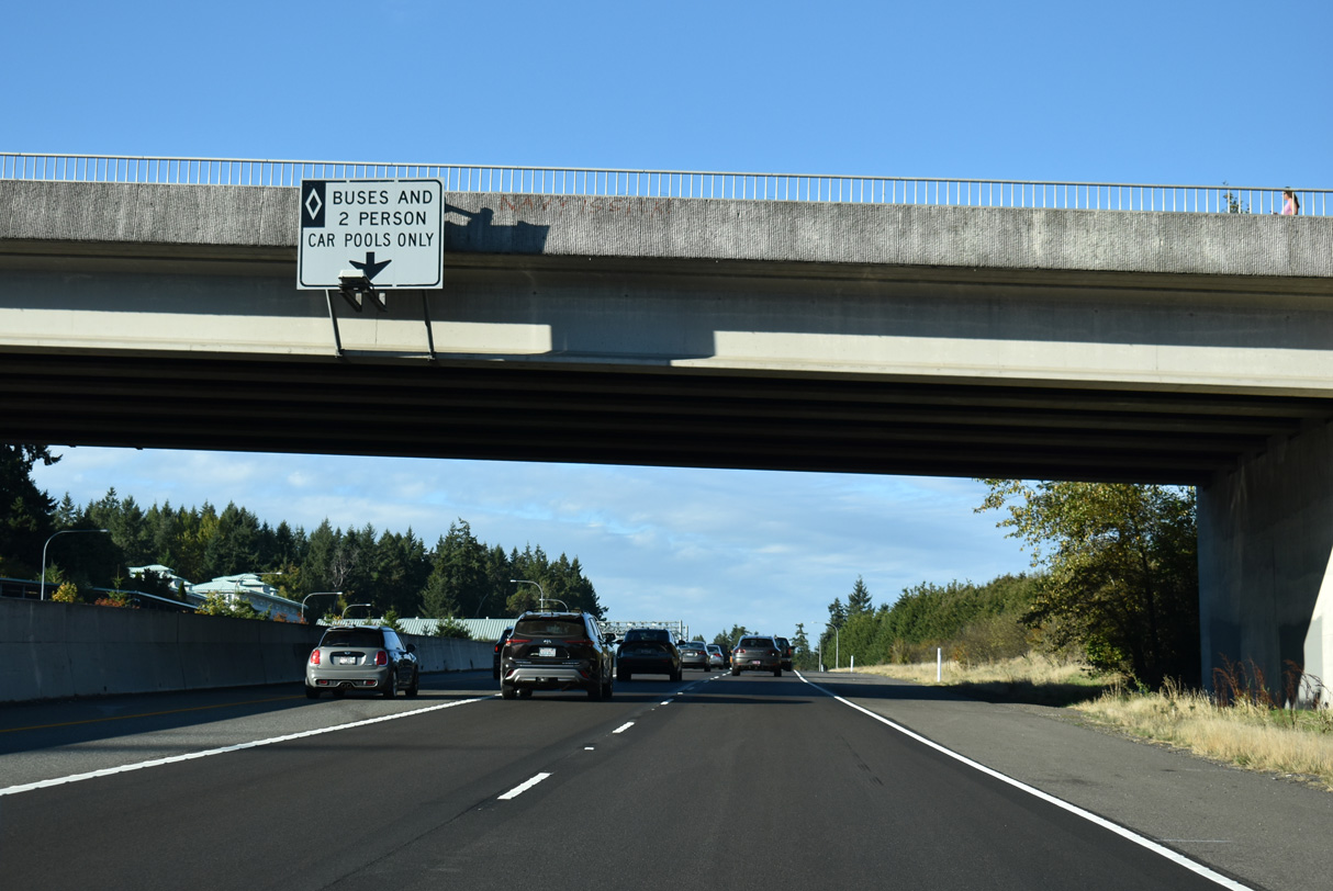
The HOV restriction for the left lane concludes along SR 16 westbound just beyond the weigh station.
09/27/25
09/27/25
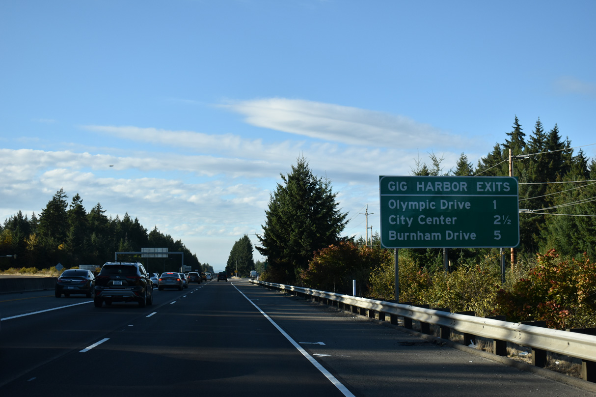
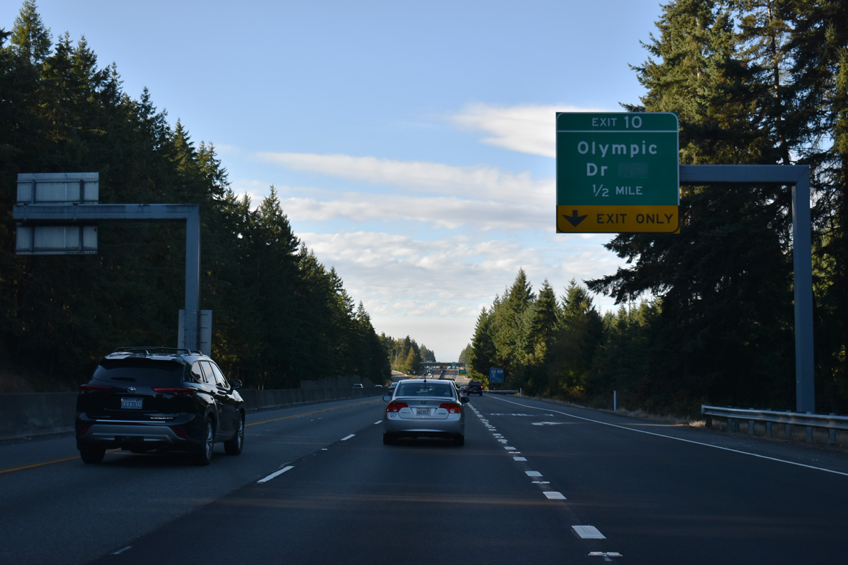
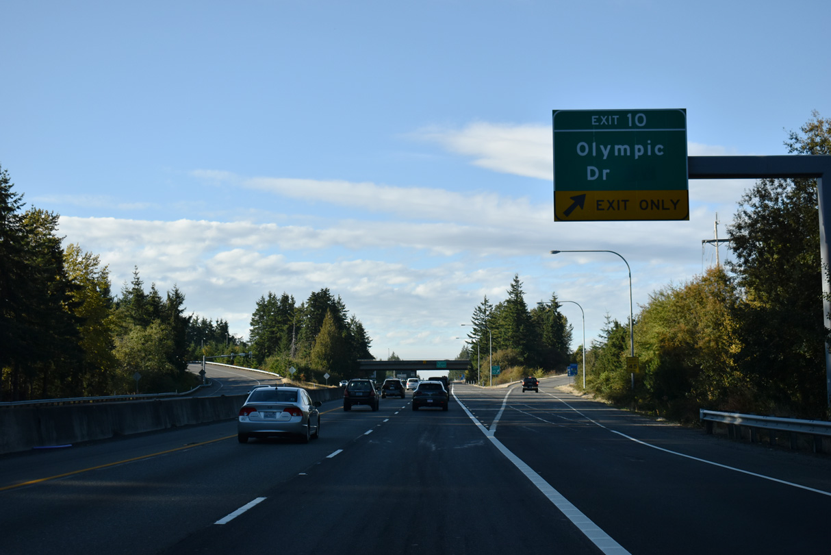
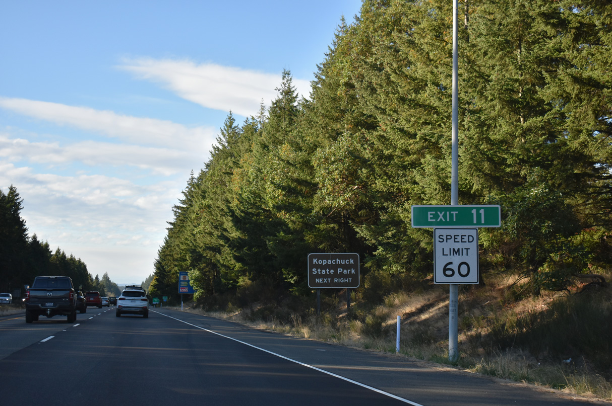
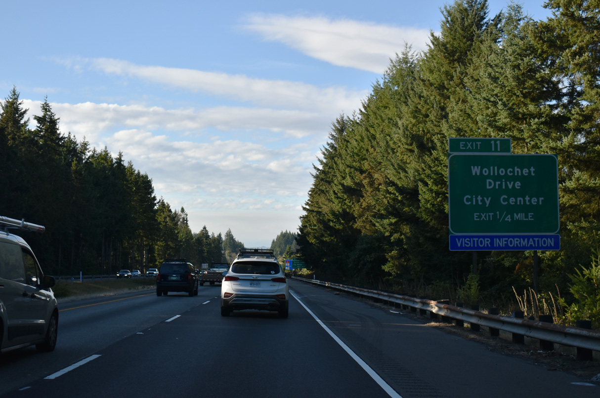
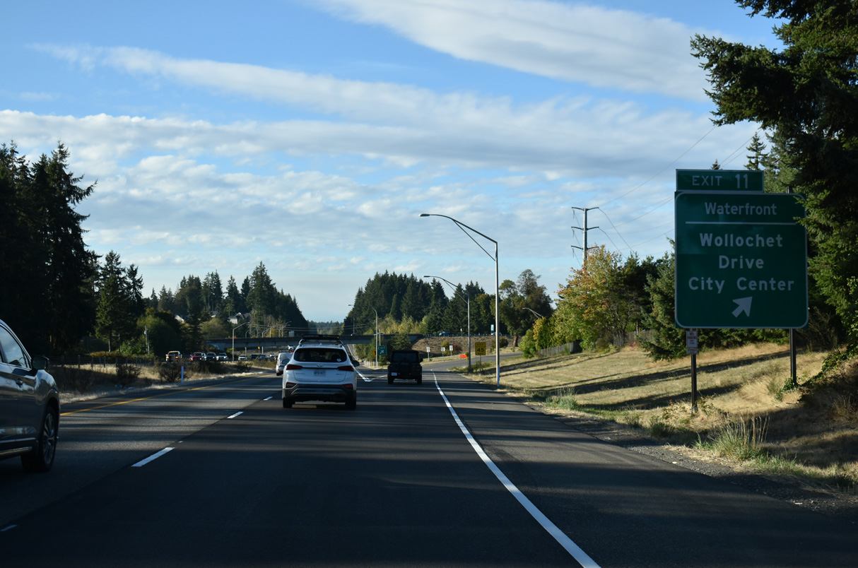
SR 16 reaches the city of Gig Harbor at the diamond interchange (Exit 10) with Olympic Drive NW.
09/27/25
09/27/25
09/27/25
09/27/25
09/27/25
09/27/25
09/27/25
09/27/25
09/27/25
09/27/25
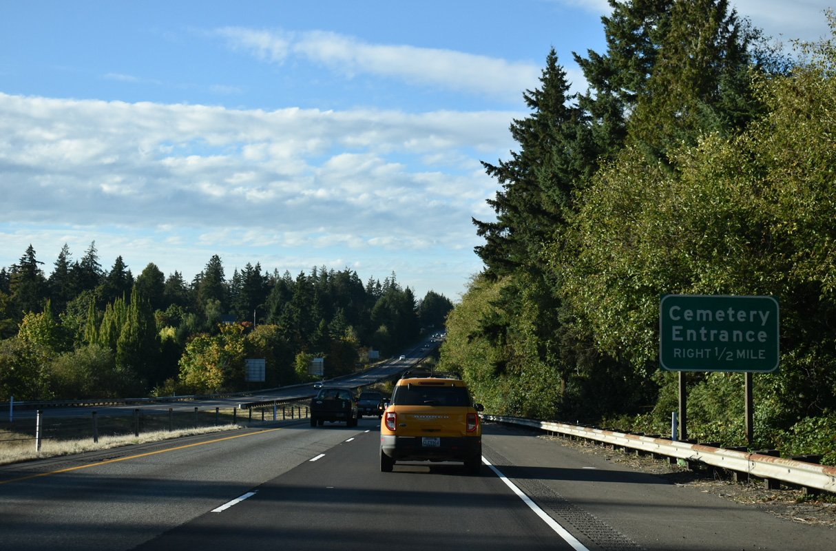
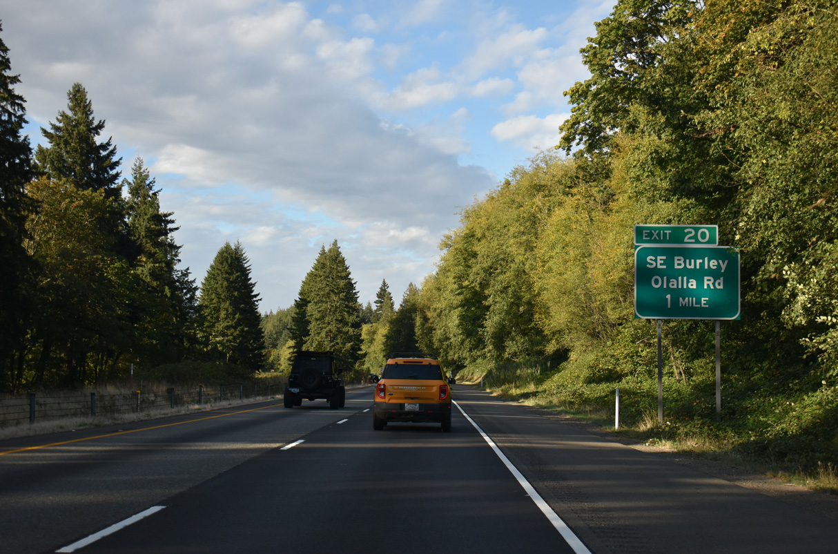
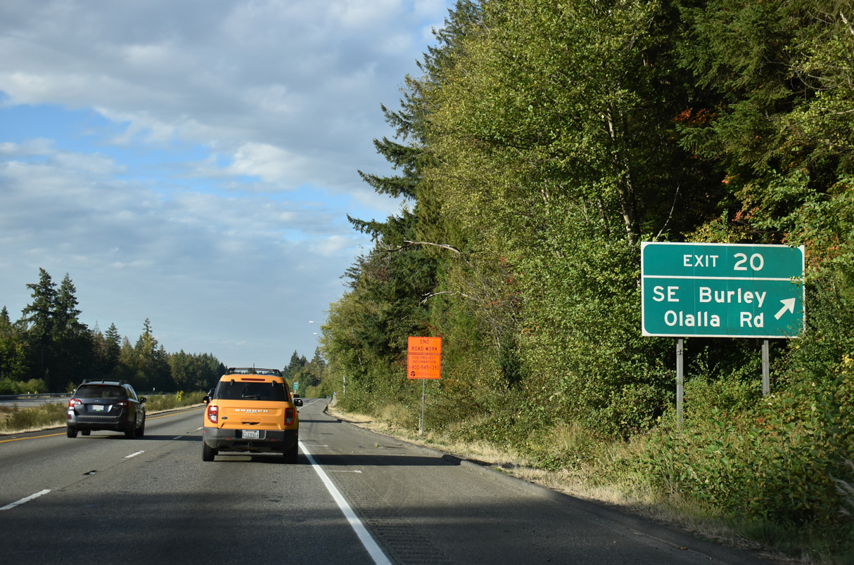
Entrances for Haven of Rest Cemetery and local businesses follow mile marker 13 along SR 16 westbound.
09/27/25
09/27/25
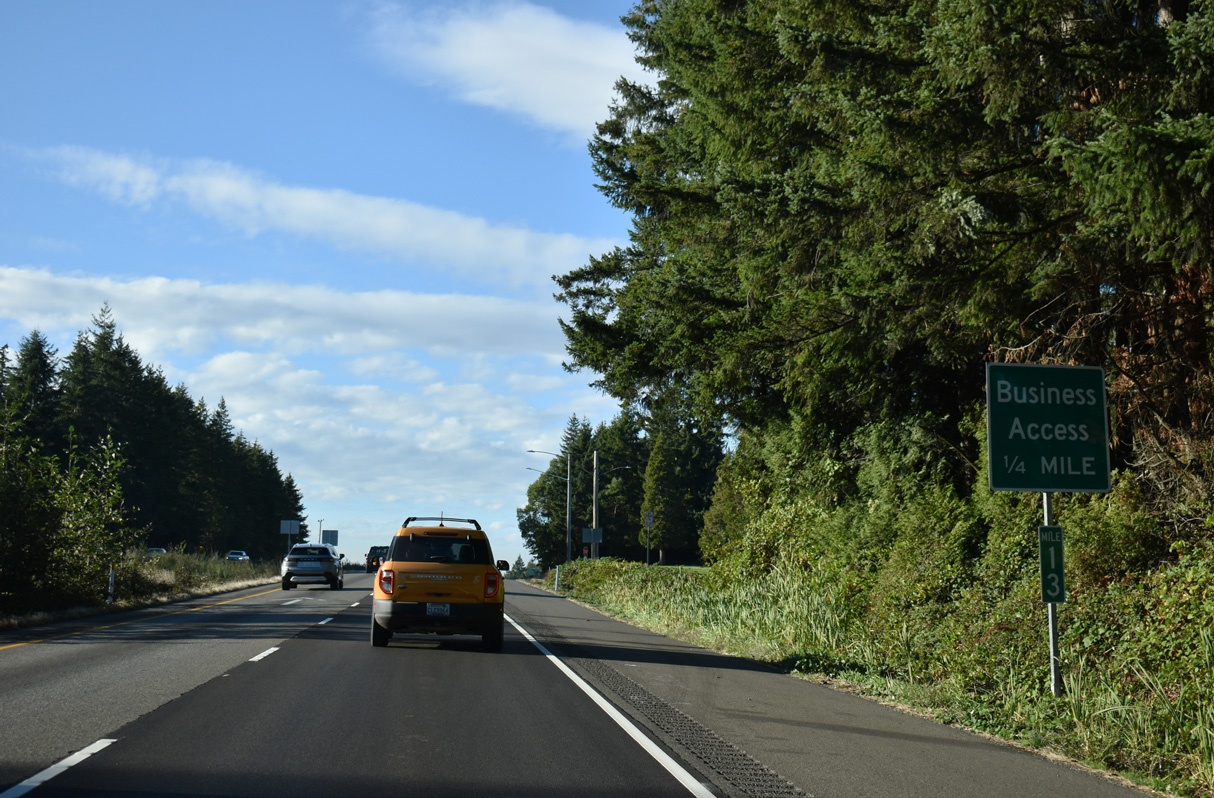
The cemetery and business driveways are not accessible from any road beyond SR 16 westbound.
09/27/25
09/27/25
Haven of Rest Cemetery
09/27/25
09/27/25
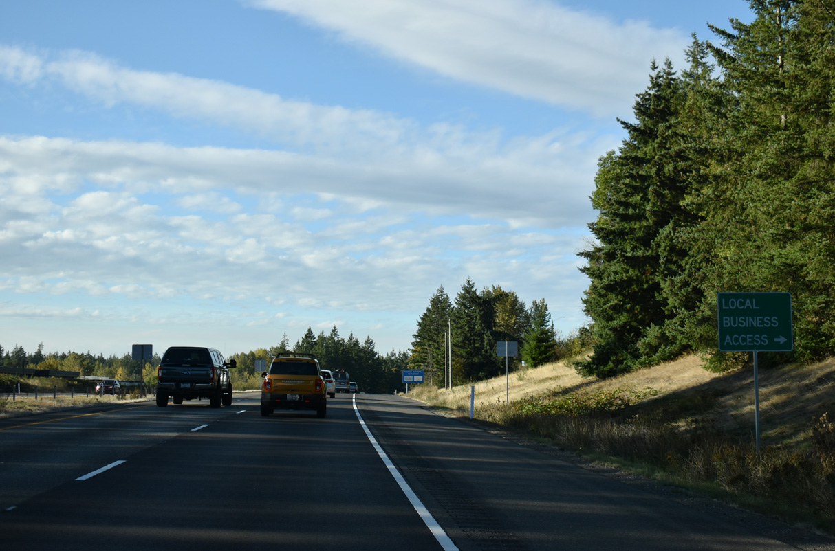
SR 16 westbound at the business entrance in Gig Harbor.
09/27/25
09/27/25
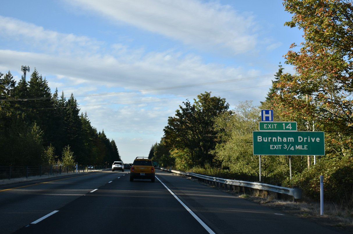
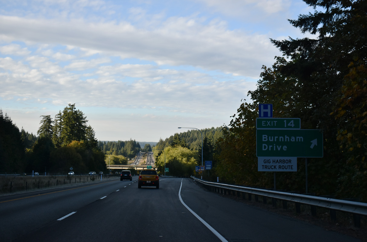
A dumbbell interchange joins SR 16 with Burnham Drive at Exit 14.
09/27/25
09/27/25
09/27/25
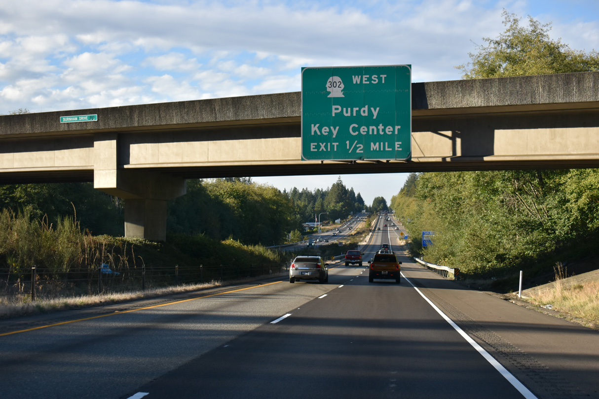
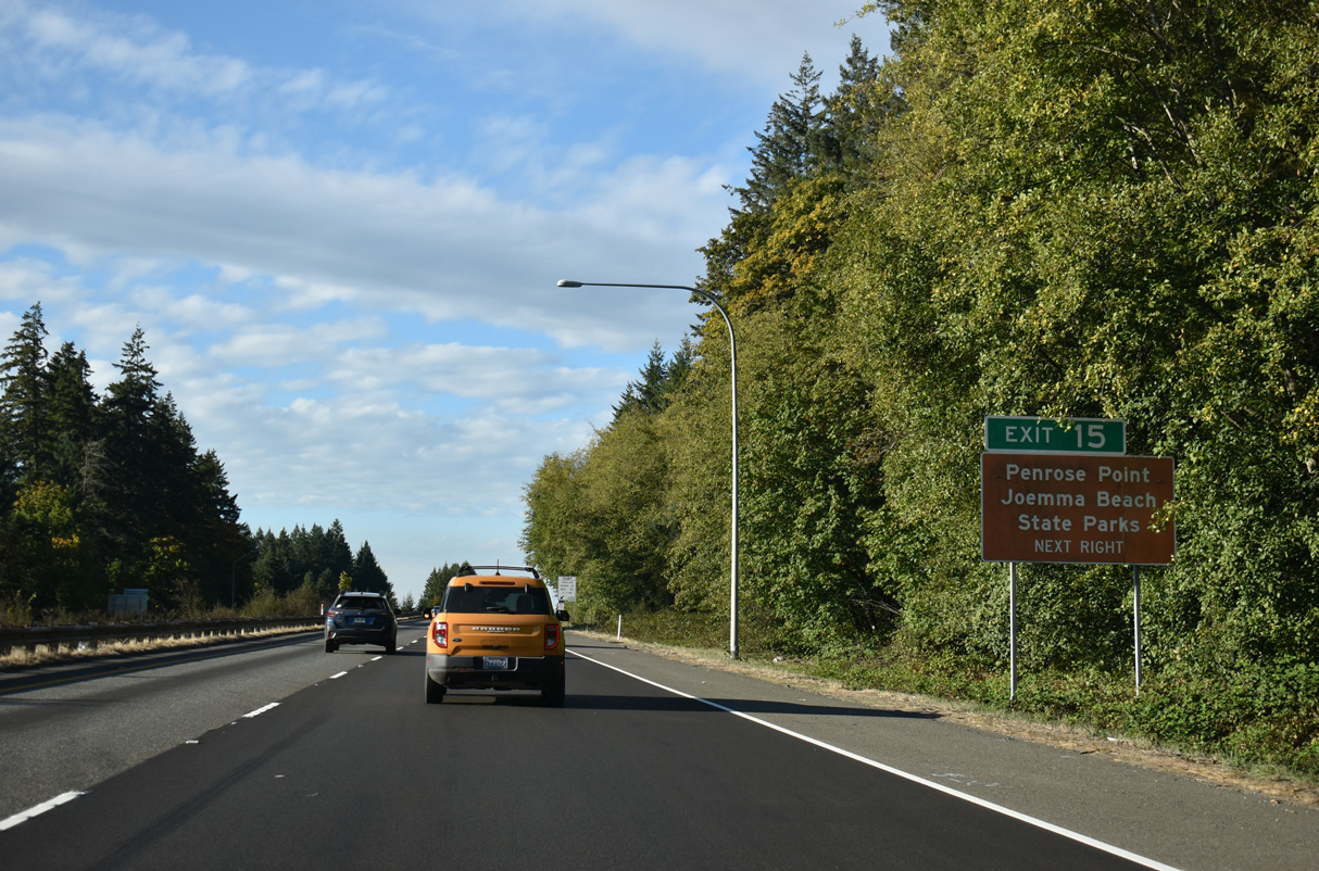
SR 302 commences north into the unincorporated community of Purdy from a wye interchange (Exit 15) with SR 16 westbound.
09/27/25
09/27/25
09/27/25
09/27/25
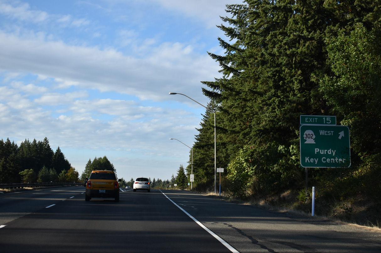
SR 302 runs 16.87 miles west from SR 16 to Key Center and SR 3 north of Allyn.
09/27/25
09/27/25
09/27/25
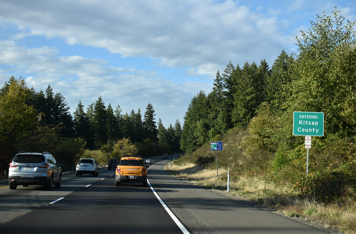
SR 16 west enters Kitsap County at the wye interchange connecting SR 302 Spur (Purdy Drive) with the freeway north.
09/27/25
09/27/25
09/27/25
09/27/25
09/27/25
09/27/25
References:
Tacoma Narrows Bridge. (2010, October 19) In hthttps://en.wikipedia.org/w/index.php?title=Tacoma_Narrows_Bridge&oldid=391555460
Photo Credits:
- Alex Nitzman: 09/27/25
Connect with:
Page Updated Sunday October 12, 2025.