
State Route 543
Washington State Route 543 connects Interstate 5 with the Canadian border crossing in Blaine. All commercial vehicles, e.g. trucks and buses, taking I-5 are required to use the port of entry connecting SR 543 and British Columbia Highway 15 in lieu of the port of entry along I-5 at Peach Arch State Park.
1.09 miles in length, SR 543 is a controlled access arterial with signalized intersections at Boblett and H Streets. A single point interchange connects the state route with D Street south of the customs and immigration station at the international border. SR 543 begins north from Interstate 5 at Exit 275.
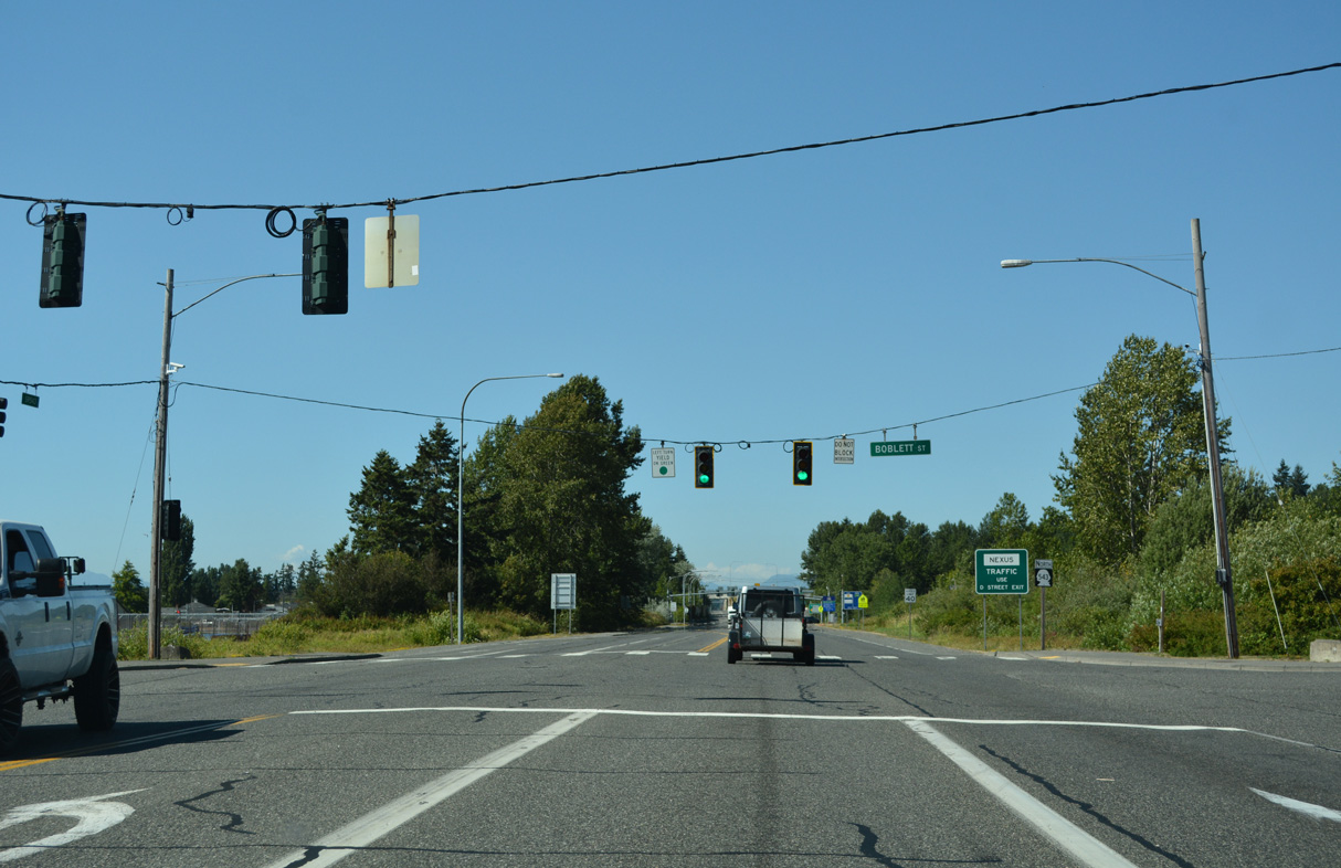
SR 543 stems north from a wye interchange (Exit 275) with Interstate 5 to a signalized intersection with Boblett Street by Blaine High School.
07/19/23
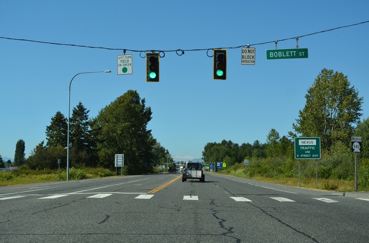
The lone reassurance marker for SR 543 north appears beyond Boblett Street.
07/19/23
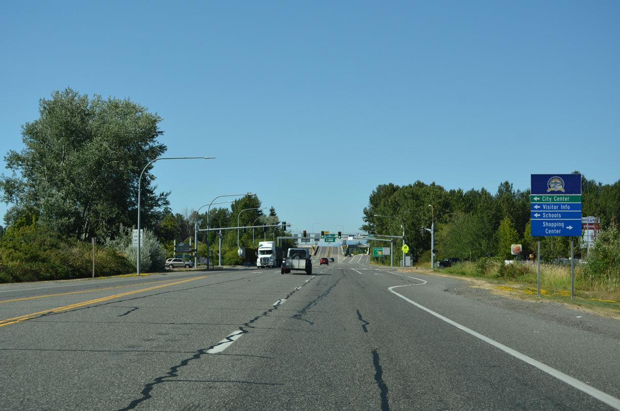
SR 543 continues north to H Street, which leads west across Interstate 5 to the Blaine city center.
07/19/23
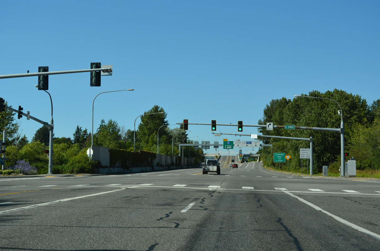
East from SR 543 and an adjacent shopping center, H Street and H Street Road travel 11.3 miles to SR 539 (Guide Meridian Road) south of the Canadian border crossing.
07/19/23
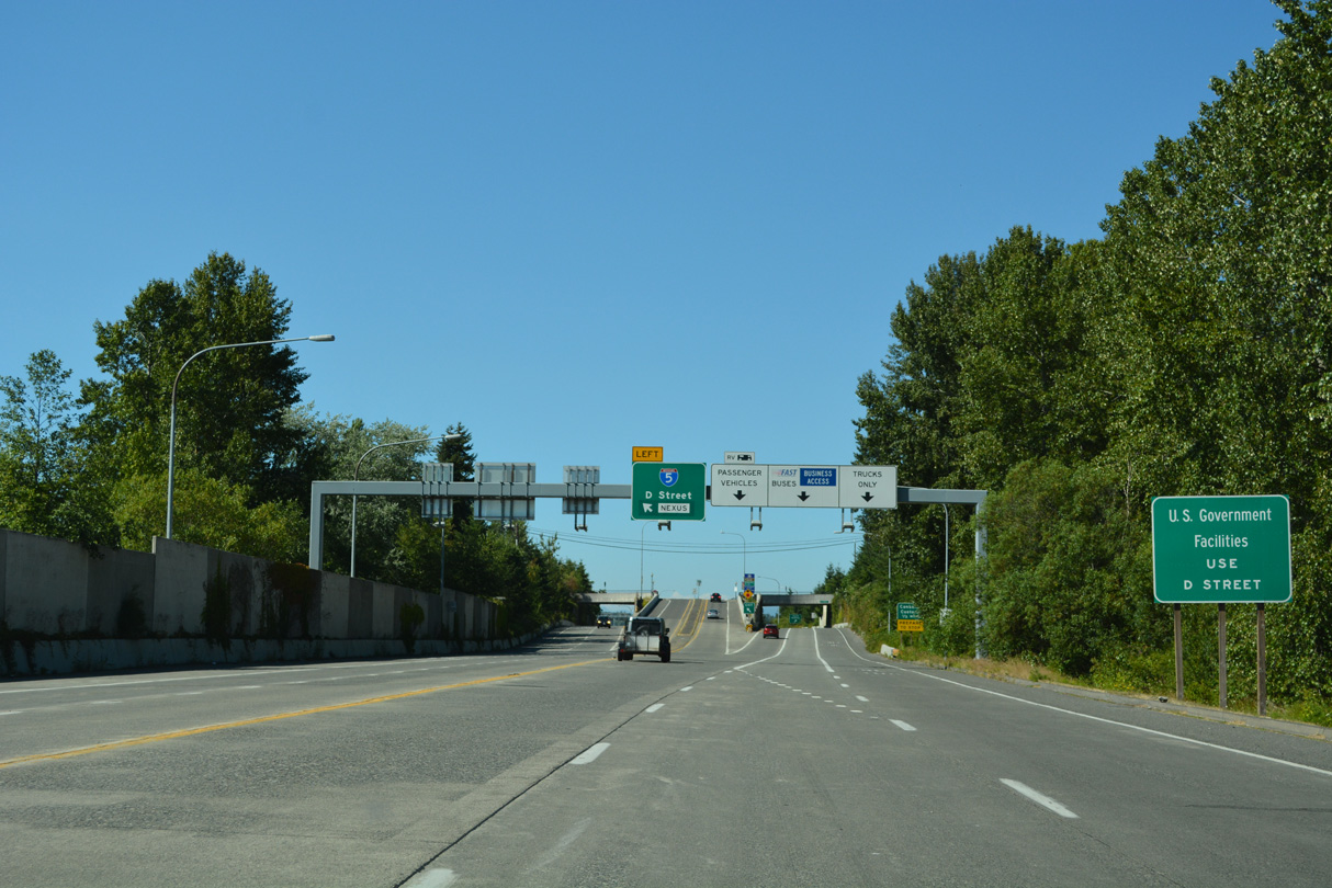
Left side ramps connect SR 543 with D Street at a grade separated intersection.
07/19/23
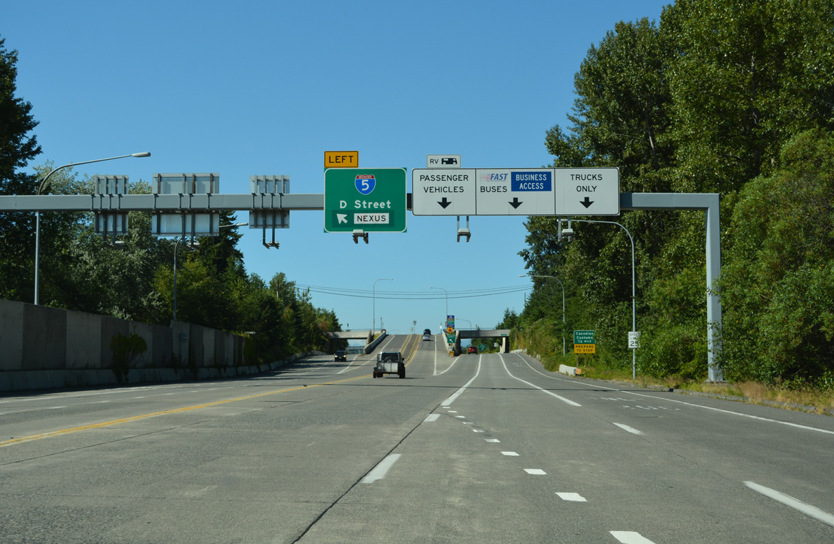
D Street runs west to SR 548 by Peace Arch Historical State Park and the north end of Interstate 5.
07/19/23
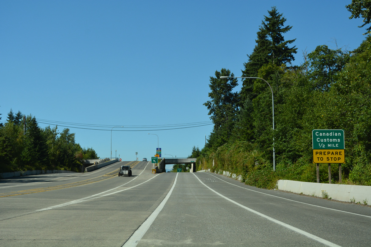
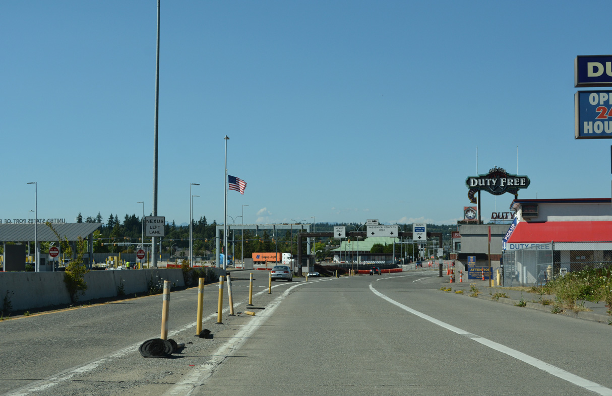
SR 543 north defaults to the Canadian customs and immigration station north of D Street.
07/19/23
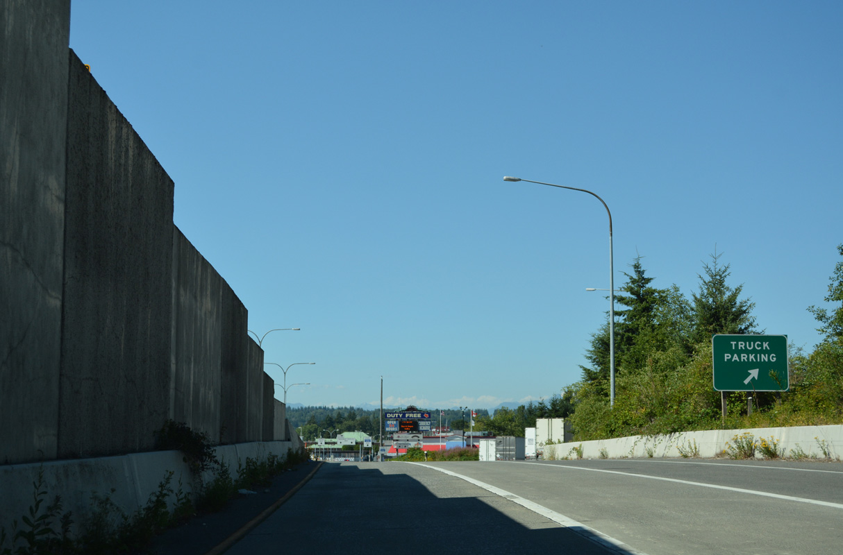
A truck parking area precedes the turn off for the commercial vehicle lanes to the port of entry.
07/19/23
The north end of SR 543 expands to four lanes leading into the port of entry. British Columbia Highway 15 extends north from the border to Cloverdale.
07/19/23
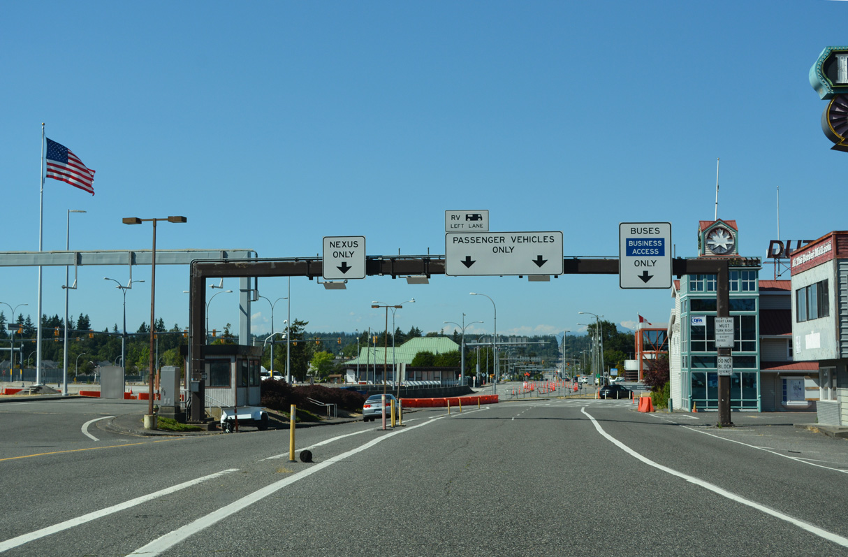
Trucks and other commercial vehicles are inspected separate from passenger vehicles at the north end of SR 543.
07/19/23
Photo Credits:
- Brent Ivy: 07/19/23
Connect with:
Page Updated Saturday September 06, 2025.