Interstate 25
Growth along Interstate 25 in Colorado expands the freeway to ten plans plus two auxiliary lanes through Greenwood Village. 08/11/16
Overview
Joining the capital cities of Santa Fe, Denver and Cheyenne, Interstate 25 follows the Front Range of the Rocky Mountains. I-25 also serves Albuquerque, New Mexico’s largest city and Pueblo and Colorado Springs in central Colorado. Suburban growth along the corridor nearly joins the Denver and Colorado Springs metropolitan areas.
High Occupancy Toll (HO/T) lanes (North I-25 Express Lanes) accompany Interstate 25 from 20th Street at Downtown Denver to Adams County, north of I-270 and south of Thornton. The I-25 North Express Lanes: Mead to Fort Collins project extends the managed lanes northward to SH 14 (Mulberry Street) at Exit 269 in northeast Fort Collins. Costing $302 million, construction commenced in 2018 on I-25 between Sh 402 and Mulberry, and from SH 56 to SH 402 in late 2019. Work runs through 2023.
The I-25 South Gap Project Monument upgraded 18 miles of Interstate 25 from south of Castle Rock to Monument. Partitioned into three sections, $419 million in construction through November 2022 expanded I-25 with tolled Express Lanes from SH 105 (2nd Street) / Exit 161 to a point south of Exit 181 / Plum Creek Parkway. Work commenced in September 2018 and the Express Lanes opened on December 10, 2021.
High Priority Corridor
Interstate 25 is part of High Priority Corridor 27: Camino Real for its entire length.
 Parallel U.S. Routes
Interstate 25 replaced all of U.S. 85 from Las Cruces, New Mexico, north to Denver, Colorado. The freeway also replaced U.S. 87 from Raton, New Mexico, northward to its terminus in Buffalo, Wyoming with the exception of a parallel stretch between Glenrock and Casper. U.S. 85 parallels the freeway again in the Cheyenne vicinity. These U.S. routes are generally not cosigned in New Mexico or Colorado, but U.S. 85 and U.S. 87 are well signed in Wyoming.
Other overlaps with U.S. routes in New Mexico include U.S. 60 north from Socorro, U.S. 285 near Santa Fe, U.S. 84 from Santa Fe east to Las Vegas and U.S. 64 at Raton. Within the Centennial state, U.S. 160 accompanies I-25 north from Trinidad to Walsenburg and U.S. 24 overlays I-25 at Colorado Springs. Within Wyoming, U.S. 26 runs in tandem with I-25 west from Dwyer to Glenrock while U.S. 20 ties in from Orin to Glenrock.
History
Interstate 25 through New Mexico replaced or directly overlaid all of U.S. 85 from Las Cruces north to the Colorado state line north of Raton. The first section ran from Socorro to Belen. Overall upgrades to U.S. 85 for I-25 were completed through the state in 1980.1
Construction building I-25 in Colorado ran from 1958 to 1969. A timeline for the completion in the Centennial State is on the Interstate 25 Colorado guide on AARoads.
Interstate 25 in Wyoming was constructed from 1958 to 1982. More detailed information is on the Interstate 25 Wyoming guide on AARoads.
The Big I
The Big I Interchange is the crossroads where I-25 and I-40 meet northeast of Downtown Albuquerque, New Mexico. The original exchange between the two freeways was known as “The Crossroads of the Southwest.”2 Opened to traffic in 1966,3 the directional interchange with left side ramps was constructed on the premise of moving military personal and other long distance traffic through the Albuquerque metropolitan area. Daily commuter traffic interests were not factored into the original interchange design.2 As as a result, the previous interchange was designed to handle 40,000 vehicles per day (vpd), but increasing traffic congestion and weaving traffic patterns eventually plagued the exchange, which served 300,000 vpd by 2000.3
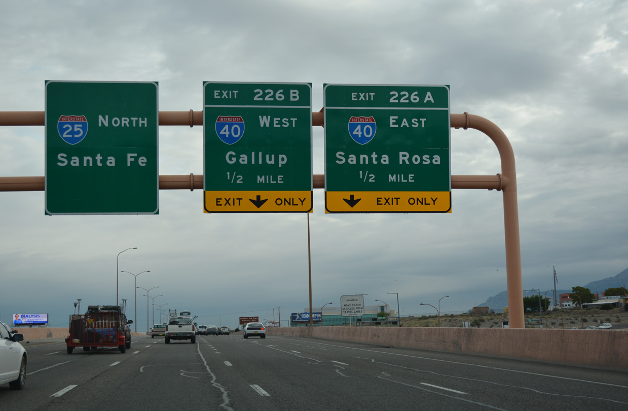
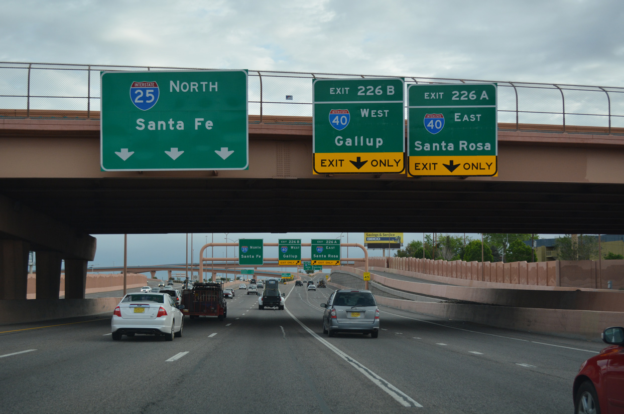
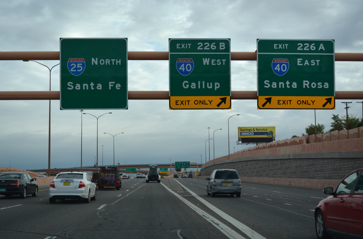
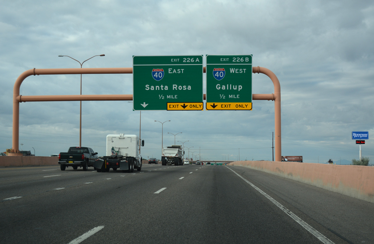
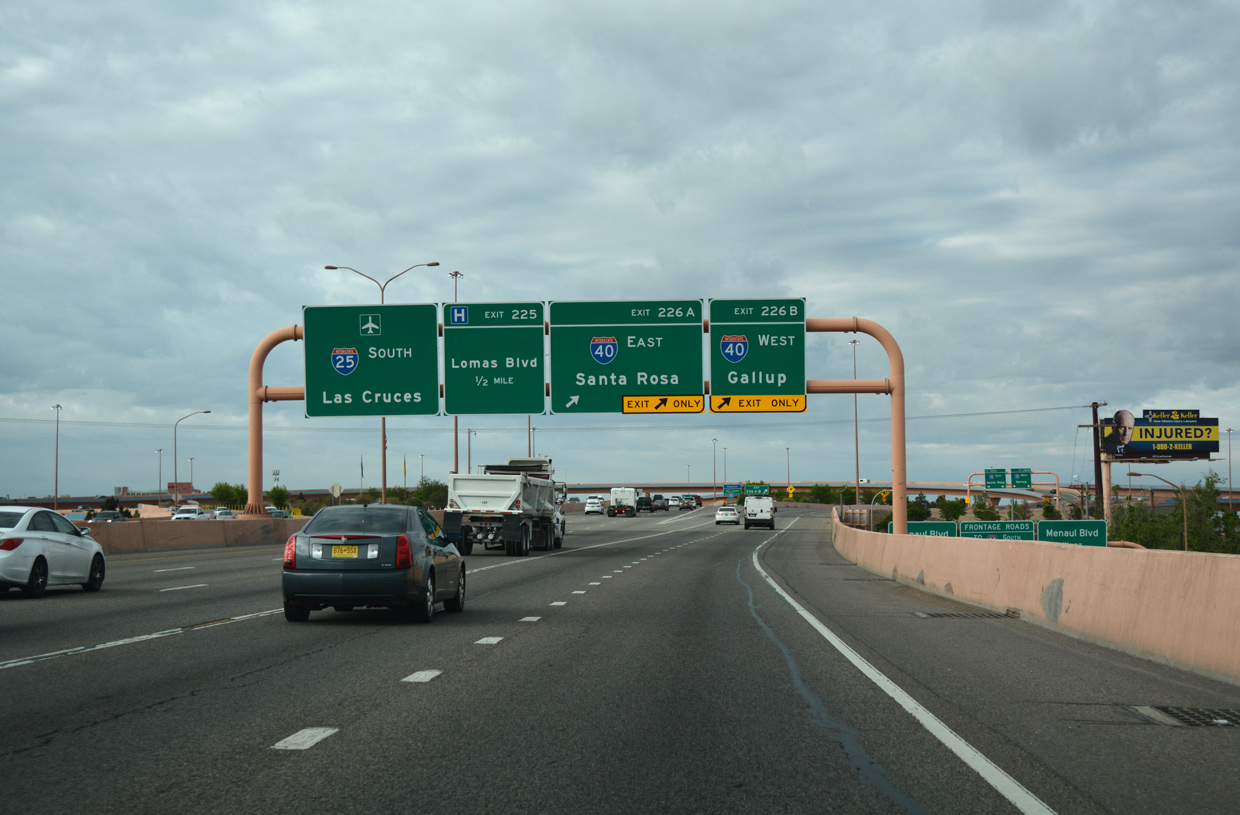
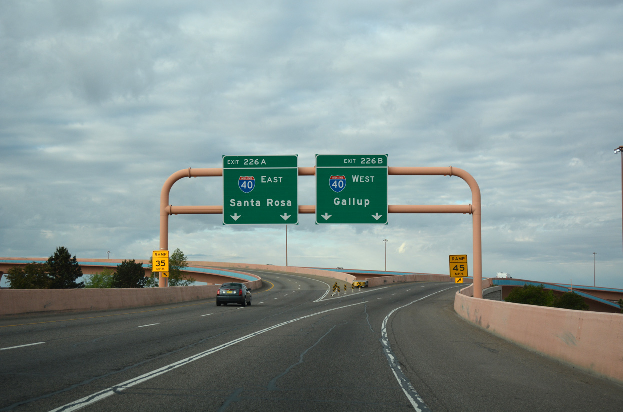
The “Big I” construction built a five level systems interchange connecting I-25 with I-40. The three phase reconstructed sections of I-40 and I-25 within 1.5 miles of the Big I. This included straightening out the S-curve along I-25 that previously passed under Candelaria Road. High speed flyovers replaced left side ramps and both freeways were expanded by one lane per direction. Additionally the adjacent frontage road system was completed and expanded to improve traffic flow through the Big I area along I-40 and the nearby Santa Barbara-Martineztown neighborhood.4 Ultimately costing $293 million,5 work on the Big I interchange kicked off on June 30, 2000 and concluded on May 25, 2002.3 The construction contract was valued at $222 million, while the design, construction engineering, and property acquisition made up the bulk of the added costs.5
Colorado Springs Metropolitan Interstate Expansion: COSMIX
Interstate 25 was also improved through the Colorado Springs area. As of March 2006, the Holland Park Noise Barrier and bridges over Ellston Street were completed. Projects continued to include widening and modernization of the freeway at the Bijou Interchange/Colorado Avenue, from Fillmore Street to Garden of the Gods, the section near N Nevada Avenue (former Business Loop I-25) and Rockrimmon, and from Woodmen to North Academy. Completion of Colorado Springs Metropolitan Interstate Expansion (COSMIX) occurred by December 2007.
T-REX
The largest multi modal transportation project in Colorado history, T-Rex, started in September 2001. With origins dating back to 1944, the predecessor of Interstate 25 was Platte Valley Drive Road. Encompassing 11.2 miles, the $33 million project broke ground on November 16, 1948. The road eventually became known as the Valley Highway.
Valley Highway opened between Evans Avenue and 52nd Avenue on November 23, 1958. Traffic counts topped at 33,000 vpd. By 1964, construction commenced for Interstate 225 with a design capacity of 50,000 vpd. This freeway opened fully between I-70 and I-25 on July 21, 1976. Both facilities were well over capacity with Valley Highway at 230,000 vpd and I-225 at 120,000 vpd in 1998. Traffic volumes were consistent in both directions of travel because of Denver’s two major employment hubs: the Central Business District to the north and the Southeast Business District to the south.
Involving the corridors along both I-25 and I-225, T-REX was the acronym for Transportation Expansion Project. Studies began in 1992 on how to address the burgeoning transportation woes along Valley Highway. As a result, a partnership formed between the Colorado Department of Transportation (CDOT) and the Regional Transportation District (RTD), which is responsible for the Denver light rail system. The two agencies commissioned the Southeast Corridor Major Investment Study (MIS).
Several options were in consideration by 1995. They included the construction of new freeway lanes, the double decking of existing freeway lanes, the construction of heavy rail, construction of monorail, and various other mass transit related options. The Denver Regional Council of Governments (DRCOG) adopted the MIS recommendations by 1997. Those included 19.7 miles of new double track light rail, 13 new light rail stations, expansion of travel lanes to coincide with interchange improvements and bridge replacement projects, and the addition of HOV lanes among other recommendations. Environmental Impact Studies, commenced in 1998, were completed in 18 months. Funding issues were addressed in 1999 and a Record of Decision signed in March 2000.6
Route Information
Mileage
New Mexico – 462.12
Cities – Las Cruces, Socorro, Belen, Albuquerque, Santa Fe, Las Vegas, Raton
- Junctions –

Colorado – 298.60
Cities – Trinidad, Pueblo, Colorado Springs, Denver, Longmont, Loveland, Fort Collins
- Junctions –

Wyoming – 300.95
Cities – Cheyenne, Douglas, Casper, Buffalo
- Junctions –
Source: December 31, 2021 Interstate Route Log and Finders List
I-25 Annual Average Daily Traffic (AADT)
| Location | Vehicles per day |
|---|---|
| Cheyenne, WY | 23,675 |
| Douglas, WY | 9,137 |
| Casper, WY | 22,111 |
| Buffalo, WY | 2,894 |
Source: 2016 AADT – Interactive Transportation System Map (WYDOT)
Through traffic along Interstate 25 between Albuquerque and Santa Fe utilized a multi lane, divided stretch of U.S. 85. Completion of the freeway in New Mexico in 1980 led to the removal of all signs for U.S. 85 in the Land of Enchantment.
The final section of I-25 to open in Colorado was a 21 mile long segment between Trinidad and Walsenburg. It was dedicated on September 21, 1969.
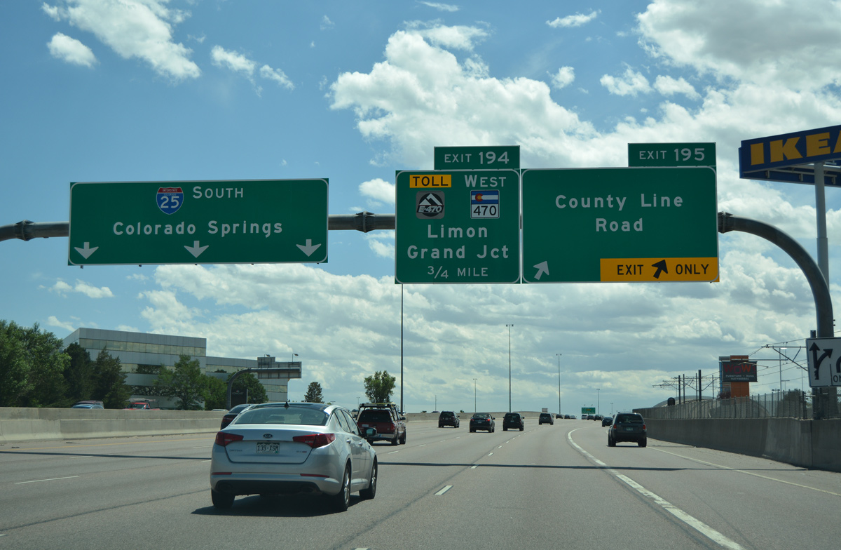
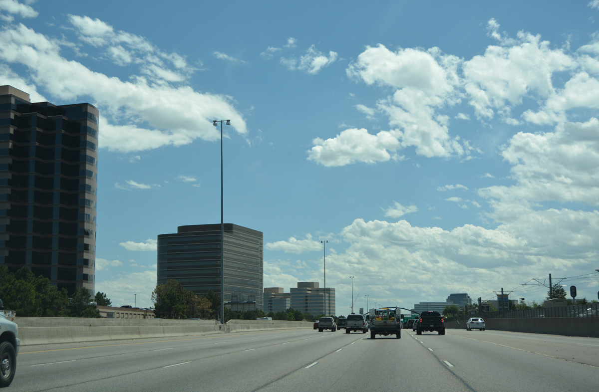
I-25 south ahead of the E-470 toll road and C-470 at Lone Tree, Colorado. E-470 provides an eastern bypass for Interstate 25 around the Denver metropolitan area. The 47 mile long beltway uses all electronic tolling (AET). 08/11/16
Short segments of Interstate 25 were open to traffic in Wyoming by 1964:
- Missile Drive (Exit 10) to the U.S. 85 split at Exit 17 (1958)
- A three mile segment north of Chugwater (1959)
- Fletcher Park Road to south of Glendo (1961 and 1962)
- West Douglas to East Glenrock (1959 and 1962)
- Yellowstone Highway to Bypass U.S. 20/26 in Casper(1960 and 1961)
- North Terry Draw to south of Kaycee (1960)
Interstate 25 was expanded to four lanes per direction between Logan Street and I-225. Two lanes in each direction were also added to I-25 from I-225 to the exchange with C-470 west and E-470 north, bringing this portion of Interstate 25 to ten overall lanes. I-225 was expanded to six overall lanes between I-25 and Park Road at Aurora. Eight interchanges were reconstructed, including the south end of I-225. Road related projects represented $795 million of the overall $1.67 billion cost for the entire project. Allowing construction and design to take place simultaneously, a design-build scheme was implemented to mitigate time concerns. Similar projects using the design build method at the time took place at the C-470/E-470 project and for the reconstruction of Interstate 15 in Salt Lake City, Utah.
Light rail lines were added along the west side of I-25 and within the median of Interstate 225. A new highway lighting system was installed utilizing new fixtures with 1,000 watt lamps on 65 foot high poles placed every 370 feet within the freeway median. Additionally sound barriers were also erected at several locations within the project zone. Intelligent Transportation Systems (ITS) added during the T-REX project included ramp meters, variable message signs (VMS) and closed circuit cameras. The goal was to have the project completed on or before June 2008. Fortunately, accelerated construction resulted in the completion by late 2006, 22 months ahead of schedule.6
The North Forty
Due to increasing development and rise in traffic volumes, plans arose to expand Interstate 25 along a 40 mile long stretch north of the capital city. Broken into separate phases, the $370 million project got underway along the southernmost seven miles of the project area, between SH 7 and SH 52. With construction underway between November 2001 and early 2005, this $73 million segment made safety and capacity improvements. Phase One work expanded Interstate 25 from four to six lanes with provisions for future HOV lanes, reconstructed the interchange with Weld County Route 8 and removed a railroad overpass to the north.
Costing $36 million, Phase Two widened Interstate 25 from SH 52 to SH 119. Phase Two construction started in November 2006 and finished in June 2009. Phase Three of the project expanded I-25 between SH 119 and SH 66 to six lanes and replaced five bridges. Phase Three work ran from September 2007 to July 2009. An Environmental Impact Study (EIS) was completed on the remaining 26 miles of the North Forty Project.7
 Photo Guides
North End  – Buffalo, Wyoming
![]()
![]() North at
North at ![]()
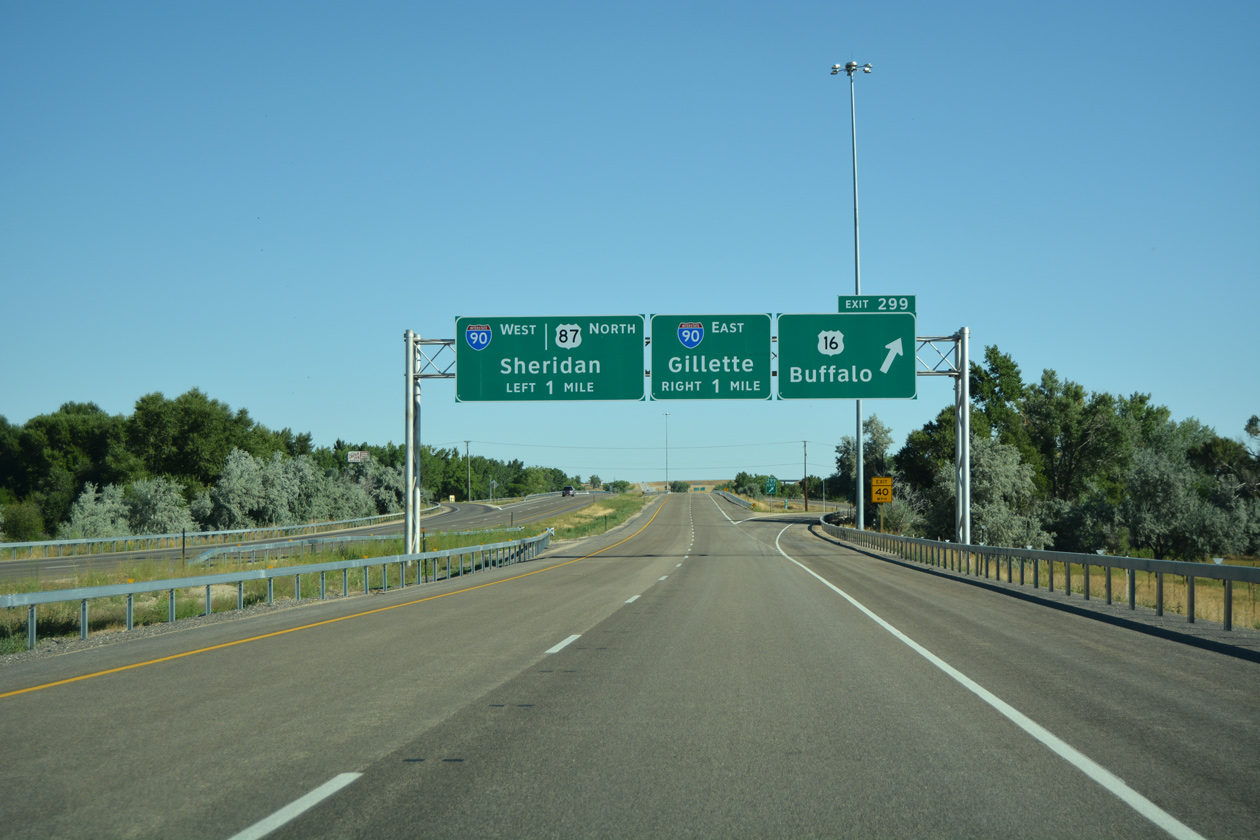
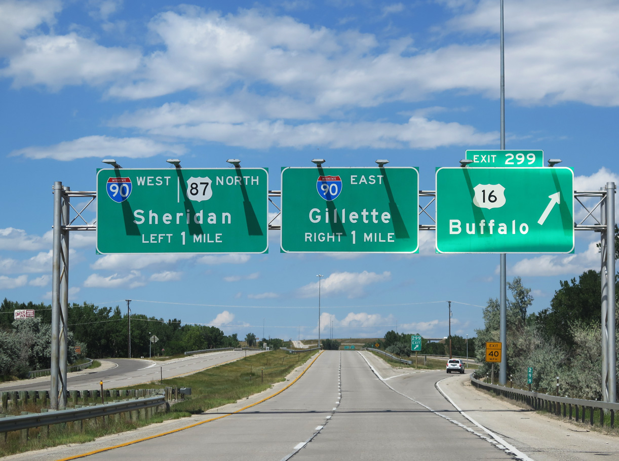
Exit 299 leaves I-25/US 87 north for US 16 and Business Loop I-90 west to Downtown Buffalo one mile ahead of the exchange with Interstate 90. 08/12/16
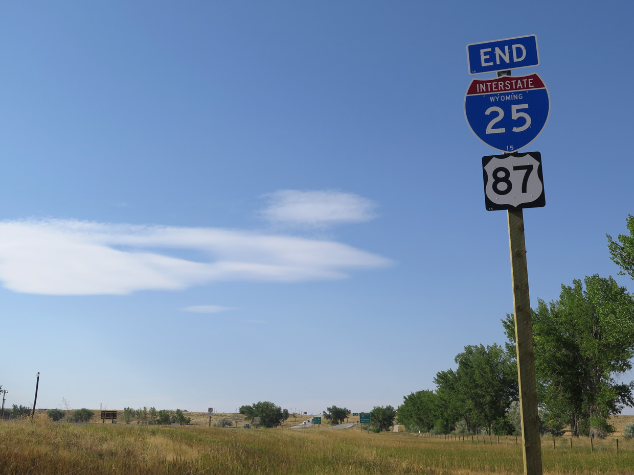
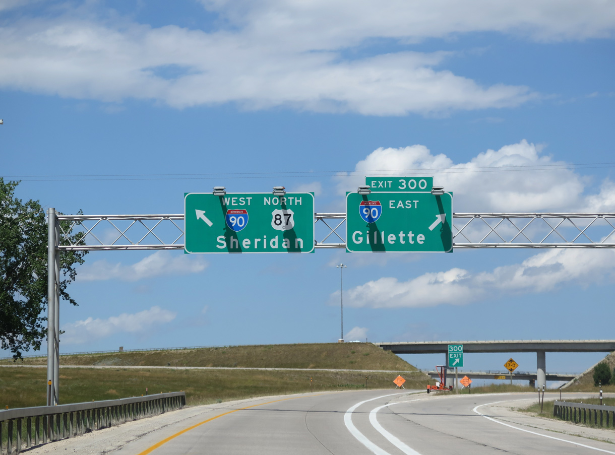
An end shield for Interstate 25 north stands just east of Johnson County Fairgrounds and ahead of the directional T interchange (Exit 300) with I-90. 08/05/16
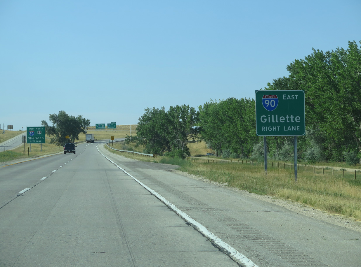
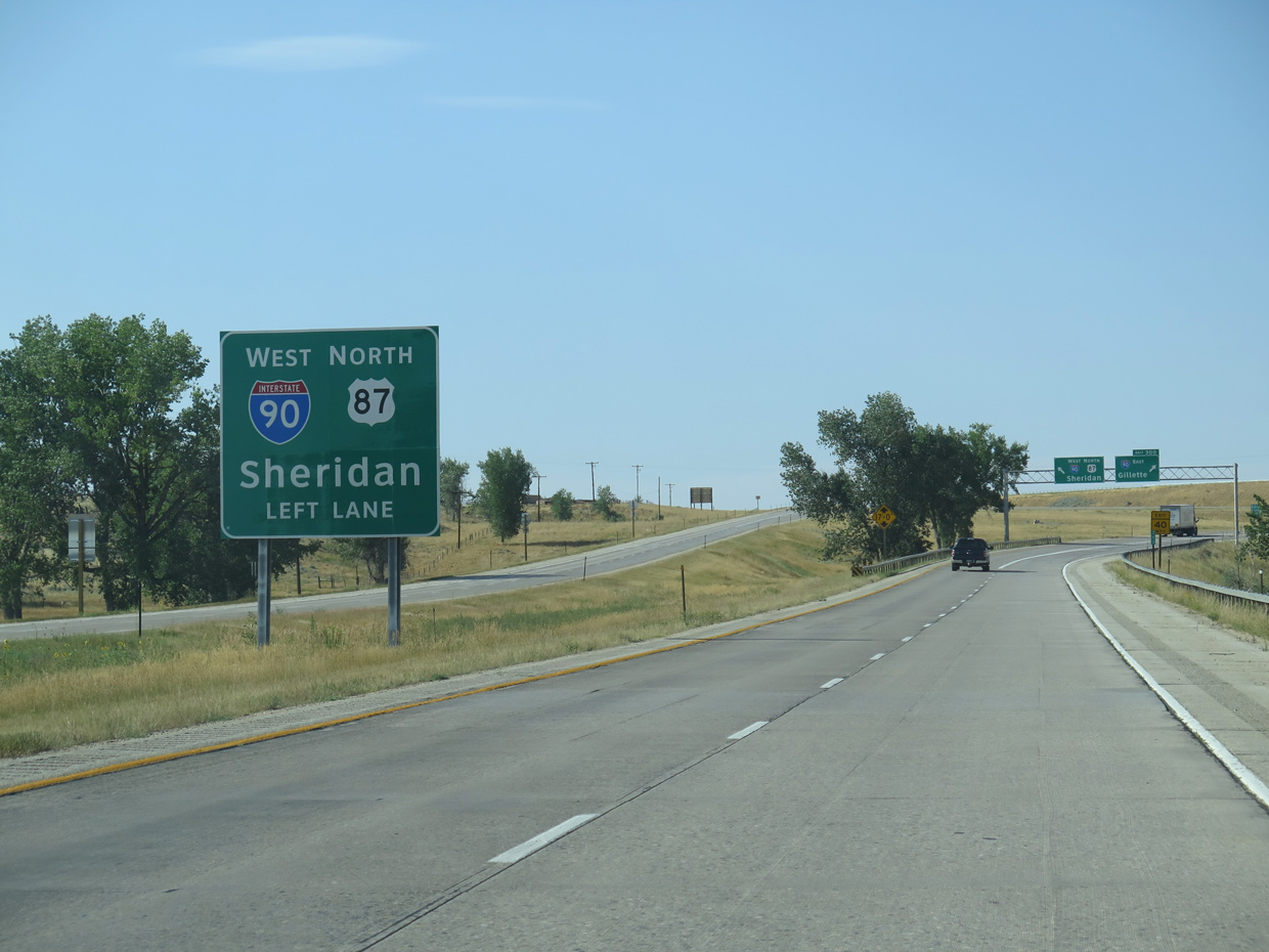
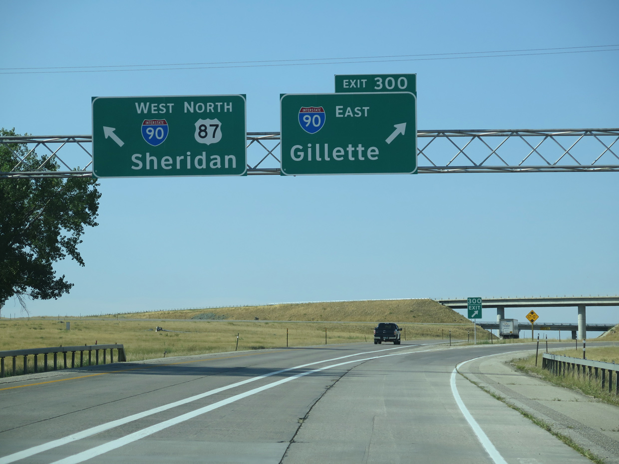
Single lane ramps partition traffic for the continuation of U.S. 87 north onto I-90 west to Sheridan and Billings, Montana and I-90 east to Gillette, Moorcroft and Rapid City, South Dakota. 08/05/16
![]()
![]() East at
East at ![]()
Heading to I-25 south at Buffalo, I-90/U.S. 87 angle southeast across a broad valley fed by Rock Creek. 08/07/16
Business loops for both I-25 south and I-90 east branch southward from Interstate 90 to accompany U.S. 87 Business along Main Street to U.S. 16 in Buffalo. I-25 bypasses the city center to the east. 08/07/16
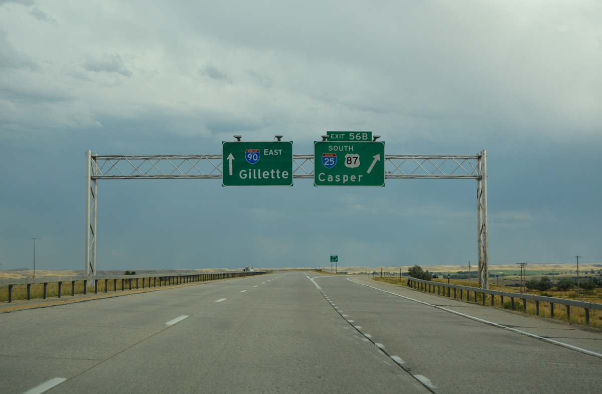
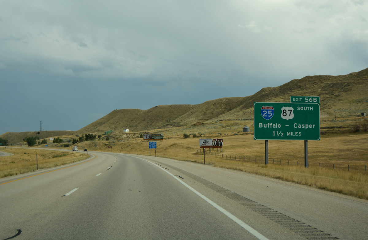
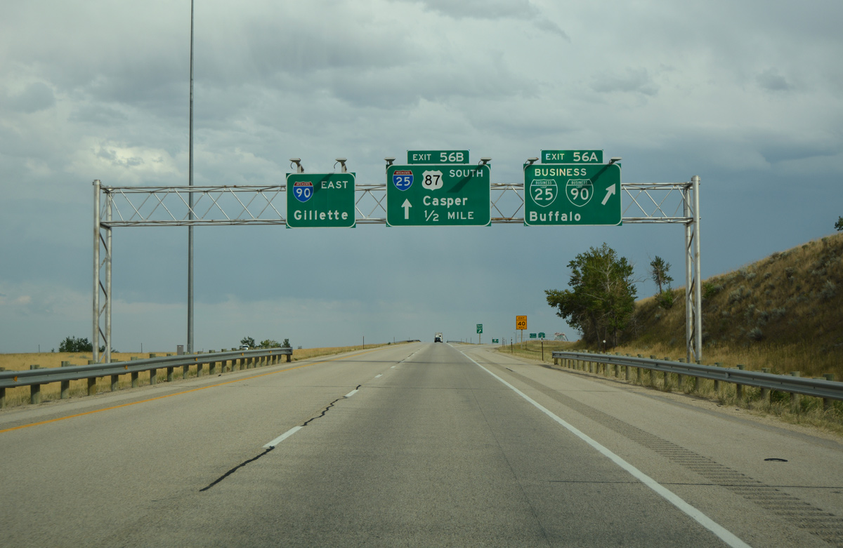
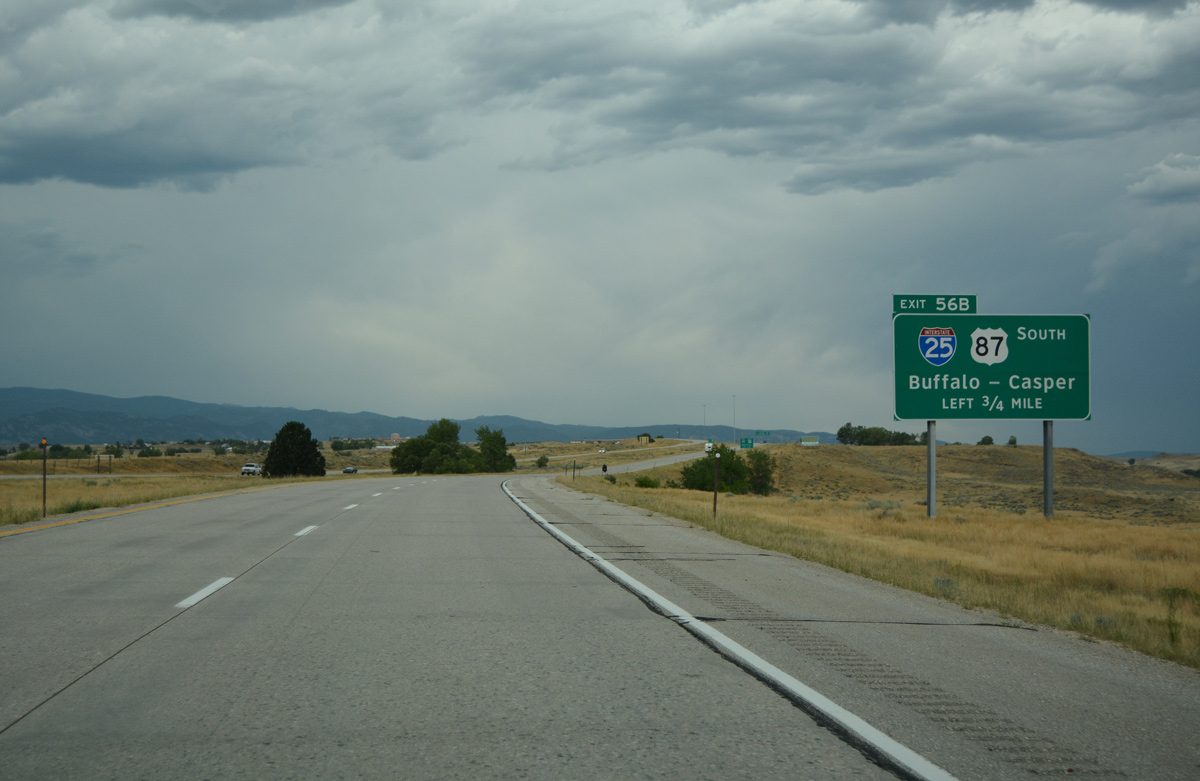
U.S. 87 splits with I-90 east at the directional T interchange (Exit 56B) for Interstate 25 south. The two overlap to Casper. 08/07/16
![]() West at
West at ![]()
![]()
Interstate 90 curves northwest from Business Loop I-90 and U.S. 16 to next meet the north end of I-25 at Exit 56B. 08/07/16
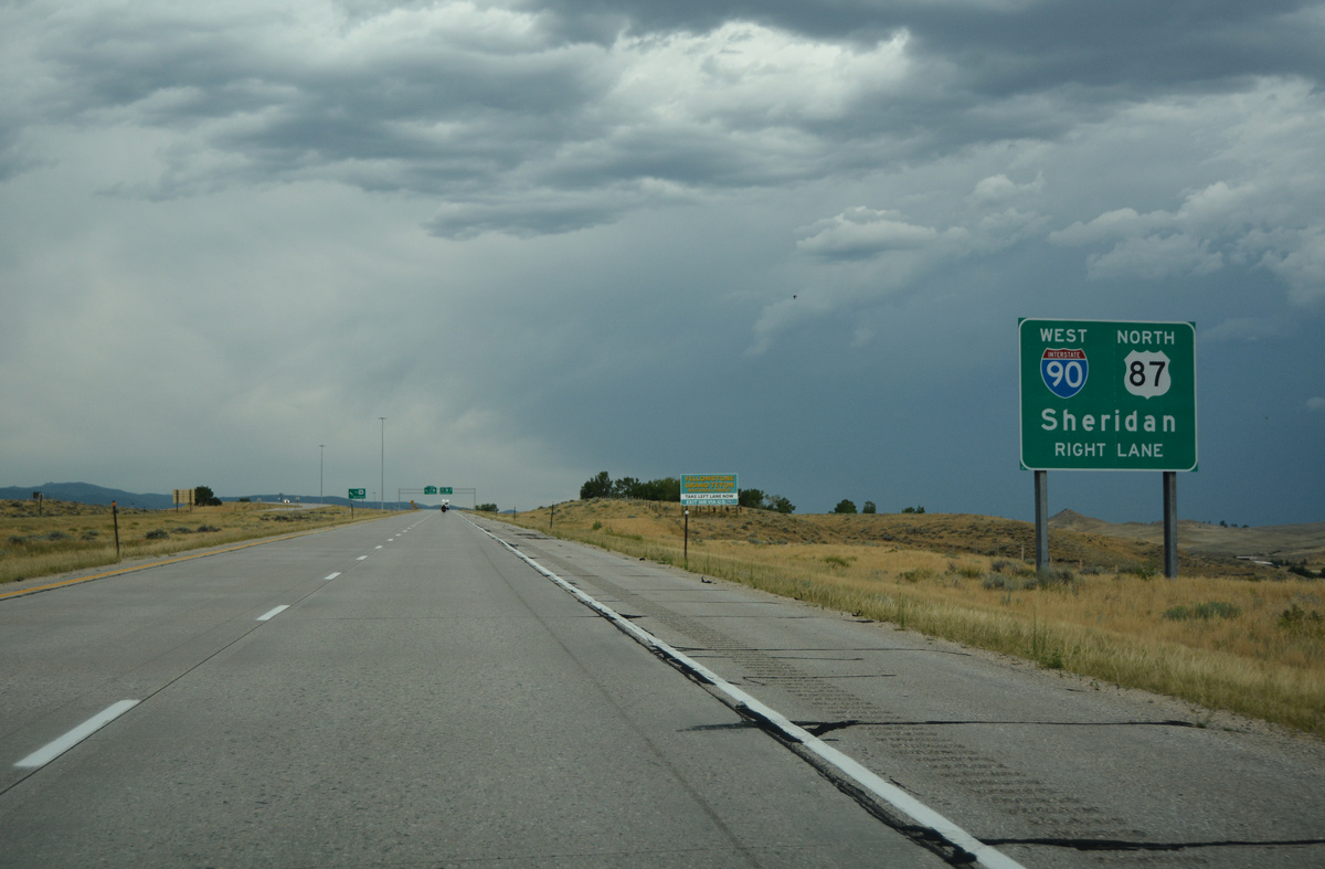
U.S. 87 north commingles with the I-90 corridor north from I-25 to Sheridan and Billings, Montana. 08/07/16
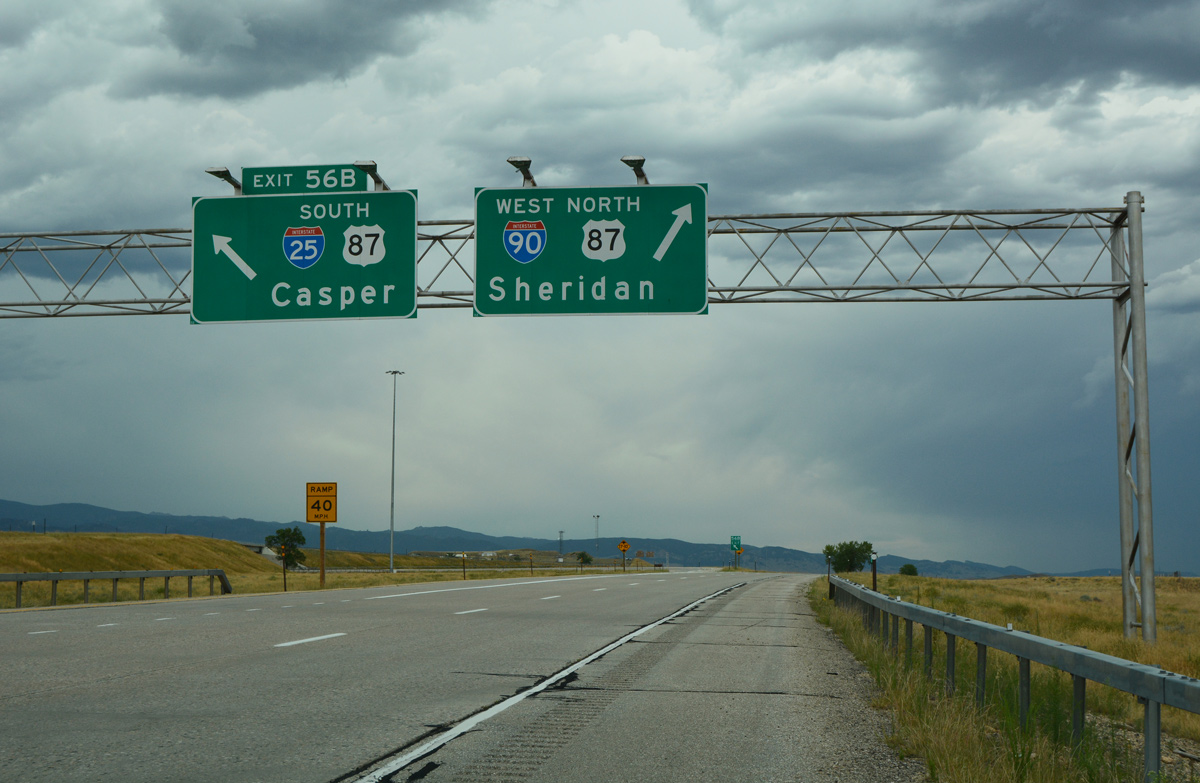
Left Exit 56B separates from I-90 west for I-25/U.S. 87 south to nearby Buffalo, Casper and Cheyenne. Business Loop I-90 west returns to I-90 at an adjacent half diamond interchange (Exit 56A on I-90 east). 08/07/16
North End Throwback


I-25 north at I-90 in March 2001. Photos by Dale Sanderson.
Signs for Interstate 25 northbound to I-90 in Buffalo were replaced to use Clearview font in 2015. 08/15/14
South End – Las Cruces, New Mexico
![]() South at
South at ![]()
![]()
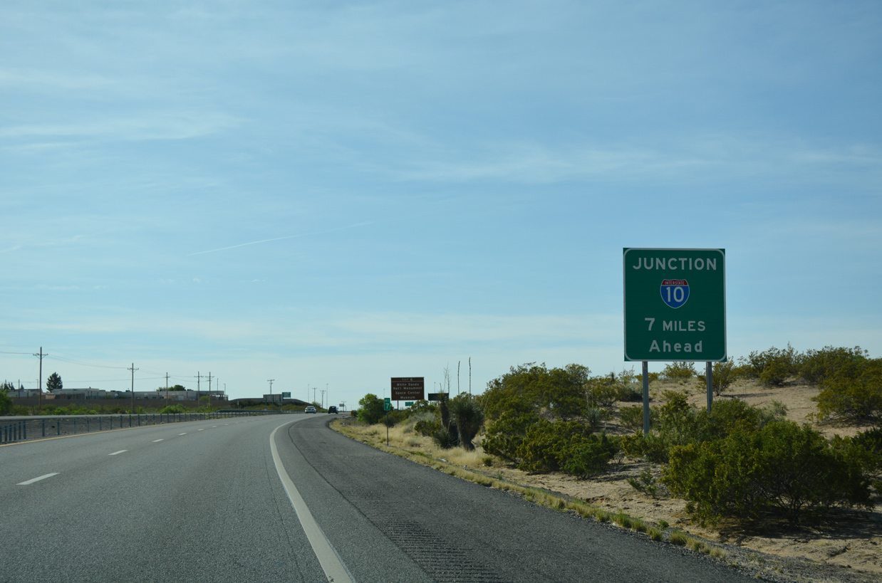
Entering the Las Cruces area along Interstate 25, seven miles ahead of I-10. 04/25/17
The final reassurance marker for Interstate 25 precedes the Wells Street underpass by New Mexico State University in Las Cruces. 04/25/17
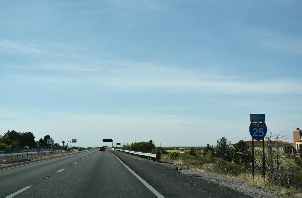
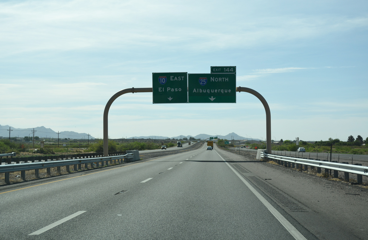
Traffic separates at the south end of Interstate 25 for I-10 east toward El Paso, Texas and west to Deming, Lordsburg, and southeastern Arizona. 04/25/17
![]()
![]() East at
East at ![]()
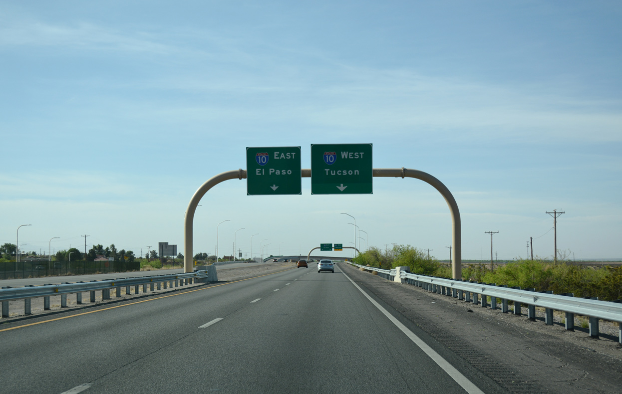
I-10/U.S. 180 travel southeast past Downtown Las Cruces and converge with the end of Interstate 25 beyond New Mexico State University. 04/25/17
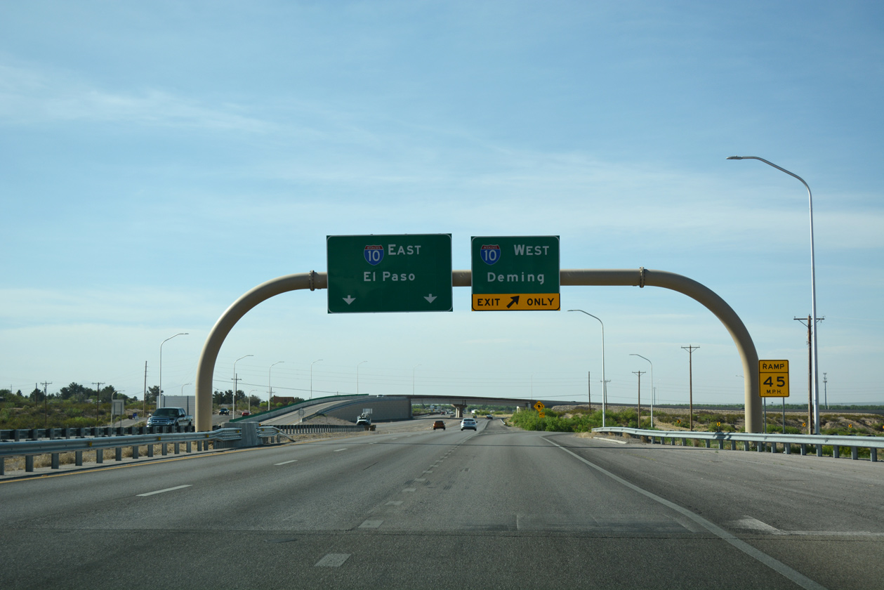
Underway from April 26, 2012 to April 9, 2013, the I-10/I-25 Interchange Reconstruction Project replaced a substandard loop ramp for I-25 north with a high speed flyover.8 04/25/17
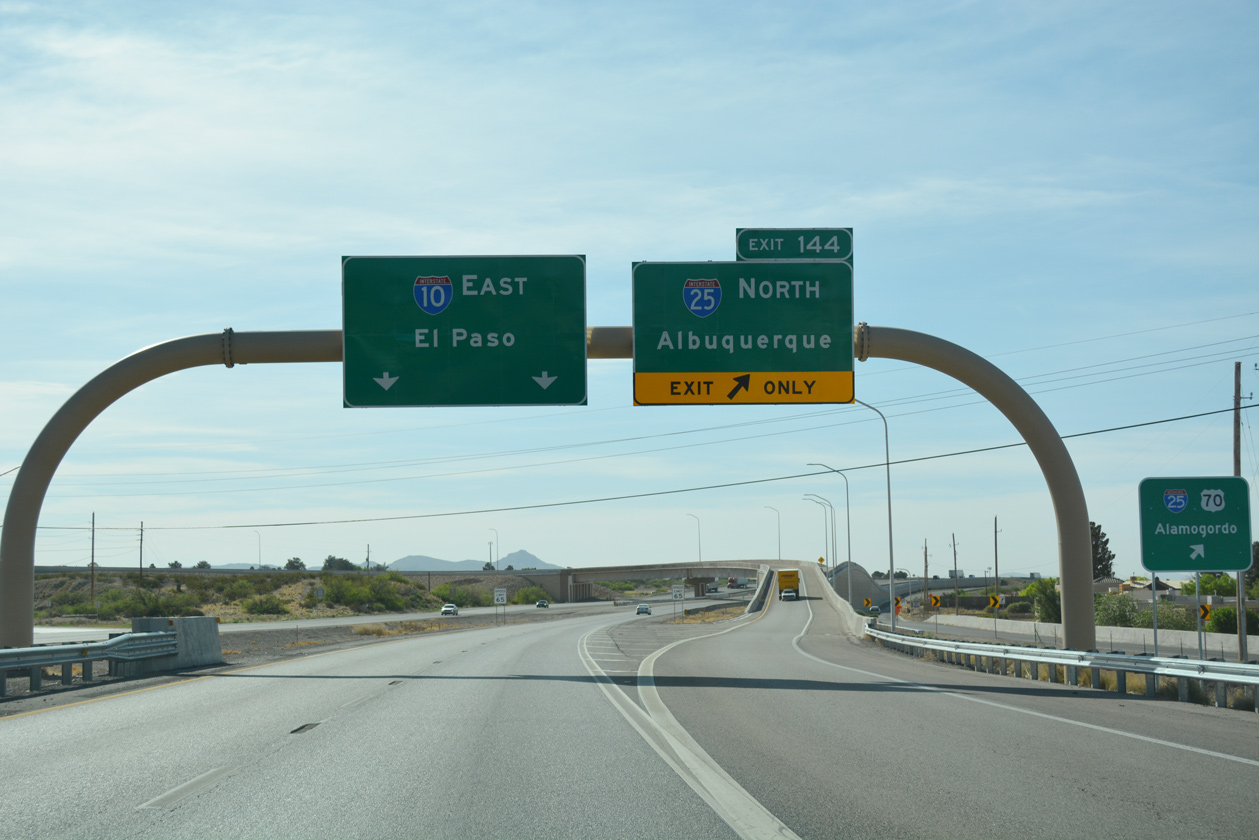
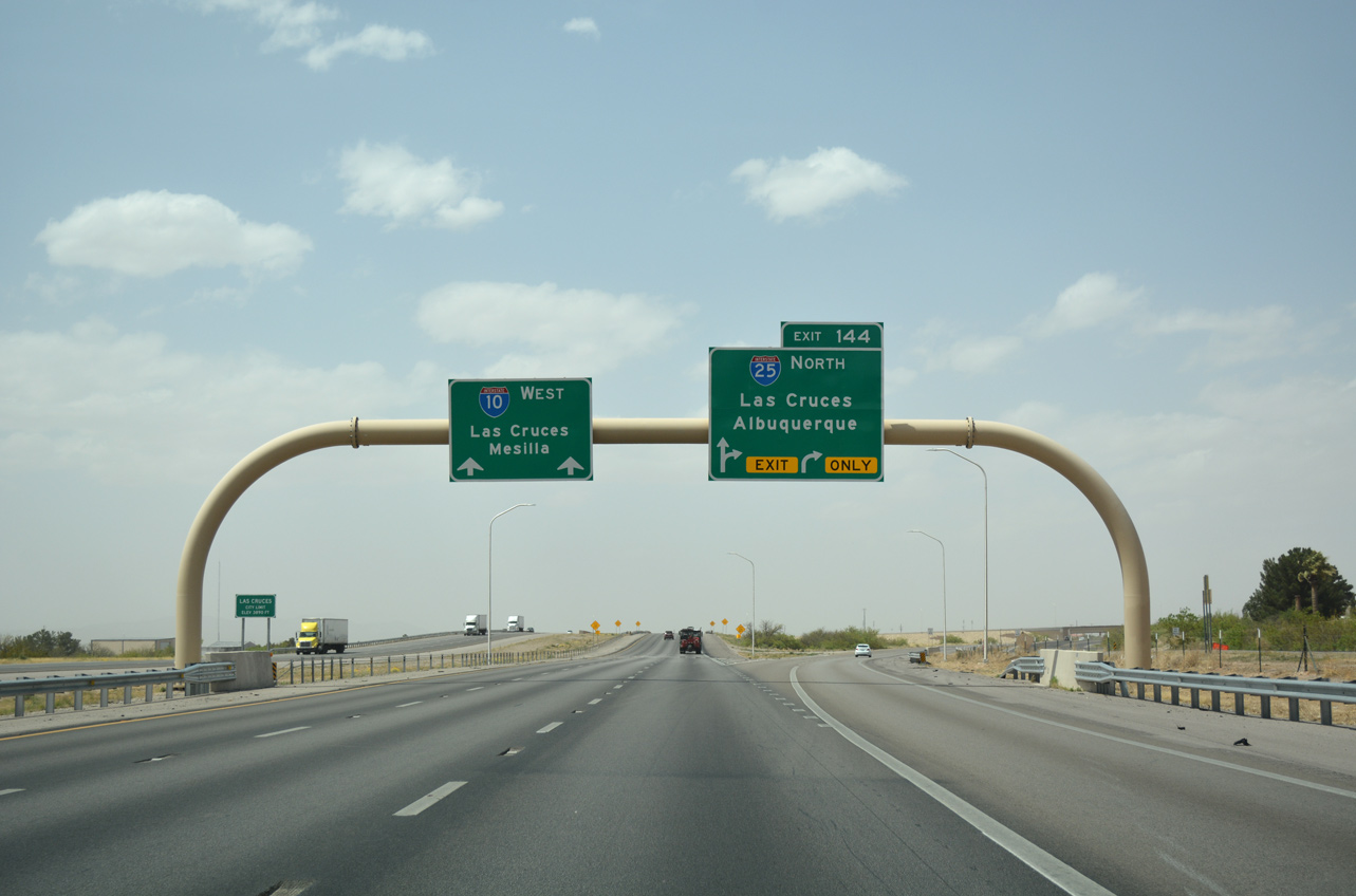
The flyover ramp (Exit 144) for I-25 north to New Mexico State University and the east side of Las Cruces parts ways with I-10/US 180 eastbound. 04/25/17
![]()
![]() West at
West at ![]()
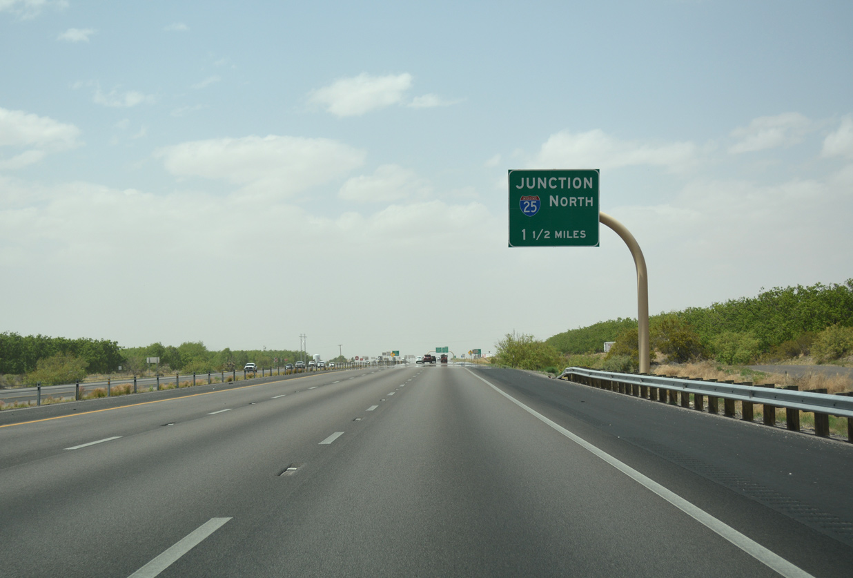
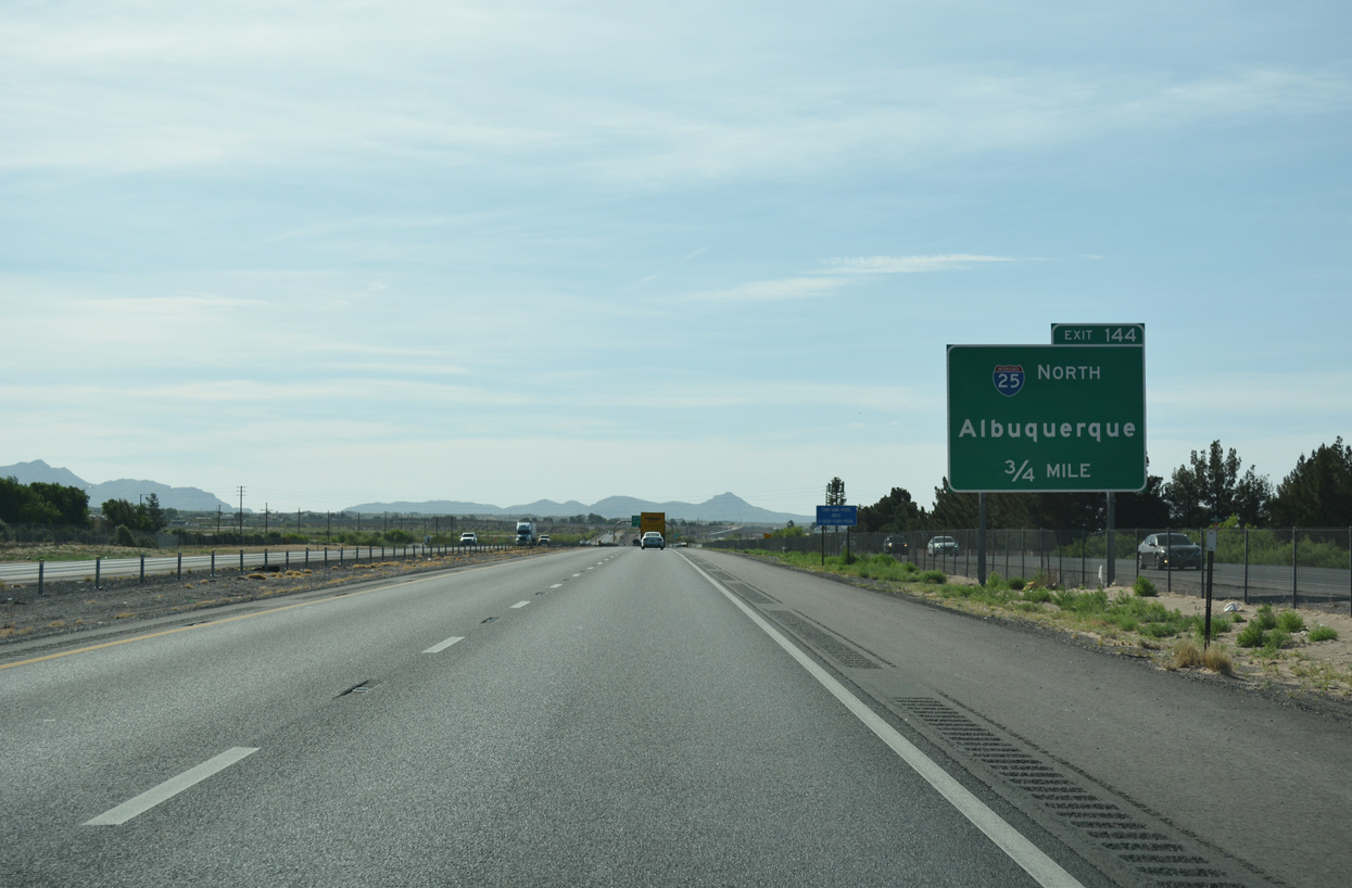
I-10, U.S. 85 and U.S. 180 leave an agricultural area across Fillmore Arroyo just ahead of the three-wye interchange (Exit 144) with Interstate 25 north. 04/25/17
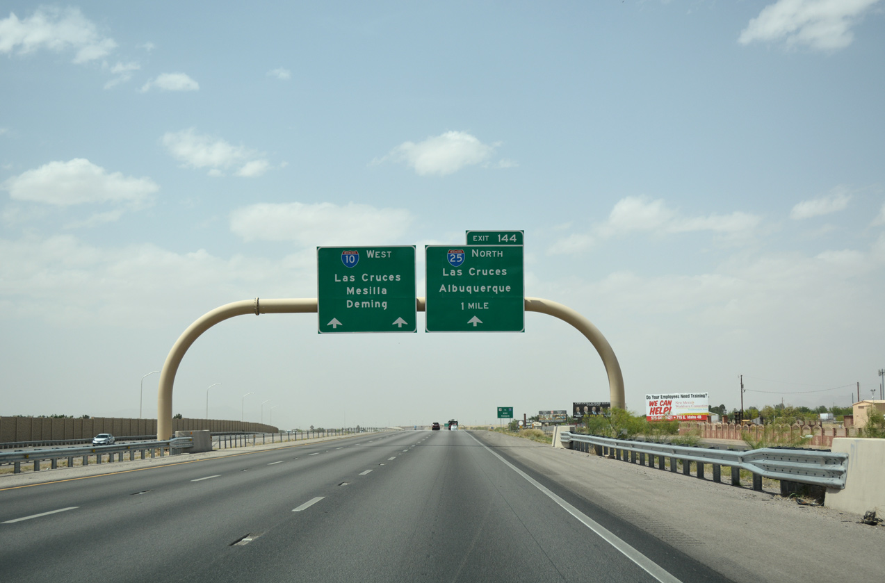
I-10/U.S. 180 turn westward across south Las Cruces, overtaking U.S. 70 en route to Deming. I-25 replaced U.S. 85 northward along the Rio Grande to Truth or Consequences, Socorro and Albuquerque. 04/25/17
South End Throwback


Photos by Jeff Royston (12/00, 05/27/04 and 05/27/04).


The original trumpet interchange at the south end of Interstate 25 during early stages of construction to both expand I-10 and upgrade the exchange. 04/29/12
Sources:
- U.S. and Interstate Highways in New Mexico (Steve Riner).
- Big I Project Information
http://www.thebigi.com/. New Mexico State Highway & Transportation Department. - “World Premiere” Albuquerque Tribune, The (NM), May 24, 2002.
- “Twin Mountain to Start Road Work” Albuquerque Journal (NM), February 17, 2000.
- “Project Was A Boon To City’s Economy.” Albuquerque Journal (NM), May 26, 2002.
- T-REX
http://www.trexproject.com/. CDOT. - The North Forty Project. CDOT.
- “I-10/I-25 interchange project to finish ahead of scheduled.” Las Cruces Sun-News (NM), March 30, 2013.
Page updated April 12, 2023.