Interstate 59
Overview
Interstate 59 angles northeasterly from New Orleans through the Deep South to north Georgia outside Chattanooga, Tennessee. The freeway combines with I-20 along a 153 mile long overlap between Meridian, Mississippi and Birmingham, Alabama marking one of the longer concurrencies in the Interstate System. U.S. 11 follows the entire length of I-59 as well as I-81; the likely reason why these two highways do not carry the same number is the lengthy stretch of Interstate 75 that follows U.S. 11 between Chattanooga and Knoxville.
Although never actually making it into New Orleans, Interstate 59 provides an important evacuation and trucking route for the central Gulf Coast. The south end is located at the same interchange as the eastern end of Interstate 12, where I-10 curves from the greater New Orleans area eastward to the Mississippi Gulf Coast. Previous plans called for I-59 to be routed south along I-10 into New Orleans, but those changed with the decision to route I-12 north of Lake Pontchartrain.
Heading north from Louisiana, Interstate 59 follows a forested route through Mississippi, which is a general constant along most Deep South freeways. Hattiesburg, home of the University of Southern Mississippi, Laurel and Meridian are all important destinations in Mississippi. The freeway navigated along older urban stretches through the latter two cities. Of those, the S-curve in Laurel was notorious for its tight radii, narrow bridges and short exit ramps. It was modernized by September 2009.
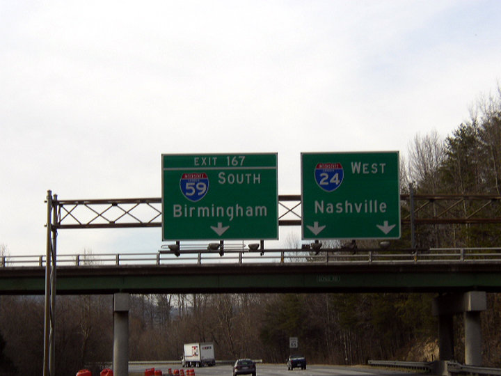
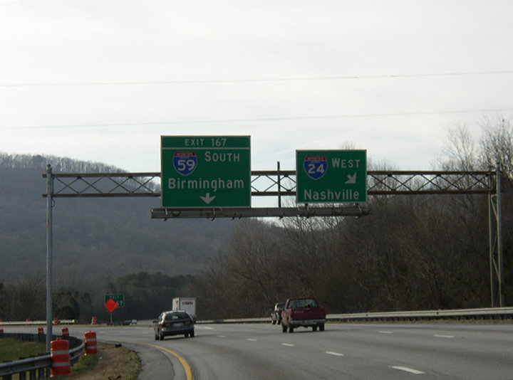
I-20 and I-59 combine from a point just west of Meridian, Mississippi northeasterly to Tuscaloosa, where Interstate 359 spurs northward toward Downtown and the University of Alabama. The pair split with Interstate 459, the Birmingham belt line, at Bessemer City, as they bee line for Downtown Birmingham and an elevated viaduct east of the “Malfunction Junction” interchange with I-65.
A four year $450 million project replaced the roadways built in 1971 along I-59/20 between I-65 and U.S. 31/280 (Red Mountain Expressway) in Birmingham with a new viaduct system. The first of three phases for the work commenced in September 2015 at the exchange with I-65. Phase II completed work at Malfunction Junction by late 2018. Phase III involved the entire shutdown of I-59/20 by Downtown so that crews could demolish the old roadway and replace it. The new bridge system fully opened to traffic following a Dedication Ceremony attended by Alabama Governor Kay Ivey on January 17, 2020.4 Associated construction on the I-59 / I-20 Bridge Replacement Project continued throughout 2020.
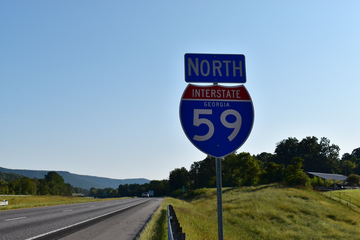
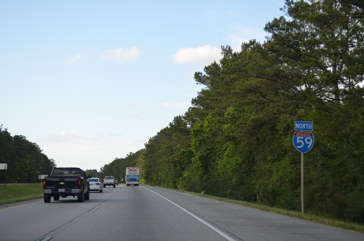
East from Downtown, I-20/59 part ways by Birmingham Shuttlesworth International Airport (BHM) to Irondale and Trussville respectively. The section of Interstate 59 northeast of Birmingham straddles the southern reaches of the Appalachian Mountains along a scenic route. I-59 serves Gadsden along this stretch with Interstate 759, a short freeway spur. I-59 enters Georgia and eventually connects with I-24, which leads east to I-75 at Chattanooga, Tennessee.
 Parallel U.S. Routes
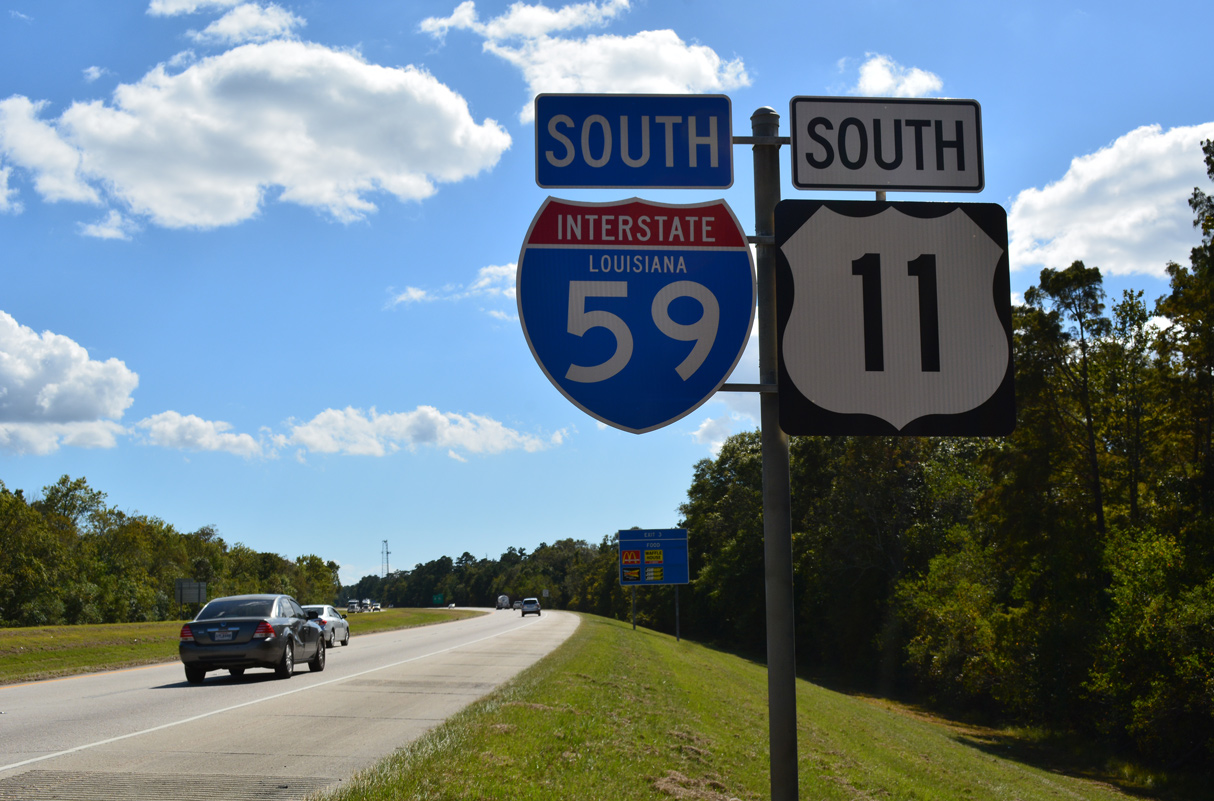
Interstate 59 follows U.S. 11 for its entirety between Slidell, Louisiana and Wildwood, Georgia. Short overlaps bring U.S. 98 onto I-59 along the west side of Hattiesburg, U.S. 84 onto I-59 through Laurel and U.S. 80 alongside I-20/59 at Meridian, Mississippi.
U.S. 11/80 combine from Meridian east to Cuba, Alabama. Northeast between Eutaw and Tuscaloosa, Alabama, parallel U.S. 11 combines with U.S. 43. Within Birmingham, U.S. 78 ties into the I-59/20 overlap both west of Downtown and east at Irondale. U.S. 411 mirrors the course of I-59 northeast from Leeds to Gadsden and Weiss Lake in Alabama as well.
History
Within Louisiana, Interstate 59 was constructed first across the Pearl River as the replacement route for U.S. 11 at St. Rose in 1958. The stretch southward into Slidell, along with I-10 south to the Twin Bridges opened in 1965-66.
Interstate 59 in Mississippi opened initially from the Louisiana line toward Picayune and from Hattiesburg to Laurel in 1963. All of the route south of the overlap with I-20 was completed by 1969.2
Built in 1961, the S-curve in Laurel, Mississippi routed I-59 by an adjacent hospital and public housing project. The 0.75 mile long stretch was limited to a 40 MPH speed limit. Starting in 2005, work redesigned the freeway onto a new six lane 1,980 foot long elevated viaduct with improved geometry. Construction commenced in June 2006, leading to an August 2008 opening of the new northbound lanes and an overall completion in September 2009. Additional funding remained from the original S-curve project, resulting in the widening of two more miles of I-59 heading northward. This included expanding the freeway footprint and widening the median from four to 15 feet. That expansion project ran between October 2009 and Fall 2010.1
$16 million in road work took place between February 2002 and July 2004 at the three-wye interchange joining I-24 and I-59 in North Georgia. Work replaced 40 year old bridges and extended auxiliary lanes.3
Route Information
Mileage
Louisiana – 11.48
Cities – Slidell
- Junctions –

Mississippi – 171.72
Cities – Picayune, Hattiesburg, Laurel, Meridian
- Junctions –
Alabama – 241.36
Cities – Tuscaloosa, Bessemer, Birmingham, Gadsden, Ft. Payne
- Junctions –

Georgia – 20.67
Cities – Trenton
- Junctions –
Source: December 31, 2021 Interstate Route Log and Finders List
I-59 Annual Average Daily Traffic (AADT)
| Location | Vehicles per day |
|---|---|
| Pearl River, LA | 36,325 |
Source: La DOTD – Average Daily Traffic Counts (2022)
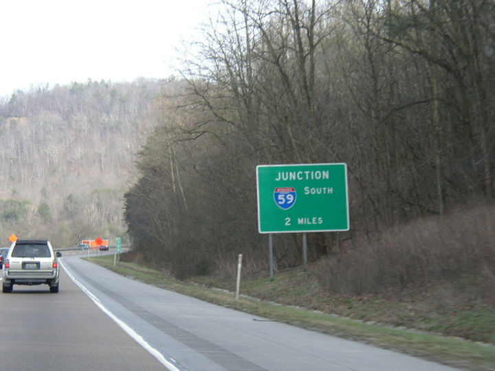
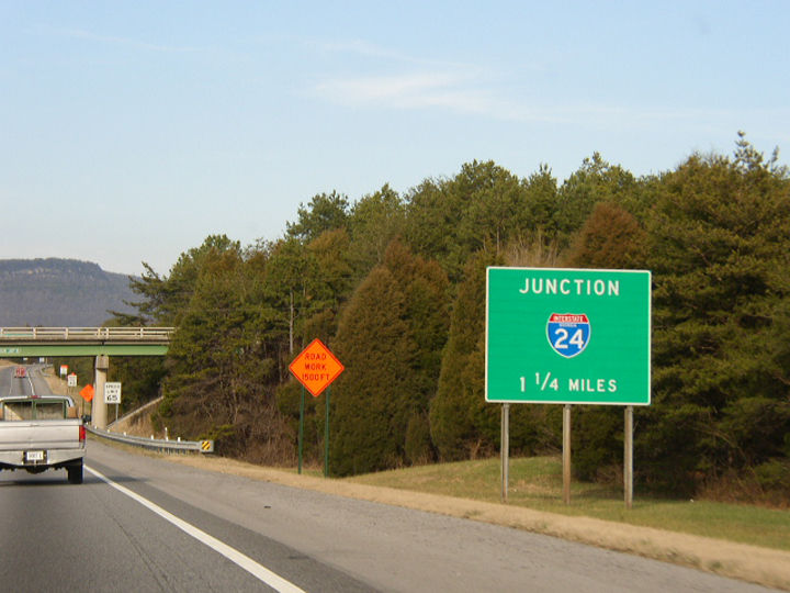
Interstate 59 was completed from Heidelberg (MS 528) north to the west split with Interstate 20 by 1969.2
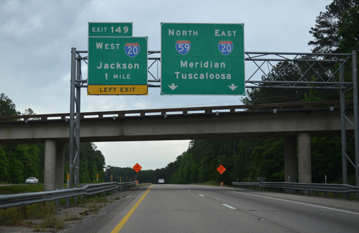
Interstate 59 north one mile ahead of the three-wye interchange (Exit 149) where the route joins I-20 for the lengthy overlap northeast to Birmingham, Alabama. 05/09/16
Completion of Interstate 59 through North Georgia occurred in 1971.
 Photo Guides
North End  – Wildwood, Georgia
![]() North at
North at ![]()
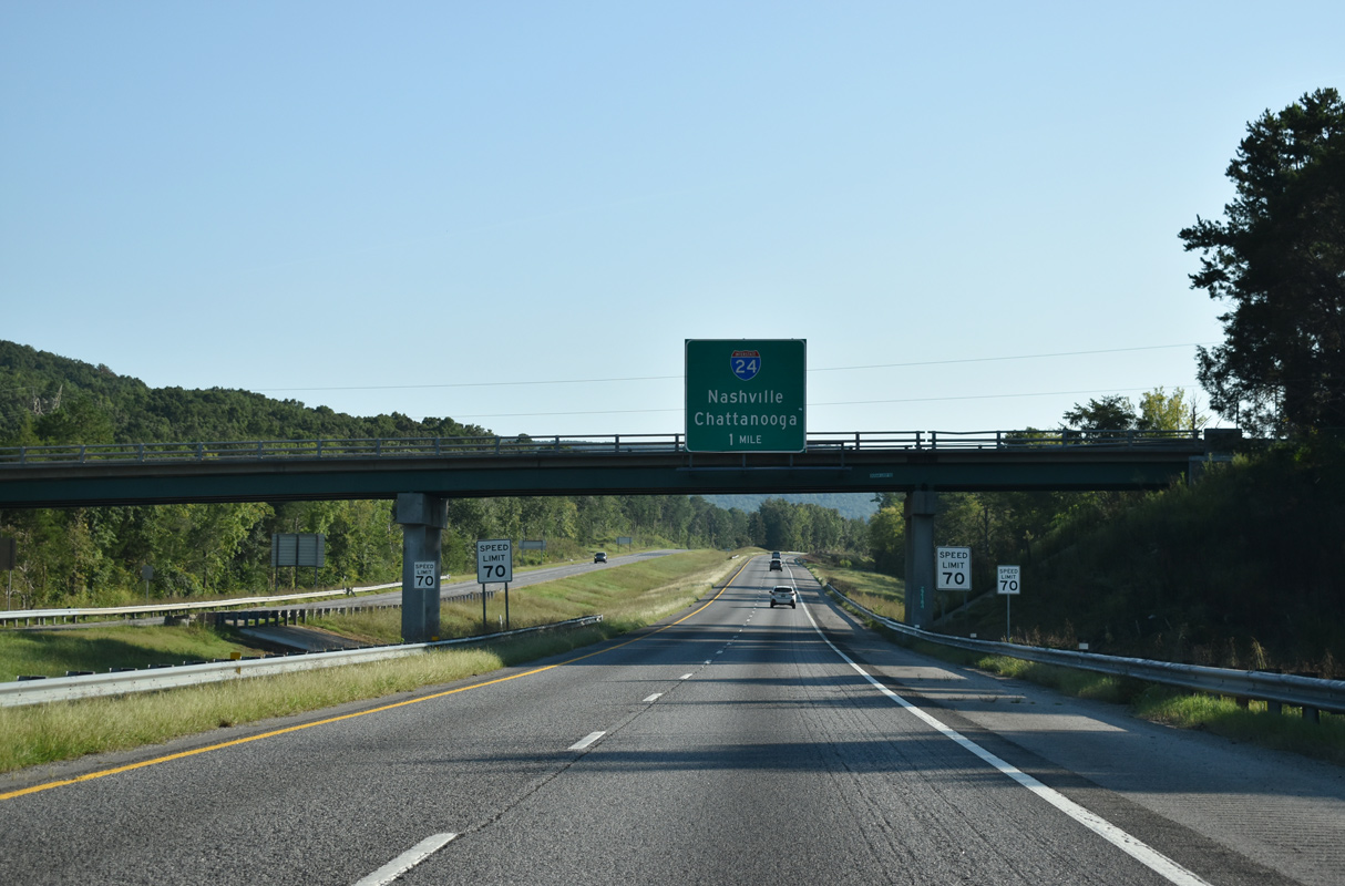
The final push of Interstate 59 north takes the freeway between Tatum Mountain and Slygo Ridge to the unnumbered three-wye interchange with I-24. The initial guide sign appears at the Dugan Loop Road overpass. 09/07/20
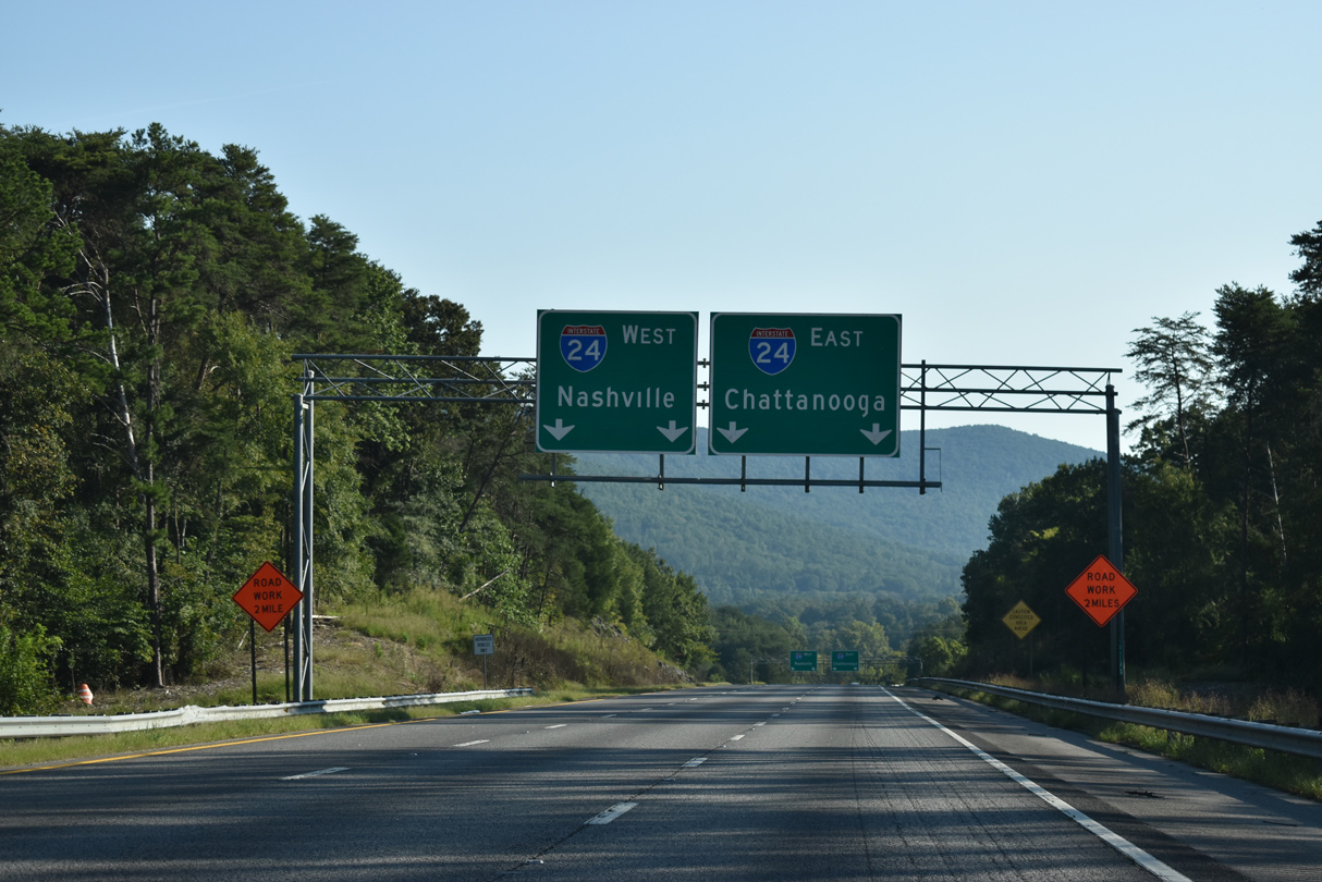
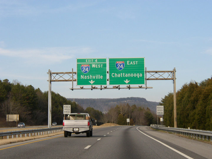
Completed in 2004, expansion of I-59 north added a third lane to the ramp split for Interstate 24 northwest to Murfreesboro and Nashville and east to Wildwood and Chattanooga. 09/07/20
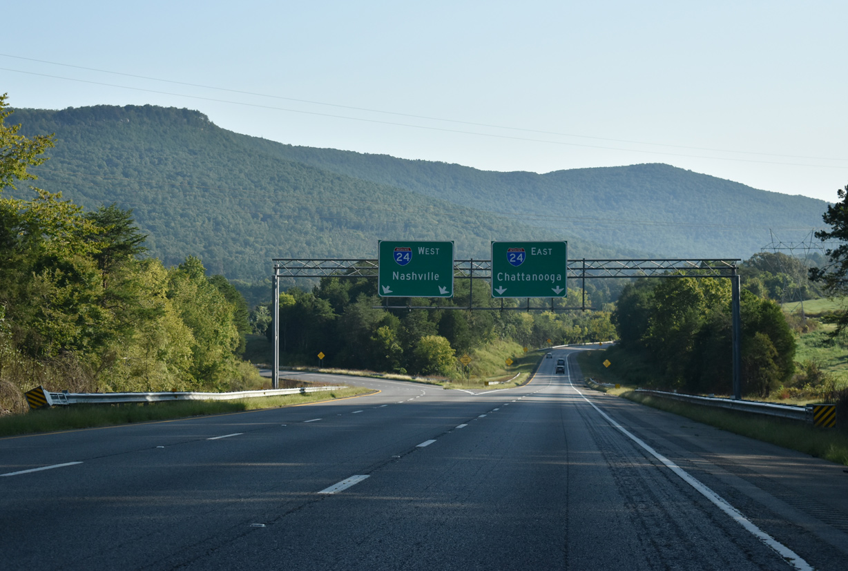
Traffic partitions from I-59 north into the respective directions of Interstate 24. Chattanooga is ten miles to the east at this point. The Tennessee capital city is 135 miles to the northwest. 09/07/20
![]() West at
West at ![]()
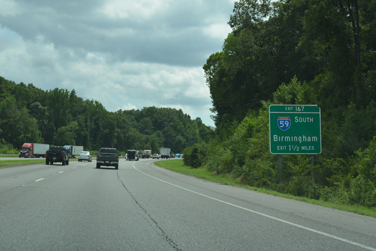
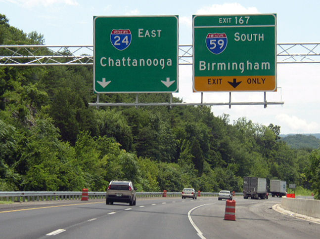
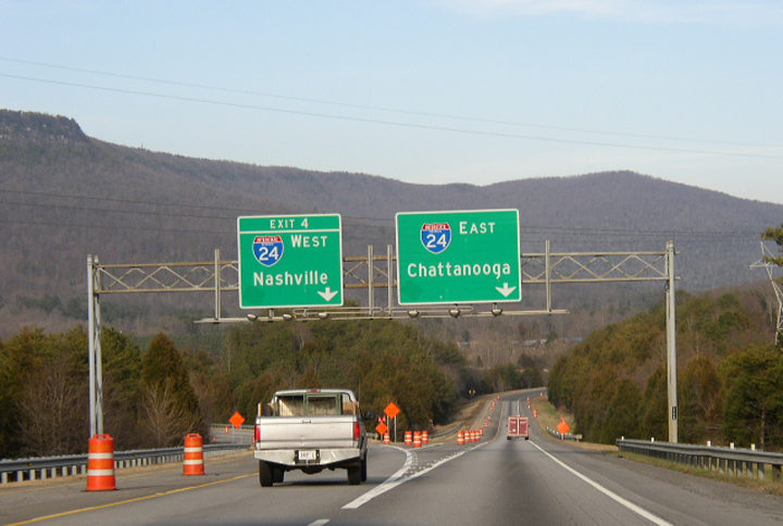
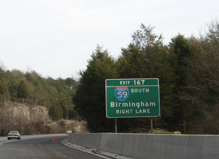
The exit numbering sequence from Tennessee extends into Dade County, Georgia, where Interstate 24 meets I-59 south at Exit 167. 07/26/22
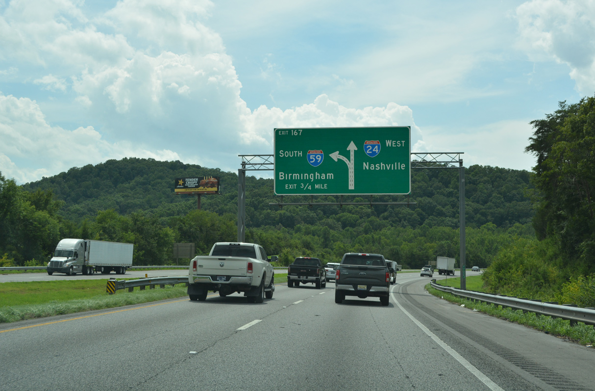
Interstate 24 westbound expands to three lanes ahead of Left Exit 167 for I-59 south. Installed by June 2003, this diagrammatic sign coincided with 2002-04 expansion of I-24 west. 07/26/22
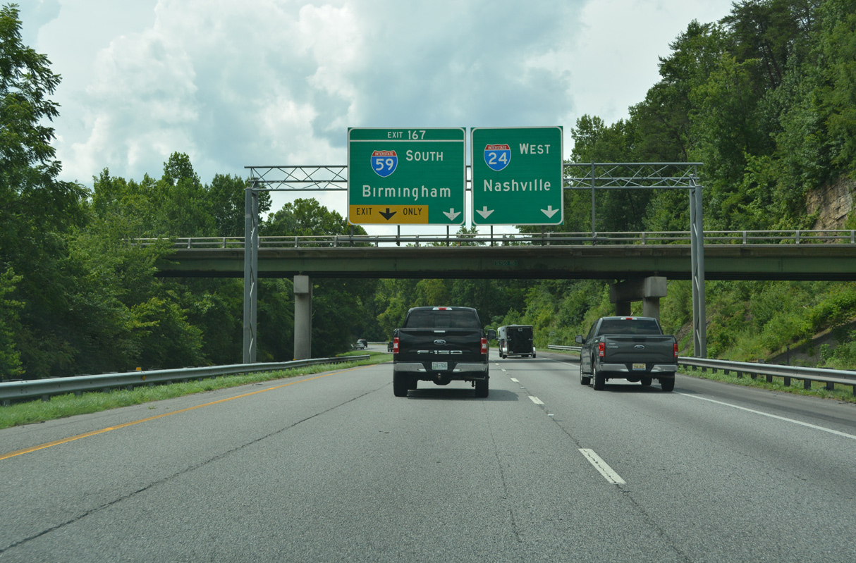
Slygo Road spans Interstate 24 just ahead of the separation with I-59 south at Exit 167. Birmingham, Alabama accompanies Nashville, Tennessee as a control city for I-24 west from I-75 in Chattanooga. 07/26/22
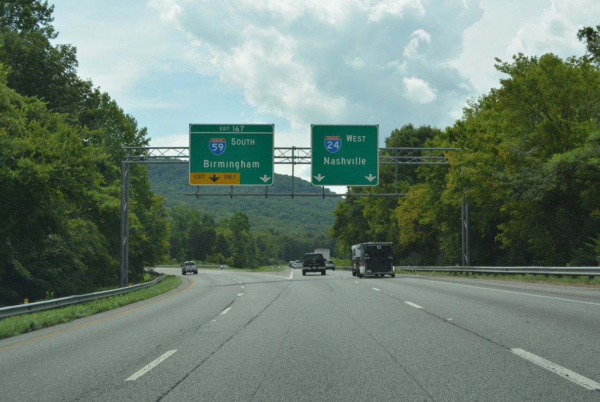
Interstate 24 turns northwest to reenter the Volunteer State in 1.4 miles through Paris Hollow. Reaching Alabama’s largest city in 127 miles, Interstate 59 travels southwest through Slygo Valley en route to New England and Trenton. 07/26/22
![]() East at
East at ![]()
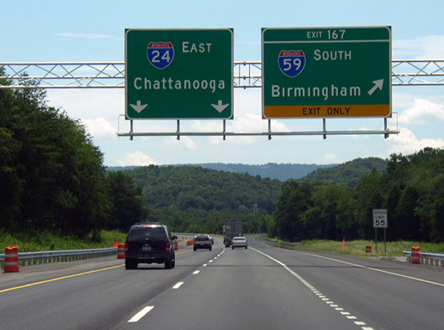
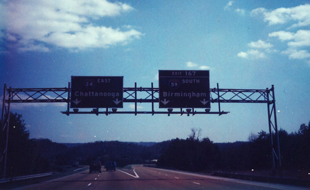
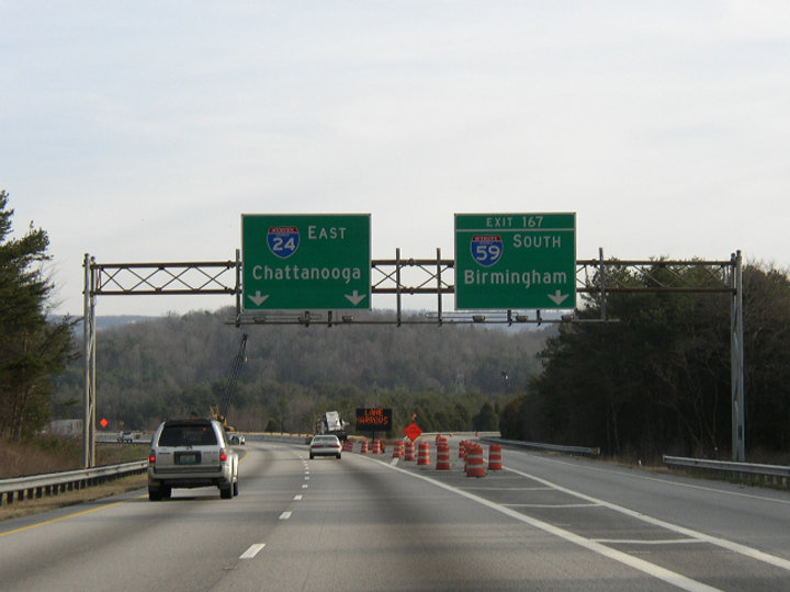
Curving south between Windy and Aetna Mountains, I-24 advances to the Georgia state line, the boundary between Central and Eastern time zones, and Interstate 59. The time zone boundary follows the Alabama/Georgia line to the south and circumvents Chattanooga along the Marion/Hamilton County line to the east. Photo by Chris Patriarca (02/01/03).
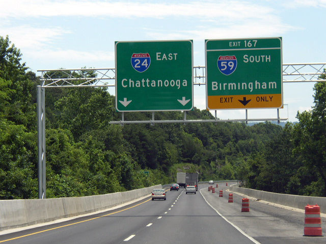
Just south of the state line, Interstate 24 east expands to three lanes ahead of the three wye interchange (Exit 167) with I-59 south. This expansion took place during 2002-04. Photo by Chris Patriarca (07/14/03).
Interstate 24 east enters a valley fed by Pope Creek between Tatum Mountain, Raccoon Mountain and Slygo Ridge. Interstate 59 angles southwest from here through Slygo Valley to New England. Photo by Chris Patriarca (07/14/03).
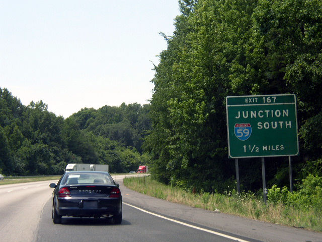
Interstate 24 curves back to the northeast and returns to Tennessee in 3.2 miles as Exit 167 departs for I-59 south. Interstate 59 is a lightly traveled route from Dade County, Georgia southwest to Fort Payne and Gadsden, Alabama. Photo by Chris Patriarca (07/14/03).
North End Throwback
![]() North at
North at ![]()
This ground level sign for I-24 was replaced with a new sign attached to the adjacent Dugan Loop Road overpass. Interstate 24 dips into the Peach State for 4.12 miles as it circumvents Raccoon Mountain. Photo by Chris Patriarca (02/01/03).
Replaced by July 2003, this sign bridge retained the sequential exit number for Interstate 24 west to Monteagle, Tennessee. Photo by Chris Patriarca (02/01/03).
This set of signs was also replaced by Summer 2003 during the project to add a lane to I-59 north. Photo by Chris Patriarca (02/01/03).
![]() West at
West at ![]()
This original button copy sign for Interstate 59 south was replaced sometime after August 2003. Photo by Chris Patriarca (07/14/03).
These signs were replaced by August 24, 2003 to reflect the second lane for Interstate 59 south at Exit 167. Photo by Chris Patriarca (02/01/03).
Tatum Mountain appears in the background as Interstate 24 west split with the southbound beginning of Interstate 59. Photo by Chris Patriarca (02/01/03).
![]() East at
East at ![]()
Emerging from Paris Hollow along Interstate 24 east ahead of I-59 south. Button copy signs remained in use along the I-24 east approach to I-59 (Exit 167) until Summer 2003. Photo by Chris Patriarca (02/01/03).
Original button copy overheads posted at Interstate 59 (Exit 167) south from I-24 east. The second lane for Exit 167 was restriped into a chevron during 2003 road work. Photo by Michael Summa (1984).
This sign bridge was replaced by Summer 2003 to reflect the eastbound lane drop for Interstate 59 south. Photo by Chris Patriarca (02/01/03).
South End – Slidell, Louisiana
![]() South at
South at ![]()
![]()
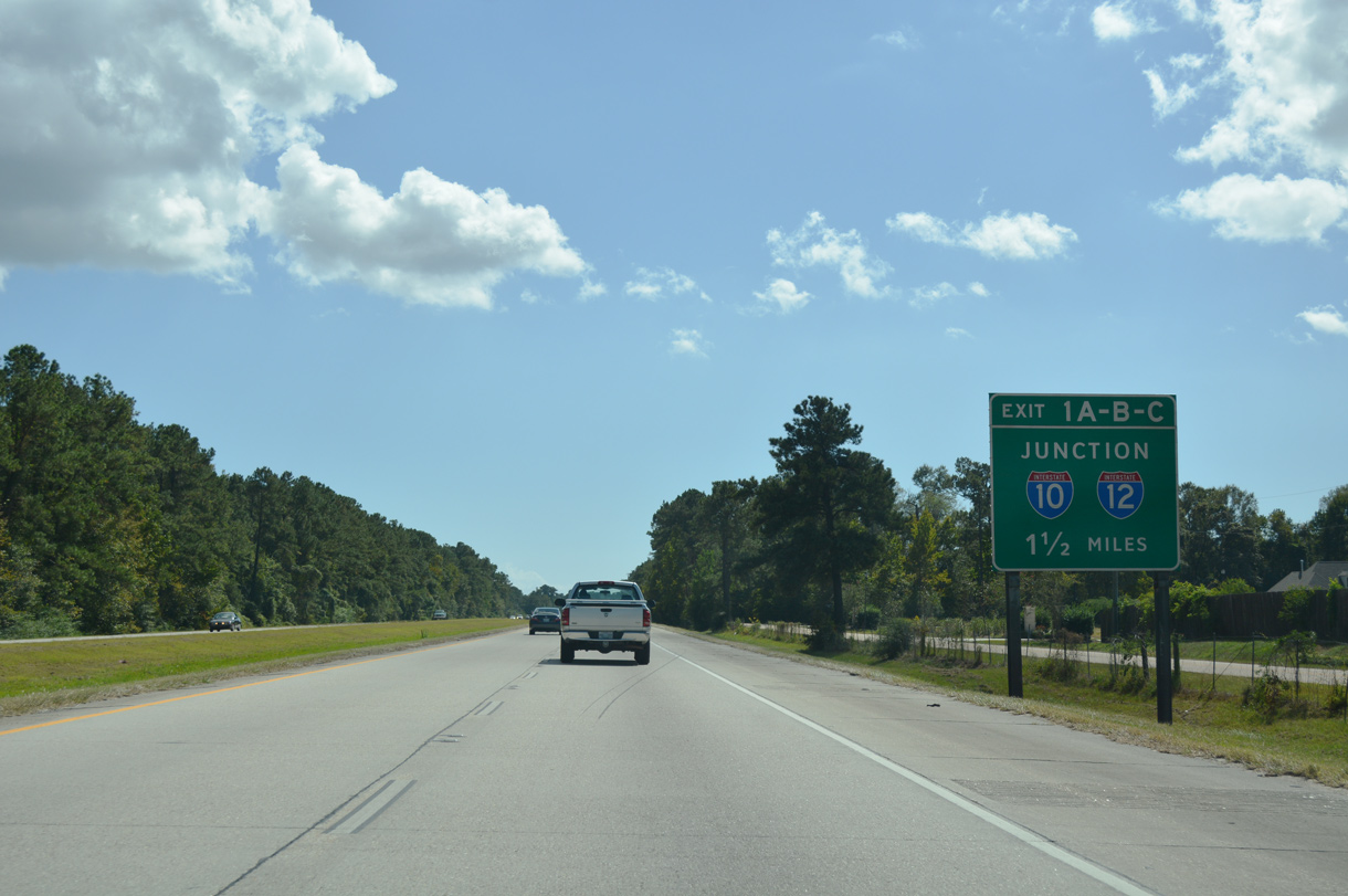
Having just split with U.S. 11 at Exit 3, Interstate 59 southbound presses towards the terminus with I-10 and I-12 at Exits 1A/B. 10/12/16
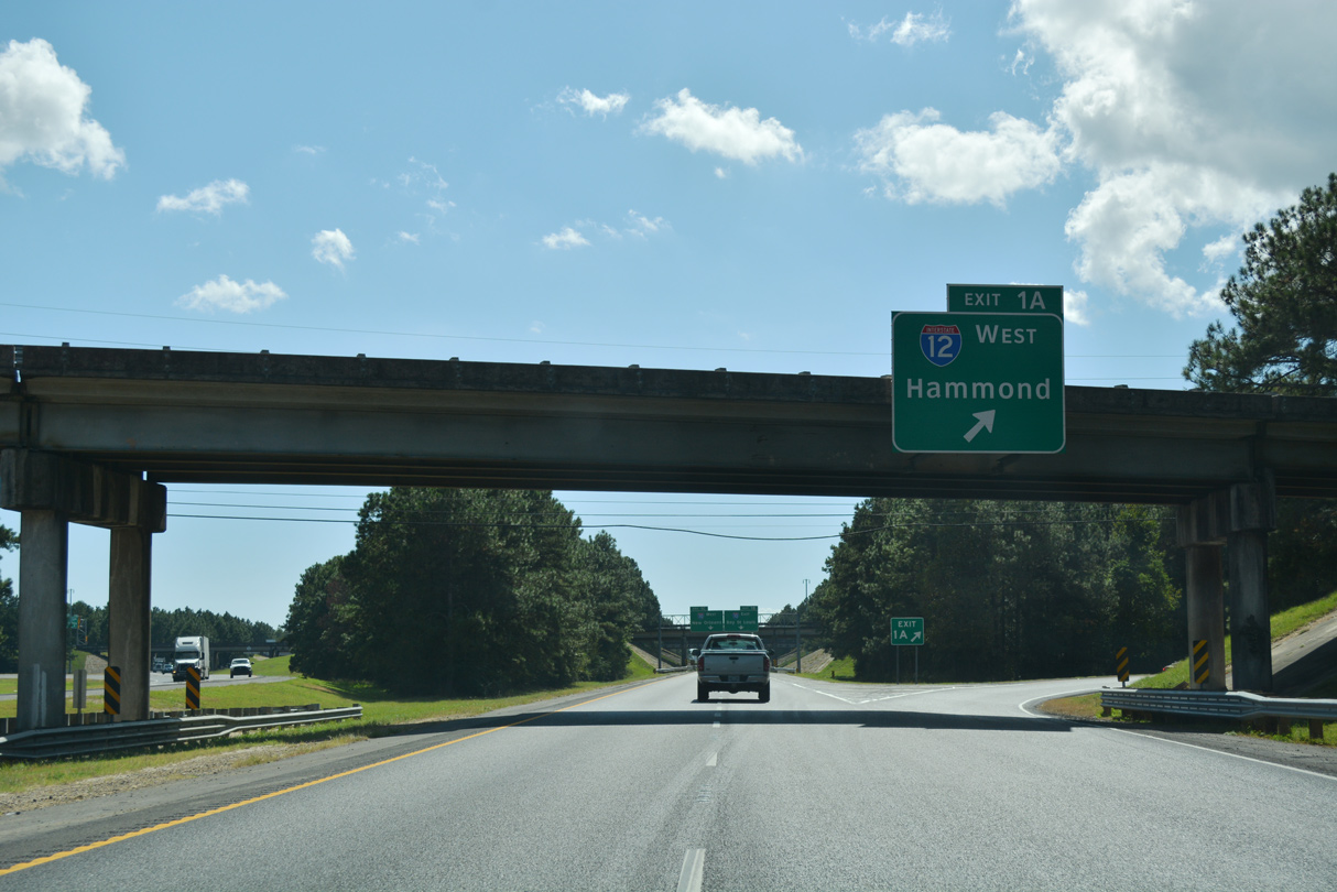
Exit 1A joins Interstate 12 west across the north side of Slidell. The intrastate route heads to Covington, Mandeville and other Northshore communities along Lake Pontchartrain. 10/12/16
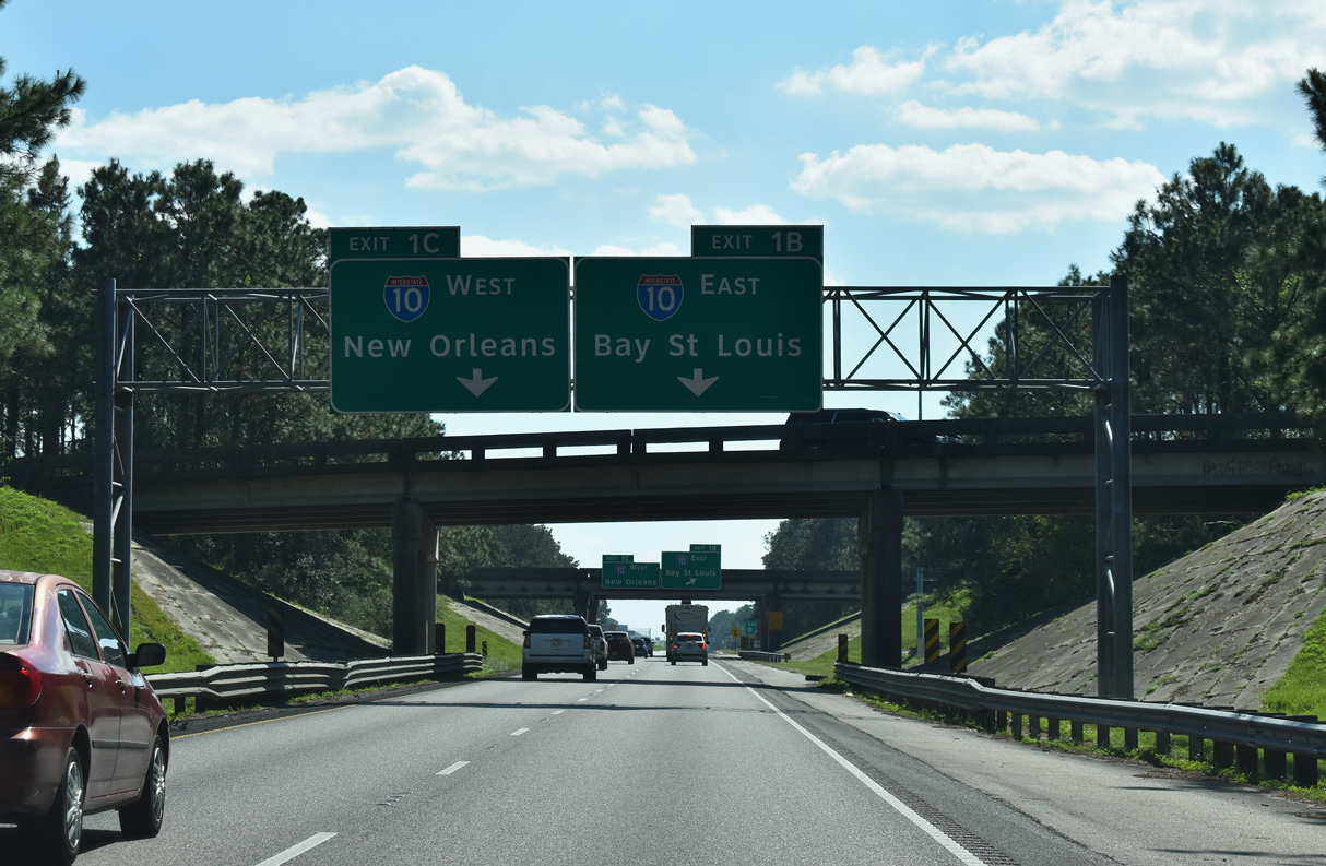
Beyond the departure of Exit 1A to I-12 west, Interstate 59 partitions into Exits 1 B/C for I-10 below the I-12 mainline. 10/08/21
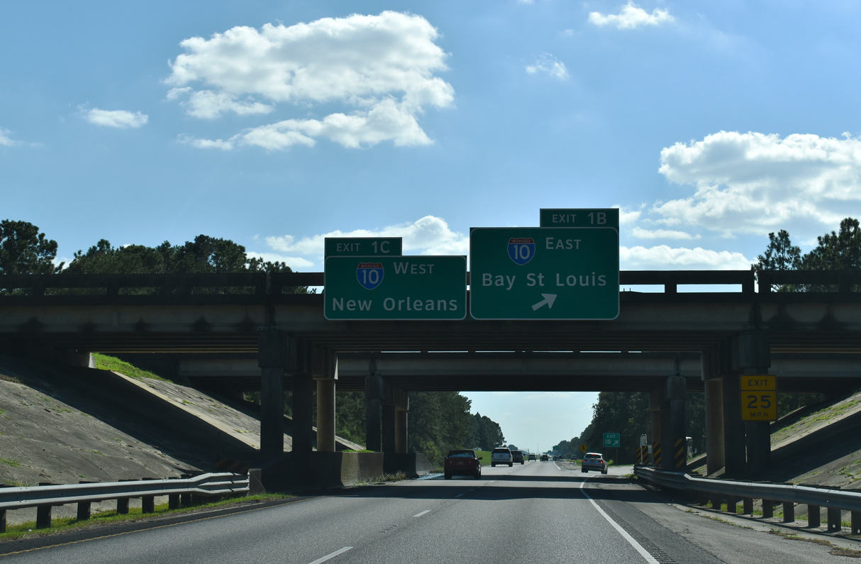
Travelers continuing south to New Orleans join three westbound lanes of Interstate 10 ahead of U.S. 190 (Gause Boulevard) in Slidell. Eastbound I-10 enters Mississippi seven miles from Exit 1 B. 10/08/21
![]() East at
East at ![]()
![]()
Eastbound I-10 meets U.S. 190 (Gause Boulevard) 1.5 miles ahead of I-12/59. Maintaining at least six overall lanes through the city of Slidell, Interstate 10 reduces to four lanes east of the exchange with I-12 and I-59. 05/11/22
Advancing north from U.S. 190, Interstate 59 north separates from the easterly turn of I-10 toward Bay Saint Louis, Mississippi. The greater Biloxi-Gulfport area and Mobile, Alabama fall within the next 100 miles along Interstate 10. 05/11/22
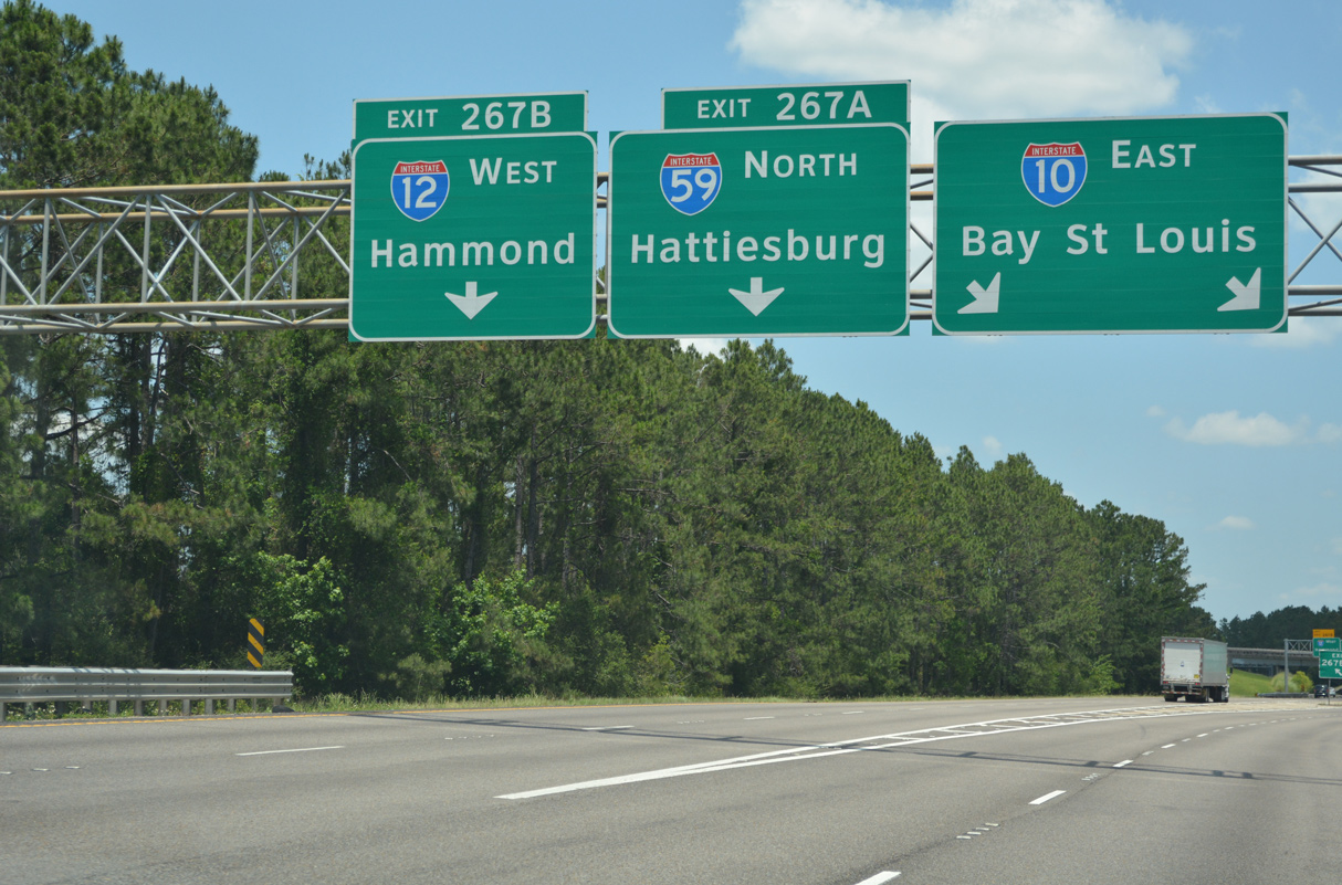
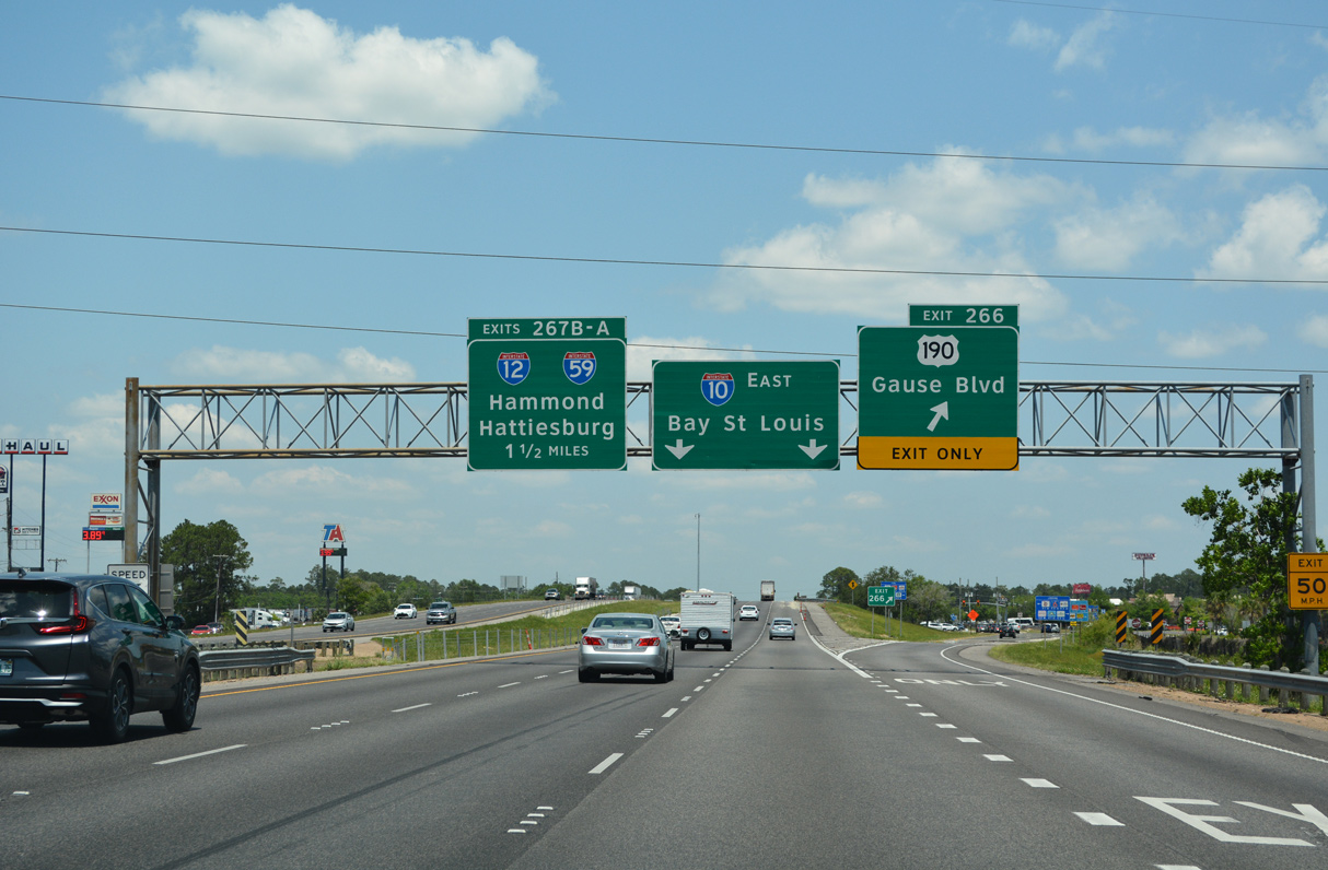
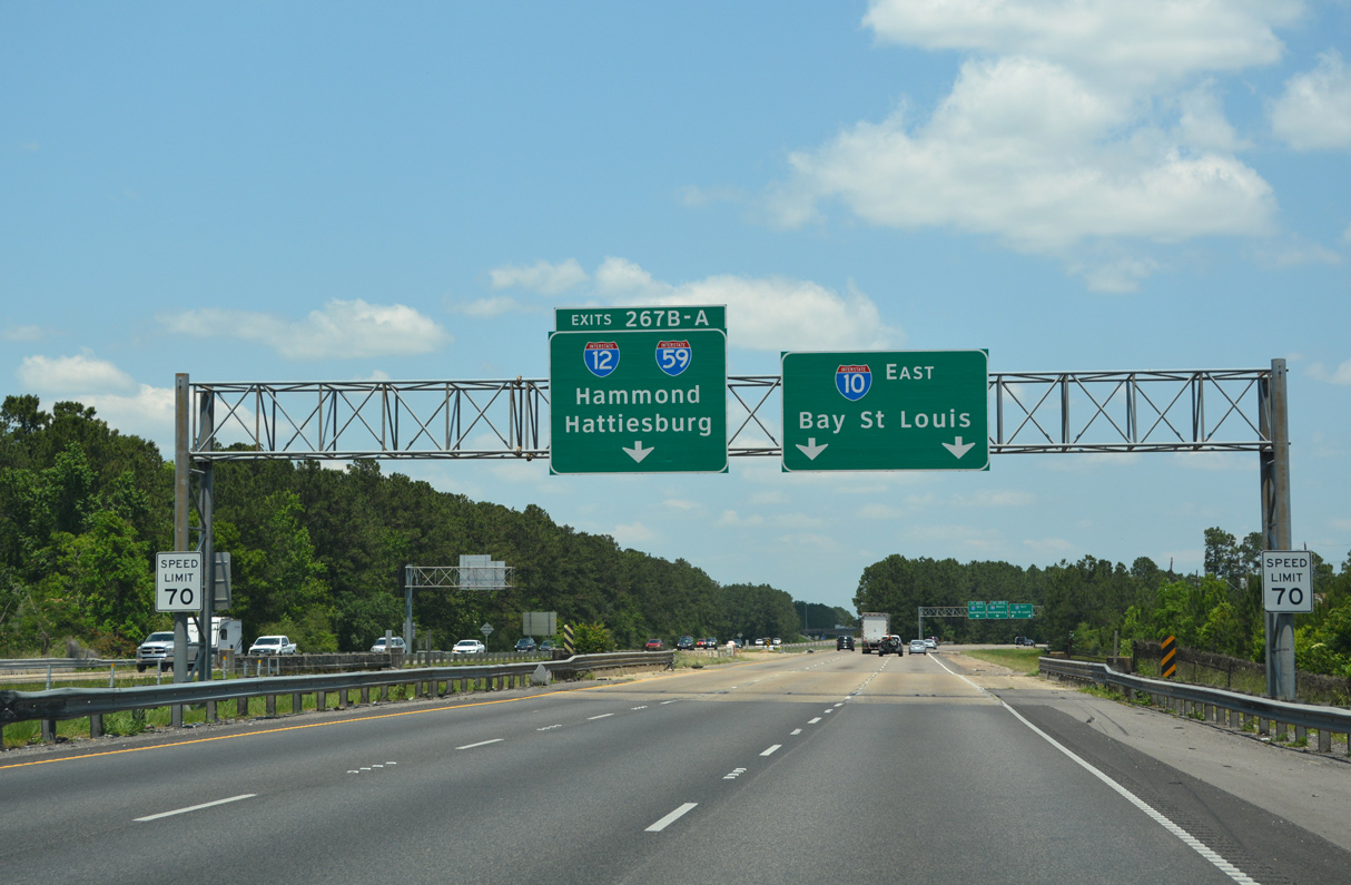
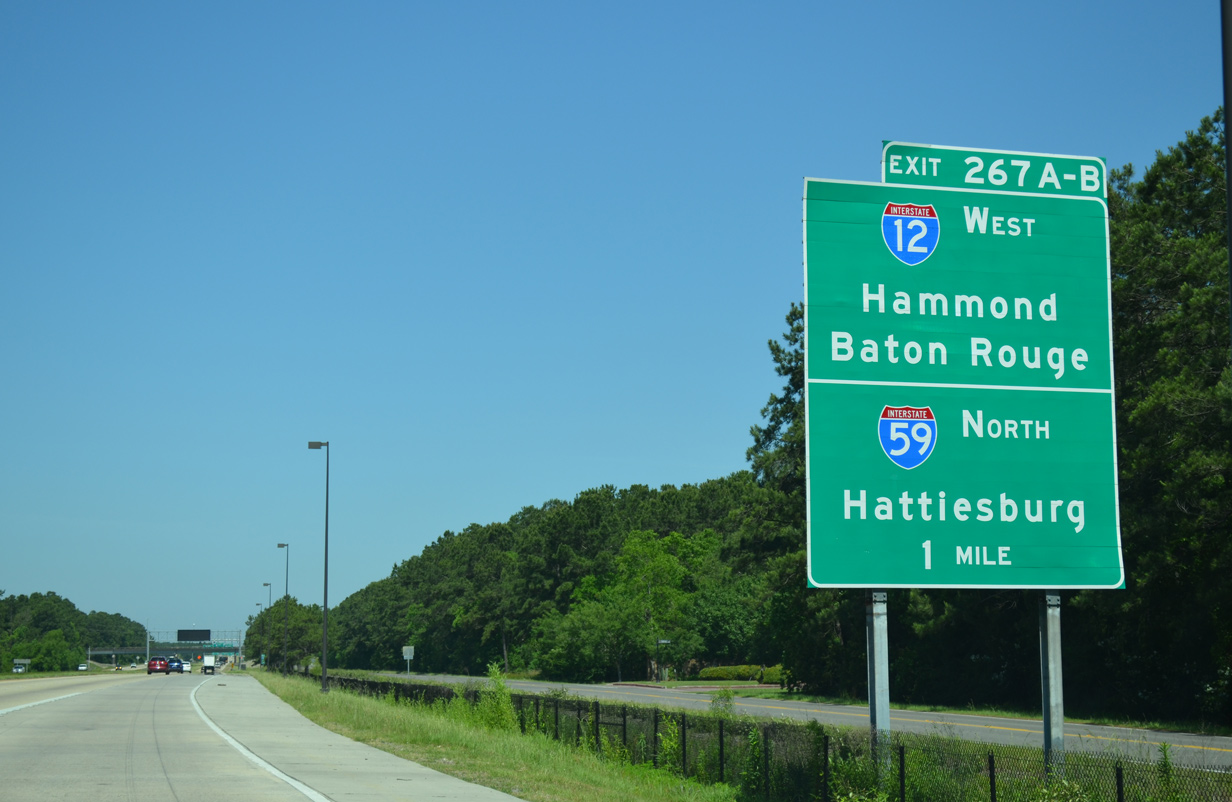
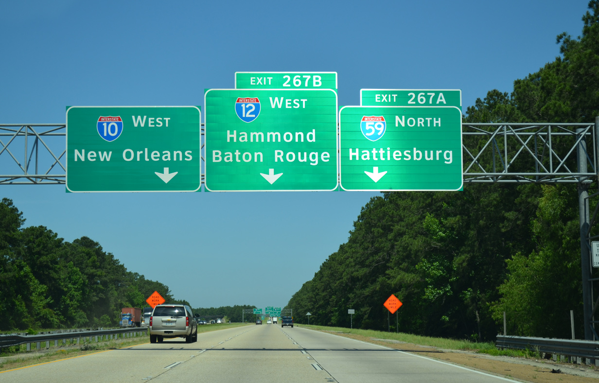
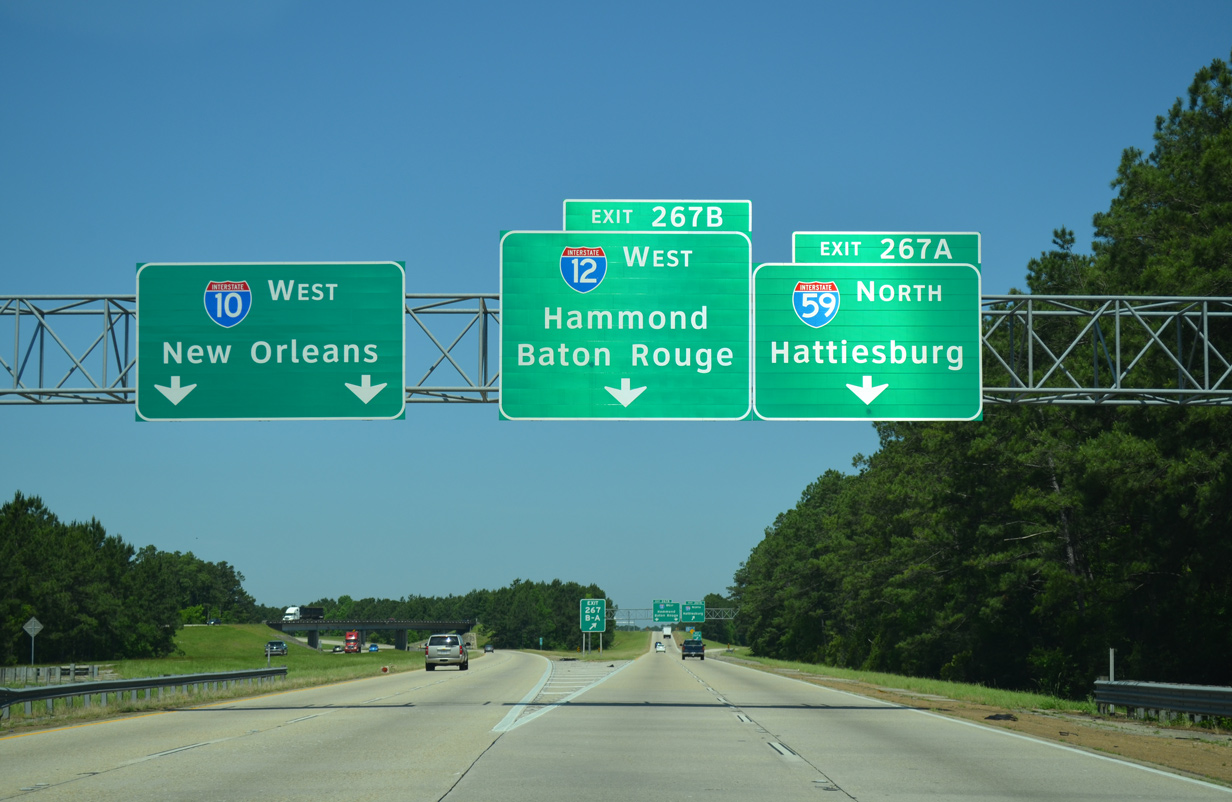
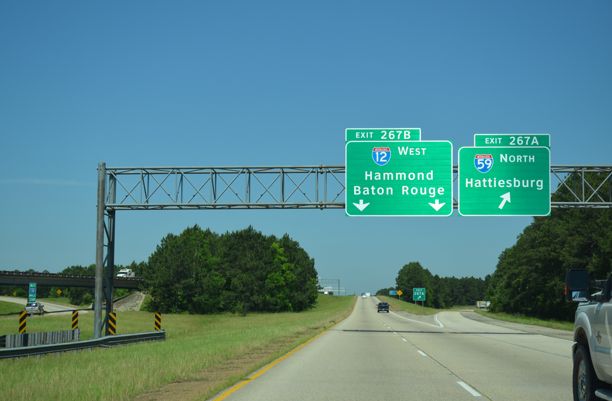
Two lanes depart from the left side of I-10 east for Exit 267A and the northbound beginning of I-59. Left Exit 267B follows from Interstate 59 for I-12 west to Hammond and Baton Rouge. 05/11/22
![]() East at
East at ![]()
![]()
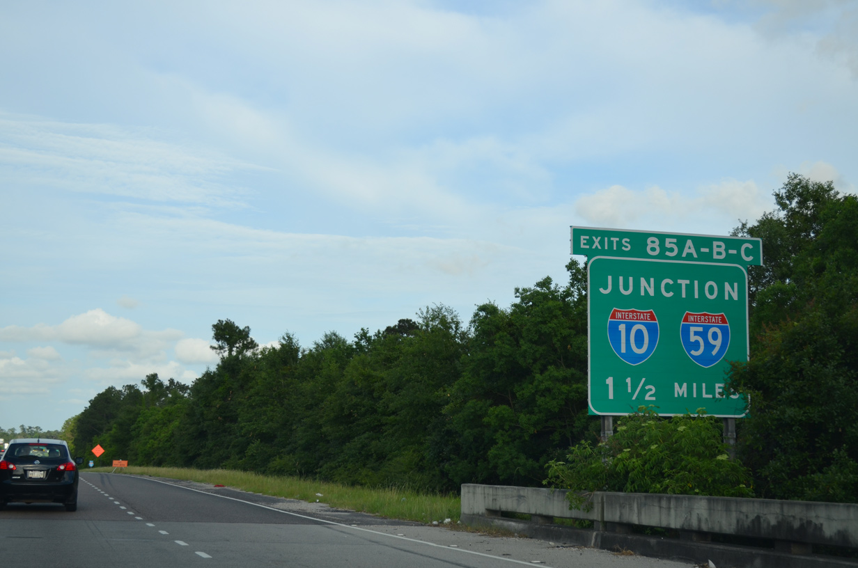
A loop ramp joins Interstate 12 east from U.S. 11, 1.5 miles ahead of the directional cloverleaf interchange with Interstates 10 and 59 north. 05/09/15
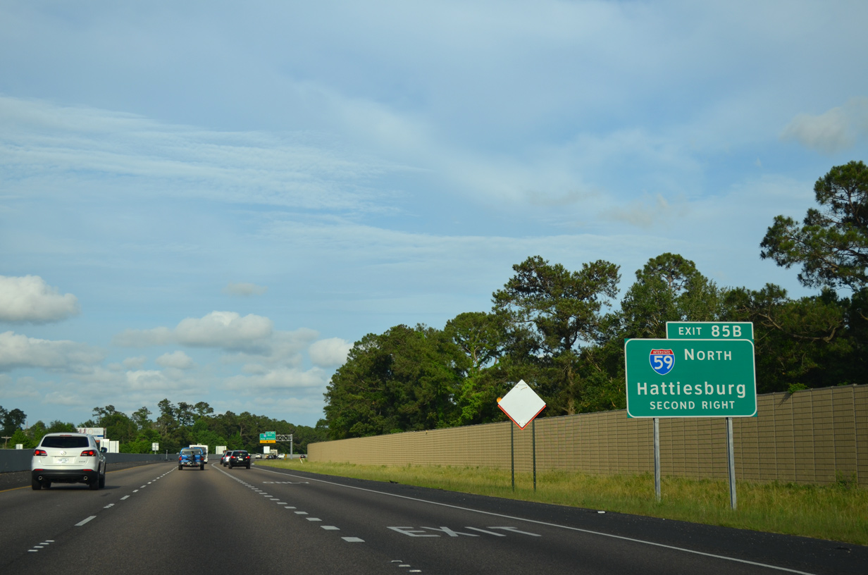
A lane drop for I-12 east occurs at the off-ramp (Exit 85A) for Interstate 10 leading back to New Orleans. Exit 85B follows as a loop ramp for the northbound beginning of Interstate 59. 05/09/15
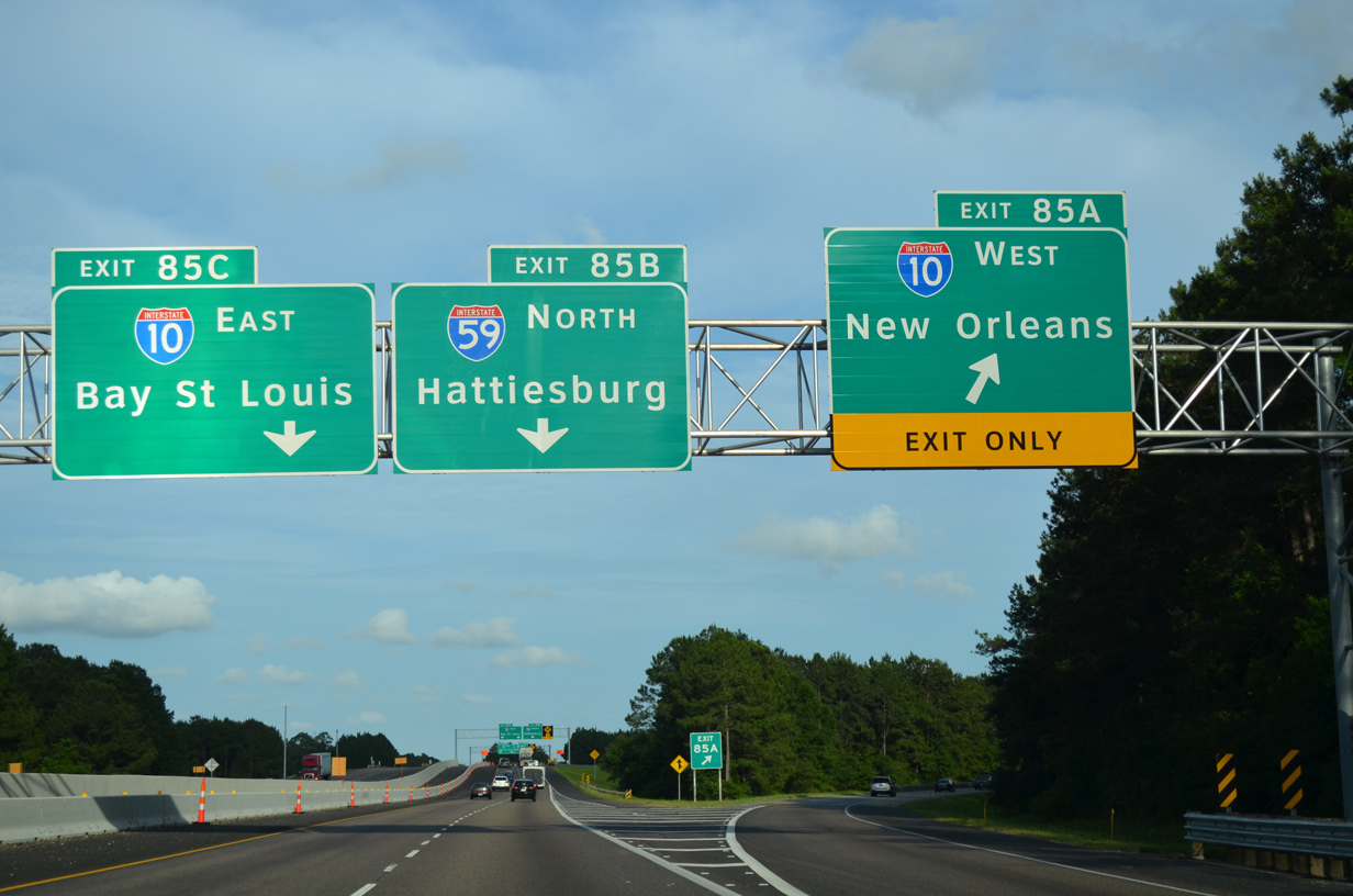
Traffic heading southwest along I-10 to New Orleans partitions from the final stretch of Interstate 12 east. A loop ramp (Exit 85B) to Interstate 59 north follows in one quarter mile. 05/09/15
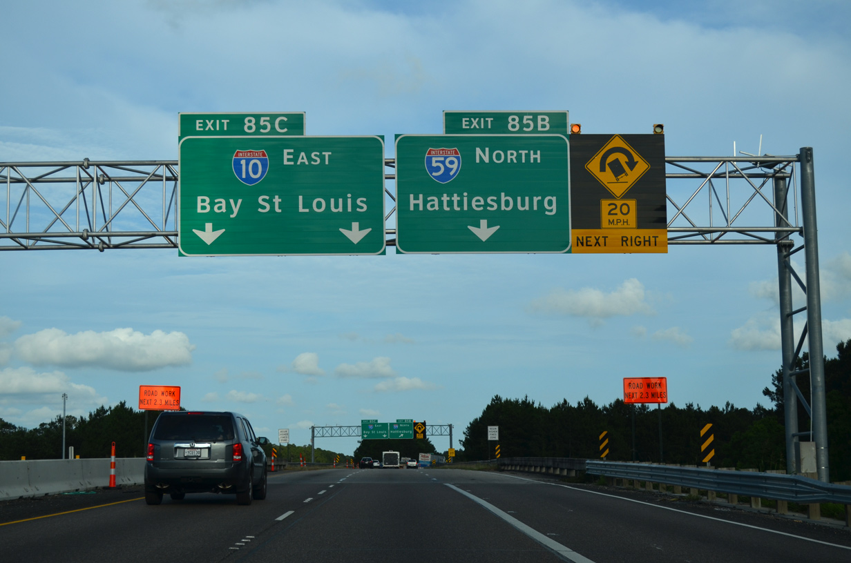
A loop ramp joins I-12 east from I-59 south ahead of the departure for Interstate 59 north. I-59 heads to industrial areas at Pearl River before plying across wetland areas associated with Pearl River Wildlife Management Area. 05/09/15
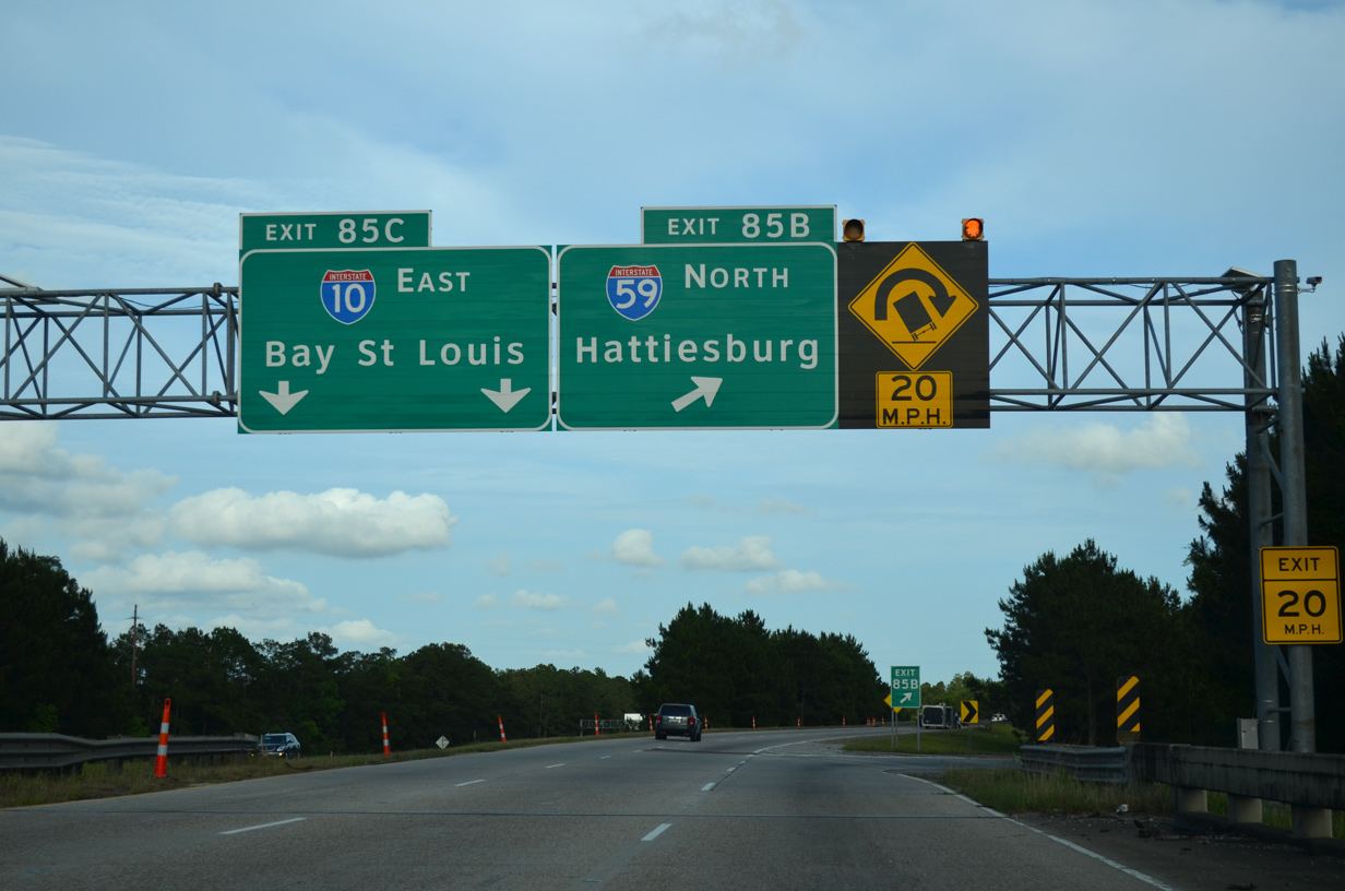
Interstate 12 east defaults onto the left side of I-10 east ahead of Harrison County, Mississippi. Interstate 59 north combines with U.S. 11 between Pearl River and Nicholson, Mississippi. 05/09/15
![]() West at
West at ![]()
![]()
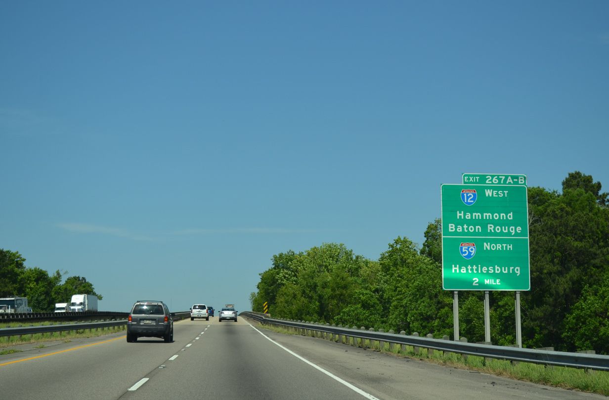
Spanning the West Pearl River, Interstate 10 continues two miles past the Louisiana Welcome Center to Exit 267 for I-12 west and I-59 north. 05/19/14
A frontage road appears along side I-10 leading west to LA 1090. LA 1090 arcs northwest to end at the first interchange along I-59, opposite U.S. 11 west to Pearl River and Alton. 05/19/14
Three lanes extend west from the Louisiana Welcome Center to the split of I-10/12 west (Exit 267B). I-10 curves southward from Slidell to New Orleans while I-12 straddles northern reaches of Lake Pontchartrain en route to Covington and Hammond. 05/19/14
I-10 and I-12 west partition on the north side of Slidell. The initial stretch of I-12 west links I-10 with the northbound beginning of Interstate 59. 05/19/14
Exit 267B departs I-12 west for Interstate 59 north to Pearl River and Picayune, Mississippi. U.S. 11 north merges with the freeway at Exit 3. The US route also meets Interstate 12 at Exit 1. 05/19/14
![]() North
North
Interstate 59 travels between several residential neighborhoods en route to Pearl River. Pictured here is the first northbound shield. 05/19/14
South End Throwback

Since removed, this sign bridge referenced the succeeding connections with Interstate 10 beyond Exit 1A to I-12 west. 08/20/01

Guide signs for I-12 and I-59 were replaced north from Exit 266 in 2000. U.S. 190 ends seven miles to the east of Interstate 10 at White Kitchen. Photo by Jeff Royston (05/27/00).
- “Interstate 59 – Realigned interstate trades hazardous history for a safer future.”
https://garverusa.com/markets/transportation/42/interstate-59/Infrastructure Quarterly, 2009 Volume 1 Issue 2. - Interstate Highway 59, Adam Froehlig.
- “Improving highway safety – Accidents down on I-24, I-59 after improvements, officials say.” Chattanooga Times Free Press (TN), September 14, 2004.
- “I-59/20 Bridge Project Update.” Alabama Department of Transportation (ALDOT) news release. January 19, 2020.
Page updated April 12, 2023.