Interstate 610 Texas
Overview
Known as the Loop or the 610 Loop, Interstate 610 constitutes the inner beltway for the city of Houston. The middle beltway is the Sam Houston Parkway / Tollway and Beltway 8. Further out from the city, Grand Parkway (SH 99) is the outer beltway around the Houston metropolitan area. The toll road forms a semicircle north from IH 69/U.S. 59 near Sugar Land to Tomball, east to IH 69 north of Humble, and south to SH 146 at Baytown.
Interstate 610 provides connectivity to metropolitan area freeways radiating out of Houston including U.S. 90 (Crosby Freeway), U.S. 290 (Northwest Freeway) and SH 288 (South Freeway) among the Interstate connections with IH 10, IH 45 and IH 69/U.S. 59. The 610 Loop is heavily traveled freeway varying between six to eight lanes with multi level systems interchanges at intersecting freeways.
 History
Plans in the 1950s assigned Loop 137 along the southern, western, and northern portions of the beltway encircling Houston. The eastern section and the bridge across the Houston Ship Channel were not included in the Loop 137 plans.1 Interstate 610 was part of the Texas urban Interstate numerology approved by the American Association of State Highway Officials (AASHO) on November 10, 1958. IH 610 was outlined as a nearly complete beltway replacing Loop 137 with the exception of the southeastern quadrant, between IH 45 and IH 10.
IH 610 was approved by the Texas State Highway Commission on October 16, 1959. The missing link between IH 10 in east Houston to IH 45 in southeast Houston was approved as IH 610 by the commission on September 17, 1962. That section was formally added to the Interstate Highway system by AASHO on June 30, 1970. The entire loop along Interstate 610 was open to traffic by 1975.1
Route Information
East End – Houston, TX
West End – Houston, TX
Mileage – 37.97 (37.93*)
Cities – Houston, Bellaire, Jacinto City, Galena Park
- Junctions –

Source: December 31, 2021 Interstate Route Log and Finders List
Texas Department of Transportation (TxDOT) Statewide Planning Map
I-610 Annual Average Daily Traffic (AADT)
Source: 2017 AADT – Texas Department of Transportation (TxDOT) Statewide Planning Map
 Photo Guides
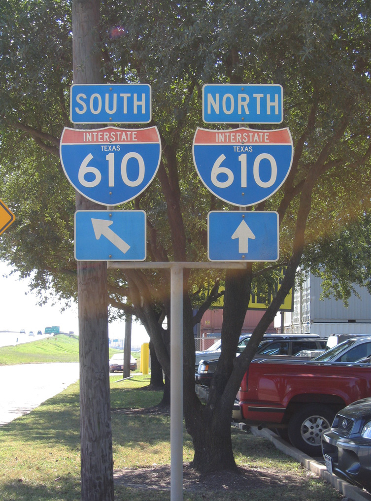
East End  – Houston, Texas
![]() North at
North at ![]()
![]()

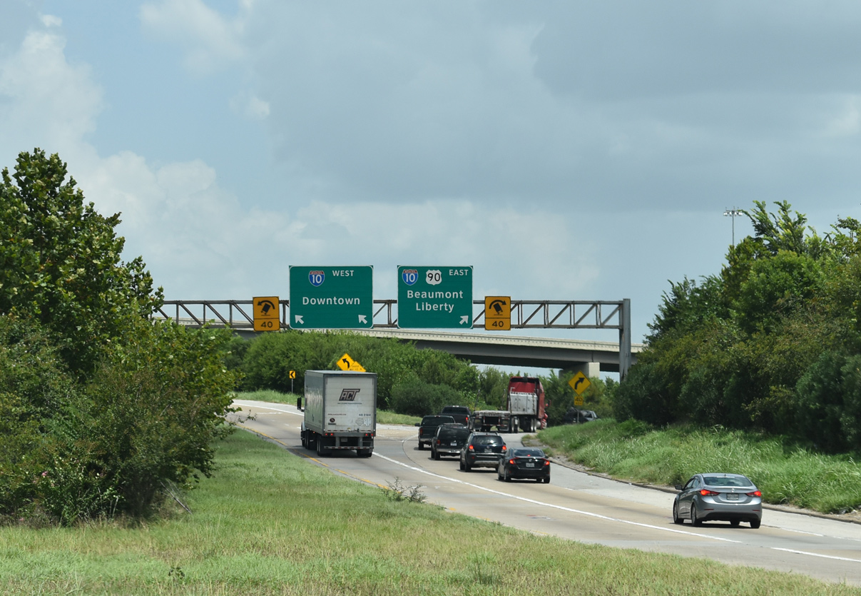
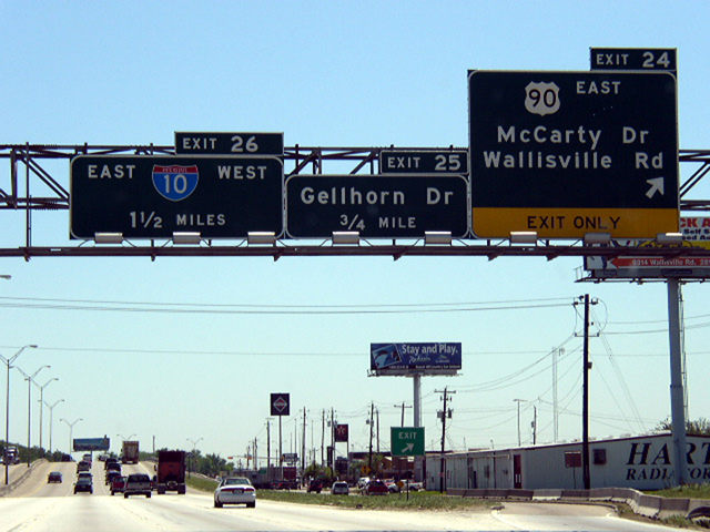
IH 610 heads north through the Clinton Park Tri-Community from Clinton Drive (Exit 28) to IH 10/U.S. 90 (Exit 26 A). 08/07/19
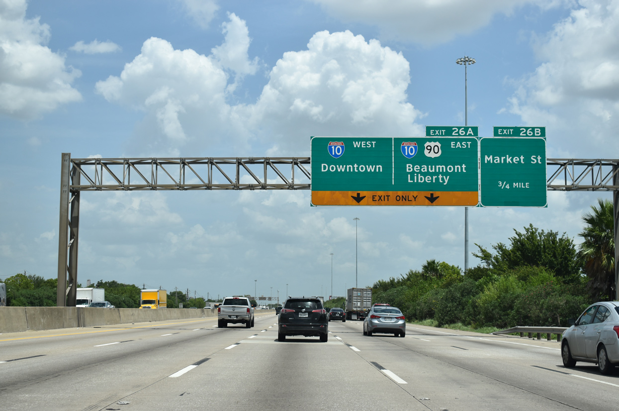
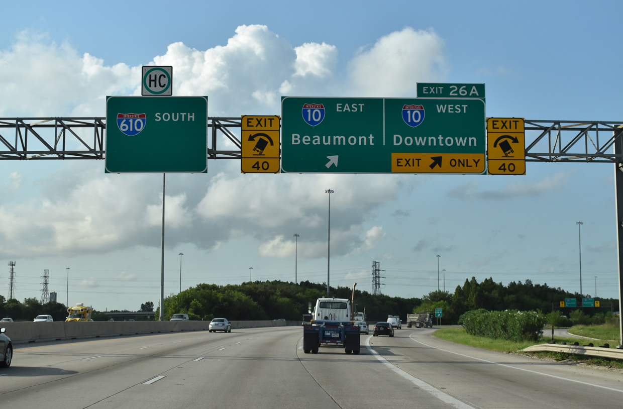
A half diamond interchange (Exit 26 B) with Market Street to Jacinto City precedes Exit 26 A for IH 10 west to Downtown Houston, IH 10 east to Beaumont and U.S. 90 (Crosby Freeway) east to Liberty. 08/07/19
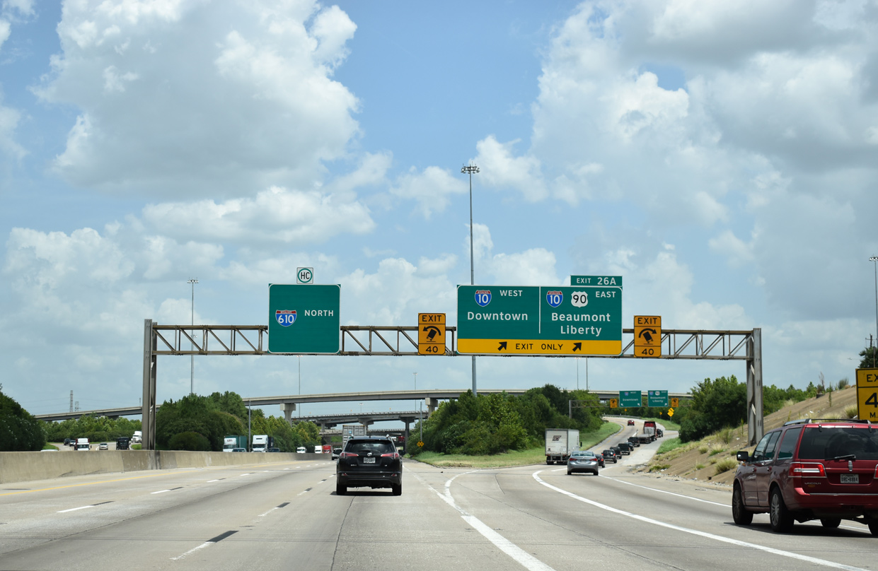
Exit 26 A departs for IH 10 and U.S. 90 (Crosby Freeway). IH 610 makes a northwesterly turn beyond this exchange to U.S. 90 Business (McCarty Drive). 08/07/19
A slip ramp connects the eastbound on-ramp for IH 10 with the departing Crosby Freeway (U.S. 90). The Crosby Freeway was completed here in 2011. 08/07/19
![]() North at
North at ![]()
![]()
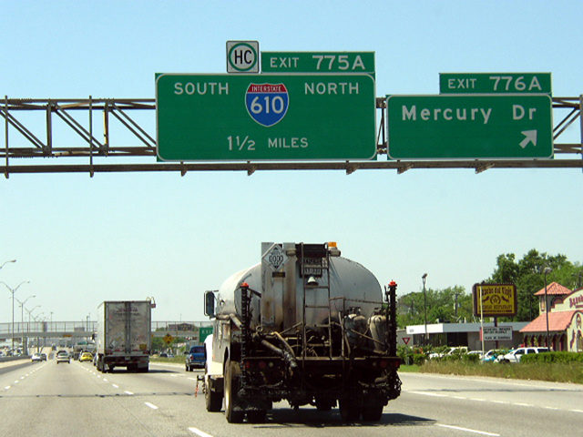
Button copy signage at Exit 24, where U.S. 90 formerly combined with IH 610 south to IH 10 west. Photo by Chris Patriarca (04/08/03).
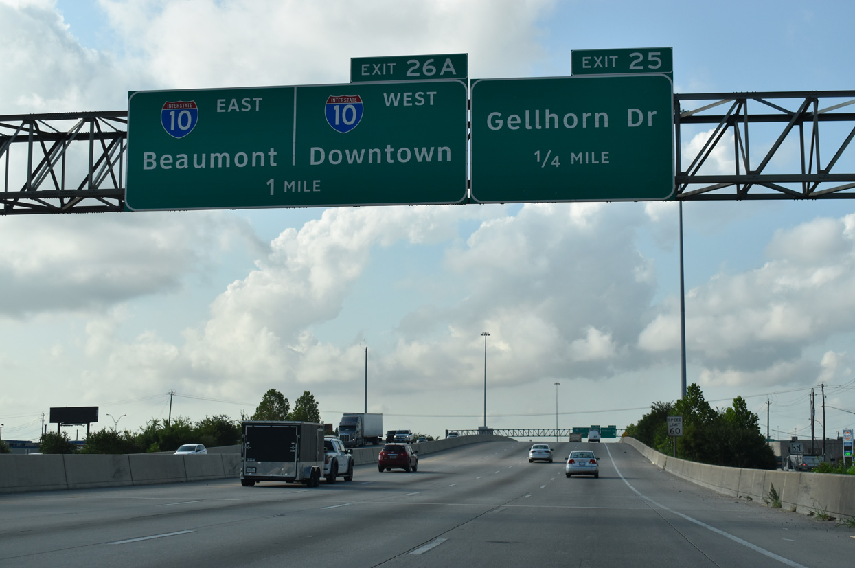
Traveling between the Pleasantville Area and Northshore neighborhood in Houston, IH 610 meets Gellhorn Drive and IH 10 over the succeeding mile. 08/02/19
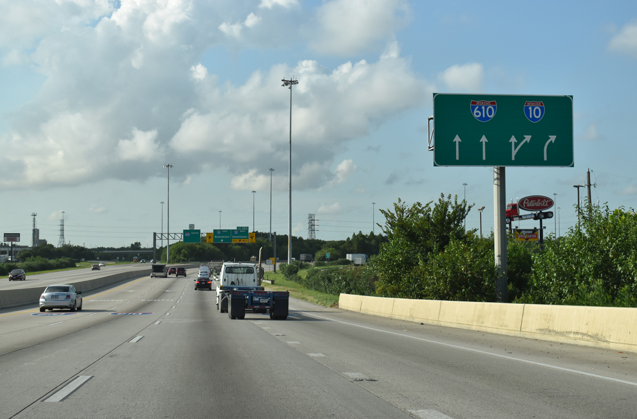
Predecessors to the modern arrow per lane (APL) signs found throughout the Interstate Highway system are used in the Houston area at freeway junctions. 08/02/19
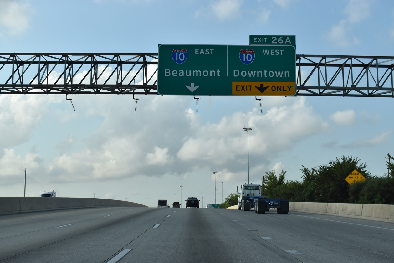
Exit 26 A for IH 10 departs from IH 610 southbound. There is no access to the Crosby Freeway from this direction. 08/02/19
![]()
![]() East at
East at ![]()
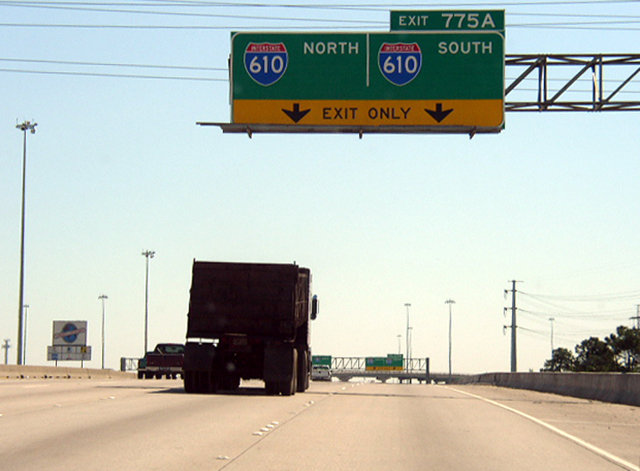
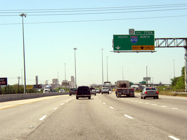
Entering the four level interchange (Exit 775 A) with IH 610 prior to the addition of ramps (Exit 775 B) with U.S. 90 (Crosby Freeway). U.S. 90 branches northeast from an unmarked overlap to Liberty. Photo by Chris Patriarca (04/09/03).
Exit 775 A partitioned for IH 610 north six miles to IH 69/U.S. 59 and south six miles to IH 45. Photo by Chris Patriarca (04/09/03).
![]() West at
West at ![]()
![]()
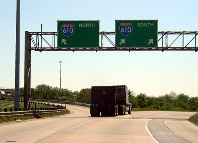
IH 10 runs along the north side of the Jacinto City line ahead of IH 610 (Exit 775 A) and the overlap with U.S. 90 (Crosby Freeway). Photo by Chris Patriarca (04/09/03).
IH 10 runs along the north side of the Jacinto City line ahead of IH 610 (Exit 775A) and the merge with U.S. 90 (Crosby Freeway). Photo taken by Chris Patriarca (04/09/03).
West End – Houston, Texas
![]()
![]() West at
West at ![]()
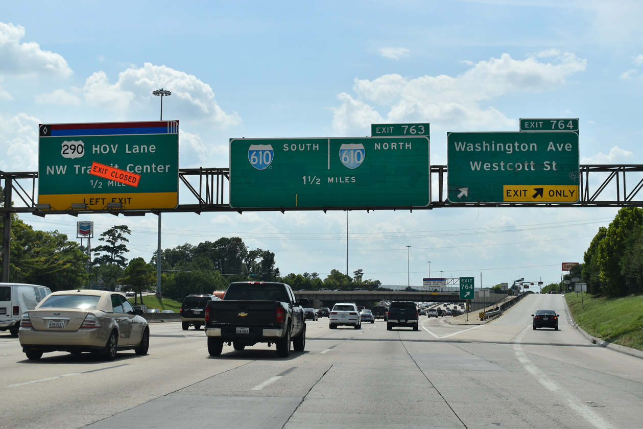
Westbound IH 10 (Katy Freeway) at Exit 764 to Washington Avenue and Westcott Street. IH 610 follows in 1.5 miles. 08/02/19
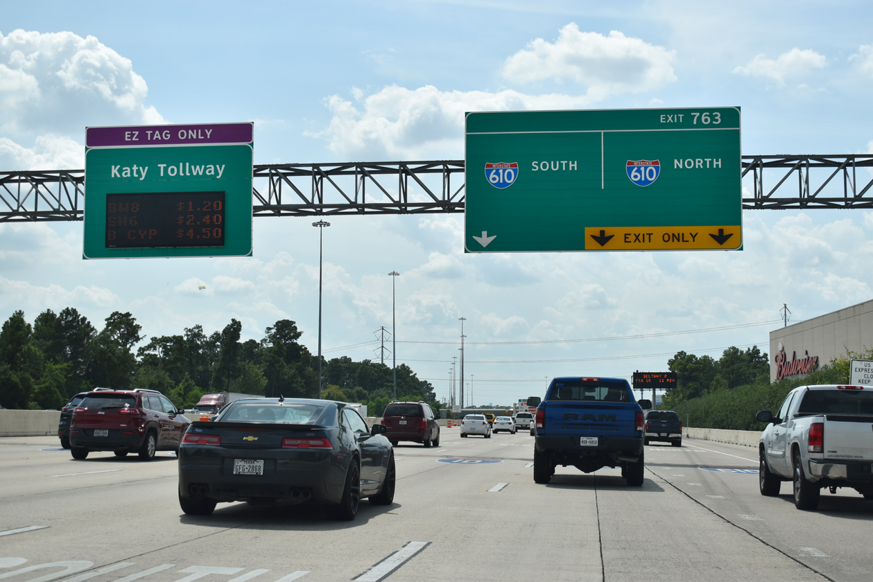
The entrance to the Katy Tollway lies just beyond the three lane off-ramp at Exit 763 for IH 610 from IH 10/U.S. 90 westbound. 08/02/19
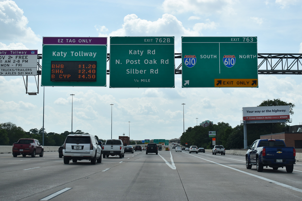
IH 10/U.S. 90 continues west to the suburbs of Addicks and Katy while IH 610 connects with U.S. 290 at Central Northwest and IH 69/U.S. 59 (Southwest Freeway) at Greater Uptown in Houston. 08/02/19
![]() North at
North at ![]()
![]()
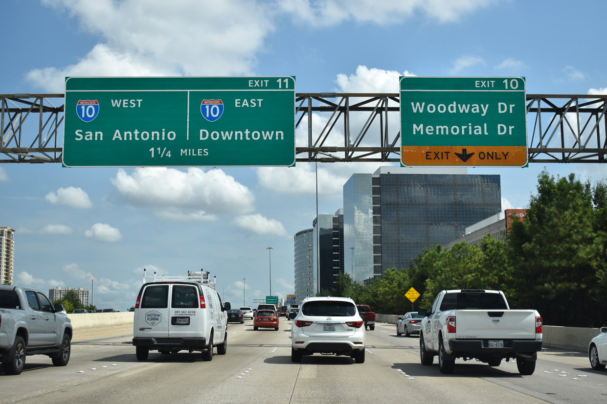
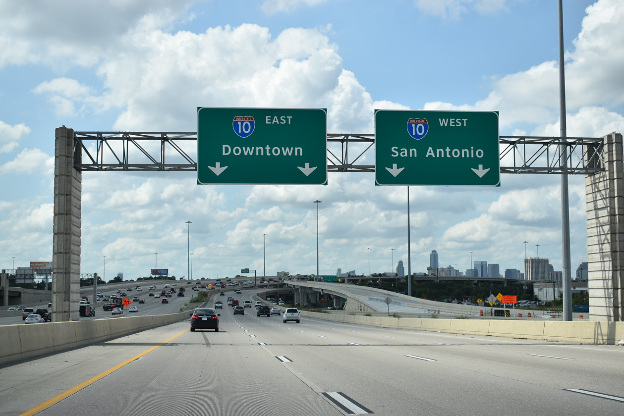
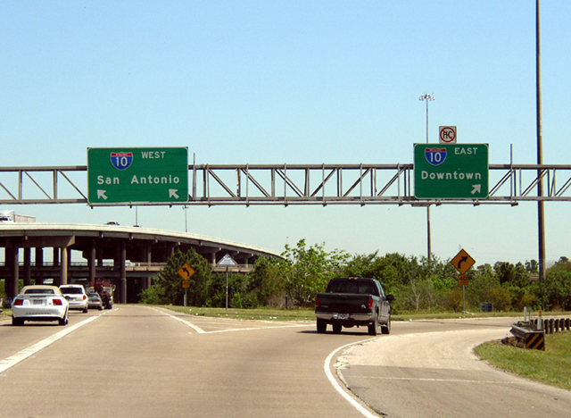
The West Loop of IH 610 runs along a viaduct system between Greater Uptown and Memorial Park in Houston toward the multi level interchange (Exit 11) with IH 10/U.S. 90 (Katy Freeway). 08/02/19
![]() South at
South at ![]()
![]()
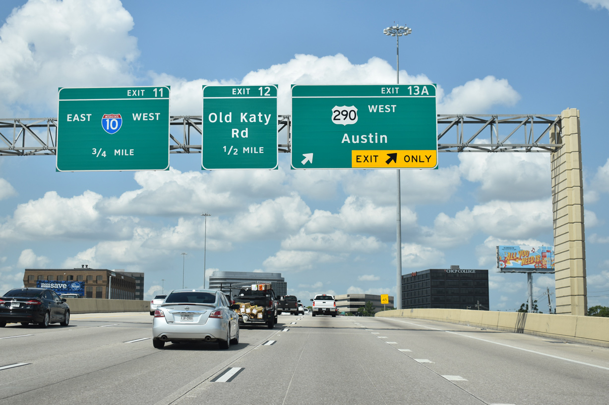
Heading south from U.S. 290 (Northwest Freeway) toward IH 10, Loop 610 passes through the Lazy Brook / Timbergrove community in Houston. 08/02/19
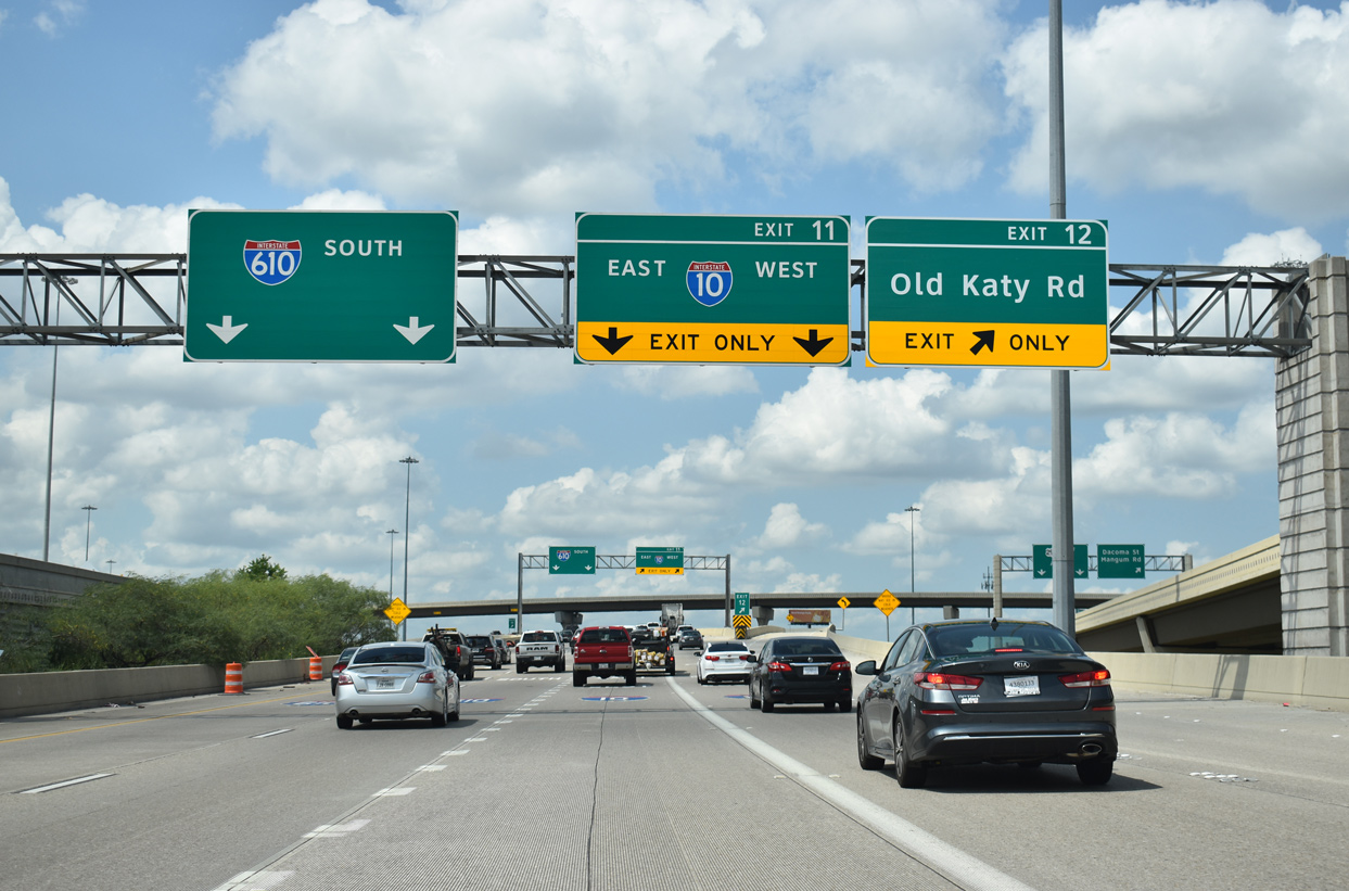
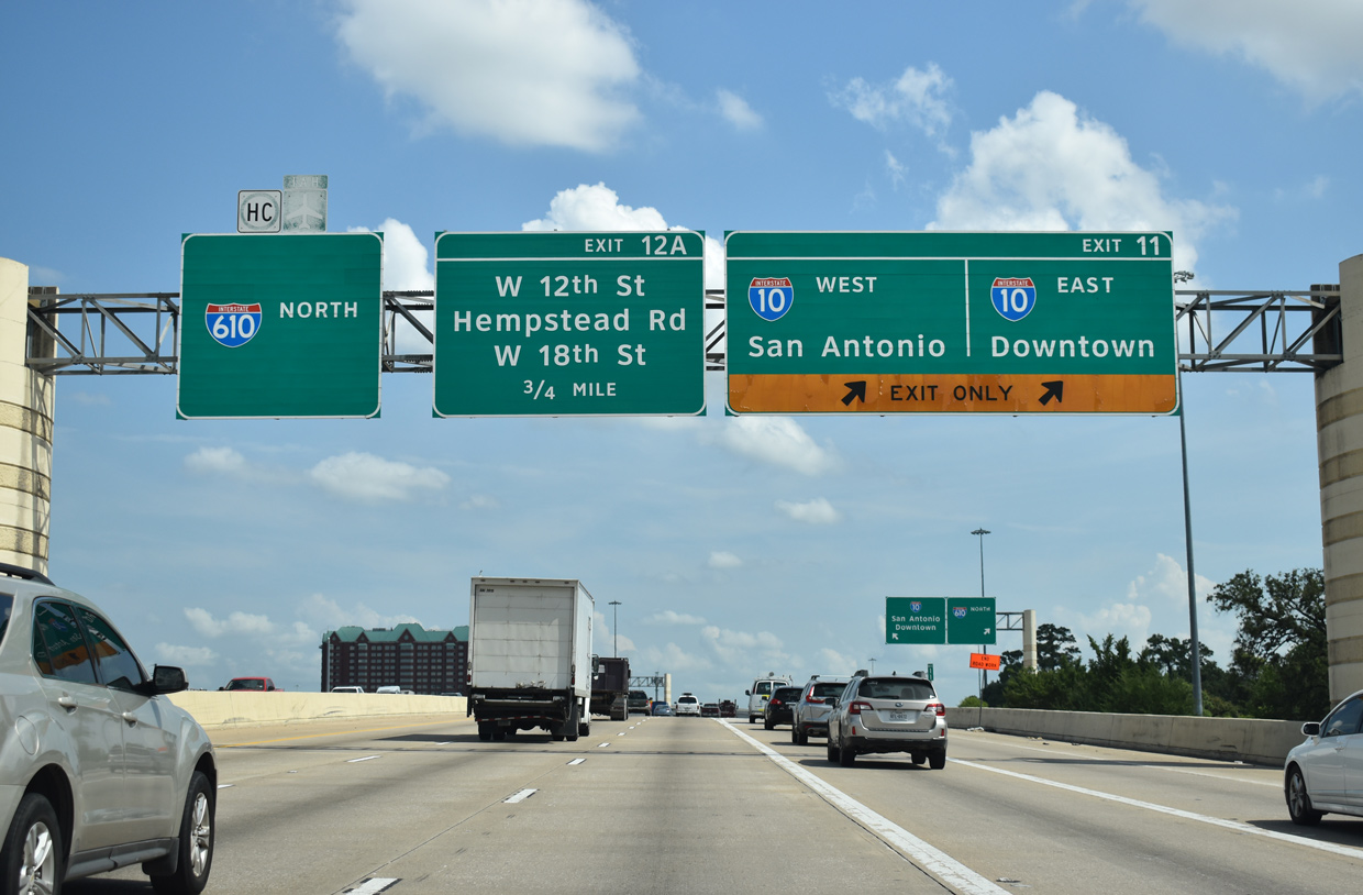
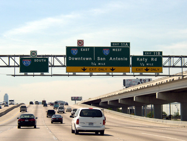
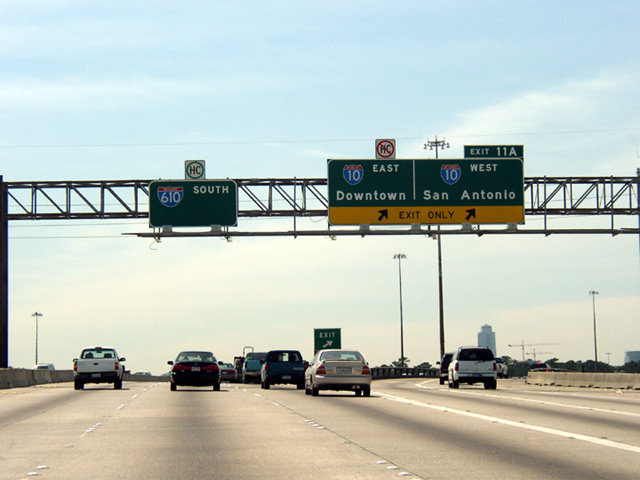
Exits 12 and 11 comprise lengthy ramp systems joining IH 610 south with Old Katy Road (old U.S. 90) and IH 10 (Katy Freeway) at the Spring Branch East area of Houston. 08/02/19
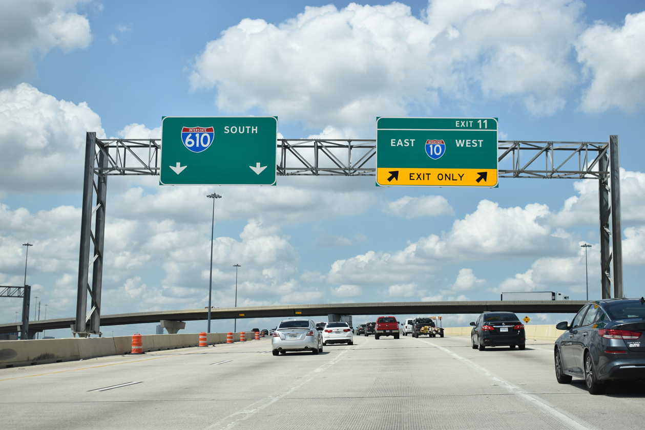
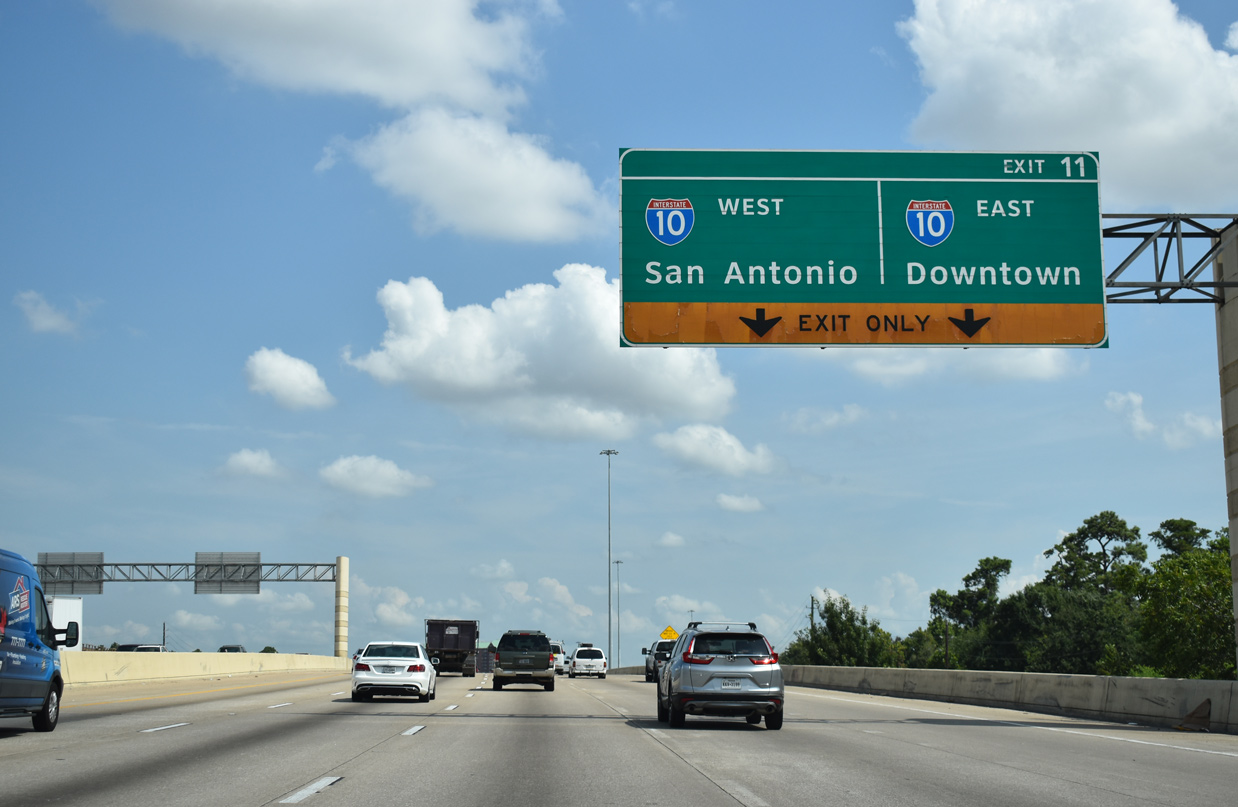
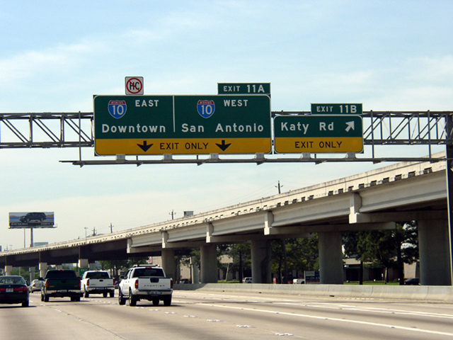
Exit 11 splits with IH 610 south along a distributor roadway extending 1.5 miles from U.S. 290 to the Katy Freeway. 08/02/19
The beltway separates into four roadways between the systems interchanges with U.S. 290 (Northwest Freeway) and IH 10/U.S. 90 (Katy Freeway). 08/02/19
 West End Throwback
 east at IH 610 – 2003")
 east at IH 610 – 2003")
 east at IH 610 – 2003")
 east at IH 610 – 2003")
 east at IH 610 – 2003")
Leading to IH 610 along IH 10/U.S. 90 eastbound prior to the 2003-08 reconstruction of the Katy Freeway. Photos by Chris Patriarca (04/10/03).
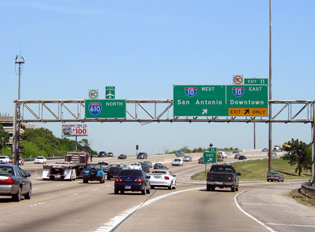
IH 610 north at the previous departure of Exit 11 for IH 10 east to Downtown Houston and west to San Antonio. Reconstruction of IH 610 at IH 10 shifted the departure of Exit 11 a half mile further north. Photos by Chris Patriarca (04/10/03).


The Katy Freeway reconstruction expanded westbound IH 10 to four general travel lanes with a tolled express lane from the previous two lanes at the four level interchange with IH 610. Photos by Chris Patriarca (04/10/03).
Exit 11B departed IH 610 south for Katy Road below the former flyover bringing traffic from U.S. 290 eastbound onto the beltway. Photo by Chris Patriarca (04/10/03).
IH 610 was completely reconstructed between the east end of U.S. 290 (Northwest Freeway) and IH 10 (Katy Freeway). Photos by Chris Patriarca (04/10/03).
Sources:
- “From Anywhere to Everywhere: The Development of the Interstate Highway System in Texas.” Texas Transportation Institute, pages 29 and 38.
http://tti.tamu.edu/interstate_anniversary/white_paper/
Page updated June 6, 2022.