

California 111 North - Calexico to Interstate 8
| California 111 north | |
|---|---|
 |
Upon entering the United States after leaving Mexico and the International Border Crossing inspection station, a small park appears on the east side of California 111 (Imperial Avenue) as the roadway begins its northward journey into Calexico. Within this small park is a welcome sign for the City of Calexico. Photo taken 01/27/06. |
 |
A fountain is also located within this park, although it is a bit difficult to see from the northbound lanes of California 111. Photo taken 01/27/06. |
 |
A Welcome to California sign is posted along the left side of northbound California 111. The first right turn is for First Street east to the U.S. Customs, while the first traffic signal on northbound is with Second Street east to downtown and west to the airport. Photo taken 01/27/06. |
 |
Almost immediately, California 111 enters the urban sprawl of businesses that line the road from the border north to California 98. Traffic is typically congested along California 111 through here, and it can be difficult to get through the commercial strip due to the number of people entering and exiting the state route. Photo taken 01/27/06. |
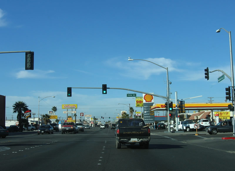 |
California 111 meets its second traffic signal at Fifth Street. Use Fifth Street east to the civic center of Calexico as well as Rockwood Plaza, police station, and fire station. Photo taken 01/27/06. |
 |
Use Seventh Street east to Aurora High School. More gas stations, restaurants, and car dealerships lie ahead on California 111. Photo taken 01/27/06. |
 |
Northbound California 111 meets Eighth Street at this traffic signal. Photo taken 01/27/06. |
 |
A California 111 shield is posted at this intersection with Ninth Street. Photo taken 01/27/06. |
 |
This mileage sign provides the distance to San Diego (122 miles) via westbound California 98 and Yuma (54 miles) via eastbound California 98. Continue straight ahead to El Centro (11 miles via California 111 north and Interstate 8 west). Photo taken 01/27/06. |
 |
Northbound California 111 meets east-west California 98 at the Birch Street intersection. California 98 runs parallel to Interstate 8, offering a more direct route in and out of Calexico to points east and west. A reassurance shield is posted immediately after California 98; it marks the beginning of the limited access expressway. Photo taken 01/27/06. |
 |
Here is another view of the first reassurance shield north of California 98 (Birch Street). Photo taken 03/26/06. |
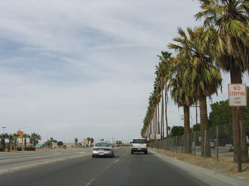 |
The dynamics of California 111 begin to change almost immediately. The city street converts into an expressway, with palm trees separating the main highway from the frontage roads. Access is permitted only at signalized intersections spaced at approximate one-mile intervals between California 98 and California 78. Photo taken 03/26/06. |
 |
California 111 also becomes a divided highway, which remains the design feature for California 111 for the entire expressway segment between Calexico and Brawley. Even as it passes Heber, El Centro, and Imperial, California 111 retains at least four lanes and is separated by a median barrier. Photo taken 03/26/06. |
 |
This mileage sign provides the distance to Heber, Brawley, and Indio. The expressway extends past Heber, El Centro, Imperial, and Brawley, a distance of 23 miles. Most of this expressway north of Interstate 8 is concrete, with sections near Brawley complete and open to traffic in 2005-2006. Photo taken 03/26/06. |
 |
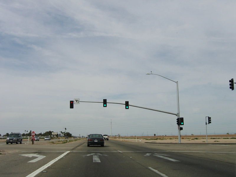
The first traffic signal since the California 98 intersection is with Cole Road. The frontage roads curve away from the expressway, which allows for a relatively easy upgrade of the expressway to a freeway if warranted in the future. Cole Road travels east-west across northern Calexico. Photo taken 03/26/06. |
 |
As California 111 leaves Calexico, it crosses the Central Main Canal after the Cole Road intersection. The two frontage roads (Yourman Road to the east and Old U.S. 99/Scaroni Road to the west) continue to flank California 111 on either side. The old alignment of U.S. 99 continues to parallel California 111 on these frontage roads. Photo taken 03/26/06. |
 |
Northbound California 111 gains enough elevation after leaving Calexico (el. -8 feet) to reach Sea Level. Photo taken 03/26/06. |
 |
The last intersection along northbound California 111 that is still within the city limits of Calexico is with Jasper Road, which is almost exactly one mile north of Cole Road. Photo taken 03/26/06. |
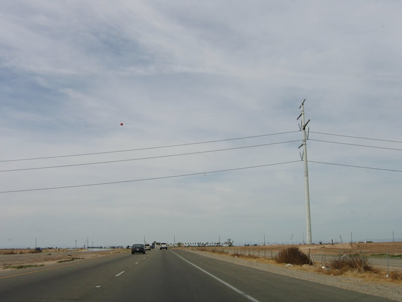 |
The 500-kV power line that crosses Imperial Valley passes over California 111 just north of the Calexico city limits. The power line brings power from Arizona east toward San Diego and interconnects with power lines originating in Mexico. Photo taken 03/26/06. |
 |
About 1.5 miles north of Jasper Road is the next intersection along northbound California 111. This intersection marks the junction with California 86, another major Imperial Valley highway. Although not as long as California 111, California 86 carries just as much if not more importance, especially north of Brawley. While California 111 is the express route from Calexico to Brawley, California 86 becomes the express route from Brawley northwest to Indio. As of April 2006, only the proposed expressway connecting California 111 and California 86 around Brawley is unconstructed. Otherwise, travelers can expect a four-lane expressway trip from Calexico north to Indio and the Coachella Valley. Photo taken 03/26/06. |
 |
This mileage sign provides the distance to Interstate 8 and Brawley. For both of these destinations, California 111 is recommended. To Heber, California 86 is the best route. To El Centro, either California 111 or California 86 is a good way to go. Photo taken 03/26/06. |
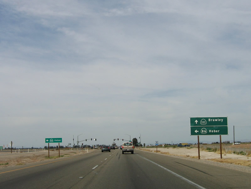 |
Northbound California 111 approaches Heber Junction. At this traffic signal, California 86 departs from California 111, then travels west to Heber and north to El Centro and Imperial. For through traffic to Brawley, use California 111 north (even though California 86 goes there too, it takes longer). Historic U.S. 99 departs from California 111 at this intersection. The old alignment curves away from the expressway, and the old road can be seen cutting to the west toward Heber. Photo taken 03/26/06. |
 |
Use the left lane to turn west onto California 86 (Heber Road); the two main lanes continue north toward Interstate 8 and Brawley. Photo taken 03/26/06. |
 |
Northbound California 111 and California 86 split at the intersection with Heber Road. This intersection marks the southern terminus of California 86. Historic U.S. 99 turns west to follow California 86 toward the town of Heber, then turns north to serve the city of El Centro. Photo taken 03/26/06. |
 |
This reassurance shield for California 111 north is posted after the Heber Road (California 86) intersection. Photo taken 03/26/06. |
 |
The next intersection (McCabe Road, about 1.5 miles north of California 86) was closed at the time this photo was taken. To the west is the new mall of Imperial Valley (on Imperial County S-31), which has generated traffic. It is not clear if the intersection is being reconfigured to allow additional access to that relatively new development. Photo taken 03/26/06. |
 |
Continuing about a mile north, the Chick Road intersection was also closed at the time this picture was taken. Again, this might be related to the large-scale developments occurring to the west. Photo taken 03/26/06. |
 |
The next interchange along California 111 is the junction with Interstate 8. This major east-west freeway bisects the Imperial Valley, offering the main route east to Arizona and west to San Diego and the coast. Originating near Mission Bay in San Diego, Interstate 8 passes through Mission Valley, La Mesa, and El Cajon before crossing the Cuyamaca Mountains and Cleveland National Forest. The freeway descends through Mountain Springs and In-Ko-Pah Gorge before entering the desert, passing through the irrigated fields in and around El Centro. Photo taken 03/26/06. |
 |
Northbound California 111 approaches a cloverleaf interchange with Interstate 8. Traveling east, Interstate 8 continues through irrigated fields for several miles. The freeway re-enters arid lands near the Highline Canal. Continuing east, Interstate 8 pushes through the Imperial (Algodones) Sand Dunes, then enters the Grand Canyon State of Arizona at the Colorado River Bridge connecting Winterhaven and Yuma, Arizona. Photo taken 03/26/06. |
 |
A reassurance shield for California 111 north is posted within the Interstate 8 cloverleaf interchange. Photo taken 03/26/06. |
 |
Northbound California 111 passes under Interstate 8. The next right turn connects to Interstate 8 west to El Centro and San Diego. Photo taken 04/20/13. |
 |
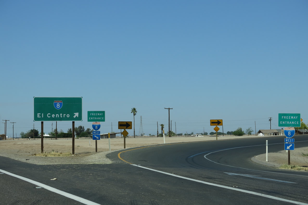 |
The loop ramp to westbound Interstate 8 is signed with El Centro as the control city rather than San Diego. This is correct, since eastbound Interstate 8 is signed for El Centro in San Diego. However, it is important to note that this is the ramp to El Centro and San Diego. Photos taken 03/26/06 and 04/20/13. |

Page Updated May 26, 2013.
|
About Contact Glossary |
In The News Interstate Guide |
Social Media:
 |
|
© 2000-25 AARoads.com | All Rights Reserved | Privacy Policy / Terms of Use
|
||