

California 111 North - Indio to Cathedral City
| California 111 north | |
|---|---|
 |
Skipping ahead (we have no photo coverage of California 111 on the eastern shore of the Salton Sea or in Indio), northbound California 111 takes a much different approach as it passes through the various cities its serves in the Coachella Valley. Here, California 111 angles northwest through Cathedral City, with an unusually barren Mt. San Jacinto dominating the view in the distance. Normally at this time of year, Mt. San Jacinto would have snow at its peak. Photo taken 02/25/06. |
 |
Small real estate signs such as this one are common along California 111 through Cathedral City. This particular area is not developed, but plans call for a new hotel complex to be constructed to the southwest of the existing highway. Photo taken 02/25/06. |
 |
California 111 crosses a drainage ditch, which could fill with water suddenly during summer monsoons or other rain events. Photo taken 02/25/06. |
 |
The next traffic signal along California 111 is with Date Palm Drive, a major north-south arterial that connects to Interstate 10 at Exit 126. Photo taken 02/25/06. |
 |
The tiny number at the corner of traffic signal mast arm indicates the number of traffic signals remaining between here and the last signal in northwestern Palm Springs. The junction with Date Palm Drive is the 37th such signal. Photo taken 02/25/06. |
 |
Redevelopment of Cathedral city's downtown area continued at the time this photo was taken. Meandering sidewalks, improved streetscape, and landscaped pop-outs all contribute to an increased traffic calming along California 111. These features are only found along California 111 because the state relinquished the highway to local control in Cathedral City and Rancho Mirage. Photo taken 02/25/06. |
 |
Continuing northwest, California 111 meets north-south Allen Avenue. Photo taken 02/25/06. |
 |
Continuing northwest, a turn pocket separates turning traffic into the Cathedral City civic center from mainline California 111 traffic. Photo taken 02/25/06. |
 |
Now reaching Monty Hall Drive, redevelopment has brought a Starbucks to the area adjacent to the civic center. Future plans call for construction of a new hotel on top of an existing parking lot on the north side of the highway after Buddy Rogers Drive. Photo taken 02/25/06. |
 |
Use this turnout for diagonal parking along the George Montgomery Trail. Photo taken 02/25/06. |
 |
The next turn off is for City Hall and Police Department. Photo taken 02/25/06. |
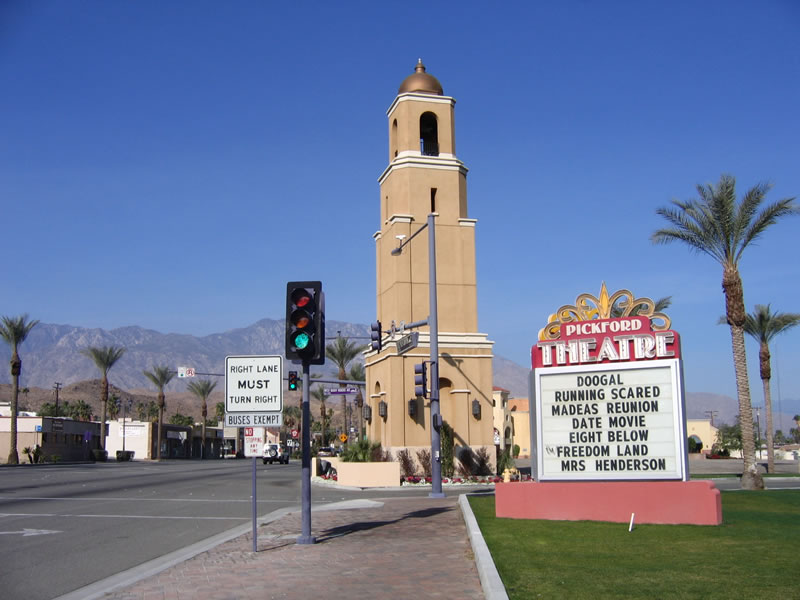 |
The restored Pickford Theatre is located to the north of California 111 (Palm Canyon Drive). Photo taken 02/25/06. |
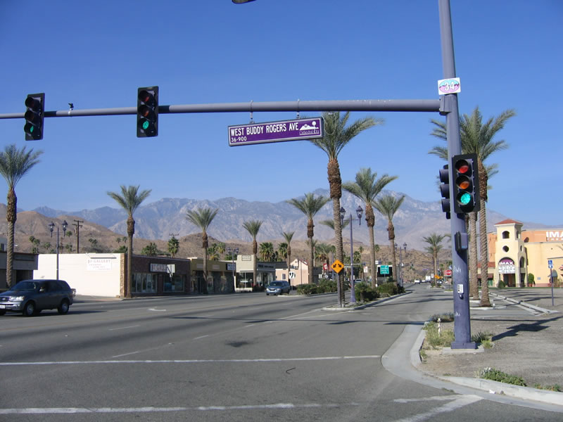 |
The next traffic signal along northbound California 111 is Buddy Rogers Avenue. This road connects to the Pickford Theatre, City Hall, and Police Station for Cathedral City. Photo taken 02/25/06. |
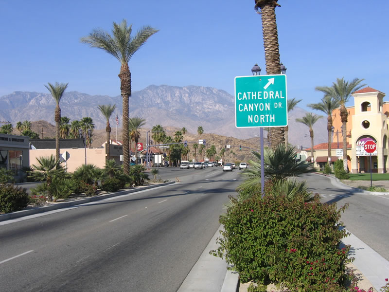 |
This guide sign advises of the next traffic signal, which is for northbound Cathedral Canyon Drive, which leads across the Whitewater River to the Cathedral Canyon Country Club. Photo taken 02/25/06. |
 |
Mount San Jacinto dominates the backdrop as California 111 continues northwest past Cathedral Canyon Drive. Photo taken 02/25/06. |
 |
Continuing northwest, California 111 (Palm Canyon Drive) passes by a car dealership and leaves downtown Cathedral City. Photo taken 02/26/06. |
 |
This wash flows from the adjacent mountains directly into the Whitewater River. The Whitewater River flows southeast through the Coachella Valley and empties into the Salton Sea. Photo taken 02/26/06. |
 |
Northbound California 111 (Palm Canyon Drive) meets Auto Park Drive at this traffic signal. Photo taken 02/26/06. |
 |
The next traffic signal is for El Dorado. Photo taken 02/26/06. |
 |
Eagle Canyon Way travels south to connect with Canyon Plaza. Photo taken 02/26/06. |
 |
After Cree Road, California 111 leaves Cathedral City and enters the city of Palm Springs. Photo taken 02/26/06. |

Page Updated April 22, 2006.
|
About Contact Glossary |
In The News Testimonials Interstate Guide |
Social Media:
 |
|
© 2000-23 AARoads.com | All Rights Reserved | Privacy Policy / Terms of Use
|
||