| Harbor Drive east |
|
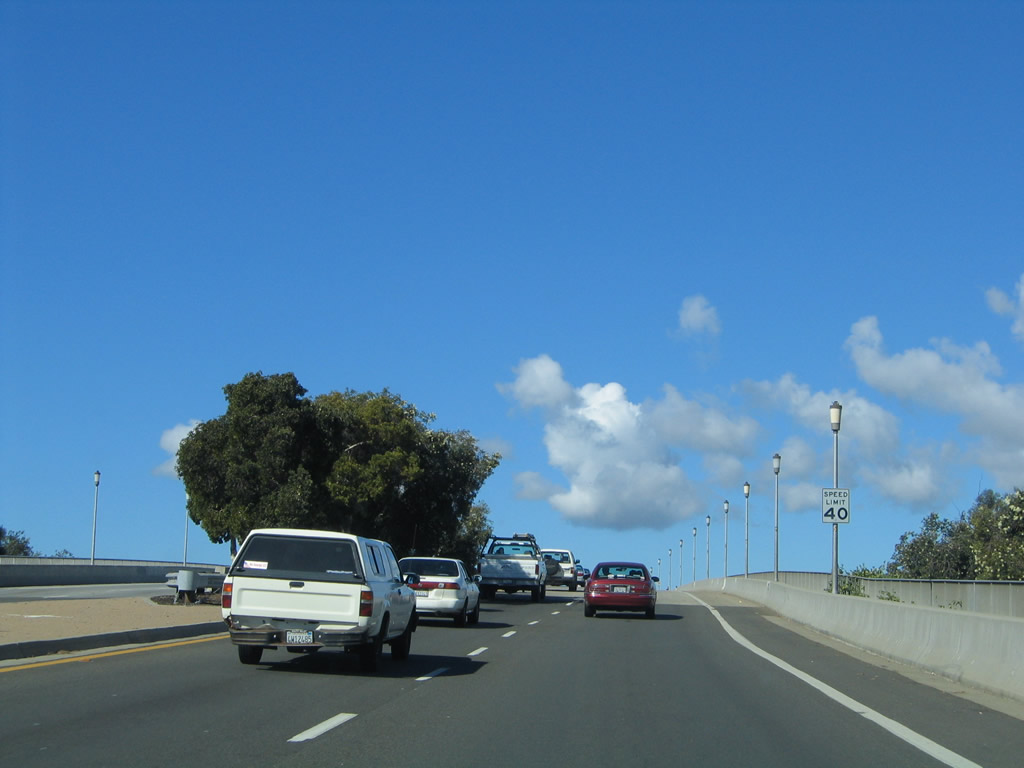
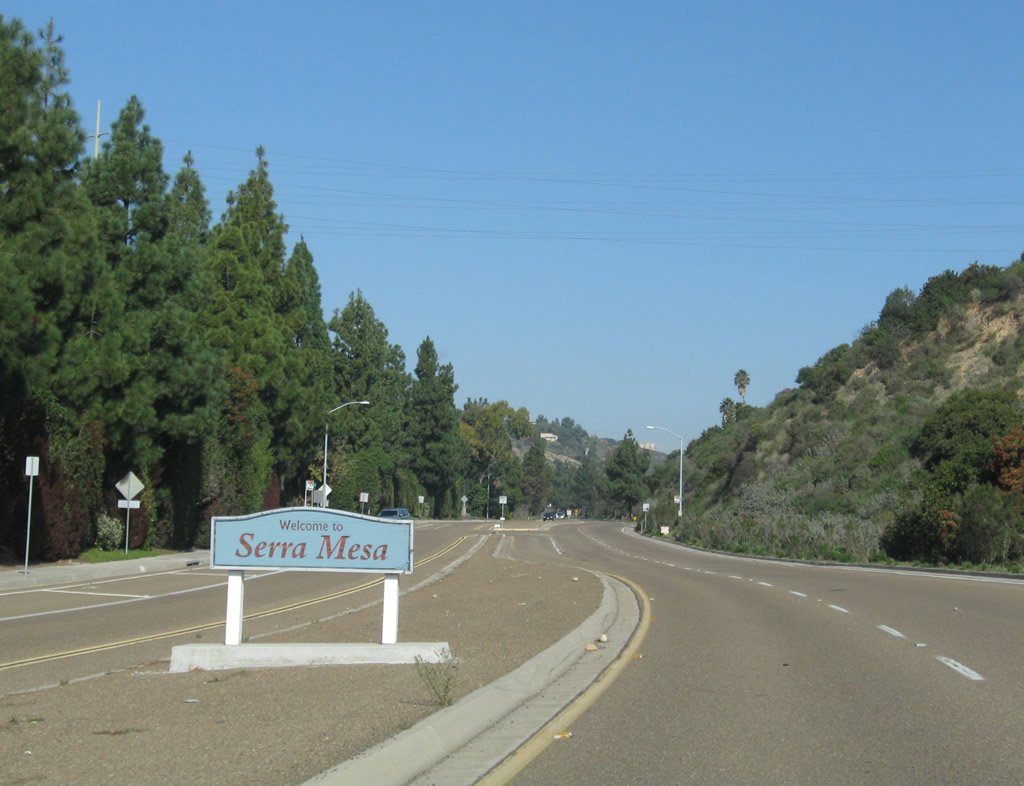
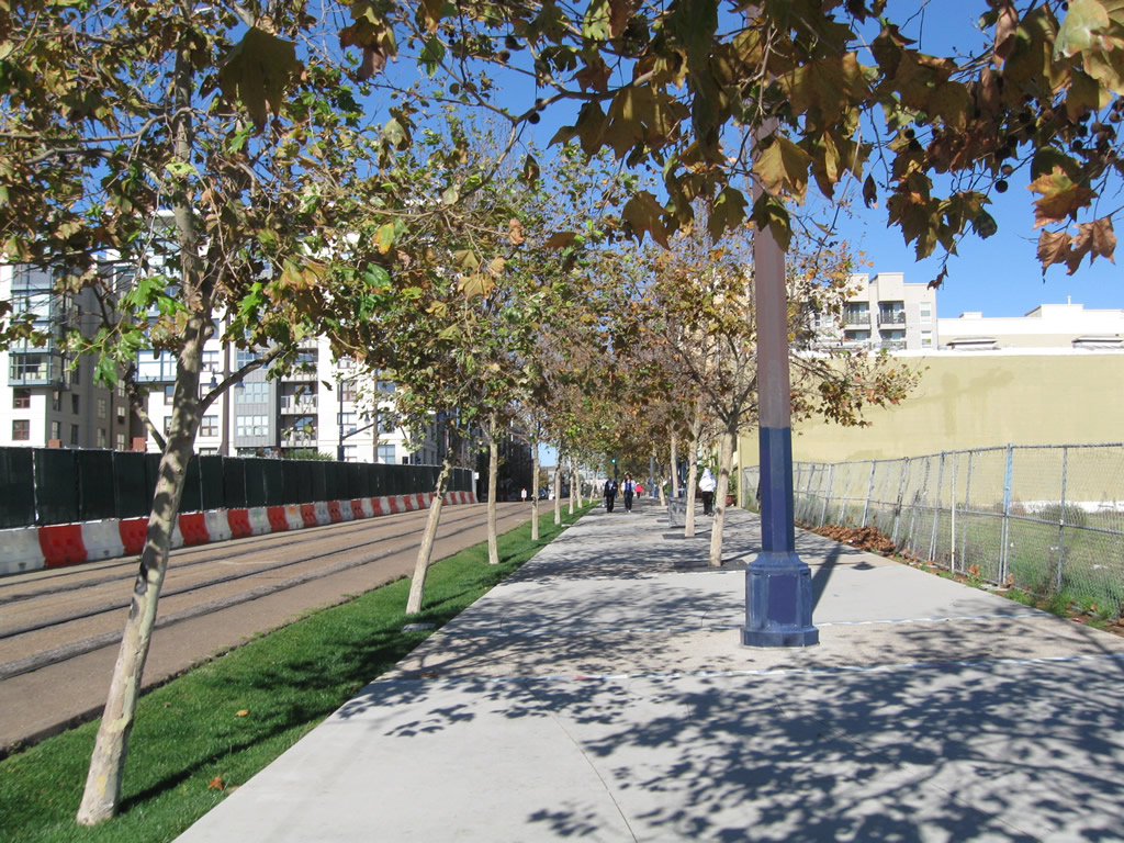
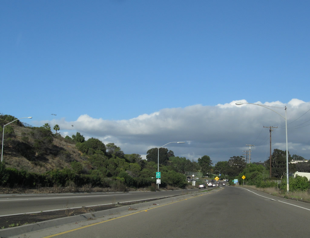
Original concrete is still in use along Harbor Drive between Rosecrans Street (former California 209) and Nimitz Boulevard. A landscaped median separated the two directions of traffic. Despite the age of this roadway, this portion of Harbor Drive is not a former route of any U.S. or state route. Photo taken 02/19/05. |
|
|
|
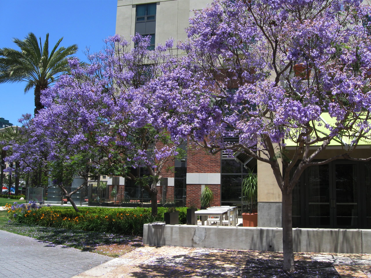
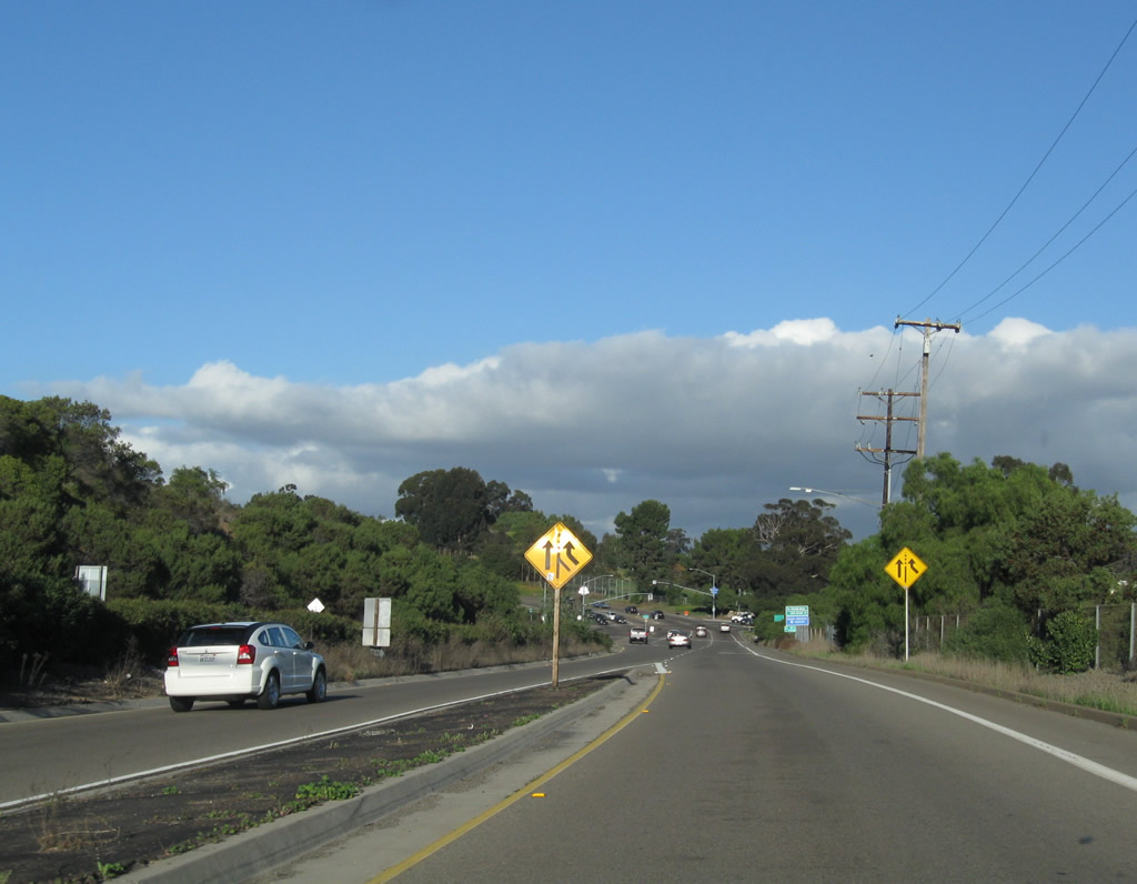
Hotels and other businesses line this section of Harbor Drive. If you like old exposed concrete roadways still in use, you'll love this segment of Harbor Drive. Photos taken 02/19/05. |
|
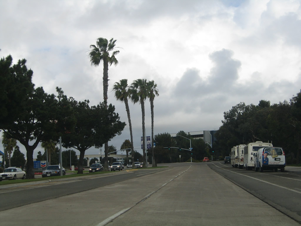
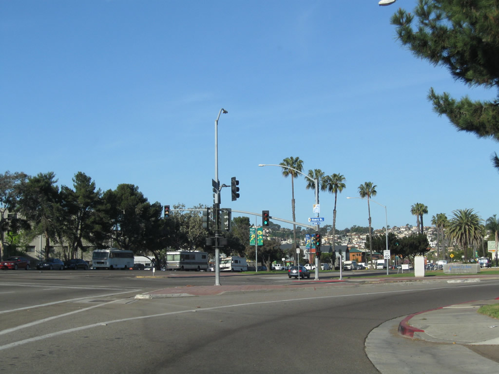
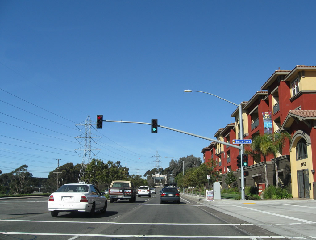
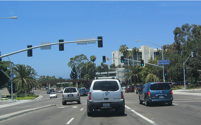
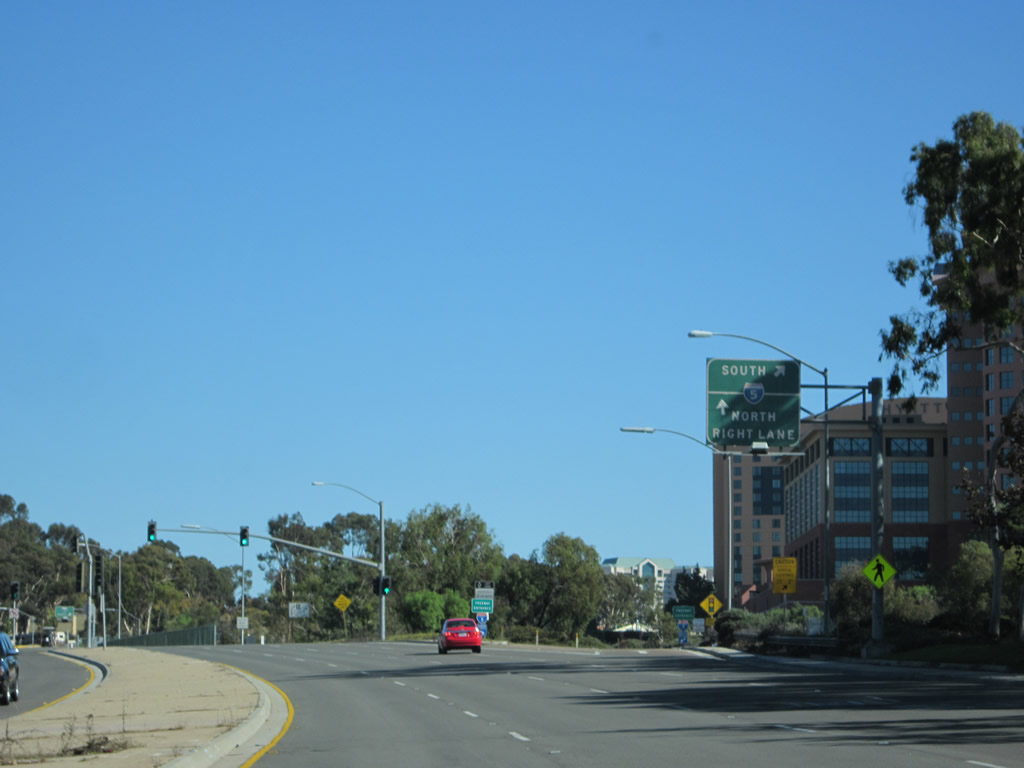
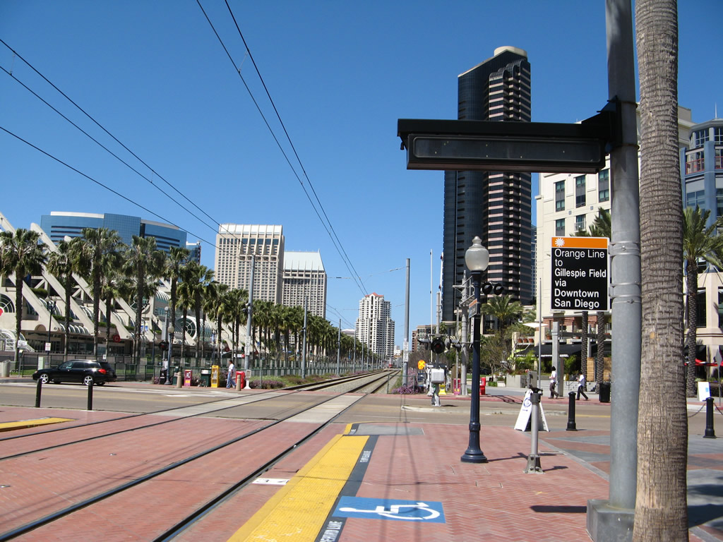
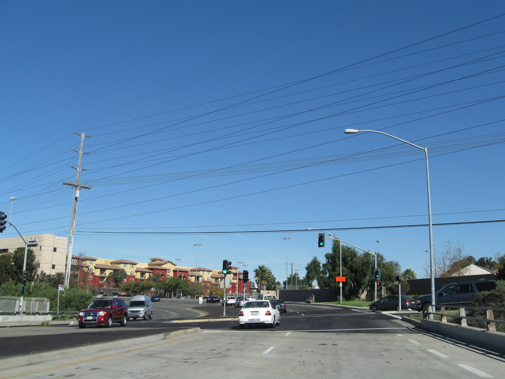
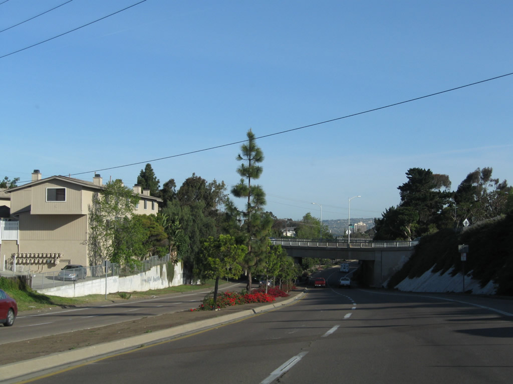
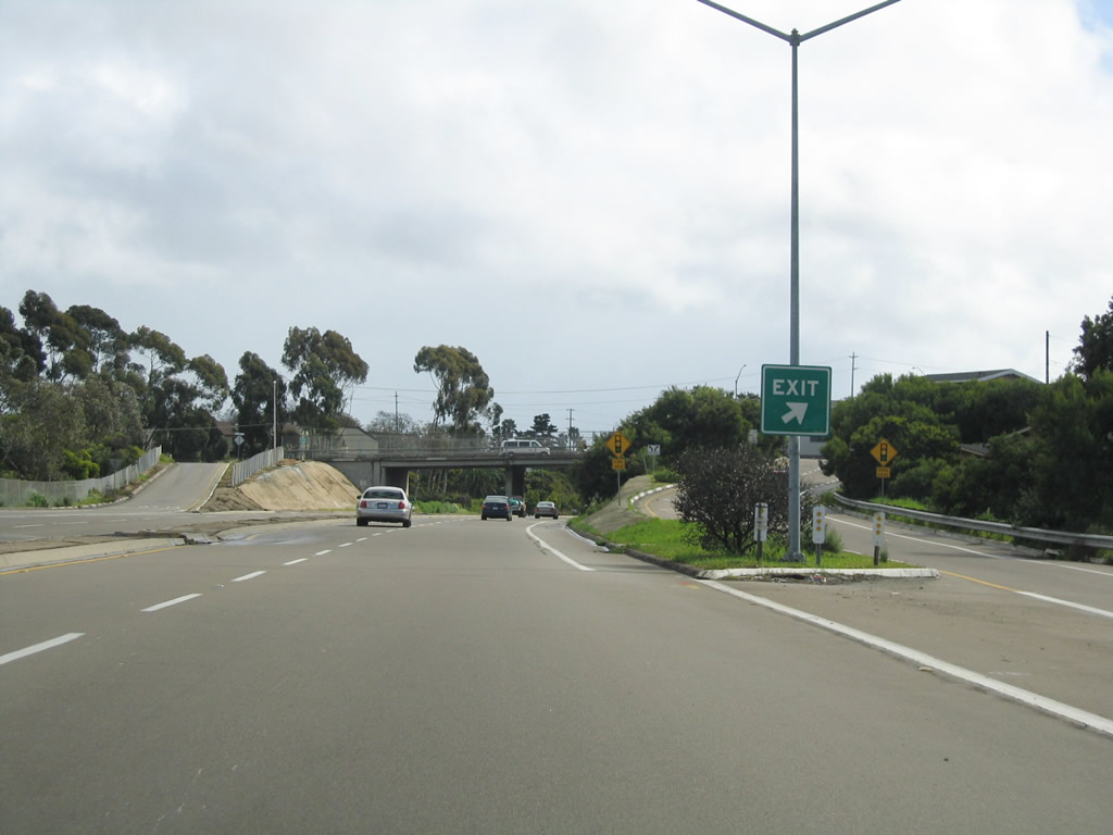
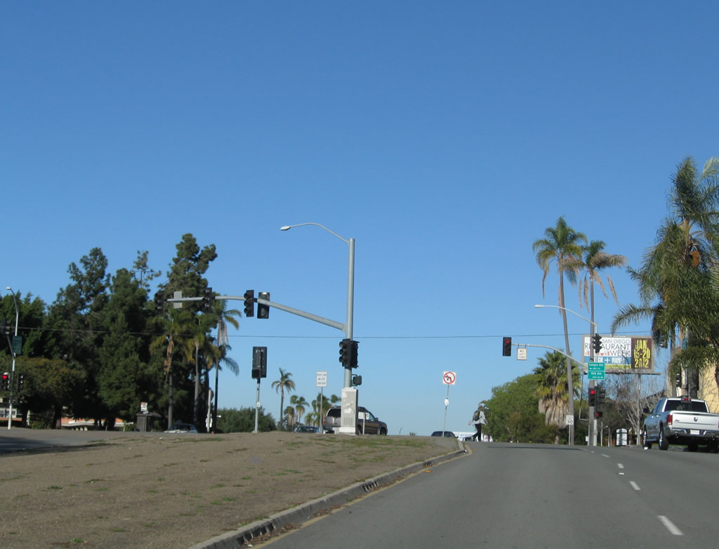
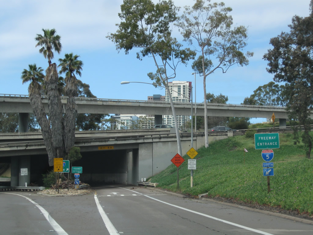
Eastbound Harbor Drive approaches Nimitz Boulevard. Turn left here to follow Nimitz Boulevard north to Mission Bay Park and points north via Mission Bay Drive, Ingraham Street, or Sea World Drive. Continue straight to cross the Naval Training Center channel and approach San Diego International Airport. Photo taken 02/19/05. |
|
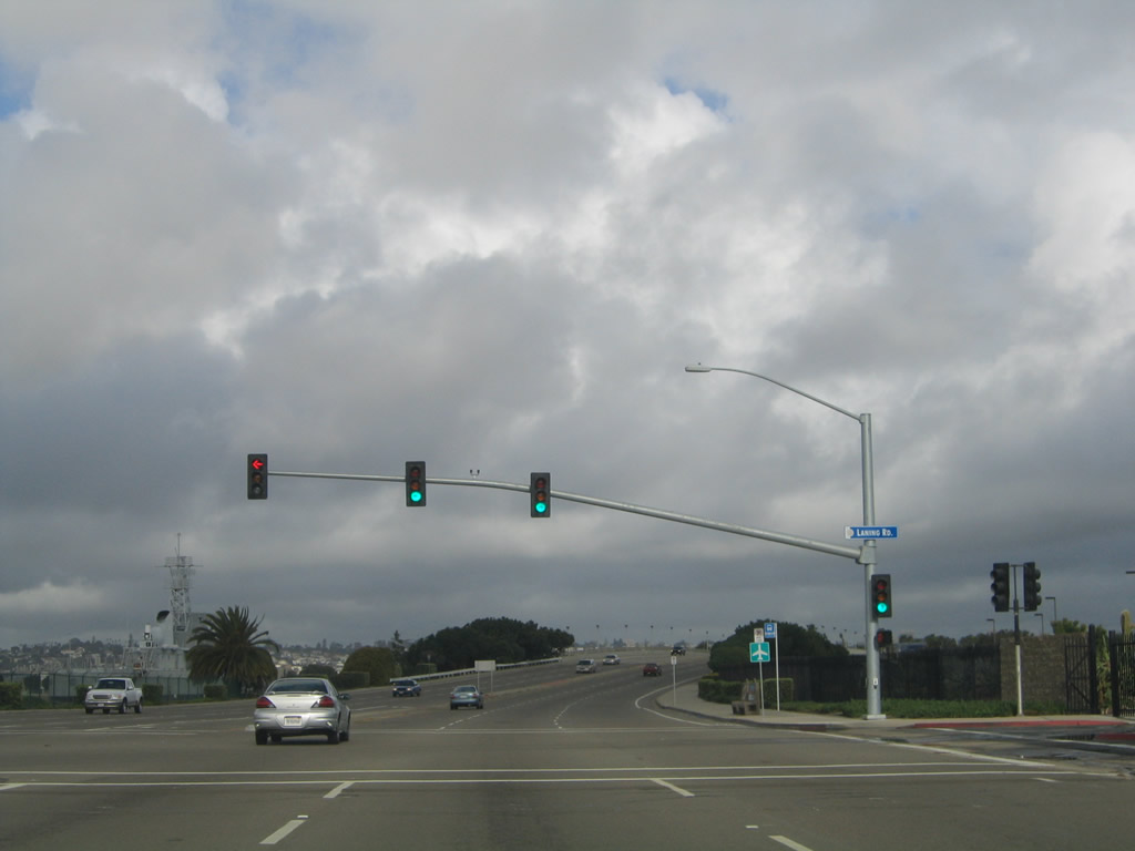
Harbor Drive expands to three lanes in each direction. Passing by the old Naval Training Center (now part of the Liberty Station neighborhood), eastbound Harbor Drive approaches Laning Road north into Liberty Station. Photo taken 02/19/05. |
|
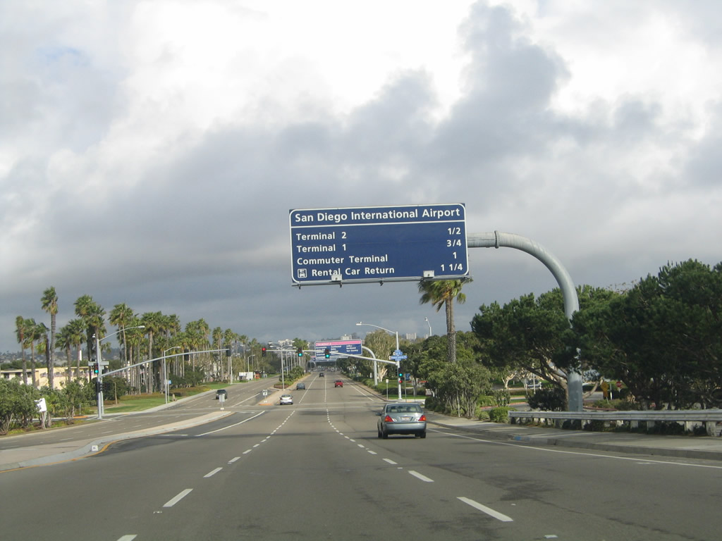
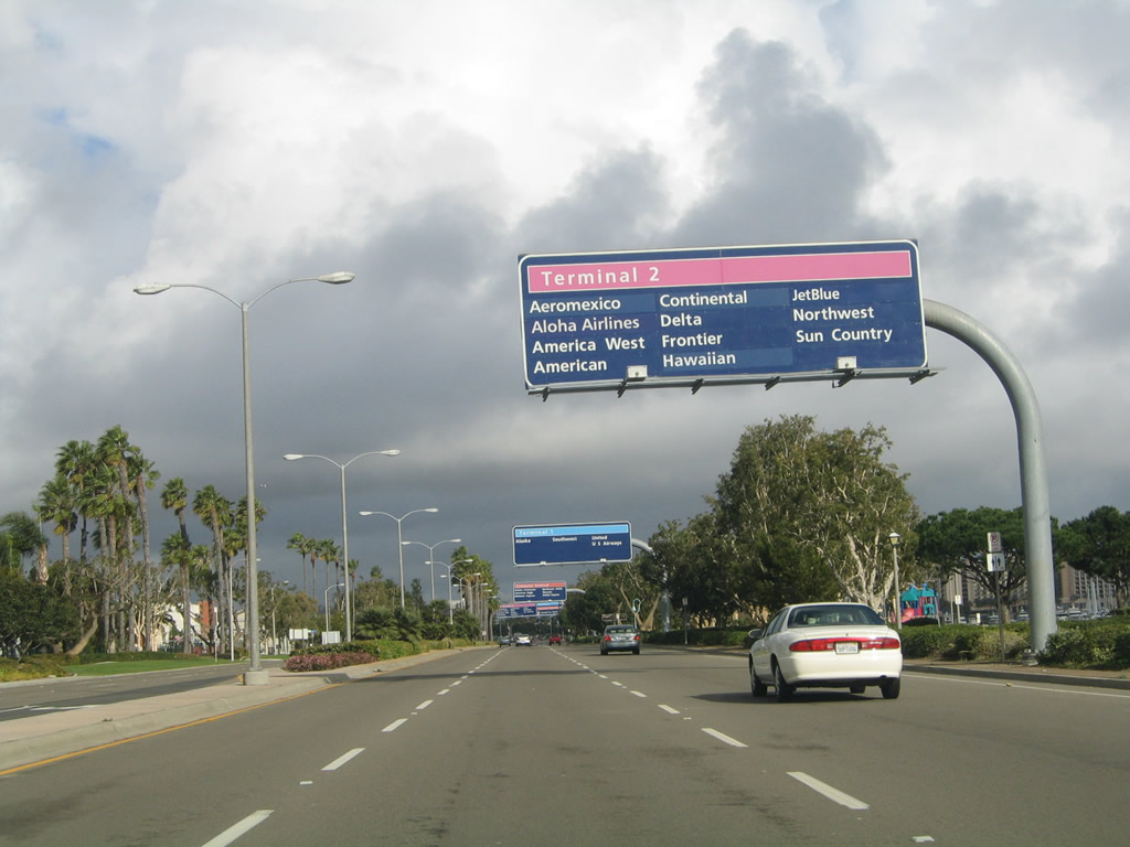
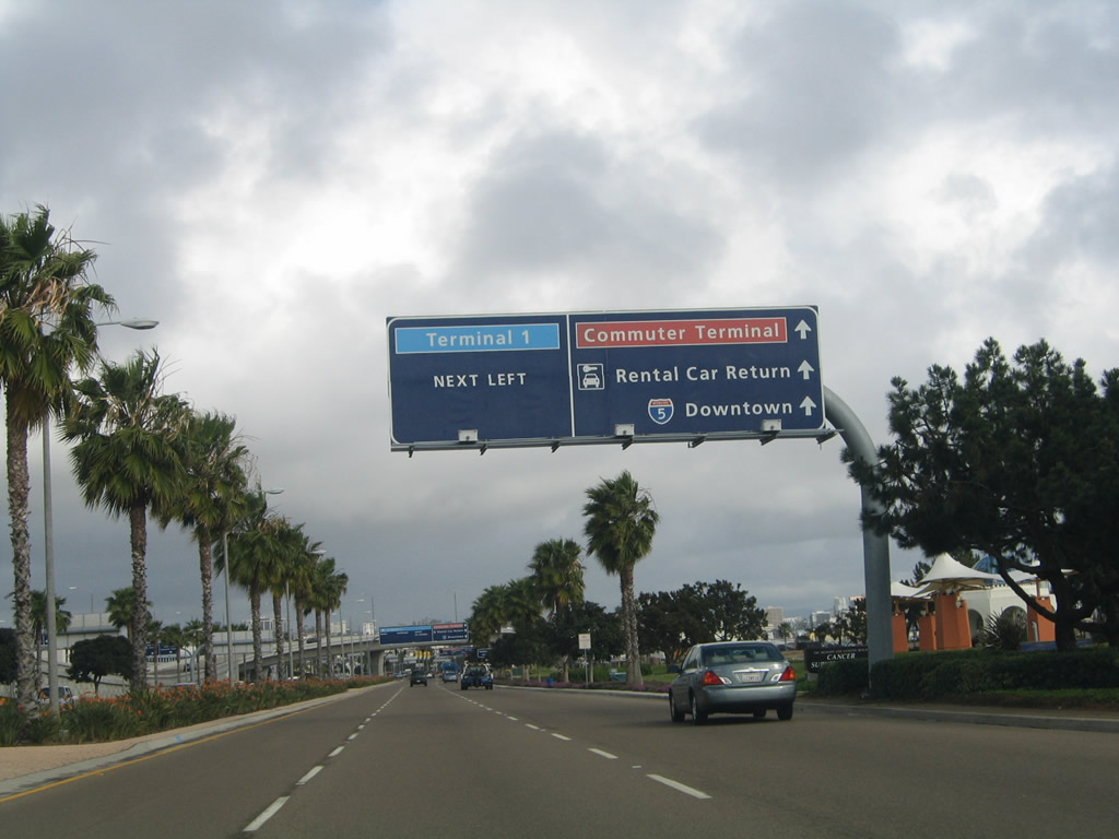
After crossing the Naval Training Center channel, this mileage sign along eastbound Harbor Drive provides the distance to Terminal Two (0.50 mile), Terminal One (0.75 mile), Commuter Terminal (one mile), and Rental Car Return (1.25 miles). The traffic signal ahead serves Lee Court and Spanish Landing Park, which is operated by the San Diego Unified Port District. Photo taken 02/19/05. |
|
|
|
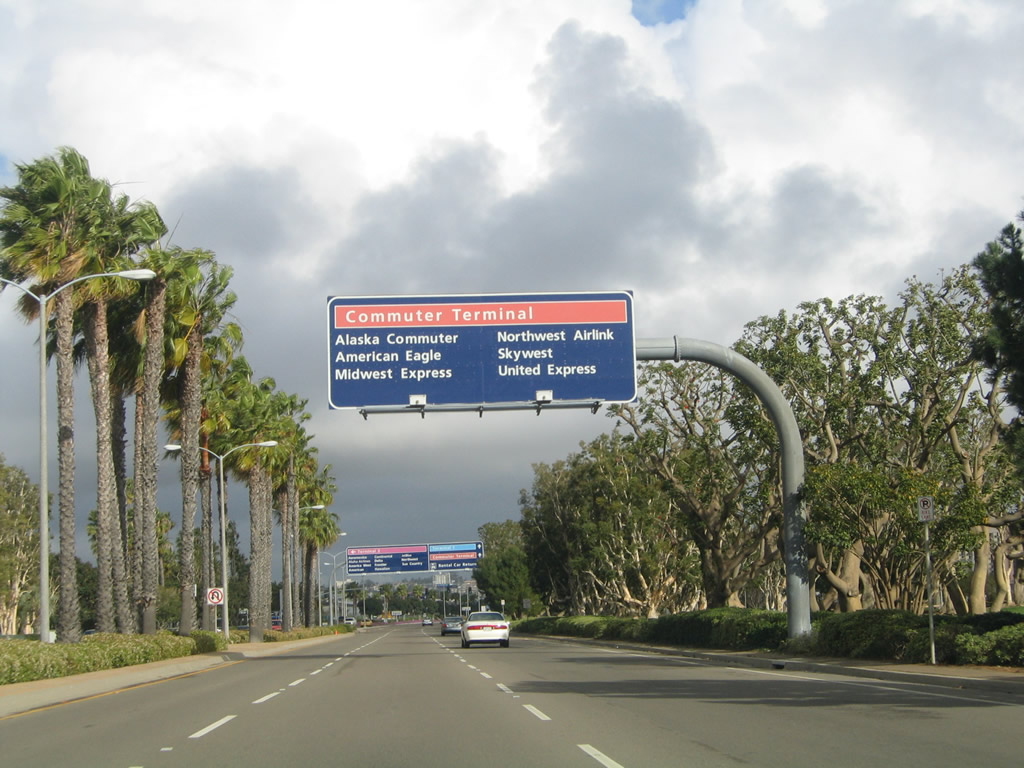
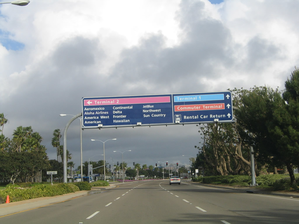
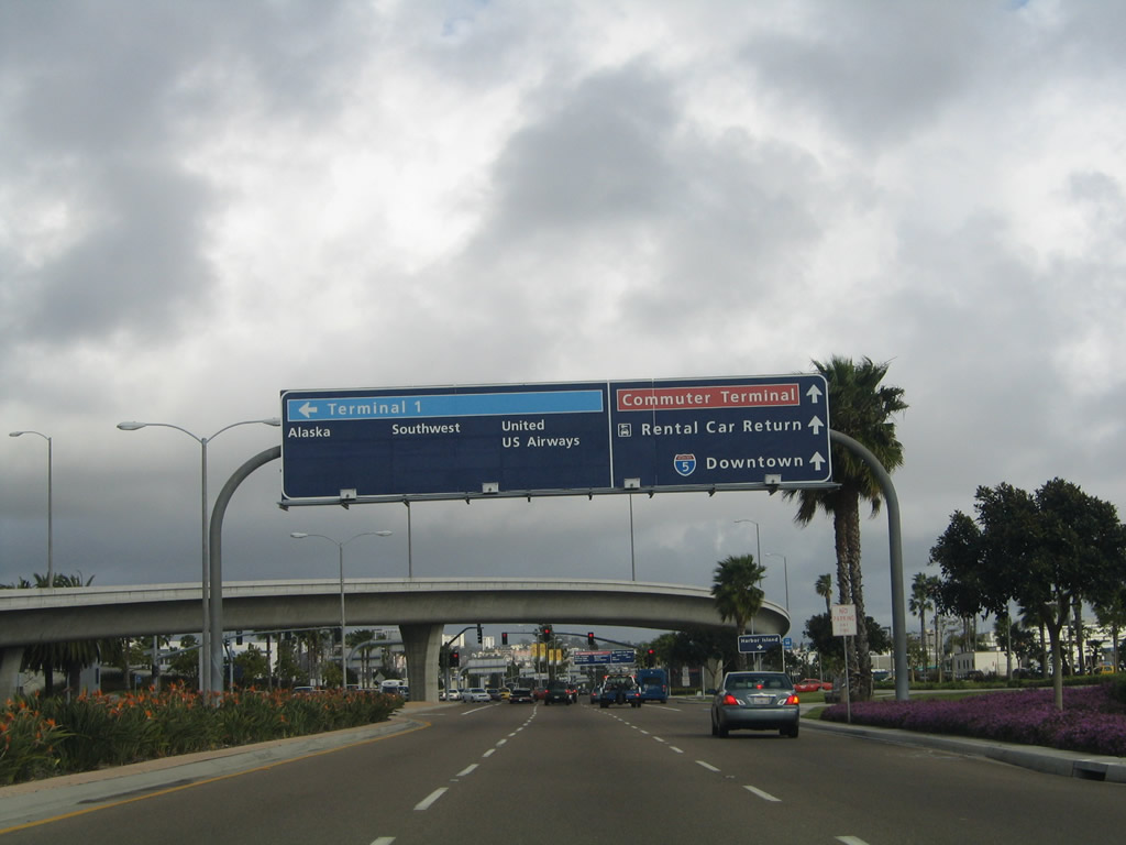
A series of signs provides the airlines assigned to each terminal. They are color coded (lavender for Terminal 2, blue for Terminal 1, and red for the commuter terminal). Photos taken 02/19/05. |
|
Eastbound Harbor Drive approaches the entrance to San Diego International Airport Terminal Two. Continue straight ahead for Terminal One and the commuter terminal. Photo taken 02/19/05. |
|
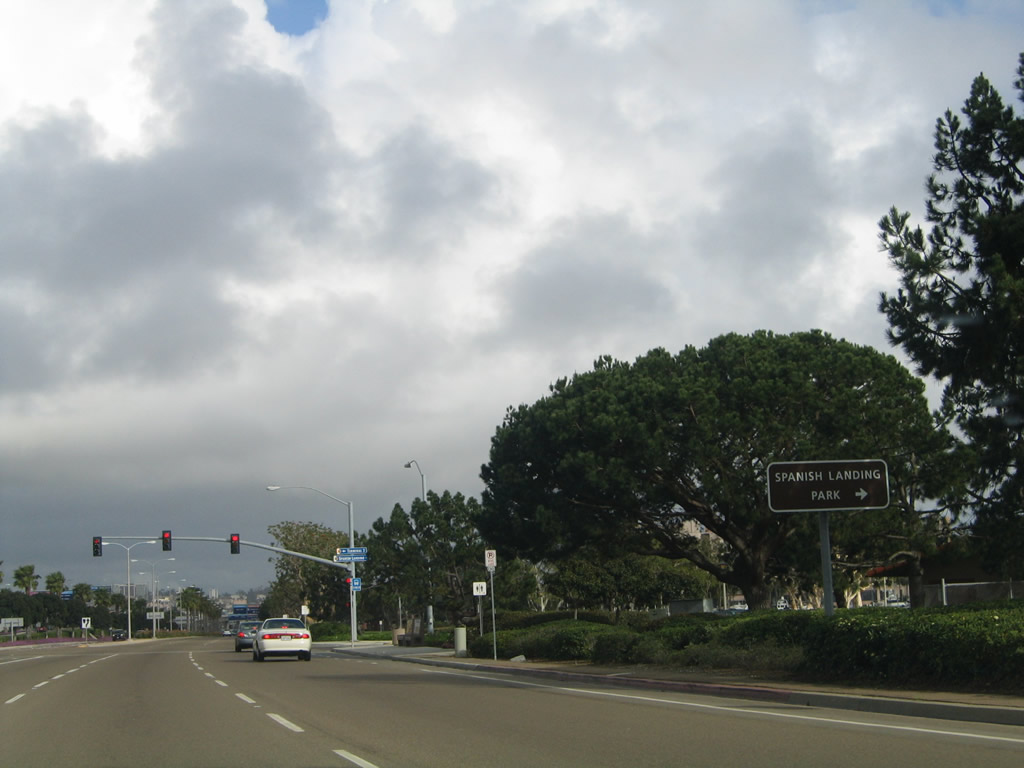
At the traffic signal for San Diego International Airport Terminal 2, turn right to Spanish Landing Park. Photo taken 02/19/05. |
|
Harbor Drive functions as an expressway as it passes along the southern edge of the airport. Traffic signals govern the flow of traffic at the Terminal 2 entrance as well as the roads to Terminal 1 and the commuter terminal. A maze of flyover ramps ahead provide direct airport access for traffic incoming from downtown San Diego. Photo taken 02/19/05. |
|
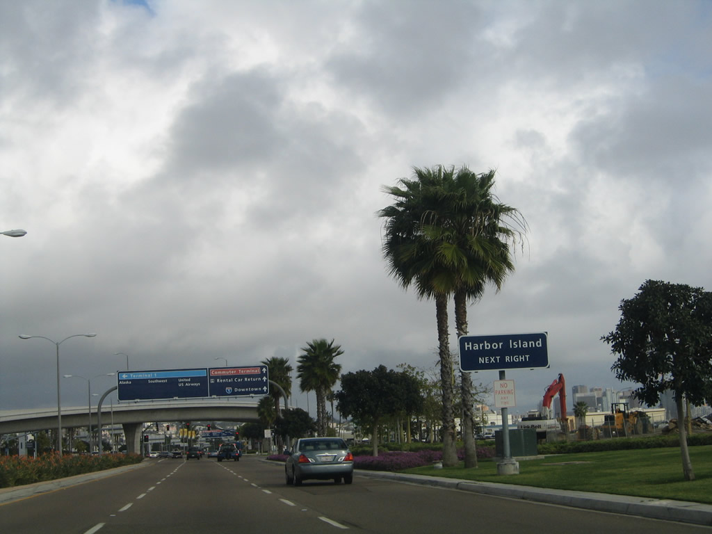
The next intersection along eastbound Harbor Drive is with Harbor Island Drive. Turn left to Terminal 1 and right to connect to Harbor Island. The island has hotels, restaurants, and bay access along its linear frontage. Photo taken 02/19/05. |
|
Eastbound Harbor Drive approaches Harbor Island Drive. This is the second entrance to San Diego International Airport. A flyover ramp, which brings traffic from the airport onto eastbound Harbor Drive, flies over the mainline. Photo taken 02/19/05. |
|
Another roadside sign along eastbound Harbor Drive indicates the connection to Harbor Island. Photo taken 02/19/05. |
|
As traffic merges onto eastbound Harbor Drive from the right, an overhead sign announces the next intersection, which connects to the commuter terminal of San Diego International Airport. Photo taken 02/19/05. |
|
Eastbound Harbor Drive leaves the grounds of the airport and approaches Laurel Street. Turn left here to Little Italy, Uptown, and Balboa Park. While access to Interstate 5 is available via Laurel Street, a better route is via Grape Street. Photo taken 02/19/05. |
| Harbor Drive west |
|
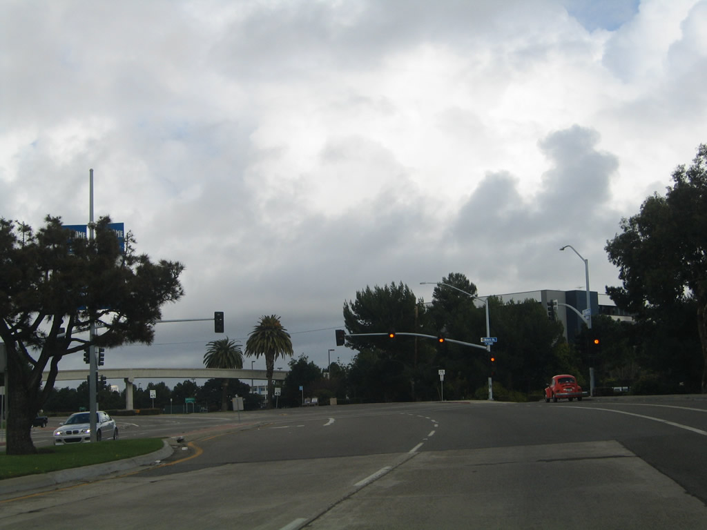
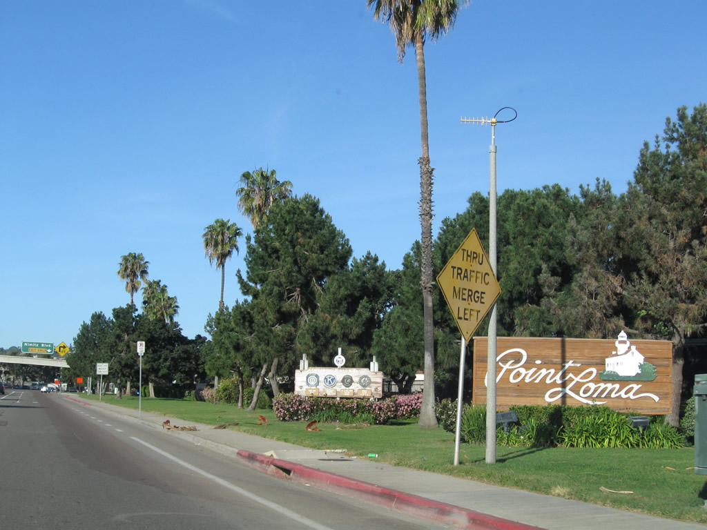
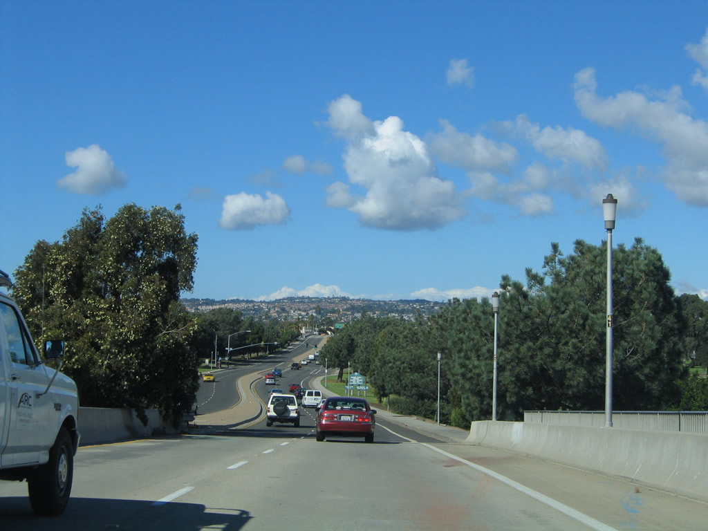
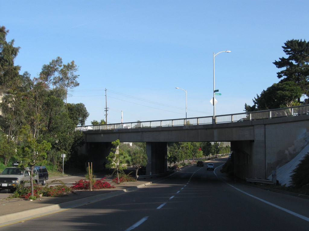
After leaving the airport grounds and crossing the Navy channel, westbound Harbor Drive approaches Nimitz Boulevard and enters the community of Point Loma. Photo taken 03/29/10. |
|
The right lane of Harbor Drive will connect exclusively to Nimitz Boulevard north to Mission Bay Park and Pacific Beach. Photo taken 03/29/10. |
|
A U.S. Navy pedestrian overcrossing passes over Harbor Drive prior to the Nimitz Boulevard turnoff. Aim right here for the tsunami evacuation zone. Photo taken 03/29/10. |
|
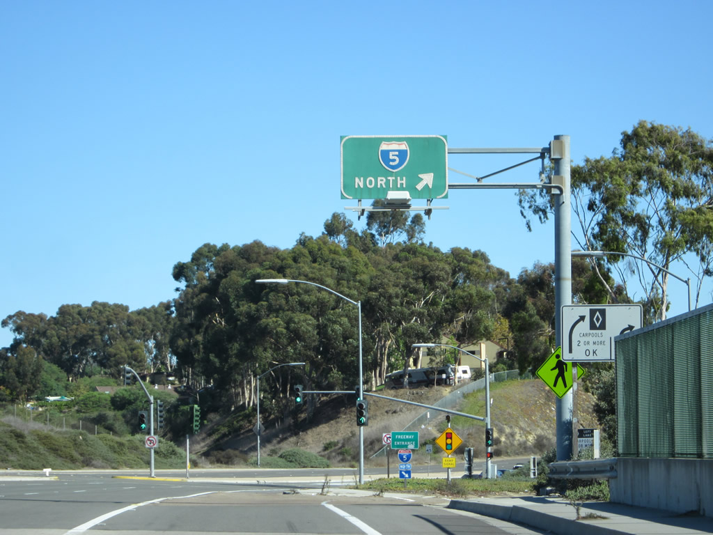
Westbound Harbor Drive meets Nimitz Boulevard. Photo taken 03/29/10. |
| Health Care Drive north |
|
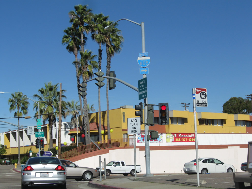
Near the Sharp medical complex (including Sharp Memorial Hospital) after the Frost Street intersection, northbound Health Care Drive approaches Mesa College Drive (turn right to connect to Kearny Villa Road north). To Interstate 805 south, turn right. Photo taken 01/14/11. |
|
This is a close-up of the fading trailblazer for Interstate 805/Dekema (Inland) Freeway south. Photo taken 01/14/11. |
|
Turn left on Mesa College Drive west to California 163 (Cabrillo Freeway). Photo taken 01/14/11. |
| Hidden Valley Road north |
|
Hidden Valley Road connects Via Capri with La Jolla Parkway and Torrey Pines Road in the Hidden Valley neighborhood of the La Jolla community of the city of San Diego. Here, Hidden Valley Road approaches La Jolla Parkway and Torrey Pines Road at this signalized intersection. Turn right on La Jolla Parkway east for California 52 east and Interstate 5 south. Continue ahead onto Torrey Pines Road north to Interstate 5, UCSD, and La Jolla Village Drive. Turn left on Torrey Pines Road south to downtown La Jolla and the business district. Photo taken 11/11/12. |
| India Street north |
|
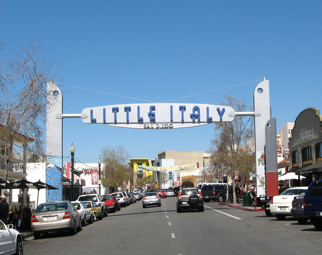
India Street enters the Little Italy neighborhood; this arch is located north of Date Street. Photo taken 03/24/08. |
| Ingraham Street north |
|
After crossing the San Diego River and passing the off-ramp to eastbound Sea World Drive, Sports Arena Drive ends and Ingraham Street begins. The next exit along northbound Ingraham Street connects to West Mission Bay Drive. Photo taken 10/28/04. |
|
The left two lanes continue along Ingraham Street north toward Pacific Beach; the right two lanes depart onto West Mission Bay Drive northwest to Mission Beach. Photo taken 10/28/04. |
|
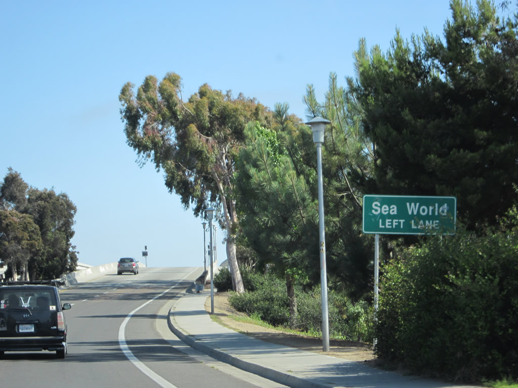
At Perez Cove Way, turn right to the main entrance to Sea World. Ingraham Street continues north through the middle of Mission Bay Park. Photo taken 10/28/04. |
|
|
Ingraham Street crosses over Mission Bay twice. This bridge carries Ingraham Street over the channel south of Vacation Island, and the second bridge connects Vacation Island with the Crown Point neighborhood in Pacific Beach. Photos taken 10/28/04. |
|
A signalized intersection with Vacation Road on Vacation Island serves a large parking area associated with Ski Beach on the east side of Ingraham Street and a resort located west of Ingraham Street. Photo taken 10/28/04. |
|
The almost-expressway segment of Ingraham Street ends with a traffic signal with Riviera Drive and Crown Point Drive. The left lane connects to Riviera Drive, the middle lane continues north on Ingraham Street, and the right lane connects to Crown Point Drive. Photo taken 10/28/04. |
|
Northbound Ingraham Street meets Riviera Drive and Crown Point Drive at this traffic signal. Photo taken 10/28/04. |
| Ingraham Street south |
|
Ingraham Street leaves Pacific Beach just south of the signalized intersection with Crown Point Drive/Riviera Drive. From there, Ingraham Street prepares to cross Mission Bay on this four-lane bridge. Photo taken 05/21/12. |
|
At the end of the first bridge, Ingraham Street touches down on Vacation Island, then crosses a second bridge. At the end of the second bridge is the main entrance into Sea World (traffic signal), which is located on the southern shore of Mission Bay. Photo taken 05/21/12. |
|
After passing by the traffic signal, southbound Ingraham Street briefly takes on the characteristics of a freeway. The first exit ramp is to westbound West Mission Bay Drive en route to Mission Beach. Photo taken 05/22/04. |
|
A small guide sign advises that traffic to Interstate 5 and Interstate 8 should stay left on Ingraham Street south rather than exiting onto either West Mission Bay Drive (next right) or Sunset Cliffs Boulevard (second right). Photo taken 05/21/12. |
|
Southbound Ingraham Street meets the off-ramp to West Mission Bay Drive. The second exit will be with Sunset Cliffs Boulevard (second right turn). Photo taken 05/21/12. |
|
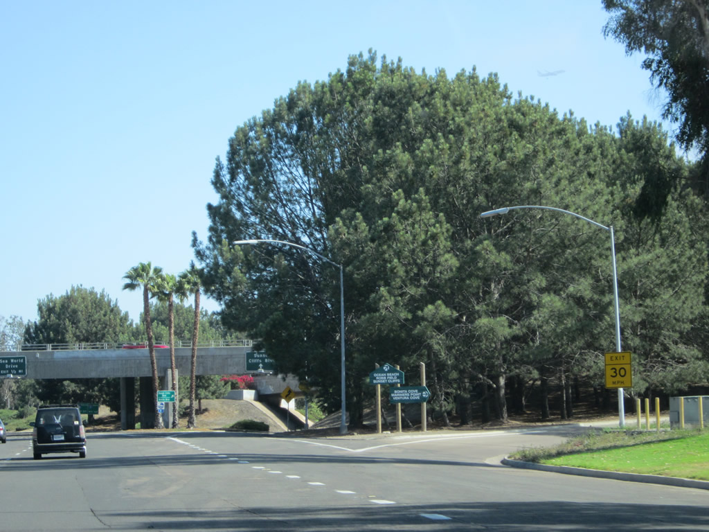
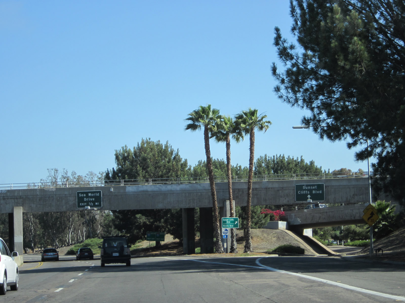
Immediately after the off-ramp to West Mission Bay Drive west to Mission Beach, the next exit from southbound Ingraham Street is with Sunset Cliffs Boulevard south to Ocean Beach and Nimitz Boulevard. Photo taken 02/19/05. |
|
Southbound Ingraham Street meets the off-ramp to Sunset Cliffs Boulevard. The left two lanes will connect to Sea World Drive eastbound, then proceed across the San Diego River toward the Midway District. Photo taken 05/21/12. |
|
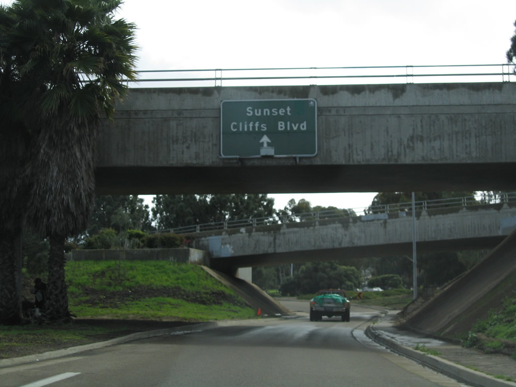
A single lane off-ramp leads from Ingraham Street south to Sunset Cliffs Boulevard south. Photo taken 02/19/05. |
|
The second exit ramp is to Sunset Cliffs Boulevard, which leads southwest to Point Loma and Ocean Beach. Photo taken 05/22/04. |
|
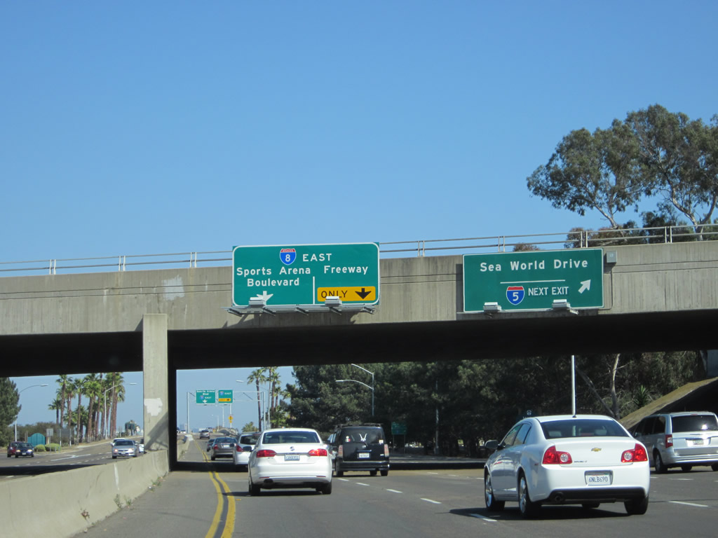
Finally, Ingraham Street reaches its end at the Sea World Drive interchange, where the through traffic is defaulted onto Sports Arena Drive southbound. Sea World Drive heads east to meet Interstate 5; this is the only connection to northbound Interstate 5. Photo taken 05/22/04. |
|
|
Southbound Ingraham Street passes under Sea World Drive in the sprawling Mission Bay Park interchange; from here, Ingraham Street ends and Sports Arena Boulevard continues south toward the Midway District and San Diego Sports Arena. Photos taken 05/21/12 and 05/22/04. |
| Island Avenue west |
|
This view looks west along Island Avenue as seen from Sixth Avenue in the Gaslamp Quarter. Photo taken 03/24/08. |
|
The William Heath Davis House is located on Island Avenue in the Gaslamp Quarter. It is open for tours with grounds maintained as a small park. Photo taken 03/24/08. |
| Kearny Villa Road north |
|
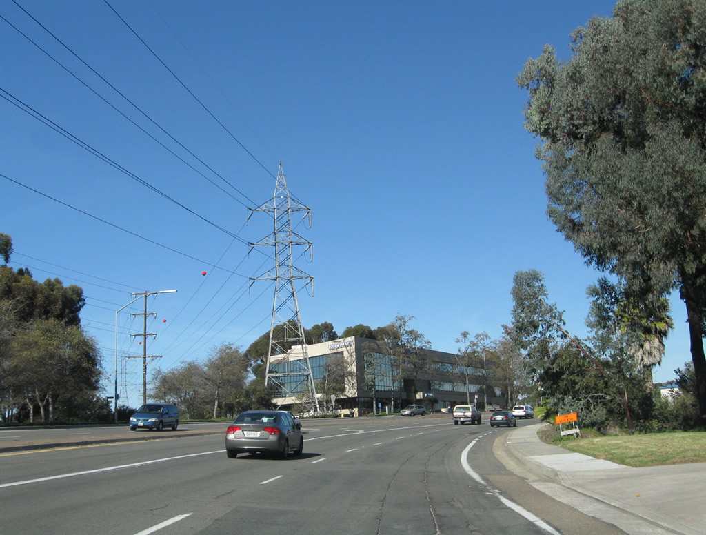
Leaving the Interstate 805 interchange and Mesa College Drive, Kearny Villa Road curves northeast toward Kearny Mesa. Photo taken 01/14/11. |
|
This view shows Kearny Villa Road as it leads northeast between Interstate 805 and Aero Drive. Photo taken 01/14/11. |
|
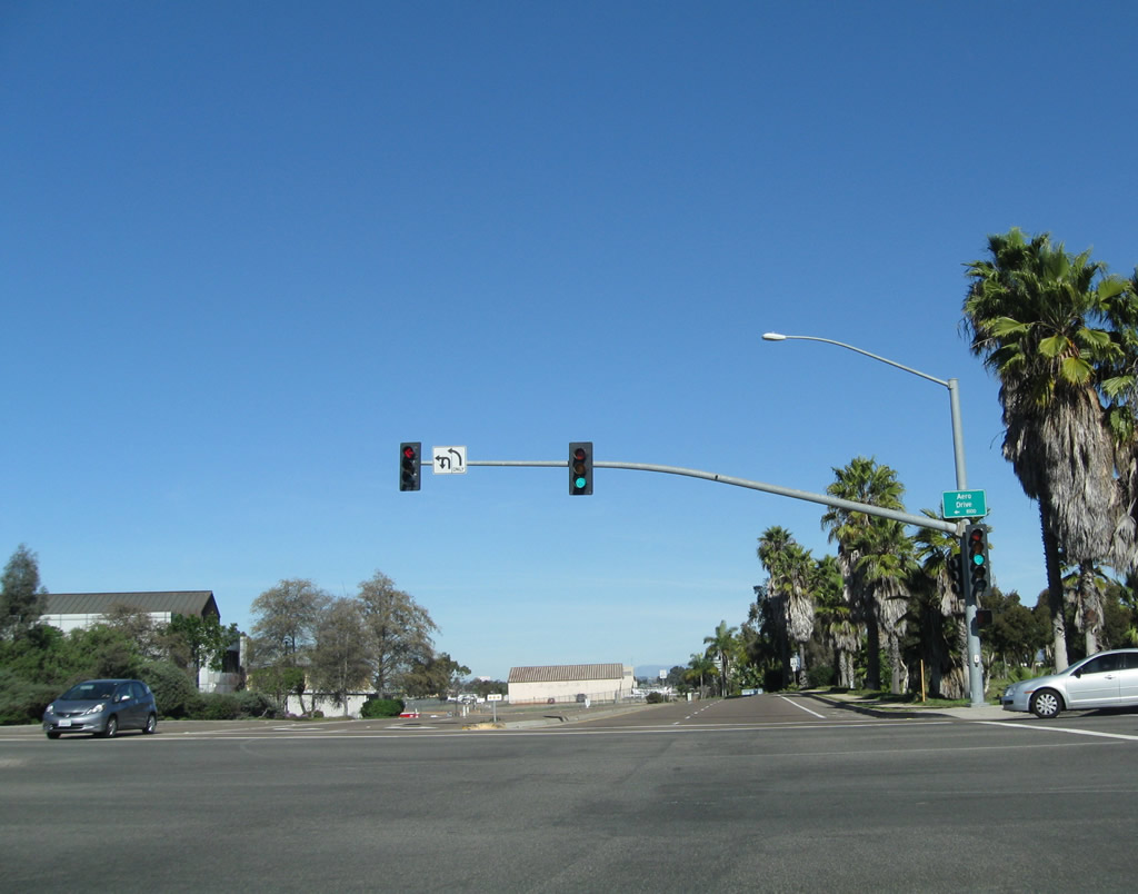
Northbound Kearny Villa Road approaches Aero Drive. Photo taken 01/14/11. |
|
Kearny Villa Road will parallel California 163 (Cabrillo Freeway) between Aero Drive and Interstate 15, roughly along the historic U.S. 395 corridor. On the east is Montgomery Airport, a general aviation airport operated by the city of San Diego. Photo taken 01/14/11. |
|
Northbound Kearny Villa Road meets an on-ramp to California 163 north. Ahead, Kearny Villa Road will approach Balboa Avenue (former California 274). Photo taken 01/14/11. |
|
Turn left (west) on Balboa Avenue to California 163 south to downtown San Diego. Photo taken 01/14/11. |
| La Jolla Boulevard (see Historic U.S. 101) |
| La Jolla Parkway west (see also California 52) |
|
After California 52 comes to its end, La Jolla Parkway picks up the route onward to La Jolla as a city of San Diego street. Photo taken 05/22/04. |
|
There is only one exit along La Jolla Parkway between Interstate 5 and Torrey Pines Road: La Jolla Scenic Drive North, which travels north through neighborhoods toward the University of California at San Diego (UCSD). Photo taken 05/22/04. |
|
Westbound La Jolla Parkway reaches the off-ramp to La Jolla Scenic Drive North. Photo taken 05/22/04. |
|
The Pacific Ocean comes into view as La Jolla Parkway descends into La Jolla Shores. Photo taken 05/22/04. |
|
The intersection between La Jolla Parkway and Torrey Pines Road was reconstructed in 2002-2003, and the revised traffic signal system has reduced waiting times for the many motorists who pass through this intersection. Photo taken 05/22/04. |
|
La Jolla Parkway comes to its end upon reaching the Torrey Pines Road and Hidden Valley Road intersection. Continue straight ahead on Torrey Pines Road to enter the village of La Jolla. Photo taken 05/22/04. |
| La Jolla Scenic Drive north |
|
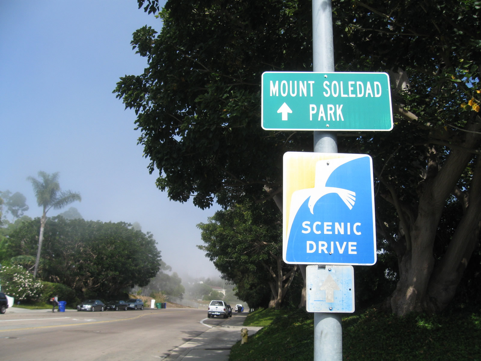
La Jolla Scenic Drive South travels along the crest of Mount Soledad within the La Jolla community of the city of San Diego. This scenic route sign is posted along northeastbound La Jolla Scenic Drive after the Soledad Mountain Road intersection. Photo taken 10/17/11. |
| La Jolla Village Drive east |
|
La Jolla Village Drive travels east-west in the vicinity of the La Jolla and University City communities. Originating at its intersection with Torrey Pines Road and North Torrey Pines Road, La Jolla Village Drive travels east past La Jolla Scenic Drive North and Gilman Drive before intersecting Villa La Jolla Drive and Interstate 5. East of Interstate 5, La Jolla Village Drive is a very busy arterial leading through North University City, ultimately connecting to Interstate 805 and Miramar Road. Here, eastbound La Jolla Village Drive approaches the signalized intersection with La Jolla Scenic Drive North. Photo taken 11/11/12. |
|
A diamond interchange governs the flow of traffic between La Jolla Village Drive and Gilman Drive, which is a former alignment of U.S. 101. Exit here for the main entrance to the University of California at San Diego. Photo taken 11/11/12. |
|
La Jolla Village Drive passes over Gilman Drive and descends to the Villa La Jolla Drive traffic signal. Photo taken 11/11/12. |
|
A pedestrian bridge crosses over La Jolla Village Drive prior to the Villa La Jolla Drive intersection. Photo taken 11/11/12. |
|
Eastbound La Jolla Village Drive approaches Villa La Jolla Drive, which travels south from this intersection to a shopping area and reconnects to Gilman Drive south of here. Photo taken 11/11/12. |
|
La Jolla Village Drive meets Villa La Jolla Drive. Photo taken 11/11/12. |
|
Immediately thereafter, eastbound La Jolla Village Drive approaches Interstate 5, which travels north to Santa Ana and Los Angeles and south to downtown San Diego, National City, Chula Vista, the International Border/San Ysidro Port of Entry, and Tijuana, Baja California, Mexico. The first right links La Jolla Village Drive with Interstate 5 south. Photo taken 11/11/12. |
|
After crossing over Interstate, eastbound La Jolla Village Drive meets the right turn/loop ramp onto Interstate 5 north to Del Mar, Solana Beach, Encinitas, Carlsbad, Oceanside, Santa Ana, Los Angeles, and Sacramento. Ahead, La Jolla Village Drive continues east into University City. Photo taken 11/11/12. |
| Law Street west |
|
The sun set on another beautiful day in Pacific Beach. This view looks west along Law Street toward the sun setting on the Pacific Ocean. Photo taken 10/27/11. |
| Market Street west |
|
This view looks west along Market Street (former U.S. 80-395) as seen from the Sixth Avenue intersection in the Gaslamp Quarter. Photo taken 03/24/08. |
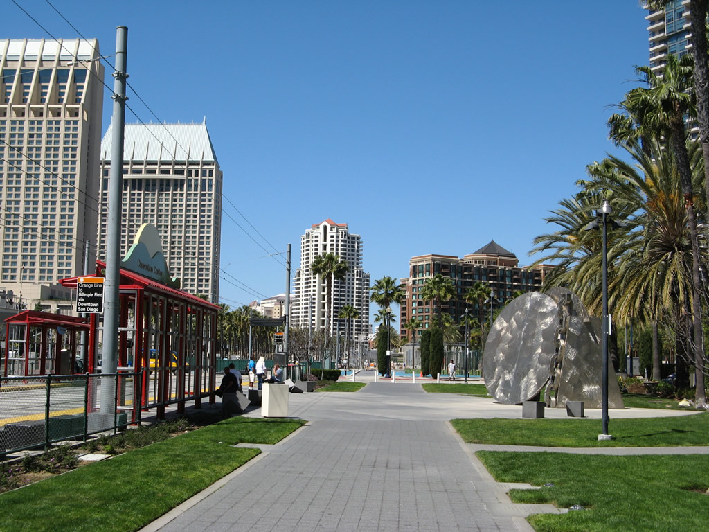
| Martin Luther King Jr. Promenade north |
|
|
|
|
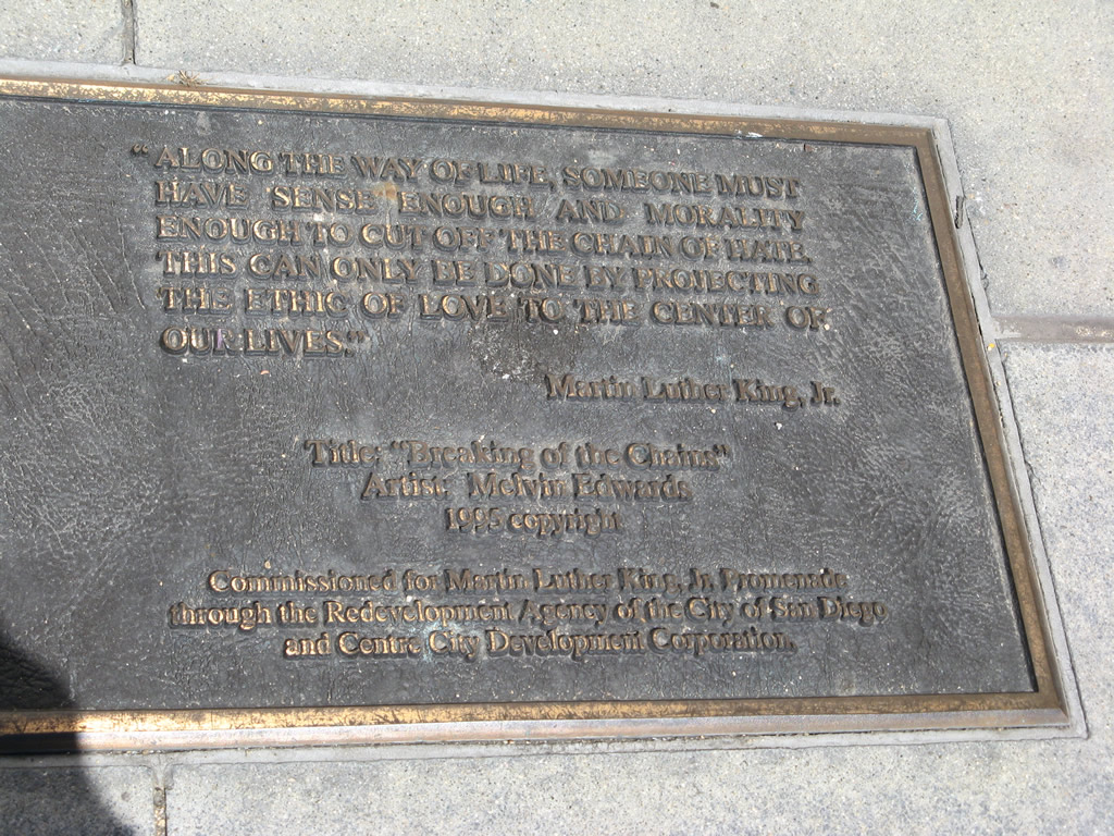
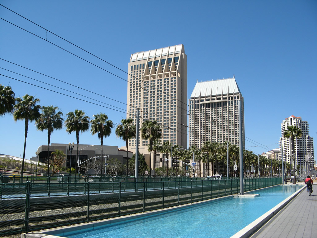
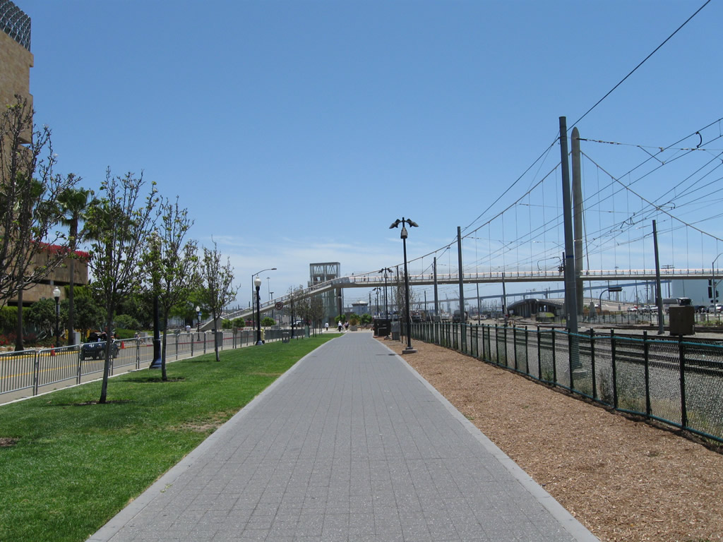
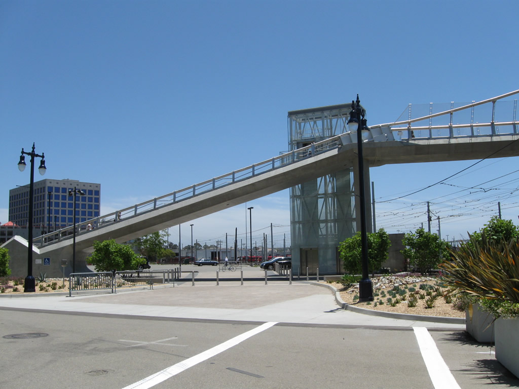
The Martin Luther King, Jr. Promenade begins near Petco Park at the intersection of Park Boulevard and Tony Gwynn Drive (Seventh Avenue). A future extension of the promenade may lead south of the Harbor Drive Pedestrian bridge adjacent to the ballpark parking lot (see first picture). Photos taken 03/24/08 and 12/27/10. |
|
|
|
|
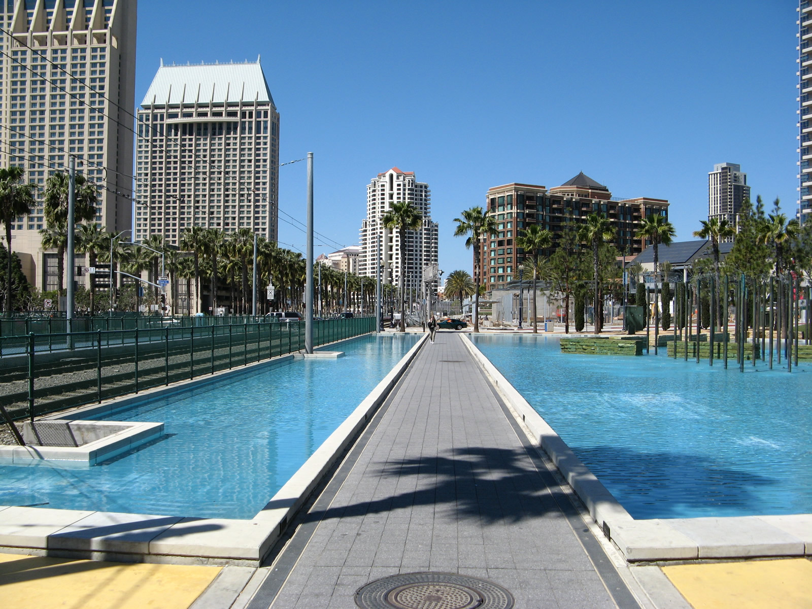
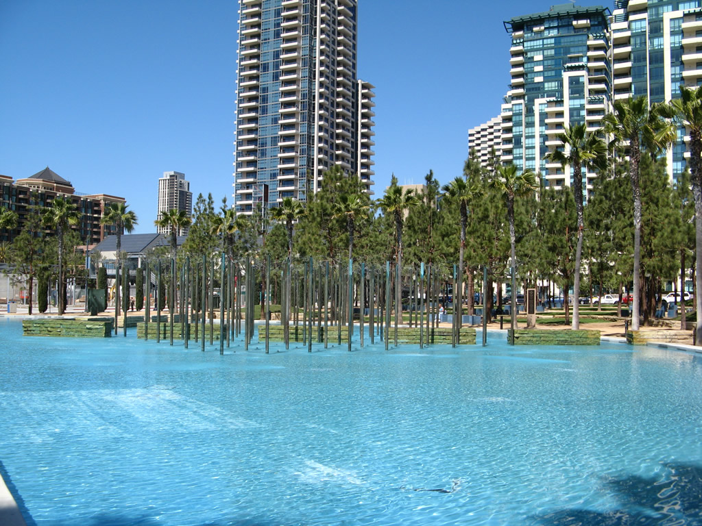
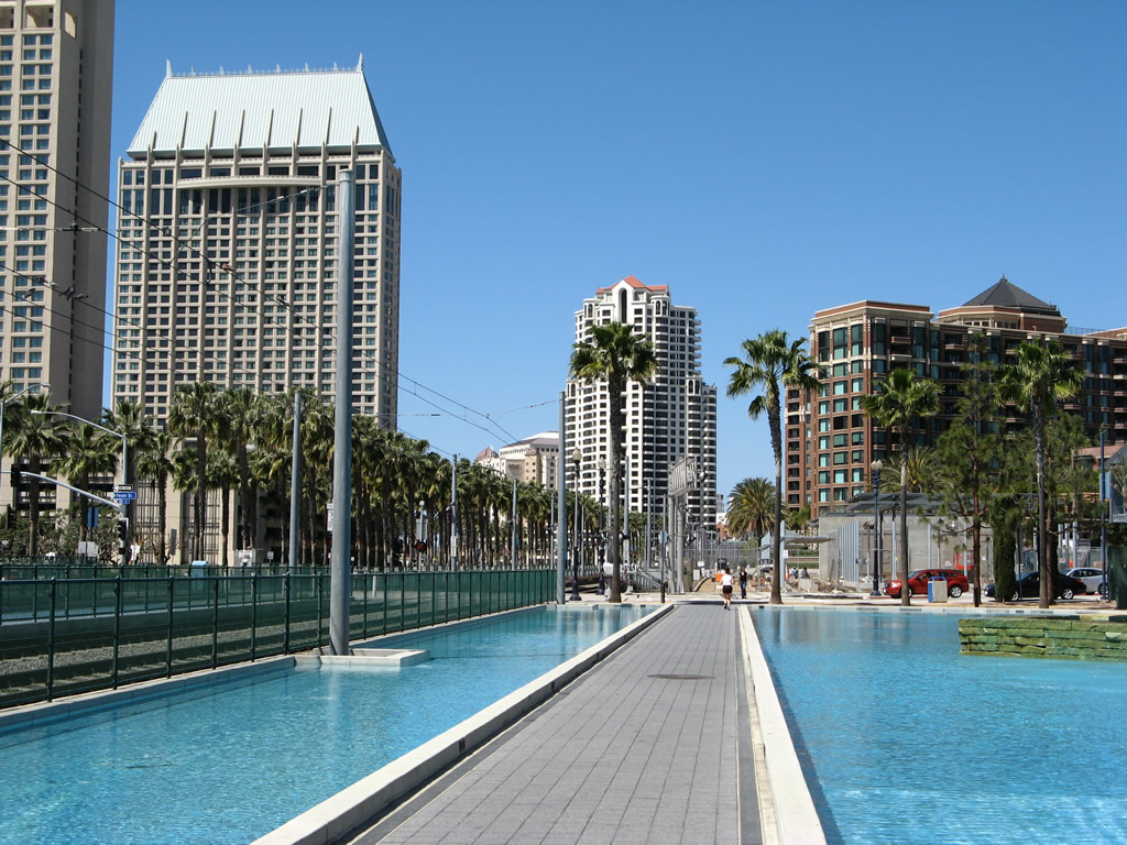
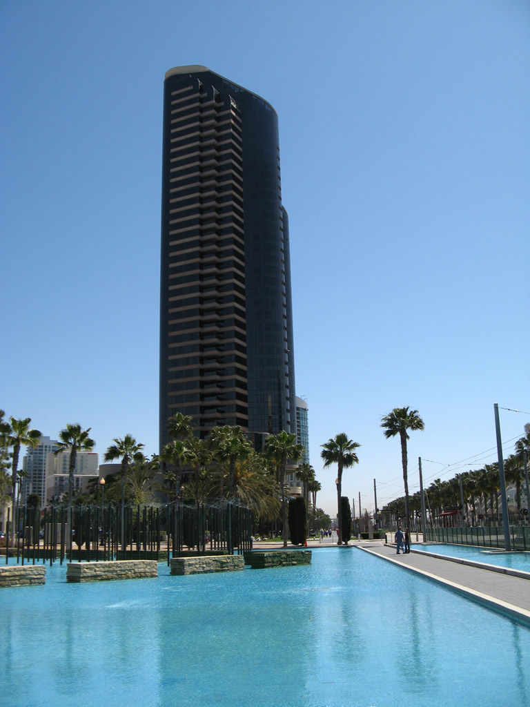
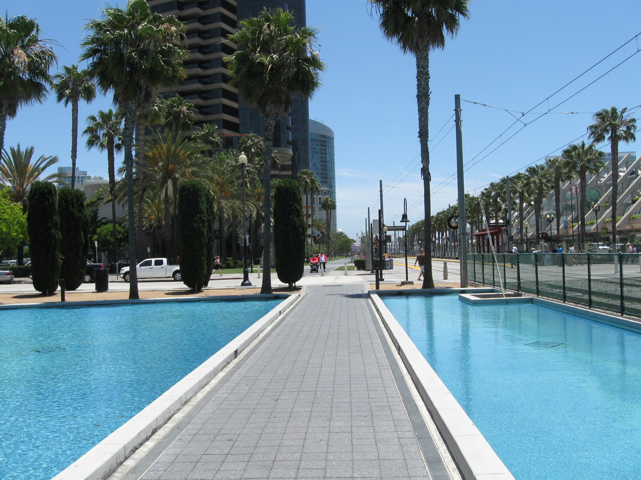
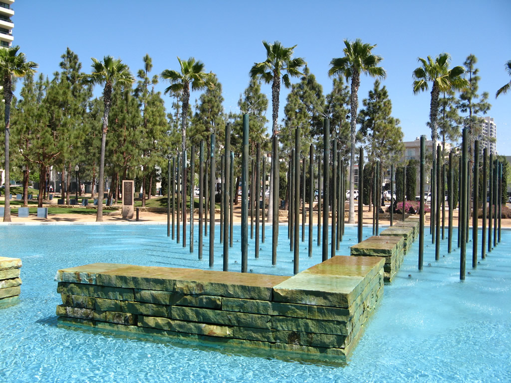
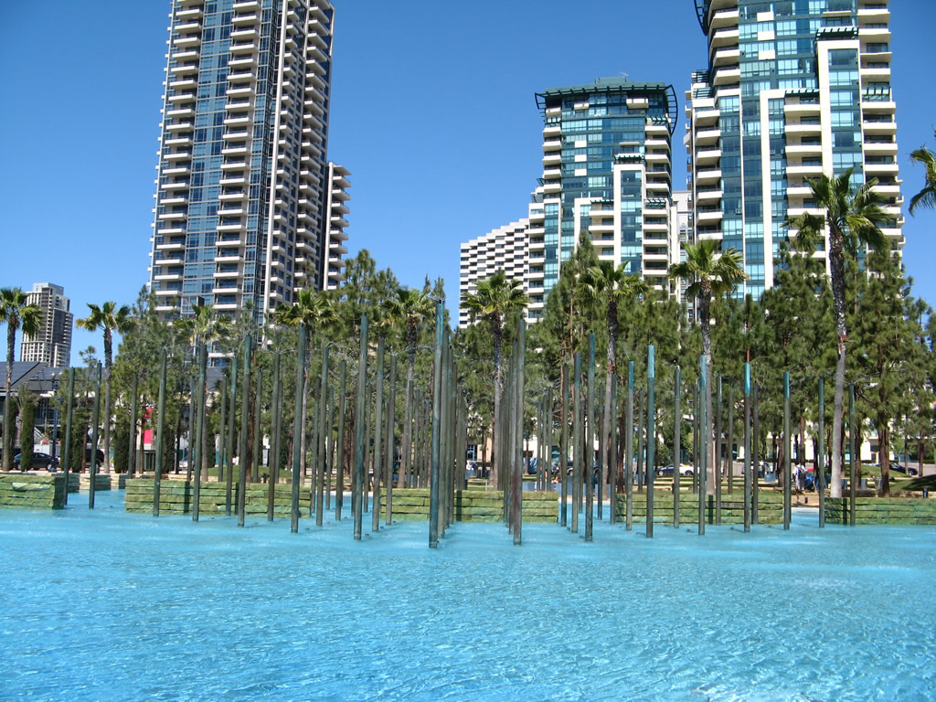
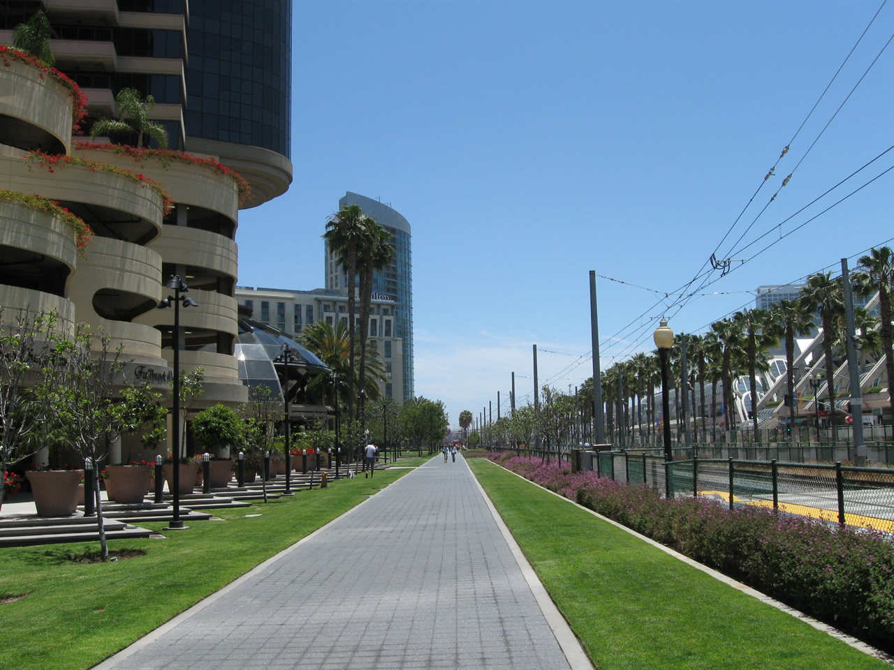
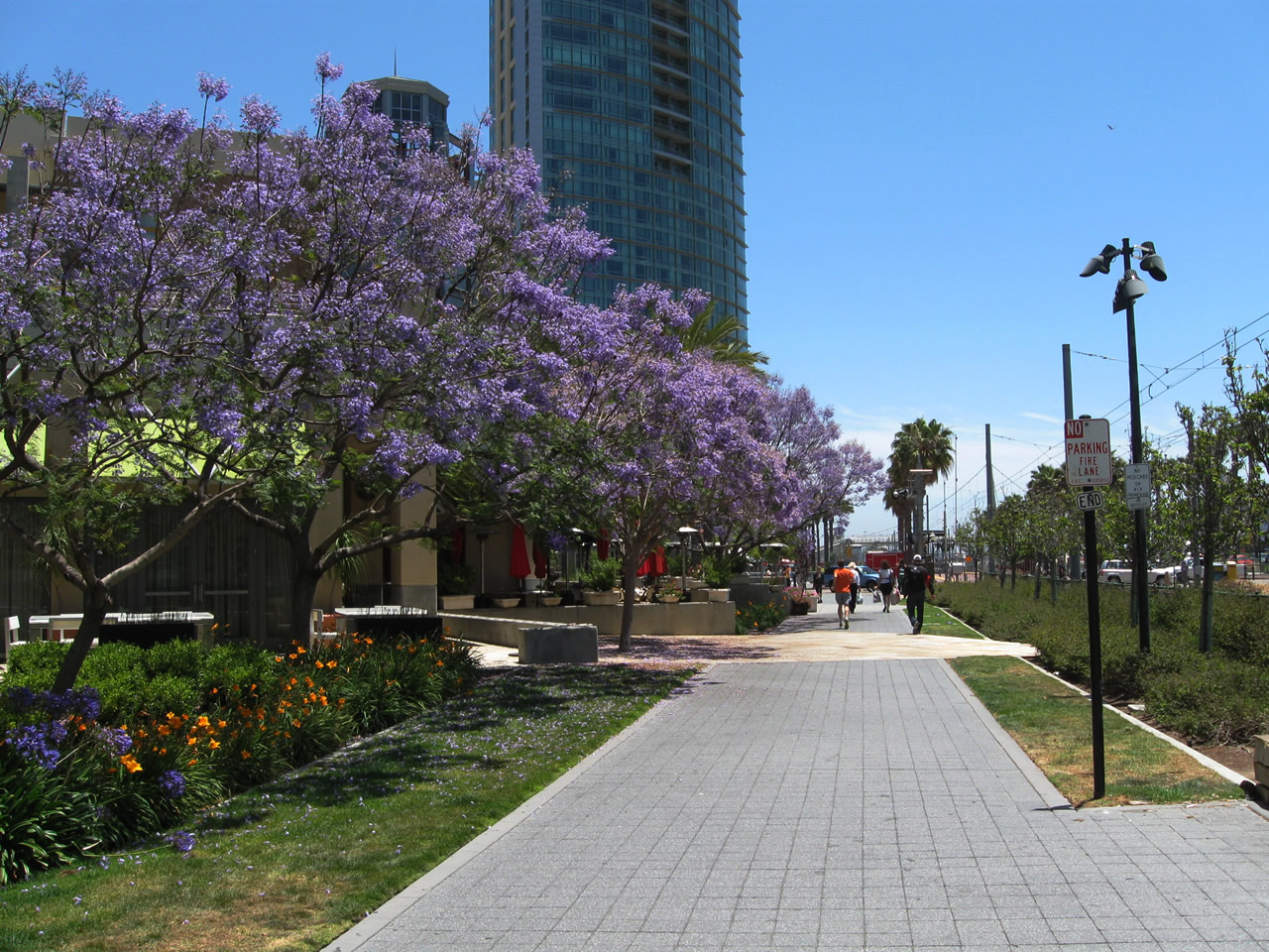
This series of pictures follows the Martin Luther King, Jr. Promenade from Fifth Avenue northwest toward Market Street. The entire extent of the pedestrian promenade is from the Harbor Drive Pedestrian Bridge northwest to Market Street, with crossings at Fifth Avenue, First Avenue, and Front Street. Bicycles and pedicabs are prohibited from the walking path; the promenade parallels the trolley tracks and Harbor Drive. The promenade crosses a large pool at Children's Park. Photos taken 03/24/08 and 12/27/10. |
|
|
|
|
|
|
|
|
|
|
|
|
| Martin Luther King Jr. Promenade south |
|---|
|
|
|
|
Now walking southeast, this series of photos follows Martin Luther King, Jr. Promenade from Market Street toward the Harbor Drive pedestrian bridge. Photos taken 03/24/08 and 06/05/11. |
|
|
|
|
|
|
|
|
|
|
|
|
The dancing waters fountain next to the trolley stop was functional in 2008, but has since ceased operation. Beyond that, the path continues south toward Petco Park, the Omni Hotel, and the Harbor Drive Pedestrian Bridge. The improved path ends temporarily at the pedestrian bridge, but it could be extended should the parking lots to the southeast be improved to include an extended pathway. Photos taken 03/24/08 and 12/27/10. |
|
|
|
|
|
|
|
|
|
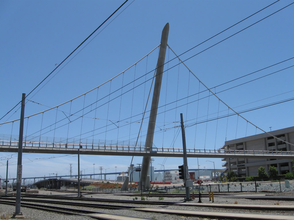
The Martin Luther King, Jr. Promenade ends at the approach to the Harbor Drive pedestrian bridge (which includes the elevator shaft and staircase up). Photo taken 06/05/11. |
| Mesa College Drive east |
|
After the Health Care Drive and Annrae Street intersection, eastbound Mesa College Drive approaches Berger Avenue. Beyond this intersection is an on-ramp to Interstate 805 south. Photo taken 01/14/11. |
|
Eastbound Mesa College Drive meets the on-ramp to Interstate 805 south. Ahead, Mesa College Drive transitions into Kearny Villa Road north. Photo taken 01/14/11. |
|
Mesa College Drive crosses over Interstate 805 and becomes Kearny Villa Road ahead. Photo taken 01/14/11. |
| Miramar Road |
|
Miramar Road is a major, six-lane arterial street that connects Interstate 805 in the west with Interstate 15 to the east, generally following along the northern boundary of Marine Corps Air Station (MCAS) Miramar. Here, Miramar Road travels east between Interstate 805 and Nobel Drive. Construction barricades were in place due to the reconfiguration and expansion of the Interstate 805 interchange in 2011. Photo taken 09/18/11. |
|
Eastbound Miramar Road approaches Nobel Drive, which travels south to the entrance to Miramar National Cemetery, then turns west to cross Interstate 805 and proceed into University City, which is a community of the city of San Diego. Use Nobel Drive west to Interstate 805 south (no access to Interstate 805 north). Photo taken 09/18/11. |
|
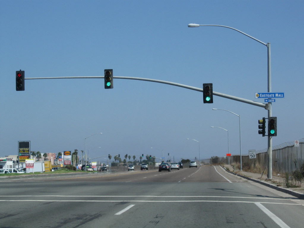
Soon thereafter, eastbound Miramar Road approaches its intersection with Eastgate Mall, which travels north and then also turns west to cross Interstate 805 and proceed into University City. Unlike Nobel Drive, Eastgate Mall offers no access to Interstate 805. Photo taken 09/18/11. |
|
Eastbound Miramar Road meets Miramar Place. Most of Miramar Road is lined with commercial and light industrial facilities, including a variety of wholesalers and distributors. Furniture stores also line Miramar Road, especially near the pyramid. Photo taken 09/18/11. |
|
Meeting Camino Santa Fe, Miramar Road continues east across the southern tier of the community of Mira Mesa (part of the city of San Diego). Use Camino Santa Fe north to Carroll Canyon, Mira Mesa Boulevard, and Calle Cristobal. Plans to extend Camino Santa Fe north across Los Peñasquitos Canyon Preserve to California 56 were scrapped due to environmental concerns. Photo taken 09/18/11. |
|
Light traffic was observed on this beautiful Sunday afternoon along Miramar Road. Photo taken 09/18/11. |
|
The next major intersection along Miramar Road east is with Commerce Avenue north and Milch Road south. While Milch Road primarily serves as a frontage road for businesses on the south side, Commerce Avenue travels north to serve industrial and business park concerns. Photo taken 09/18/11. |
|
|
|
A railroad spur provides access for the businesses and industrial areas along the Miramar Road corridor. The railroad crosses Miramar Road just east of the Commerce Road intersection. Photos taken 09/18/11. |
|
|
|
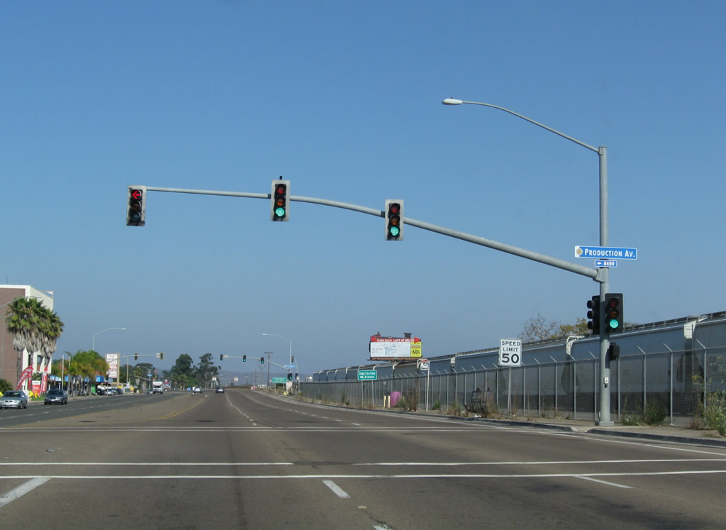
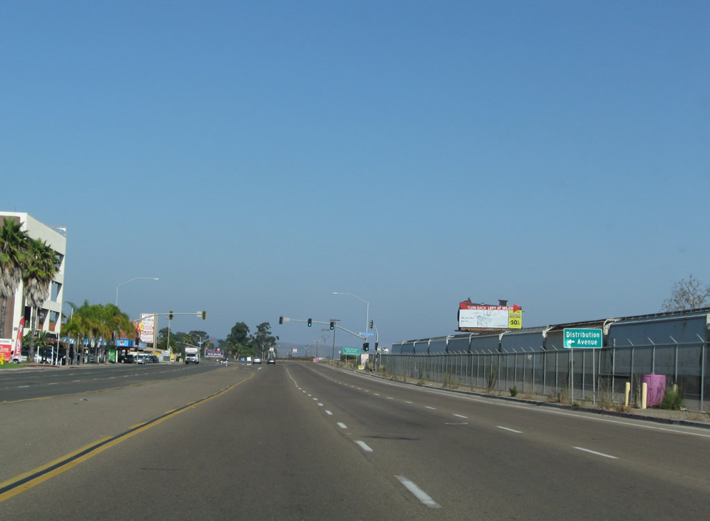
The names of the next two intersections confirm the type of land use along this stretch Miramar Road. First up is Production Avenue, followed by Distribution Avenue. Photos taken 09/18/11. |
|
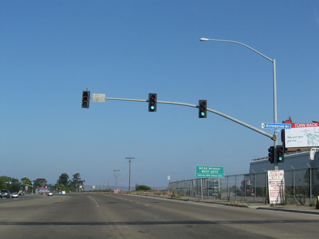
Eastbound Miramar Road approaches Miramar Way, which provides the entrance to the East Gate of MCAS Miramar. Only authorized vehicles may enter the Marine Base. Photo taken 09/18/11. |
|
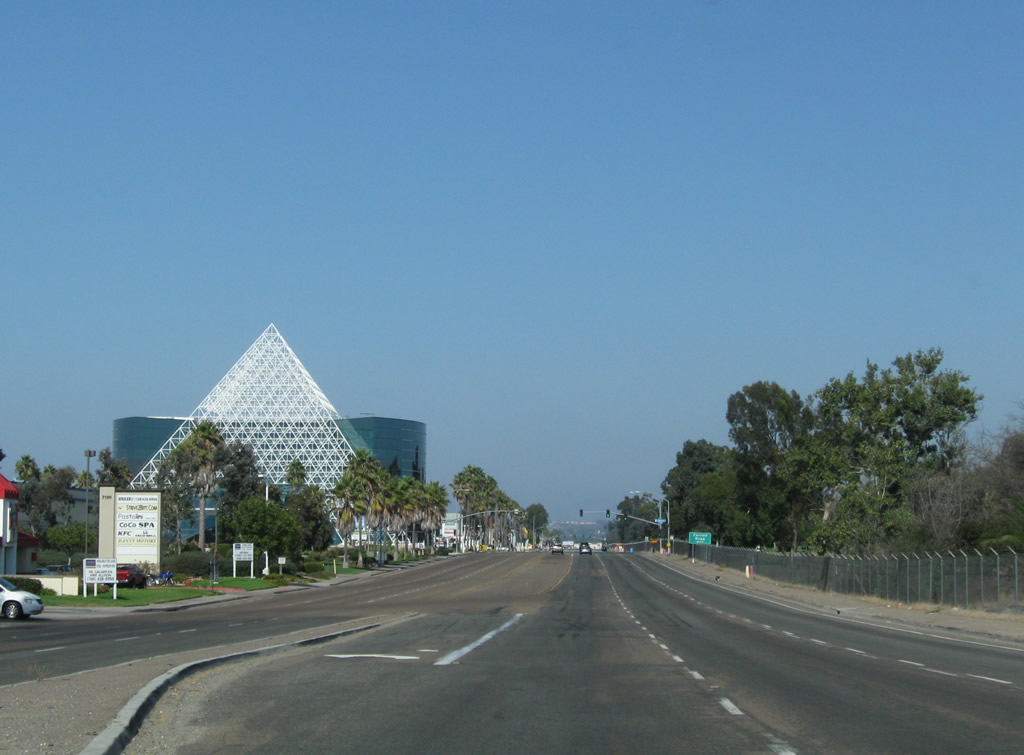
The pyramid, the most visible landmark along Miramar Road, comes into view as the roadway curves along with the northern boundary of MCAS Miramar. Photo taken 09/18/11. |
|
The next intersection along Miramar Road east is with Carroll Road north. Photo taken 09/18/11. |
|
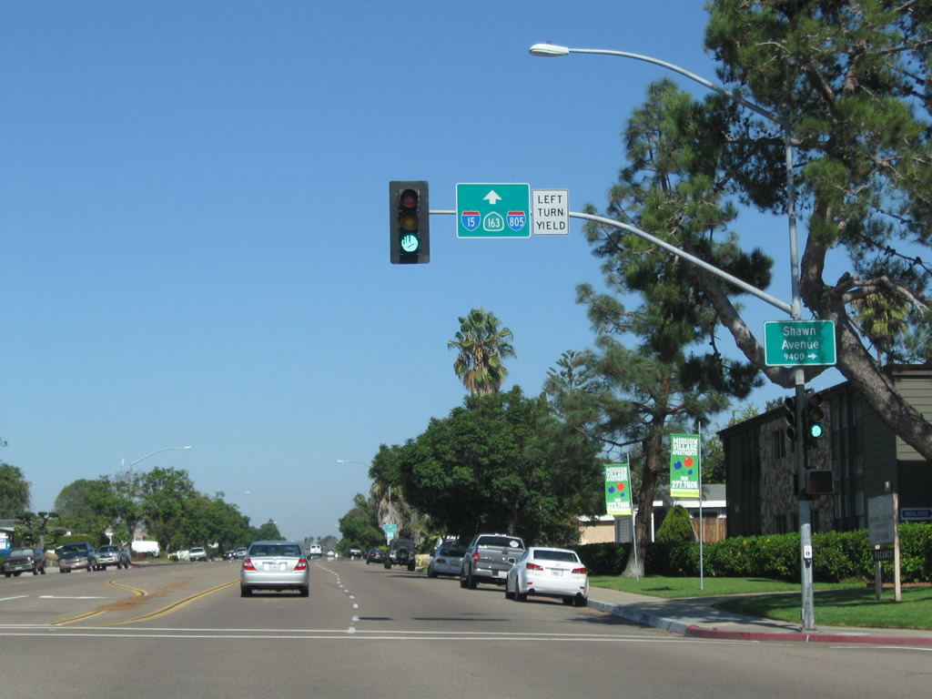
Skipping ahead a couple miles and approaching the east end, Miramar Road intersects former U.S. 395 at the Kearny Villa Road intersection. Turn south here to follow the expressway that briefly served as Interstate 15; this brief expressway alignment travels south and then ends at the interchange with California 52 and California 163. Photo taken 10/08/05. |
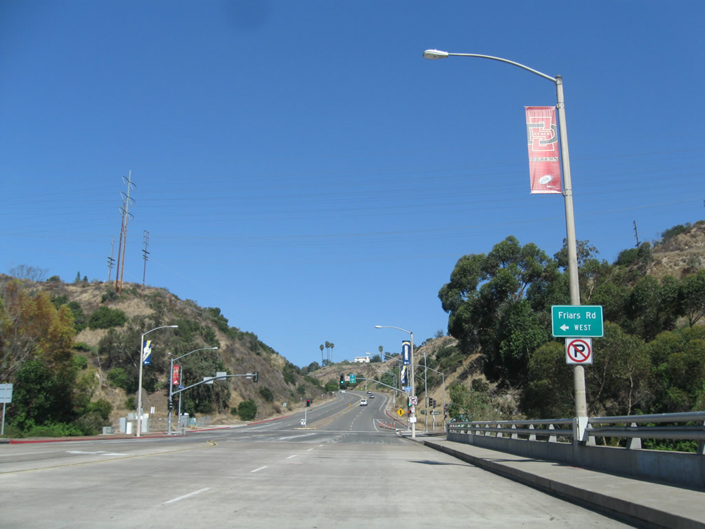
| Mission Center Road |
|
Northbound Mission Center Road approaches its interchange with Friars Road in the Mission Valley community. A mural painted into the highway bridge serves as an entry monument. Photo taken 06/16/06. |
|
Leaving Mission Valley, northbound Mission Center Road enters the community of Serra Mesa and ascends out of the valley. Photo taken 01/19/12. |
|
Landmark canary island pine trees line Mission Center Road as it travels uphill to leave Mission Valley. Photo taken 01/19/12. |
|
Mission Center Road takes a switchback as it continues uphill. Photo taken 01/19/12. |
|
Upon turning east at the switchback, Mission Center Road approaches a grade separation with Interstate 805. Photo taken 01/19/12. |
| Mission Village Road |
|
Mission Village Road connects Qualcomm Stadium and Friars Road with the Serra Mesa community to the north. A trailblazer sign is posted along northbound Mission Village Road after the San Diego Mission Road intersection and exit from Qualcomm Stadium. A diamond interchange connects to Friars Road. Turn right here for Friars Road east. Photo taken 10/11/10. |
|
Passing over Friars Road, northbound Mission Village Road approaches a left turn to westbound Friars Road. Use Friars Road west through Mission Valley to Fashion Valley and Mission Bay Park. Photo taken 10/11/10. |
|
Turn left onto Friars Road west to California 163 (Cabrillo Freeway) and Interstate 8 (Mission Valley Freeway). Photo taken 10/11/10. |
|
Leaving Mission Valley and Qualcomm Stadium behind, northbound Mission Village Road ascends into Serra Mesa, a community of the city of San Diego. Photo taken 10/11/10. |
|
|
|
A series of signs along northbound Mission Village Road direct motorists to the Interstate 15, Interstate 805, and California 163 freeways. Photos taken 10/11/10. |
|
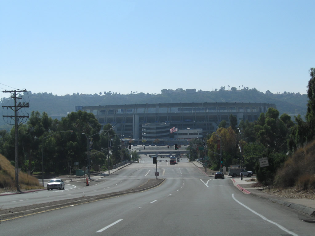
Descending from Serra Mesa into Mission Valley, southbound Mission Village Road approaches Qualcomm Stadium, home of the National Football League's San Diego Chargers. Photo taken 10/11/10. |
|
Southbound Mission Village Road reaches the on-ramp to westbound Friars Road, which parallels the San Diego River west toward Fashion Valley. Photo taken 10/11/10. |
|
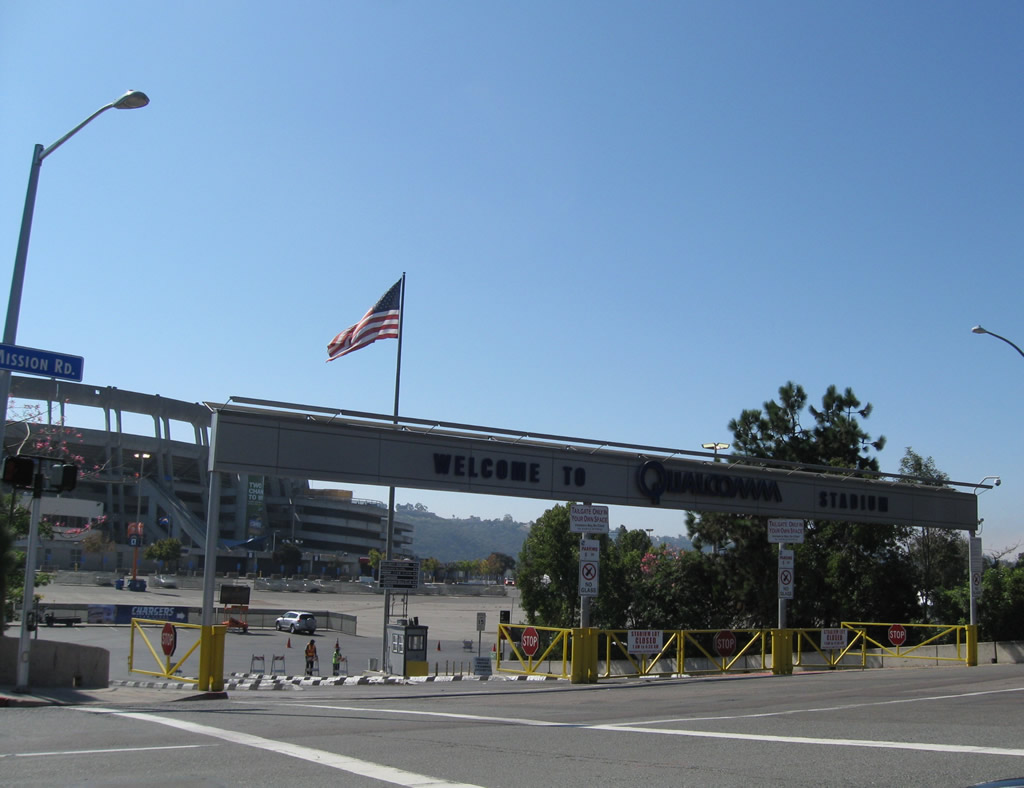
After crossing Friars Road, southbound Mission Village Road enters Qualcomm Stadium, which was originally known as San Diego Stadium and later named Jack Murphy Stadium after a local sportswriter. Opened in 1967, the stadium gained its current name in 1997 after naming rights were purchased by Qualcomm, a local company. Photo taken 10/11/10. |
| Morena Boulevard south |
|
In the Morena District, southbound Morena Boulevard (Historic U.S. 101) approaches Sherman Street near the Linda Vista Road intersection. The point where Morena Boulevard and Linda Vista Road intersect was the original intersection between U.S. 101 and U.S. 395. Both routes have since been retracted out of San Diego County. The Sherman Street sign is unique as it dates back to the at least the 1950s, is black porcelain enamel, and has button copy. Photo taken 06/06/11. |
|
|
|
|
Southbound Morena Boulevard meets the on-ramp to Interstate 5 south to downtown San Diego and former California 209/Rosecrans Street south to Point Loma; the next right turn is to Interstate 8 east to Mission Valley and El Centro. Photos taken 03/18/09. |
|
|
After the ramp to Interstate 5 south, southbound Morena Boulevard passes under Interstate 8 then enters Old Town San Diego. Photos taken 03/18/09. |
|
|
Southbound Morena Boulevard meets the ramp to Interstate 8 east to Mission Valley, the eastern suburbs of San Diego, and El Centro. Continue straight ahead to Old Town San Diego and Taylor Street, the southern terminus of Morena Boulevard. Photos taken 03/18/09. |
| Mount Soledad |
|
|
|
Views the top of Mount Soledad, near the interchange of Interstate 5 and California 52 in La Jolla. The pictures are in clockwise direction, starting in the north looking toward Torrey Pines, then turning south toward downtown. Note the late-afternoon sun angle, which makes views to the south much hazier. Photos taken 03/01. |
| Nimitz Boulevard north |
|
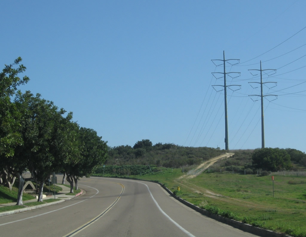
Leaving Harbor Drive, Nimitz Boulevard proceeds north through Point Loma toward Mission Bay Park and Pacific Beach. Nimitz Boulevard generally has two lanes in each direction with a median barrier. Portions of the route are at expressway and minimal freeway standards. The north end of Nimitz Boulevard is located at the Interstate 8 and Sunset Cliffs Boulevard junction near Ocean Beach. Photo taken 03/29/10. |
|
Northbound Nimitz Boulevard meets Rosecrans Street (former California 209) near Shelter Island and Liberty Station (former Naval Training Center). The state route was decommissioned in 2001. Photo taken 03/29/10. |
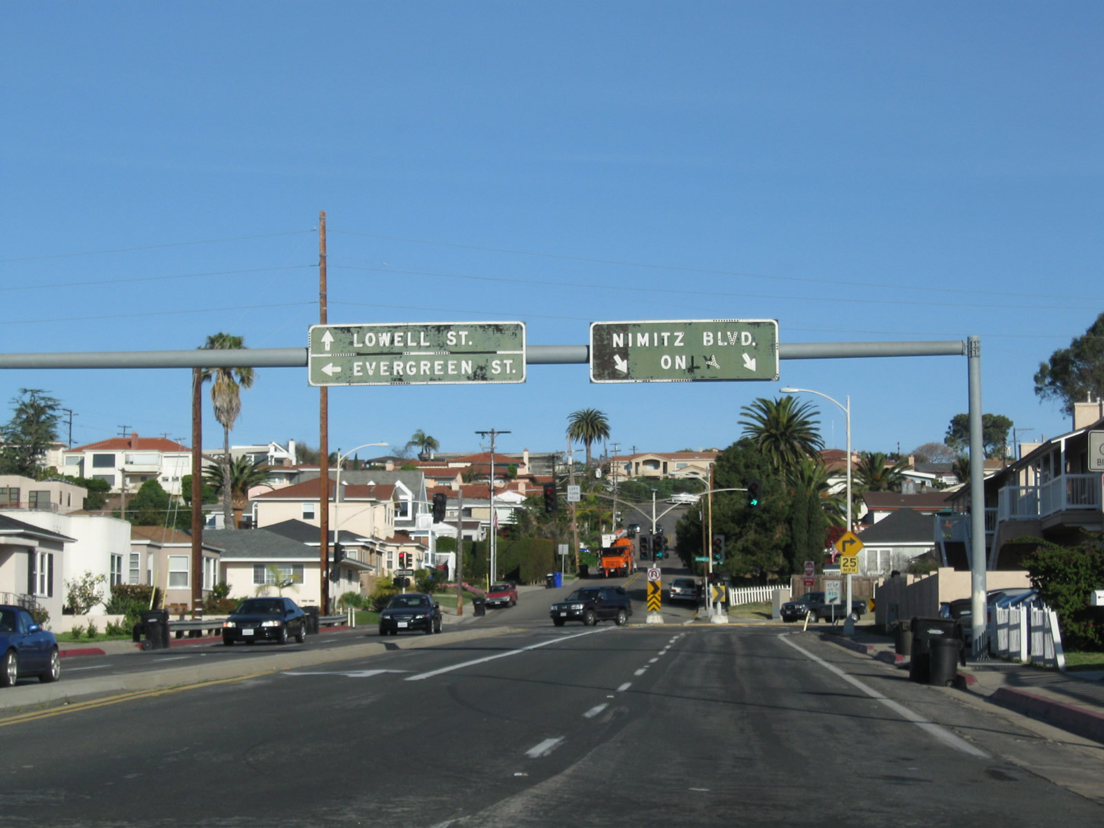
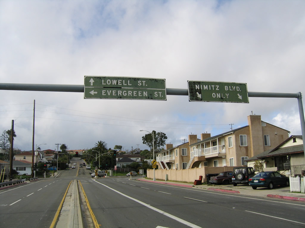
|
A very old overhead guide sign for Lowell Street and Evergreen Street along northbound Nimitz Boulevard is peeling and losing its color. Photo taken 03/29/10. |
|
|
After the Rosecrans Street intersection northbound Nimitz Boulevard prepares to split. Stay right for the continuation of Nimitz Boulevard north to Mission Bay Park and Interstate 8. Stay left for the connection to Lowell Street north and Evergreen Street west. These old, wooden signs have been in this position for a long time and have deteriorated significantly. They are still in place as of 2009. Photos taken 02/19/05. |
|
At this intersection, Nimitz Boulevard curves onto its expressway alignment. Photo taken 03/29/10. |
|
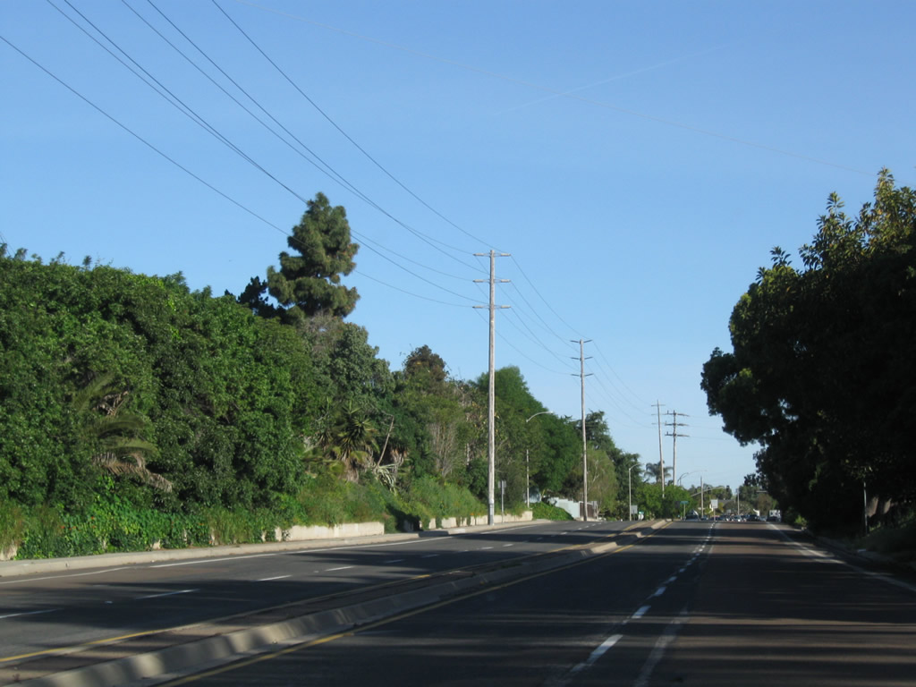
Nimitz Boulevard continues north with limited intersections and no driveway access as it proceeds through Loma Portal. Photo taken 03/29/10. |
|
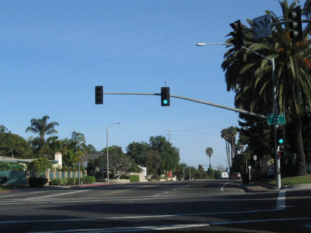
Northbound Nimitz Boulevard meets Chatsworth Boulevard at this traffic signal. Turn left here for Chatsworth Boulevard south to Cabrillo National Monument. Photo taken 03/29/10. |
|
Soon thereafter, Nimitz Boulevard meets Atascadero Drive west and Tennyson Street north to Voltaire Street. Photo taken 03/29/10. |
|
|
|
Northbound Nimitz Boulevard goes below grade to pass under the Voltaire Street and Famosa Boulevard bridges. This is a brief freeway alignment that will end at the signalized intersection with West Point Loma Boulevard. Photos taken 03/29/10. |
|
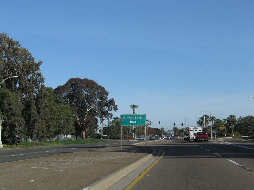
Northbound Nimitz Boulevard approaches West Point Loma Boulevard. Photo taken 03/29/10. |
|
Nimitz Boulevard connects Harbor Drive with Interstate 8 and Sunset Cliffs Boulevard across Point Loma along a multi-lane, divided highway. This sign is the first advance warning for Interstate 8 along northbound Nimitz Boulevard in Point Loma. Photo taken 05/22/04. |
|
Use Interstate 8 east to Interstate 5 south or Nimitz Boulevard straight ahead to Sunset Cliffs Boulevard to Sea World Drive east to Interstate 5 north. There is no direct connection from eastbound Interstate 8 to northbound Interstate 5. Photo taken 05/22/04. |
|
Northbound Nimitz Boulevard reaches the off-ramp for Interstate 8 east to Interstate 5 south; Nimitz Boulevard changes into Sunset Cliffs Boulevard and then Sea World Drive by continuing straight ahead into Mission Bay Park. Photo taken 05/22/04. |
|
This is the gore point signage found on northbound Nimitz Boulevard for the connection to Interstate 8. This marks the western terminus of Interstate 8. Photo taken 05/22/04. |
| Nimitz Boulevard south |
|
After splitting from Sunset Cliffs Boulevard, southbound Nimitz Boulevard assumes a near-expressway configuration with access limited to traffic signals and a half-diamond interchange with Famosa Boulevard. Photo taken 02/19/05. |
|
The only exit from southbound Nimitz Boulevard is Famosa Boulevard, which connects to Catalina Boulevard southwest to Fort Rosecrans National Cemetery (military reservation) and Cabrillo National Monument. Photo taken 02/19/05. |
|
Southbound Nimitz Boulevard meets the off-ramp to Famosa Boulevard west to Catalina Boulevard south. Photo taken 02/19/05. |
|
Some distance south of Famosa Boulevard, southbound Nimitz Boulevard approaches former California 209/Rosecrans Street in Roseville. This trailblazer for California 209 was gone as of 2008. Photo taken 02/19/05. |
| Ninth Avenue north |
|
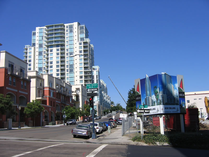
Many redevelopment activities are currently taking place in downtown San Diego. Several projects are clustered on Cortez Hill, which is named for the famous El Cortez Hotel, which was redeveloped into a condominium complex earlier this decade after years of laying dormant. As a result of this reconstruction, many other buildings nearby have been retrofitted or replaced with new construction, including the tower shown as proposed for the northeastern corner of 9th Avenue and Ash Street. Photo taken 10/06/05. |
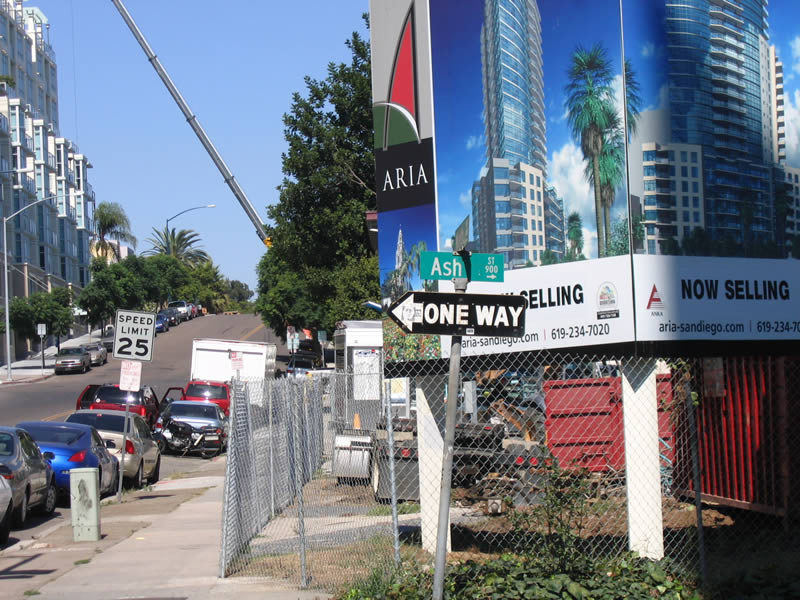
|
This view of the 9th Avenue and Ash Street intersection is afforded from northbound 9th Avenue. The billboard for the proposed new tower on the northeast corner is visible, as is the older style one-way signage that is white on black with button copy. Photo taken 10/06/05. |
| Normal Street north |
|
Normal Street is a short yet wide street that connects the communities of Hillcrest and University Heights. A project is planned to create green space and parking spaces in the median of Normal Street. This picture shows the first block of Normal Street between University Avenue and Harvey Milk Street (former Blaine Avenue). Photo taken 01/11/12. |
|
Northbound Normal Street meets Harvey Milk Street (former Blaine Avenue) at this intersection. Photo taken 01/11/12. |
|
Normal Street meets Lincoln Avenue at this stop sign. Photo taken 01/11/12. |
|
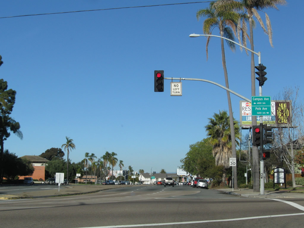
Divoted curbing on the unimproved raised median speaks to the age of this median as it comes into view along northbound Normal Street as we approach Campus Avenue and Polk Avenue. Northbound Normal Street will become Business Loop I-8 between this traffic signal and the point where Normal Street, Park Boulevard, and El Cajon Boulevard merge together. Photo taken 01/11/12. |
|
Business Loop I-8, which follows Washington Street east between California 163 and Normal Street, merges onto Normal Street for the short distance between Normal Street and Park Boulevard. The business route will then merge onto El Cajon Boulevard east. Photo taken 01/11/12. |
| Old Town Transit Station |
|
|
|
A massive viaduct carries ten lanes of Interstate 5 over the Old Town Transit Center parking lot and Pacific Highway in Old Town San Diego. These pictures were taken looking east from Pacific Highway toward the viaduct, then looking south while under the viaduct. Photos taken 03/18/09. |
|
|
|
Underneath the railroad tracks is a pedestrian tunnel that connects Old Town State Park with the large parking lot located under the Interstate 5 viaduct. The first three photos show the tunnel looking west, and the second three photos show the tunnel looking east. Photos taken 03/18/09. |
|
|
|
| Park Boulevard north |
|
Park Boulevard begins its northbound journey at Harbor Drive near the Harbor Drive Pedestrian Bridge and Martin Luther King, Jr. Promenade at Petco Park. This view looks northeast from the railroad tracks alongside Petco Park. Photo taken 12/27/10. |
|
Near K Street, only trolley tracks follow Park Boulevard as it travels north toward Balboa Park. The main library is located just west of this vantage point. Photo taken 12/27/10. |
|
A wide walking path parallels the east side of the trolley tracks. Photo taken 12/27/10. |
|
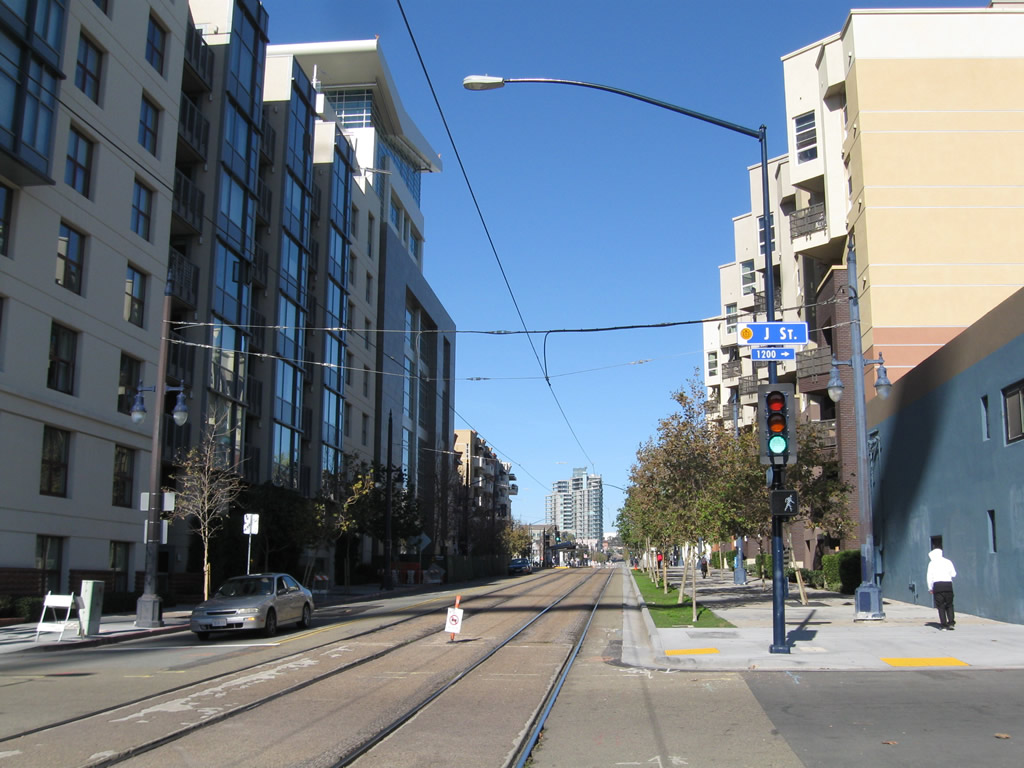
Northbound Park Boulevard meets J Street. Photo taken 12/27/10. |
|
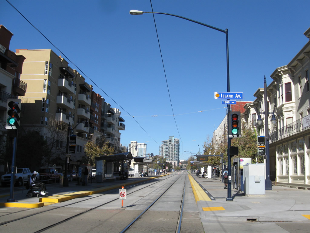
Continuing north, Park Boulevard approaches Island Avenue. Photo taken 12/27/10. |
|
Park Boulevard passes under the University Heights Business District arch. This gateway arch is located north of El Cajon Boulevard and Normal Street in the city of San Diego. Photo taken 05/15/08. |
| Park Boulevard south |
|
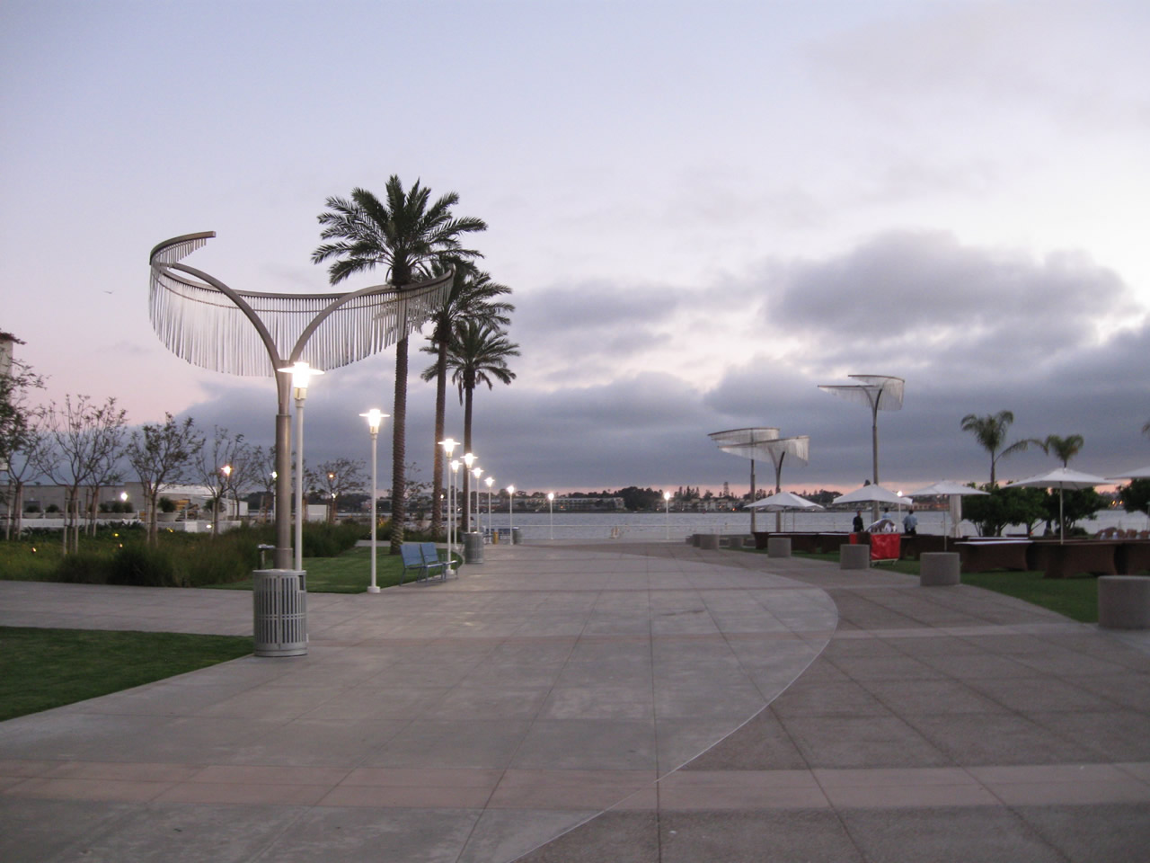
The south end of the Park to Bay Link is this pedestrian plaza located next to the Hilton. Park Boulevard culminates here, at the bayfront, just past the Harbor Drive Pedestrian Bridge. Photo taken 06/29/11. |
| Pershing Drive north |
|
Pershing Drive begins at the intersection of B Street and 19th Street; this view looks north from 19th Street. Initially Pershing Drive looks like a freeway, but it quickly downgrades to a surface street by the time it meets Florida Drive and 26th Street in Balboa Park. This brief freeway section was originally planned as California 171/Switzer Canyon Freeway, which was officially cancelled in 1994. Photo taken 12/16/10. |
|
|
|
Traffic from 19th Street merges with traffic from Interstate 5 to form Pershing Drive. Had California 171 been constructed, the freeway would have followed Pershing Drive until the 26th Street intersection, then taken on new alignment cutting through Balboa Park Golf Course then leading into Switzer Canyon (a finger canyon). At the traffic signal, turn left for Florida Drive north to University Heights or right for 26th Street southeast to Golden Hill. Pershing Drive ascends the Arizona Landfill en route to the Pershing Portal into North Park. Photos taken 12/16/10. |
|
|
|
| Pershing Drive south |
|---|
|
|
|
This series of pictures follows Pershing Drive (unconstructed California 171) south into the Interstate 5 interchange. Stay right to connect to Interstate 5 (San Diego Freeway) north (first on-ramp) or Interstate 5 (Montgomery Freeway) south (second on-ramp). Pershing Drive then passes under Interstate 5 and comes to a somewhat abrupt end at B Street. Turn right for B Street west into downtown San Diego. Photos taken 03/21/11. |
|
|
|
| Phyllis Place east |
|
A set of San Diego Gas & Electric power lines follows Phyllis Place on the rim of Mission Valley. Photo taken 01/19/12. |
|
Eastbound Phyllis Place approaches Interstate 805. Turn right for Interstate 805 south to Mission Valley, North Park, City Heights, National City, and Chula Vista. Turn left for Interstate 805 north to Clairemont, Kearny Mesa, University City, and Sorrento Valley. Photo taken 01/19/12. |
|
Phyllis Place crosses over Interstate 805 on this concrete bridge. Photo taken 01/19/12. |
|
Eastbound Phyllis Place meets the on-ramp to Interstate 805 north. Photo taken 01/19/12. |
| Phyllis Place west |
|
Phyllis Place travels east-west along the northern rim of Mission Valley between Interstate 805 and a small neighborhood within the Serra Mesa community of the city of San Diego. Photo taken 01/19/12. |
| Poway Road east |
|
Poway Road is signed as San Diego County S-4. An initial reassurance shield is posted along eastbound Poway Road after the Interstate 15 interchange. Photo taken 06/05/11. |
Page Updated December 9, 2012.