

Historic U.S. 101 - Southern & Central San Diego
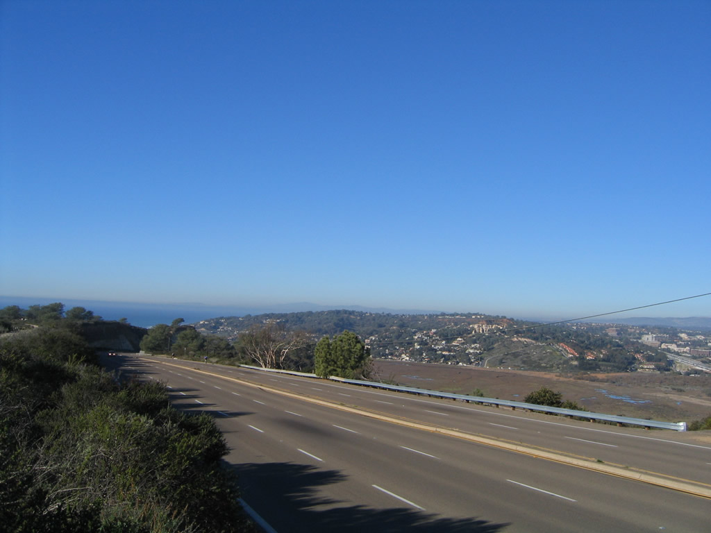
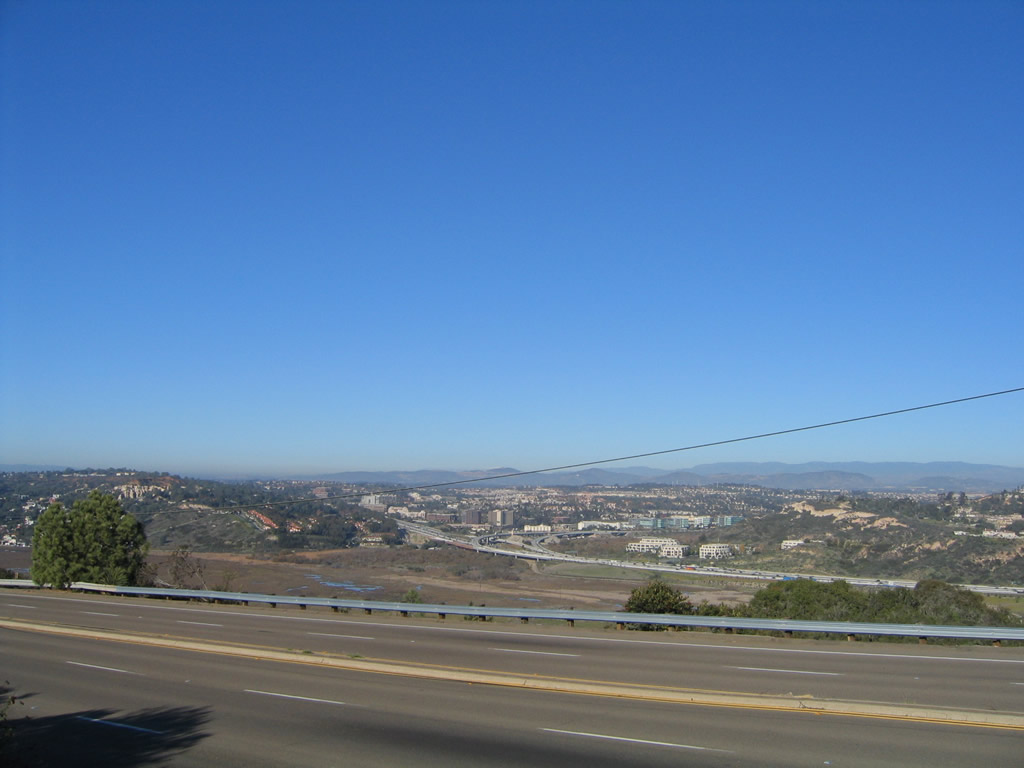
Looking north from the first generation of U.S. 101 in Torrey Pines State Reserve, this view shows the five-lane, second-generation U.S. 101 (North Torrey Pines Road) as it climbs Torrey Pines Mesa. Interstate 5 (third generation alignment) is visible at the right edge of the picture. Photo taken 12/11/04.
- Historic U.S. 101 North - Southern & Central San Diego
- Historic U.S. 101 South - Southern & Central San Diego
U.S. 101 has been completely decommissioned in San Diego and Orange Counties. Starting at the International Border at San Ysidro, U.S. 101 roughly paralleled Interstate 5 all the way through San Diego County. It began at the southern trolley terminus in the city of San Diego along San Ysidro Boulevard, continued northwest via Beyer Boulevard through the Otay-Nestor community, then entered the city of Chula Vista as Broadway. The old alignment of U.S. 101 was buried by the Mile of Cars in National City, then hooks into Harbor Drive via an "S" curve at 8th Street. Re-entering the city of San Diego, historic U.S. 101 entered downtown via Harbor Drive, then met U.S. 80 and U.S. 395 at the intersection of Harbor and Market Street. An older alignment (from before Harbor Drive was built) took U.S. 101 along Main Street and Broadway into downtown. At Pacific Highway (just north of Seaport Village), post-1933 U.S. 101 followed Pacific Highway toward the airport, passing through a vintage segment of expressway that was originally slated to be part of Interstate 5 (and was built as part of the World War II effort in 1942-1943) but today is a city of San Diego major arterial street, complete with old-style interchanges.
Leaving downtown, the original 1926 route of U.S. 101 (north of Broadway) appears to have followed India Street, San Diego Avenue, Morena Boulevard, Garnet Avenue, Cass Street, Turquoise Street, La Jolla Boulevard, Prospect Place, Torrey Pines Road, La Jolla Scenic Drive, and North Torrey Pines Road (partially destroyed with the construction of UCSD). This route was realigned through Rose Canyon by 1933, taking the route along Pacific Highway, Mission Bay Drive (partially obliterated by modern Interstate 5 between Old Town and Rose Canyon), Gilman Drive, and North Torrey Pines Road.1
Leaving the city of San Diego along North Torrey Pines via San Diego County S-21 near Torrey Pines Municipal Golf Course, U.S. 101 entered the city of Del Mar after passing over Soledad Creek and the San Diego Northern Railroad. Now known as Camino del Mar, U.S. 101 is signed as an historic route for the first time along its northerly journey. Continuing through downtown Del Mar, U.S. 101 enters Solana Beach just west of the Del Mar Racetrack and Fairgrounds, home of the San Diego County Fair (formerly known as the Del Mar Fair).
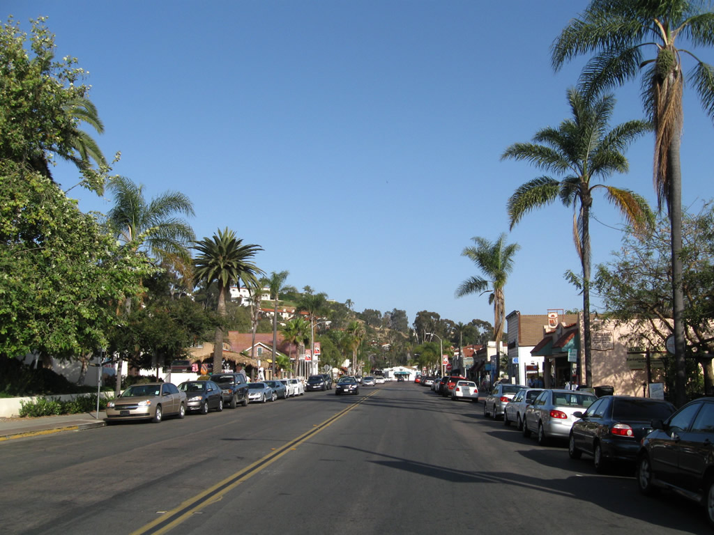
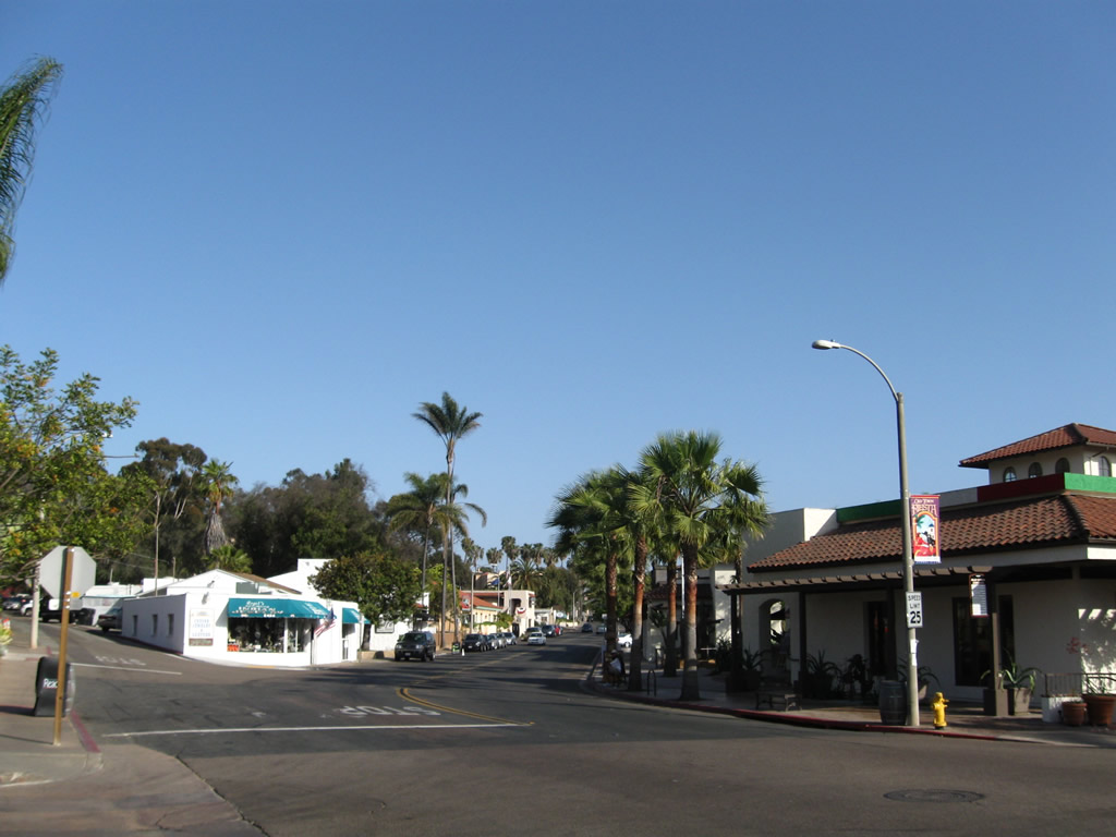
U.S. 101 hugs the coast as it passes through the next several towns: Solana Beach, Encinitas (including Cardiff and Leucadia), and Carlsbad. Locally known as "Coast Highway 101," "Coast Highway," or simply "Highway 101," U.S. 101 is well-signed with brown historic shields as well as some standalone shields that are reminiscent of the original U.S. 101 shields. Each town has its moments of interest, from the outstanding Encinitas restaurants to the antique stores in Leucadia and Solana Beach.
Passing through Carlsbad and entering Oceanside at the mouth of the Buena Vista Lagoon, U.S. 101 finally leaves sight of the coast as it enters the city. U.S. 101 follows what used to be known as Hill Street but is today known as Coast Highway (even though the route is several blocks inland). After passing Vista Way (to the California 78 freeway), Mission Avenue (California 76 Business), and San Luis Rey Mission Expressway (California 76), U.S. 101 is forcibly absorbed into Interstate 5 for the first time. The old route continues to run parallel to the freeway, but it is largely inaccessible because of its location within Camp Pendleton Marine Base. U.S. 101 does not gain freedom from Interstate 5 until the Harbor Boulevard exit (former California 72).
Upon entering San Clemente, the first city north of Camp Pendleton and the first city in Orange County, U.S. 101 follows El Camino Real and the Coast Highway through the city via the poorly signed Business Loop I-5. Through the newly developed areas along Interstate 5 north of San Clemente and San Juan Capistrano, the old alignment of U.S. 101 generally remains within the shadow of Interstate 5. At the Harbor Boulevard exit in Anaheim (very close to Disneyland), old U.S. 101 splits off from Interstate 5, following Harbor Drive (former California 72) north through Fullerton to La Habra, then turns northeast along California 72 (Whittier Boulevard) to enter the county of Los Angeles. Whittier Boulevard is home to a variety of old expressway artifacts and is well worth the trip for vintage U.S. 101.
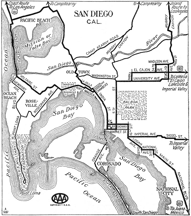
This 1933 AAA map of San Diego shows the original route of U.S. 101 prior to the completion of Mission Bay Park. Although the streets used by U.S. 101 are not all individually labeled, it does show the path U.S. 101 took during those early days of the U.S. highway. See also a 1940 Gousha Map.
Split Route: U.S. 101E and 101W
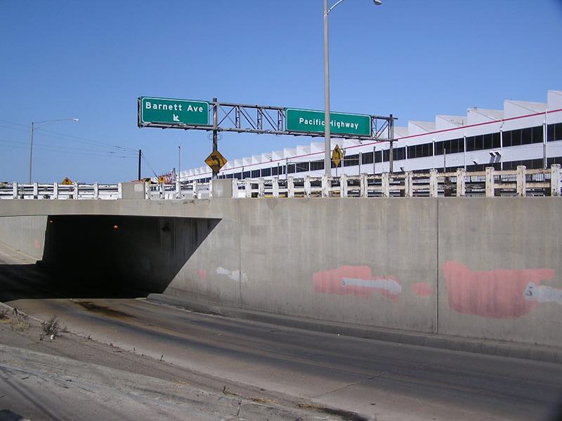
Some maps depict a split route definition for U.S. 101 in between Middletown and Torrey Pines Mesa. Called U.S. 101E and U.S. 101W for the eastern and western alignments of U.S. 101, the two routes most likely split somewhere near Old Town, Middletown, Five Points, or Midway/Sports Arena area. A possible starting point for the split may have been the current interchange between Barnett Avenue and Pacific Highway in the Midway district. If signed, it appears that U.S. 101E followed the 1933 historic alignment of Old U.S. 101 via Pacific Highway, Morena Boulevard, Mission Bay Drive, Gilman Drive, and North Torrey Pines Road. U.S. 101W seems to have followed the 1926 alignment and may have had deviations from the route described above.
Possible routes for U.S. 101W (leaving U.S. 101) include but are not limited to:
- Barnett Avenue west, Midway Drive north, Sports Arena Drive, Mission Bay Drive, and possibly Ingraham Street to Mission Boulevard into the community of Pacific Beach and connecting with La Jolla Boulevard
- Barnett Avenue west, Midway Drive north, former bridge to Mission Beach, and Mission Boulevard north to La Jolla Boulevard
- Barnett Avenue west, Midway Drive north to Ingraham Street, which changes into Foothill Drive and Turquoise Street before connecting to La Jolla Boulevard
- Morena Boulevard north to Grand Avenue or Garnet Avenue west to Ingraham Street or Cass Street north to Turquoise Street west, then north again on La Jolla Boulevard
In the second possibility, U.S. 101W may have connected to the south end of Mission Boulevard in the Mission Beach community via either the West Mission Bay Drive bridge or the old bridge that used to connect Mission Beach with Ocean Beach at the mouth of Mission Bay and the San Diego River. (This bridge did not survive for long, and it is no longer in place today.) Since we've not found any good street-level maps that clearly show U.S. 101E or U.S. 101W, it is really conjectural as to where they went.
Continuing north, the 1926 alignment of U.S. 101 (U.S. 101W) definitely stayed west of Mount Soledad, passing through the Bird Rock neighborhood before entering downtown La Jolla via La Jolla Boulevard and Prospect Place (or possibly Pearl Street). U.S. 101W then followed Torrey Pines Road to La Jolla Shores Drive, then rejoined U.S. 101E near the current North Torrey Pines Road/La Jolla Shores Drive intersection just west of the University of California at San Diego (UCSD). Torrey Pines Road bypasses La Jolla Shores Drive to the east and is the more recent iteration of U.S. 101 through here. The split route was gone by the 1940s. With development on the coast, the main route of U.S. 101 relocated to stay east of La Jolla, Mount Soledad, Pacific Beach, and Mission Beach by using Gilman Drive. The following map shows our best guess of the approximate routing of the old U.S. 101E-W split that used to exist in the northern San Diego area.
| Historic U.S. 101 - San Diego scenes | |
|---|---|
| San Ysidro | |
 |
Southern terminus of Historic U.S. 101 at Camino de la Plaza at the Mexican Port of Entry in San Ysidro, a community of the city of San Diego. Photo taken 06/99. |
 |
Southbound Historic U.S. 101 along San Ysidro Boulevard approaching Camino de la Plaza. Photo taken 06/99. |
 |
Southbound Historic U.S. 101 along San Ysidro Boulevard after Camino de la Plaza approaching the southern terminus of the trolley station. At one time, this marked the port of entry into Tijuana, but the border crossing has since been realigned to match the flow of Interstate 5. This marks the southern terminus of Historic U.S. 101. Photo taken 06/99. |
| Old Pacific Highway Bridge over Cudahy Channel north | |||
|---|---|---|---|
 |
 |
 |
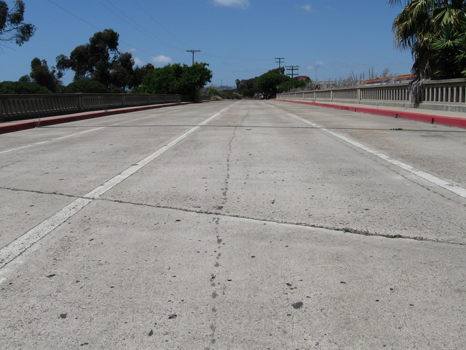
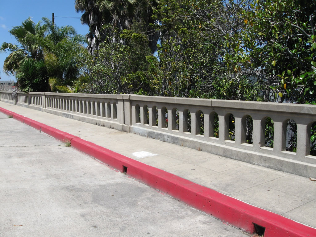
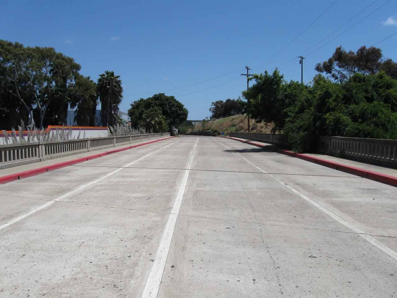
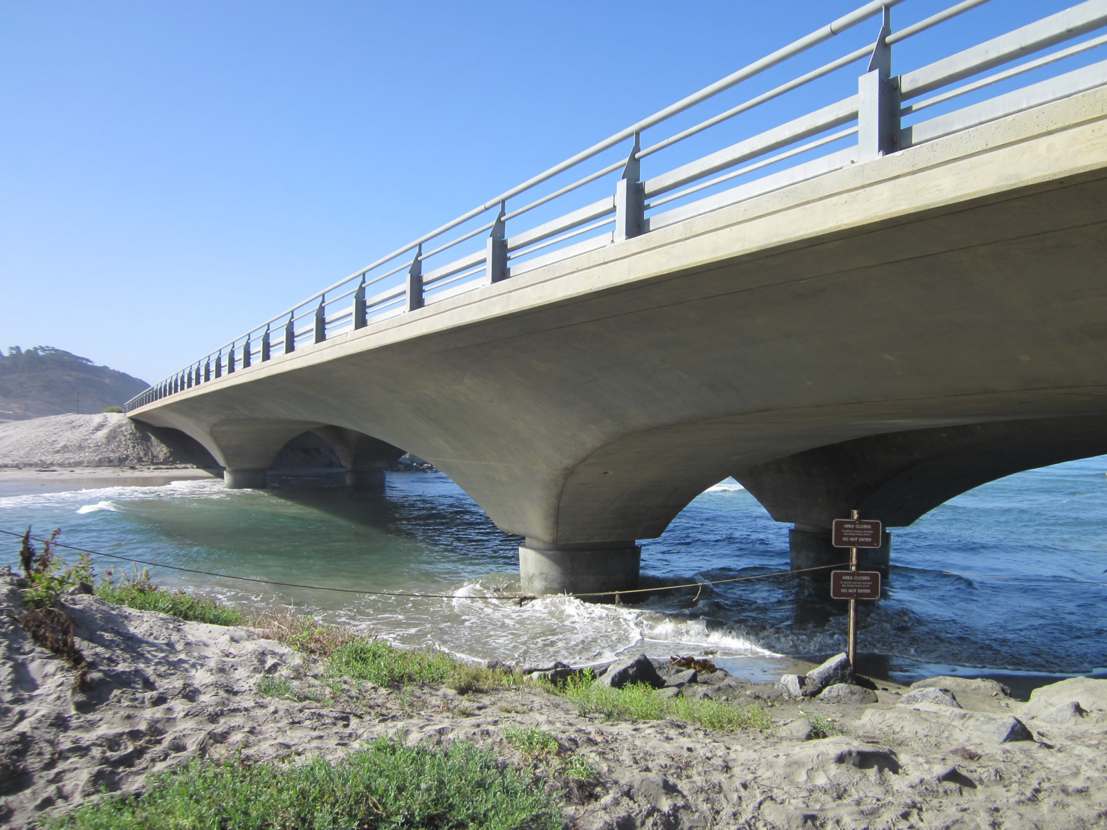
A 1933 concrete T-beam bridge carries Anna Avenue over the Cudahy Channel. This bridge was widened to increase traffic flow; it appears to have had at least four lanes. U.S. 101 used to pass over this bridge, but was later rerouted as part of the freeway construction. This series of pictures looks north along Anna Avenue, which spurs off Pacific Highway in the Morena District and provides local business access, ending at a dead end. Behind the dead end is the Interstate 5 and Sea World Drive interchange (Exit 21); the roadway north of here was abandoned in order to provide sufficient room for the interchange. As a result, this bridge sees very little daily traffic as it only serves adjacent businesses. Photos taken 06/06/11. |
 |
 |
 |
|
 |
 |
 |
|
 |
 |
 |
|
| Old Pacific Highway Bridge over Cudahy Channel south | |||
 |
 |
 |
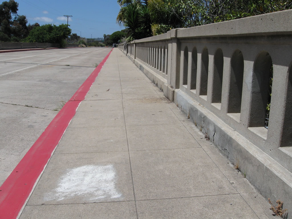
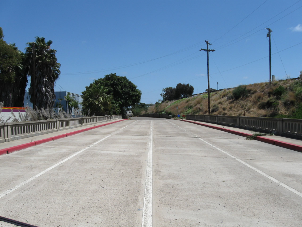
This series of pictures looks south along Anna Avenue. At the south end of the bridge, the bridge would have continued straight and merged directly onto today's Pacific Highway; the last few pictures show the trajectory of the bridge versus the earthen fill built to carry modern Pacific Highway over Interstate 5. The segment of modern Pacific Highway between Anna Avenue and Sea World Drive is not the original Pacific Highway, but Pacific Highway south of Anna Avenue is an historic route of U.S. 101 (and briefly Business Loop I-5). The road was aligned due to the Interstate 5 and Interstate 8 interchange construction. Photos taken 06/06/11. |
 |
 |
 |
|
 |
 |
 |
|
| Pacific Highway | |
|---|---|
 |
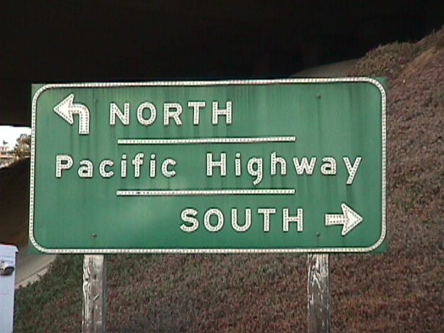
This pull-through sign for Pacific Highway was posted on an overhead sign on northbound just south of Washington Street; it was replaced with a reflective sign in early 2003. The older sign was porcelain enamel with no button copy; the replacement signs are reflective. Photo taken 06/99. |
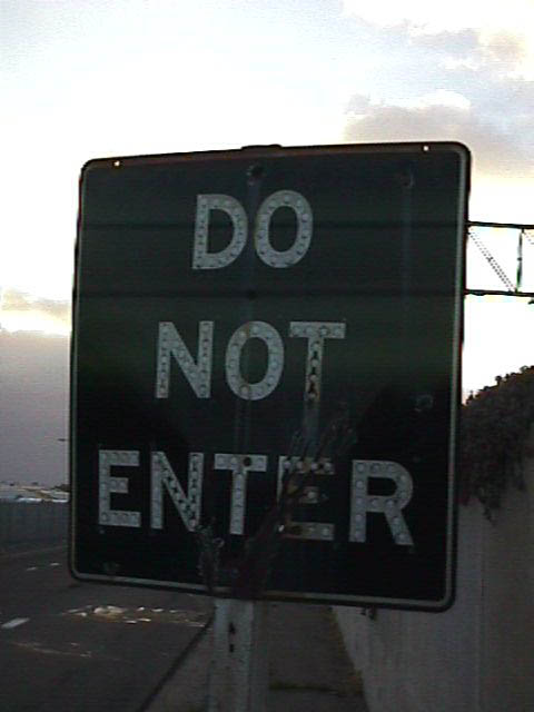 |
An old white on black "Do Not Enter" signage used to be located on the off-ramp from southbound Pacific Highway to Washington Street (this view looks north in the wrong way of the off-ramp). This sign was modernized to the red and white standard in 2003 along with the other Pacific Highway signs. Photo taken 06/99. |
 |
This older directional signage for Pacific Highway was posted along eastbound Washington Street. It was removed and apparently not replaced. Photo taken 06/99. |
 |
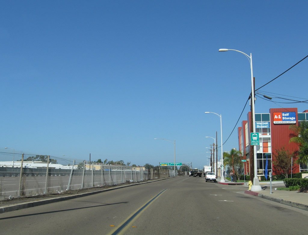
A frontage road parallels Pacific Highway and offers access to "roadside business" that otherwise would not be accessible from the northbound lanes of the Pacific Highway freeway. This view looks north on the frontage road just north of the Washington Street intersection. An off-ramp connects Pacific Highway directly to the frontage road, flying overhead. Photo taken 10/09/10. |
 |
 |
 |
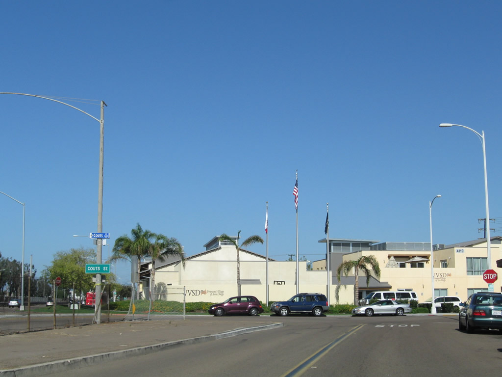
The off-ramp from northbound Pacific Highway merges onto the frontage road on the right side. The Pacific Highway frontage road features old highway features, most notably the divoted curbing seen on the left side of the frontage road. The frontage road connects several businesses alongside Pacific Highway and ends at Coutts Street. A chain link fence is all that separates the old freeway from the frontage road. Photo taken 10/09/10. |
 |
 |
 |
 |
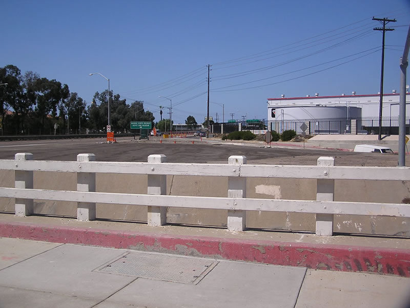 |
This set of photos shows areas around the Pacific Highway and Witherby Street interchange near the Marine Corps Recruit Depot looking northwest. Photos taken 09/23/06. |
 |
 |
These views are from Pacific Highway looking east on Witherby Street toward the railroad overpass and Interstate 5. Photos taken 09/23/06. |
 |
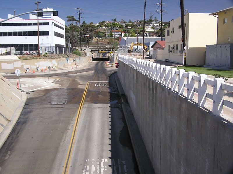
Now looking south, this view shows the northbound lanes at the Witherby Street subway. Photo taken 09/23/06. | |
 |
This intersection is located immediately east of the Pacific Highway and Witherby Street interchange. The lack of signage here makes navigation a bit more difficult than it would otherwise be through this below grade maze. This image is taken looking southeast from Pacific Highway. Photo taken 09/23/06. | |
 |
 |
 |
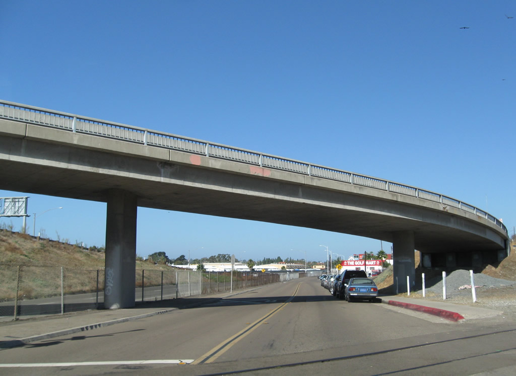
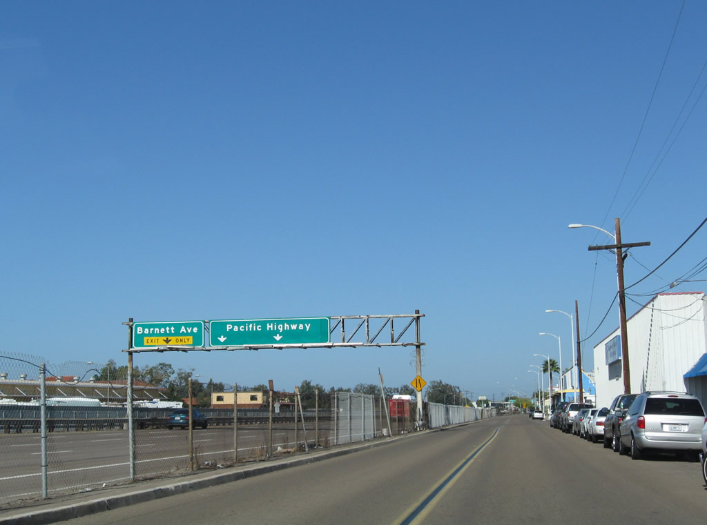
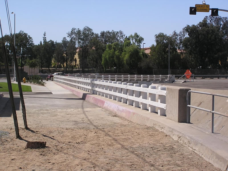
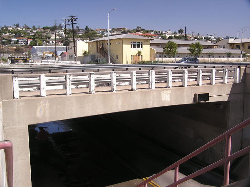
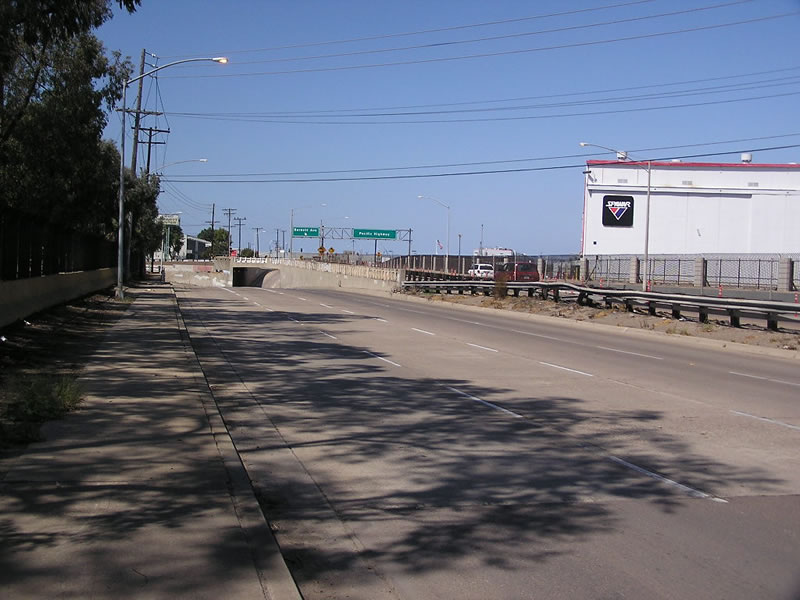
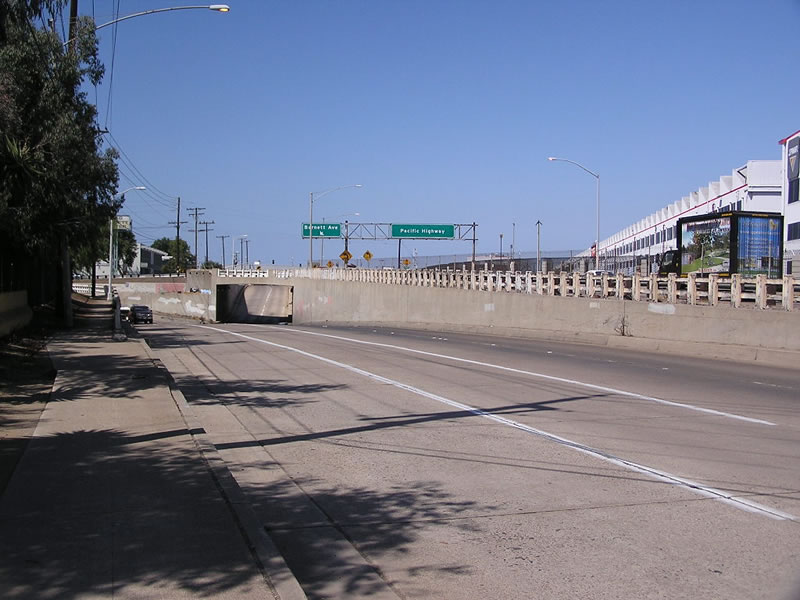
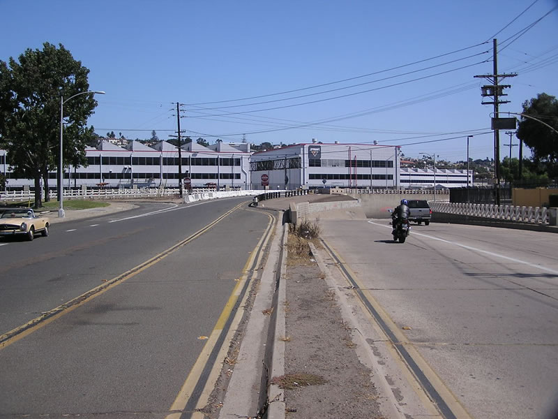
This suite of pictures shows the view of the southbound lanes of Historic U.S. 101 (Pacific Highway) at the Barnett Avenue interchange looking north toward the subway. The adjacent sidewalk offers date stamps of 1942. Photos taken 09/23/06. |
 |
 |

|
 |
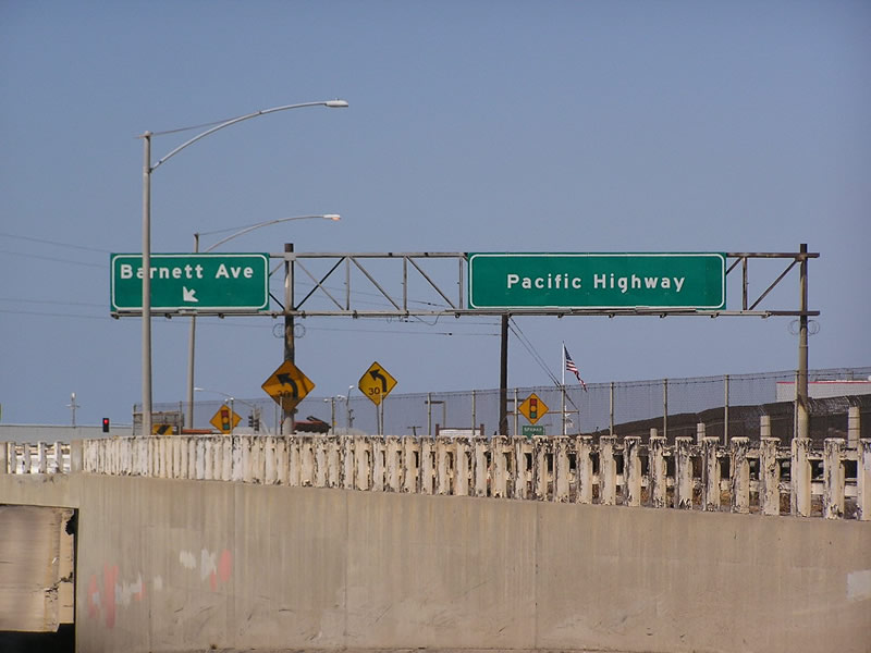
This view shows eastbound Barnett Avenue as it approaches Historic U.S. 101 (Pacific Highway) and merges onto the southbound lanes immediately after the subway. The overhead sign advises "subway flooded" when appropriate. Photo taken 09/23/06. |
 |
Still looking east on Barnett Avenue toward Pacific Highway, this view shows the white wooden railing alongside the sidewalk. Photo taken 09/23/06. |
 |
This is a second view of eastbound Barnett Avenue looking toward the Pacific Highway interchange, this time from the median. Photo taken 09/23/06. |
| San Diego Avenue and Old Town | |
|---|---|
 |
 |
 |
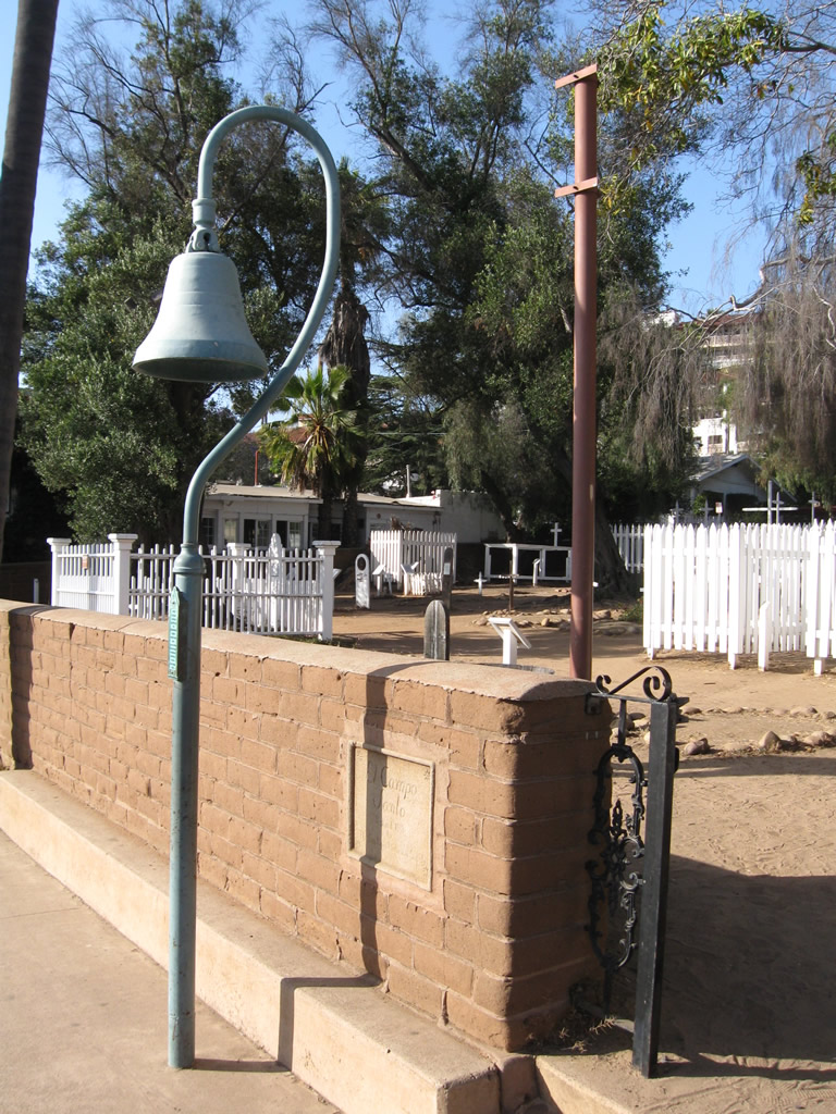
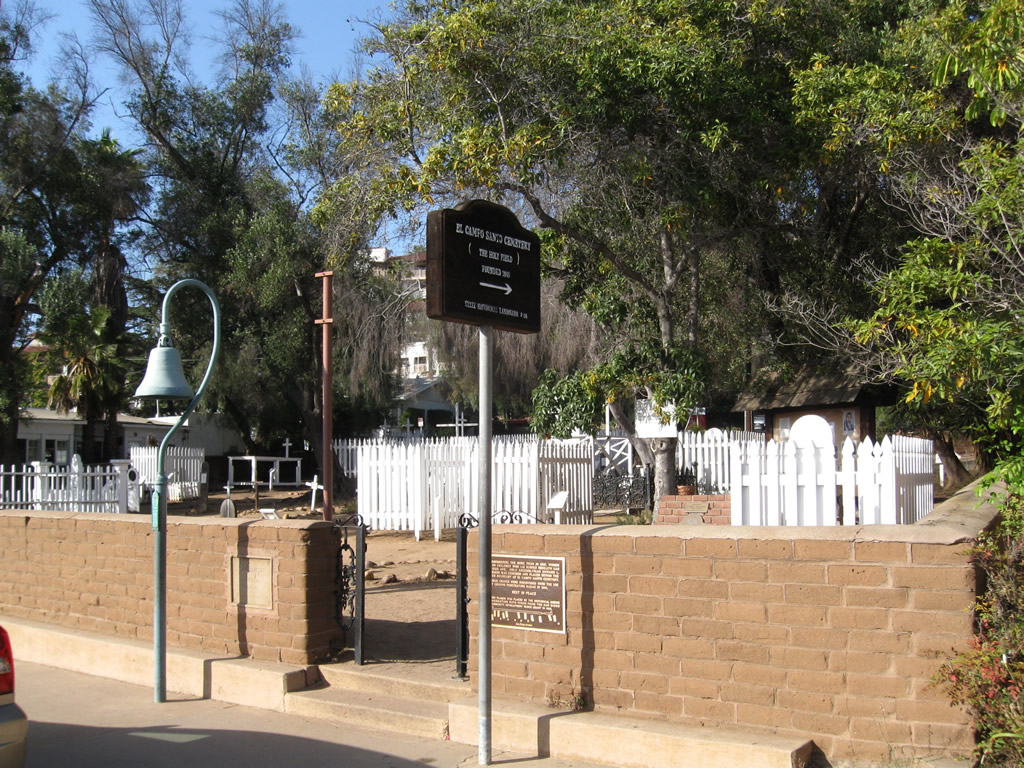
An El Camino Real replica mission bell is found along San Diego Avenue in Old Town San Diego, a couple blocks south of the state historical park next to El Campo Santo Cemetery. Photos taken 05/13/09. |
 |
 |
 |
|
 |
 |
 |
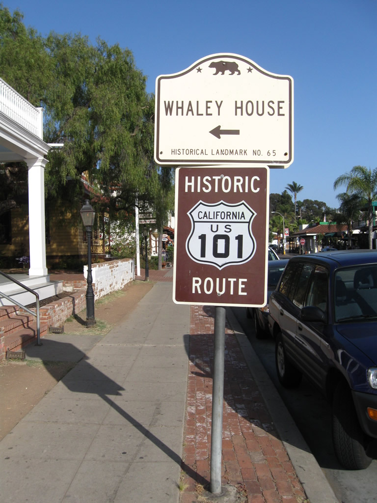
A Historic U.S. 101 route marker is posted next to the historic Whaley House in Old Town San Diego. The Whaley House is open for tours; it was built in a Greek revival standard starting in 1856 and was complete on August 22, 1857. The building still stands today, and some believe it is haunted. Photos taken 05/13/09. |
 |
 |
 |
The Catholic Church of the Immaculate Conception is located at the intersection of San Diego Avenue and Twiggs Street. Opened on July 22, 1917, the church was built in a Spanish revival style that echoes older missions, such as the historic Mission San Diego de Alcala located in eastern Mission Valley. Photos taken 05/13/09. |
 |
This view looks south on San Diego Avenue from the southern edge of the state park in Old Town San Diego. San Diego Avenue is part of the original route of U.S. 101 through San Diego. Photo taken 05/13/09. |
 |
This view looks south on San Diego Avenue from El Campo Santo Cemetery in Old Town San Diego. Photo taken 05/13/09. |
| Torrey Pines State Reserve | ||
|---|---|---|
 |
This view looks east on Callan Road from the 1944 North Torrey Pines Road bridge near the golf course. Photo taken 12/28/10. | |
 |
Leaving the golf course, travelers on eastbound Callan Road may turn right onto North Torrey Pines Road south toward La Jolla and San Diego or pass under the bridge to connect with North Torrey Pines Road north toward Los Angeles. This sign has been replaced several times since the original installation, but it still uses U.S. 101's original control cities. Photo taken 12/28/10. | |
 |
This view looks west on Callan Road as it passes under the North Torrey Pines Road bridge near the golf course. Photo taken 12/28/10. | |
 |
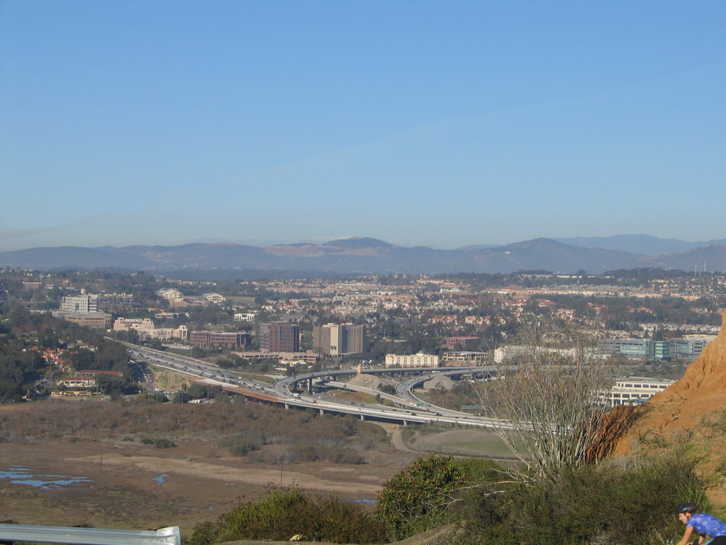 |
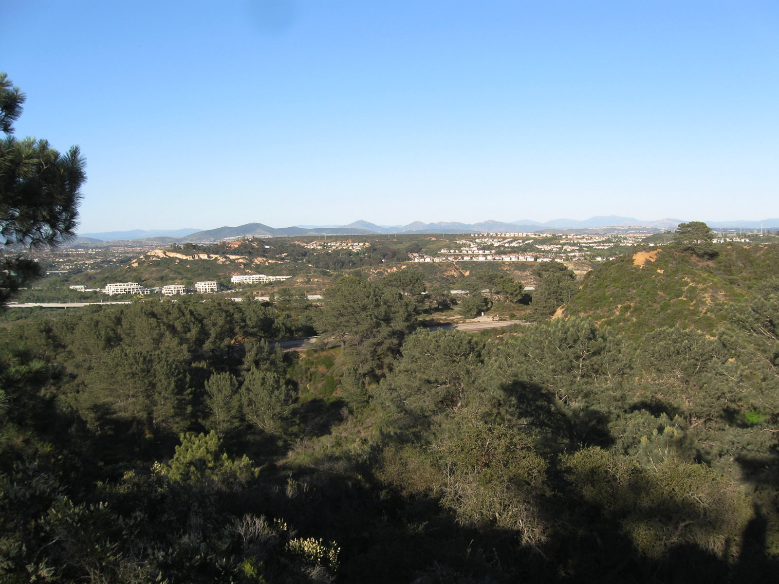
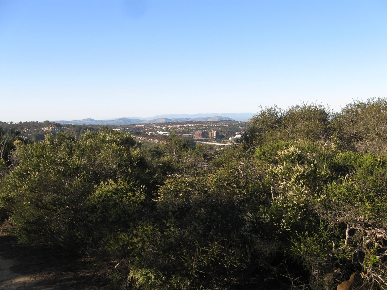
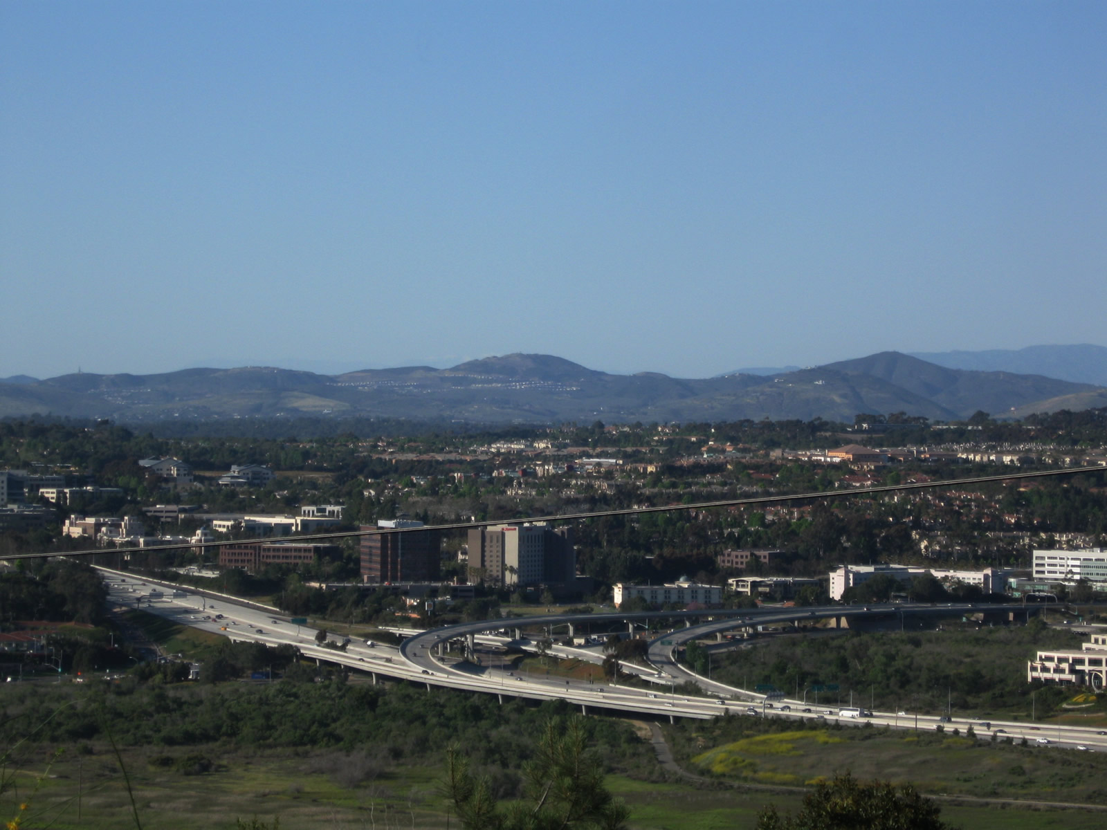
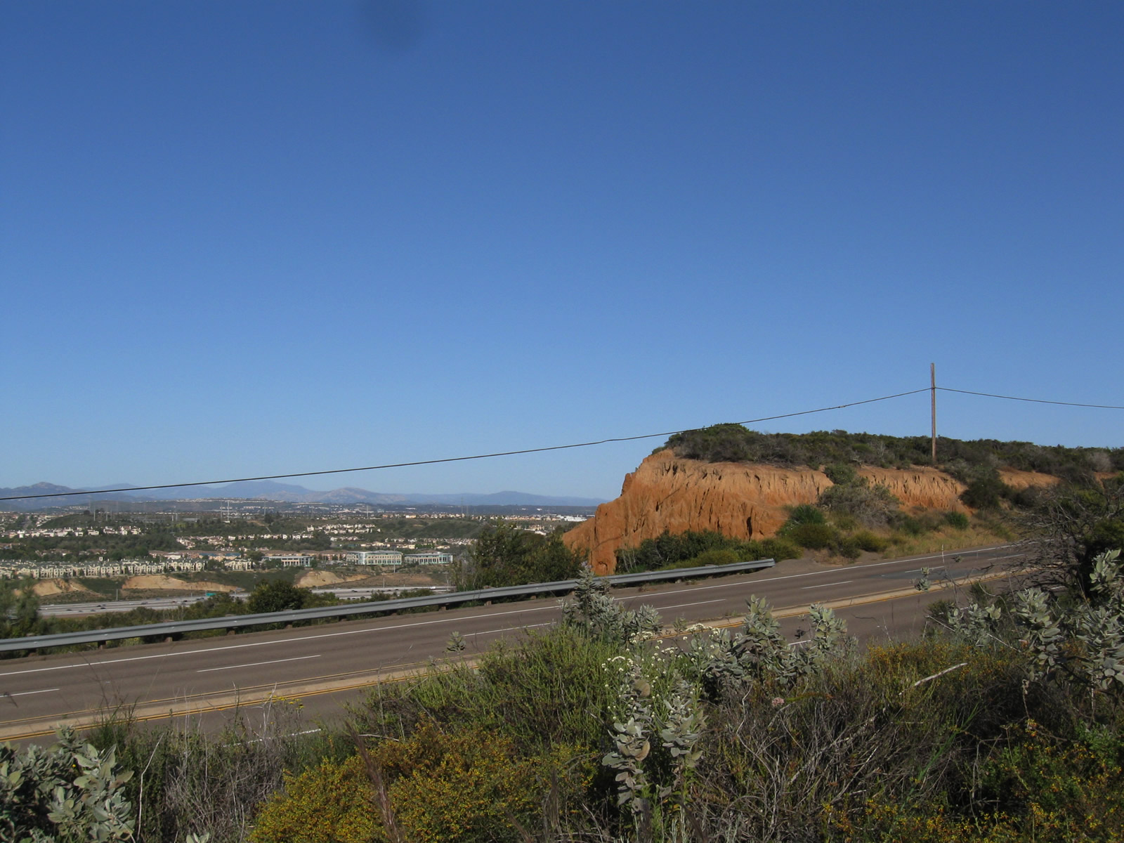
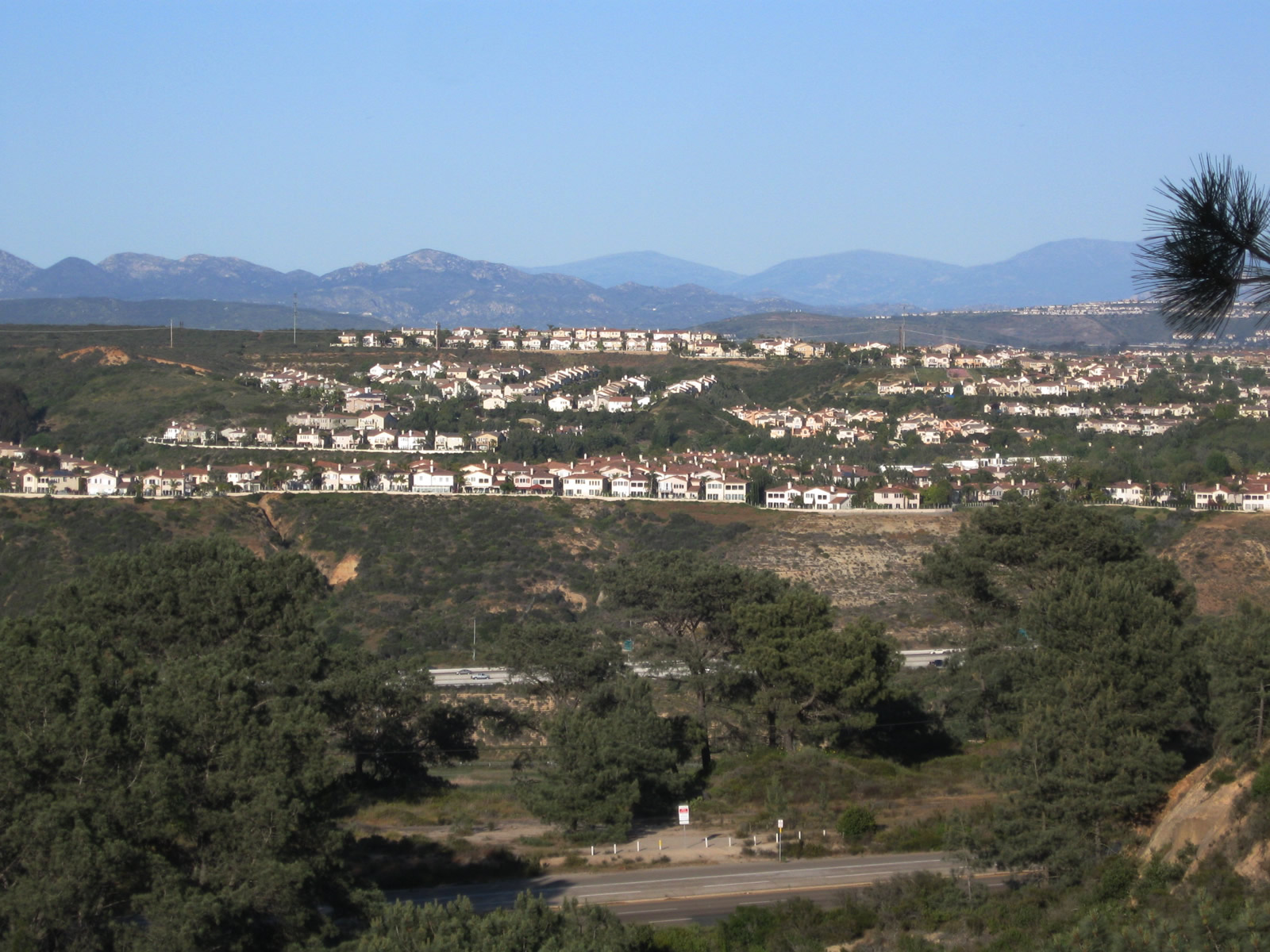
This view looks northeast from Torrey Pines State Reserve toward Los Peñasquitos Lagoon, Carmel Valley, and the Interstate 5 and California 56 freeway interchange. Photos taken 12/11/04 and 05/01/11. |
 |
 |
As the old alignment of U.S. 101 proceeds north, the vastness of the Pacific Ocean comes into view toward the west. Photos taken 12/11/04. |
 |
Torrey Pines Lodge today serves as the visitors center and museum for the Torrey Pines State Reserve. The historic adobe structure is located adjacent to Old U.S. 101. This lodge is not to be confused with the other lodge adjacent to Torrey Pines Golf Course. Photo taken 05/01/11. | |
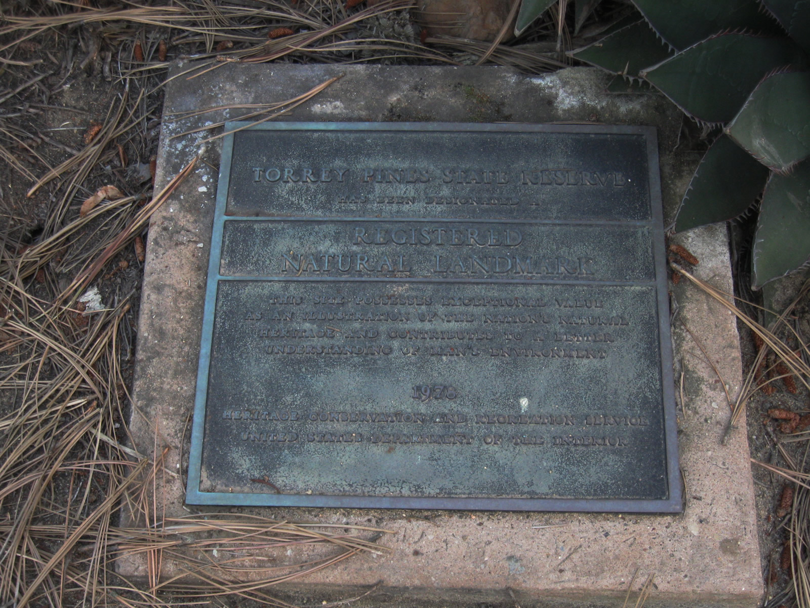 |
Torrey Pines State Reserve was designated as a national historic landmark in 1978; this plaque is located near the historic lodge. Photo taken 05/01/11. | |
 |
 |
 |
 |
 |
 |
 |
 |
 |
 |
 |
 |
 |
 |
 |
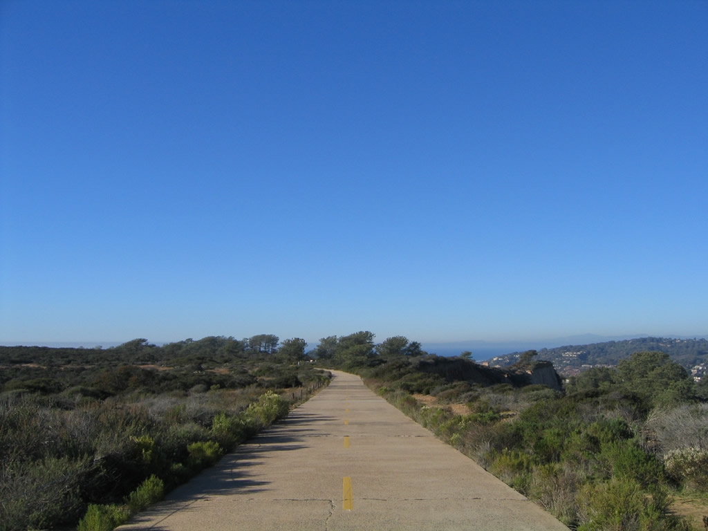
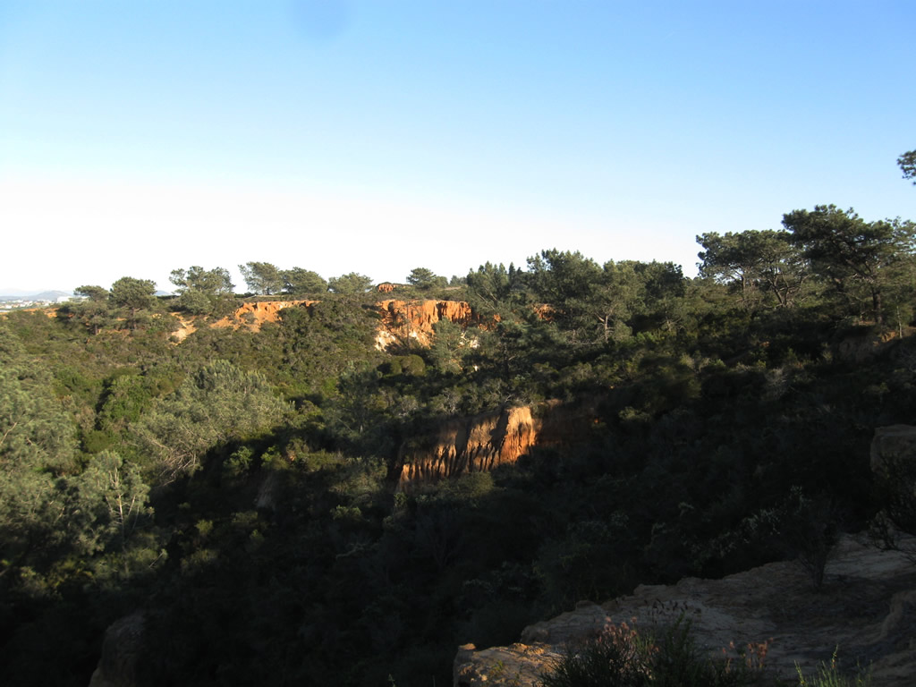
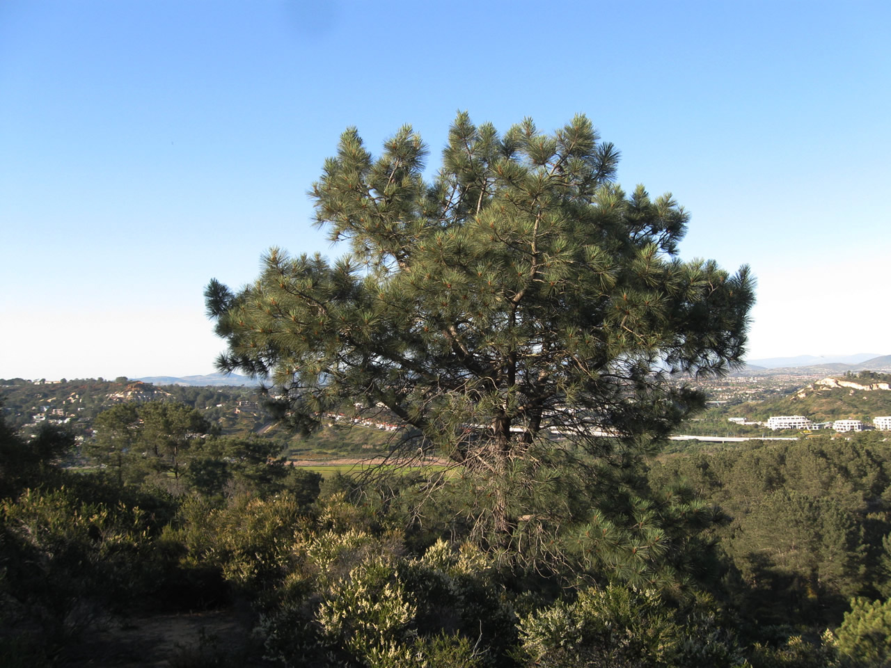
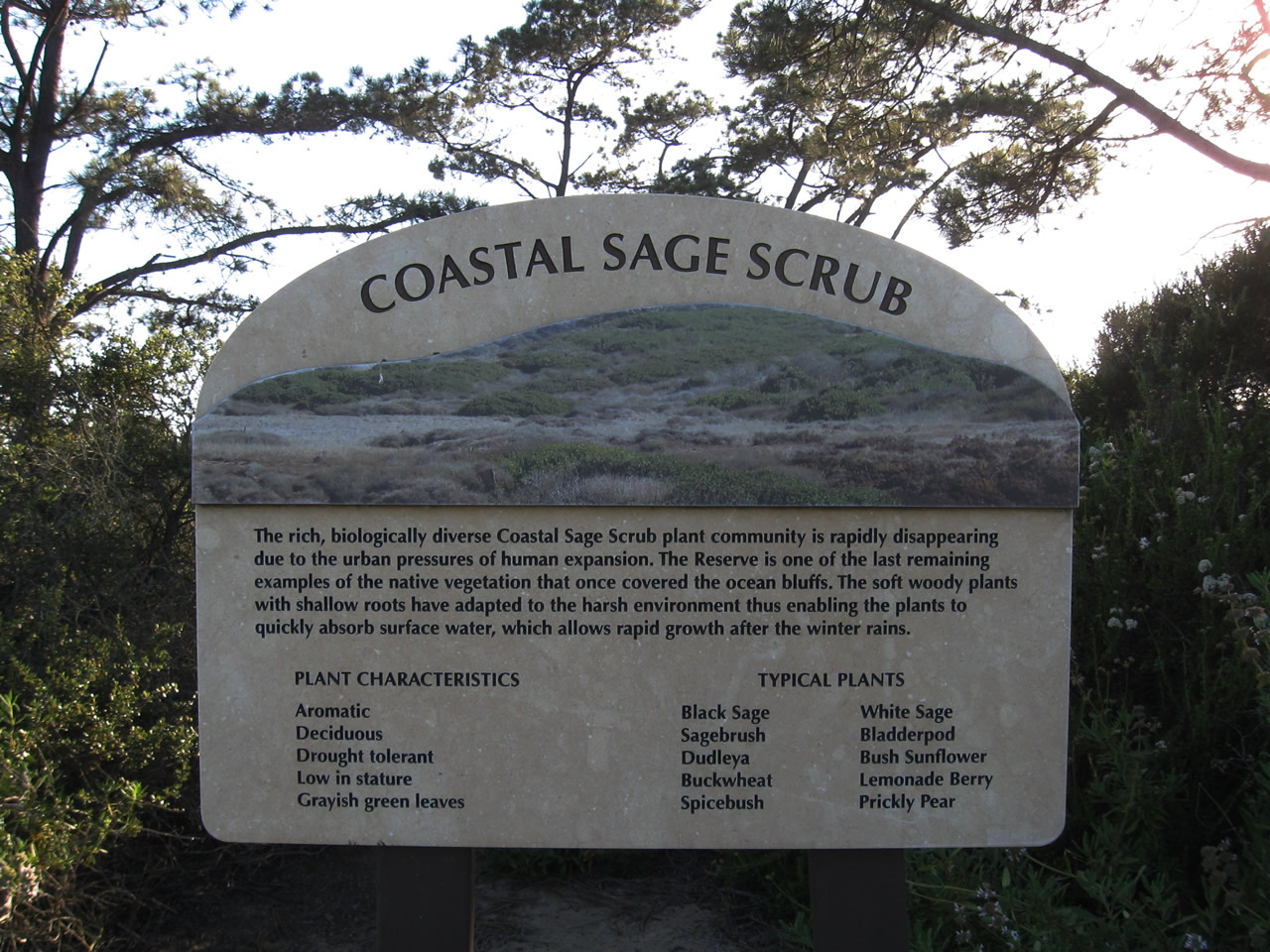
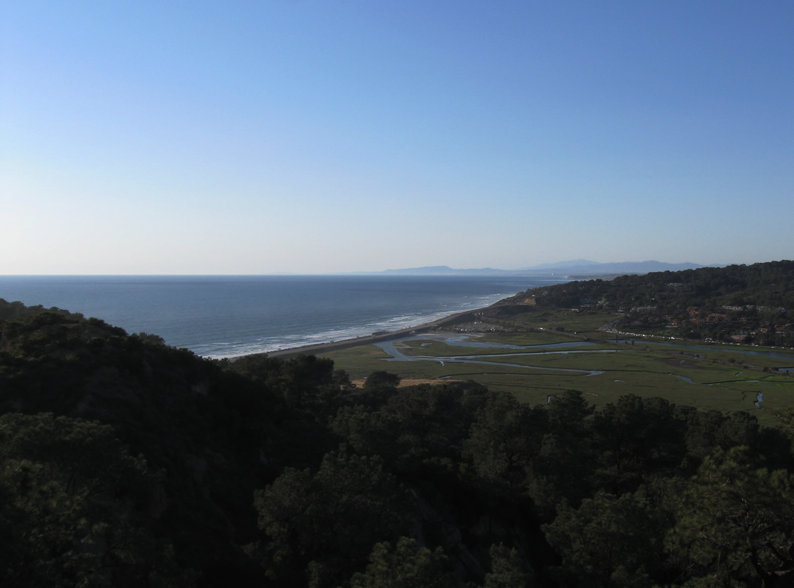
| This series of pictures shows the Torrey Pines State Reserve, including the Torrey pine groves and coastal sage scrub that line the mesa. The Pacific Ocean comes into view to the west, while Carmel Valley and Black Mountain can be seen to the east. To the north is Los Peñasquitos Lagoon, while the Interstate 5 and California 56 interchange comes into view toward the northeast. Photos taken 05/01/11. | ||||
 |
Now traveling south on the oldest alignment of U.S. 101 from Los Peñasquitos Lagoon south to Torrey Pines Mesa in Torrey Pines State Reserve, this view shows the southern end of the concrete segment. You can see the second-generation U.S. 101 alignment in the background. Photo taken 12/11/04. |
| Torrey Pines State Beach | |
|---|---|
 |
 |
 |
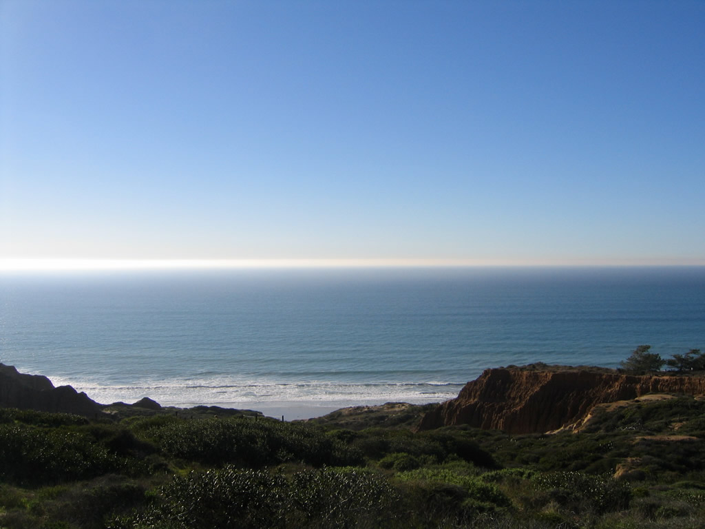
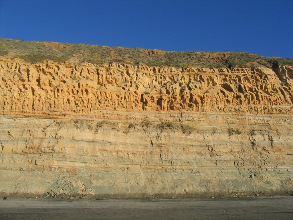
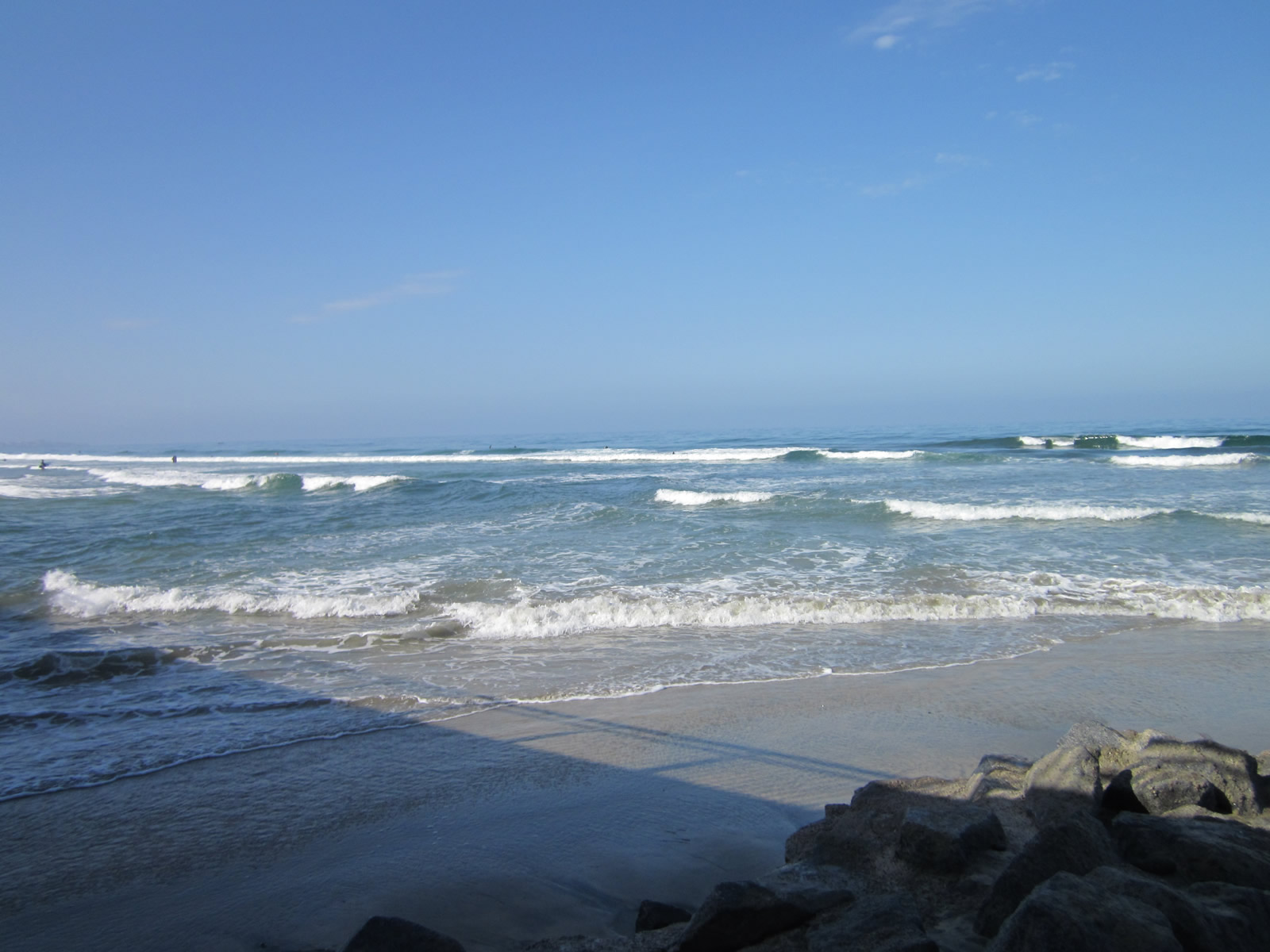
This series of photos shows the incredible sandstone cliffs and beach of Torrey Pines State Reserve. Torrey Pines State Beach is best accessed from a parking lot at the north end off North Torrey Pines Road. The south end is much more difficult to reach, including famous Blacks Beach, which is considered a clothing optional beach by popular (although not necessarily legal) custom. Photos taken 12/11/04. |
 |
 |
 |
|
| Los Peñasquitos Lagoon | |||
|---|---|---|---|
 |
 |
 |
An Amtrak train speeds across Los Peñasquitos Lagoon on an alignment that takes the train directly across the wetland. Del Mar Terrace and the northern unit of Torrey Pines State Reserve rises at the north end of the lagoon. Photos taken 12/11/04. |
| Los Peñasquitos Lagoon - Peñasquitos Creek Bridge | |
|---|---|
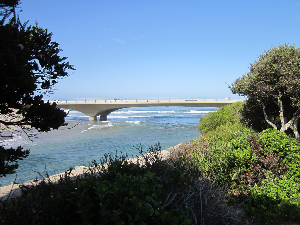 |
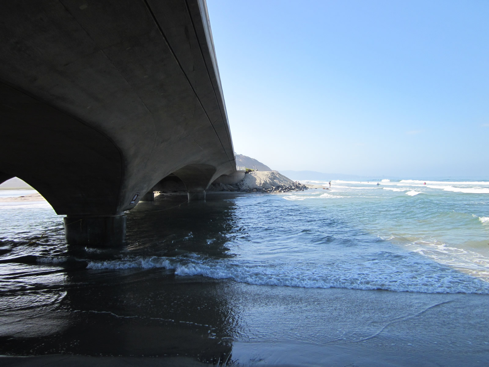
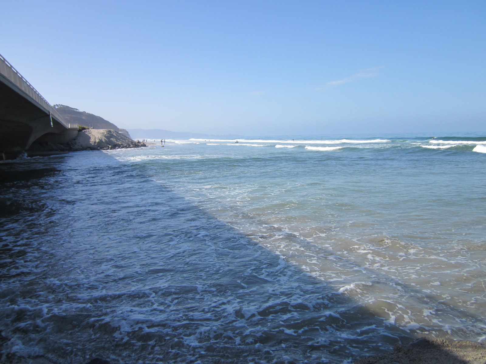
Los Peñasquitos Creek Bridge, built in 2005, provides a focal point for visitors to the Torrey Pines State Reserve. This view is taken from the lagoon parking lot, looking west during the early morning hours. Photo taken 09/01/12. |
 |
Construction of this bridge was completed by the city of San Diego in 2005. The bridge that preceded this bridge dated back to the original construction of U.S. 101 across the lagoon. While that bridge was a beautiful highway relic, it was not the best design for the ebb and flow of the lagoon. The new bridge takes this into account and has fewer supports, making it more environmentally sensitive than its predecessor. Photo taken 10/29/05. |
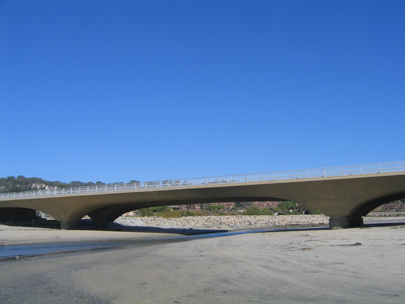 |
The unique arch shape of the new Peñasquitos Creek Bridge makes it stand out from its peers. Only two sets of piers carry the weight of the highway over the lagoon. Photo taken 10/29/05. |
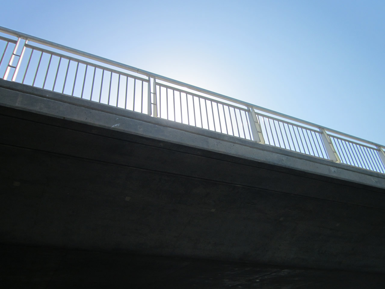 |
A unique bridge railing is in place for the Peñasquitos Creek Bridge; this view is taken looking east from the beach side during the early morning hours. Photo taken 09/01/12. |
 |
This view looks south at the Peñasquitos Creek Bridge as seen from the beach. Photo taken 09/01/12. |
 |
An interpretive sign near the Peñasquitos Creek Bridge parking lot advises of the unique habitat of the lagoon and its many distinguishing characteristics. Photo taken 09/01/12. |
 |
 |
 |
 |
 |
| This suite of pictures show Peñasquitos Creek passing under the bridge opened in 2005 that carries North Torrey Pines Road over the lagoon inlet. In the 2005 pictures, only a narrow strip of water passed under the then-newly constructed bridge. Seven years later, in 2012, a much wider expanse of water passed under the bridge, with no obstructions caused by bridge piers or pilings. The previous bridge from the 1930s inhibited water flow and was blamed for choking the area by blocking water from entering and exiting the lagoon. Photos taken 10/29/05 and 09/01/12. | ||||
 |
 |
 |
 |
 |
 |
 |
 |
 |
 |
 |
 |
 |
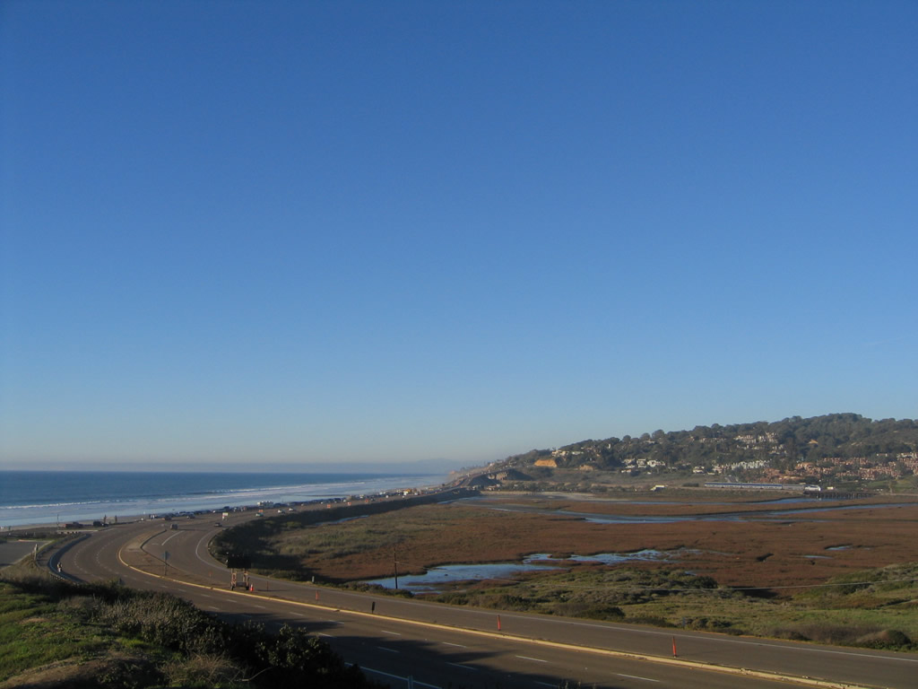
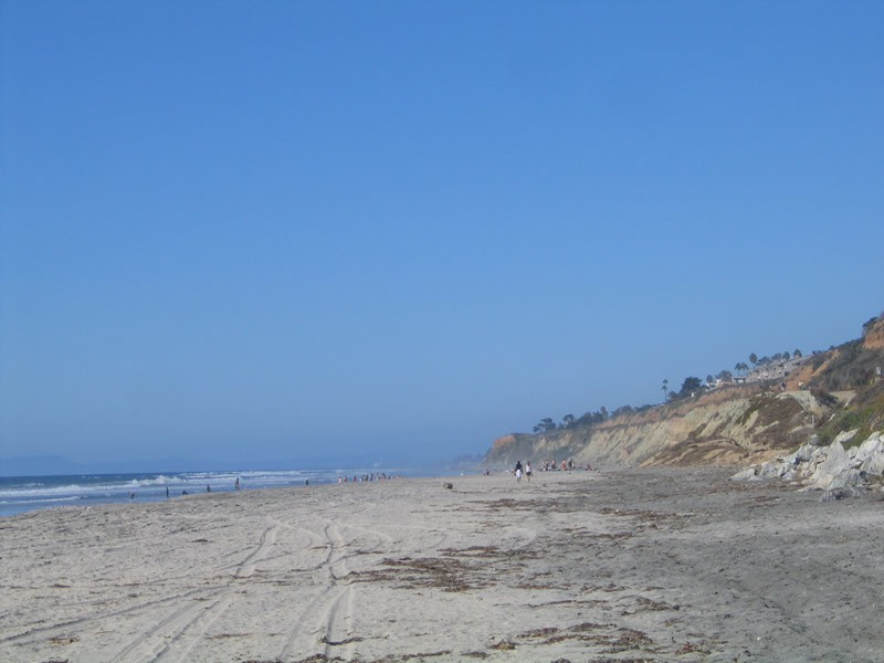
Looking north, the Torrey Pines State Beach continues north along the Pacific Ocean coast line. A narrow beach lines the west side of the narrow strand until the area widens near the railroad bridge crossing. Photos taken 10/29/05 and 09/01/12. |
Sources:


Page Updated September 7, 2012.

