| U.S. 101 south |
|
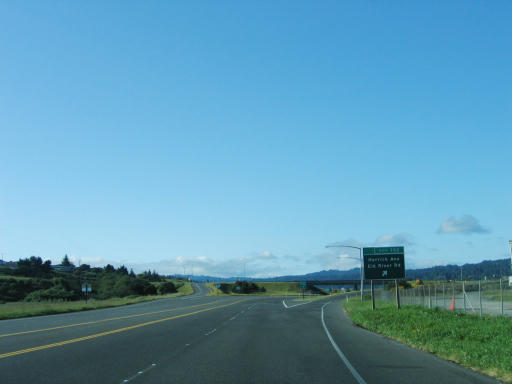
Southbound U.S. 101 (Redwood Highway) reaches Exit 702, Herrick Avenue and Elk River Road to Headwaters Forest Reserve. Photo taken 05/29/06. |
|
The next exit along U.S. 101 (Redwood Highway) south is Exit 701, Humboldt Hill Road. Photo taken 05/29/06. |
|
Use Humboldt Hill Road south to the Spruce Point and Humboldt Hill communities. Photo taken 05/29/06. |
|
Southbound U.S. 101 (Redwood Highway) reaches Exit 701, Humboldt Hill Road. Photo taken 05/29/06. |
|
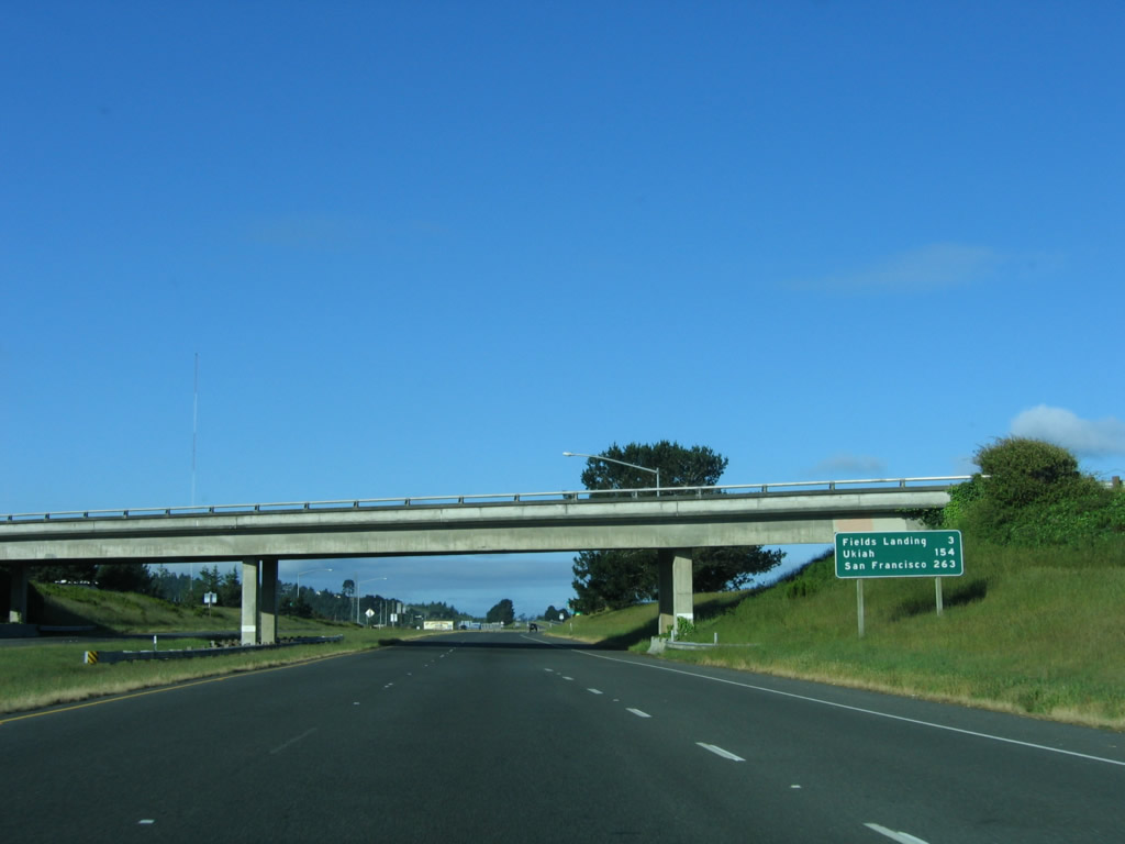
This mileage sign along southbound U.S. 101 (Redwood Highway) provides the distance to Fields Landing (three miles), Ukiah (153 miles), and San Francisco (263 miles). Photo taken 05/29/06. |
|
The next exit along U.S. 101 (Redwood Highway) south is Exit 700, King Salmon Avenue. Photo taken 05/29/06. |
|
A billboard advises of the "World Famous Avenue of the Giants - Ancient Redwoods - Entrance 27 Miles." Follow U.S. 101 (Redwood Highway) south to California 254 (Avenue of the Giants), which follows old U.S. 101 through the Humboldt Redwoods State Park. The "drive-through tree" is not part of the state park but is a privately operated attraction. Also notable here are the power lines, which carry electricity generated by the fossil fuel plant located at King Salmon (formerly Humboldt Bay Nuclear Generating Station). Photo taken 05/29/06. |
|
Southbound U.S. 101 (Redwood Highway) reaches Exit 700, King Salmon Avenue. Photo taken 05/29/06. |
|
The next exit along U.S. 101 (Redwood Highway) south is Exit 699, Fields Landing. To the west of U.S. 101 sits the site of the decommissioned Humboldt Bay Nuclear Power Plant. This electricity generating facility began operating in 1963 and ceased nuclear operations in 1976. As one of four facilities to generate nuclear power in the state of California (the others include San Onofre and Diablo Canyon, both of which are still active, and Rancho Seco, which has also been decommissioned), Humboldt Bay Nuclear Power Plant is today reduced to a small fossil fuel power plant facility. The old nuclear power smokestack has since been removed, but radioactive materials remain at the plant's cooling pond. Photo taken 05/29/06. |
|
Southbound U.S. 101 (Redwood Highway) reaches Exit 699, Fields Landing (Orchard Avenue/Railroad Avenue). Fields Landing is a small community along the shore of Humboldt Bay south of Eureka. Photo taken 05/29/06. |
|
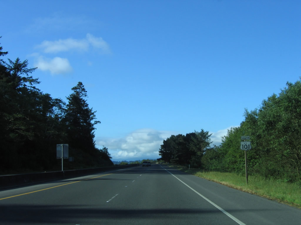
A U.S. 101 reassurance shield is posted after the on-ramp from Fields Landing (Orchard Avenue and Railroad Avenue). Photo taken 05/29/06. |
|
The next exit along U.S. 101 (Redwood Highway) south is Exit 698, Tompkins Hill Road. Photo taken 05/29/06. |
|
A reflective exit number tab is placed on top of an older, non-reflective button copy guide sign for Exit 698, Tompkins Hill Road/College of the Redwoods. The College of the Redwoods consists of three campuses: Mendocino Coast (in Fort Bragg), Eureka, and Del Norte (in Crescent City). Part of the Redwoods Community College District, the Humboldt County campus was founded in 1964, followed by annexations to the district in coastal Mendocino County in 1975 and Del Norte County in 1978. The district also serves portions of Trinity County to the east (along California 299). Photo taken 05/29/06. |
|
Southbound U.S. 101 (Redwood Highway) reaches Exit 698, Tompkins Hill Road to the College of the Redwoods. Tompkins Hill Road is an old alignment of U.S. 101 complete with old one-lane bridges and narrow stretches of old road. It reconnects with U.S. 101 at Exit 690. This exit also connects to Eel River Road, which follows U.S. 101 on the west side of the freeway and is another old alignment of the U.S. highway. Photo taken 05/29/06. |
|
The next exits along U.S. 101 (Redwood Highway) south are Exit 696, Loleta/Hookton Road; Exit 694, Loleta Drive; Exit 692, California 211 south to Fernbridge and Ferndale; Exit 690, Palmer Boulevard; and Exit 689, U.S. 101 Business (Main Street) south. We continue our southbound journey with Exit 690 and Exit 689 after the California 211 interchange. Photo taken 05/29/06. |
|
Although the previous sign was for Exit 689, the actual next exit along U.S. 101 (Redwood Highway) south is Exit 690, Palmer Boulevard. Photo taken 05/29/06. |
|
Southbound U.S. 101 (Redwood Highway) reaches Exit 690, Palmer Boulevard. Photo taken 05/29/06. |
|
The next exit along U.S. 101 (Redwood Highway) south is Exit 689, U.S. 101 Business (Main Street) south into the city of Fortuna. As of the 2000 Census, the city of Fortuna was home to 10,497 people. Located on 4.8 square miles of land, Fortuna (the "Friendly City") is growing along with its neighbor Eureka to the north. Fortuna was founded as a company town named Springville, and a post office was added in the 1870s. By 1884, the town was renamed Fortuna; it was incorporated as a city on February 20, 1906. Photo taken 05/29/06. |
|
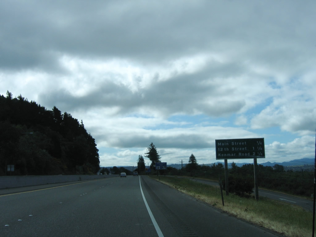
The next three exits along U.S. 101 (Redwood Highway) south are Exit 689, U.S. 101 Business (Main Street); Exit 688, 12th Street; and Exit 687, Kenmar Road. Photo taken 05/29/06. |
|
Southbound U.S. 101 (Redwood Highway) reaches Exit 689, U.S. 101 Business (Main Street) to Fortuna. Photo taken 05/29/06. |
|
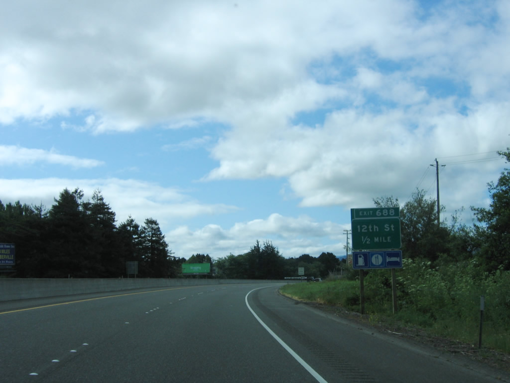
The next exit along U.S. 101 (Redwood Highway) south is Exit 688, 12th Street and Riverwalk Drive. Photo taken 05/29/06. |
|
Exit 688 (12th Street and Riverwalk Drive) serves the city of Fortuna. Photo taken 05/29/06. |
|
Southbound U.S. 101 (Redwood Highway) reaches Exit 688, 12th Street and Riverwalk Drive. Photo taken 05/29/06. |
|
The next exit along U.S. 101 (Redwood Highway) south is Exit 687, Kenmar Road to U.S. 101 Business north. Photo taken 05/29/06. |
|
Southbound U.S. 101 (Redwood Highway) reaches Exit 687, Kenmar Road. At the time this photo was taken, the old sign was being replaced with a new exit number sign. Photo taken 05/29/06. |
|
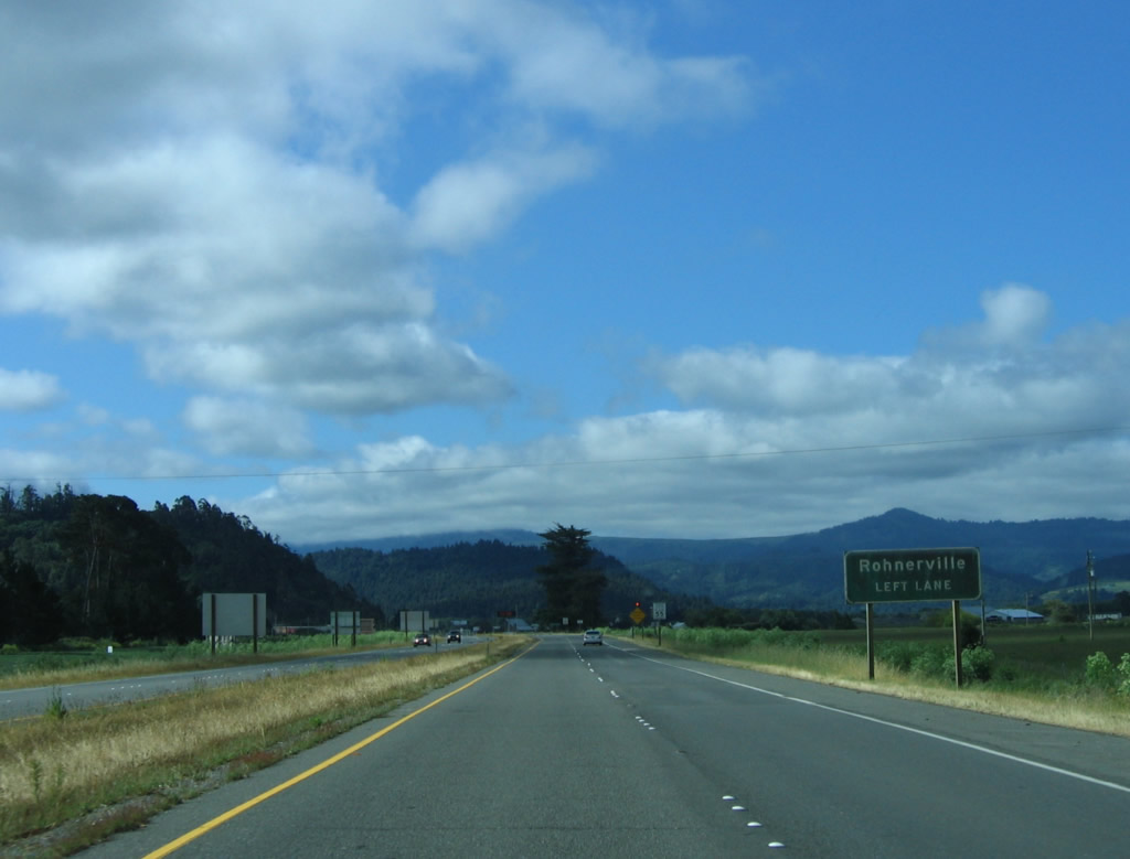
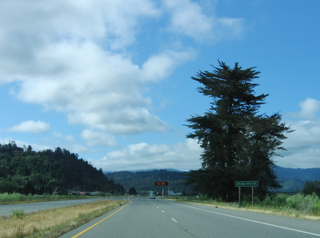
The freeway again ends as U.S. 101 approaches Drake Hill Road to Rohnerville. Photo taken 05/29/06. |
|
Southbound U.S. 101 meets Drake Hill Road at this intersection south of Fortuna. Photo taken 05/29/06. |
|
The next intersection along U.S. 101 (Redwood Highway) south is with Sandy Prairie Road. Photo taken 05/29/06. |
|
Southbound U.S. 101 meets Sandy Prairie Road at this intersection. Photo taken 05/29/06. |
|
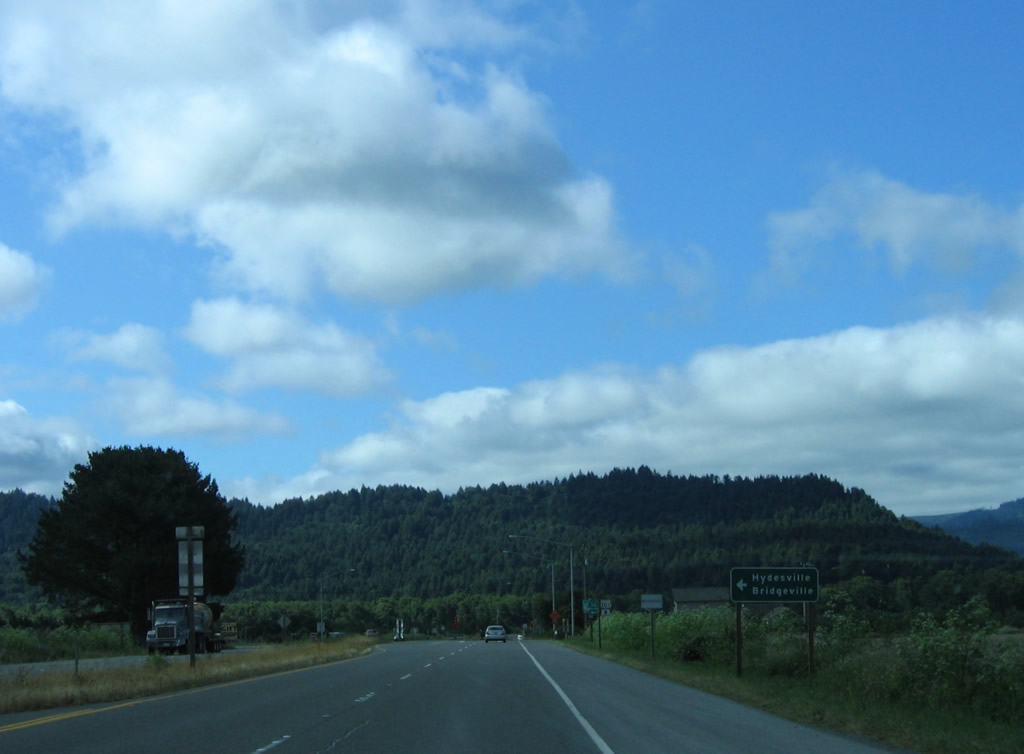
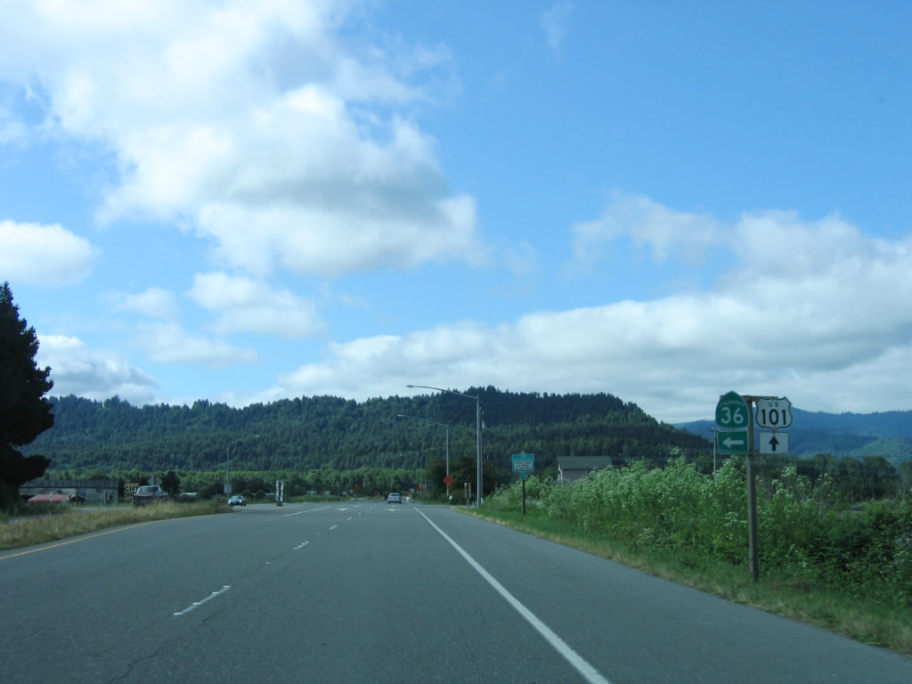
The next intersection along U.S. 101 south is California 36 east to Redding in the town of Alton. Photo taken 05/29/06. |
|
California 36 is an east-west highway that connects U.S. 101 at Alton with Interstate 5 at Red Bluff and U.S. 395 near Susanville. This long road twists across the Coast Range via Bridgeville, Mad River, Forest Glen, Shasta-Trinity National Forest, and Platina. It is the first east-west crossing to the Central Valley until we meet California 20 near Ukiah in Mendocino County (not counting unconstructed California 162 across Mendocino County). Photo taken 05/29/06. |
|
Southbound U.S. 101 (Redwood Highway) meets California 36 at this intersection in Alton. The current Regional Transportation Improvement Program calls for construction of an interchange with California 36, but it was delayed as a result of the state's budget crisis from 2002. Construction and completion of the eventual interchange is still forthcoming. Photo taken 05/29/06. |
|
This mileage sign (after the California 36 intersection) provides the distance to Rio Dell (Exit 681, four miles), Ukiah, and San Francisco. Photo taken 05/29/06. |
|
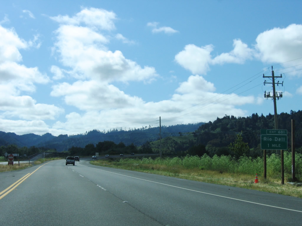
The freeway resumes after the Metropolitan Road intersection, and the next exit along southbound U.S. 101 (Redwood Highway) is Exit 681, U.S. 101 Business south to Rio Dell. Photo taken 05/29/06. |
|
The city of Rio Dell, known as the "Warm Hearted City," sits on a bend of the Eel River adjacent to the Scotia Bluffs. The estimated 2005 population of Rio Dell is 3,174 people. First settled by Lorenzo Painter in the 1870s, the city of Rio Dell was incorporated in 1965. Photo taken 05/29/06. |
|
Southbound U.S. 101 (Redwood Highway) crosses the Eel River on this 1974 span. The northbound lanes use an older 1941 bridge that parallels the 1974 bridge but features steel through truss superstructure bridge. Photo taken 05/29/06. |
|
U.S. 101 Business serves Rio Dell, then follows unsigned California 283 across the Eel River into the town of Scotia, where it rejoins U.S. 101. Photo taken 05/29/06. |
|
Southbound U.S. 101 (Redwood Highway) reaches Exit 681, U.S. 101 Business south to Rio Dell. Photo taken 05/29/06. |
|
Now on the ramp from U.S. 101 (Redwood Highway) south to U.S. 101 Business in Rio Dell, a left turn connects to Eeloa Avenue. Continue straight ahead to follow the business route into Rio Dell. Photo taken 05/29/06. |
|
Continuing south after Exit 679 (U.S. 101 Business and California 283 north to Eagle Prairie Bridge), the freeway temporarily ends along U.S. 101 south as the highway passes by Scotia south of Rio Dell. Photo taken 05/29/06. |
|
The first intersection on this brief expressway section is with Main Street north to Scotia. This would be Exit 678. Photo taken 05/29/06. |
|
The second and final intersection on this brief expressway section is with Shively Road, followed by Exit 676, Stafford Road. Photo taken 05/29/06. |
|
Shively Road follows the Eel River east, while U.S. 101 continues south. Another crossing over the Eel River is ahead. Photo taken 05/29/06. |
|
After the Shively Road intersection, the freeway begins again. Here, U.S. 101 south crosses the Eel River. Photo taken 05/29/06. |
|
This bridge carries U.S. 101 over the Eel River again. Photo taken 05/29/06. |
|
Southbound U.S. 101 reaches Exit 676, Stafford Road. Photo taken 05/29/06. |
|
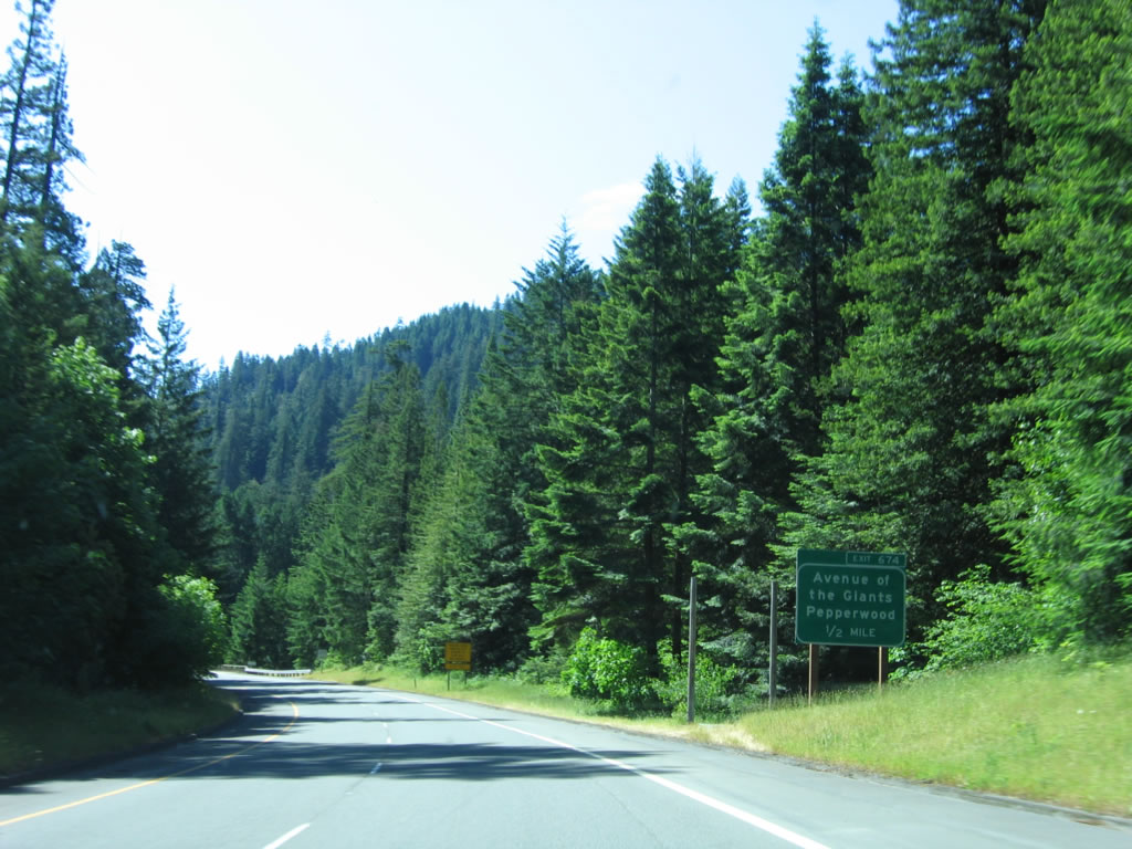
The next exit along southbound U.S. 101 (Redwood Highway) is Exit 674, California 254 (Avenue of the Giants) south to Humboldt Redwoods State Park and the town of Pepperwood. Photo taken 05/29/06. |
|
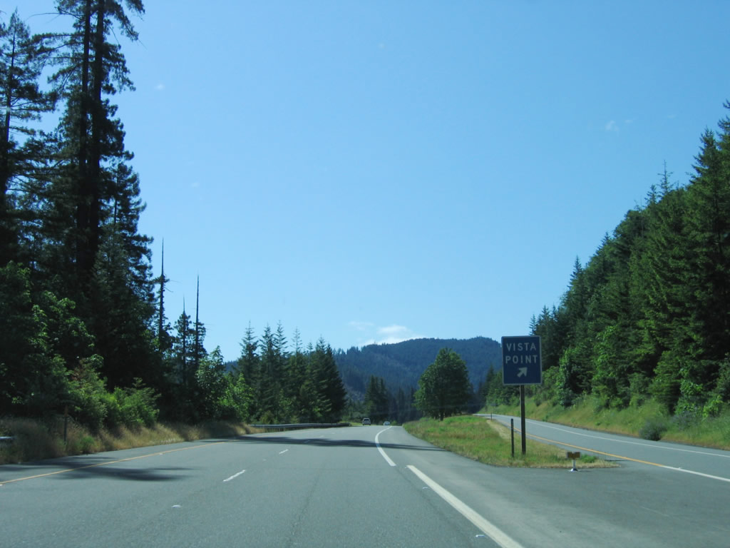
Around Milepost 675 is a vista point and informational sign containing information about the redwood areas along the Avenue of the Giants. Photo taken 05/29/06. |
|
Redwood trees dominate the view along U.S. 101 as the Redwood Highway approaches the vista point. Photo taken 05/29/06. |
|
Southbound U.S. 101 (Redwood Highway) reaches Exit 675, Vista Point. Photo taken 05/29/06. |
|
Descending into the river valley, redwoods and coniferous trees can be seen from the freeway. Follow California 254, the scenic alternative to U.S. 101. Photo taken 05/29/06. |
|
The next seven exits along southbound U.S. 101 (Redwood Highway) all serve Humboldt Redwoods State Park: Exit 674, California 254 (Avenue of the Giants); Exit 671, Pepperwood; Exit 667, Redcrest; Exit 667A, Avenue of the Giants; Exit 663, South Fork/Honeydew; Exit 661, Weott; and Exit 656, Myers Flat. Photo taken 05/29/06. |
|
At Exit 674, U.S. 101 will interchange with Jordan Road, which travels northeast to the Avenue of the Giants. The route is signed as California 254 on the route itself, but not from U.S. 101. Photo taken 05/29/06. |
|
Southbound U.S. 101 (Redwood Highway) reaches Exit 674, California 254 (Avenue of the Giants) south to Humboldt Redwoods State Park and the town of Pepperwood. At this point, southbound U.S. 101 is traveling almost due east. This is the northern terminus of California 254 (Avenue of the Giants). An old alignment that can be hiked continues north of the Avenue of the Giants to an old concrete 1938 bridge. The bridge serves today as a trail connection in the northern part of the state park. Photo taken 05/29/06. |
|
At the end of the off-ramp, take a left turn onto California 254 (Avenue of the Giants) south to Humboldt Redwoods State Park. Photo taken 05/29/06. |
|
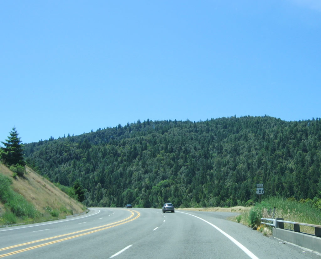
After Exit 674, the next exits on U.S. 101 south are: Exit 671, Pepperwood; Exit 667, Redcrest; Exit 667A, Avenue of the Giants; Exit 663, South Fork/Honeydew; Exit 661, Weott; Exit 656, Myers Flat; Exit 653, Salmon Creek Road; Exit 650, Miranda/French Road/Phillipsville; and Exit 645, California 254 (Avenue of the Giants) to Hooker Creek Road. This mileage sign for Garberville, Ukiah, and the control city of San Francisco is located after the Exit 645 on-ramp. The next exit along southbound is Exit 642, Redwood Drive south to Redway/Shelter Cove. Photo taken 05/29/06. |
|
From left to right, U.S. 101 (Redwood Highway) follows Hooker Creek Road and the South Eel River in this scenic view. Photo taken 05/29/06. |
|
Only a painted median with rumble strips separates the two directions of U.S. 101 traffic along this section of freeway. Photo taken 05/29/06. |
|
The next exit along U.S. 101 south is Exit 642, Redwood Drive south to Redway and Shelter Cove. Redwood Drive is an old alignment of U.S. 101. Photo taken 05/29/06. |
|
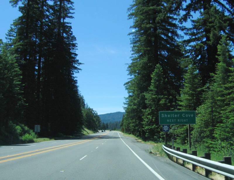
Exit 642 also serves Shelter Cove, which is about 23 miles west of Redway. Photo taken 05/29/06. |
|
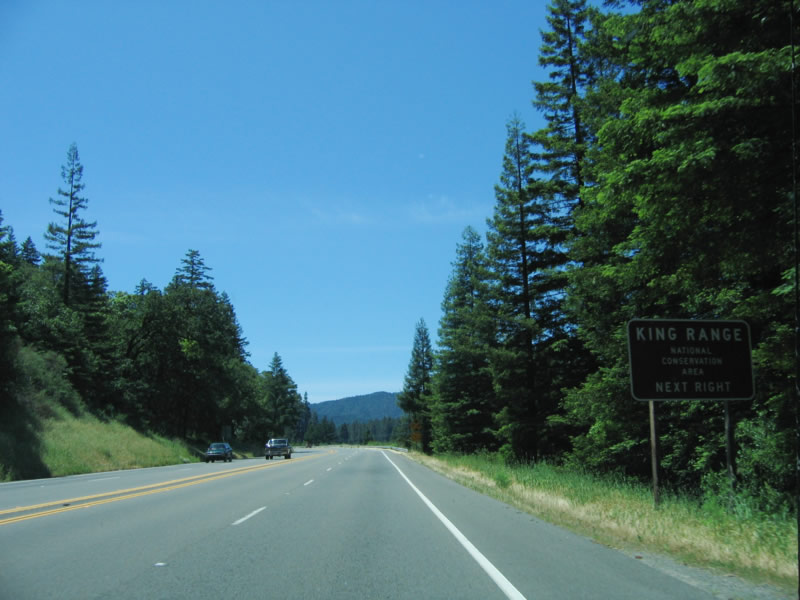
Use Exit 642 to King Range National Conservation Area. Photo taken 05/29/06. |
|
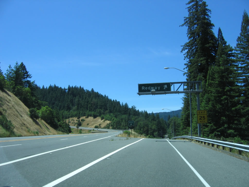
Southbound U.S. 101 (Redwood Highway) reaches Exit 642, Redwood Drive south to Redway and Shelter Cove (which is located on the coast west of here). Photo taken 05/29/06. |
|
Upon exiting, the business route into Redway begins its southbound journey along Redwood Drive. Continue straight ahead to Shelter Cove and Kings Range National Conservation Area. Photo taken 05/29/06. |
|
The next exit along U.S. 101 (Redwood Highway) south is Exit 639B, Garberville. Photo taken 05/29/06. |
|
Garberville is an unincorporated community of southern Humboldt County located south of Redway. Both Exits 639B and 639A serve the town. Photo taken 05/29/06. |
|
Southbound U.S. 101 (Redwood Highway) south approaches Exit 639B, Garberville. Photo taken 05/29/06. |
|
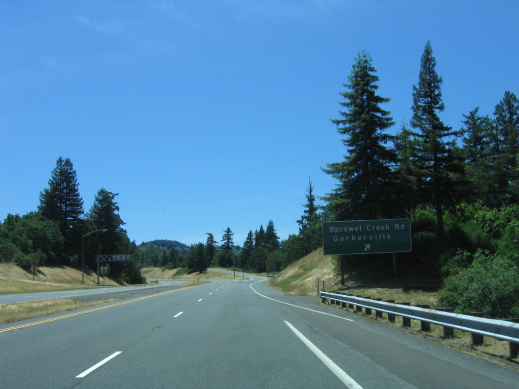
The next exit along southbound U.S. 101 is Exit 639A, Sprowel Creek Road. Photo taken 05/29/06. |
|
Southbound U.S. 101 (Redwood Highway) reaches Exit 639B, Garberville. Photo taken 05/29/06. |
|
Shortly thereafter, southbound U.S. 101 reaches Exit 639A, Sprowel Creek Road to Garberville. Photo taken 05/29/06. |
|
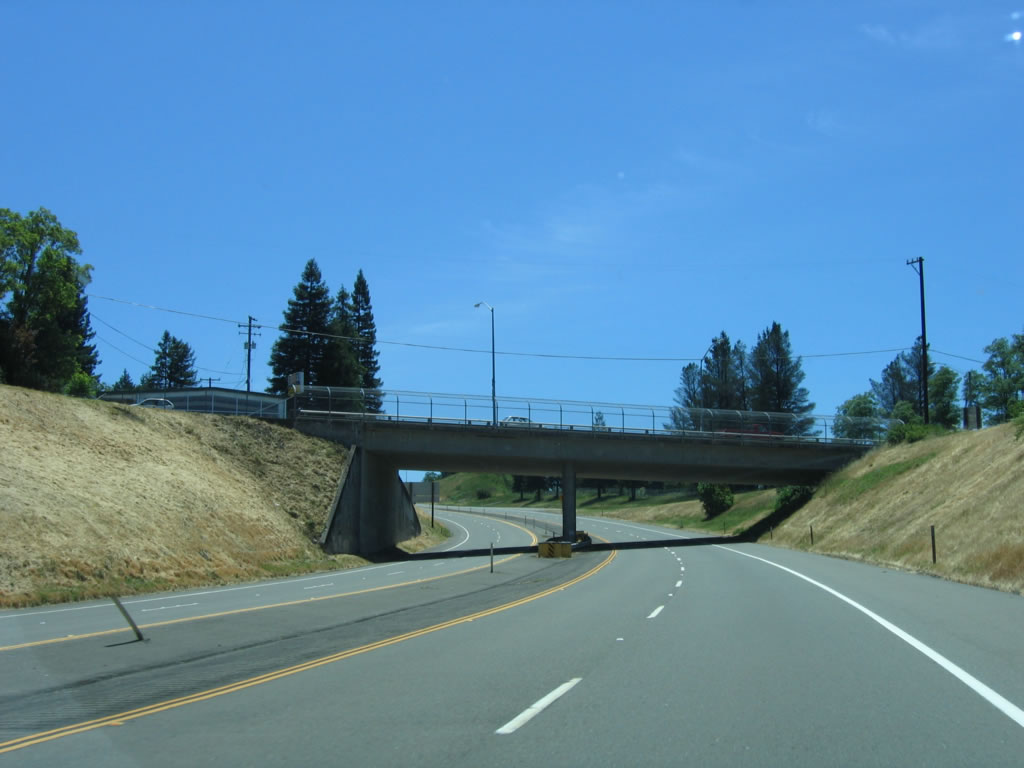
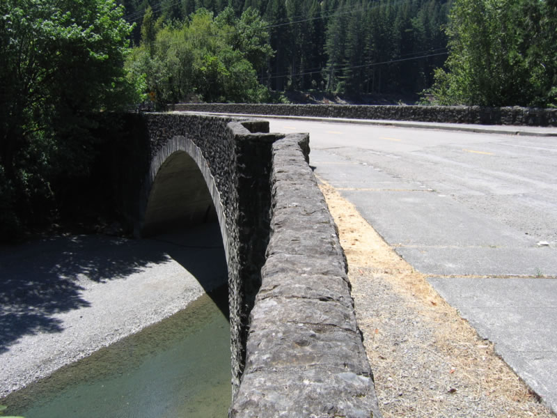
Southbound U.S. 101 passes under Sprowel Creek Road. Note that the bridge has a center support yet is wide enough to accommodate two
|
|
This mileage sign provides the distance to Piercy, Ukiah, and San Francisco after leaving Garberville. Photo taken 05/29/06. |
|
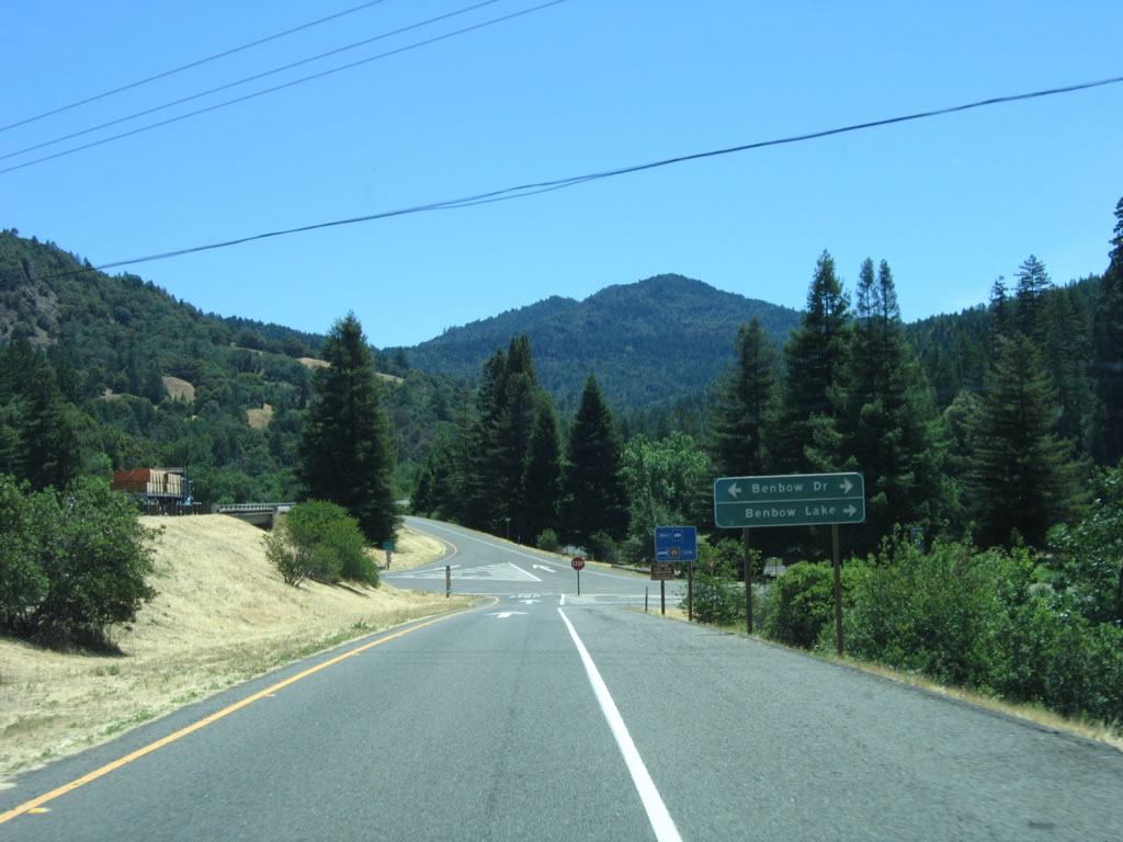
The next exit along southbound U.S. 101 is Exit 636, Benbow Drive (one mile). Photo taken 05/29/06. |
|
Falling behind a lumber truck, the right lane will connect to the community of Benbow. Photo taken 05/29/06. |
|
Southbound U.S. 101 reaches Exit 636, Benbow Drive. Another section of old U.S. 101 can be explored at this exit. Photo taken 05/29/06. |
|
Now on the off-ramp from U.S. 101 south to Benbow Road, turn right to Benbow Lake. Photo taken 05/29/06. |
|
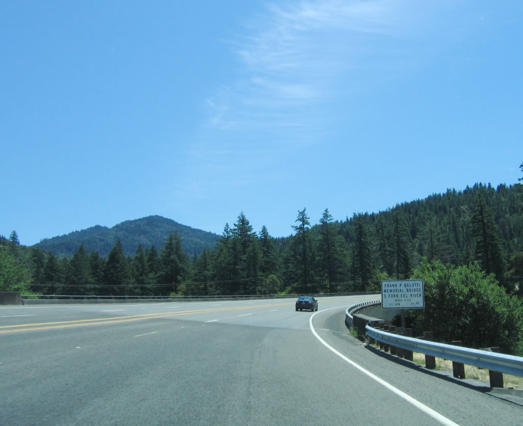
Continuing south, U.S. 101 (Redwood Highway) crosses over the first of several bridges (Frank P. Belotti Memorial Bridge) over the South Fork of the Eel River. Photo taken 05/29/06. |
|
U.S. 101 (Redwood Highway) next uses the Mal Coombs Memorial Bridge to cross over the South Fork of the Eel River. Photo taken 05/29/06. |
|
A U.S. 101 shield is posted along southbound after the Mal Coombs Memorial Bridge. Note that the bridge and freeway are four lanes and undivided. Photo taken 05/29/06. |
|
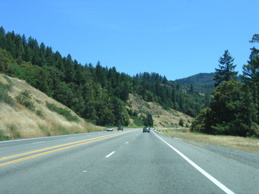
Road cuts are still visible, even though they are now covered with vegetation. Photo taken 05/29/06. |
|
The freeway section will come to an in a half-mile, after crossing the South Fork of the Eel River again. Photo taken 05/29/06. |
|
The third bridge in this series is the Edward C. Wagner Memorial Bridge, which is the last bridge before the freeway shifts back onto a two-lane alignment. Photo taken 05/29/06. |
|
At the end of the bridge, the freeway ends and the right lane ends on southbound U.S. 101. Photo taken 05/29/06. |
|
Now two lanes wide with one lane southbound, U.S. 101 approaches Benbow Road (Old U.S. 101). Photo taken 05/29/06. |
|
A left turn from U.S. 101 (Redwood Highway) south will connect to Benbow Road (Old U.S. 101). A nice old U.S. 101 bridge over the South Fork of the Eel River can be seen via this left turn. Photo taken 05/29/06. |
|
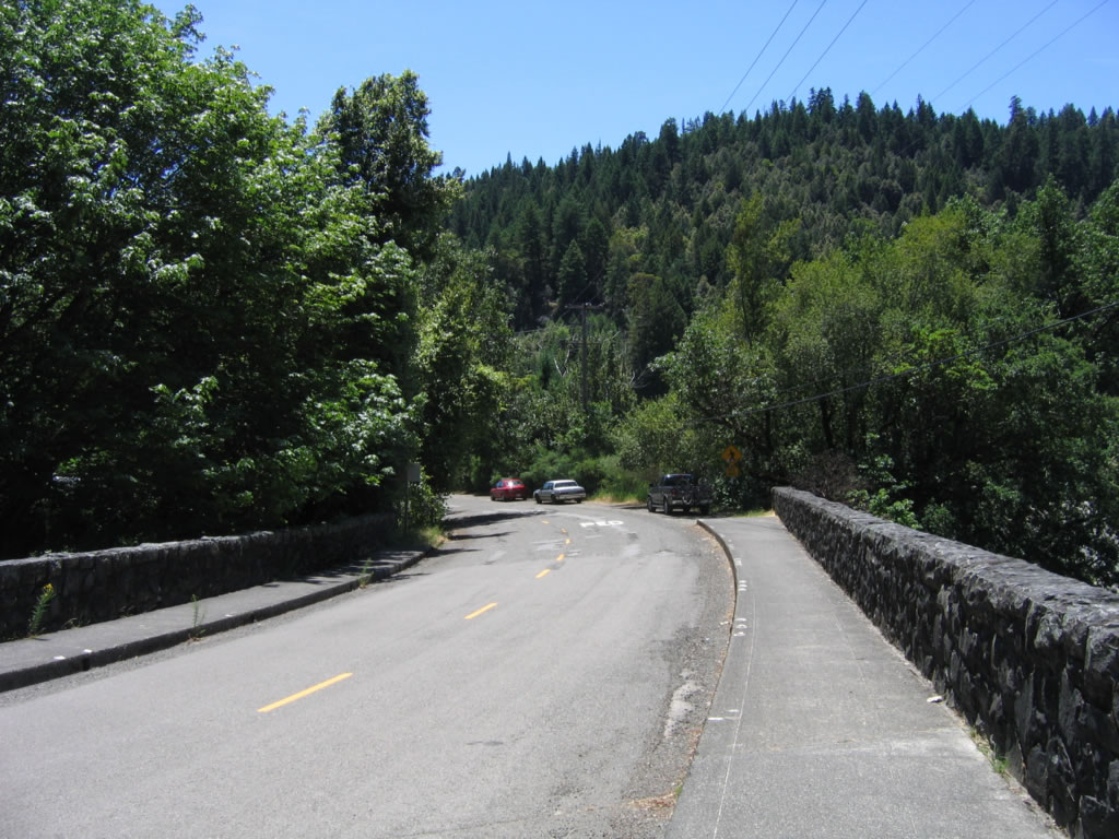
After Benbow Road, U.S. 101 returns to its original alignment. The two-lane highway will enter Richardson Grove State Park along a winding alignment as it gets closer to the Humboldt-Mendocino County line. Photo taken 05/29/06. |
|
Before entering the park, U.S. 101 passes by the Legend of Bigfoot attraction and gift shop. Photo taken 05/29/06. |
|
U.S. 101 (Redwood Highway) enters Richardson Grove State Park, which is named for Friend Richardson, the 25th governor of California. Highway improvements to U.S. 101 in Humboldt County are slow in forthcoming, and the need for a bypass of the Richardson Grove State Park is one such needed area. The truck restriction for U.S. 101 between Eureka and Leggett is due to the sharp turns in Richardson Grove State Park. Photo taken 05/29/06. |
|
A large redwood tree lies next to U.S. 101 as the highway continues through the state park. Photo taken 05/29/06. |
|
Crossing an older bridge (built in 1958), concrete railing appears on U.S. 101. Photo taken 05/29/06. |
|
Blue skies dominate as U.S. 101 continues south out of the dense redwood forest and into a clearing. Photo taken 05/29/06. |
|
A gift store, museum, and other services are located along U.S. 101 after leaving the state park and entering the town of Cooks Valley. Photo taken 05/29/06. |
|
A gas station is located on the west side of southbound U.S. 101 in Cooks Valley. After the gas station, the highway reenters the woods. Photo taken 05/29/06. |
|
A reassurance shield on U.S. 101 south is posted shortly after leaving Cooks Valley. Photo taken 05/29/06. |
|
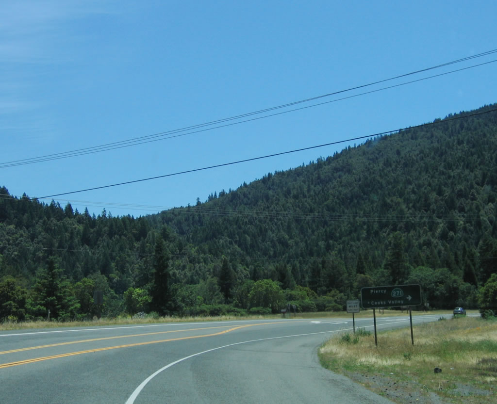
The next intersection along southbound U.S. 101 is with California 271, which is old U.S. 101 in Mendocino County. Photo taken 05/29/06. |
|
California 271 follows the old alignment to Cooks Valley and Piercy. At this point, U.S. 101 leaves Humboldt County and enters Mendocino County. Photo taken 05/29/06. |
| U.S. 101 scenes |
|
Westbound Hookton Road approaches U.S. 101 near the College of the Redwoods. Hookton Road connects with Tompkins Hill Road is an old alignment of U.S. 101 complete with old one-lane bridges and narrow stretches of old road. It parallels U.S. 101 between Exit 690 and Exit 698. Photo taken 05/29/06. |
|
The interchange between Hookton Road and U.S. 101 is rather unusual. The first ramp connects to U.S. 101 north, then Hookton Road loops under U.S. 101 (turns north, then west, then south). Here, Hookton Road south has a left turn to U.S. 101 south. Hookton Road turns west again to Table Bluff Park and the Pacific Ocean. Continue straight ahead (south) along Eel River Drive for an old alignment of U.S. 101. This area shows on maps as the community of Beatrice. Photo taken 05/29/06. |
|
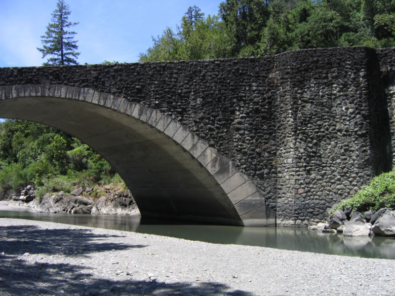
This 1976 bridge carries U.S. 101 over the Eel River near Scotia and Rio Dell. Photo taken 05/29/06. |
|
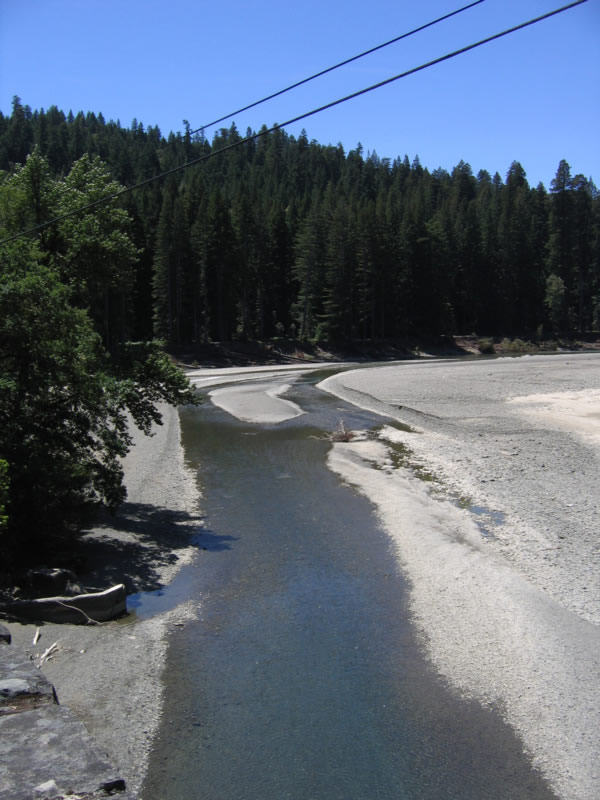
View of the South Fork Eel River from U.S. 101 (Redwood Highway) looking west. Photo taken 05/29/06. |
Page Updated December 7, 2007.