
U.S. 101 South - San Benito County
| U.S. 101 south | |
|---|---|
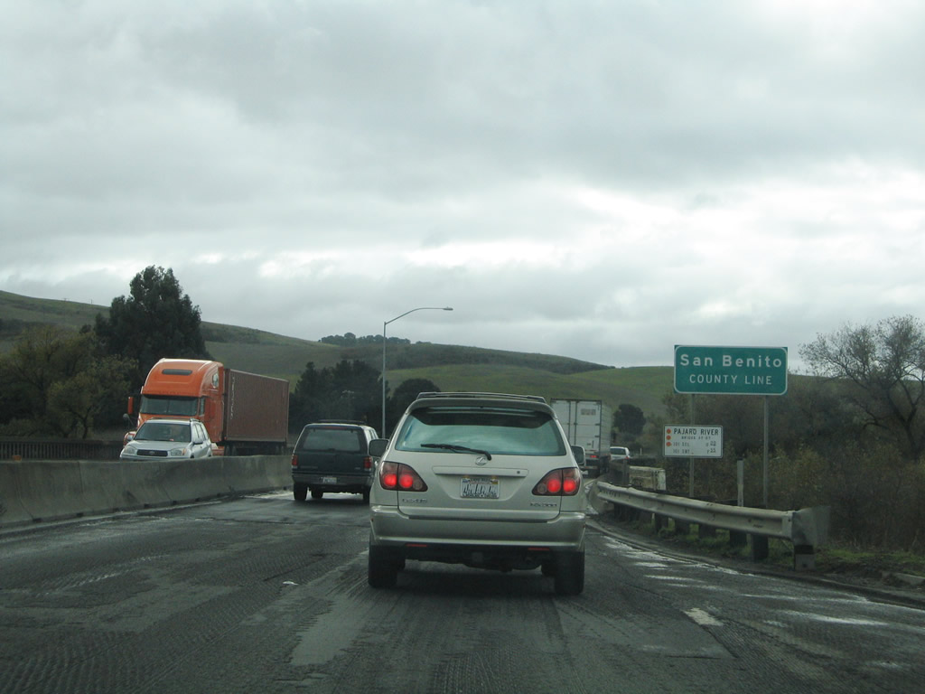 |
Shortly thereafter, U.S. 101 departs Santa Clara County and enters San Benito County upon crossing the Pajaro River. U.S. 101 resumes as a freeway almost immediately after crossing the county line, but the freeway configuration does not last for long. Photo taken 11/27/04. |
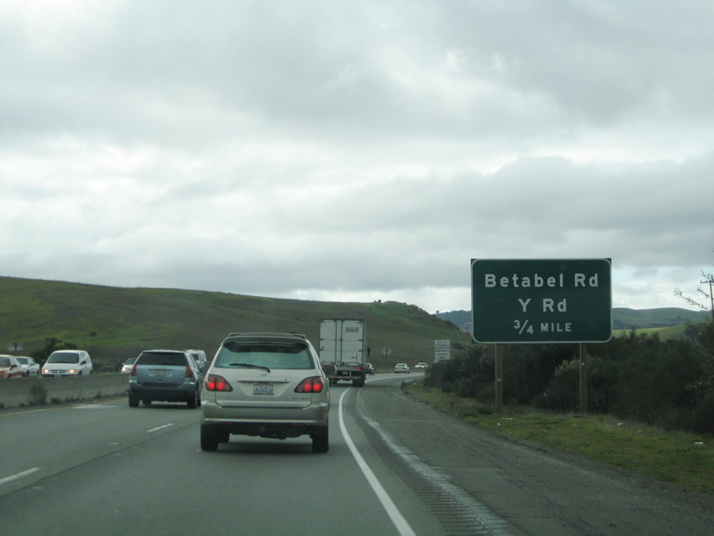 |
The first San Benito County interchange along U.S. 101 south is Exit 349, Betabel Road and Y Road. Photo taken 11/27/04. |
 |
Southbound U.S. 101 (El Camino Real) reaches Exit 349, Betabel Road and Y Road. A recreational vehicle (RV) park is located on the west side of the freeway at this interchange. Photo taken 11/27/04. |
 |
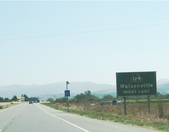
The next exit along U.S. 101 south is Exit 347, California 129 west to Watsonville. Photo taken 11/27/04. |
 |
California 129 heads west to Watsonville. Photo taken by Pete Sison (05/24/03). |
 |
Southbound U.S. 101 (El Camino Real) reaches Exit 347, California 129 west to Watsonville. This interchange marks the eastern terminus of California 129. Photo taken 11/27/04. |
 |
The next exit along U.S. 101 south is Exit 345, California 156 east to San Juan Bautista and Hollister (two miles). Photo taken 11/27/04. |
 |
California 156 heads east toward Hollister, the seat of San Benito County. After passing through Hollister, California 156 merges onto California 152 east for the connection to the Central Valley. To the west, California 156 will merge onto southbound U.S. 101 en route to Prunedale. Photo taken 11/27/04. |
 |
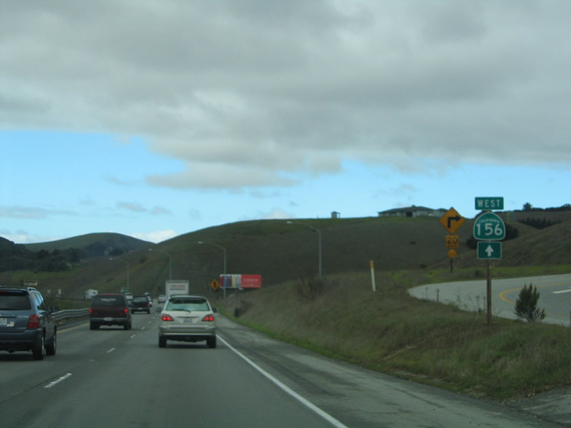
Southbound U.S. 101 approachesExit 345, California 156 east to Hollister. Photo taken 11/27/04. |
 |
Southbound U.S. 101 reaches Exit 345, California 156 east to Hollister. U.S. 101 south and California 156 west merge together for the next nine miles between here and Prunedale in Monterey County. California 156 west splits at Exit 336 en route to the Monterey Peninsula. Photo taken 11/27/04. |
 |
A California 156 trailblazer is posted shortly after Exit 345. Photo taken 11/27/04. |
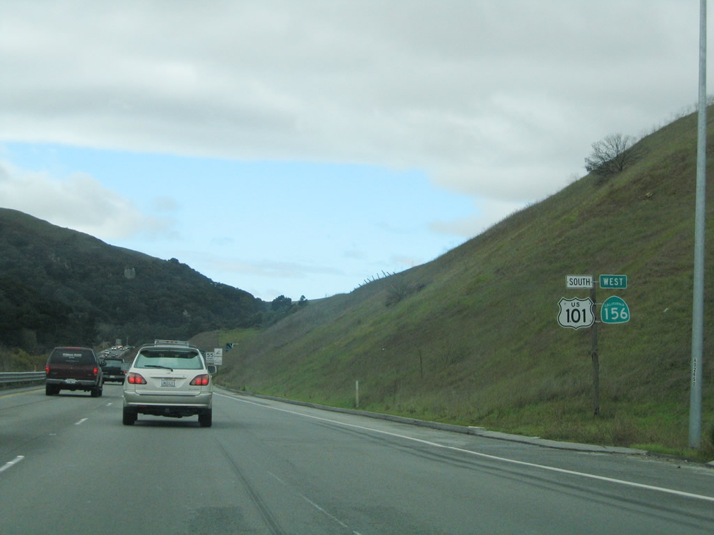 |
This reassurance shield assembly is found after the California 156 east interchange (Exit 345). Both U.S. 101 south and California 156 west are signed. Photo taken 11/27/04. |
 |
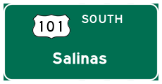
This mileage sign along U.S. 101 south and California 156 west provides the distance to Salinas (17 miles), San Luis Obispo (143 miles), and Los Angeles (347 miles). Photo taken 11/27/04. |
 |
San Benito County is home to an intriguing section of U.S. 101. The freeway narrows somewhat as it enters a eucalyptus forest, with the tall Australian imports flourishing on both sides of the highway. Note the advisory speed reduction as U.S. 101 and California 156 enter the forest. Photo taken 11/27/04. |
 |
Within the forest, U.S. 101 ceases to be a freeway and reverts to an expressway configuration. The first intersection along this section of expressway is with Rocks Road and Cannon Road. U.S. 101 and California 156 are generally traveling due west at this point. Photo taken 11/27/04. |
 |
An end freeway sign is posted just prior to the Rocks Road and Cannon Road intersection. Cannon Road travels north to Anzar Road from this intersection. Watch for turning traffic; as evidenced in this photo, U.S. 101 and California 156 carry a great deal of traffic through this canyon. Photo taken 11/27/04. |
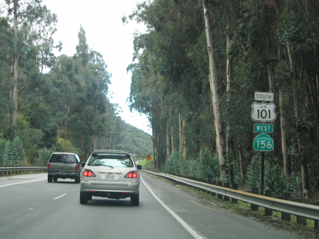 |
Another set of U.S. 101 and California 156 reassurance shields are posted after the Cannon Road intersection. Photo taken 11/27/04. |
 |
Leaving the eucalyptus forest, southbound U.S. 101 and westbound California 156 approach the Cole Road intersection. Photo taken 11/27/04. |
 |
The next intersection along southbound U.S. 101 and westbound California 156 is what would be Exit 343, Monterey County G-11/San Juan Road west to Pajaro and Watsonville. Photo taken 11/27/04. |
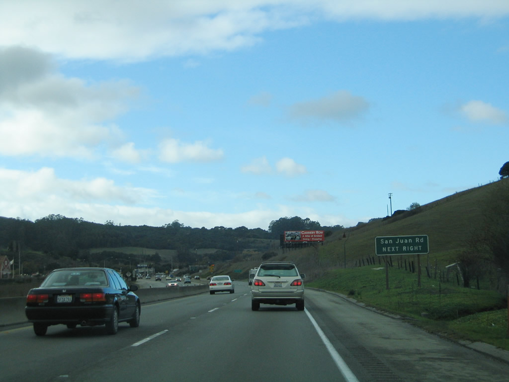 |
The next intersection along southbound U.S. 101 and westbound California 156 is what would be Exit 343, Monterey County G-11/San Juan Road west to Pajaro and Watsonville. Welcome to Monterey County! Photo taken 11/27/04. |
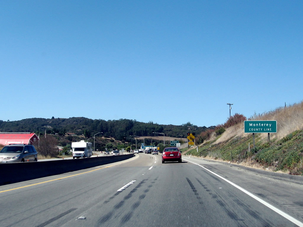 |
At this point (prior to the intersection with San Juan Road), U.S. 101 leaves San Benito County and enters Monterey County. Photo taken by Jeff Waller (10/13/07). |


Page Updated February 12, 2008.
|
About Contact Glossary |
In The News Testimonials Interstate Guide |
Social Media:
 |
|
© 2000-23 AARoads.com | All Rights Reserved | Privacy Policy / Terms of Use
|
||