
Interstate 25 Northbound - Converse County
| I-25/U.S. 87 North U.S. 26 West | |
|---|---|
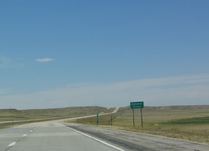 |
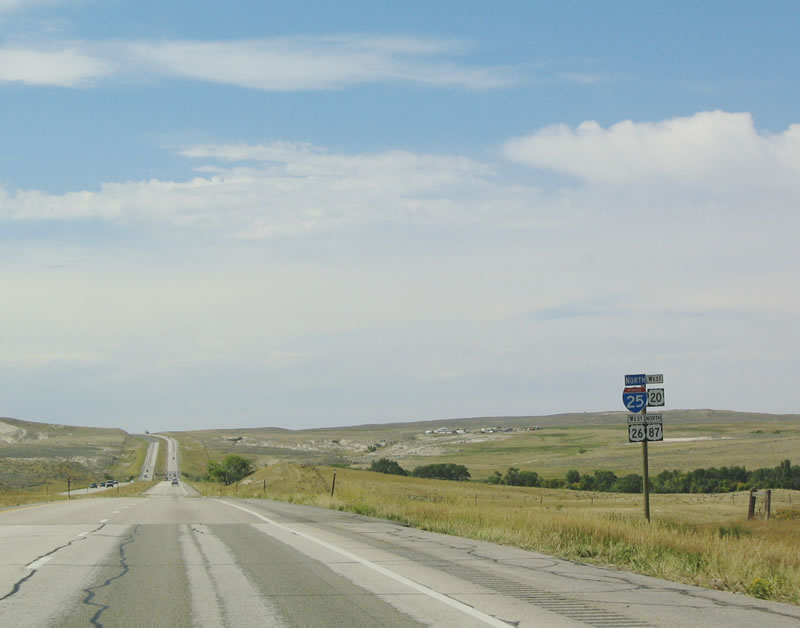
Northbound Interstate 25/U.S. 87 and westbound U.S. 26 depart from Platte County and enter Converse County. Photo taken 09/01/04. |
 |
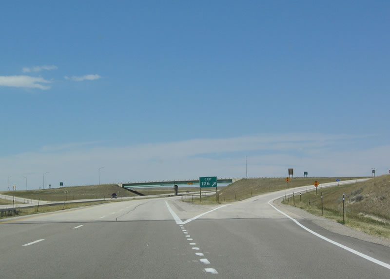
The next exit along northbound Interstate 25 and U.S. 26-87 is Exit 126, U.S. 18-20 east to Lusk. This interchange is also known as Orin Junction. A variety of small towns, such as Shawnee, Lost Springs, Keeline, and Manville, are located between Orin Junction and Lusk. U.S. 20 continues east from Lusk to serve towns along the northern tier of Nebraska, then enters Iowa as a major east-west route (parts of which are freeway, especially east of Interstate 35). Photo taken 09/01/04. |
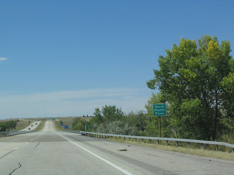 |
For the first time, Interstate 25 crosses over the North Platte River. The North Platte River follows Interstate 25 from here west to Casper, then trends toward the southwest and south into Colorado. Photo taken 09/01/04. |
 |
Motorist services, including food, phone, and gas are available at Exit 126. The next services on the freeway are available 13 miles. Photo taken 09/01/04. |
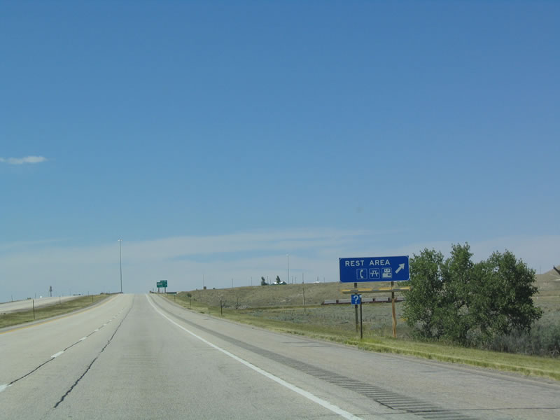 |
The Orin Junction Rest Area is located at the U.S. 18-20 interchange. Telephone, restrooms, and picnic tables are all available at Orin Junction. Photo taken 09/01/04. |
 |
Northbound Interstate 25 and U.S. 26-87 reaches Exit 126, U.S. 18-20. This interchange marks the western terminus of U.S. 18. Follow U.S. 18 (along with U.S. 20) east to Lusk, where the routes divide. U.S. 18 turns north on U.S. 85 to Mule Creek Junction, then sets out on its own to trace its own route across the southern tier of South Dakota. The US route gains traffic as it travels east, and it continues east through Minnesota into Wisconsin, ending in downtown Milwaukee on the shore of Lake Michigan. Photo taken 09/01/04. |
 |
The interchange between Interstate 25 and U.S. 18-20 is a standard diamond. U.S. 20 west joins with Interstate 25/U.S. 87 north and U.S. 26 west. The four routes continue northwest from here toward Douglas and then west to Casper. Photo taken 09/01/04. |
 |
Turn right from the ramp from northbound Interstate 25 to eastbound U.S. 18-20 to the Orin Junction Rest Area. It is located in the southeastern quadrant of the interchange. Photo taken 09/01/04. |
 |
Signage is posted for U.S. 18-20 east to Lusk. U.S. 18 superfluously follows U.S. 20 and U.S. 85 to Mule Creek Junction; it was extended in 1968 to overlap U.S. 85 and U.S. 20. Photo taken 09/01/04. |
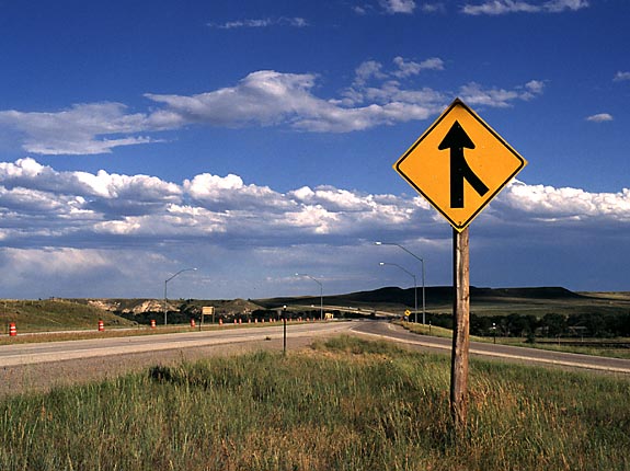 |
Immediately after the U.S. 18-20 interchange is this merge sign on northbound Interstate 25. Photo taken 10/22/00. |
| Interstate 25/U.S. 87 Northbound and U.S. 20-26 Westbound | |
|---|---|
 |
Immediately after Exit 126 (U.S. 18-20, Orin Junction) is the first shield assembly for Interstate 25/U.S. 87 north and U.S. 20-26 west. Notice that the U.S. 20 is on the same level as the Interstate 25 shield. Photo taken 09/01/04. |
 |
The next city along northbound Interstate 25 and U.S. 20-26-87 is Douglas, about 11 miles northwest of Orin Junction. Casper is a little less than an hour's drive west of here. Photo taken 09/01/04. |
 |
A parking area is located near Milepost 129. Photo taken 09/01/04. |
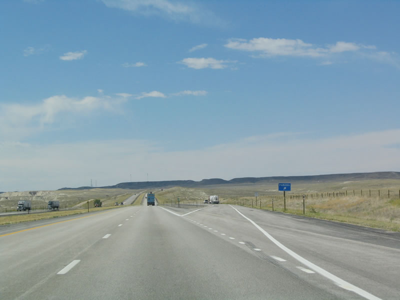 |
Northbound Interstate 25 and U.S. 20-26-87 reaches the parking area. The freeway continues northwest toward Douglas. Photo taken 09/01/04. |
 |
The next exit along northbound Interstate 25 and U.S. 20-26-87 is Exit 135, Junction Business Loop I-25 and Business U.S. 20-26-87, Richards Street. This is the fourth business loop along Interstate 25 in Wyoming. Follow Richards Street west to 4th Street north to Center Street west. Photo taken 09/01/04. |
 |
The city of Douglas, the Home of the Jackalope. The county seat for Converse County, Douglas is situated along the North Platte River. Founded in September 1887, the city was born as a result of the continuing expansion of the railroad during that era. However, nearby energy deposits (natural gas, uranium, etc.) helped Douglas to grow. The city is home to 5,288 people as of the 2000 Census. Photo taken 09/01/04. |
 |
The only example of four business routes cosigned, Business Loop I-25, U.S. 20-26-87 Business overlap through Douglas. "Jackalope" is a hybrid between a jack rabbit and an antelope; it looks like a rabbit with antlers. Locals created a legend around the fictious animal, as it appears on postcards and is part of the local folklore.1. 09/01/04 |
 |
A major north-south route, Wyoming 59 travels north through the Powder River Basin to Gillette, then continues north into Montana. The highway has gained significance through the late 1990s and early 2000s as a result of the energy boom. Wyoming 59 is the most direct route connecting Interstate 25 to Interstate 90. To get to Wyoming 59, follow Interstate 25 northwest to Exit 140, five miles ahead. Photo taken 09/01/04. |
 |
Northbound Interstate 25 reaches Exit 135, Junction Business Loop I-25 and Business U.S. 20-26-87, Richards Street. Douglas is home to the state fairgrounds as well as the Wyoming Pioneer Museum. All motorist services are available at this interchange. Photo taken 09/01/04. |
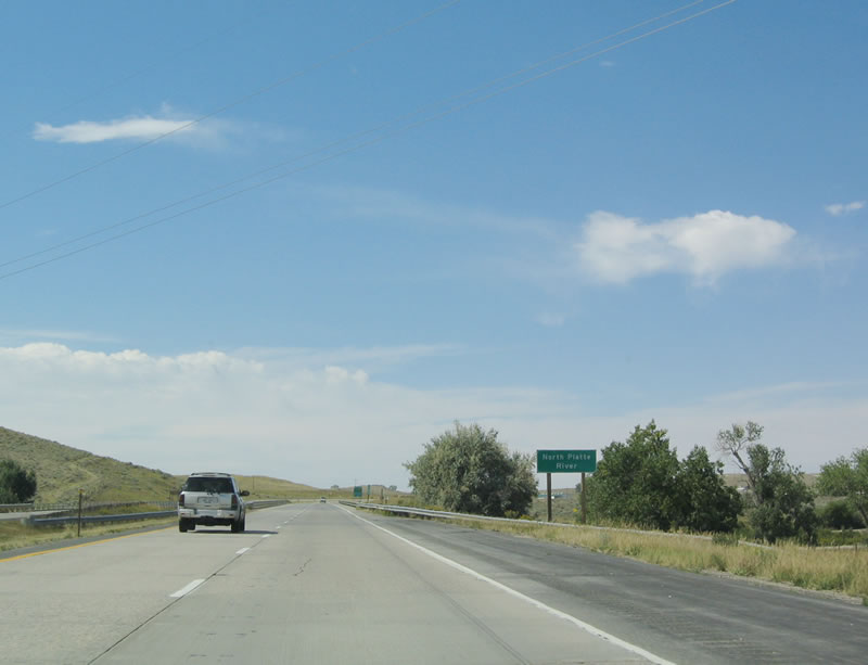 |
Interstate 25 again crosses the North Platte River, and the river flows north of the freeway. The freeway will remain south of the river until Casper. Photo taken 09/01/04. |
 |
The next exit along northbound Interstate 25 and U.S. 20-26-87 is Exit 140, Junction Business Loop I-25, Business U.S. 20-26-87, Wyoming 59, and To Wyoming 91, Wyoming 93, and Wyoming 94. Like Exit 135, Exit 140 is a trumpet interchange. This is the west end of the Douglas business route. The two state routes offer local connections: Wyoming 91 travels west from Douglas to La Prele Reservoir and Cold Springs, Wyoming 93 travels northwest to Orpha, and Wyoming 94 travels south on Esterbrook Road to provide ranch access. Photo taken 09/01/04. |
 |
Located off of WYO 93, Exit 140 serves Fort Fetterman State Historic Site, a park preserving the remains of Fetterman City. WYO 93 travels northwest from Casper by Fort Fetterman and Orpha en route to WYO 95 and the intersection with Highland Road in the Highland Flats. 09/01/04 |
 |
After Exit 140, no services are available for another 25 miles (Wyoming 95 in Glenrock). North on Wyoming 59, services are even scarcer, so it is a good idea to obtain gas and food here. Photo taken 09/01/04. |
 |
Northbound Interstate 25 and U.S. 20-26-87 reaches Exit 140, Junction Business Loop I-25, Business U.S. 20-26-87, and Wyoming 91-93-94 to Wyoming 59. To Wyoming 59, follow the business route east to the first traffic signal (Wyoming 59). Turn right (north) on Wyoming 59 (Esterbrook Road)to connect to Wyoming 93, and turn left (south) on Esterbrook Road to connect to Wyoming 91-94. Wyoming 91 and Wyoming 94 travel under Interstate 25, then split, with Wyoming 91 traveling west via Cold Springs Road and Wyoming 94 traveling south via Esterbrook Road. Photo taken 09/01/04. |
 |
The next exit along westbound Interstate 25 and U.S. 20-26-87 is Exit 146, Wyoming 96, La Prele Road. Wyoming 96 is an east-west road that closely parallels Interstate 25 between Wyoming 91 (Cold Springs Road) and Exit 146. Photo taken 09/01/04. |
 |
Westbound Interstate 25 and U.S. 20-26-87 reaches Exit 146, Wyoming 96, La Prele Road. Wyoming 96 and Wyoming 91 constitute Old U.S. 20-26-87 between Douglas and La Prele. Photo taken 09/01/04. |
 |
This reassurance shield assembly is located on westbound Interstate 25 and U.S. 20-26-87 after the Wyoming 96 interchange. Photo taken 09/01/04. |
 |
The next exit along westbound is Exit 150, Junction Converse County Route 29, Inez Road. Photo taken 09/01/04. |
 |
Westbound Interstate 25 and U.S. 20-26-87 reaches Exit 150, Junction Converse County Route 29, Inez Road. Inez Road travels north to the Chicago and Northwestern Railroad, then follows the railroad east to Wyoming 93 near Orpha. Photo taken 09/01/04. |
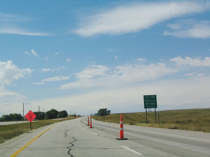 |
The next exit along westbound Interstate 25 and U.S. 20-26-87 is Exit 151, Junction Converse County Route 13, Natural Bridge Road. Ayres Natural Bridge is a natural landmark located about five miles south of Interstate 25. The natural land bridge crosses over a body of water, making it a rare sight indeed; Ayres Natural Bridge crosses over LaPrele Creek. Although not an official state park, it is a county park. The ranch surrounding the bridge is open to the public and is free. Photo taken 09/01/04. |
 |
Westbound Interstate 25 and U.S. 20-26-87 reaches Exit 151, Junction Converse County Route 13/Natural Bridge Road south to Ayres Natural Bridge. Photo taken 09/01/04. |
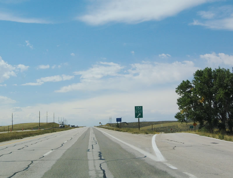 |
This is the gore point to Exit 151 from westbound Interstate 25. This exit is well worth the detour, especially given the free cost of admission. Photo taken 09/01/04. |
 |
After Exit 151, near Milepost 152, is another Parking Area. Photo taken 09/01/04. |
 |
Westbound Interstate 25 and U.S. 20-26-87 reaches Exit 154, Barber Road. This exit provides local and ranch exit. Photo taken 09/01/04. |
 |
The next exit is Exit 156, Bixby Road. The North Platte River valley comes into view to the north of Interstate 25 as the freeway interchanges with Bixby Road. Photo taken 09/01/04. |
 |
Just prior to the Bixby Road interchange, Interstate 25 crosses the Box Elder Creek. Many of the major trails -- Oregon, Bozeman, Texas and California -- followed the North Platte River and today's Interstate 25 alignment between Douglas and Casper. Photo taken 09/01/04. |
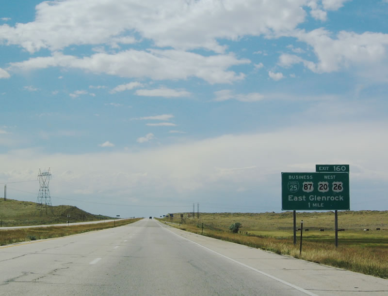 |
The next exit along westbound is Exit 160, Junction Business Loop I-25 and U.S. 20-26-87, Birch Street. (Yes, U.S. 87 and NOT Business U.S. 87 depart from Interstate 25 here.) The business route serves the town of Glenrock, which has the motto "Big Enough to Enjoy, Small Enough to Care." Home to 2,231 people as of the 2000 Census, Glenrock has been growing, albeit very slowly, since 1990. Photo taken 09/01/04. |
 |
Use Exit 106 the Birch Street (Business Loop I-25) exit and turn east via Converse County Route 27 to the Dave Johnston Power Plant. The set of power lines depicted in the previous photobox lead to that power plant, which is situated on the North Platte River. This exit also connects Interstate 25 to Wyoming 90/Box Elder Road south. Photo taken 09/01/04. |
 |
Westbound Interstate 25 reaches Exit 160, Junction Business Loop I-25 and U.S. 20-26-87, Birch Street. No services are available at this interchange; continue west to Exit 165. Photo taken 09/01/04. |
| Interstate 25 Northbound | |
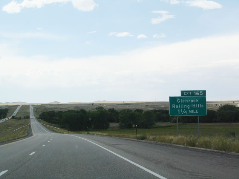 |
For the first time since entering Wyoming, the Interstate has no companion U.S. highways. The next exit is Exit 165, Junction Business Loop I-25 and Wyoming 95 east to Glenrock. Wyoming 95 continues northeast of Glenrock, crossing the North Platte River and passing by Monkey Hill and the Top of the World via Monkey Mountain Road. From there east to Wyoming 93, Wyoming 95 follows Glenrock-Ross Road. Photo taken 09/01/04. |
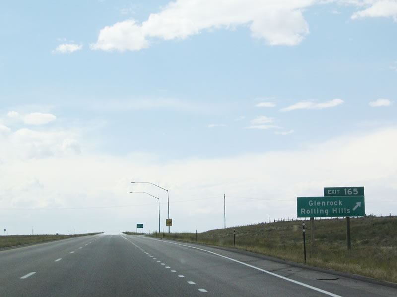 |
Westbound Interstate 25 reaches Exit 165 for Business Loop I-25 east to Glenrock and to U.S. 20-26-87. The next exit is 15 miles further west from here. Photo taken 09/01/04. |
 |
A parking area is located near Milepost 171. Within a few miles, Interstate 25 departs from Converse County and enters Natrona County. Photo taken 09/01/04. |
 |
 |
Sources:
- Jackalope. Wikipedia.
Page Updated October 27, 2005.
|
About Contact FAQ |
Spotlights Testimonials Interstate Guide |
Social Media:
 |
|
© 2000-23 AARoads.com | All Rights Reserved | Privacy Policy / Terms of Use
|
||