|
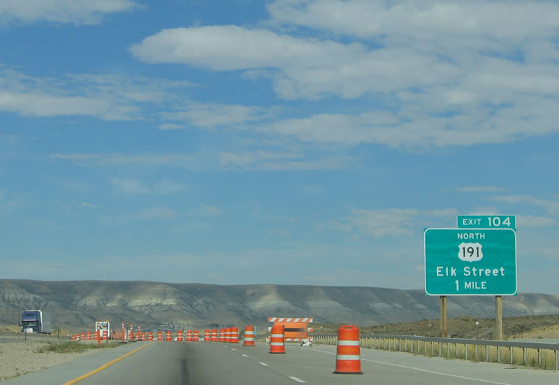
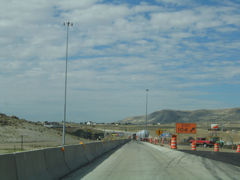
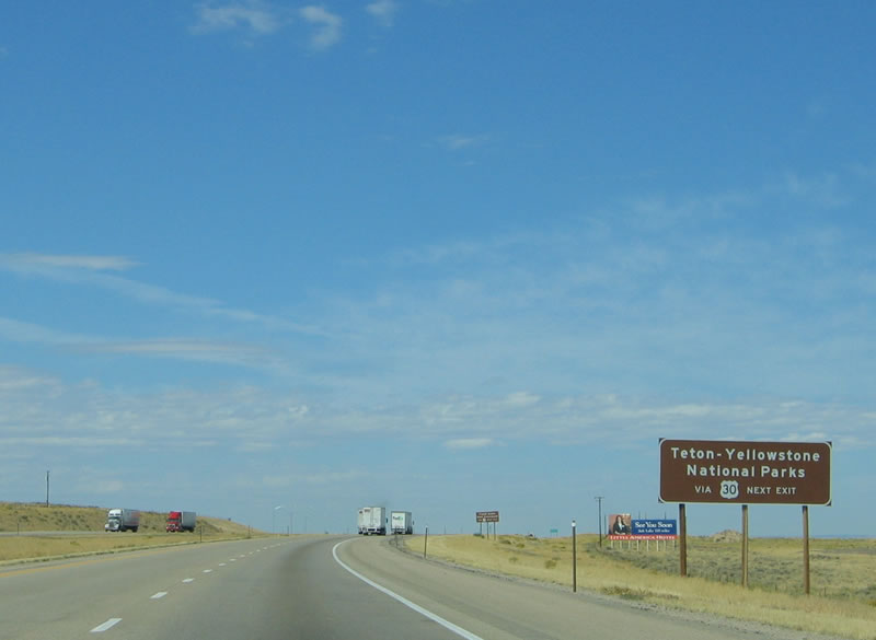
The next exit along westbound Interstate 80 and U.S. 30 is Exit 104, U.S. 191 north to Pinedale, Jackson, and Grand Teton-Yellowstone National Parks. The U.S. highway has a route break in Yellowstone, then resumes in West Yellowstone, Montana, for the rest of its journey north to Canada. A two-lane highway between Rock Springs and Pinedale, U.S. 191 has passing lanes on steep upgrades along its many straight stretches. Photo taken 09/07/05.
|
|
The History Museum is located at 201 B Street in downtown Rock Springs, at the site of the original City Hall (which was built in 1892). Near the museum, mounted one block from the museum, is the famous "Home of Rock Springs Coal Welcome" arch. Photo taken 09/07/05.
|
|
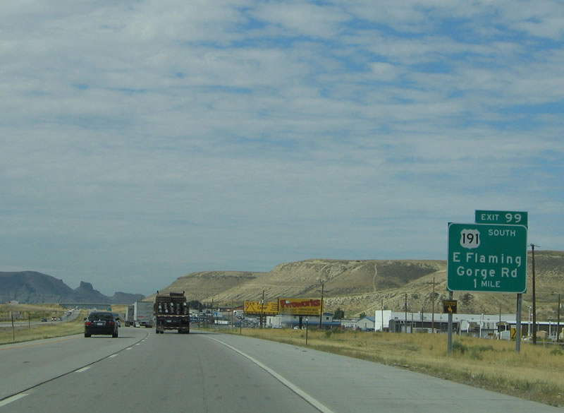
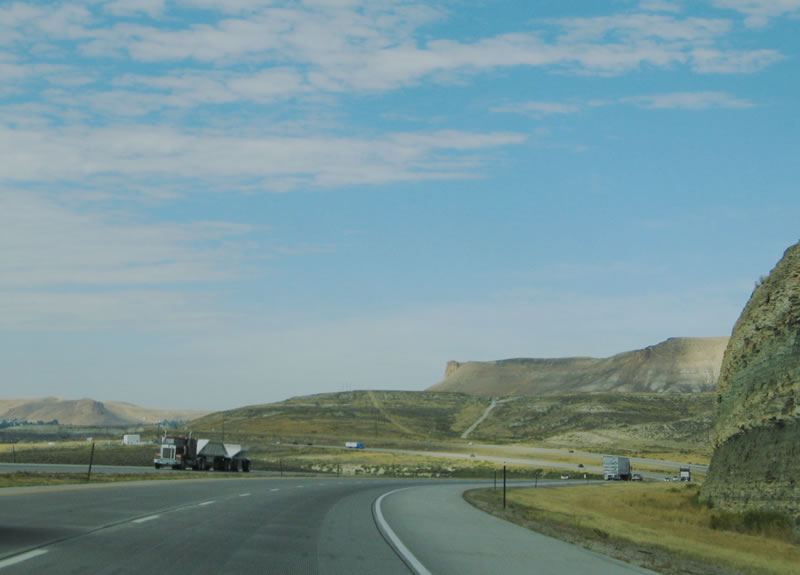
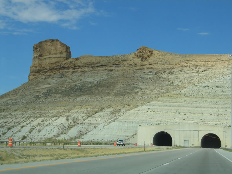
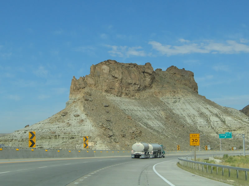
U.S. 191 is the second of four major routes that connect Interstate 80 and U.S. 30 to Yellowstone and Grand Teton National Parks. The others are U.S. 287/Wyoming 789 north via Muddy Gap and Lander, U.S. 189 north via Big Piney, and U.S. 30 west to Wyoming 89 north via Star Valley and Afton. In addition to providing a link to the famed national parks of northwest Wyoming, U.S. 191 also provides the most direct route from Rock Springs the Killpecker Sand Dunes in the Red Desert. Follow U.S. 191 for 11 miles north to Sweetwater County Route 17/Chilton Road, and then take Sweetwater County Route 17 northeast for 20 miles. The county route serves Killpecker Sand Dunes and Boar's Tusk (an ancient volcanic cone that rises from the ground and is visible from U.S. 191) as well as Jack Morrow Hills, which has been considered for massive gas and oil exploration and extraction. This area is the site of a continuing feud between various factions that currently use the land, those who want to preserve, and those who want to extract the minerals from it. Photo taken 09/07/05.
|
|
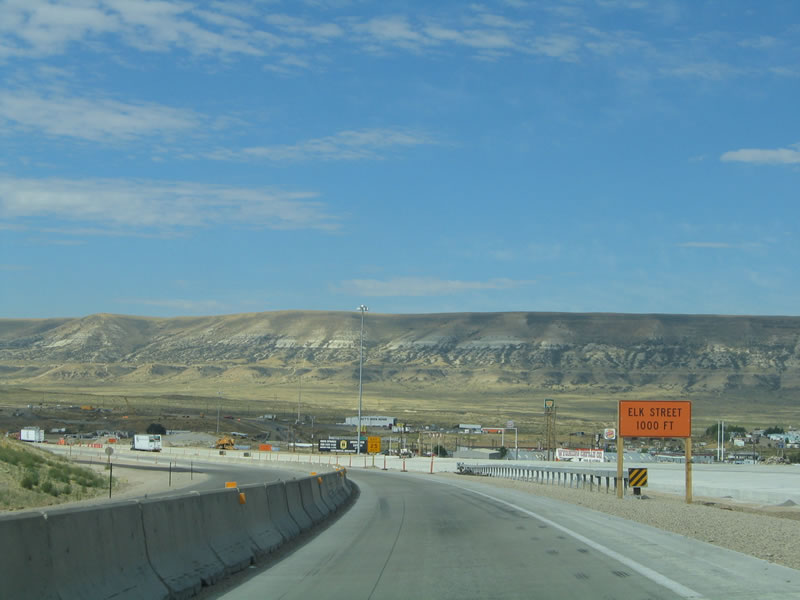
Westbound Interstate 80 and U.S. 30 reaches Exit 104, U.S. 191. U.S. 191 leads north from here toward Farson, Pinedale, and Jackson. Farson is the only town between Rock Springs and Pinedale. At Farson, turn northeast on Wyoming 28 to South Pass and Lander. Although Pinedale can be one of the coldest spots in the nation during the winter, the scenic beauty of the Bridger-Teton National Forest and Green River Lakes makes for a very scenic trip. The headwaters of the Green River is located in the Wind River Mountains above Pinedale in Sublette County near the highest point in Wyoming: Gannett Peak, elevation 13,804 feet above sea level. Back in Rock Springs, Elk Street is a major north-south thoroughfare from downtown Rock Springs to link with U.S. 191 north of town. While Elk Street is a state highway, it does not have a state highway designation (although it could easily be Business U.S. 191, with a connection back to its parent route via a brief overlap with Business Loop I-80 and Blairtown-Flaming Gorge Road). Photo taken 09/07/05.
|
|
Due to the ongoing construction project to replace the concrete, westbound traffic used the eastbound lanes, with the passing lanes closed. U.S. 191 joins Interstate 80 and U.S. 30 west around the Rock Springs marginal, but the cosigned route remains for only a short duration. Photo taken 09/07/05.
|
|
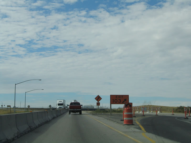
The next exit along westbound Interstate 80/U.S. 30 and southbound U.S. 191 is Exit 103, College Drive. College Drive south leads to Western Wyoming College, a two year community college that serves all of southwestern Wyoming. Photo taken 09/07/05.
|
|
Westbound Interstate 80/U.S. 30 and southbound U.S. 191 reaches Exit 103, College Drive. The College Drive interchange is a relative newcomer to the system of interchanges along Interstate 80 in Wyoming; it was added in the early 1990s to allow for direct access to the community college as well as the northwest part of Rock Springs. Photo taken 09/07/05.
|
|
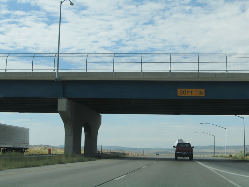
Now restored to the normal configuration with the completion of the construction zone, Interstate 80 and U.S. 30-191 pass under the College Drive overpass. Photo taken 09/07/05.
|
|
A reassurance shield for Interstate 80 and U.S. 30 is posted after the College Drive interchange, but U.S. 191 is missing. Ever since the College Drive interchange was constructed in the early 1990s, U.S. 191 has been missing from this shield assembly. Photo taken 09/07/05.
|
|
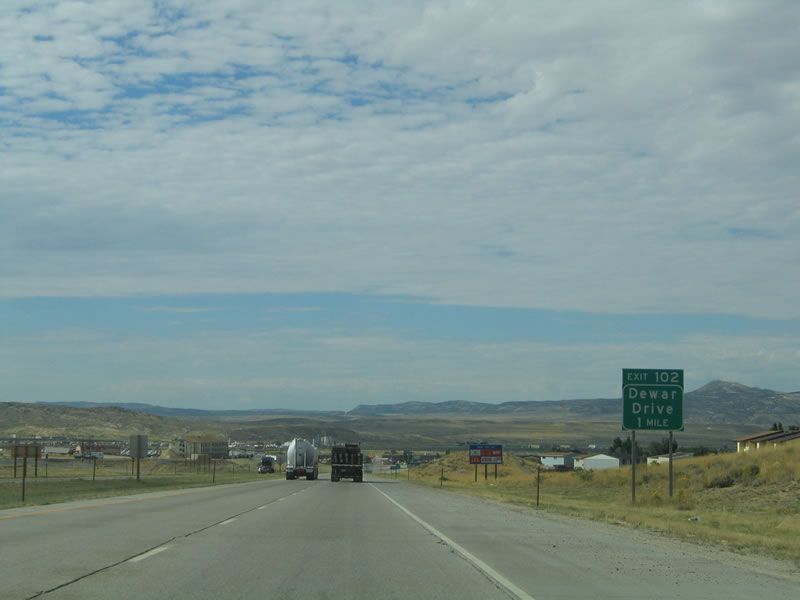
The next exit along westbound Interstate 80/U.S. 30 and southbound U.S. 191 is Exit 102, Junction Business Loop I-80 and Business U.S. 30, Dewar Drive. Business Loop I-80 follows Dewar Drive, Center Street, and Pilot Butte Avenue (9th Street) through downtown Rock Springs. The central intersection in downtown Rock Springs is between Center Street (Business Loop I-80 west), Elk Street (To U.S. 191 north and Wyoming 430 south), and Pilot Butte Avenue (Business Loop I-80 east). Photo taken 09/07/05.
|
|
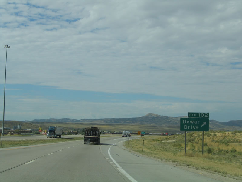
Westbound Interstate 80 and U.S. 30-191 reach Exit 102, Junction Business Loop I-80 and Business U.S. 30, Dewar Drive. This is the final Rock Springs interchange. At this point, the 1926 Lincoln Highway returns to the Interstate 80 corridor. The historical route of the Lincoln Highway followed two different route through Rock Springs. Starting at the Pilot Butte interchange (Exit 107), the first generation of the Lincoln Highway (from around 1916) followed 9th Street/Pilot Butte Avenue west, then turned south on Elk Street, which changes into C Street after crossing the Union Pacific Railroad tracks. Note that the signed route Wyoming 430 follows A Street across the travels, so bear left on southbound Elk Street. Upon entering downtown, Lincoln Highway turned west on Blair Avenue, which becomes Blairtown-Flaming Gorge Road after crossing Wyoming 376, South Side Belt Road. The second generation (1926) of the Lincoln Highway follows the signed business route through Rock Springs. Photo taken 09/07/05.
|
|
After the business loop returns to Interstate 80, all three routes (Interstate 80, U.S. 30, and U.S. 191) are all fully signed. The three routes will remain merged for another three miles, and they divide at Exit 99. Photo taken 09/07/05.
|
|
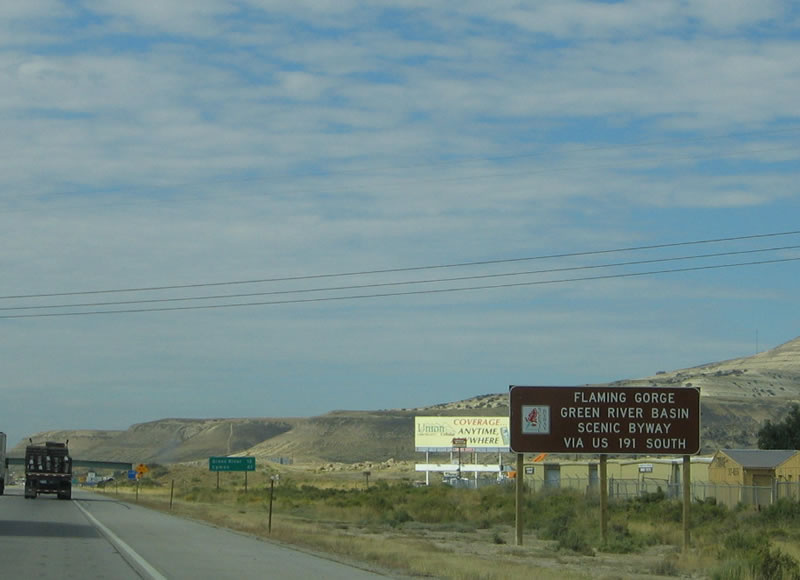
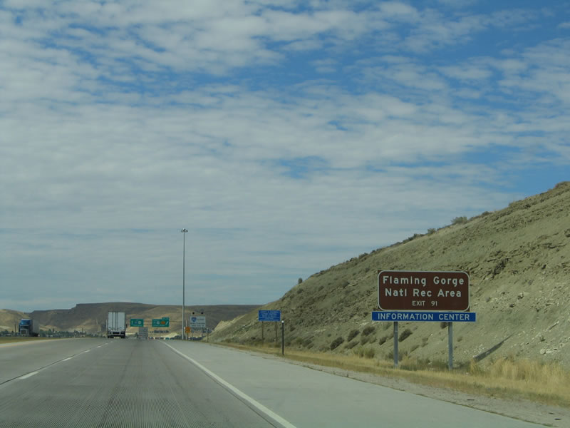
The Flaming Gorge National Recreation Area is managed by the National Forest Service as a unit of Ashley National Forest. Most of Ashley National Forest is located in Utah, in the High Uinta Mountains. Explorer John Wesley Powell, who launched his exploratory expedition from Expedition Island in Green River city in 1869, followed the Green River south into Utah, and he named the Flaming Gorge due to its fiery red rock formation and cliff walls. Established on October 1, 1968, after the construction of the Flaming Gorge Dam and formation of Lake Flaming Gorge reservoir, the national recreation area consists of 207,363 acres. At capacity, the reservoir has a full elevation of 6,045 feet. To reach the Flaming Gorge Dam, Sheep Creek Canyon (and Uinta Crest Fault), and reservoir, follow U.S. 191 south to Dutch John, Utah. Another option is to follow Wyoming 530 south from Green River. Photo taken 09/07/05.
|
|
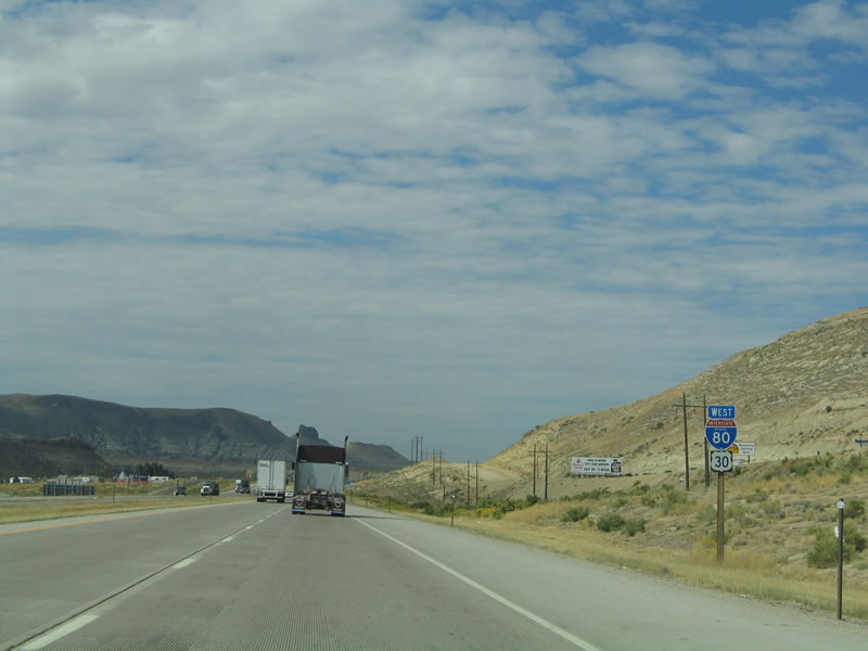
Meanwhile, Interstate 80 continues on a western alignment toward Green River, then splits with U.S. 30 near Little America and Granger. From there, Interstate 80 angles on a southwesterly trajectory along the old alignment of U.S. 30S toward Lyman, Mountain View, Carter, and Evanston before entering Utah. U.S. 30, meanwhile, travels northwest toward Kemmerer. Photo taken 09/07/05.
|
|
The next exit along westbound Interstate 80 and U.S. 30 is Exit 99, U.S. 191 south(Flaming Gorge Road). The tiny brown square shield beneath the green guide sign is for Wyoming Loop Tours. The U.S. 191/Utah 44/Utah 43/Wyoming 530 loop is designated as a Wyoming Scenic Loop Tour, offering a trip south across wild mustang country and into Utah, where the Flaming Gorge Dam holds back the Green River. Continuing to the west, Utah 44 connects to the scenic Sheep Creek Canyon, then loops north to Manila. From Manila, follow Utah 43 east to Wyoming 530 north to Green River. U.S. 191 generally follows the Green River south into the Ashley National Forest, connecting to U.S. 40 at Vernal and with U.S. 6 at Price. Use U.S. 40 east to Dinosaur National Monument. U.S. 191 continues south to Green River, Utah, which like its sister city to the north, lies on the banks of the Green River. The Green River itself connects with the mighty Colorado River in Canyonlands National Park at a point southwest of Moab. Photo taken 09/07/05.
|
|
Interstate 80 and U.S. 30 separates from U.S. 191 at Exit 99. U.S. 191 is the newest transcontinental highway, having been extended in stages from its original length. U.S. 191 was an original 1926 route, but it was fairly short: it only extended from Idaho Falls, Idaho, north to West Yellowstone, Montana. In 1934, U.S. 191 was extended north to U.S. 10 (now Interstate 90) in Bozeman, and in 1963, U.S. 191 was extended north again to U.S. 2 in Malta. A major change to the route occurred in 1982, when U.S. 191 between Idaho Falls and West Yellowstone was eliminated, and U.S. 191 was rerouted into Wyoming via U.S. 89 south to Hoback Junction. From there, U.S. 191 overtook former U.S. 187 south to Rock Springs, former Wyoming 373 into Utah, former Utah 260 through Dutch John, Utah 44 south to Vernal, Utah 33 south to Price, and U.S. 163 (Utah 47) south of Green River through Moab. From there, U.S. 191 entered Arizona via Arizona 63 to meet Interstate 40 at Chambers. In 1992, U.S. 191 replaced the Arizona section of U.S. 666 from Sanders south to Douglas at the U.S.-Mexico International Border. In 1999, a final change was made when U.S. 191 was extended north to the U.S.-Canada International Border via Montana 242. As a result, U.S. 191 became the last transcontinental U.S. route to be established. Photo taken 09/07/05.
|
|
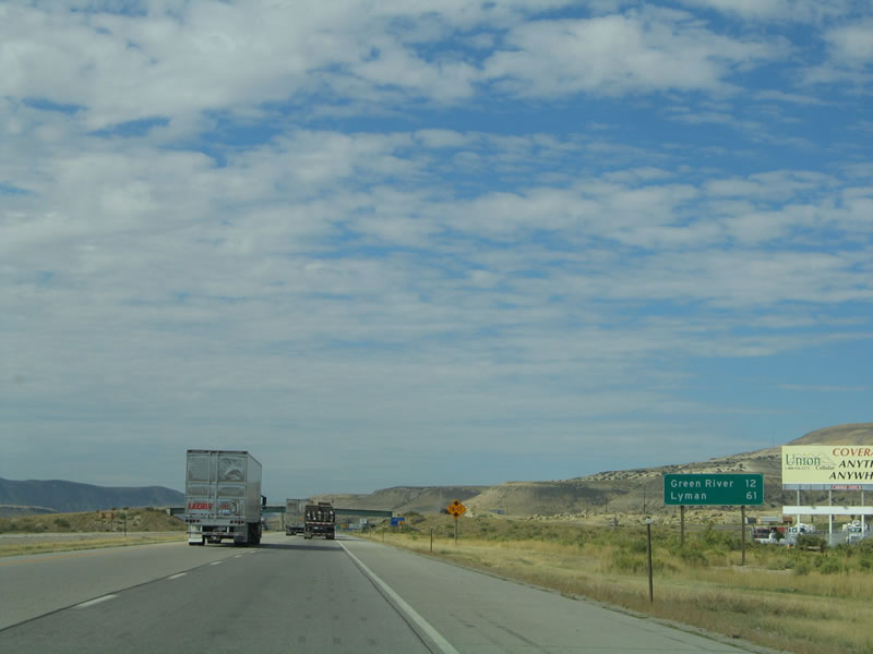
For the next eight miles, there are no exits. Westbound Interstate 80 and U.S. 30 follow the relatively busy freeway between Rock Springs and Green River; there is no direct, paved alternate route to the freeway between these two cities. As a result, traffic count data indicates that this stretch is the busiest along Interstate 80 in Wyoming. West of U.S. 191, remnants of the Lincoln Highway are visible on the north side of the freeway. Photo taken 09/07/05.
|
|
The Sweetwater County Museum was founded in 1967 to preserve the history of Sweetwater County. The museum contains exhibits regarding the Oregon, Overland, California, and Mormon Trails, and it chronicles the John Wesley Powell expedition that launched from Expedition Island in Green River. A pavilion dedicated to the Powell expedition is located on Expedition Island, which is connected to the city by a steel truss bridge. The museum is located at 3 East Flaming Gorge Way (Business Loop I-80). In addition to the museum, a whitewater kayaking park allows for launching into the Green River south toward Flaming Gorge National Recreation Area. Photo taken 09/07/05.
|
|
The rock formations continue to dominate as Interstate 80 and U.S. 30 continue west alongside the Bitter Creek en route to the city of Green River. Incorporated in 1868 as part of Dakota Territory and again in 1891 as part of the new state of Wyoming, Green River is home to 11,808 people as of the 2000 Census. The city is a hub for the trona mining industry; the trona mines are located west of Green River. In addition, the railroad, tourism to the Flaming Gorge, and Interstate traffic augment the economy of this vibrant region. There are no coal mines near Green River; those are primary located near Rock Springs. Green River is also the seat of Sweetwater County, so its courthouse is located downtown. The annual Flaming Gorge Days are a festival of fun during June. Photo taken 09/07/05.
|
|
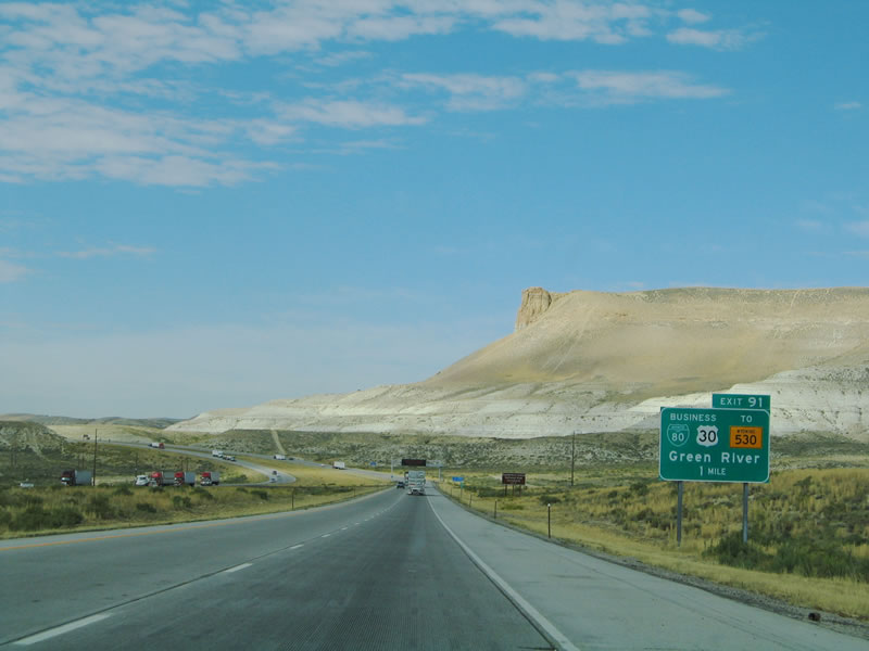
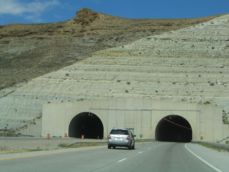
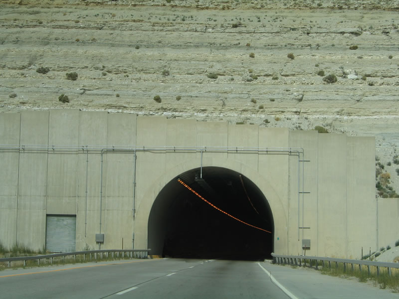
The next exit along westbound Interstate 80 and U.S. 30 is Exit 91, Junction Business Loop I-80 and Business U.S. 30 west to Wyoming 530 south. The business loop is fairly short, following Flaming Gorge Way (Old U.S. 30) between Exits 91 and 89. Since Interstate 80 passes through the Castle Rock Tunnels, all vehicles prohibited from using the tunnels due to hazardous materials restrictions must use the business route through Green River. Photo taken 09/07/05.
|
|
As noted earlier, Expedition Island National Landmark is located in Green River. The island is today a memorial park, with a pavilion dedicated to the John Wesley Powell trip that began in 1869 and covered over a thousand miles along the Green River and Colorado River before emerging near the mouth of the Virgin River and the Grand Canyon. The trip took three months, and only five of the original nine men who accompanied Powell on the trip survived, including Powell himself. Photo taken 09/07/05.
|
|
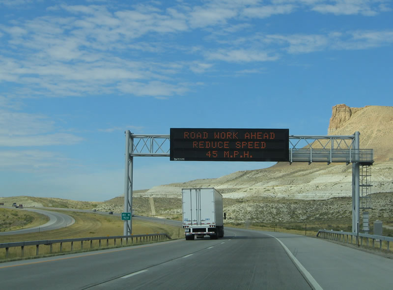
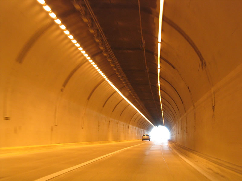
On this day, minor work was being conducted near the Castle Rock Tunnels, and this variable message sign was activated to advise motorists of a reduced speed limit in this area. Photo taken 09/07/05.
|
|
Wyoming 530 offers a second route to the Flaming Gorge National Recreation Area (U.S. 191/East Flaming Gorge Road is the other route). This state route, which is the fifth state route branch from U.S. 30, travels south along Uinta Drive through southern Green River, then travels south on a route that follows the west side of the Flaming Gorge Reservoir. Wyoming 530 continues south, crossing the state line and becoming Utah 43 just east of Manila. To continue around the Flaming Gorge Scenic Loop, turn south on Utah 44 (with a detour at Sheep Creek Canyon) and then north on U.S. 191 to the Flaming Gorge Dam and then north back to Rock Springs. Photo taken 09/07/05.
|
|
Westbound Interstate 80 and U.S. 30 reaches the Exit 91, Junction Business Loop I-80 and Business U.S. 30 west to Wyoming 530 south and to the city of Green River. This is the last exit before the Castle Rock Tunnels along westbound Interstate 80, so vehicles that cannot use the tunnels must use the business route through Green River before rejoining the Interstate at Exit 89. Note the gates that can be closed in order to prevent access to the twin Castle Rock Tunnels. Photo taken 09/07/05.
|
|
Tan and white cliffs dominate the area around Interstate 80 as the freeway continues above the city of Green River and preparing to enter the Castle Rock tunnels. Photo taken 09/07/05.
|
|
Castle Rock is perhaps the best known of the prominent rock formations that surround the city of Green River. Together with Mansface to the south and Tollgate Rock to the east (part of the Eocene Cliffs), Castle Rock is part of the geological features known as the "Green River Formation." Interstate 80/U.S. 30 continues west toward the Castle Rock Tunnels. Photo taken 09/07/05.
|
|
The city of Green River is perhaps best known nationally for the Green River Ordinance, which prohibits door to door selling. Created in 1931, the Green River Ordinance was passed with the intent of allowing railroad workers to sleep during the day; it was upheld by the Wyoming State Supreme Court, U.S. Court of Appeals, and U.S. Supreme Court later that decade. The ordinance can be considered as an anti-trespass law, since peddlers are not allowed on private property without prior permission from the property owner. Photo taken 09/07/05.
|
|
Tollgate Rock appears immediately in front of westbound travelers as Interstate 80 emerges from the tunnel. The next exit is Exit 89, Junction Business Loop I-80/U.S. 30 east to Wyoming 374/Jamestown Road west. Between the city of Green River and Little America, Interstate 80/U.S. 30 is paralleled by Wyoming 374, a service road that follows Old U.S. 30. Photo taken 09/07/05.
|
|
Westbound Interstate 80 and U.S. 30 reaches Exit 89, Junction Business Loop I-80/U.S. 30 east to Wyoming 374/Jamestown Road west. The business route follows Flaming Gorge Way east into downtown Green River, with a connection to Wyoming 374. Wyoming 374 follows Old U.S. 30/Lincoln Highway west to Jamestown and thence west to serve the various trona mines that lie west of the city of Green River. For the 1924 alignment of the Lincoln Highway, follow Wyoming 374 west to the Green River, a steel arch bridge built in the same year. The Interstate passes north of the old road. For an even older alignment, the 1916 route of the Lincoln Highway crosses the Green River via Wyoming 530, then turns west via Riverview Drive. West of the last housing development, Riverview Drive becomes a dirt road, following old U.S. 30 via Telephone Canyon (which is not the same as the Telephone Canyon near Sherman Hill in Albany County). The Lincoln Highway returned to its current alignment via the Peru Cutoff, reconnecting with U.S. 30 and the 1924 alignment in Peru, thus bypassing Jamestown. Photo taken 09/07/05.
|
|
Here is another look at Tollgate Rock at the Exit 89 trumpet interchange. In this picture, the Green River appears for the first time alongside Tollgate Rock, and Wyoming 374/Jamestown Road squeezes between the river and the rock formation. The Green River Palisades, which are among the most photographed features in southwestern Wyoming, comes into view along Interstate 80. Photo taken 09/07/05.
|
|
The Green River Palisades come into view as Interstate 80 and U.S. 30 follow the Green River west. Photo taken 09/07/05.
|
|
Little America is the next settlement along Interstate 80/U.S. 30; it is located 20 miles west of Green River. In the space between Green River and Little America are a series of trona mines and natural gas/petroleum enterprises. The control city is now Evanston, some 85 miles southwest of here. Photo taken 09/07/05.
|
|
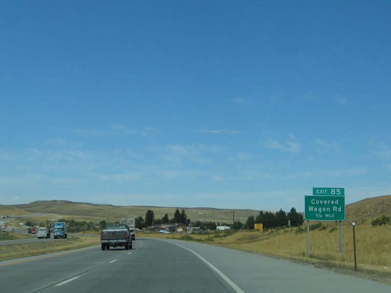
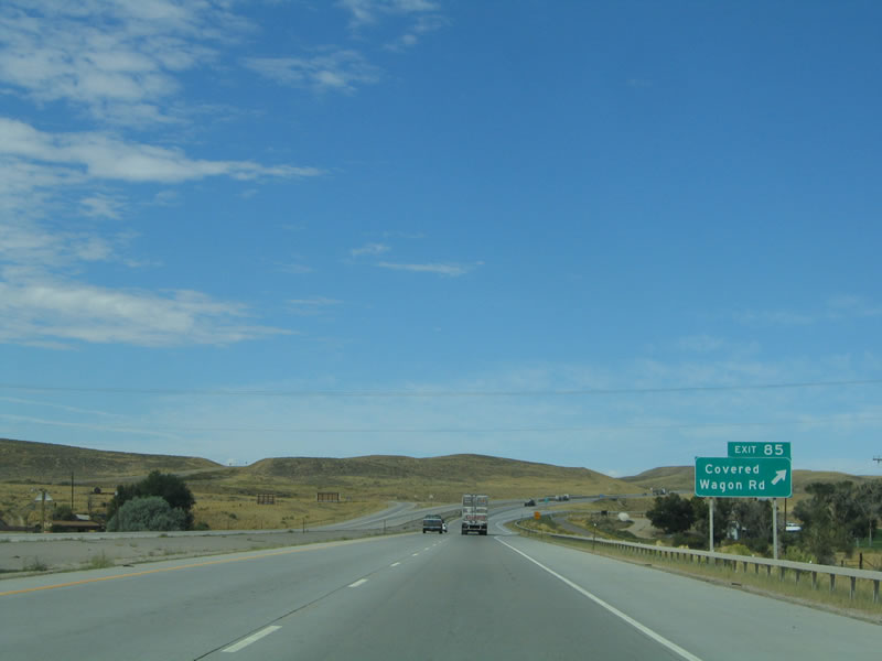
Now leaving the famed Green River Palisades, the next exit along westbound Interstate 80 and U.S. 30 is Exit 85, Junction Sweetwater County Route 59, Covered Wagon Road. The Rolling Green Country Club golf course is located north of the freeway. Photo taken 09/07/05.
|
|
Interstate 80 and U.S. 30 cross the Green River. To the south, look at the steel arch bridge that carries Wyoming 374 across the Green River. The Green River originates in the Wind River Mountains northeast of Pinedale. To the south, the Green River carries runoff from the mountains to the Colorado River in Utah. Photo taken 09/07/05.
|
|
Westbound Interstate 80/U.S. 30 reaches Exit 85, Junction Sweetwater County Route 59, Covered Wagon Road. To Sweetwater County Route 5/Blue Rim Road, take Covered Wagon Road south to Wyoming 374/Jamestown east. Photo taken 09/07/05.
|
|
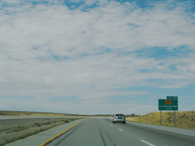
As Interstate 80 and U.S. 30 ascend out of the Green River valley, the next exit along westbound is Exit 83, Wyoming 372/LaBarge Road north, Wyoming 374/Jamestown Road east, and Wyoming 374 west. Photo taken 09/07/05.
|
|
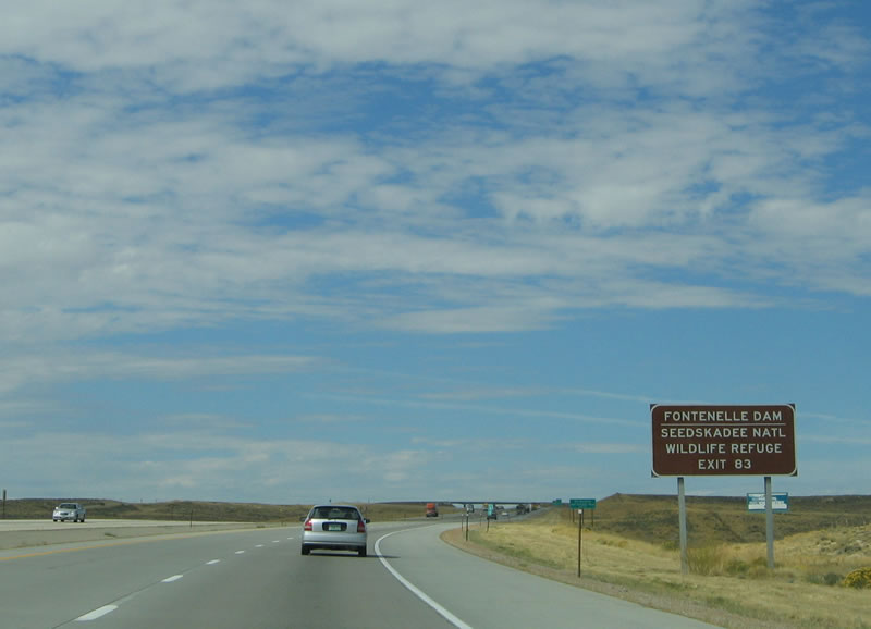
To the northwest via Wyoming 372 is Seedskadee National Wildlife Refuge, a haven for migratory birds. This wildlife refuge was established by the Fish and Wildlife Service in 1965 along the Green River south of the Fontenelle Dam and northwest of Green River city. The Fontenelle Dam was constructed and filled between 1961 and 1964. A relocation of U.S. 189 was required to allow for the new reservoir to be filled. However, trouble started shortly after the dam was constructed: A leak appeared in 1965 along the west abutment of the dam. While it was repaired within a week of discovering the problem in September 1965, flooding occurred downriver. Longer range repairs ensued, with completion by 1968. Seepage again became a problem in 1983, after a particularly wet winter. Within three years, a concrete wall was installed, thus fixing the seepage problem to date. Photo taken 09/07/05.
|
|
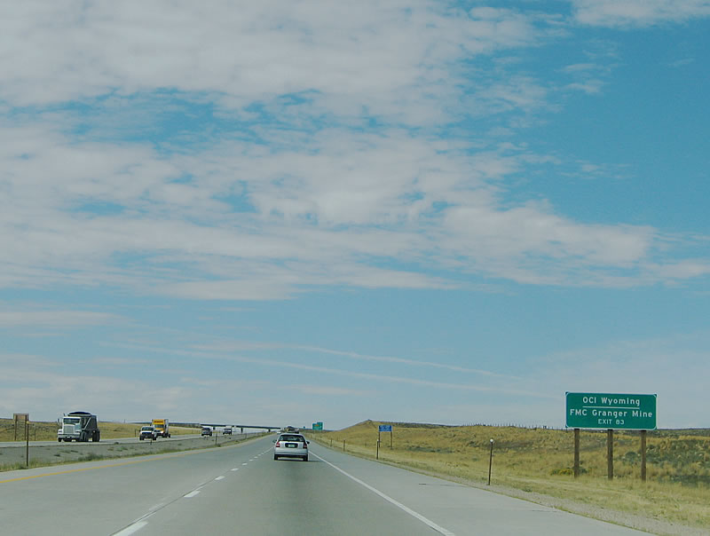
The Wyoming Department of Transportation has placed signs for the trona, petroleum, and other mining companies that are located along Interstate 80. Use Exit 83 (Wyoming 374 west) to OCI Wyoming and FMC Granger Mine. Photo taken 09/07/05.
|
|
Westbound Interstate 80 reaches Exit 83, Wyoming 372/LaBarge Road north, Wyoming 374/Jamestown Road east, and Wyoming 374 west. Wyoming 374 continues to follow the old alignment of U.S. 30 and the Lincoln Highway. Photo taken 09/07/05.
|
|
Interstate 80 and U.S. 30 continue along a shared alignment, but only for another 17 miles. At Exit 66, the two transcontinental routes will split for the final time, with U.S. 30 traveling northwest toward Oregon and Interstate 80 southwest to California. Photo taken 09/07/05.
|
|
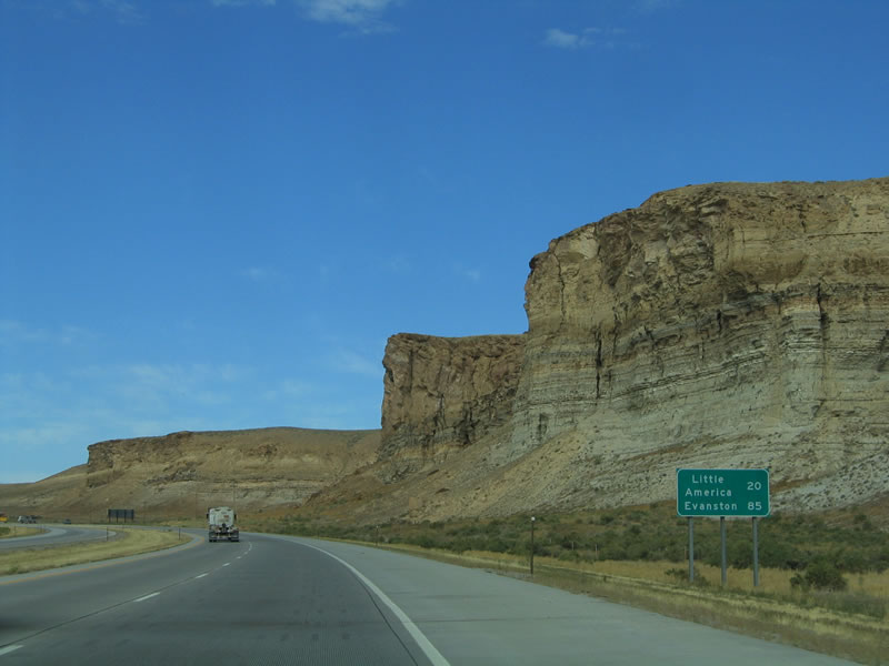
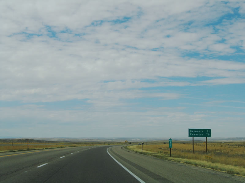
This mileage sign provides the distance to Kemmerer (61 miles via U.S. 30 west) and Evanston (79 miles via Interstate 80 west). Lyman, Mountain View, and Fort Bridge are omitted from the mileage sign. Photo taken 09/07/05.
|
|
Deceptively empty on the surface, deep below the freeway lies a vast network of underground tunnels used to mine the mineral trona from the depths. Interstate 80 continues west through the Green River basin. Photo taken 09/07/05.
|
|
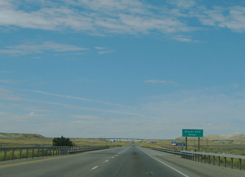
The Blacks Fork River is a tributary to the Green River in southwestern Wyoming. It originates in the High Uintas in Utah, travels north near Lyman, then turns northeast past Interstate 80 toward Granger and south again past Interstate 80 again to join the Green River in the Flaming Gorge Reservoir. Photo taken 09/07/05.
|
|
A spur of the Union Pacific Railroad crosses Interstate 80 here. The railroad has several spurs that connects to the various trona mines. Photo taken 09/07/05.
|
|
The next exit along westbound Interstate 80 and U.S. 30 is Exit 72, Wyoming 374, Westvaco Road. As noted earlier, this is a major mining area. Deep under the surface are hundreds of underground tunnels built in the hopes of mining trona, a mineral known as sodium sesquicarbonate that is converted into soda ash. Soda ash is used in the production of glass and baking soda. Trona is crystalline in nature and has tiny shards in the rock. The only other known deposit of trona in the United States is located in Trona, California, near Death Valley. According to the Sweetwater County Joint Travel and Tourism Board,1 16 million tons of trona ore are mined annually. This amounts to a significant share (90%) of soda ash produced in the country. Photo taken 09/07/05.
|
|
The first instance of trona was found by the Mountain Fuel Supply Company while exploring for natural gas in 1938. By 1940, the Union Pacific Railroad Company (which owned much of the land above the trona deposits) confirmed the abundance of trona below ground. By 1947, mining in earnest began when Westvaco Chlorine Products Corp. (now part of FMC Corporation) mined trona for the first time through an underground mine. Within six years, soda ash was refined on site by FMC. Starting in 1961, OCI of Wyoming began mining activities, followed by General Chemical in 1968 and Solvay Minerals in 1982. Arm and Hammer, which produces baking soda, partnered with General Chemical. Trona mining remaining very active even though it is nearly invisible to passing motorists on Interstate 80. Most of the deposit lies thousands of feet below the freeway. Photo taken 09/07/05.
|
|
Westbound Interstate 80 and U.S. 30 reach Exit 72, Junction Sweetwater County Route 85 north to Wyoming 374, Westvaco Road. Follow Sweetwater County Route 85 south to Tenneco, another trona mining operation. Photo taken 09/07/05.
|
|
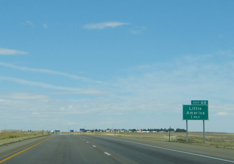
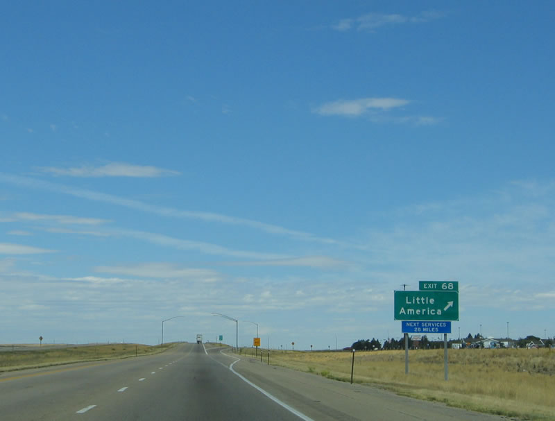
The next exit along westbound Interstate 80 and U.S. 30 is Exit 68, Wyoming 374, Little America. This interchange marks the reconnection of Interstate 80 with the old alignment of U.S. 30/Lincoln Highway (now signed as Wyoming 374). The frontage road to the right (north) is Wyoming 374, which provides access to the trona mines. Photo taken 09/07/05.
|
|
Westbound Interstate 80 and U.S. 30 reaches Exit 68, Wyoming 374, Little America. Little America is a combination hotel, restaurant, and truck stop that is visible for miles from the freeway. Trona miners visit this location frequently for food and gas. In addition, it is a welcome respite from miles of monotonous high desert terrain. The trees that are at this location were planted, and they do not fare well without adequate watering due to the minimal amounts of precipitation received. Photo taken 09/07/05.
|
|
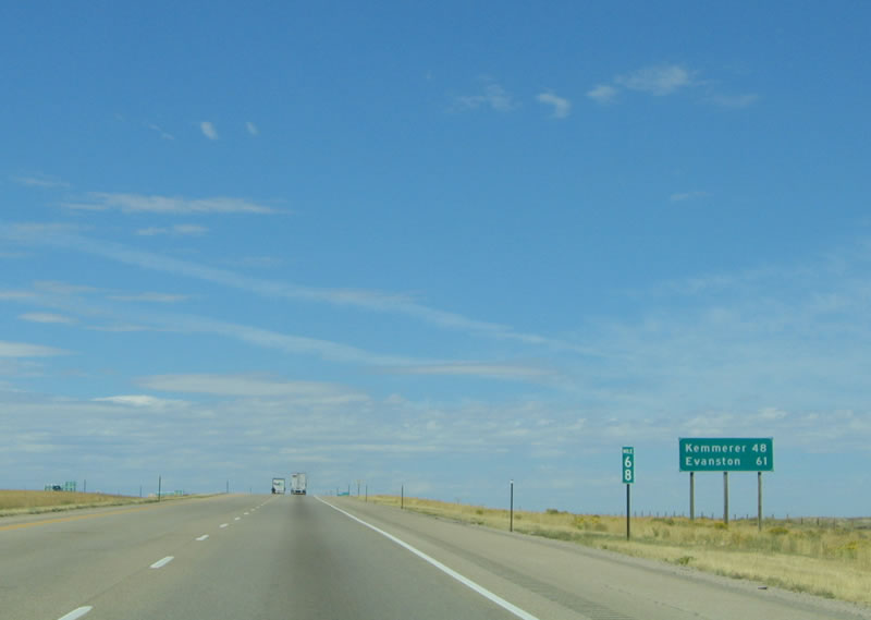
This mileage sign, found at Milepost 68, provides the distance to Kemmerer via U.S. 30 and Evanston via Interstate 80. The routes divide at the next interchange. Photo taken 09/07/05.
|
|
The next exit along westbound Interstate 80 and U.S. 30 is Exit 66, U.S. 30 west to Portland, Oregon. After over 200 miles of combined routing within the state of Wyoming, U.S. 30 will finally exit the Interstate 80 freeway permanently at Exit 66. U.S. 30 travels northwest to Kemmerer and Pocatello, Idaho. Photo taken 09/07/05.
|
|
Travelers may access Yellowstone and Grand Teton National Parks via U.S. 30 by taking either U.S. 189 at Kemmerer or U.S. 89 at Star Valley. Both routes are good scenic alternatives to reach northwestern Wyoming. U.S. 30 itself does not enter either national park. Photo taken 09/07/05.
|
|
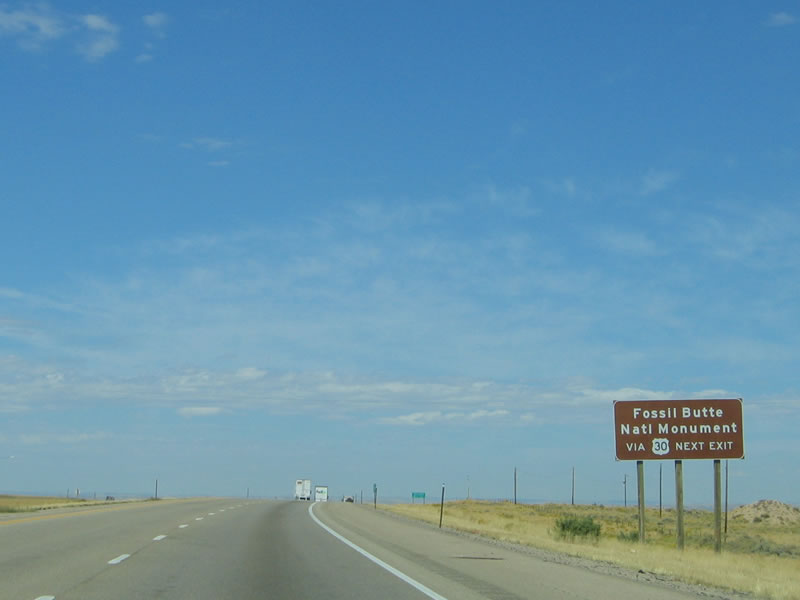
In addition, a lesser-known national monument is accessible from U.S. 30. Fossil Butte National Monument is a collection of fossils from Wyoming's verdant past, back when much of the state was warm and tropical. Fossils, including dinosaur bones, have been discovered in a variety of locations across the state, and Fossil Butte is one such place. Photo taken 09/07/05.
|
|
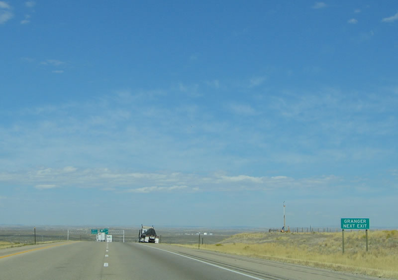
Use U.S. 30 west to Granger, which is connected to U.S. 30 via the short Wyoming 375 state highway. As of the 2000 Census, 146 people called Granger home. U.S. 30N and U.S. 30S used to split here, but now only U.S. 30 passes through Granger en route to Kemmerer and Pocatello, Idaho. Photo taken 09/07/05.
|
|
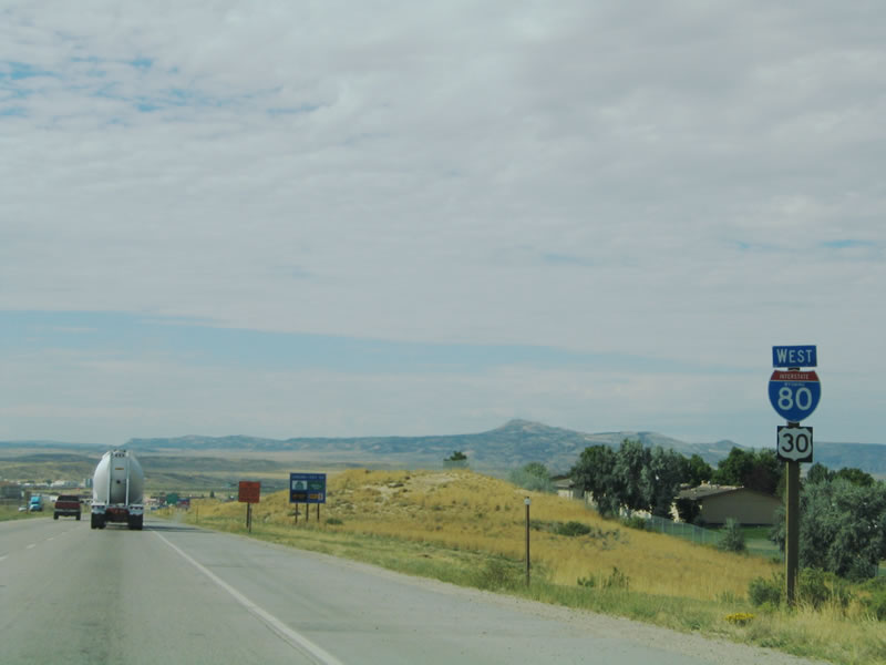
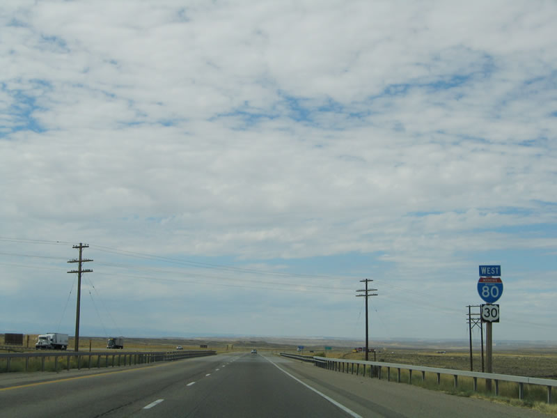
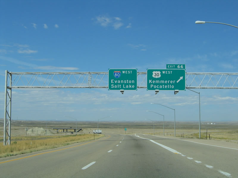
Interstate 80 and U.S. 30 finally part ways at Exit 66 in Granger. Exit 66 is the junction with U.S. 30 west to Kemmerer and Pocatello. This is the last time that Interstate 80 and U.S. 30 meet along westbound; U.S. 30 continues along a northwesterly trajectory toward Pocatello, Twin Falls, Boise, Portland, and Astoria. Interstate 80 turns southwest toward Salt Lake City, Nevada, and ultimately San Francisco. Many truckers opt to take U.S. 30 as a short cut between Granger and Twin Falls via Pocatello, finding that route to be a bit quicker than using Interstate 84, which requires traffic to go south before heading northwest. U.S. 30 between Granger and Pocatello was submitted as a requested addition to the Interstate Highway System, but it was denied. With the amount of truck traffic on U.S. 30, it may be considered for such an addition at a future time. The section of U.S. 30 between Granger and Pocatello is one of the last remaining extant portions of U.S. 30 that are not directly paralleled by an Interstate highway. It has been largely replaced by Interstate 86 between Pocatello and Rupert and by Interstate 84 from there west to Portland. Photo taken 09/07/05.
|
| Interstate 80 Westbound
|
|
For the first time since the Snow Chi Minh Trail section through Arlington and Elk Mountain, Interstate 80 is now signed along without any companion U.S. or state routes. The route of the rest of Interstate 80 through Wyoming follows what was known as U.S. 30S, which used to follow Interstate 80 west to Echo Junction, then turned northwest via Interstate 84 (former Interstate 80N) to rejoin U.S. 30N near Rupert, Idaho. Both U.S. 30S and U.S. 30N were decommissioned in 1972; U.S. 30N was replaced with U.S. 30, while U.S. 30S was supplanted by its new companion Interstate routes. Photo taken 09/07/05.
|
|
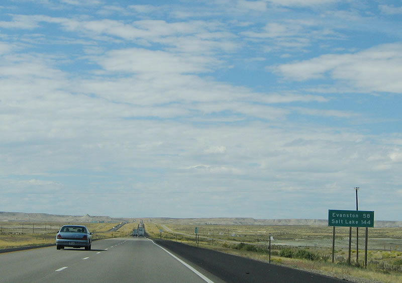
For the first time, the distance to Salt Lake City, Utah, is provided on a mileage sign (144 miles). The destination city is Evanston (58 miles). Photo taken 09/07/05.
|
|
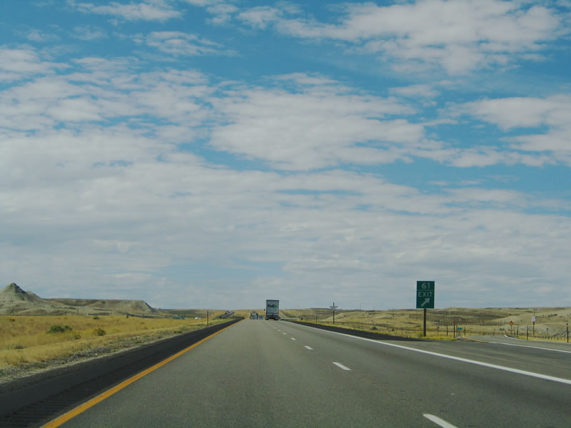
The next exit along westbound Interstate 80 is Exit 61, Wyoming 374 (North Service Road/old U.S. 30S) east to Granger and local county route Cedar Mountain Road (South Service Road) east. This is the last exit in Sweetwater County. Photo taken 09/07/05.
|
|
Interstate 80 reaches Exit 61, Wyoming 374 east to Granger and Cedar Mountain Road east. Photo taken 09/07/05.
|
|
A parking area is located just prior to leaving Sweetwater County. Photo taken 09/07/05.
|
|
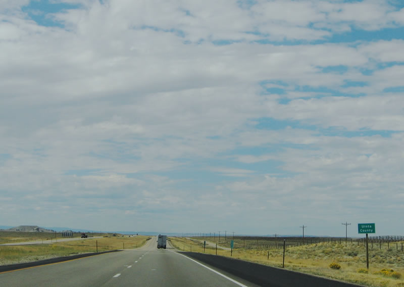
Interstate 80 leaves Sweetwater County and enters Uinta County, the final county served in Wyoming. Photo taken 09/07/05.
|
Page Updated October 21, 2005.