
Started the day off with a bang, a huge crash of thunder at around 6:30 am at the onset of a thunderstorm in Quincy, MA. A few hours later storm clouds gave way to brilliant skies, setting the tone for the day. We were due in Vermont this night, but opted to stay with our friend in Quincy another night and explore more of the area roads instead. Beginning on Interstate 93 south, we again headed to its terminus with Interstate 95, viewing work associated with the aforementioned project between the two highways. Surprisingly the tight single lane loop ramp that Interstate 95 northbound utilizes between itself and the Massachusetts 128 circumferential highway is not being addressed. The northbound mainline of one of America’s busiest freeways remains relegated to just one lane here. At the same time, abandoned ramps and bridges associated with unconstructed Interstate 95 northeast through Canton remain and presently are the site of construction staging areas for the current project.
Further south, cloverleaf ramps between Interstates 95 and 495 are being slightly altered to improve their curvature. It is amazing to us as to how many full cloverleaf interchanges remain in service between two Interstates, let alone freeways of any kind. It reminds me of the interchanges I experienced in the Minneapolis-St. Paul area..
Interstate 495, for as long as the highway is, carries six lanes throughout most of its length. It is a testament to the far reaching suburbs of Boston and the increasing weekend beach and mountain-bound traffic to have that much capacity on a freeway so far from the city center. Unfortunately the only modern interchange along the route that comes to mind is the Exit 23C directional to Simarano Drive at Marlborough, officially known as Joseph A. Ferrecchia Connector Road.
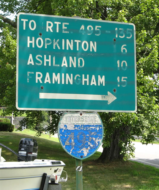
Finding a state-named Interstate shield in either Massachusetts or New Hampshire is next to impossible, but thanks to our friend Jake, we were able to locate this 18″ wooden trailblazer for Interstate 495 in Upton.
One stop along the northward drive along Interstate 495 took us into the city of Lowell via the Lowell Connector. Once upon a time this freeway spur received the designation Business Spur Interstate 495 (one junction shield still remains). Nowadays it is simply signed as the “Lowell Connector” or “To Interstate 495 & U.S. 3”. A complex series of loop and directional ramps join both the Lowell Connector and the U.S. 3 freeway with Interstate 495 via Exits 35A-B-C. Spurring north from U.S. 3 just south of Interstate 495, the six-lane freeway even receives its own set of sequential exit numbers.
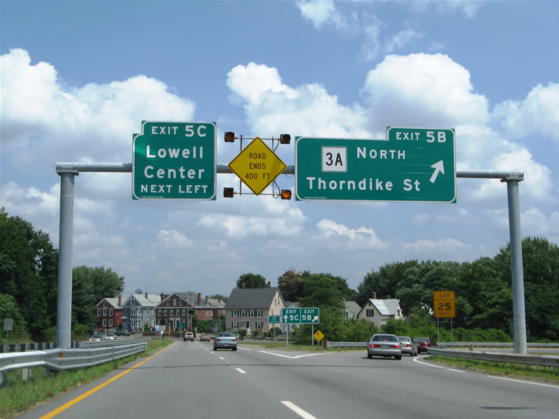
Nearing the northern end of the Lowell Connector at the partition between Exits 5B (Massachusetts 3A north) and 5C (Central Lowell via Gorham Street). “Road Ends” signs are a bit misleading in our opinion. Having seen them as far south as Rhode Island and as far north as Essex Junction, Vermont, they are somewhat standard in the New England states.
Continuing northeast on Interstate 495, the freeway next meets Interstate 93 near Lawrence. Lawrence, Lowell’s sister city if you will, has its own connector in the form of the Loop Connector. Like the Lowell Connector, the Loop Connector also has its own sets of exit numbers but receives the designation Massachusetts 213. Massachusetts 213 carries four overall lanes as it joins Interstate 495 to the east with Interstate 93 to the west.
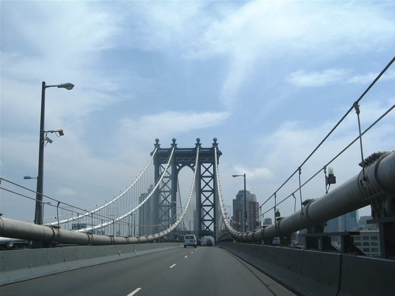
After encircling Lawrence, we headed back south along Interstate 93 to Interstate 95 & Massachusetts 128. Unfortunately the junction between these two busy and pivotal roadways is facilitated by a full-cloverleaf interchange. A much better interchange lies to the north between Interstate 93 and Commerce Way (Exit 37C) in the form of a tri-level stack. Thank the completion of the Anderson RTC (Commuter Rail Station) for that high-speed connection, but what is being considered for junction Interstate 93 and 95? The Interstate 93 / 95 Interchange Transportation Study recommendations involve constructing directional ramps, perhaps as flyovers, from Interstate 95 north onto Interstate 93 north and Interstate 95 south onto Interstate 93 south. Cost estimates range between $160 and $249 million on the two preferred alternates mentioned in the study. No time table is set on this project, but the sooner, the better considering the single-lane ramps between the two Interstates.
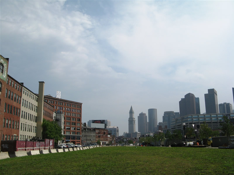
Back in downtown Boston, the view above the Interstate 93 Big Dig from Causeway Street looking south. The green swath represents the location of the former Fitzgerald Expressway. Interstate 93 sinks into the tunnel from the Zakim Bridge over the Charles River behind this scene adjacent to the TD Banknorth Garden, home of the NBA Boston Celtics.
A short distance east of the Interstate 93 Zakim Bridge is the Massachusetts 99 Charles River Bridge. Massachusetts 99 on an expressway-style alignment between the central business district and Massachusetts 16. Rotary interchanges and others join the multi-lane divided highway with primary cross streets in lieu of large at-grade intersections.
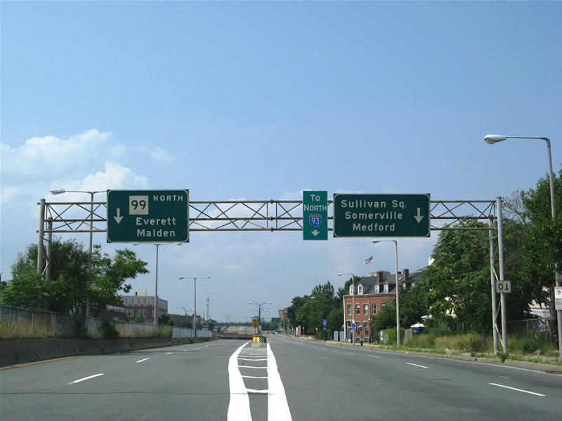
Massachusetts 99’s urban expressway features a cut and cover tunnel among its features through north Boston. The tunnel exists just south of the Sullivan Square rotary at Mishawum Street.
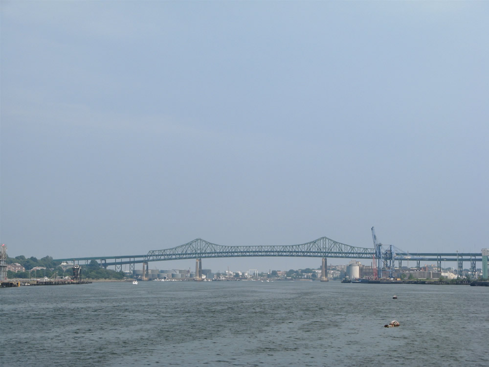
The Mystic River draw bridge went up as we approached along Massachusetts 99 northbound. Time spent waiting for the single leaf bascule to raise allowed for this view of the distance U.S. 1 Tobin Bridge.
Interstate 95 carried us northward into New Hampshire and southern Maine. EZ Pass lanes are now in operation along the New Hampshire Turnpike, a change from our 2005 trip. Additionally the eight-lane toll road was resurfaced recently. The turnpike collects tolls adjacent to the New Hampshire 101 interchange (Exit 2). Those departing or entering from N.H. 101 are levied 50 cents. All others must pay $1.00. Interstate 95 becomes a freeway highway south of Exit 1 (New Hampshire 286) and north of Exit 3 (New Hampshire 33).
We exited Interstate 95 north just shy of the Maine Turnpike beginning (Exit 7) and doubled back south along U.S. 1 and U.S. 1 Bypass through Kittery. With beach traffic quite fierce, this was the better route across the Piscataqua River. Interesting enough, the Maine Welcome Center along Interstate 95 northbound provides access to and from parallel U.S. 1.
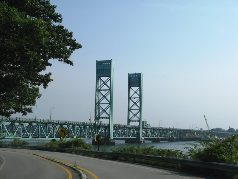
U.S. 1 Bypass spans the Piscataqua River across this two-lane lift bridge. The route was the first connection between the Maine and New Hampshire Turnpikes. Still serving as a viable through route. U.S. 1 Bypass splits from U.S. 1 near the Exit 3 interchange with Interstate 95 in Maine en route to the Portsmouth Circle with U.S. 4 in New Hampshire.
Venturing northwest, we followed the Spaulding Turnpike beyond its split with U.S. 4 to Dover and Rochester. A pair of 50 cent toll plazas lie along the tolled sections of the highway. North of Exit 12, the four-lane divided highway narrows into a super-two expressway.

A handful of classic button copy signs remain in use along the Spaulding Turnpike at Rochester. The two lane section includes a striped center line laden with rumble strips. U.S. 202 incidentally is signed as east-west through much of New Hampshire.
Since the Spaulding Turnpike is co-signed with another route throughout its entire length, NHDOT places reassurance markers in a green box along with the corresponding routes. This is standard practice for route overlaps in the Granite State.
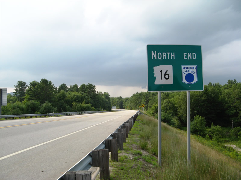
Just north of the folded-diamond interchange (Exit 18) with New Hampshire 125 is the end sign for the Spaulding Turnpike. New Hampshire 16 continues northward as the primary route into the White Mountains from Portsmouth and points south.

Great blogs from the northeast, Alex.
We’re currently in Key West and I’ve just blogged about it on blog.georgiaroadgeek.com.
Take care and enjoy your trip.
Great pictures. Maybe people will forget about the cost of the Big Dig someday, b/c the results are stunning.