
All of day 3 focuses on southern Michigan Interstates. Commenced the day in Coldwater and headed north to Lansing, then west to Grand Rapids and the St. Joseph area and east to Detroit and Port Huron. Very clear and cool day, highs in the low 50s with some northwesterly winds.
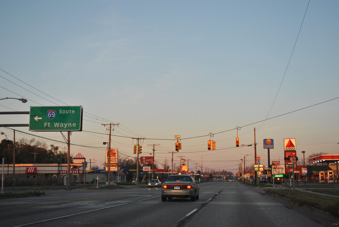
This view looks at the southbound on-ramp to Interstate 69 from U.S. 12 west & Business Loop Interstate 69 south at Coldwater.
All Interstate 69 shields posted on guide signs within Branch County, Michigan utilize Clearview-based font for the numbers. This is not supposed to be the case, but in Michigan, one can find shields for Interstates 69, 75, 96 and 696 in violation.
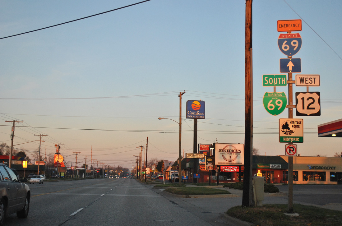
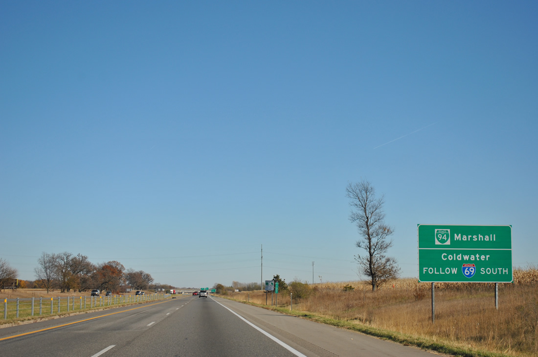
Business Loop Interstate 69 through Coldwater doubles as Emergency Interstate 69.
There are a number of Emergency detour routes posted for Interstate highways throughout southern Michigan. Some of these even extend into Indiana, such as Interstate 69 south from Branch County to Steuben County, Indiana. The Emergency Routes provide an alternate or detour route for the parent route in case of road closure due to weather or other incidents. The Coldwater element of Emergency Interstate 69 includes an east-west portion along U.S. 12 between Division Street south / Marshall Street north (collectively former U.S. 27) and Interstate 69, and a north-south portion following old U.S. 27 out from town.
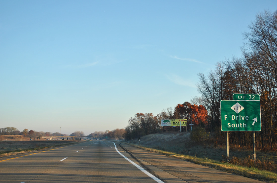
Interstate 69 north at M-227
All of U.S. 27 between Fort Wayne, Indiana and Lansing, Michigan was replaced by Interstate 69. The old alignment remains in use as “Angola Road, “Lansing Road”, “Old 27”, etc. A portion of the old US Route remains in the state system as M-223 (17 Mile Road) from F Drive South to Michigan Avenue in Marshall. Michigan 227 begins at Exit 32 of Interstate 69 and travels 6.71 miles to Business Loop Interstate 94. U.S. 27 was truncated from the state of Michigan and from Fort Wayne northward in Indiana by 2002. Efforts to turn back the U.S. 27 designation commenced in 1991 by both states, but those were met with resistance from AASHTO as the segment north from Lansing was not included in the request to truncate the US Highway. In 1999, MDOT applied for the renumbering of U.S. 27 north of Lansing as an extension of U.S. 127. This was subsequently approved and sign changes commenced in 2001 with the removal of U.S. 27 shields to the south and in 2002 with the replacement of U.S. 27 as U.S. 127. Read much more on the history of U.S. 27, including the truncation from Michigan, at Chris Bessert’s Michigan Highways.
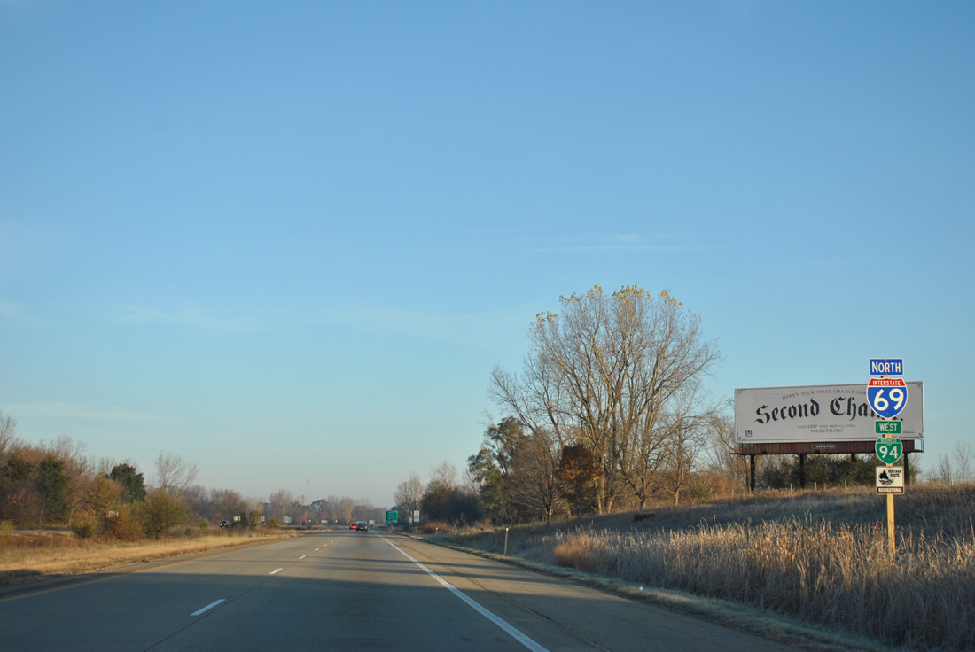
Business Loop Interstate 94 joins Interstate 69 north for its return trip to Interstate 94 at Exit 38.
The loop follows old U.S. 12 along Michigan Avenue between Exit 36 of I-69 to Partello Road and Exit 112 of Interstate 94. The Marshall business loop of I-94 was designated in 1960.
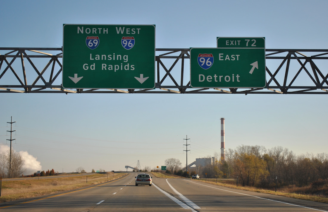
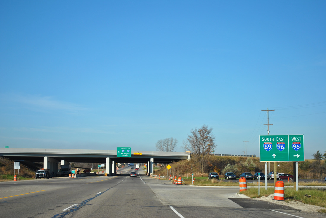
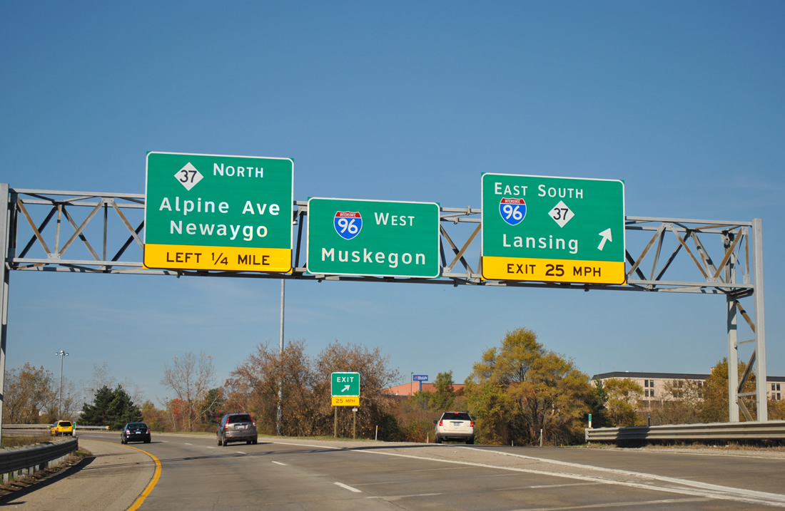
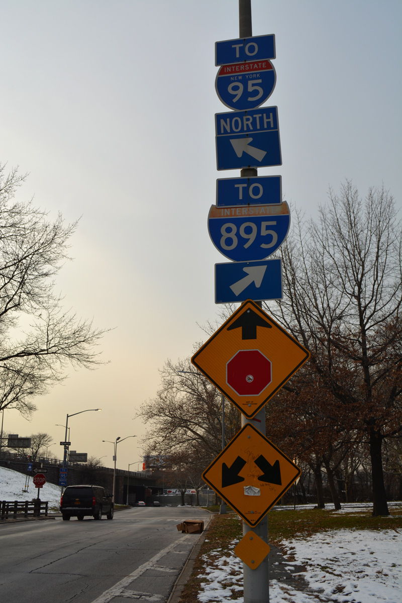
Interstate 69 north joins Interstate 96 west to bypass Lansing on the west side of town. Their overlap is unusual in that the two routes mirror each other number wise, a distinction not replicated anywhere else in the system.
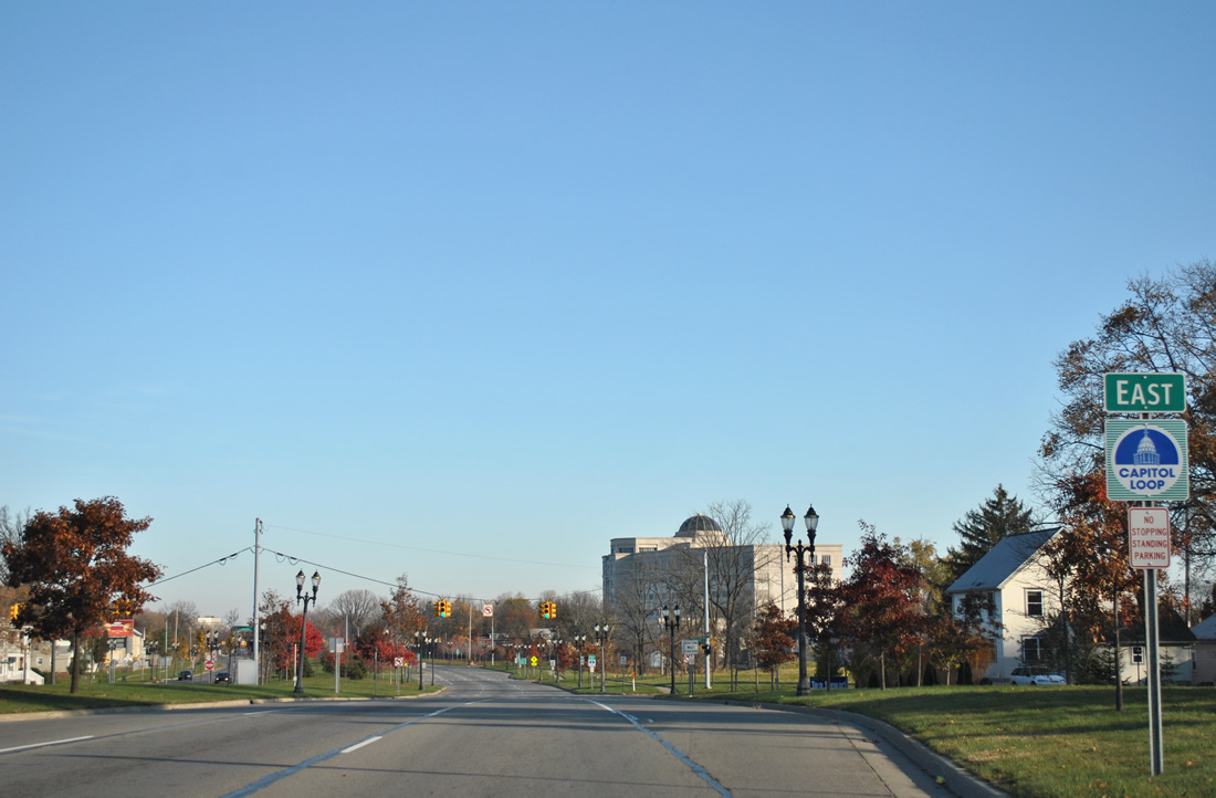
Capitol Loop shield assembly in Lansing.
The Capitol Loop acts as a business loop for Interstate 496 (Olds Freeway) through downtown Lansing, serving the state Capitol complex and various attractions. Capitol Loop follows old M-99 northward from Exit 5 of Interstate 496 along the divided Martin Luther King, Jr. Boulevard to the one-way street couplet of Allegan (east) and Ottawa (west) Streets. Grand Avenue connects the one-way pair and joins them with Michigan Avenue across the Grand River to their turn onto Business Loop I-96 (Cedar Street south / Larch Street north) for the return to Interstate 496 (Exit 7). The loop was first signed in 1986.
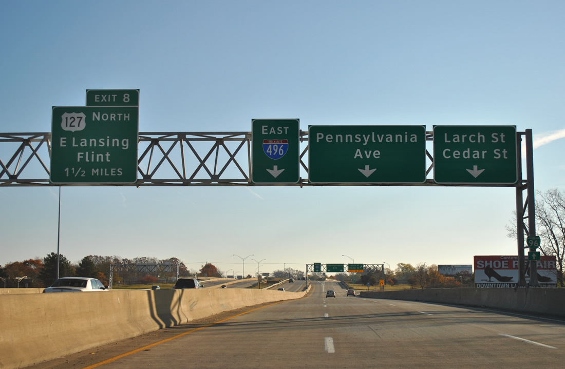
The one-way frontage street couplet of St. Joseph (west) and Main Street (east) forms a collector/distributor roadway system for Interstate 496 from the Grand River into the folded-diamond interchange with Business Loop I-96 & Capitol Loop at Cedar Street.
Interstate 496 opened in stages between 1963 and 1970 as an 11.8-mile urban loop through Lansing. Pleasingly, the freeway is signed with a 70 mile per hour speed limit throughout.
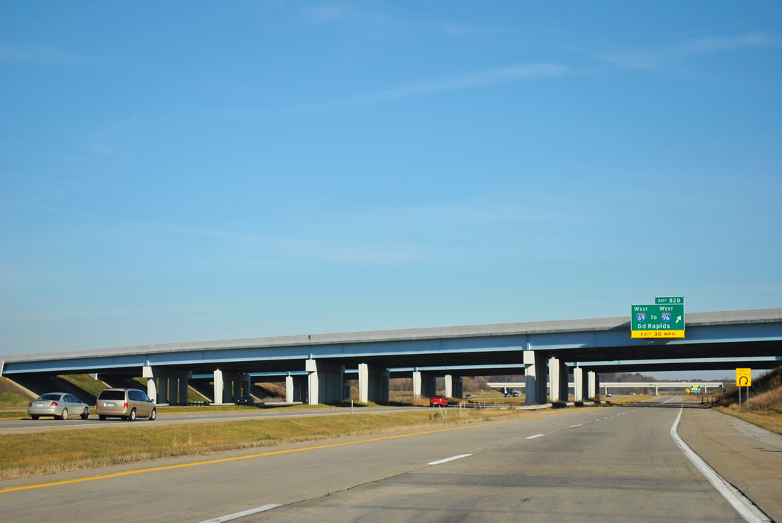
Full cloverleaf interchanges are still viable as freeway to freeway connections when they are coupled with collector/distributor roadways. Such is the case where the U.S. 127 freeway meets Interstate 69 on the northeast side of Lansing.
Business Loop Interstate 96 (Grand River Avenue) bisects the split of Interstate 69 east from Interstate 96 west. A diamond interchange joins the Interstate 96 mainline between the I-69 mainline and the I-69 to I-96 “Wye” connector to the north.
Grand River Avenue represents the historic routing of U.S. 16 through northwest Lansing. The US Route was wholly replaced by Interstate 96 from Muskegan eastward to Detroit and thus removed from the state in 1962.
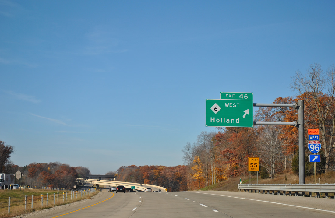
Michigan 6 begins at a directional interchange (Exit 46) with I-96 adjacent to the Thornapple River.
M-6 consists of a 19.71-mile freeway bypass of Grand Rapids between Interstates 96 and 196. The route was completed in 2004. Emergency Interstate 96 follows the freeway west to Exit 15 (M-37). An Emergency M-6 is also posted along 36th Street from Exit 44 of Interstate 96 as well.
Another full-cloverleaf interchange with c/d roadways joins the M-6 freeway with U.S. 131 at Cutlerville. A diamond interchange ties into the c/d roadways from the south at 68th Street.
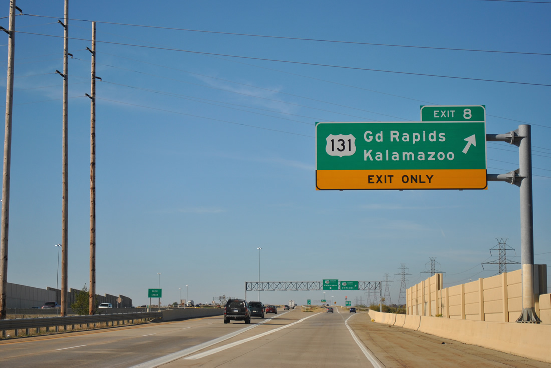
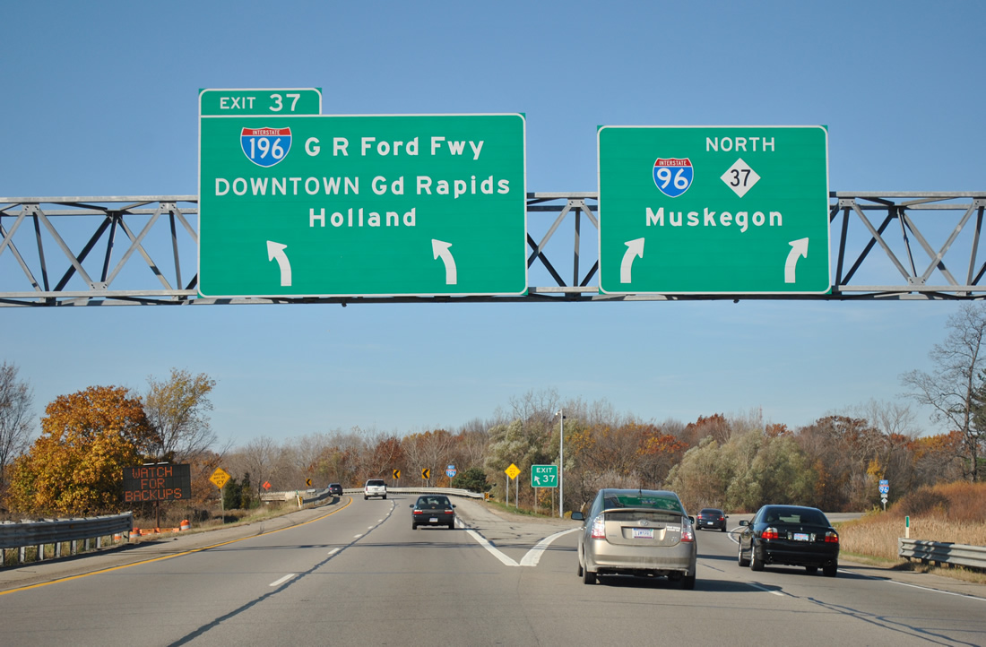
U.S. 131 is a modern freeway leading north to Exit 81 and not so much from there to downtown Grand Rapids. Overall the U.S. 131 freeway stretches 169 miles from Portage to Manton.
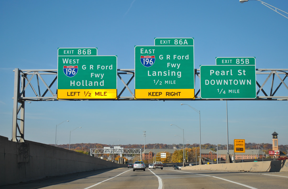
Spanning the Grand River, U.S. 131 prepares to meet Interstate 196 and become a part of the hidden Interstate 296 at Exit 86. Variable curve speed signs are posted in both directions of the elevated freeway as U.S. 131 kinks westward to span the waterway.
At least one official Michigan Highway Map showing Interstate 296 points to the “Wye” connector from U.S. 131 to Interstate 96 near Walker. U.S. 131 remains adjacent to the Grand River northward from the city to Comstock Park (Exit 91) as the Wye ties into Interstate 96 at M-37 (Exit 30).
A wye interchange facilitates movements from Interstate 96 west onto Interstate 196 west via a left-hand ramp at Exit 37.
Originally, Interstate 196 followed the current I-96 mainline from Grand Rapids to Muskegan, with Interstate 96 planned to angle southwesterly to Interstate 94 at St. Joseph. In 1961, all of the freeway from Lansing to Muskegan was completed, and this wye was not open, so Interstate 96 transitioned onto Interstate 196. A swap in designations occurred in 1963, but the current alignment of Interstate 196 was not completed through Grand Rapids until 1964.1

Looking northward at the Interstate 196 (Gerald R. Ford Freeway) crossing of the Grand River from Bridge Street. Ramps to U.S. 131 tie into the bridge from the west.
The I-196 and U.S. 131 interchange is unusual in that the carriageways of U.S. 131 switch sides so that northbound is west of southbound and vice versa to accommodate left-hand ramps to the Ford Freeway.
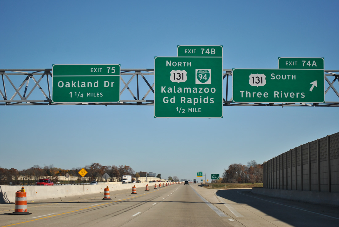
Traveling through Kalamazoo, Interstate 94 underwent widening from a point west of the U.S. 131 interchange to Oakland Drive between 2006 and 2008. This work included the replacement of the southbound U.S. 131 loop ramp onto I-94 east with a directional ramp.
Continued southwest along Interstate 196 to its conclusion at Interstate 94 near St. Joseph. Then Interstate 94 took us the remainder of the way for day 3 to Port Huron. $52-million widening of the freeway east from Oakland Drive (Exit 75) to Portage Road (Exit 78) commenced in April 2009 and expands the freeway to six lanes and redesigns the Westnedge Avenue interchange from a six-ramp partial-cloverleaf interchange into a single point urban interchange (SPUI).2 Work should be completed on this project by the end of this month.
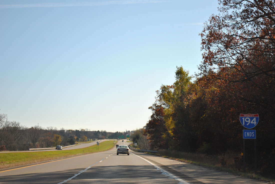
South end of I-194
Interstate 194 southbound concludes at the full-cloverleaf interchange with Interstate 94 opposite a sprawling retail area bounding the intersection of M-66 and Beckley Road. I-194, one of those designations that eluded the Rand McNally Road Atlas for decades, was completed in 1966 as a 3.4-mile spur into downtown Battle Creek from Interstate 94. The highway doubles as a leg of M-66.
We come full circle at the Interstate 94 junction with Interstate 69 outside Marshall.
Business Loop I-94 begins and follows Interstate 69 south to Michigan Avenue (old U.S. 12) and is signed with Coldwater on this auxiliary guide sign. Secondary control cities for freeway to freeway connections are often signed on ground level signs such as this in Michigan. Such as Chicago and Detroit are the primary cities for Interstate 94; secondary cities include Kalamazoo, Battle Creek, Jackson and Ann Arbor among others. Completed through Jackson by 1960, Interstate 94 combines with U.S. 127 between Exits 138 and 142 along a narrow stretch of freeway on the north side of town.
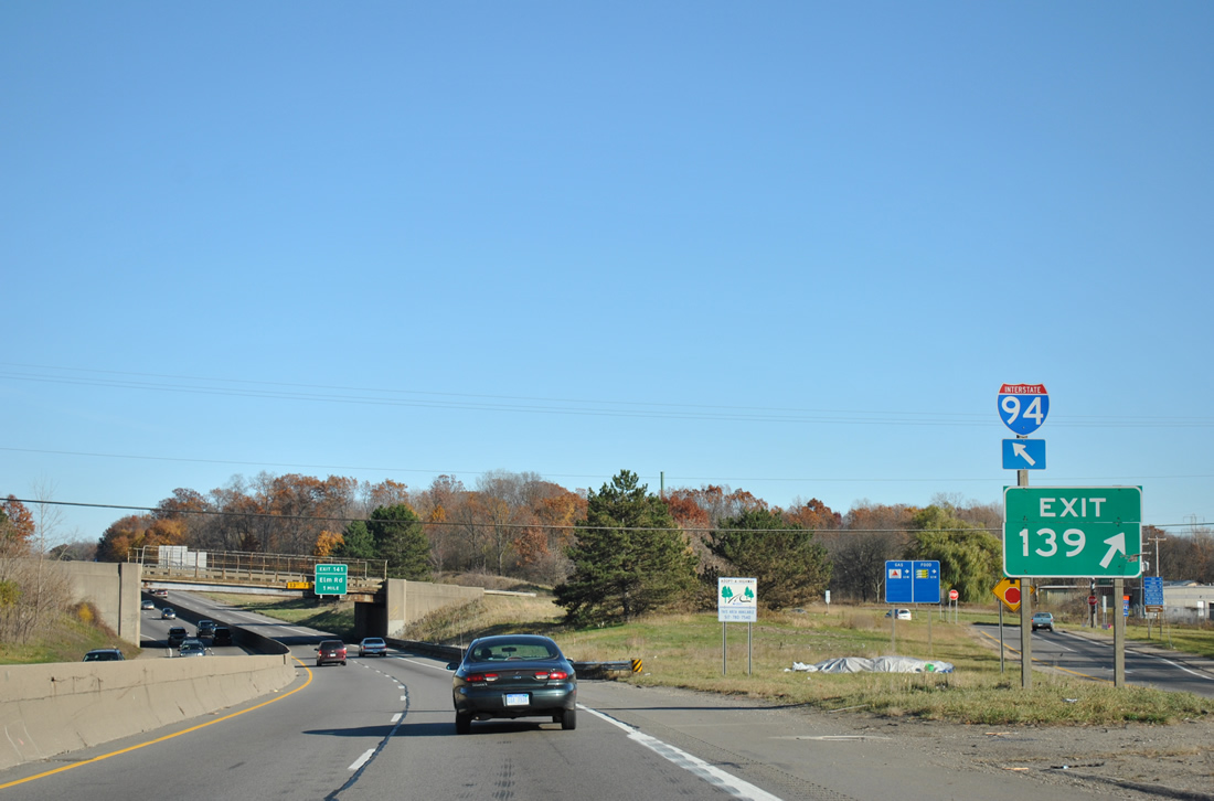
A partial-cloverleaf interchange follows the crossing of the Grand River and eastbound drivers see this Interstate 94 trailblazer at the Exit 139 gore point sign. There are not many instances of a shield and diagonal arrow posted on an Interstate mainline…
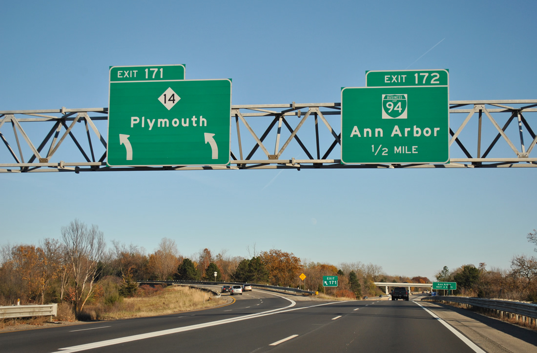
Interstate 94 expands to six overall lanes at Exit 167 (Baker Road), near Dexter, through to the split with the M-14 freeway at Ann Arbor.
M-14 constitutes a 22.54-mile freeway linking Ann Arbor and the western suburbs of Detroit with Interstates 96 & 275 at Livonia. Michigan 14 replaced the routing of U.S. 12 when that route shifted to the south in 1956, replacing the original U.S. 112 alignment. M-14 joined the freeway from Ann Arbor to Livonia as it opened between 1964 and 1979.
I-94 east at U.S. 24 (Exit 202).
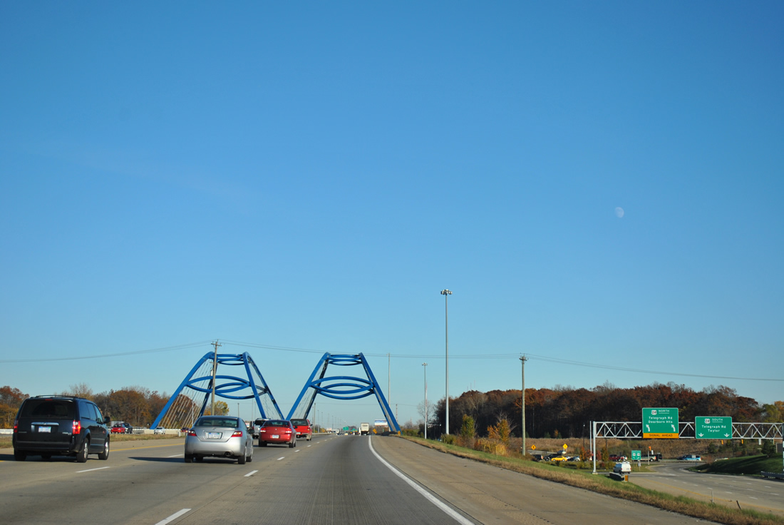
Interstate 94 carries just four lanes from Exits 171 to 180, expanding to six lanes from the U.S. 23 freeway to the city of Detroit. Once at U.S. 24 (Telegraph Road), the freeway passes through a SPUI accented with two blue arches, formally named the Gateway Arch Bridges. Constructed as part of a $55-million upgrade of Interstate 94 between the airport and downtown, the Gateway Arch Bridges support the Interstate 94 mainline above Telegraph Road with a clear span of 246 feet between the abutments. The Exit 202 single point urban interchange replaced an unusual interchange that resembled back to back trumpet interchanges with U.S. 24 within a wide carriageway split of Interstate 94. Construction relocated the eastbound mainline to closely line the westbound carriageway through the new SPUI. A portion of the original eastbound was abandoned, leaving behind a grassy footprint along side Beverly Road.
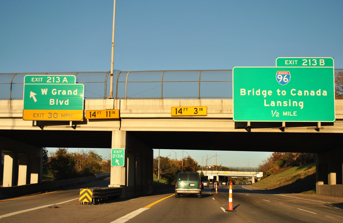
Interstate 94 east, one half mile ahead of I-96 (Exit 213B).
45 minutes to travel three miles so that six or seven asphalt patches could be made, we reach the Interstate 94 junction with Interstate 96. Interstate 96 continues a short distance southeast to Interstate 75, where major work on the Gateway Project was completed in 2009 that extended the I-96 carriageways alongside I-75 to a proposed connection with the Ambassador Bridge to Windsor, Ontario. The MDOT and City of Detroit elements of the project are complete, The Detroit International Bridge Company portion, including the addition of high speed ramps between the suspension bridge and Interstate 96. The organization has neglected to complete its connection, instead focusing on building a duty-free shop in the path of one of the planned ramps. This has resulted in truck traffic remaining along city streets to make the connection.3
Interstates 69 east & 94 north merge at Port Huron for their final approach to the Bluewater Bridge to Sarnia, Ontario.
MDOT began a major rework of the freeway in March 2011 as part of a project to reconstruct the last two miles of I-69 & 94 at Port Huron. Elements of the $90-million construction include a new nine-lane span for the freeway (mainline and c/d roadways) over the Black River, an improved Water Street interchange (Exit 274), a revamp of the wye interchange with the Lapeer Connector to provide access in both directions, and the replacement of the left-hand ramp to Pine Grove Avenue (Business Loop I-69 & 94) with one that departs from the right. See the MDOT project map http://www.michigan.gov/documents/mdot/I-94_I-69_map_344956_7.pdf for more details on the work expected to last until November 2012.
Sources:
- Michigan Highways: Highways 180 through 199, Chris Bessert.
- “I-94 widening and South Westnedge Avenue interchange project to break ground in June”
http://michigan.michigan.gov/mdot/0,1607,7-151-9620-213012–,00.htmlMDOT, April 16, 2009. - “Ambassador Bridge owner Matty Moroun may face jail time, penalties.” Detroit Free Press, November 4, 2011.


