
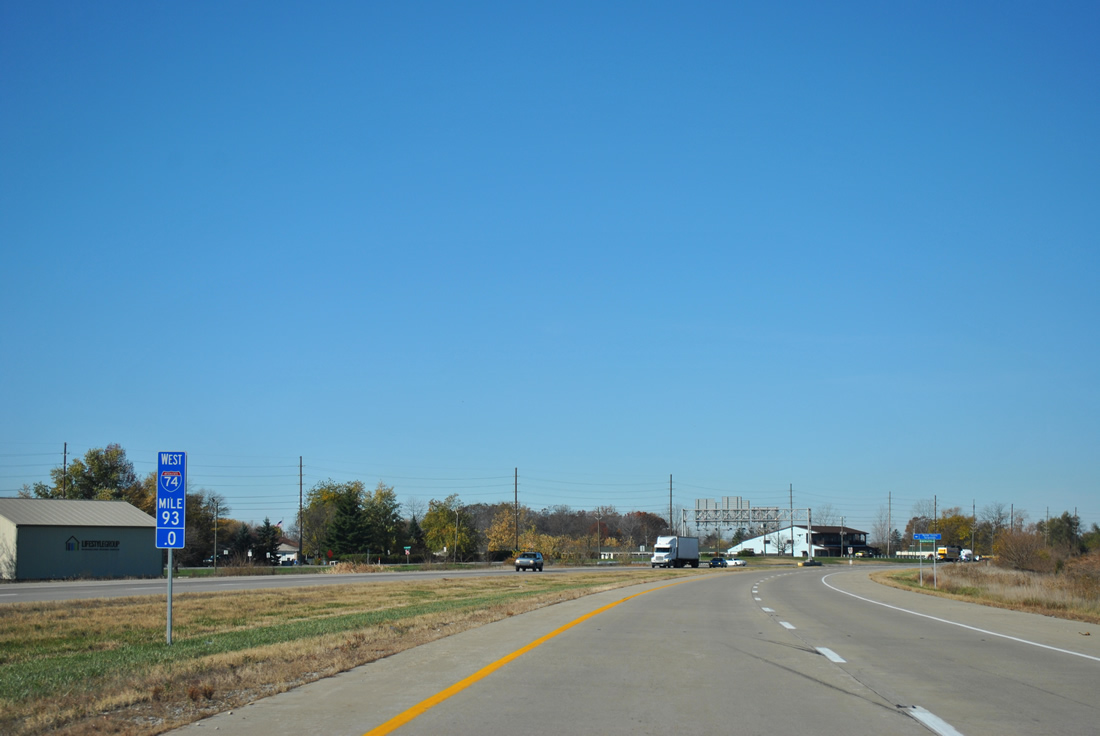
Began the morning of day 2 just outside Cincinnati on a cloudy morning with the last remnants of cold front moving out. Decided to poke around downtown Cincinnati for an hour or so before heading westward along Interstate 74 to Champaign, Illinois. The trip would turn us north along Interstate 57 and east to Michigan later this day, and how far into Michigan we would make it depended upon how much daylight was left…
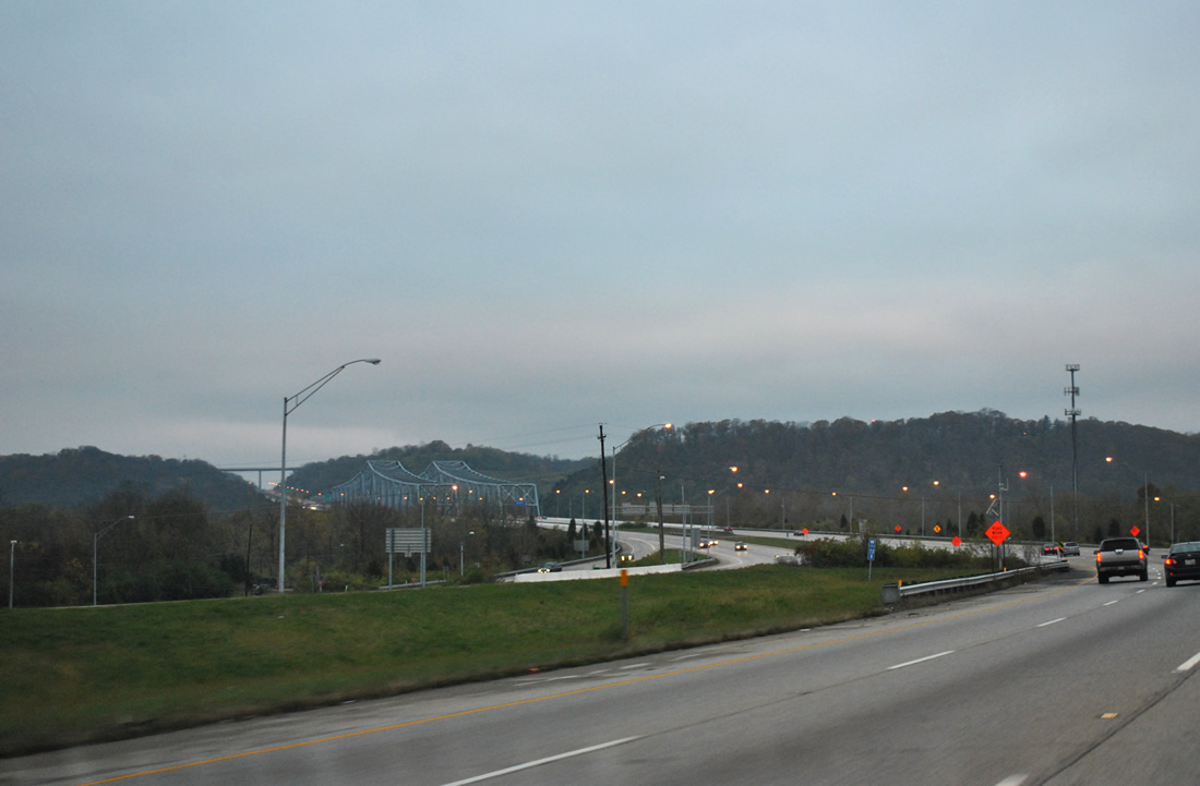
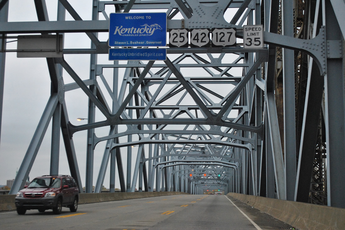
Approaching the Combs-Hehl Bridge, a pair of cantilever bridges spanning the Ohio River between Kellogg Avenue in Cincinnati and Fort Thomas, Kentucky, along Interstate 275 west (inner loop).
These bridges opened in 1979 and carry six lanes of travel. More info on the span can be found at Cincinnati-Transit.net.
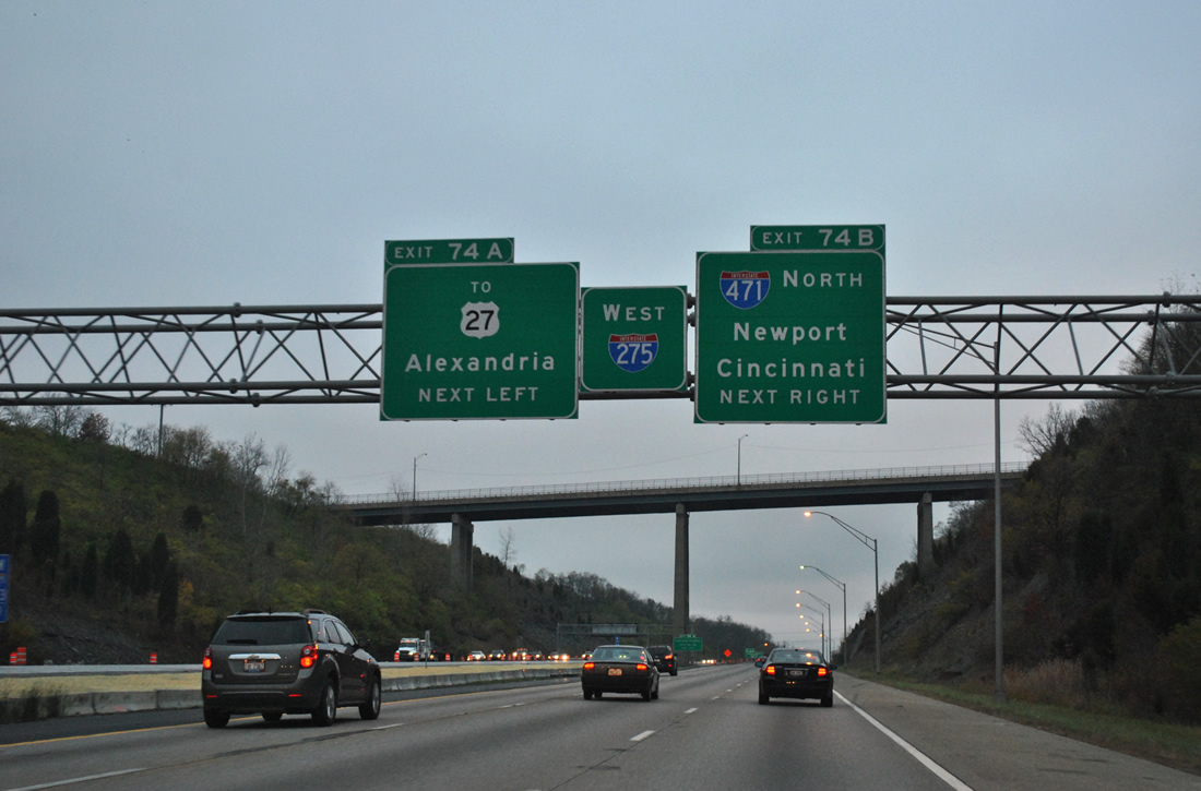
A short distance west of the Combs-Hehl Bridge is directional interchange with Interstate 471 and the U.S. 27 connector. U.S. 27 travels high above the beltway via Alexandria Pike in this scene.
Construction underway along Interstate 275 involves concrete pavement replacement for both directions of the freeway within Campbell County and the addition of cable barriers along the highway median. Eastbound work will be completed by December 1, 2011; westbound construction commences on April 1, 2012 and lasts through September 1, 2012.
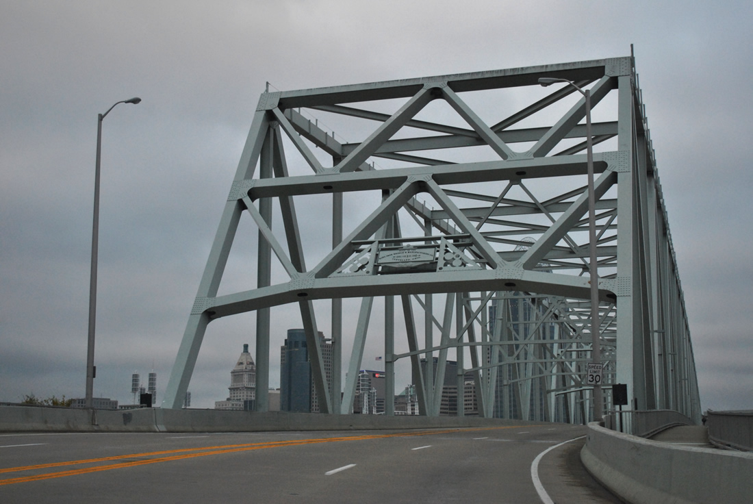
Spanning the Ohio River again via the Taylor-Southgate Bridge of U.S. 27.
This cantilever bridge opened in 1995, replacing the original Central Bridge that was demolished by late 1992. Bridge placards from the 1890-built cantilever truss bridge were restored and mounted at both ends of the Taylor-Southgate Bridge.
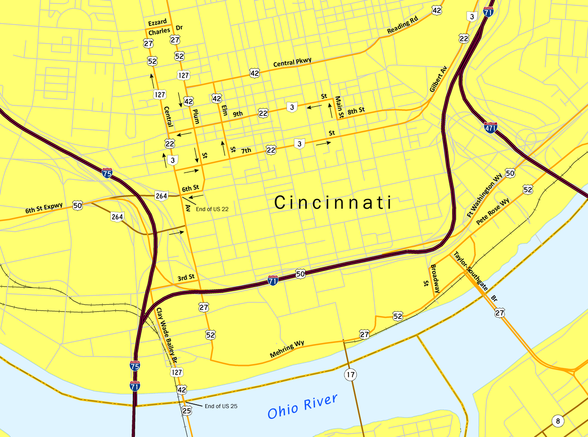
Map of Downtown Cincinnati numbered routes.
Heading into downtown Cincinnati, we documented the west end of U.S. 22 and the north end of U.S. 22. U.S. 22 & Ohio 3 follow a one-way street couplet of 7th (eastbound) and 9th (westbound) Streets between Main and the U.S. 27-42-52-127 couplet of Central Avenue and Plum Street. U.S. 22 & Ohio 3 end at the intersection of Central Avenue and 6th Street (Ohio 264), sharing an overlap with U.S. 27-52-127. U.S. 25 has a simpler end, concluding at the Ohio state line along the Clay Wade Bailey Bridge with U.S. 42 & 127.
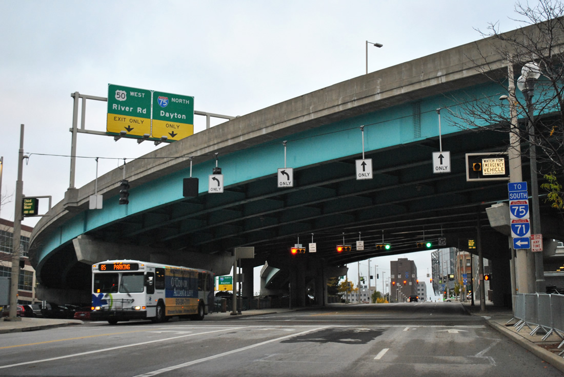
U.S. 27 north & U.S. 52 west (and U.S. 50 Truck west) follow Central Avenue northward from Mehring Way to 3rd Street (U.S. 42 & 127). The U.S. 50 mainline parts ways with Interstate 71 above after sharing a brief overlap from Fort Washington Way to the east. U.S. 42 & 127 combine with U.S. 27 & 52 along Central Avenue beyond 3rd Street.

Reassurance shields for U.S. 27-42-52-127 follow the Central Avenue intersection with 4th Street and the northbound on-ramp to Interstate 75.

U.S. 22 & Ohio 3 begin at the Central Avenue intersection with Ohio 264 (5th Street) east. A six-way overlap with U.S. 27-42-52-127 continues for two blocks. Pictured here is the first shields for U.S. 22 & Ohio 3. North for U.S. 22 should display East.

U.S. 22 & Ohio 3 part ways with U.S. 27-42-52-127 (Central Avenue) for 7th Street eastbound and follow that street through to Gilbert Avenue. U.S. 42 also splits here but is not acknowledged along the two-block overlap with 7th to Elm Street northbound.
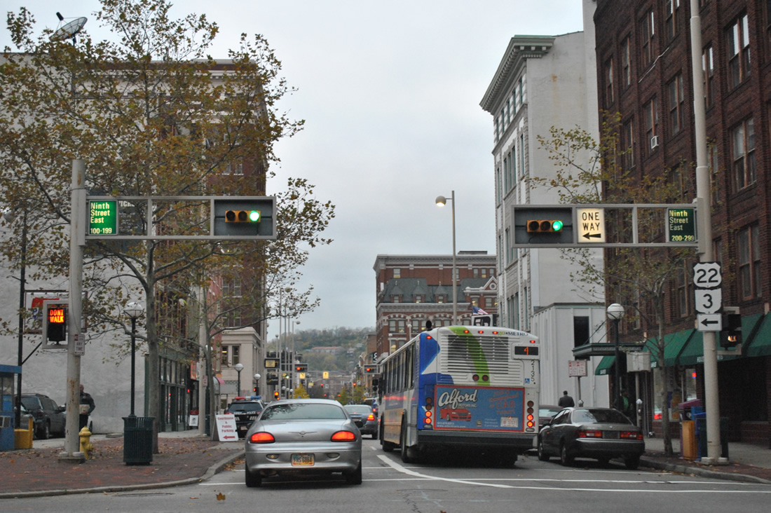
U.S. 22 & Ohio 3 west follow Main Street one block north to make the connection between 8th and 9th Streets in downtown Cincinnati. 9th Street carry the tandem west to Central Avenue.
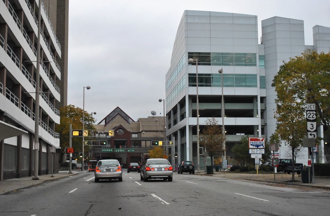
U.S. 27-52-127-42 eastbound / southbound utilize Plum Street southbound from Ezzard Charles Drive through the turn onto 6th Street west to Central Avenue and Ohio 264. This photo looks at the southbound block of Plum between 8th and 7th (U.S. 22 & Ohio 3 east) Streets.
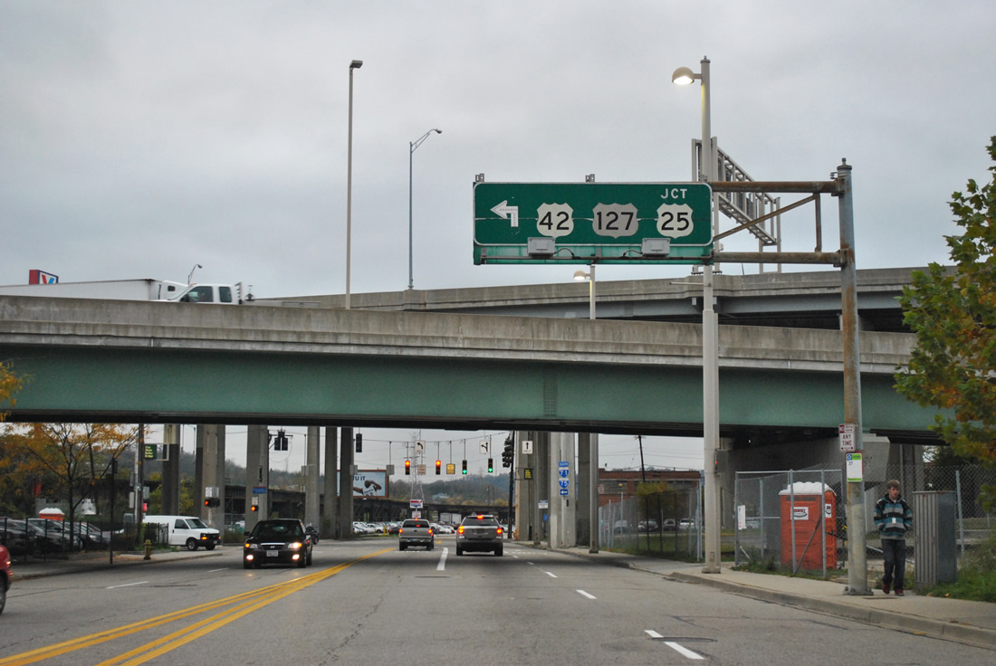
U.S. 27 & 42 follow 3rd Street west under the Interstate 71 and U.S. 50 ramps to Interstate 75 and turn again onto the Clay Wade Bailey Bridge to Covington, Kentucky. U.S. 25 used to follow this bridge fully, but now ends at the state line. “JCT” was added to this button copy overhead to indicate the truncation of U.S. 25 from Ohio.
U.S. 25 begins formally at the Kentucky state line, midway across the Clay Wade Bailey Bridge over the Ohio River.
The US Route travels 750 miles south to Brunswick, Georgia, but originally continued all the way north to Port Austin, Michigan. The route north from Cincinnati was vastly replaced by Interstate 75 and so Michigan and Ohio truncated the route wholly from their jurisdictions by 1974.
[caption id="attachment_8065" align="aligncenter" width="480"]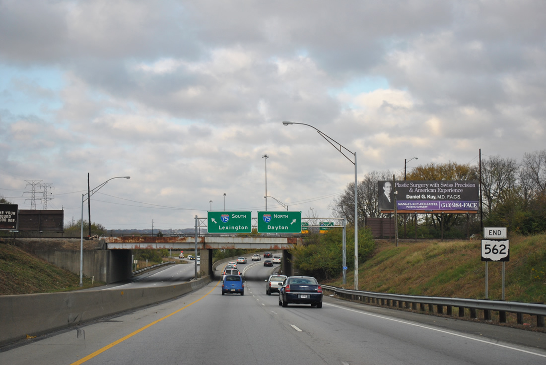 Westbound end shield assembly for Ohio 562.
Following the Norwood Lateral, Ohio 562 provides a freeway connection between Interstate 71 at Norwood with Interstate 75 at St. Benard. Completed in the 1970s to coincide with Interstate 71 construction, the freeway utilizes a portion of right of way originally allocated for a 1920s subway system.
Interstate 74 carried us westward to Indianapolis from Cincinnati. A new six-ramp partial-cloverleaf interchange opened July 9, 2008 at Greensburg.1 The exit brings U.S. 421 westbound onto the freeway for its overlap through to the Indianapolis Beltway and also serves a new Honda auto assembly plant constructed to the west.
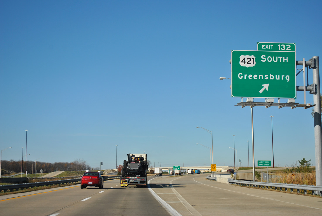
Interstate 74 west at U.S. 421 south in Indiana.
Once I-74 reaches Interstate 465, the designation shifts to the south side of the Indianapolis Beltway between Exits 94 and 73. A freeway spur continues the I-74 mainline otherwise to Southeastern Avenue (former U.S. 421). ITS (Intelligent Transportation Systems) mileposts continue for Interstate 74 until the the stub overtakes old U.S. 421. This is not a unique scenario to just this location, as Interstate 670’s ITS markers continue along the U.S. 62 freeway spur from its end at Interstate 270 at Columbus, Ohio.
The Interstate 74 spur west to Southeastern Avenue in Indianapolis.
We opted for a revisit of Interstate 70 through the Circle City. I-70 and I-65 share 2.13-miles of pavement and a lengthy collector/distributor roadway system (Exit 83A) acts as local lanes to the express lanes of the freeway mainline.
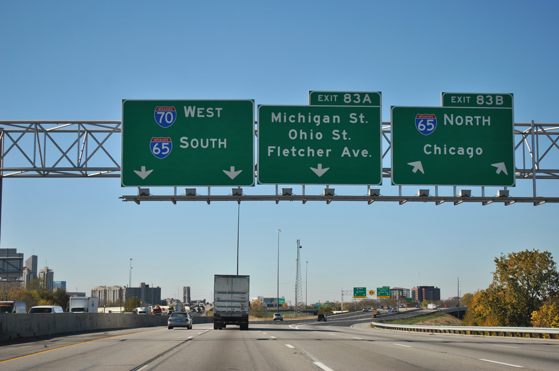
The I-70 merge with Interstate 65 southbound along the east side of the Indianpolis central business district.
Part of the work involved with the Accelerate 465 project to reconstruct the Indianapolis Beltway includes a redesign of the former directional-cloverleaf interchange with the Sam Jones Expressway. When the expressway first opened in 1969, it served as the main route to Indianapolis International Airport from downtown and points eastward. A new terminal for the airport opened in 2008 west of the beltway by Exit 68 of Interstate 70, reducing the traffic along the Airport Expressway. http://www.in.gov/indot/div/projects/accelerate465/design/

Construction along the Sam Jones Expressway east at I-465.
Renamed in 2007 after local civic leader Sam Jones, the west end of the expressway is now being redesigned to utilize a standard diamond interchange with Interstate 465. Traffic lights will govern all movements between the north-south freeway and now downgraded arterial. http://www.in.gov/indot/div/projects/accelerate465/design/airportexp.html
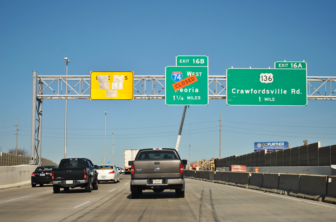
Interstate 465 north, one mile ahead of U.S. 136
Work of Accelerate 465 entails all of the beltway from Mann Road northward to 56th Street. Construction is completed north of the 38th Street (Exit 17) interchange and in portions between Interstates 70 and 74. A major component of the work otherwise is the upgrade of the former cloverleaf interchange with Interstate 74 west and Crawfordsville Road(former U.S. 136) east at Exit 16. Work focuses on eliminating the I-74 freeway stub to Crawfordsville Road, adding ramps to U.S. 136 (Crawfordsville Road) west of the beltway, and replacing the antiquated loop ramps with high-speed ramps. This will truncate U.S. 136 to its new interchange with the beltway and provide two continuous lanes for Interstate 74 west and east from and to the beltway. http://www.in.gov/indot/div/projects/accelerate465/design/i74.html
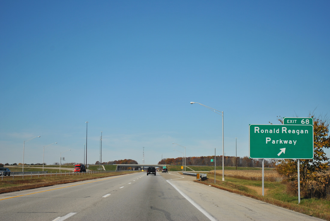
Interstate 74 west at Exit 68
Another new interchange to open along Interstate 74 in 2008 is the diamond interchange (Exit 68) with Ronald Reagan Parkway at Brownsburg. Funded by the Major Moves initiative, the exit is part of an overall plan for a new 15-mile north-south roadway linking Interstates 70, 74 and 65 to the west of Indianapolis.
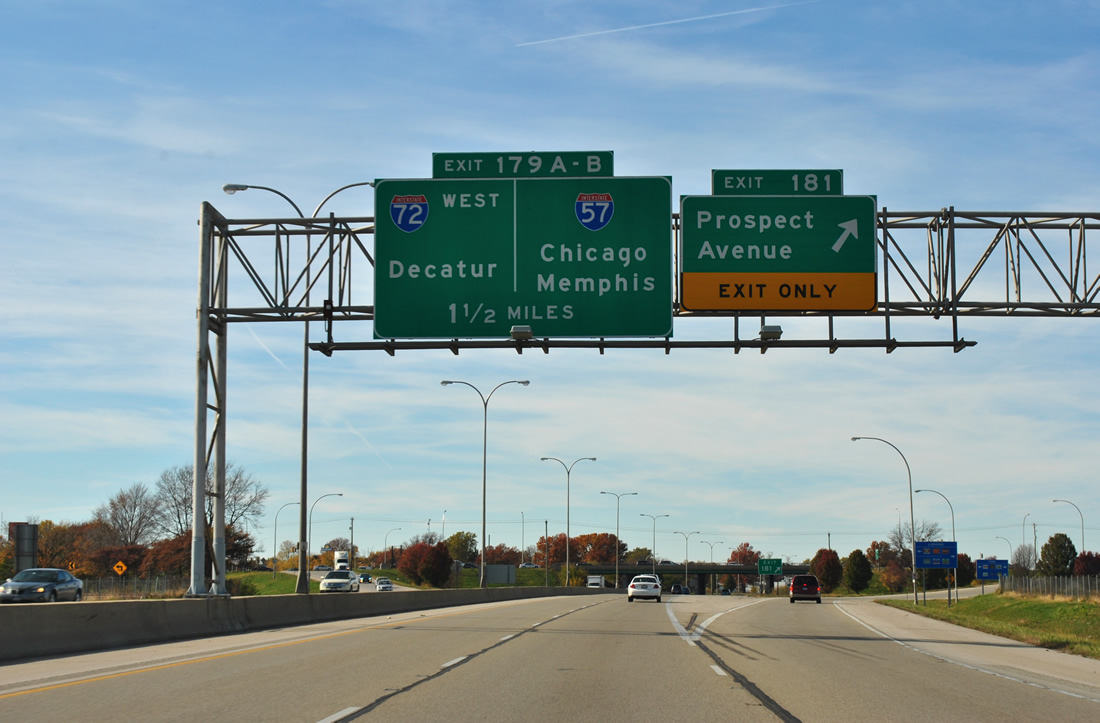
Approaching the exchange with Interstate 57 along Interstate 74 west in Champaign. Interstate 57 meets Interstate 72 at the next interchange southbound from Interstate 74.
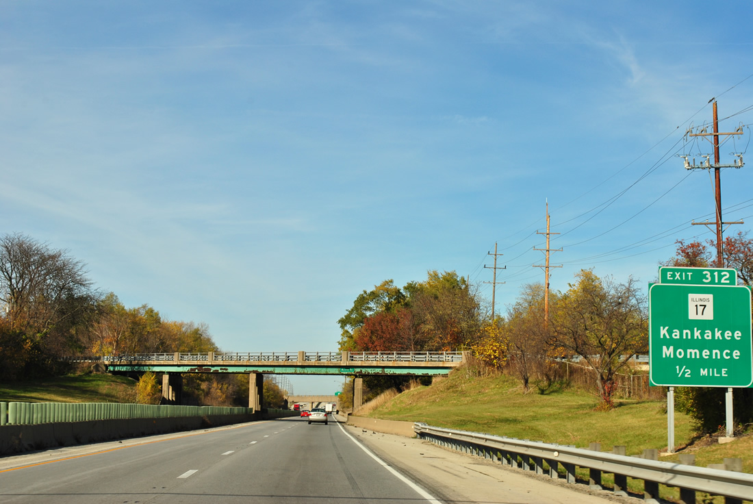
Traveling through a substandard section of Interstate 57 through the city of Kankakee.
Road work is presently underway just north of Exit 312 at the interchange with Illinois 50. A $39.5-million project is underway to reconstruct SR 50 from Armour Road to Larry Power Road, rebuild the ramps between the state route and freeway, and replace the Interstate 57 overpass. That work will be underway until December 2013.2
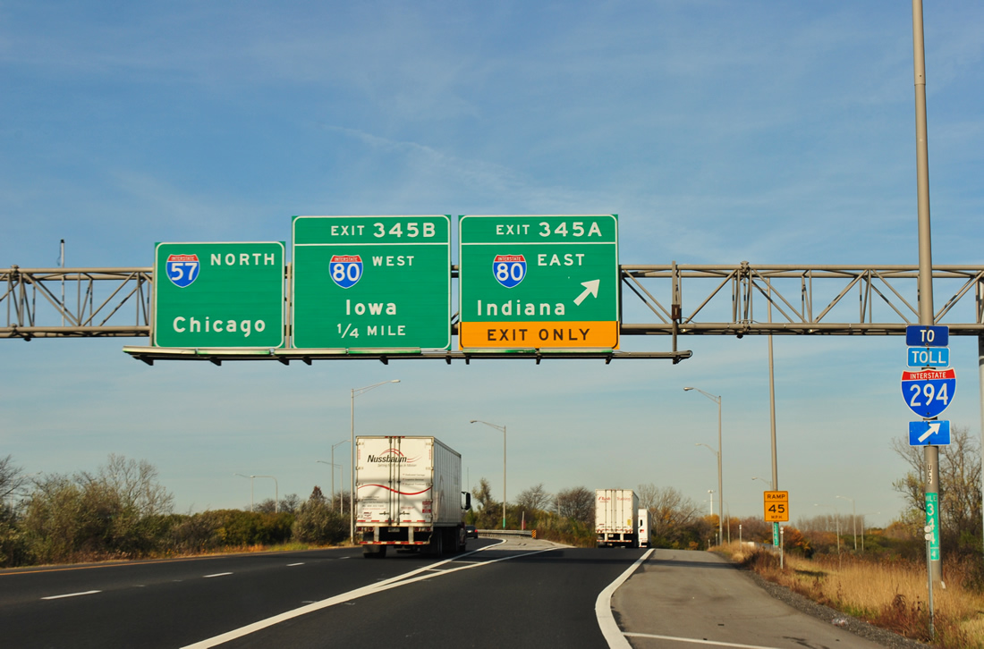
An Interstate 294 trailblazer directs motorists from Interstate 57 north onto Interstate 80 east at Exit 345A.
There is no direct connection between Interstate 57 and the Tri-State Tollway presently and U.S. 6 provides the shortest route between the two roads via 159th Street. A proposal is underway to build a new interchange between the two highways at a cost of $580 million. http://www.illinoistollway.com/portal/page?_pageid=133,2045125&_dad=portal&_schema=PORTAL
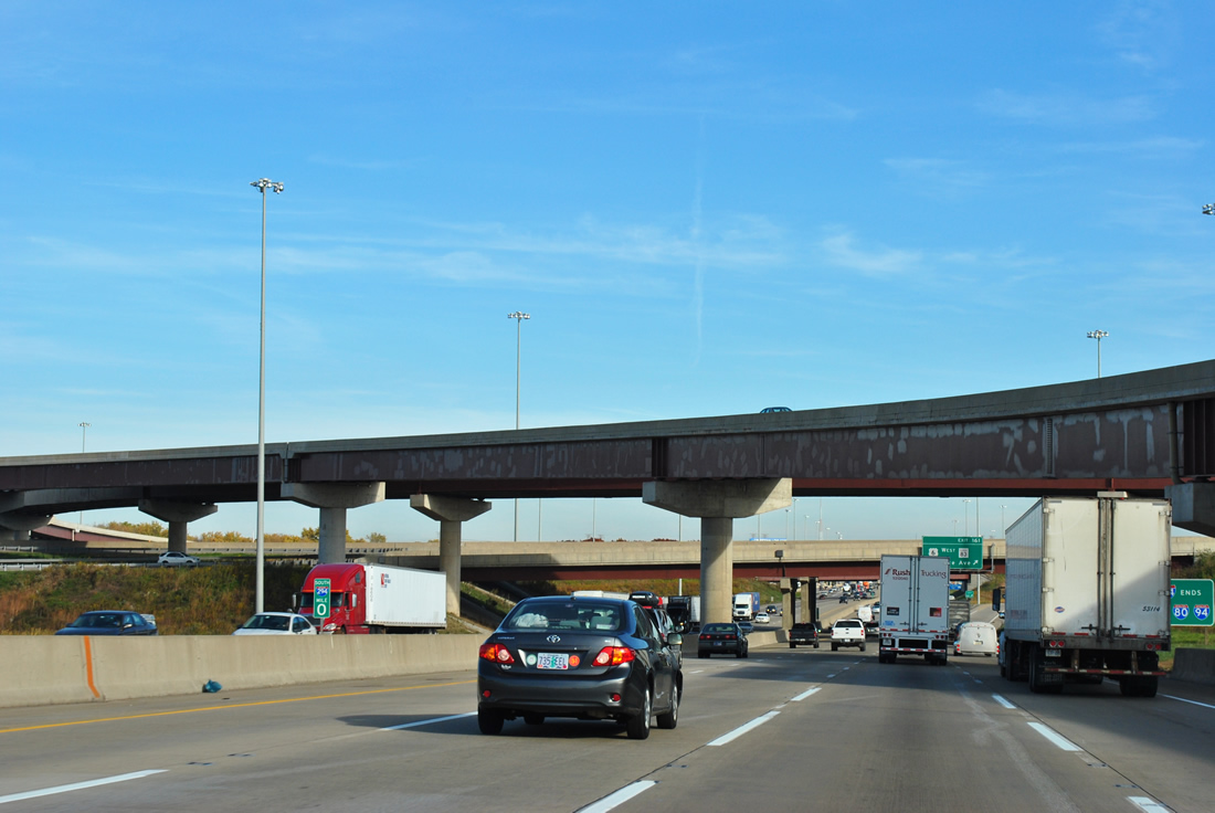
Interstates 80 & 294 combine along the southeastern most portion of the Tri-State Tollway through to the merge with Interstate 94 (Bishop Ford Freeway / Calumet Expressway) at SR 394. Major reconstruction occurred here between January 2005 and July 2007, resulting in an improved Kingery Expressway (Interstates 80 & 94 east to the Indiana state line).
Sources:
- “INDOT officially opens revamped I-74.” Greensburg Daily News, July 9, 2008.
- “Kankakee County: I-57 construction clogs traffic” The Daily Journal, November 5, 2011.


