
Quebec City is the capital of Canada’s French-speaking Quebec province. The city celebrates its 400th anniversary next year, and has the only city walls in North America north of Mexico that still stand. But how to the freeways stack up? Well, they dont really “stack” but there are quite a few of them for a city of about 750,000.
Autoroute 73 forms the main route in from the south, and connects QC with Maine. I’m assuming the yellow tabs indicate exit only, as it is never expressly stated. Instead of the American A,B,C exits – these get the French O,E treatment for the cardinal directions.
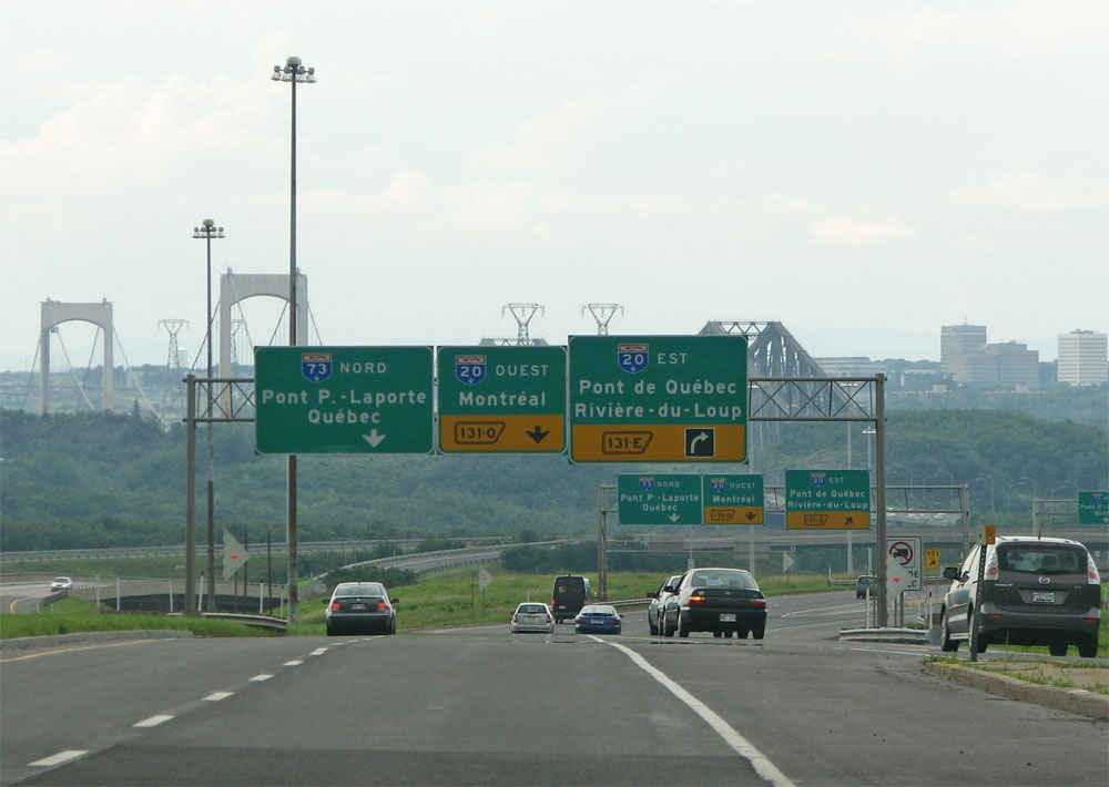
This view looks northbound just before the river, a little bit of the city’s skyline is showing to the right. The A20 is the Trans-Canada Highway, but its barely signed if at all through here.
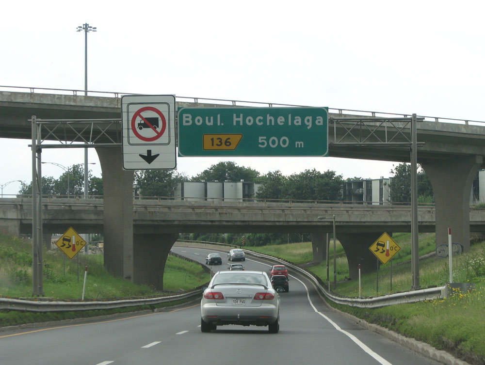
Crossing the river, A73 meets with the A40, the main freeway on the north side of the river throughout the province. Exits are denoted with yellow tabs – each pointing to the side that the exit is on.
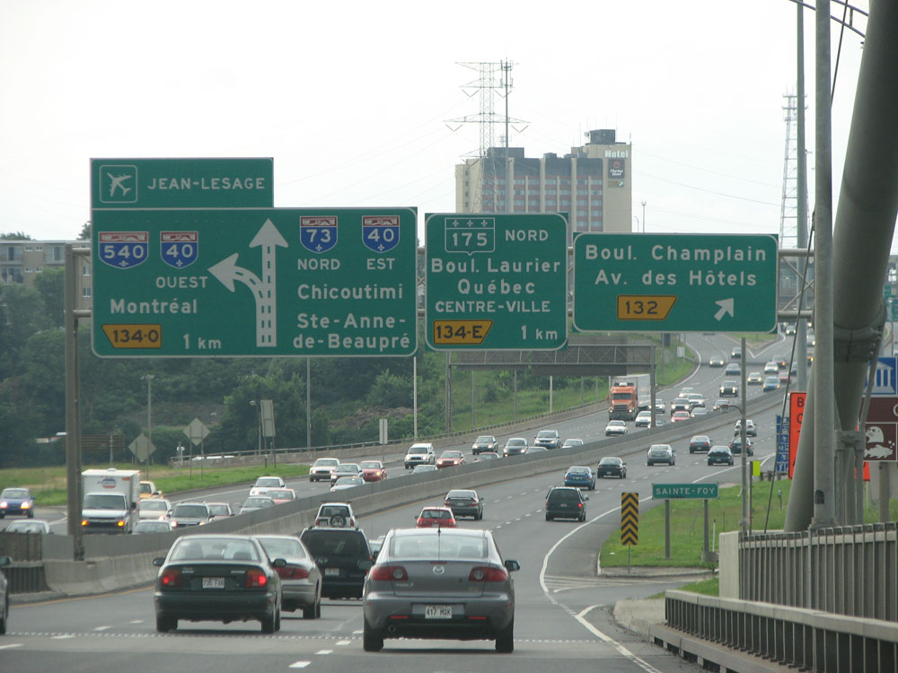
The largest interchange in the QC area occurs here, far to the west of the city centre.
Many of the city’s hotels and shopping areas are right here, where the A73 and the A540 come together. The bridges all look quite old, and just last week the cover of Quebec’s largest tabloid magazine had an alarming cover story about the deteriorating state of the province’s bridges.
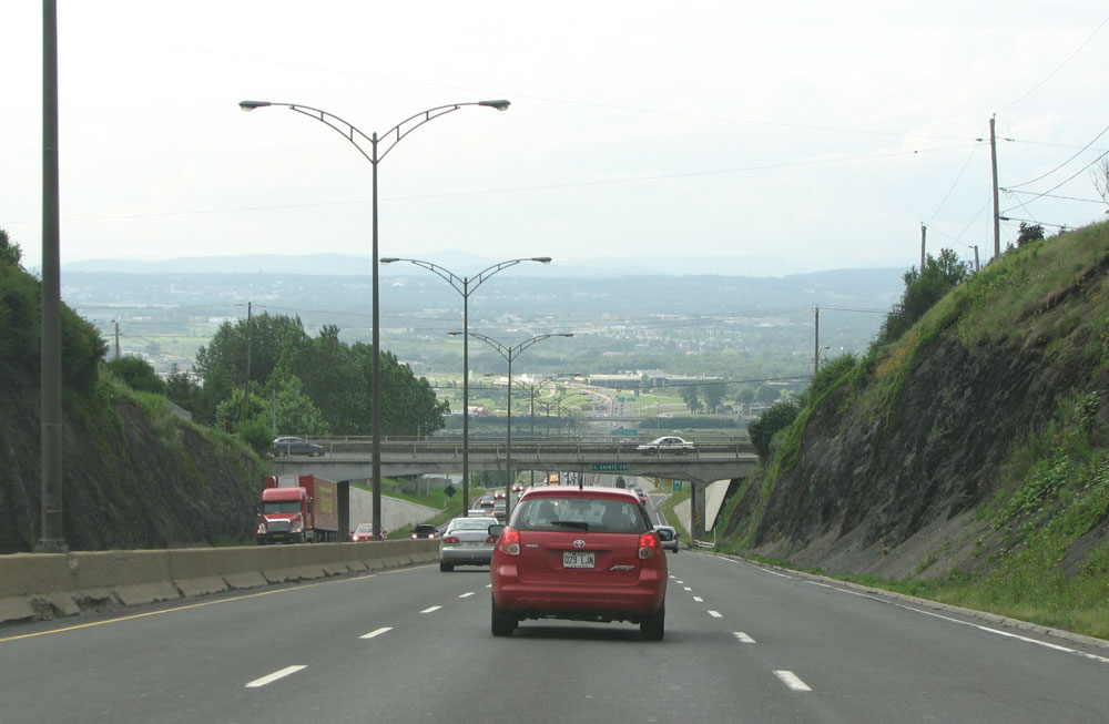
I found the next scene interesting, after crossing the river from the south, there is a large drop off. I was not expecting this as usually one rises after a large river crossing. Upon further examination, I found that Quebec City is actually built on a large bluff, and there is a valley to the north.
This view looks north on the A73 at Sainte-Foy, to the west of the city centre.
From the A73, take the A440 eastbound into the city centre. The A440 is the main ‘urban freeway’ in the city, and is discontinuous on each side of town, with the old part of the city in the middle. The road is 6 lanes for most of its length, and has a very large right of way.
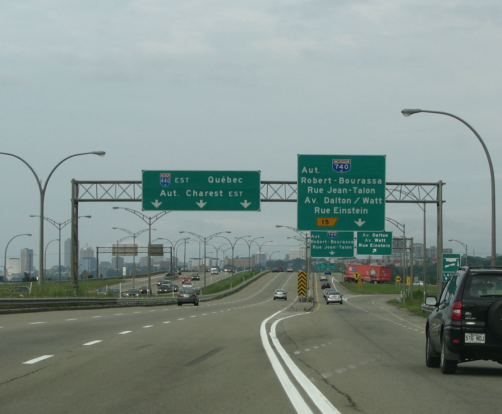
This view looks eastbound towards downtown, at the junction with the A740, a short 7-mile spur freeway. Traffic was light, here on a Wednesday afternoon.
I found it interesting that the Autoroute names were signed here, as they’re not usually signed anywhere else.
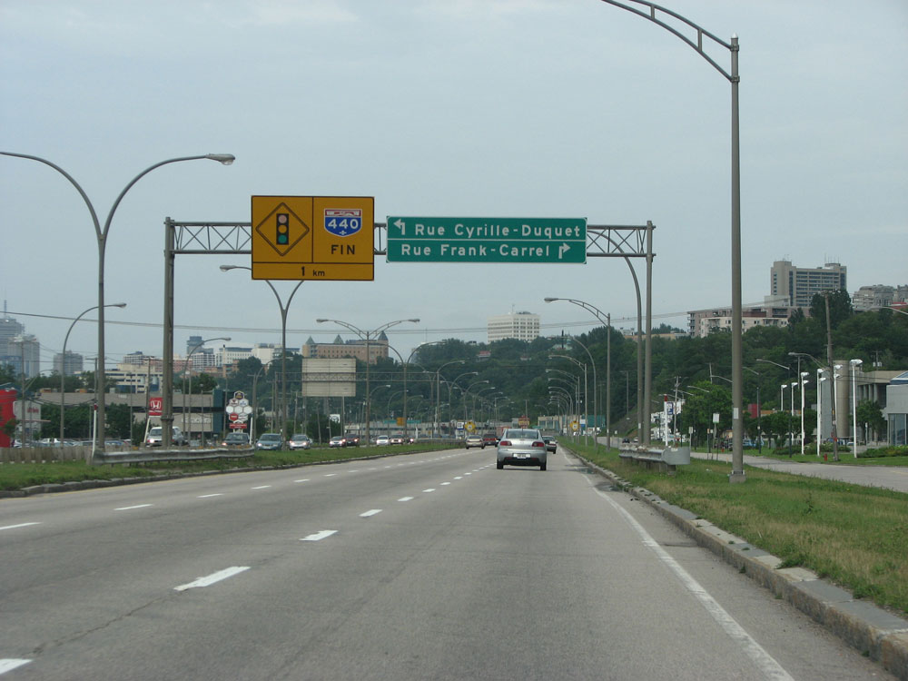
The A440, at least the western section of it, ends at a traffic light fairly distant from the city centre.
I find the word “fin” to be a lot more fun than “end”. The city, positioned on a ridge next to the river, is very high and removed from the bland suburban surroundings to the north.
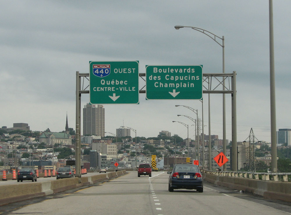
As I noted earlier, the A440 actually forms two spurs going into the city centre, this view looks westbound on the other side.
There are no “FIN” signs, unfortunately, but there is a large viaduct that carries traffic very high above the plain and dumps you right into the old part of the city on the bluff. Its a fantastic view.
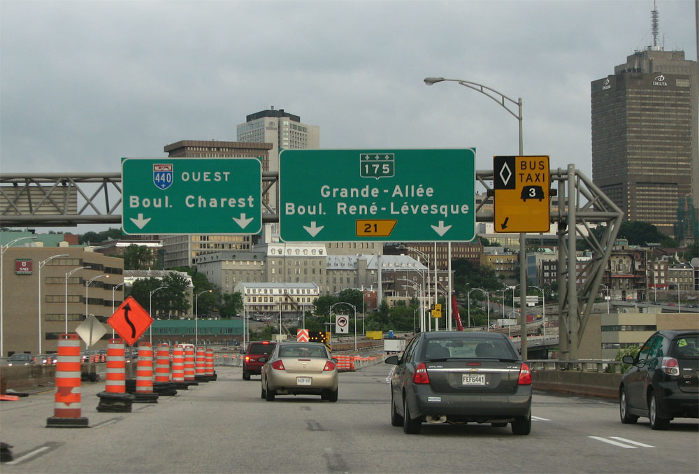
Another view on the viaduct heading into the city centre. Work is currently ongoing to rehabilitate the pavement.
Well, that is a very quick tour of Quebec City. Unfortunately, the rest of Northern Quebec got rained out for me. I saw a lot of trees, and a lot of poutine. Tune in next time for Montreal (sunny)
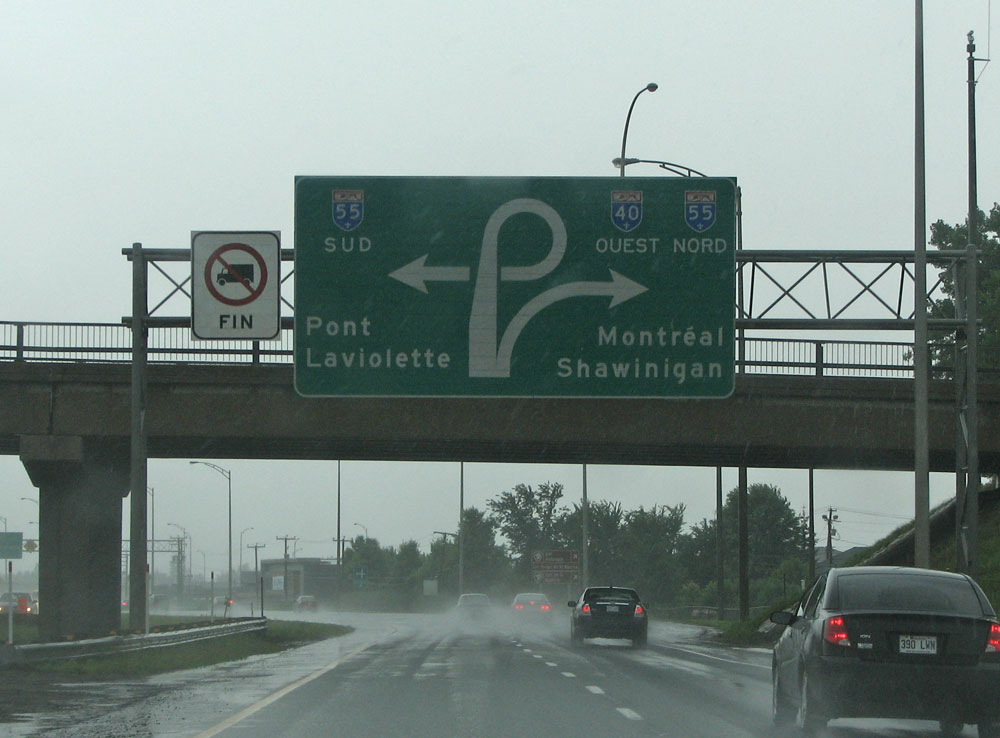
A-40 west at A-55
I once lived in Quebec, great coverage.
Dont be shy to continue to explore our great province
My family and I were in this area about three weeks before your blog post. I don’t speak French, either, but I took five years of it in school. I am a traffic engineer by trade, so I was taken in not only by the natural surroundings but also the differences in signing technique from the U.S. (and even neighboring provinces). Thanks for the nice coverage.
Ever thought of doing Ontario or BC?
Man I recognize all the signs and locations, even though we haven’t been there since 2004. Even though my french is non-existent, it’s easier to navigate than Mass or NY.