
Day two of our week long travels across the Upper Midwest took us around the Minneapolis and St. Paul area to revisit roads we drove previously in 2007. Several changes were made to area freeways and interchanges.

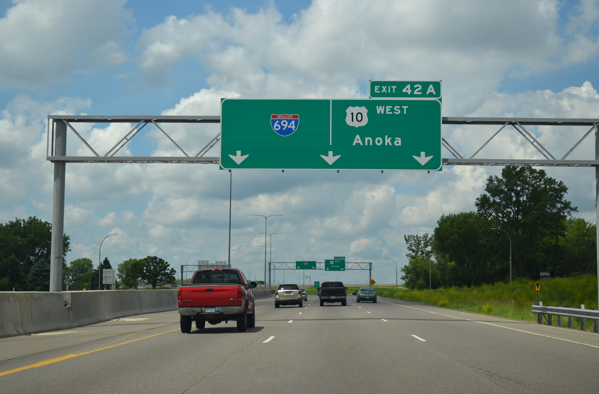
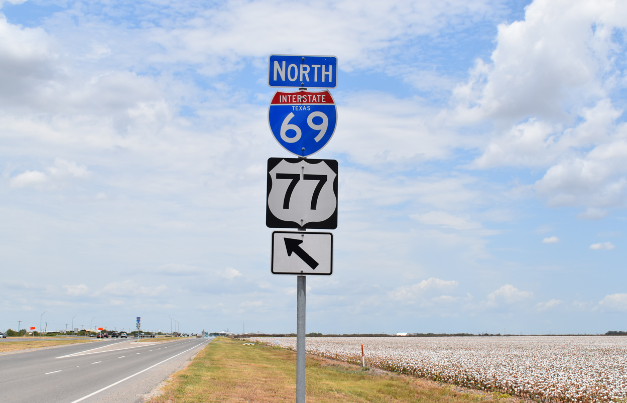
U.S. 10 west at Minnesota 610.
U.S. 10 branches west from Interstate 35W at Mounds View as a full freeway through to Anoka to the north of Minneapolis. Minnesota 610 stems west from U.S. 10 at MN 47 as a freeway leading west to Brooklyn Park. The trunk highway is currently being extended west to Interstate 94.

Interstate 694 west at I-94 and Minnesota 100.
Interstate 94 combines with Interstate 694 from Brooklyn Center to Maple Grove to the northwest side of Minneapolis. The interchange where the two combine lies opposite of where Minnesota 100, a north-south freeway, ties into the beltway from Golden Valley to the south. A dual carriageway configuration ensues westbound after the Mississippi River to separate movements to both busy freeways.
Major road work is underway along Interstate 494, between Interstates 94 & 694 at Maple Grove and Interstate 394 & U.S. 12 at Minnetonka. Construction focuses on pavement rehabilitation of the I-494 mainline, bridge replacements at CR 47, Schmidt Lake Road and the CN Railway, addition of a third lane between MN 55 and East Fish Lake Road, and ramp repairs at all interchanges. The project kicked off in July 2014 and runs throguh November 2016.

Southbound I-494 runs along the northbound lanes during the reconstruction project in this scene ahead of Minnesota 55. Northbound traffic was reduced to just one through lane, resulting in a lengthy back-up further south.
Interstate 394 overtakes U.S. 12 east from I-494 to Downtown Minneapolis. Established by AASHTO in 1969, I-394 took the place of U.S. 12 (Wayzata Boulevard) and was completed in 1992.

Minneapolis St. Paul inset from the 1991 Rand McNally Road Atlas.
Note that I-394 was not posted and that Wayzata Boulevard was still shown partially as a divided highway instead of a freeway. The I-394 freeway spur into Minneapolis was not displayed either.
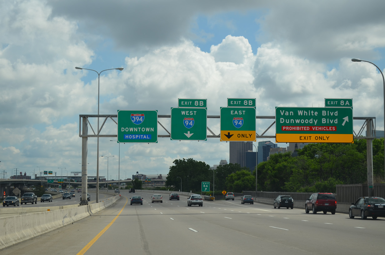
Interstate 394 approaches Interstate 94 at Dunwoody Boulevard outside Downtown Minneapolis. The I-394 Express lanes provides a direct ramp to I-94 east.
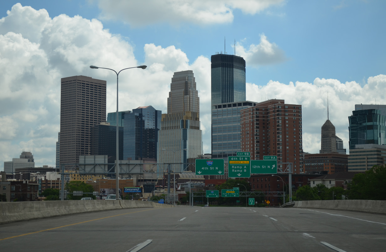
The Downtown skyline of Minneapolis unfolds as Interstate 394 lowers to pass below grade betwen Target Field (home of the MLB Minnesota Twins) and Target Field (home of the NBA Timberwolves). The freeway concludes at the intersection of 3rd and Washington Avenues.

Looking west at the the 5th Street overpass above I-394 adjacent to Target Field. The westbound lanes of I-394 begin at the intersection of 3rd and Washington Avenues two blocks to the east.

The west end of Interstate 394 at Minnetonka. U.S. 12 extends west as a freeway through to Wayzata. The US route was unsigned along its overlap with I-394. The southbound loop ramp to I-494 was closed at this time due to the aforementioned rehabilitation project.
Turning easterly, Interstate 494 crosses paths with the U.S. 169 freeway at Exit 10A.
There is no direct access to northbound as prior connections with both MN 62 and U.S. 212 provide that movement. The partial cloverstack interchange with U.S. 169 replaced a diamond interchange when the US route traveled as an at-grade roadway across the Anderson Lakes area.
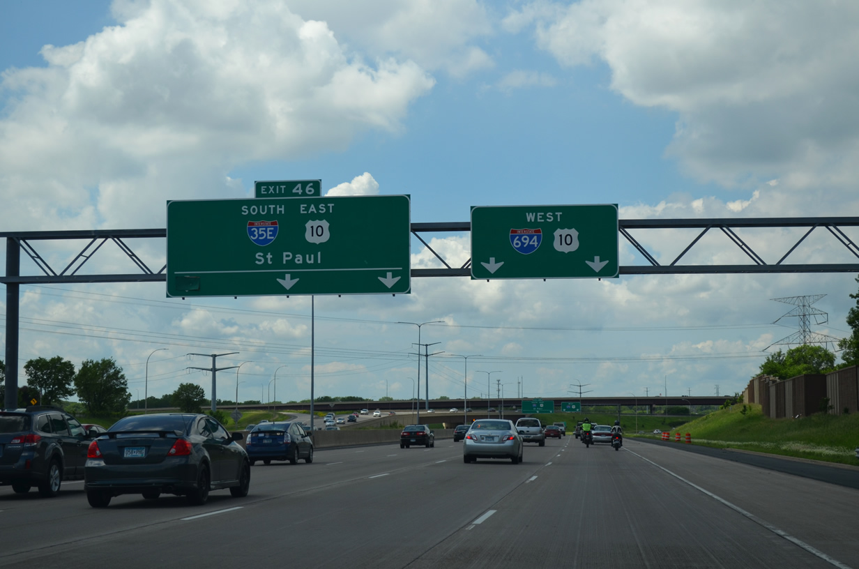
Many of the freeway to freeway junctions in the Minneapolis and St. Paul area remain simply cloverleaf interchanges. The junction between Interstates 94, 494 and 694 at Woodbury is one such slow-speed exchange. Thus far no plans are underway to upgrade this exit.

Interstate 494 ends as Interstate 694 begins at the full cloverleaf interchange with I-94.
I-694 extends the beltline north and west to Oakdale, North St. Paul and White Bear Lake. I-94 leads west to Maplewood and Downtown St. Paul and east to Afton and Hudson, Wisconsin.
Recent speed limit increases on 810 miles worth of Wisconsin Interstates to 70 miles per hour affects Interstate 94 east from I-494 / 694 as well. MnDOT increased the limit from 65 to 70 on June 17, 2015 along the nine mile stretch to the St. Croix River due to driving speeds and physical attributes of the freeway.1
One major project underway during our 2007 visit to Minnesota was the “Unweave the Weave” project where Interstates 694 and 35E previously overlapped through Vadnais Heights and Little Canada. The original configuration saw back to back directional-T interchanges positioned opposite a 1.2 mile overlap between I-35E and the beltline. This resulted in weaving traffic for the I-35E mainline, which saw drivers enter from the left and depart from the right or vice versa.
Interstates 35E and 694 still merge, but with the mainlines of each route no longer requiring lane changes. Additional work added a new ramp from I-35E north to I-694 east, eliminating weaving traffic from the left.
The four year Unweave the Weave project was completed in 2008. Work widened 3.2 miles of Interstate 35E from four to six overall lanes and 2.8 miles of I-694. Additionally eight bridges were built during construction between 2004 and 2008.
Interstate 694 west approaches the split with U.S. 10 at Shoreview and Arden Hills. The Arrow-Per-Lane (APL) sign craze has yet to hit Minnesota, as this sign would be appropriate for an APL.
The interchange between Interstate 694, Minnesota 51 and the U.S. 10 expressway leading northwest to Arden Hills was reconfigured as part of the I-694 North Central project completed in November 2013.2 Left-hand ramps with Snelling Avenue were eliminated as a new carriageway for I-694 was built adjacent to the original eastbound lanes. U.S. 10 now separates from I-694 west immediately west of Lexington Avenue (CR 51), where it previously separated from the belt line via a wye interchange by Valentine Lake. The westbound off-ramp to MN 51 was also eliminated.
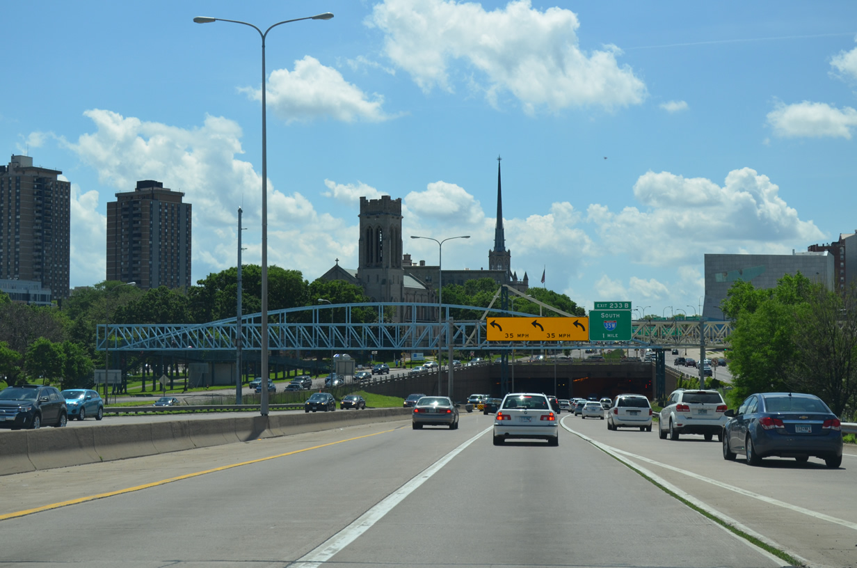
Interstate 94 makes a 90-degree turn south of I-394 through a tunnel below Hennepin and Lyndale Avenues. The freeway emerges ahead of the wye interchange (Exit 233B) with I-35W south opposite Downtown Minneapolis.
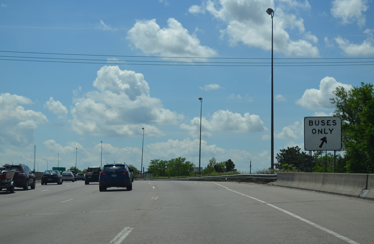
Interstate 35W sees pull offs in both directions for a bus stop at Lake Street. This is similar to bus stops on the Seattle, Washington area freeway system, but otherwise is a rarity on the Interstate highway system.
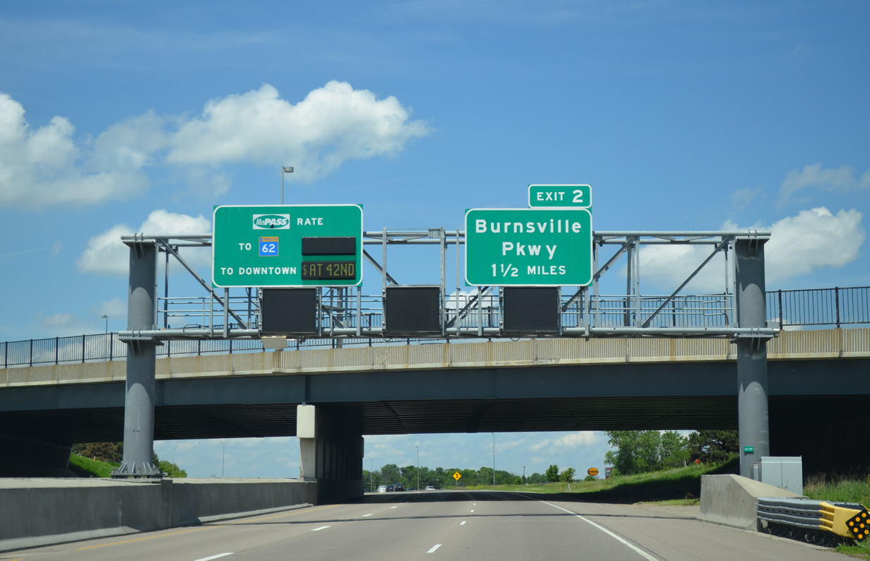
The left-hand lane of Interstate 35W between the split with I-35E and Downtown Minneapolis forms a HOT lane. Variable rates are charged through to Minnesota 62 (Crosstown Highway) and the freeway spur to 5th Avenue South.
HOT lanes were introduced along Interstate 35W as part of a $183-million funding from the Urban Partnership Agreement (UPA). Funding originated in a federal grant and from the state. The project converted the HOV lane into a MnPass express lane while adding a northbound lane between 90th Street and I-494 and a southbound lane from 106th Street to Minnesota 13. 2,000 additional park and ride spaces were added and the first phase of Bus Rapid Transit was instituted on I-35W and Minnesota 77. Work ran through September 2009.3

What was a left-hand ramp to Minnesota 121 north into south Minneapolis was moved to the right as part of the $288 million revamp of the Crosstown/I-35W reconstruction.
The Crosstown Highway (Minnesota 62) and Interstate 35W previously came together for a short overlap along the Minneapolis and Richfield city line. Similar to the I-35E/694 merge, the mainlines of both freeways required weaving traffic, where motorists shifted from left to the right. A new three-wye interchange was constructed at the east merge of the two freeways while the west split was reconfigured as I-35W and MN 62 now travel along separate carriageways. Construction began in late 2005 and ran through 2009.
I-35W north at Downtown Minneapolis.
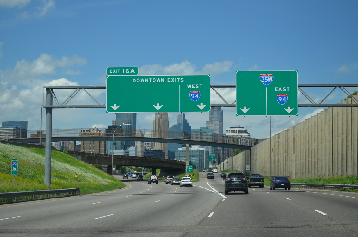
Returning to Downtown Minneapolis, a left-hand ramp (Exit 16A) departs with three overall lanes to the couplet of 4th and 5th Avenues South. Collectively these surface streets between 10th Street and Washington Avenue were formally a part of Minnesota 65. MN 65 is no longer acknowledged from I-35W, despite it still running north.

Spectacular views of the Minneapolis skyline are afforded to motorists along Interstate 35W through to the eastern turn along side Interstate 94.

Crossing the Saint Anthony Falls Bridge over the Mississippi River along Interstate 35W north.
Up next is a review of our drive northward to Duluth and Superior, Wisconsin.
Sources:
http://www.twincities.com/localnews/ci_28316781/i-94-speed-limit-woodbury-wisconsin-raised-70mphhttp://www.dot.state.mn.us/metro/projects/694expand/- “Fleshing out what’s in store for I-35W – A MnDOT official answers questions about a major project aimed at easing congestion along Interstate 35W and Hwy. 77.” Star Tribune: Newspaper of the Twin Cities (Minneapolis, MN), October 8, 2008.


Awesome report. I love this Facebook page. As a resident of Saint Paul, I have to correct you on one thing though. The Minnesota Wild NHL Hockey Team plays at the Exel Energy Center in Downtown Saint Paul and not at the Target Center in Minneapolis where the NBA Minnesota Timberwolves play. Anyway, the detail you put into these reports is fantastic. Keep up the good work and thanks. BTW, my wife is from Hudson Falls, NY north of Albany. I loved your report on the Interstate 87 Northway and the Thaddeus Kosciusko Twin Bridges over the Mohawk River.
A few comments and clarifications:
– The I-94/694 concurrency begins in Brooklyn Center.
– Not sure if you were aware of this, but the 494 construction zone features a zipper lane between Fish Lake Rd and MN 55. From your description, looks like southbound had the 2nd lane at the time you drove it. MnDOT has a video posted on YouTube showing the zipper change in operation, IIRC from the Rockford Rd overpass.
– The Wild actually have their home at the Xcel Center in downtown St. Paul. Target Center is just the Timberwolves.
– Here’s the hierarchy of the 494/169 interchange: originally a diamond interchange which dates to when the cross-road was County 18. Converted to a 7-ramp par-clo (but with signals remaining at the frontage roads) in the mid-90s when the new Bloomington Ferry Bridge was built…they basically took the original diamond and added 3 loops inside it, with 169 replacing County 18 in two stages shortly afterwards. Then finally a few years ago, the current partial clover-stack.
– Timeline for the Crosstown Commons reconstruction was 2007-10.
Thanks for the feedback. I should not have added the Wild to the Target Center description, as I have been by the Xcel Center in St. Paul before. Brain omission there!
Thanks also for the update on the Crosstown Commons timeline. The MnDOT web page only indicates that it is complete, so I used this PDF to access the timeline: http://nexus.umn.edu/Courses/Cases/CE5212/F2004/CS9/CS9PPT.pdf