
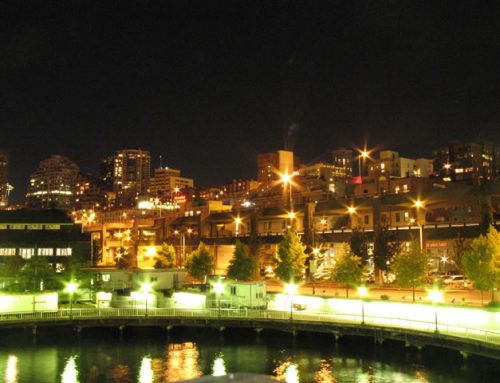
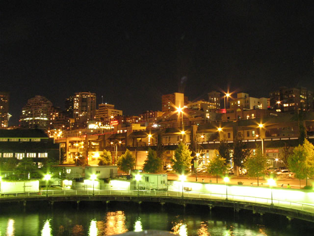
After just five or six hours of sleep, we began our day in Corvallis traveling through downtown looking to photograph a sign we saw the night before. The sign in question still showed Oregon 99W as U.S. 99W, a designation long since retired. From there we opted for Oregon 99W west northward to Salem in lieu of Interstate 5 as an alternate. The routing also allowed us to visit two new counties too.

The U.S. 99W sign found within downtown Corvallis. U.S. 20 & Oregon 34 join together through town, intersecting the one-way street couple of Oregon 99W in the process. Corvallis is home to Oregon State University.
Oregon 99W did not disappoint as it traveled through pastural settings, farms, open fields, small stands of trees, all dotted with farm houses and small businesses. Once we were at Oregon 22, we took that east to the capital city of Salem. Oregon 22 travels an expressway between Oregon 99W and downtown Salem.
In downtown, we visited the capital complex and capital mall area. The state grounds were pristine with beautiful landscaping and fountains. The capitol features a bronze statue gold statue finished in gold leaf on top. It represents an Oregon Pioneer, symbolic of the spirt of the first Oregon settlers.
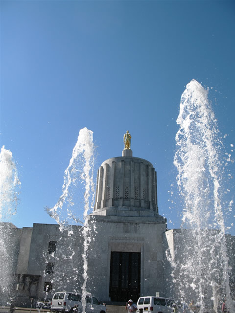
Looking through the fountains at the Oregon State capitol building, with the Oregon pioneer statue looking back.
After wandering around the grounds for a good half hour or so, we headed out of downtown toward the Salem Parkway, what was planned as the Interstate 305 freeway spur. Salem Parkway ends just north of the one-way street couplet of Oregon 99E Business. It provides a four-lane expressway with four signalized intersections between Interstate 5 and the central business district. The north end merges onto Interstate 5 at the 45 Parallel, halfway between the North Pole and Equator.
Interstate 5 carried us northward into the greater Portland area. First we traveled Oregon 99W southwest through some of the suburban areas of the metro. The suburbs look like any other American suburb as one would expect, and so after that, it was back to the freeway. Taking Interstate 205 north from Interstate 5, we rounded the bend at West Linn and Oregon City, to the Milwaukee Expressway (Oregon 224). The Milwaukee Expressway was nothing more than a glorified arterial with just two interchanges (one at SE Lake Road, and the other at Oregon 99E, the west end).
So taking the Milwaukee Expressway was sort of a waste of time roadwise, but nonetheless it was done. We continued north on Interstate 205 to clinch the highway, ending up on Washington 14 in Vancouver for a westward jog to Interstate 5. Washington 14 travels a four-lane freeway between the Columbia River and the city. The west end ties into Interstate 5 at the Interstate Bridge and central business district of the city.
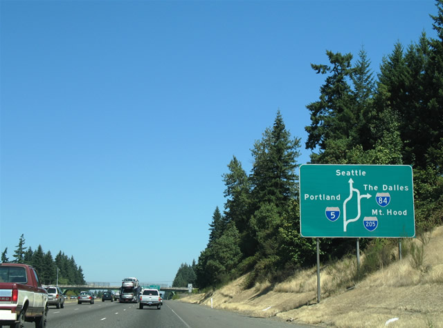
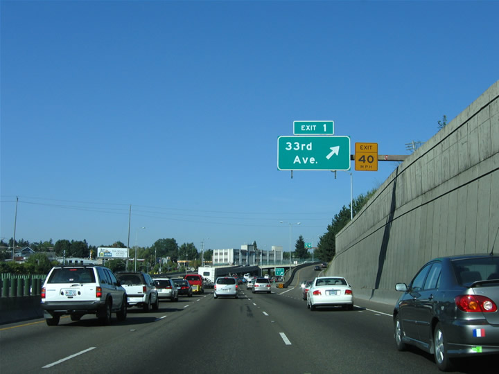
Approaching the split of Interstate 5 and 205 on northbound, a diagrammatic guide sign advises through traffic to both The Dalles (Interstate 84 east) and Seattle (Interstate 5 north) to use Interstate 205. Interstate 205 not only provides six overall lanes as opposed to I-5’s four to six, but also a higher 65 mph speed limit, as opposed to I-5’s 50 MPH near downtown, and also full shoulders for its entire length, converse to the substandard nature of I-5 and the Interstate Bridge with their lack of shoulders.
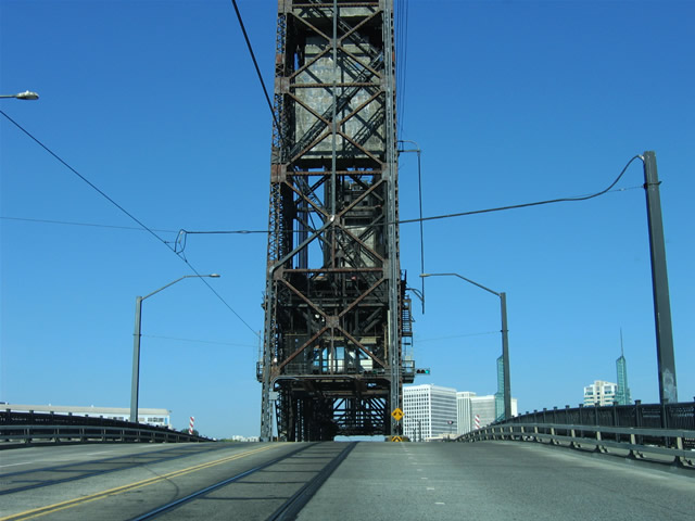
The Interstate Bridge carries six-lanes of Interstate 5 over an antiquated lift bridge across the Columbia River. The bridge has no shoulders and its undulations offer a rather gnarly drive for cars and trucks. There’s a replacement slated at some point, and it can’t come too soon for skiddish drivers.
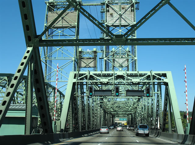
The Interstate Bridge was built in two stages. The original northbound span, that would eventually carry U.S. 99, opened in 1917. The southbound span followed in 1958. The bridges each carry three overall lanes with no shoulders and a 50 mph speed limit. This view looks at northbound approaching the lift-span portion of the bridge.
Back in Portland, we encircled the cbd via Interstate 405, which travels over the Columbia River along the somewhat majestic Freemont arch Bridge. That took us west of downtown, and we continued southward back to Interstate 5 to Oregon 217, a northwest-southeast freeway linking I-5 with U.S. 26 (Sunset Highway) and the northwest suburbs. Taking Oregon 217, we ended up as far west as Hillsboro on U.S. 26, deep within the western suburbs. U.S. 26 itself carries six to eight lanes on its westward trek and by far was one of the most modern freeways within the Portland metro. We ate lunch near the 185th Street diamond interchange and then decided to head back east to downtown.
U.S. 26 descends rather dramatically toward Central Portland, even passing under a tunnel before its merge onto Interstate 405 south. We opted for I-405 north to check out the freeway stub planned for Interstate 505. Interstate 505 was to be a short freeway serving the northwest Portland industrial area along U.S. 30, but only a three-quarter mile section of freeway was ever built. The freeway itself spurs from the south end of the Freemont Bridge to near U.S. 30 along the waterfront. A sort of gentrification is ongoing in the area, as town homes and condos are slowly replacing the aged industrial warehouses and wharves along the Willamette River.
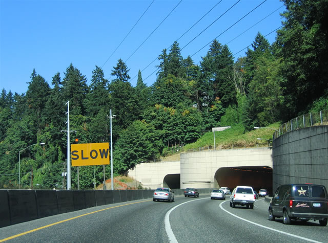
U.S. 26 (Sunset Highway) winds eastward and downward through Washington Park to this set of tunnels opposite the Portland central business district and interchange with Interstate 405.
A loop through downtown was next, taking us from Interstate 405 across the Steel Bridge to the Rose Garden (home of the Trailblazers NBA team) and back west across the Broadway Bridge. By this time we decided to make some headway east, and to take Interstate 84 in Oregon for the first time…
Spanning the Willamette River across the narrow Steel Bridge between downtown Portland and the Rose Garden. Two lanes pass underneath the lift structure, while two also travel along the outside.
Interstate 405 again took us back to Interstate 5, which led us onto Interstate 84’s eastbound beginning. The freeway begins along the Banfield Expressway through residential areas east of central Portland. The freeway travels below grade for part of its path, with concrete retaining walls and sound barriers along the right-of-way. An accident on this day caused our trek to be a slow go between Interstate 5 and Interstate 205. So we trudged through a four-mile stretch in about 15 minutes or so, before finally heading east of Interstate 205 to the eastern suburbs of Gresham and Troutdale.
Interstate 84 wanders through the East Portland, Laurelhurst, and Hollywood neighborhoods en route to Gresham and Troutdale and the rest of the east suburbs. The Banfield Expressway meanders along a curved freeway below the adjoining communities, with hills covered in concrete retaining walls. A light rail line also parallels the freeway along the westbound side.
Next on our agenda was to visit Multnomah Falls and the historic Columbia River Highway (old U.S. 30). There are several segments of old U.S. 30 still open to traffic, and each section offers its own beauty and allure. Our first stop took us from Interstate 84 at Exit 22 southward and upward to Corbett and old U.S. 30 there. We poked around a bit before realizing that the falls were still much further east, and decided to turn around and descend back to the river’s edge. Here is where our agenda was forced to change…
As we got toward the bottom, we noted several cars and RV’s were parked along Corbitt Hill Road, the road between Exit 22 and old U.S. 30. Once we got to the diamond interchange, we realized why. All traffic along Interstate 84 was at a standstill, with various people standing outside of their cars or milling about. Something blocked their progress, so we thought, no thanks on this, and turned around. As we turned around, Andy took a look down the drop from Corbitt Hill Road and noted a car or truck upside and on fire within the travel lanes of I-84. So it was safe to say that we would have to opt for the old U.S. 30 irregardless…

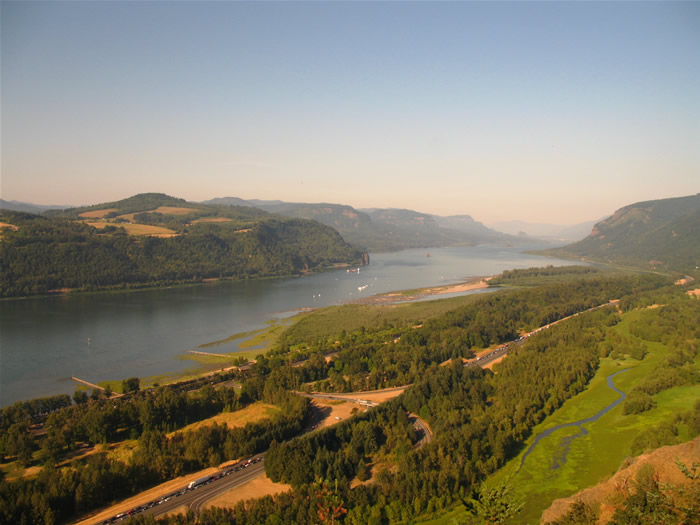
Peering east at the majestic Columbia River Gorge from Chanticleer Point along old U.S. 30, high above Interstate 84 and the river below. The Vista House sits atop the palisade in the distance.
Several miles to the east, we stopped at the Vista House, a structure built above a palisade overlooking both the Columbia River and Interstate 84. The facility housed a museum about the old highway and other area history. The view from the observation deck revealed that I-84 west was not moving, and that only a car or two were traveling at a time along I-84 east.
Time to continue east along the Historic Columbia River Highway some more. Well the road as an alternate, despite it being very narrow with lots of traffic also using it to bypass Interstate 84, was not a disappointment. Several sets of waterfalls, old concrete arch bridges, and overall scenery lie along the road between Corbitt and Exit 31. Among the attractions are the famous Multnomah Falls, a series of waterfalls dropping from palisades high above to the Columbia River at Benson State Park.
…and the view from the Vista House looking east at the river and Interstate 84 (with westbound at a stand still) below. Below is Rooster Rock State Park and the Exit 25 trumpet interchange to the day use area along the river. The Historic Columbia River Highway winds along the hillside to the south under cover of the forest.
We spent enough time touring the falls, hiking, and driving along the narrow switch-back laden road, that the majority of the traffic back-up along Interstate 84 was cleared in time for us to double back to Exit 22 to resume clinching the highway. Sunset there around 7:45, and that left us with enough time to briefly look at Bonneville Dam and to overnight at Cascade Locks, home to the Bridge of the Gods.
I’ve been meaning to visit America, but I haven’t got round to it just yet. You have some massive bridges over there, and that view of Columbia River Gorge looks breathtaking. I would love to go hiking in an area like that and take in the sights. Maybe one day I’ll get myself motivated and actually do it, fingers crossed!