
The Nihonbashi (which translates to “Japan Bridge”) is decrepit bridge huddled under an elevated expressway, and spanning a little polluted river. Why is it important? Not only is it the site of Japan’s oldest stone bridge it’s also the nation’s zero milestone and the starting point for a whole slew of national routes – including 1, 15, and 4 (signed) and 2,3,6 and 7 (on paper).

The bridge sits just east of Tokyo’s city center, the original was built way back in 1603.
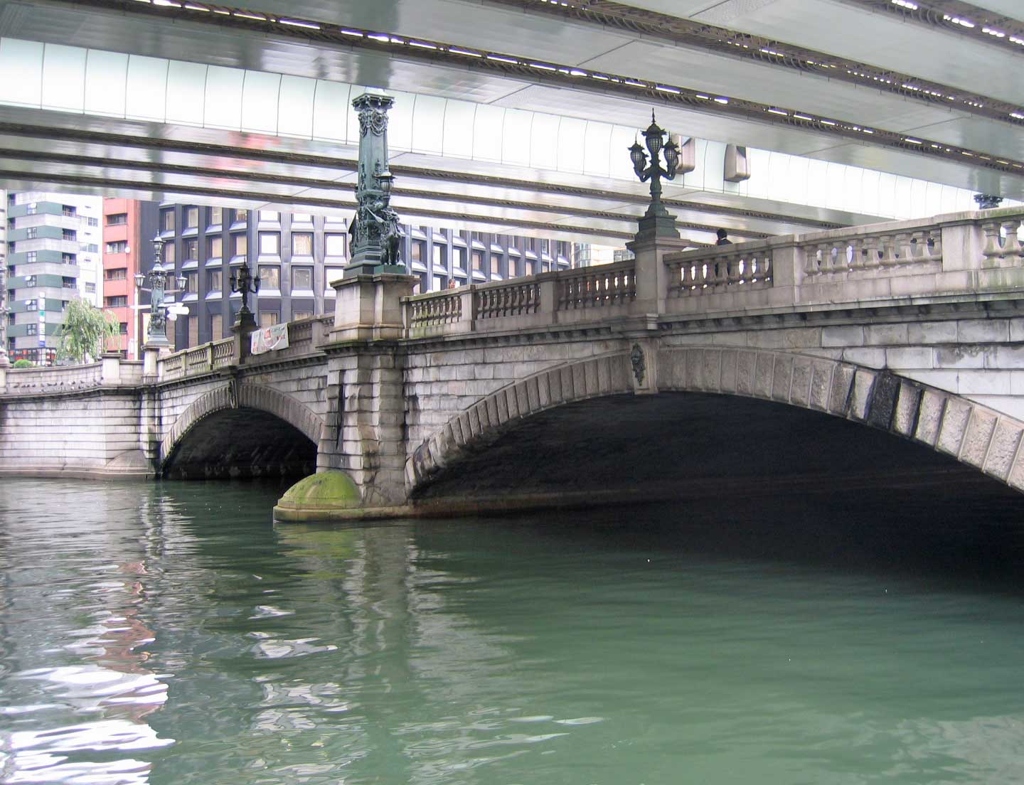
This one was built in 1911, as a replacement to the others which had been destroyed through various wars.
The zero milestone was conceived of in the 1700s when Japan was building a vast road network. It really came into play in 1868 when Tokyo became the national capital and the nation’s roads converged here. During the American occupation, a route numbering scheme was enacted and the zero milestone became the begin and end point for many of the most important national routes.

The milestone used to be in the center of the pavement, but was moved in 1973 to a point just off the bridge.
Many national routes end and begin here, but the only three that are signed are 1, 4, and 15. Route 1 runs southwestward from Tokyo and connects it with Osaka and Yokohama. Before the expressways were built, it was the most important road in Japan. Route 1 also follows the Tokaido for most of its length, Japan’s most important medieval road.

The first Rt. 1 shield is at the southern foot of the bridge.

Another view from the opposite corner. Rt. 4 begins on the opposite end of the bridge and connects the capital to the northern half of the country.
The Nihonbashi and zero milestone are marked on just about every map of Tokyo, and many maps of the country showing mileages also list it. It’s important from a historical standpoint, and from a practical one. When you’re looking at mileage to the world’s largest city, knowing where exactly in the city the mileage is measured to can prove very helpful, as it’s about 200 kilometers from one end of Tokyo to the other.

The Nihonbashi and zero milestone are marked on this expressway map by a cross surrounded by a circle.
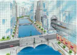
“Being such an important historical and practical spot, it is a shame that the Nihonbashi has to endure being under such an ugly freeway” – that’s a paraphrase of the position of the national road authority. Plans are underway to both widen and relocate the city’s central loop away from the river. It will cost billions, but the city will get a new outdoor spot and the sun will again shine on one of Japan’s most interesting roadgeek spots. This rendering has the freeway built through adjacent skyscrapers.


