
After on and off debate for well over 35 years, Delaware officials have finally chosen a path for U.S. 301 that most people can live with. South of the Chesapeake and Delaware Canal in the bustling community of Middletown, whose city limits have expanded dramatically in recent years to accommodate the pervasive sprawl of the Wilmington metro area, is the only two-lane bottleneck of U.S. 301 between the Washington metropolitan area and the Newark area. U.S. 301 already follows a full freeway with U.S. 50 east from the Bowie area across the Chesapeake Bay Bridge onto the Eastern Shore of Maryland. North of the split with U.S. 50, U.S. 301 follows a four-lane expressway (access controlled but not limited) to the Delaware state line southwest of Middletown. Once in Delaware, U.S. 301 narrows to just four lanes through Middletown and Mt. Pleasant, before again expanding to four-lanes at the merge with Delaware 896. U.S. 301 & Delaware 896 head northward across the Summit Bridge to U.S. 40, the northern terminus of U.S. 301.
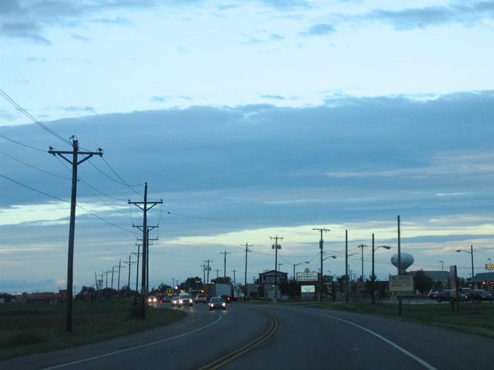
Open fields and farmland becomes suburban sprawl on a yearly, if not monthly, basis in Middletown. The increased and unorganized development puts a strain on U.S. 301 and the other Middletown area roads (Delaware 15, 71, 299).
U.S. 301 creates a popular truck bypass route of Baltimore for commercial drivers emanating between Virginia and points south to New Jersey and points north. In addition some local motorists use the highway between Washington and the Wilmington metropolitan area. As Middletown grows in an unregulated fashion, U.S. 301 becomes increasingly congested with the addition of local commuters to the pre-existing through traffic. Factor in the fact that the highway is both four-lanes north and south of Middletown, and the situation becomes worse with impatient drivers unable to make safe passes.
Beginning in the 1960s, Delaware officials began planning a north-south freeway along the U.S. 301 corridor from Interstate 95 south to the Maryland state line. Corridors included alignments along the state line and alignments tying into the planned Pike Creek Freeway at unconstructed Exit 2 of the Delaware Turnpike. All of the previous proposals for a U.S. 301 freeway met stiff resistance and by 1995, all were shelved.
Flash forward to 2000 and the suburbanization of Middletown, and the freeway idea was reconceptualized as a toll road. The growth of previously rural southern New Castle County has put great strain on U.S. 301 and other area roads. The lack of access control on U.S. 301 also plays into the increasing congestion of the Middletown through-road network. So with all that stated, officials went to the drawing boards and presented the public with numerous options for a limited-access highway to replace the surface-road routing of U.S. 301 in Middletown. Alternatives considered even included the ‘Ridge Route’ and other options from the original 1960s and 70s freeway concepts between Summit Bridge and the Maryland state line.
Last week officials chose a preferred alternate for the new U.S. 301, which will be a tolled facility, after two years of data collecting and public input. Dubbed the green route on planning maps, new U.S. 301 will split from the existing road just north of the Maryland state line and travel along the “Ridge” alternative west of Middletown (the Ridge represents the line from which water flows west to Chesapeake Bay and east to Delaware Bay). Northwest of Middletown, new U.S. 301 turns northeast toward existing U.S. 301 at point south of Mt. Pleasant. The toll road arcs across the Whitehall property, farmland long awaiting the addition of 2,500 new homes, to its end at the SR 1 Turnpike near the Biddles Corner Toll Plaza.
In addition to the U.S. 301 toll road mainline, the green alternative includes a Super Two spur from Summit Bridge southward to U.S. 301 north of Middletown. This concept also revives another element of the 1960s/70s proposal to incorporate Summit Bridge into a U.S. 301 freeway. The Super Two toll road ties into Delaware 71 & 896 at their intersection with Delaware 15 on the south approach to the Chesapeake and Delaware Canal crossing.
The News Journal ran an article on the toll road today:
http://www.delawareonline.com/apps/pbcs.dll/article?AID=/20061120/NEWS/611200357/1006/NEWS
“Officials say new U.S. 301 will be worth wait”
“Road expected to ease traffic, bring in business”
Delaware’s selection last week of a preferred route for a high-speed U.S. 301 highway through southern New Castle County was a long time coming — and the road itself almost surely will take even longer to be built. The state doesn’t have the $534 million to $590 million it needs to build the bypass. Construction probably would take five years, and state officials don’t expect it to be finished for 10 years.But the eventual impact of the road already is clear to government officials, civic leaders and developers.
A new U.S. 301 route would help relieve traffic congestion in the rapidly growing area, and separate through-truck traffic from local traffic — both upfront objectives for the bypass, according to the Department of Transportation.
In the long run, the four-lane divided highway also would help absorb the big expected growth in traffic from many new subdivisions under construction or planned south of the Chesapeake & Delaware Canal — particularly the Village of Bayberry, a planned 2,500-home community straddling Boyds Corner Road north of Middletown.
The road, if built, also could help attract business tenants to the long-planned Scott Run Business Park, and make development more likely on the 1,800-acre Whitehall properties just south of the canal between Summit Bridge and Jamison Corner roads.
The southwest-to-northeast “green route” selected for U.S. 301 would cut a swath through the area, gobbling up almost 900 acres of farmland, homes and businesses. Twenty-seven residential and eight commercial properties would be “totally impacted” — meaning the highway would displace any homeowners or occupants.
The route also runs right through two planned subdivisions — Pleasanton and Churchtown Manor — that envision nearly 500 new homes just west of the existing U.S. 301/Del. 71, north of Marl Pit Road. New Castle County has approved Pleasanton’s preliminary plans but Churchtown Manor’s are still under review.
In an e-mail response to questions, Rick Woodin, a developer behind Churchtown Manor, a planned subdivision of about 200 homes along Cedar Lane Road, said he expects the project to move forward, even though the property would be cut into two pieces by the proposed highway.
“We believe that the new highway is sorely needed and that it will remove interstate traffic from local roadways and provide benefits in many ways,” said Woodin, who also is the driving force behind the Westtown and Parkside developments in Middletown. “We can find no fault in the study process and accept the result. … We will attempt to move forward with a modified design.”
Principals in the Pleasanton project could not be reached this week.
The chosen route also would make traveling easier from the west side of Middletown, where Woodin is moving ahead with Westtown, a planned development of commercial space and homes.
The route would snake from the Maryland state line, bend north just west of Middletown and then veer northeast, crossing U.S. 301/Del. 71 near Armstrong Corner, jumping Boyds Corner Road west of Cedar Lane Road and then linking to Del. 1 north of Biddles Corner.
The route skirts the Bayberry development to the north, but does cut into the northern portion of the planned Scott Run Business Park at Jamison Corner Road.
Brian DiSabatino, vice president of the EDiS Company, which is among the partners in the business park, said the developers favor the road, which would have an interchange near the proposed park of about 2 million square feet of office space and support buildings.
“We believe that the future of the Delaware work force is in southern New Castle County, Kent and Sussex counties,” he said. “The closer we put those jobs to the employees, the fewer roads we have to build, and the fewer emissions there are in the environment.”
The proximity to the highway will help to sell space in the park, by making it more attractive to potential tenants, DiSabatino said.
The road and the nearby interchange also would provide future Bayberry homebuyers high-speed access to Del. 1.
“I don’t think it has any effect on Bayberry, other than it’s something that’s needed to be done to help serve Bayberry and the citizens down there in general,” said Tom Prusak, a senior principal of Landmark Engineering, who is involved with Blenheim Homes’ Bayberry North development.
Prusak suggested the highway would make Bayberry more attractive to homebuyers because it would provide easy access to a highway ushering commuters to jobs in Wilmington, Philadelphia or New Jersey, just as Del. 1 did for commuters in Kent County.
Ed O’Donnell, who specializes in transportation and land use for the Institute for Public Administration at the University of Delaware, said the route’s six interchanges will be prime points for development.
But the zoning and the county’s comprehensive land-use plan will dictate how the land is developed, he said.
“It’s not necessarily going to lead to increased development pressures and increased density,” he said.
O’Donnell, a former head planner for New Castle County, predicted a new U.S. 301 wouldn’t change southern New Castle County as profoundly as Del. 1 has — if it gets built.
“This is somewhat of an academic exercise, because they don’t have construction money,” O’Donnell said.
The almost $600 million price tag is way more than the state can handle. Already — even without that project — the state is $2.7 billion short of the money it would need to complete the projects DelDOT and state lawmakers say are needed in the next six years.
That’s one reason why DelDOT is open to considering a private-sector approach that would involve a 99-year lease of the road to a private company that would build it and recoup the investment through collection of tolls and concessions.
For now, DelDOT will hold a round of public workshops in January on its draft environmental impact statement.
DelDOT expects to finalize its selection of the route in the spring, and is awaiting approval from the Federal Highway Administration, perhaps by summer.


You can see a map of the current (tentative) plan at http://www.deldot.gov/static/projects/us301/jan07_flash_maps/preferred_alt/pages/301map_preferredalternatives.htm . Unfortunately it’s in Flash and I’ve found it a bit difficult to navigate.
It looks like they are maintaining at least part of the route for a previous incarnation of the plan. I work in the mapping section at New Castle County (maintaining the GIS centerline file). There are a couple of places north and west of Middletown where they already dedicated right of way as part of development plans. I checked the DelDOT plans, and the new corridor will incorporate them.