
I’m starting this roadtrip summary on day 4, as I have yet to retrieve the photos for Days 1 through 3 from Justin’s laptop. Rather then wait on that, I will just start from the back ala the Washington Trip reports, and focus on the drive from South Carolina back to Florida. The trip overall involved traveling north to visit my brother in South Carolina, and spending daytrips to see Myrtle Beach, Wilmington, North Carolina, and Charleston.
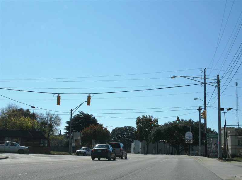
Day 4 starts on the road at around 11 am and proceeds west from Summerville, SC to Interstate 95 on U.S. 17 Alternate. A little bit about U.S. 17A first: U.S. 17 veers northeast from the Interstate 95 corridor at Yemassee, South Carolina for Charleston and the coast. U.S. 17A provides an overall inland bypass route for the U.S. 17 routing between Yemassee and Georgetown. While Interstate 95 and other freeways have dwarfed the U.S. highway system in importance overall, U.S. 17 and the Atlantic Coast from Savannah northward generally is not served by an Interstate highway. So Interstate 95’s path provides a long-distance bypass of the coast, but does not serve the regional needs such as movements between Savannah and Myrtle Beach. That is where U.S. 17 Alternate comes into play. However the path is two-lanes for the most part, and between Summerville and Moncks Corner, congestion and heavy development rules the road. Traffic counts are relatively low in the rural areas though.
U.S. 15 ends at U.S. 17 Alternate within the town of Walterboro, South Carolina. The U.S. highway travels northward from here all the way to Painted Post, New York, and originally continued from there to downtown Rochester, New York.
Once south of Yemassee, U.S. 17 joins Interstate 95 for a 20-mile or so overlap southward to Ridgeland. One would assume that the original alignment was overridden or is impassable because of the overlap. However that is not the case as aerial photos will attest, as old U.S. 17 remains as a frontage road, with four lanes even in some spots! At Exit 22 (Ridgeland), U.S. 17 leaves the freeway via a trumpet interchange for a parallel alignment of Interstate 95. Shortly south of there, U.S. 278 joins for 12 miles to a point just north of Hardeeville. U.S. 17 & 278 follow I-95 closely to the west, providing a viable alternate route in case of an accident closure or what not.
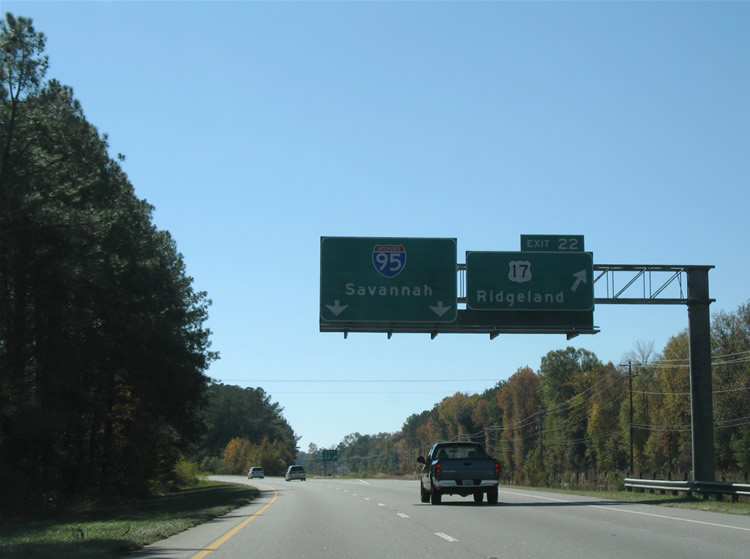
U.S. 17 departs Interstate 95 at Exit 22 for Ridgeland and Hardeeville. Paralleling the freeway within sight distance, U.S. 17 joins U.S. 278 for the drive between Ridgeland and Hardeeville.
U.S. 321 ends at Hardeeville just south of the U.S. 17 & 321 split. Signs on Interstate 95 reflect U.S. 321, but the highway never actually makes it to the freeway. U.S. 17Â meanwhile widen to four lanes from U.S. 321 south to the split with South Carolina 170 (old U.S. 17 mainline). When the new Talmadge Bridge was completed over the Savannah River, South Carolina and Georgia agreed to reroute U.S. 17 from its bypass routing to the northwest at Port Wentworth to the routing through the city of Savannah. That left old U.S. 17 to be replaced with South Carolina 170 (technically South Carolina 17-0) and for the remaining portion in Georgia as just Georgia 25. U.S. 17 provides a direct route into Savannah from Interstate 95, but it is only two-lanes from the South Carolina 170 interaction southward to Hutchinson Island on the Savannah River.
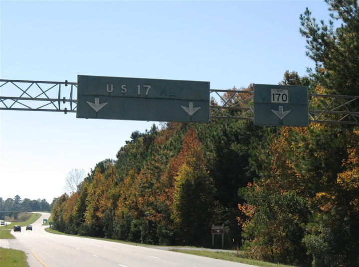
Vintage button copy signs remain in use at the U.S. 17 and South Carolina 170 southbound split.
An interchange joins the two highways north of their respective crossings of the Savannah River. Close observation of the overheads reveal a scraped off “ALT” on the left-hand panel and “US 17” on the right-hand panel, for the U.S. 17 split routing until 1988.
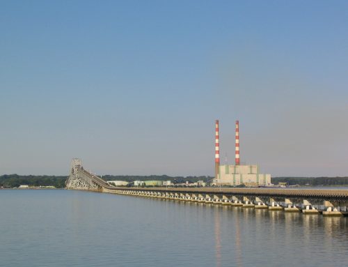
South Carolina 170 and Georgia 25 follow old U.S. 17 across the Houlihan Bridge at Port Wentworth, Georgia. The two-lane routing remained part of U.S. 17 until 1988 because of a rift between South Carolina and Georgia and the original tolled-Talmadge Bridge. Despite tolls coming down from the bridge in 1975, U.S. 17 remained to the northwest with U.S. 17 Alternate following the bridge until the 1988 relocation in anticipation of the replacement Talmadge Bridge. South Carolina initially objected to U.S. 17 following the Talmadge Bridge because of its tolls. The old alignment of U.S. 17 today carries truck traffic to the industrial Port Wentworth and Garden City for the Port of Savannah. Georgia 25 and U.S. 17 reunite at the Interstate 516 interchange with Interstate 16.
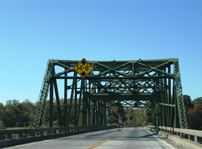
Crossing the James P. Houlihan Memorial Bridge over the Savannah River along South Carolina 170/Georgia 25 southbound. The narrow bridge includes a lift-section for large vessels traveling the river below.
Shifting to east of Savannah, the Harry S. Truman Parkway provides a link between downtown Savannah and the eastern reaches of the city. The newest segment of the freeway opened last Summer between Georgia 204 Spur (Whitfield Avenue) and Montgomery Cross Road. There’s some significance of that for me as I spent a couple of years living out on Skidaway Island during my childhood. Seeing the freeway end at Georgia 204 Spur (which was not signed until 1991), was quite a change for how the road looked throughout the 1980s and 1990s. A half-diamond interchange exists there awaiting Phase E of the Truman Parkway, the final link between downtown and South Side Savannah. Phase E construction begins in 2009 to extend the freeway west to Georgia 204 (Abercorn Street Extension) at its turn from north-south to east-west.
In June 2005, the Harry S. Truman Parkway opened between Montgomery Cross Road and Georgia 204 Spur (Whitfield Avenue) in the southeastern Savannah area. The extension joins the freeway with the coastal areas including Skidaway and Burnside Island. Construction that begins in 2009 involves building over the Vernon River and associated wetlands between Georgia 204 Spur and South Side Savannah.
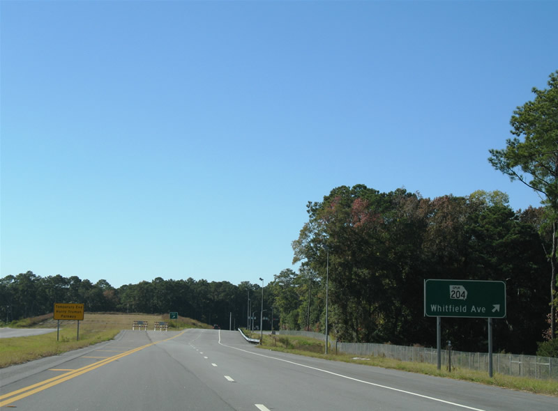
A grass stub end lies at the half-diamond interchange with Whitfield Avenue awaiting the westward extension to Georgia 204 (Abercorn Street).
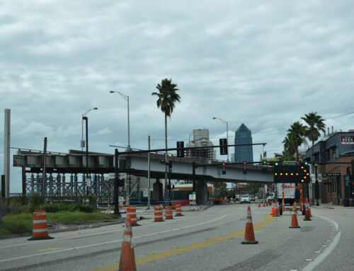
Back in Savannah itself, Georgia 204 (Abercorn Street) is awful as ever. The six to eight lane arterial crawled for it being midday. I remember traffic bad in 1983 on the road, and it seems that its worse then ever. It took about 15 minutes just to get from Montgomery Cross Road (Georgia 204 Spur’s north end) to De Renne Avenue (Georgia 21’s south end)!
After reminiscing with Savannah, it was time to bolt out of town via Interstate 516 west to Interstate 16 west to Interstate 95 south. Widening of Interstate 95 from U.S. 84 (Exit 76) southward to Exit 58 (Eulonia area) is underway and many portions of the highway look to be near completion. The Interstate 95 Business signed at Darien (Georgia 251) appears on mainline guide signs, but the shield once posted at the freeway overpass is no more! So mark that Business Loop as dead for all intents and purposes.
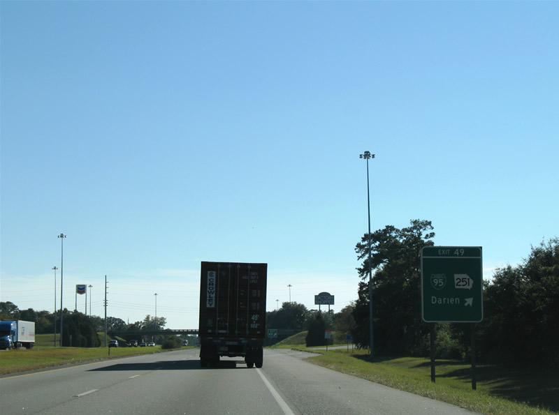
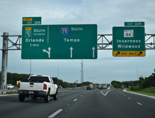
Exit 49 guide signs still display Business Loop Interstate 95 on the Interstate 95 mainline, but once off the freeway, the loop cannot be found…
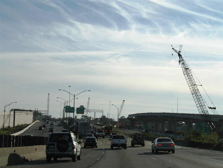
Next in line was Jacksonville. Interstate 95 through the city has two major construction projects underway. The first is the Trout River bridge replacement project http://www.troutriverbridge.com/. The original spans carrying four lanes will be replaced with a pair of higher three-lane span. Much of the new deck is already in place for the replacement southbound span and work will be complete on the entire project by early 2008. Further south road work involving reconstruction of the Interstate 10 and 95 interchange is also well underway. At stake is the replacement of the original substandard interchange with a new high-speed stack. Work began on this project, dubbed “The Big I” http://www.thebigi.info/ (New Mexico rip-off anyone?), in 2005 and it should be complete by 2011.
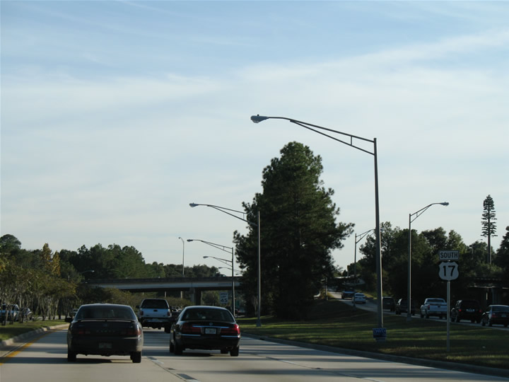
Spurring south from Interstate 10 is a short freeway spur (more like a glorified off-ramp) for U.S. 17, the Roosevelt Expressway. U.S. 17 proceeds south from there along the six-lane Roosevelt Boulevard to Jacksonville Naval Air Station and Orange Park. The stretch of roadway is significant in that a proposal is underway to reroute U.S. 17 from Roosevelt Boulevard between Interstate 10 and Interstate 295 south onto the Jacksonville area freeway network. The logic is that Roosevelt Boulevard no longer serves the through needs of a U.S. highway evidently, but as I saw on Monday, the road actually flowed great for 4 pm, carrying decent amounts of traffic, and providing access to Jacksonville NAS from Interstate 295.
Interstate 95 southbound at the eastern terminus of Interstate 10.
U.S. 17 (Roosevelt Boulevard) southbound within the interchange at Florida 21 (Blanding Boulevard).
This stretch of six-lane highway may soon be just Florida 15 if U.S. 17 is siphoned onto the freeway network.
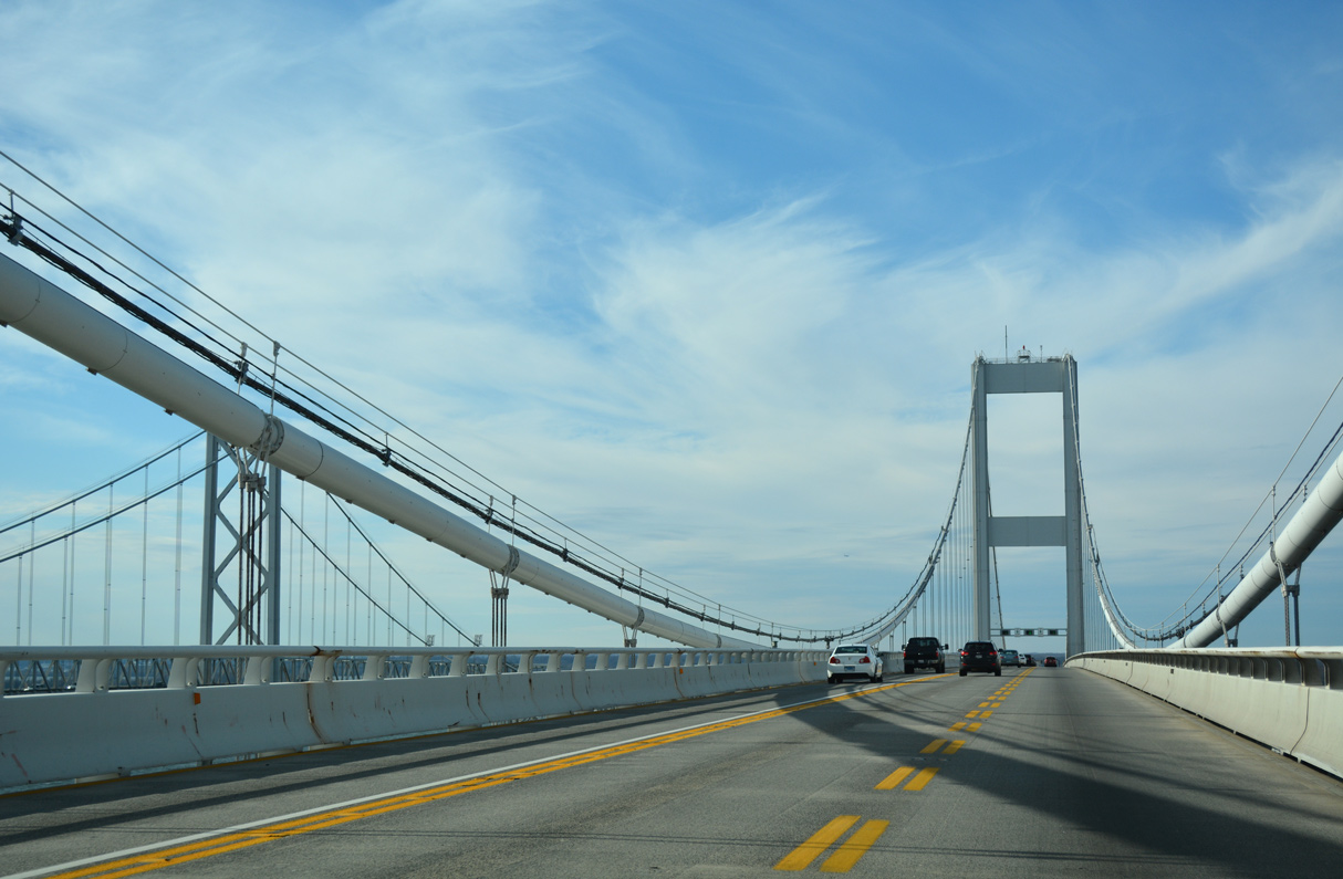
U.S. 17 carried us south all the way to Palatka, and we opted for Florida 19 south to Marion County 314, Florida 40, and Interstate 75 at Ocala. On Florida 40 is a high-level bridge that once was supposed to span the wide Cross Florida Barge Canal. Plans for the canal were abandoned a long time ago, but not before a high-level bridge was built for Florida 40. The bridge spans the relatively narrow Ocklawaha River.

