
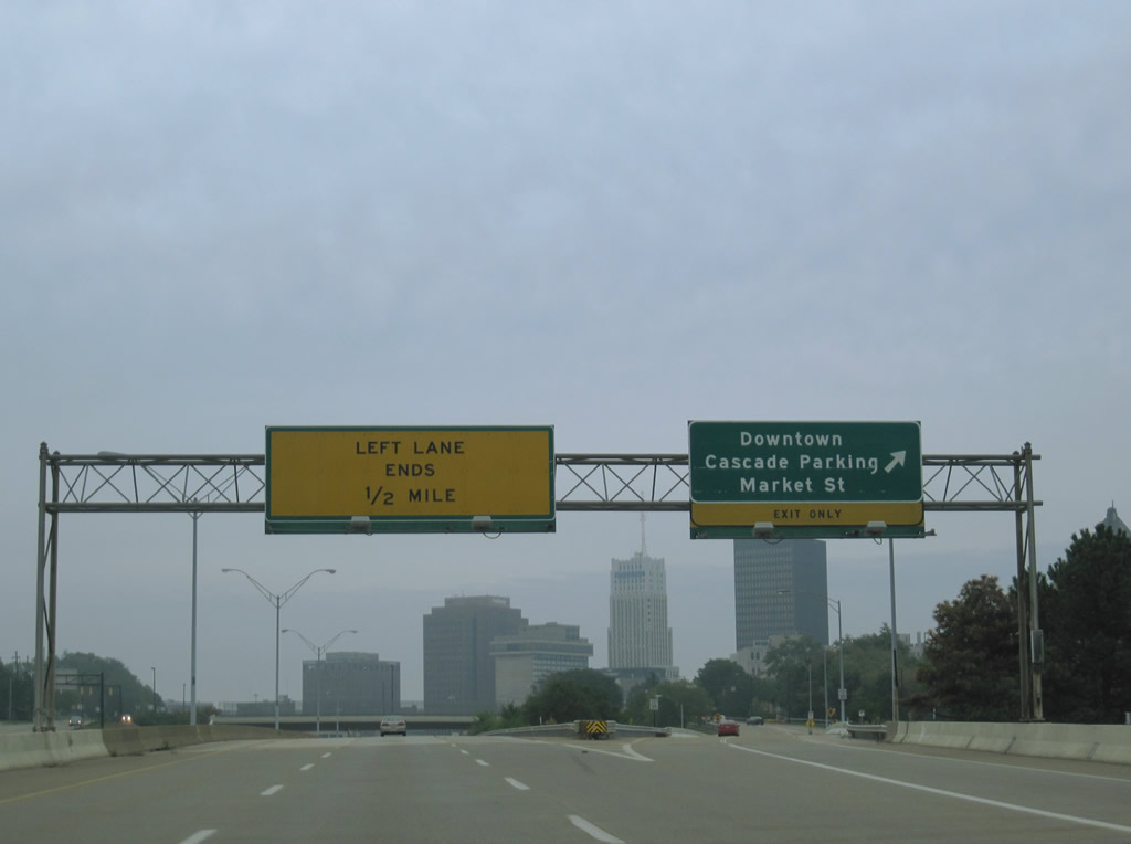
Day 3 of the trip focused on documenting the Cleveland area Interstates, walking around Public Square in downtown, heading east to Pennsylvania to redrive the extended Interstate 376, and revisiting the city of Pittsburgh. Orange cones, barriers and signs were omnipresent throughout northeast Ohio and western Pennsylvania related to numerous resurfacing and bridge rehabilitation projects. Some of the more major road projects we encountered are highlighted below.
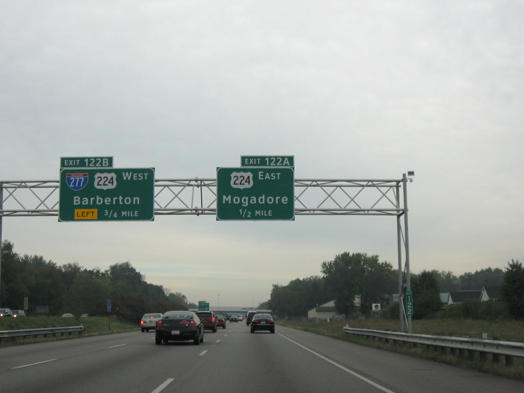
Sign bridge located along Interstate 77 north ahead of Interstate 277 west and U.S. 224.
Clearview based signage replaces button copy signs throughout the Akron and Cleveland area Interstate system. U.S. 224 follows all of Interstate 277 and much of Interstate 76 to the west. The highway continues the freeway east to Kelly Avenue near Akron Fulton International Airport.
Traveling virtually alone on the Innerbelt freeway of Ohio 59 north into downtown Akron.
This 2.24-mile freeway spur connects Interstates 76 & 77 with the central business district of Akron at Main and Howard Streets. Connections at the south end only provide access to Interstates 76-77 west and from I-76-77 east to OH-59 north. Like other partially completed and underutilized freeways, the Innerbelt has been considered for partial or total removal to reclaim land lost by its construction.
Interstate 77 travels west and merges with Ohio 21 (former U.S. 21) southwest of Montrose. U.S. 21 joined Interstate 77 when the freeway opened between Ghent and a point one mile south of the Ohio Turnpike in 1964. U.S. 21 was downgraded to Ohio 21 in 1971.
Partial interchanges between Interstates in Cleveland are not that uncommon. There is no interchange between Interstate 271 and the Ohio Turnpike, the merge of Interstate 90 west onto Interstate 80 east includes no access to the turnpike east, and here on Interstate 77 north, a direct ramp to Interstate 271 south is not provided.
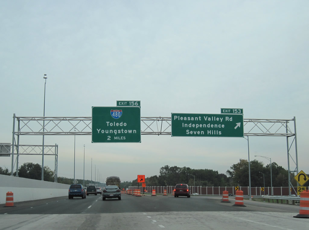
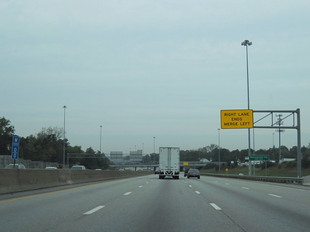
Work is underway from Brecksville along Interstate 77 north to Interstate 480 (Exit 156) to add a lane in each direction.
The project entails the freeway between Oakes Road (south of Exit 149) to Rockside Road (Exit 155). Completion is expected by Fall 2011.
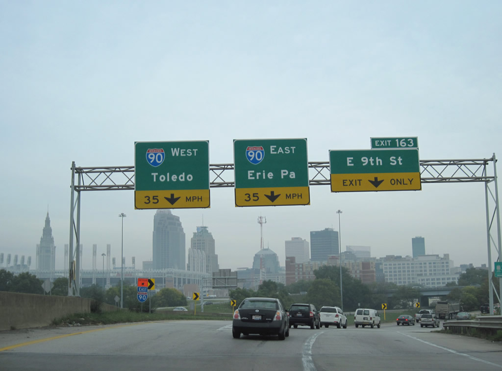
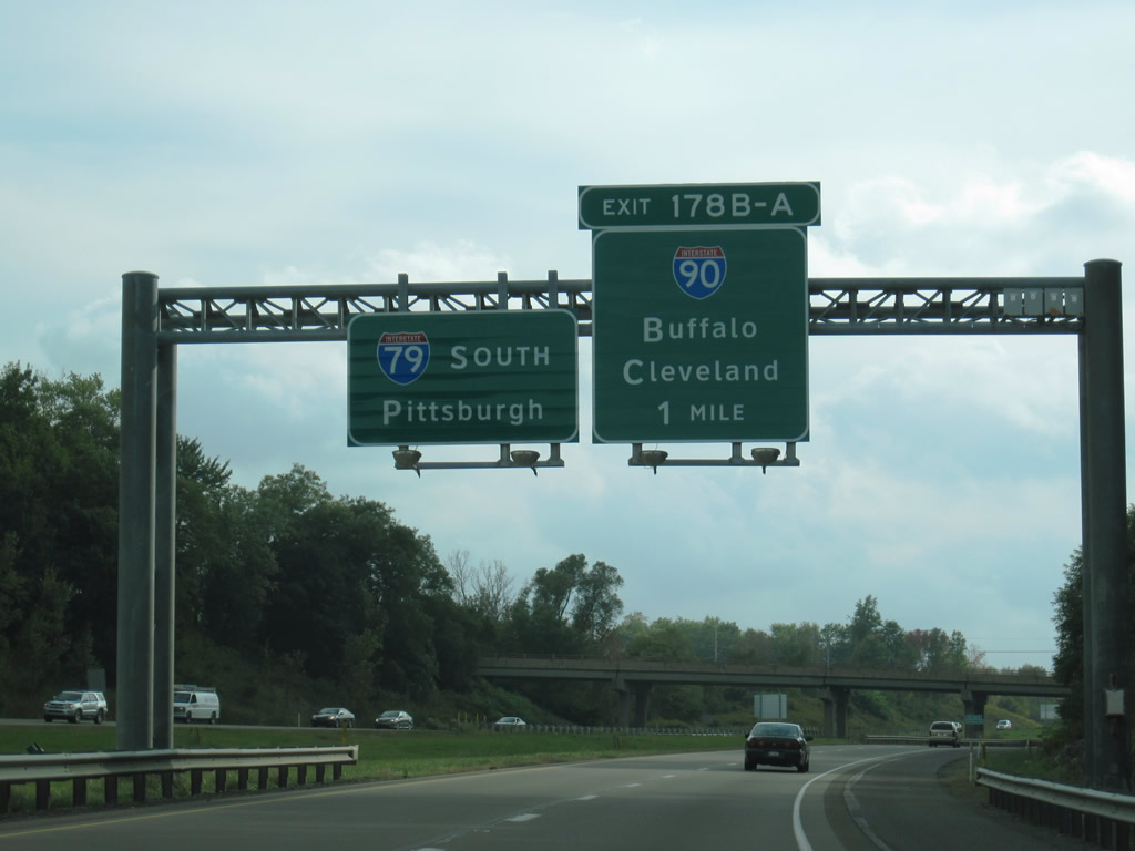
Interstate 77 ends at the ramp split to Interstate 90 west, Interstate 90 east, and East 9th Street (a ramp to East 14th Street south to U.S. 422 / Orange Avenue).
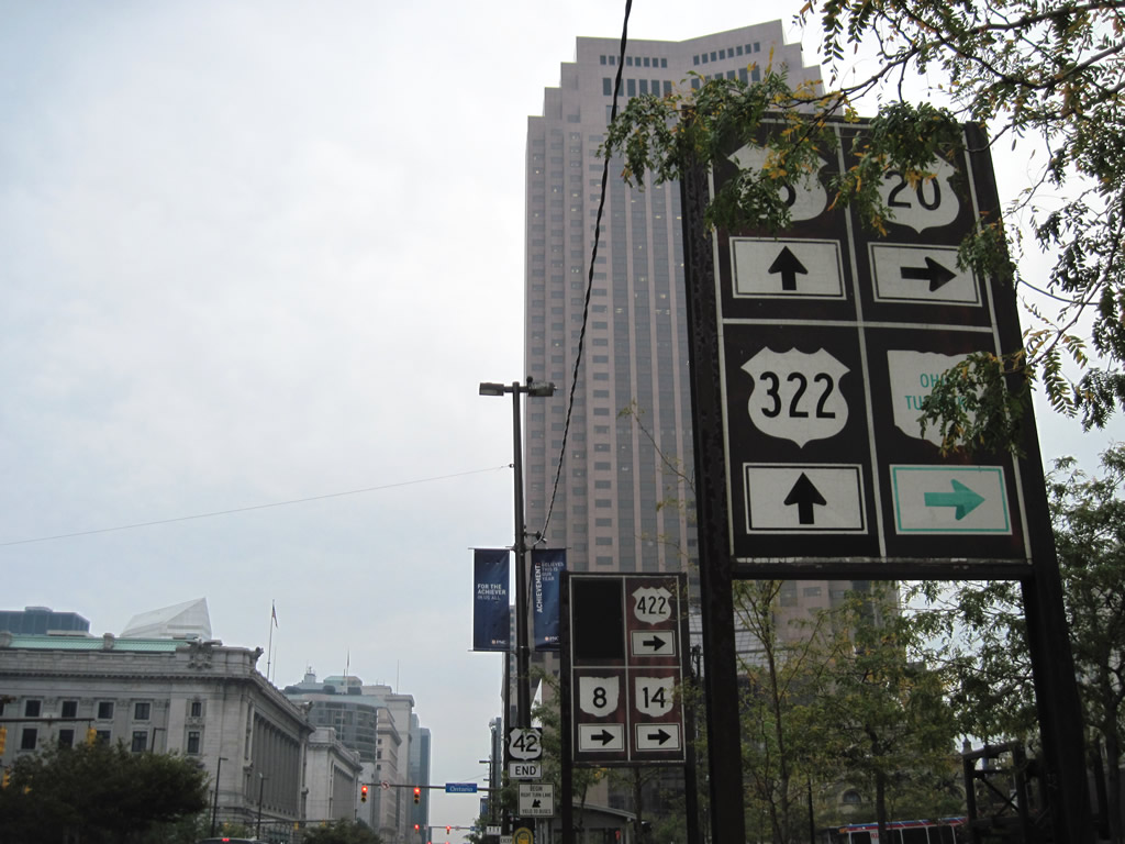
U.S. 6 and 20 east split at Public Square
Cleveland’s Public Square represents the nexus of U.S. and State highways radiating out from downtown. The four-block area surrounds the intersection of Ontario and Superior Streets within the central business district. Ending/beginning here are U.S. 42, U.S. 322, U.S. 422 and historically U.S. 21. State highways that begin/end here as well include Ohio 8 and Ohio 14 and historically Ohio 43 and Ohio 87.

Ontario Street southbound from Superior Avenue carries U.S. 20 one block to Euclid Avenue east from Public Square. The stretch doubles as the eastbound beginning of U.S. 422 and historically the southbound start of U.S. 21. The blacked out area on these hand painted signs once included U.S. 21.
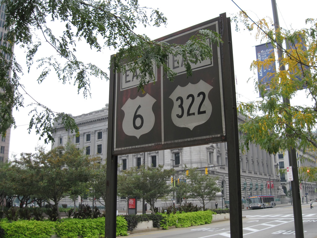
U.S. 322 begins along Superior Street east with U.S. 6 after Ontario Street. The two travel in tandem to East 13th Street, where U.S. 322 dog legs to Chester Avenue east.
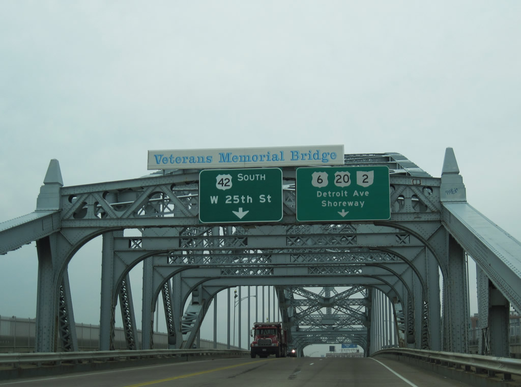
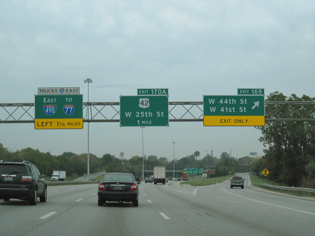
U.S. 42 begins and follows U.S. 6 & 20 west along Superior Avenue onto the Veterans Memorial Bridge, a steel arch bridge opened in 1917, across the Cuyahoga River. U.S. 42 turns southward from Superior Street onto West 25th Street opposite the U.S. 6 & 20 northward turn to the Cleveland Memorial Shoreway (Ohio 2).
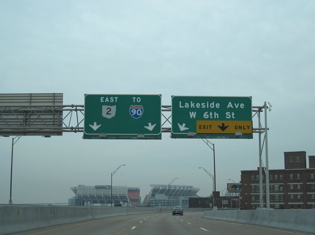
Traveling high above the Cuyahoga River along Ohio 2 (Cleveland Memorial Shoreway) eastbound, with Cleveland Browns Stadium lurking.
This stretch of freeway was originally slated to carry Interstate 90. Nowadays talks surround dismantling the elevated freeway to open the lakefront to downtown.
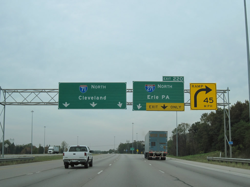
Beginning at Exit 184B, signs for Interstate 90 east coincide with Interstate 271 south… The two never overlap and their junction does not occur until Exit 188.
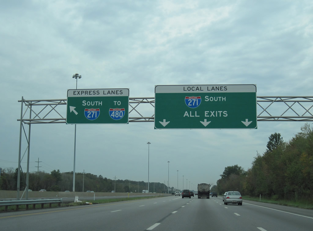
The Interstate 271 Local/Express roadway system begins at Exit 189 of Interstate 90 and leads southward to Interstate 480N and U.S. 422 (Exit 28B).
Access to the express roadway for motorists originating from Interstate 90 east is not available until midway between the tri-level stack interchange of I-271’s north end and Exit 36 (Wilson Mills Road). Travelers heading west on Interstate 90 may access both roadways.
I-480N west at the merge with Interstate 480.
Interstate 480N is the connector between the Interstate 480 mainline west of Interstate 271 at Maple Heights and the U.S. 422 freeway junction with Interstate 271 at North Randall. ITS markers display Interstate 480N shields and the ODOT straight line diagram also references the Interstate highway. The east-west connector otherwise is more or less U.S. 422 and does not include any exit numbers. Pictured here is the westbound end, a wye interchange.
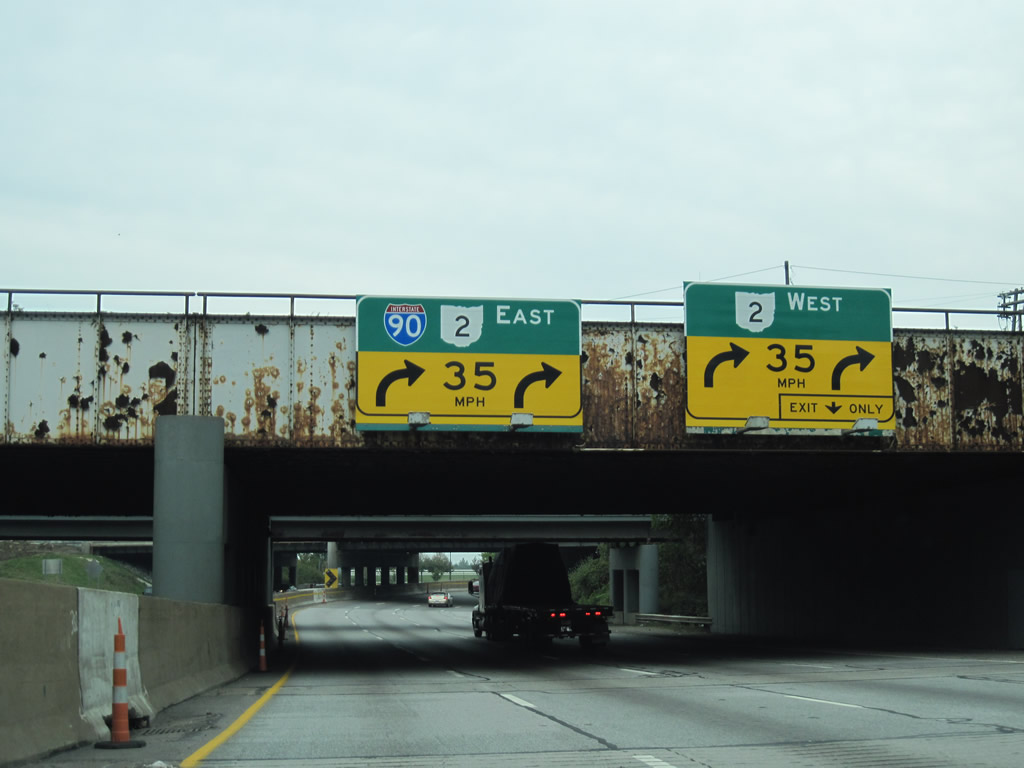
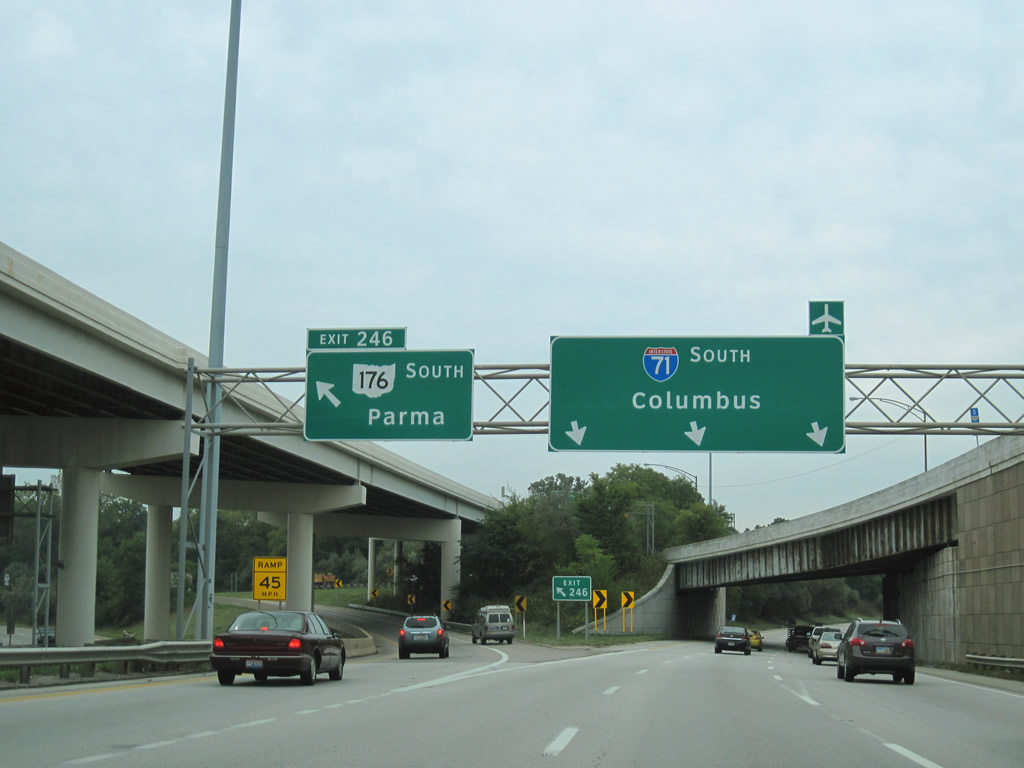
A grassy swath lies west of the split diamond interchange at Exit 169 along Interstate 90 eastbound. This is a leftover from the unconstructed Parma Freeway.
Had the Parma Freeway been constructed as envisioned, the freeway would have started at State Road near the Ohio Turnpike and proposed Cleveland Bypass (predecessor to today’s I-271) and ran northward to parallel West 65th Street to the Cleveland Memorial Shoreway. The wye interchange (Exit 244) of Interstate 71 and roadway stubs from the freeway spur north of Interstate 71 to Denison Avenue are also remnants from the cancelled freeway.
Traveling through “Dead Man’s Curve”, where Interstate 90 merges with Ohio 2 and the Cleveland Memorial Shoreway. This tight trumpet interchange remains from the 1959 design of the freeway network here and involves a 90 degree turn for motorists remaining along the Interstate 90 mainline.
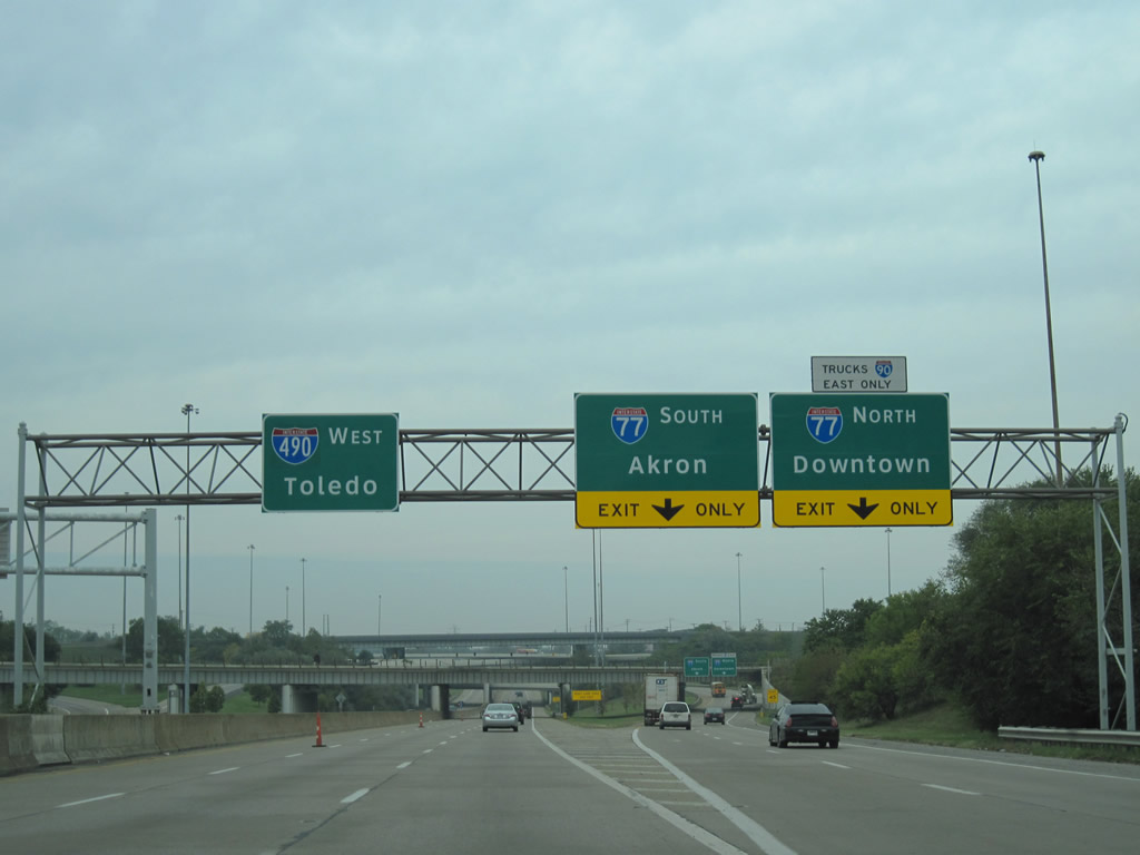
The westbound beginning of the Interstate 490, a 2.43-mile route.
Interstate 490 connects East 55th Street and adjacent Interstate 77 with Interstates 71 & 90 in central Cleveland. The freeway doubles as the mandatory truck route for Interstate 90 through traffic between Interstates 71 and 77. Completed in 1990, Interstate 490 was the only portion of the Interstate 290 / Clark Avenue Freeway proposal between central Cleveland and Interstate 271 at Shaker Heights to be built.
Interstate 71 begins at the nearly symmetrical stack interchange with Interstate 90 and Interstate 490. A short distance south of its beginning, Interstate 71 splits with the southbound beginning of Ohio 176 (Jennings Freeway).
The Jennings Freeway connects I-71 with Interstate 480 at Brooklyn Heights while Interstate 71 turns west from Ohio 176 to Linndale. The stretch between Interstate 90 and Exit 244 (unconstructed Parma Freeway) is known as the Innerbelt Freeway.
Interstate 71 expands at Exit 244 for the Parma Freeway. A wide median was intended to carry the Parma Freeway mainline in tandem with Interstate 71 until its southerly turn through Brooklyn.
A wye interchange provides access to the Interstate 271 northbound beginning only from Interstate 71 north. Early proposals for Interstate 271 saw the route turn west along what is currently Interstate 480 to Interstate 71.
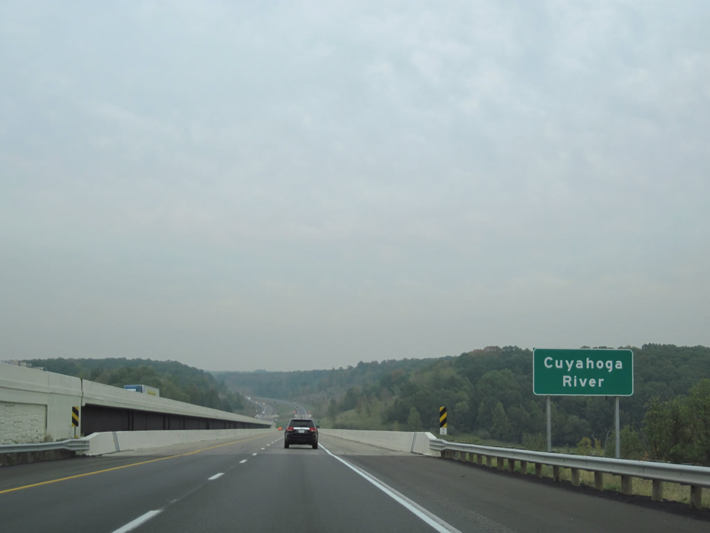
Like all of the other Cuyahoga River freeway bridges, Interstate 271 spans the waterway high above.
Separate bridges carry the north and southbound carriageways of the rural freeway. The northbound and original span opened in 1968. The higher southbound bridge was completed in 2006.
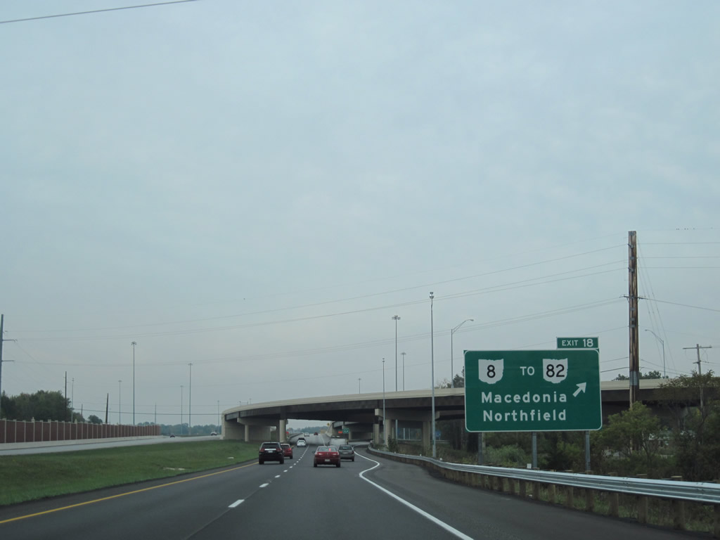
A new wye interchange was added to Interstate 271 at Exit 18 to bring Ohio 8 travelers onto the northbound freeway.
The exchange was constructed ahead of a project to upgrade Ohio 8 to limited access standards from Interstate 271 south to a $47.5-million interchange between Ohio 8 and the Ohio Turnpike (Interstate 80). http://district4sight.com/state-route-8-connection.aspx
Interstate 480 absorbs Ohio 14 east from its split with Interstate 271 south at Oakwood to its eastern conclusion at Streetsboro. The trumpet interchange and access road to Interstate 80 (Ohio Turnpike) represents the end of I-480 as Ohio 14 downgrades from a freeway to an at-grade arterial.
Poorly designed Clearview-fonted signs abound along Interstate 79 in and near Erie. These panels see the lower case letters vertically centered with respect to the Capitalized first letter…
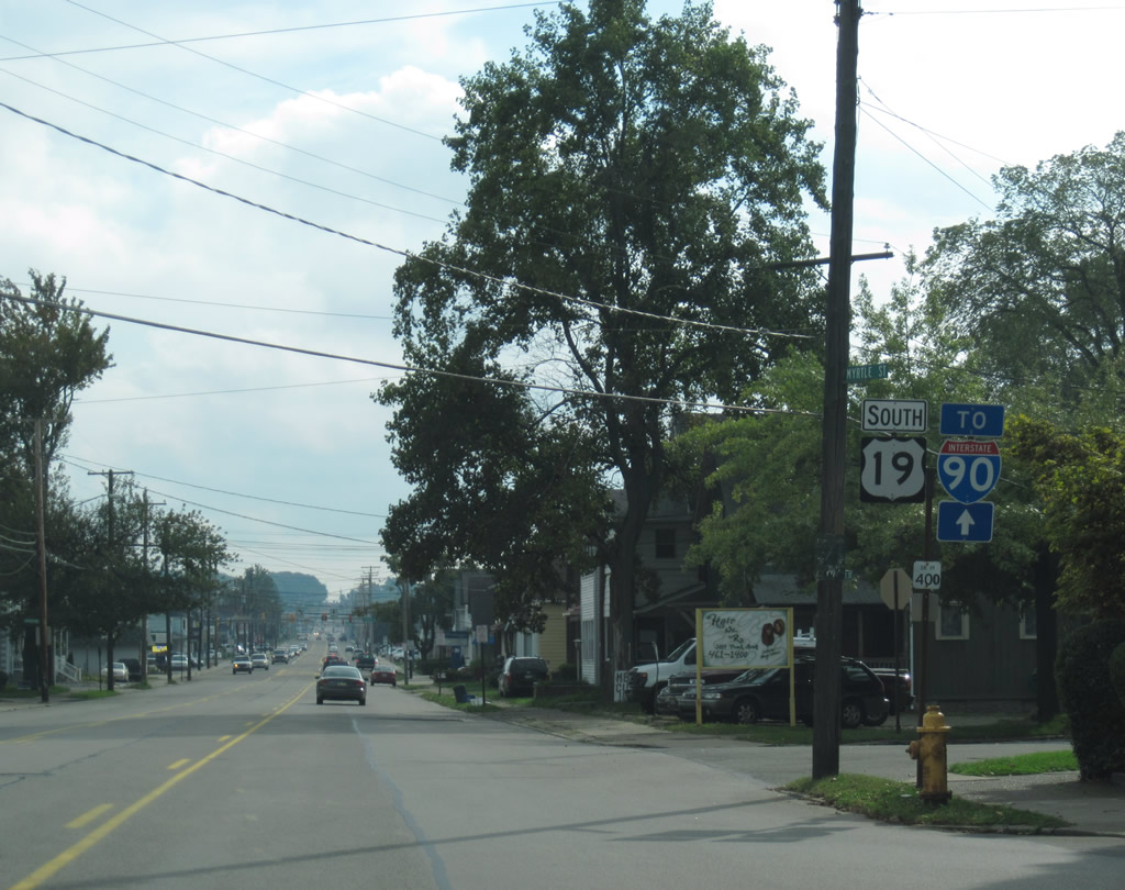
The first southbound shield of U.S. 19, posted along Peach Street south at Myrtle Street in Erie, Pennsylvania.
More Clearview spacing nonsense along Interstate 79 south ahead of Interstate 90.
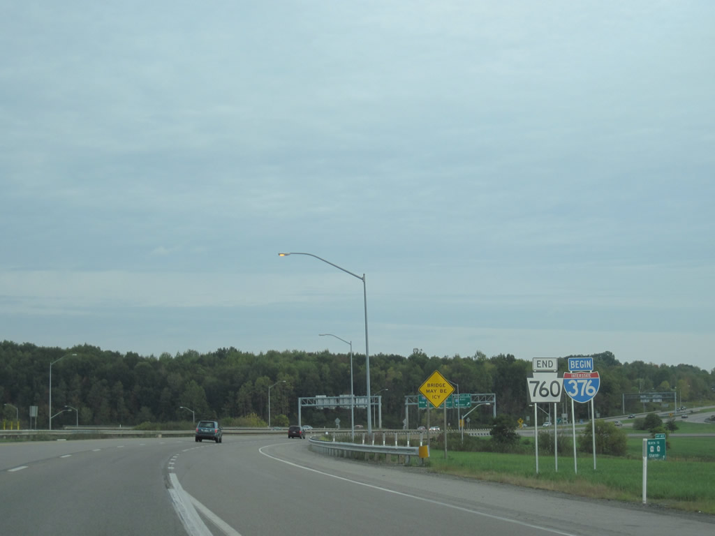
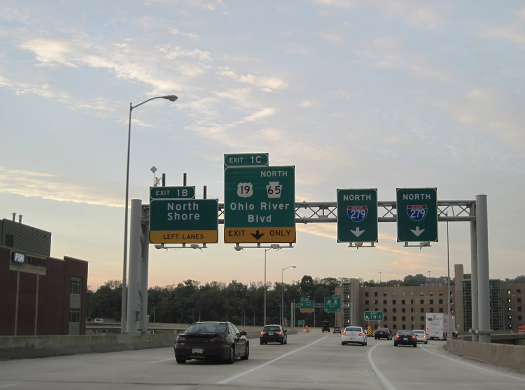
Pennsylvania 760 transitions to I-376.
Interstate 376 begins where Pennsylvania 760 ends at the cloverleaf interchange with Interstate 80 near Sharon. Extended initially in June 2009 to Interstate 79 over the previously signed east-west portion of Interstate 279, Interstate 376 grew to 85 miles in length by November 6, 2009. The north-south route overtook Pennsylvania 60 and Pennsylvania 60 Toll between Interstate 80 and Interstate 79 west of Pittsburgh. This left a segment of Pennsylvania 60 north of Interstate 80 into Sharon, which was redesignated at Pennsylvania 760.
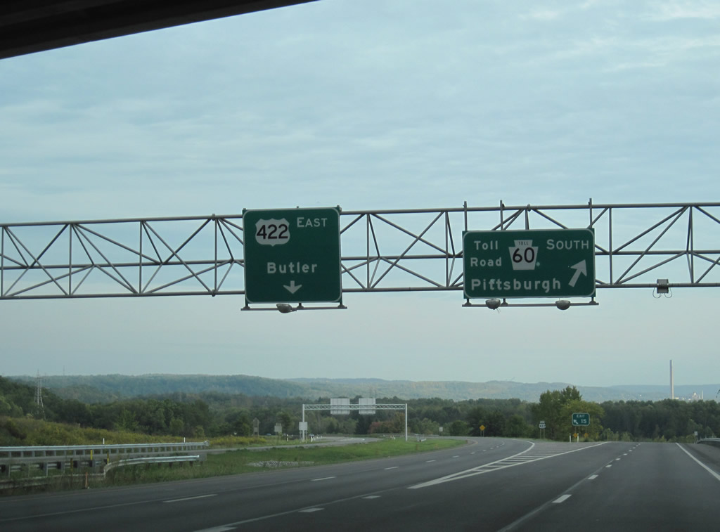
These text-button copy signs are still kicking along Interstate 376 eastbound at U.S. 422 (Exit 12A). This stretch of roadway dates back to 1975.
New sign bridges and guide signs are replacing the originals (this particular sign bridge should be replaced soon) along the New Castle Bypass at the junction with the Beaver Valley Expressway. Interstate 376 overtakes Pennsylvania 60 Toll here.
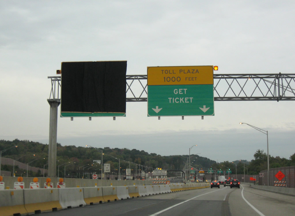
The ticketed system of the Pennsylvania Turnpike begins after Exit 28 and Interstate 79.
Current construction commences at the Warrendale main line Toll Plaza on widening of the four-lane roadway to six overall lanes from the toll plaza to Exit 38 (Pennsylvania 8). Work began on June 9, 2009 and is expected to be completed by late fall of 2012. http://www.paturnpike.com/constructionprojects/mp31to38/home.html
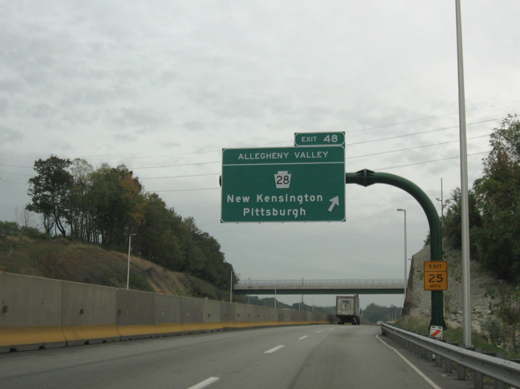
Interstate 76 east at the Allegheny Valley Interchange (PA 28).
Work nearing completion involves the replacement of the Pennsylvania Turnpike Allegheny River Bridge near Exit 48 with Pennsylvania 28. Construction focuses on expanding Interstate 76 between mileposts 46.56 and 49.54 to six overall lanes and improving ramps at the Allegheny Valley Interchange. http://www.paturnpike.com/ConstructionProjects/arb/index.htm The original Allegheny River bridges opened on December 26, 1951 and were removed from service by June 2010.
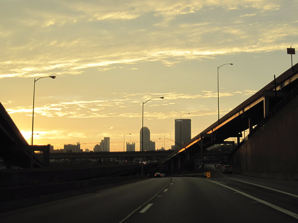
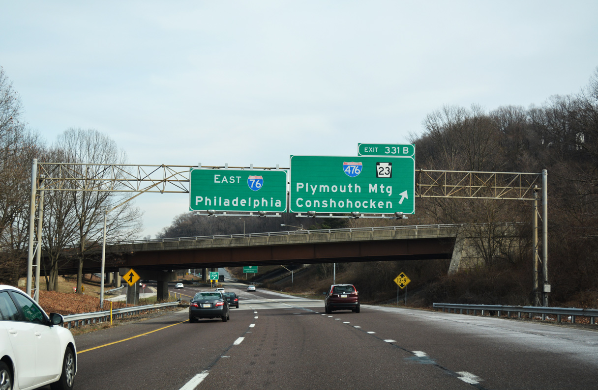
The cloud deck associated with Tropical Storm Nicole’s remnants and a strong cold front gave way to a brilliant sunset west of Pittsburgh. Exit 72B departs in this scene for parallel Boulevard of the Allies to provide access to Interstate 579 north and the Liberty Bridge south.
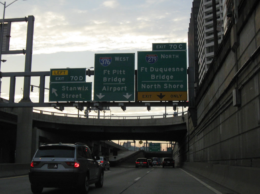
What was originally the west end of Interstate 376 is now the south end of Interstate 279.
Interstate 279 begins and crosses the Fort Duquesne Bridge and quickly meets the northbound beginning of Pennsylvania 65 (Ohio River Boulevard) north to U.S. 19 (West End Bridge).
Night fell soon after wards and after shooting some video in the Steel City, we headed west to Business Loop Interstate 376, the Findlay Connector (Pennsylvania Turnpike 576) and Interstate 376 west to Interstate 76 and Youngstown, Ohio. Sadly while on the drive, we passed by a fatal accident on the eastbound lanes just minutes after it occurred on the Beaver Valley Expressway. http://www.timesonline.com/bct_news/news_details/article/1373/2010/october/01/woman-killed-in-i-376-crash-1.html
Sources:
- Ohio State Route 59 @ Wikipedia.org.
- The Unofficial Ohio State Highways Web Site.
http://pages.prodigy.net/john.simpson/highways/ohhwys.html - “Independence, Broadiew Heights, Brecksville: Interstate 77 North goes to one lane tonight.” Sun Courier, March 24, 2009.
- Interstate 490 (Ohio) @ Wikipedia.org.
- Beechwood: The Book – Chapter 6: The Clark Avenue Freeway & I-271.
- “Construction season kicks off.” The Suburbanite, April 19, 2010.


Enjoy the blog. I have one too, mostly about politics, but with a number of backroads adventures on Kentucky’s highways.
I noticed one picture of the Veterans Bridge in Cleveland denoting US42-South. US42 ends here in Louisville (after beginning in Cleveland) at its intersection with US31E-North, on a map at the intersection of Baxter Avenue, Story Avenue, and E. Main Street.
However, in Kentucky we mark US42 as an East-West highway, not a North-South one.
Thanks.
— Jeff Noble
Regarding the I-271 bridges over the river, neither of them are the original 1960s bridges anymore–both were replaced in the past decade completely. Both were narrow, without much of a shoulder, while the replacements are much wider with full shoulders–all traffic both directions ran on one while the other was completed.
The reason for the difference in height between the two has never been clear to me–I don’t recall the old bridges being nearly so different in height. I guess it has to do with the terrain and angles of the approaches.
Jeff: I know that intersection well (Story/Baxter/Main). I’ve asked KYDoT a couple of times to fully sign the three US Highways there properly, including end/start signage for US 42 in the proper locations. Hope they get around to it!
RE earlier post: US 60 Westbound also passes through the intersection (ending its multiplex with US 42 W which ends here) while US 60 E/US 42 E tracks along E Main St./Mellwood Ave. to Frankfort Ave., where EB and WB US 60 meet.US 42 E continues up Mellwood to Brownsboro Road, rejoining US 42 W and on to Ohio.