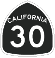
Former State Route 30


This shield assembly for California State Route 30 east preceded the temporary entrance to SR 210. It was posted prior to the completion of the freeway through Rialto and western San Bernardino near Muscoy. Today there is no access between SR 210 and Highland Avenue. - 11/14/2004
Former California 30 used to begin at Interstate 210 at the Glendora Curve interchange (located partially in Glendora and partially in San Dimas) and followed Base Line Road through San Dimas, La Verne, and Claremont, turned north along Mountain Avenue in Upland, turned east again along 19th Street in Upland, and became Highland Avenue in Rancho Cucamonga. California 30 continued east along Highland Avenue from Rancho Cucamonga through Fontana and Rialto before reconnecting with California 259, where California 30 Business continued east through San Bernardino.
Former California State Route 30 Guides

State Route 30 Business - San Bernardino - 36 photos
Prior to completion of the California 210 freeway, eastbound California 30 approaches Lilac Avenue after the Cactus Avenue interchange. This portion of California 30 is not continuous with modern California 210, as the freeway was built almost on top of Highland Avenue through northern Rialto.
11/14/04
Eastbound California 30 approaches Riverside Avenue. An interchange with California 210 is now located here, and this area no longer looks like this due to construction.
11/14/04
California 30 carried four lanes after the Riverside Avenue interchange. This section of California 30 still exists and is in use today. Use California 210 to Exit 71 (Riverside Avenue), take Riverside Avenue south to Easton Street, and turn east on Easton Street. After crossing California 210 freeway, Easton Street changes into this section of Highland Avenue expressway.
11/14/04
Leaving Rialto, eastbound California 30 enters the city of San Bernardino. The expressway carries four lanes over the Lytle Creek Wash. The railroad bridge in the distance (built in 1965) has provisions for the railroad to pass over California 30, California 210, and the creek.
11/14/04
California 30 passes under the Union Pacific Railroad. This bridge, built in 1965, was painted back when the Southern Pacific was an extant railroad company before being absorbed into the Union Pacific Railroad empire.
11/14/04
Eastbound California 30/Highland Avenue meets Macy Street north through Muscoy to Ogden Street and U.S. 66-91-395/Cajon Boulevard.
11/14/04
A trailblazer for California 30 east used to be posted after California Street; this route marker has since been removed.
11/14/04
California 30 used to transition from Highland Avenue onto the freeway at this point. Today, there is no access to the freeway at this point; all access is via State Street and University Parkway. This portion of California 30 might be part of California 30 Business given the elimination of this interchange. Continue straight ahead here for California 30 Business (Highland Avenue) east to San Bernardino.
11/14/04
Westbound Former California 30 approaches Mountain Avenue in Upland. An entrance to the new California 210 freeway is located just north of this intersection on Mountain Avenue.
09/28/02
Freeway entrance shield assembly for westbound California 30 as seen from Fifth Street in Highland.
04/18/04
Photo Credits:
- AARoads: 11/14/04
- Andy Field: 03/15/01, 09/28/02, 04/18/04
Connect with:
Page Updated Sunday January 10, 2010.


