
Clark County Route 215 South and East (Outer Loop)
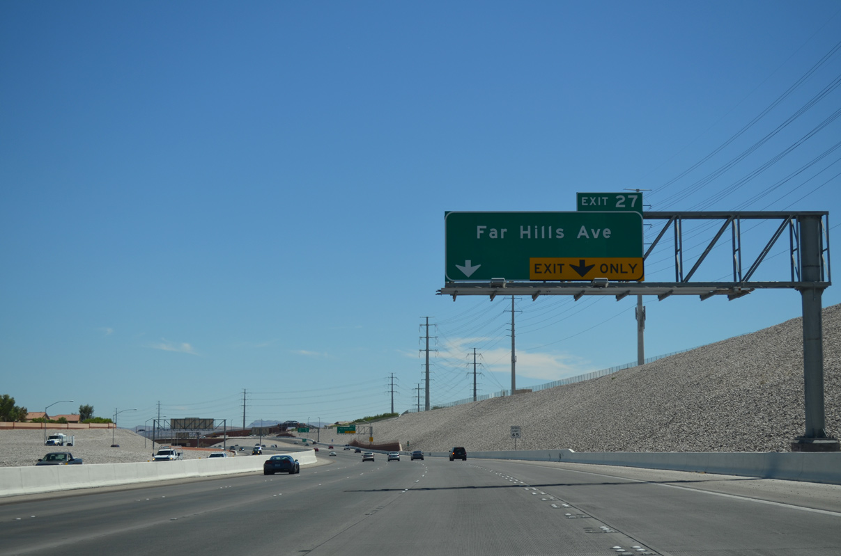
Clark County 215 advances south along the Bruce Woodbury (Las Vegas) Beltway from a parclo interchange (Exit 28) with Summerlin Parkway to meet Far Hills Avenue next.
07/21/14
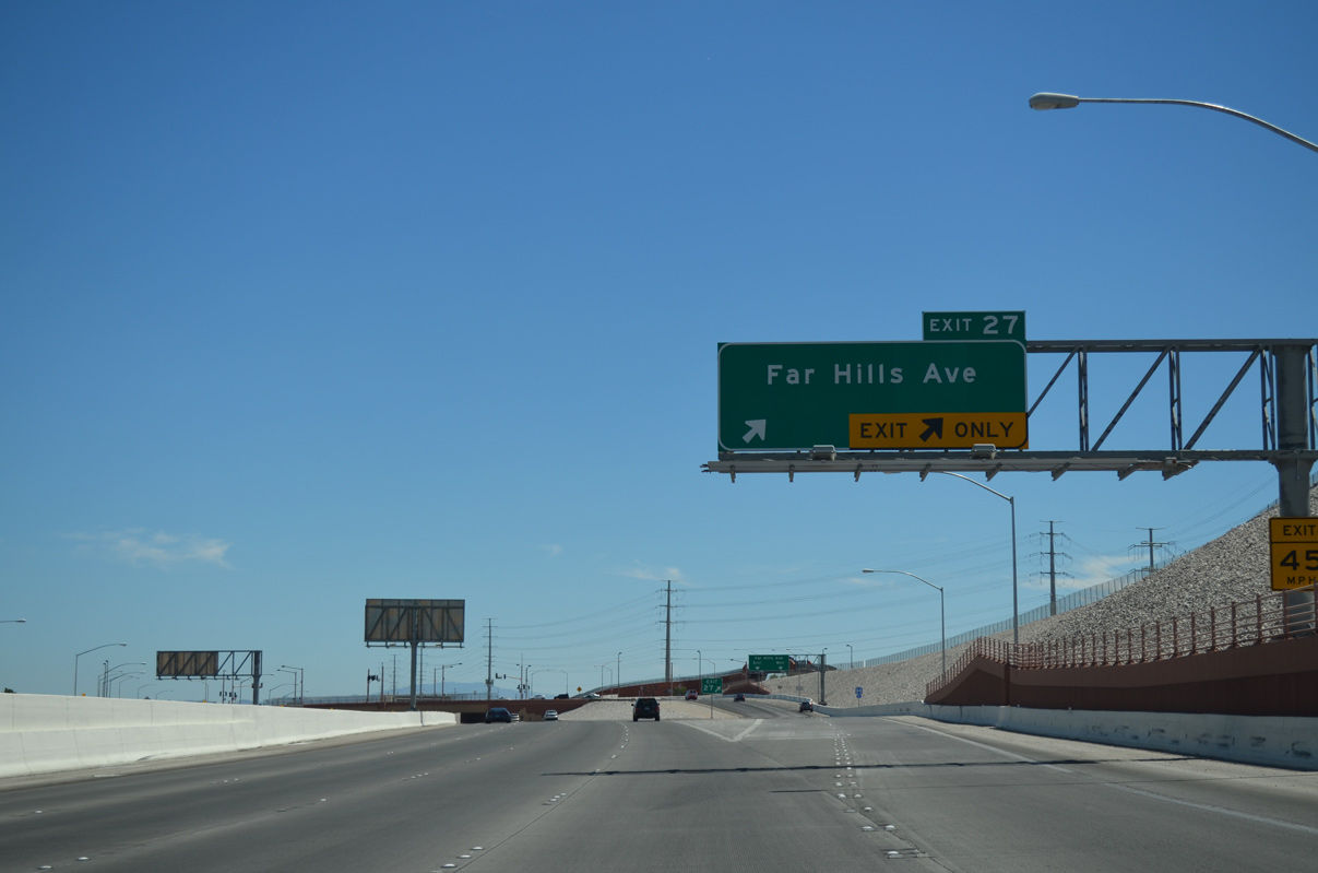
Exit 27 (Far Hills Avenue) joins the Bruce Woodbury Beltway with the Arbor View and Sonoma Hills subdivisions within the Summerlin master planned community. Far Hills Avenue otherwise arcs southeast to meet Town Center opposite Hualapai Way.
07/21/14
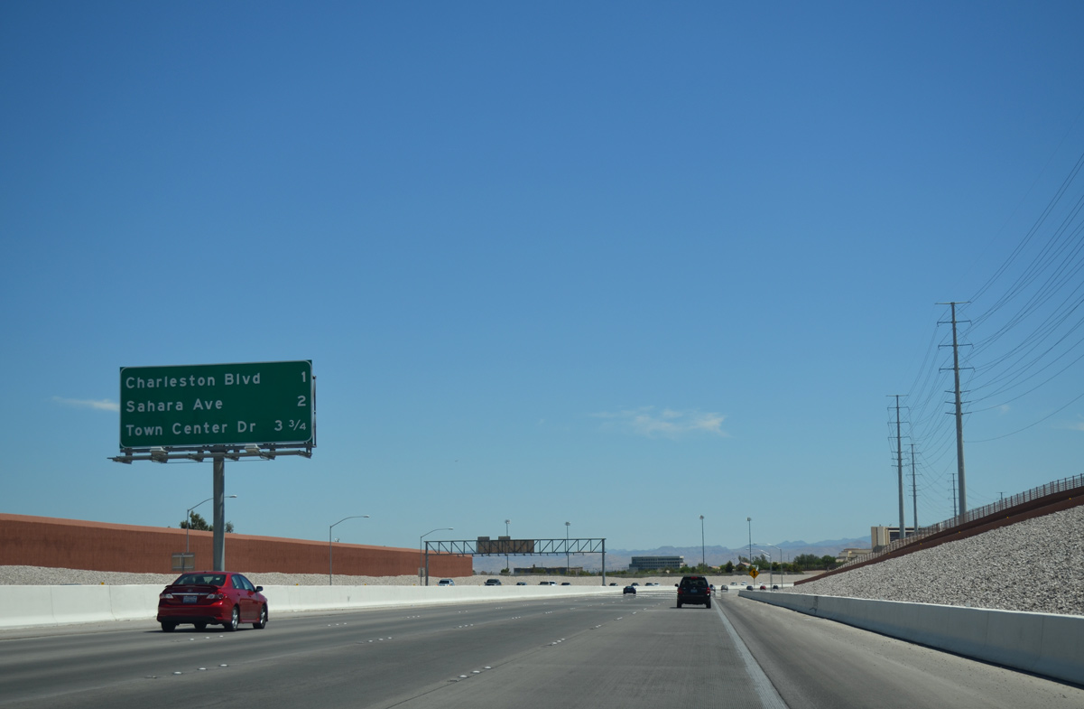
Interchange sequence gantry posted for the next three access points along CC-215 south.
Charleston Boulevard (SR 159) stretches across the central Las Vegas valley one mile ahead while Sahara Avenue joins CC-215 with the northern end of the Las Vegas Strip.
07/21/14
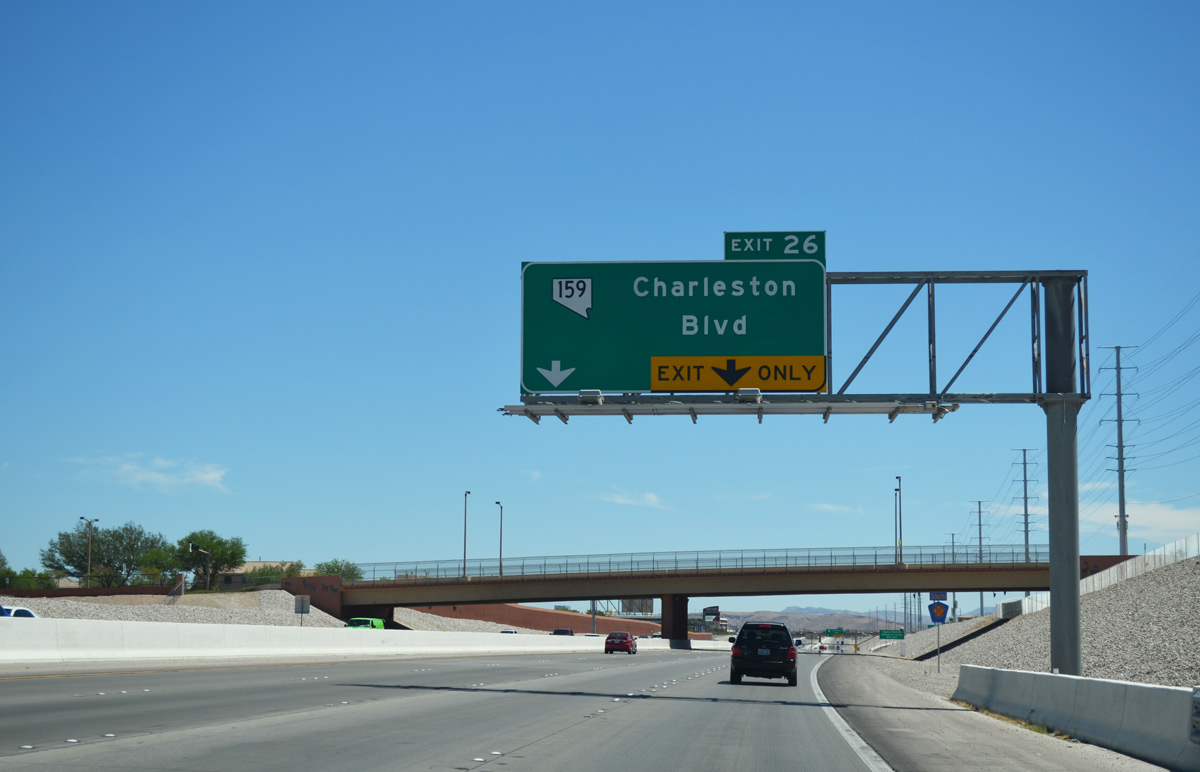
Clark County 215 bends due south on the approach to SR 159 (Exit 26). SR 159 overlays Charleston Boulevard and Blue Diamond Road on a 31.2 mile course through Las Vegas to Red Rock Canyon National Conservation Area and Blue Diamond.
07/21/14
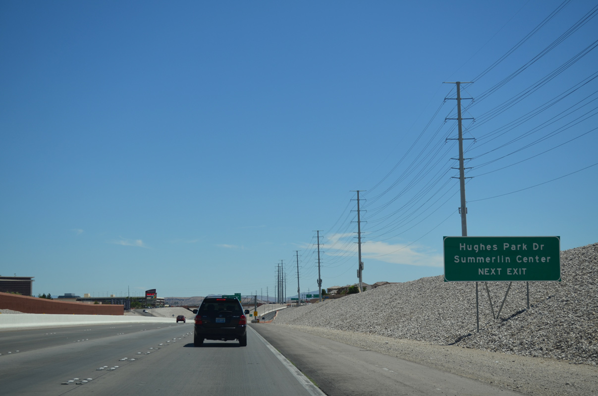
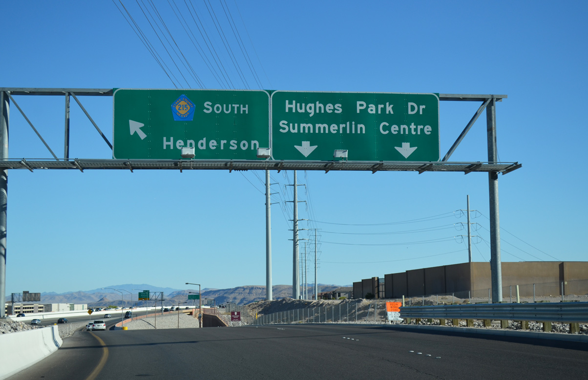
Hughes Park Drive serves as a frontage road between Exit 26 and Exit 25 (Sahara Avenue) connecting CC-215 with Summerlin Centre Drive and the Downtown Summerlin shopping and entertainment complex.
07/21/14
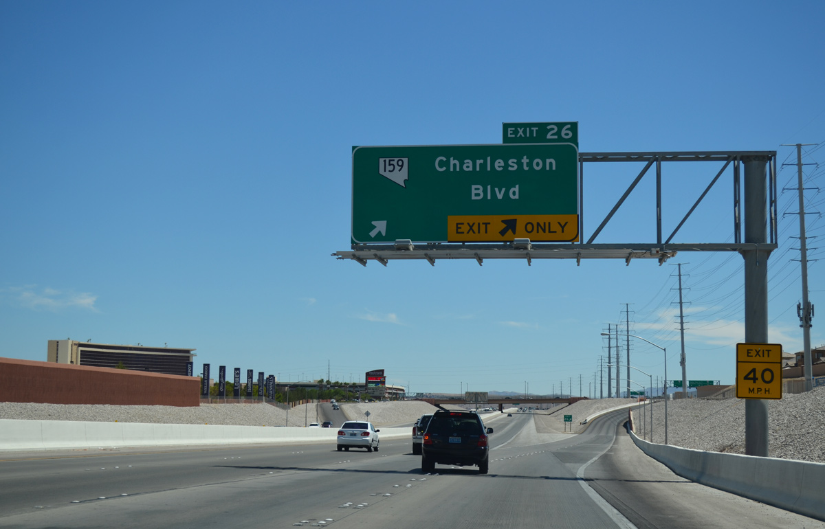
Two lanes separate from the Bruce Woodbury Beltway (CC-215) to Charleston Boulevard (SR 159). Downtown Summerlin lines the east side of CC-215 south of the diamond interchange (Exit 26).
07/21/14
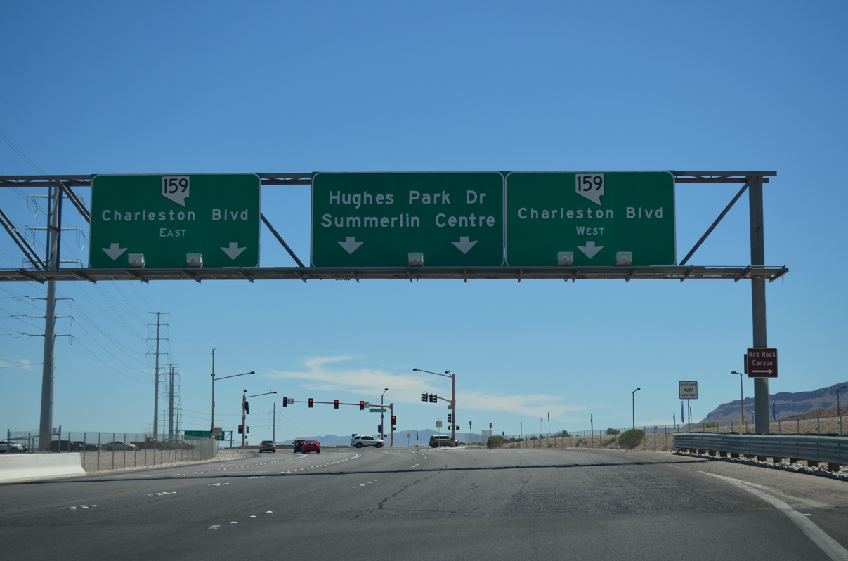
SR 159 follows Charleston Boulevard on a westerly course to the entrance of Red Rock Canyon before looping south and east to SR 160 near Blue Diamond. Several hiking trails line the Red Rock Canyon area as well as a 12 mile driving loop (Scenic Loop Drive).
Charleston Boulevard otherwise continues SR 159 east through Summerlin into Las Vegas along a six lane arterial. Hughes Park Drive continues south from SR 159 to the Downtown Summerlin complex.
07/21/14
A slip ramp leads motorists from SR 159 (Charleston Boulevard) to CC-215 (Bruce Woodbury Beltway) south as Hughes Park Drive departs to Summerlin Centre Drive ahead. Summerlin Centre Drive separates Downtown Summerlin from the Red Rock Casino Resort.
07/21/14
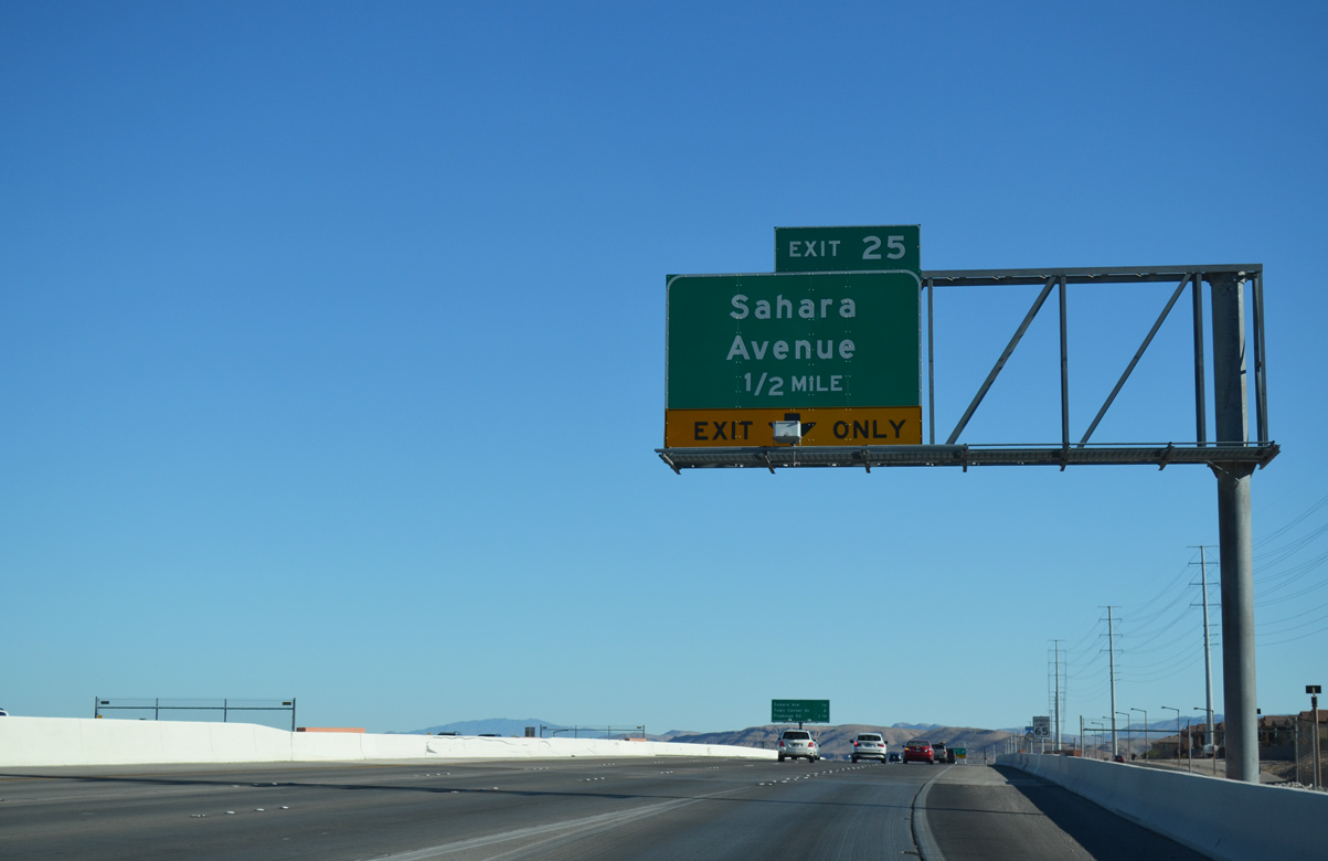
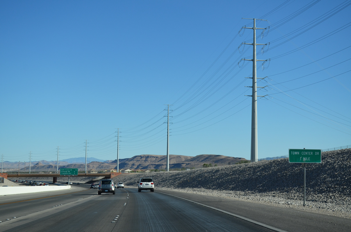
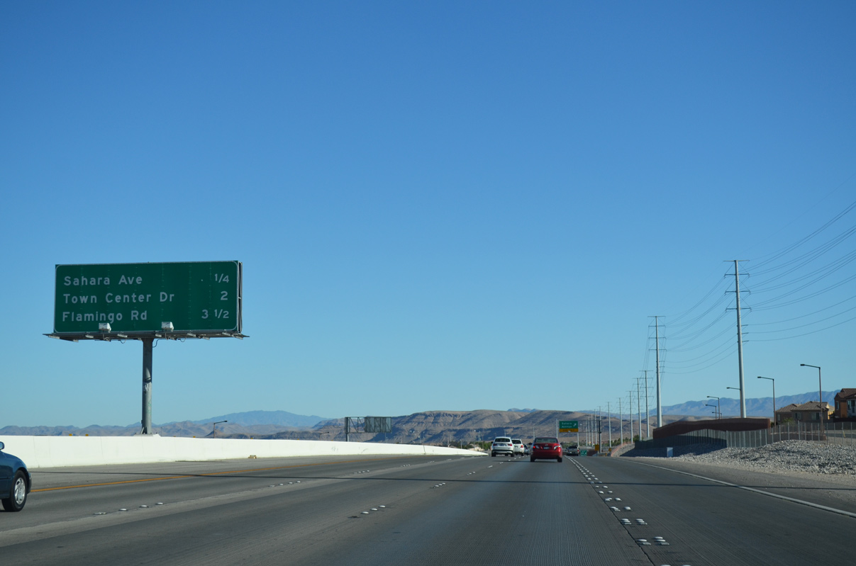
An auxiliary lane joins Clark County 215 south on the one half mile drive to Sahara Avenue (Exit 25). Sahara Avenue connects the beltway with Desert Foothills Drive and Town Center Drive.
07/21/14
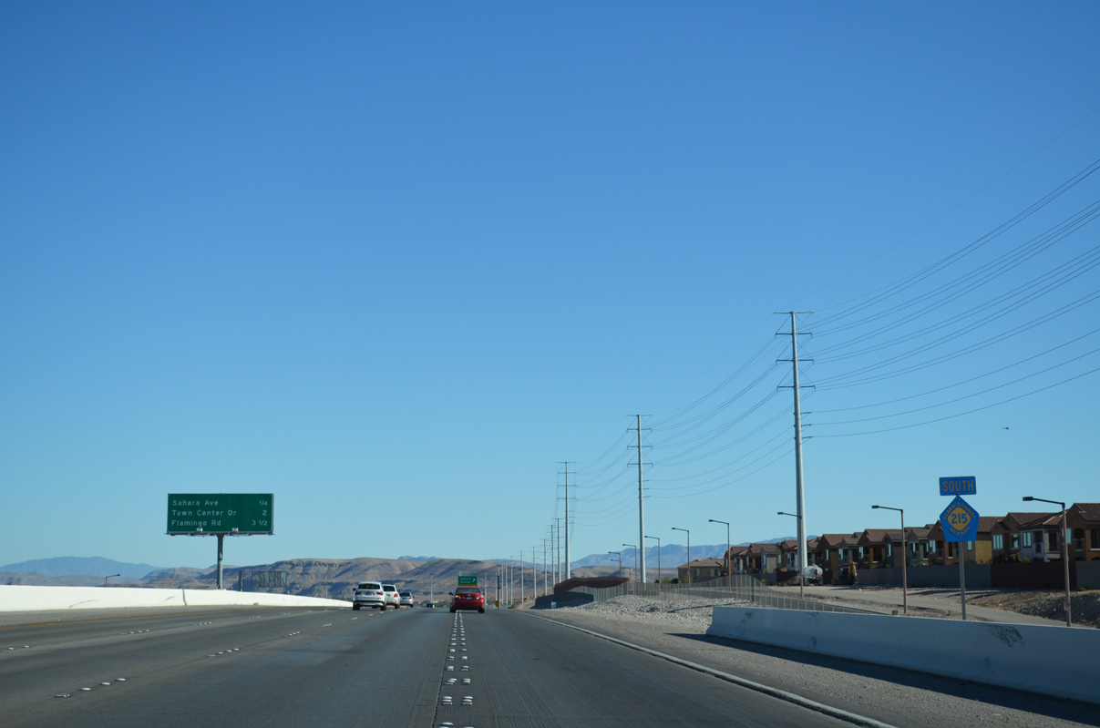
Hughes Park Drive and the West Park/Summerlin Village neighborhood line the western side of CC-215 (Bruce Woodbury Beltway) on the approach to Sahara Avenue.
The beltway curves southeast to meet Town Center Drive (Exit 23) at a single point urban interchange (SPUI) two miles ahead.
07/21/14
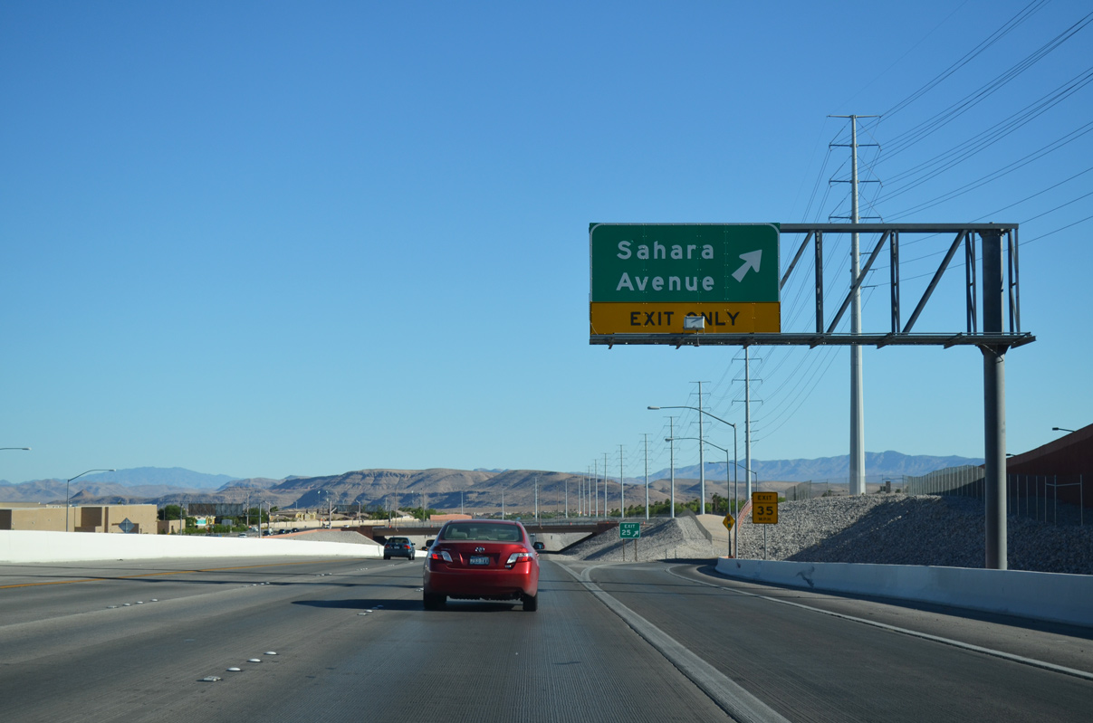
Sahara Avenue (Exit 25) extends 17.3 miles east from the Las Vegas Beltway across the valley to end at Hollywood Boulevard in eastern Las Vegas. Sahara Avenue also doubles as SR 589 between Rainbow Boulevard and Nellis Boulevard (SR 612).
Desert Foothills Drive otherwise continues west and north from the beltway to SR 159 (Charleston Boulevard).
07/21/14
An unnamed mountain chain rises in the distance one mile out from Town Center Drive (Exit 23) along CC-215 south.
07/21/14
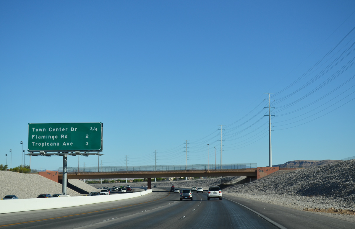
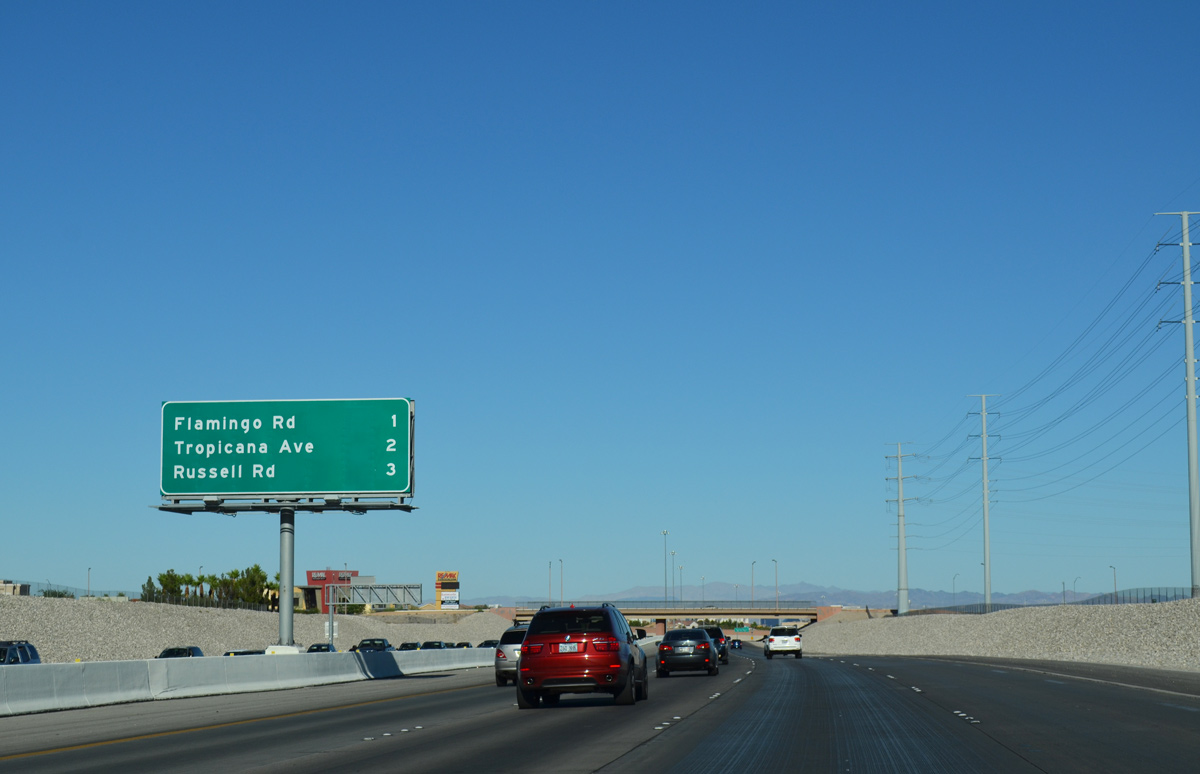
Desert Inn Road spans the Bruce Woodbury Beltway 0.75 miles ahead of Exit 23 (Town Center Drive). Flamingo Road (Exit 21) and Tropicana Avenue (Exit 20) both serve interests to the Las Vegas Strip.
07/21/14
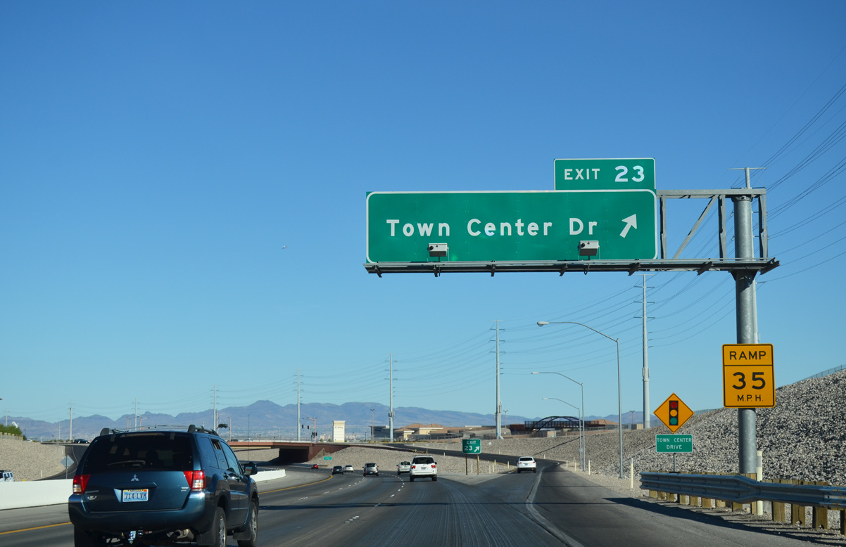
Locally, Town Center Drive (Exit 23) travels north from CC-215 through the Gardens neighborhood to Desert Inn Road. To the south, Town Center Drive continues to South Square and Siena before turning east for a return to the beltway along Tropicana Avenue.
07/21/14
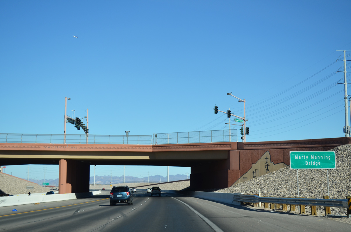
The span that carries Town Center Drive over Clark County 215 is named in honor of Marty Manning, a former Public Works director for Clark County. During Manning's tenure, he oversaw primary construction efforts of the entire Bruce Woodbury Beltway.1
07/21/14
Traffic advances southward along CC-215 (Bruce Woodbury Beltway) to meet Flamingo Road (Exit 21) next.
07/21/14
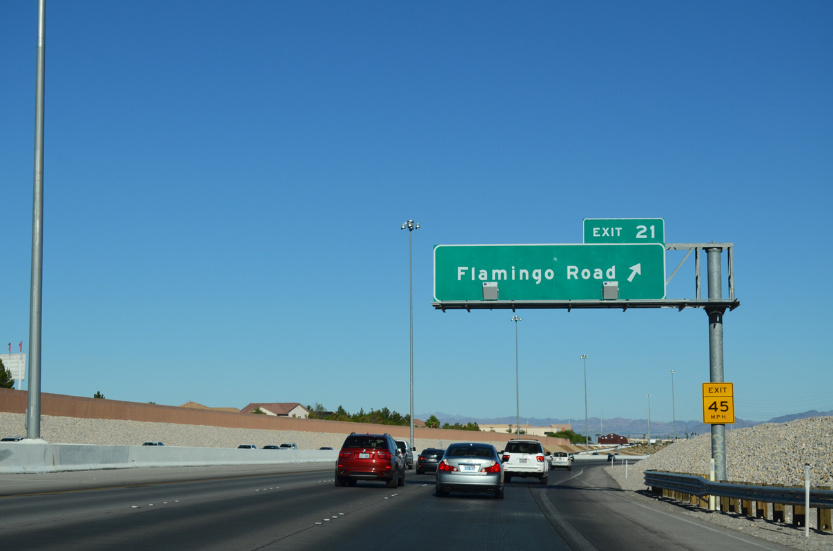
Motorists depart a one lane ramp to Exit 21 (Flamingo Road). Flamingo Road extends west to Haulapai Way and east to Spring Valley and the heart of the Las Vegas Strip.
07/21/14
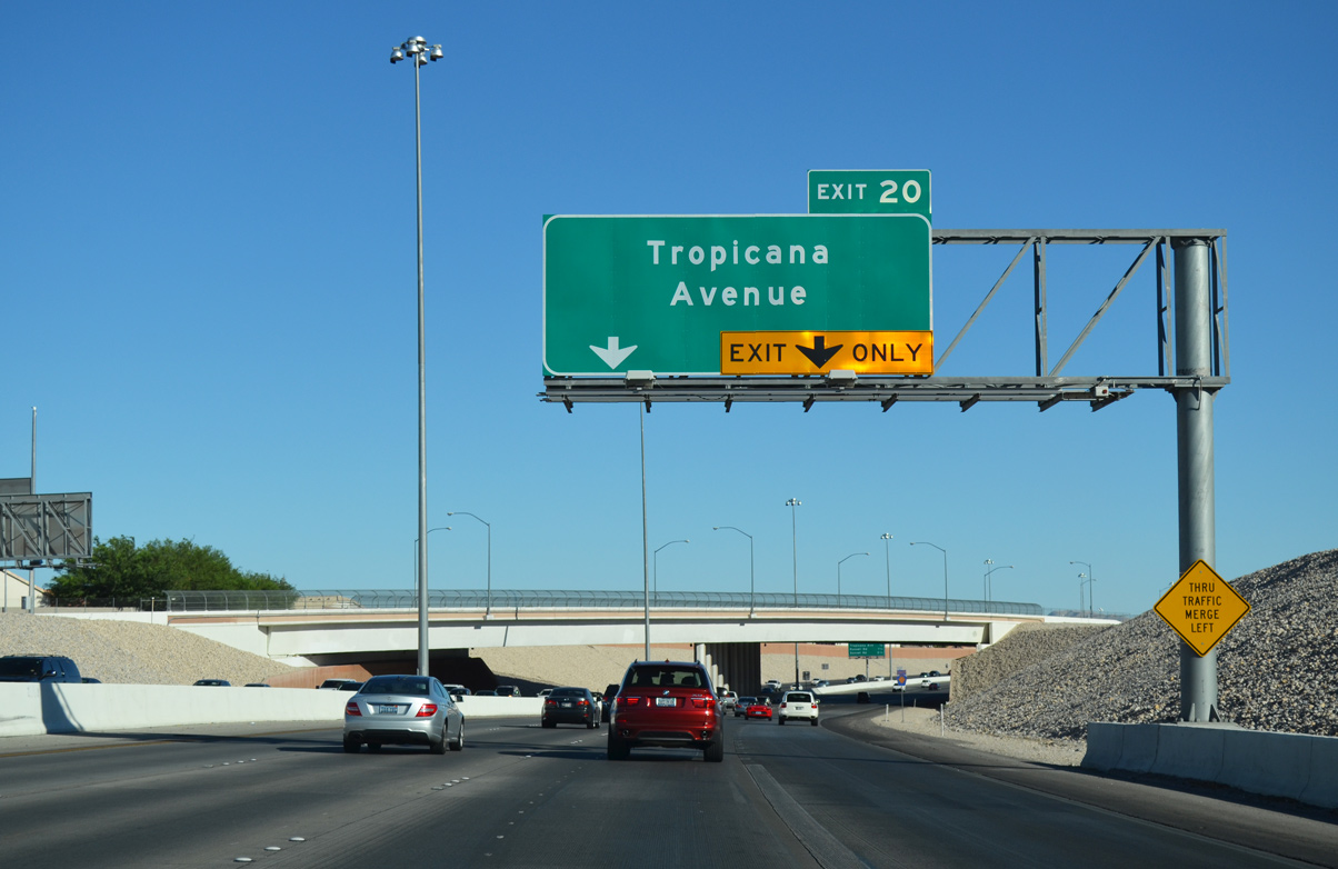
Tropicana Avenue stretches 16.4 miles across Spring Valley, Paradise, and Henderson, connecting with Clark County 215 south at a diamond interchange one half mile ahead.
07/21/14
Fort Apache Road arcs over the Bruce Woodbury Beltway ahead of the ramp to Tropicana Avenue (Exit 20).
07/21/14
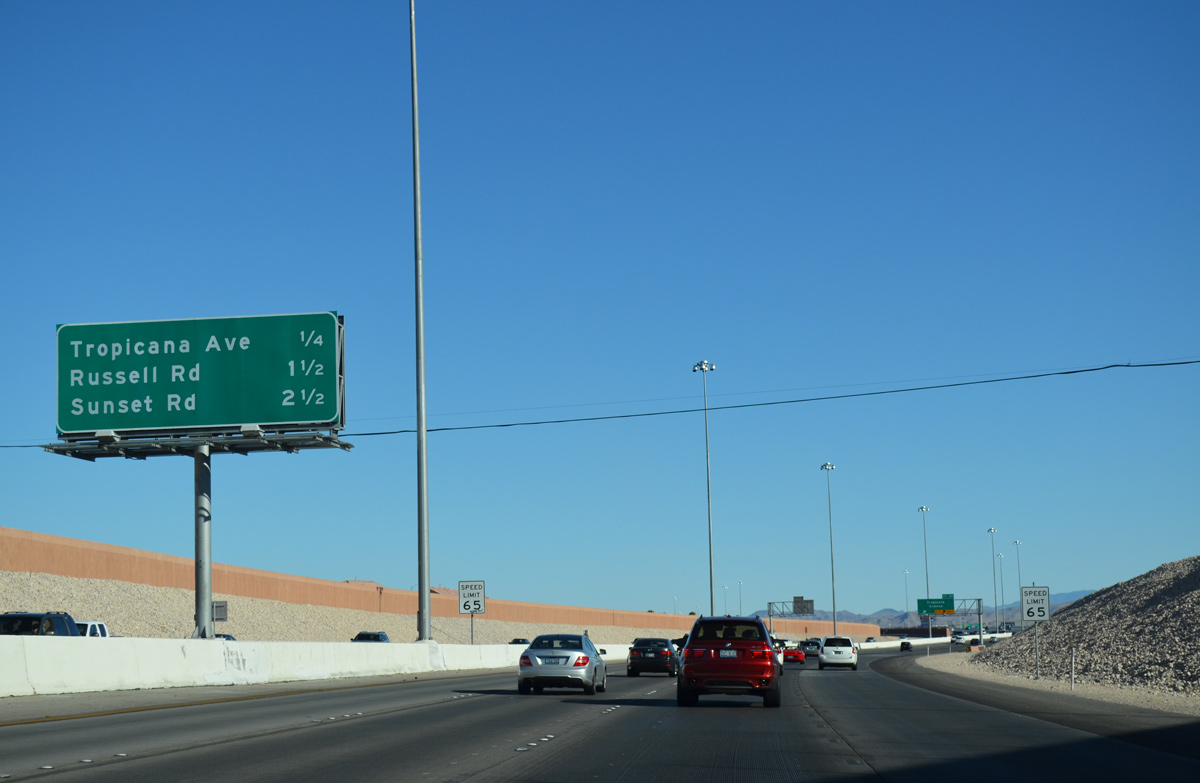
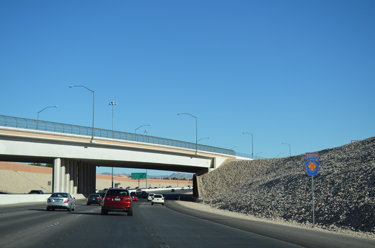
2.5 miles separate motorists along southbound CC-215 from Sunset Road (Exit 18). The Las Vegas Beltway curves east beyond that point for Interstate 15 and McCarran International Airport (LAS).
07/21/14
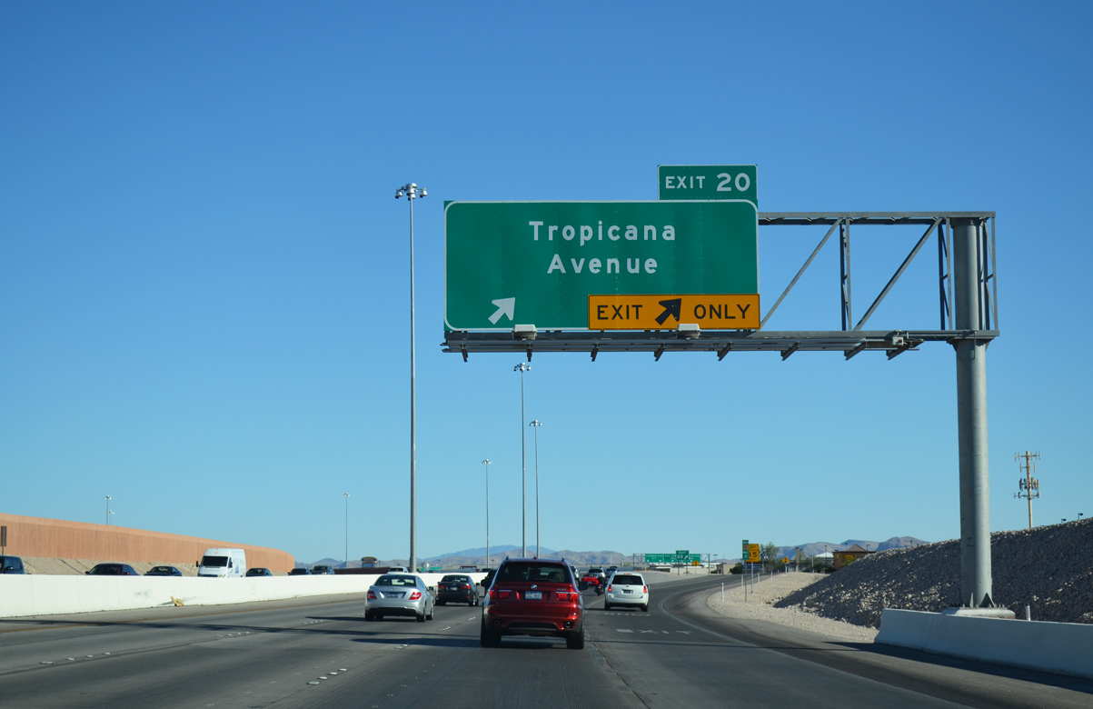
Traffic departs for Tropicana Avenue (Exit 20) east to Spring Valley and the Strip. SR 593 joins the six lane arterial between I-15 and SR 582 (Boulder Highway) near Henderson.
Tropicana Avenue otherwise extends west 1.7 miles to Town Center Drive.
07/21/14
A slip ramp joins southbound CC-215 from Jerry Tarkanian Way (frontage road) as the freeway bends to meet Russell Road. A frontage road system continues along CC-215 south and east to Decatur Boulevard (Exit 13).
07/21/14
CC-215 south toggles between three to four travel lanes throughout its remaining course to Interstates 15 and 215 (Exit 12).
07/21/14
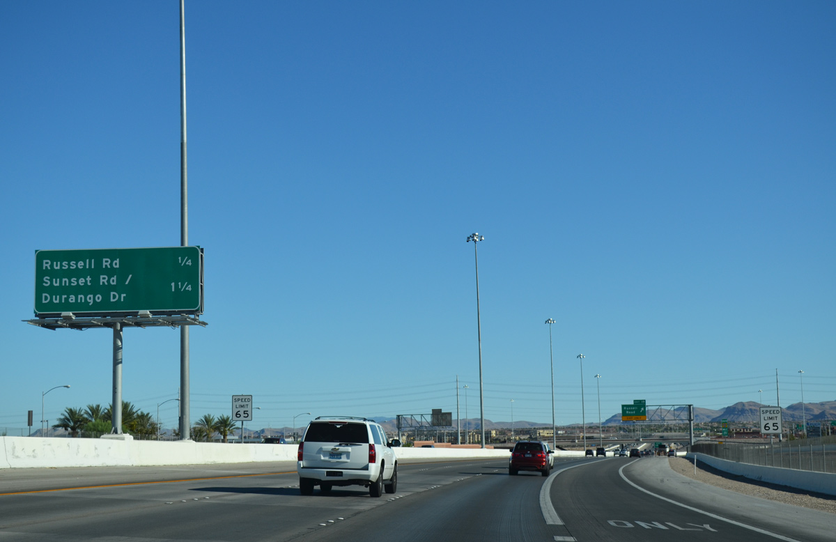
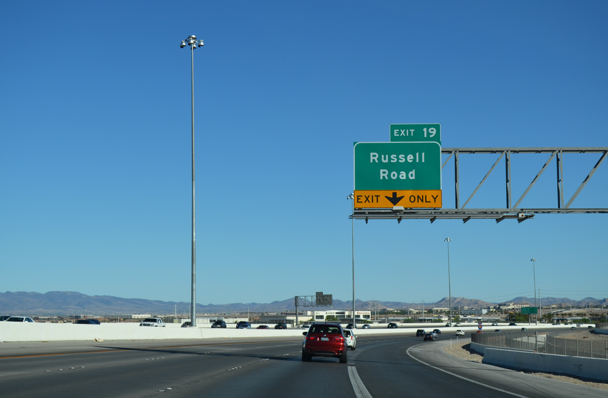
Russell Road runs east from the Bruce Woodbury Beltway in one quarter mile to Las Vegas Boulevard opposite McCarran International Airport.
07/21/14
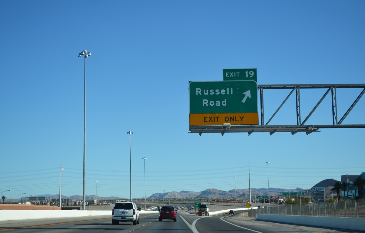
A single lane ramp shuttles motorists between CC-215 south to Jerry Tarkanian Way and Russell Road (Exit 19). Russell Road stems west to the southern neighborhoods of Summerlin beyond Haulapai Way and east to Durango and Buffalo Drive in Spring Valley.
07/21/14
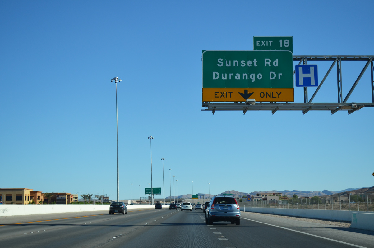
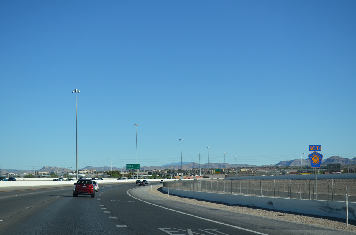
Traffic advances south along the Bruce Woodbury Beltway 0.3 miles to Sunset Road and Durango Drive. Southern Hills Hospital lies to the west of the interchange at Fort Apache Road.
07/21/14

This confirming marker is posted ahead of the departure to Sunset Road (Exit 18).
07/21/14
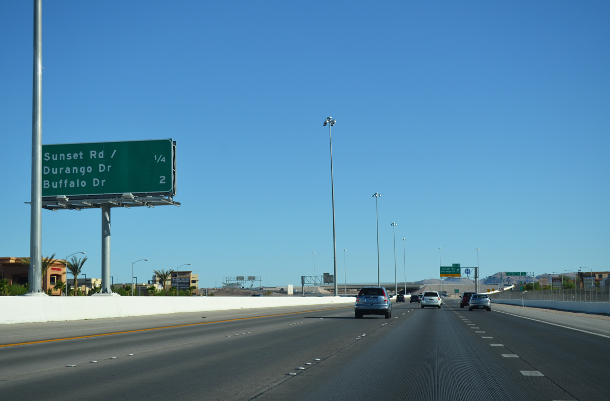
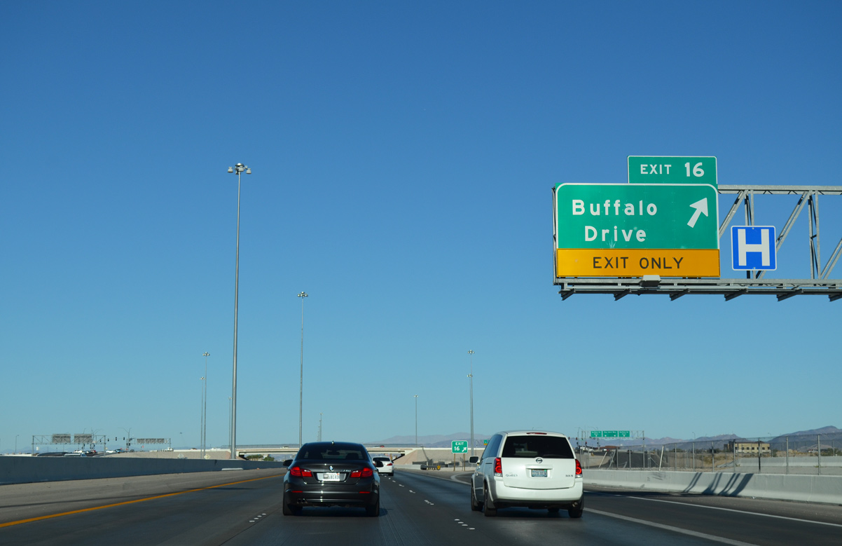
Exit 16 (Buffalo Drive) joins Clark County 215 south with western reaches of Enterprise two miles ahead.
07/21/14
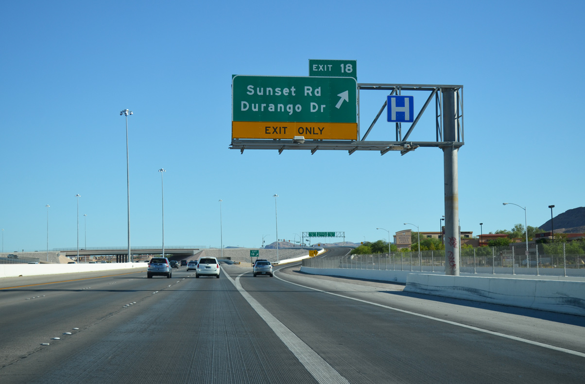
Drivers leave for the frontage road (Roy Horn Way) to Sunset Road (Exit 18). Sunset Road overall travels 18.3 miles between the Cliffs village of Summerlin and Henderson. Roy Horn Way continues 0.7 miles to connect with Durango Drive as the Bruce Woodbury Beltway arcs east toward Henderson.
07/21/14
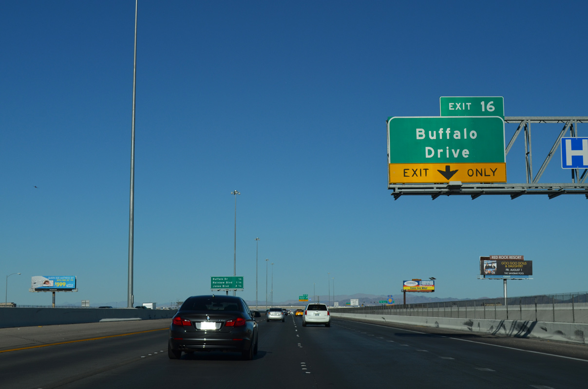
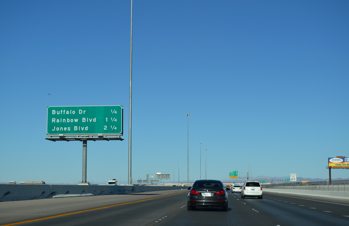
Clark County Route 215 (Bruce Woodbury Beltway) runs due east on the initial approach to Buffalo Drive (Exit 16). Buffalo Drive travels north to Hacienda Avenue and south to SR 160 (Blue Diamond Road).
07/21/14
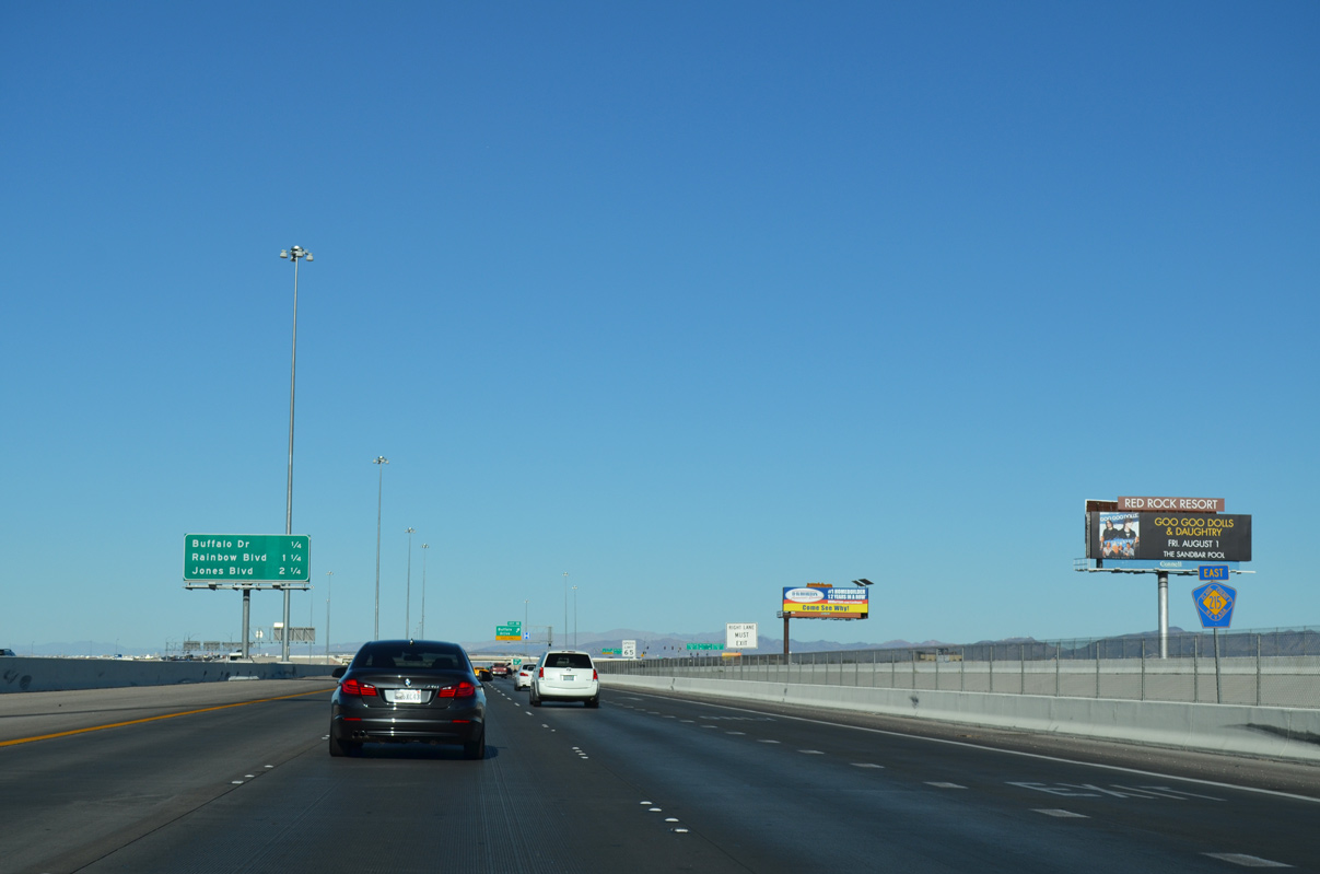
CC-215 east bisects unoccupied lands between Durango Drive and upcoming Buffalo Drive.
07/21/14
Interchanges occur every mile along this stretch of Clark County 215 east to the systems exchange with Interstates 15-215 (Exit 12), locally dubbed the Fish Bowl interchange.
07/21/14
Eastbound motorists reach the ramp to Exit 16 (Buffalo Drive). Close to CC-215 the local arterial stems south to meet Warm Springs Road and north to Sunset Road.
07/21/14
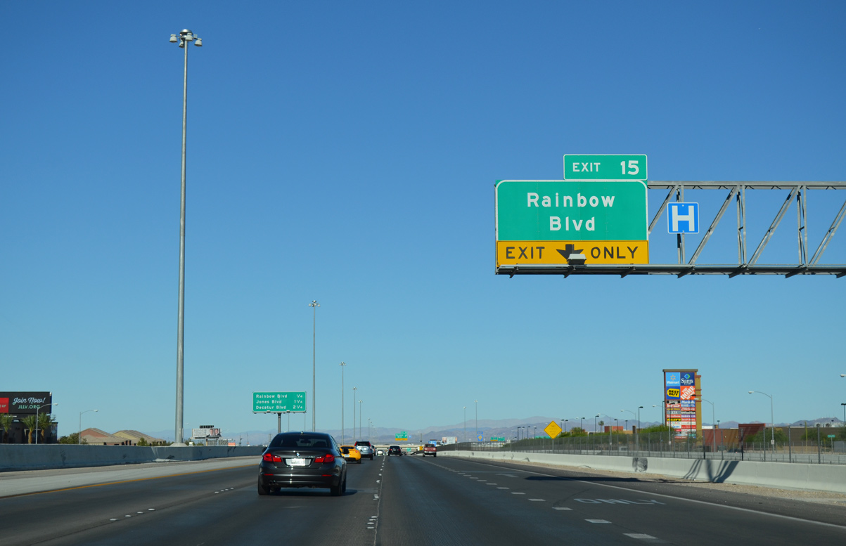
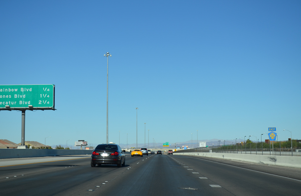
The Bruce Woodbury Beltway passes north of The Arroyo Market Square big-box retail center en route to Rainbow Boulevard (Exit 15). Rainbow Boulevard is a major thoroughfare extending north to Spring Valley and U.S. 95 (Oran K. Gragson Freeway) at Summerlin Parkway.
07/21/14
Exit 13 departs for Decatur Boulevard in 2.25 miles, ahead of the Fish Bowl interchange with I-15 and I-215.
07/21/14
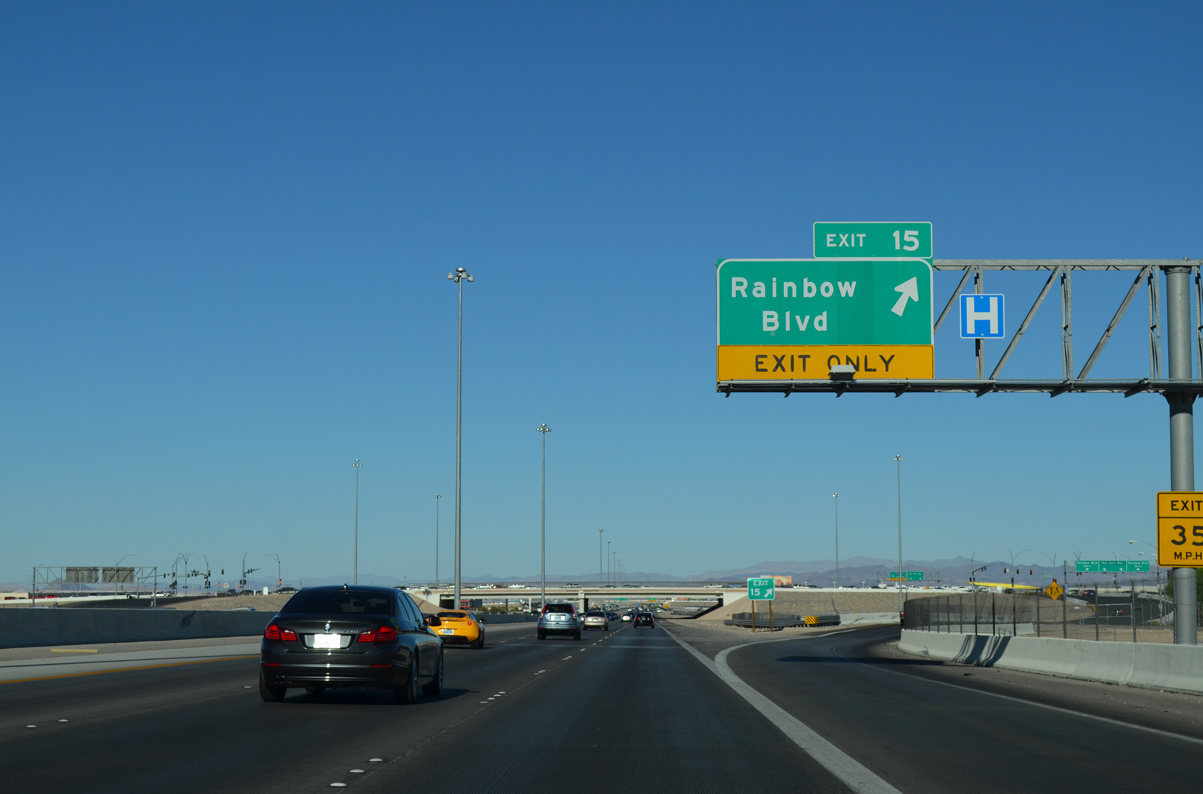
A slip ramp connects to Roy Horn Way ahead of Rainbow Boulevard (Exit 15). Rainbow Boulevard travels three miles south to meet SR 160 (Blue Diamond Road) near the center of Enterprise.
07/21/14
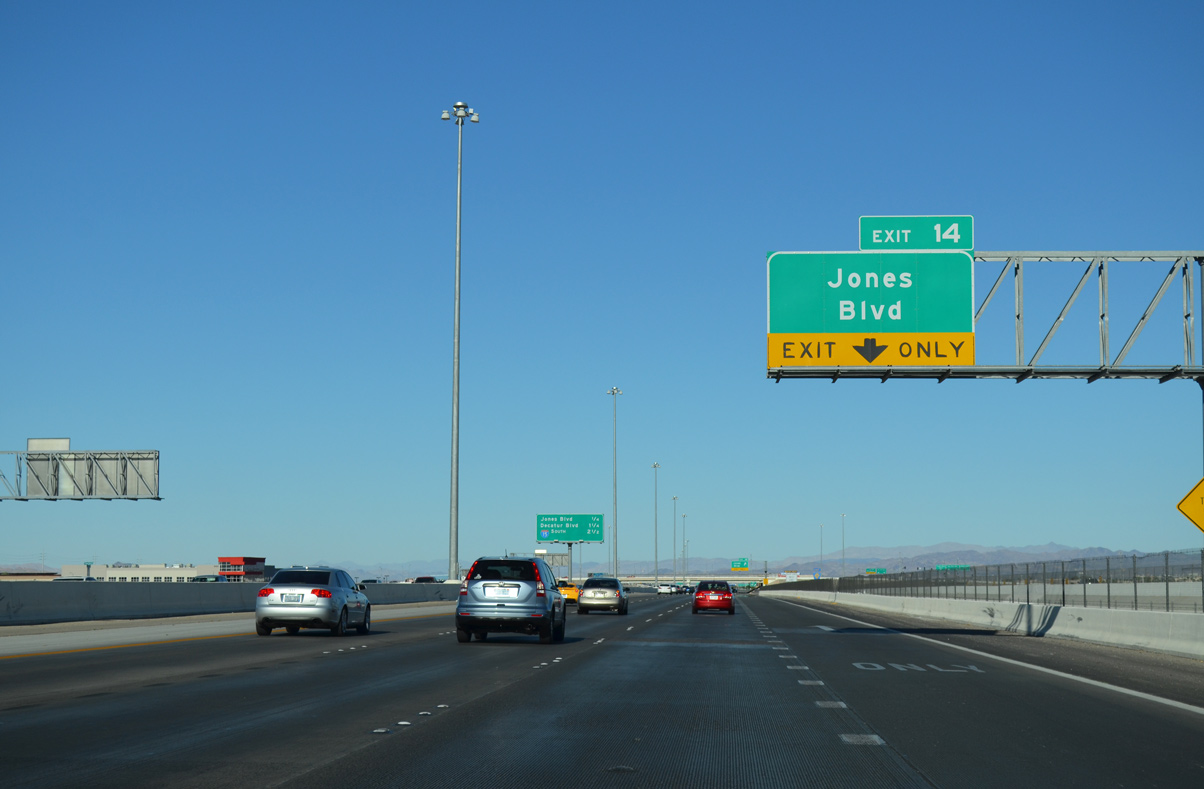
Jones Boulevard (Exit 14) meets the Bruce Woodbury Beltway next at a diamond interchange.
07/21/14
Interstate 215 overlays the Bruce Woodbury Beltway to Henderson beyond the Interstate 15 systems interchange 2.5 miles ahead.
07/21/14
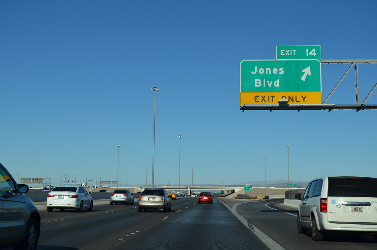
Jones Boulevard (Exit 14) follows a northerly course through Spring Valley to Flamingo Road and south to Windmill Lane.
07/21/14
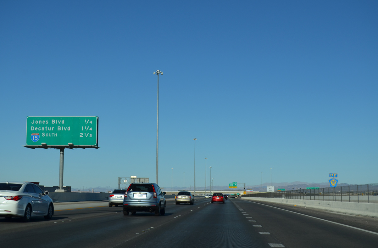
One half mile separates the ramps between Jones Boulevard (Exit 14) and the approaching Decatur Boulevard (Exit 13).
07/21/14
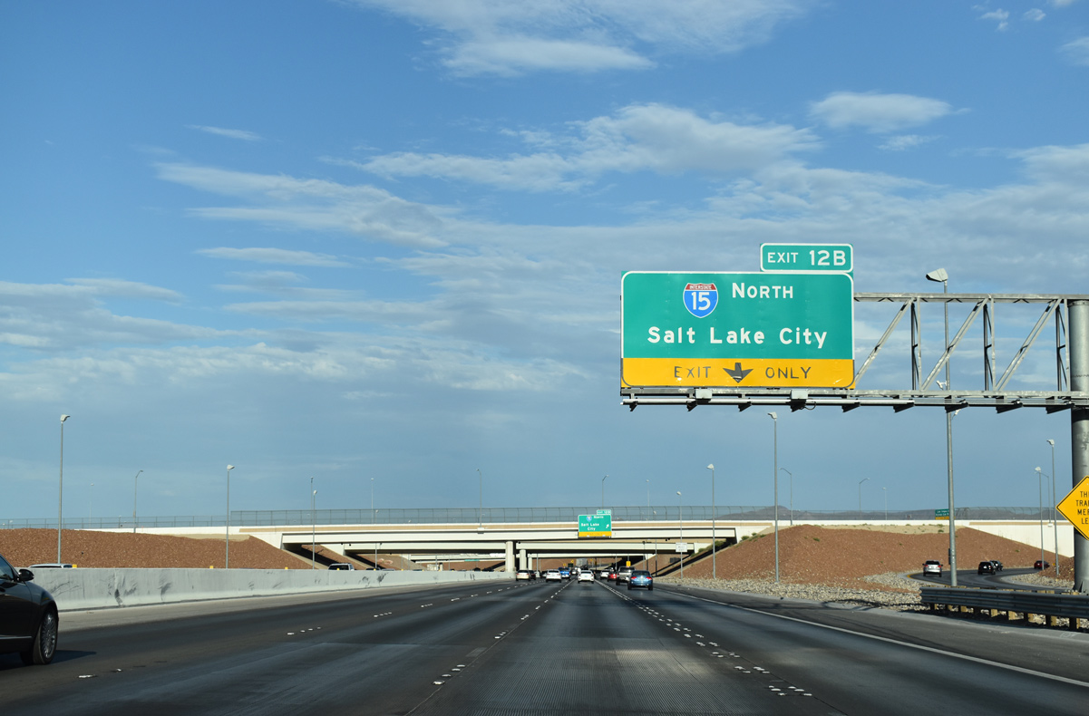
A pair of ramps joins the Las Vegas Beltway (CC-215) with Interstate 15 north (Exit 12B) and south (Exit 12A) at the exchange ahead. I-15 south leads to Primm at the California border while I-15 carries motorists north to Downtown Las Vegas.
07/21/14
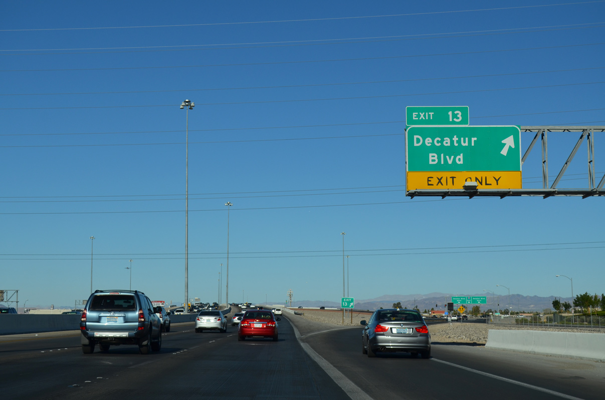
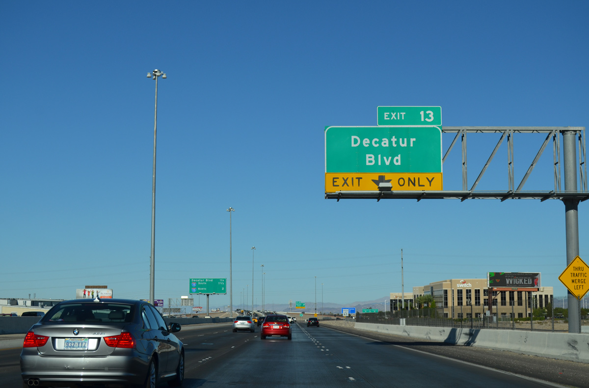
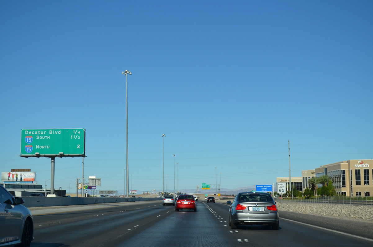
Traffic leaves for Decatur Boulevard (Exit 13) along Clark County 215 east. Decatur Boulevard represents another major north-south arterial in the Las Vegas region, following a linear path from Southern Highlands Parkway in southeast Enterprise to Rancho Drive (SR 599) in North Las Vegas.
07/21/14
The Bruce Woodbury Beltway kinks southeast on the initial approach to I-15 (Exits 12AB) and the Fish Bowl interchange. The Airport Connector (SR 171) joins the beltway with McCarran International Airport (LAS) in two miles.
07/21/14
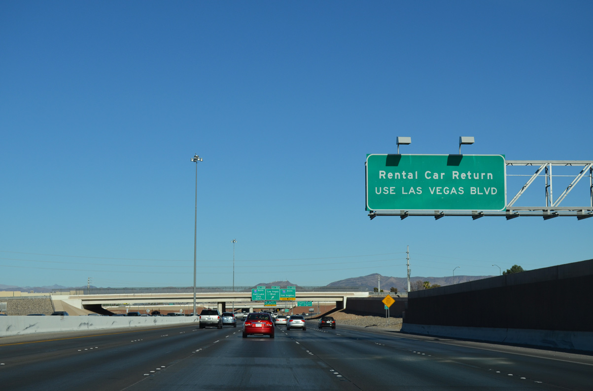
Motorists bound for the McCarran Rent-A-Car center are advised to depart ahead at Exit 12A to Interstate 15 south and Las Vegas Boulevard. The center houses several car rental agencies and is located on Gilespie Street two blocks east of Las Vegas Boulevard.
07/21/14
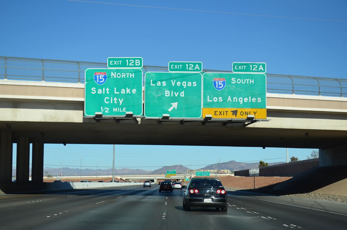
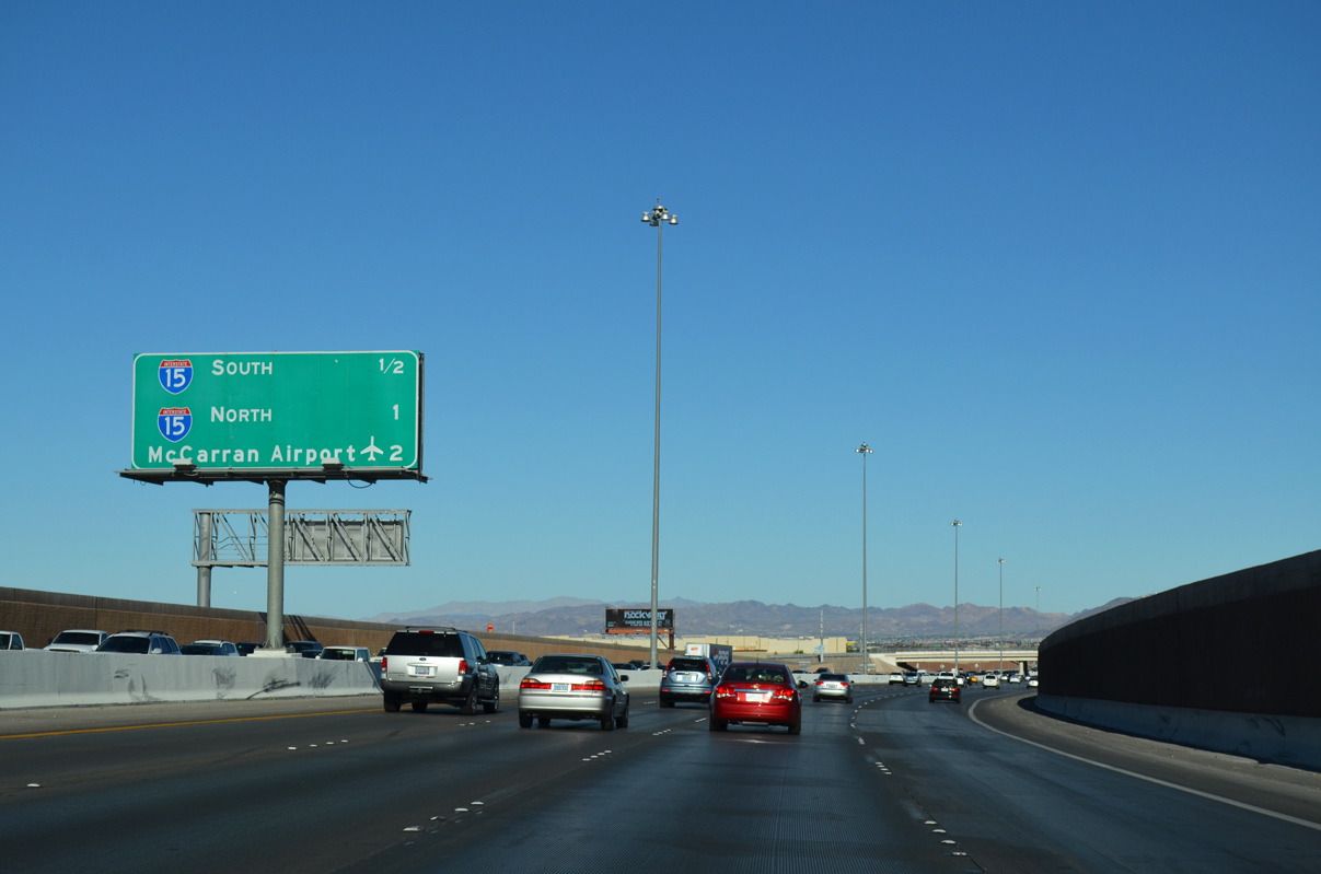
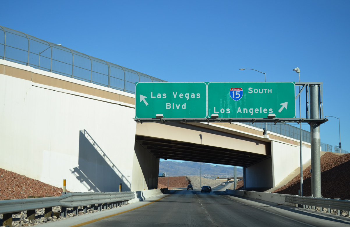
Valley View Boulevard spans CC-215 as traffic leaves in unison for Interstate 15 south and Las Vegas Boulevard (Exit 12A). I-15 travels southwest from Las Vegas to Barstow and Victorville before entering the greater Los Angeles metro area.
Las Vegas Boulevard extends north from the beltway to the Las Vegas Strip and south to Sloan.
07/21/14
Traffic partitions ahead of a ramp split for I-15 south to Primm and Las Vegas Boulevard. A separate ramp joins eastbound Clark County 215 with Interstate 15 north to Downtown Las Vegas ahead. I-15 travels northeasterly from Las Vegas toward St. George and Salt Lake City, Utah.
07/21/14
07/06/18
Dean Martin Drive bends around the western extent of the Fish Bowl interchange as ramps shuttle traffic to Interstate 15 south and to Las Vegas Boulevard.
07/21/14

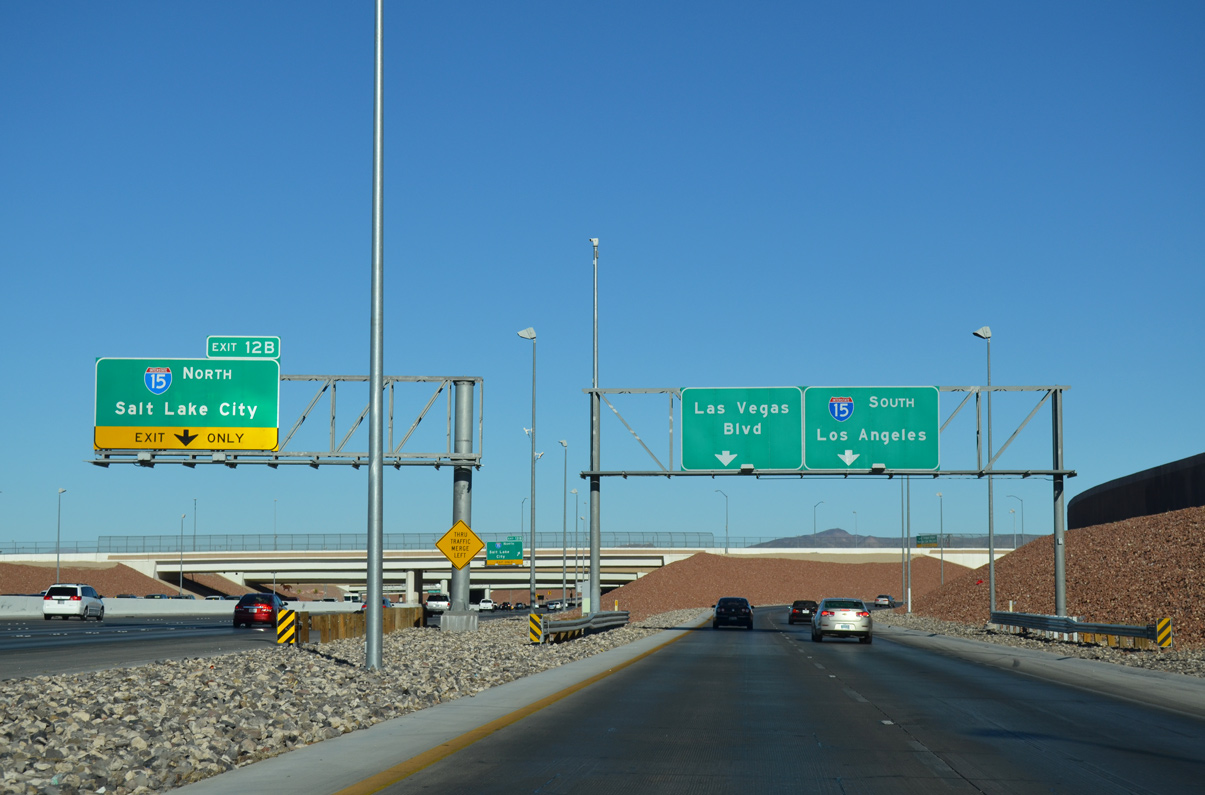
A loop ramp joins CC-215 east with Interstate 15 north at Exit 12A. I-15 travels north from the Fish Bowl interchange providing four direct connections with the Las Vegas Strip before continuing to downtown. Salt Lake City otherwise lies 428 miles northeast of the exchange.
CC-215 officially concludes here while Interstate 215 continues along the Bruce Woodbury Beltway, ending 12 miles ahead at a systems exchange with I-11 and I-515.
07/06/18
References:
- "Manning retires as county Public Works director",Las Vegas Sun, July 6, 2005.
Photo Credits:
- Alex Nitzman: 07/21/14
- Brent Ivy: 07/06/18
Connect with:
Page Updated Saturday June 30, 2018.