
State Road 100
State Road 100 angles northwest from Flagler Beach to Lake City across North Florida. Within Flagler County, SR 100 runs 26.29 miles, connecting Bunnell with SR A1A along the Atlantic Ocean to the east and with the Putnam County seat of Palatka to the northwest. This includes a 0.42 mile overlap with U.S. 1 through Bunnell.
Florida State Road 100 Guides
East

Lake City to Starke - 61 photos
Keystone Heights to Palatka - 57 photos
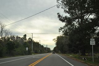
Bunnell to Flagler Beach - 24 photos
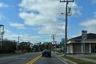
West

Flagler Beach to San Mateo - 58 photos
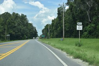
Palatka to Keystone Heights - 31 photos
Keystone Heights to Lake City - 41 photos
Navigating along a 34.27 mile course across Putnam County, SR 100 overlaps with U.S. 17 and unsigned SR 20 west from San Mateo and East Palatka across the St. Johns River. Following Reid Street through Downtown Palatka, SR 20 branches west from SR 100 along 9th Street toward Gainesville while U.S. 17 turns north toward Green Cove Springs.
SR 100 bee lines west from Palatka to the rural community of Florahome. Beyond there, SR 26 connects with the state road east from Gainesville and Melrose. SR 100 turns northward from SR 26 through Keystone Heights along a 5.30 mile course in southwestern Clay County. Passing east of Santa Fe Swamp, the highway advances north to the Bradford County seat of Starke.
Water Street north and Madison Street west lead SR 100 across the city of Starke. The Starke Railroad Overpass Interchange Improvements project built a bridge taking SR 100 over the CSX Railroad between Church Street and Walnut Street on the south side of Downtown. Costing $23.6 million, construction ran from July 2020 to late 2023 (Florida Department of Transportation, n.d.). U.S. 301 (Temple Avenue) intersects SR 100 at Downtown, while an Alternate Truck Bypass for U.S. 301 connects with SR 100 at a diamond interchange further west. The 22.17 mile alignment through Bradford County concludes at the New River and Union County line.
Within Union County, SR 100 travels 14.01 miles along a mostly rural route excluding Main Street through the city of Lake Butler. Crossing Olustee Creek, SR 100 enters Columbia County and continues 9.99 miles northwest to Lake City Gateway Airport (LCQ), SR 10A (Baya Drive) and U.S. 90 (Duval Street).
The remainder of State Road 100 northwest from Lake City to the Georgia state line north of Jasper is an unmarked route. SR 100 overlaps with U.S. 90 west 2.17 miles to U.S. 41 in Downtown Lake City. U.S. 41 coincides with SR 100 northward 11.48 miles to the Hamilton County line outside White Springs and another 16.50 miles to U.S. 129 south of Jasper.
U.S. 41/129 overlap with unsigned SR 100 for 3.40 miles through Jasper. SR 100 accompanies the northernmost 7.52 miles of U.S. 129 within Florida as the highway leads north toward Statenville, Georgia.
References:
Starke Railroad Overpass Interchange Improvements. (n.d.). Florida Department of Transportation. Retrieved August 11, 2025, from https://nflroads.com/ProjectDetails.aspx?p=5034
Connect with:
Page Updated Monday October 24, 2022.