
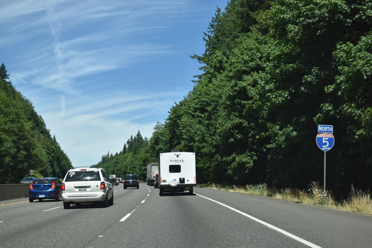
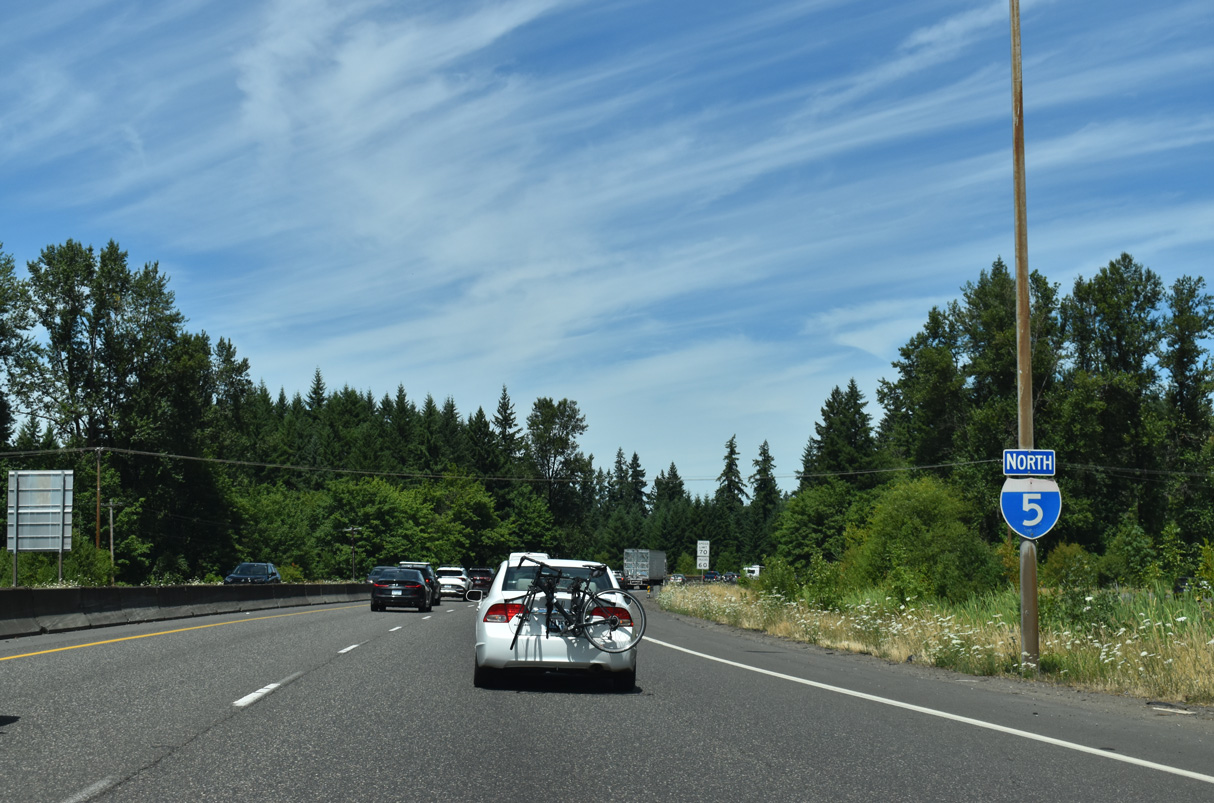
Interstate 5 North - Vader to Centralia
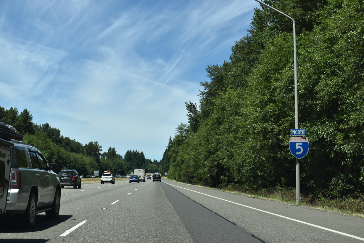
Interstate 5 continues paralleling the Cowlitz River, BNSF Railroad and Old Pacific Highway (Old U.S. 99) north from Castle Rock.
07/16/23
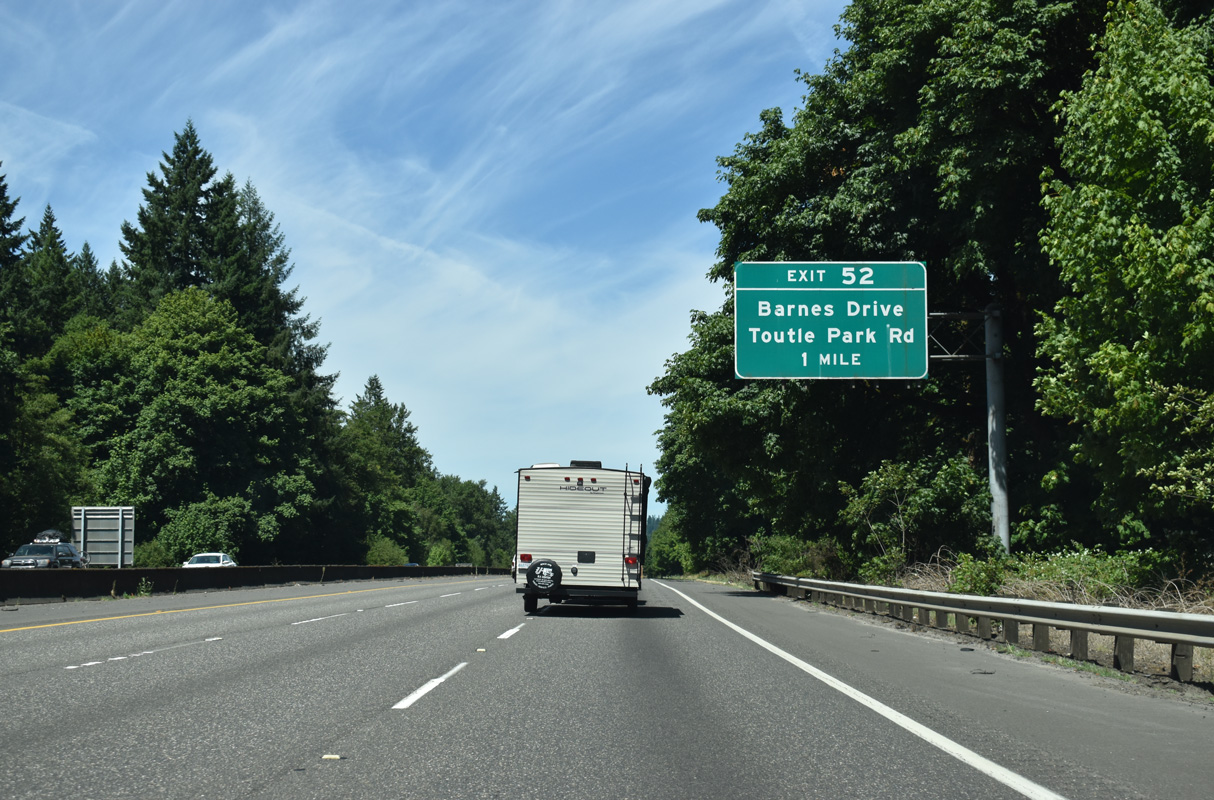
Old Pacific Highway converges with Interstate 5 at Barnes Drive and the succeeding exit northbound.
07/16/23
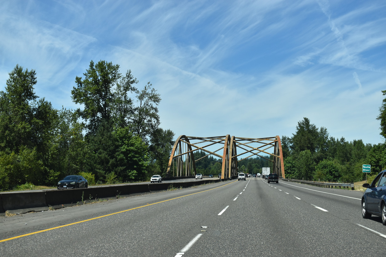
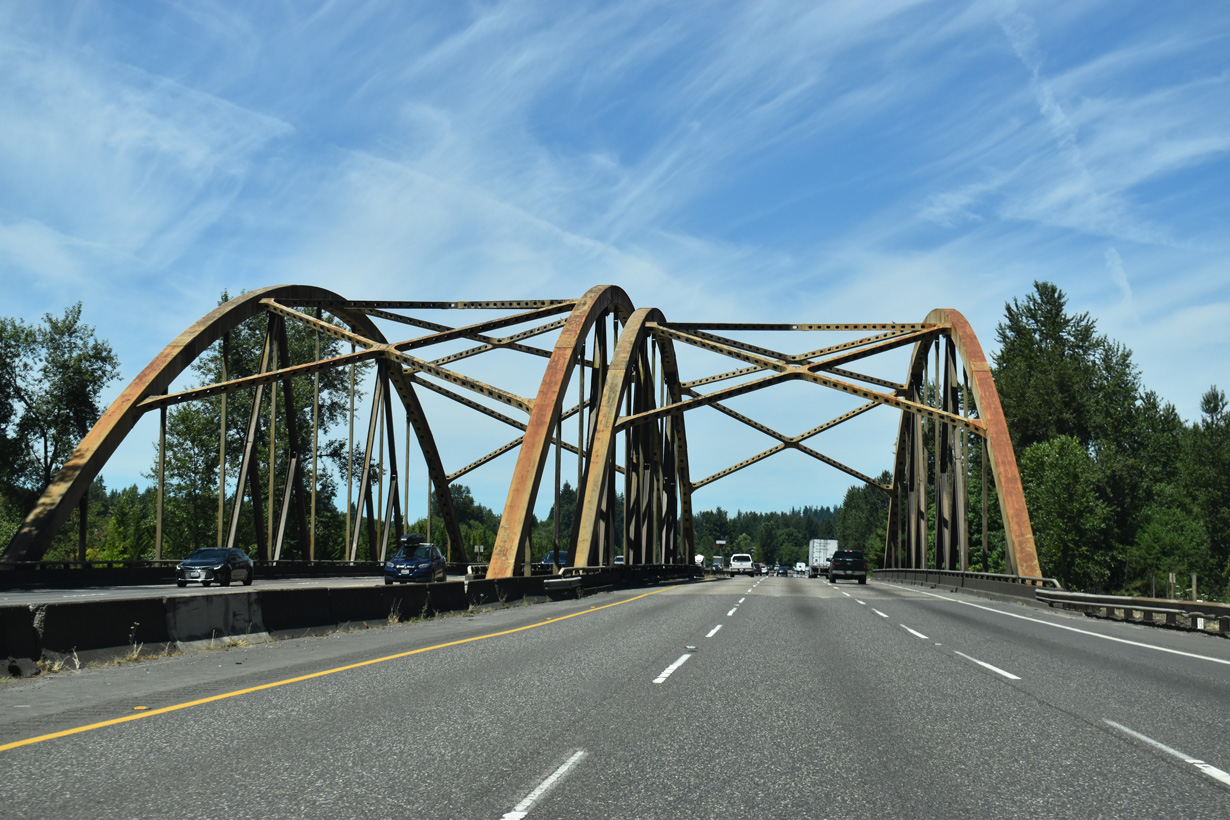
Both directions of Interstate 5 cross the Toutle River over tied-arch bridges built in 1969.
07/16/23
Interstate 5 travels across the Wilkes Hills north to Smokey Valley in Lewis County.
07/16/23
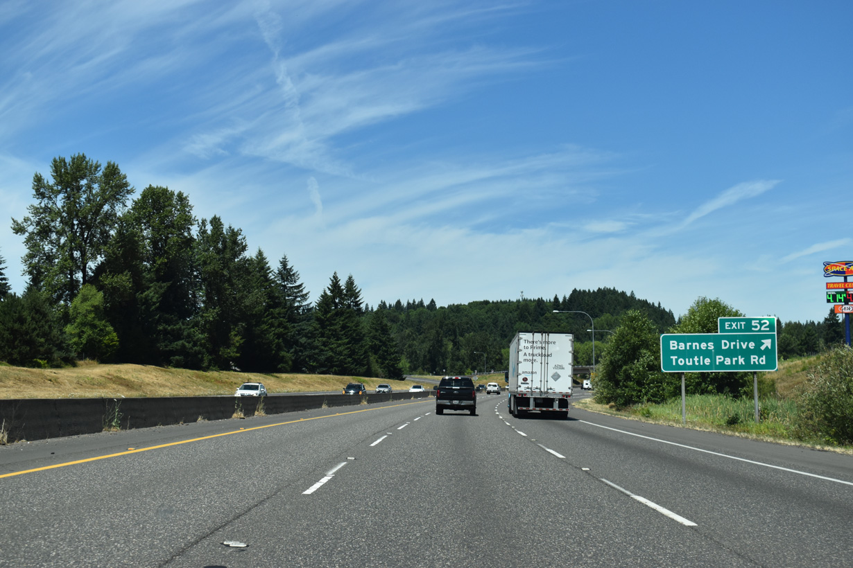
Interstate 5 north from the diamond interchange at Exit 52 was originally part of U.S. 99 (Pacific Highway). Paralleling I-5 to the west, Barnes Drive is pre-1950s alignment of U.S. 99. Toutle Park Road is a local road spurring east from adjacent Burma Road.
07/16/23
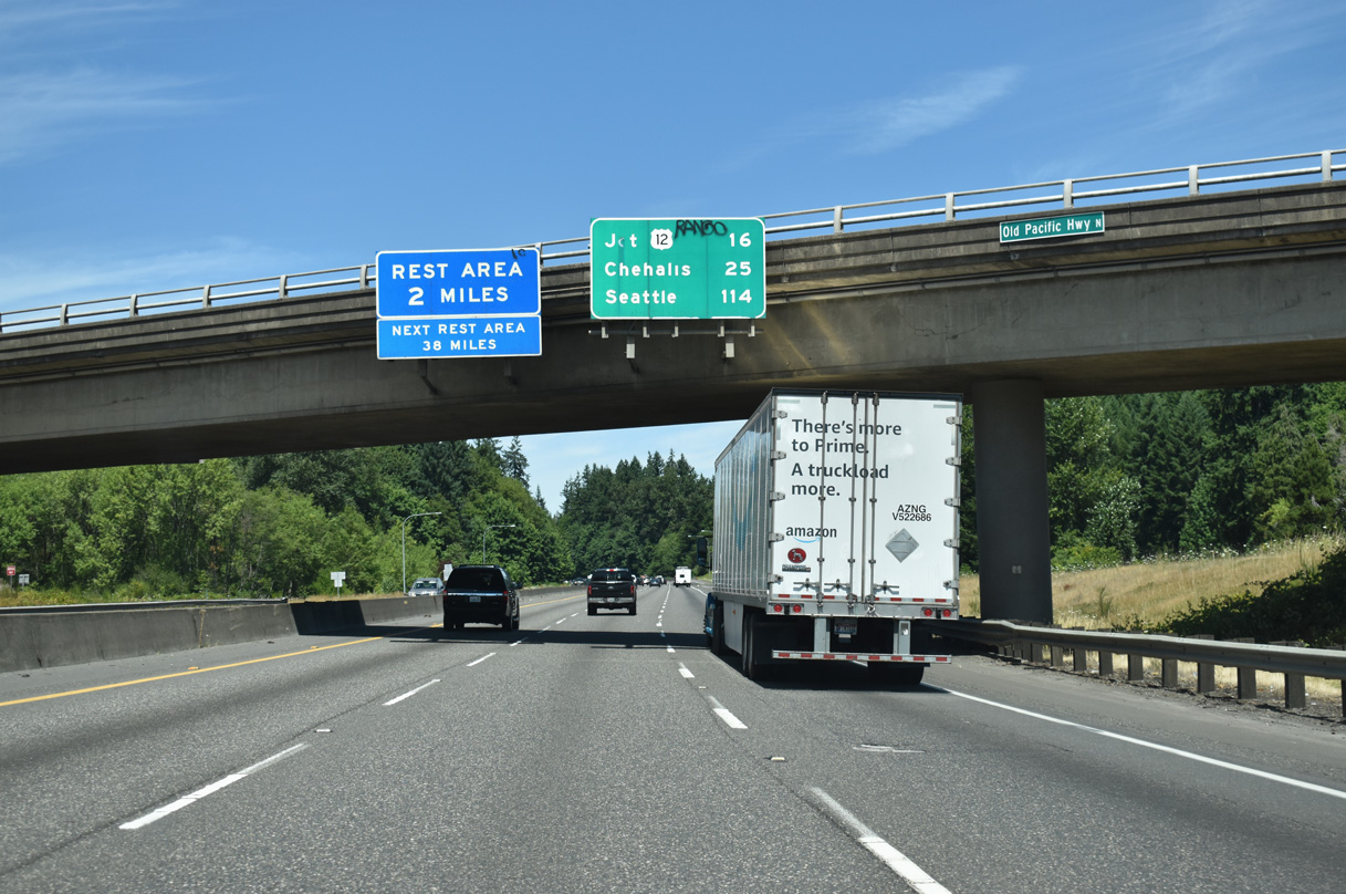
The Toutle River Rest Area lies two miles north of Barnes Drive and Exit 52.
07/16/23
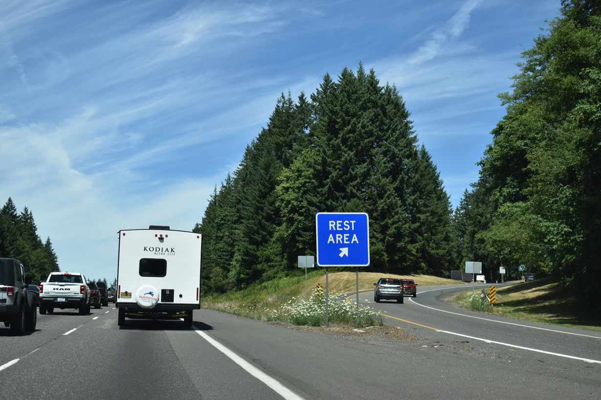
The Toutle River Rest Area lines both roadways of Interstate 5 in a woodland setting.
07/16/23
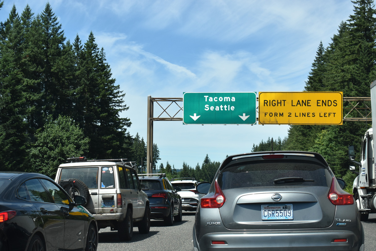
Northbound Interstate 5 maintains at least three general travel lanes north from I-205 at Salmon Creek. Past the Toutle River Rest Area, it narrows to two lanes.
07/16/23
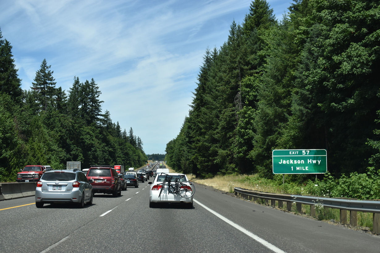
The diamond interchange at Exit 57 joins Interstate 5 with Rogers Road between Barnes Drive and Jackson Highway.
07/16/23
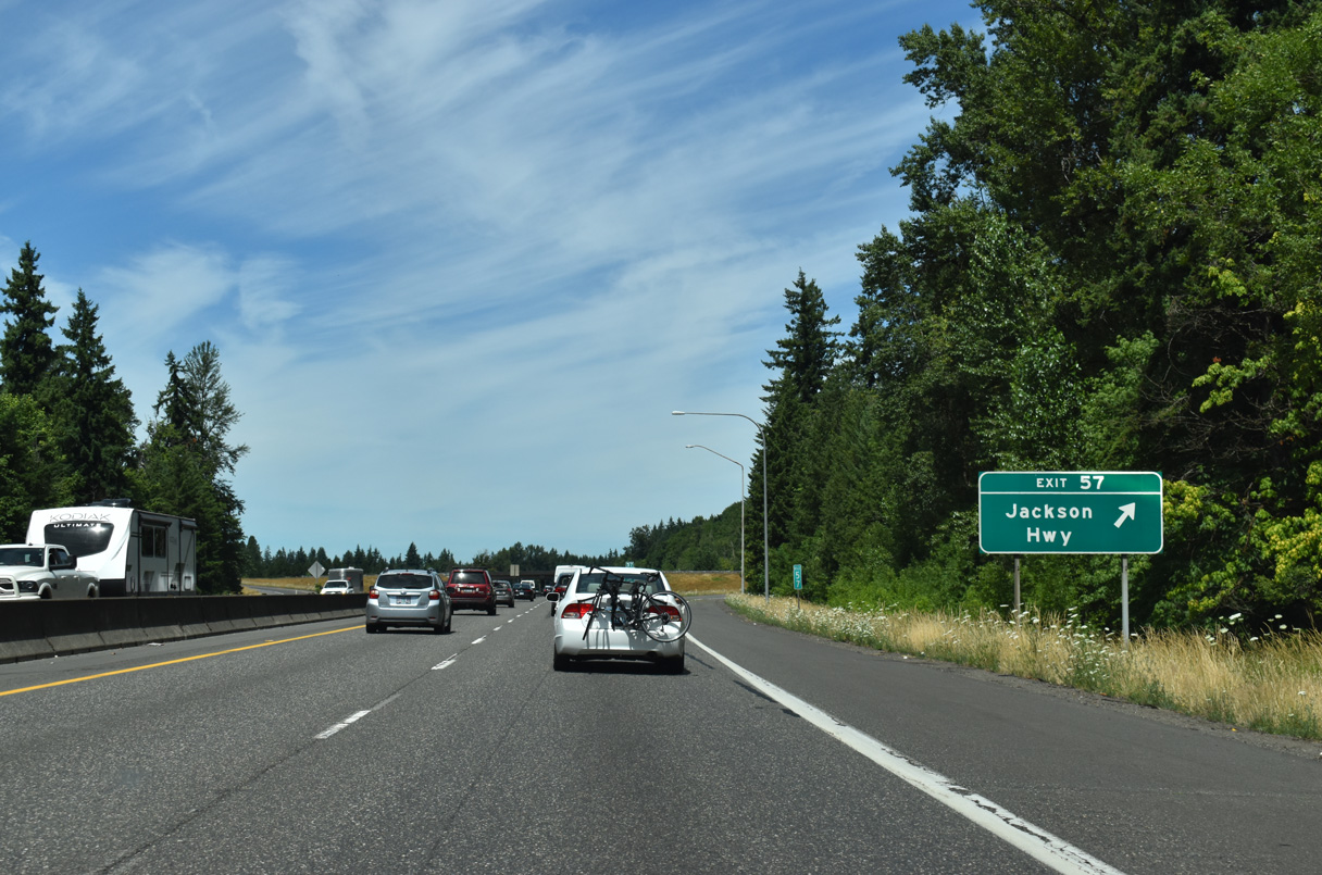
Exit 57 departs from I-5 northbound at milepost 57 and the Lewis County line. Following the pre-1950s route of U.S. 99, Jackson Highway travels northeast from Rogers Road to SR 505 east of Toledo.
07/16/23
Interstate 5 shifts northeast through an S-curve across Smokey Valley, east of Foster Creek.
07/16/23
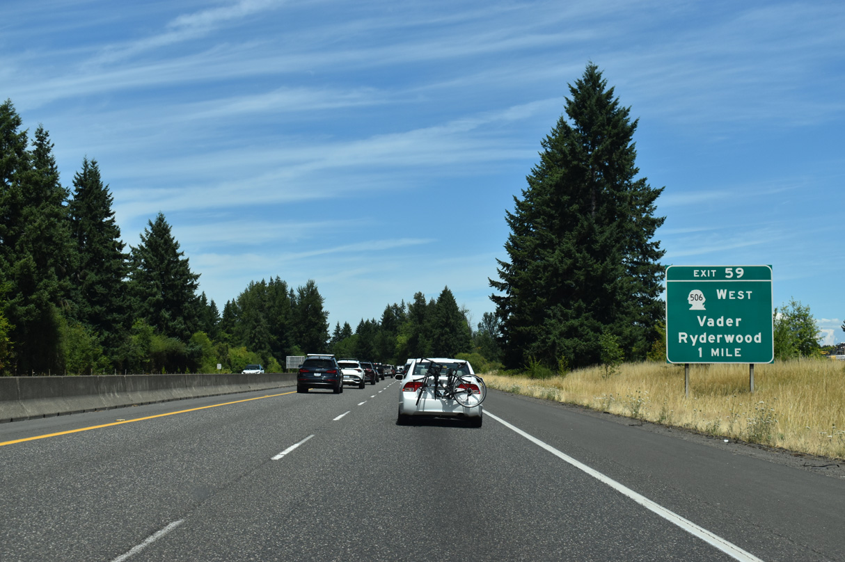
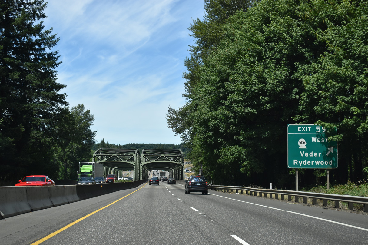
Continuing north, RIRO (right in right out) ramps at Exit 59 link Interstate 5 with the intersection of Cowlitz Loop Road south, Mulford Road east and Cowlitz Ridge Road north.
07/16/23
Cowlitz Loop Road runs south alongside I-5 to a turnaround at the Cowlitz River where the frontage road turns north to SR 506. SR 506 is an 11.53 mile long spur west to the city of Vader and Ryderwood. Vader, named for a German settler and not a Jedi, is 3.6 miles to the west along Olequa Creek.
07/16/23
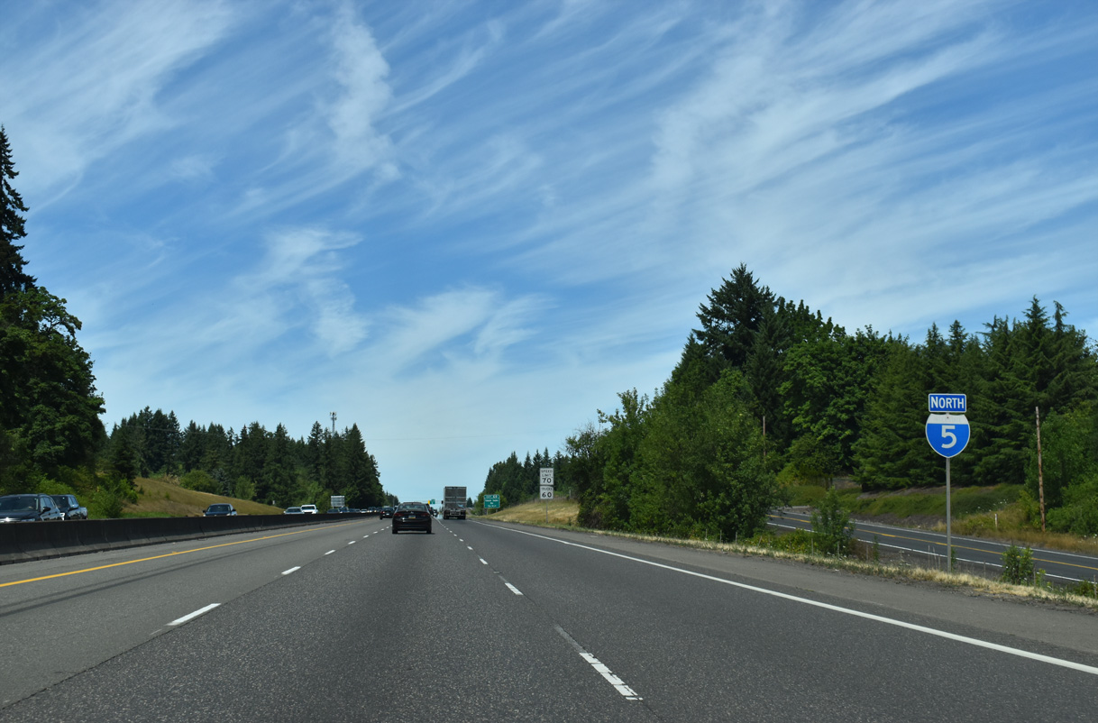
Cowlitz Ridge Road accompanies Interstate 5 along the east side northward to Exit 60.
07/16/23
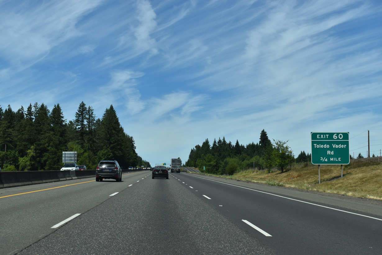
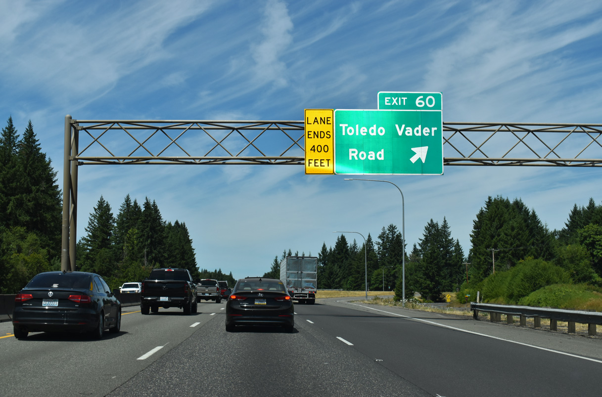
SR 506 runs along the west side of Interstate 5 from Exit 59 north to the diamond interchange (Exit 60) with Toledo Vader Road.
07/16/23
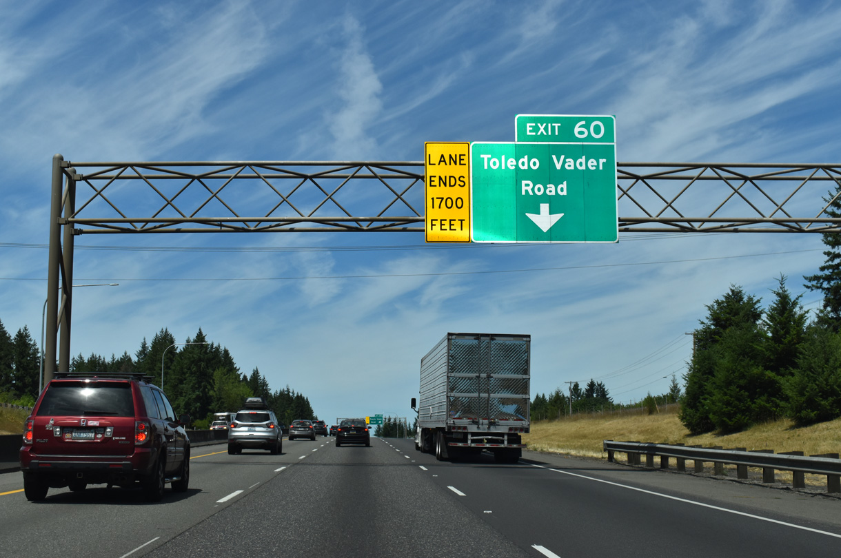
Toledo-Vader Road extends east from the end of SR 506 and Exit 60 onto Ash Street in Toledo. This is a more direct route to the city versus remaining on I-5 north to Exit 63.
07/16/23
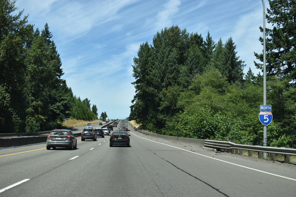
This Interstate 5 north confirming marker stands by Lacamas Creek.
07/16/23
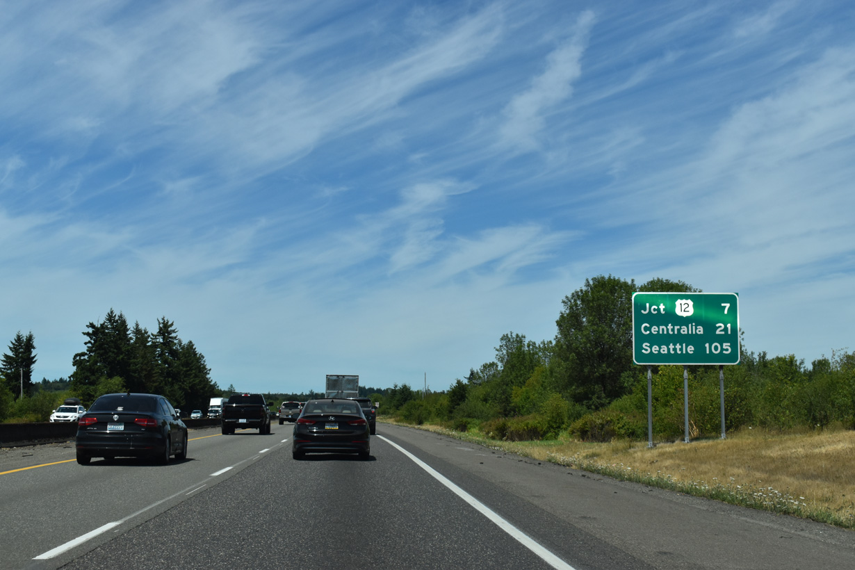
Crossing Drews Prairie, Interstate 5 travels another 21 miles north to the city of Centralia.
07/16/23
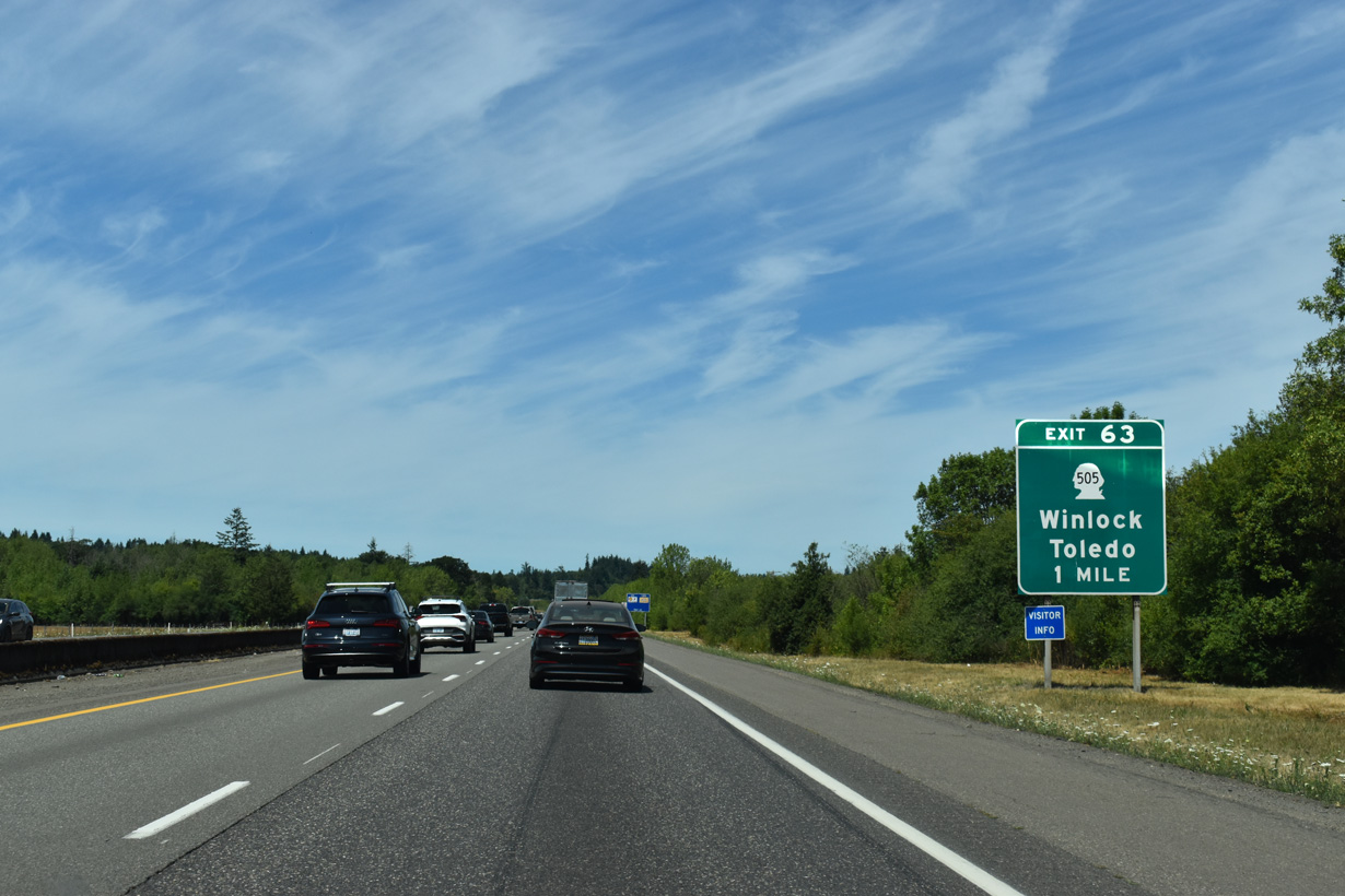
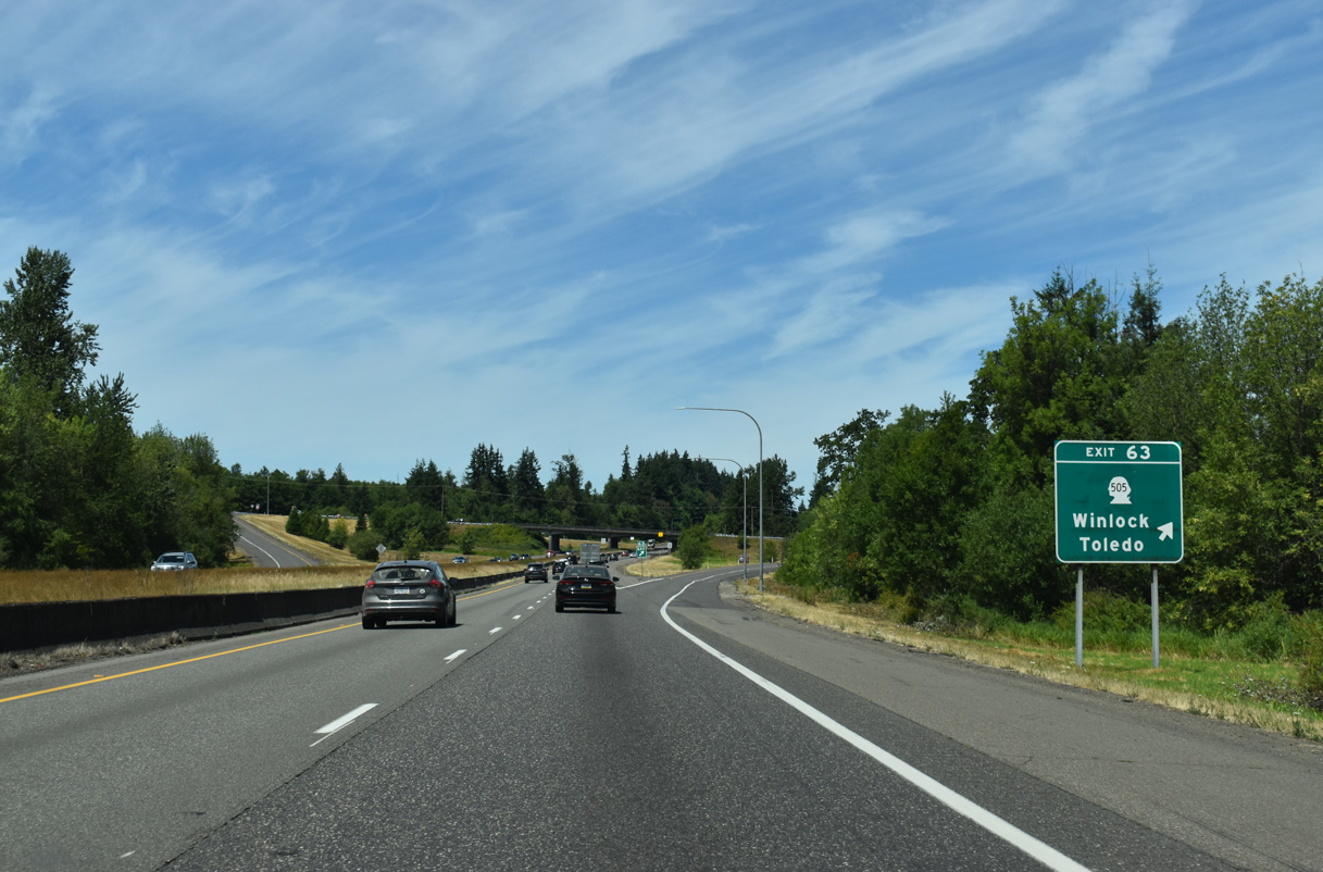
Forthcoming SR 505 connects the city of Winlock west of I-5 with Toledo to the southeast. According to roadsideamerica.com, Winlock is home to the "world's largest egg," a 12-foot long, 1,200-lb. fiberglass egg emblazoned with the stars and stripes.
07/16/23
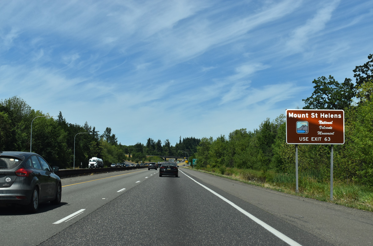
SR 505 continues east from Toledo across Layton Prairie and south through Eden Valley to SR 504 (Spirit Lake Highway), the main route to Mount St. Helens National Volcanic Monument.
07/16/23
SR 505 travels 19.29 miles overall from SR 504 to the intersection of Walnut and Kerron Streets in Winlock.
07/16/23
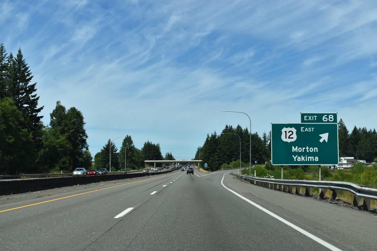
A truck climbing lane opens along I-5 from the diamond interchange at Exit 68 northward for 1.2 miles.
07/16/23
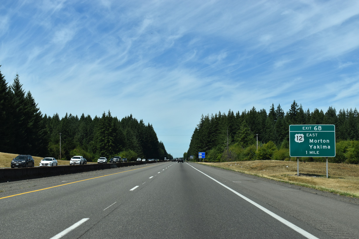
U.S. 12 heads west across Jackson Prairie from Jackson Highway (Historic U.S. 99) at Marys Corner to Interstate 5 at Exit 68.
07/16/23
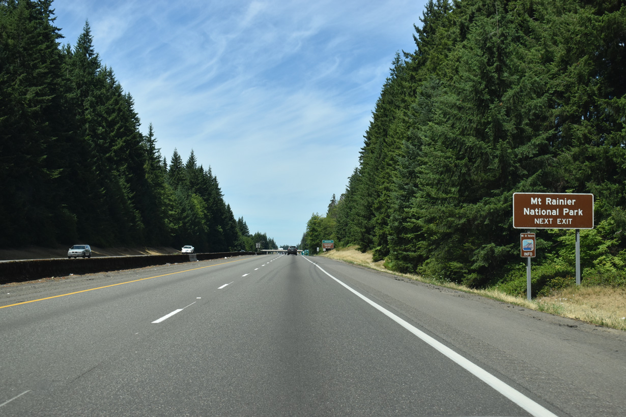
U.S. 12 east traverses the Cascade Range, passing just south of Mount Rainier National Park. The park can be accessed at junctions with SR 7 on the west end, or SR 123 on the east end. The northern entrance to Mount Saint Helens National Volcanic Monument is also off U.S. 12 via SR 131 south from Randle.
07/16/23
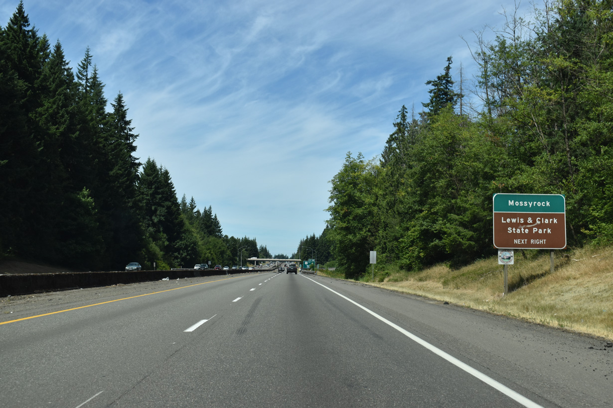
The city of Mossyrock is 20.2 miles east along U.S. 12 from the parclo interchange with Interstate 5. Lewis and Clark State Park lies south of Marys Corner along Jackson Highway (Historic U.S. 99).
07/16/23
Morton is 30 miles to the east along U.S. 12 at SR 7. 107 miles further, Yakima is where U.S. 12 meets I-82/U.S. 97. Once across the Cascade crest, U.S. 12 slowly descends into the dry side of Washington State, where annual rainfall totals are a fraction of those of the west side.
07/16/23
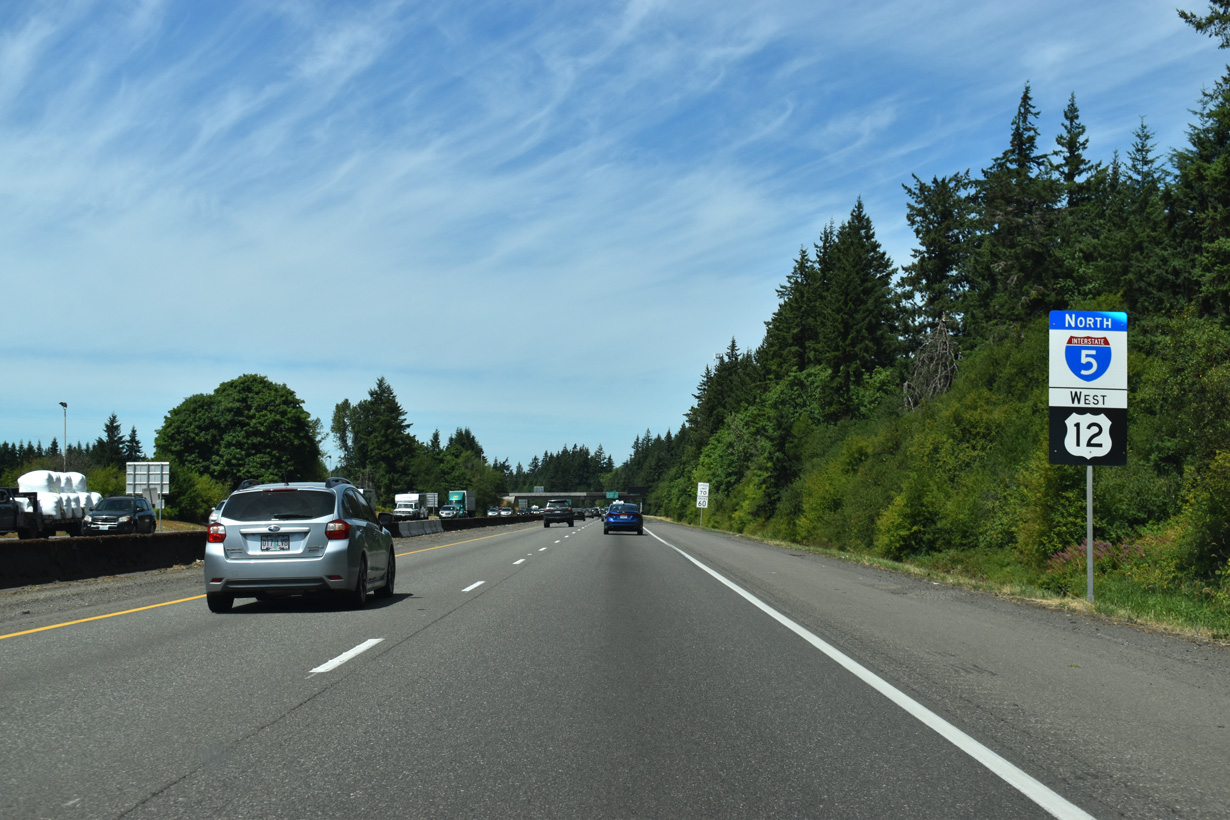
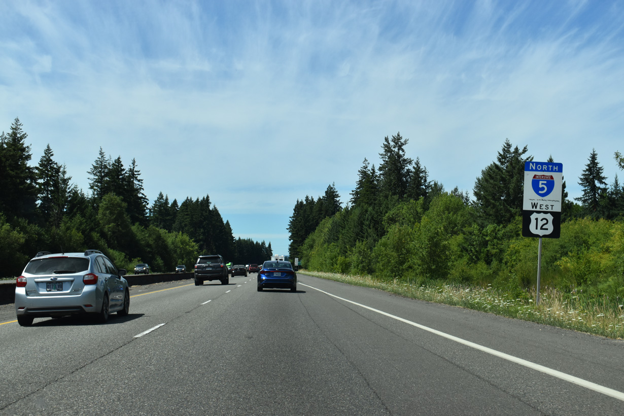
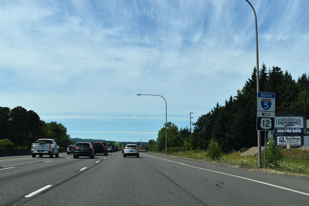
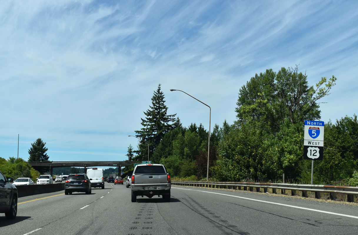
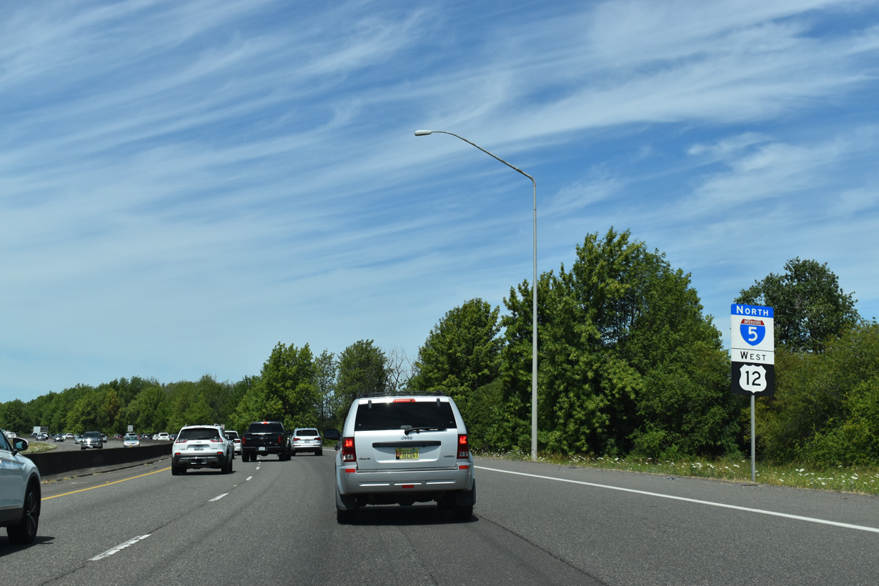
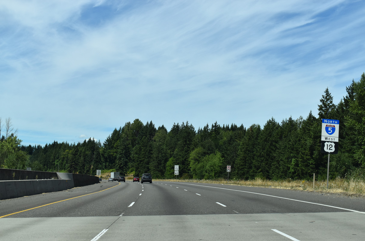
U.S. 12 west combines with Interstate 5 north for 19.95 miles to Grand Mound.
07/16/23
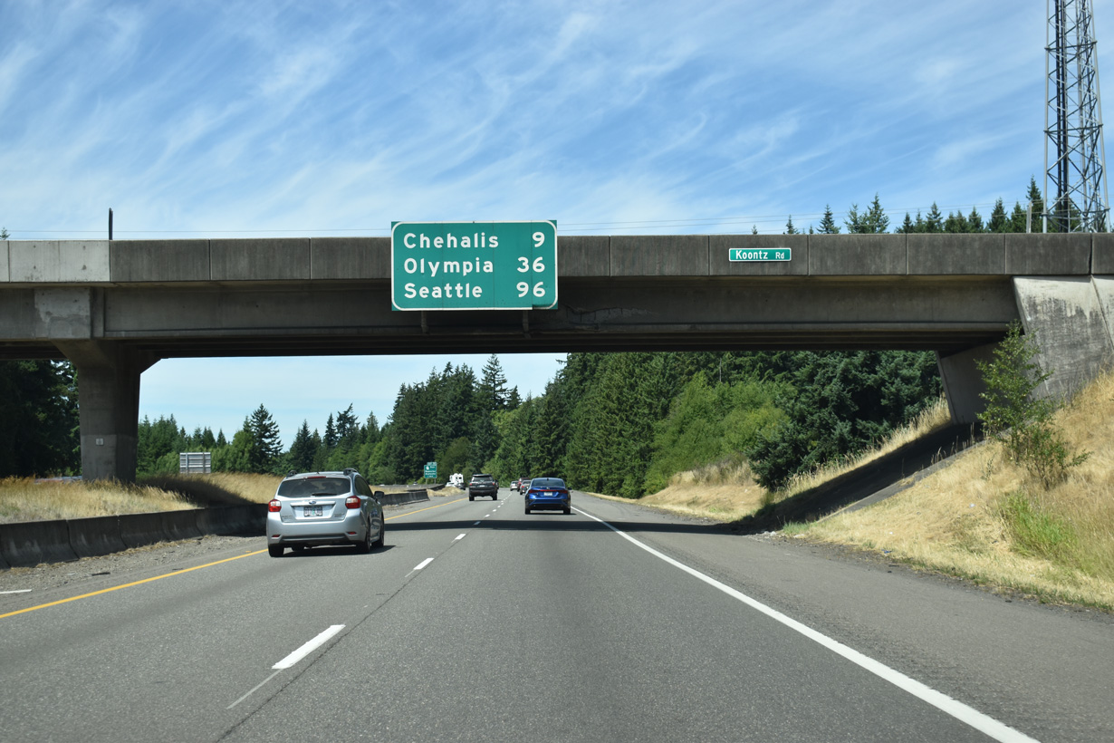
Interstate 5 north is less than 100 miles from the Emerald City. The state capital, Olympia, is 36 miles away.
07/16/23
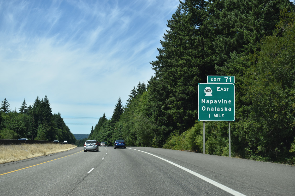
The west end of SR 508 is at Exit 71 in the city of Napavine. W Forest Napavine Road ties into the diamond interchange with I-5/U.S. 12 from 5th Avenue E.
07/16/23
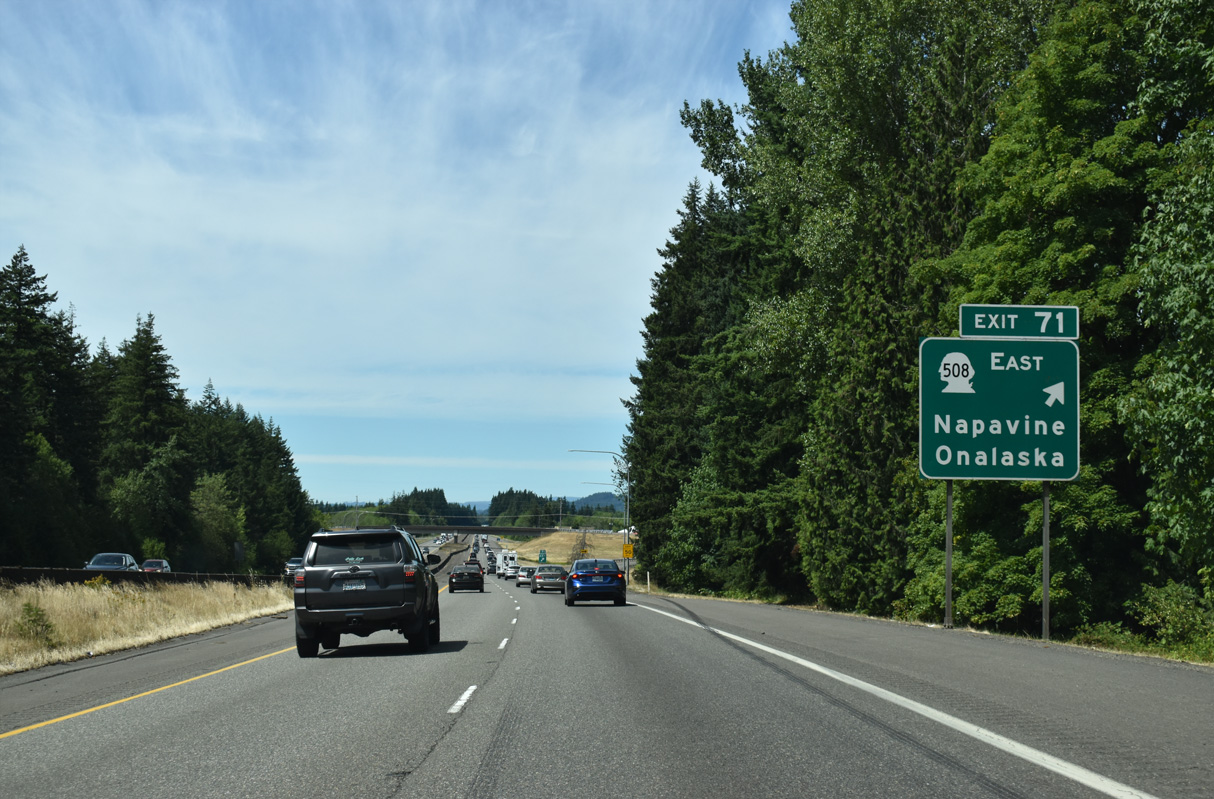
32.84 miles in length, SR 508 heads east across Newaukum Prairie to the unincorporated community of Onalaska and along the Tilton River to SR 7 in Morton.
07/16/23
I-5/U.S. 12 advance northwest across Newaukum Prairie to the Newaukum River.
07/16/23
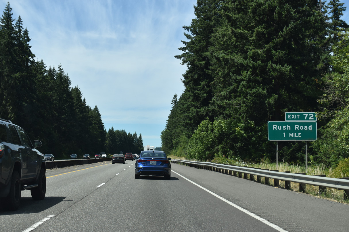
Rush Road extends north from 2nd Avenue E in the city of Napavine to a diamond interchange (Exit 72) with I-5/U.S. 12.
07/16/23
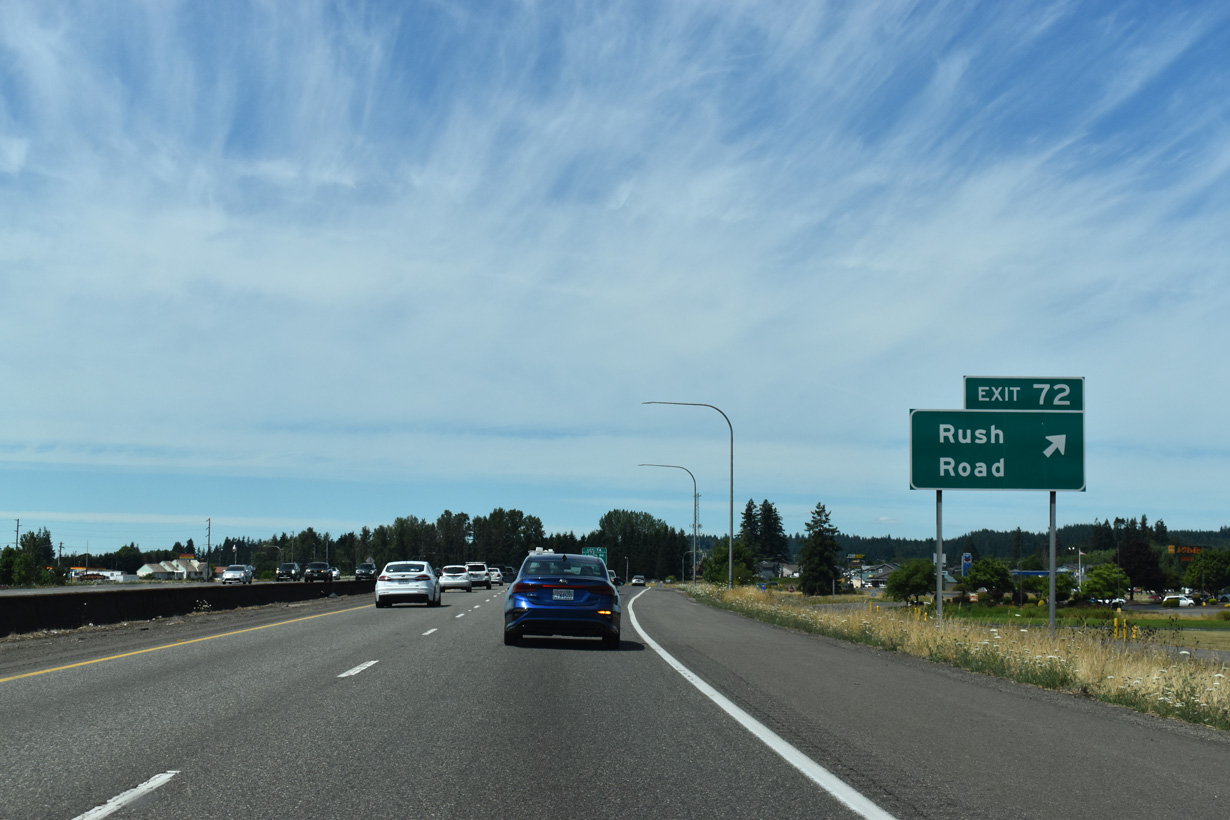
Rush Road continues north from Exit 72 to Jackson Highway (Historic U.S. 99). An array of traveler services surround the exchange with I-5/U.S. 12.
07/16/23
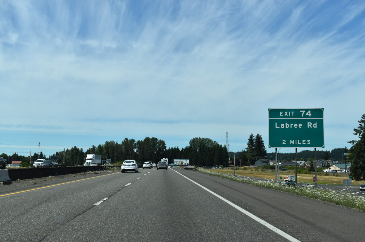
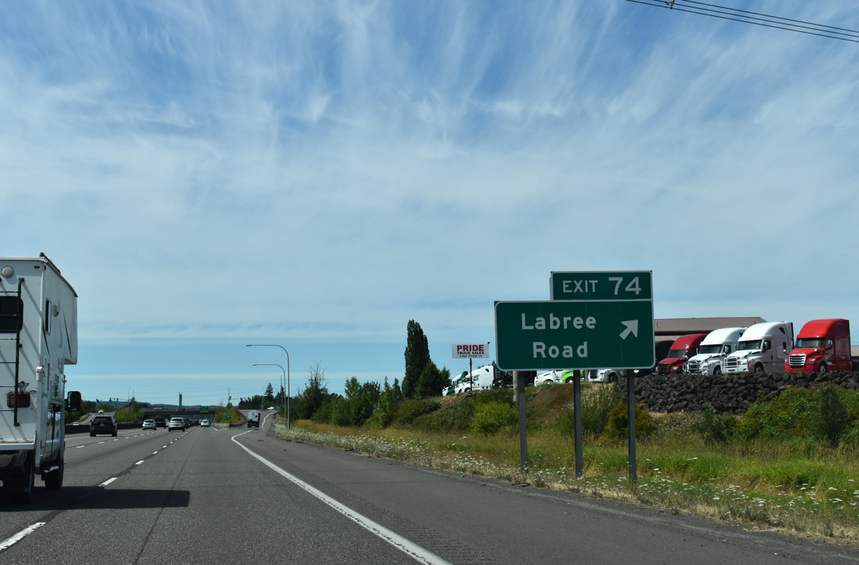
Heading northwest, I-5/U.S. 12 next meet Labree Road at Exit 74 by Chehalis Industrial Park.
07/16/23
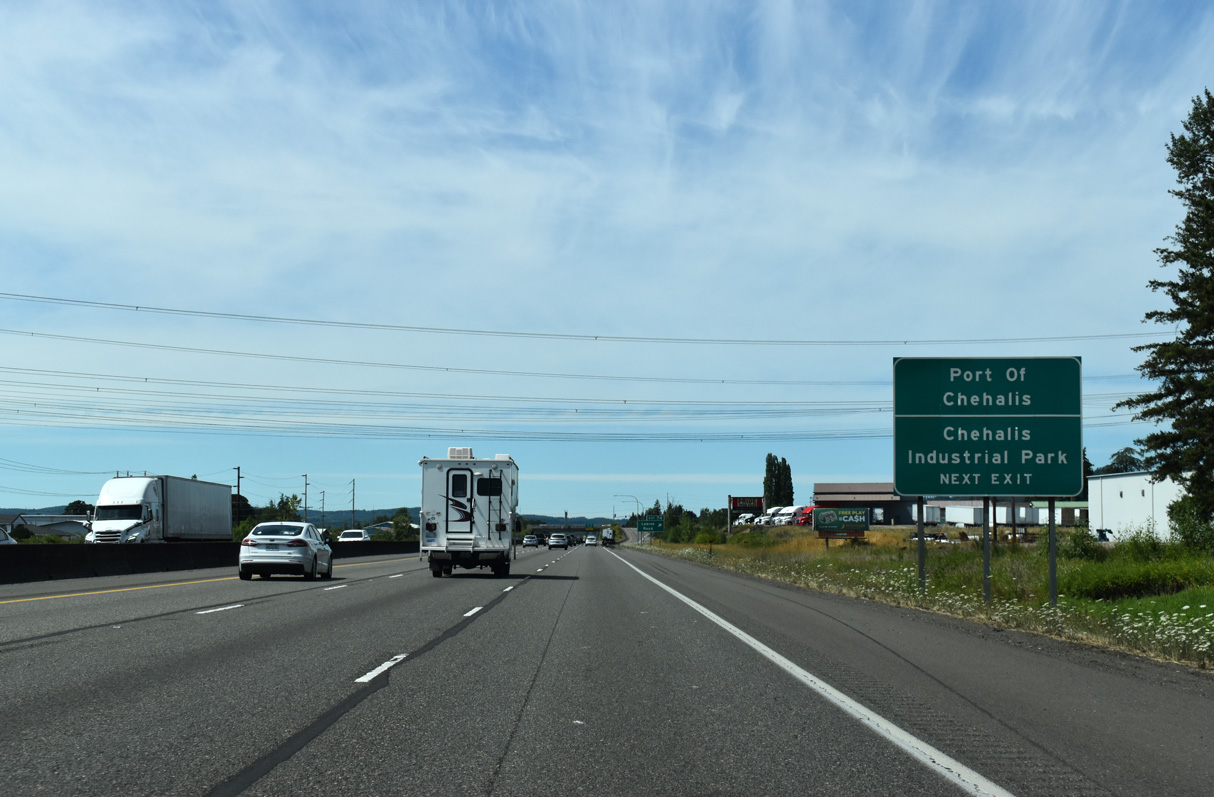
North beyond Exit 74, Interstate 5 reaches the twin cities of Chehalis and Centralia. As the freeway gets closer to the Puget Sound population belt, high-voltage power lines become an increasingly common sight.
07/16/23
Labree Road east becomes Maurin Road at parallel Bishop Road. The Fred Meyer Stores Retail Service Distribution Center further east along Maurin Road is one of many industrial businesses between Interstate 5 and Jackson Highway.
07/16/23
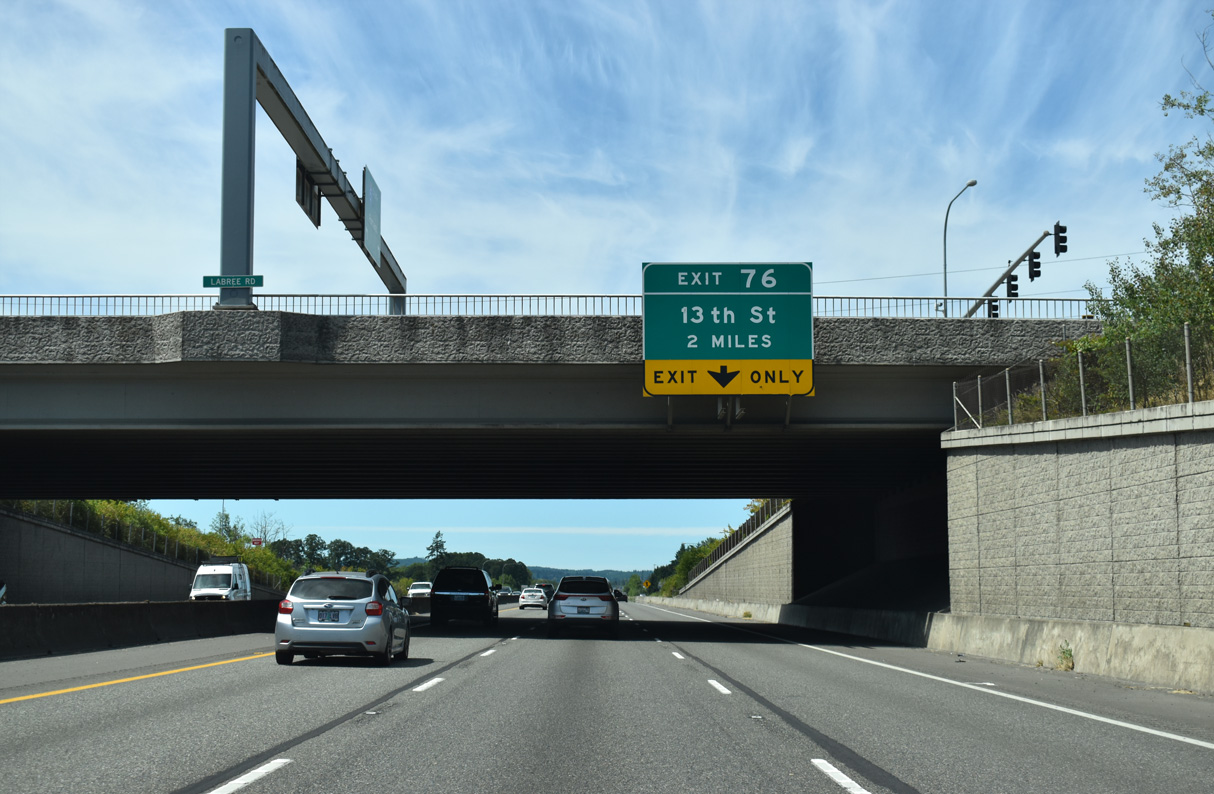
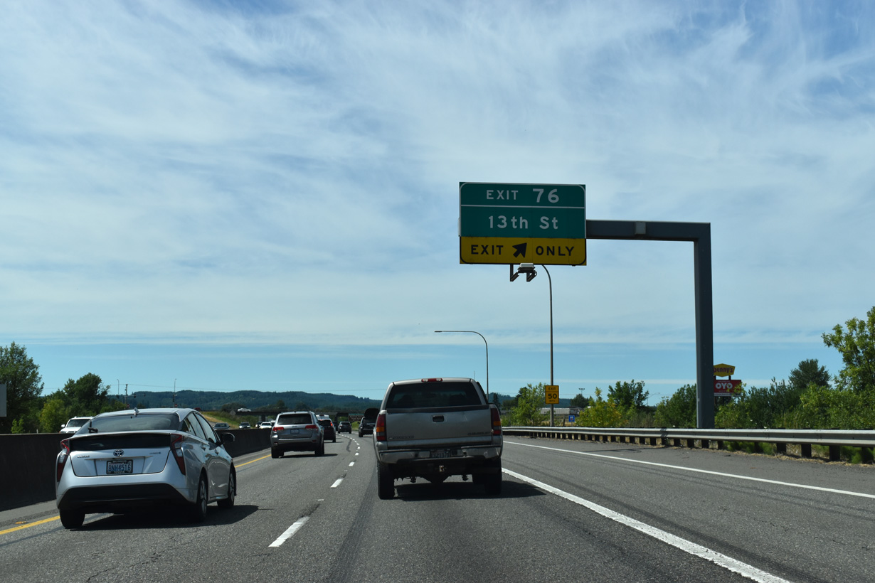
Signed for 13th Street, the first exit from I-5/U.S. 12 north in Chehalis is with Parkland Drive.
07/16/23
The six lane section of Interstate 5 that started at Exit 72 / Rush Road concludes with the lane drop at Exit 76.
07/16/23
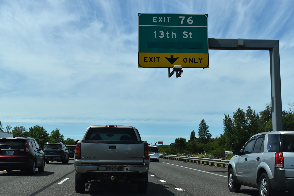
The overlay on this overhead for Exit 76 conceals "Next Right". Parklane Drive south becomes Rice Road across Dillenbaugh Creek to nearby Stan Hedwell Park.
07/16/23
Parkland Drive north becomes 13th Street at Mills Avenue in the Chehalis street grid. Chehalis is the Lewis County seat. Situated just east of the Chehalis river, the town's name means "sand." The Confederated Tribes of the Chehalis are based in nearby Oakville.
07/16/23
I-5/U.S. 12 span the BNSF Railroad and Dillenbaugh Creek at Chehalis Junction.
07/16/23
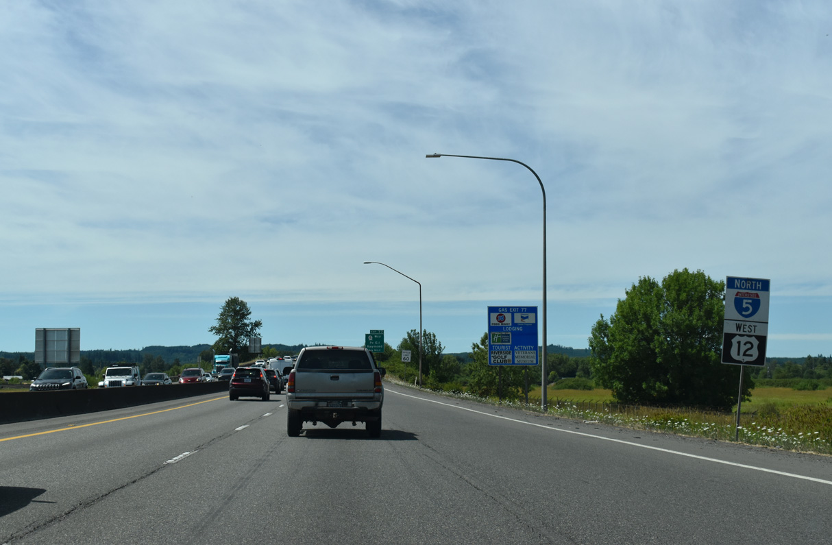
SR 6 east and W Main Street come together at the succeeding exit in 0.75 miles.
07/16/23
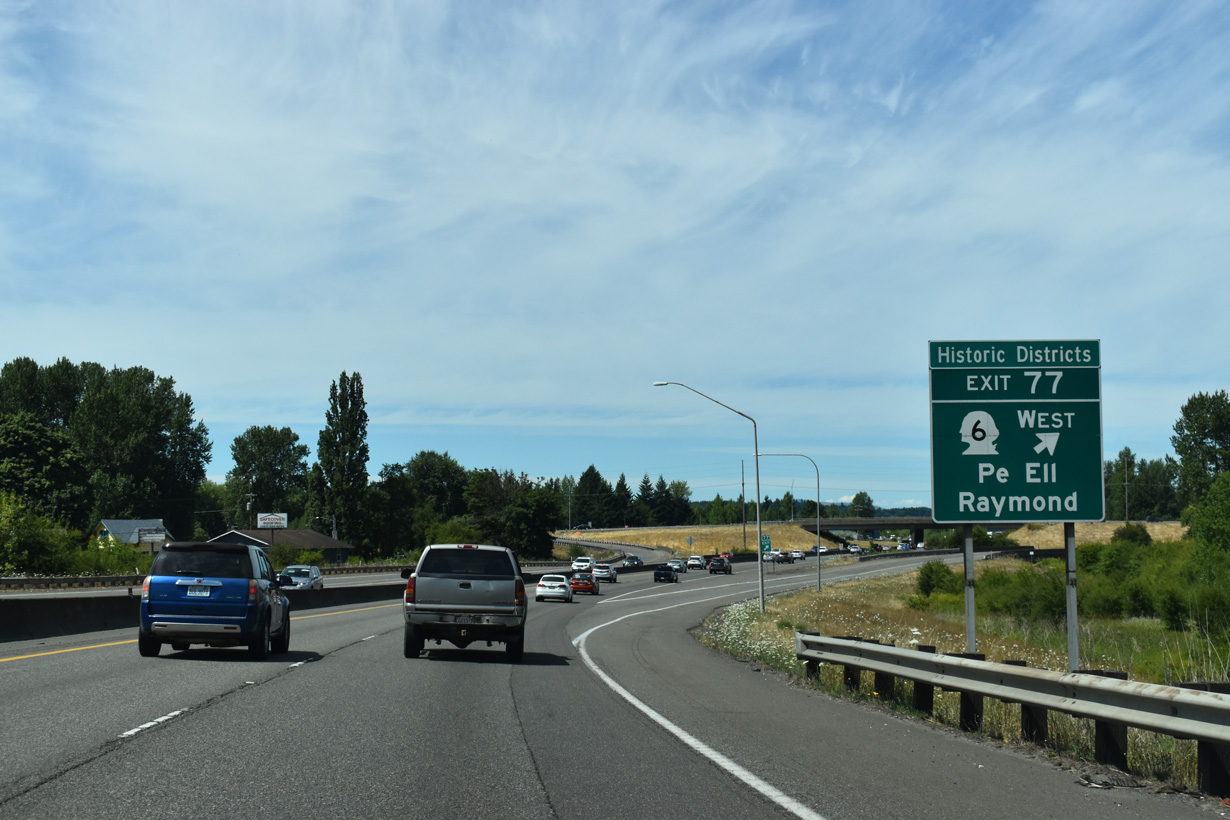
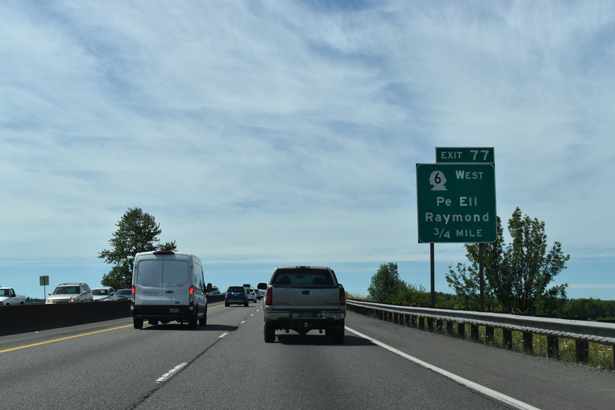
SR 6 travels 51.37 miles west from Exit 77 to the Washington coast, passing through Pe Ell and concluding at U.S. 101 in Raymond near the east end of Willapa Bay. East from I-5/U.S. 12, Main Street leads to the Chehalis city center.
07/16/23
The WSDOT I-5 Chamber Way Stage 2 project started in 2023 makes a number of improvements at Exits 77, 79 and 82. This includes the addition of ramp meters, roundabouts along SR 6 and Chamber of Commerce Way and a southbound auxiliary lane along this stretch.
07/16/23
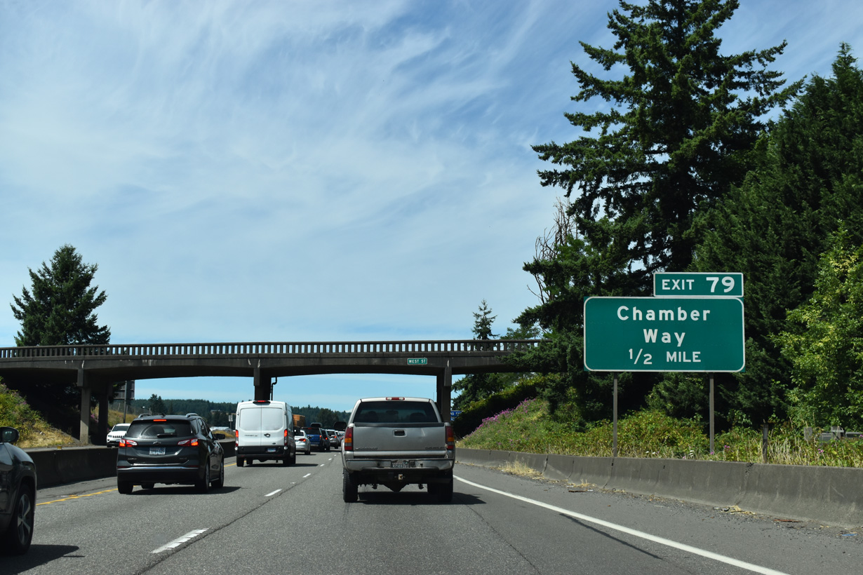
The WSDOT I-5 Chamber Way Stage 2 project also replaces the West Street overpass a half mile south of Exit 79.
07/16/23
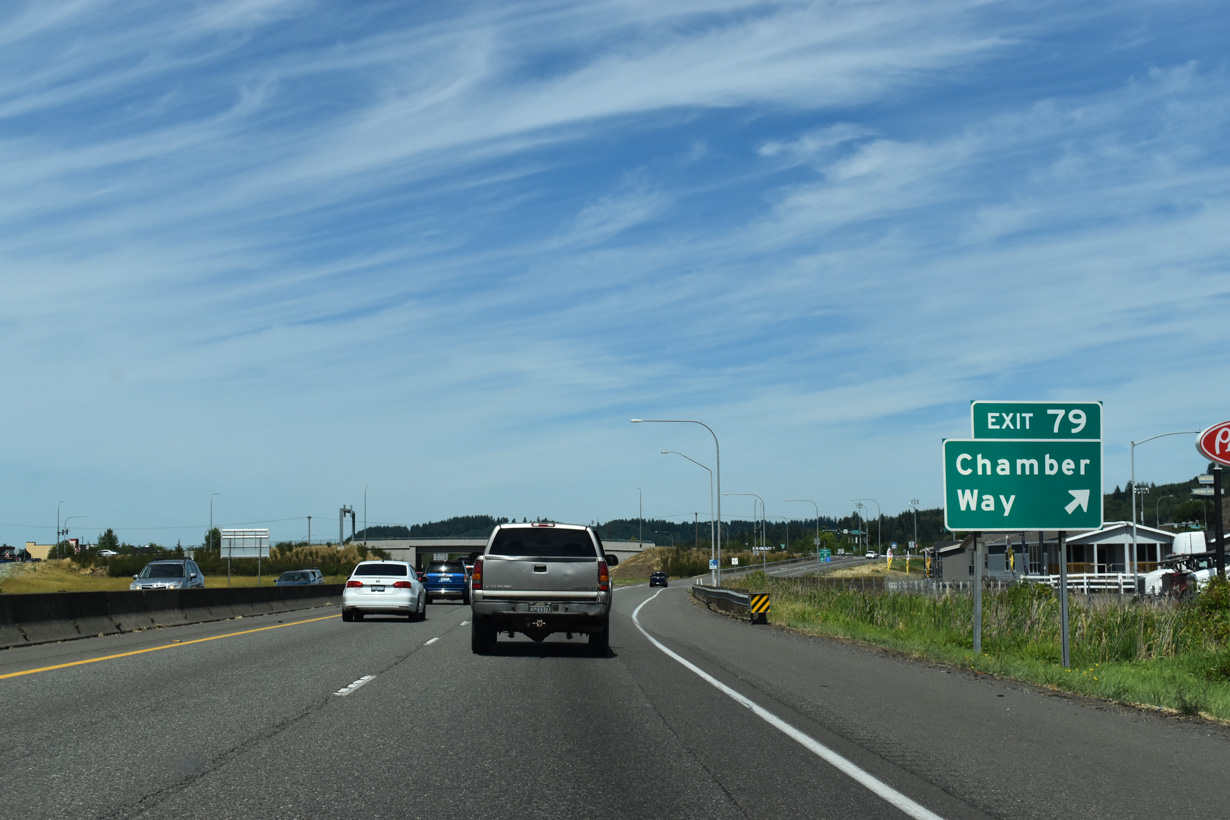
Chamber of Commerce Way stems northwest from National Avenue (Historic U.S. 99) to the Twin City Town Center West retail area.
07/16/23
The retail area adjacent to I-5/U.S. 12 at Exit 81 was built at the site of Chehalis-Centralia Airport. Louisiana Avenue extends north from the Chamber of Commerce Way by car dealerships to become Airport Road.
07/16/23
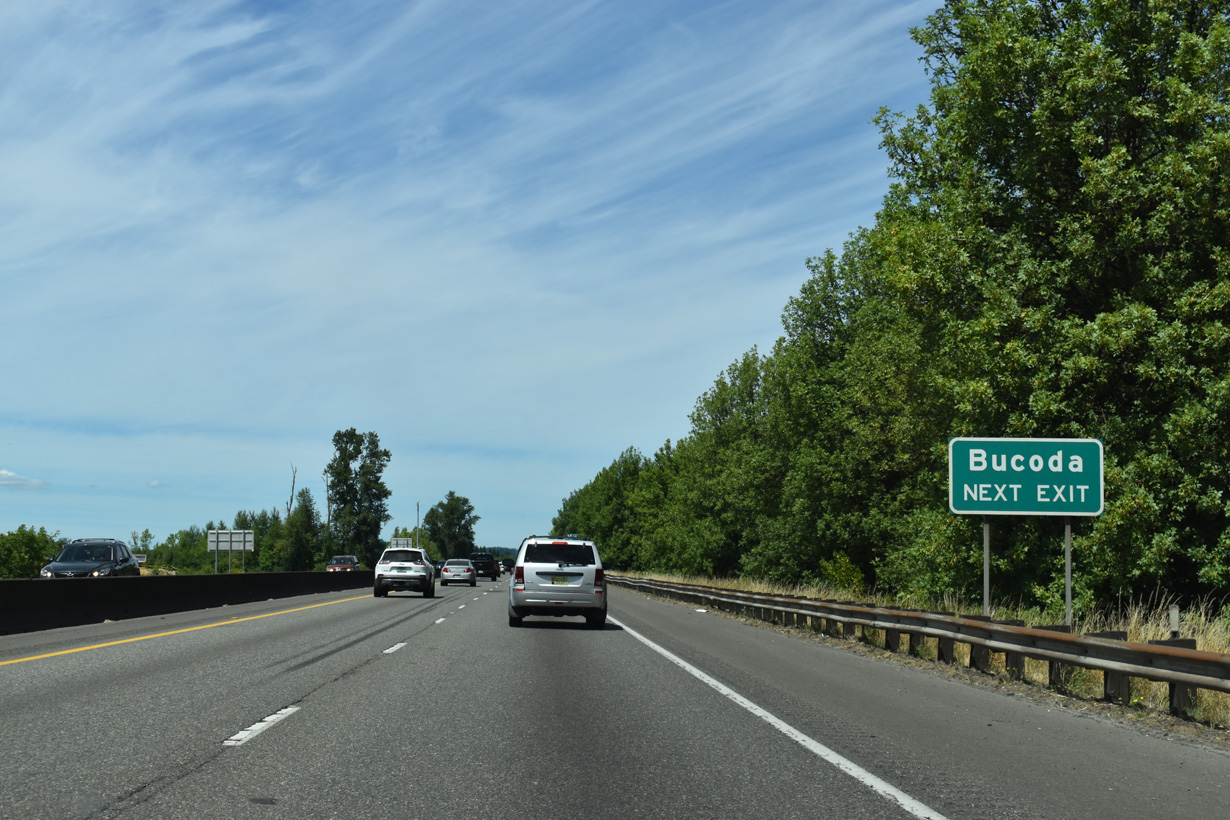
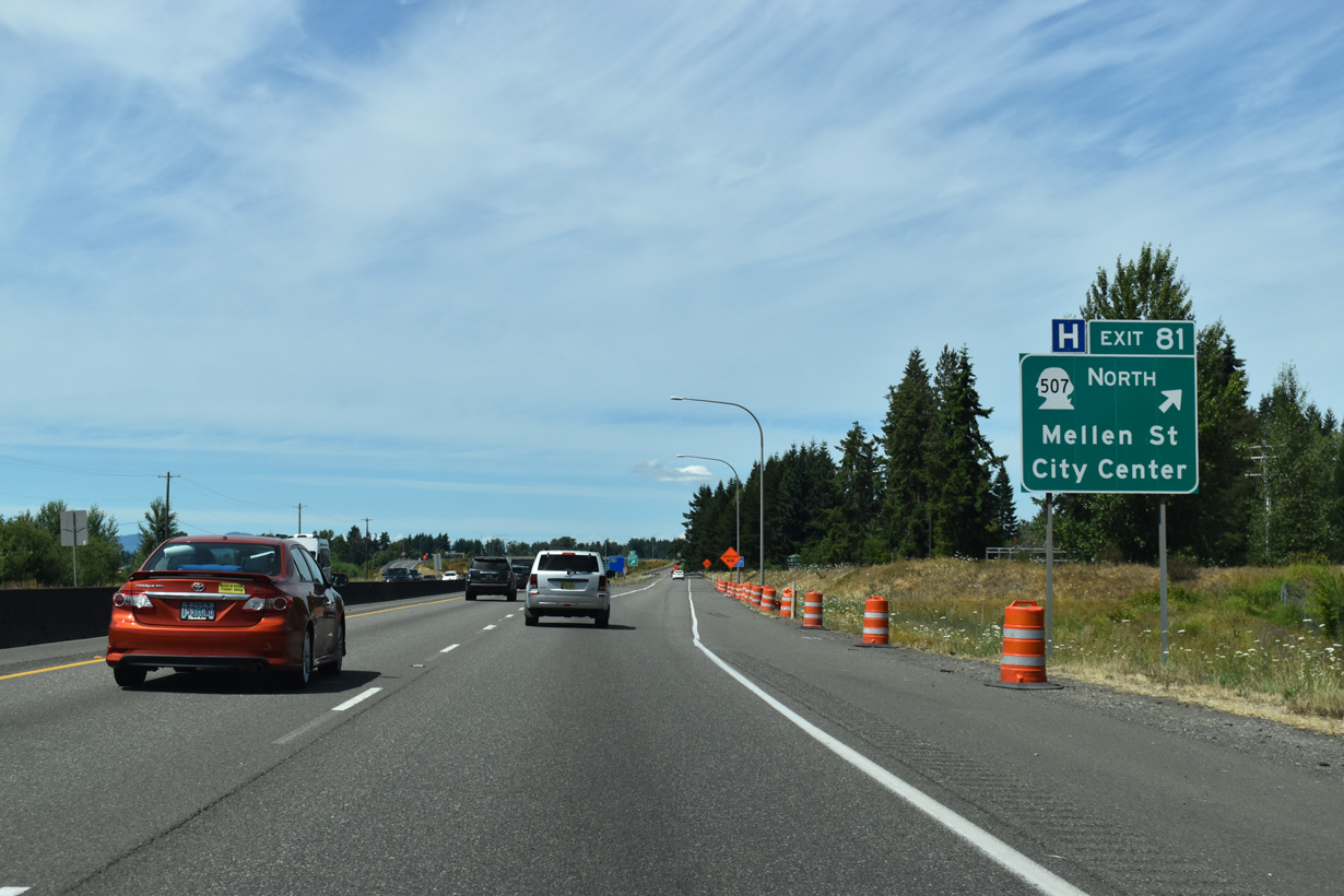
Beginning at Exit 81 in Centralia, SR 507 runs north to the city of Bucoda.
07/16/23
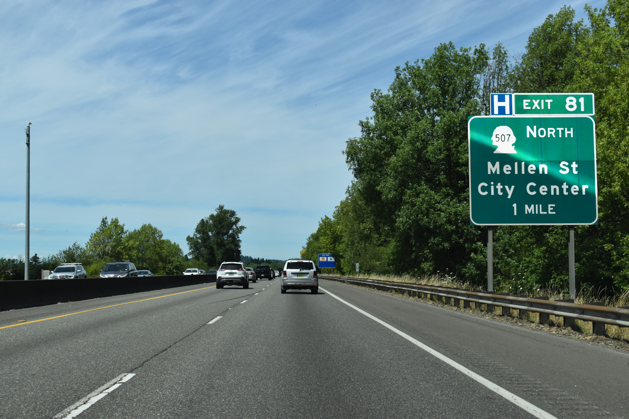
The split diamond interchange at Exit 81 in Centralia joins I-5/U.S. 12 with Art Lehman Avenue east to Yew Street and OR 6 along Mellon Street west of the city center.
07/16/23
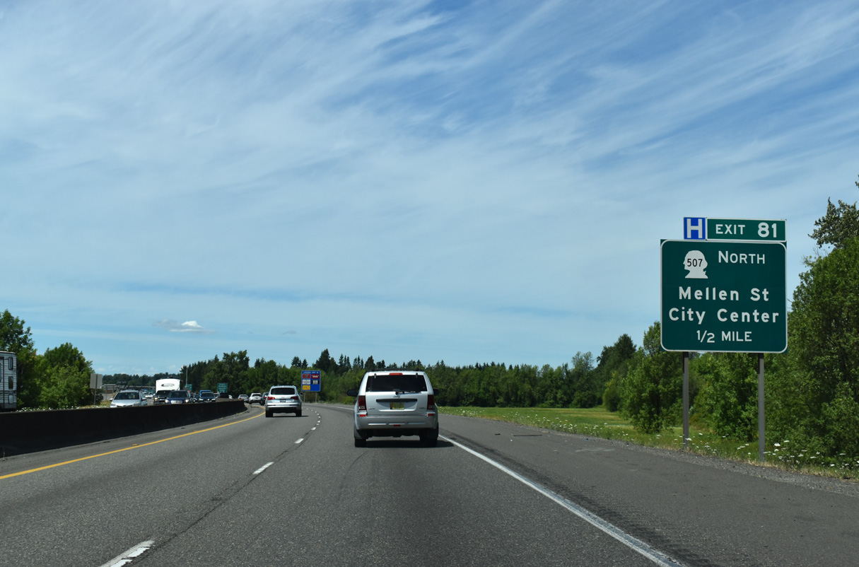
SR 507 overall travels 43.81 miles from Centralia to SR 7 via Tenino, Rainier and Yelm. Mellon Street becomes Cooks Hill Road west from I-5/U.S. 12 to apartments and subdivisions in west Centralia.
07/16/23
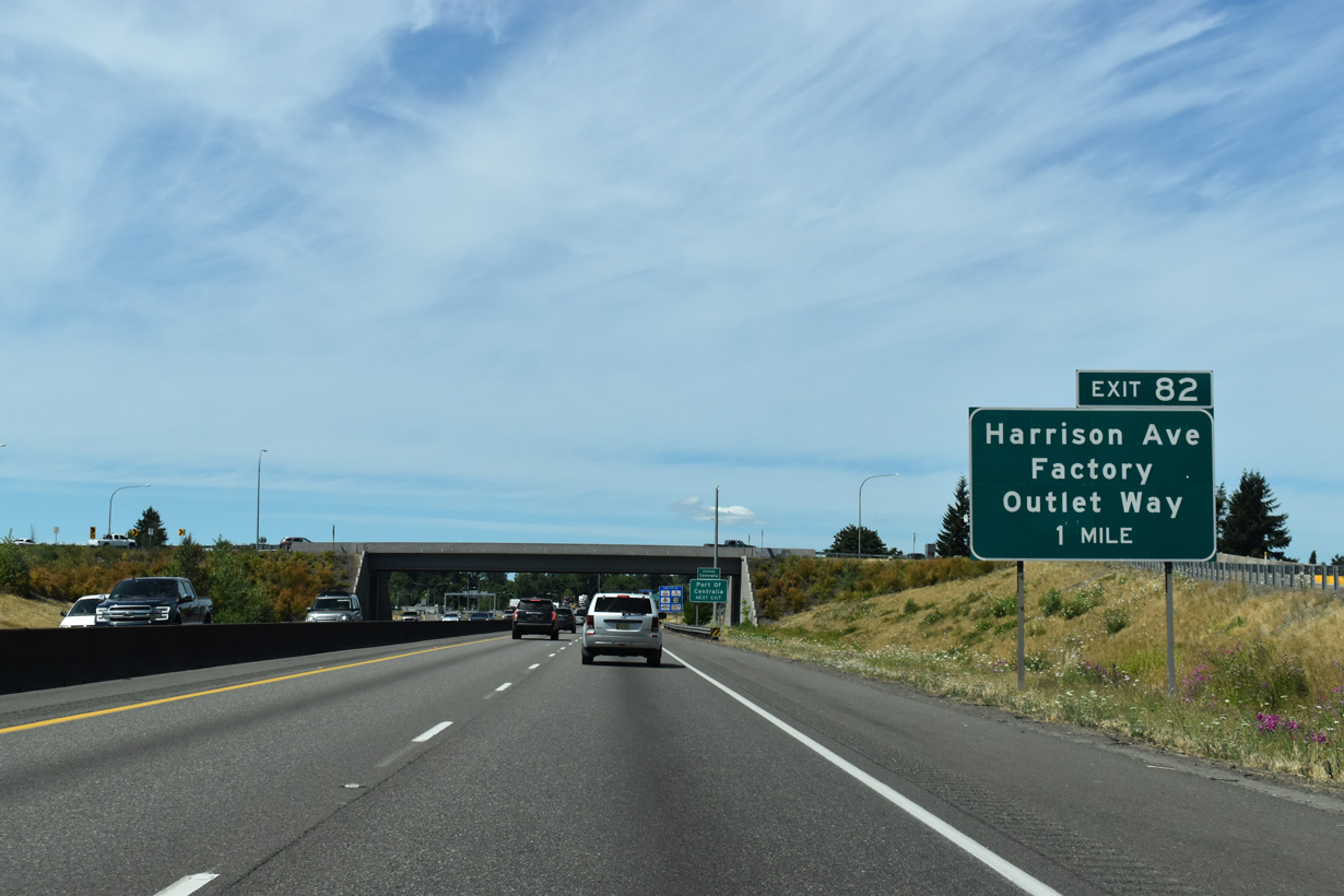
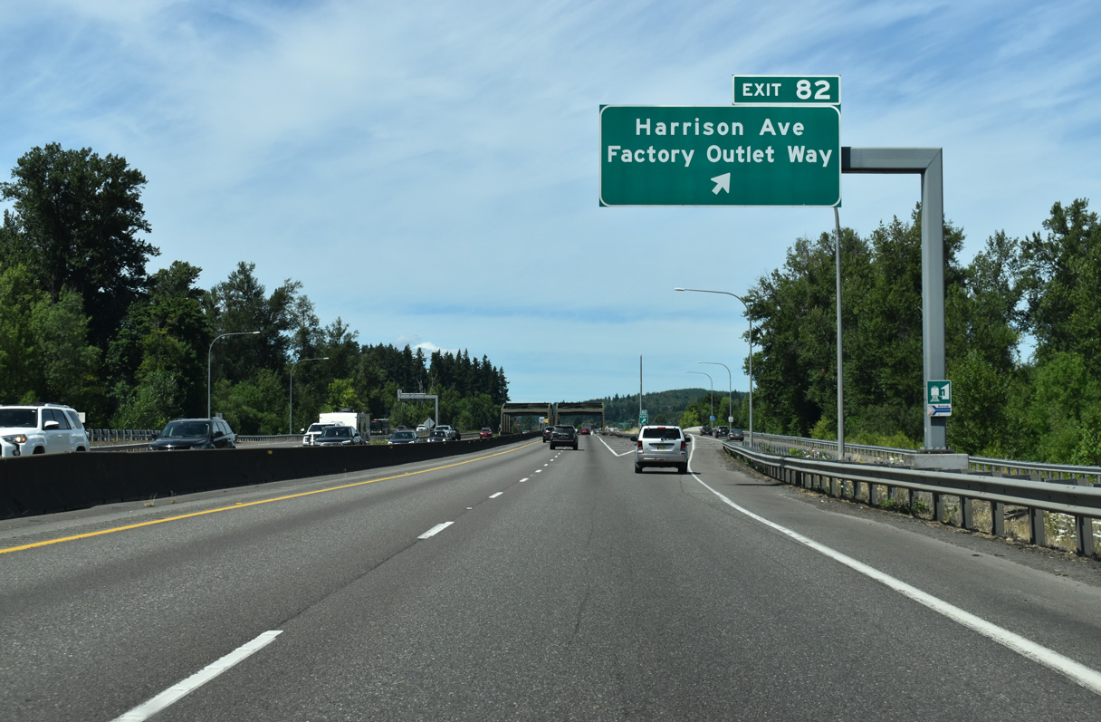
I-5/U.S. 12 run between the Chehalis River and Plummer Lake on the ensuing stretch north to Exit 82 for Harrison Avenue and Factory Outlet Way.
07/16/23
Interstate 5 enters the city of Centralia at the Art Lehman Drive over crossing. According to the city's website, Centralia was founded in 1875 by a former slave named--believe it or not--George Washington.
07/16/23
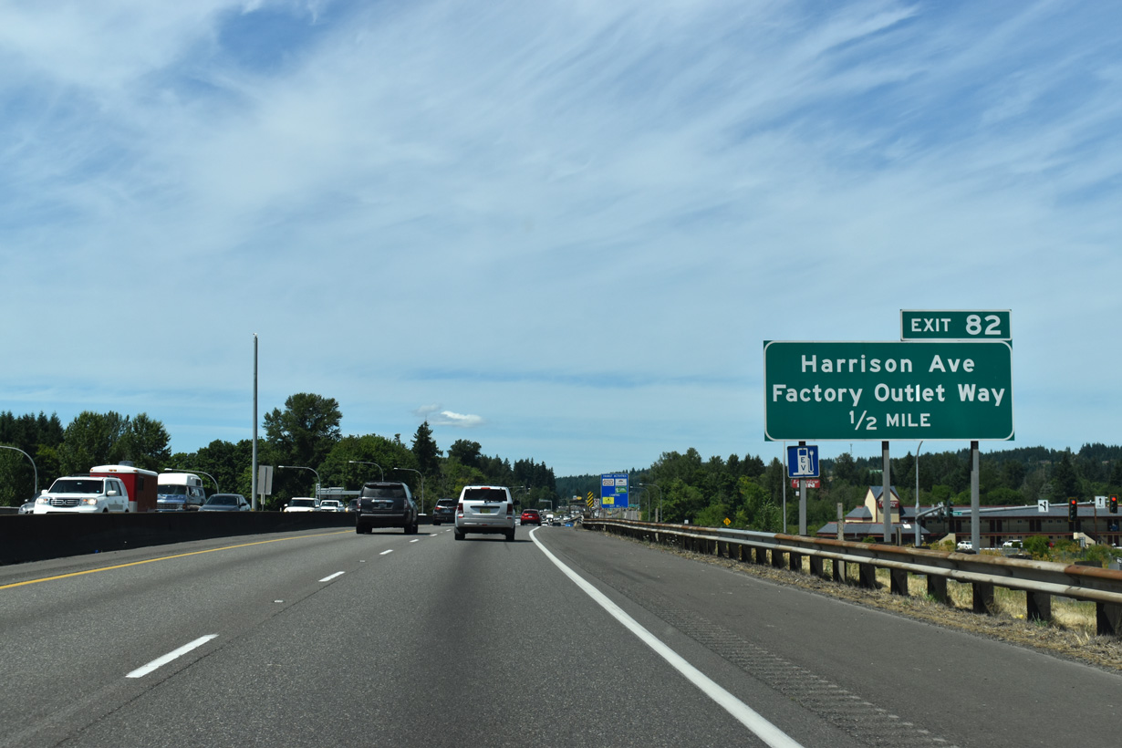
There is no road named Factory Outlet Way in Centralia. The stores of the Centralia Factory Outlets are located along Harrison Avenue east of I-5/U.S. 12 and along parallel Lum Road on the west side of the freeway.
07/16/23
The entrance ramp OR 507 (Mellen Street) forms a lengthy distributor roadway north to the diamond interchange (Exit 82) with Harrison Avenue. Harrison Avenue angles southeast to Main Street and Downtown Centralia.
07/16/23
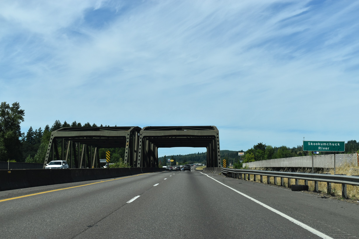
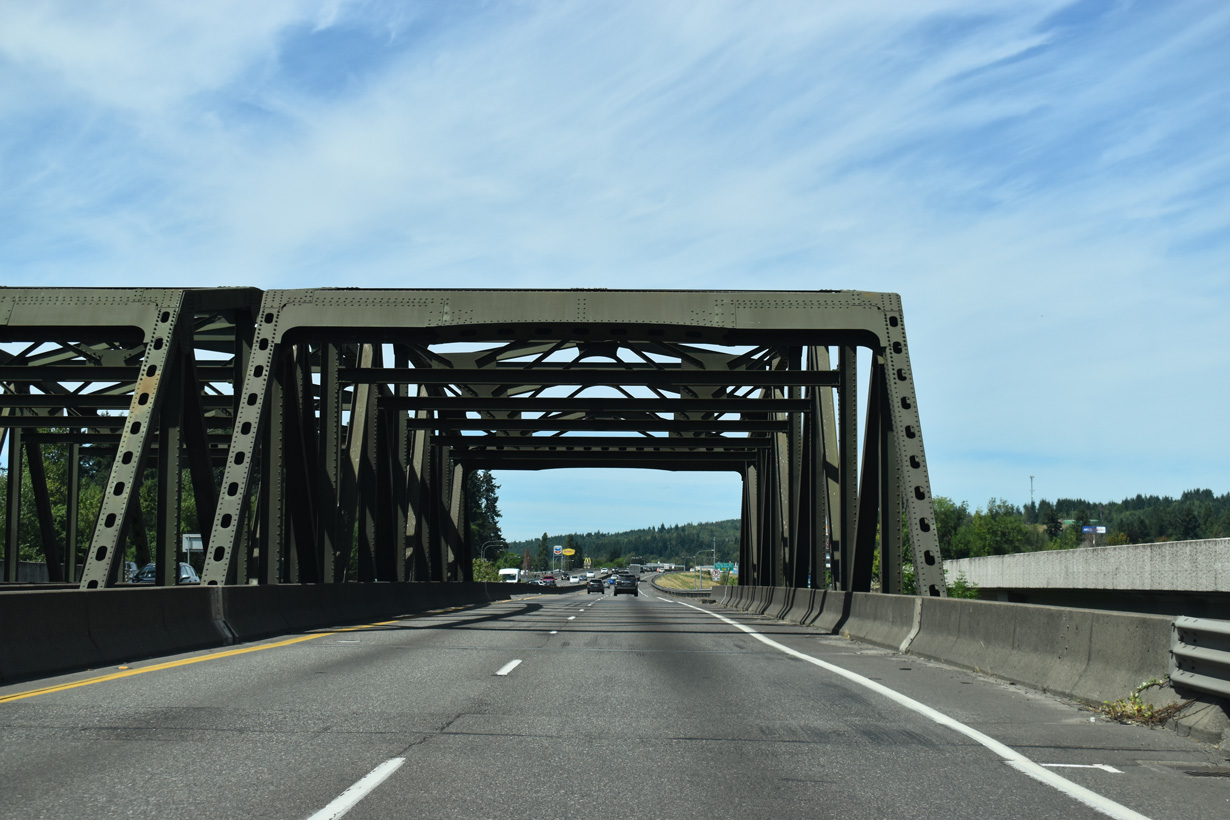
Just beyond the slip ramp at Exit 82, northbound Interstate 5 crosses the Skookumchuck River on a steel truss bridge. The adjacent distributor roadways utilize modern spans built in 2013.
07/16/23
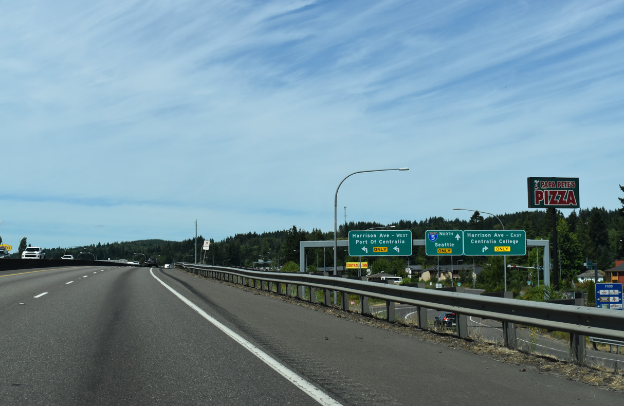
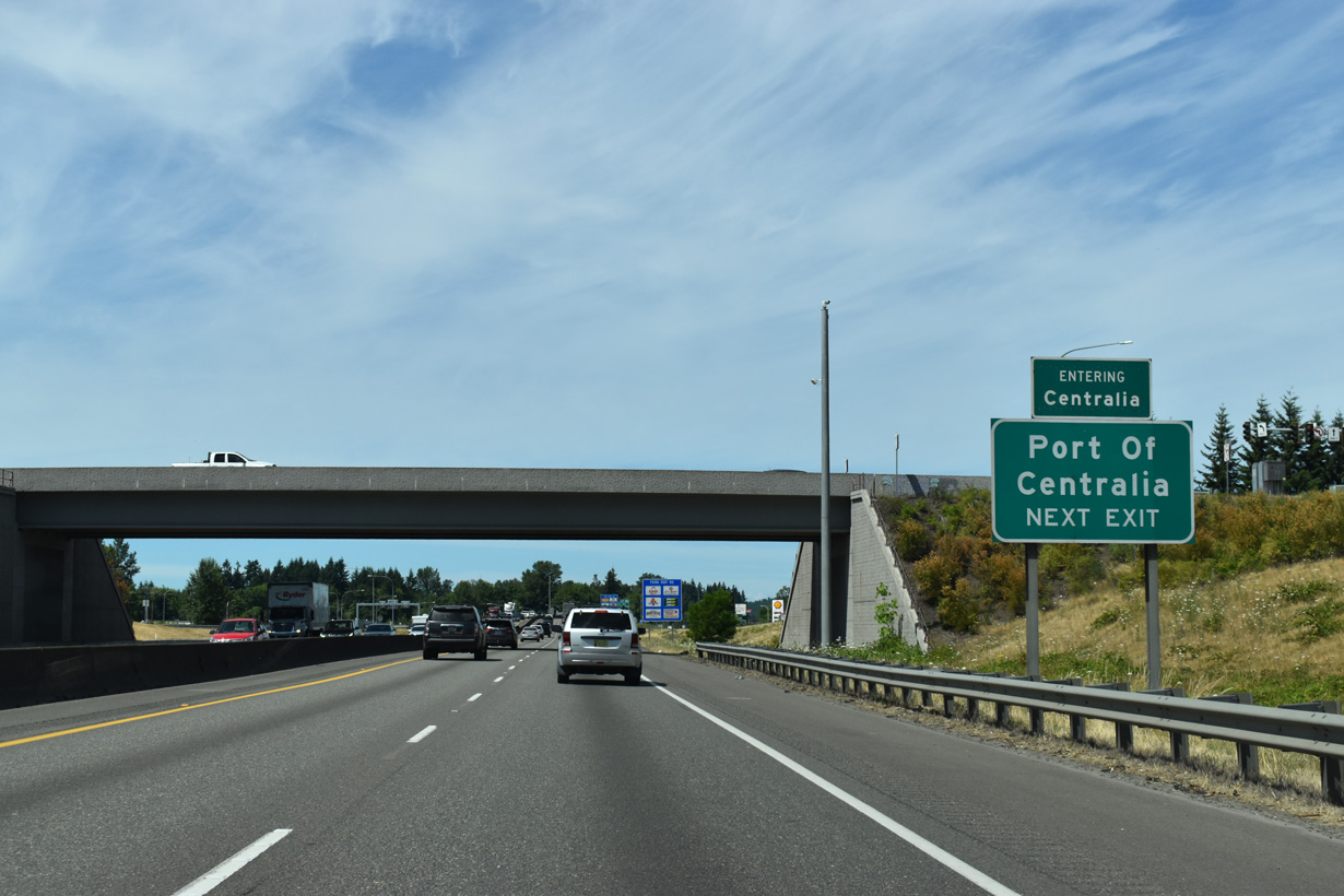
Centralia College is west of the Centralia city center, one block south of Main Street. Harrison Avenue (Old U.S. 99) north to Galvin Road leads to the Port of Centralia.
07/20/23
I-5/U.S. 12 span Reynolds Avenue, the BNSF Railroad and the Chehalis Western Railroad at Blakeslee Junction ahead of these confirming markers.
07/16/23
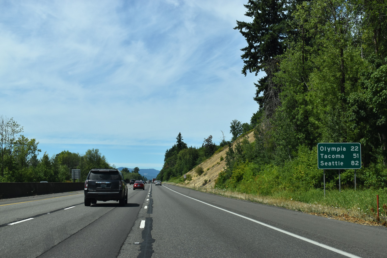
Interstate 5 maintains at least six overall lanes on the 22 miles north to Olympia.
07/16/23
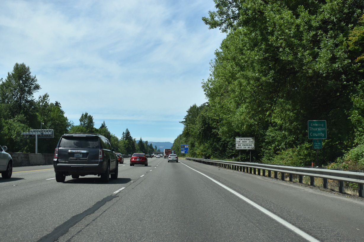
Interstate 5 enters Thurston County north of Davis Hill.
07/16/23
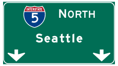

Photo Credits:
- Brent Ivy: 07/16/23, 07/20/23
Connect with:
Page Updated Thursday August 28, 2025.