
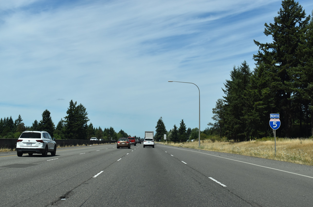
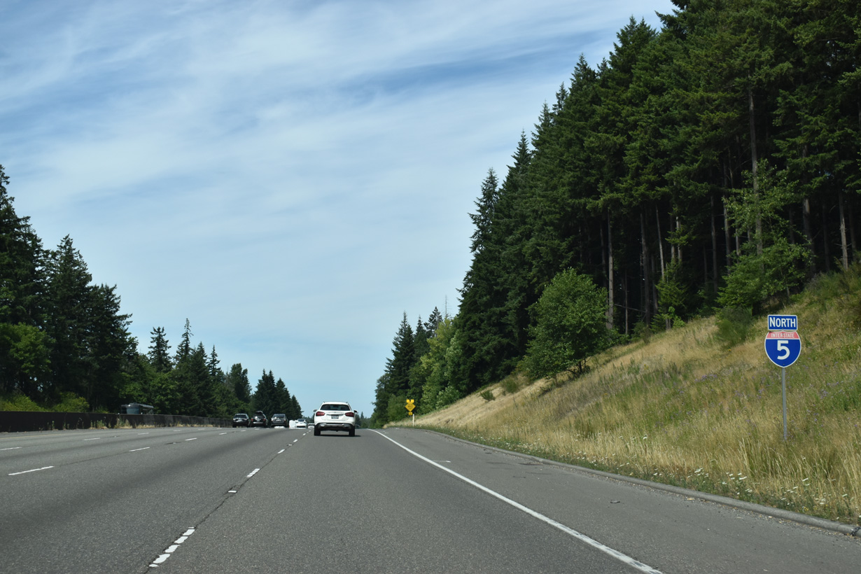
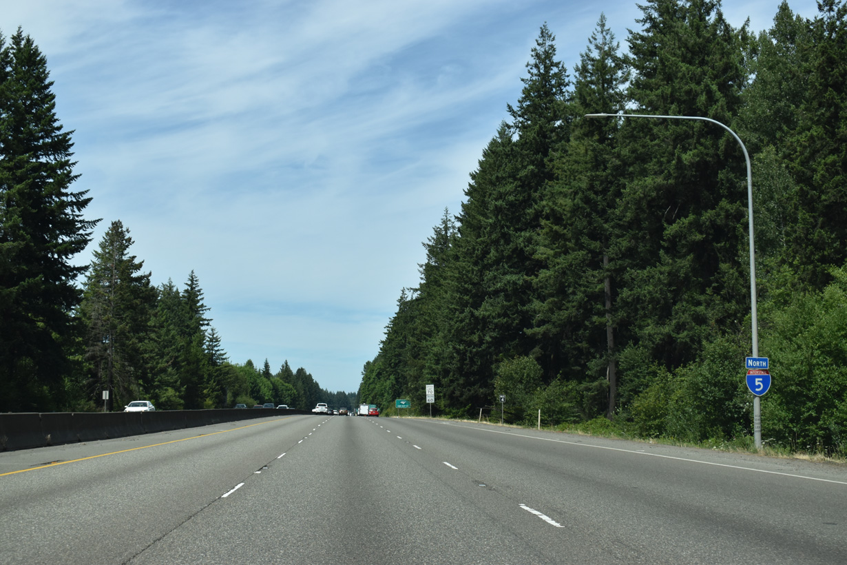
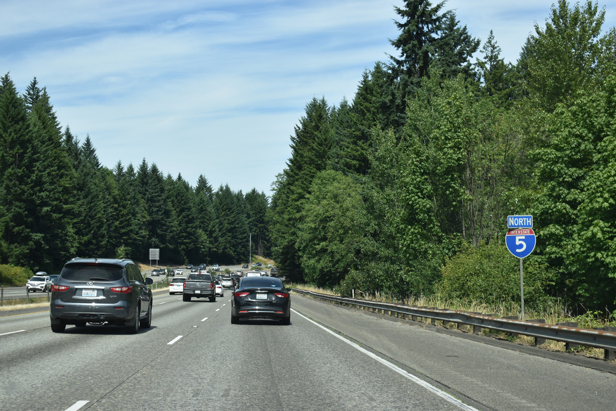
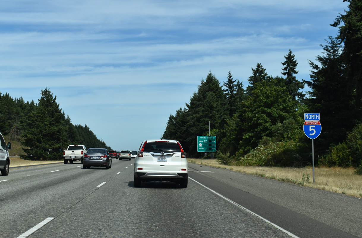
Interstate 5 North - Grand Mound to Olympia
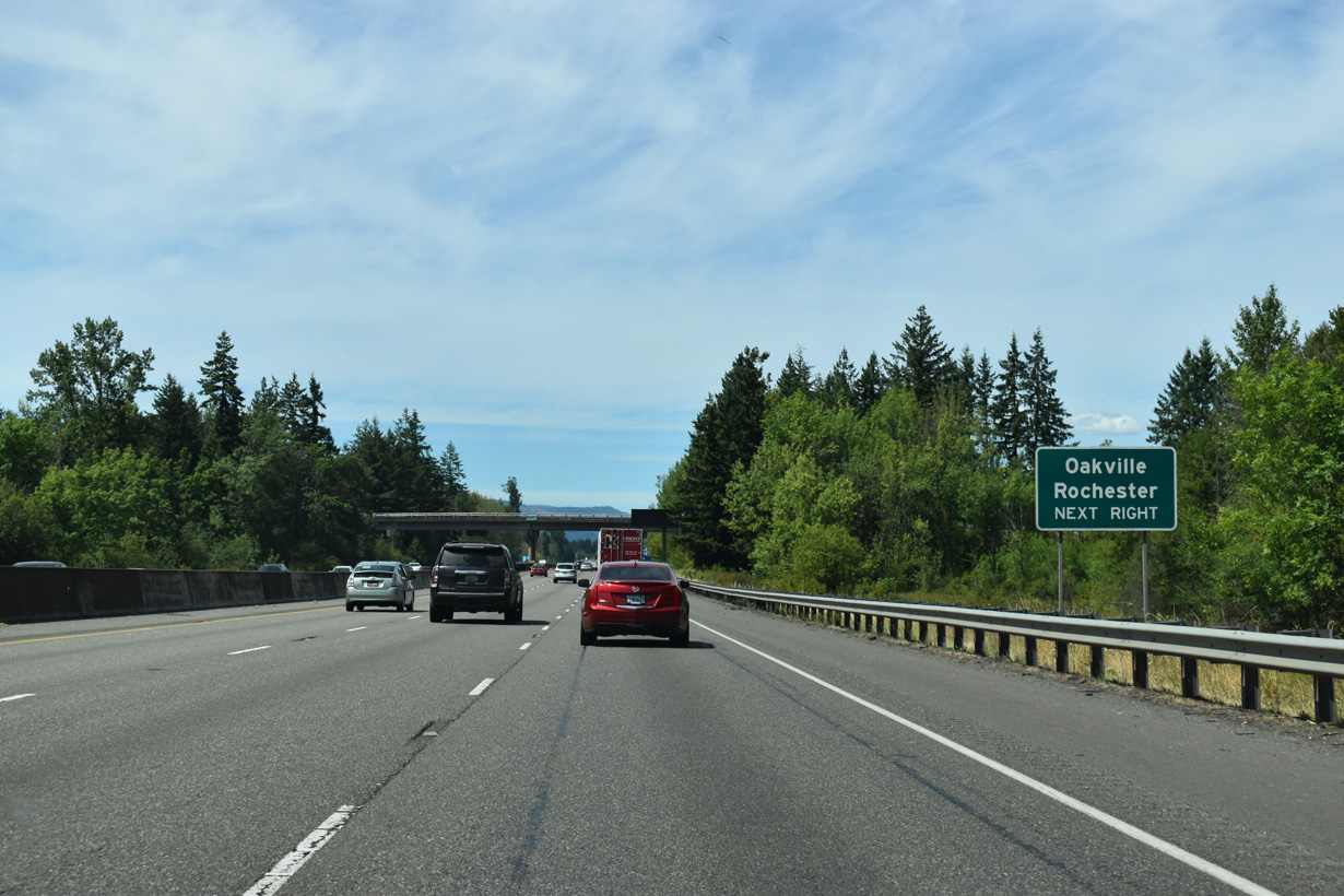
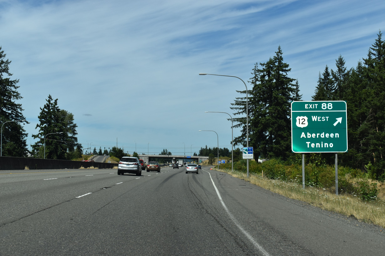
U.S. 12 branches west from Interstate 5 at Exit 88 to the census designated place of Rochester and city of Oakville.
07/16/23
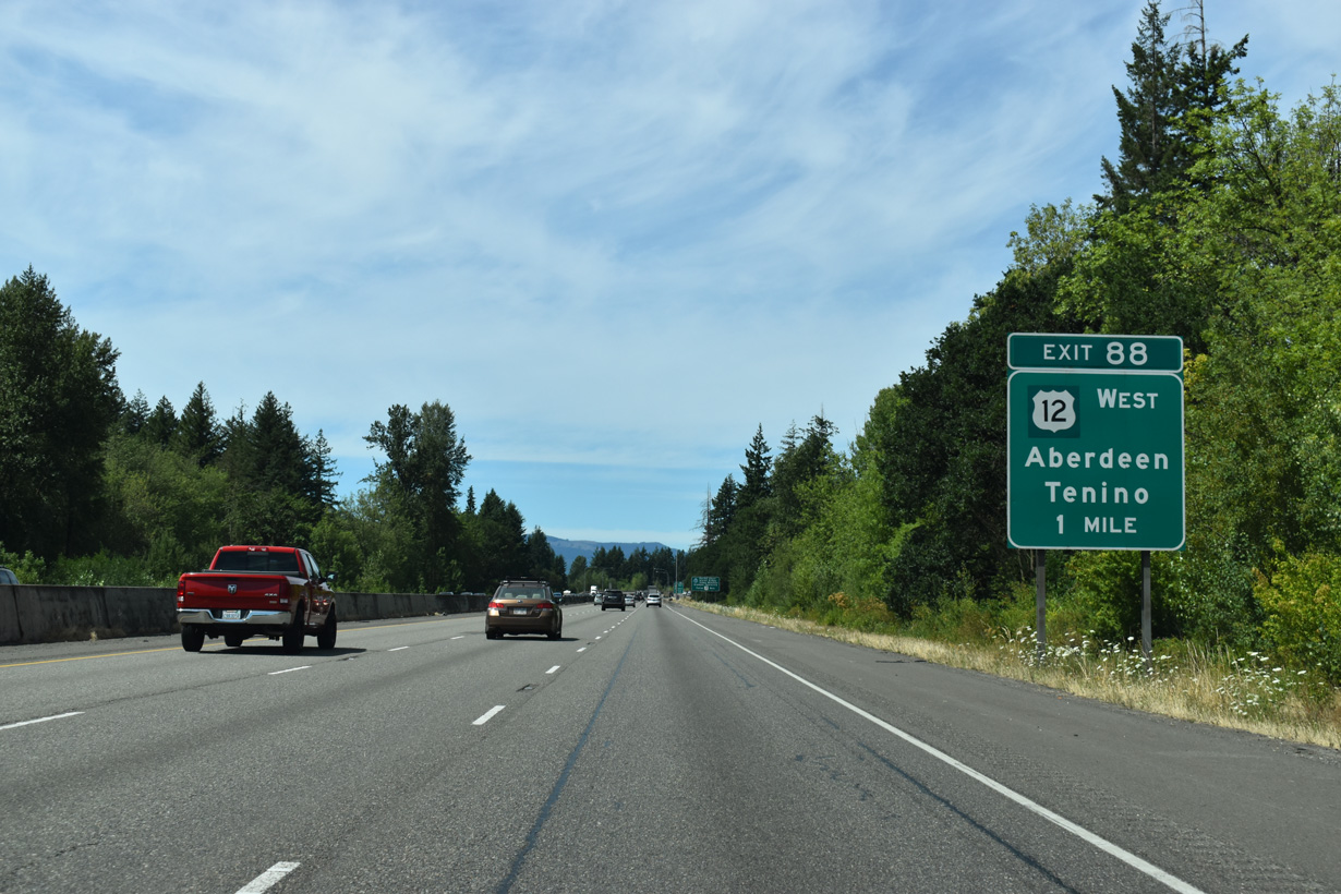
U.S. 12 parts ways with Interstate 5 north at the census designated place of Grand Mount. The highway continues 46.32 miles from Exit 88 west to U.S. 101 in the Aberdeen city center.
07/16/23
U.S. 101 heads north from U.S. 12 and Aberdeen to the Olympic Peninsula and south to Raymond and Astoria, Oregon.
07/16/23
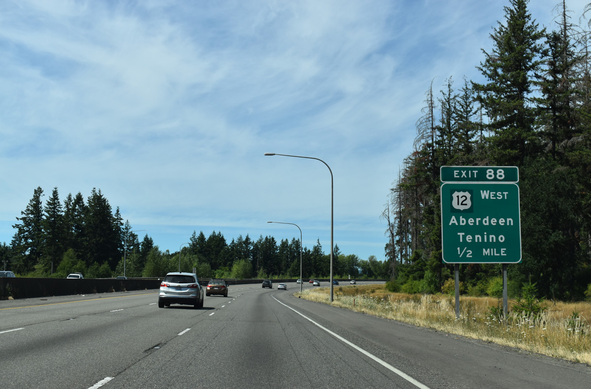
Construction completed in 2012 reconfigured the six-ramp parclo interchange (old Exits 88 A/B) with U.S. 12 west and Old Highway 99 into a diamond interchange. U.S. 12 previously used a loop ramp to depart I-5 north.
07/16/23
Old Highway 99 heads northeast along Grand Mound Prairie to South Sound Speedway at 183rd Avenue SW and SR 507 in the city of Tenino.
07/16/23
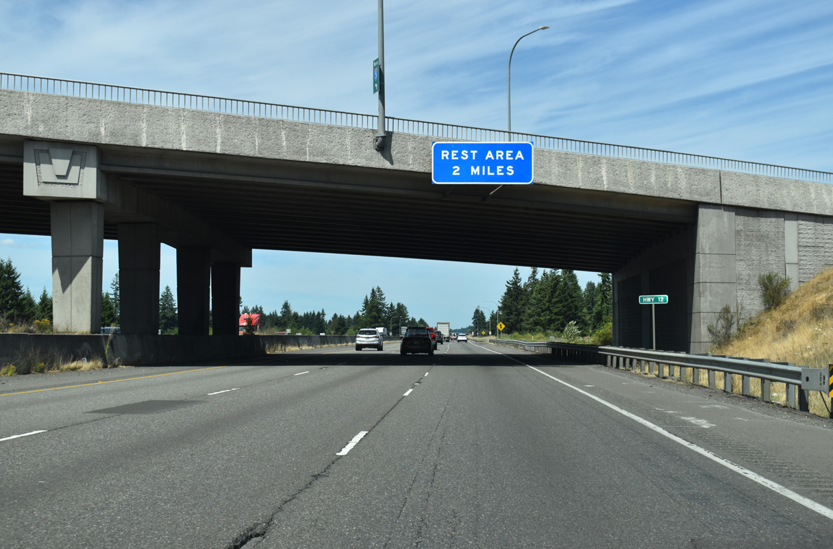
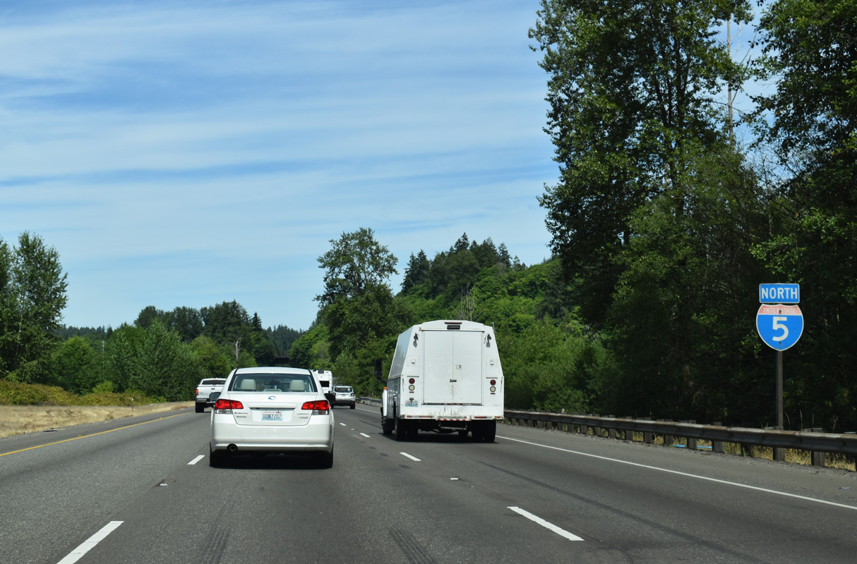
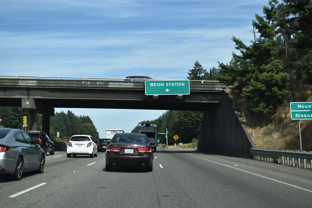
The Scatter Creek Rest Area follows along Interstate 5, two miles north of U.S. 12.
07/16/23
The Chehalis Western Railroad continues along the west side of Interstate 5 as both proceed north across Grand Mound Prairie.
07/16/23
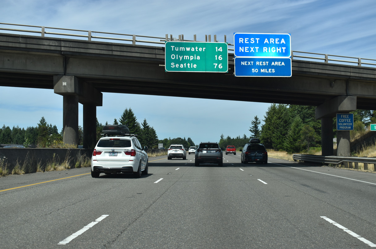
The 183rd Avenue SW spans Interstate 5, 14 miles south of Tumwater. Grand Mound is 76 miles south of Seattle.
07/16/23
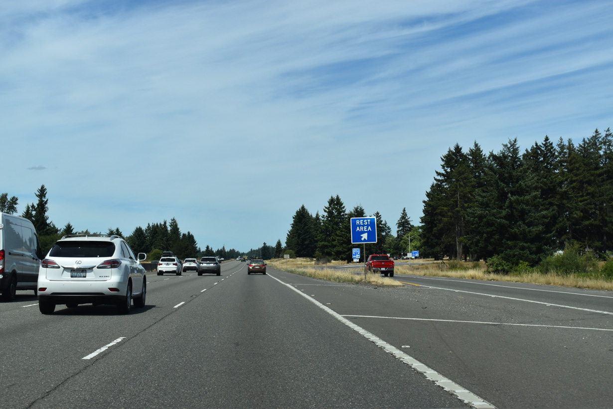
The Scatter Creek Rest Area offers the last respite to northbound travelers before the heavy traffic of the Puget Sound population belt.
07/16/23
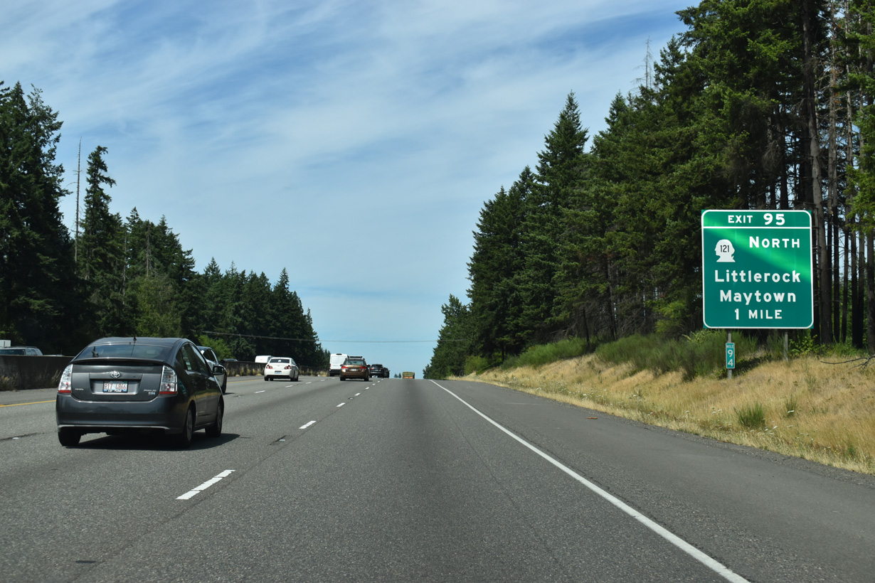
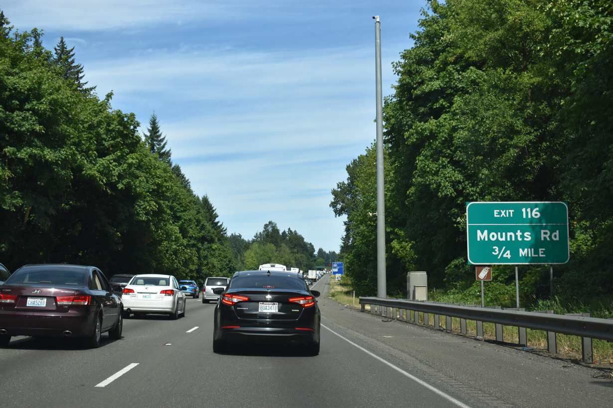
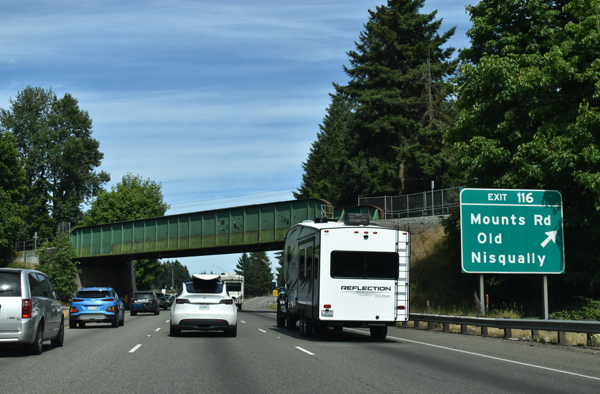
SR 121 (Maytown Road) connects with Interstate 5 at Exit 95 to the west of the unincorporated community of Maytown.
07/16/23
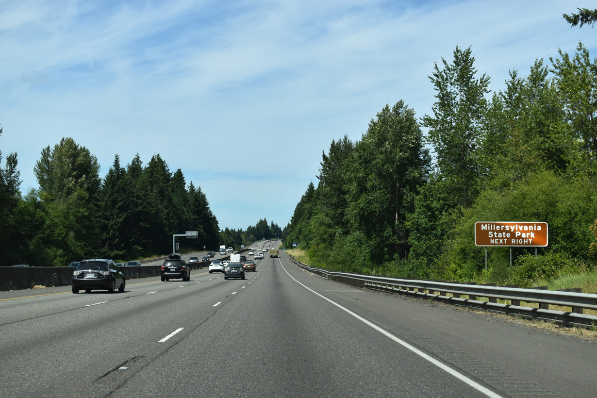
The 7.67 mile long loop of SR 121 passes through Millerslyvania State Park north along Tilley Road.
07/16/23
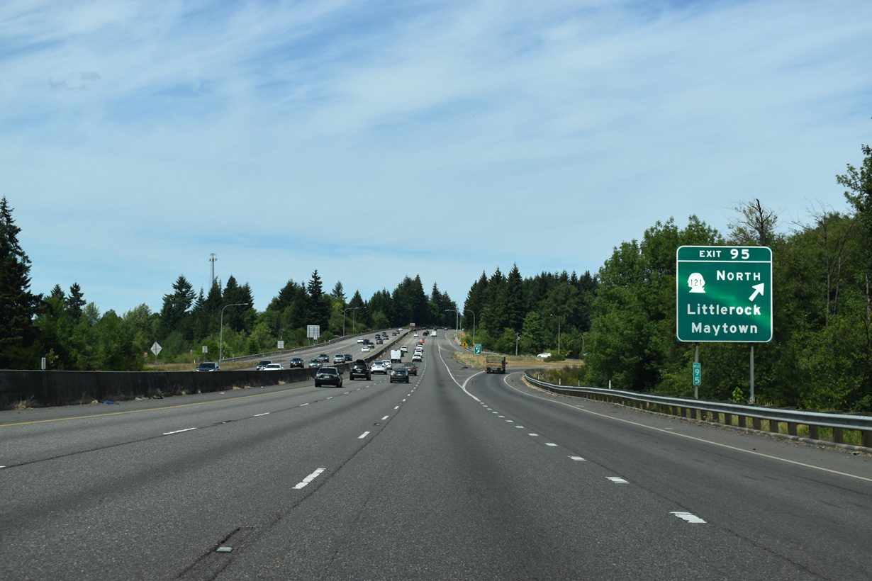
Maytown Road continues west from SR 121 and the folded diamond interchange at Exit 95 to the unincorporated community of Littlerock.
07/16/23
The six lane section of Interstate 5 previously began north from Exit 95.
07/16/23
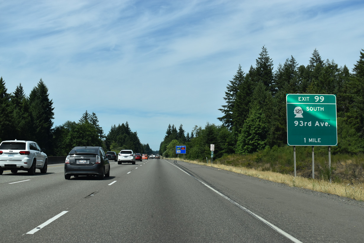
SR 121 returns to Interstate 5 at Exit 99 west along 93rd Avenue S. Several large distribution centers were built on previously rural land off SR 121 by 2023.
07/16/23
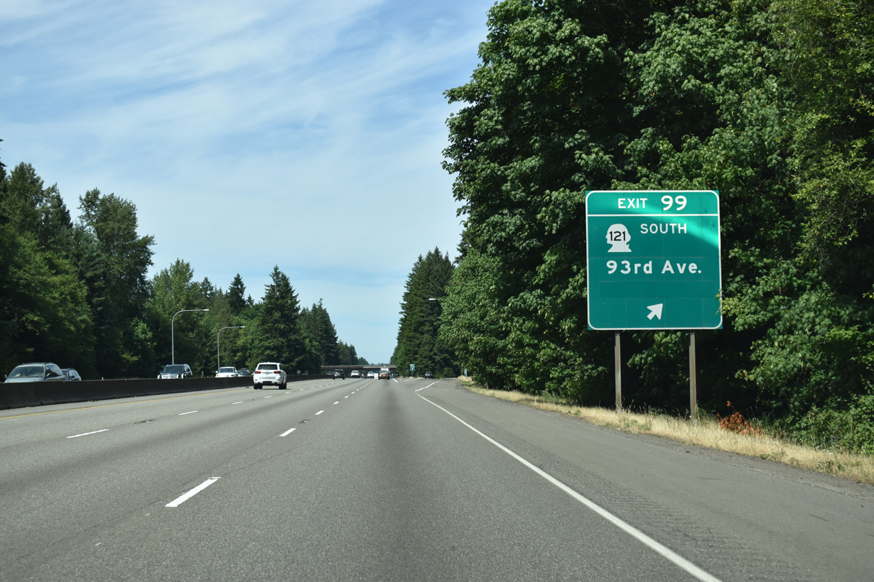
Interstate 5 enters the city of Tumwater at the diamond interchange (Exit 99) with the north end of SR 121 and 93rd Avenue SW. Greened out on Exit 99 signage is Scott Lake.
07/16/23
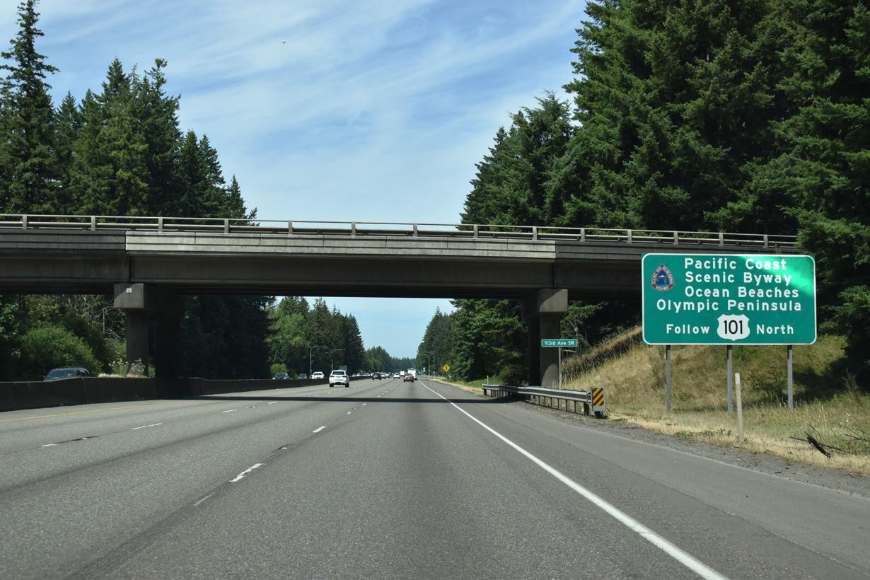
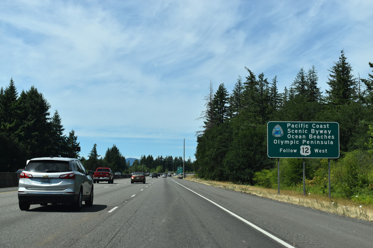
U.S. 101 (Olympic Loop Highway) begins from Interstate 5 at Exit 104, well beyond this sign preceding the SR 121 (93rd Avenue SW) overpass that references the Pacific Coast Scenic Byway encircling the Olympia Peninsula.
07/16/23
Incorporated in 1869, Tumwater, whose name comes from Chinook jargon for "waterfall," is the oldest permanent Euro-American settlement on Puget Sound (City of Tumwater, n.d.).
07/16/23
There are five overall exits from Interstate 5 north in the city of Tumwater.
07/16/23
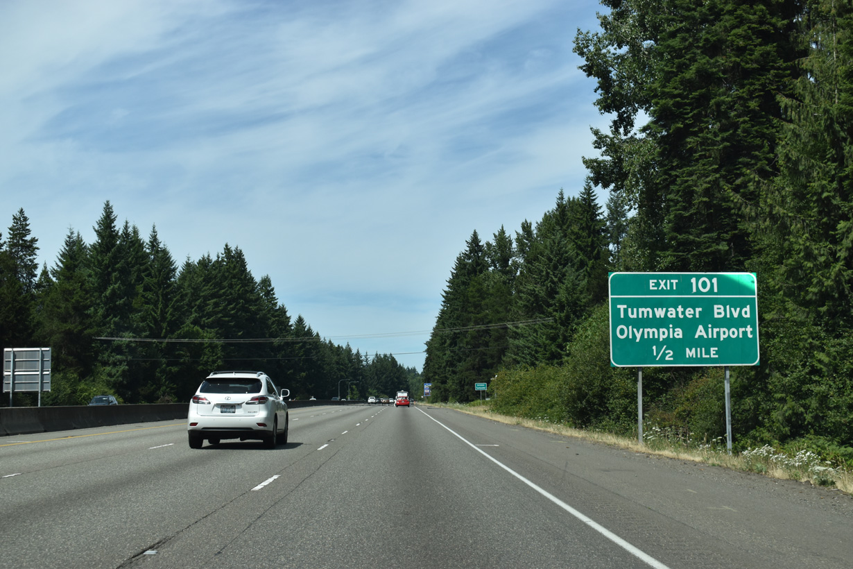
Tumwater Boulevard joins Interstate 5 with Capital Boulevard SE (Old U.S. 99) north of Olympia Regional Airport (OLM).
07/16/23
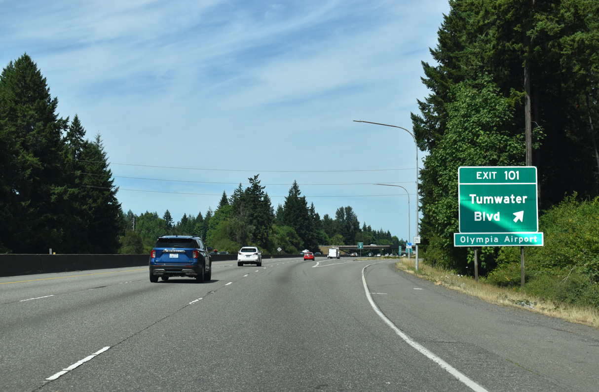
Exit 101 departs Interstate 5 north for Tumwater Boulevard.
07/16/23
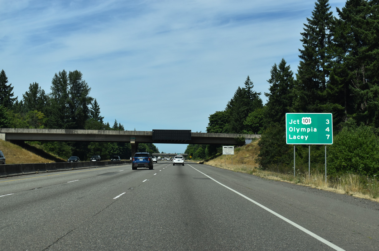
The remaining three miles leading north to U.S. 101 along Interstate 5 are urban with a barrier median separating the roadways.
07/16/23
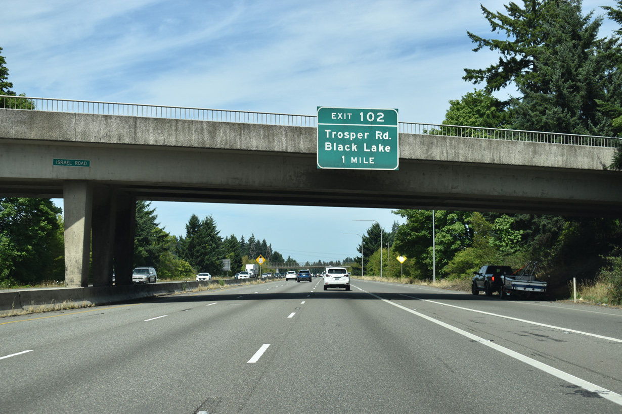
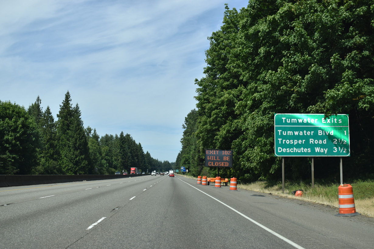
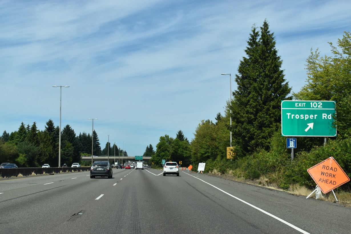
The speed limit lowers to 60 miles per hour north between the Israel Road overpass and a commercialized parclo interchange (Exit 102) with Trosper Road.
07/16/23
West of from Exit 102, Trosper Road (54th Avenue SW) leads eventually to Black Lake-Belmore Road and Black Lake, a popular water-skiing spot. Trosper Road east ties into Capitol Boulevard (Old U.S. 99) at a roundabout to the immediate east. of I-5.
07/16/23
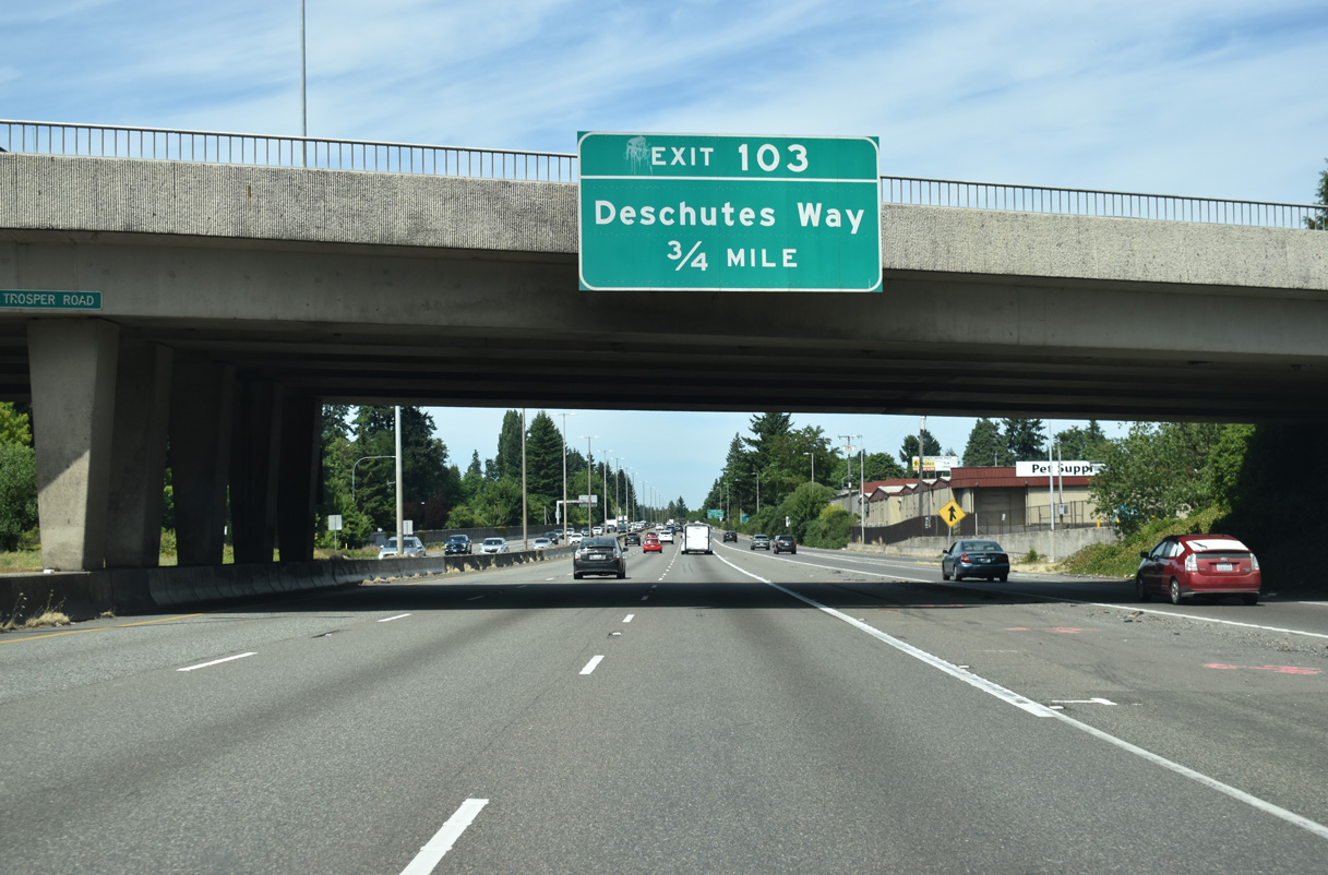
Interstate 5 runs alongside Capitol Boulevard (Old U.S. 99) north from Trosper Road 0.75 miles to Exit 103 for Deschutes Way.
07/16/23
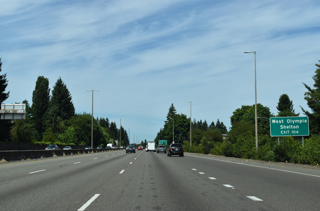
U.S. 101 follows a freeway northwest from Exit 104 through West Olympia and an expressway north from SR 8 to the city of Shelton.
07/16/23
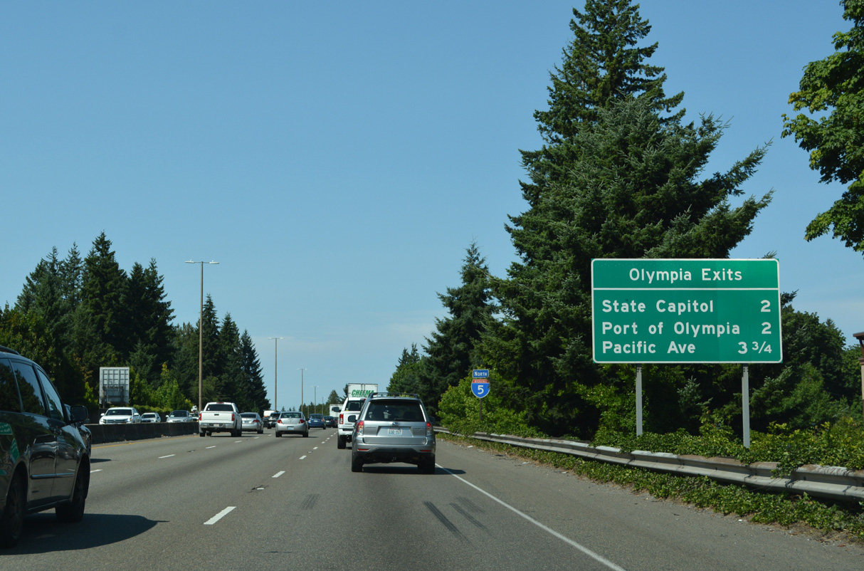
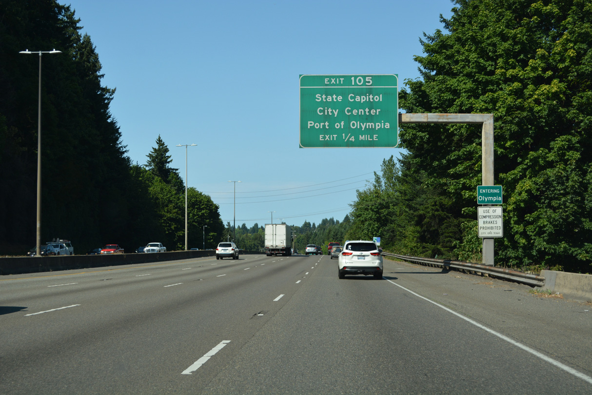
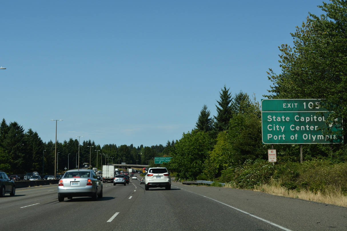
Interstate 5 turns northeast from U.S. 101 and Tumwater into the city of Olympia. Exit 105 to the State Capitol and Port of Olympia follows.
07/20/23
This confirming marker for Interstate 5 stands beyond the entrance ramp from Trosper Road.
07/20/23
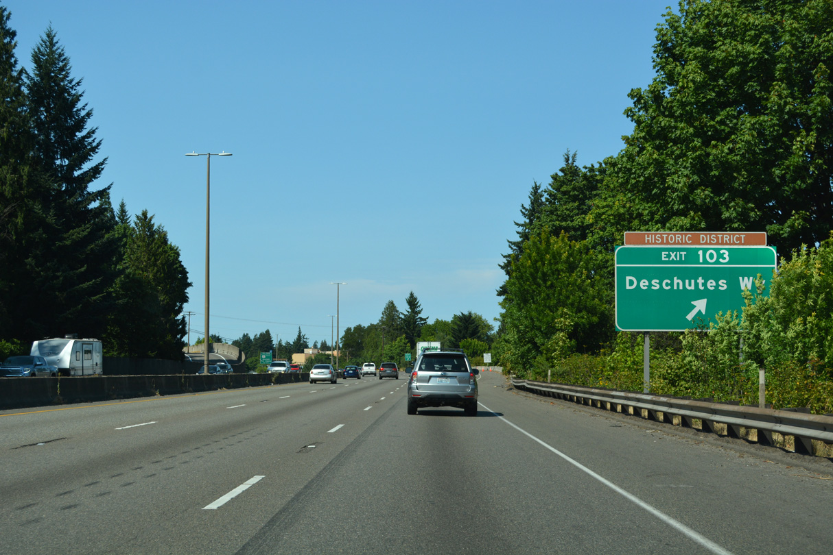
Deschutes Way is named for the Deschutes River which flows into Budd Inlet at the south end of Olympia. The historic district references Tumwater Historical Park, a park next to Capitol Lake along Deschutes Way.
07/20/23
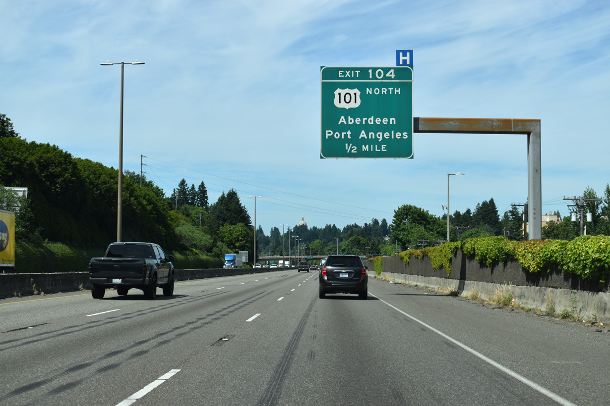
The dome of the Washington State Capitol appears above the tree line, a half mile ahead of Exit 104 for U.S. 101 north to Aberdeen and Port Angeles.
07/16/23
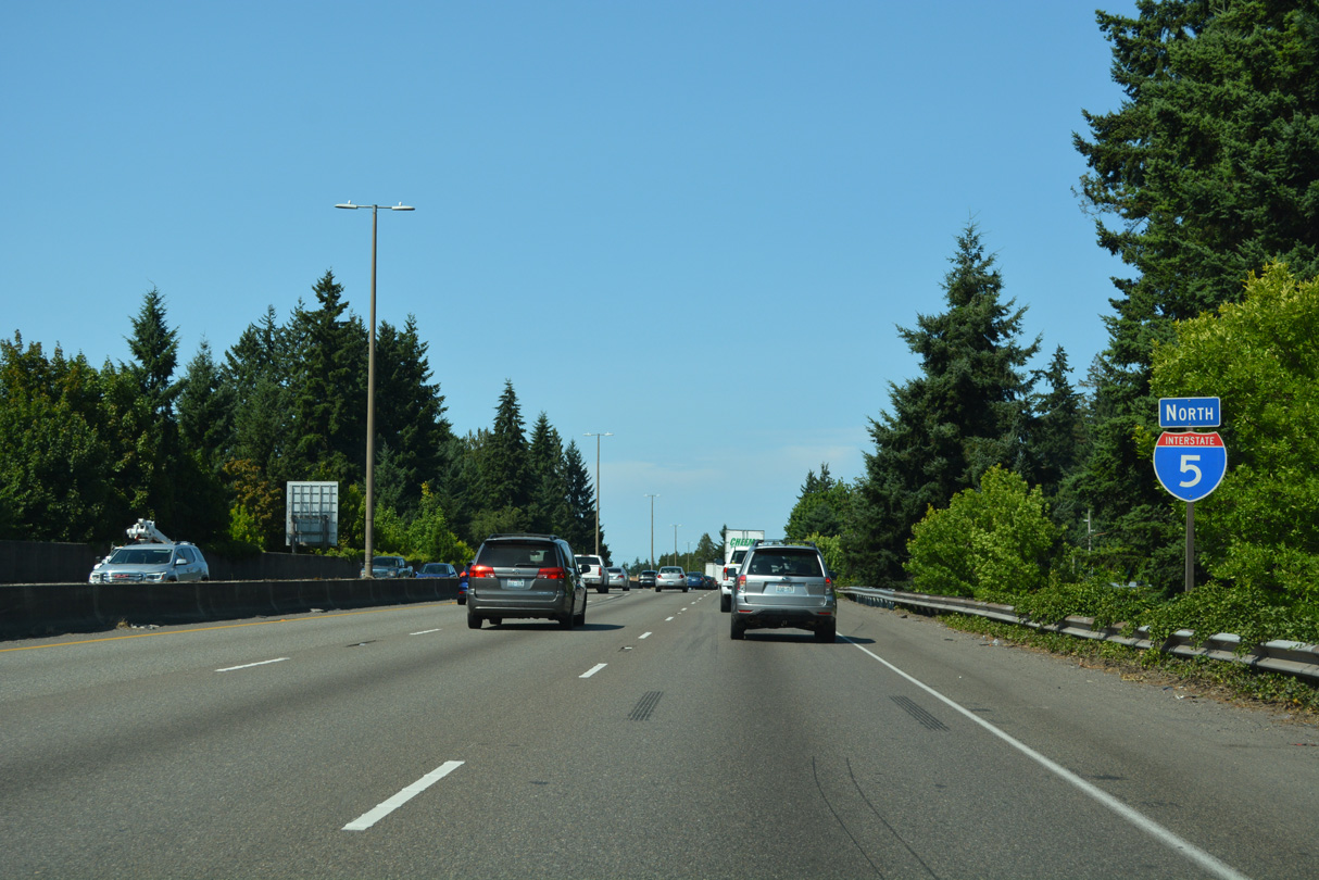
U.S. 101 (Olympic Loop Highway) travels north along the Olympic Peninsula toward Port Townsend (via SR 20) and west to Port Angeles and Olympic National Park. SR 8 branches west from U.S. 101 to U.S. 12 at Elma; U.S. 12 continues west from SR 8 to U.S. 101 at Aberdeen.
07/16/23
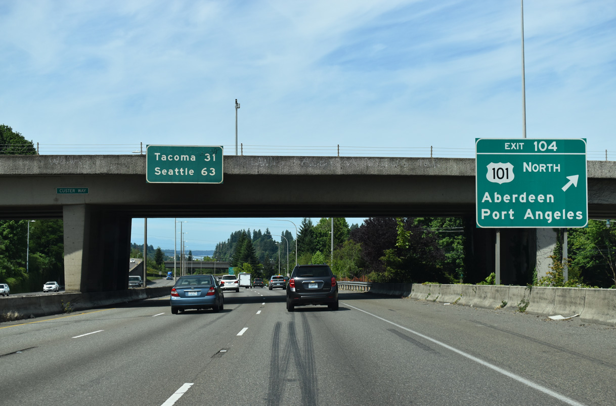
An entrance ramp from adjacent Deschutes Way joins the ramp from I-5 north at Exit 104 leading into the directional T interchange with U.S. 101.
09/02/06
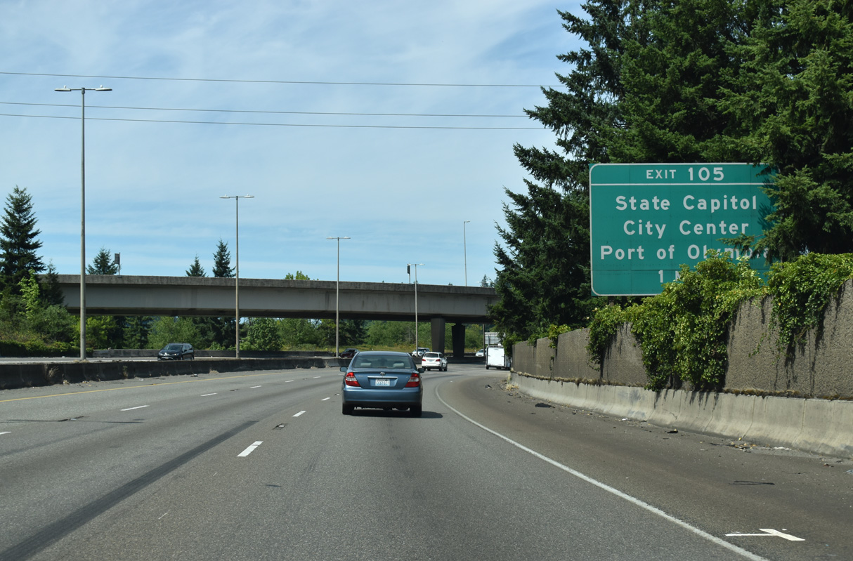
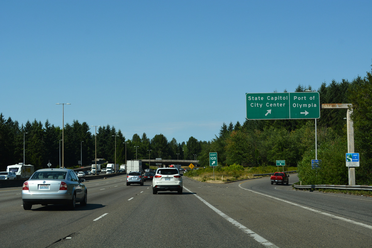
Curving east across Capitol Lake, Interstate 5 enters the city of Olympia ahead of Exit 105 to 14th Avenue SE and Henderson Boulevard.
07/16/23
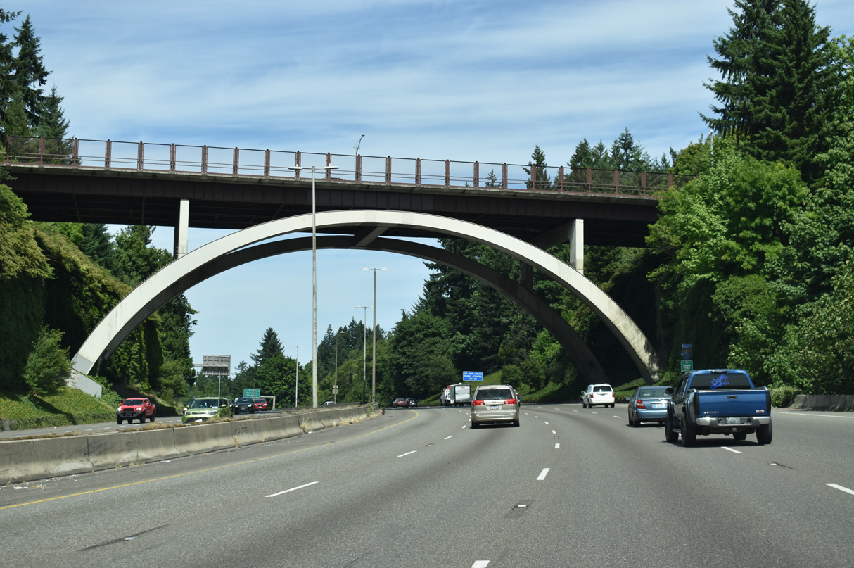
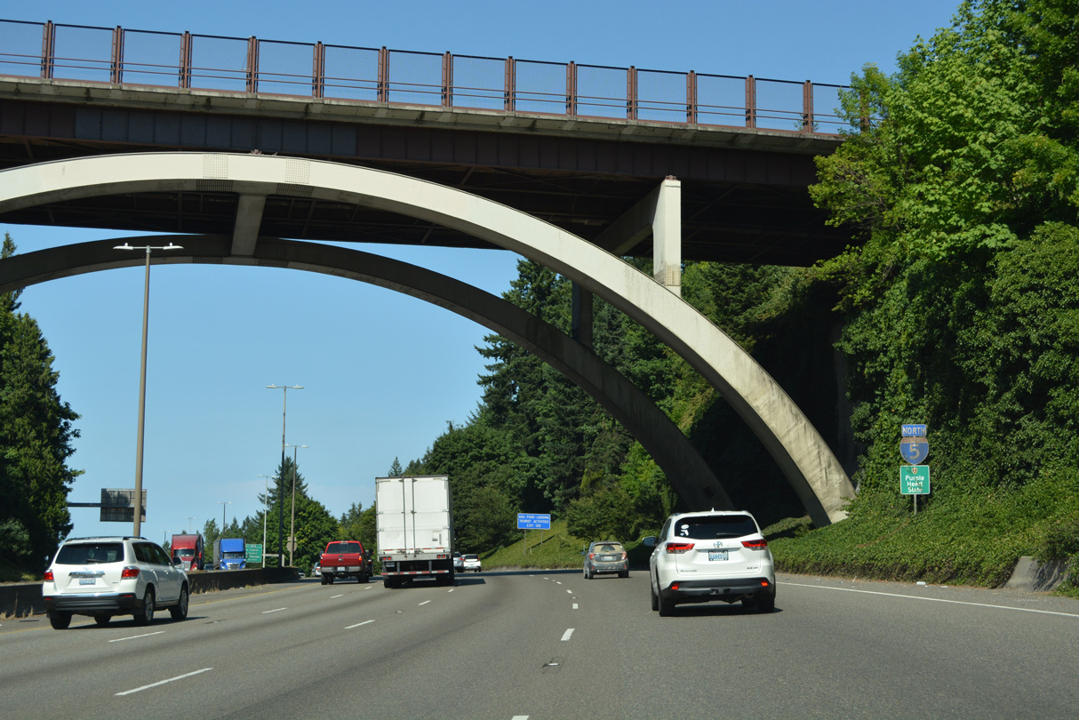
Capitol Boulevard spans Interstate 5 across an arch bridge east of Capitol Lake.
07/16/23
Northbound Interstate 5 continues with four lanes across Olympia to Exit 108.
07/20/23
Once named by Time magazine as the "hippest town in the West," Washington's capital sits at the southernmost end of Puget Sound. The capital city is a waypoint to the Olympic Mountains, beaches, forests, as well as the heavily-urbanized area of the east sound.
07/20/23
Exit 105 diverges into separate ramps for 14th Avenue SE south to Henderson Boulevard and north to the Washington State Capitol.
07/20/23
Henderson Boulevard curves northward below I-5 and 14th Avenue SE en route to Plum Street. Plum Street extends north to East Bay Drive near the Port of Olympia.
07/20/23
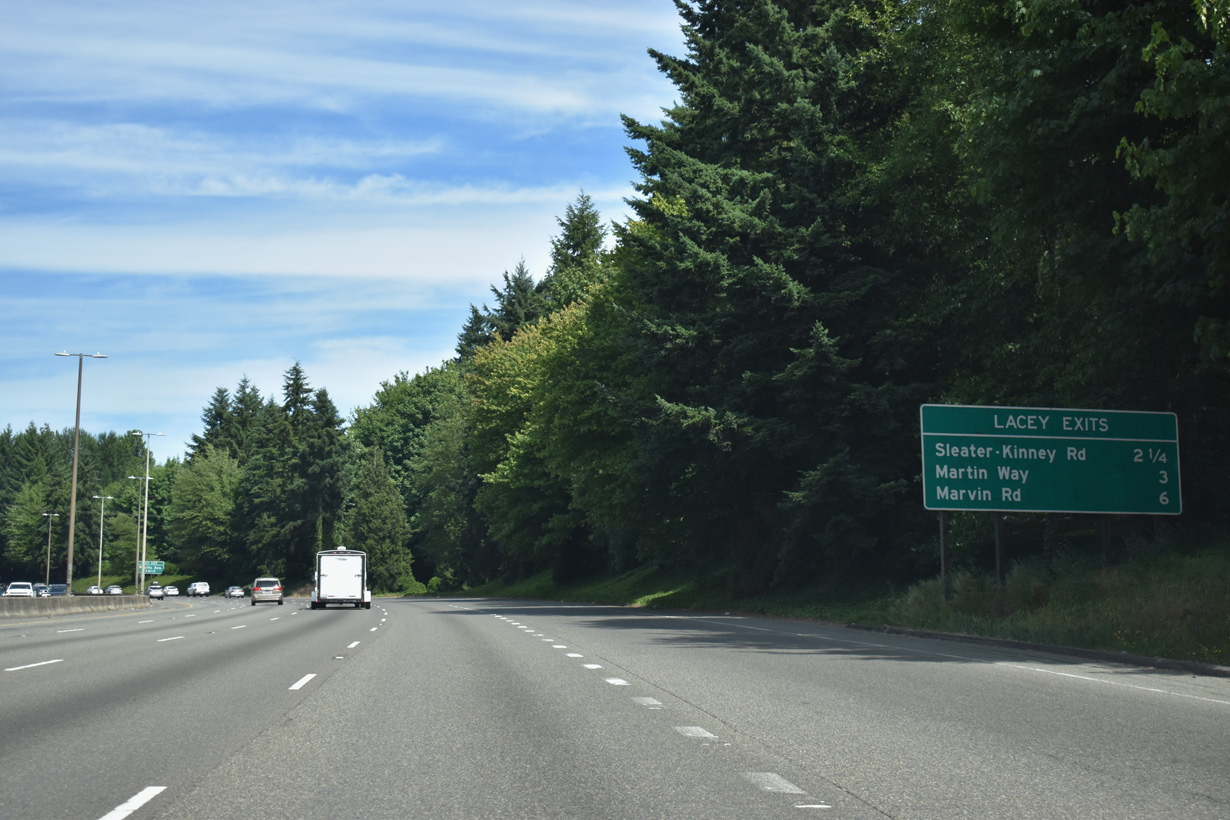
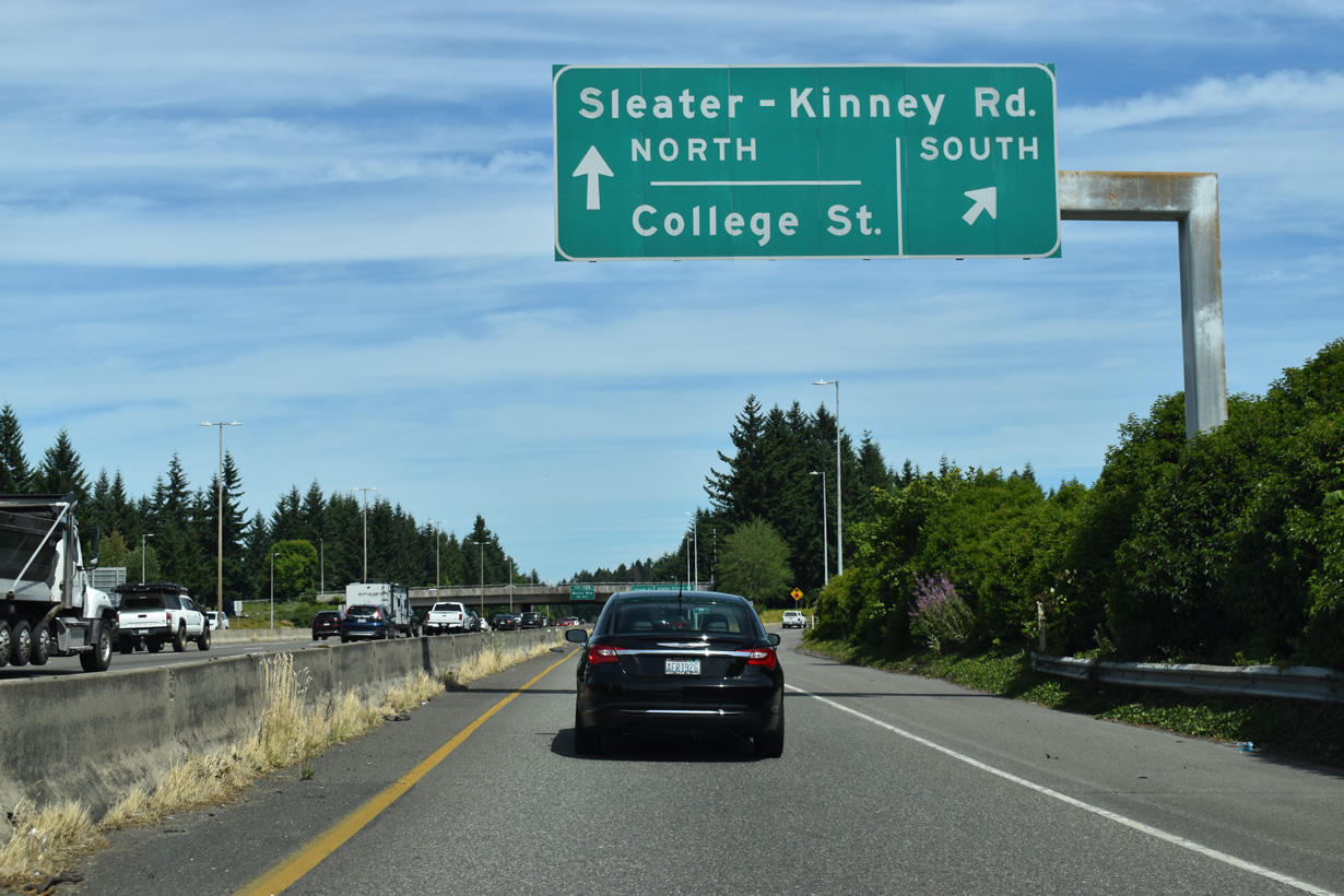
Located 2.25 miles to the east, Exit 108 for Sleater-Kinney Road is the first of three exits for the city of Lacey, a city incorporated in 1966.
07/16/23
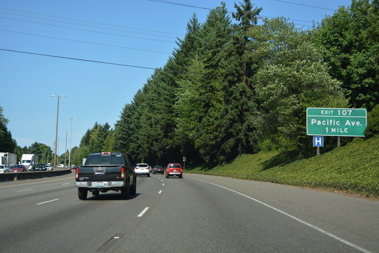
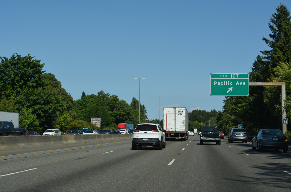
Pacific Avenue branches southeast from the couplet of 4th Avenue E (Old U.S. 99/410) and State Avenue NE to a parclo interchange (Exit 107) with Interstate 5 in east Olympia.
07/20/23
Southeast of Exit 107, Pacific Avenue (Old SR 510) enters Lacey ahead of Sleater-Kinney Road and partitions into the couplet of Pacific Avenue / Lacey Boulevard. Roundabouts at the each end of the couplet were two of eight constructed by the city of Lacey in the mid-2000s.
07/20/23
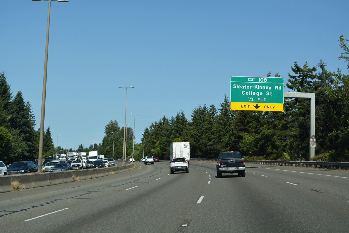
A lane drop occurs along Interstate 5 northbound for Exit 108 to Sleater-Kinney Road and College Street.
07/20/23
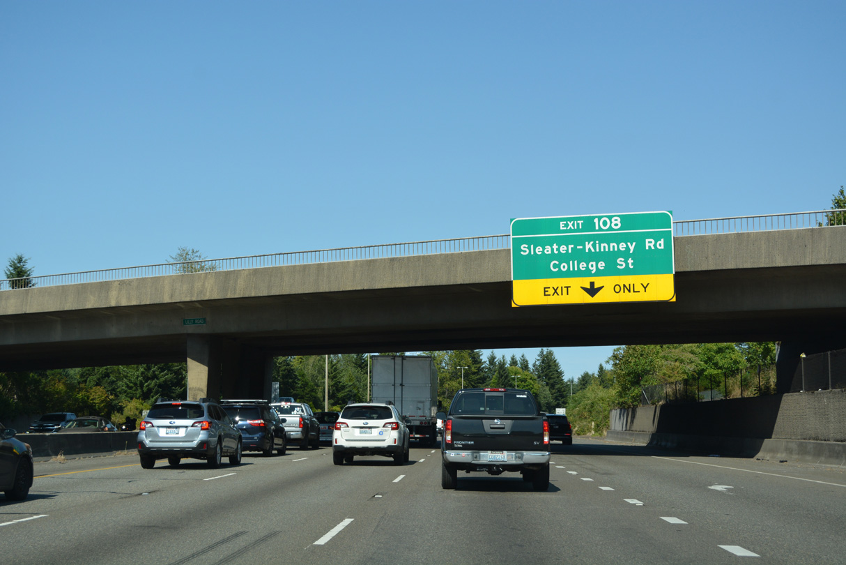
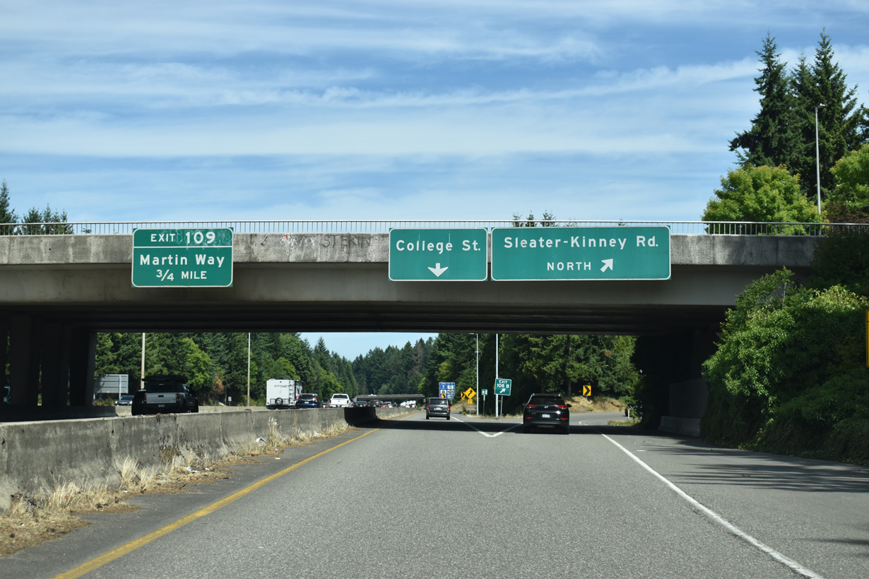
Lily Road spans Interstate 5 north from Pacific Avenue (Old SR 510) to Martin Way (Historic U.S. 99/410) just ahead of the distributor roadway at Exit 108.
07/20/23
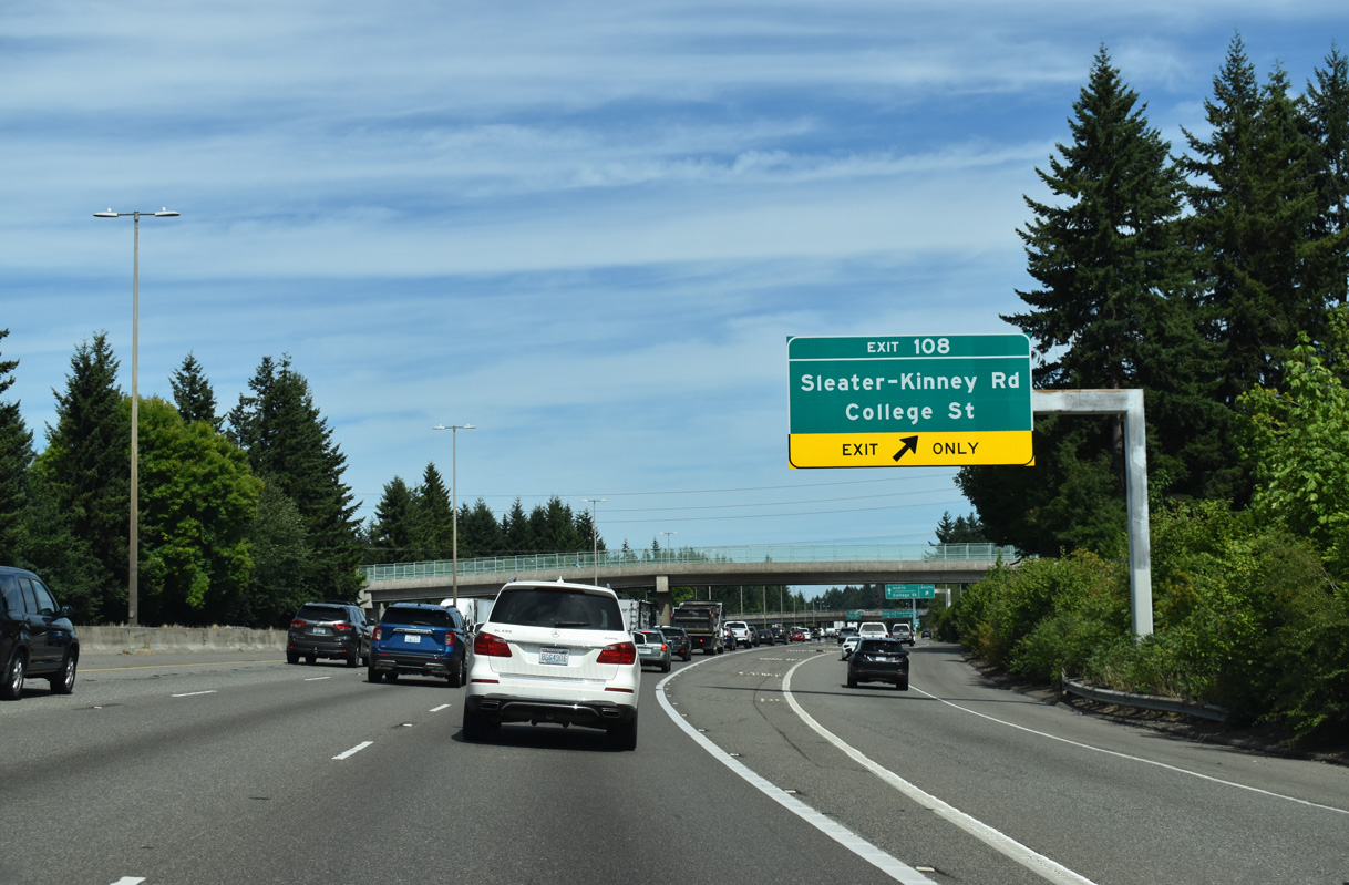
Gore point signs assign the ramps for Sleater-Kinney Road south as Exit 108 A and north as Exit 108 B. The continuation of the distributor lane to the intersection of 3rd Avenue SE and Golf Club Road SE is unnumbered.
07/16/23
South from I-5, Sleater-Kinney Road is a commercial boulevard passing between the South Sound Center and Market Square retail areas.
07/16/23
Sleater-Kinney Road north crosses the Olympia city north north from Exit 108 B to a commercialized intersection with Martin Way. 3rd Avenue SE extends east from the third ramp at Exit 108 to College Street. The Lacey Campus of South Puget Sound Community College lines Golf Club Road nearby.
07/16/23
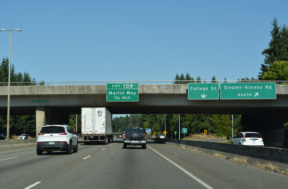
Martin Way (Old U.S. 99/410) east converges with Interstate 5 at a diamond interchange (Exit 109) in 0.75 miles.
07/20/23
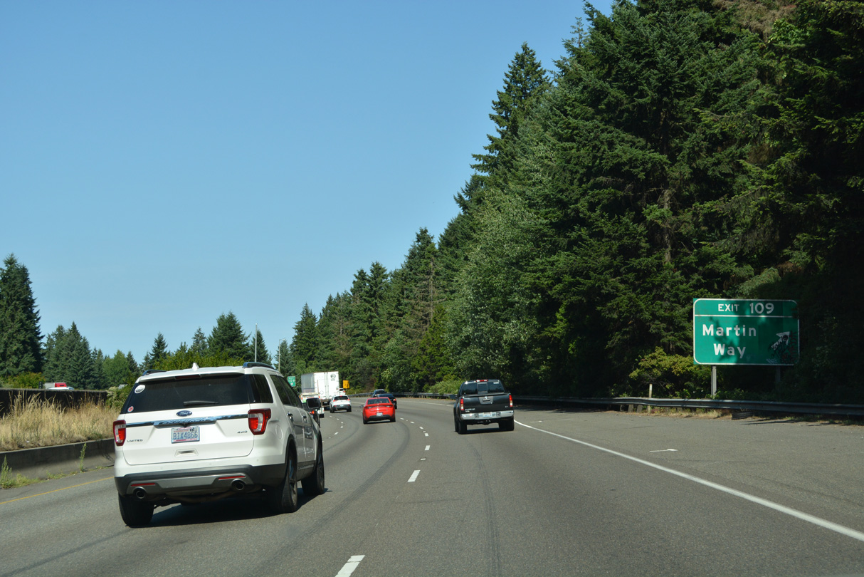
Martin Way continues east from Exit 109 between the campus of Saint Martin's University and Martin Village shopping center in Lacey to the census designated place of Tanglewilde.
07/20/23
Interstate 5 shifts northeast from Exit 109 through a wooded area before resuming eastward across Woodland Creek.
07/16/23
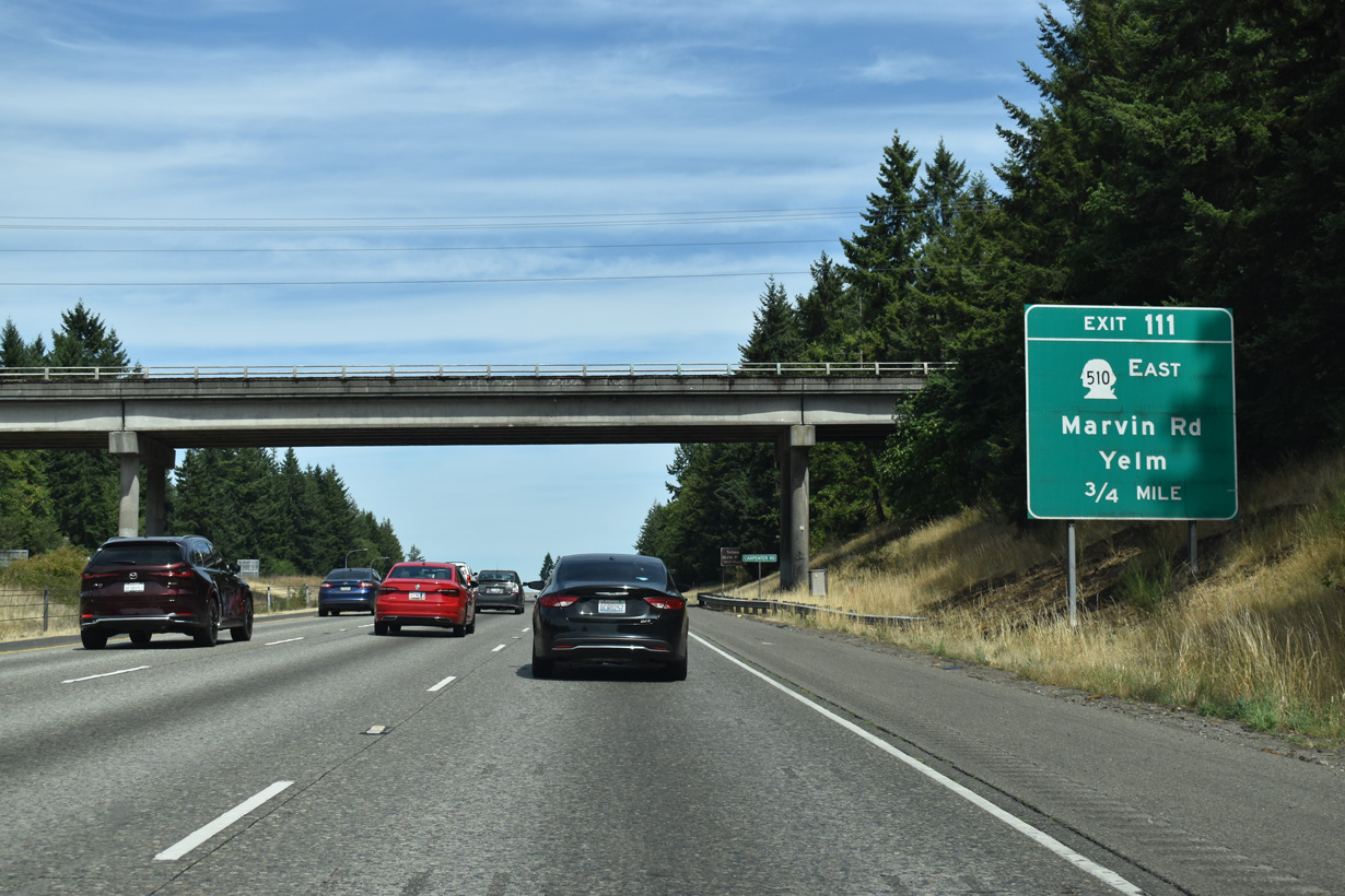
SR 510 commences south from Exit 111 through east Lacey along Marvin Road.
07/16/23
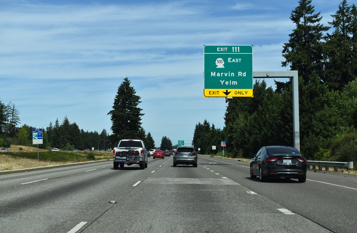
State Route 510 ranges south from Interstate 5 then turns east toward the Nisqually Reservation and Yelm at a roundabout intersection with the Pacific Highway east of Lacey. The route runs 13.10 miles between Exit 111 and SR 507 in Yelm.
07/16/23
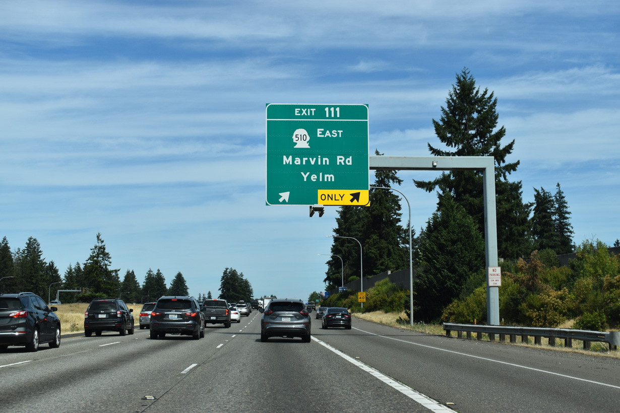
Construction in 2019/20 converted the diamond interchange at Exit 111 into a DDI. Marvin Road extends north from I-5 to 56th Avenue NE near Tolmie State Park.
07/16/23
Interstate 5 leaves the city of Lacey east from Exit 111.
07/16/23
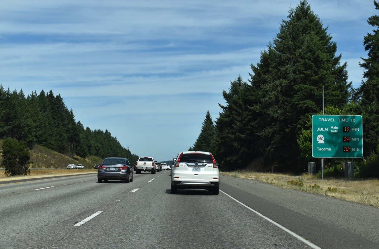
Travel times provided for SR 512, the freeway bypassing Tacoma, and the Tacoma city center.
07/16/23
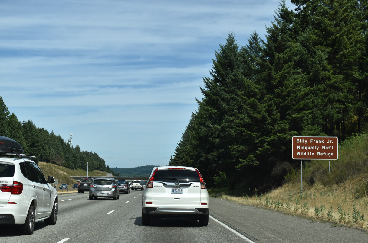
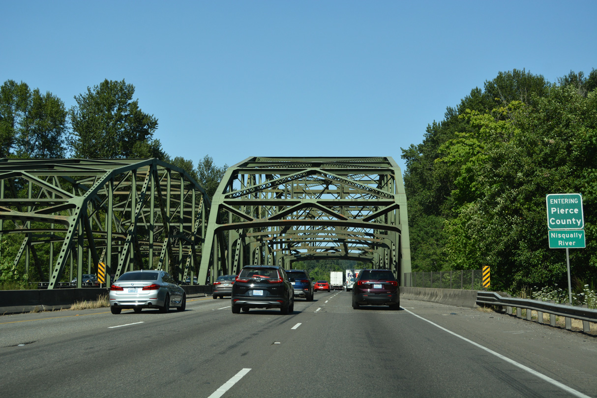
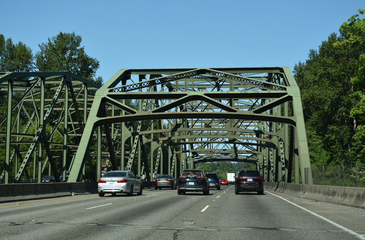
Interstate 5 enters the Nisqually Basin at the Bill Frank, Jr. Nisqually National Wildlife Refuge. Both the basin and the Nisqually River, which flows west through the basin to Puget Sound, are named after the Native American Nisqually Tribe.
07/16/23
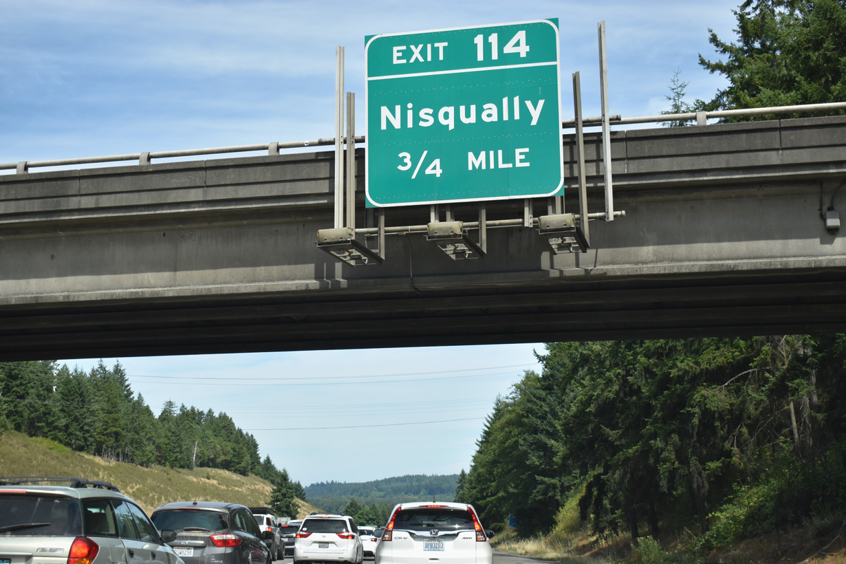
Martin Way (Old U.S. 99/410) returns to Interstate 5 at a wye interchange east of the half diamond interchange (Exit 114) with Nisqually Cut-Off Road.
07/16/23
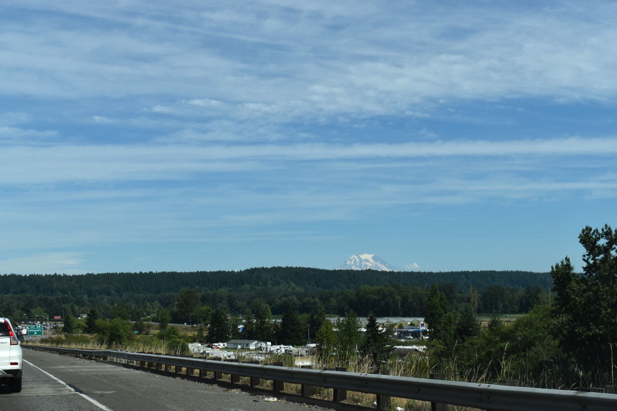
Mount Rainer appears along the eastern horizon beyond Bartlett Hill and the Nisqually Basin.
07/20/23
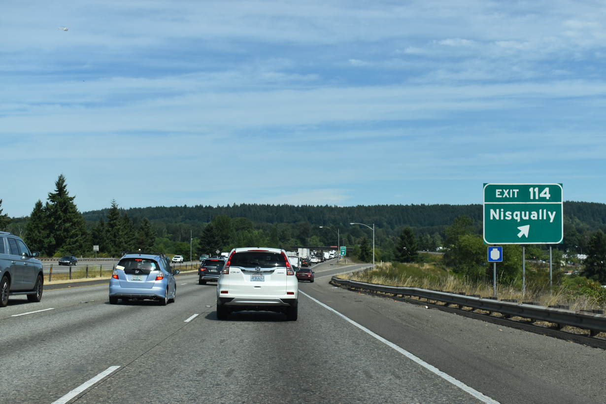
Nisqually Cut-Off Road leads south from I-5 toward Nisqually, which is along Old Pacific Highway. Guide signs for Exit 114 previously also displayed Old Nisqually.
07/20/23
07/20/23
07/16/23

References:
City of Tumwater. (n.d.). Official website. Retrieved from http://www.ci.tumwater.wa.us
Photo Credits:
- Brent Ivy: 07/16/23, 07/20/23
- AARoads: 09/02/06
Connect with:
Page Updated Friday August 29, 2025.