
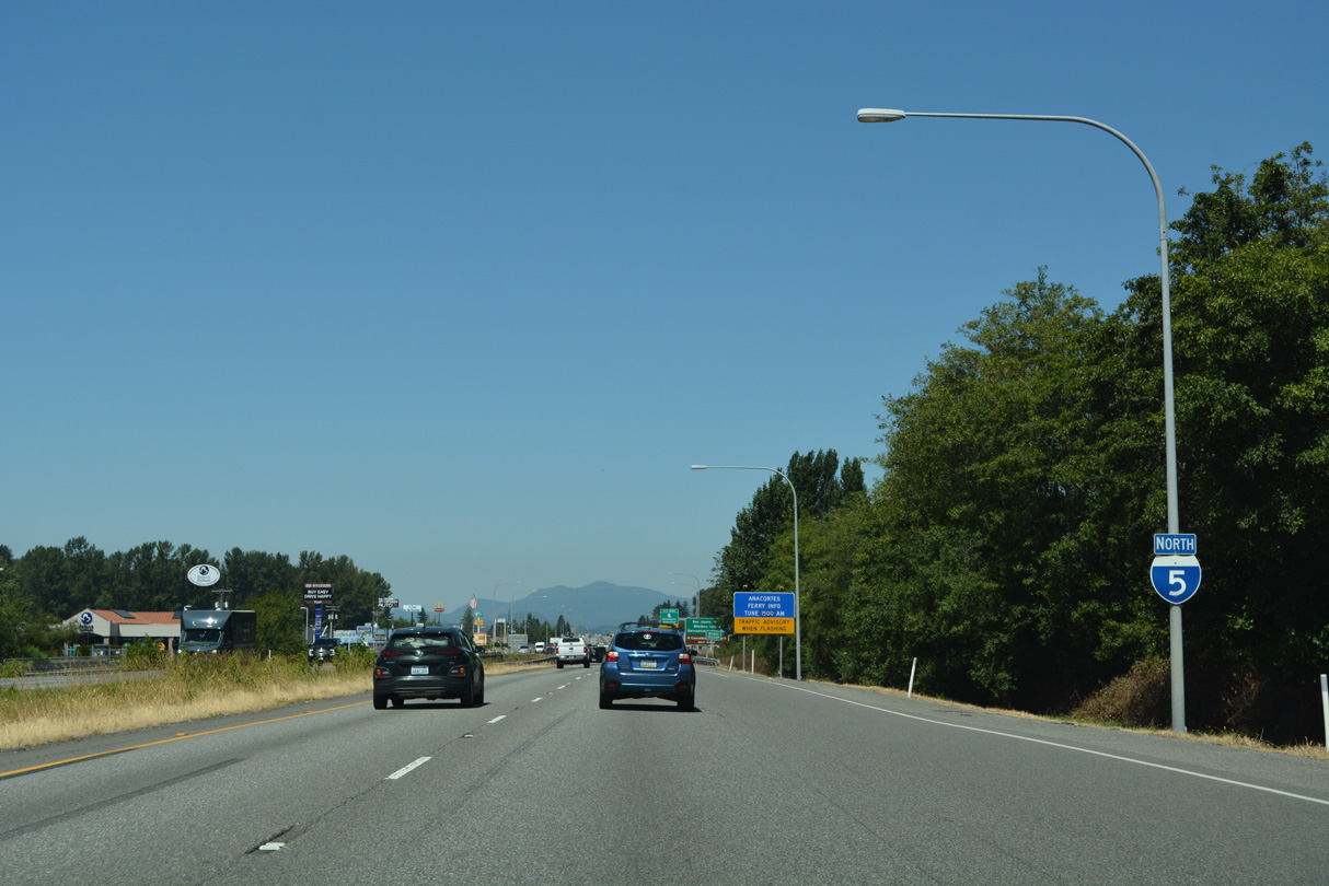
Interstate 5 North - Arlington to Mount Vernon
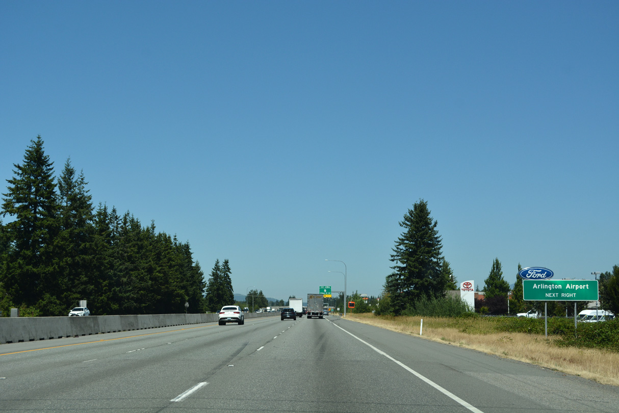
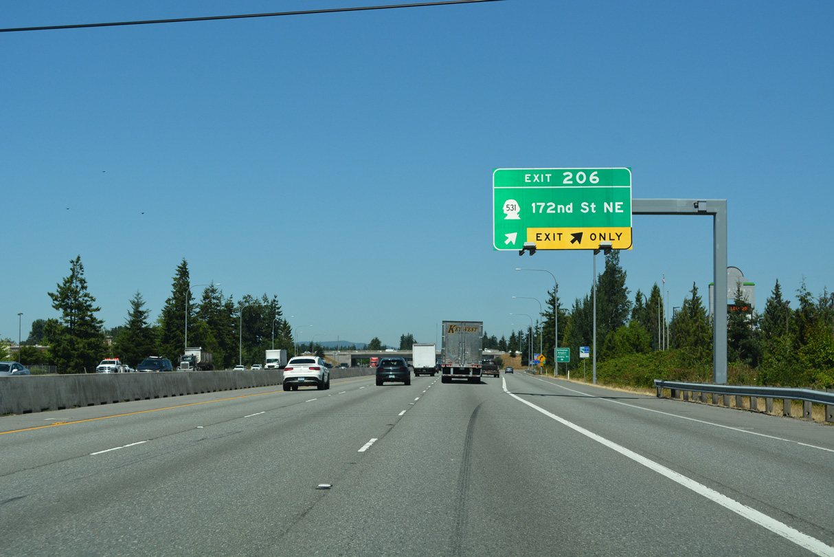
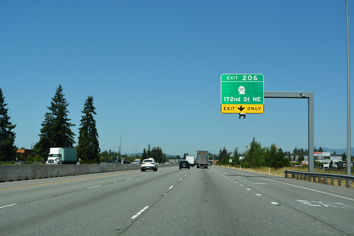
SR 531 (172nd Street NE) heads west from Arlington Municipal Airport (AWO) to the parclo interchange with Interstate 5 at Exit 206.
07/19/23
A 9.88 mile route, SR 531 stems west from SR 9 through Arlington to Wenberg County Park off Lake Goodwin.
07/19/23
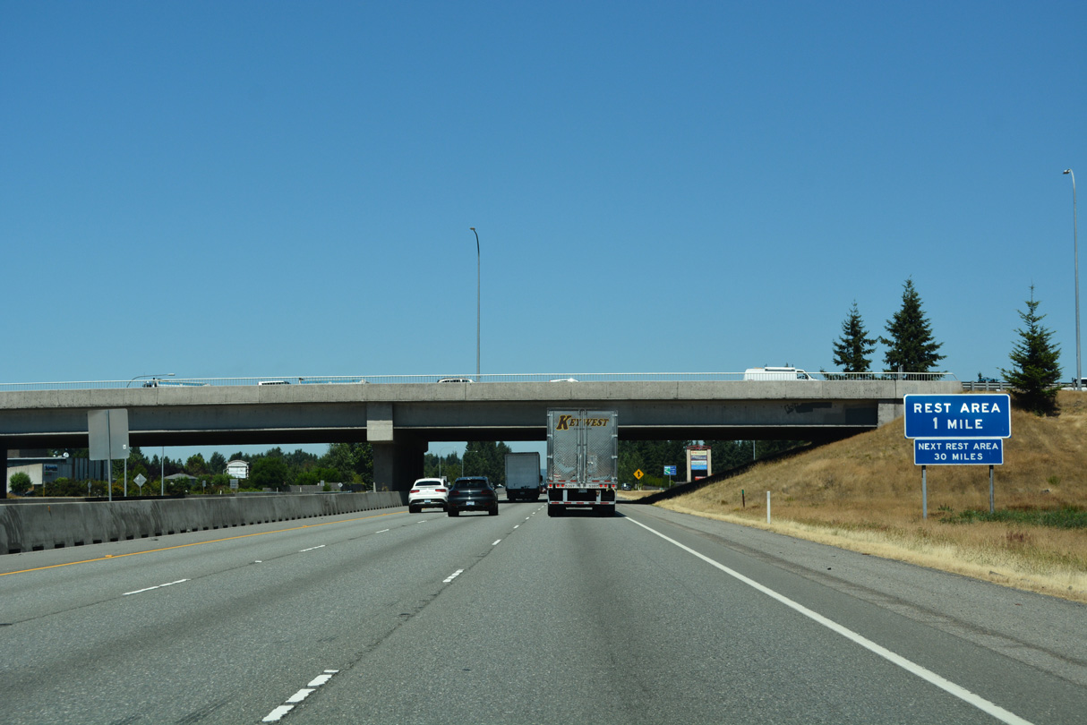
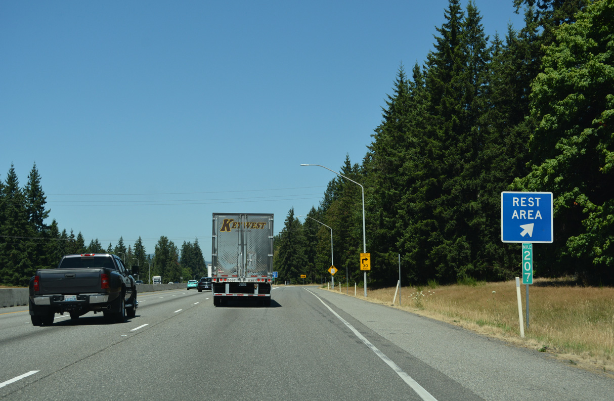
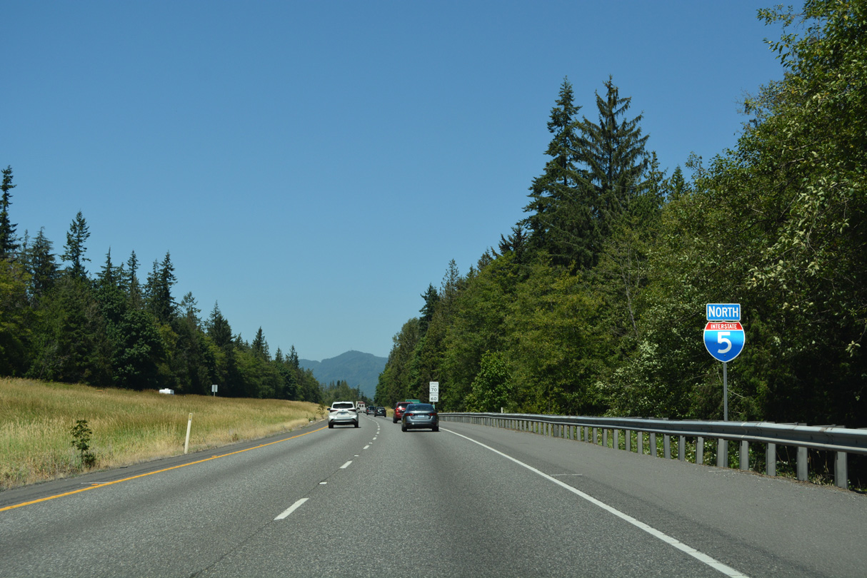
Interstate 5 runs north along the Arlington city line to the first rest area facility since Federal Way.
07/19/23
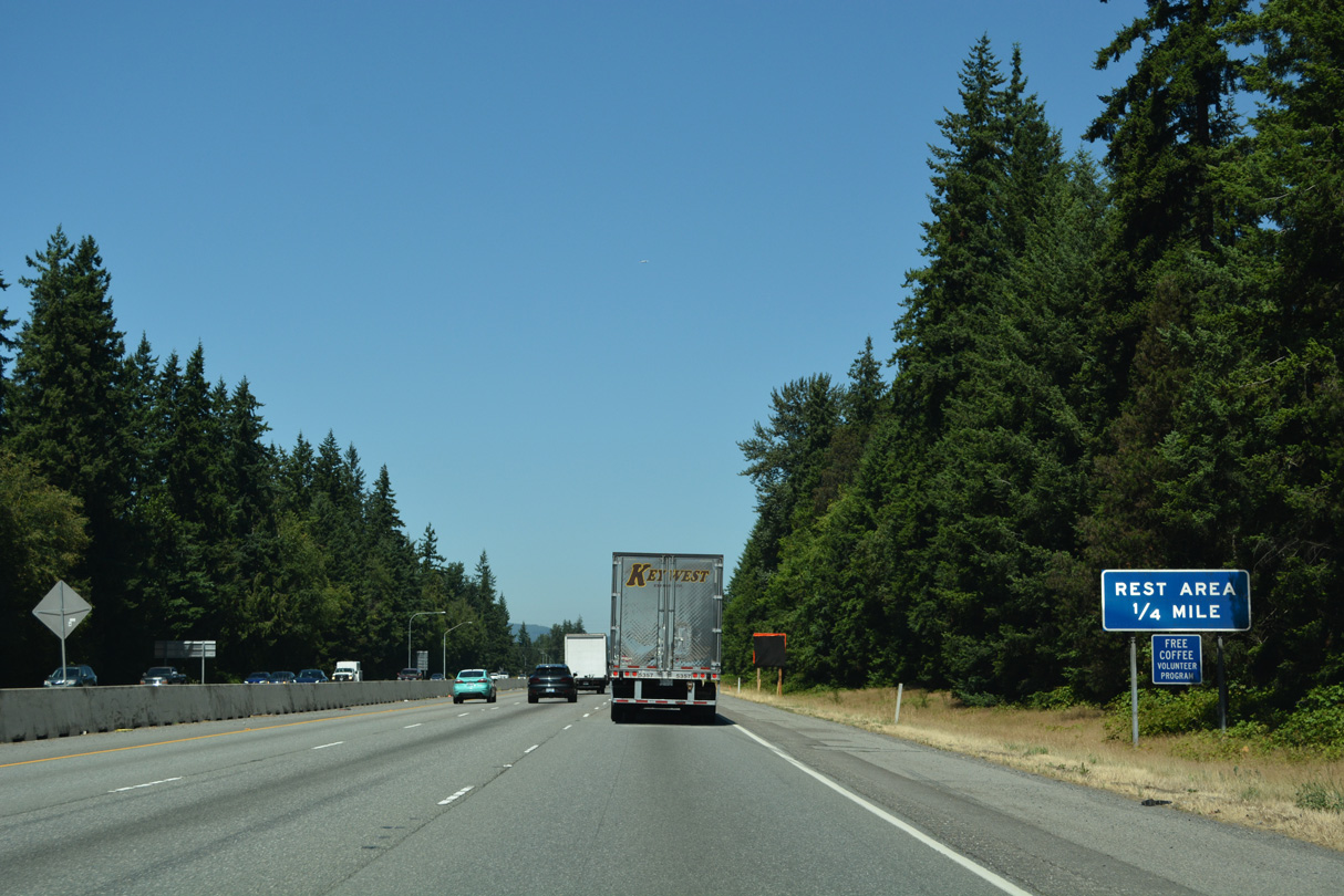
The Smokey Point Rest Area lines both roadways of Interstate 5 at Arlington and Smokey Point.
07/19/23
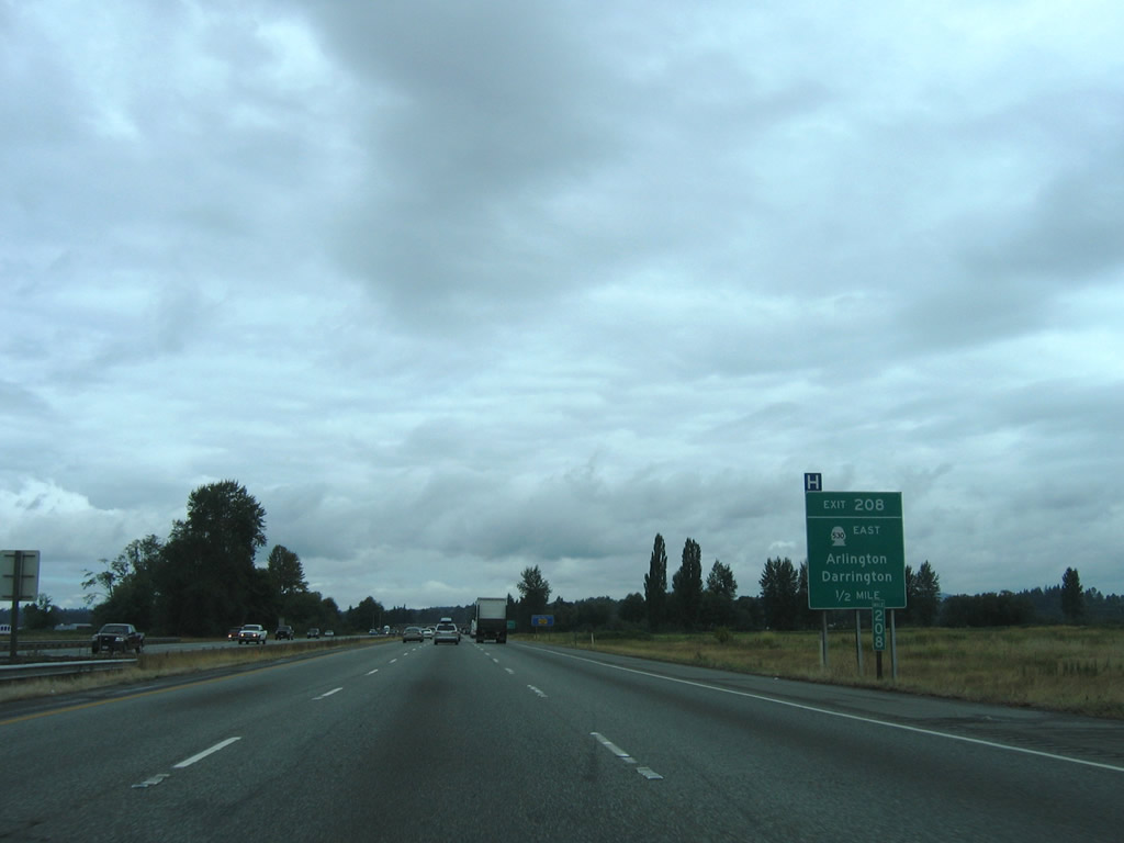
Angling northwest, Interstate 5 next meets Pioneer Highway and the eastbound beginning of SR 530. SR 530 constitutes a 50.45 mile long highway from Arlington northeast to Darrington and SR 20 at Rockport.
08/30/06
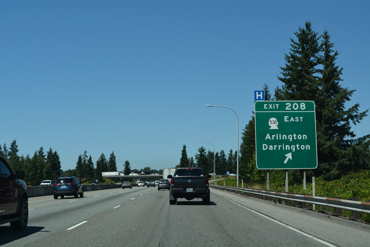
SR 530 combines with SR 9 (Hazel Street) 3.84 miles to the east near the Arlington city center. Pioneer Highway (former SR 530) extends west to Silvana and East Stanwood. SR 530 west of Interstate 5 was decommissioned in 1991 (AARoads Wiki, 2024).
07/19/23
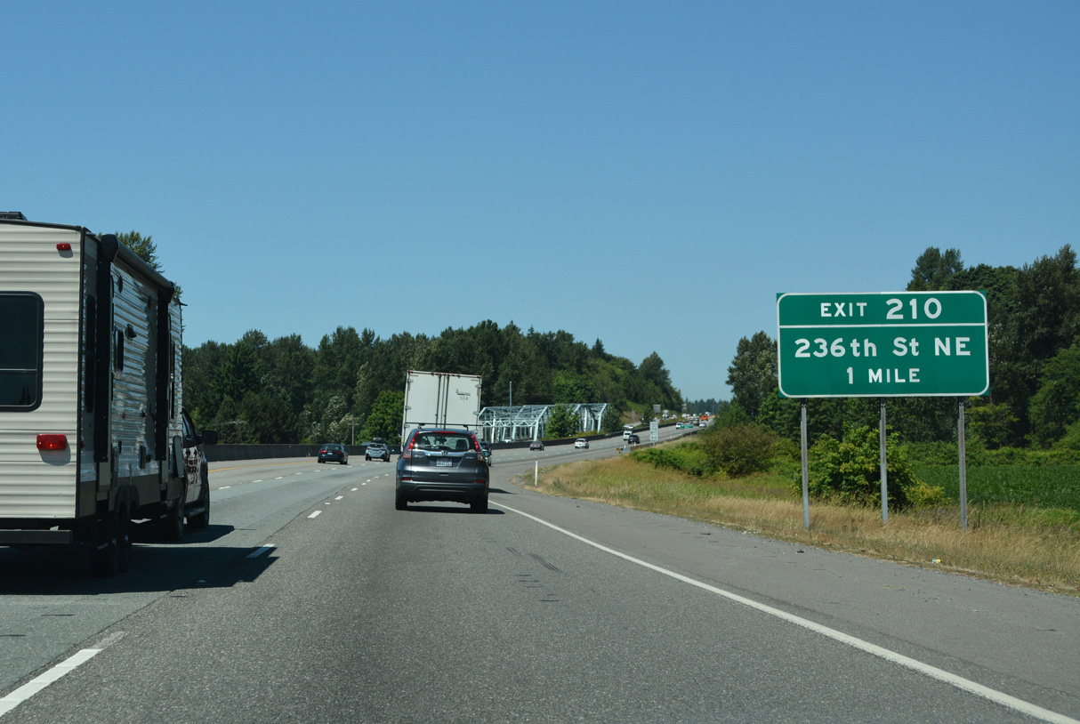
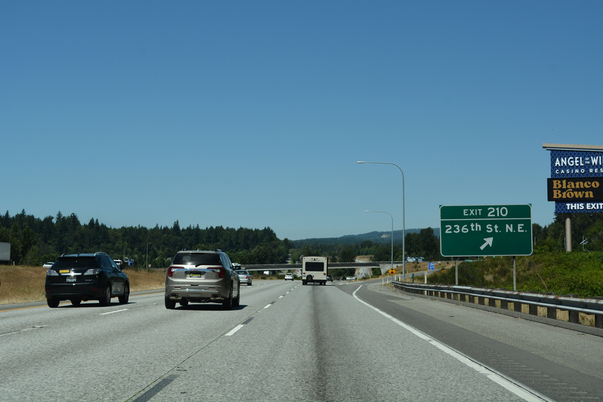
The diamond interchange (Exit 210) with 236th Street NE lies midway between the Stillaguamish River and Pilchuck Creek.
07/19/23
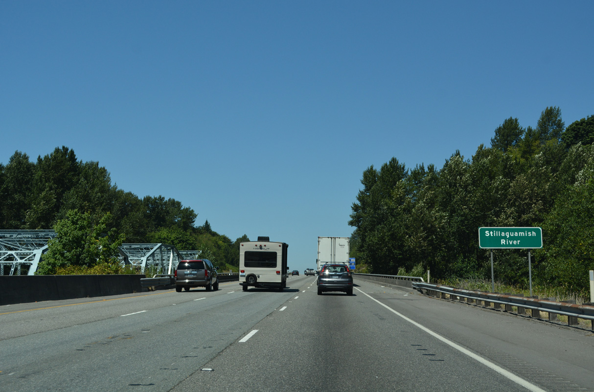
The northbound span taking Interstate 5 across the Stillaguamish River was built in 1971. The southbound steel through truss bridge dates back to 1933 as part of the original U.S. 99.
07/19/23
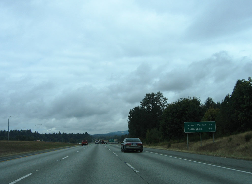
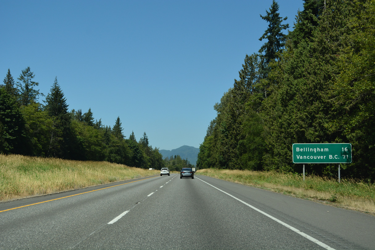
Distance sign posted 17 miles from Mount Vernon and 44 miles from the Whatcom County seat of Bellingham.
08/30/06
236th Street NE heads west to Jackson Gulch and Pioneer Highway (former SR 530) near Silvana and east to 35th Avenue NE.
07/19/23
Continuing northwest from Pilchuck Creek, Interstate 5 rises 200 feet in elevation to SR 532 / Stanwood Bryant Road.
07/19/23
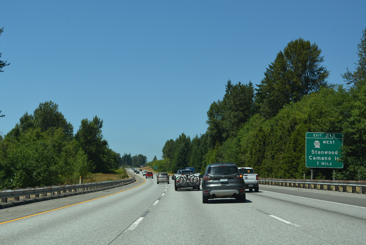
A 10.09 mile long highway west through the city of Stanwood to Terrys Corner, SR 532 constitutes one of two routes to Island County from the Washington mainland.
07/19/23
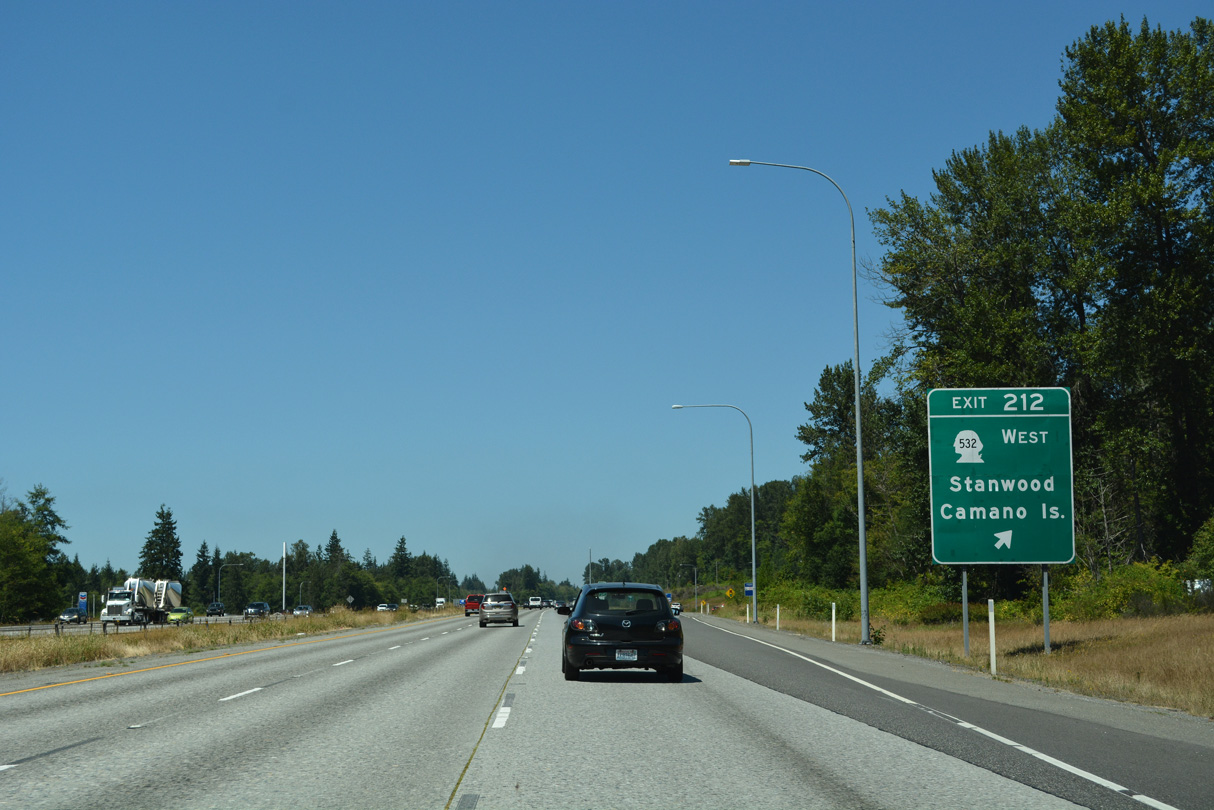
SR 532 extends west to North Camano Drive to Utsalady and East Camano Drive to Cama Beach and Camano Island State Parks. Stanwood Bryant Road heads 4.1 miles east from Exit 212 to SR 9 at Bryant.
07/19/23
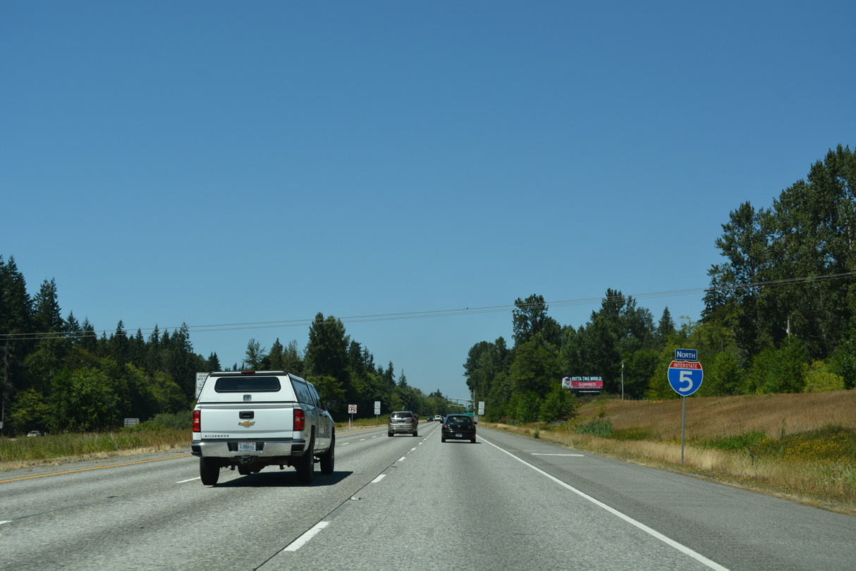
Old 99 N (Historic U.S. 99) runs along the west side of Interstate 5 through a rural area of northern Snohomish County
07/19/23
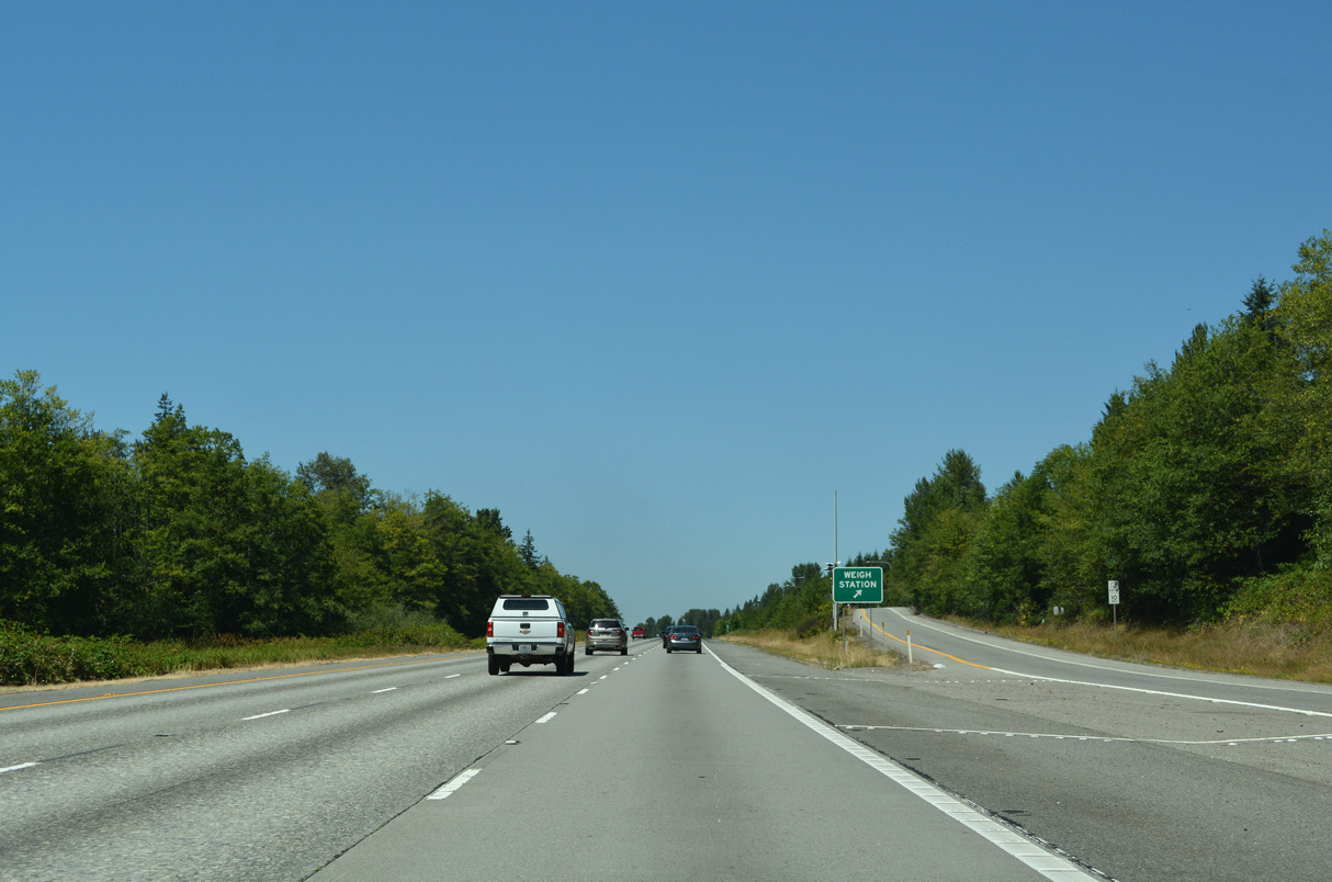
A northbound weigh station operates along Interstate 5 at mile marker 214.
07/19/23
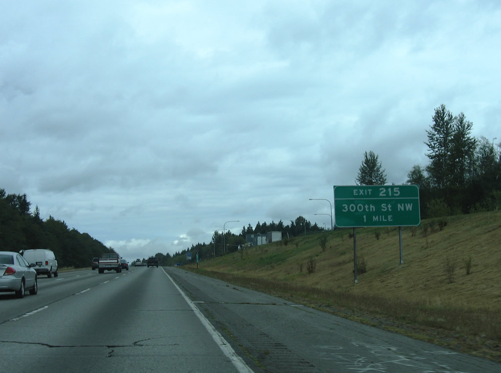
The diamond interchange (Exit 215) with 300th Street NW is one mile north of the weigh station.
08/30/06
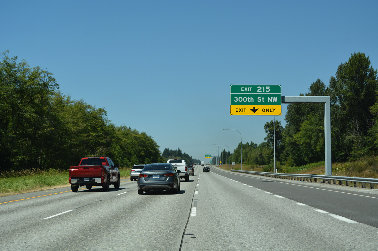
The entrance ramp from the weigh station forms an auxiliary lane to Exit 215. 300th Street NW heads west to Pioneer Highway (old SR 530) north of Stanwood.
07/19/23
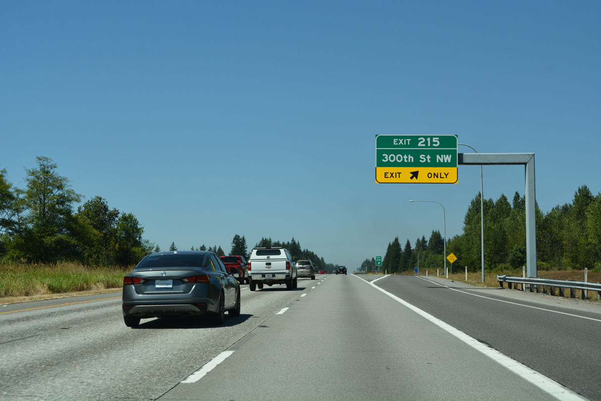
Exit 215 leaves Interstate 5 north for 300th Street NW. 300th Street NW dog legs north along Old 99 N to the west while the local road east ends at a rural residential area.
07/19/23
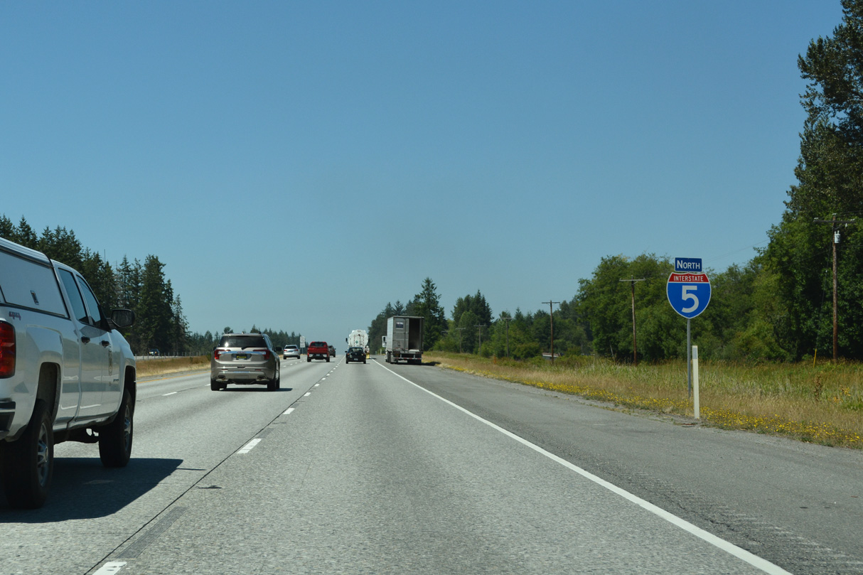
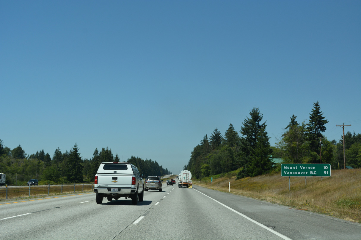
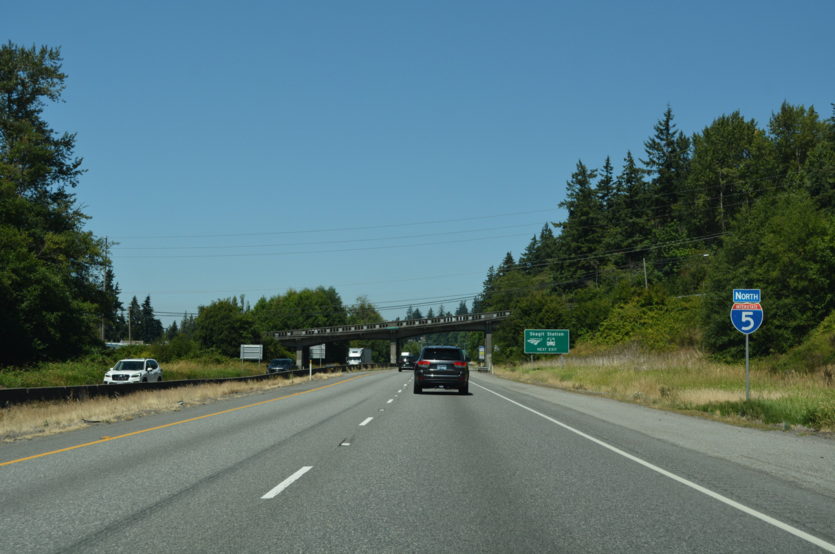
Continuing north, Interstate 5 reaches the Skagit County seat of Mount Vernon in ten miles. Vancouver, British Columbia is 81 miles further via B.C. Highway 99.
07/19/23
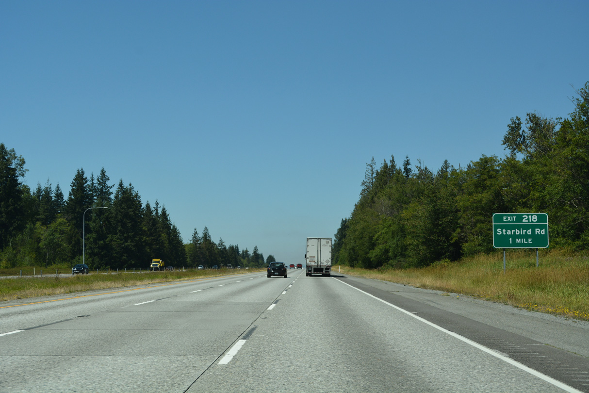
Starbird Road converges with Interstate 5 at a diamond interchange (Exit 218) east of Milltown.
07/19/23
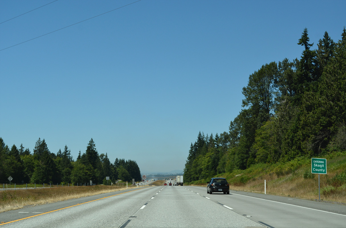
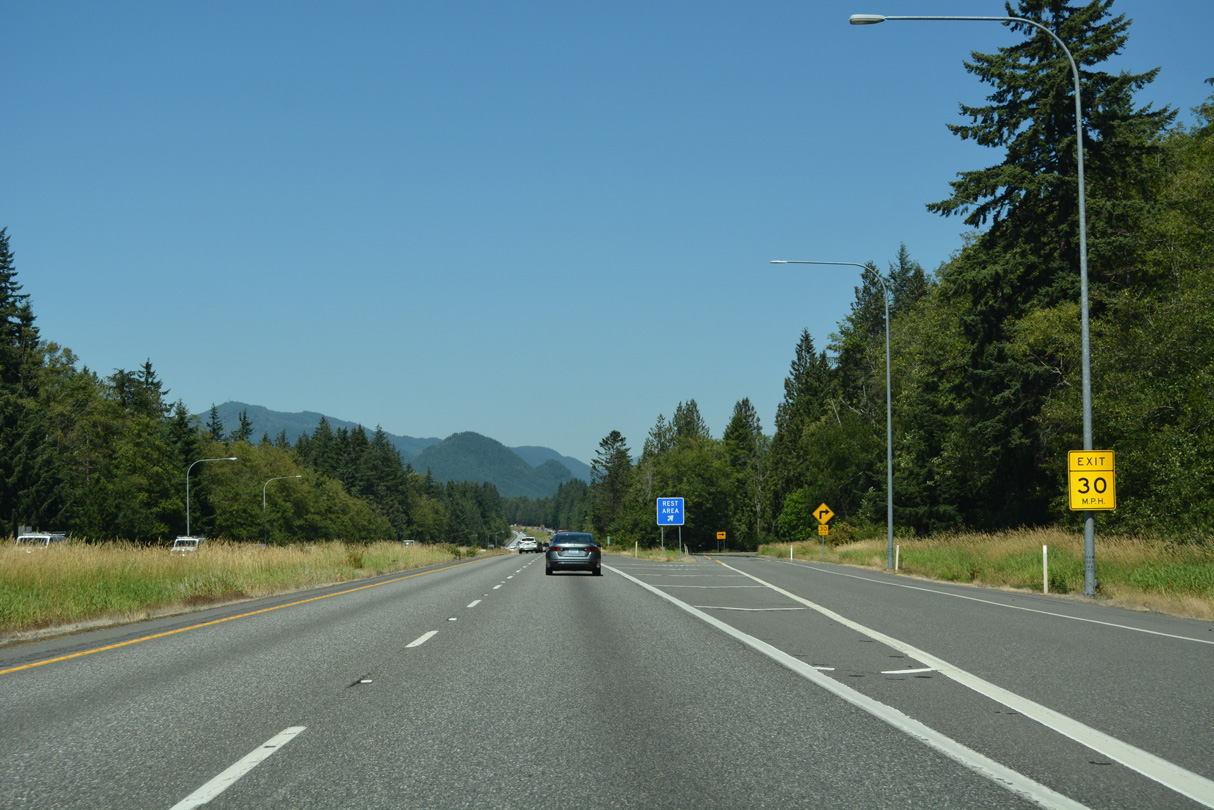
The 39.89 miles of I-5 north through Snohomish County conclude as the freeway enters Skagit County.
07/19/23
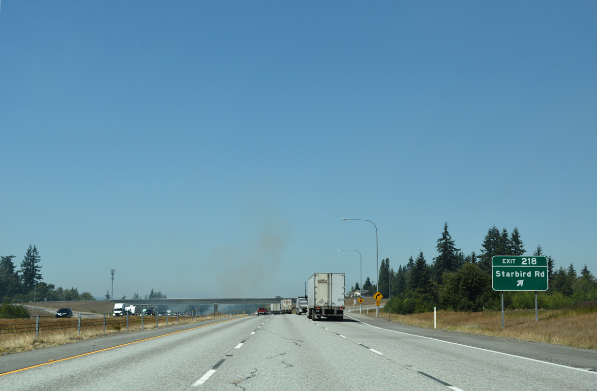
Milltown Road stems east from Pioneer Highway (old SR 530) to become Starbird Road at Pacific Highway (old U.S. 99) adjacent to Exit 218. Starbird Road continues east and then south through rural areas into Snohomish County.
07/19/23
North from Exit 218, Interstate 5 lowers onto the coastal plain east of Skagit Bay.
07/19/23
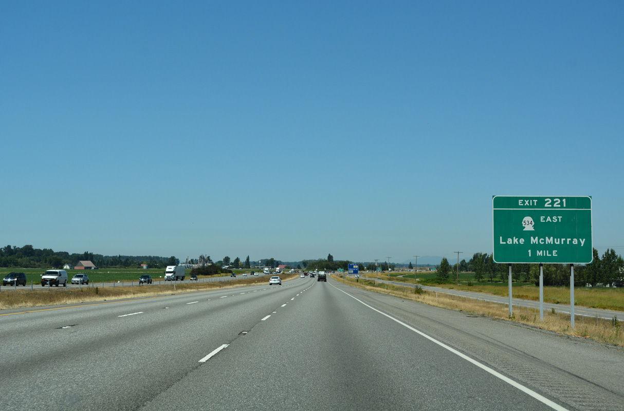
SR 534 west and Pioneer Highway (former SR 530) north come together at Exit 221 by Conway.
07/19/23
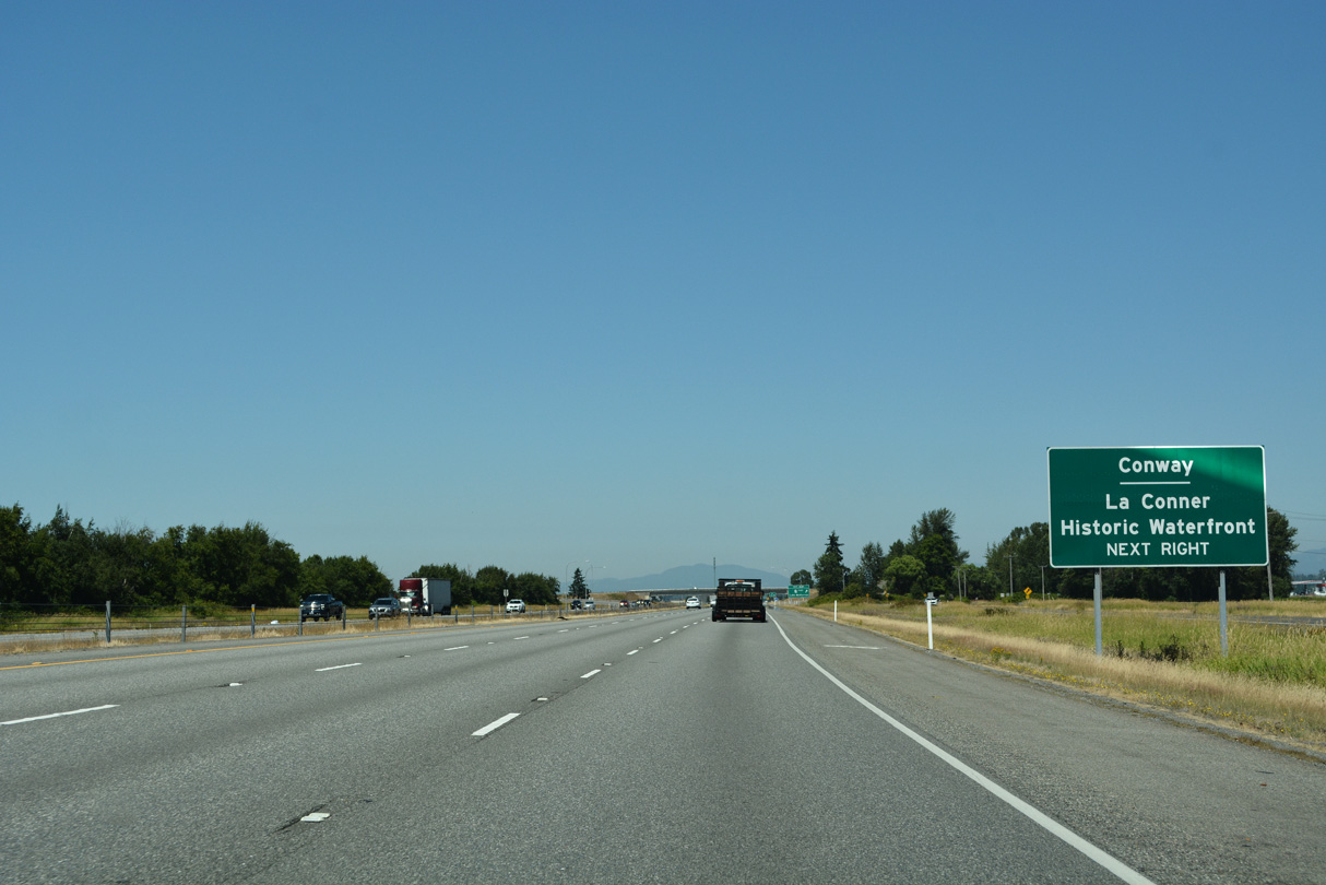
Conway is a census designated place along the South Fork of the Skagit River across from Fir Island. The town of La Conner lies northwest of Pleasant Ridge along Snohomish Channel, ten miles from Interstate 5 at Exit 221.
07/19/23
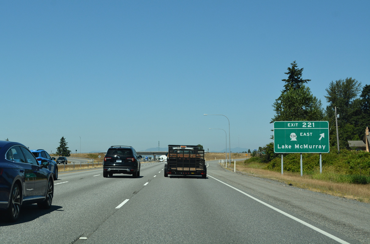
SR 534 travels 5.08 miles east to SR 9 at Lake McMurray. Fir Island Road stems west from Pioneer Highway and Conway to Best Road north toward La Conner.
07/19/23
Little Mountain appears to the east along Interstate 5 north near Cedardale.
07/19/23
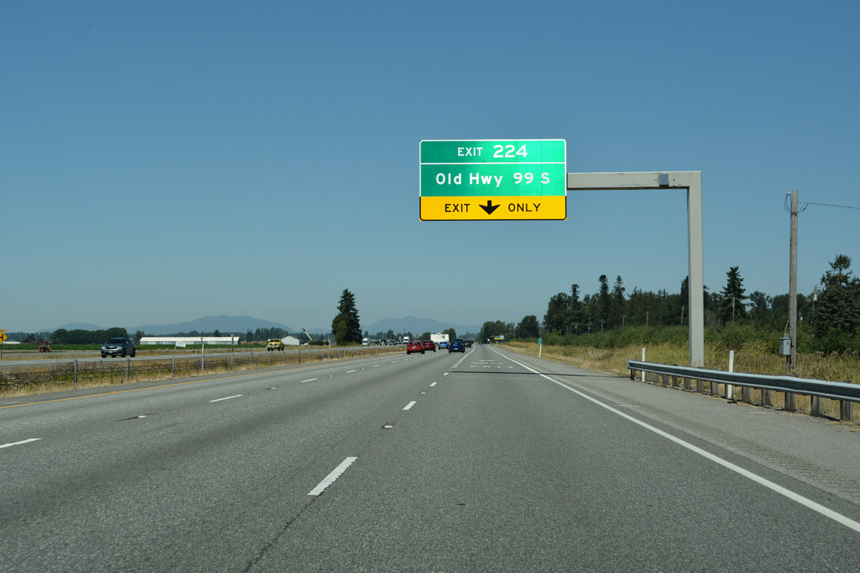
Exit 224 to Old Highway 99 S is the first of four to serve the city of Mount Vernon along Interstate 5 north.
07/19/23
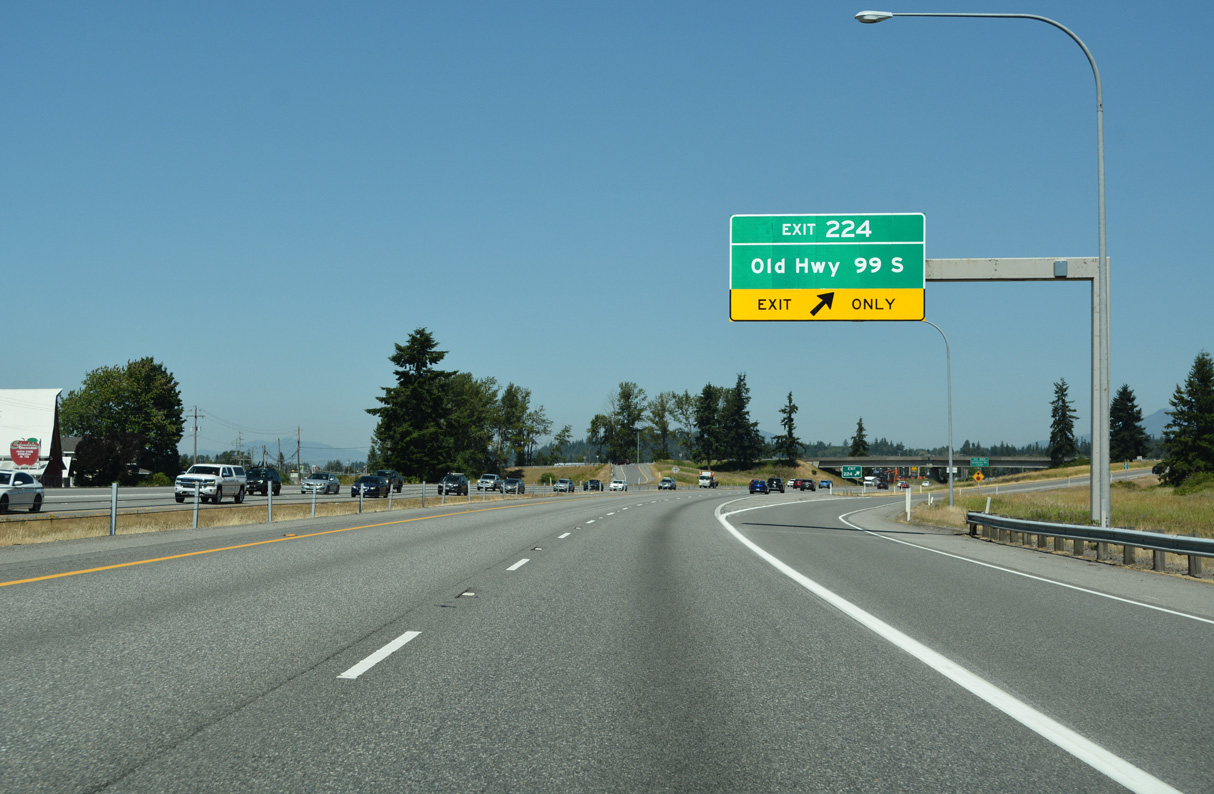
Interstate 5 reduces to four overall lanes at half diamond interchange (Exit 214) with Old Highway 99 S. Cederdale Road and Conway Frontage Road, service roads for I-5, tie into Old Highway 99 from the south nearby.
07/19/23
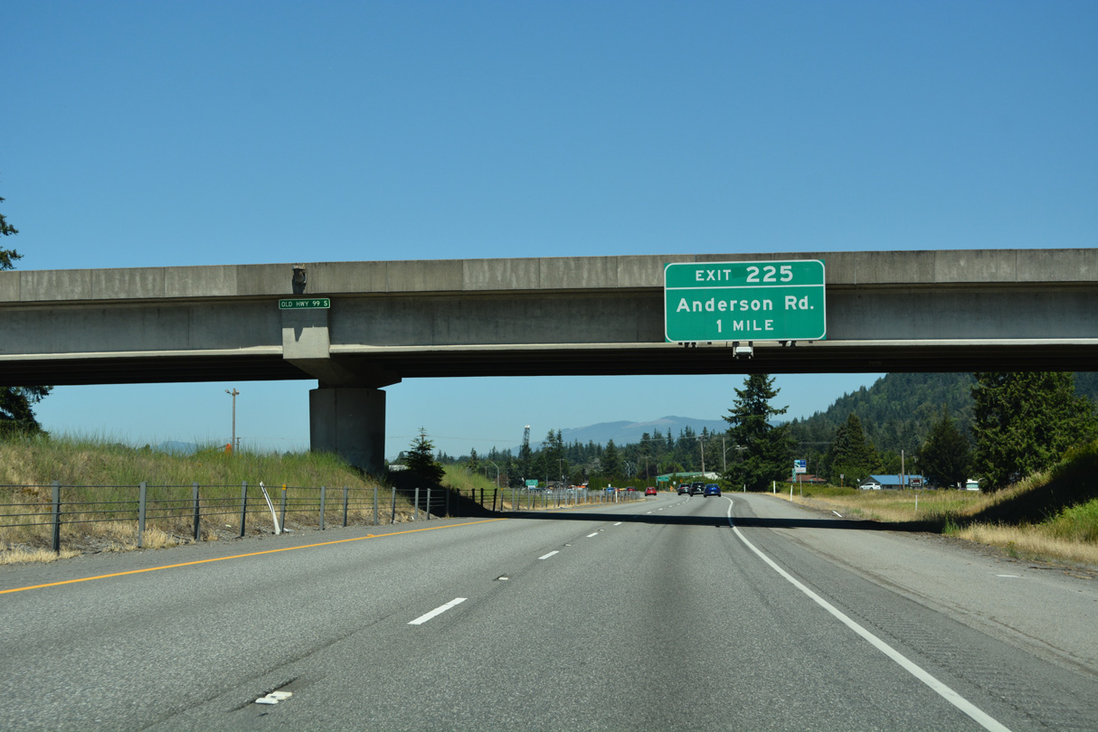
Anderson Road stems east from Old Highway 99 S to the diamond interchange at Exit 225. The speed limit lowers to 60 m.p.h. as the freeway enters the Mount Vernon city limits just north of Exit 224.
07/19/23
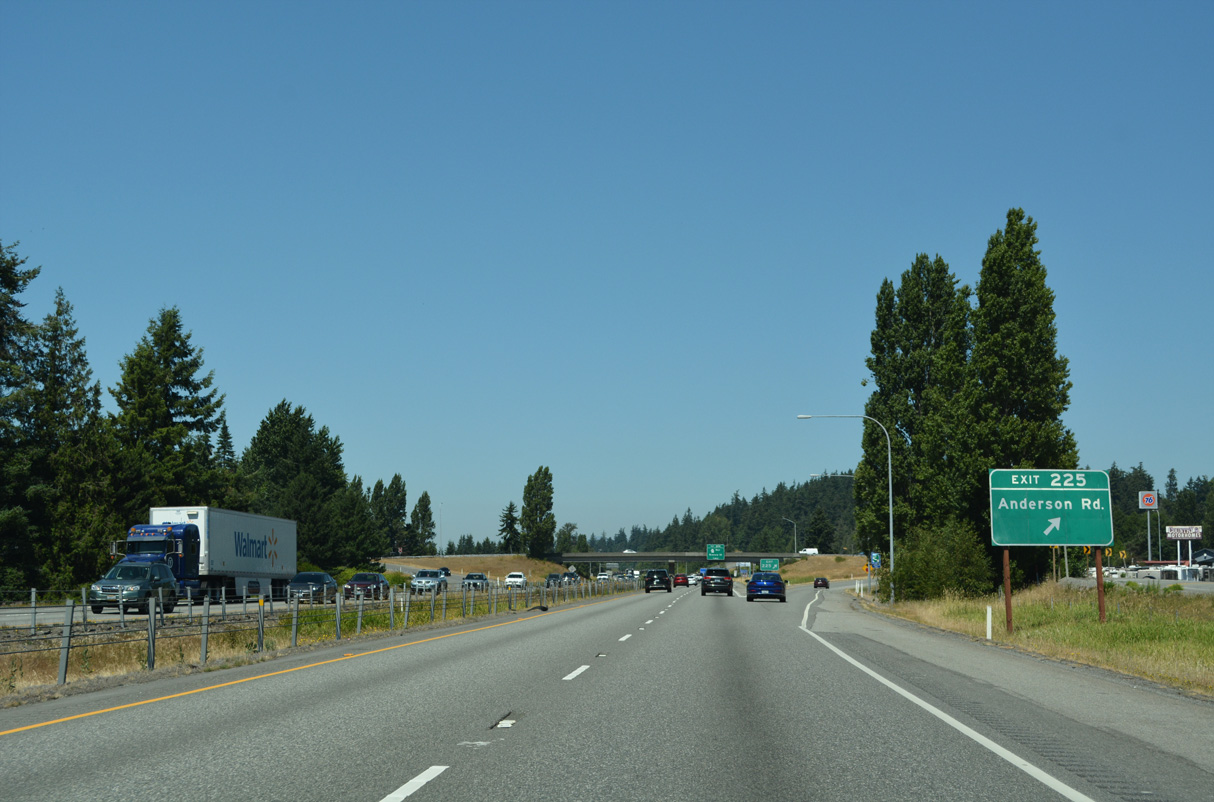
Cloverdale Road continues alongside Interstate 5 north to a roundabout with Anderson Road adjacent to Exit 225 and beyond to Blodgett Road. Old Highway 99 S north to S 2nd Street leads to the Skagit County Fairgrounds.
07/19/23
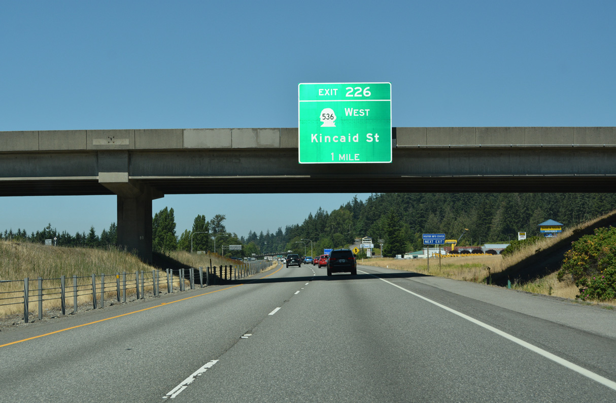
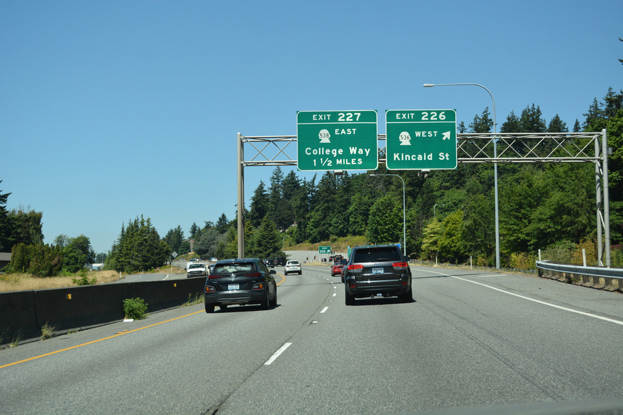
Exit 226 joins Interstate 5 with SR 536 (Kincaid Street) west and Broad Street east in one mile. SR 536 begins at the forthcoming diamond interchange.
07/19/23
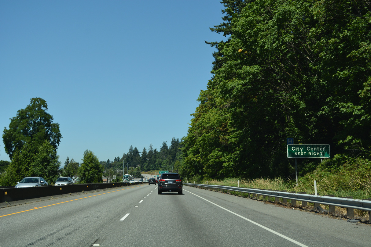
Located along Kincaid Street adjacent to Exit 226, Skagit Station provides multimodal transportation options from Mount Vernon. Blackburn Road passes over I-5 by Hillcrest Park beyond this confirming marker.
07/19/23
Constructed in the mid-1950s, a barrier median separates the four lane freeway where Interstate 5 passes the Mount Vernon Vernon city center.
07/19/23
SR 536 follows S 3rd Street around the Mount Vernon city center to Division Street west across the Skagit River. The 5.38 mile long route provides a cut off from I-5 north to SR 20 near Fredonia via Memorial Highway.
07/19/23
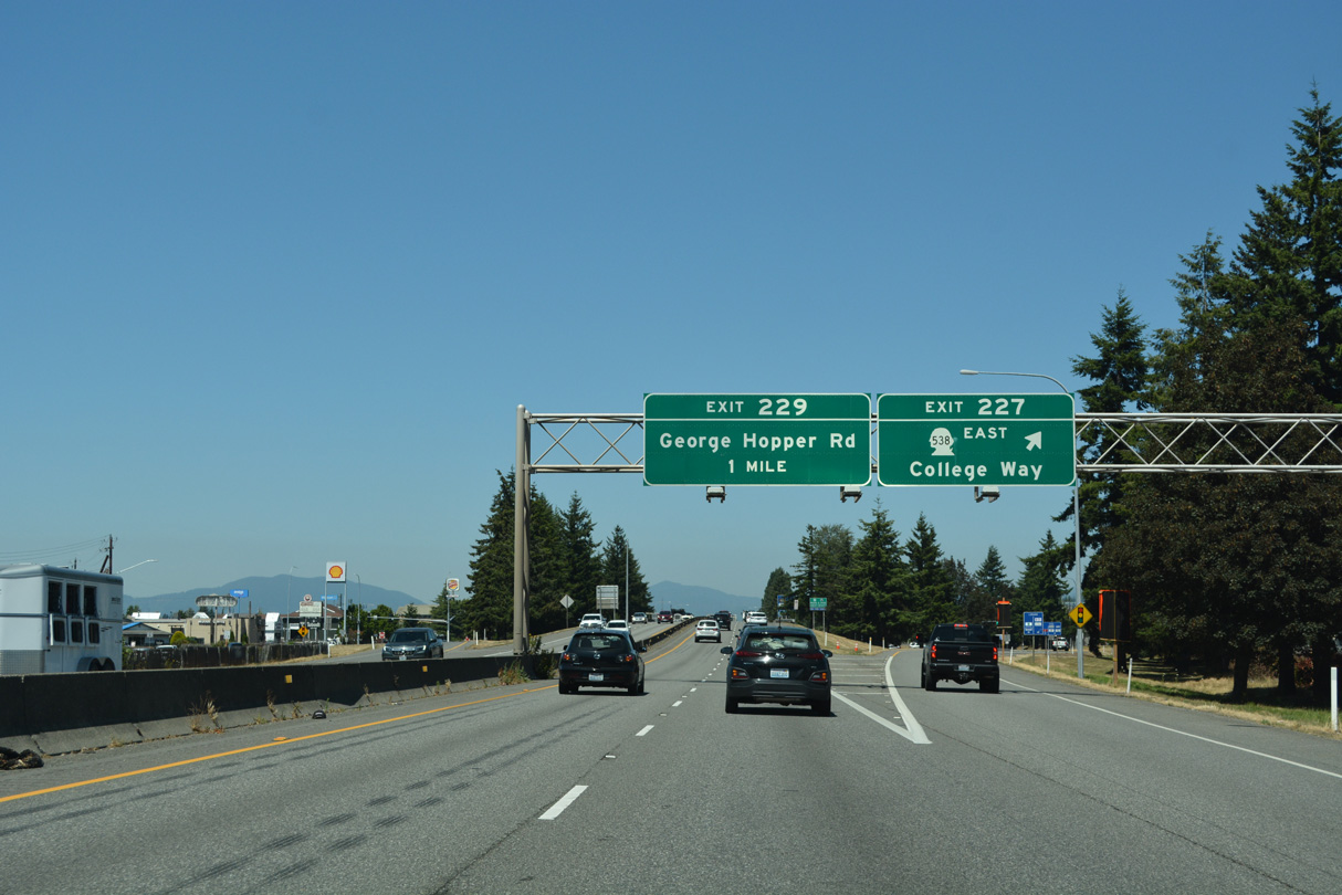
Exit 227 descends from Interstate 5 north to College Way and the eastbound beginning of SR 538. Measuring 3.61 miles in length, SR 538 follows College Way to Skagit Valley College and SR 9 at Baker Heights.
07/19/23
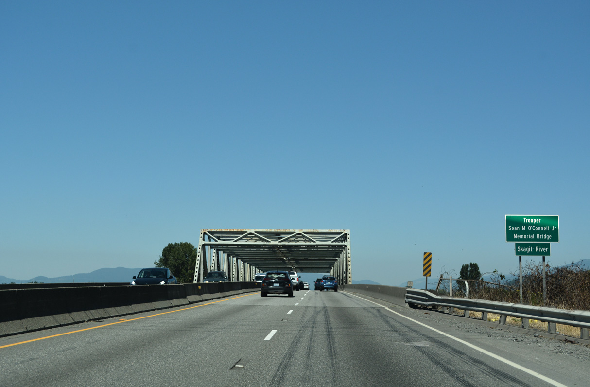
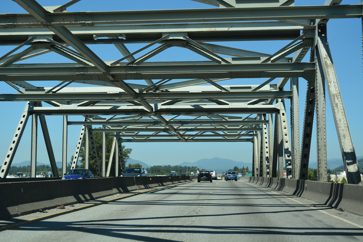
Leaving Mount Vernon and entering the city of Burlington, Interstate 5 crosses the Skagit River north over the Trooper Sean M. O'Connell, Jr. Memorial Bridge.
07/19/23
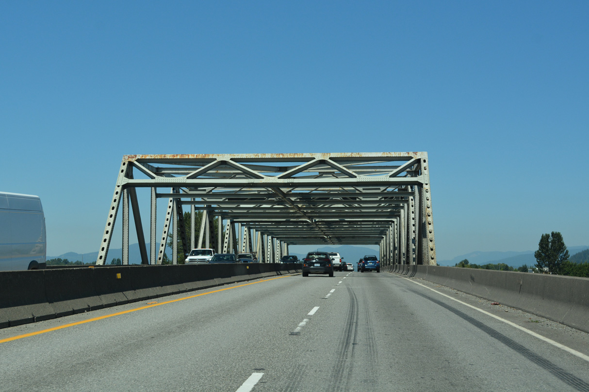
The steel through truss bridge taking I-5 across the Skagit River was built in 1955.
07/19/23
A portion of the Skagit River bridge on I-5 collapsed when a semi-truck collided with critical steel support members on May 23, 2013. The bridge was closed to mid-June, when a temporary span was placed to restore the crossing to service.1
07/19/23
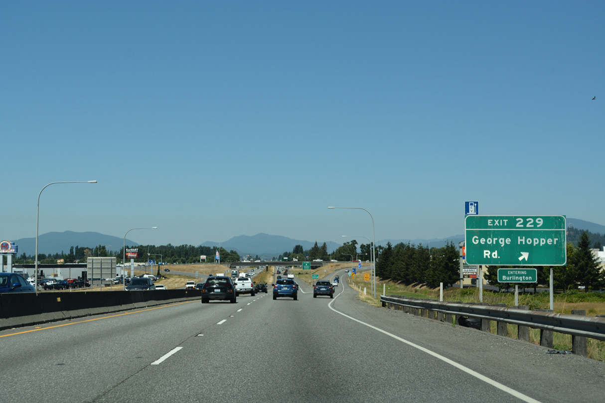
The diamond interchange (Exit 229) with George Hopper Road serves an array of car dealerships, big box retail, hotels and restaurants.
07/19/23
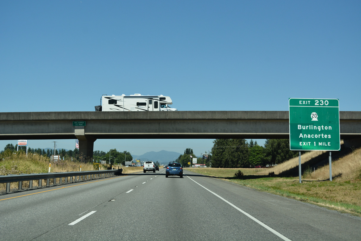
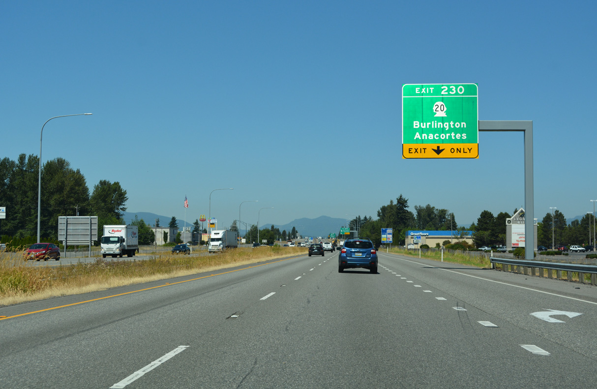
The second exit in Burlington joins Interstate 5 with SR 20 (Avon Cutoff / North Cascades Highway). SR 20 represents the second route to Island County, leading west to the Swinomish Indian Reservation and south across Deception Pass onto Whidbey Island.
07/19/23
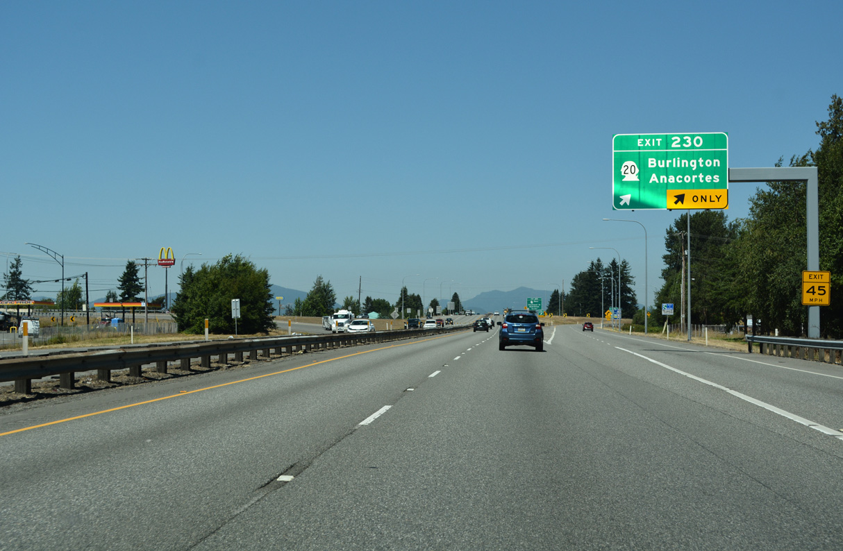
Forthcoming Exit 230 is a folded diamond interchange due to the parallel BNSF Railroad along the north side of SR 20 (Avon Cutoff).
07/19/23
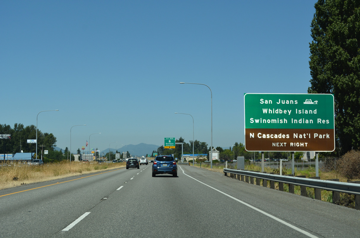
SR 20 leads 12 miles west to the city of Anacortes and SR 20 Spur, a 7.78 mile route to the Anacortes Ferry Terminal. A system of ferry routes joins Anacortes with the San Juan Islands and Sidney, British Columbia.
07/19/23
SR 20 is a lengthy route, traveling 436.13 miles across the state from U.S. 101 at Discovery Bay to U.S. 2 at Newport near the Idaho state line. SR 20 travels 52 miles east from I-5 to North Cascades National Park.
07/19/23
SR 20 circumvents the Burlington city center via Rio Vista Avenue east, Burlington Boulevard north, and Avon Avenue east to reach the North Cascades Highway. The state route continues east to Sedro-Woolley, Lyman, Hamilton and Concrete.
07/19/23
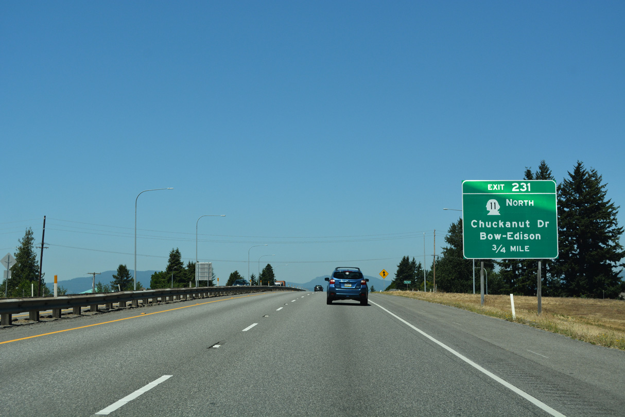
Curving northeast along the Burlington city line, the succeeding exit is with SR 11, a 21.30 mile long loop west to Bellingham Bay and Bellingham. SR 11 returns to I-5 at Exit 250.
07/19/23
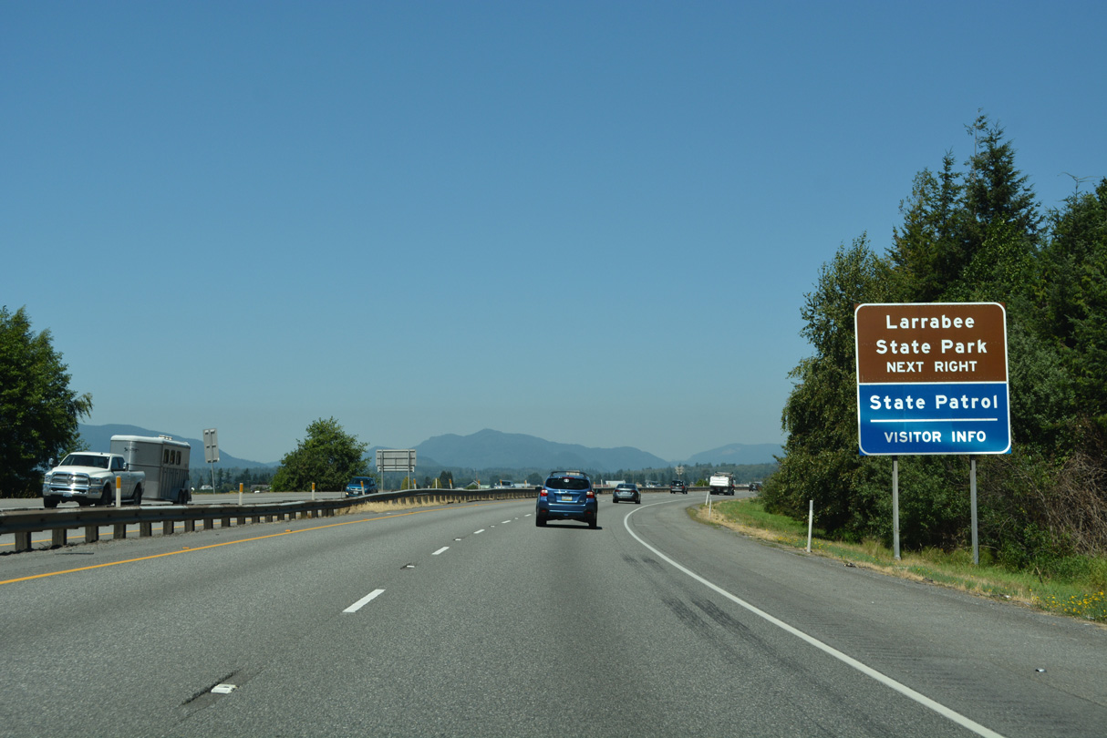
Chuckanut, Lookout and Anderson Mountains rise along the northern horizon. Interstate 5 eventually crosses these mountains whiles SR 11 curves northwest along Samish Bay to Larrabee State Park north of Dogfish Point.
07/19/23
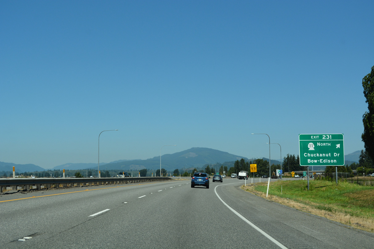
Exit 231 is a folded diamond interchange with roundabouts at Burlington Road and Josh Wilson Road. SR 11 angles northwest along Chuckanut Drive to Allen, Edison and Bow.
07/19/23
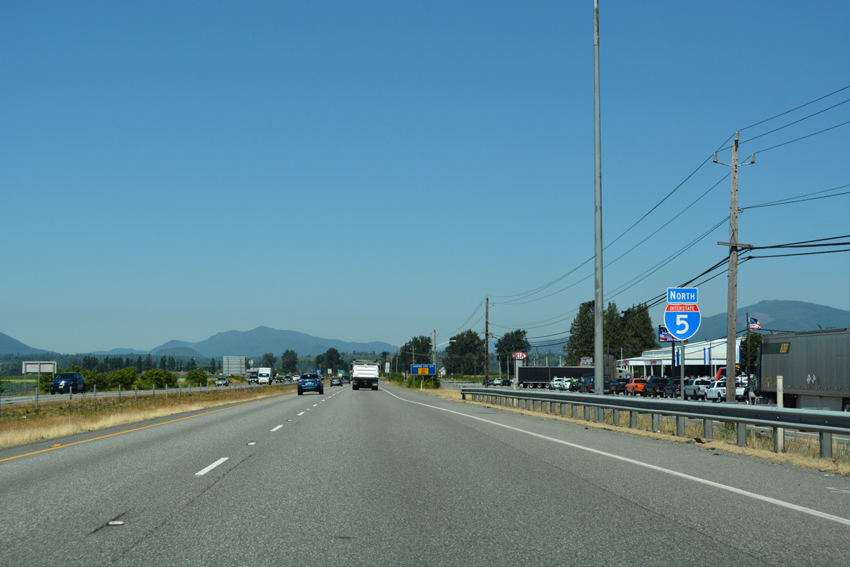
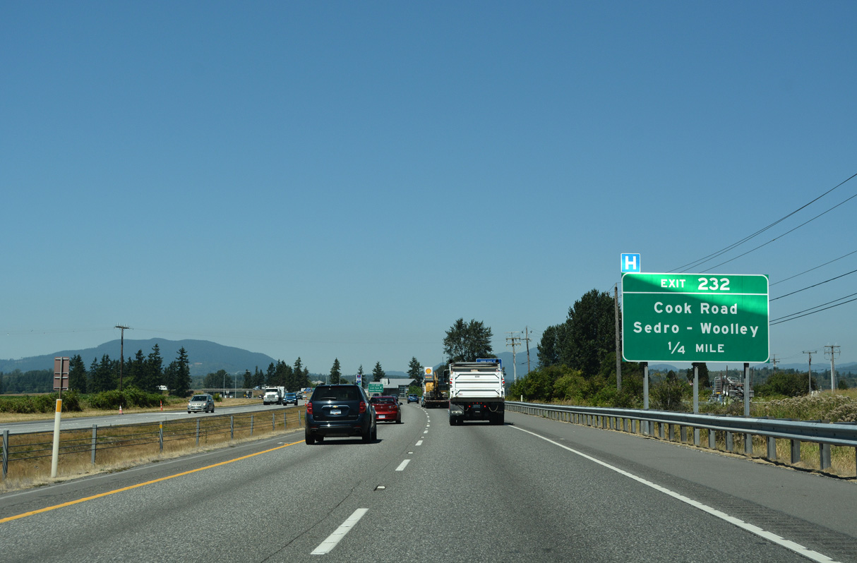
Old Highway 99 N (Historic U.S. 99) runs along the east side of Interstate 5 north from Burlington to Exit 232.
07/19/23
Cook Road travels between SR 11 (Chuckanut Drive) near Allen and a roundabout with SR 9/20 (North Cascade Highway) in Sedro-Woolley.
07/19/23
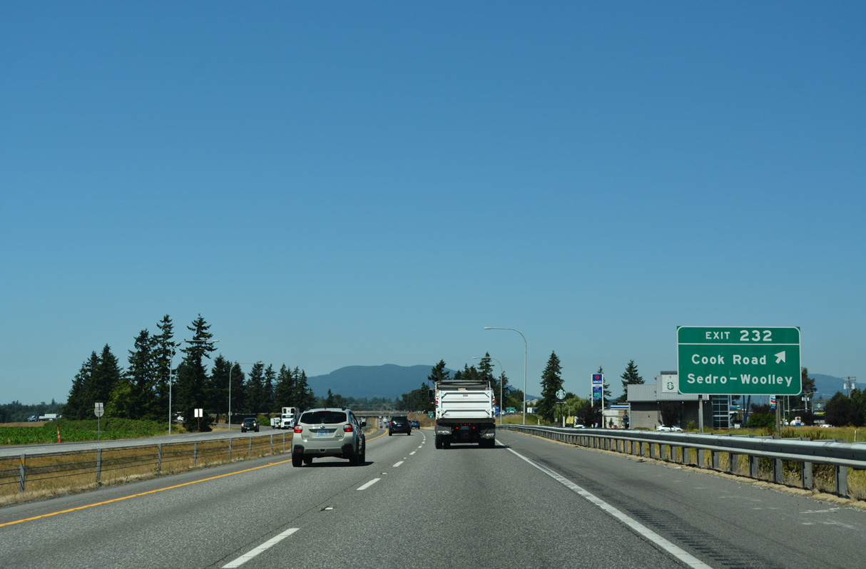
A selection of motorist services lines adjacent Old Highway 99 N at the diamond interchange (Exit 232) with Cook Road.
07/19/23
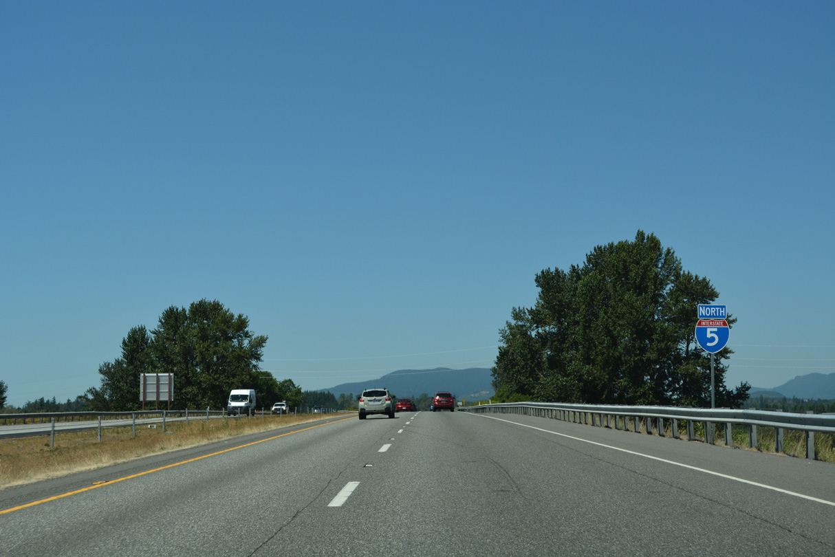
Interstate 5 passes over a BNSF Railroad beyond this north confirming marker.
07/19/23
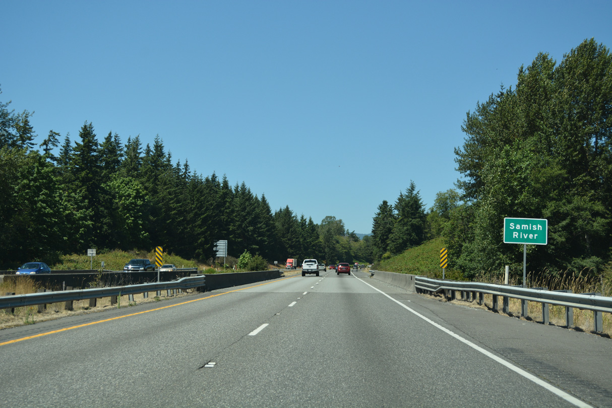
Beginning the ascent from Butler Flat, Interstate 5 crosses the Samish River ahead of a roadway separation at mile marker 295.
07/19/23
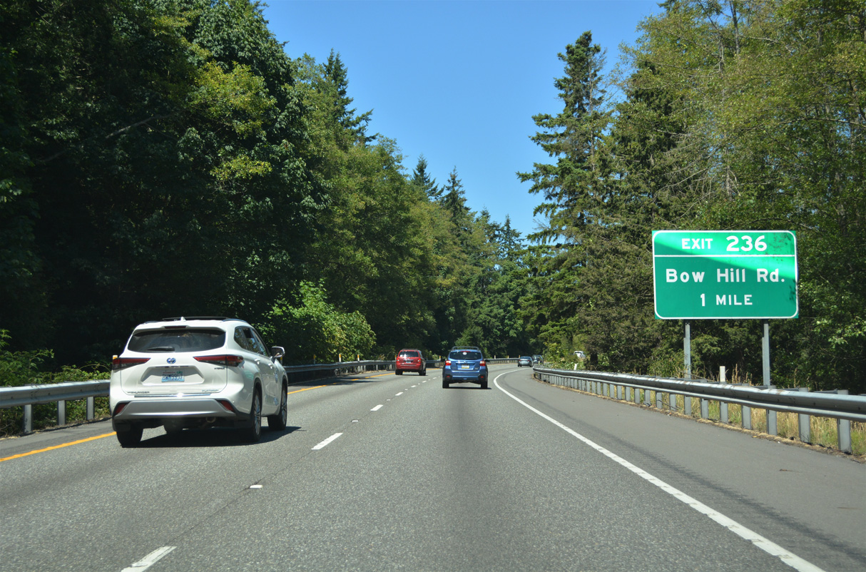
Bow Hill Road runs west from Old Highway 99 N and Prairie Road at Jarman Prairie to the diamond interchange at Exit 236.
07/19/23
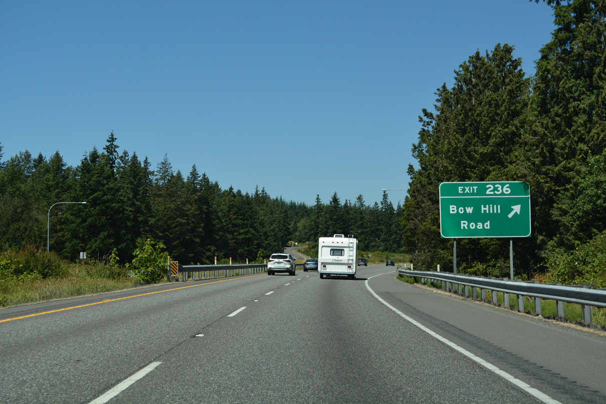
Continuing west from Exit 236, Bow Hill Road lowers into the communities of Bow and Edison Station. West from SR 11, Bow Hill Road was once a part of SR 237 to Edison. All 9.07 miles of that state route, between Edison Station and SR 20, were decommissioned in 1991 (AARoads Wiki, 2023).
07/19/23
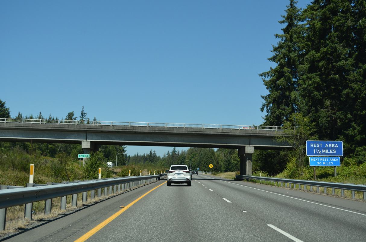
The Bow Hill Rest Area is 1.5 miles north of Bow Hill Road.
07/19/23
Interstate 5 continues north toward Lookout Mountain.
07/19/23
Distance sign posted 16 miles south of Bellingham and 71 miles out from Vancouver, British Columbia.
07/19/23
The Bow Hill Rest Areas line both sides of Interstate 5 on a bluff rising west of Friday Creek and Old Highway 99 N.
07/19/23
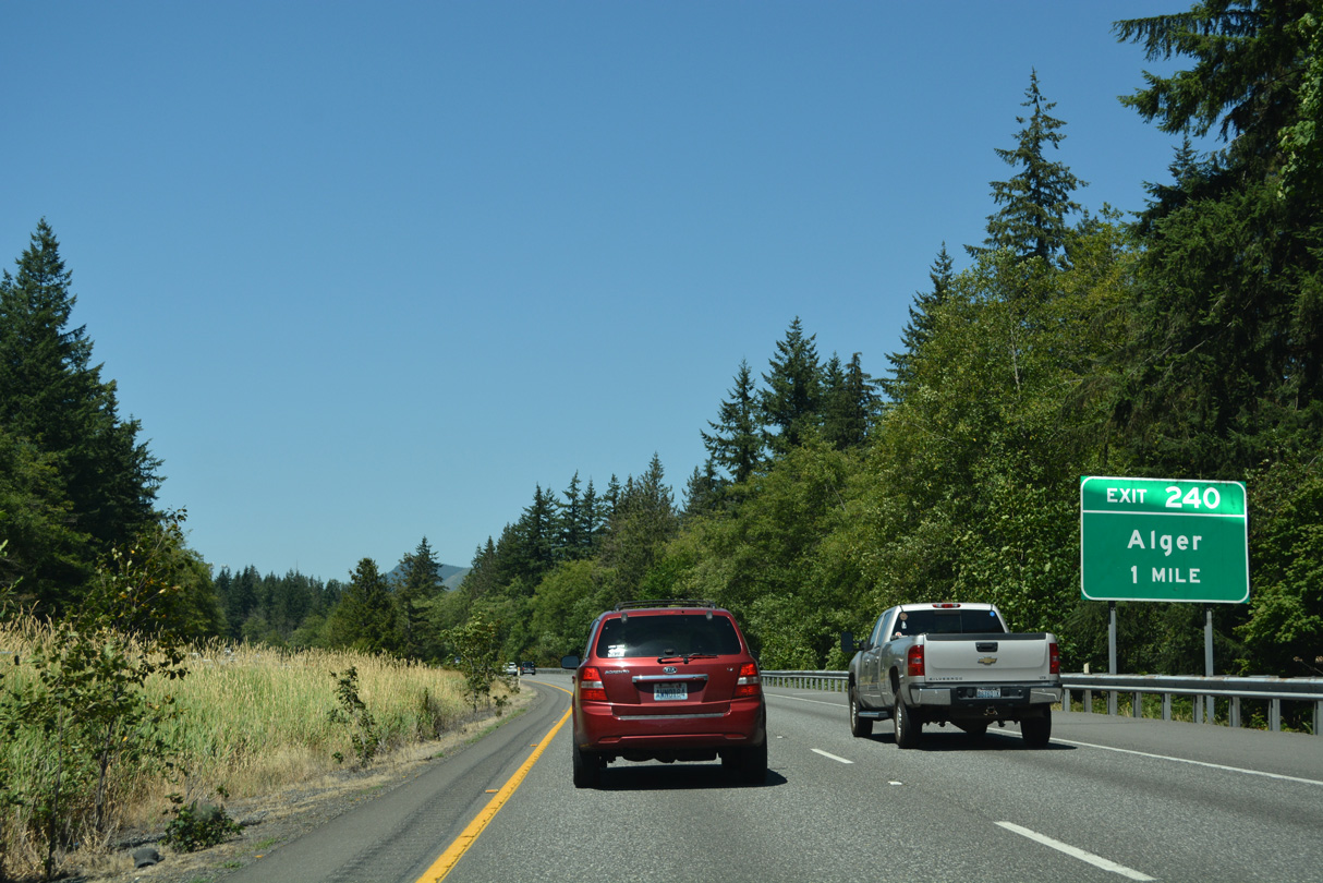
Lake Samish Road connects with Interstate 5 at Exit 240 west from the census designated place of Alger.
07/19/23
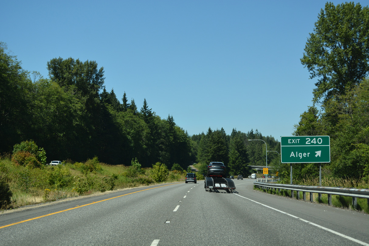
Lake Samish Road turns north from Exit 240 to W Lake Samish Drive and Lake Samish in Whatcom County. Alger Cain Lake Road extends east from Lake Samish Road and Alger to Glenhaven and Lake Whatcom.
07/19/23
Interstate 5 parallels Friday Creek across a broad valley east of Chuckanut Mountain north to Lake Samish.
07/19/23
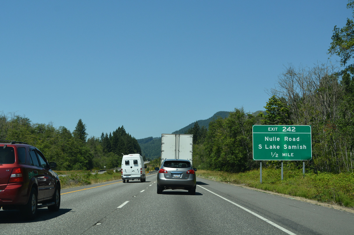
Nulle Road arcs west from Pacific Highway (old U.S. 99) to the diamond interchange at Exit 242.
07/19/23
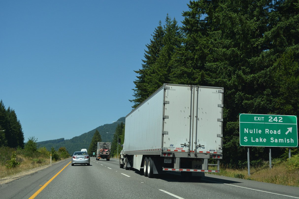
E Lake Samish Drive ties into Nulle Road south from Dittrich Park adjacent to Exit 242. Nulle Road continues southwest along the county line to W Lake Samish Drive, which encircles Lake Samish along with E Lake Samish Drive.
07/19/23
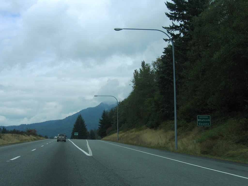
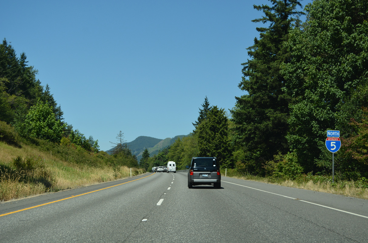
Interstate 5 travels 24.98 miles north through Skagit County to Whatcom County, the last county northbound along the 1,381 mile long route.
08/30/06


References:
AARoads Wiki. (2024, December 18). Washington State Route 530. AARoads Wiki. Retrieved September 2, 2025, from https://wiki.aaroads.com/wiki/Washington_State_Route_530
AARoads Wiki. (2023, September 8). Washington State Route 237. AARoads Wiki. Retrieved September 4, 2025, from https://wiki.aaroads.com/wiki/Washington_State_Route_237
- "I-5 bridge over Skagit River should reopen next week." The Spokesman-Review, June 10, 2013.
Photo Credits:
- Brent Ivy: 07/19/23
- AARoads: 08/30/06
Connect with:
Page Updated Friday September 05, 2025.