
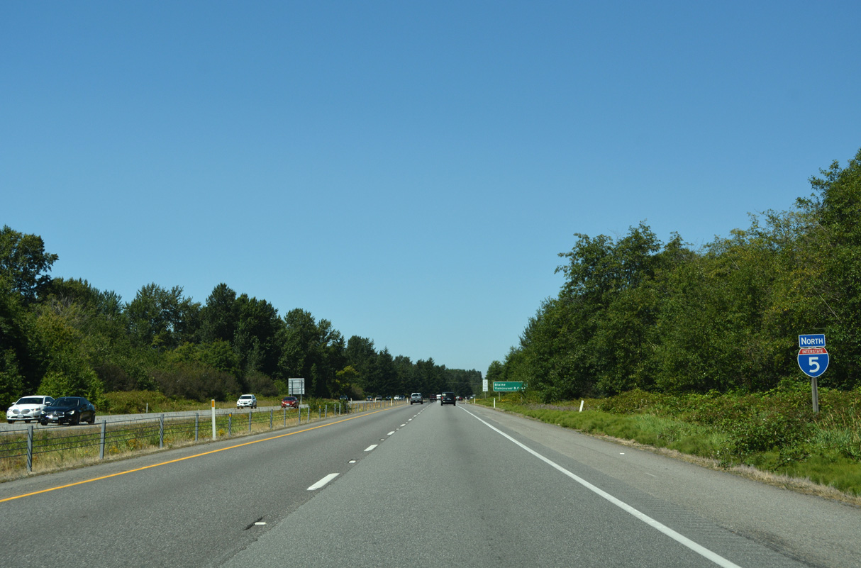
Interstate 5 North - Bellingham to Blaine
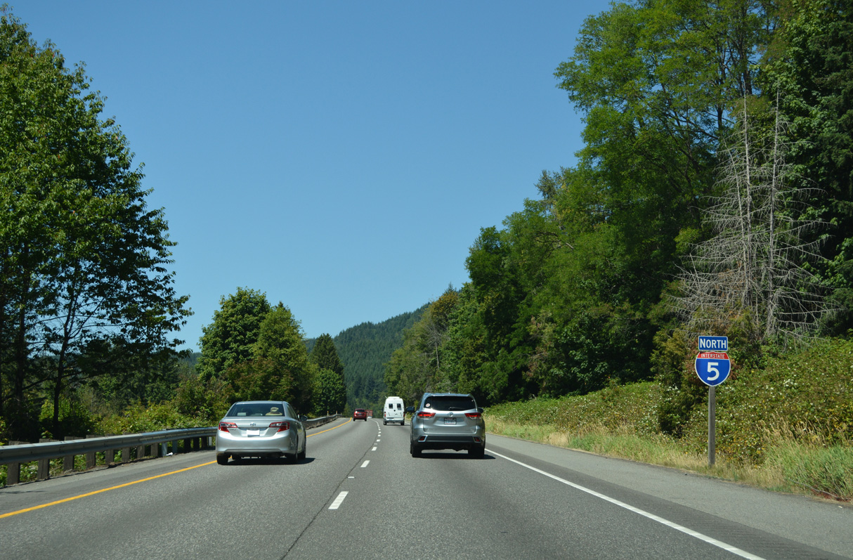
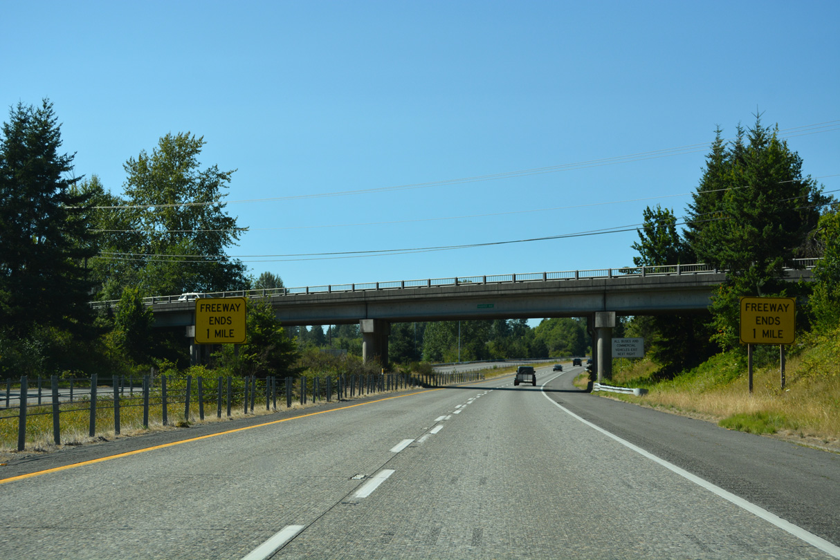
The speed limit reduces to 60 miles per hour along Interstate 5 north of Exit 242.
07/19/23
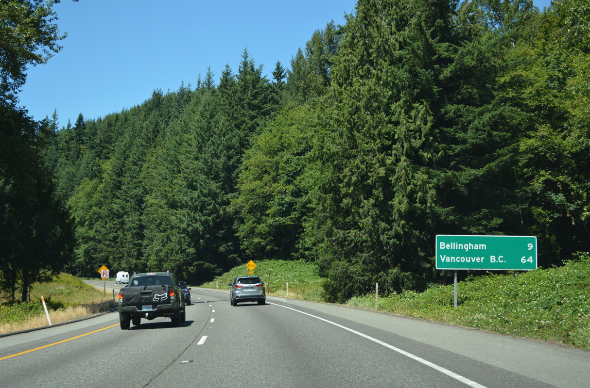
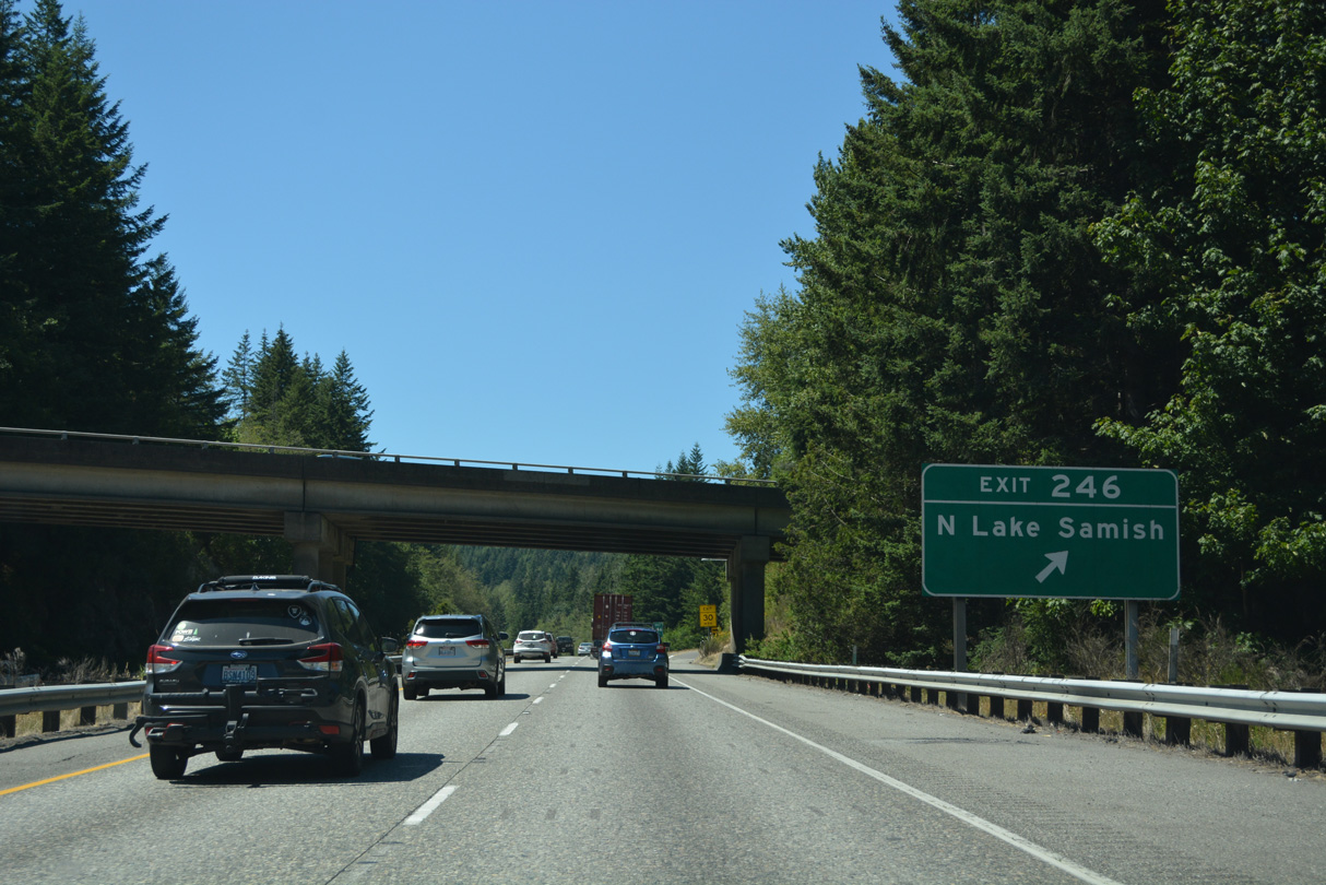
Advancing north along the east side of Lake Samish, Interstate 5 continues nine miles to Bellingham.
07/19/23
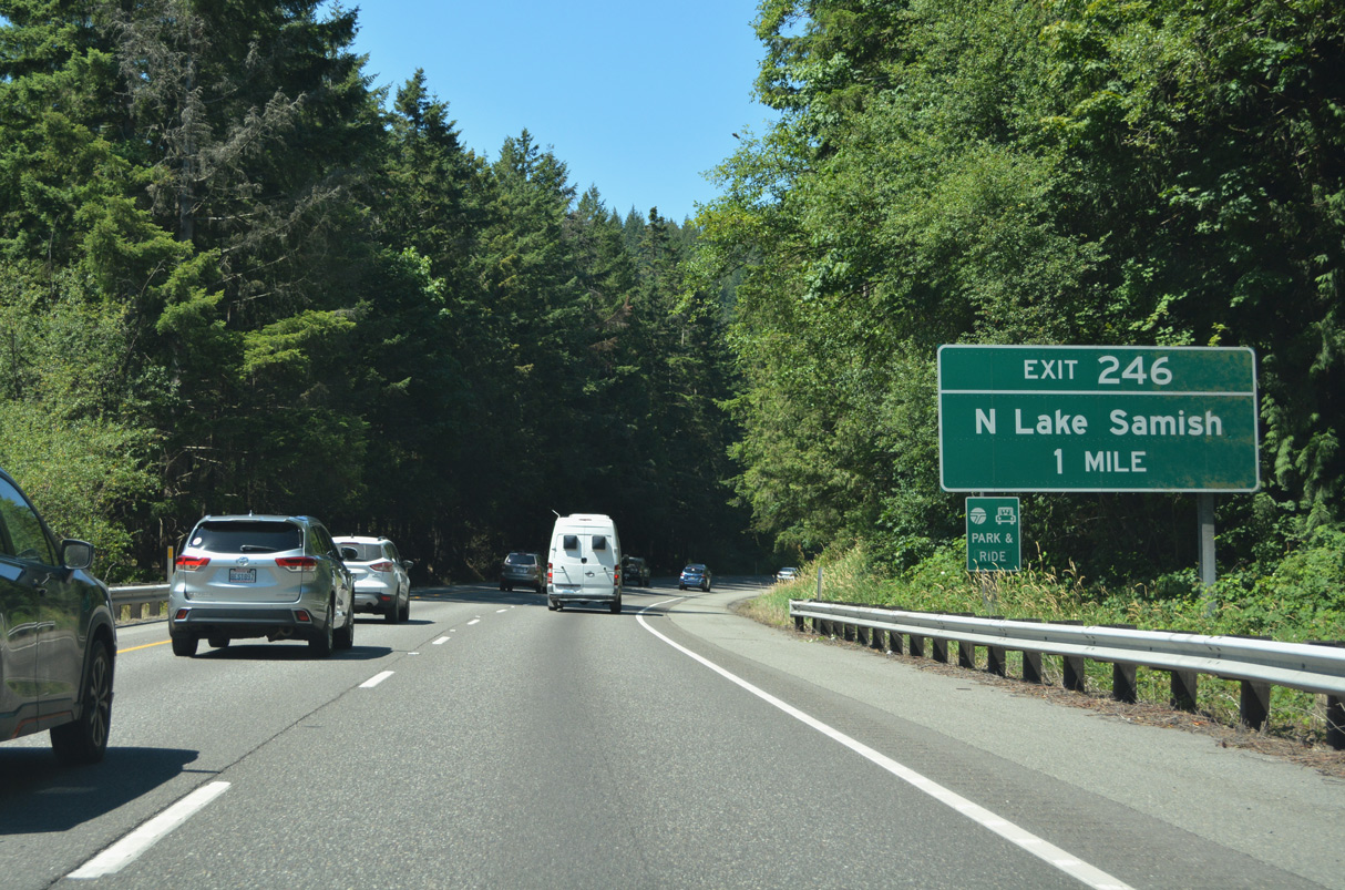
E Lake Samish Drive ends at N Lake Samish Drive, a continuation of the ring road system around the lake. N Lake Samish Drive climbs northward to the right in right out (RIRO) ramps at Exit 246.
07/19/23
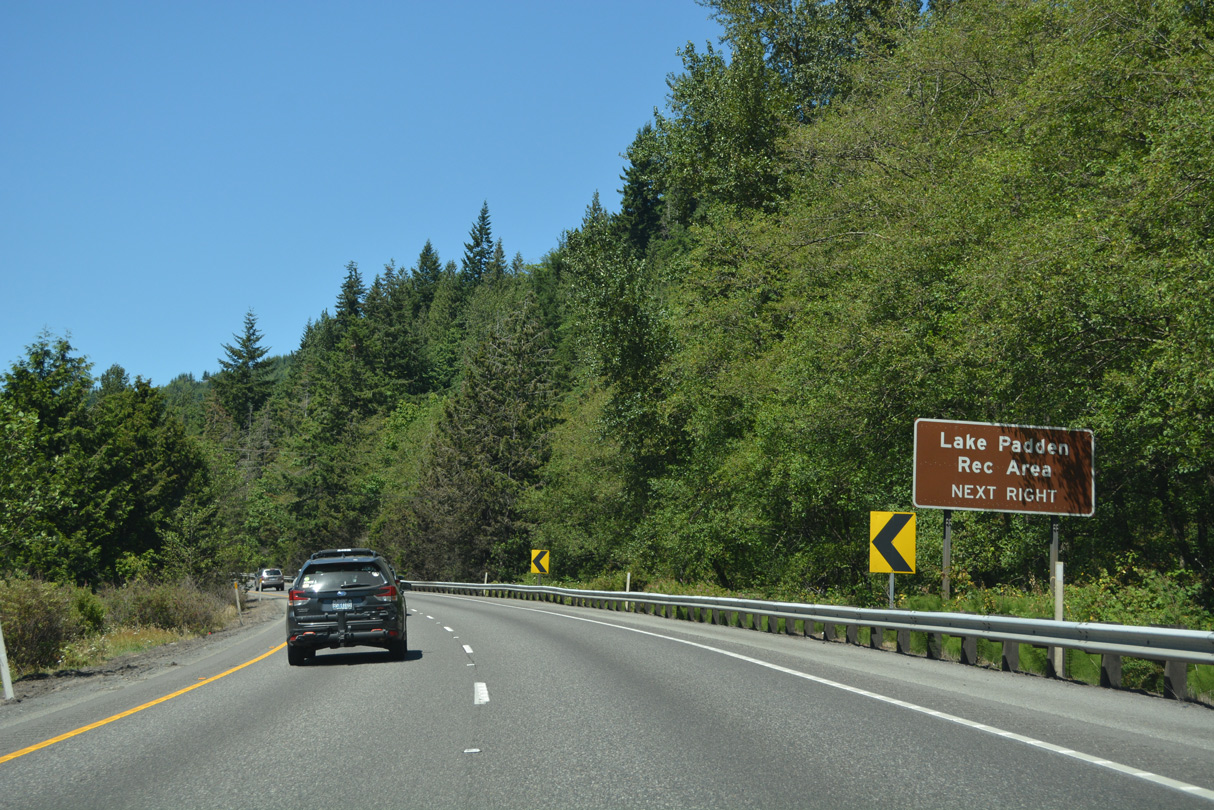
Lookout Mountain stretches westward toward Lake Padden. Samish Way (former U.S. 99) extends northwest from N Lake Samish Drive and Exit 246 to Lake Padden Park and Happy Valley in Bellingham.
07/19/23
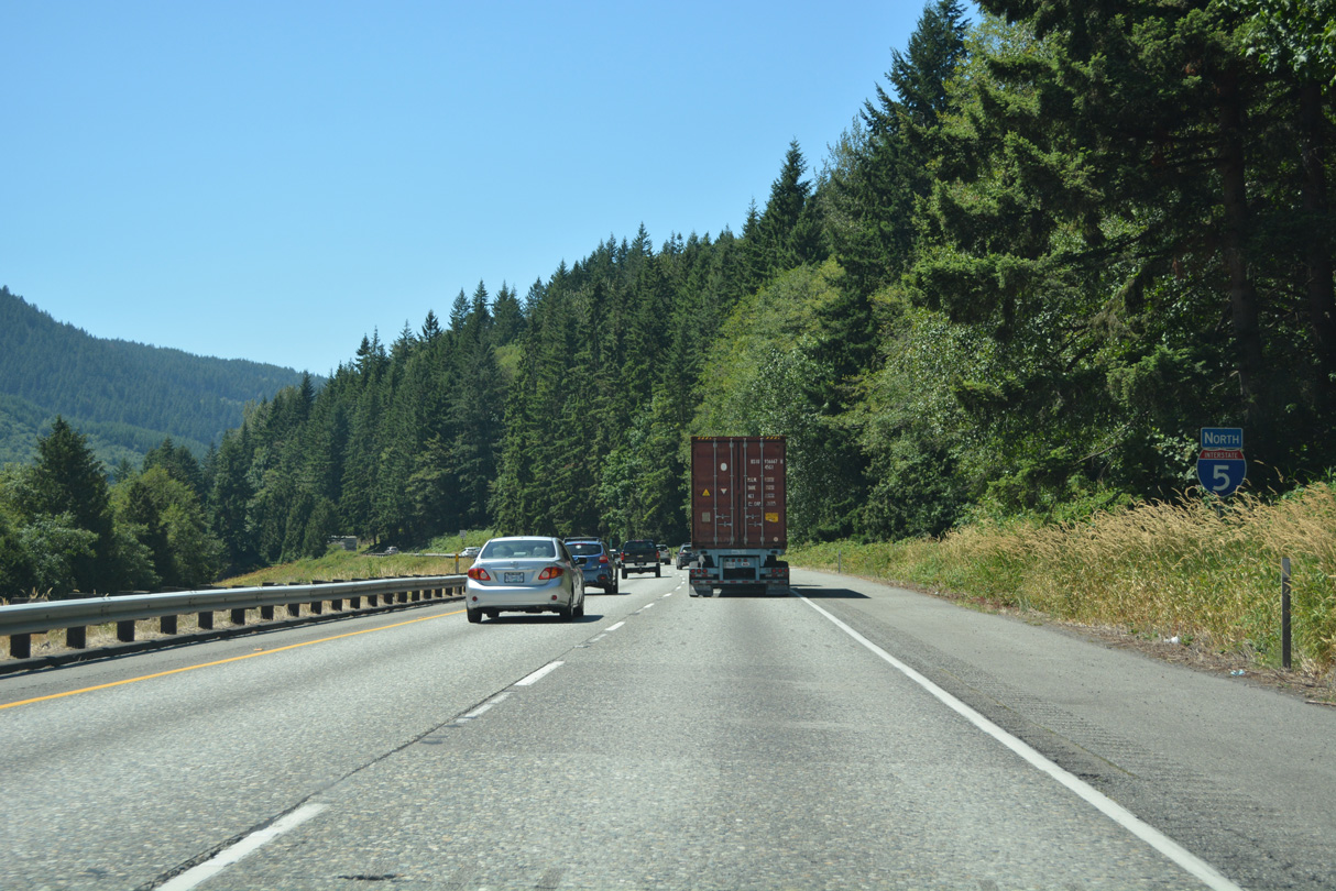
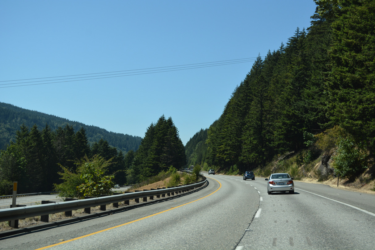
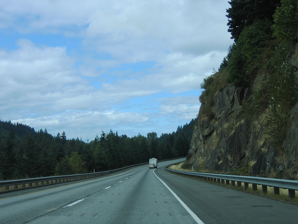
Interstate 5 and parallels Old Samish Road and Chuckanut Creek in a valley north of Chuckanut Mountain. This is the most mountainous section of Interstate 5 within the Evergreen State.
07/19/23
08/30/06
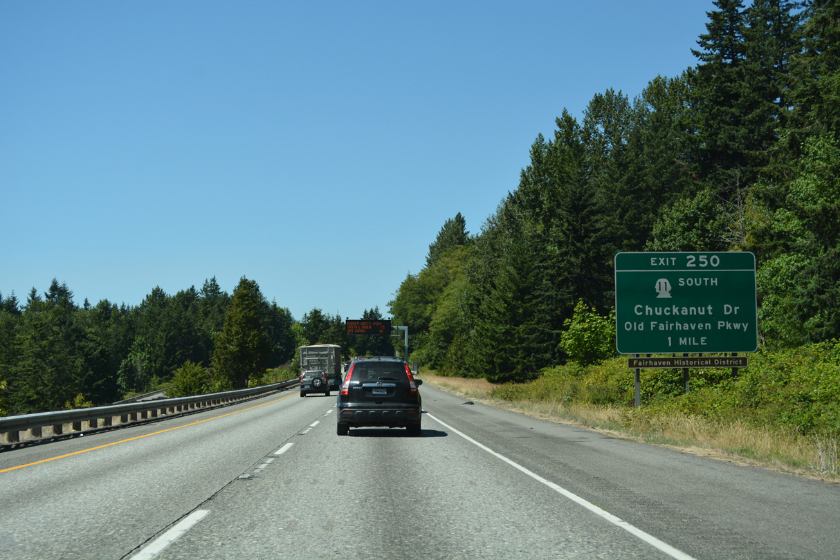
SR 11 returns to I-5 at the first of seven exits for Bellingham east from Samish Bay along Old Fairhaven Parkway. The state route began at Exit 231 in Burlington.
07/19/23
Curving north into Happy Valley, I-5 lowers to the diamond interchange (Exit 250) with SR 11 (Old Fairhaven Parkway) and Connelly Avenue east to 36th Street.
07/19/23
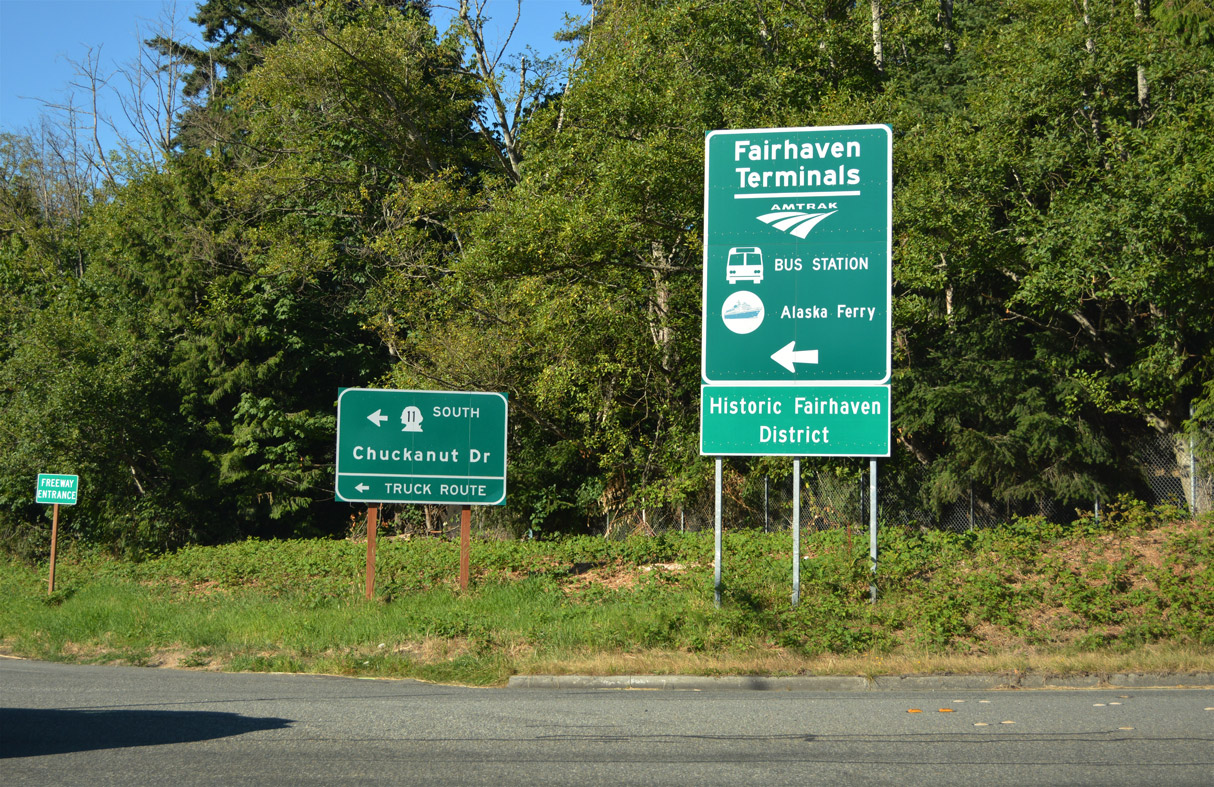
SR 11 follows Chuckanut Drive (former U.S. 99 Alternate) south from 12th Street to Chuckanut Village along Chuckanut Bay. The Fairhaven Transportation Center is located along Harris Avenue west of 12th Street.
07/19/23
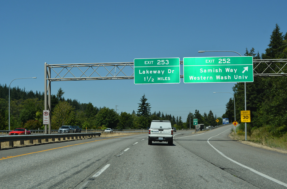
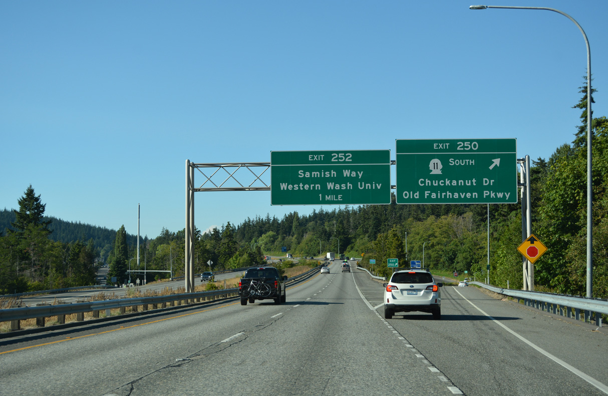
Samish Way (old U.S. 99) converges with I-5 again at a split diamond interchange (Exit 252) east of Western Washington University. Samish Way crosses I-5 north from Elwood Avenue en route to Maple Street. The historic route of U.S. 99 followed Maple, Ellis and Holly Streets to the Bellingham city center.
07/19/23
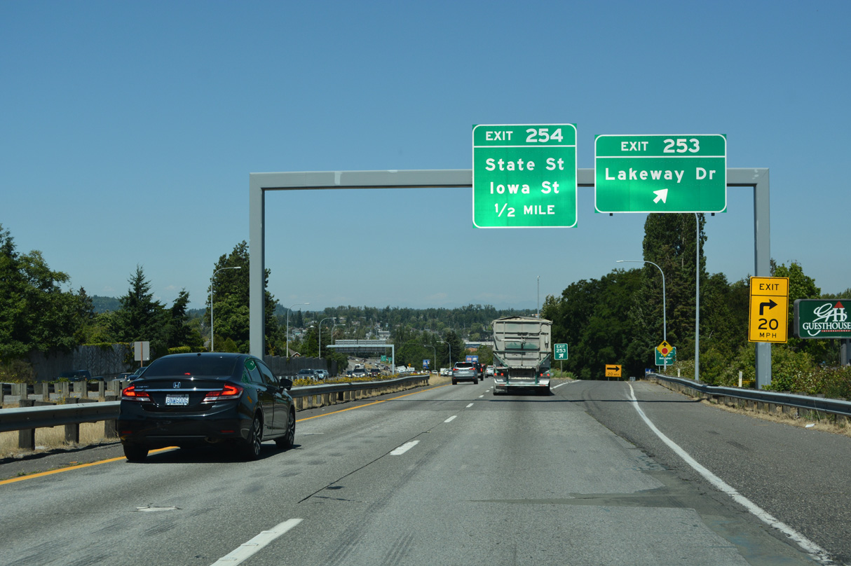
Lakeway Drive west from forthcoming Exit 253 becomes Holly Street (Old U.S. 99) northwest to Downtown Bellingham.
07/19/23
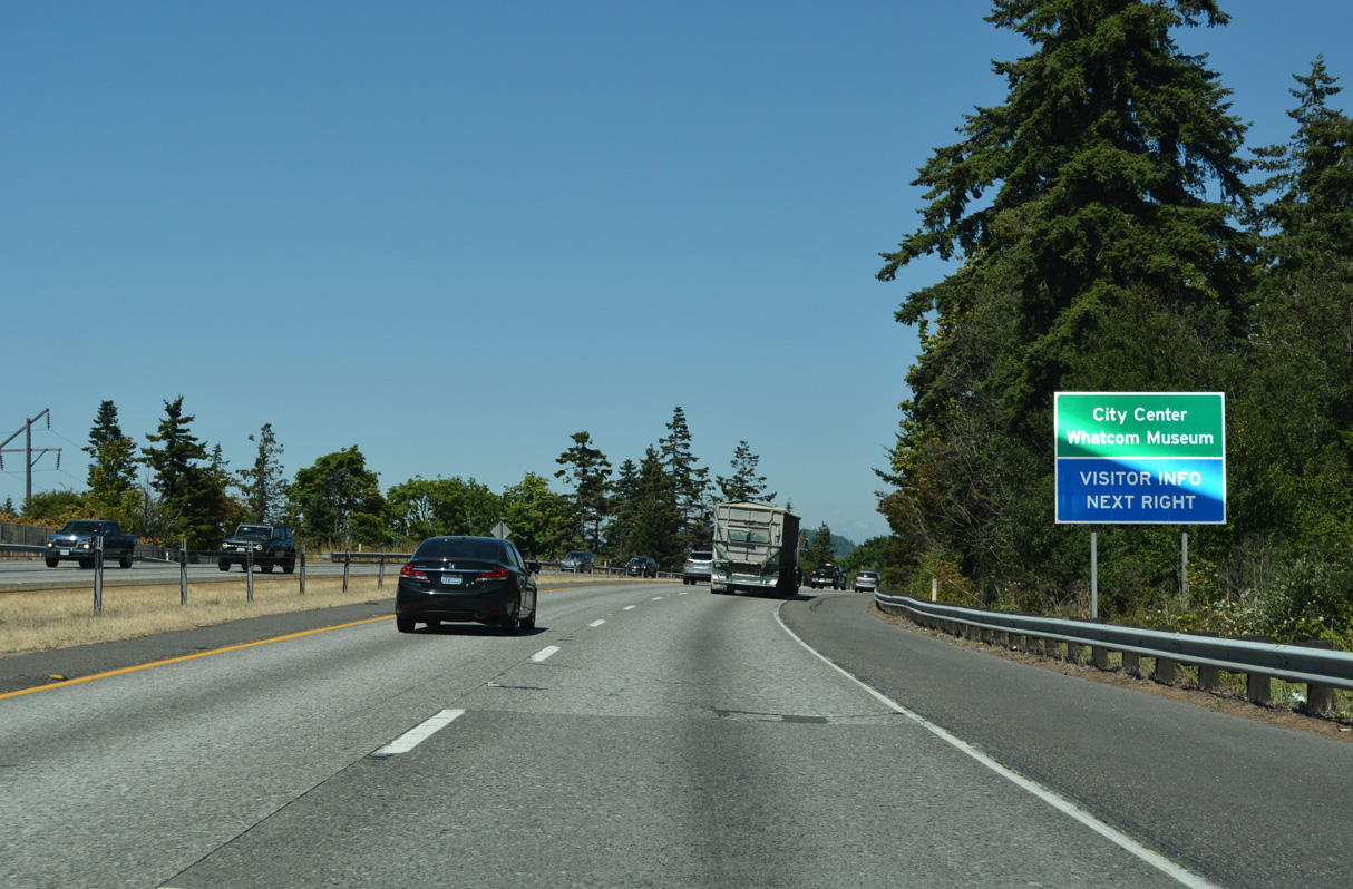
The northbound ramps at Exit 253 connect Interstate 5 with King Street at Potter Street north of Lakeview Drive. Points of interest for Exit 253 include a visitors center and the Whatcom Museum.
07/19/23
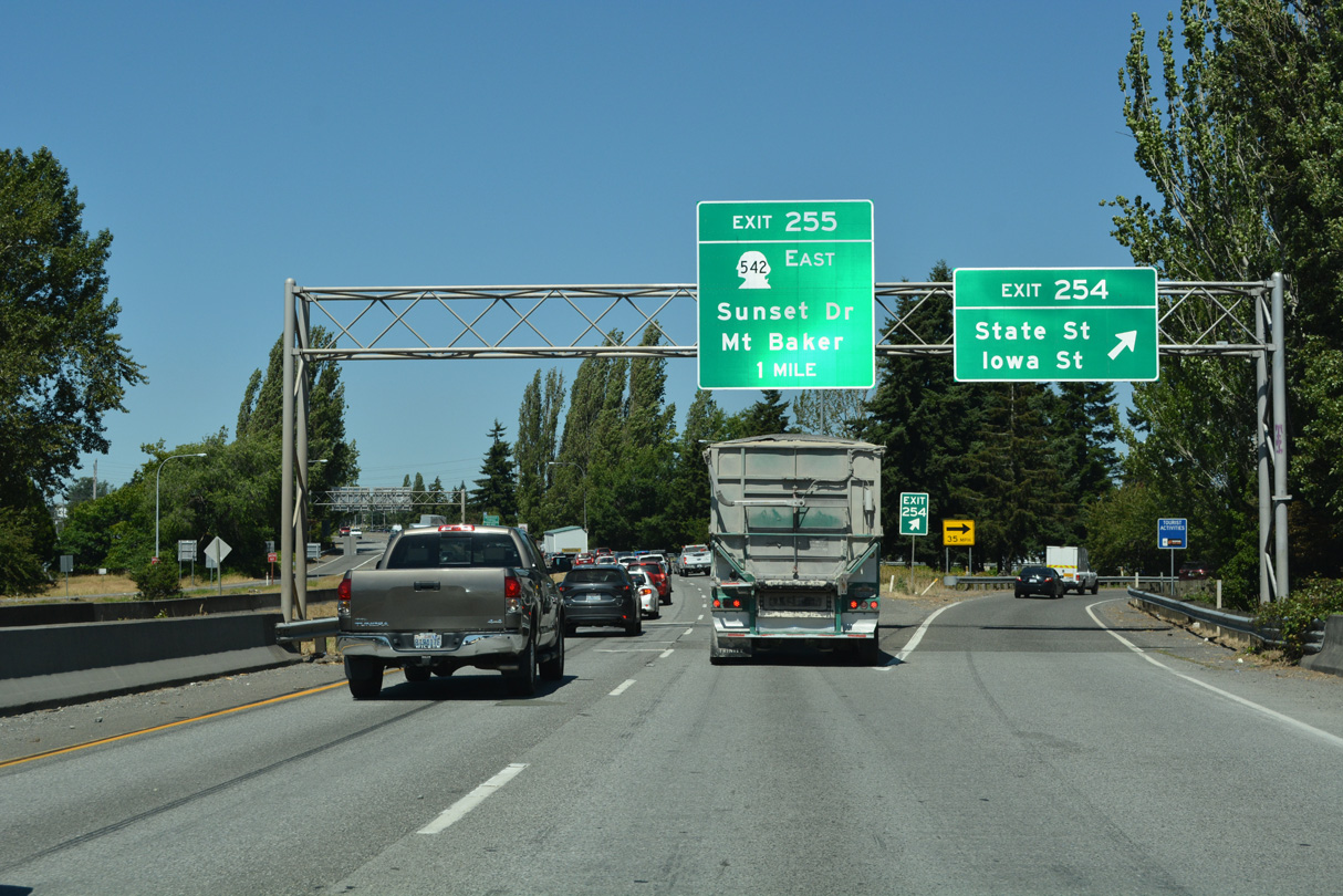
Exit 254 leaves Interstate 5 north at Whatcom Creek for Iowa Street at Moore Street. Iowa Street constitutes a commercial arterial east to Woburn Street and west to the five point intersection with State and James Streets. State Street provides a second route to Downtown Bellingham.
07/19/23
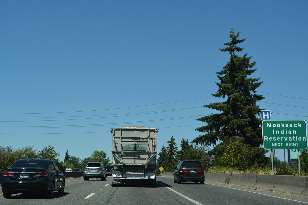
SR 542 (Sunset Drive) runs 9.98 miles east from the parclo interchange at Exit 255 to SR 9 at Nugents Corner, west of the Nooksack Indian Reservation.
07/19/23
Interstate 5 ascends from the Alabama Street overpass through the Bellingham street grid to a commercial area anchored by Sunset Square shopping center along Sunset Drive east.
08/30/06
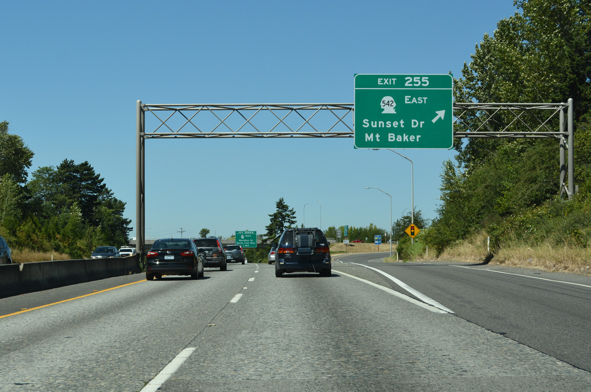
Northbound Interstate 5 at Exit 255 to SR 542 east and Sunset Drive west to Broadway and Bellingham Bay. SR 542 overall travels 57.29 miles between Bellingham and the Mount Baker Ski Area.
07/19/23
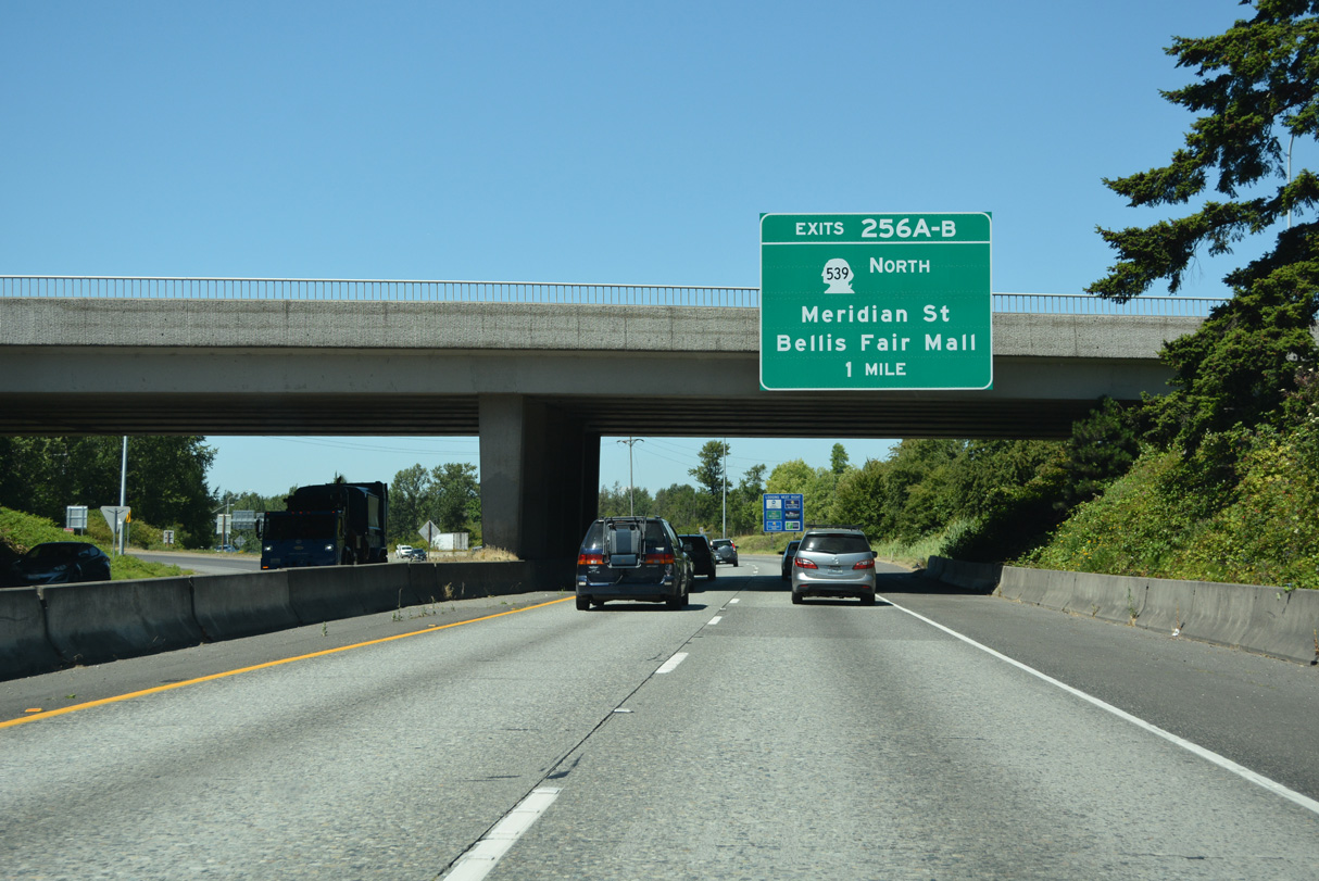
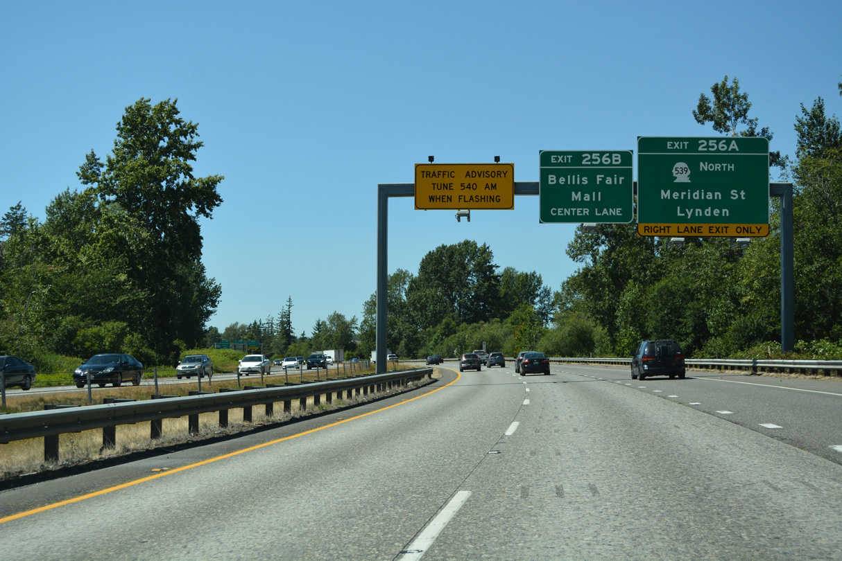
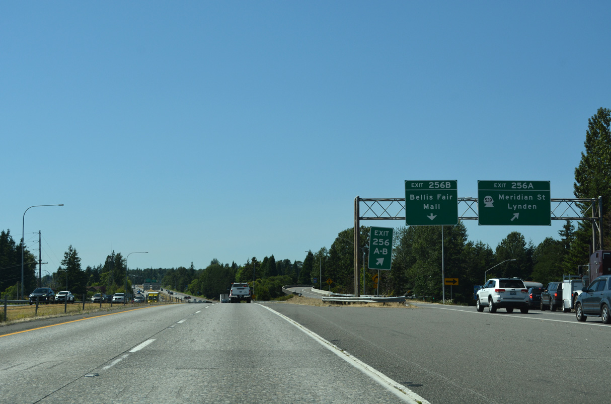
Curving west, Exits 256 A/B joins Interstate 5 next with SR 539 north at Meridian Street (Old U.S. 99 Alternate) and Bellis Fair Parkway at Bellis Fair Mall.
07/19/23
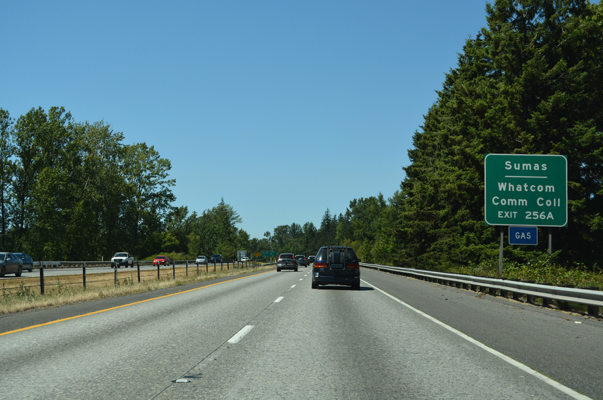
Meridian Street (Old U.S. 99 ALT) heads south to Cornwall Park and Downtown Bellingham from Exit 256. SR 539 (Meridian Street) runs east of Whatcom Community College at W Kellogg Road.
07/19/23
SR 539 travels 15.18 miles north to Laurel, Lynden, and the Canadian border south of Aldergrove, British Columbia. The state route is part of a truck route to Trans Canada Highway 1 for Surrey and Vancouver.
07/19/23
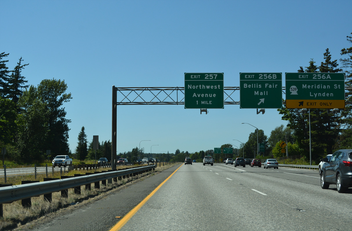
Exit 256 partitions into separate ramps for SR 539 north / Meridian Street and Bellis Fair Mall Parkway, a ring road encircling Bellis Fair Mall. SR 539 north provides connections to the Sumas border crossing via SR 544 and SR 546 east.
07/19/23
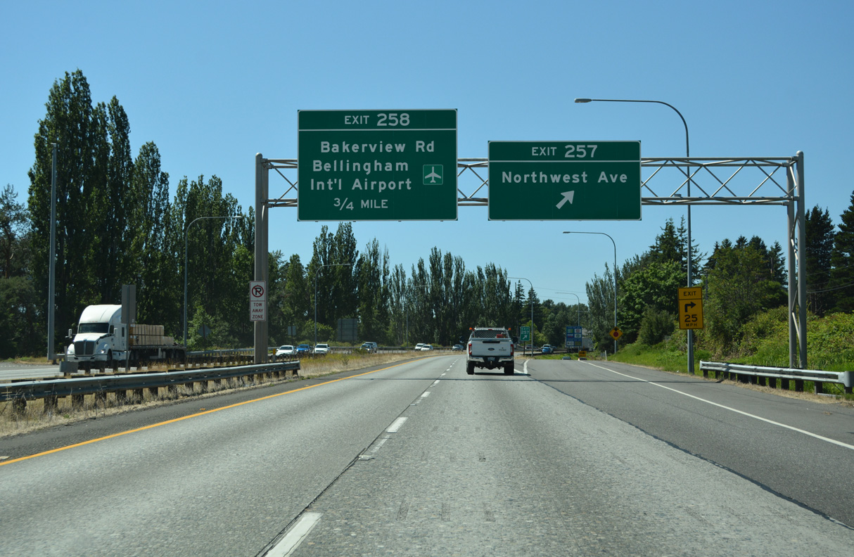
Northwest Avenue branches west from Elm Street north of Downtown Bellingham to a modified diamond interchange (Exit 257) with Interstate 5.
07/19/23
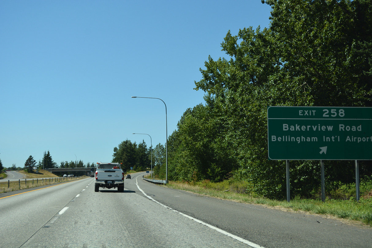
Bakerview Road travels west across northern Bellingham to Interstate 5 at Exit 258. Bakerview Road becomes Airport Drive west at Maplewood Avenue (Old U.S. 99) near Bellingham International Airport (BLI).
07/19/23
A wye interchange brings motorists onto Interstate 5 north from Maplewood Avenue (former U.S. 99). Pacific Highway continues old U.S. 99 alongside the freeway to Ferndale.
07/19/23
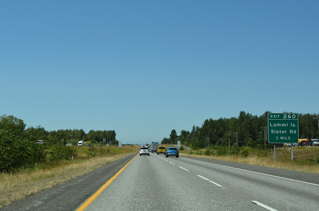
Slater Road stems west from Northwest Drive to a dumbbell interchange with Interstate 5 at Exit 260.
07/19/23
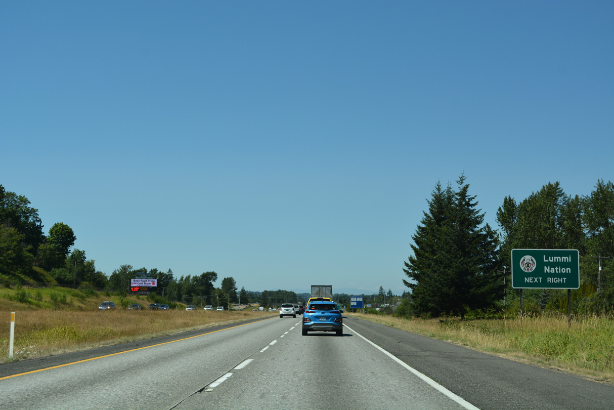
Slater Road continues west to Haxton Way south for the Lummi Indian Reservation and ferry to Lummi Island.
07/19/23
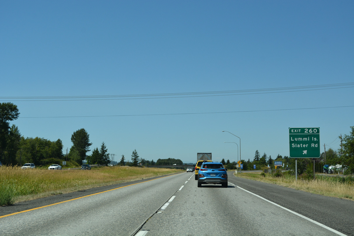
Slater Road travels 7.2 miles west from Interstate 5 to Neptune Beach along the Strait of Georgia.
07/19/23
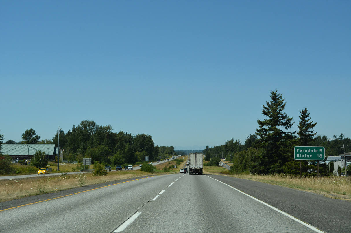
Interstate 5 enters the city of Ferndale just north of Exit 260 at Silver Creek.
07/19/23
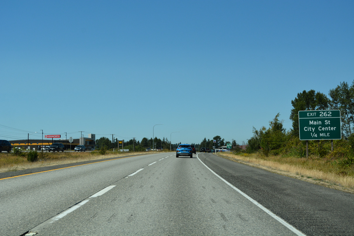
The parclo interchange at Exit 262 connects Interstate 5 north with Main Street at Barrett Road S (Old U.S. 99).
07/19/23
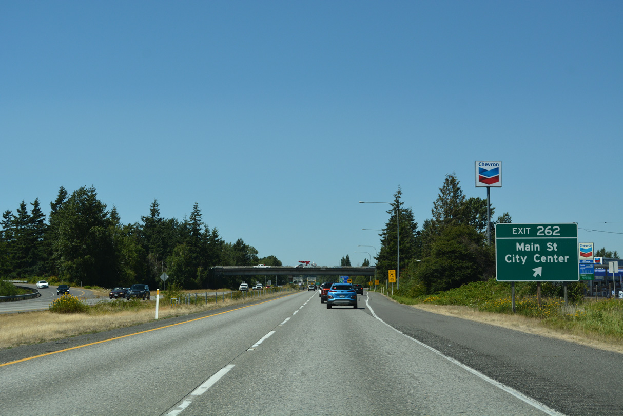
Exit 262 leaves Interstate 5 north for Axton Road east to SR 539 near Laurel and Main Street west to the Ferndale city center. Main Street becomes Mountain View Road west to Mountain View and Lake Terrell.
07/19/23
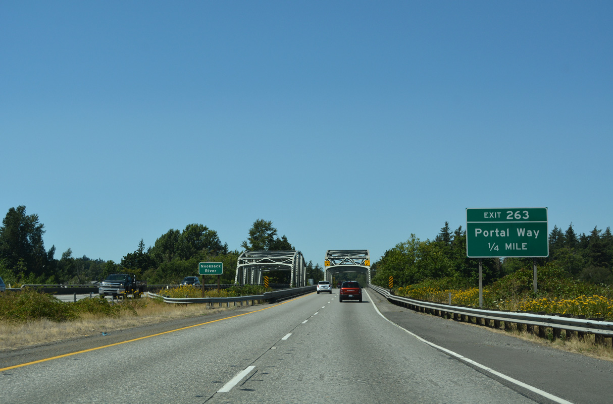
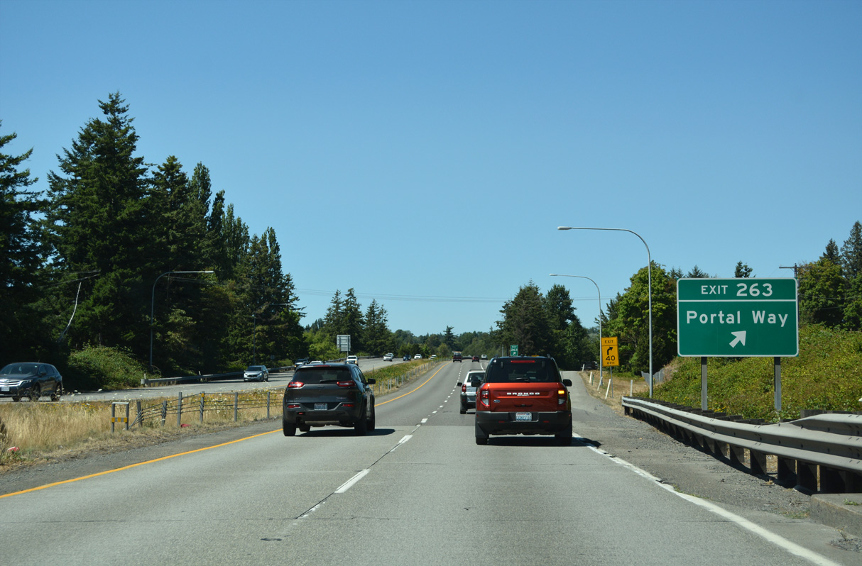
2nd Avenue north becomes Portal Way at a roundabout with Thornton Street at the parclo interchange (Exit 263) with Interstate 5. 2nd Avenue south to Washington Street and 3rd Avenue leads to Historic Downtown Ferndale.
07/19/23
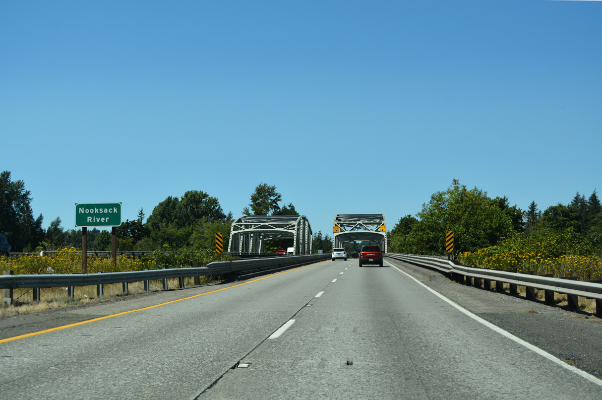
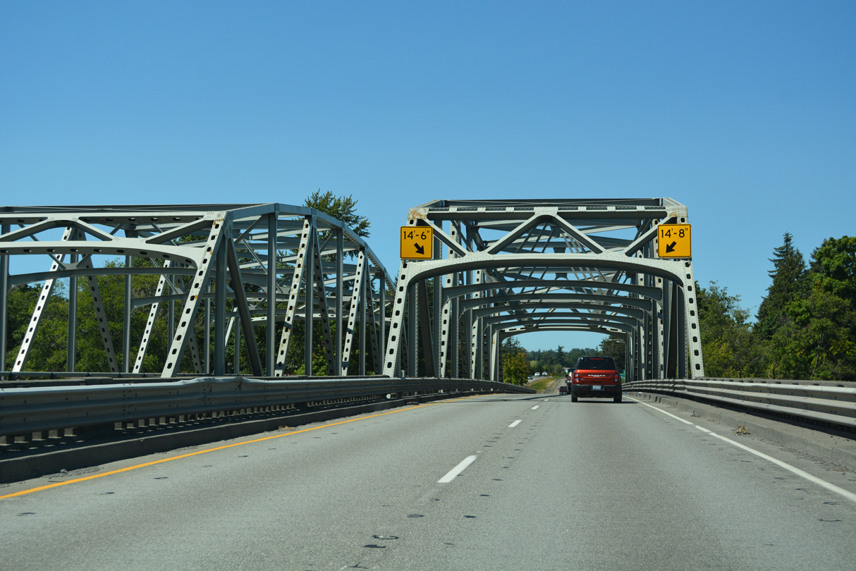
Interstate 5 spans the Nooksack River across a pair of steel through truss bridges.
07/19/23
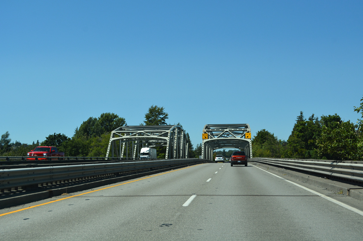
The northbound span across the Nooksack River opened in 1955 as a part of U.S. 99 (Pacific Highway). A wider southbound bridge was completed in 1971.
07/19/23
Portal Way (former U.S. 99) parallels Interstate 5 north to Custer and Blaine.
07/19/23
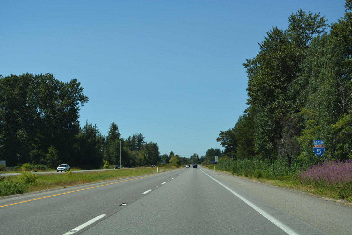
Interstate 5 north remains in Ferndale to Exit 266.
07/19/23
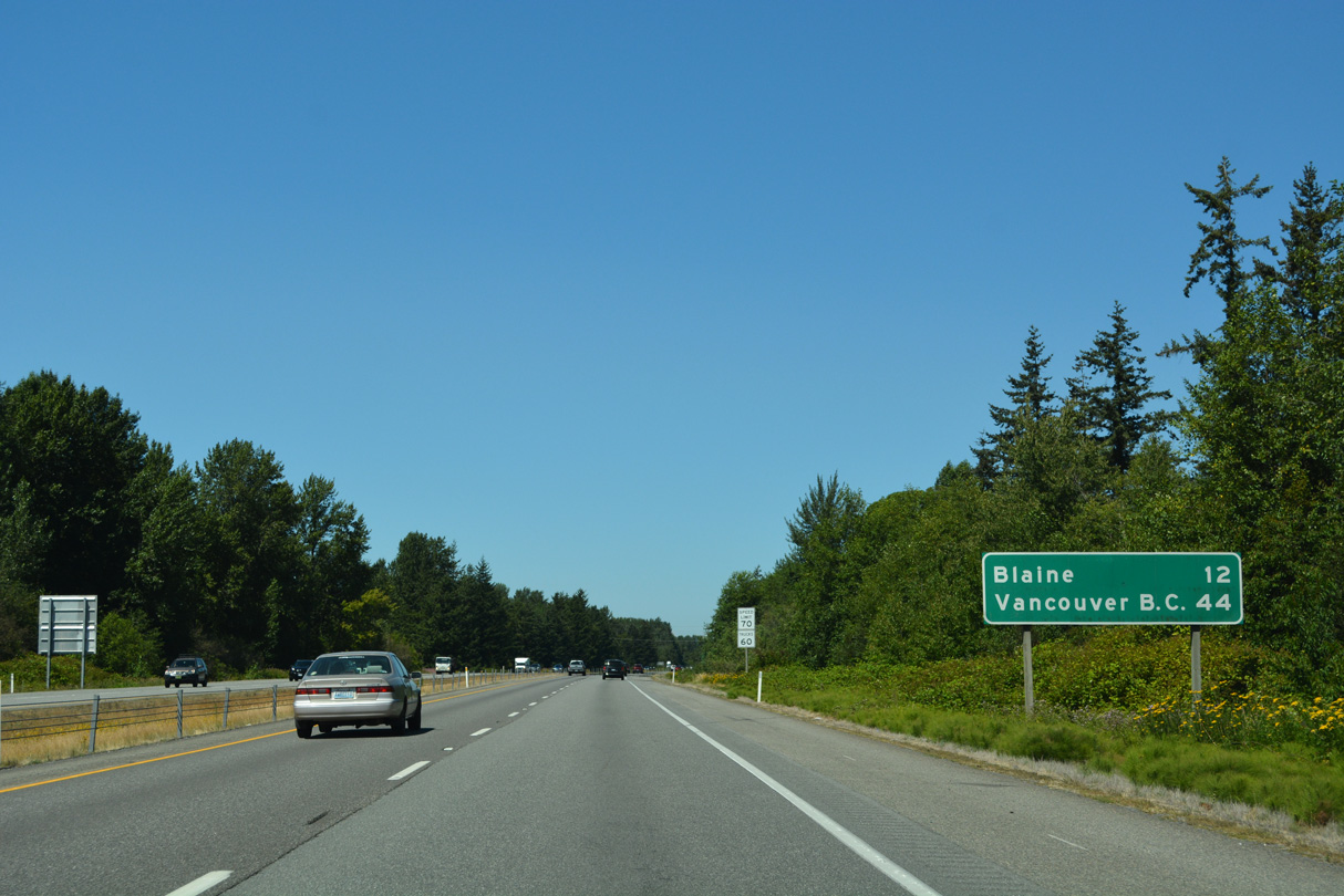
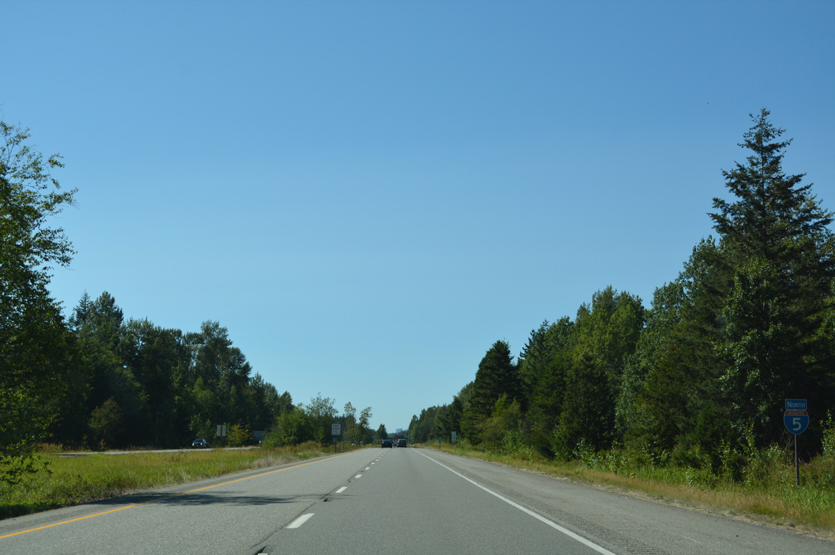
12 miles out from Blaine and 44 miles southeast of Vancouver, British Columbia on Interstate 5 north.
07/19/23
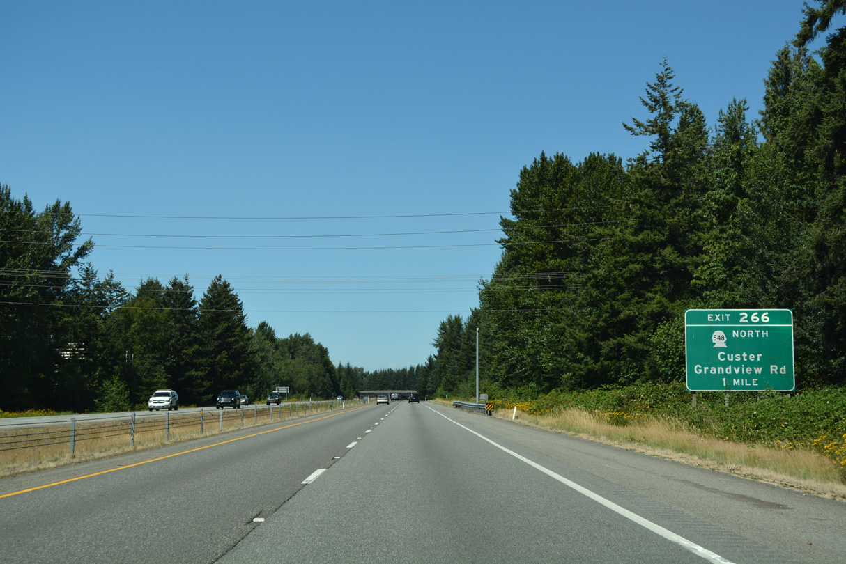
Grandview Road west becomes part of SR 548 at the diamond interchange (Exit 266) with Interstate 5. SR 548 loops west to Birch Bay along the 13.85 mile course north to Blaine.
07/19/23
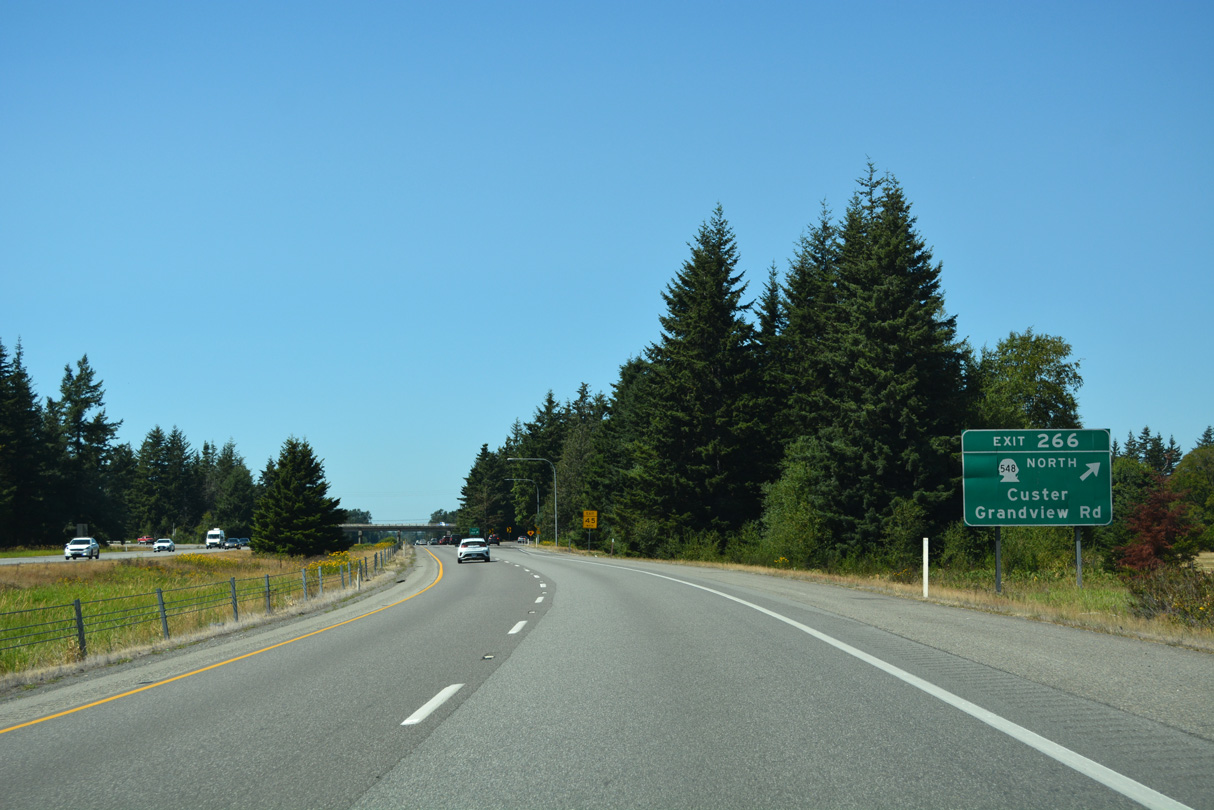
Old U.S. 99 / Portal Way crosses SR 548 just west of Exit 266 north en route to Custer. SR 548 follows Grandview Road west to a roundabout with Blaine Road. Grandview Road continues from there to Point Whitehorn south of Birch Bay State Park.
07/19/23
Interstate 5 confirming marker posted north beyond the Ferndale city line.
07/19/23
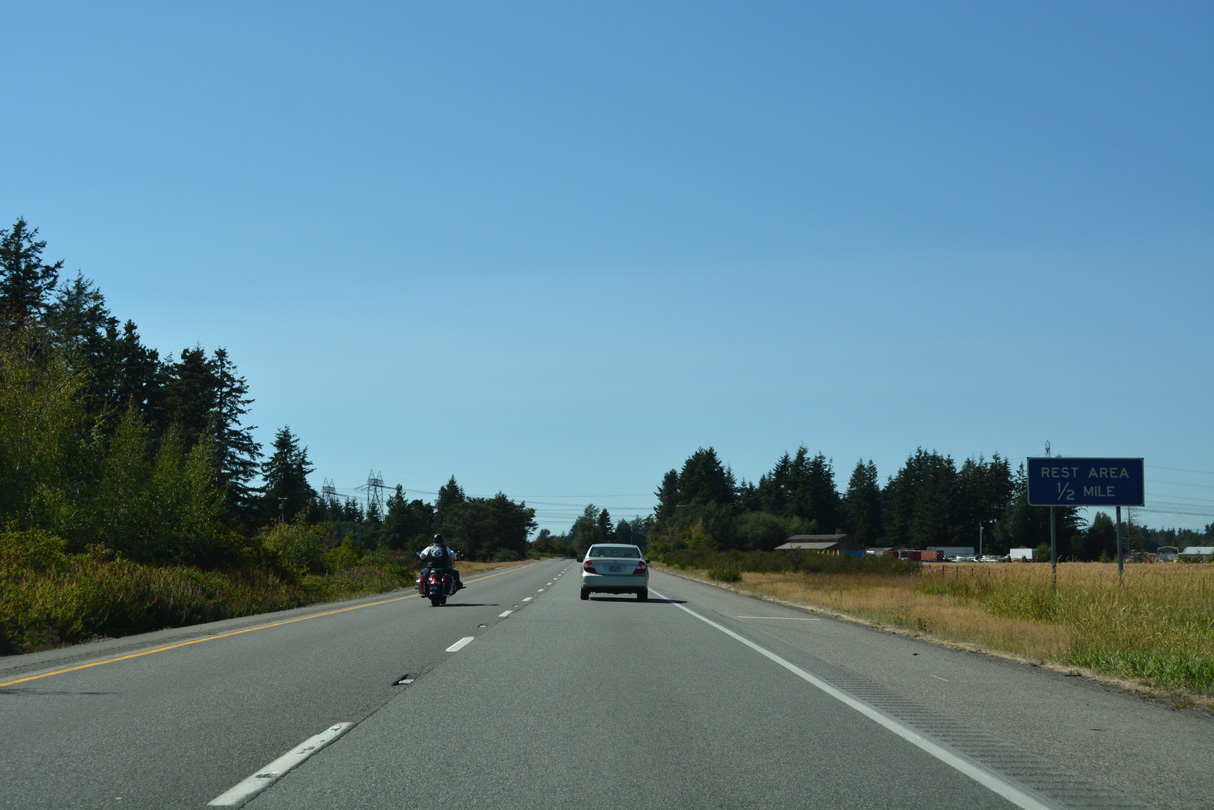
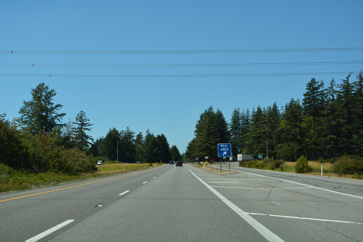
The final facility along Interstate 5 north, the Custer Rest Area follows mile marker 267.
07/19/23
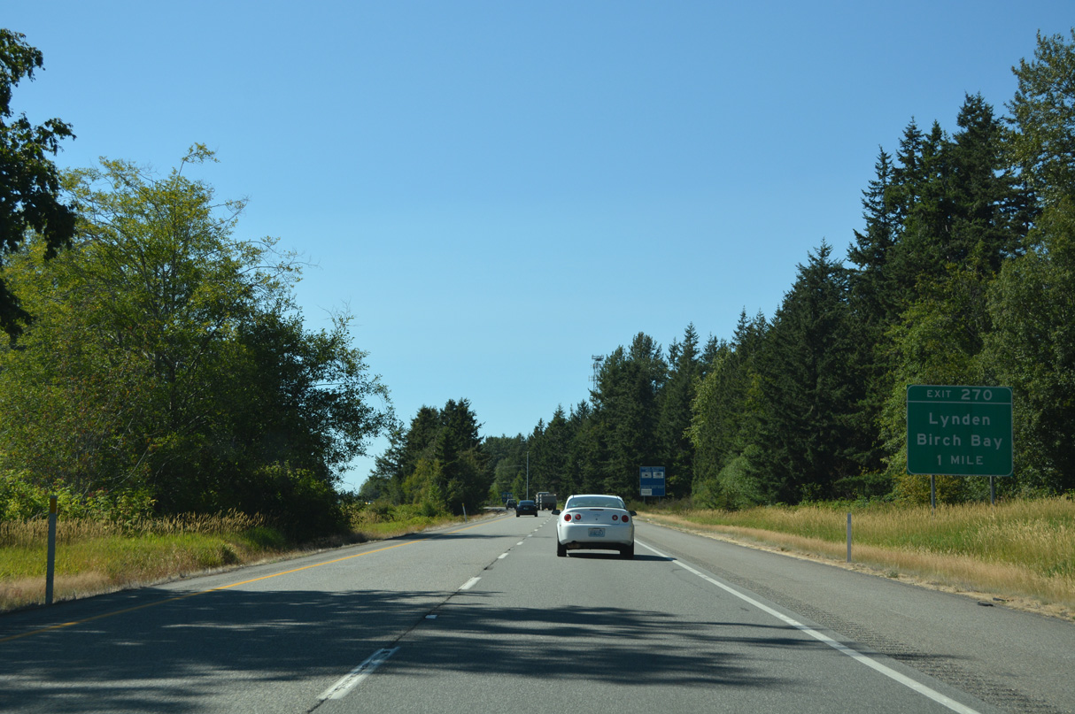
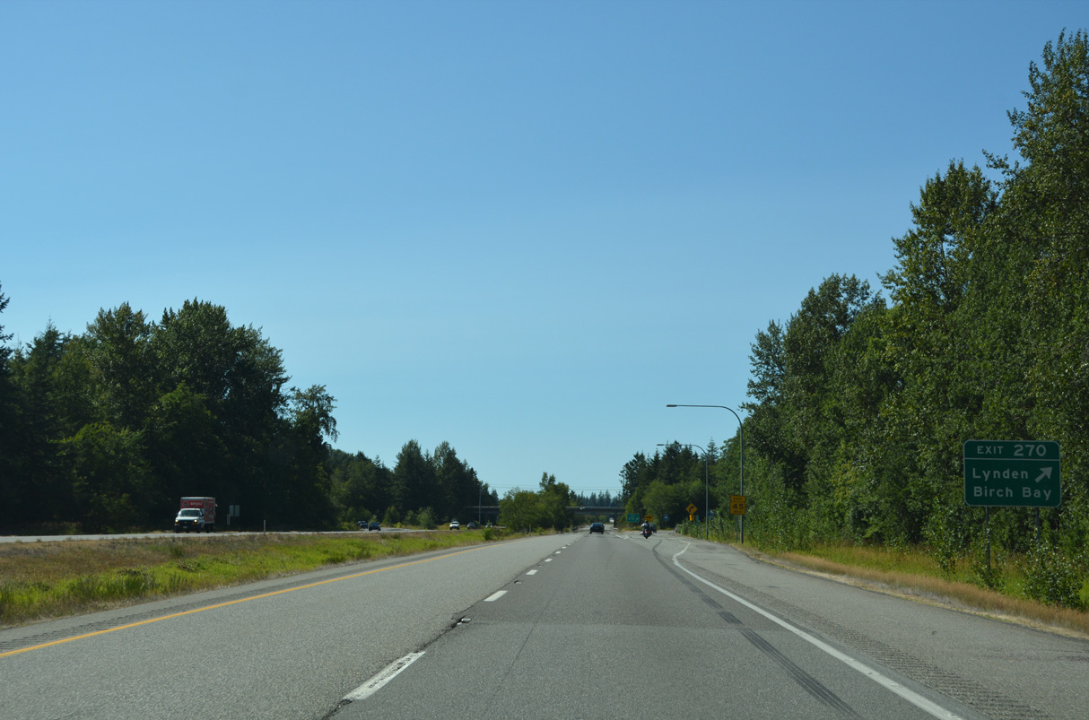
Birch Bay-Lynden Road crosses paths with Interstate 5 at a diamond interchange (Exit 270) northwest of Custer. The road connects the two communities for which it is named.
07/19/23
West from Exit 270, Birch Bay-Lynden Road ties into Harborview Road south of Cottonwood Beach and north of Birch Bay. Eastward the highway leads to SR 539 / former U.S. 99 Alternate (Guide Meridian Road) at Kok Road in the city of Lynden.
07/19/23
The reassurance marker for Interstate 5 north precedes the Loomis Trail Road over crossing.
07/19/23
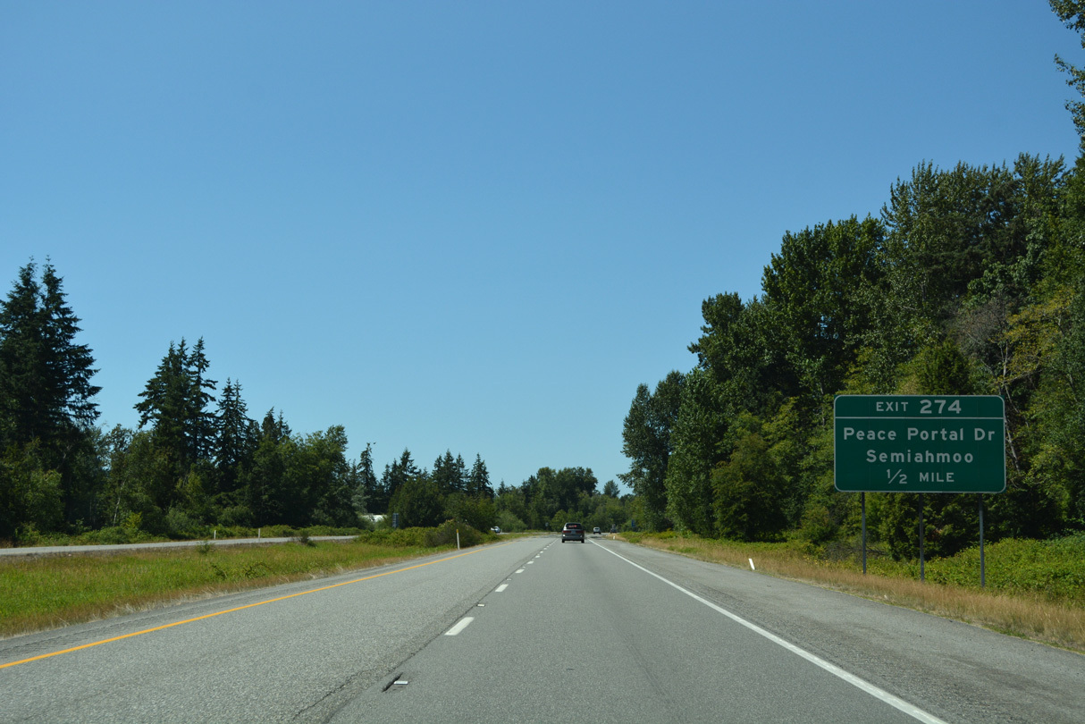
The last three exits from Interstate 5 north fall within the city of Blaine. First is the wye interchange (Exit 274) to Peace Portal Drive (old U.S. 99) after Dakota Creek.
07/19/23
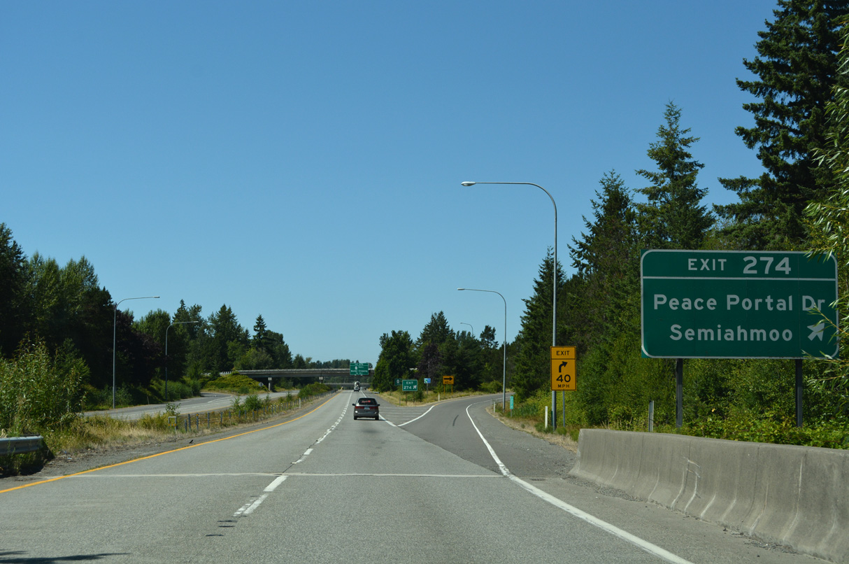
Portal Way becomes Peace Portal Drive (Old U.S. 99) upon entering the city of Blaine. The parallel road is part of SR 538 north from Blaine Road to Exit 276. SR 538 (Blaine Road) south to Drayton Harbor Road leads west to Semiahmoo Parkway north onto Semiahmoo Spit. Semiahmoo lies at Tongue Point on Semiahmoo Bay.
07/19/23
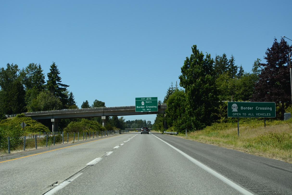
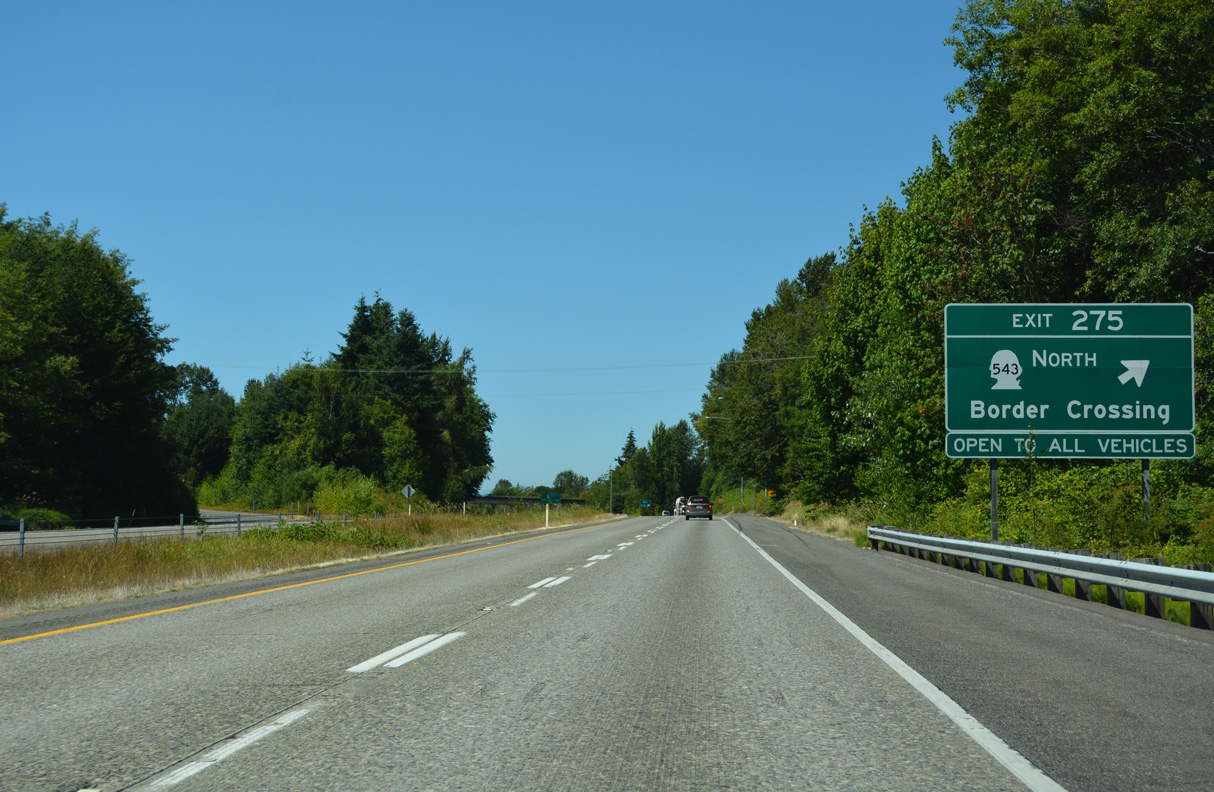
SR 548 branches 1.09 miles north from a wye interchange (Exit 275) with Interstate to the Canadian border crossing with B.C. Highway 15.
07/19/23
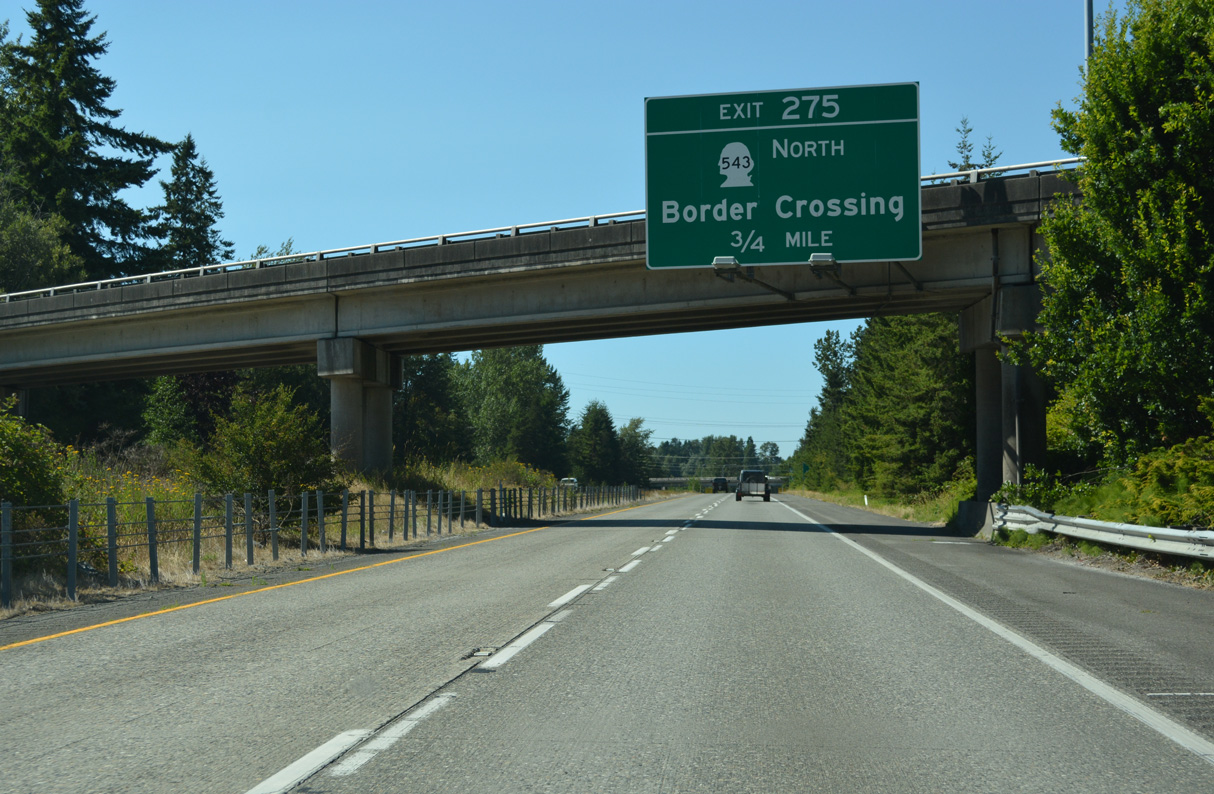
All trucks and buses (commercial traffic) bound for Canada are required to use the border crossing along SR 543 north from Exit 275.
07/19/23
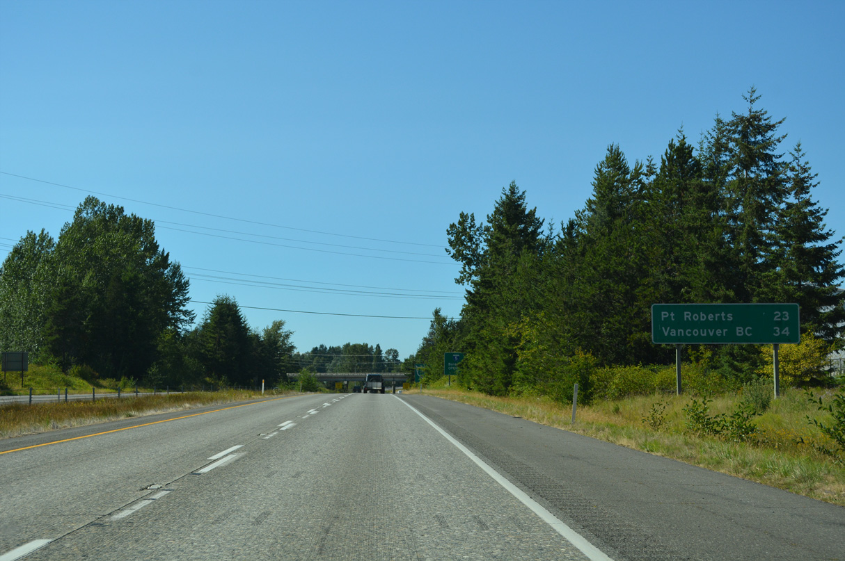
Point Roberts joins Vancouver on the final Interstate 5 distance sign. Point Roberts is unusual in that it is an American community only accessible by land from Canada. B.C. Highway 99 north to B.C. Highway 17 south provides the most direct route to the peninsular town.
07/19/23
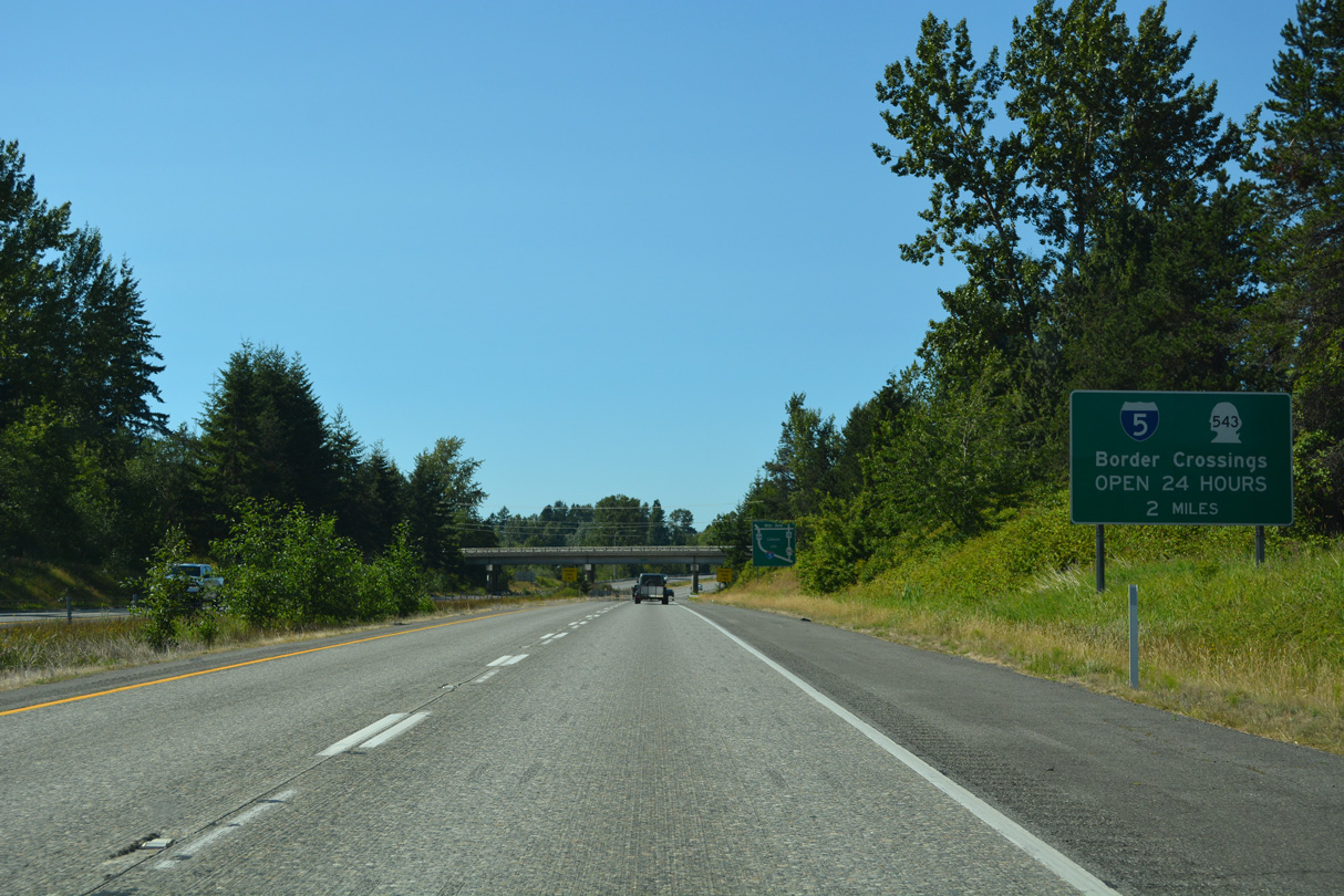
Some International border crossings close at night. This is not the case for the ports of entry along I-5 and SR 543 at Blaine.
07/19/23
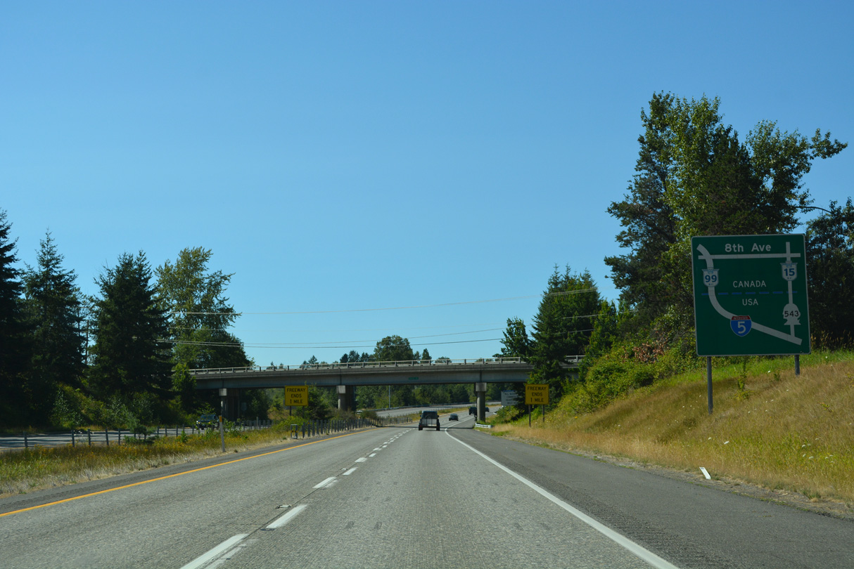
I-5 north becomes British Columbia Highway 99, a freeway northwest to Delta and Richmond. SR 543 becomes British Columbia Highway 15, an arterial north to Trans Canada Highway 1 near Surrey.
07/19/23
Hughes Avenue passes over Interstate 5 one mile south of the freeway end at the Canadian customs facility.
07/19/23
This Nexus Lane sign for the I-5 and SR 543 border crossings remained partially covered as of May 2025.
07/19/23
B.C. Highway 15 north to Trans Canada Highway 1 provides a route to Vancouver from Surrey and New Westminster to the east. B.C. Highway 99 angles westward through Richmond toward Vancouver International Airport (YVR), crossing the Fraser River north into Vancouver.
07/19/23
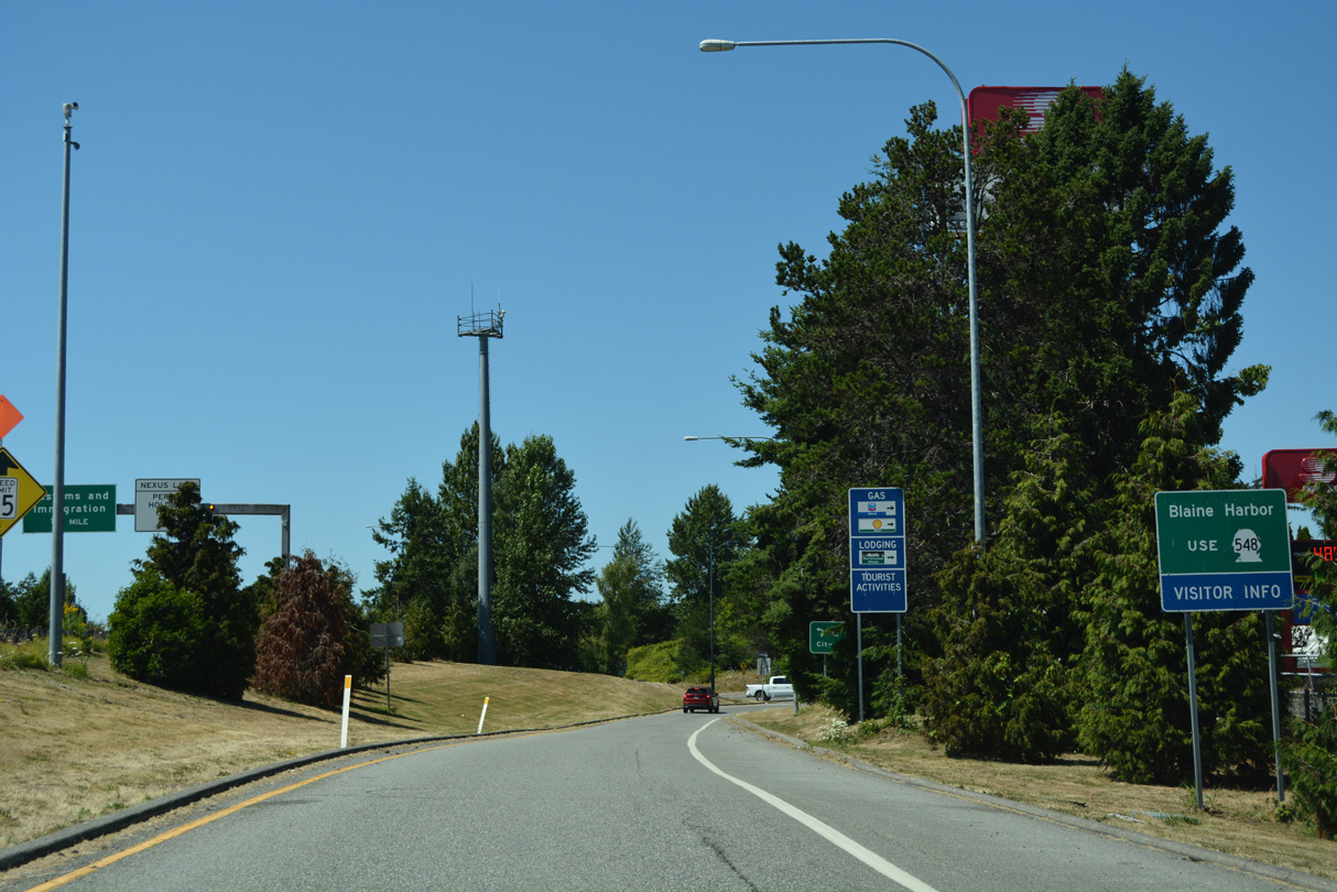
SR 543 intersects H Street before entering an inverted diamond interchange with D Street ahead of the customs facility. H Street leads east to SR 539 near its border crossing and west to the Blaine city center.
07/19/23
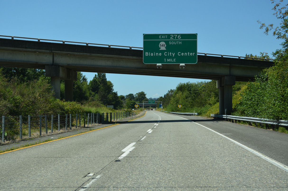
SR 548 (Peace Portal Drive) concludes north of Downtown Blaine at a dumbbell interchange (Exit 276) with I-5. U.S. 99 originally followed Peace Portal Drive to D Street and a turn into Peace Arch State Park.
07/19/23
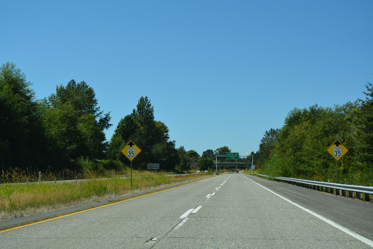
The speed limit reduces to 35 m.p.h. along Interstate 5 north ahead of the H Street overpass.
07/19/23
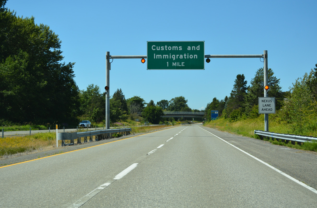
One mile ahead of the customs and immigration station at the north end of Interstate 5.
07/19/23
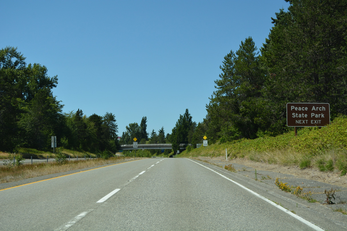
Peace Arch State Park contains the famous Peace Arch, which marks the boundary between the United States and Canada. Accessible from Exit 276 to 2nd Street north, the park is jointly maintained by the two countries. A walking path leads from the parking lot to the arch, which is located in the median between the two roadways linking I-5 and B.C. Highway 99.
07/19/23
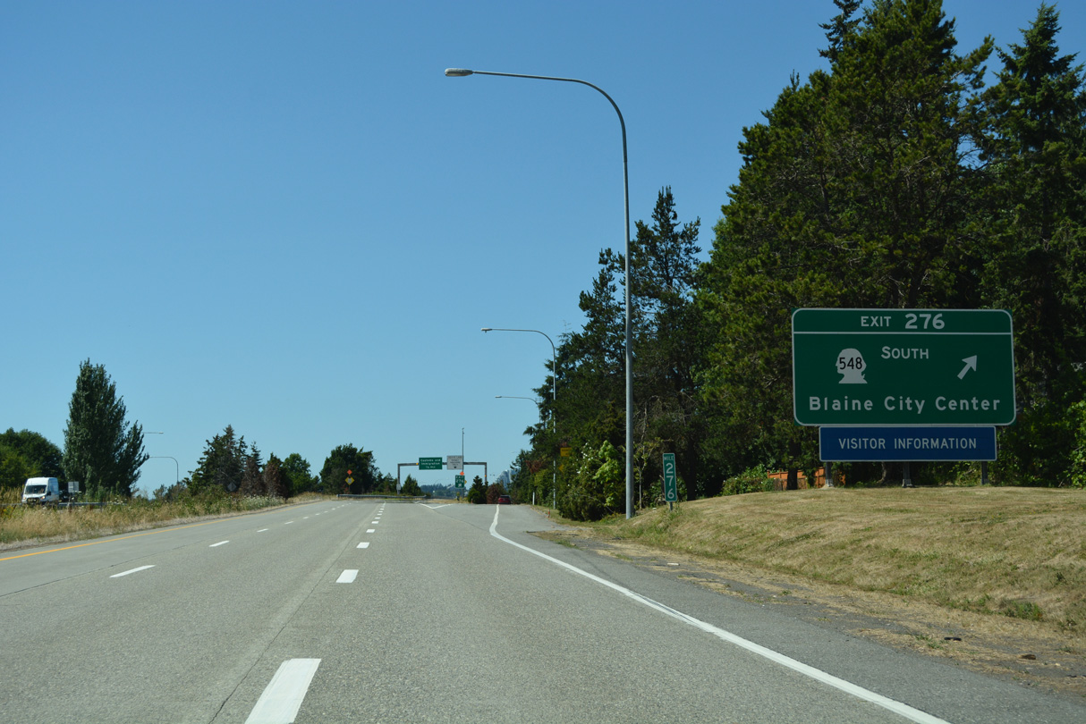
Interstate 5 north reaches Exit 276 to SR 548 (Peace Portal Drive) south and D Street east to SR 543 and Lincoln Park.
07/19/23
All motorists not destined to Canada must leave Interstate 5 at Exit 276. Marine Drive stems west from the roundabout joining SR 548 with the southbound I-5 ramps to Blaine Harbor.
07/19/23
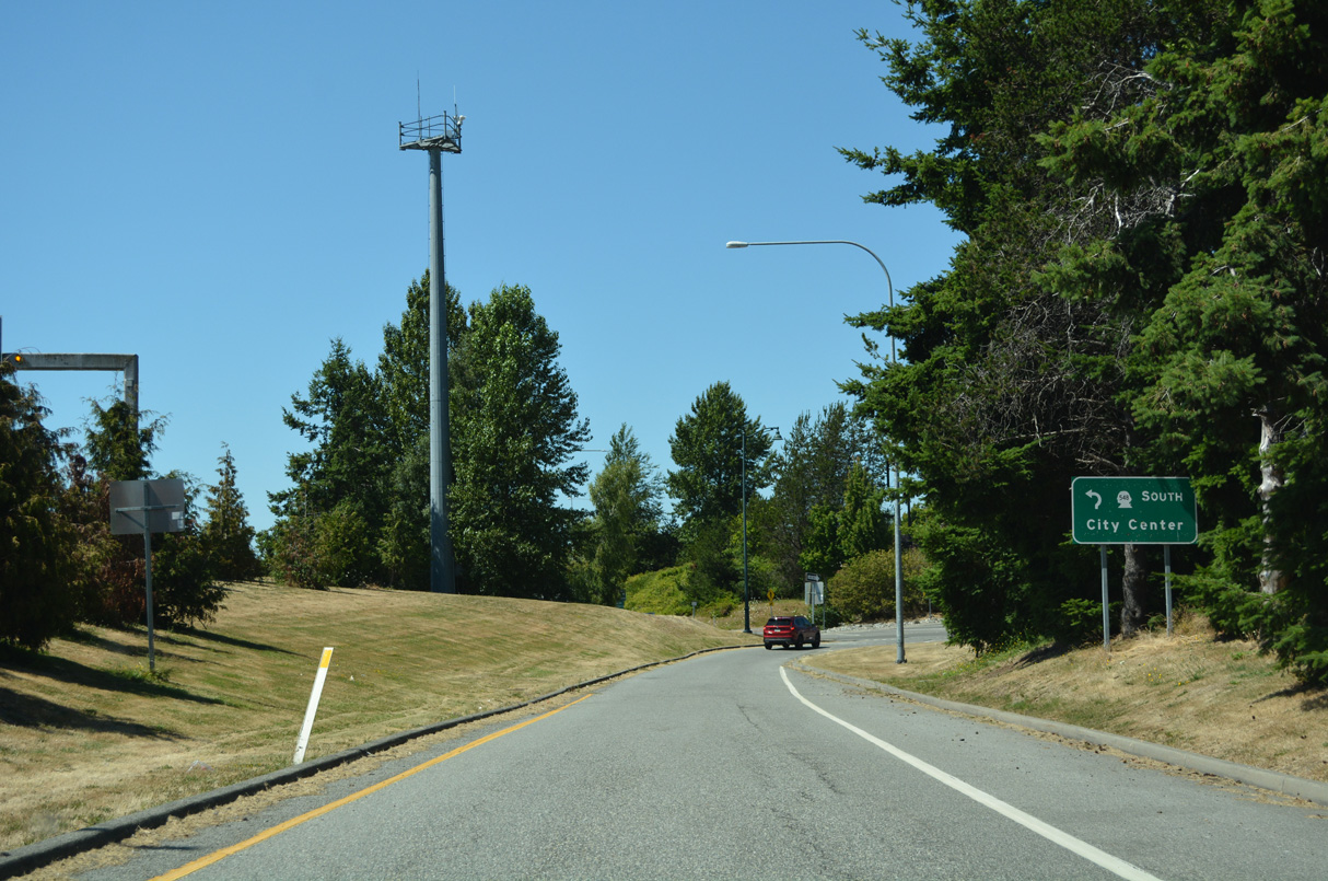
A roundabout joins Exit 276 with SR 548 (Peace Portal Drive) south to the Blaine city center, 2nd Street north to Peace Arch State Park, and D Street leading east to Lincoln Park.
07/19/23
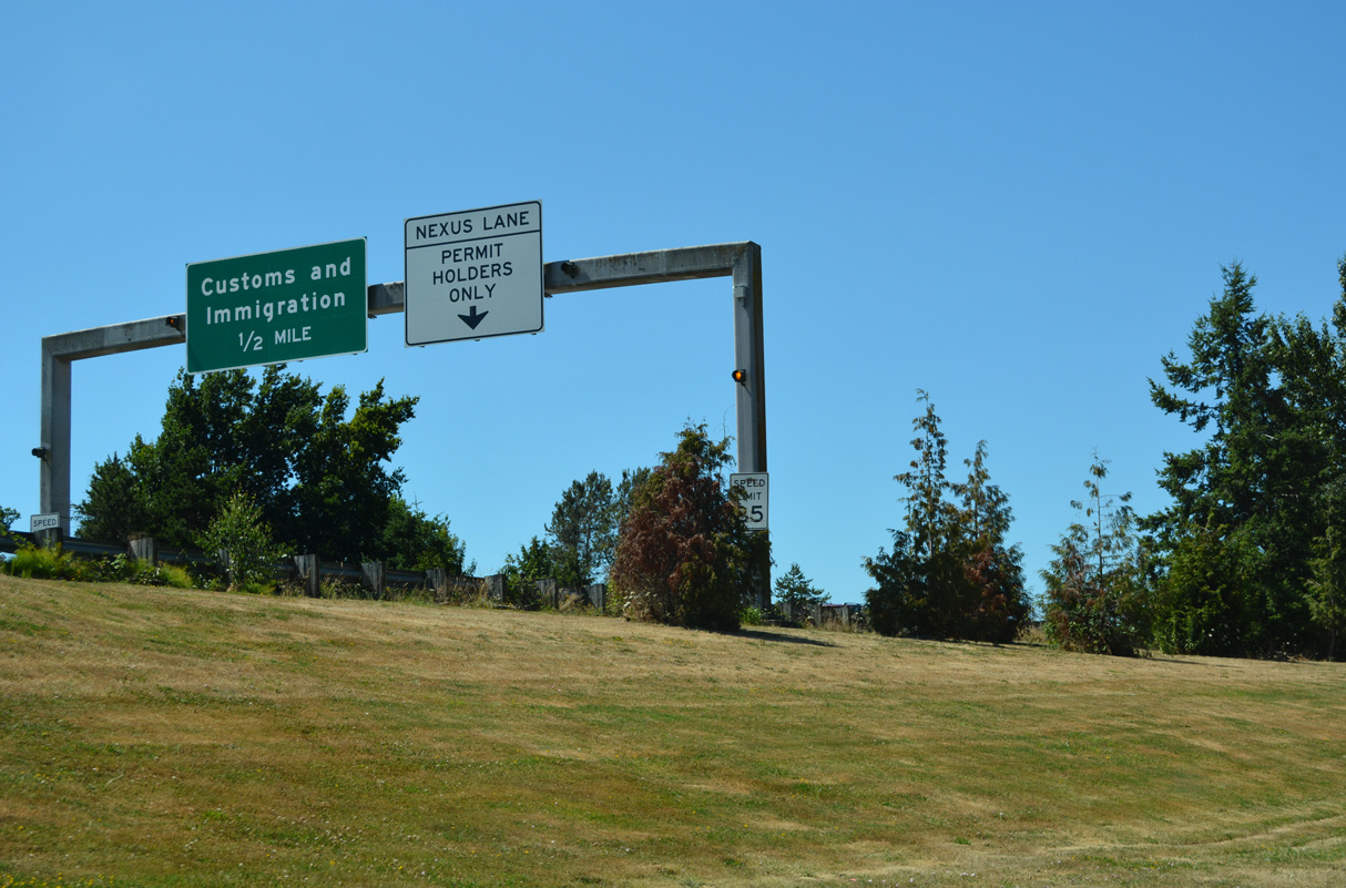
I-5 expands with a Nexus Lane for the Customs and Immigration Station ahead of Exit 276. This border crossing is much less well-traveled than the one that carries Interstate 5 south into Mexico.
07/19/23

Photo Credits:
- Brent Ivy: 07/19/23
- AARoads: 08/30/06
Connect with:
Page Updated Sunday September 07, 2025.