
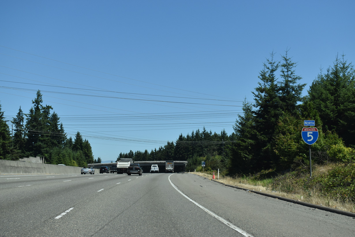
Interstate 5 North - Lynwood to Everett
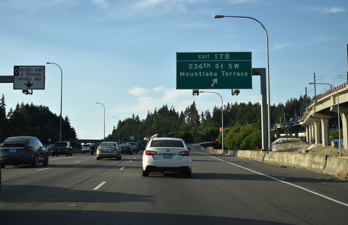
The first of two exits within Mountlake Terrace departs Interstate 5 north just beyond the King County line for 236th Street SW. 236th Street SW meanders west to Lakeview Drive at Lake Ballinger, and east to the city of Brier.
07/20/23
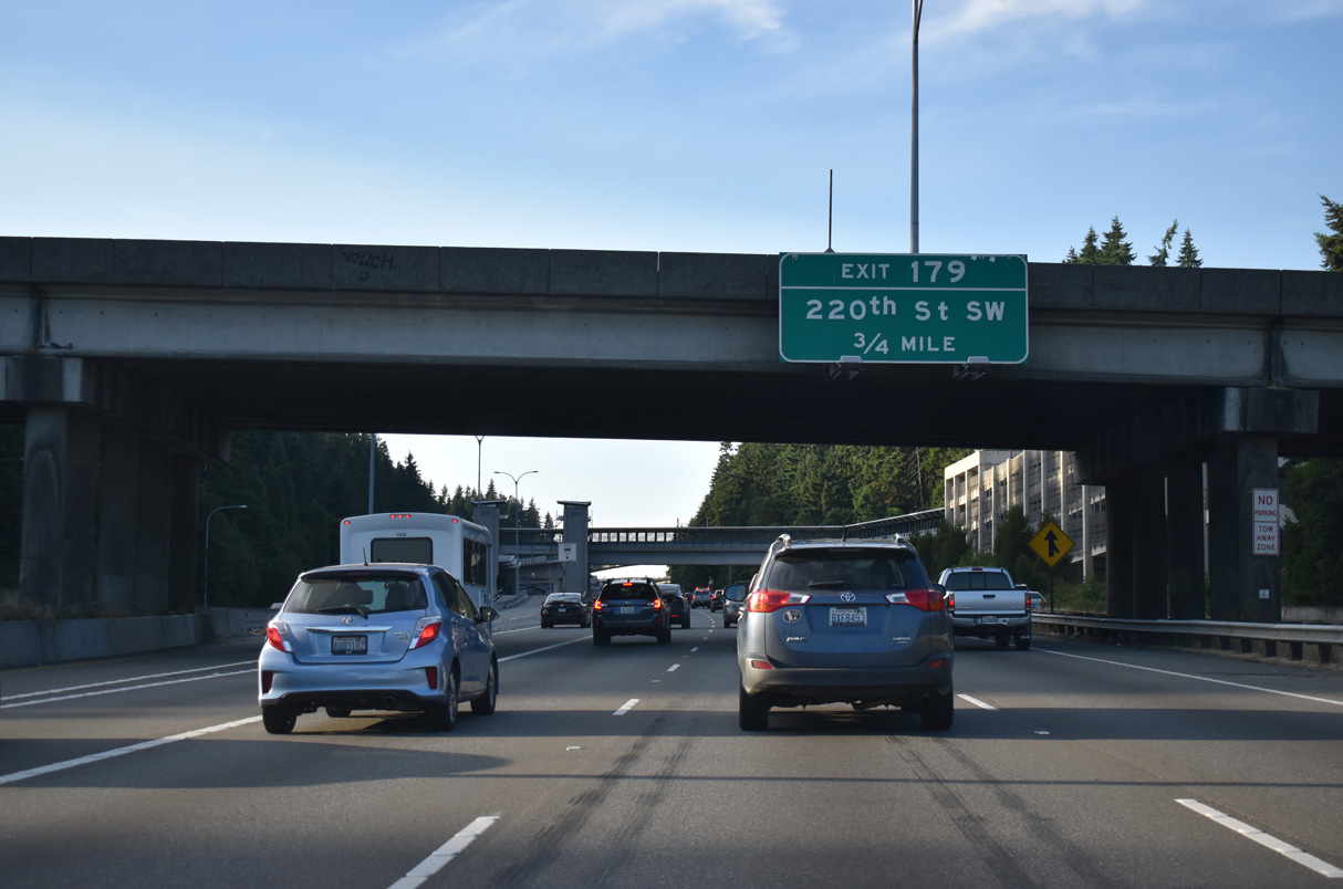
Interstate 5 continues three quarters of a mile north from 236th Street SW to Exit 179 with 220th Street SW near Seattle Heights in Mountlake Terrace.
07/20/23
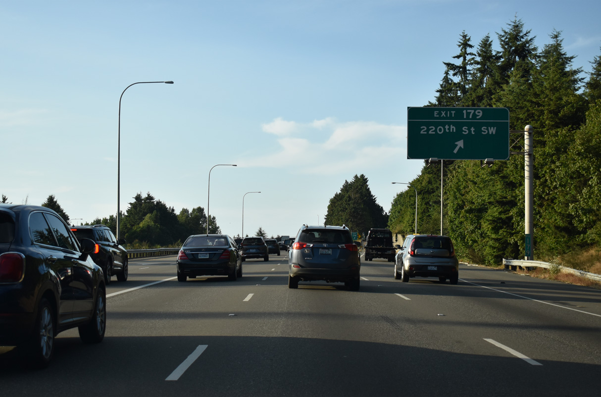
East from the diamond interchange at Exit 179, 220th Street SW leads to 52nd Avenue W. 220th Street SW extends west to 9th Avenue S in Edmonds.
07/20/23
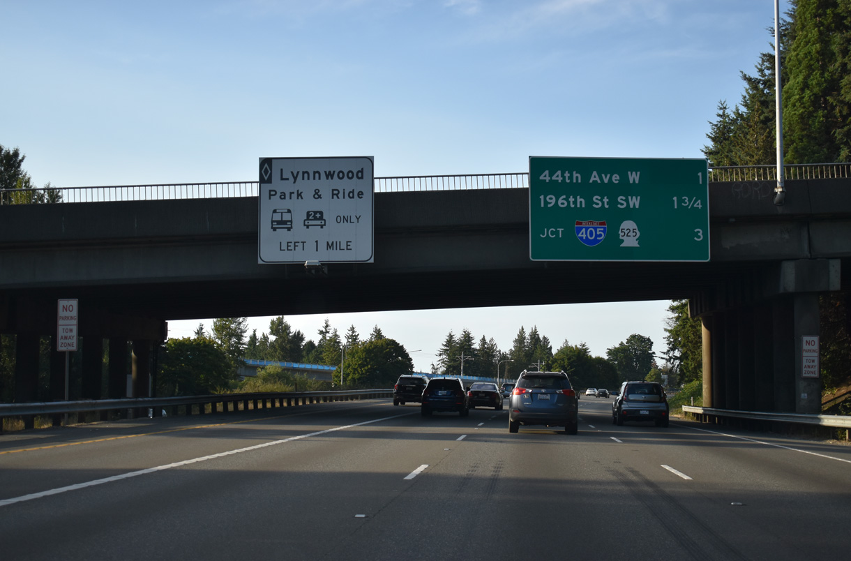
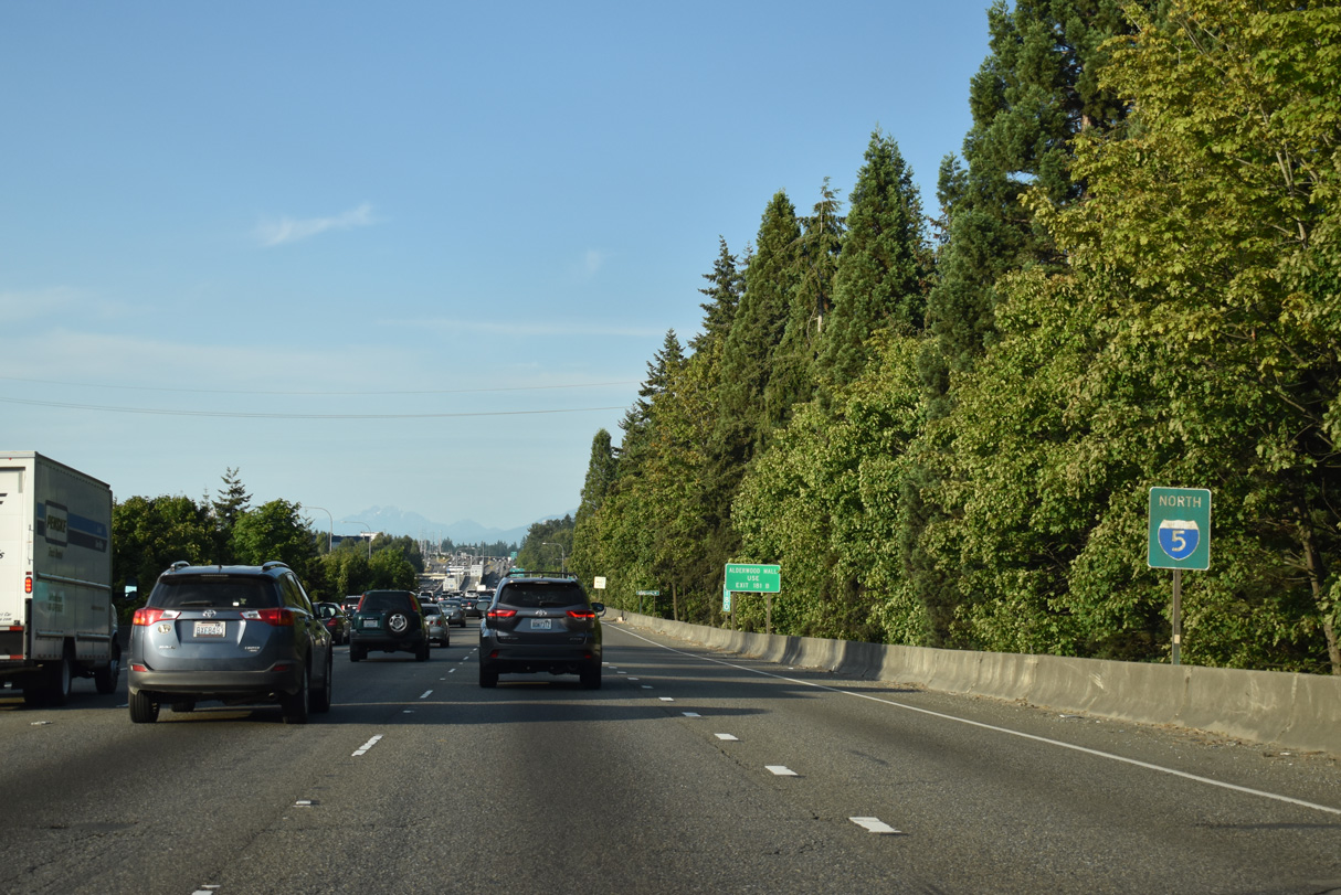
Originally a split diamond interchange, Exit 181 was expanded into separate ramps for 44th Avenue W (Exit 181 A) and SR 524 (Exit 181 B) to serve the city of Lynnwood.
07/20/23
44th Avenue W leaves Mountlake Terrace and crosses I-5 south of SR 524 (196th Street SW).
07/20/23
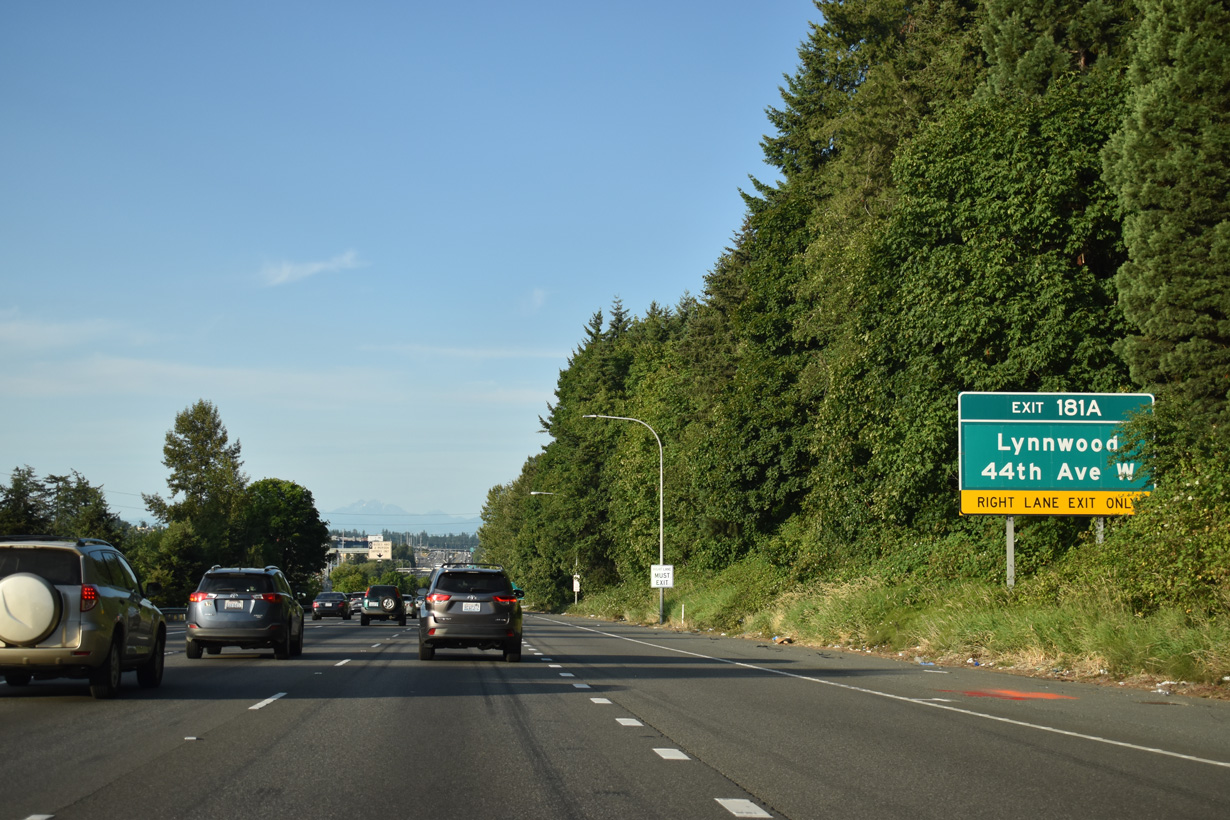
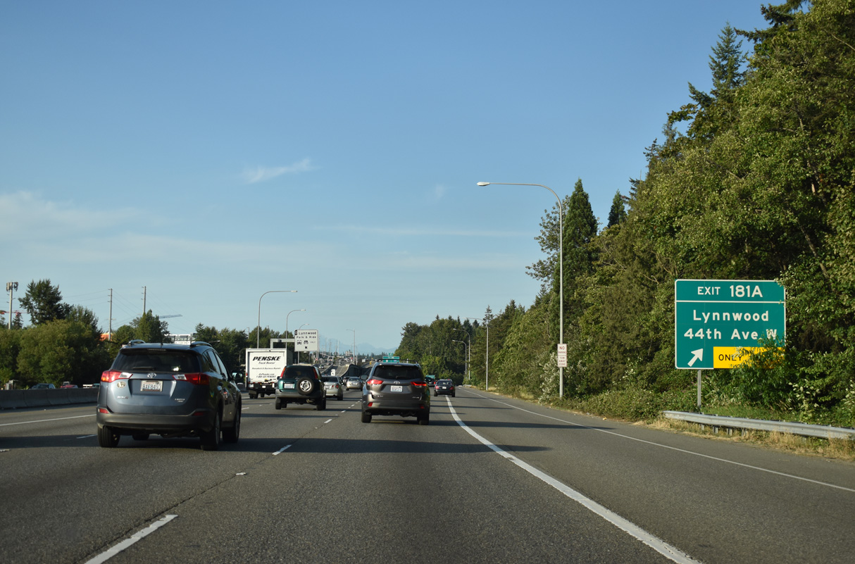
Interstate 5 bends northeast through Cedar Valley ahead of the half diamond interchange (Exit 181 A) with 44th Avenue W.
07/20/23
44th Avenue W provides a more direct route from I-5 north to SR 524 west for Edmonds and Edmonds Community College. 44th Avenue SW connects Interstate 5 with the city of Brier as well.
07/20/23
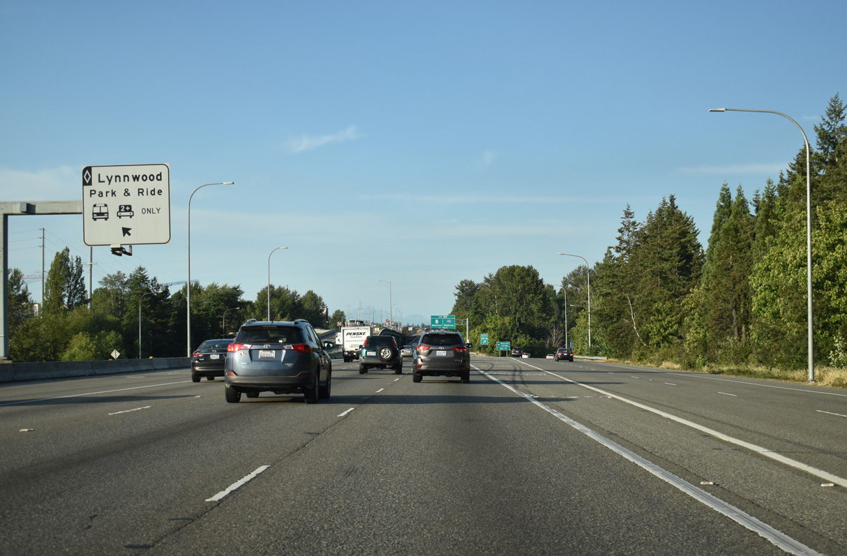
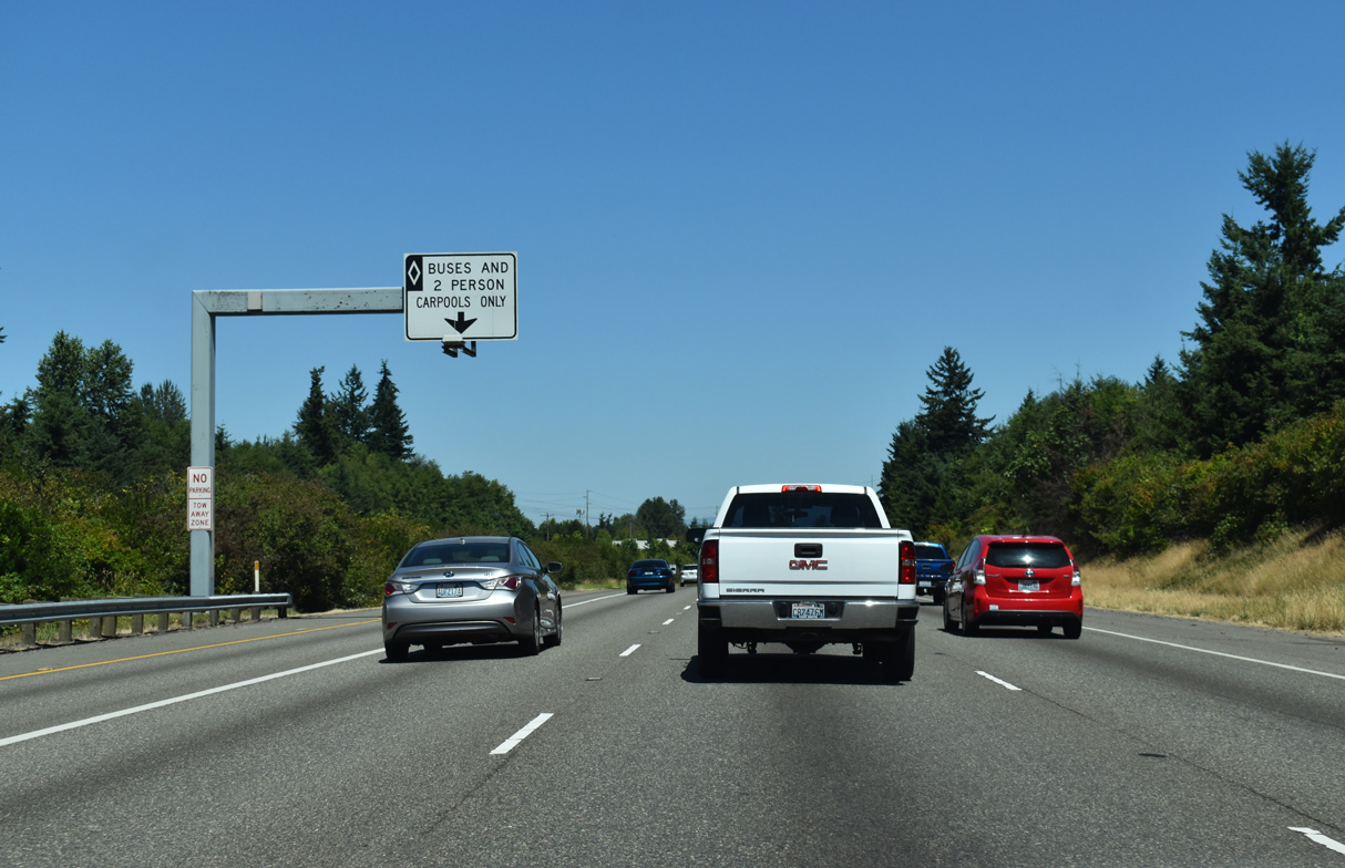
An inverted diamond interchange joins the HOV-2 lanes with the Lynnwood City Center Station along 46th Avenue W.
07/20/23
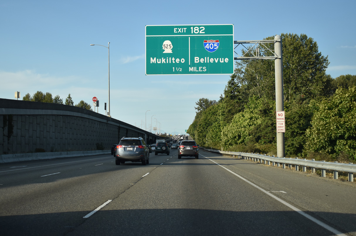
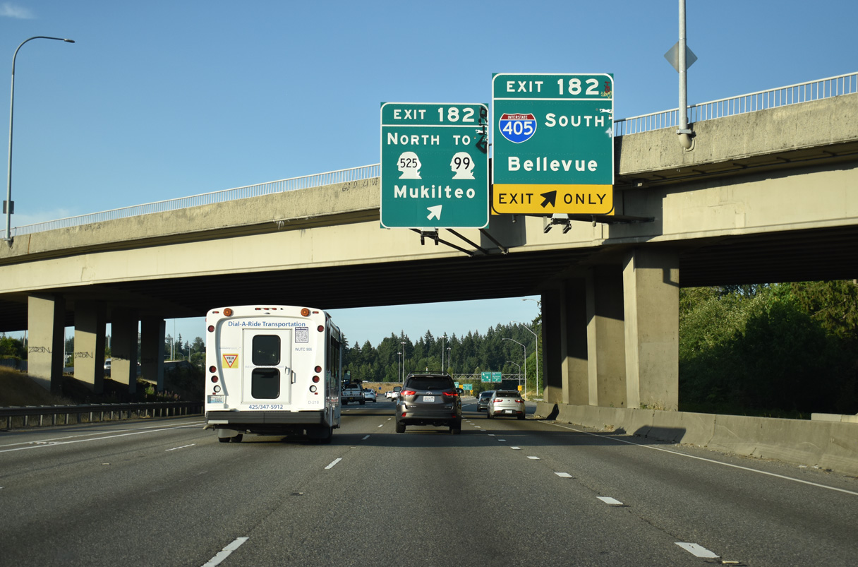
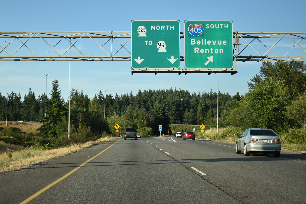
Exit 182 departs I-5 in 1.5 miles to I-405 south and SR 525 north.
07/20/23
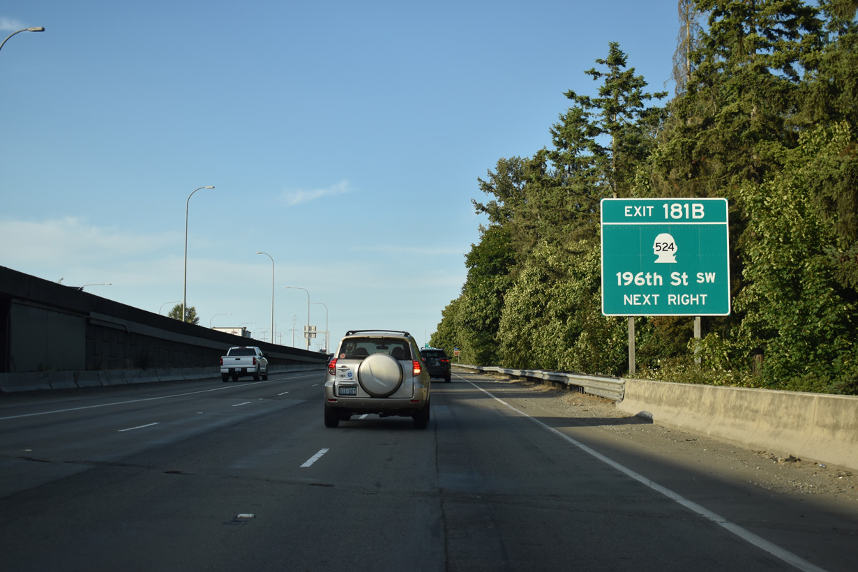
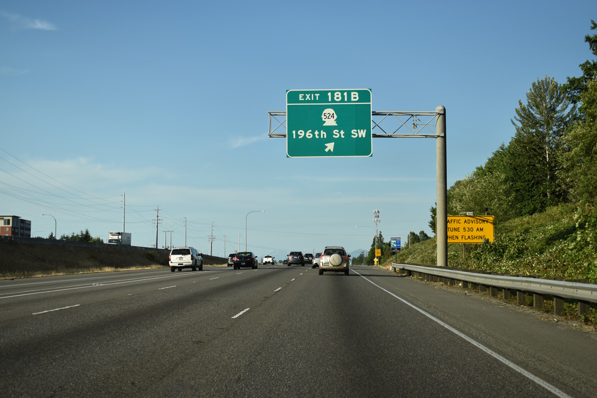
Exit 181 B is a six-ramp parclo interchange with SR 524 (196th Street SW) and Alderwood Mall Parkway in Lynnwood. SR 524 constitutes a commercial arterial west to Edmonds and east to the city line. The state route overall runs 14.68 miles from SR 104 (Sunset Avenue) to SR 522 at Maltby.
07/20/23
Exit 181 B ties into the intersection of Poplar Way and Alderwood Mall Parkway south of SR 524. Alderwood Parkway arcs northeast from Interstate 5 to Alderwood Mall and SR 525. Poplar Way meanders south to Brier Road and the city of Brier.
07/20/23
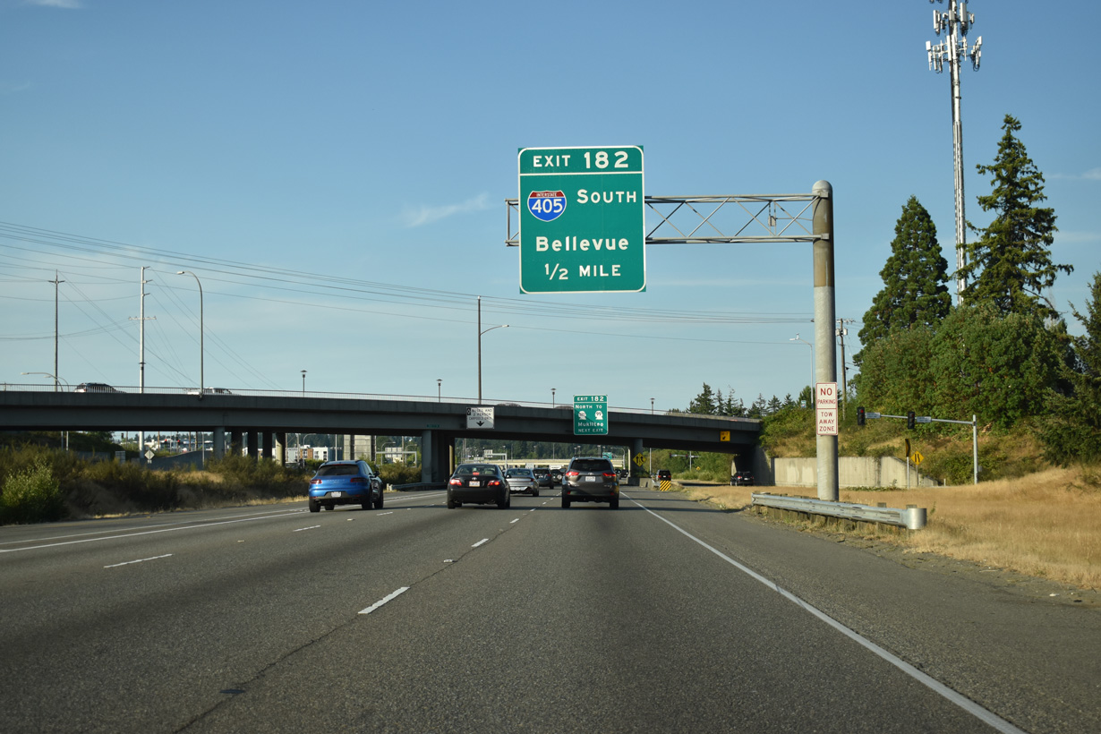
Originally a directional T interchange, expansion of the exchange joining I-5/405 occurred with the 1985 completion (AARoads Wiki, 2024) of the freeway along SR 525 north to SR 99 south of Mukilteo.
07/20/23
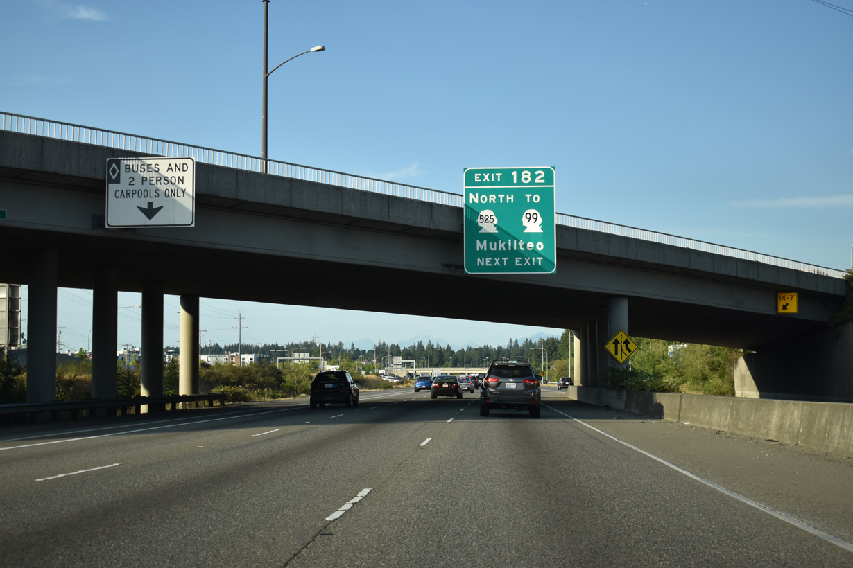
Like the south end, Interstate 405 concludes as a state route freeway spur to the west of I-5. SR 525 travels 2.76 miles north to an interchange with SR 99.
07/20/23
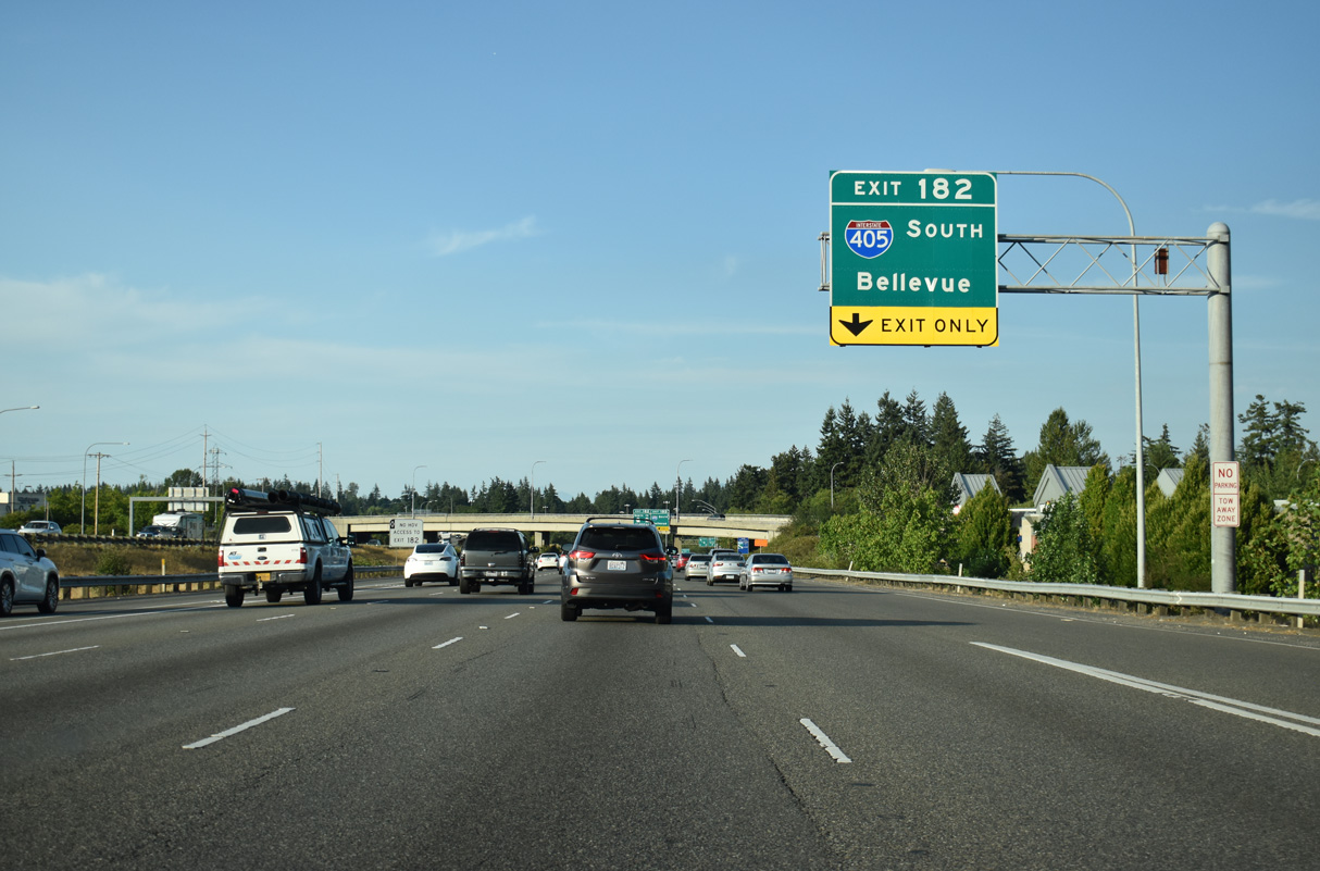
Interstate 405 loops 30.30 miles southward from I-5/SR 525 to Bothell, Kirkland, Bellevue and Renton east of Lake Washington.
07/20/23
Alderwood Mall Parkway passes over Interstate 5 north at Exit 182.
07/20/23
SR 525 constitutes a 30.68 mile long route from I-5/405 to SR 20 on Whidbey Island. The state route utilizes a ferry to make the connection between Mukilteo and Clinton across Possession Sound.
07/20/23
SR 525 north meets Alderwood Mall Parkway north of a retail area anchored by Alderwood Mall.
07/20/23
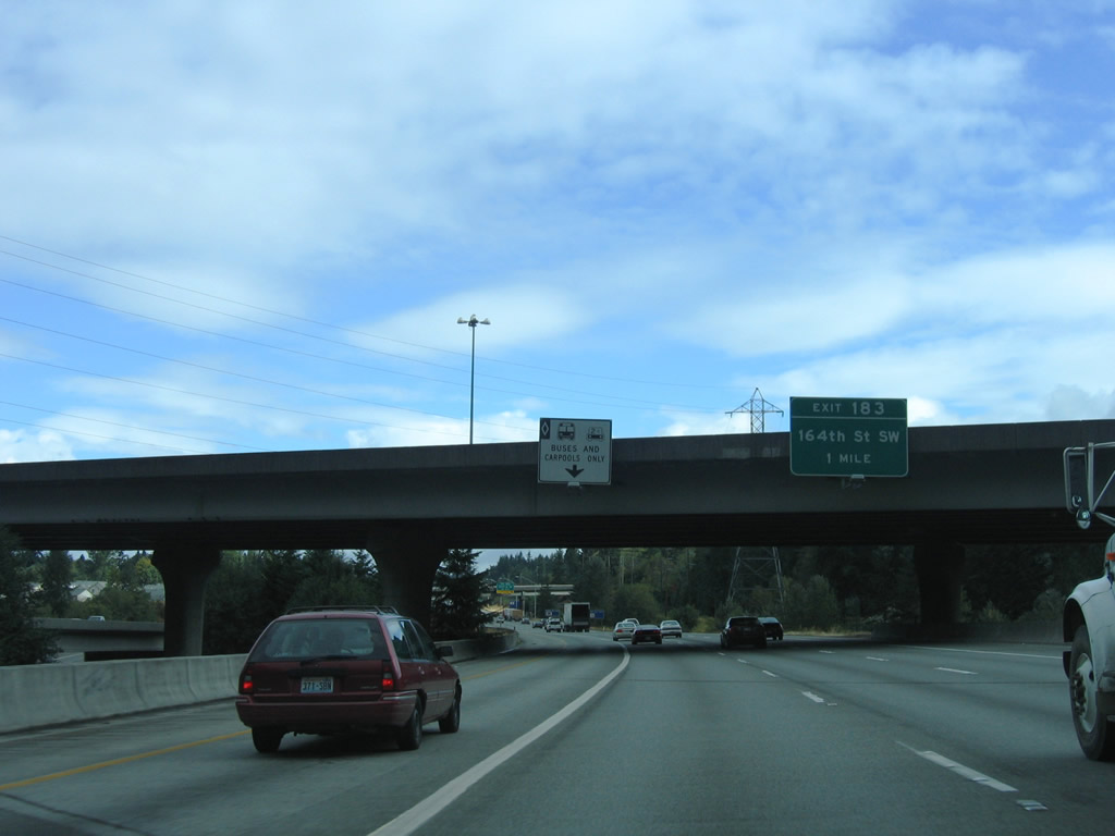
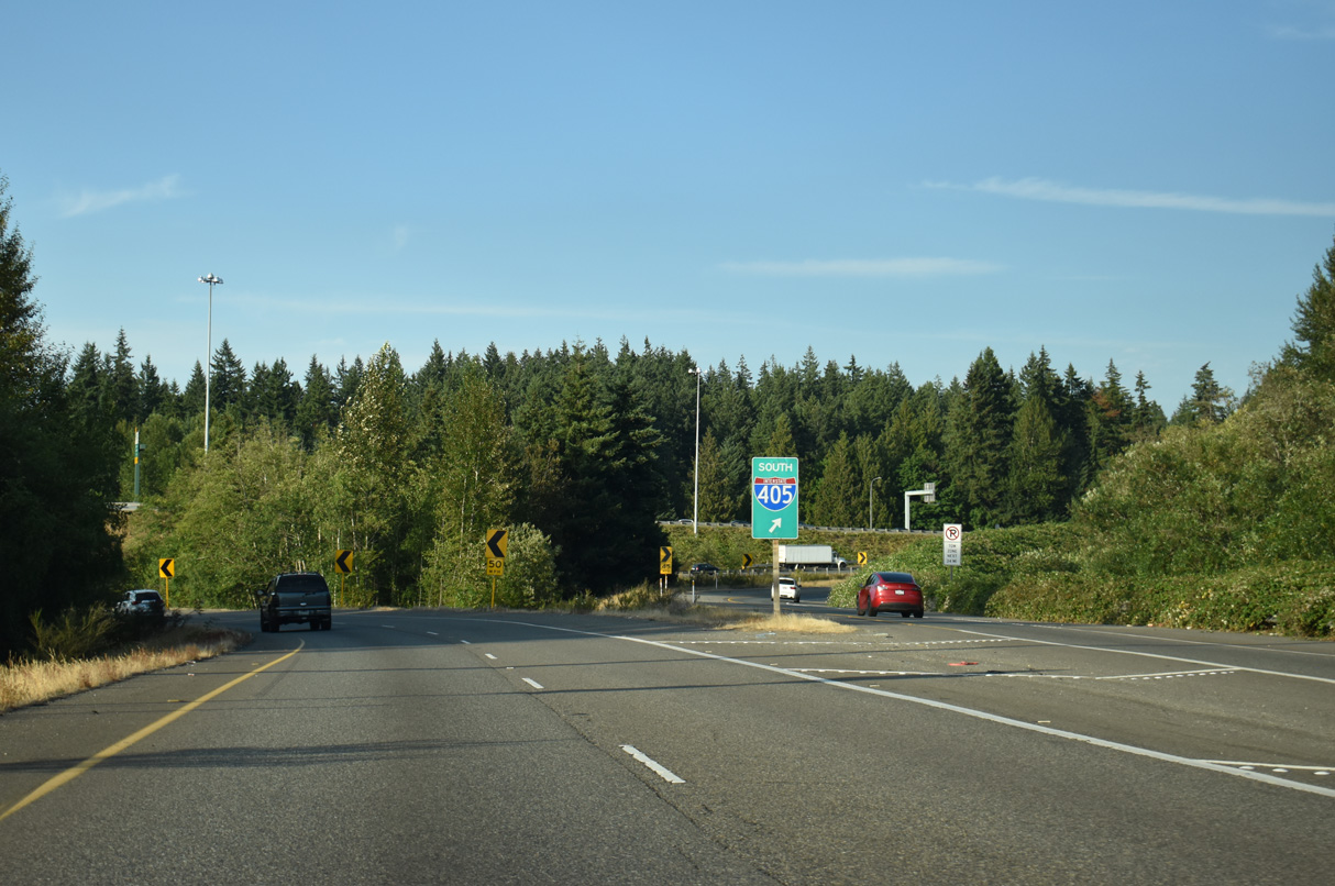
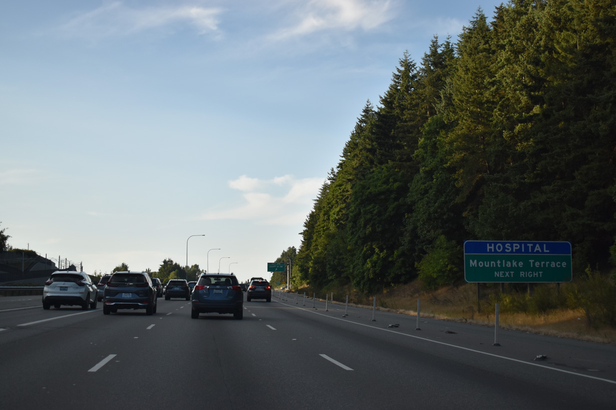
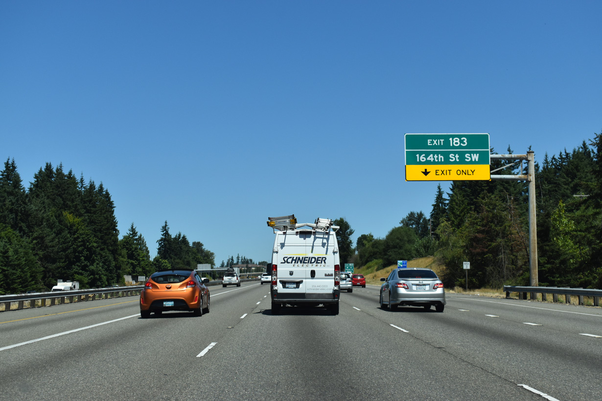
Interstate 5 enters unincorporated Snohomish County within the multi level interchange at Exit 182. 164th Street SW meets the freeway next at a six-ramp parclo interchange (Exit 183).
08/30/06
The entrance ramp from Interstate 405 north forms an auxiliary lane to Exit 183 for 164th Street SW.
07/19/23
164th Street SW leads west to SR 99 at north Lynnwood and east to SR 527 (Bothel Everett Highway) at Mill Creek. The stretch between 35th Avenue W and Interstate 5 was once a part of SR 525 before the state route shifted to the freeway.
07/19/23
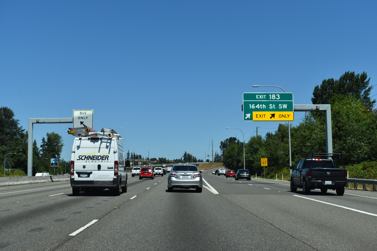
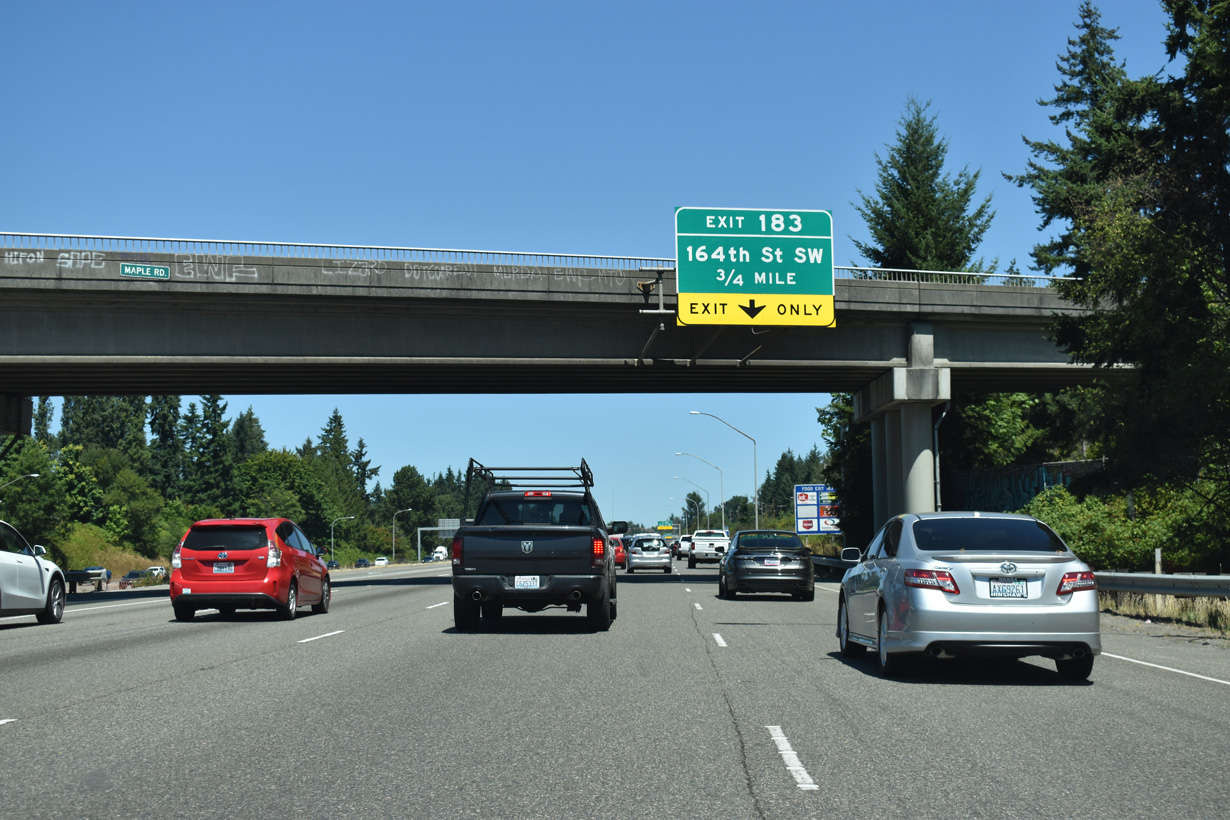
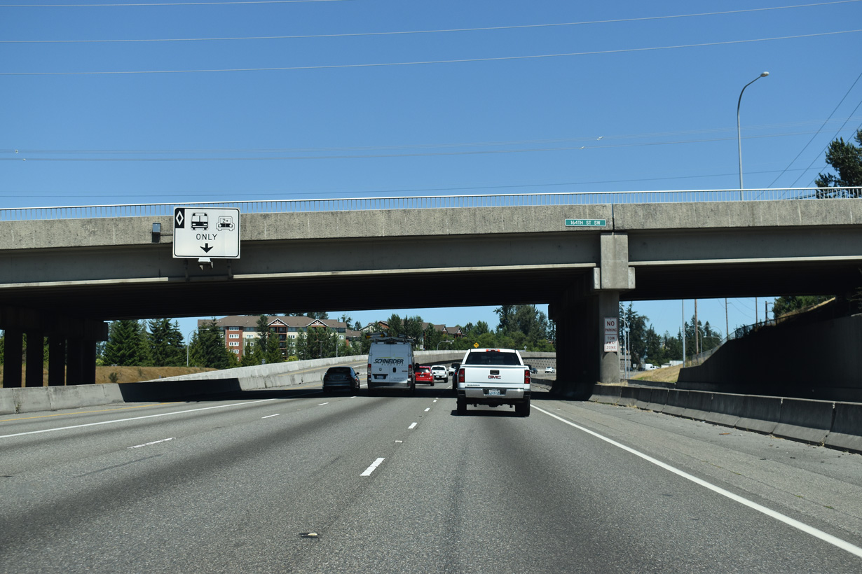
Exit 183 leaves I-5 north across from a bus-only ramp to the Ash Way Park & Ride facility north of 164th Street SW. 164th Street becomes Mill Creek Road at SR 527 and Wintermutes Corner.
07/19/23
Shifting eastward, Interstate 5 continues north between the communities of Lake Stickney and Martha Lake on the ensuing stretch.
07/19/23
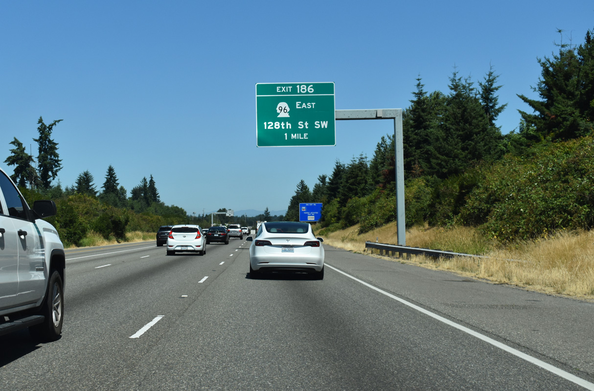
SR 96 (128th Street) joins Interstate 5 at Exit 186 with Mill Creek to the east. The state route travels 6.75 miles from the freeway to SR 9 south of Snohomish.
07/19/23
Northbound Interstate 5 ahead of the diamond interchange (Exit 186) with SR 96 and 128th Street SW.
07/19/23
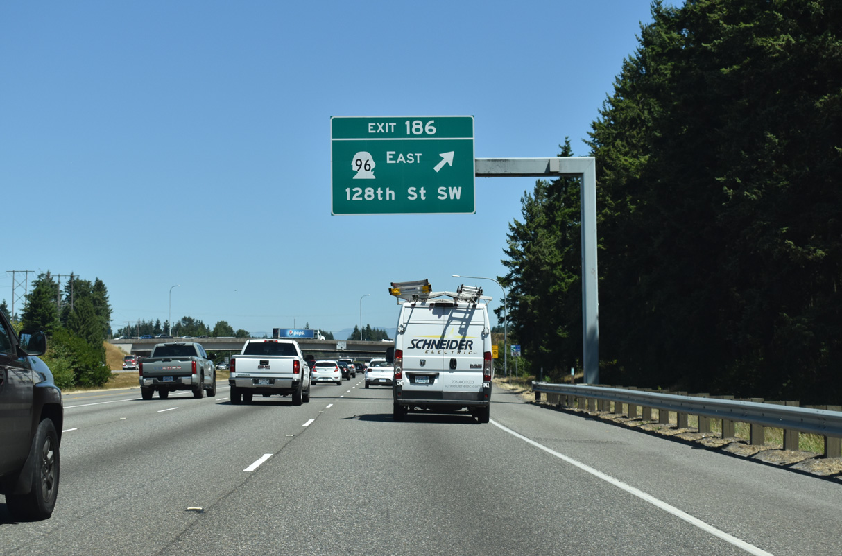
SR 96 (128th Street SE) runs east from Exit 186 to Murphys Corner and Mill Creek. 128th Street NW extends west from I-5 to Airport Road and Seattle Paine Field International Airport (PAE).
07/19/23
Interstate 5 enters the city limits of Everett west of Silver Lake.
07/19/23
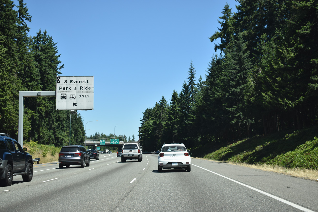
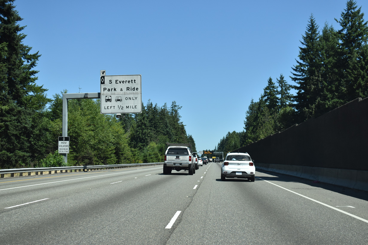
Left exit ramps connect the HOV lanes in both directions of Interstate 5 with the South Everett Park & Ride lot off 112th Street SE.
07/19/23
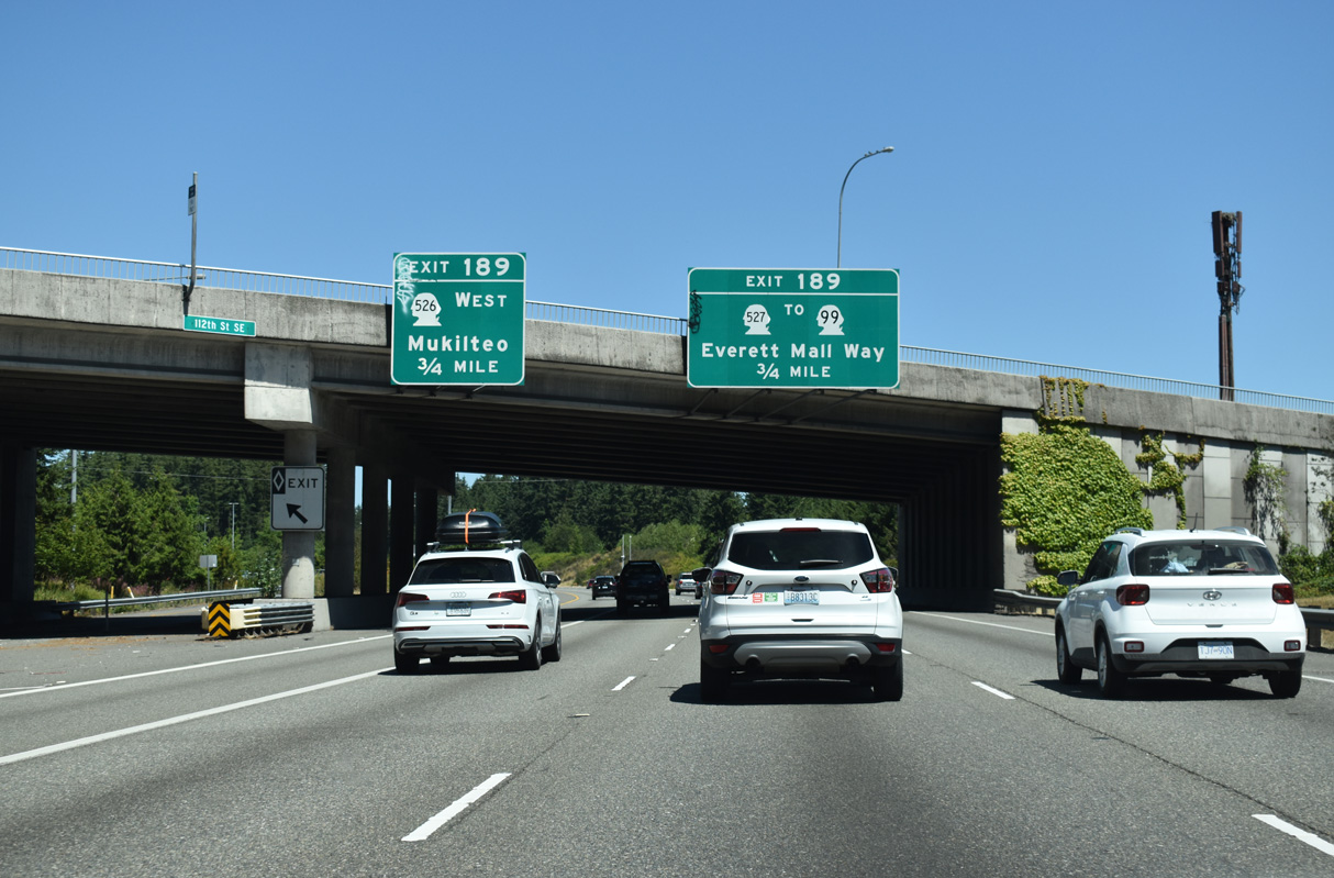
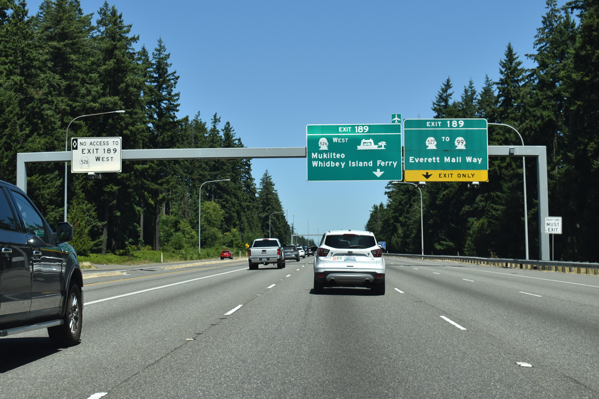
The directional interchange at Exit 189 serves SR 99 (Broadway / Everett Mall Way) south, SR 526 (Boeing Freeway) west, and SR 527 (19th Avenue).
07/19/23
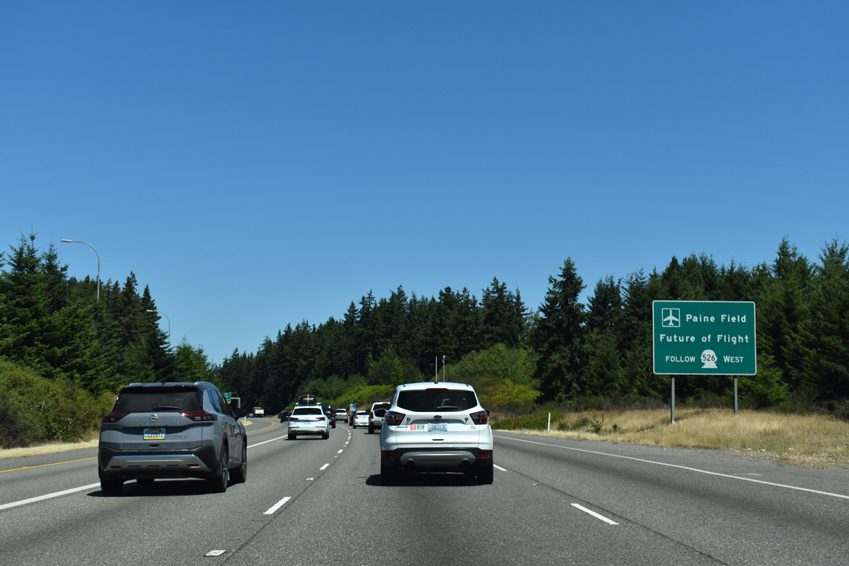
SR 526 constitutes a 4.52 mile long route that serves the Boeing Company plant in Everett, Seattle Paine Field International Airport (PAE), and SR 525 north from Nelsons Corner.
07/19/23
SR 527 follows 19th Avenue north from Murphys Corner and Mill Creek to SR 99-526 and I-5 in south Everett. SR 527 links I-5 with SR 99 (Broadway) south to Everett Mall and Broadway north into the Pinehurst community.
07/19/23
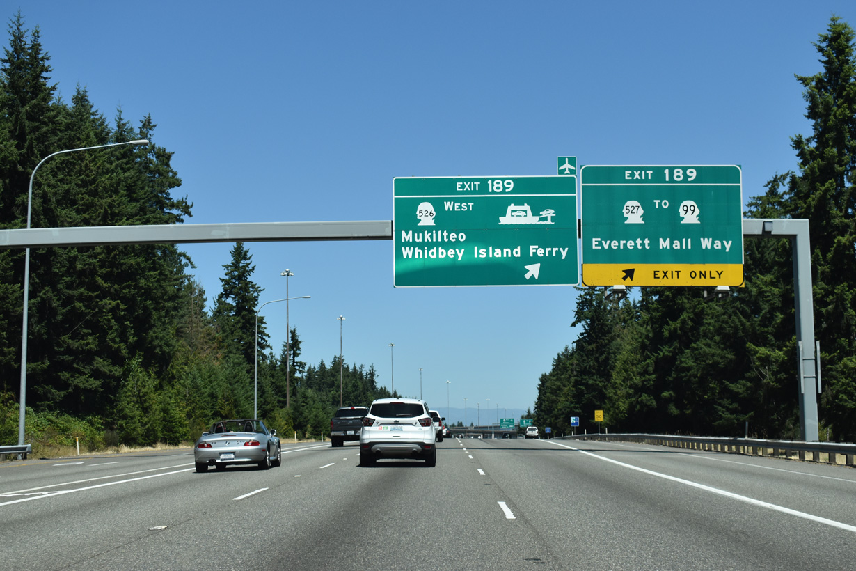
Exit 189 connects with SR 527 (19th Avenue SE) at El Capitan Way. SR 527 winds west over I-5 to SR 99 (Broadway) and the Boeing Freeway westbound entrance ramps to SR 526. The 48.97 mile long route of SR 99 concludes via Everett Mall Way and Broadway northeast from old U.S. 99 (Evergreen Way) near Intercity.
07/19/23
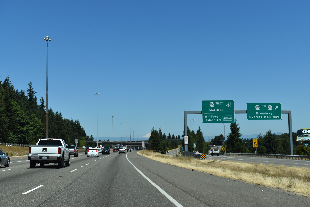
A flyover ramp leads onto SR 526 (Boeing Freeway) to Mukilteo and SR 525 to the Whidbey Island Ferry.
07/19/23
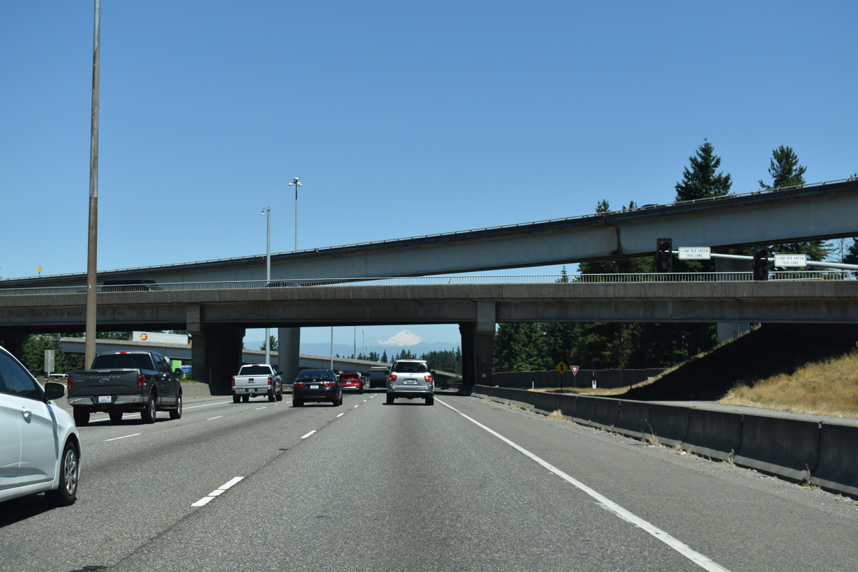
SR 527 (19th Avenue SE) passes over Interstate 5 below the flyover ramp to SR 526 (Boeing Freeway) west.
07/19/23
Freeway expansion underway in 2006/07 widened Interstate 5 northbound to five overall lanes (four general purpose, one carpool).
07/19/23
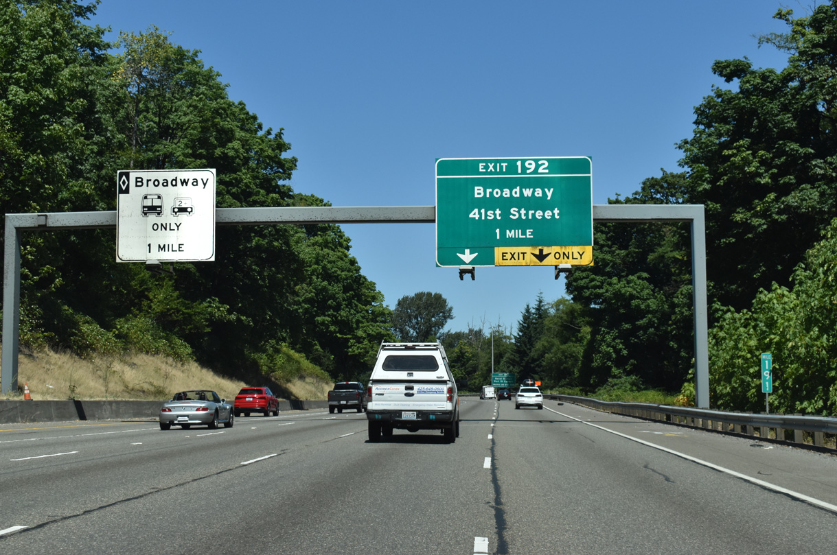
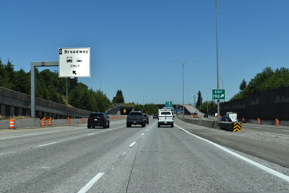
A distributor roadway departs at Exit 192 in one mile for ramps to Broadway north and 41st Street.
07/19/23
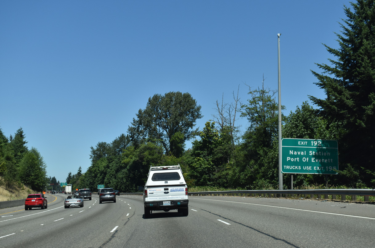
Trucks to Naval Station Everett and the Port of Everett are directed to remain on I-5 north to Exit 195 and SR 529 (Everett Avenue) west instead of taking Broadway north to the state route.
07/19/23
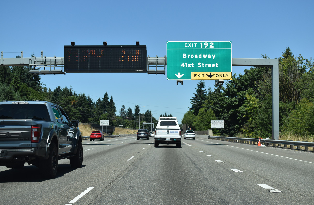
Construction at Exit 192 shifted the original left exit ramp to Broadway into an HOV ramp and added a flyover ramp from the general purpose lanes of Interstate 5 north to the parallel roadway. A large retaining wall was also added along the HOV-2 lanes for I-5 south.
07/19/23
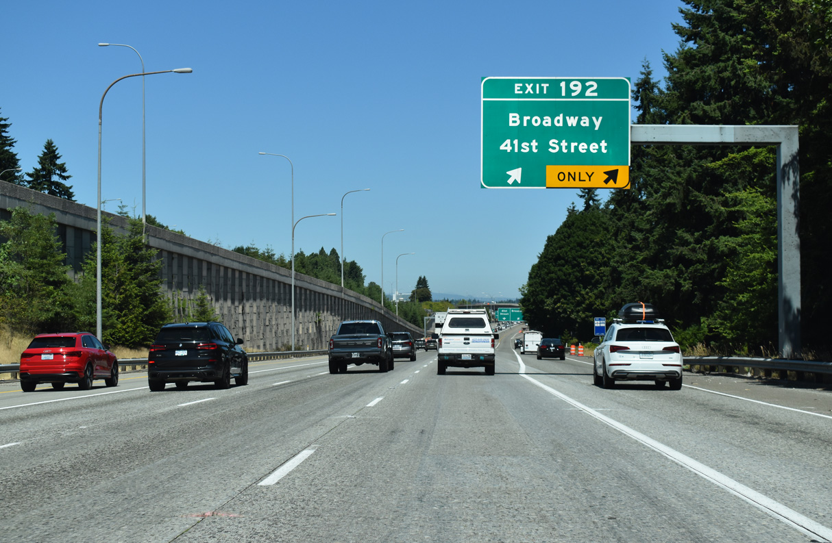
41st Street comprises an arterial west to Rucker Avenue (historic U.S. 99) and east to Riverfront Boulevard. Broadway provides a direct route into Downtown Everett.
07/19/23
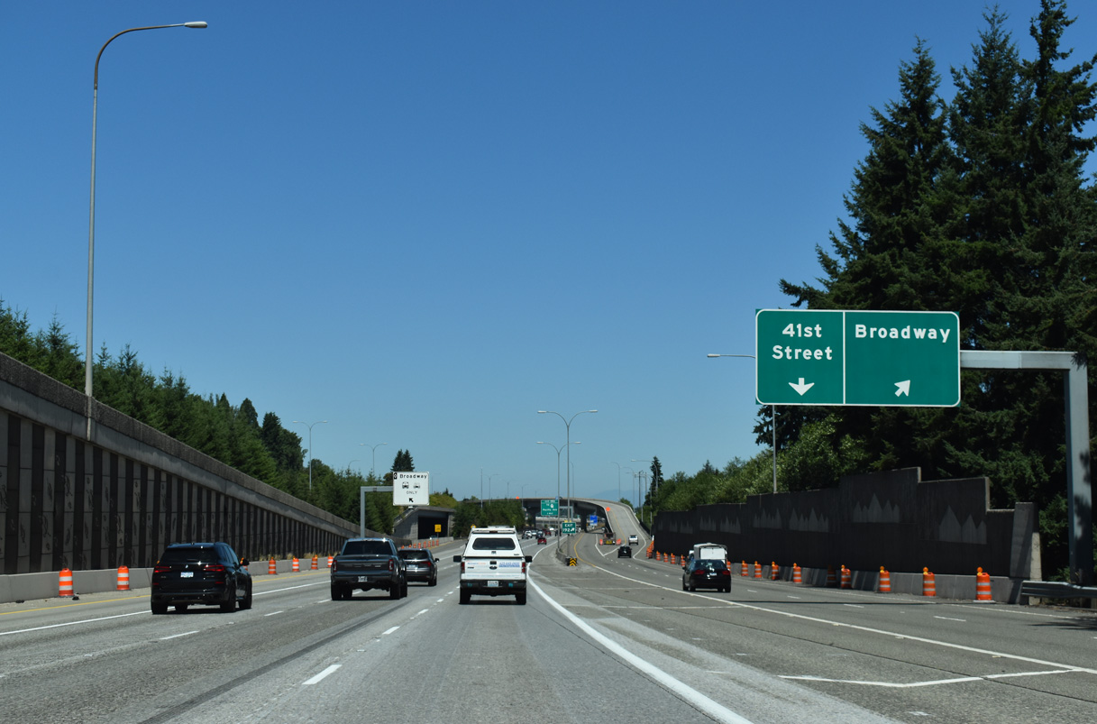
Exit 192 partitions into the flyover for Broadway and single point urban interchange (SPUI) with 41st Street.
07/19/23
Broadway extends north through the Everett street grid to SR 529 (E Marine View Drive) at Delta Junction.
07/19/23
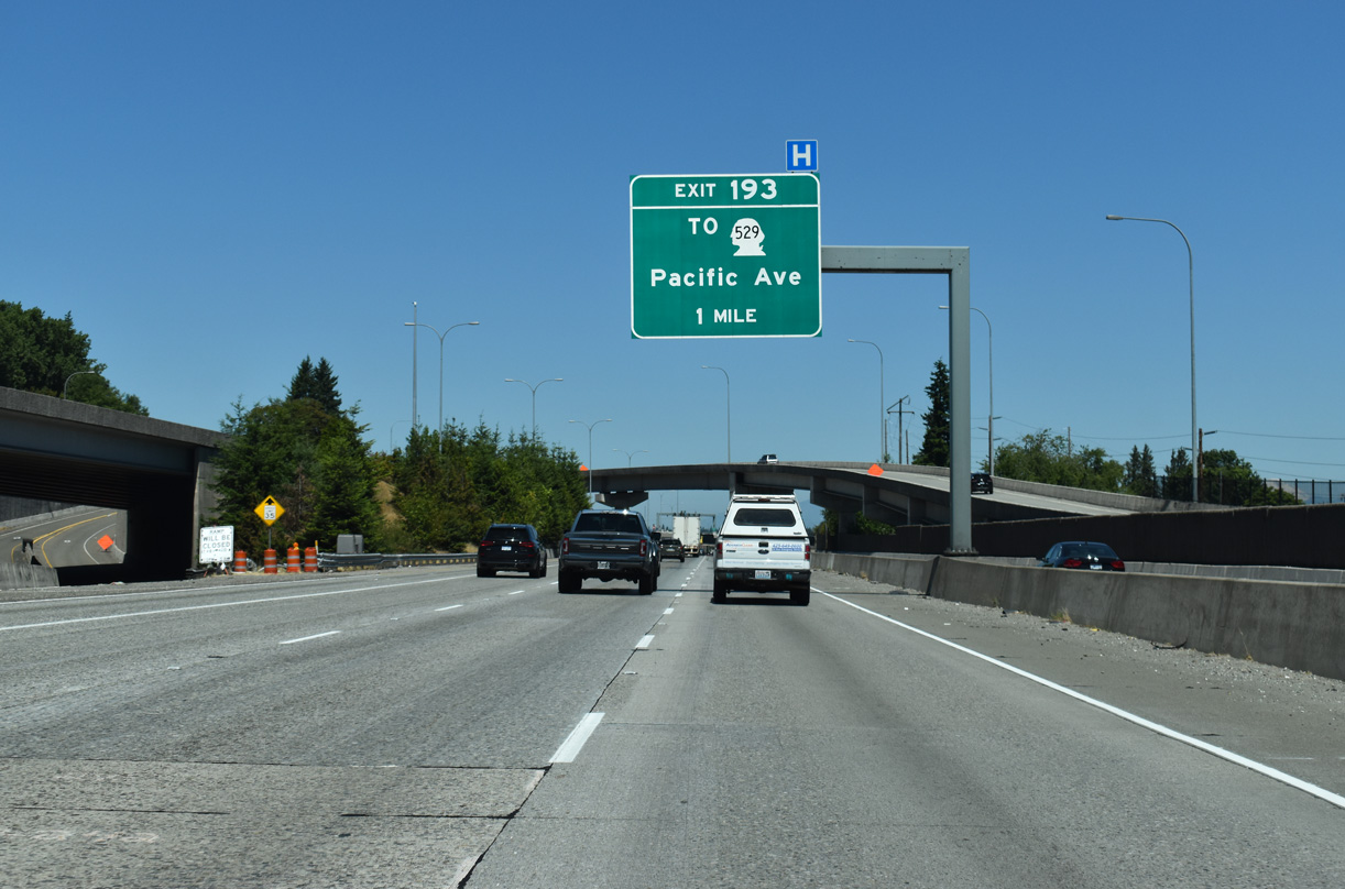
Curving northeast alongside a Union Pacific Railroad, I-5 advances one mile north to a half diamond interchange (Ext 193) with Pacific Avenue.
07/19/23
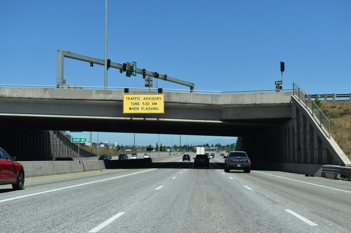
Passing through the SPUI with 41st Street.
07/19/23
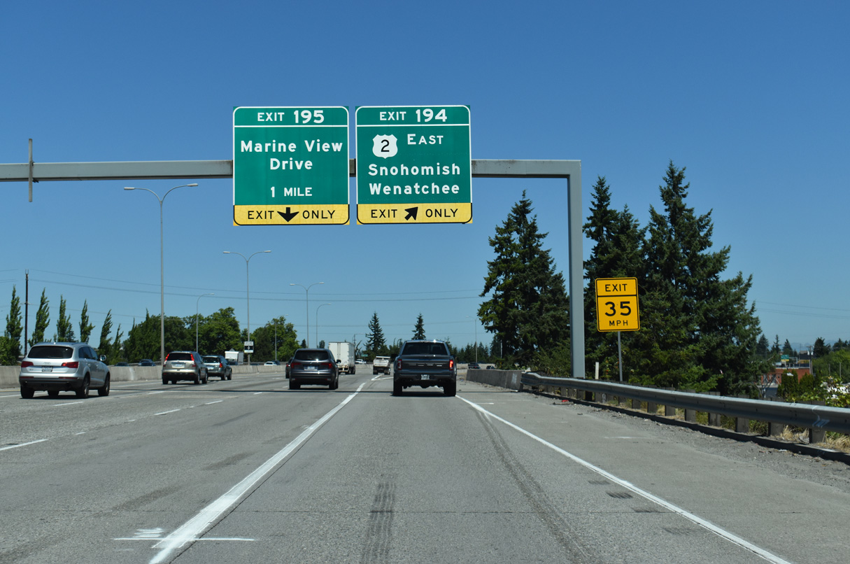
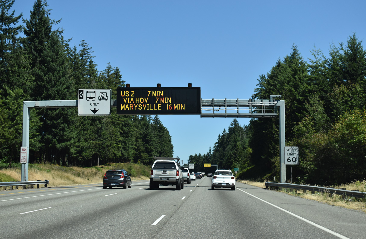
A lane drop occurs at Exit 194 for the beginning of U.S. 2 east. U.S. 2 travels two miles to SR 204 and seven miles southeast to Snohomish along an alignment varying between freeway and expressway.
07/19/23
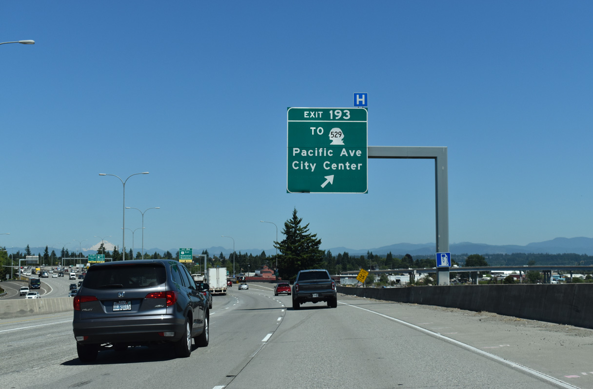
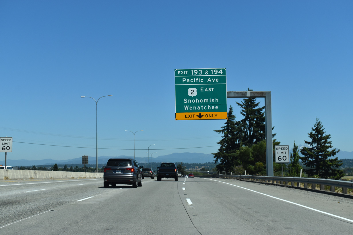
Exit 193 serves Everett Station, the Angel of the Winds Arena and SR 529 north on Maple Street to Everett Avenue west. SR 529 encircles Everett along a 4.92 mile long loop north to Broadway.
07/19/23
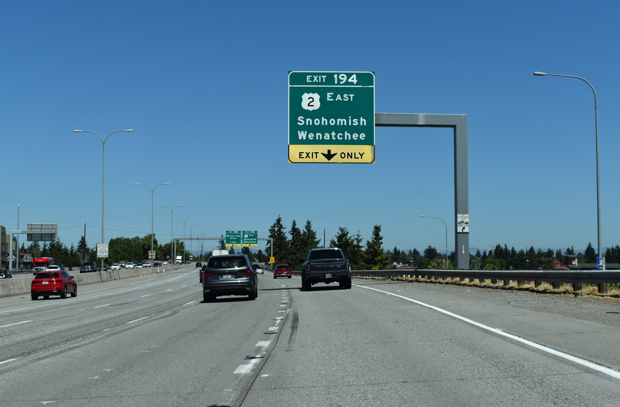
The U.S. 2 end point is formally located at the intersections of California Street west / Hewitt Avenue east with parallel SR 529 (Maple Street) next to the directional T interchange at Exit 194.
07/19/23
U.S. 2 crosses Stevens Pass east to Wenatchee. The western branch of U.S. 2 travels 2,119 miles overall between Everett and I-75 at St. Ignace, Michigan.
07/19/23
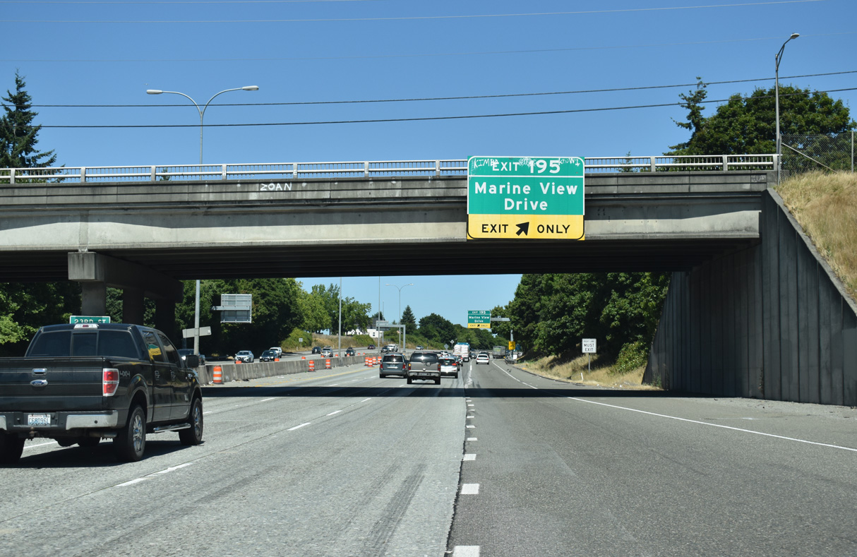
Interstate 5 travels below grade from U.S. 2 to the half diamond interchange (Exit 195) with Marine View Drive and E Grand Avenue. Previous overheads for Exit 195 referenced the Port of Everett.
07/19/23
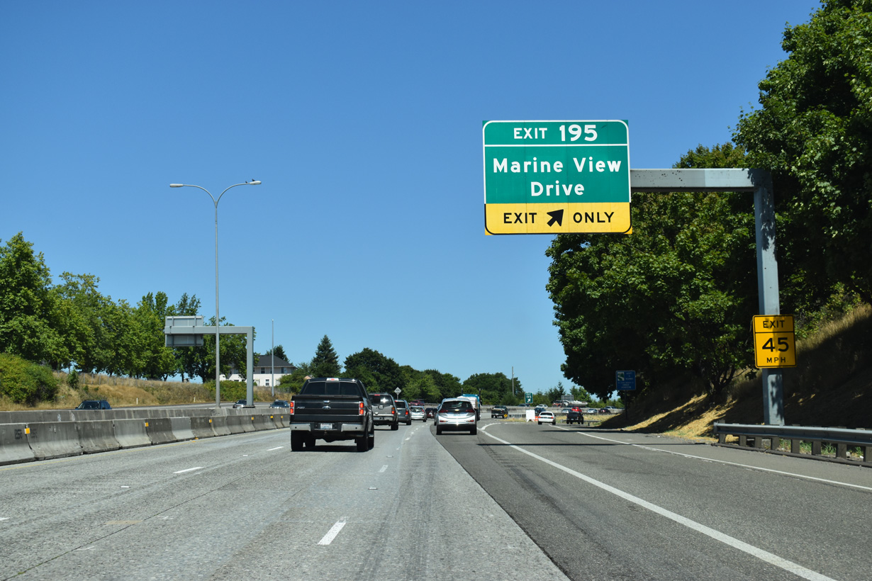
Marine View Drive runs north along industrial areas on the Snohomish River to Preston Point. E Grand Avenue is a residential street leading south back to Everett Avenue.
07/19/23
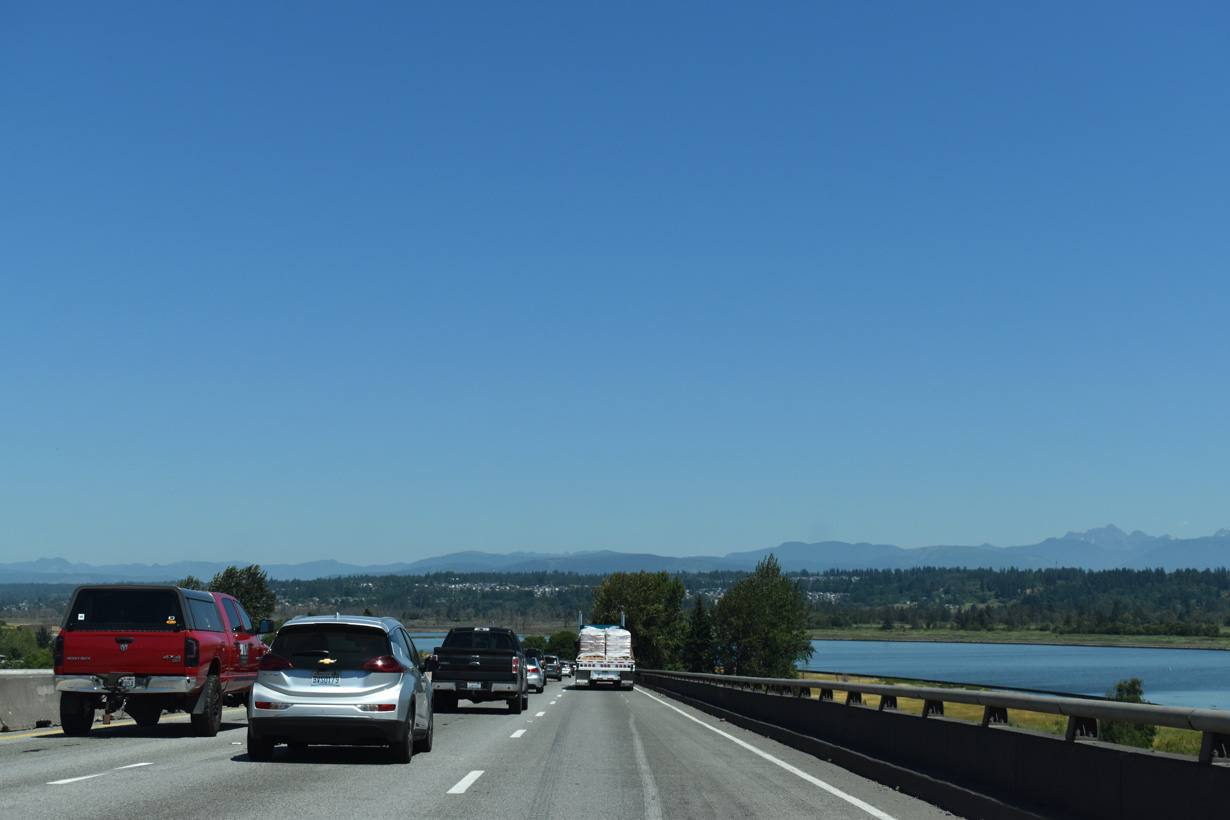
Northbound Interstate 5 spans the Snohomish River with three general travel lanes and an HOV lane.
07/19/23
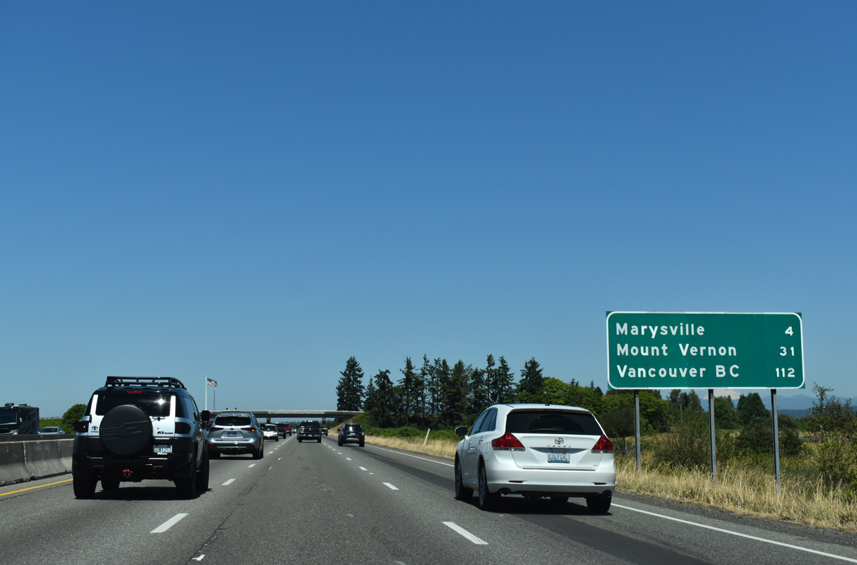
I-5 runs alongside Langus Riverfront Park by this distance sign posted 31 miles from the Skagit County seat of Mount Vernon and 112 miles from Vancouver, British Columbia via B.C. Highway 99.
07/19/23
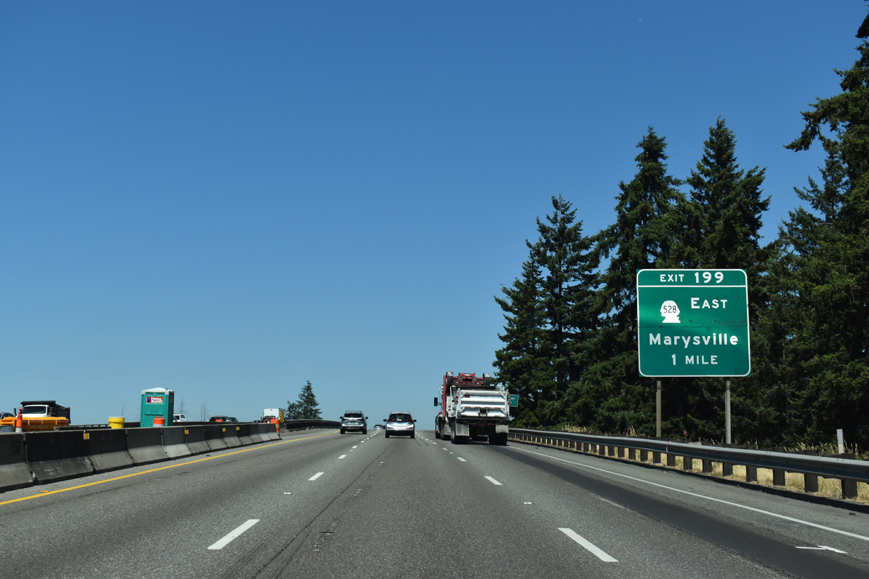
The first of four exits for the city of Marysville joins Interstate 5 with SR 528 (4th Street) at Marine Drive NE.
07/19/23
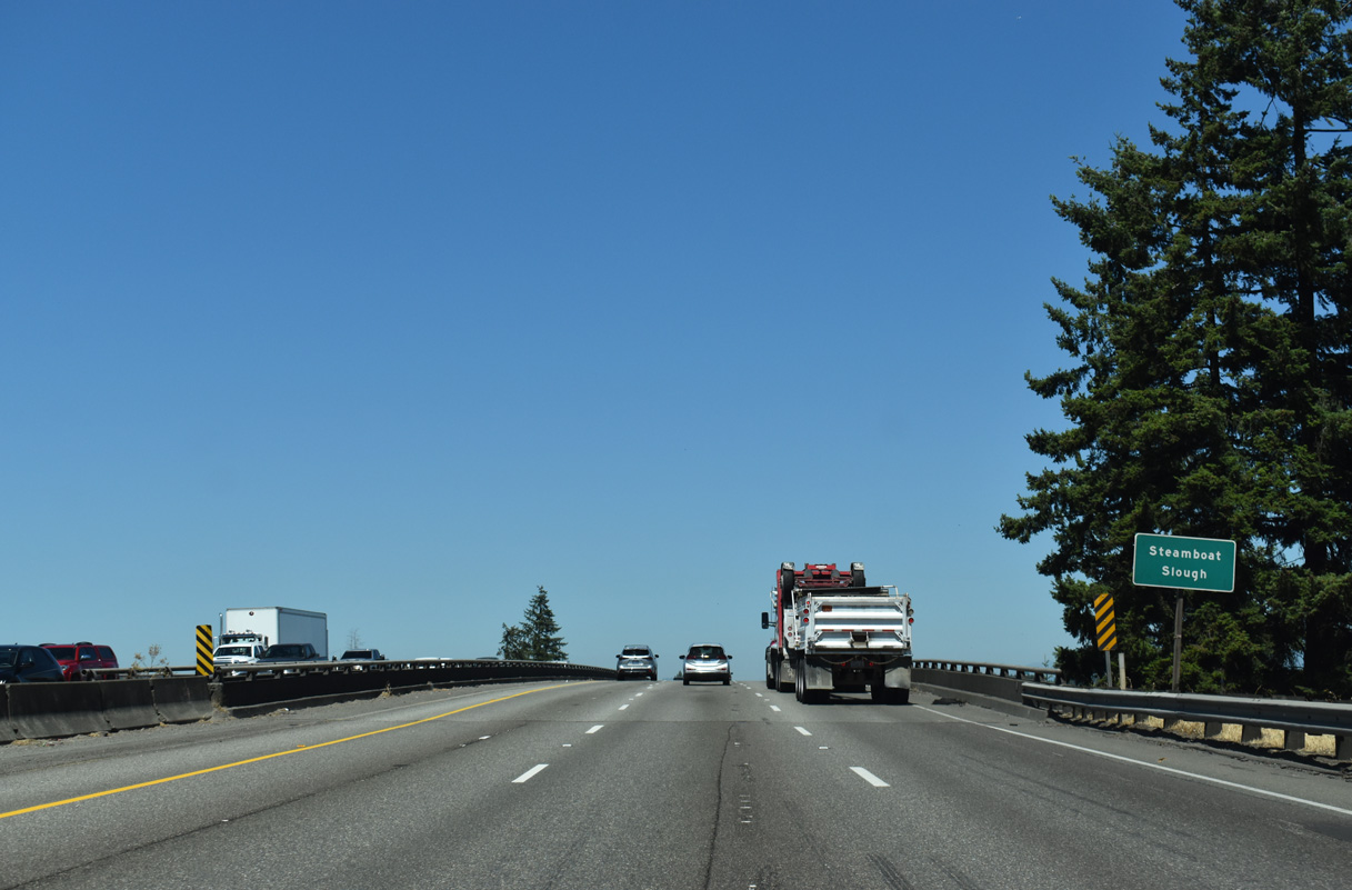
I-5 crosses Steamboat Slough and the Marysville city line ahead of a wye interchange adding traffic from SR 529 north.
07/19/23
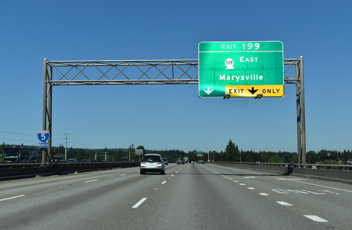
The entrance ramp from SR 529 adds an auxiliary lane spanning Ebey Slough to the diamond interchange (Exit 199) with SR 528 east and Marine Drive NE west. SR 528 travels 3.46 miles overall between I-5 and SR 9.
07/19/23
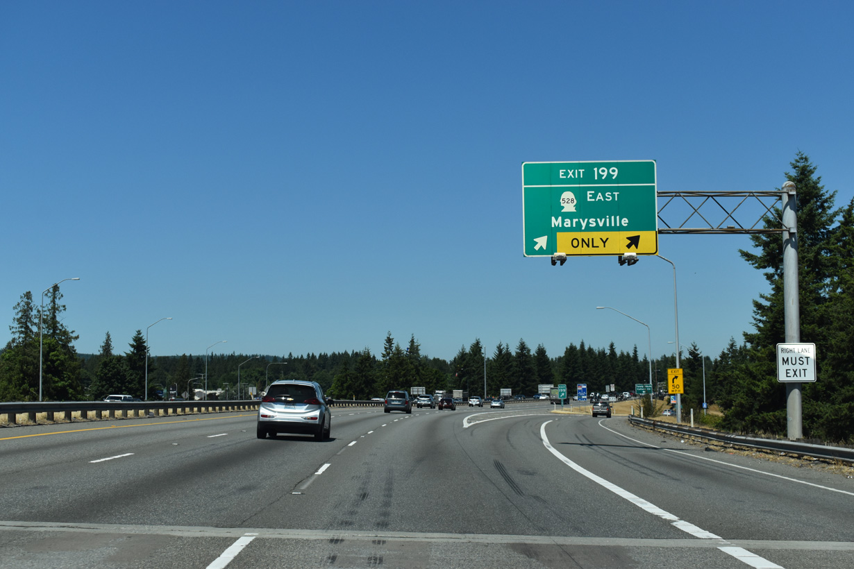
Exit 199 leaves Interstate 5 for SR 528 (4th Street) east to the Marysville city center and Marine Drive NE west to Priest Point Grange and Tulalip along Possession Sound.
07/19/23
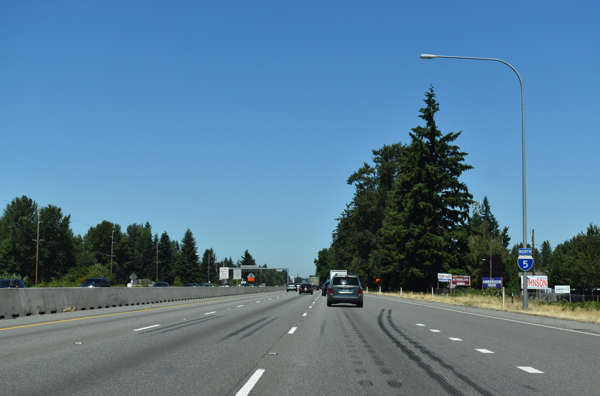
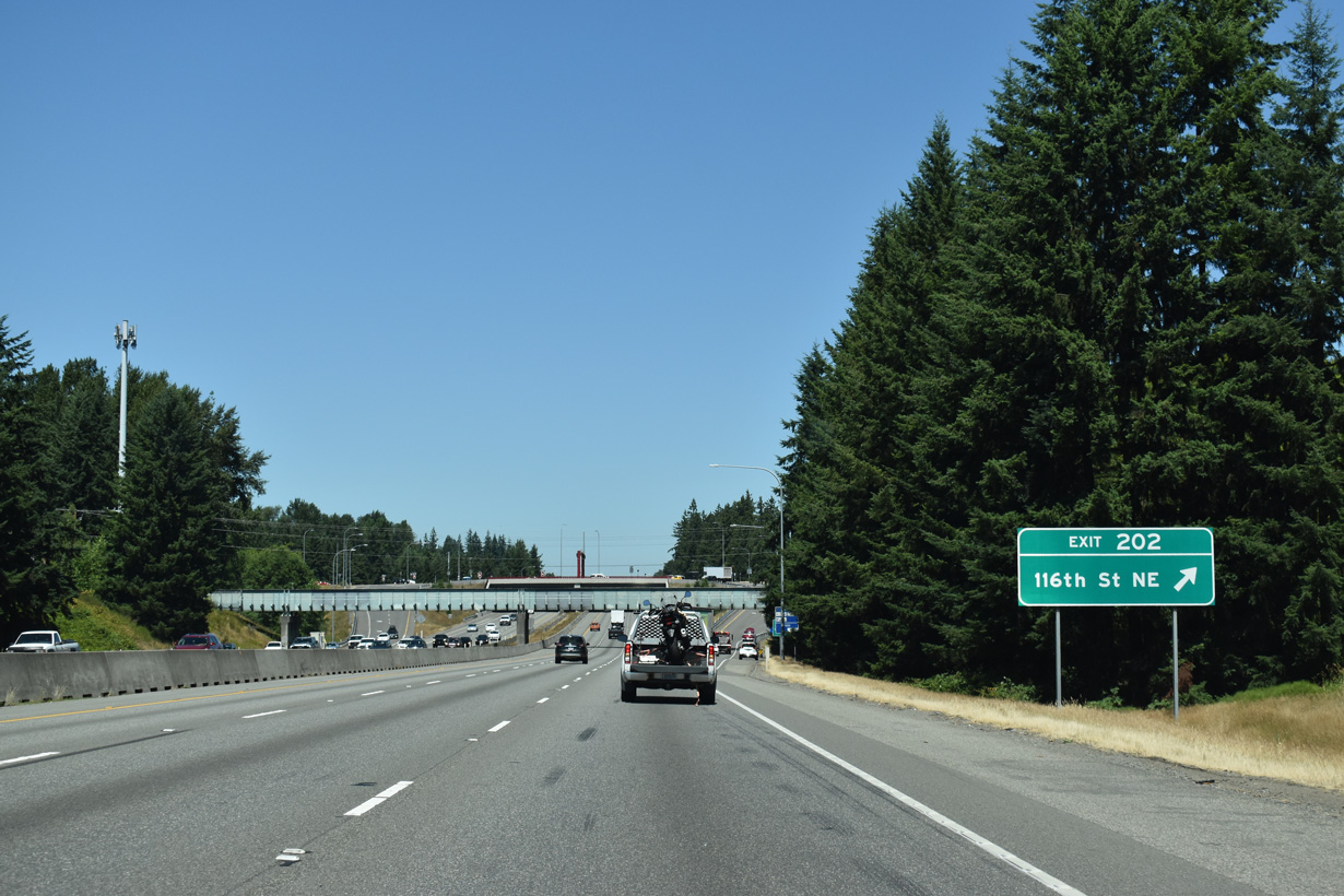
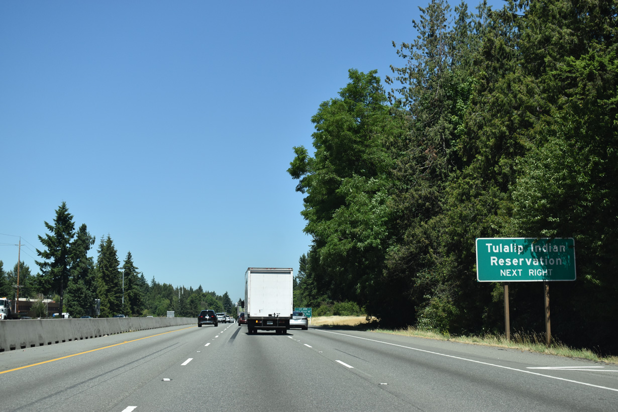
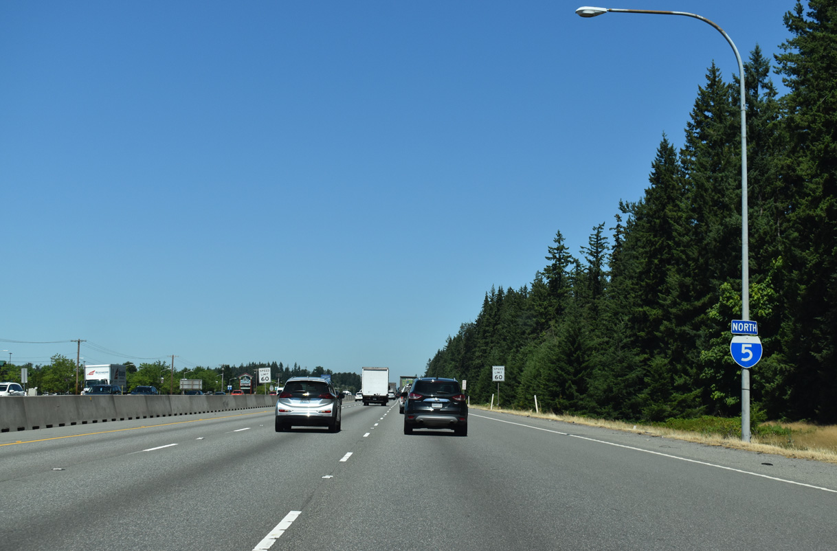
Interstate 5 straddles the Marysville city line and Tulalip Indian Reservation boundary northward through Exit 202.
07/19/23
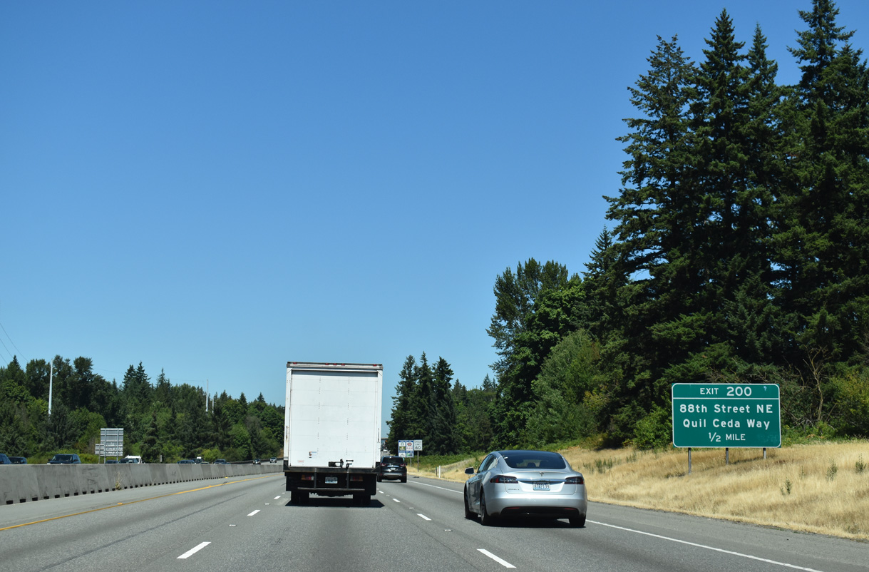
The diamond interchange at Exit 200 connects Interstate 5 with 88th Street NE east and Quil Ceda Way west.
07/19/23
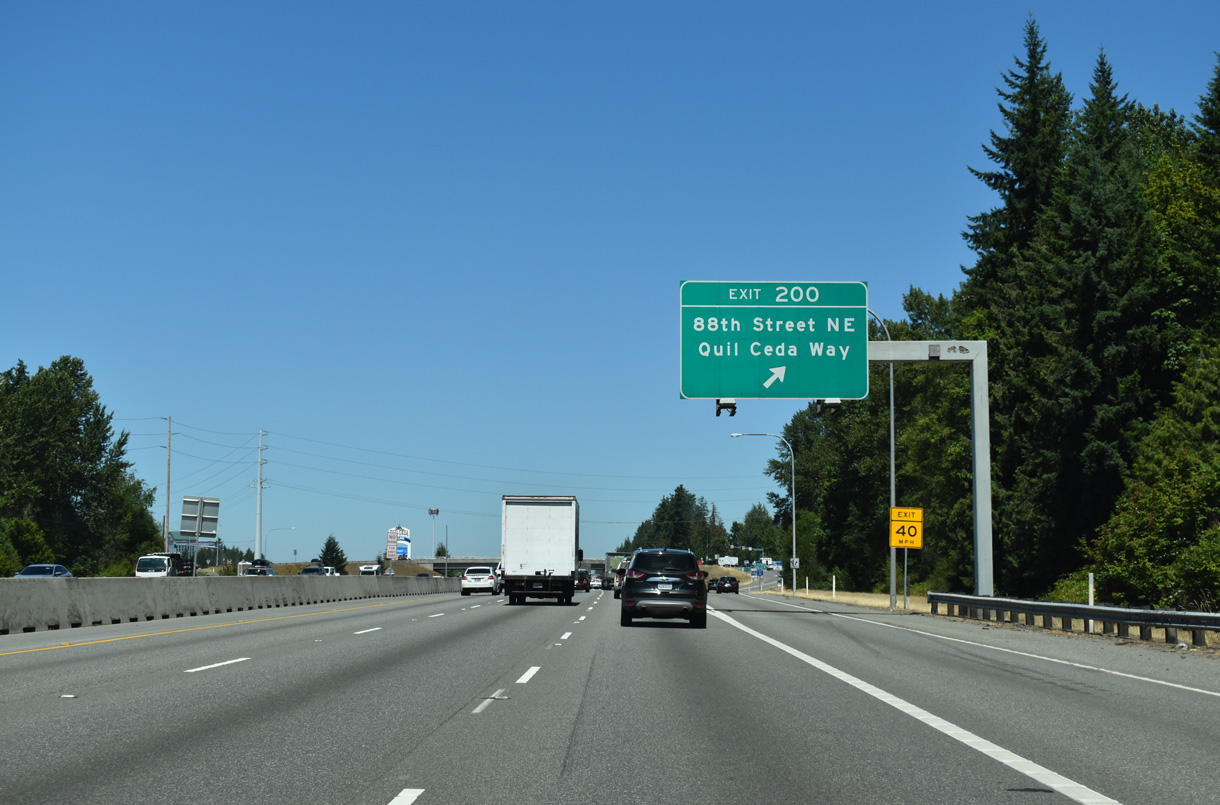
88th Street NE leads east to State Avenue (former U.S. 99) and 67th Avenue NE in Marysville. Quil Ceda Way continues the road west to 27th Avenue NE.
07/19/23
North from Exit 200, Tulalip Resort Casino, the Seattle Premium Outlets, and traditional big box retail line parallel 34th Avenue NE along the west side of I-5.
07/19/23
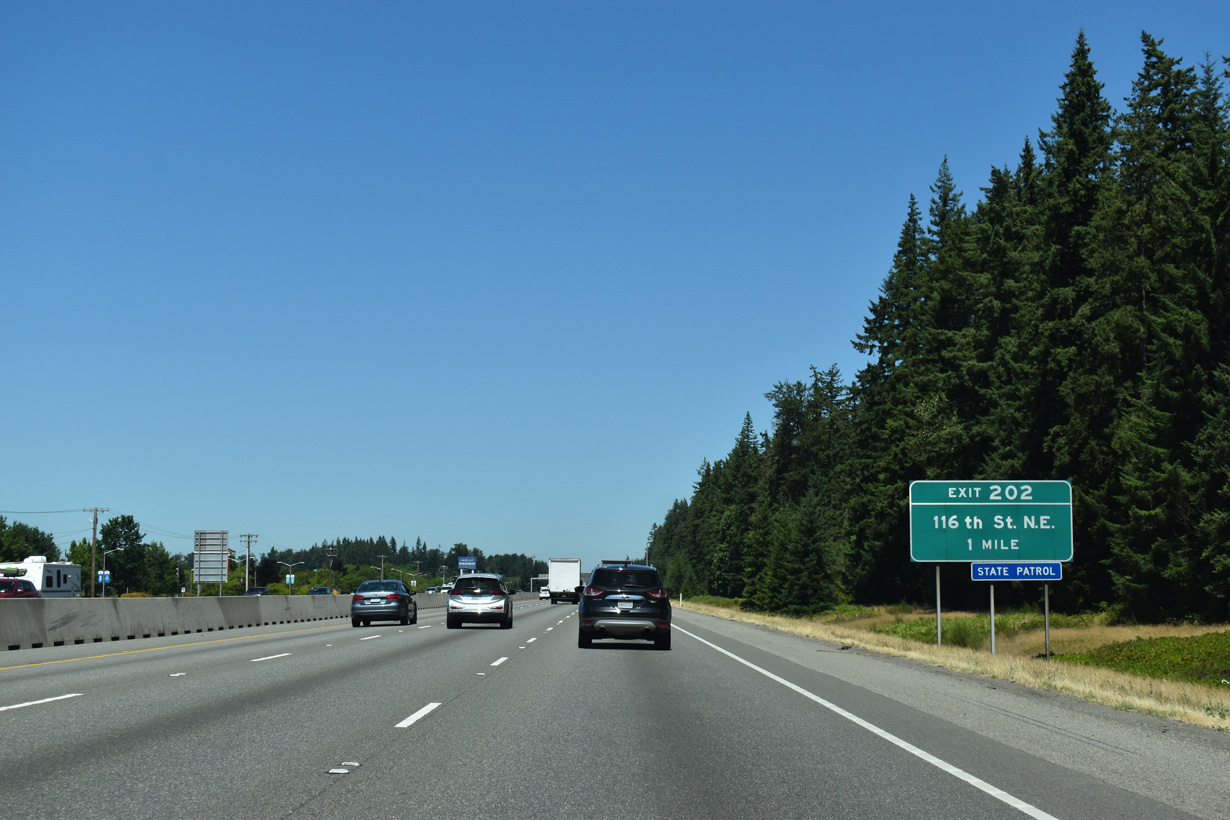
The single point interchange at Exit 202 links Interstate 5 with 116th Street NE near Kruse in north Marysville.
07/19/23
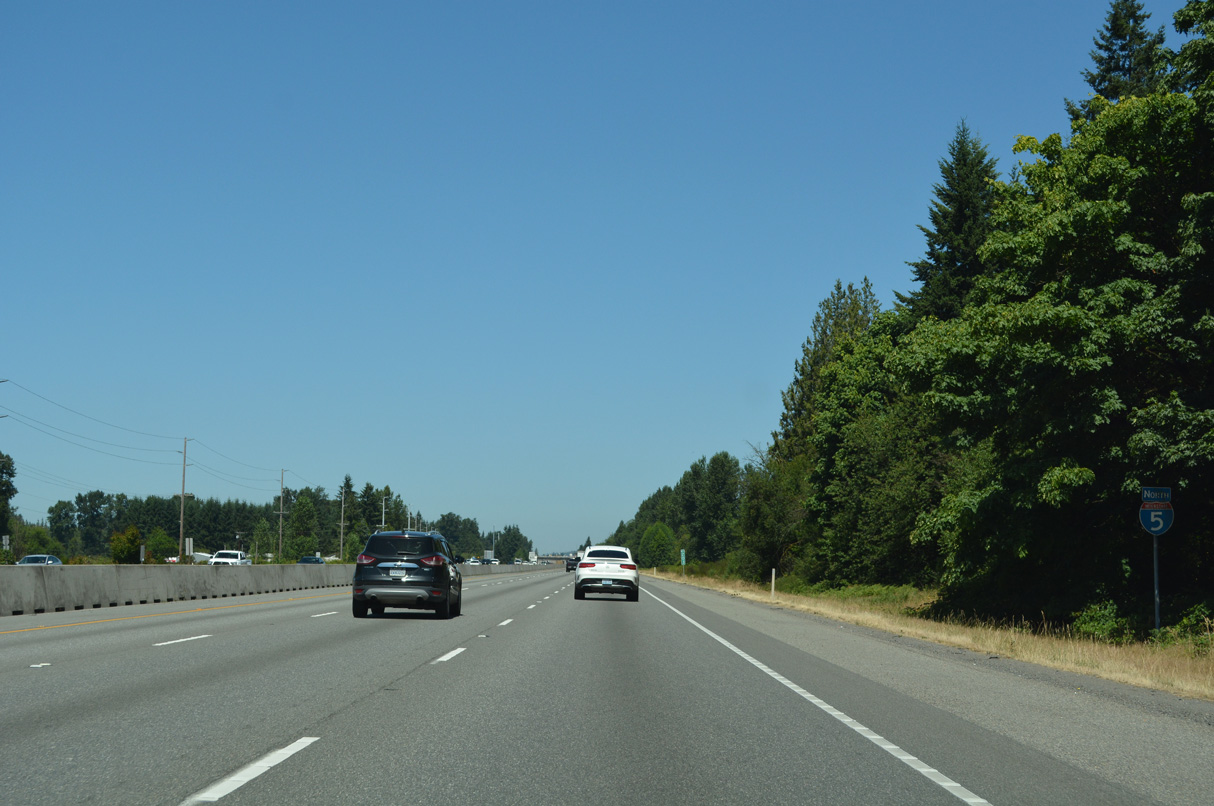
Confirming marker posted north of 116th Street NE.
07/19/23


References:
AARoads Wiki. (2024, November 13). Washington State Route 525. AARoads Wiki. Retrieved September 2, 2025, from https://wiki.aaroads.com/wiki/Washington_State_Route_525
Photo Credits:
- Brent Ivy: 07/19/23, 07/20/23
- AARoads: 08/30/06
Connect with:
Page Updated Thursday September 04, 2025.