
Interstate 5 South - Everett to Lynnwood
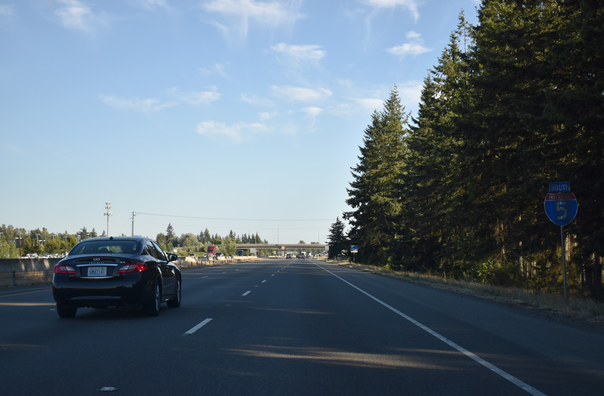
Interstate 5 advances south into the city of Marysville.
07/19/23
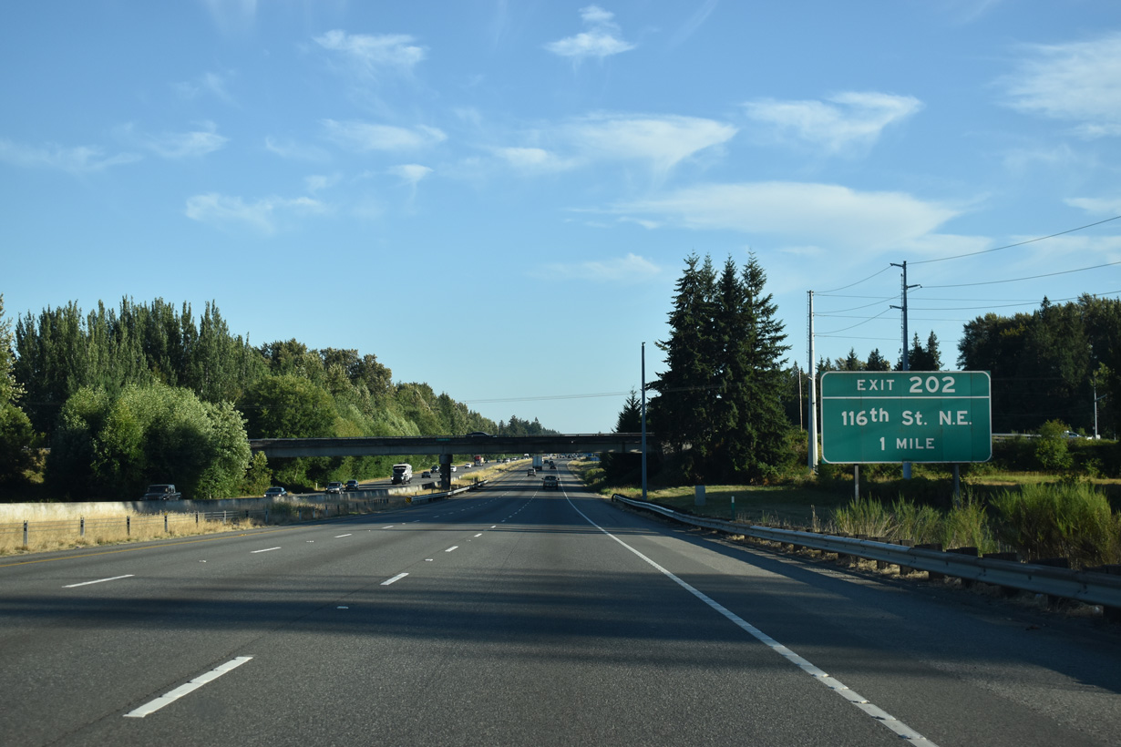
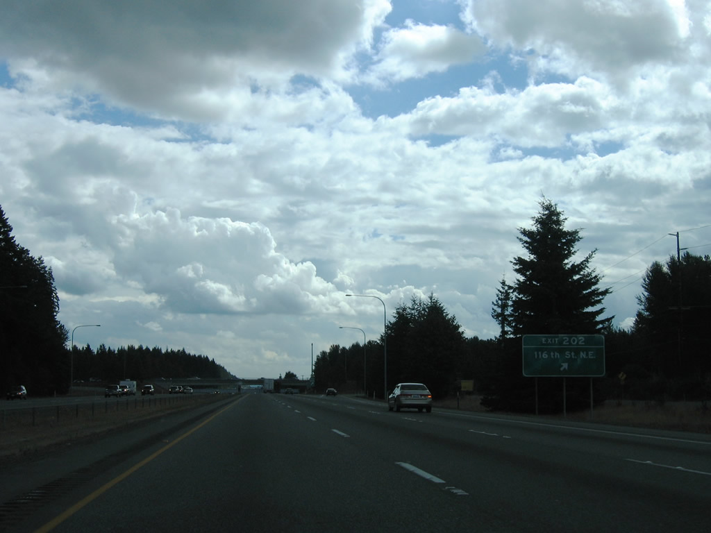
Interstate 5 south next meets 116th Street NE at Exit 202.
07/19/23
116th Street joins Interstate 5 with 27th Avenue NE and the Tulalip Indian Reservation to the west and old U.S. 99 (Smokey Point Boulevard) at Kruse to the east.
08/30/06
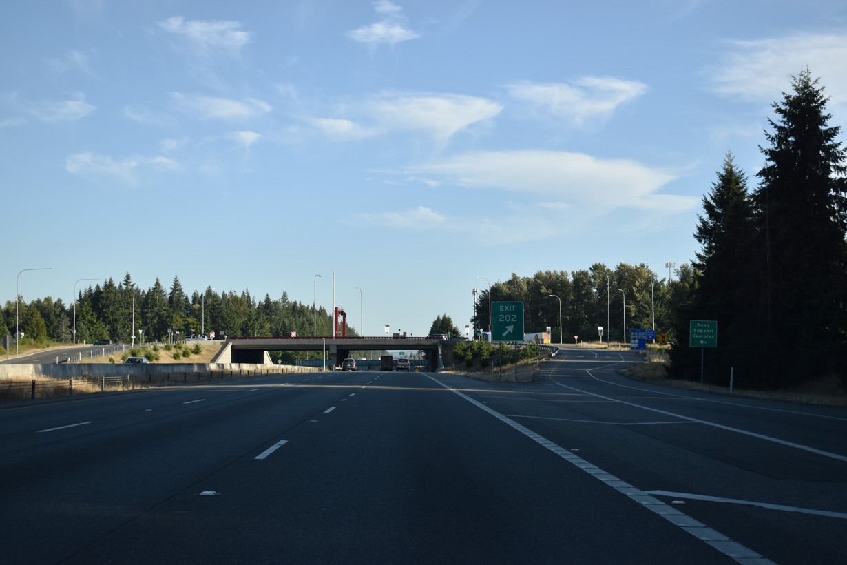
The SPUI at Exit 202 was originally a diamond interchange. Tulalip Resort Casino, the Seattle Premium Outlets, and additional big box retail line Quil Ceda Boulevard along the west side of I-5.
07/19/23
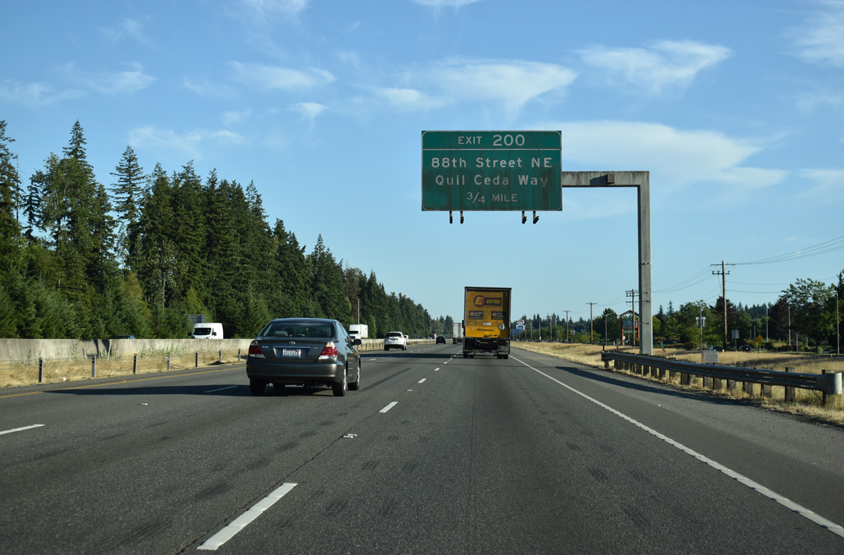
Quil Cela Way joins Interstate 5 south as a parallel frontage road to the diamond interchange with 88th Street NE at Exit 200. 88th Street NE leads east to State Avenue (former U.S. 99) and 67th Avenue NE in Marysville.
07/19/23
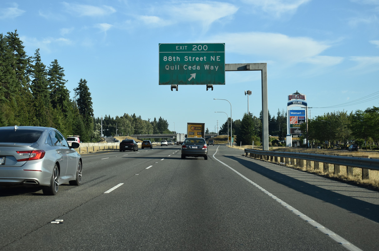
Exit 200 departs Interstate 5 south for 88th Street NE and Quil Cela Way.
07/19/23
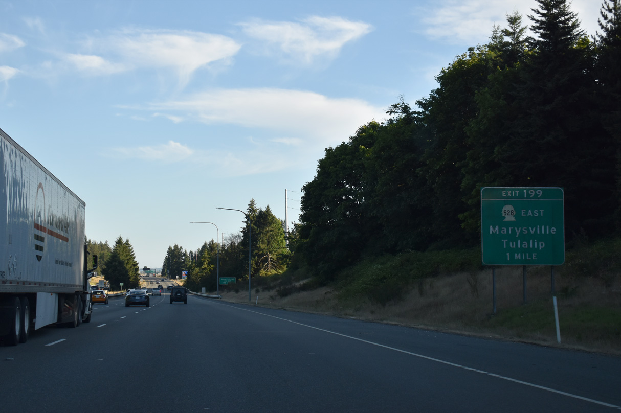
Marine Drive NE and 4th Street (SR 528) come together at Exit 199 near the Marysville city center. SR 528 begins at the diamond interchange with I-5 and travels 3.46 miles east to SR 9 via 64th Street NE.
07/19/23
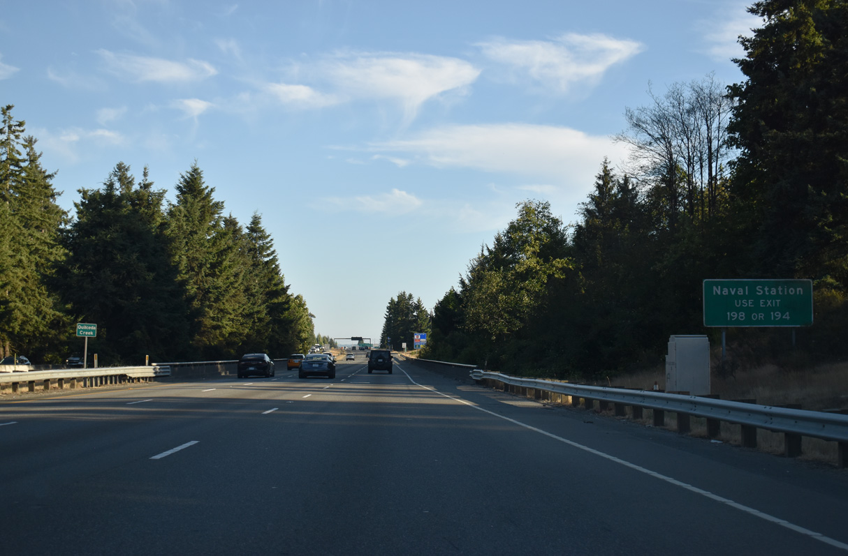
Naval Station Everett lies along Possession Sound off SR 529 (Marine View Drive) in the city of Everett.
07/19/23
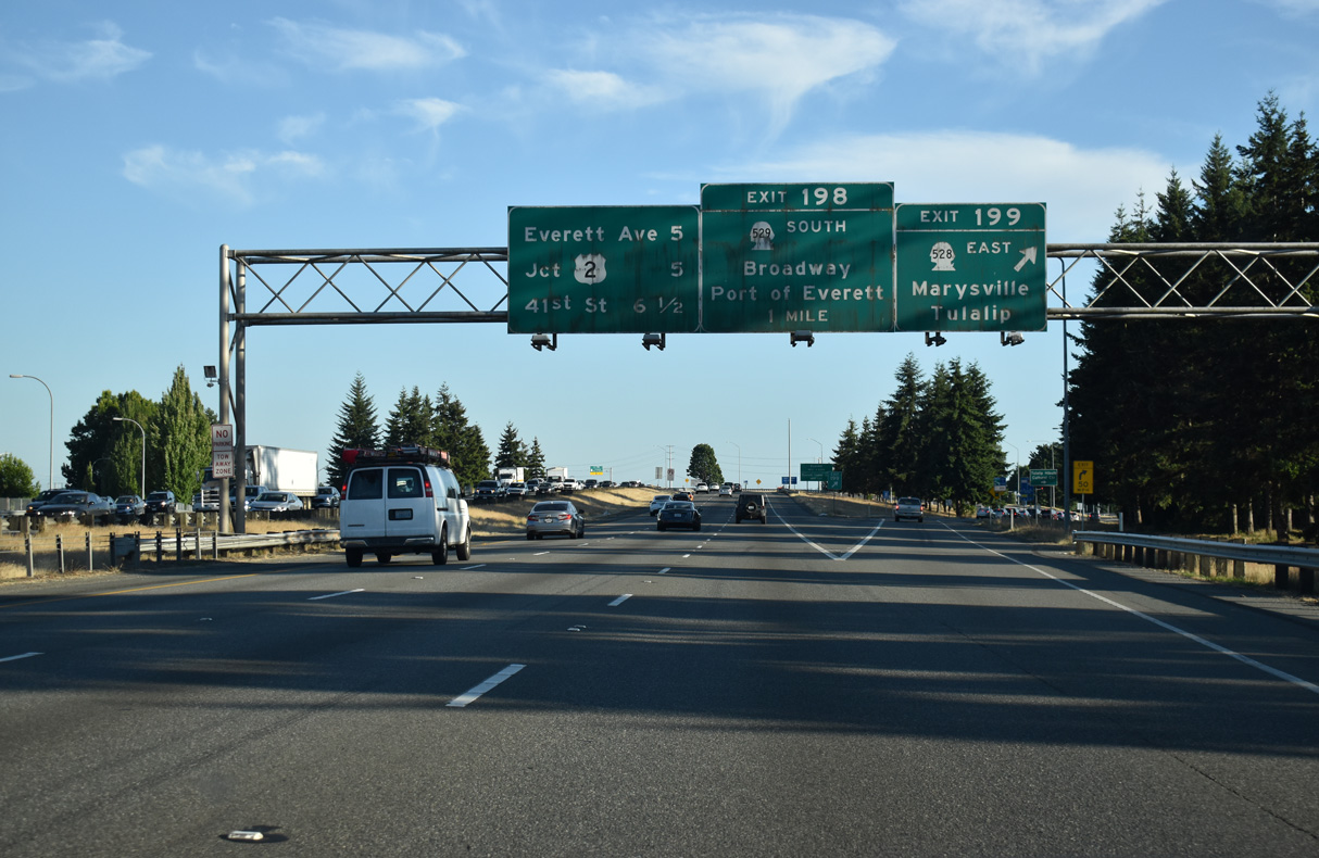
Interstate 5 enters the Everett area south of Ebey Slough. Exit 199 departs for SR 528 (4th Street) east and Marine Drive NE west to Priest Point Grange and Tulalip along Possession Sound. Exit 198 follows in one mile for the southbound SR 528 (Broadway).
07/19/23
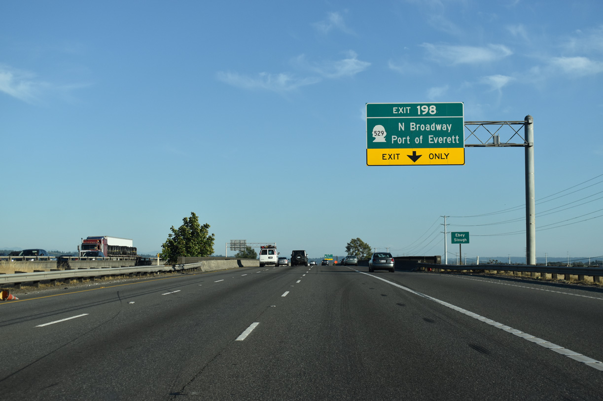
Exit 198 is the first of four serving the city of Everett. SR 529 follows the old U.S. 99 alignment southwest across Smith Island to Marine View Drive at Broadway. Marine View Drive winds westward to the Port of Everett as SR 529 continues south to the city center.
07/19/23
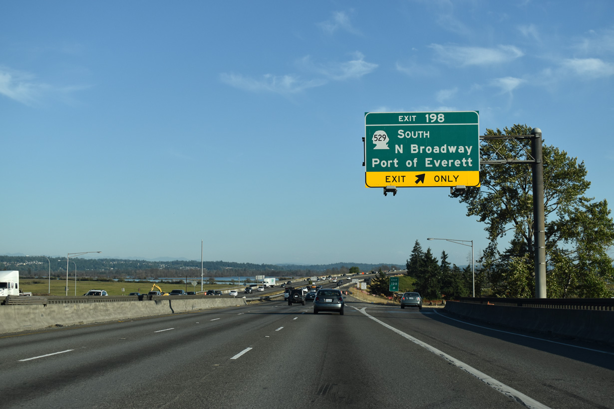
I-5 spans Ebbey Slough ahead of the wye interchange with SR 529 south. Beginning at the intersection of State Avenue (former U.S. 99) and SR 528 (4th Street) in Marysville, SR 529 leads 7.88 miles south through Everett. Everett Community College lies southwest of SR 529 along Broadway.
07/19/23
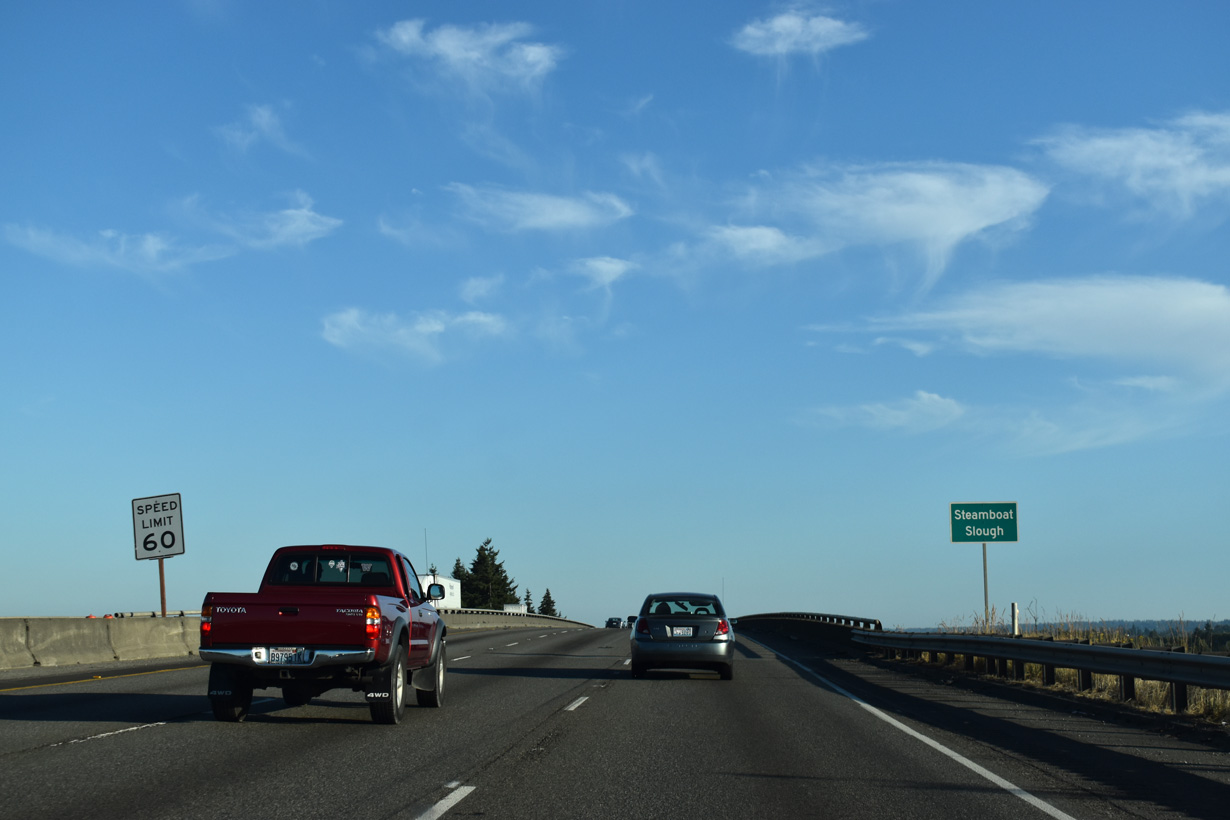
Interstate 5 runs along the Everett city line south from Steamboat Slough.
07/19/23
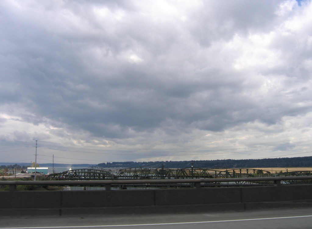
Visible to the west over Steamboat Slough are truss bridges for SR 529 and the adjacent BNSF Railroad. The road bridges opened in 1927 and 1954 respectively.
08/30/06
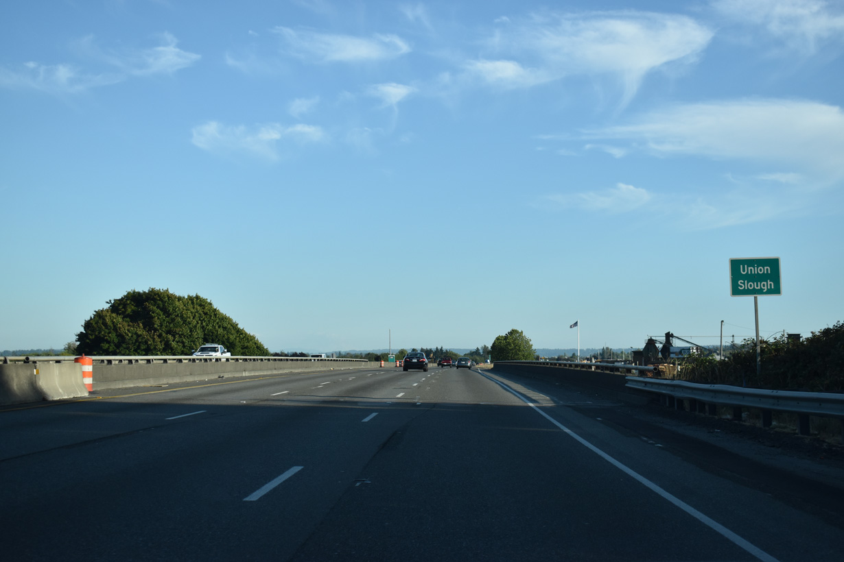
Interstate 5 continues through wetland areas in north Everett to a crossing of Union Slough.
07/19/23
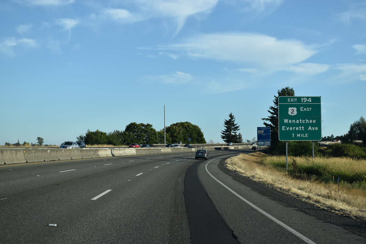
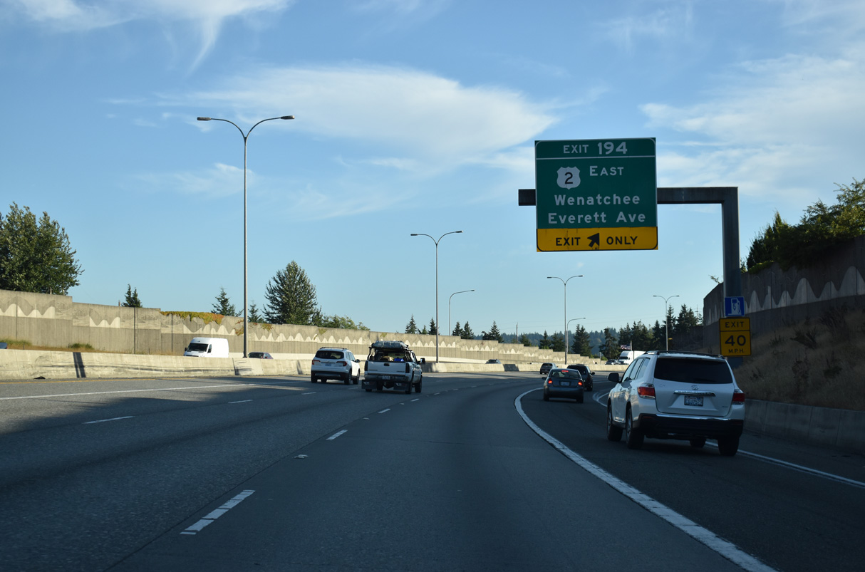
Beginning in Everett, U.S. 2 travels east from Exit 194 to Snohomish, Monroe and U.S. 97 at Wenatchee. The 2,119 mile long highway joins the Pacific Northwest with the northern Great Plains and the Upper Peninsula of Michigan. U.S. 2 ends in St. Ignace, Michigan at Interstate 75.
07/19/23
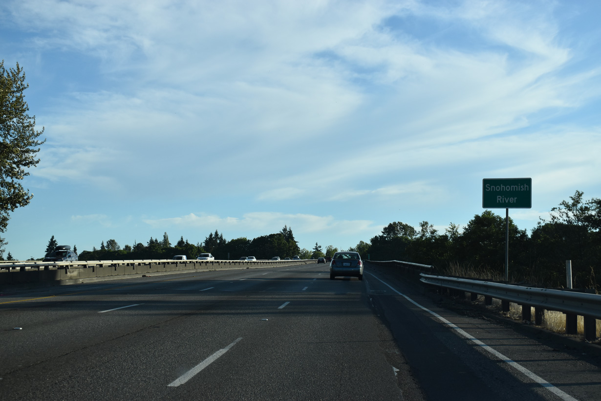
Spanning the Snohomish River along Interstate 5 south. These bridges opened with the freeway in 1968.
07/19/23
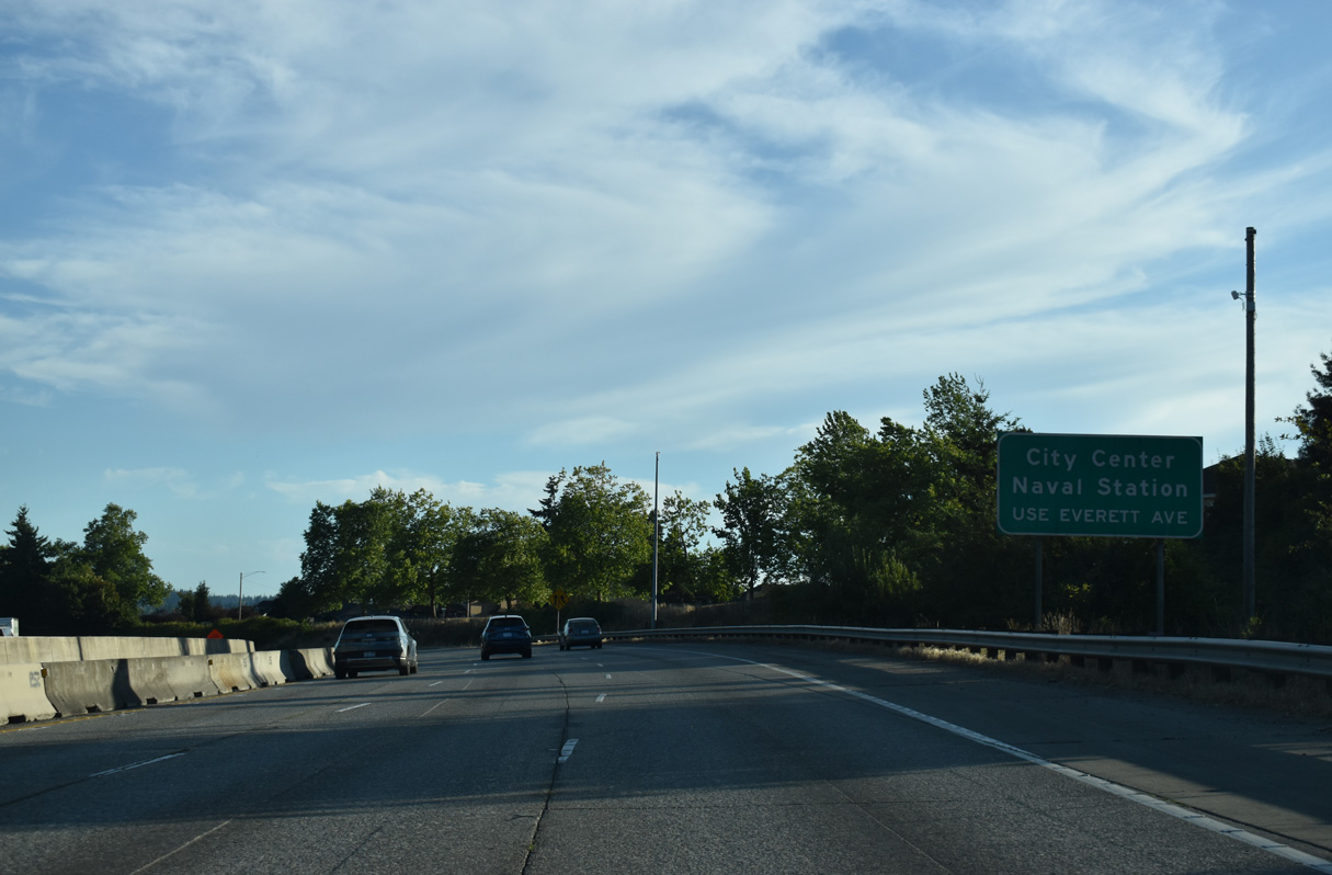
Everett Avenue leads SR 529 west past the Everett city center to Marine View Drive north for Naval Station Everett.
07/19/23
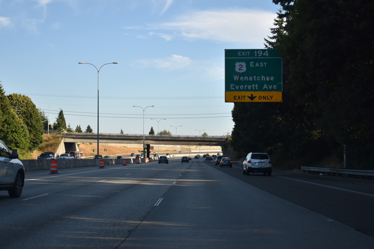
A half diamond interchange (Exit 195) adds an auxiliary lane from Grand Avenue south to Exit 194 for U.S. 2 east and Everett Avenue west to SR 529.
07/19/23
U.S. 2 formally begins at the intersection of Hewitt Avenue and Maple Street (SR 529) two blocks west of Exit 194. A directional ramp provides access to the U.S. 2 causeway across Ebey Island.
07/19/23
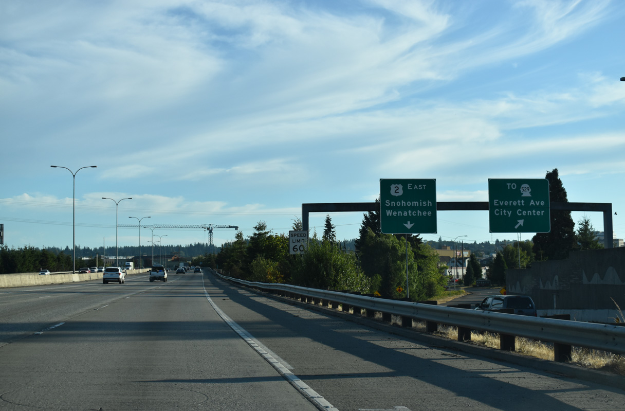
Exit 194 partitions into separate ramps for the eastbound beginning of U.S. 2 and Everett Avenue west to Downtown Everett. U.S. 2 heads seven miles southeast to Snohomish along an alignment varying between freeway and expressway. Further east, the US route continues across Stevens Pass to Wenatchee.
07/19/23

Interstate 5 angles southwest from U.S. 2 and the half diamond interchange (Exit 193) with Pacific Avenue along a freeway varying between an elevated roadway or viaduct to Exit 192 for 41st Street.
07/19/23
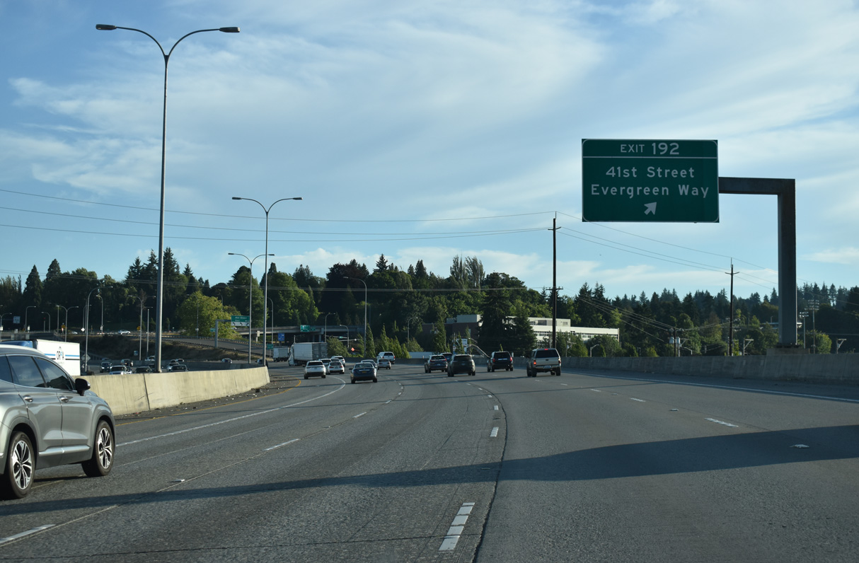
Construction associated with the freeway expansion project during the mid to late 2000s altered Exit 192 into a single point urban interchange (SPUI). 41st Street comprises a short arterial west to Rucker Avenue (historic U.S. 99). Rucker Avenue becomes Evergreen Way two and half blocks south of 41st Street.
07/19/23
A new flyover ramp was added to carry motorists from Interstate 5 north onto Broadway (historic U.S. 99) during 2006 construction. Separate ramps were added linking the HOV-2 lanes with Broadway ahead of this confirming marker.
07/19/23
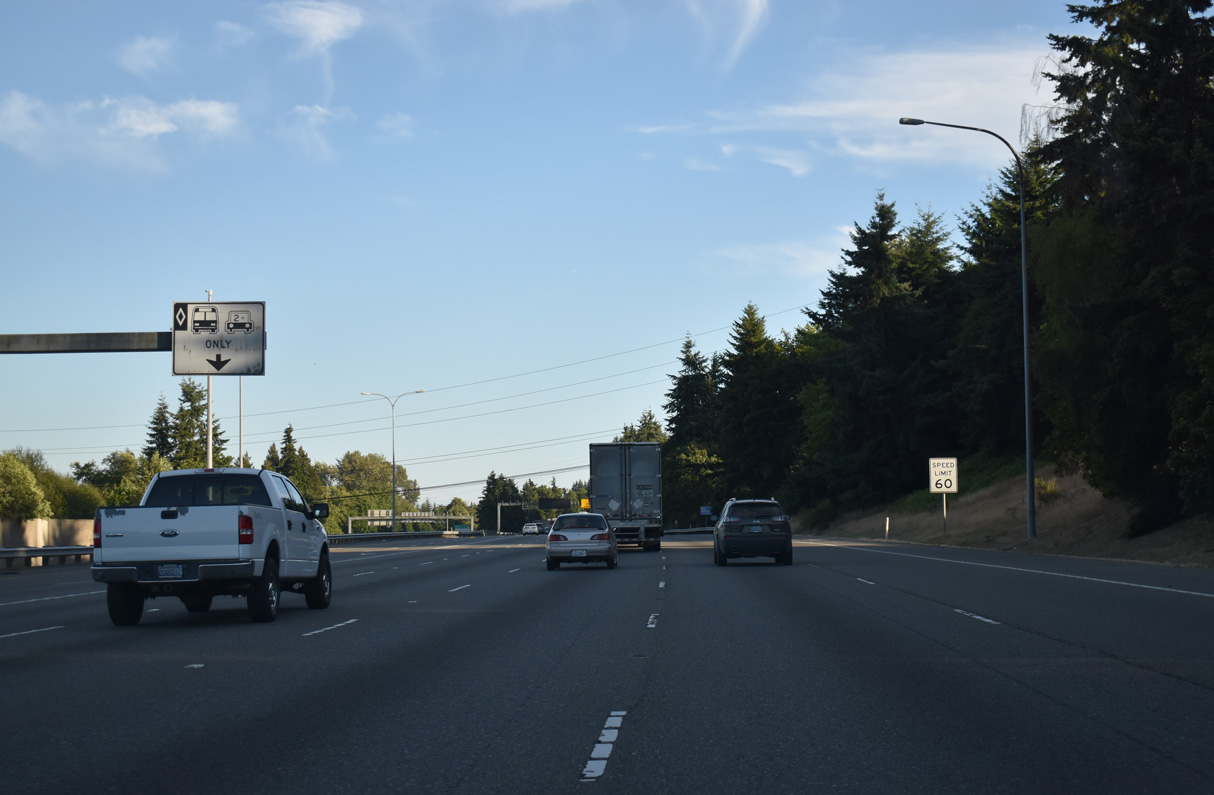
The HOV lanes extends south along Interstate 5 from U.S. 2 in Everett to SR 16 in Tacoma.
07/19/23
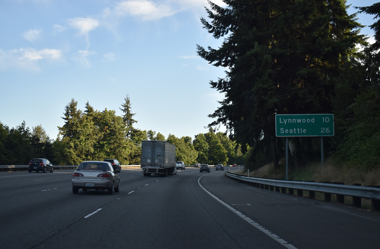
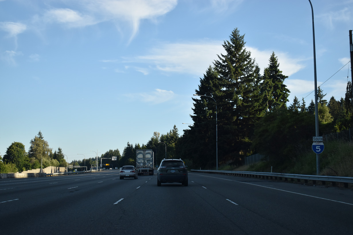
Due to the local terrain, Interstate 5 south travel at an elevation above the northbound roadway through south Everett. Lynnwood is the next Snohomish County city on I-5. Seattle is 26 miles southward.
07/19/23
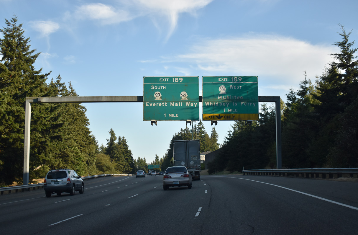
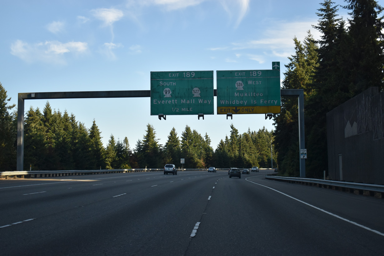
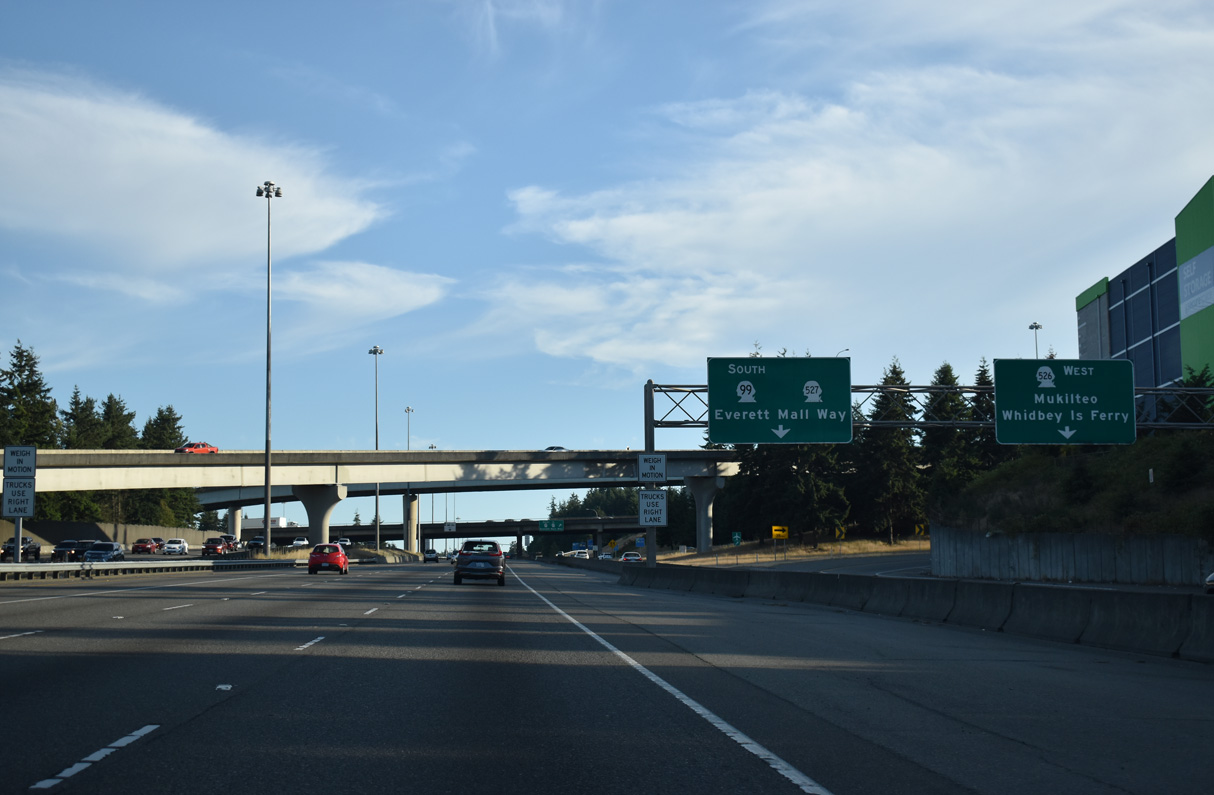
Exit 189 joins Interstate 5 south with SR 526 west and SR 99 (Broadway) to SR 527 (19th Avenue SE) via a collector distributor roadway. 48.97 miles long, SR 99 follows old U.S. 99 south from Everett to Lynwood, Edmonds, Shoreline and Seattle.
07/19/23
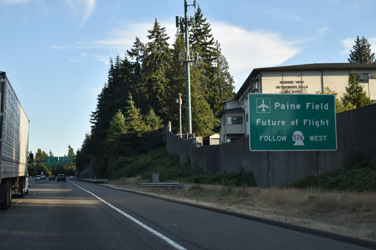
SR 526, the Boeing Freeway, connects Interstate 5 at Exit 189 with Seattle Paine Field International Airport (PAE) and the Boeing Company operations in southwest Everett.
07/19/23
SR 526 (Boeing Freeway) connects I-5 with Mukilteo and SR 525 to the Whidbey Island Ferry. The state route measures 4.52 miles in length between Exit 189 and Nelsons Corner.
07/19/23
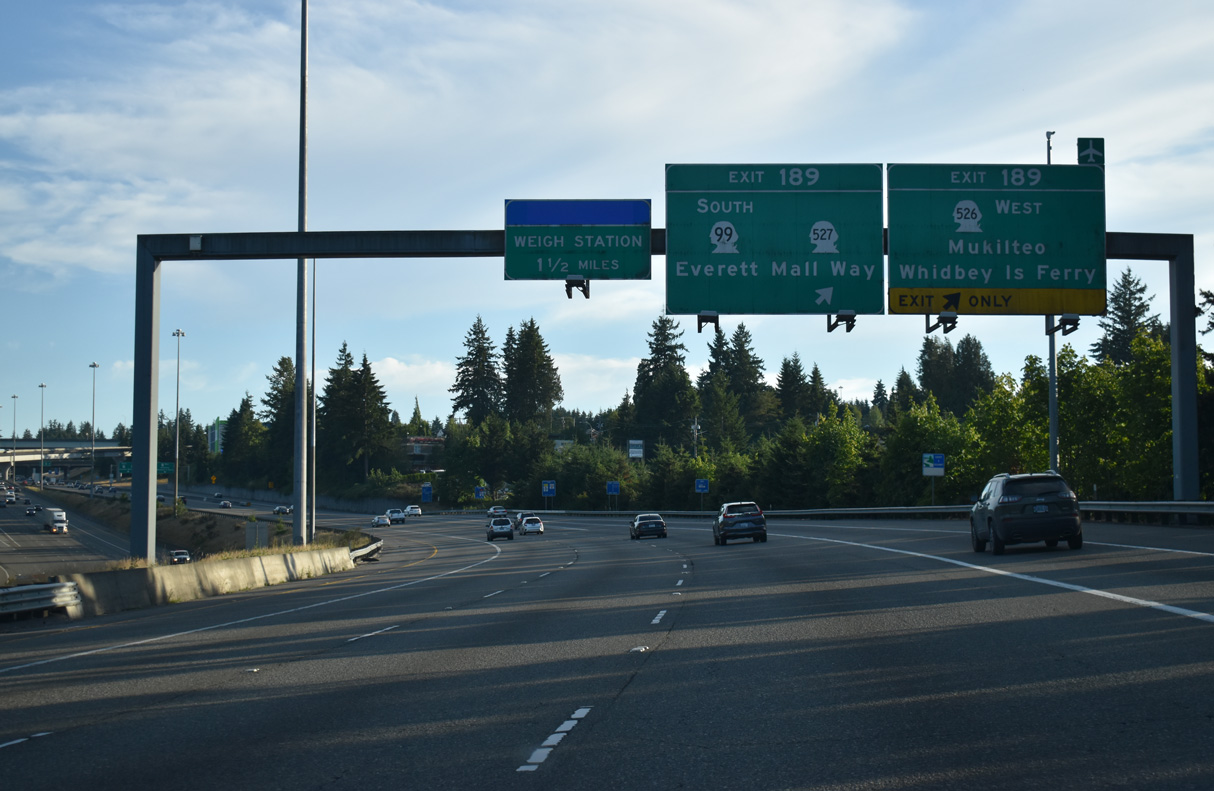
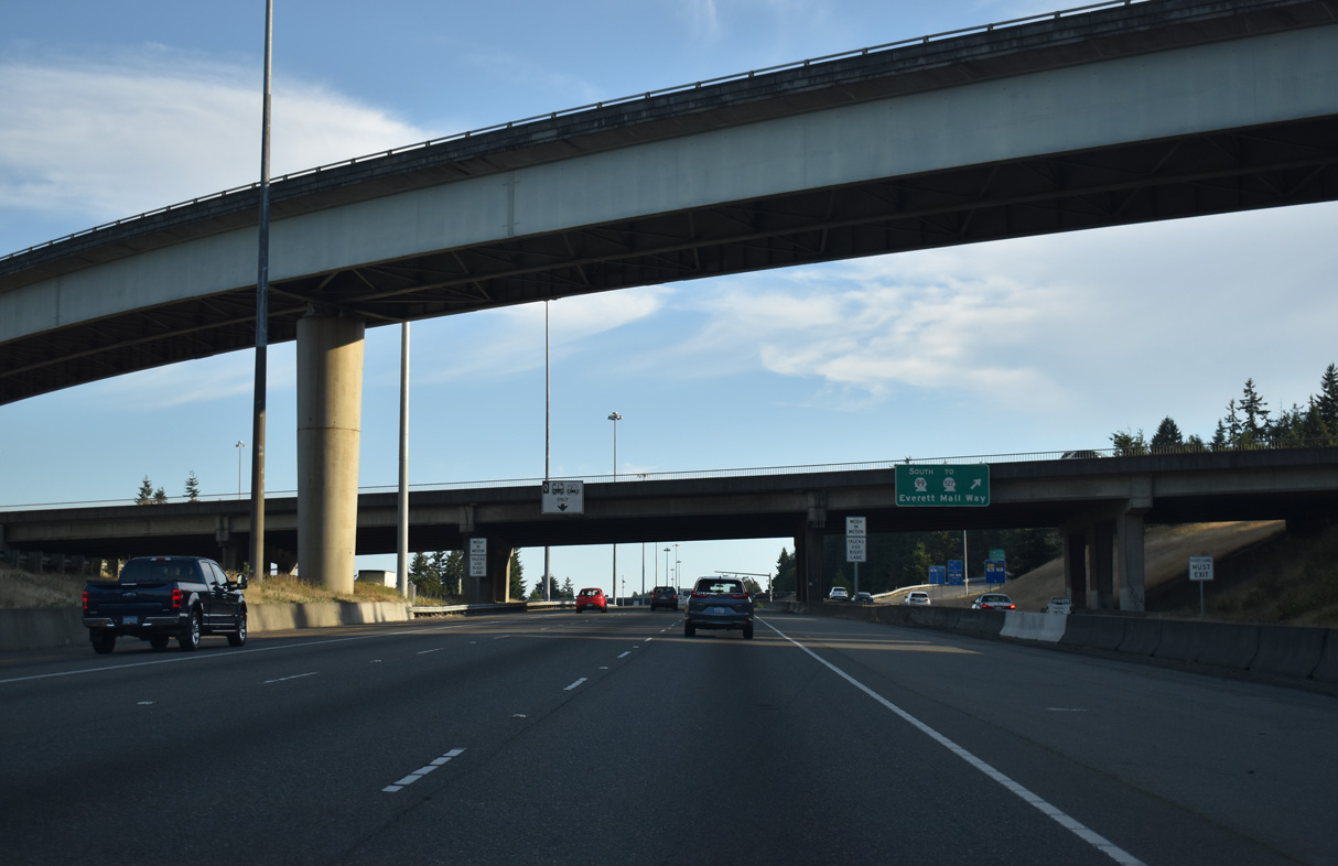
SR 526 begins at the intersection with SR 99 (Broadway) and SR 527 (19th Avenue SE) adjacent to Exit 189. SR 527 also commences there and leads south 9.29 miles to Mill Creek and Bothell.
07/19/23
The c/d roadway for Exit 189 splits into ramps for Boeing Freeway west and SR 99 (Broadway) near Everitt Mall. Broadway becomes Everett Mall Way southwest to Evergreen Way.
07/19/23
Flyover ramps join SR 526 east with Interstate 5 north and I-5 north with the Boeing Freeway west.
07/19/23
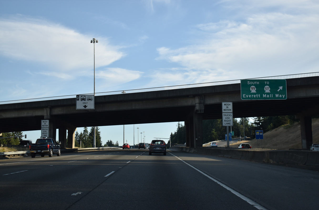
SR 99 (Broadway) intersects SR 526 west and SR 527 south just north of the ramp from Exit 189.
07/19/23
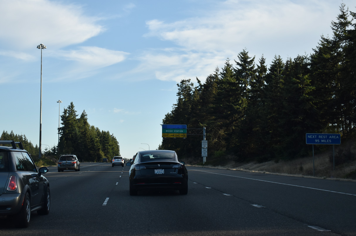
Interstate 5 continues to a commercial truck weigh station that previously housed the fourth southbound rest area.
07/19/23
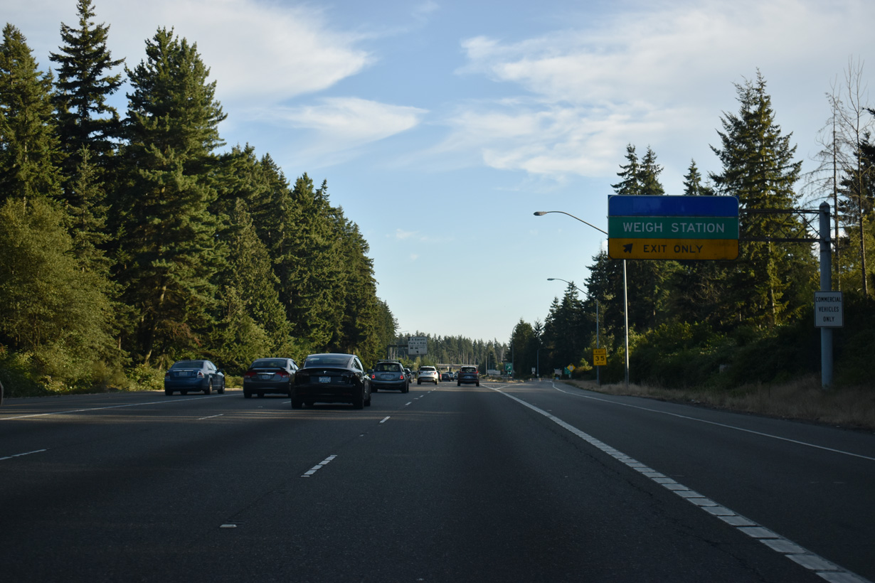
The Silver Lake Rest Area closed for maintenance in September 2021. However, due to problems with illegal dumping, vandalism, extended stays and littering, the closure became indefinite (Craighead, 2021).
07/19/23
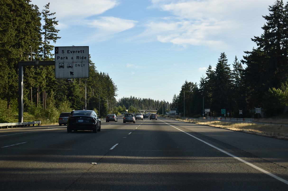
Left exit ramps from the HOV-2 lanes connect Interstate 5 with the South Everett Park & Ridge facility located off 112th Street SE.
07/19/23
Interstate 5 angles southwest by Thorton A. Sullivan Park and Silver Lake.
07/19/23
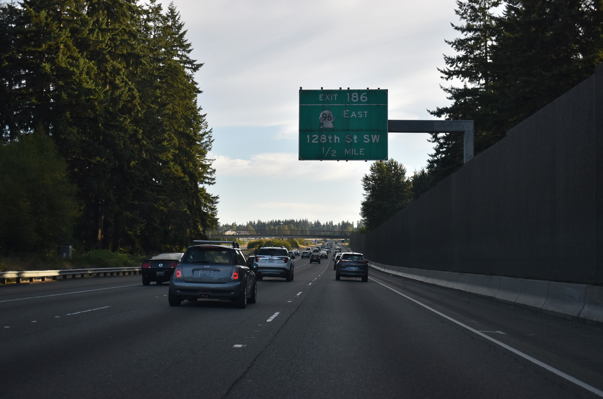
One half mile north of the diamond interchange (Exit 186) with SR 96 (128th Street SE) between the Lake Stickney and Martha Lake communities.
07/19/23
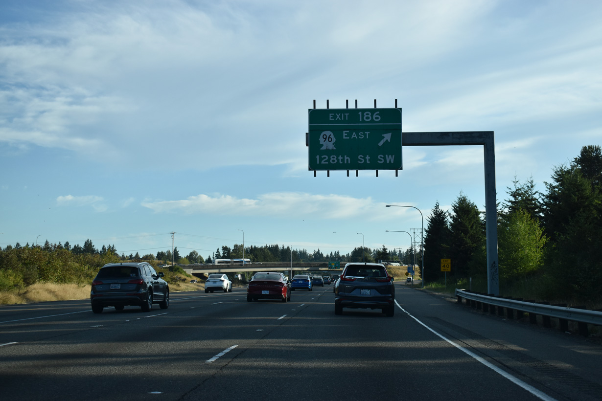
Exit 186 leaves Interstate 5 south for SR 96 east and 128th Street SW west to Airport Road and SR 99 (Evergreen Way). SR 96 travels 6.75 miles along the Mill Creek city line to SR 9 south of Snohomish.
07/19/23
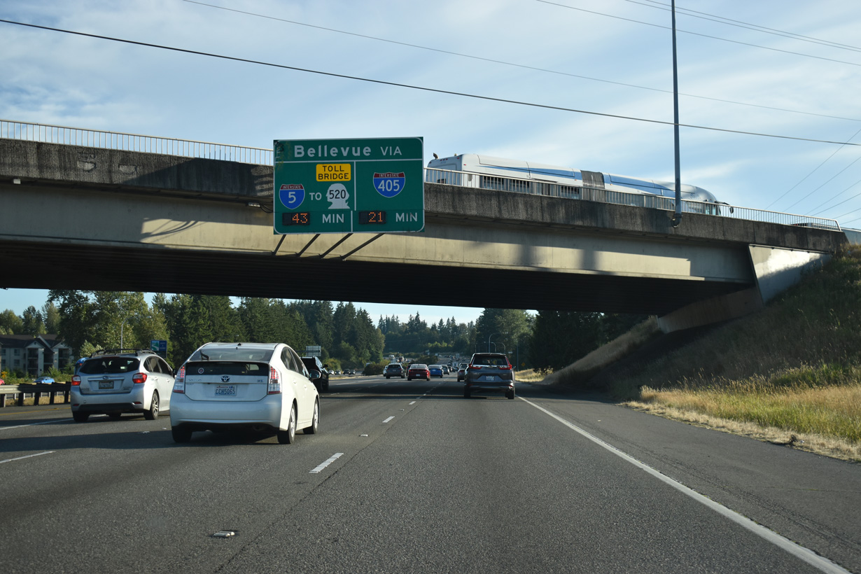
Travel times to Bellevue via Interstate 405 south or I-5 south to SR 520 east across the tolled Evergreen Point Floating Bridge.
07/19/23
Confirming marker posted south of Exit 186.
07/19/23
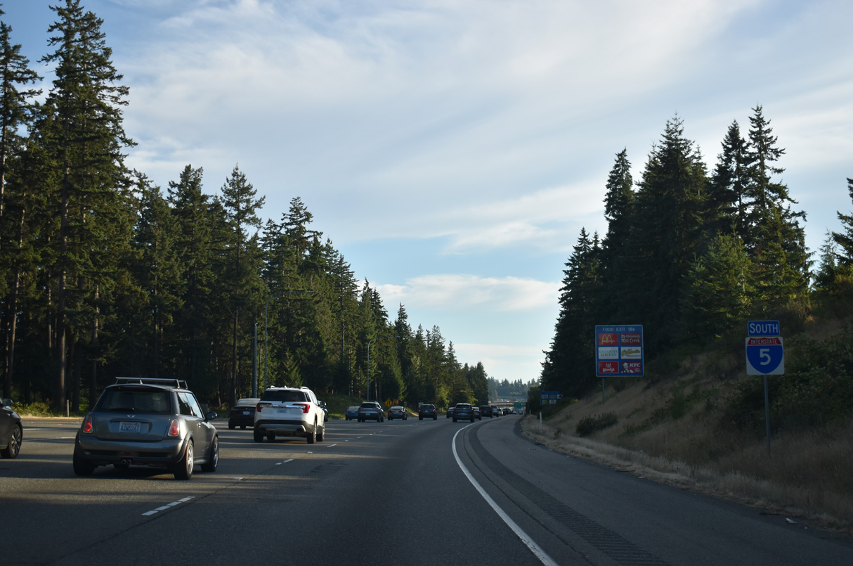
Interstate 5 proceeds 20 miles south from Lake Stickney to Seattle.
07/19/23
Exit 183 follows for 164th Street SW. 164th Street provides a second route into Mill Creek from I-5 to the east. The arterial continues west to SR 99 on the outskirts of Lynnwood.
07/19/23
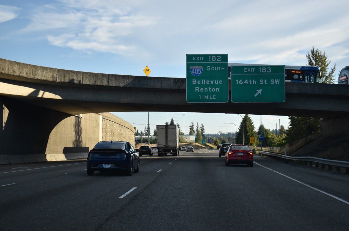
An HOV on-ramp joins I-5 south from a park and ride facility on Ash Way north of 164th Street SW and Exit 183. Historically, 164th Street SW was once a part of SR 525, from 35th Avenue W east to I-5, before the state route shifted to a freeway. SR 525 leads south from SR 99 directly to I-405 at Exit 182.
07/19/23
What was originally a three-wye interchange with Interstate 405 south only was expanded in 1985 to include partial access to the freeway alignment taking SR 525 north to Mukilteo.
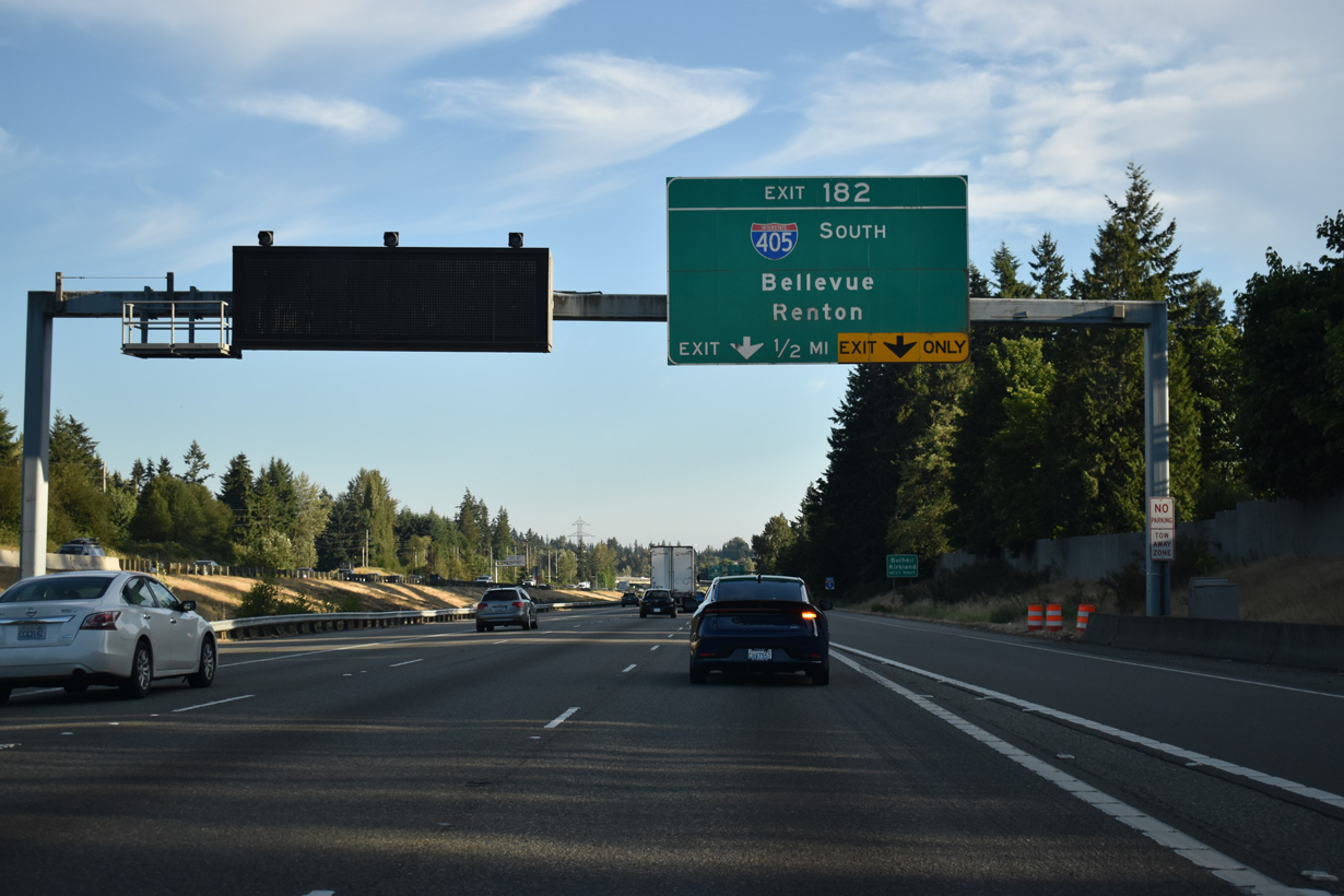
07/19/23
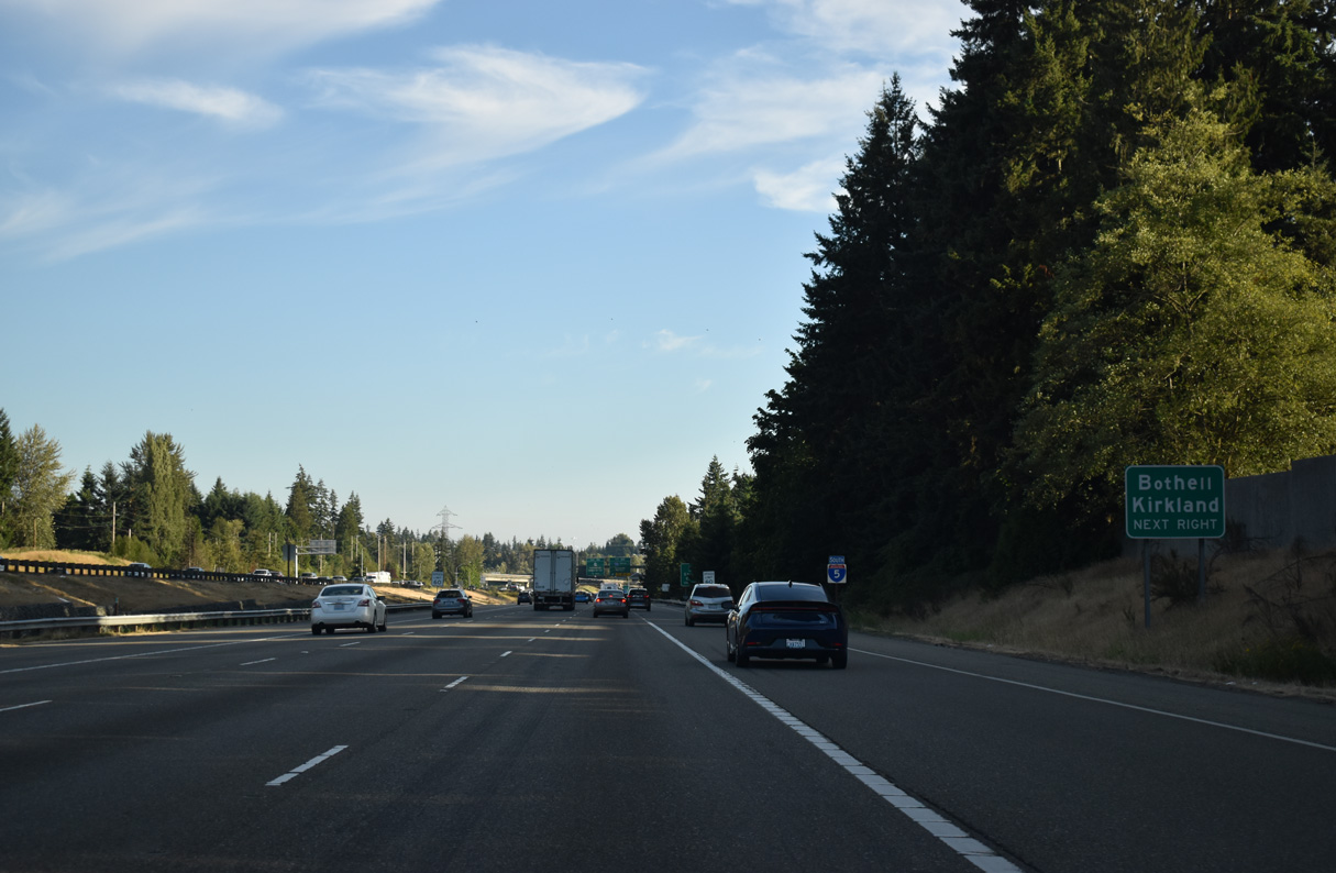
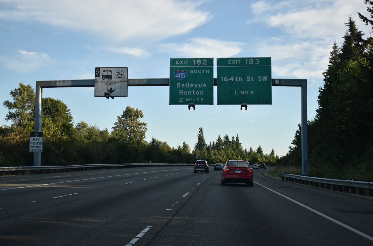
Exit 182 is a two lane directional ramp onto Interstate 405 south for Bothell, Bellevue and Renton.
07/19/23
07/19/23
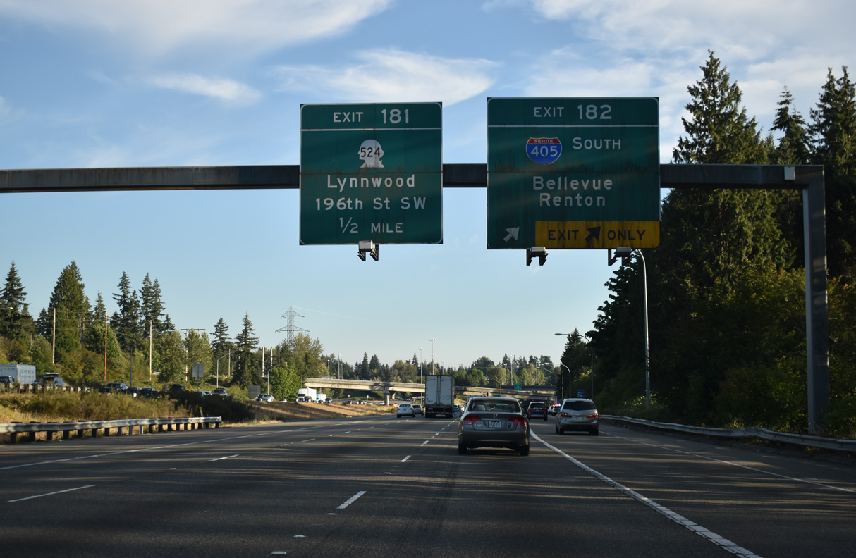
Interstate 405 is a heavily traveled urban loop encircling the Lake Washington area east of Seattle. The freeway is not necessarily a better through route due to commuter traffic. Traveling 30.30 miles, I-405 ends like it begins, at I-5 and a state route freeway (SR 518) at Exit 154.
07/19/23
A multi level systems interchange joins I-5/405 and SR 525.
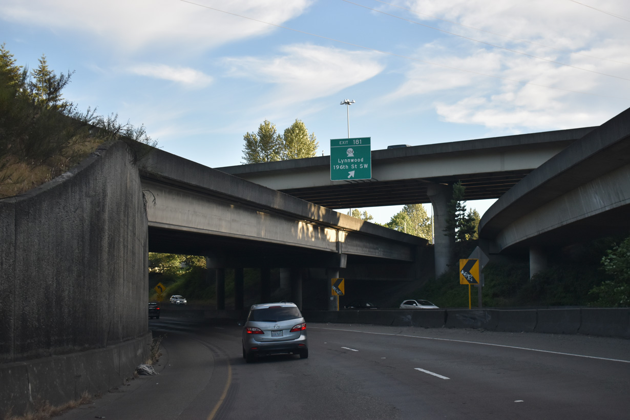
07/19/23
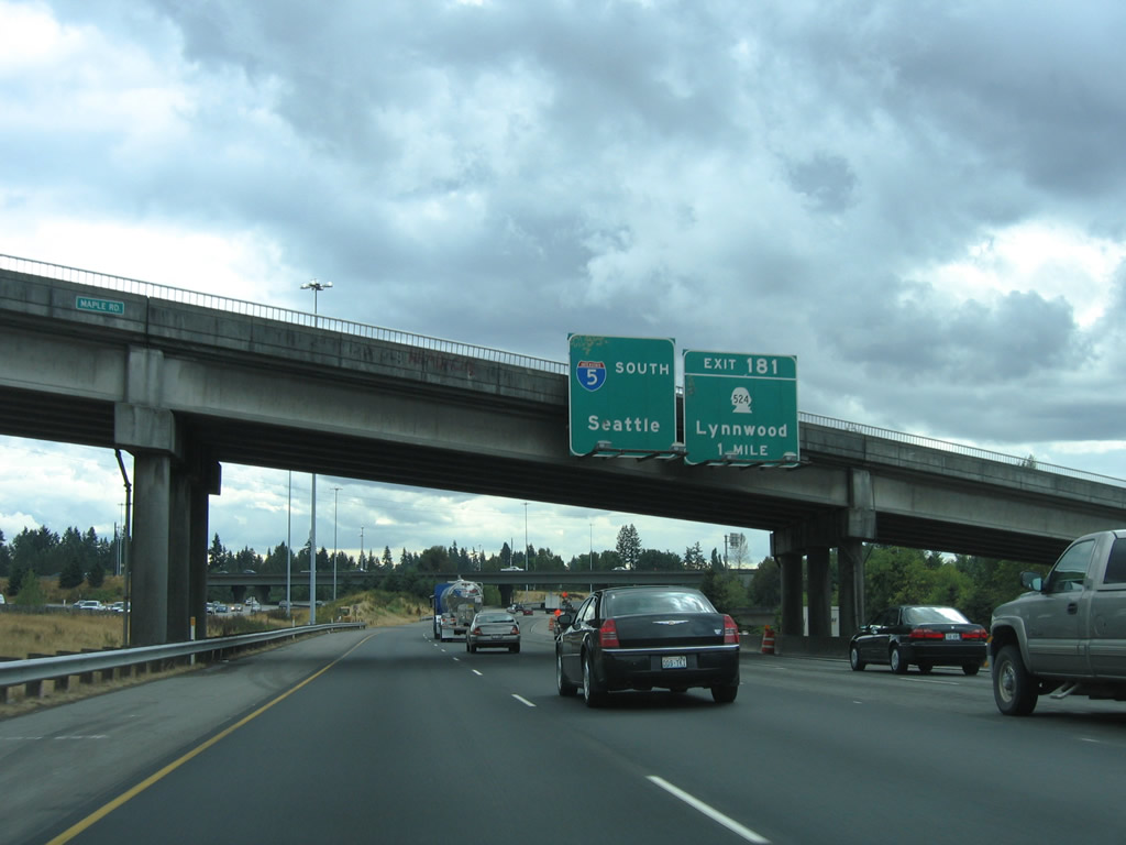
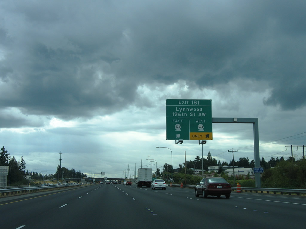
Eliminating a weaving traffic pattern, 2010-12 construction lengthened the off-ramp for Exit 181 with a tunnel below the SR 525 entrance ramp. Exit 181 to SR 524 (196th Street SW) previously departed a mile south of the Maple Road over crossing.
08/30/06
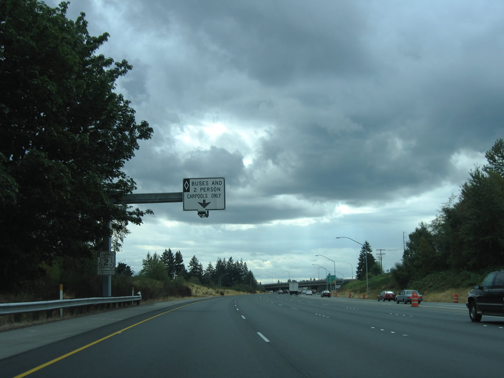
The left lane of Interstate 5 continues with an HOV-2 restriction to the Express Lanes at Shoreline.
08/30/06
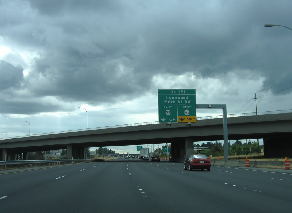
Exit 181 provides separate ramps for SR 524 (196th Street SW) west to Lynwood and east to Alderwood Mall Parkway and Thrashers Corner.
08/30/06
SR 524 connects Interstate 5 with Locust Way south to the city of Brier and Edmonds Community College west of SR 99.
08/30/06
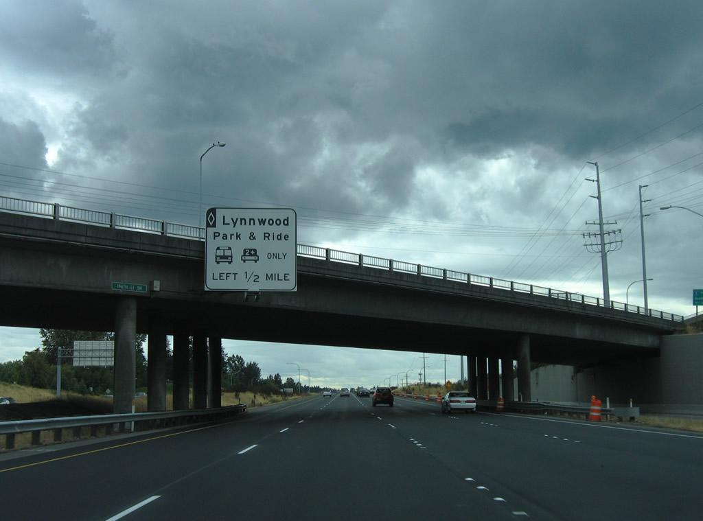
An exit from the HOV lane connects Interstate 5 south with Lynnwood City Center Station at 46th Avenue W south of 200th Street SW.
08/30/06
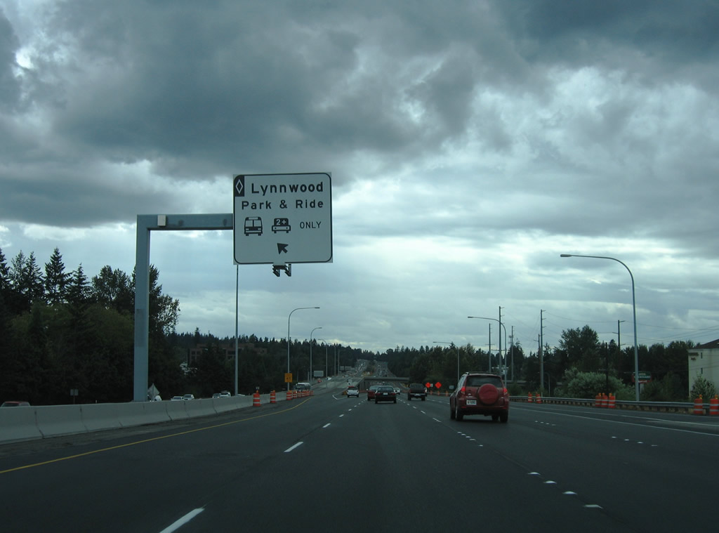
Southbound at Lynnwood City Center Station HOV ramp. A half diamond interchange (Exit 181 A) coincides with the HOV exit between Interstate 5 north and 44th Avenue W.
08/30/06
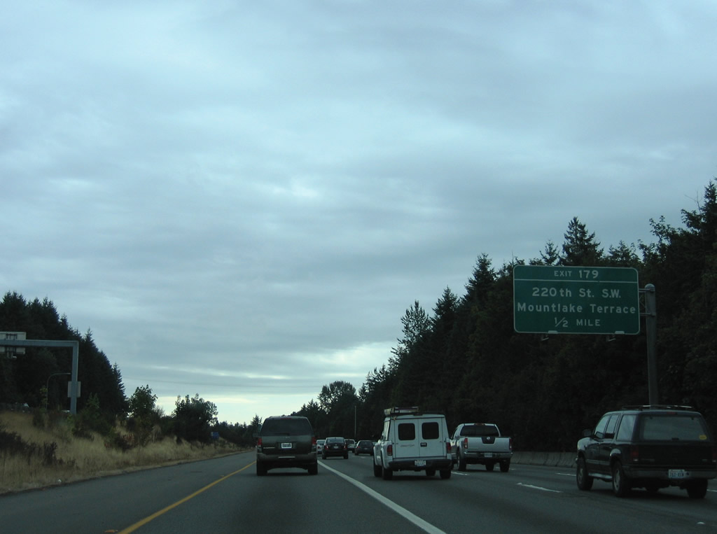
Turning southward past Halls Lake, Interstate 5 continues toward the diamond interchange (Exit 179) with 200th Street SW at Mountlake Terrace.
08/27/06
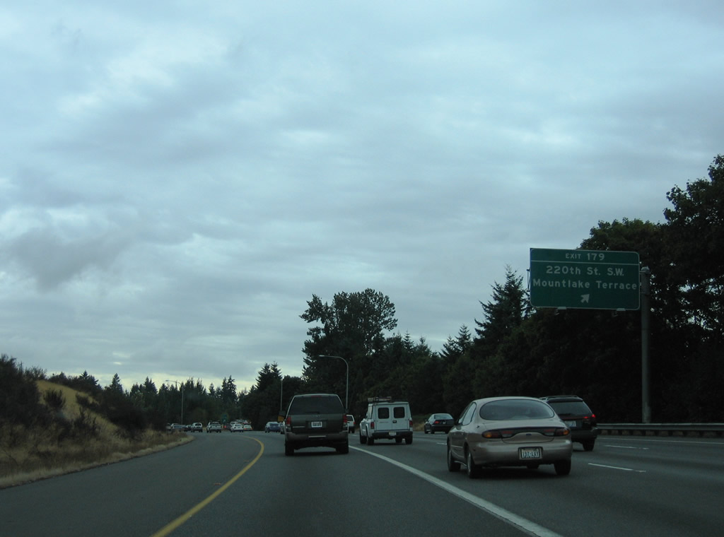
220th Street SW leads to 52nd Avenue W in a residential area to the east of Exit 179 and 9th Avenue S in Edmonds to the west.
08/27/06
Interstate 5 next meets SR 104 at a three quarter cloverleaf interchange (Exit 177). The state route is one of a handful of that utilize Puget Sound ferry crossings to make connections with land-based routes. SR 104 continues west from Edmonds via ferry to Kingston in Kitsap County.
08/30/06
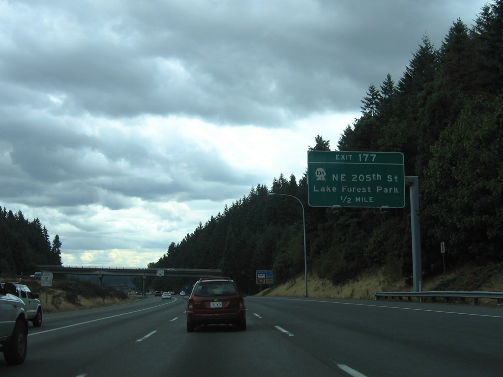
Progressing south toward Exit 177 and SR 104 (NE 205th Street) in Mountlake Terrace. A 31.75 mile long route, SR 104 travels between Lake Forest Park and U.S. 101 south of Discovery Bay.
08/30/06
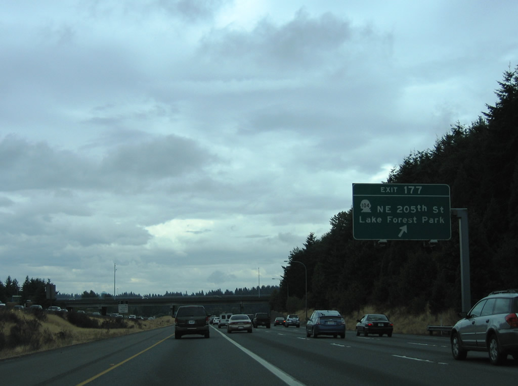
Exit 177 leaves Interstate 5 south for SR 104 ahead of the half diamond interchange with 236th Street SW. SR 104 follows Ballinger Way southeast to Lake Forest Park and SR 522 (Bothell Way). NE 205th Street carries the state route west to Edmonds Way in Edmonds.
08/27/06
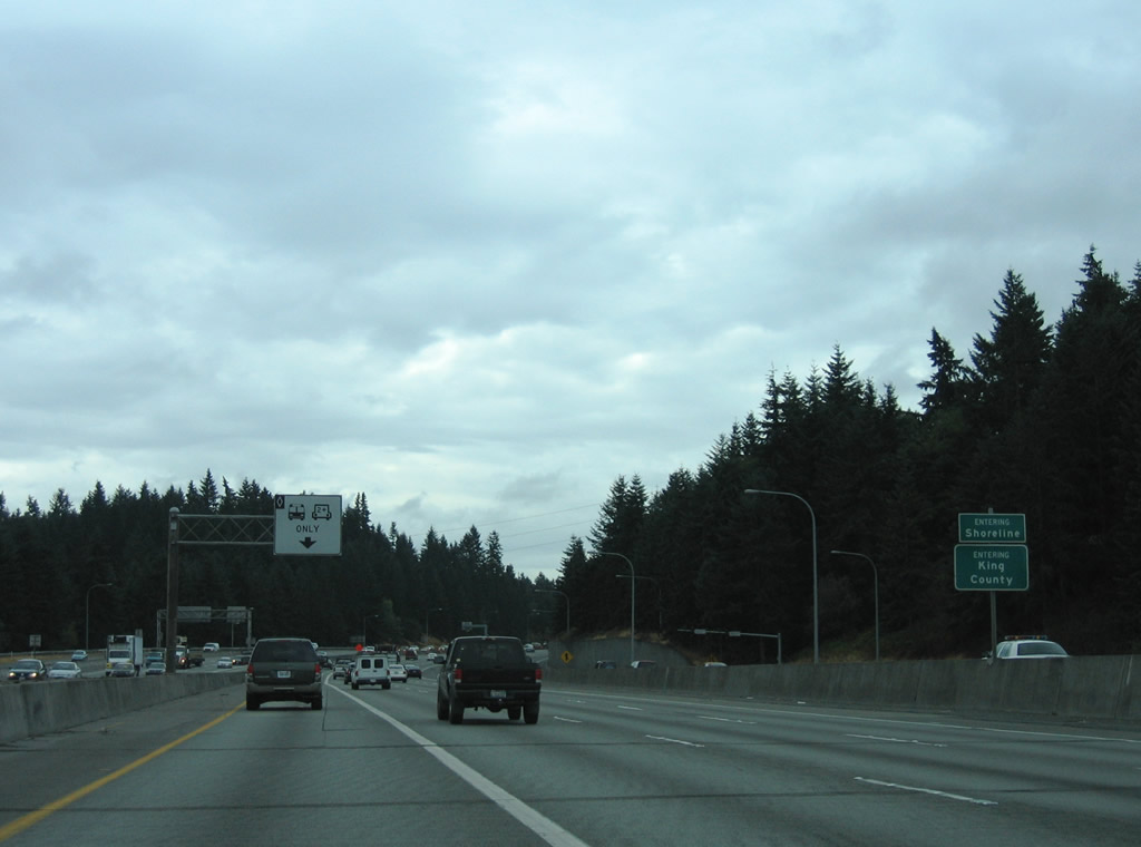
Interstate 5 vacates Snohomish County for King County and the city of Shoreline at the SR 104 under crossing.
08/27/06

References:
Craighead, C. (2021, October 15). Washington closes several rest areas along Interstate 5 indefinitely due to vandalism, trash. Seattle Post-Intelligencer. https://www.seattlepi.com/local/transportation/article/washington-closes-i-5-rest-areas-indefinitely-16535766.php
Photo Credits:
- Brent Ivy: 07/19/23
- AARoads: 08/27/06, 08/30/06
Connect with:
Page Updated Monday September 08, 2025.