
Interstate 5 South - Shoreline to Seattle
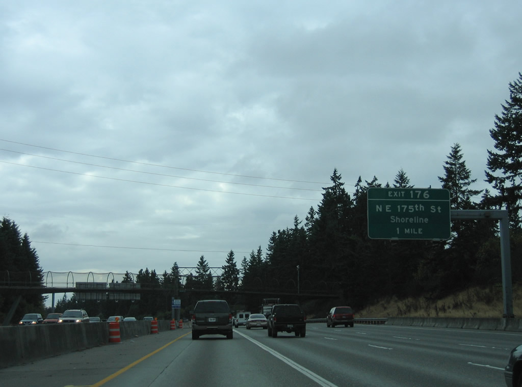
Heading south through Shoreline, Interstate 5 next meets NE 175th Street at a diamond interchange (Exit 176).
08/29/06
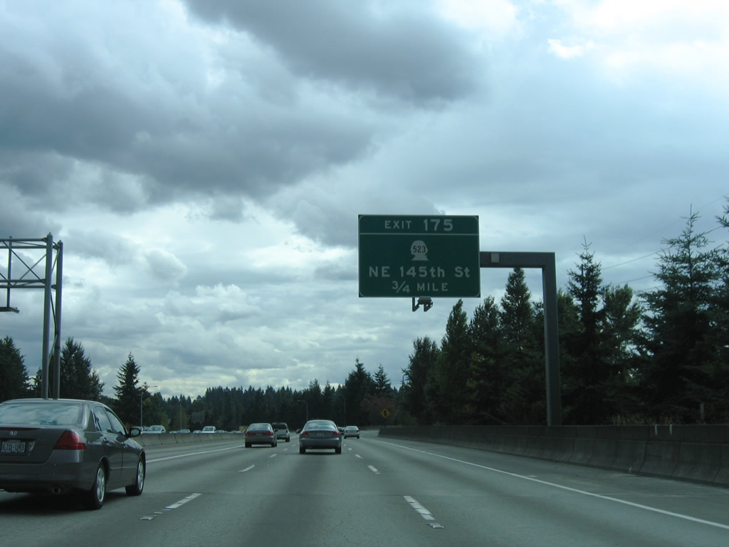
NE 175th Street leads west to Richmond Highlands and east to North City within Shoreline. NE 145th Street (SR 523) follows at the Seattle city line in two miles.
08/30/06
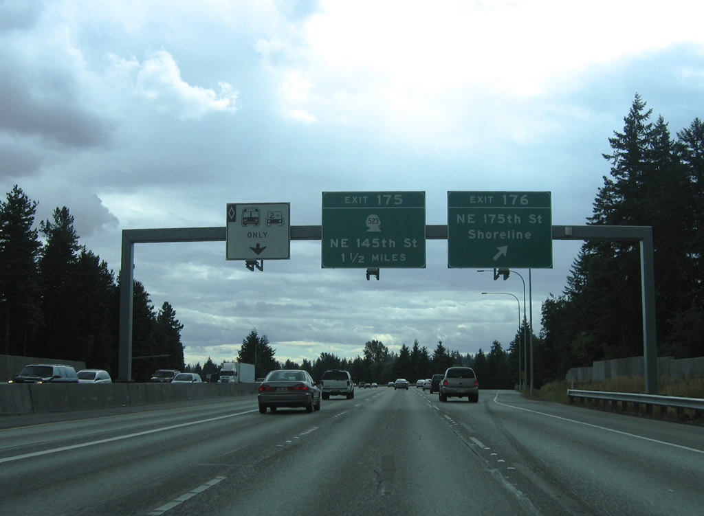
Exit 176 departs Interstate 5 south 1.5 miles from SR 523, a 2.45 mile long route linking SR 99 (Aurora Avenue North) with SR 522 (Lake City Way NE).
08/30/06
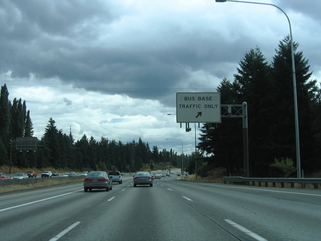
Interstate 5 south enters a diamond interchange for the Metro Transit North Base next. Only transit employees are permitted to use these restricted ramps.
08/30/06
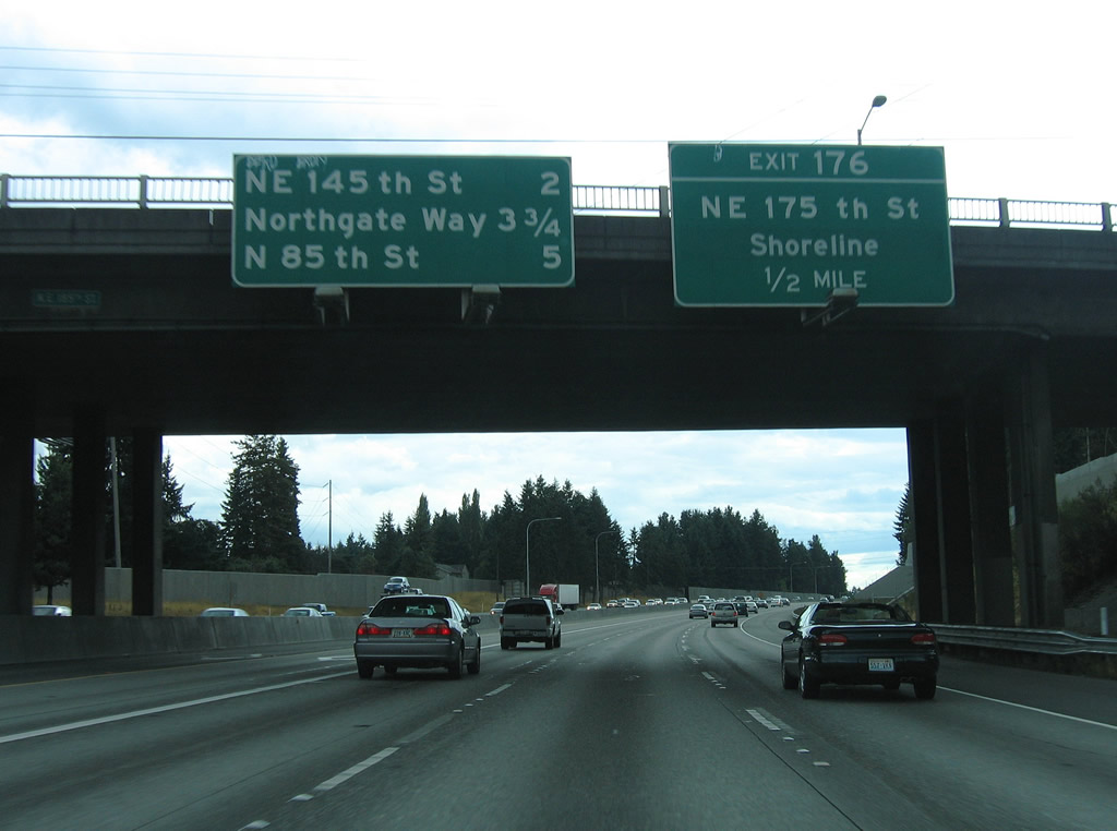
SR 523 straddles the Shoreline and Seattle city line along NE 145th Street west from Exit 175 to Bitter Lake and Parkwood, and east from I-5 to Paramount Park and Kenwood.
08/30/06
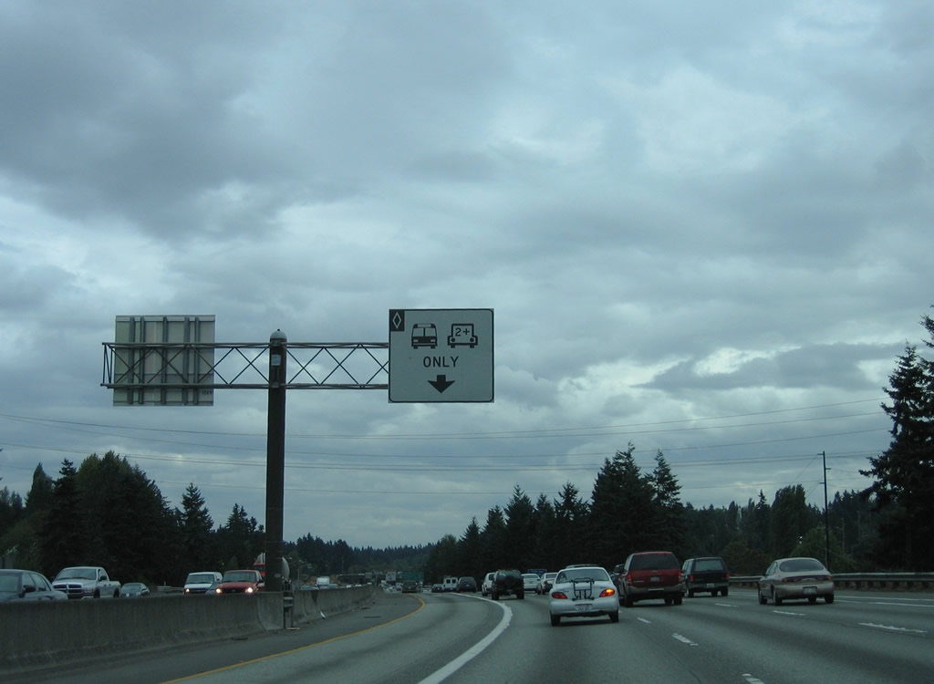
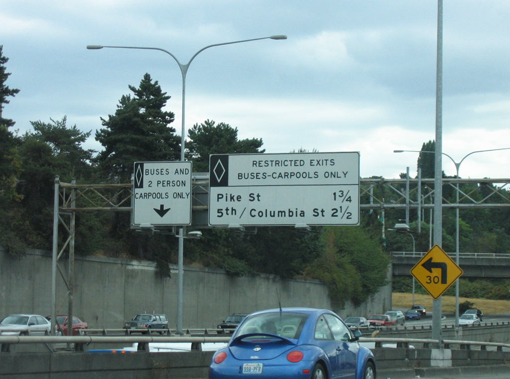
The left lane remains restricted to HOV-2 traffic.
08/29/06
Exit 175 is a modified diamond interchange between Interstate 5 and NE 145th Street. Ramps along the east side tie into parallel 5th Avenue N at Paramount Park and Jackson Park Golf Course.
08/30/06
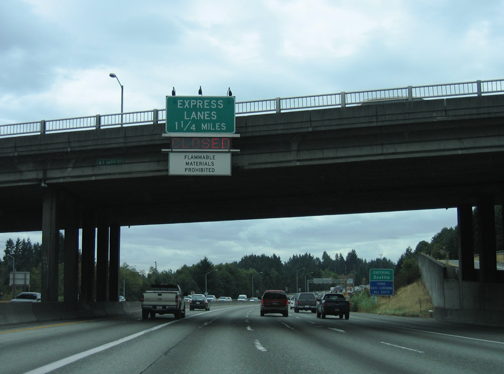
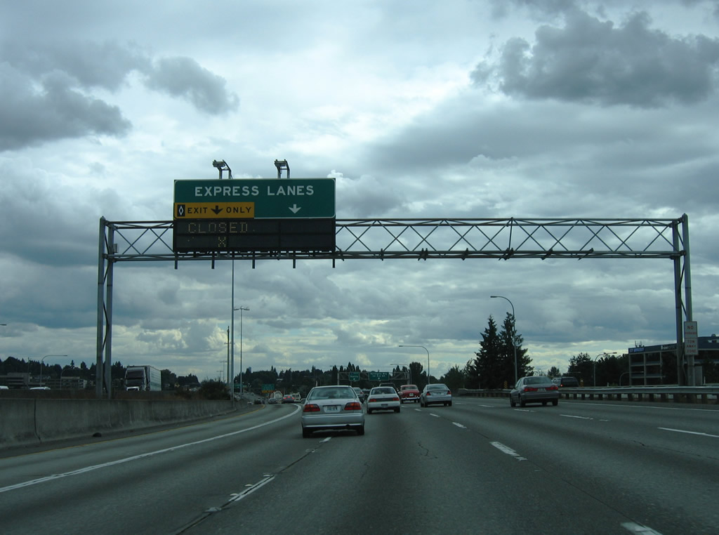
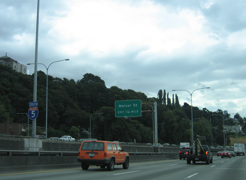
Separating from the freeway south of the Seattle city line at SR 523 (N 145th Street) are the Interstate 5 Express Lanes. The reversible roadway extends southward to the Columbia Street ramp at Seattle city center.
08/29/06
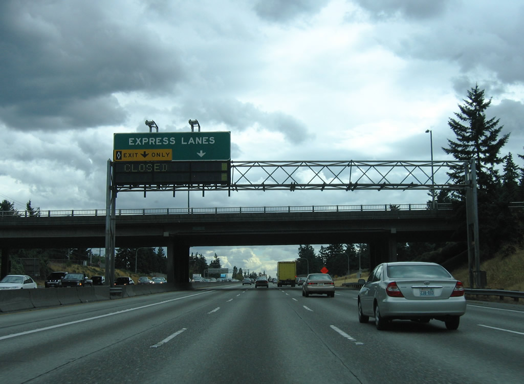
1.2 miles ahead of the Express Lanes, another half diamond interchange (Exit 174) adds traffic to I-5 south from NE 130th Street by Northacres Park. The reversible roadway shifts direction on a weekly schedule to aid in peak hour traffic or during special events.
08/30/06
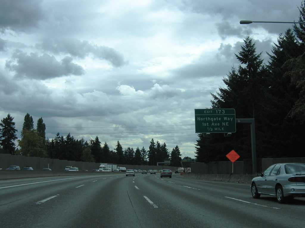
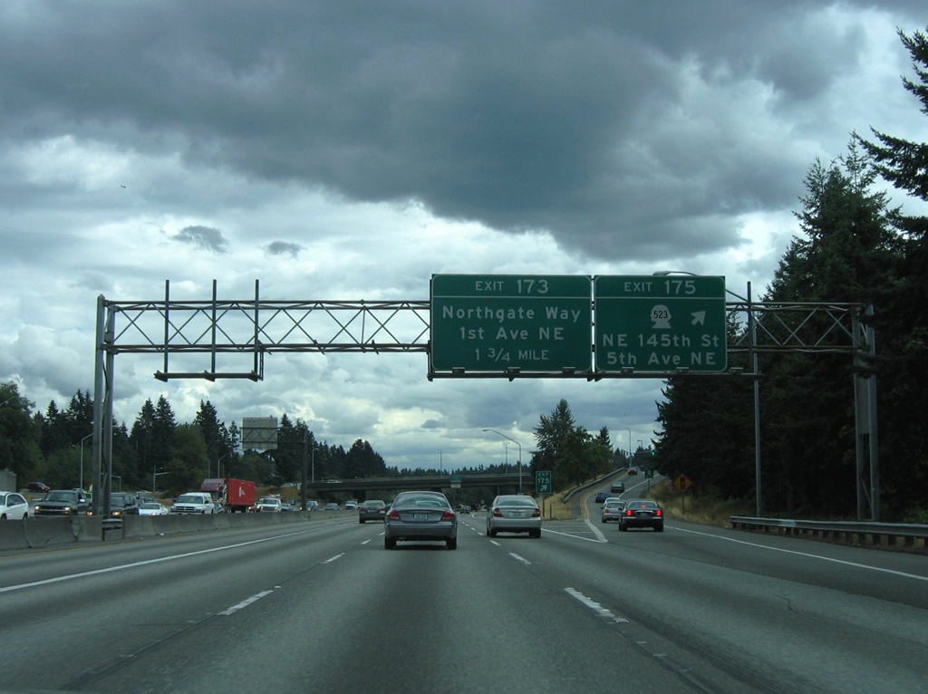
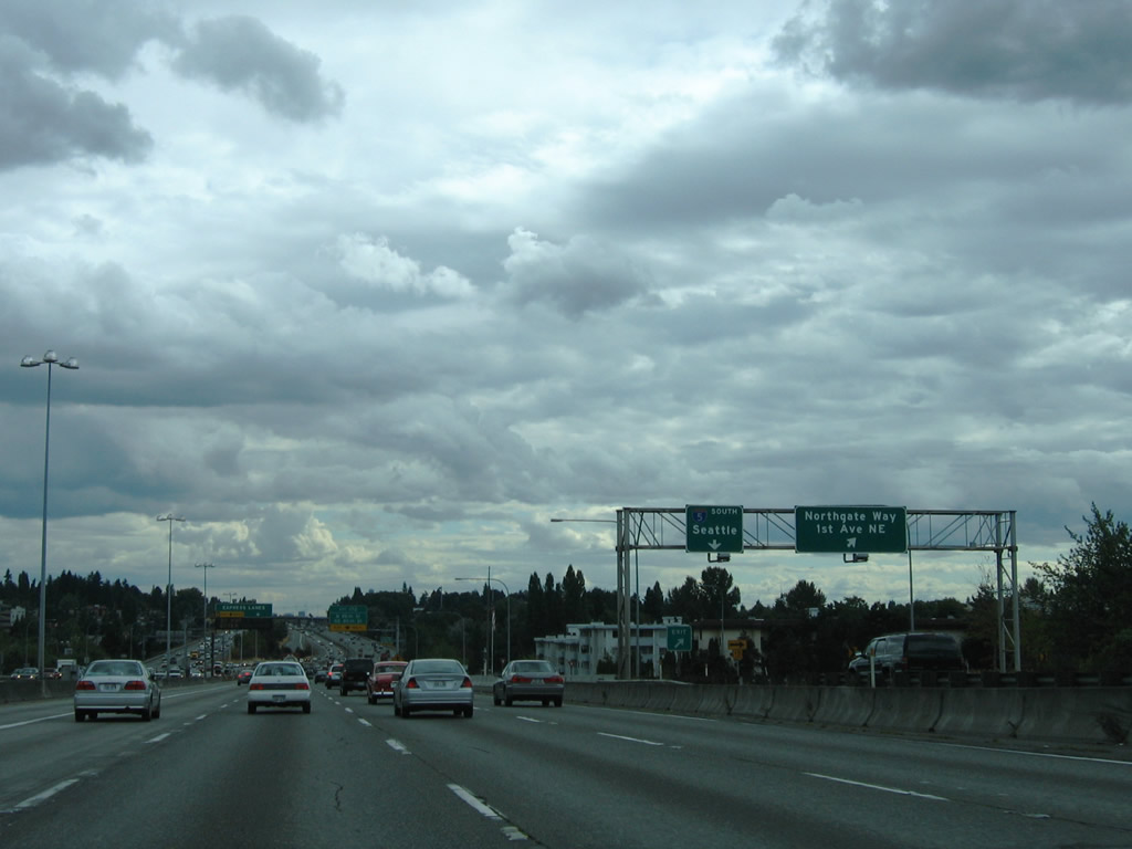
Exit 173 leaves I-5 south in a half mile for Northgate Way. Northgate Way runs southwest to SR 99 (N Aurora Avenue) at North Park and east to SR 522 at Victory Heights.
08/30/06
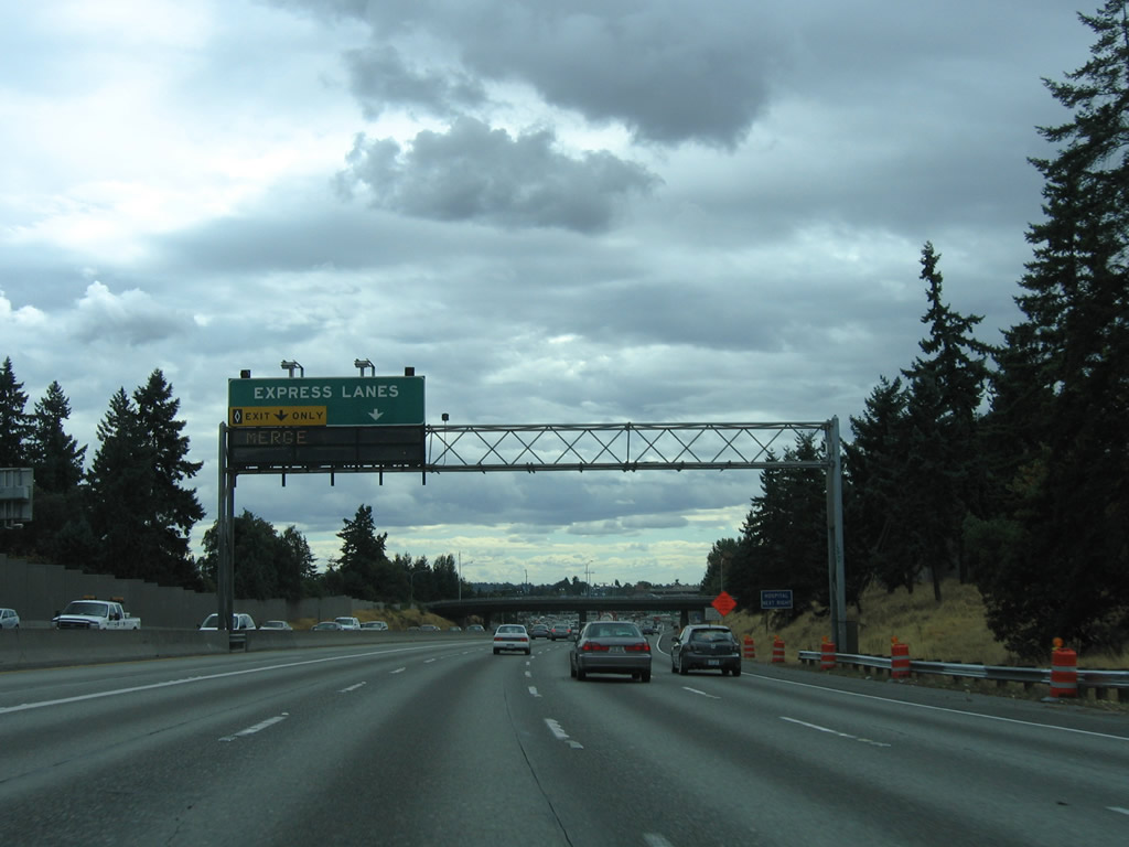
The Interstate 5 Express Lanes commence just south of the N 107th Street entrance ramp at Northgate and run south to the Mercer Street interchange (Exit 167). Ingress ramps join the reversible lanes from Lake City Way, Ravenna Boulevard, and NE 42nd Street between Northgate and Capitol Hill.
08/30/06
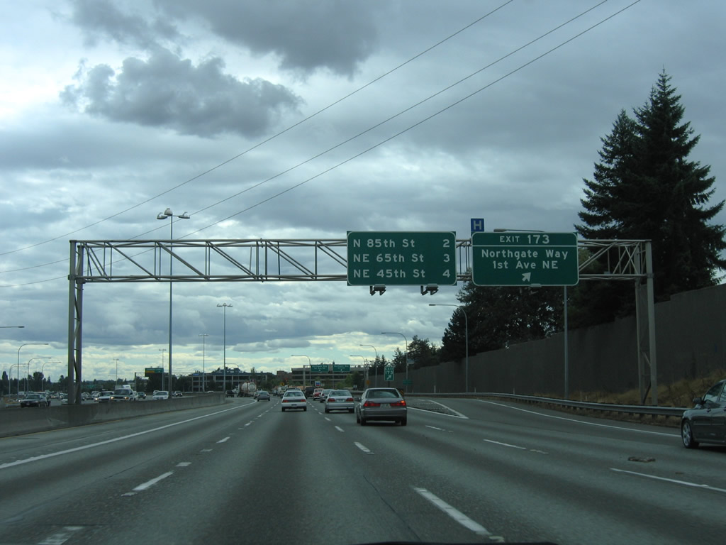
The three quarter cloverleaf interchange joining I-5 and Northgate Way utilizes connections with adjacent 1st Avenue NE and Corliss Avenue NE. Exit 173 to Meridian Avenue south leads to North Seattle Community College.
08/30/06
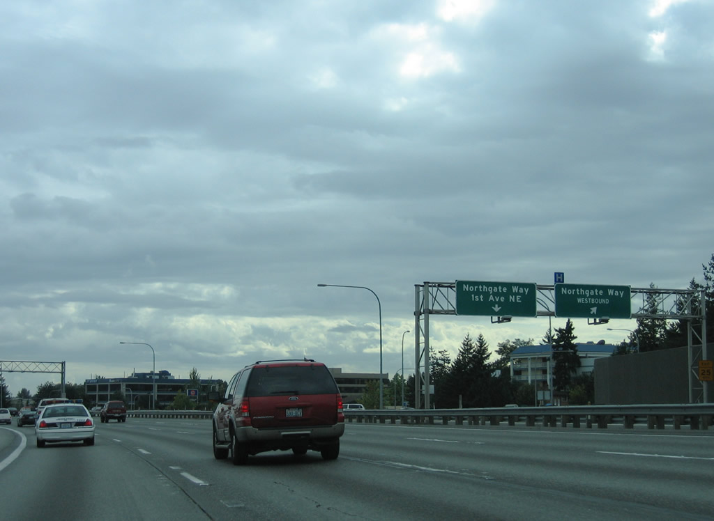
A collector distributor roadway at Exit 173 links with the respective ramps to Northgate Way. Northgate Station is along the southeast quadrant of Northgate Way and 1st Avenue NE. The former mall has a dedicated ramp from the I-5 Express Lanes northbound.
08/29/06
HOV-2 motorists are permitted to use the Interstate 5 Express Lanes during their southbound periods of operation. All others must remain on the general purpose lanes.
08/30/06
A loop ramp departs the c/d roadway at Exit 173 onto Corliss Avenue N to Northgate Way east.
08/30/06
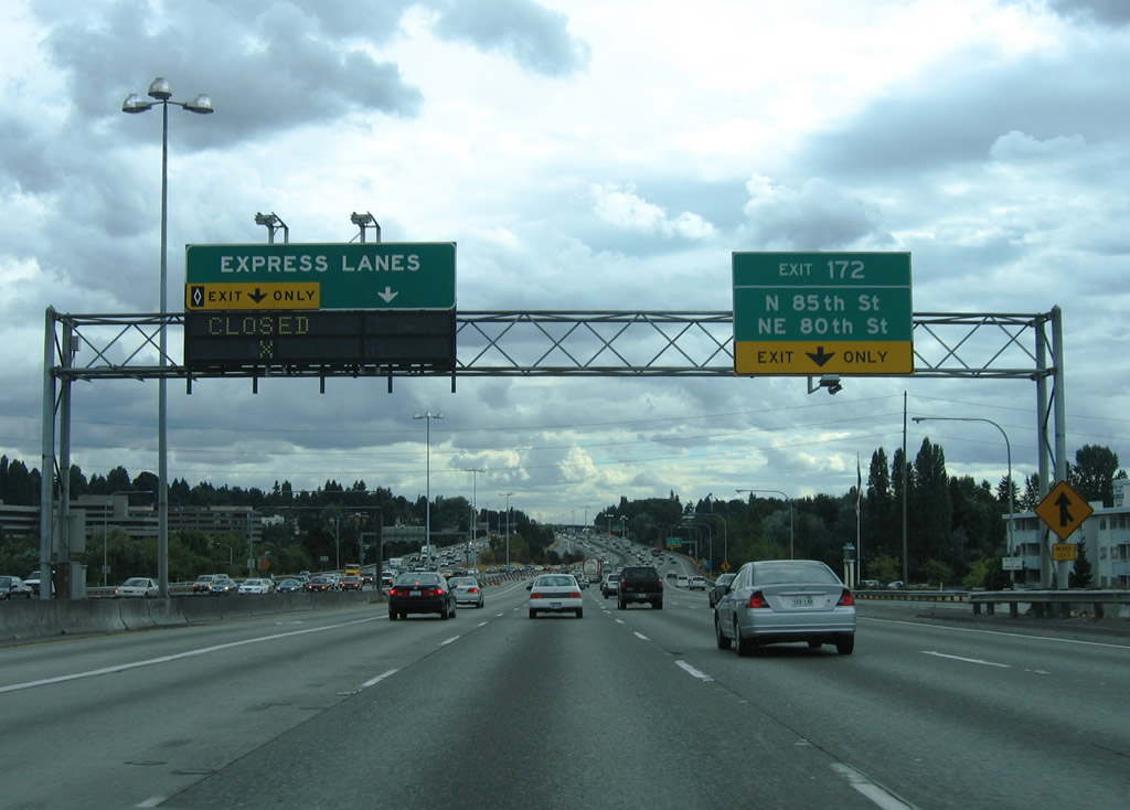
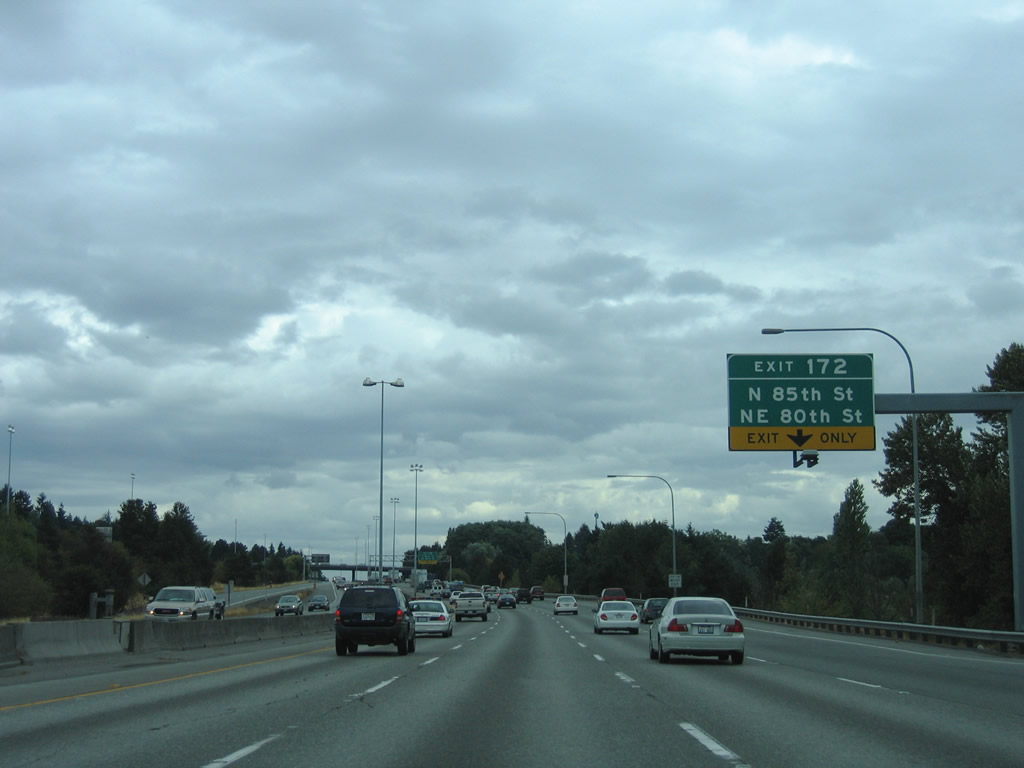
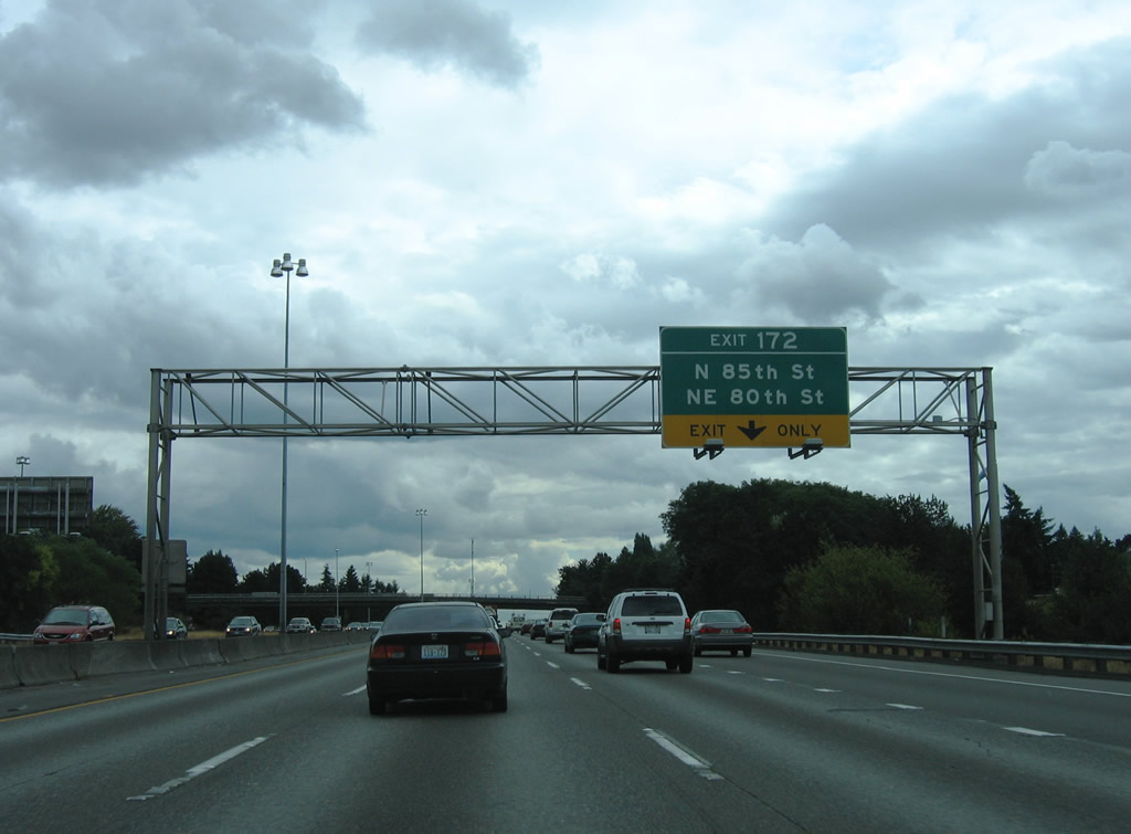
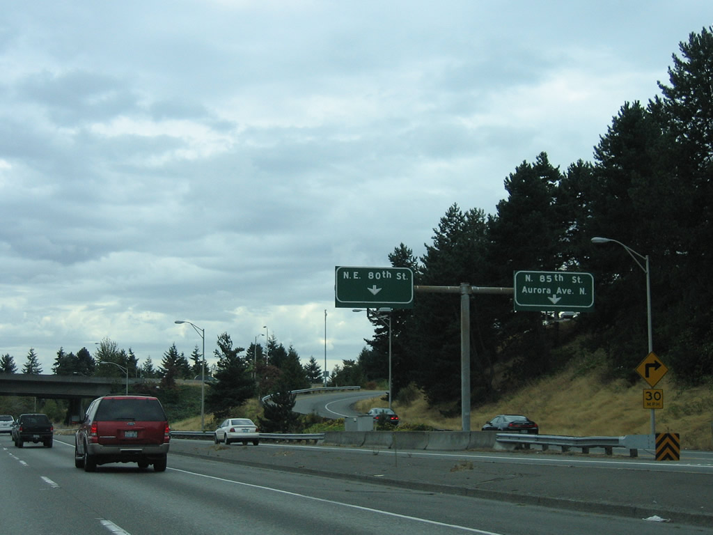
Continuing south, separate ramps connect I-5 with NE 85th Street west and NE 80th Street at Exit 172.
08/30/06
The merging c/d roadway from Exit 173 forms an auxiliary lane to Exit 172. NE 85th Street stems west from Interstate 5 to Greenwood, Loyal Heights and Golden Gardens Park on Shilshole Bay.
08/29/06
NE 80th Street travels two blocks to the south of N 85th Street through the Green neighborhood west of Interstate 5.
08/30/06
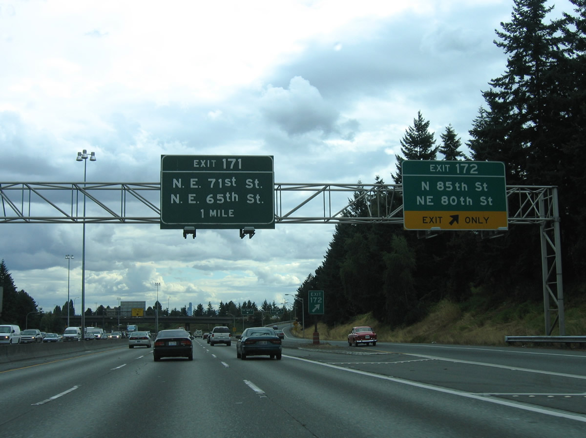
NE 80th Street provides access to SR 522 (Lake City Way), Maple Leaf, and Wedgwood east of I-5. SR 522 south ends at a wye interchange (Exit 171) with Interstate 5 next.
08/30/06
08/29/06
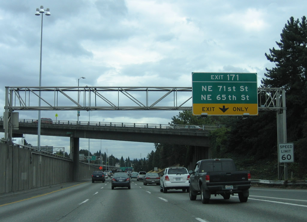
Exit 171 connects I-5 south with 6th Avenue NE ahead of NE 70th Street east of Green Lake.
08/29/06
5th Avenue NE passes over the freeway where Exit 171 departs for 6th Avenue NE at NE 72nd Street. Motorists taking Exit 171 must navigate through the street grid to reach NE 65th Street west to Green Lake and east to Ravenna.
08/30/06
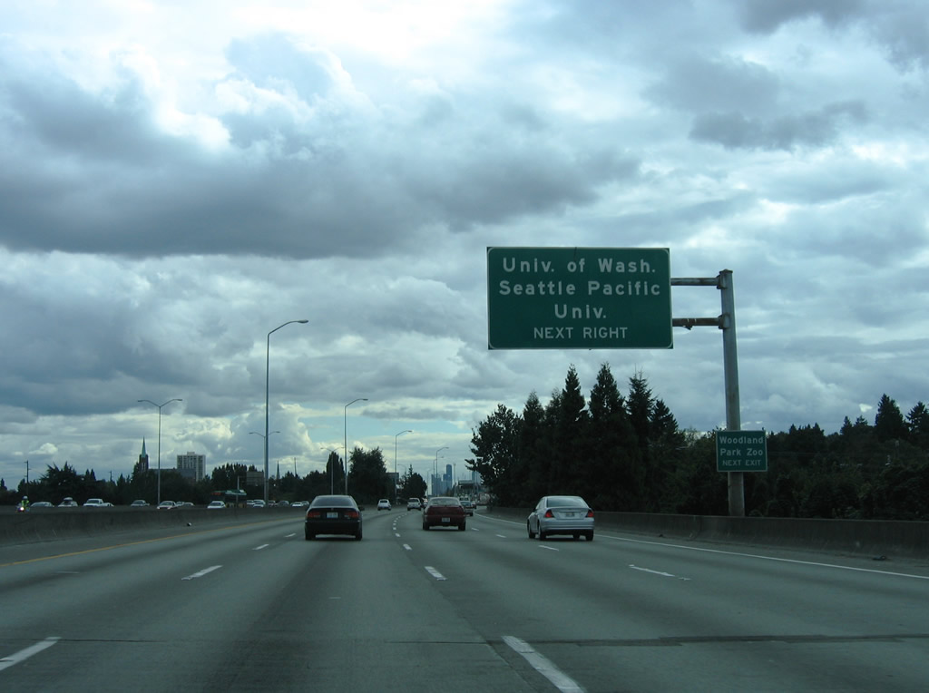
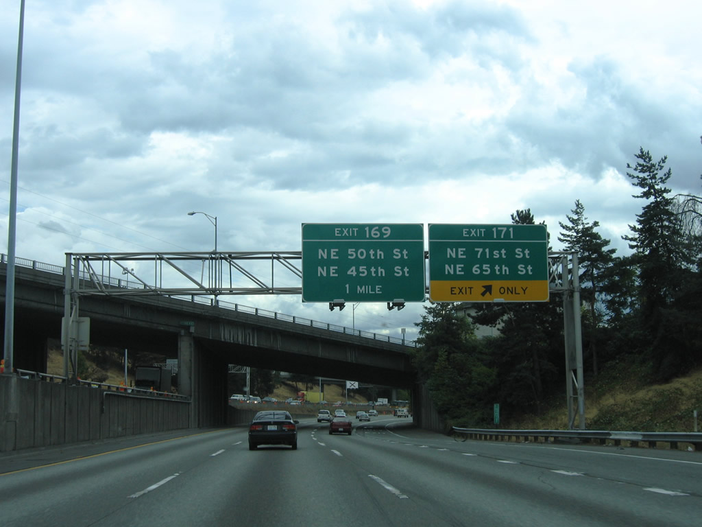
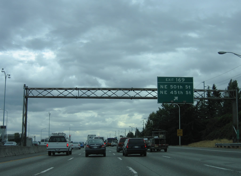
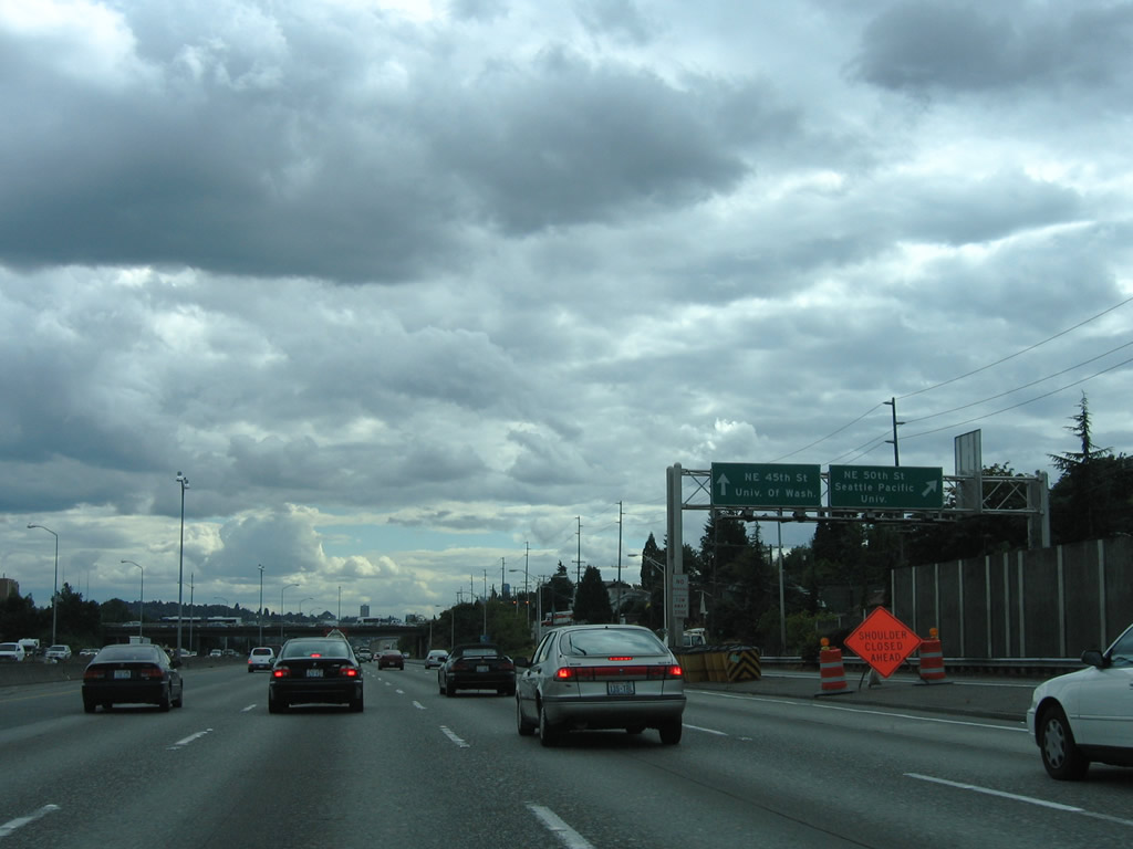
Interstate 5 rises onto a viaduct between Weedin Place and Ravenna Boulevard near the Meridian neighborhood. Interests to Woodland Park Zoo and Seattle Pacific University are directed onto NE 50th Street west toward Fremont. NE 45th Street follows as the route to the University of Washington campus on Union Bay.
08/30/06
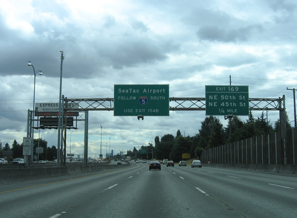
A collector distributor roadway at Exit 169 links to NE 50th Street by University Heights and NE 45th Street to the University District. Both ramps rise onto parallel 5th Avenue NE to make the connections.
08/30/06
NE 45th Street becomes a part of SR 513 at University Village. SR 513 is a 3.35 mile spur northeast from SR 520 to NE 65th Street at Warren G. Magnuson Park.
08/29/06
An entrance ramp from Ravenna Boulevard emerges from below Interstate 5, providing access to both the general travel lanes and Express Lanes roadway.
08/30/06
NE 50th and 45th Streets lead west to the Meridian and Wallingford neighborhoods and east to the University section of Seattle.
08/30/06
Interstate 5 crosses Lake Washington Ship Canal, a waterway linking Lake Union and Portage Bay. The Express Lanes descend onto a deck below the eight lane mainline.
08/30/06
Traffic congestion is common along the stretch of I-5 south to Exit 168 B / SR 520 due to the "Mercer Street Merge". This is due to a weaving traffic pattern between the left entrance ramp from SR 520 west and the following exit ramp to the Mercer Street on the right.
08/29/06
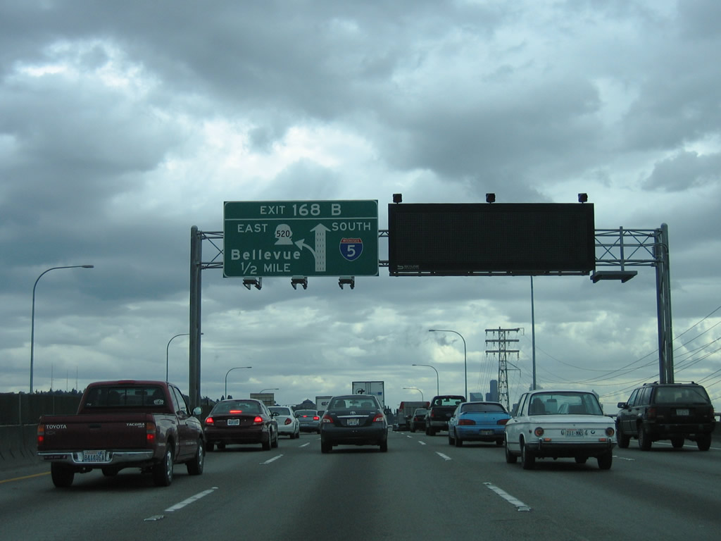
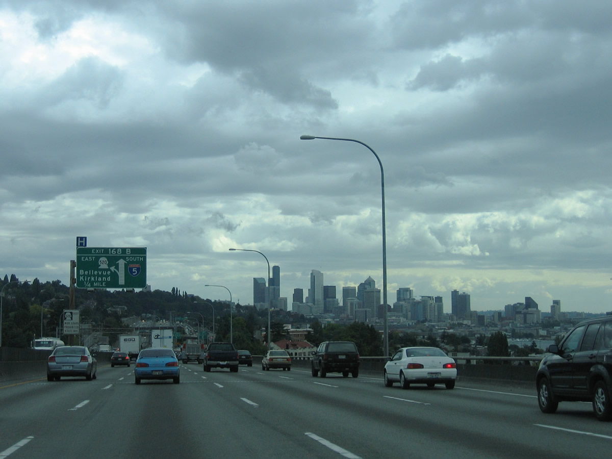
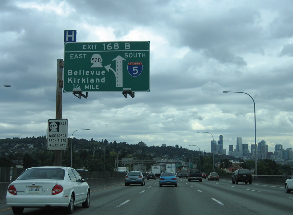
SR 520 heads east from Exit 168 B through Montlake to Lake Washington. Doubling as a commuter route to the high-tech business centers east of the Lake, the 12.82 mile long route is a limited access highway from Interstate 5 to Bellevue and Redmond.
08/29/06
Left Exit 168 B sinks below the Express Lanes and I-5 northbound roadway to join SR 520 east ahead of Montlake and the University of Washington area.
08/29/06
Major reconstruction of SR 520 got underway in April 2011. Completed in 2014, work revamped the freeway between I-5 and I-405, resulting in a new Evergreen Point Floating Bridge across Lake Washington. This work was partially funded by the reinstitution of tolls for the bridge on December 29, 2011 (AARoads Wiki, 2023).
08/29/06
SR 99 (N Aurora Avenue) spans Lake Union to the west across the George Washington Memorial Bridge which was built in 1932.
08/30/06
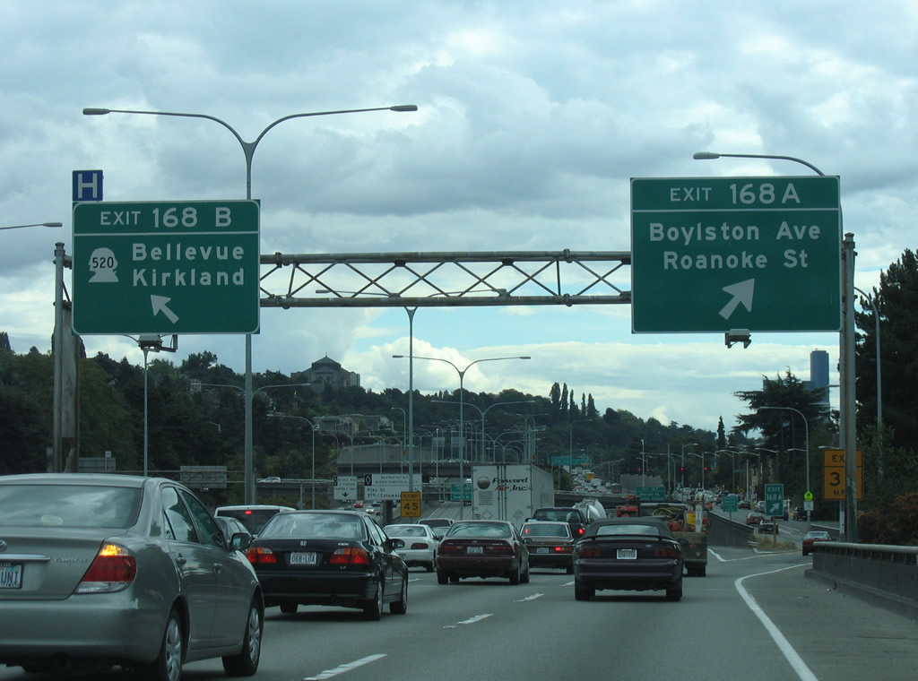
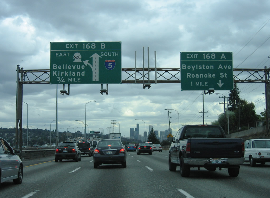
Exit 168 A departs Interstate 5 from the south end of the Lake Washington Ship Canal bridge to join parallel Boylston Avenue south ahead of Roanoke Street at the North Broadway community. Exit 168 B leaves simultaneously for SR 520 east to Kirkland, Bellevue and Redmond.
08/30/06
The next two exits of the Interstate 5 Express Lanes southbound are for Pike Street and 5th Street. Underway from August 2021 to May 2025, $68 million in road work at the exchange with SR 520 added a dedicated flyover for HOV-3 traffic between the Express Lanes and SR 520 (WSDOT, 2025).
08/29/06
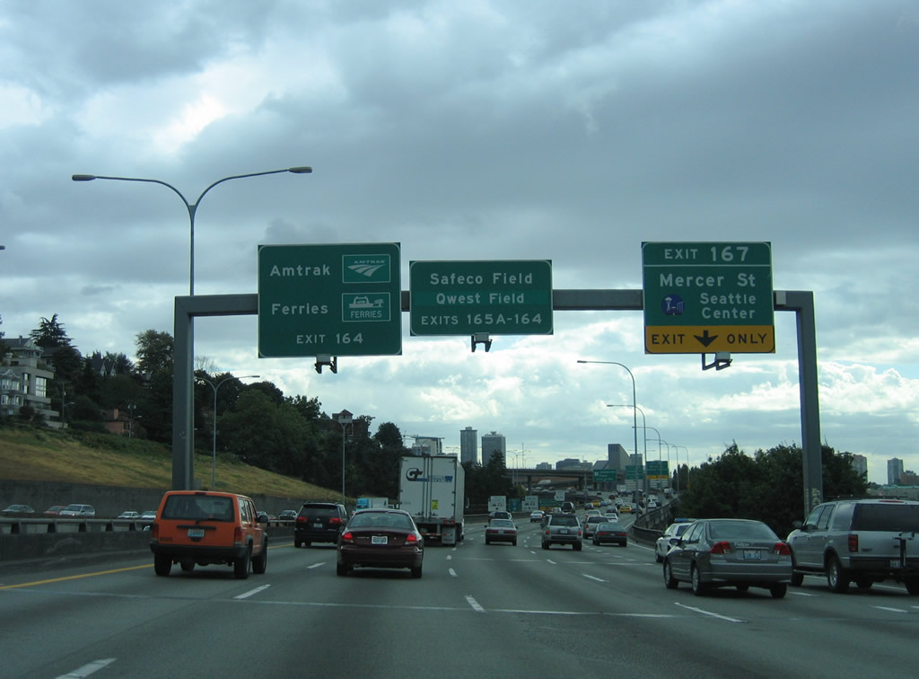
The Mercer Street connector provides direct access to Mercer Street at Fairview Avenue. Mercer Street extends west to Seattle Center, which is home to the Space Needle, Climate Pledge Arena (former home of the NBA Seattle Supersonics), Pacific Science Center, and the Seattle Rep theatre.
08/30/06
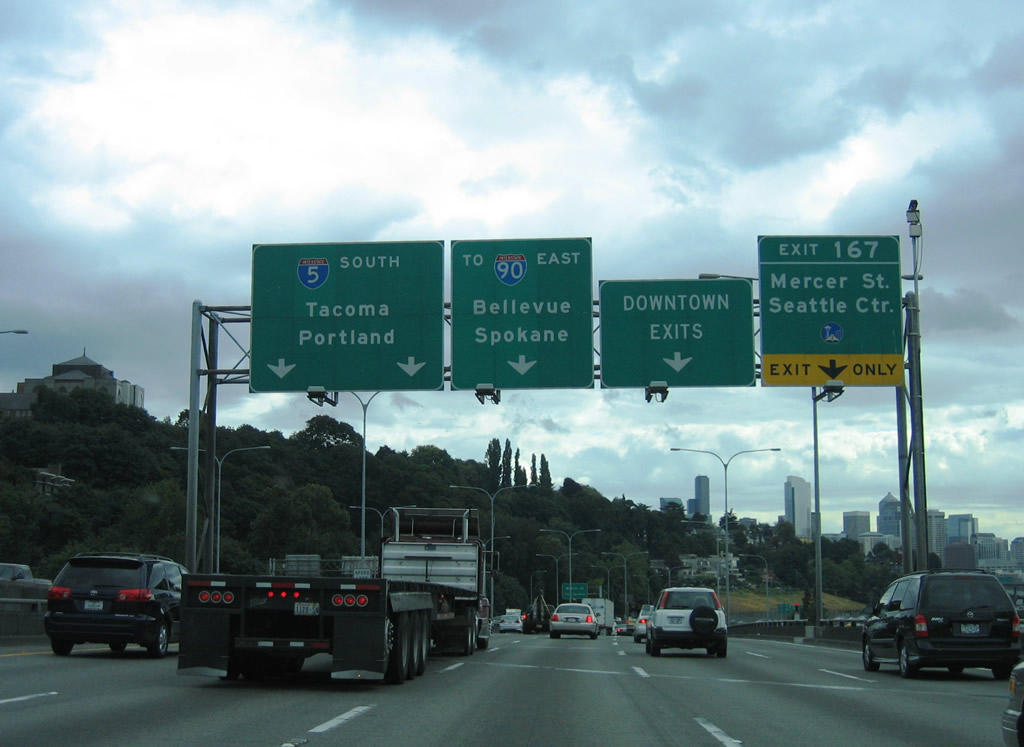
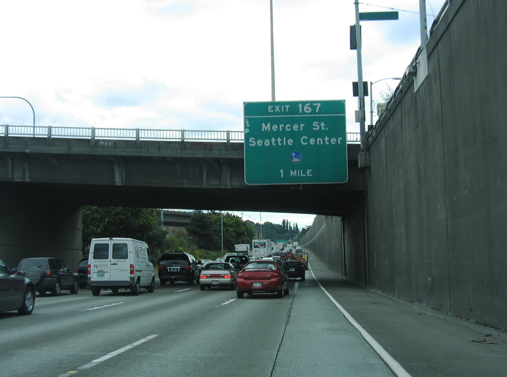
I-5 ascends onto a viaduct with five southbound lanes west of Capitol Hill. A lane drop occurs at Exit 167 for Mercer Street while the freeway mainline progresses toward Downtown Seattle and Interstate 90.
08/29/06
The exit for Mercer Street from the southbound Express Lanes drops below grade and combines with Exit 167 ahead of the signalized intersection with Fairview Avenue.
08/29/06
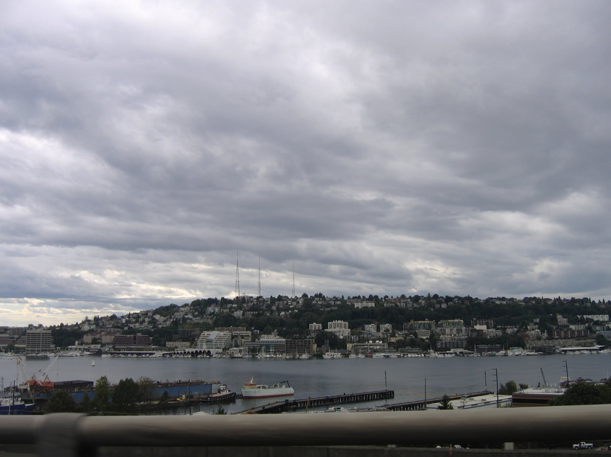
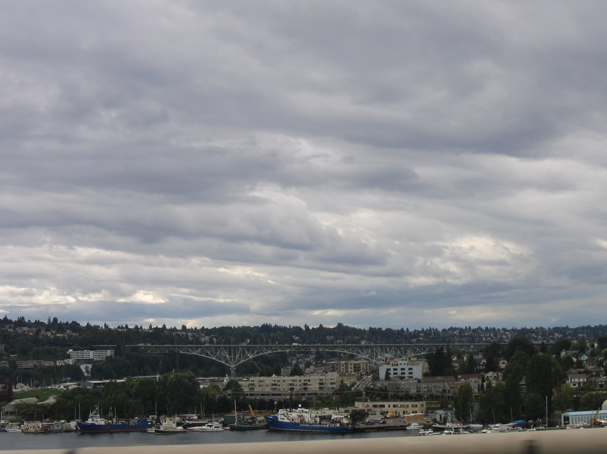
Westward view of Lake Union and Queen Anne Hill from the Interstate 5 viaduct at Blaine Street.
08/30/06
Construction on the Mercer Corridor Project began in 2010 that rebuilt the Mercer Street corridor west from I-5. The eastbound flowing street was redesigned into a six lane boulevard through the South Lake Union neighborhood west toward Seattle Center. Broad Street, a 1950s-era expressway linking Valley Street west with Seattle Center, was removed as part of the project to rebuild the street grid surrounding Mercer Street and SR 99 (N Aurora Avenue).
08/29/06
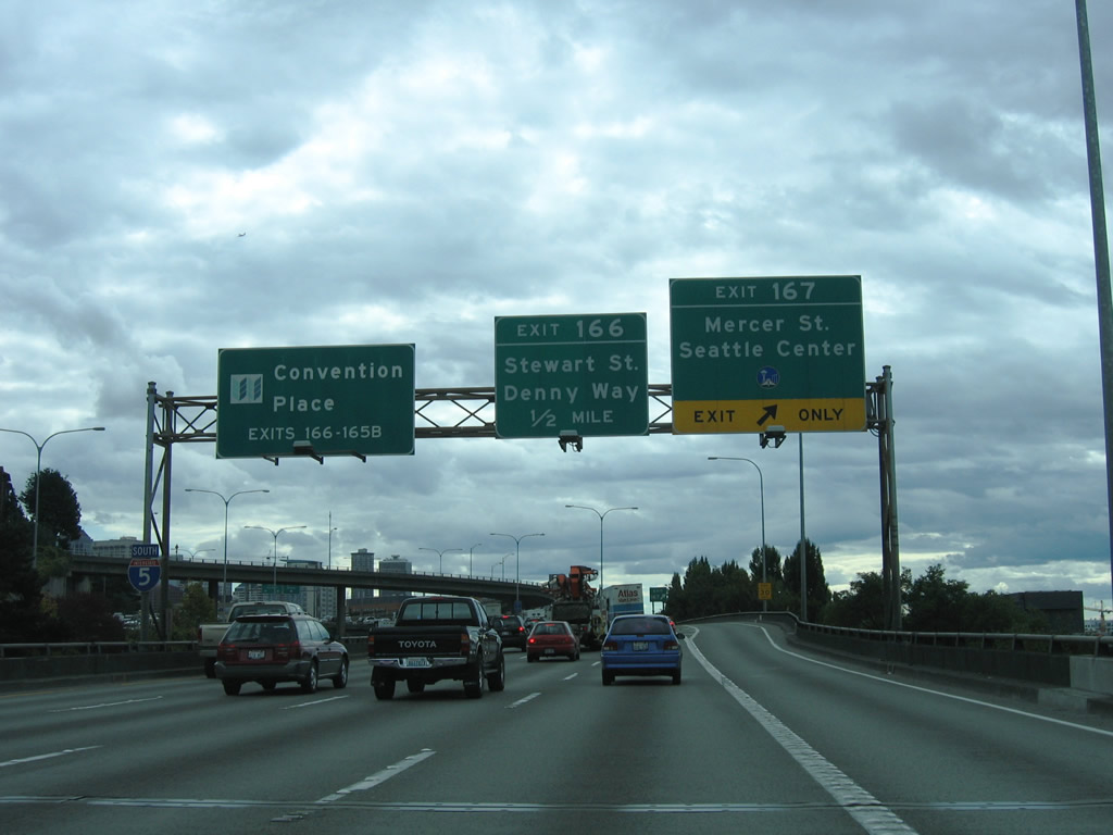
Exit 167 parts ways with the Interstate 5 viaduct ahead of the Lakeview Boulevard overpass. Mercer Street replaced Valley Street as the gateway into South Lake Union. A half diamond interchange (Exit 166) with Stewart Street follows on I-5 south in a half mile.
08/30/06
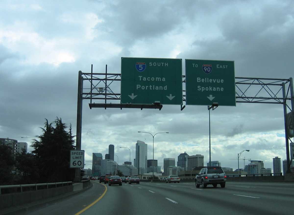
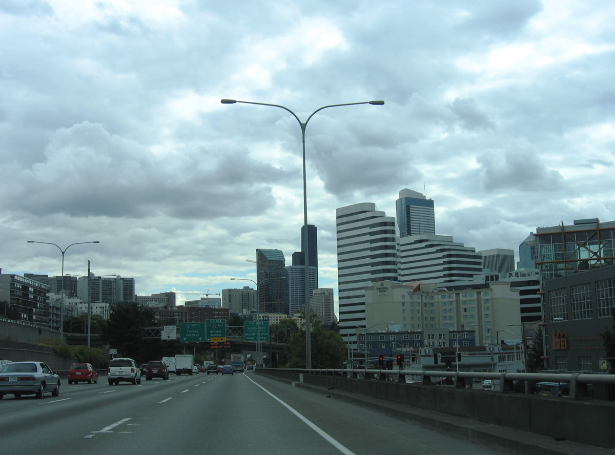
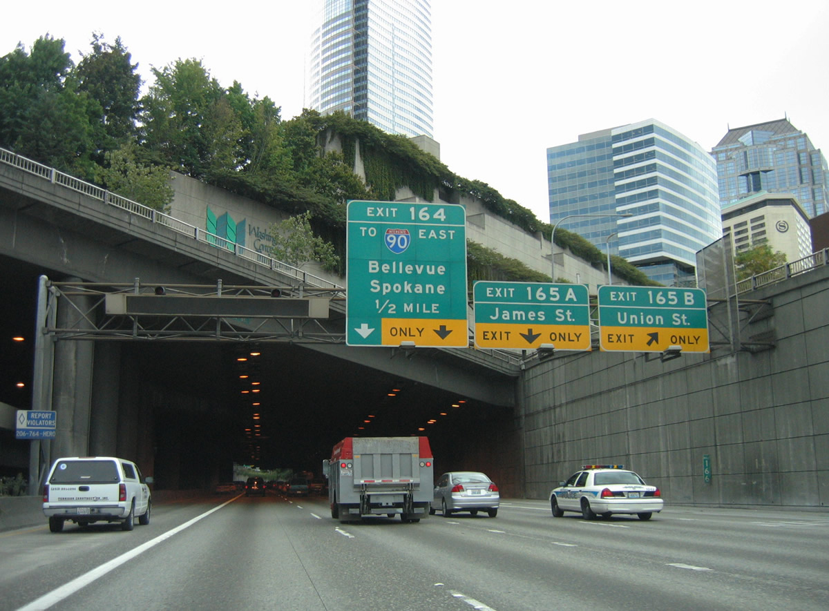
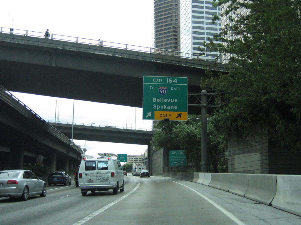
Exit 164 constitutes a 1.65 mile long collector distributor roadway that eventually leads to Interstate 90 east to Mercer Island and Bellevue. The local roadway also provides access to the various ramps south of Downtown Seattle.
08/29/06
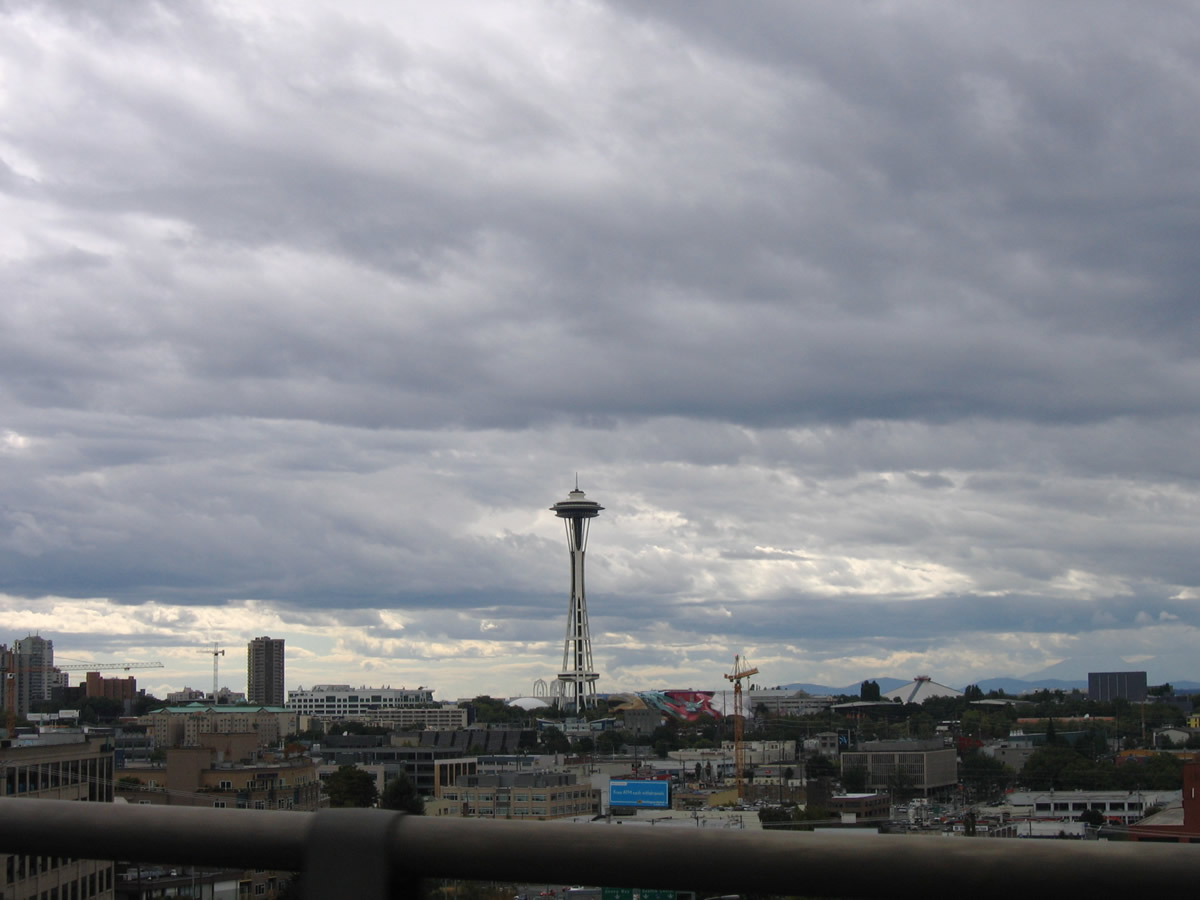
The Seattle Space Needle rising from Seattle Center comes into view west of the Interstate 5 viaduct near Mercer Street.
08/30/06
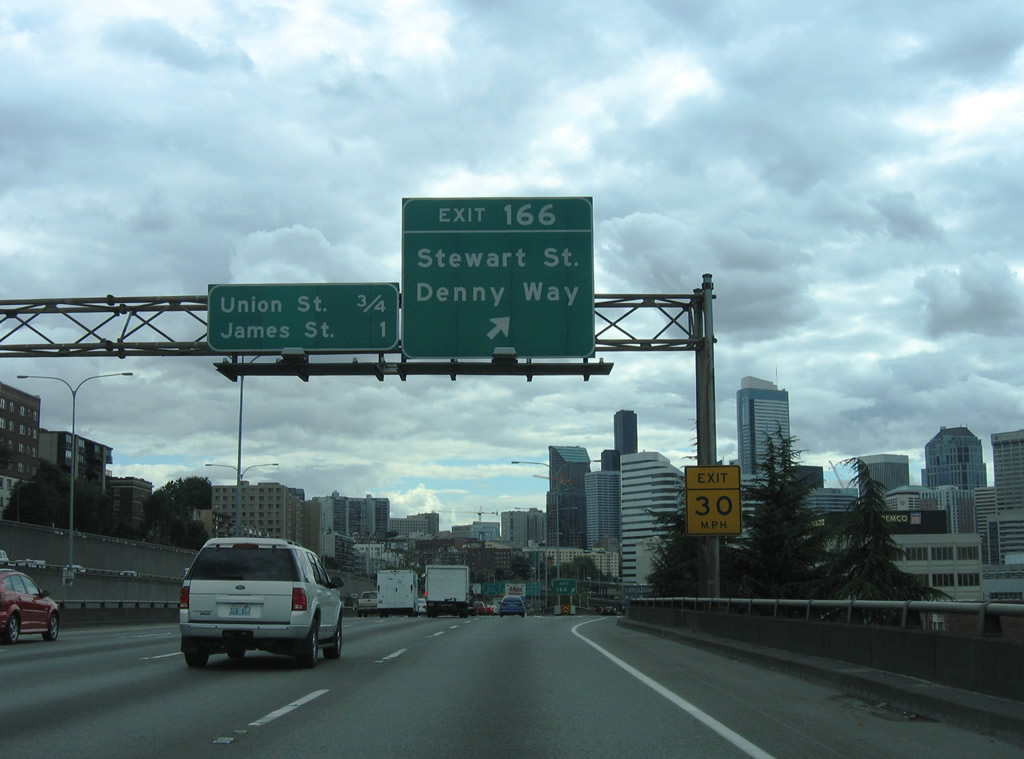
Stewart Street angles southwest from Exit 166 to Denny Way and Pike Place in Downtown Seattle. Denny Way heads west to Belltown and east to Capitol Hill from Interstate 5.
08/30/06
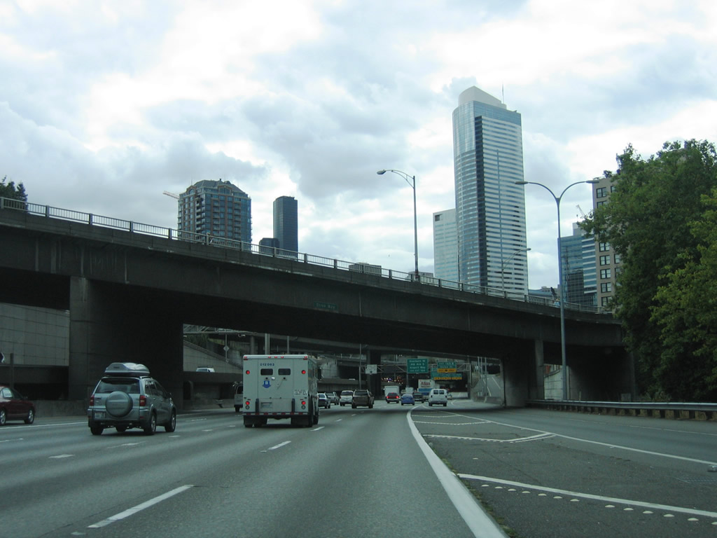
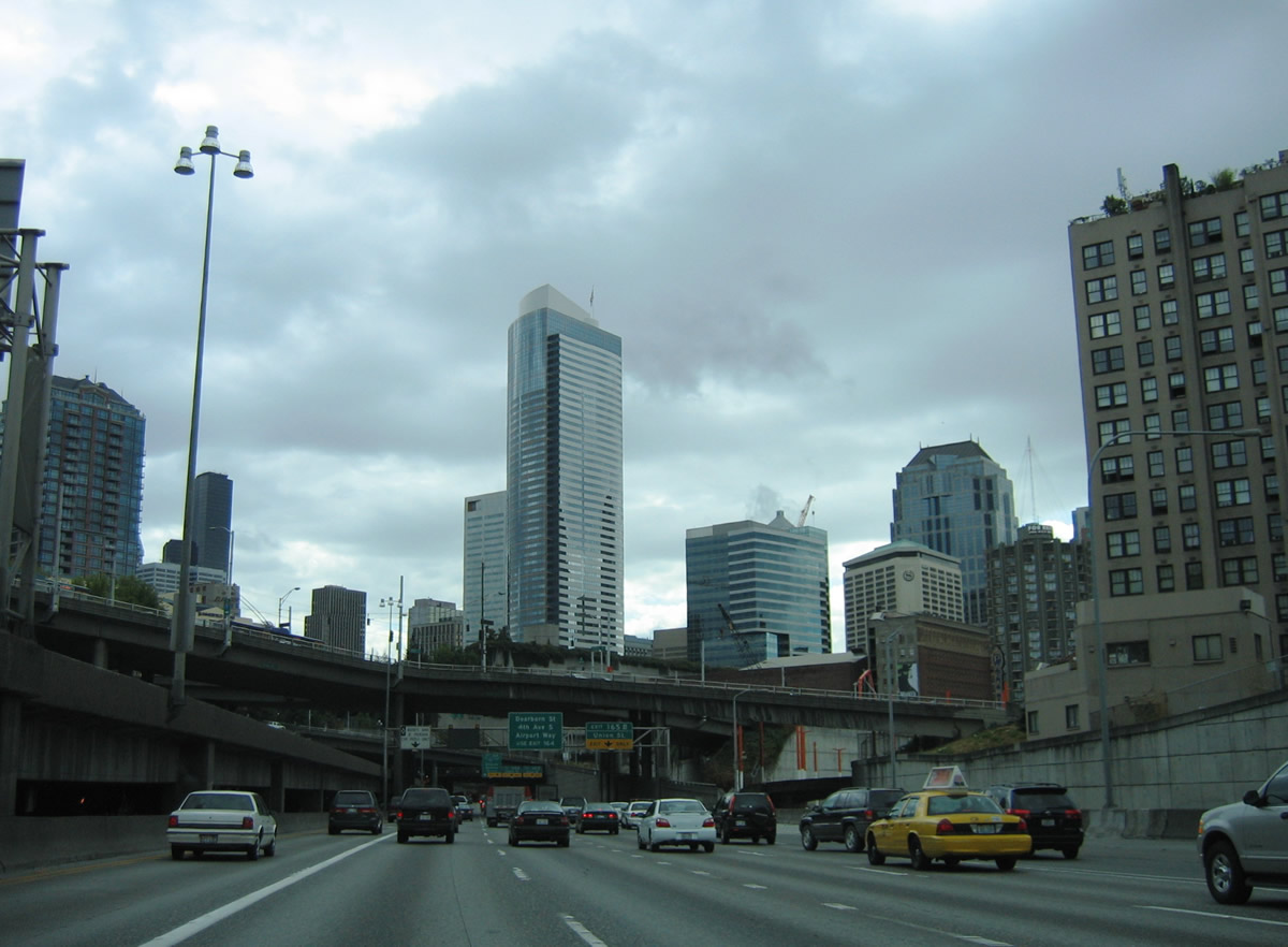
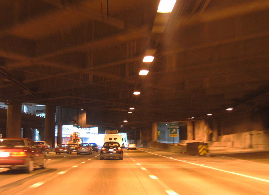
Advancing to Downtown Seattle, Interstate 5 south lowers toward the cut and cover tunnel under Freeway Park.
08/30/06
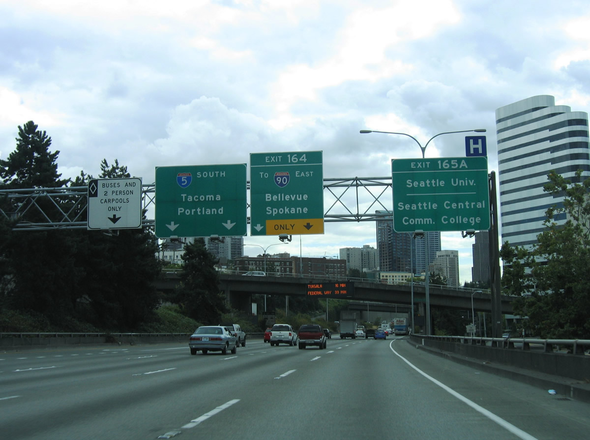
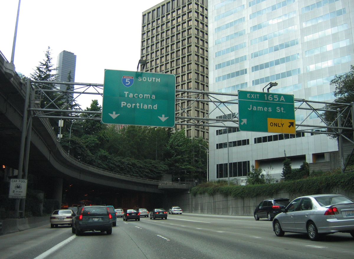
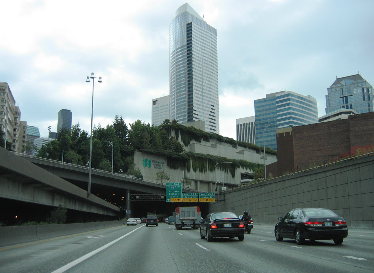
Interstate 5 south carries two general purpose and one HOV-2 lane through the Seattle central business district. The right two lanes facilitate access to Exit 165 A for James Street, Exit 165 B for Union Street, and Exit 164 for I-90. James Street east to Broadway serves interests to Seattle University and Seattle Central Community College.
08/30/06
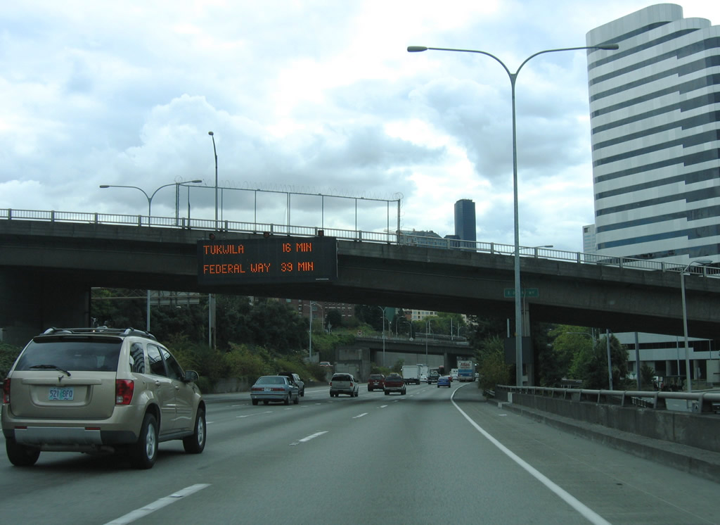
A dynamic message sign at the Denny Way overpass indicates travel times to cities south of Seattle.
08/30/06
Two Union Square anchors the northern extent of the Seattle skyline in this scene along Interstate 5 south at Olive Way.
08/30/06
Boren Avenue and Pine Street intersect directly above Interstate 5 next.
08/29/06
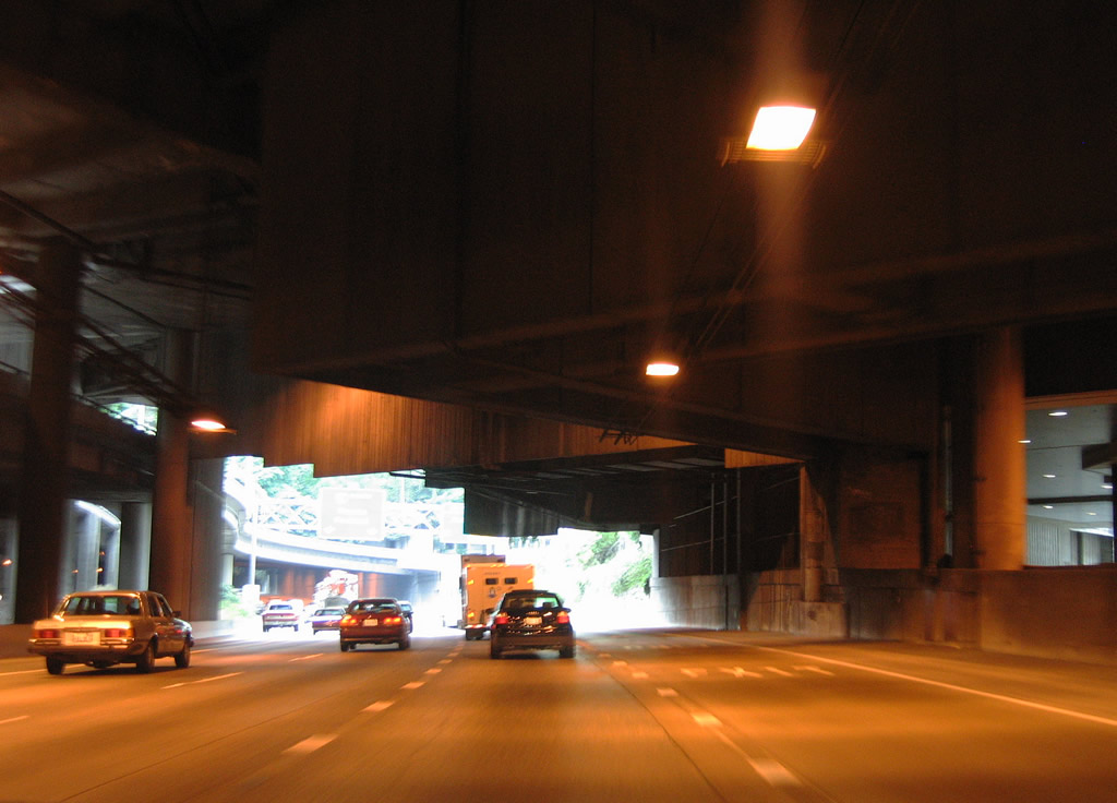
Interstate 5 south travels under the Washington State Convention Center at Exit 165 B to Union Street. Union Street flows west to Waterfront Park.
08/29/06
Exit 165 A to James Street follows onto parallel 6th Avenue at Columbia Street. James Street angles northeast from Yesler Way in Pioneer Square to Cherry Street at Seattle University. Exit 164 leaves in a half mile for Interstate 90 east to Spokane.
08/29/06
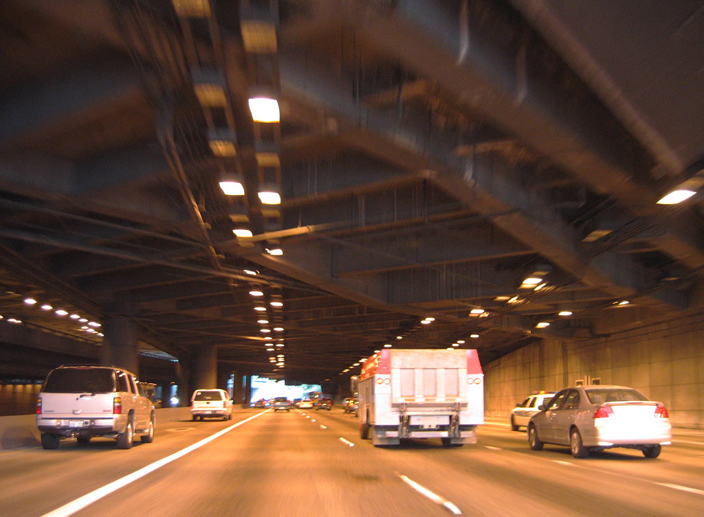
The first of two cut and cover tunnels takes Interstate 5 below Pike Street and 8th Avenue under the convention center. Exit 165 B emerges from the tunnel at the intersection of Union Street south at 7th Avenue.
08/29/06
08/30/06
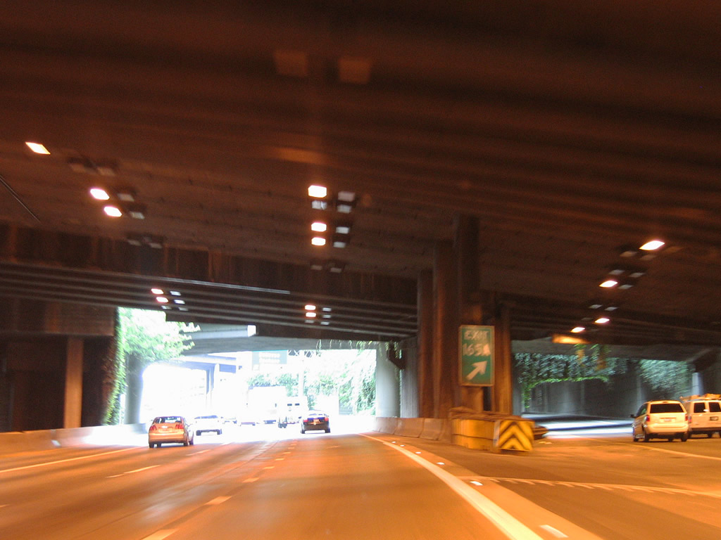
Exit 165 A departs between the two tunnels with two lanes for James Street and Seattle City Hall. This ramp remains underground until after Spring Street.
08/29/06
08/30/06
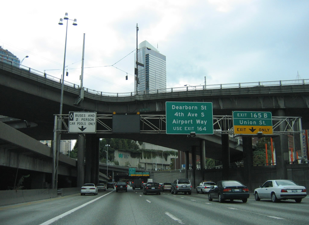
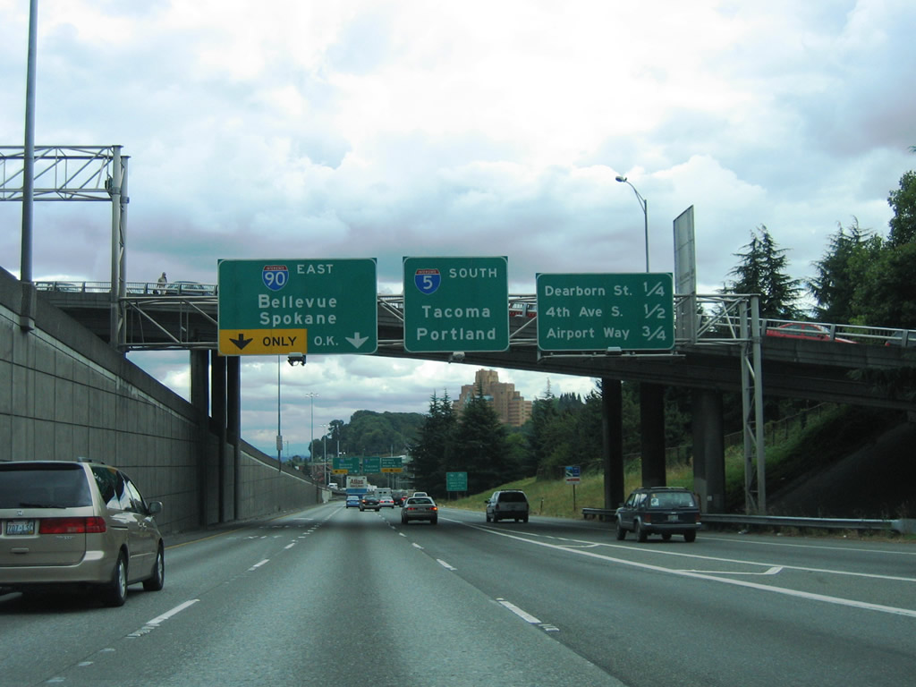
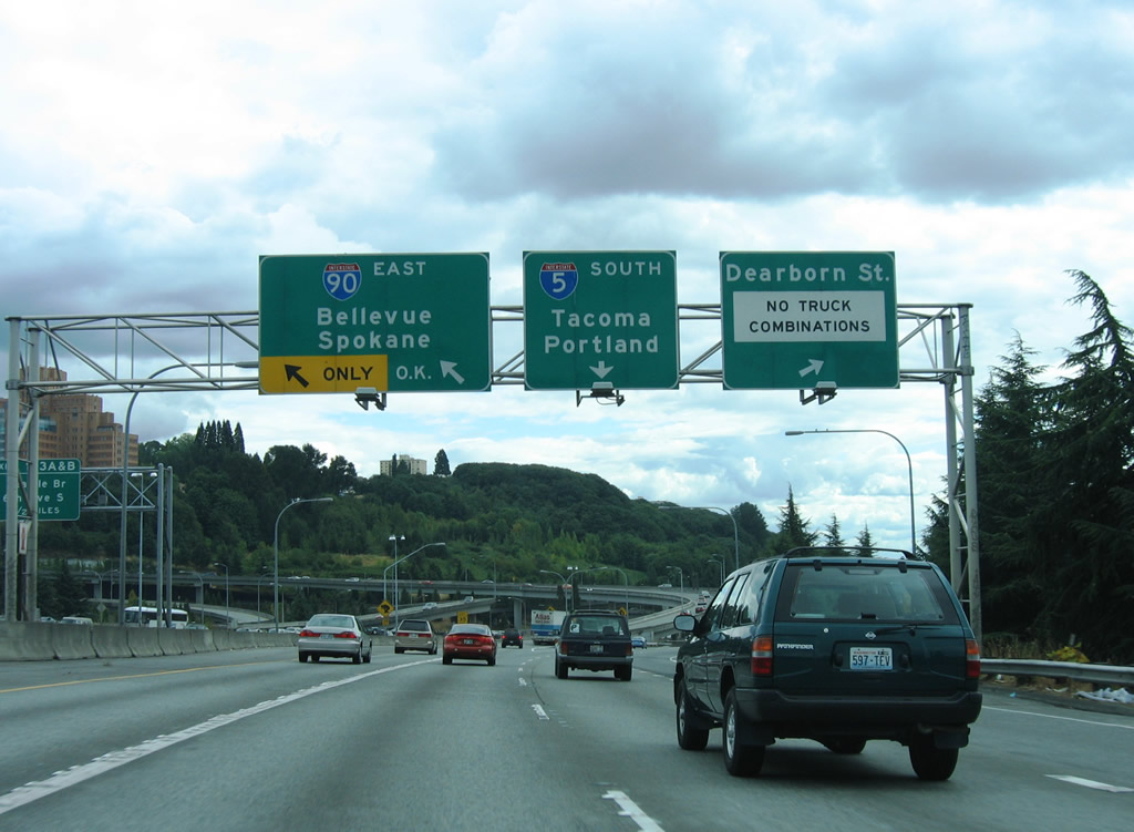
Travelers bound for transcontinental Interstate 90 east to Bellevue, Ellensburg, Moses Lake and Spokane leave the I-5 mainline for the c/d roadway at Exit 164. Access is available to both directions of I-90 from I-5 south; the freeway ends to the west at SR 519 (4th Avenue S) adjacent to Lumen Field.
08/30/06
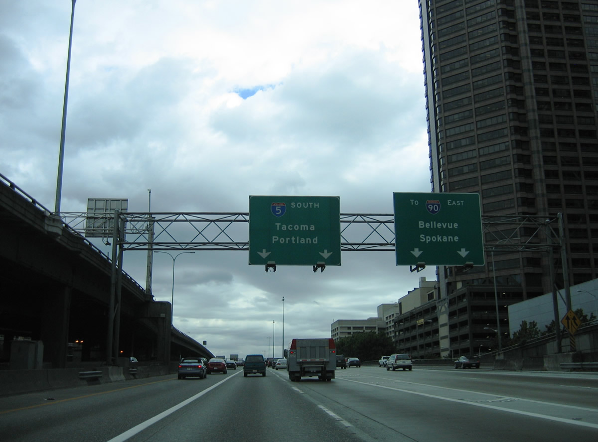
Traffic partitions at Exit 164 for the c/d roadway to Interstate 90 east and the ramps for Dearborn Street, 4th Avenue S, and Airport Way. I-90 represents the longest Interstate highway in the system at 3,020.54 miles, concluding to the east of I-93 in Boston, Massachusetts.
08/29/06
The 7.14 mile long Interstate 5 Express Lanes rejoin the general travel lanes ahead of Yesler Way.
08/29/06
Forming an auxiliary lane to Dearborn Street, an entrance ramp joins the c/d roadway from parallel 6th Avenue at the Yesler Way overpass. The left lanes eventually join I-90 east to the Mercer Island Floating Bridge across Lake Washington and I-405 at Bellevue. I-90 is the main route across the Cascade Mountains in Washington, utilizing Snoqualmie Pass at an elevation of 3,022 feet.
08/30/06
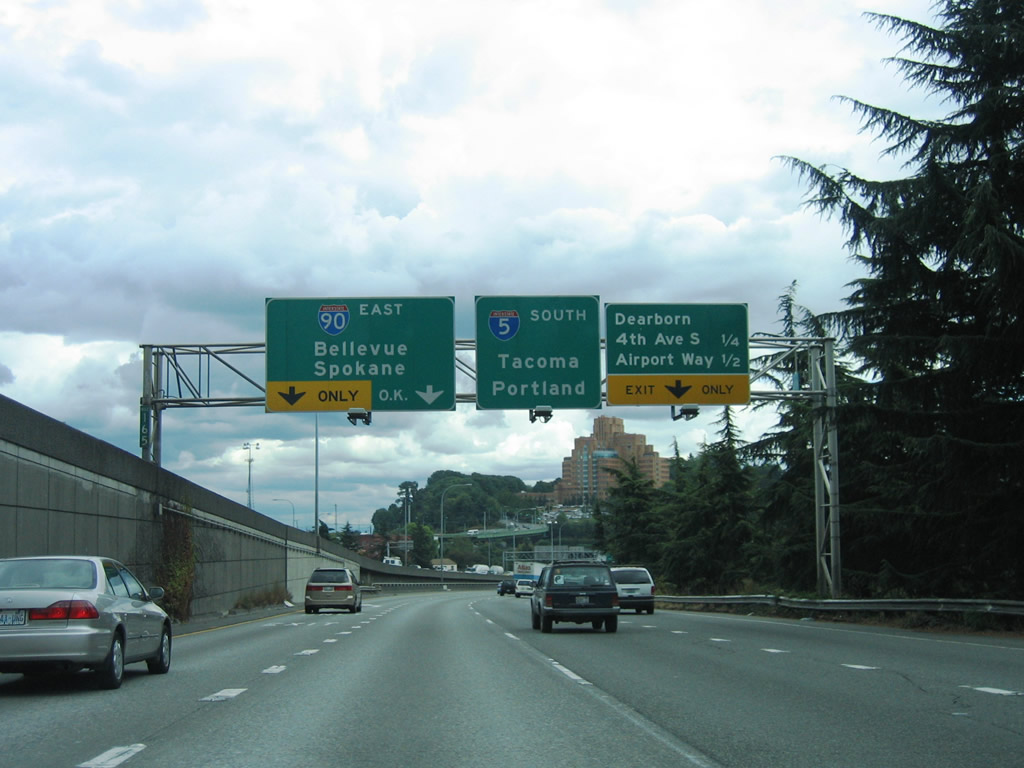
The local exit from the c/d roadway links I-5 to the International District and Yesler Terrace (via Dearborn Street), SoDo and Pioneer Square (via I-90 west to 4th Avenue S), and the Duwamish Industrial Area (via 4th Avenue S and Airport Way).
08/30/06
A two lane flyover leads onto Interstate 90 east ahead of Beacon Hill and Mount Baker. The Dearborn Street exit leaves simultanously. The west end of I-90 joins I-5 with area streets to T-Mobile Park, Lumen Field and the WSDOT Seattle Ferry terminal.
08/30/06
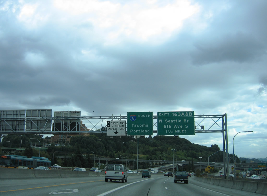
The Interstate 5 mainline next meets Exit 163 B to Forest Avenue and 6th Avenue S, and Exit 163 A to the West Seattle Bridge / Spokane Street Viaduct at the Duwamish Industrial area.
08/29/06
Interstate 90 comprises a double-deck freeway over I-5 in a local / express configuration. The I-90 mainline concludes west at SR 519 (4th Avenue S) between Lumen Field and T-Mobile Park. The I-90 express lanes end at the intersection of Airport Way, 5th Avenue S, and Dearborn Street nearby.
08/30/06
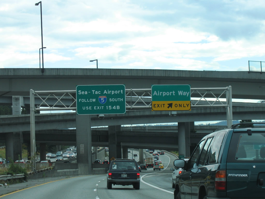
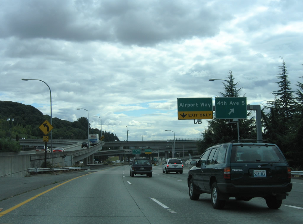
The ramp to Airport Way departs south of the I-5/90 systems interchange. Airport Way extends southward to Boeing Field / King County International Airport (BFI) in southern Seattle.
08/30/06


References:
AARoads Wiki. (2023, December 17). Washington State Route 520. AARoads Wiki. Retrieved September 8, 2025, from https://wiki.aaroads.com/wiki/Washington_State_Route_520
Washington State Department of Transportation (WSDOT). (2025, May 9). SR 520 I-5 Express Lanes Connection Project - Completed. https://wsdot.wa.gov/construction-planning/search-projects/sr-520-i-5-express-lanes-connection-project
Photo Credits:
- AARoads: 08/29/06, 08/30/06
Connect with:
Page Updated Tuesday October 26, 2010.