
Interstate 5 South - Castle Rock to Kalama
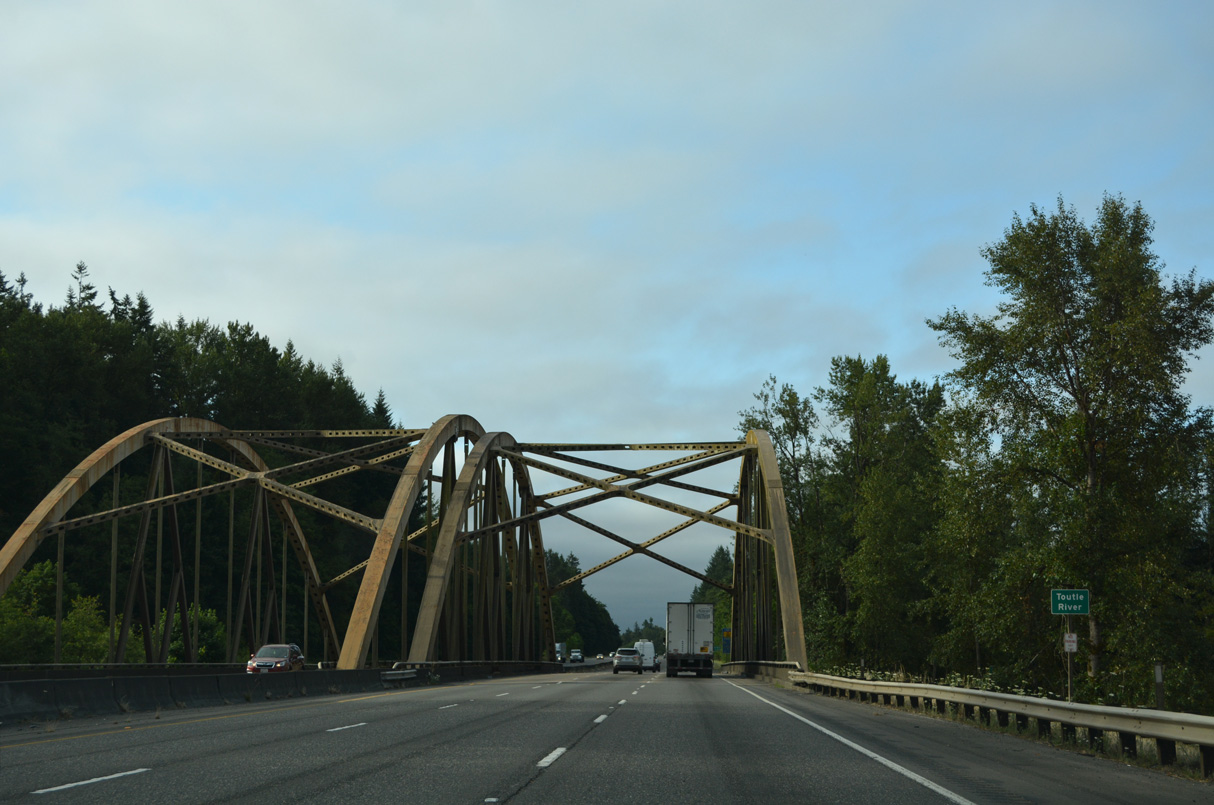
Advancing to the Toutle River along Interstate 5 south. The BNSF Railroad spans the river nearby along a truss bridge to the west.
07/20/23
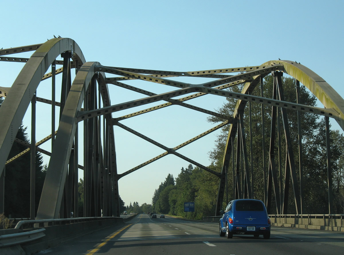
Tied arch bridges carry Interstate 5 over the Toutle River. These spans opened in 1969 when Interstate 5 extended the U.S. 99 expressway south from Exit 57.
09/02/06
SR 504 extends east to the small town of Toutle and the Johnston Ridge Observatory, five miles north of the volcano's crater. Mount Saint Helens is currently active and periodically produces small eruptions of steam and ash.
07/20/23
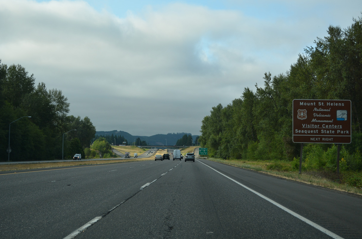
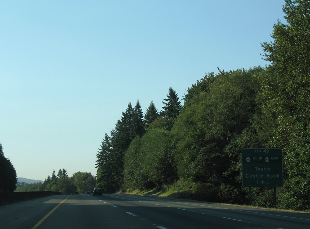
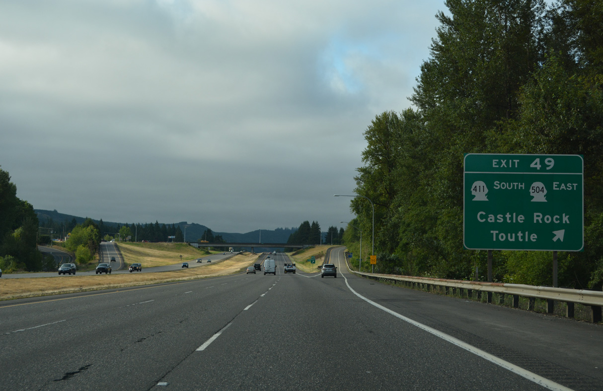
SR 411 north and SR 504 west come together at a diamond interchange (Exit 49) with I-5 in Castle Rock. SR 504 constitutes a 51.76 mile spur east to Silver Lake, Kid Valley and Mount St. Helens National Volcanic Monument. SR 411 travels 13.48 miles south from Castle Rock to SR 432 at Longview.
09/02/06
SR 411 follows Huntington Avenue (Old U.S. 99) to the Castle Rock city center where it turns west to cross the Cowlitz River. SR 411 parallels the Cowlitz south to Kelso.
Historically, SR 411 continued north from Castle Rock, west of the Cowlitz River, to SR 506 in Vader. The truncation of the route north of Castle Rock occurred in 1991 (AARoads Wiki, 2023a).
07/20/23
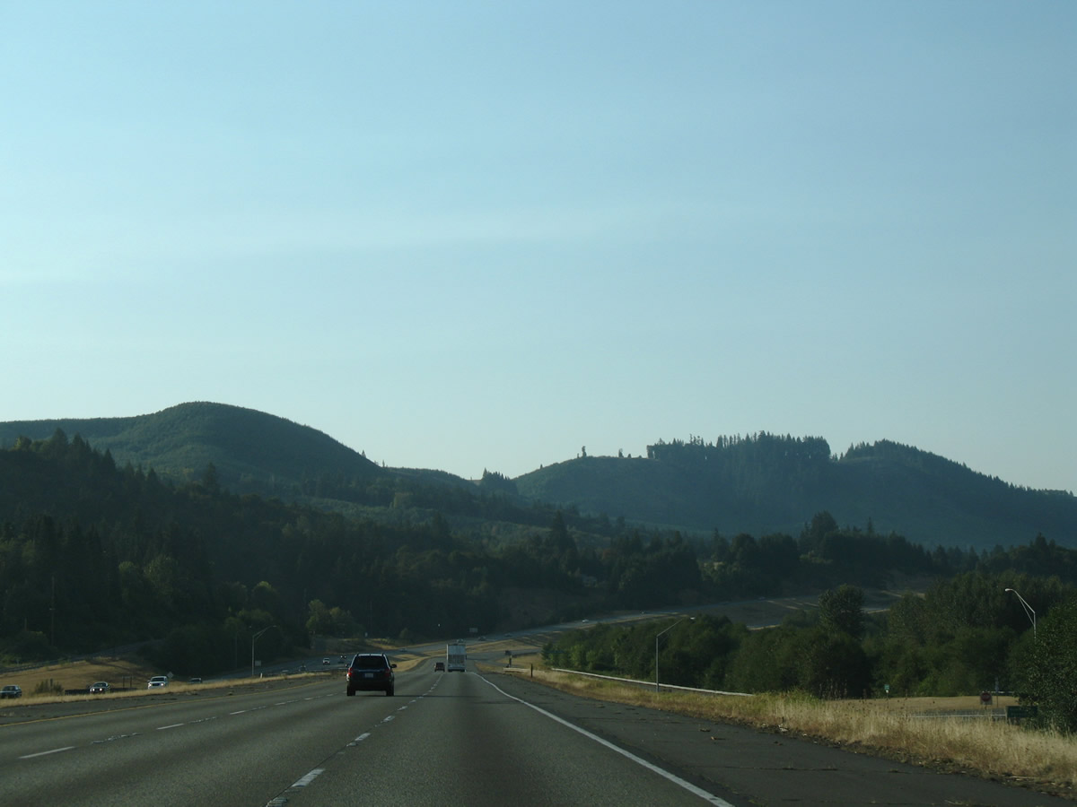
Staying east of Castle Rock, Interstate 5 continues ten miles to Kelso.
07/20/23
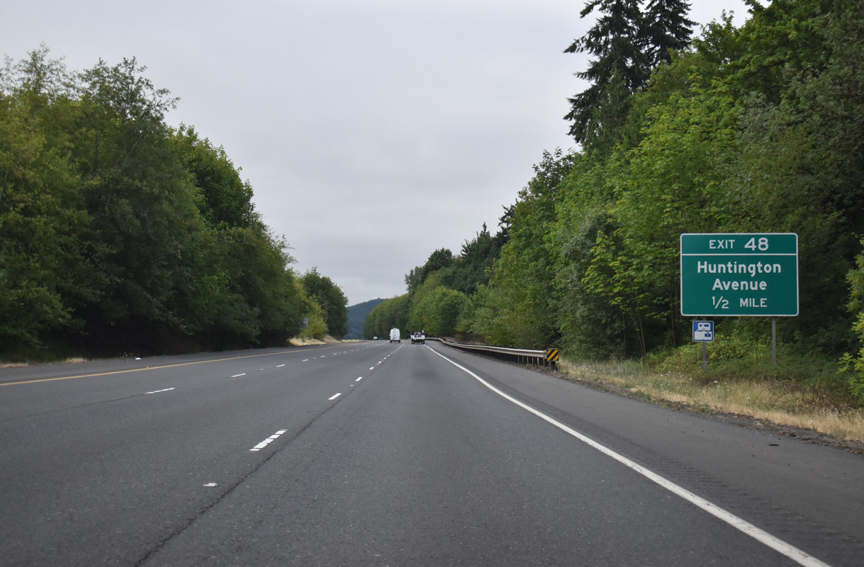
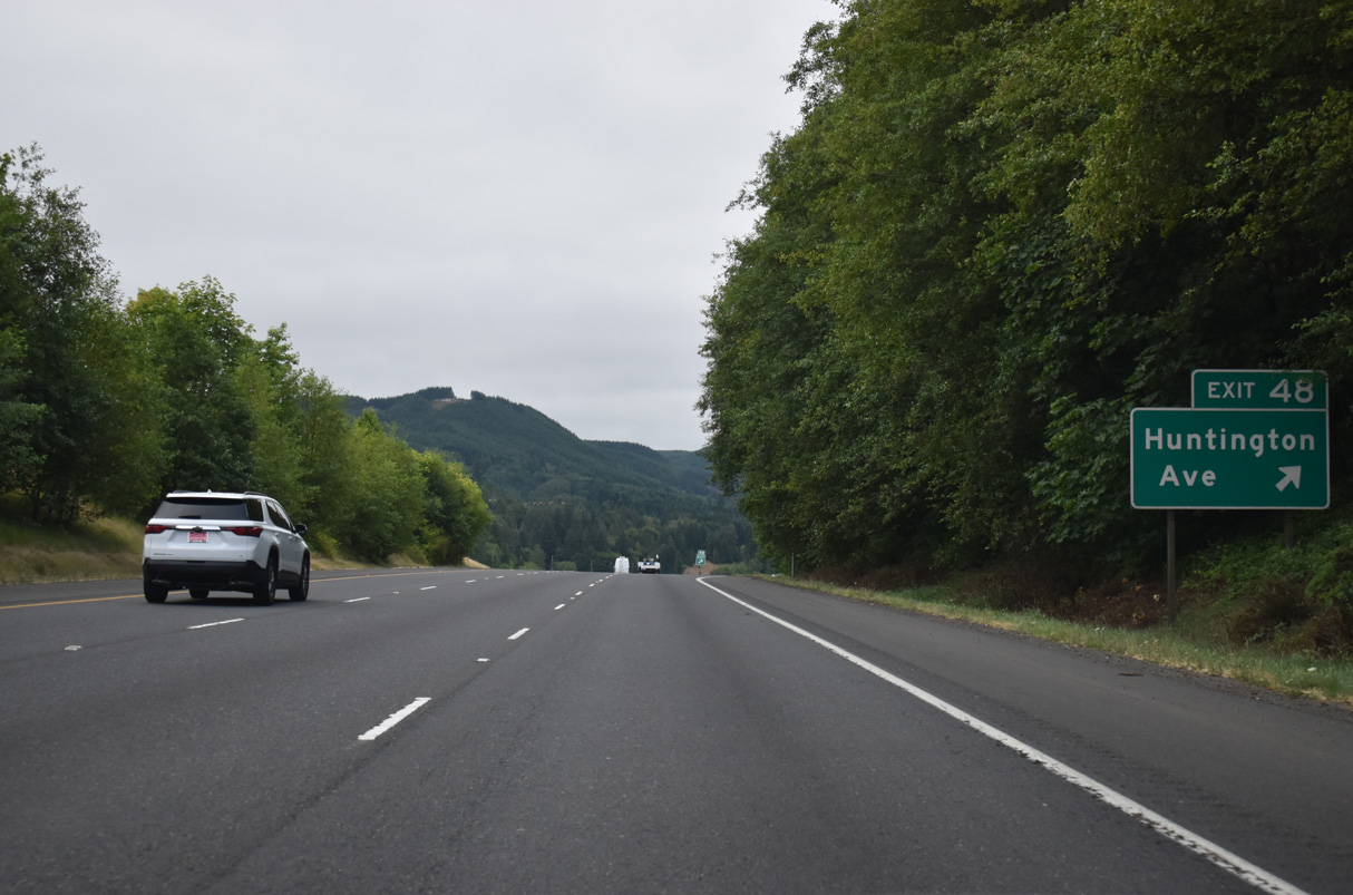
Huntington Avenue (Old U.S. 99) returns to Interstate 5 at a diamond interchange (Exit 48) on the south side of Castle Rock. Huntington Avenue west of I-5 is considered Business Loop I-5, but signage only appears at the south end interchange.
07/20/23
Exit 48 departs Interstate 5 south for Huntington Avenue (Business Loop I-5) north back into Castle Rock. Pleasant Hill Road (Old U.S. 99) travels south alongside I-5 from Huntington Avenue to Pleasant Hill and Ostrander.
07/20/23
Interstate 5, Pleasant Hill Road (Old U.S. 99) and a BNSF Railroad bend southwest toward Pleasant Hill from Business Loop I-5 (Huntington Avenue).
09/02/06
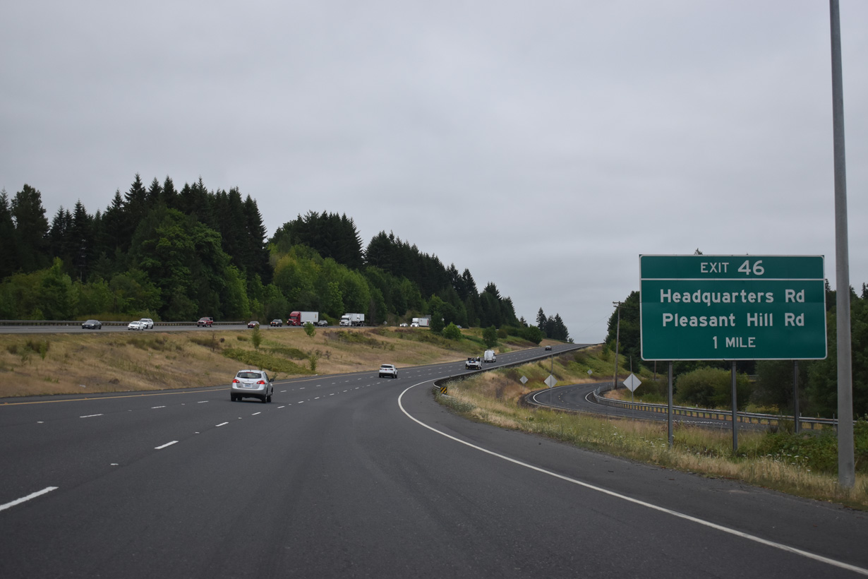
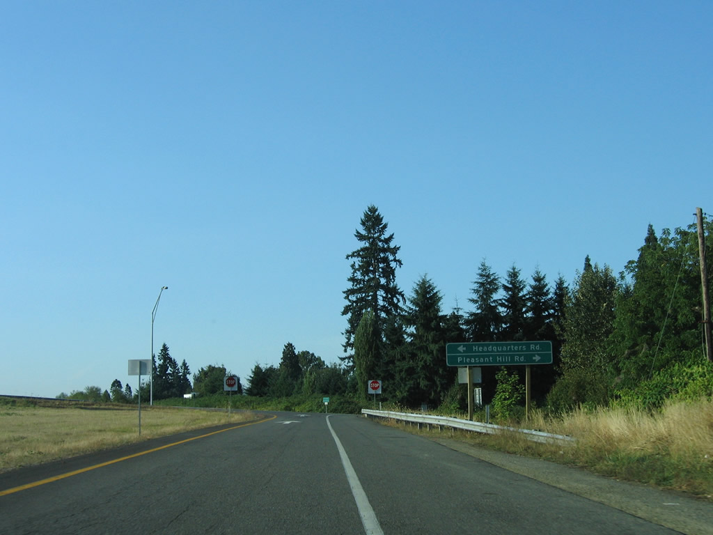
One mile north of the diamond interchange (Exit 46) with Headquarters Road on Interstate 5 south.
07/20/23
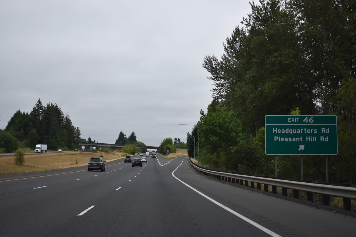
Headquarters Road connects Interstate 5 with Pleasant Hill Road (Old U.S. 99) to the west and meanders eastward to Silver Lake Road, west of the settlement of Headquarters.
07/20/23
Taking Exit 46 to Headquarters Road. Pleasant Hill Road travels nearby and loops south to Pleasant Hill before crossing under Interstate 5 near Exit 42.
09/02/06
Interstate 5 confirming marker posted southbound at Pleasant Hill.
07/20/23
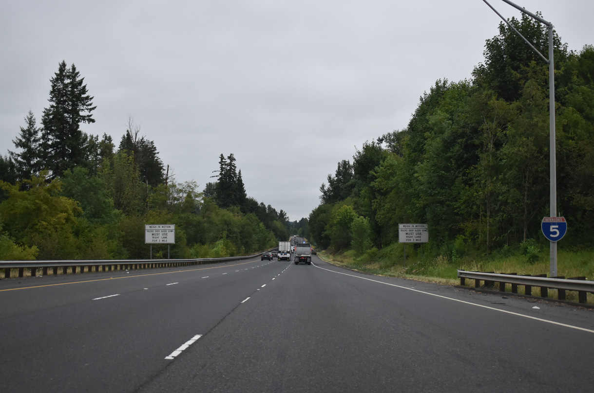
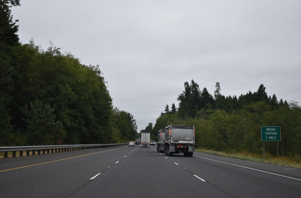
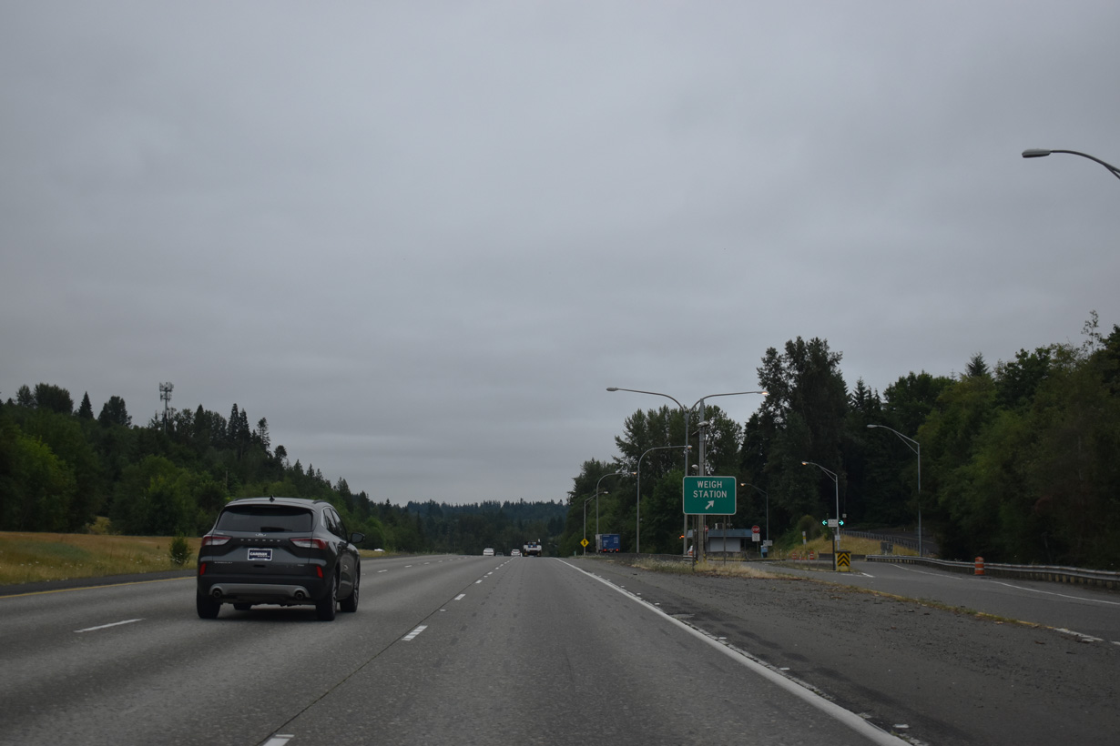
A weigh station facility operates along Interstate 5 southbound near Ostrander.
07/20/23
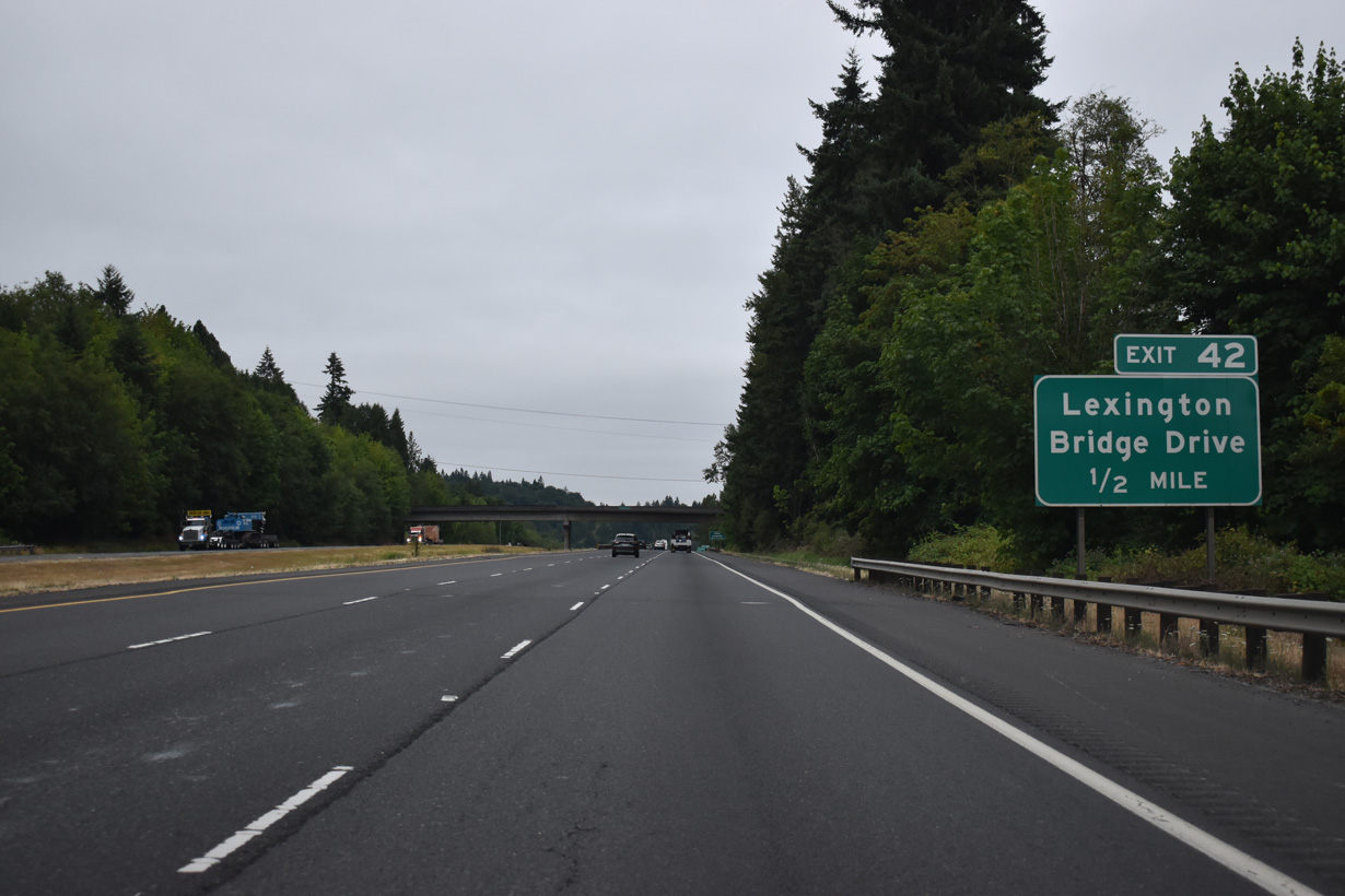
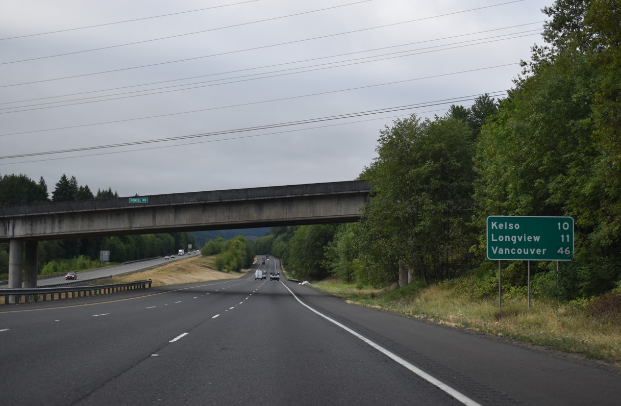
Interstate 5 overtook the original course of U.S. 99 from Ostander south to Rocky Point. Exit 42 connects with Lexington Bridge Drive, which spans the Cowlitz River west into the census designated place of Lexington.
07/20/23
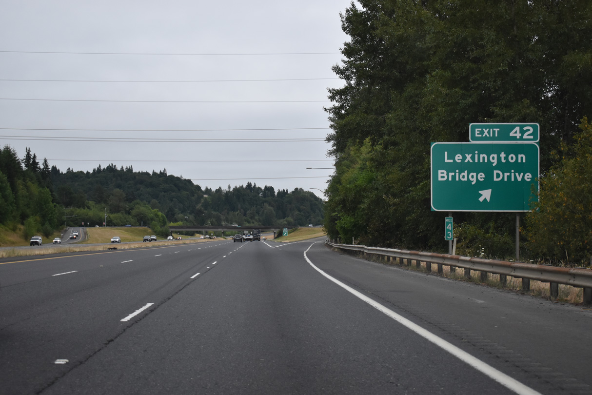
Lexington Bridge Drive stems west from parallel Pacific Avenue into the diamond interchange at Exit 42. West of the Cowlitz River, Lexington Drive intersects SR 411 (Westside Highway) across from Sparks Drive. SR 411 runs south from Lexington to Beacon Hill and West Kelso.
07/20/23
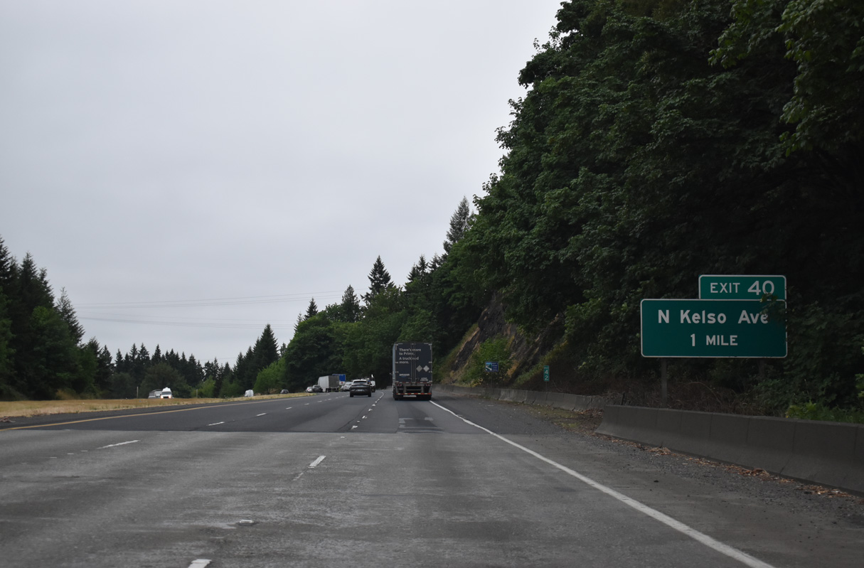
Exit 40 joins I-5 with Kelso Avenue (former SR 431) and Holcomb Road, the east side frontage road. SR 431 followed Kelso Avenue south to Pacific Avenue and SR 4 (Cowlitz Way) at the Kelso city center. The state route was dropped in 1992 (AARoads Wiki, 2023).
07/20/23
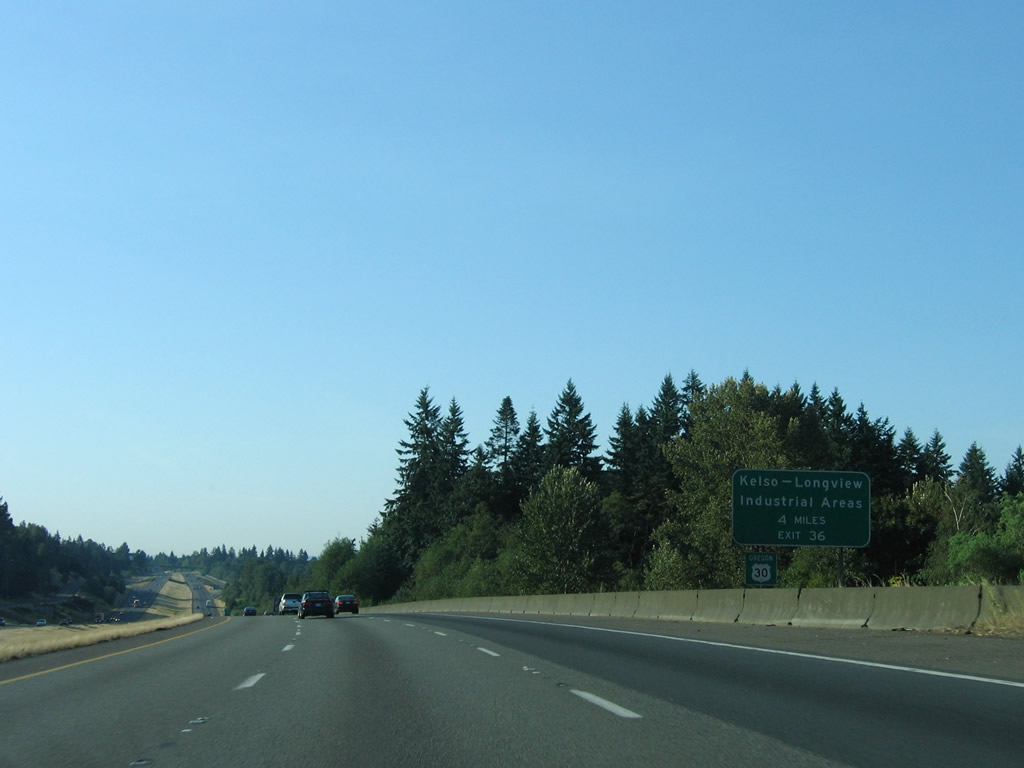
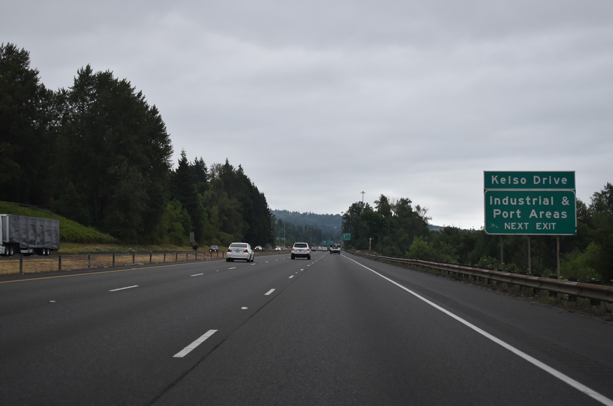
Industrial areas of Kelso and Longview lie south of the cities along the Columbia and Cowlitz Rivers. SR 432 provides direct access to these areas and a bypass route to the Lewis and Clark bridge to U.S. 30 (Lower Columbia River Highway) in Oregon.
09/02/06

Southbound at the diamond interchange (Exit 40) with Kelso Avenue south and Holcomb Road north. Kelso Avenue provides a more direct route to SR 4 west to Longview. SR 4 is a 62.27 mile long highway stretching west from Kelso/Longview to U.S. 101 east of Long Beach.
07/20/23
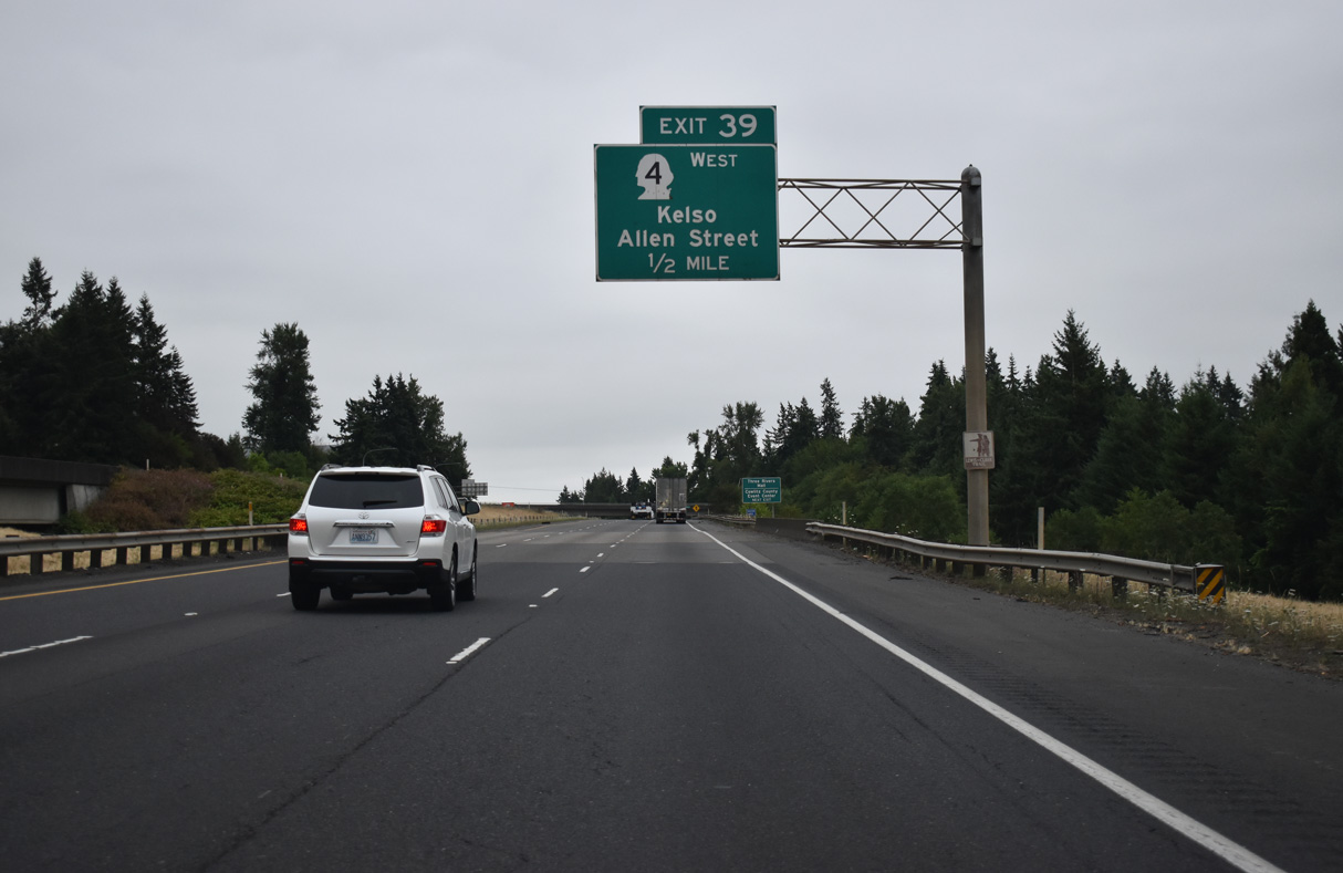
SR 4 heads east from the Kelso city center via Allen Street to end at Exit 39 near Three Rivers Mall. Decommissioned in 1968 (Bozanich, n.d.-a), SR 4 replaced U.S. 830 west from Kelso to U.S. 101 at Johnsons Landing. U.S. 830 east joined U.S. 99 south from Kelso to Vancouver. The original alignment through Kelso used Pacific Avenue south to Ash Street east to Grade Street south.
07/20/23
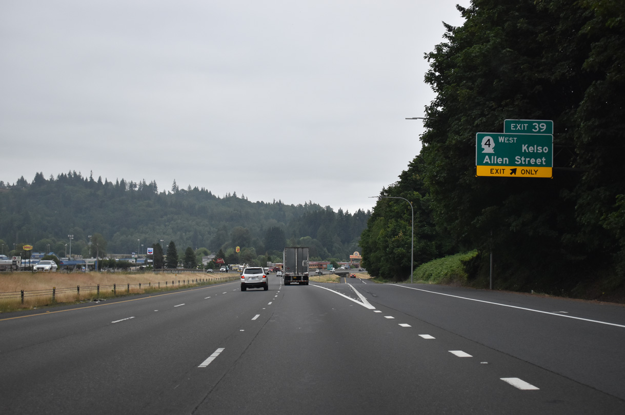
East from the diamond interchange at Exit 39, Allen Street follows the Cowerman River to the base of Mount Brynion. SR 4 spans the Cowlitz River from Downtown Kelso to West Kelso on the two miles into the city of Longview.
07/20/23
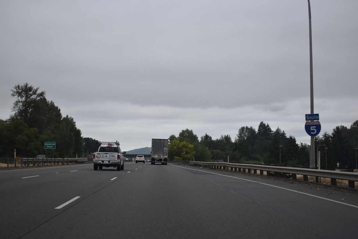
Interstate 5 crosses the Coweeman River three times in the Kelso area. A pair of non-descript bridges carry the six lane freeway over the river near Davis Terrace. These were built in 1979 and 1980.
07/20/23
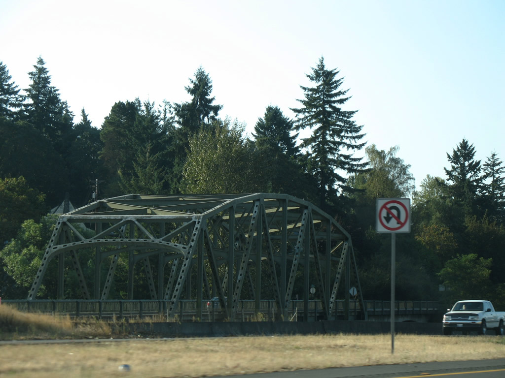
Adjacent Kelso Drive spans the Coweeman River across a two lane truss bridgealong the east side of Interstate 5. This bridge opened in 1947 as part of the original U.S. 99 Kelso bypass (Bozanich, n.d.-b).
09/02/06
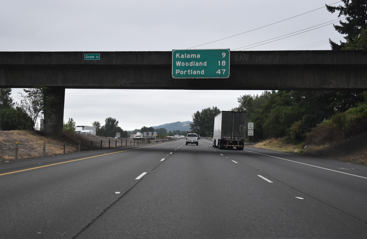
Grade Street (Old U.S. 99/830) spans I-5 nine miles north of Kalama and 18 miles from Woodland.
07/20/23
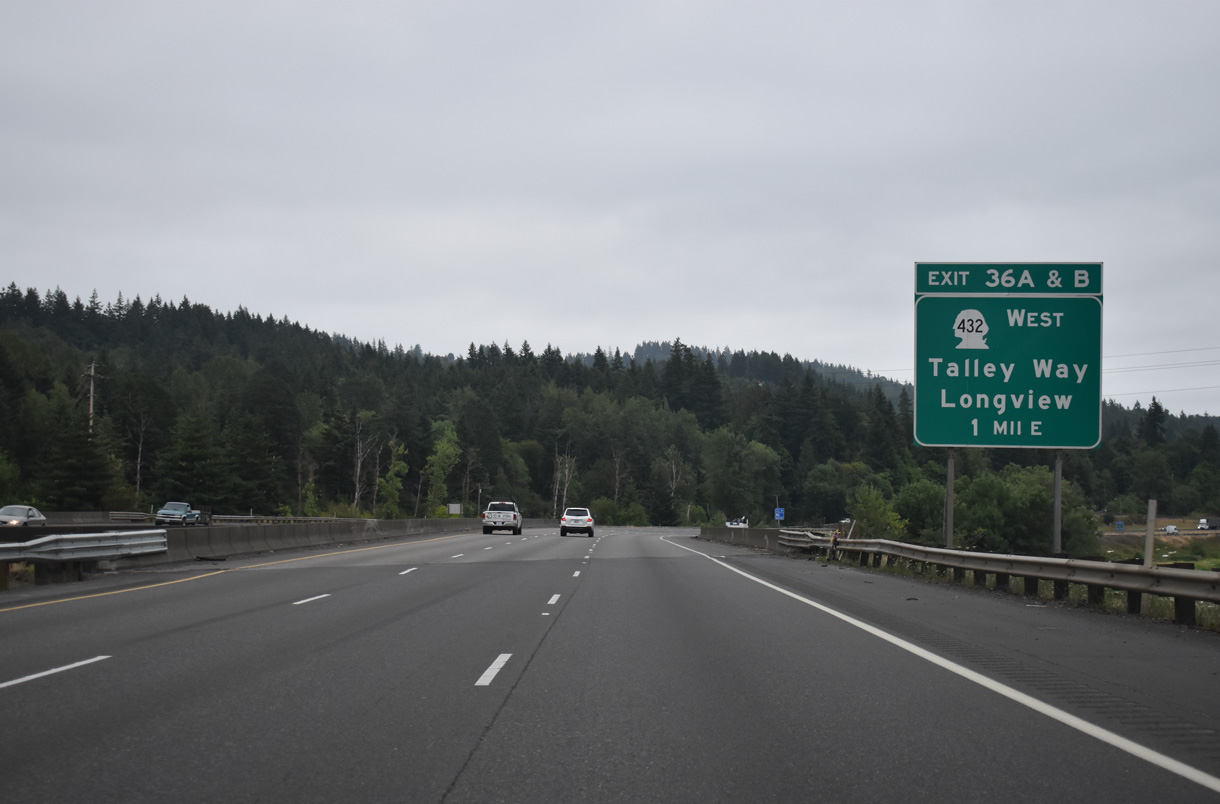
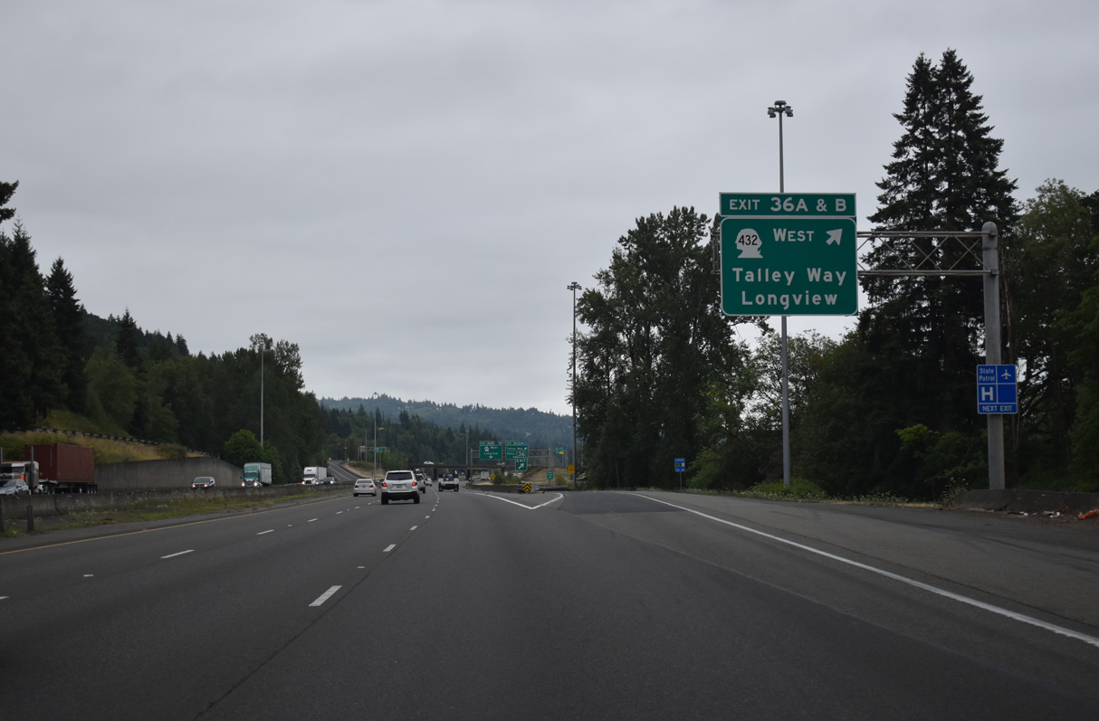
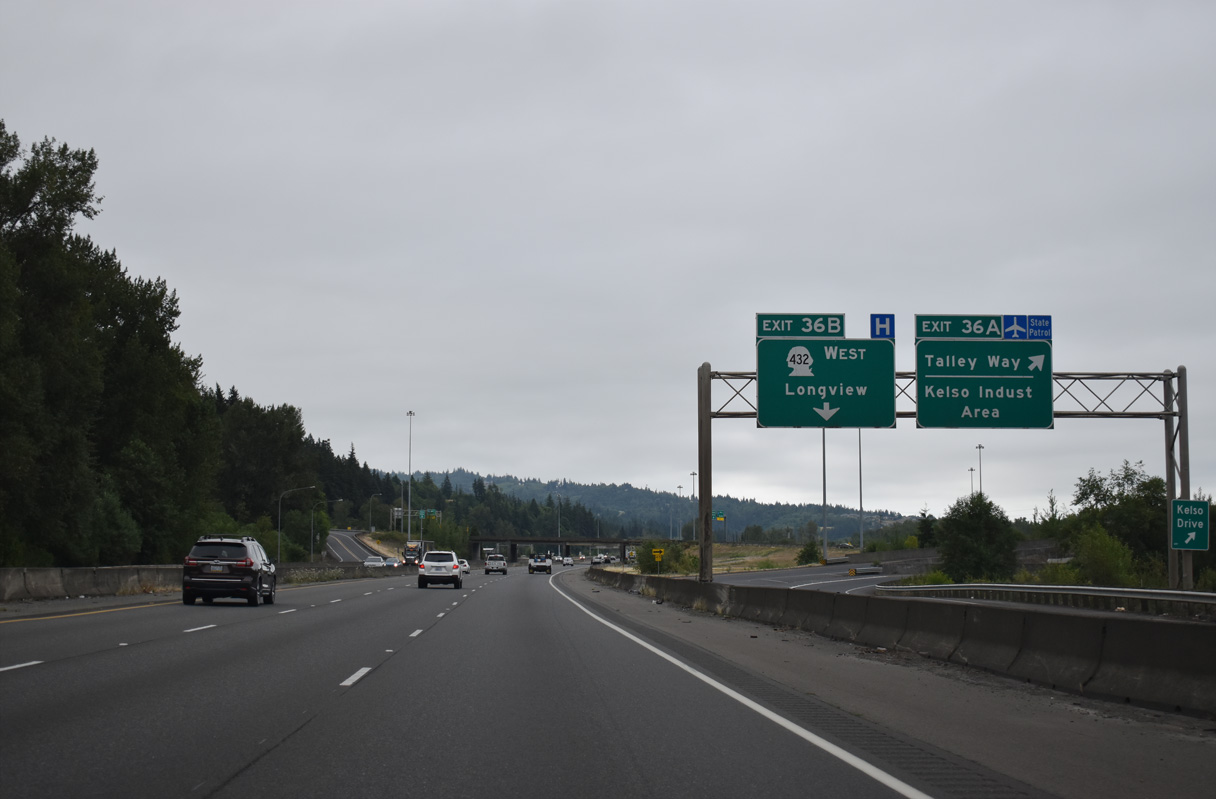
The final Kelso / Longview area exit joins Interstate 5 south with SR 432 west in one mile. SR 432 constitutes a 10.32 mile loop west to SR 4 (Ocean Beach Highway) in west Longview.
07/20/23
SR 432 (Tennant Way) comprises an expressway west from Longview Junction to SR 411 (3rd Avenue) in Longview. SR 432 follows 3rd Avenue south to Industrial Way west and generally bypasses Longview. The route was realigned in 1992 off Tennant Way beyond SR 411 and Nichols Boulevard north to SR 4 (Bozanich, n.d.-c). SR 433 (Oregon Way) between Industrial Way and Nichols Boulevard was also decommissioned (Bozanich, n.d.-d).
07/20/23
SR 432 (Tennant Way) west to SR 433 leads south to U.S. 30 in Rainier, Oregon. The bridge across the Columbia River opened in 1930 and was tolled until 1965 (Bozanich, n.d.-d).
07/20/23
The parclo cloverleaf interchange with SR 432 west also connects to Coweeman Park Drive west to Talley Way. The entrance ramp from Talley Way east to I-5 includes access to a roundabout with Kelso Drive north / Old Pacific Highway (Old U.S. 99/830) south to Vision Acres and Carrolls.
07/20/23
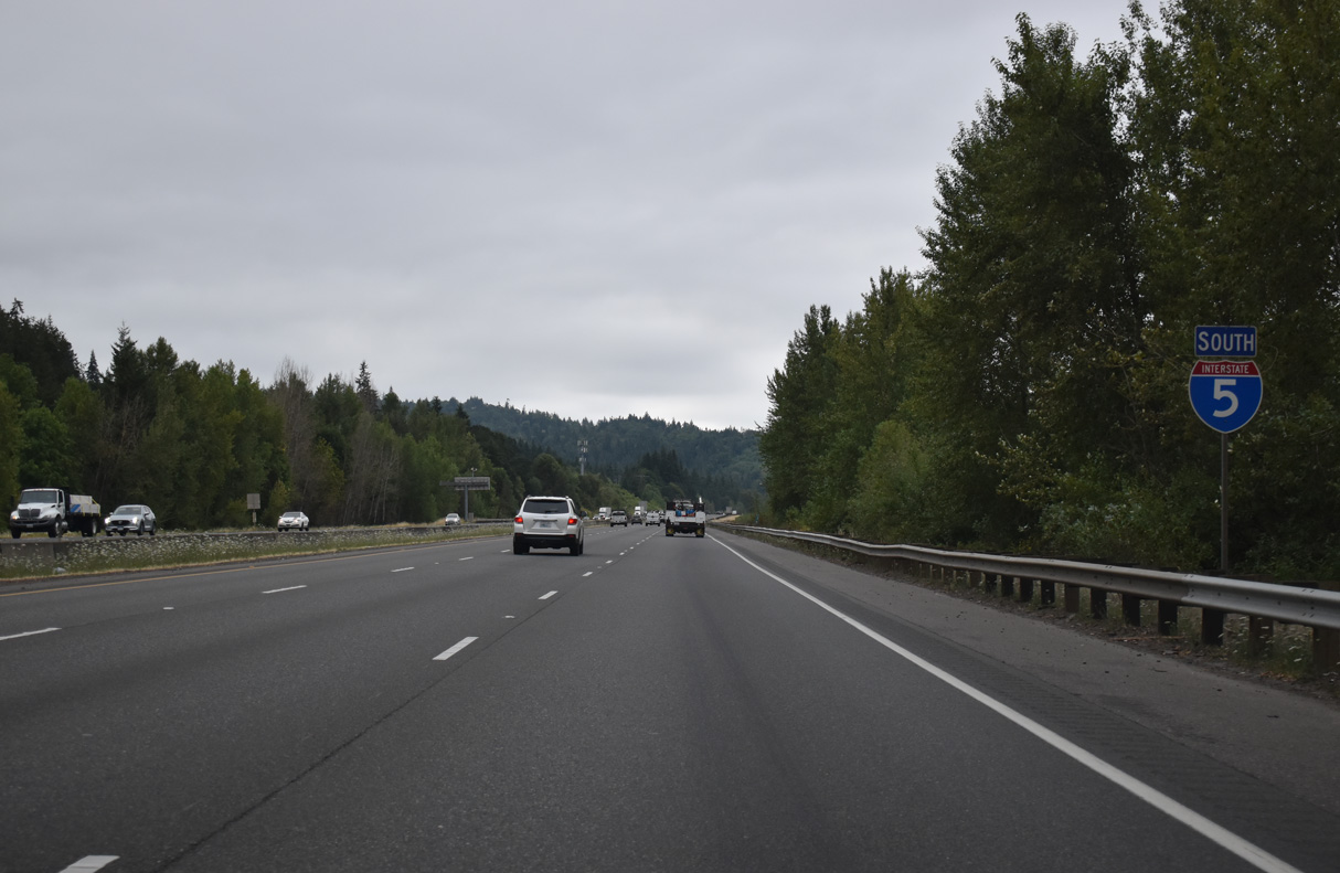
Interstate 5 continues south from Kelso between a BNSF Railroad line and Old Pacific Highway S.
07/20/23
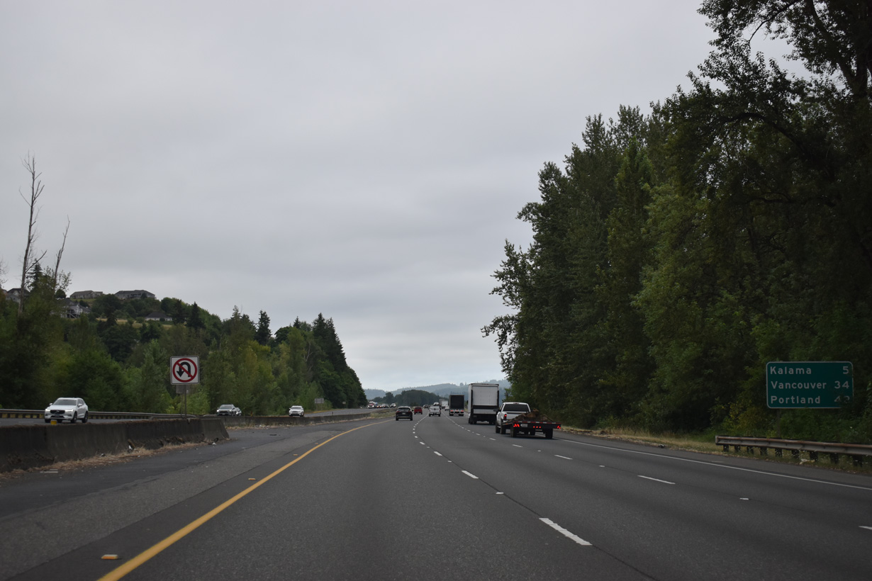
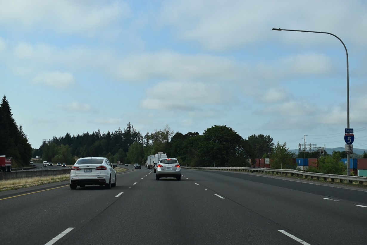
Kalama is five miles south of Kelso, followed by Vancouver in 34 miles.
07/20/23
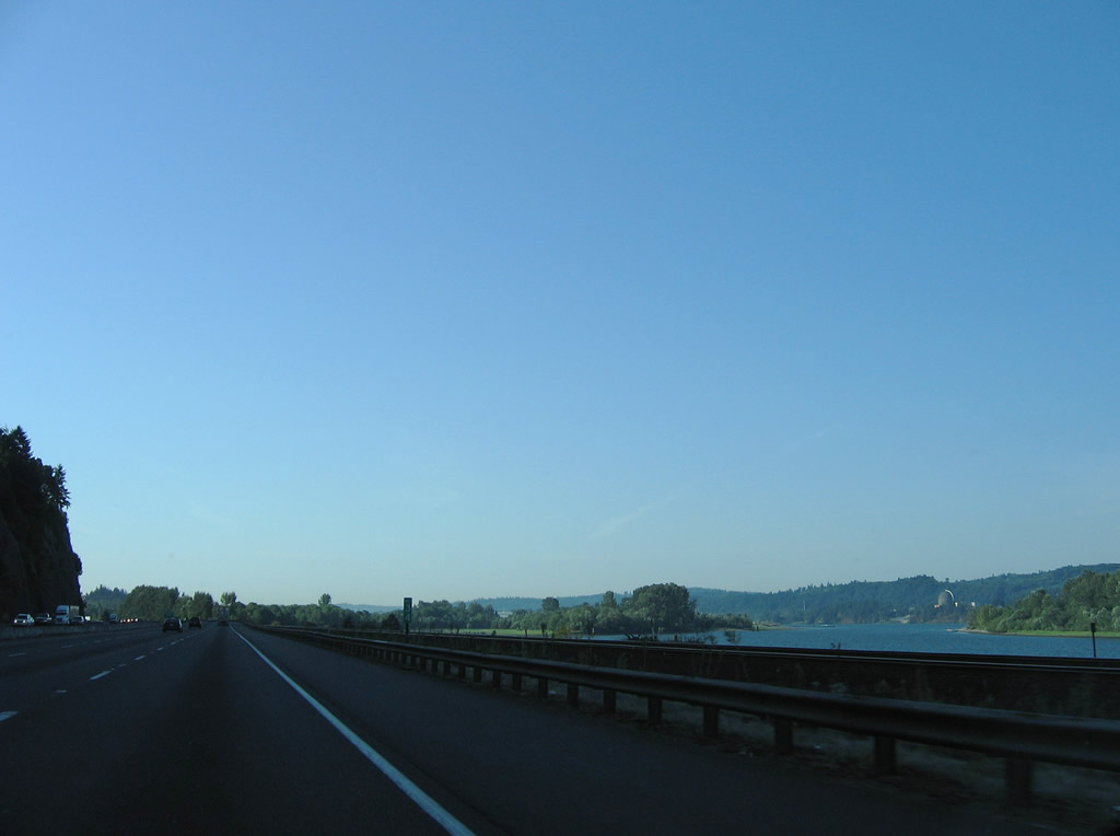
Carrolls Channel along the Columbia River basin flows adjacent to the BNSF Railroad and Interstate 5 southbound roadway. This view looks at the waterway from near Carrolls Bluff.
09/02/06
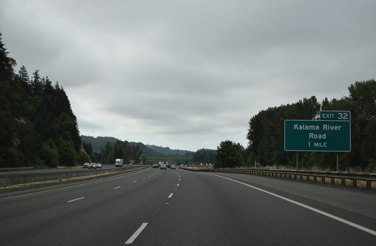
Kalama River Road follows the Kalama River east from the Columbia River and Exit 32 into the Cascade Range foothills.
07/20/23
The diamond interchange (Exit 32) with Kalama River Road is the first of three exits from Interstate 5 south for the city of Kalama.
07/20/23
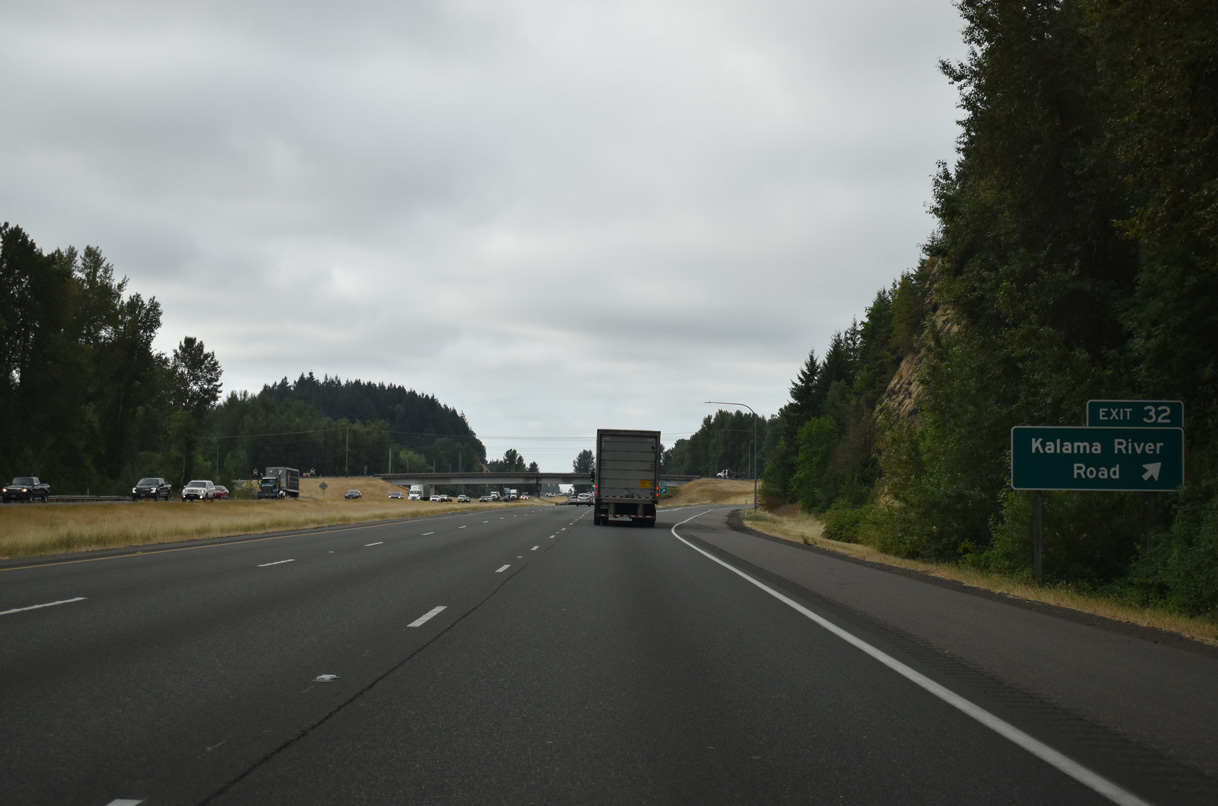
Drays Mound rises alongside I-5 south where Exit 32 departs. Kalama River Road meets Old Pacific Highway north and Meeker Drive south, both of which are old alignments of U.S. 99/830. Kalama River Road continues from Spencer Creek Business Park to Pigeon Springs.
07/20/23
Interstate 5 crosses the Kalama River on a pair of non-descript bridges built in 1970 and 1971.
07/20/23
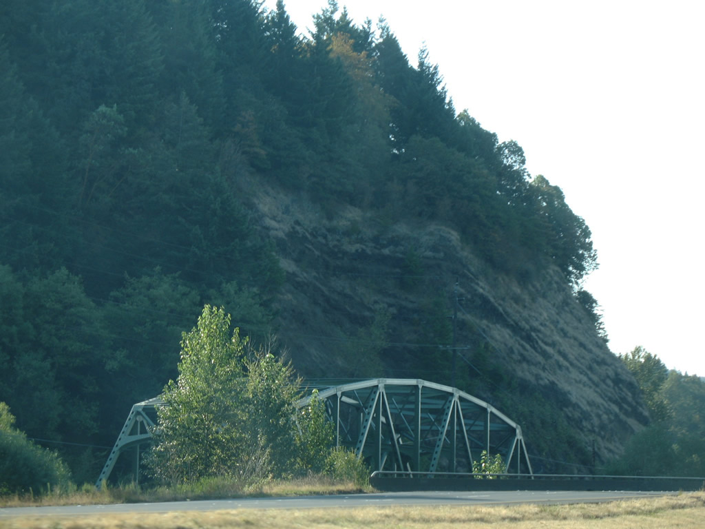
A truss bridge from 1952 takes Meeker Drive (Old U.S. 99/830) across the Kalama east of Interstate 5. This bridge was historically half of the original four lane U.S. 99/830.
09/02/06
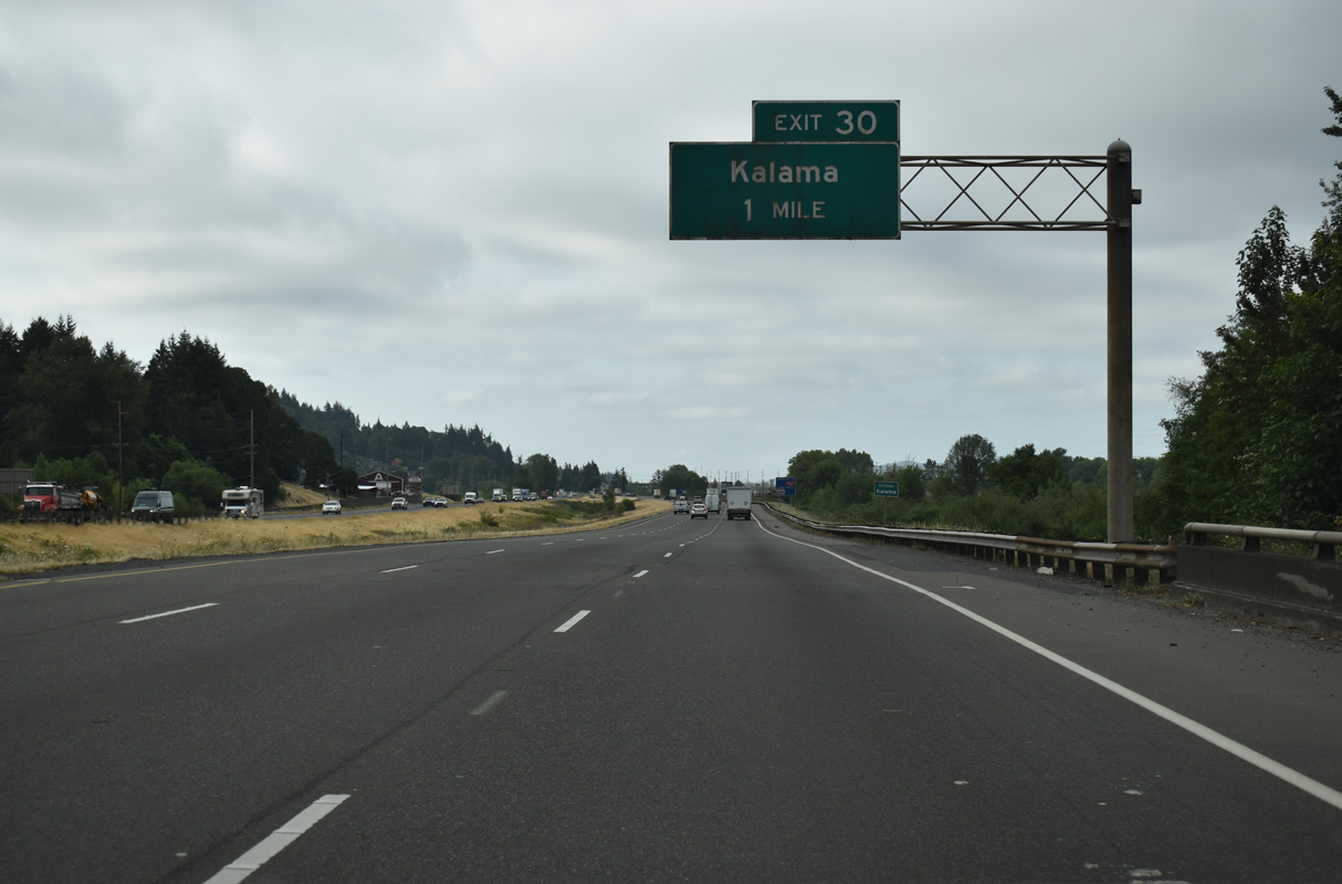
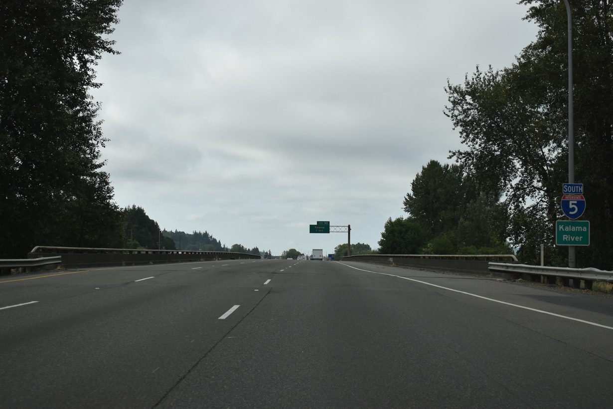
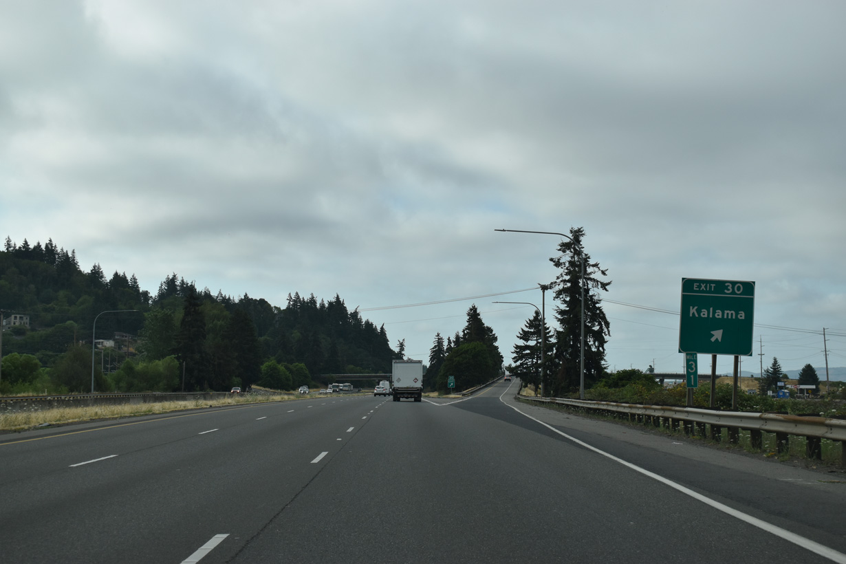
A split diamond interchange (Exit 30) joins Interstate 5 with the Kalama city center. Frontage Roads connect the ramp at Oak Street with Elm Street and the business district.
07/20/23
Oak Street crosses the BNSF Railroad to an industrial area along the Columbia River to the south. Frontage Roads lead south to the ramps at Elm Street; 1st Street (old U.S. 99/830) parallels one block to the east.
07/20/23
Interstate 5 advances south along the Kalama city line to Exit 27.
07/20/23
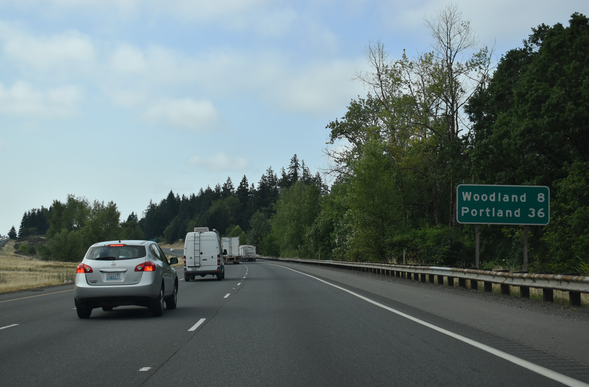
The city of Woodland is eight miles south of Kalama.
07/20/23
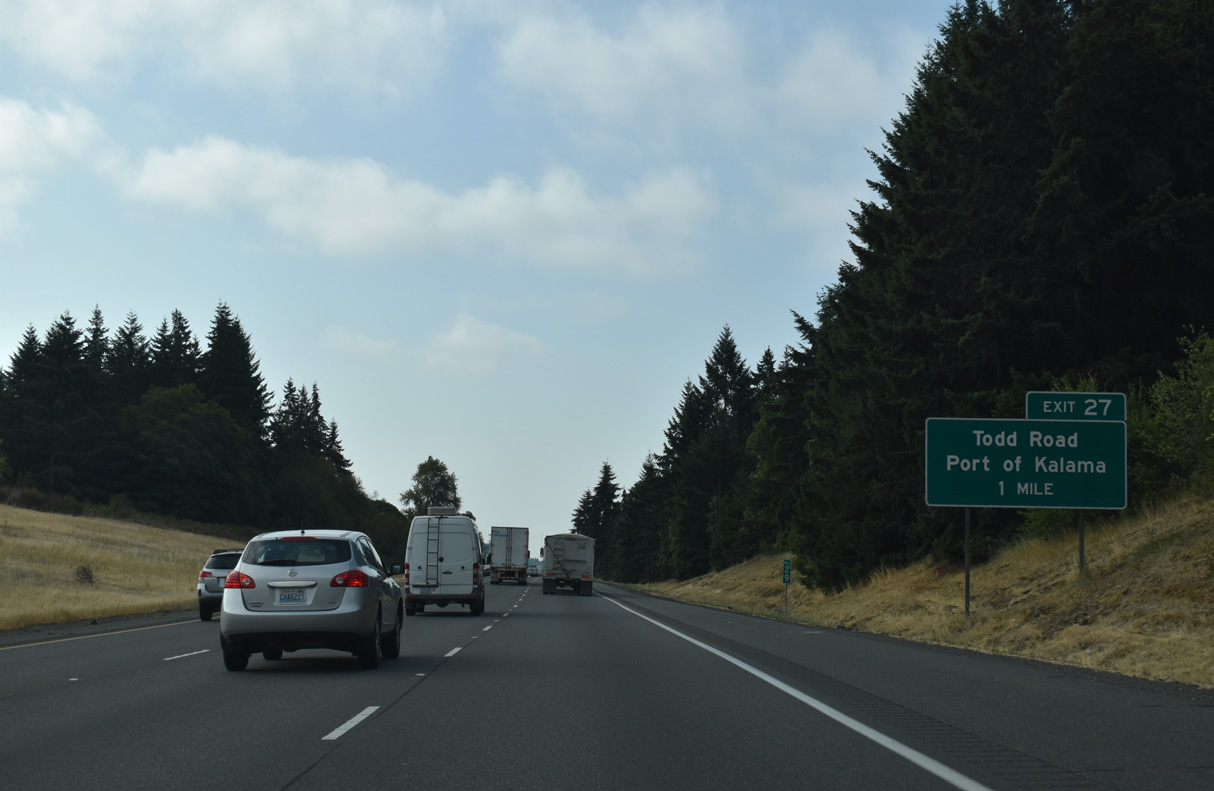
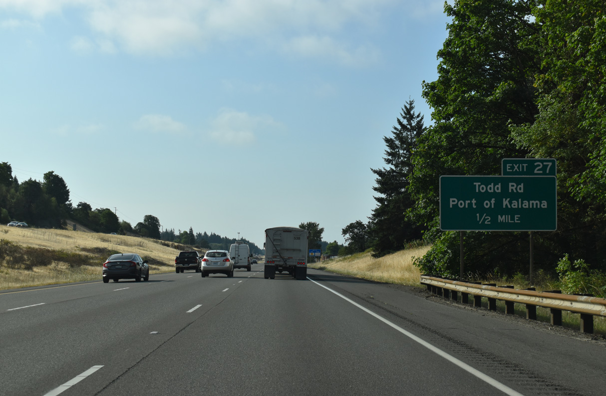
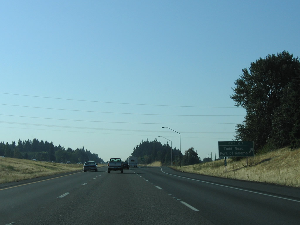
Todd Road joins Interstate 5 with the Port of Kalama west of Exit 27 and Old Pacific Highway east at Robb Road.
07/20/23
Todd Road runs east from the port area to Cloverdale Road. There is no through access south to Woodland independent of I-5.
07/20/23
The alignment of Interstate 5 south from the diamond interchange at Exit 27 replaced the pre-expressway route of U.S. 99/830 to Exit 22 (Bozanich, n.d.-b).
09/02/06

References:
AARoads Wiki. (2023, September 9). List of former state routes in Washington - State Route 431. AARoads Wiki. Retrieved September 17, 2025, from https://wiki.aaroads.com/wiki/List_of_former_state_routes_in_Washington#State_Route_431
Bozanich, M. (n.d.-a) US 830 decommissioned. Highways of Washington State. Retrieved September 17, 2025, from https://www.angelfire.com/wa2/hwysofwastate/us830.html
Bozanich, M. (n.d.-b) US 99 trunk. Highways of Washington State. Retrieved September 16, 2025, from https://www.angelfire.com/wa2/hwysofwastate/us099trunk.html
Bozanich, M. (n.d.-c) State Route 432. Highways of Washington State. Retrieved September 17, 2025, from https://www.angelfire.com/wa2/hwysofwastate/sr432.html
Bozanich, M. (n.d.-d) State Route 433. Highways of Washington State. Retrieved September 17, 2025, from https://www.angelfire.com/wa2/hwysofwastate/sr433.html
Photo Credits:
- Brent Ivy: 07/20/23
- AARoads: 09/02/06
Connect with:
Page Updated Wednesday September 17, 2025.