
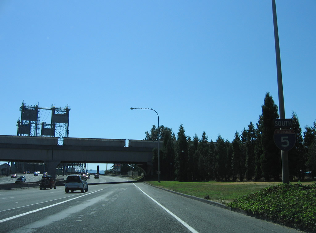
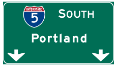
Interstate 5 South - Woodland to Vancouver
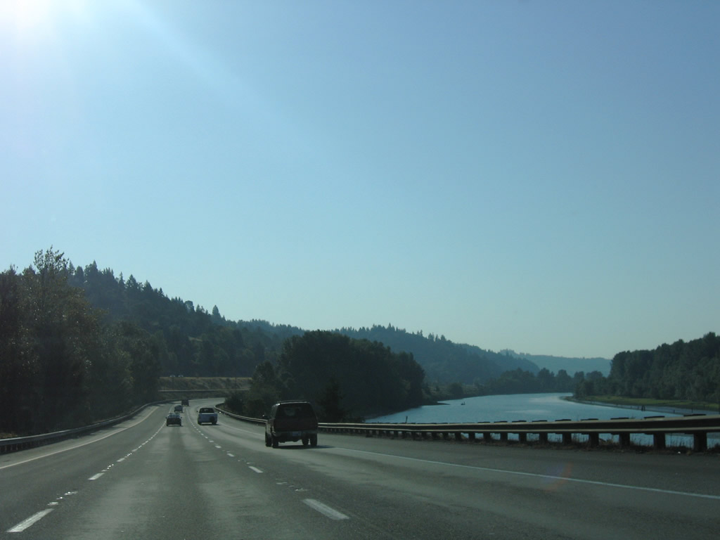
The roadways for Interstate 5 separate at Martin Bluff. The freeway proceeds southeast along Martin Slough across from Martin Island.
09/02/06
The roadway split accommodates the BNSF Railroad lining the median of Interstate 5 along Martin Slough.
07/20/23
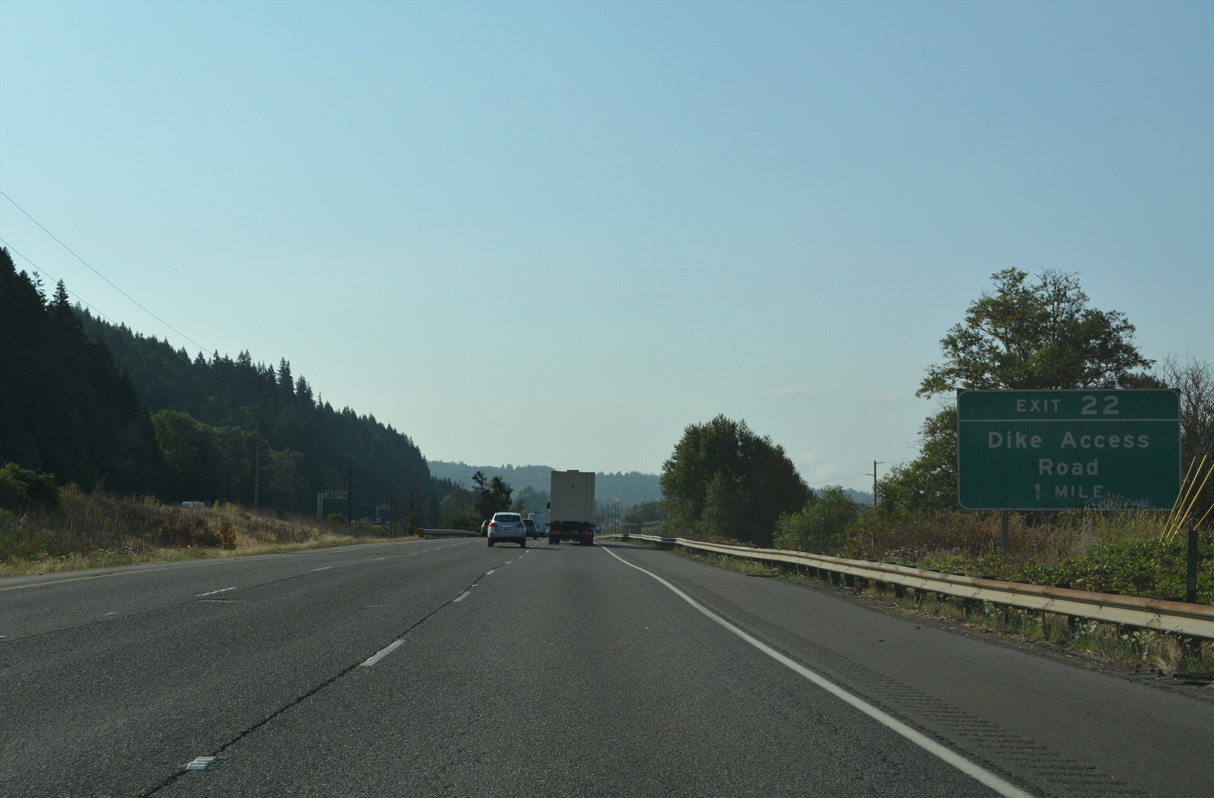
Dike Access Road connects Interstate 5 south with Old Pacific Highway (Old U.S. 99/830) south into Woodland and Dike Road along the levee above Burke Slough.
07/20/23
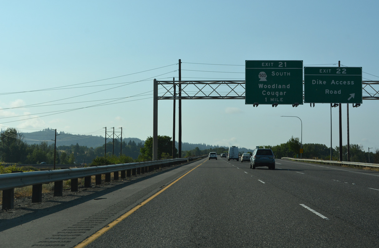
Exit 22 departs Interstate 5 south for Dike Access Road and the Port of Woodland. Exit 21 follows in one mile for Pacific Avenue south to SR 503 (Lewis River Road) east. Old Pacific Highway south from the dogbone interchange with I-5 provides a more direct route to SR 503.
07/20/23
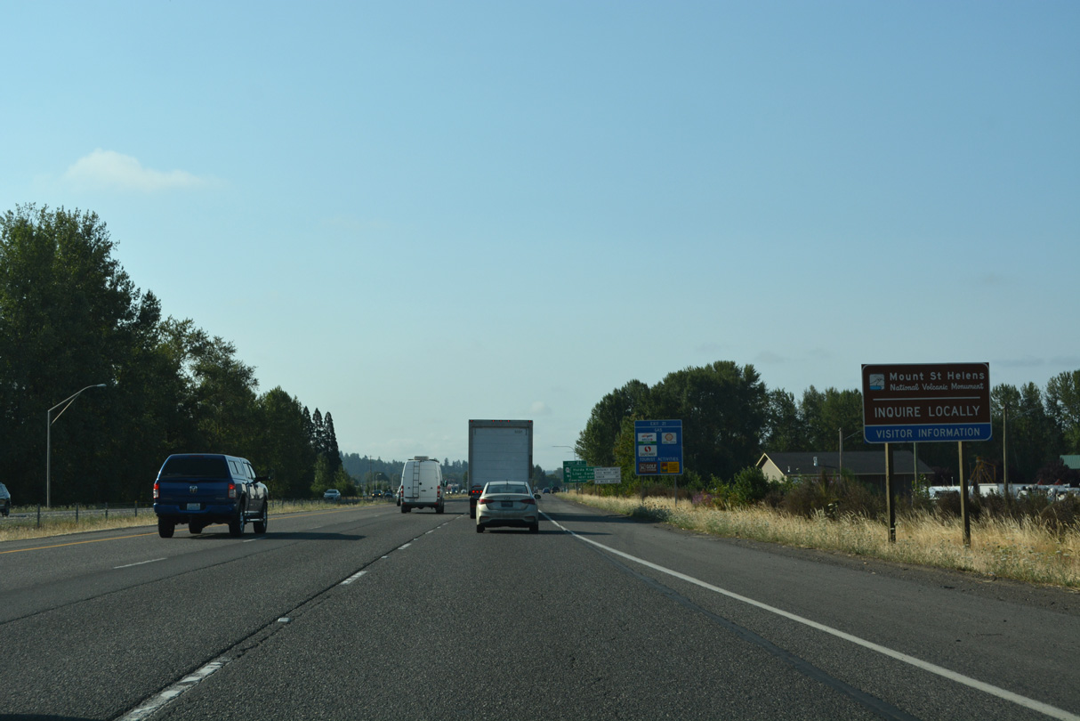
SR 503 follows the Lewis River 21 miles east to Lake Merwin, Yale and SR 503 Spur. SR 503 Spur heads to Cougar and the south end of Mount St. Helens National Volcanic Monument while SR 503 turns southward to Chelatchie and Battle Ground.
07/20/23
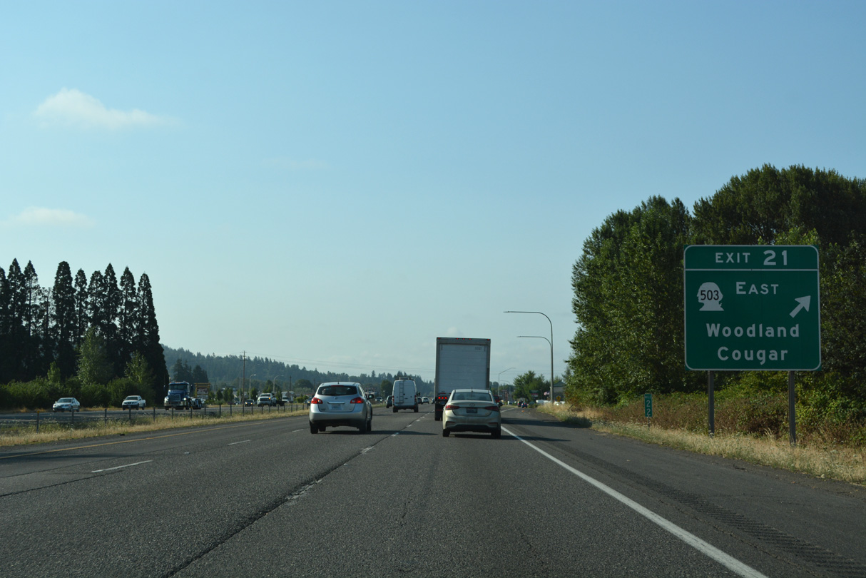
A split diamond interchange at Exit 21 joins Interstate 5 with the west end of SR 503 in Woodland. SR 503 is a 54.11 mile long loop south to SR 500 at Vancouver.
07/20/23
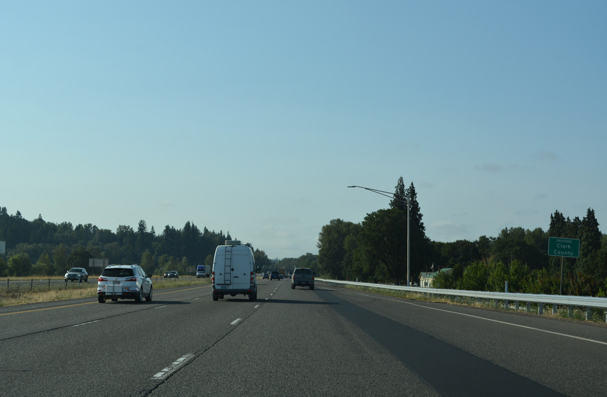
An entrance ramp joins Interstate 5 south from Pacific Avenue, Goerig Street, and SR 503 (Lewis River Road) at Horseshoe Lake and the Clark County line.
07/20/23
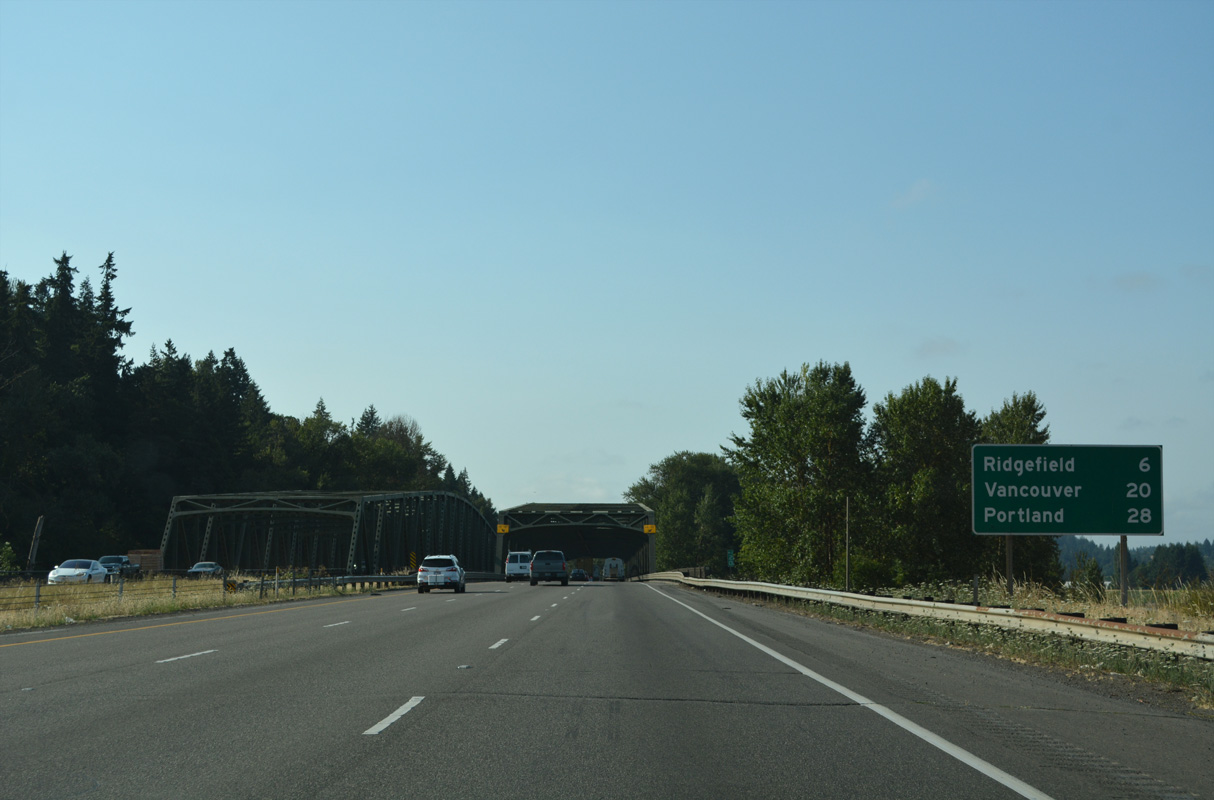
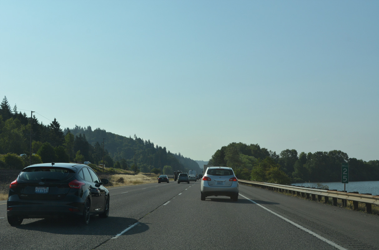
Interstate 5 travels 20 miles south from Woodland and a notch of Cowlitz County at Horseshoe Lake to Vancouver.
07/20/23
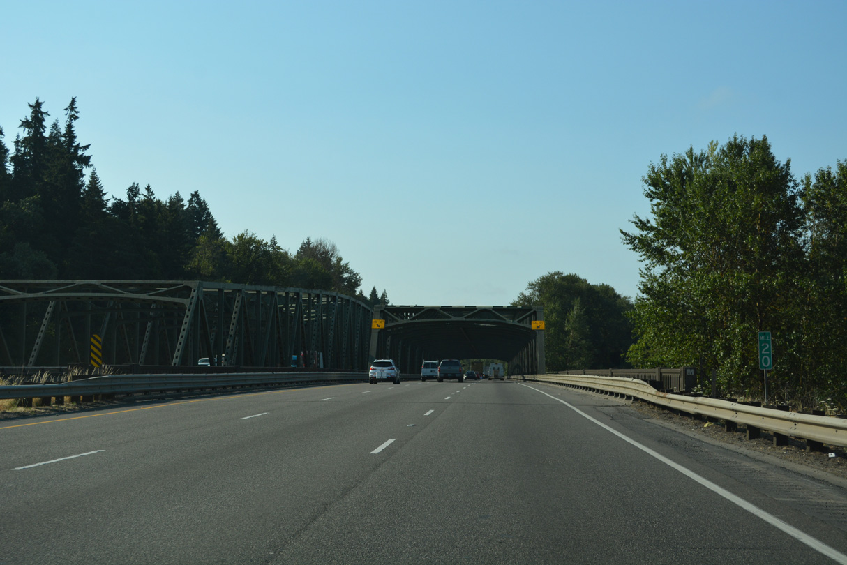
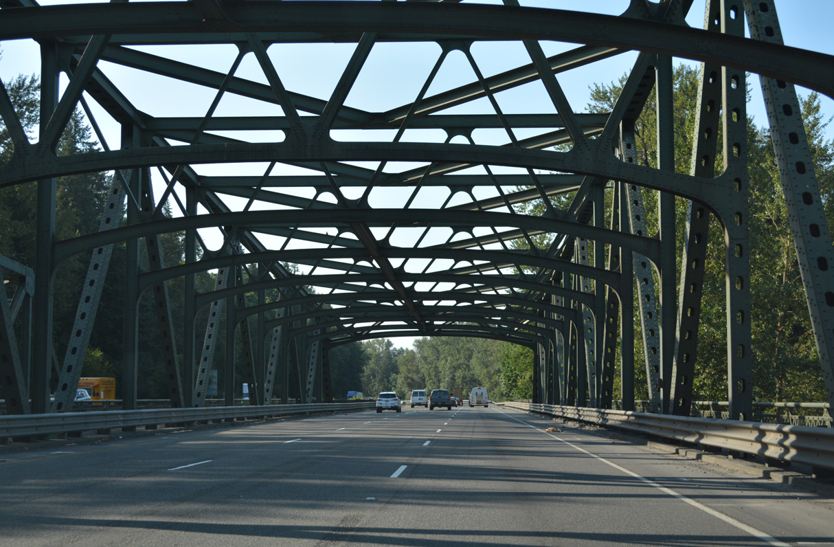
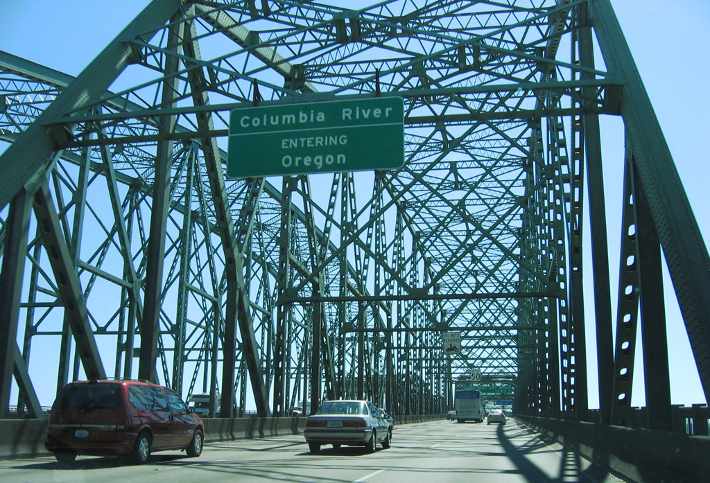
Interstate 5 spans the Lewis River across a pair of truss bridges south of Horseshoe Lake.
07/20/23
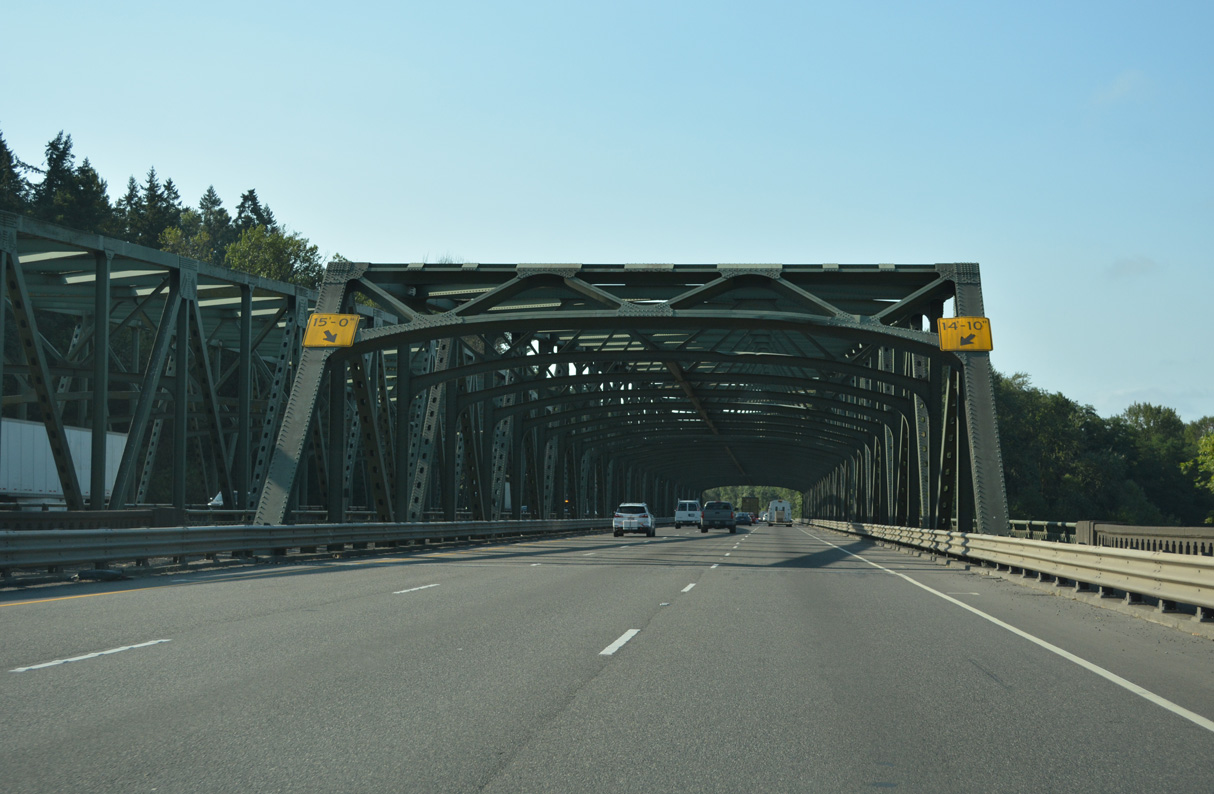
The northbound bridge over the Lewis River was built in 1940 as part of U.S. 99/830. The southbound span was added in 1968 during the upgrade to Interstate 5.
07/20/23
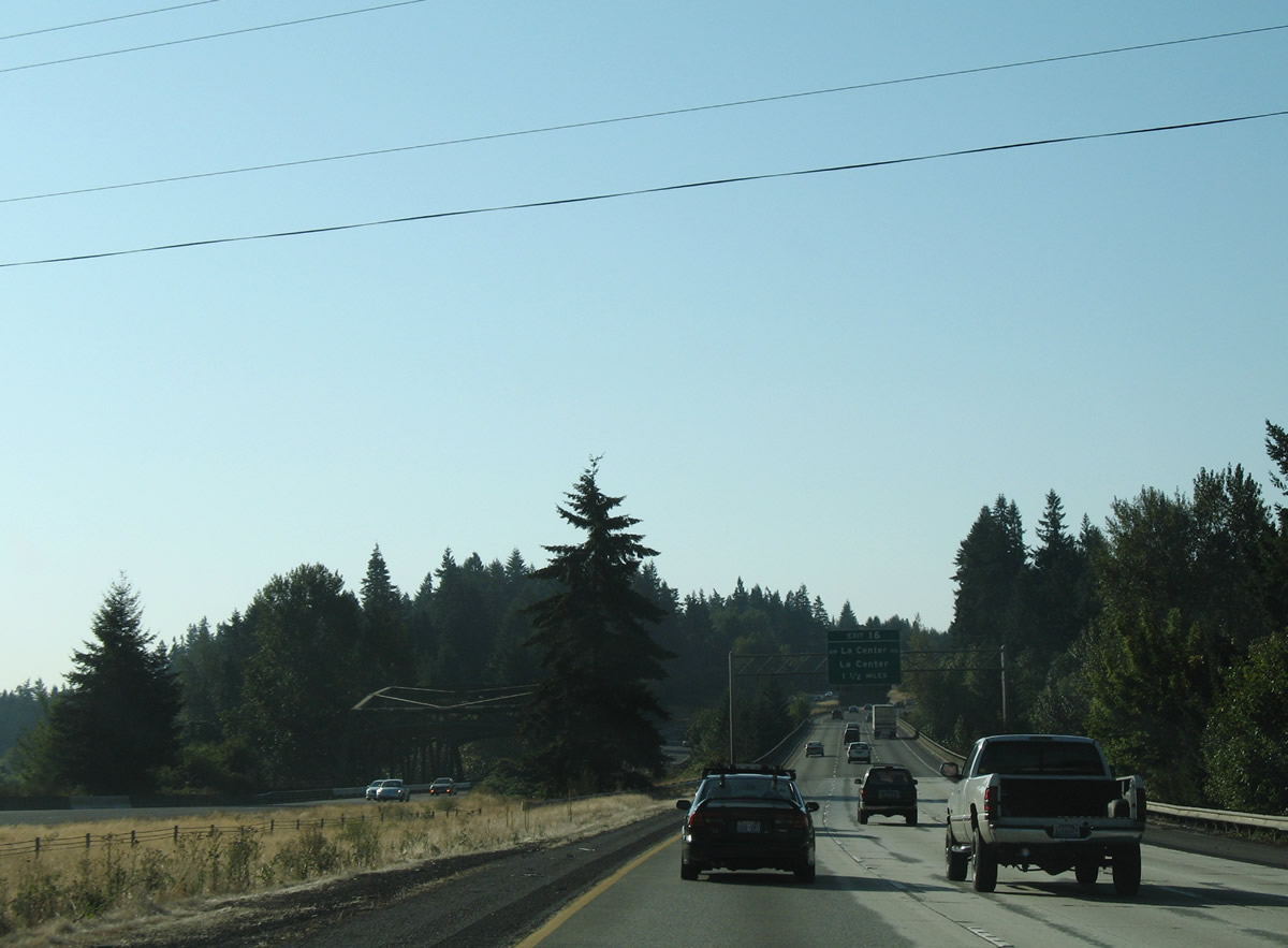
1.5 miles south of the Lewis River, Interstate 5 crosses the Lewis River East Fork at Paradise Point. The northbound bridge dates back to 1936 as U.S. 99/830. The non-descript span on I-5 southbound was built in 1969.
09/02/06
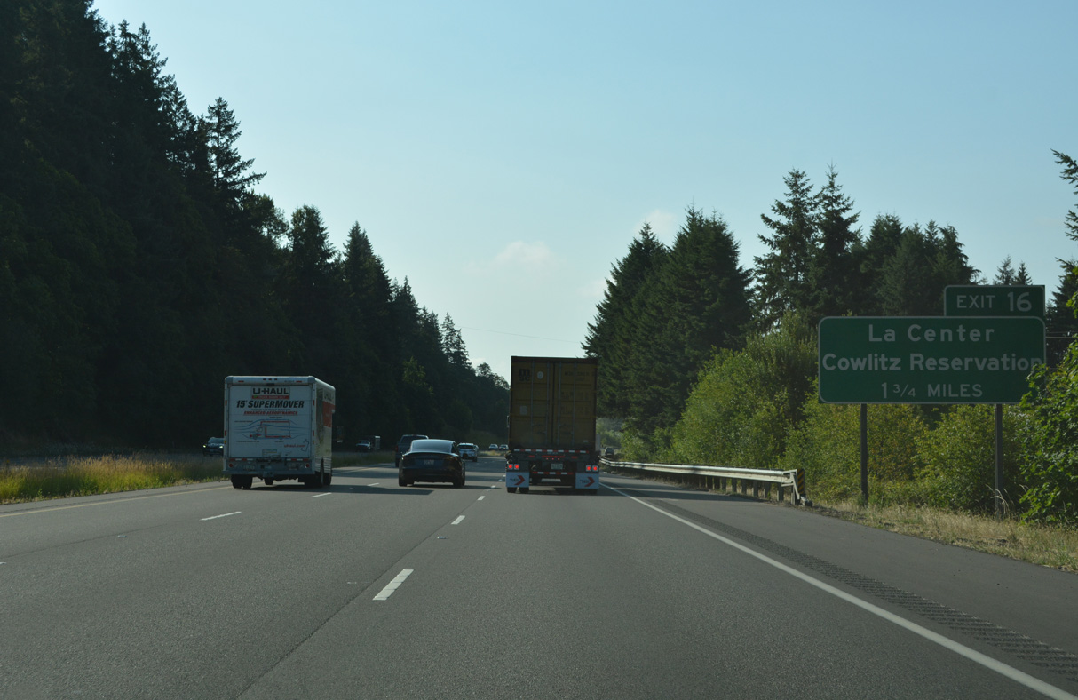
Gaining elevation, I-5 advances 1.75 miles south to Exit 16 for NW La Center Road and the community of La Center. Guide signs for Exit 16 previously referenced NW 319th Street.
07/20/23
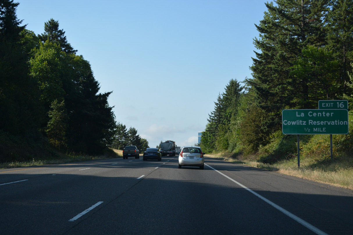
NW La Center Road arcs two miles northeast from a dumbbell interchange (Exit 16) with I-5 into the city of La Center.
07/20/23
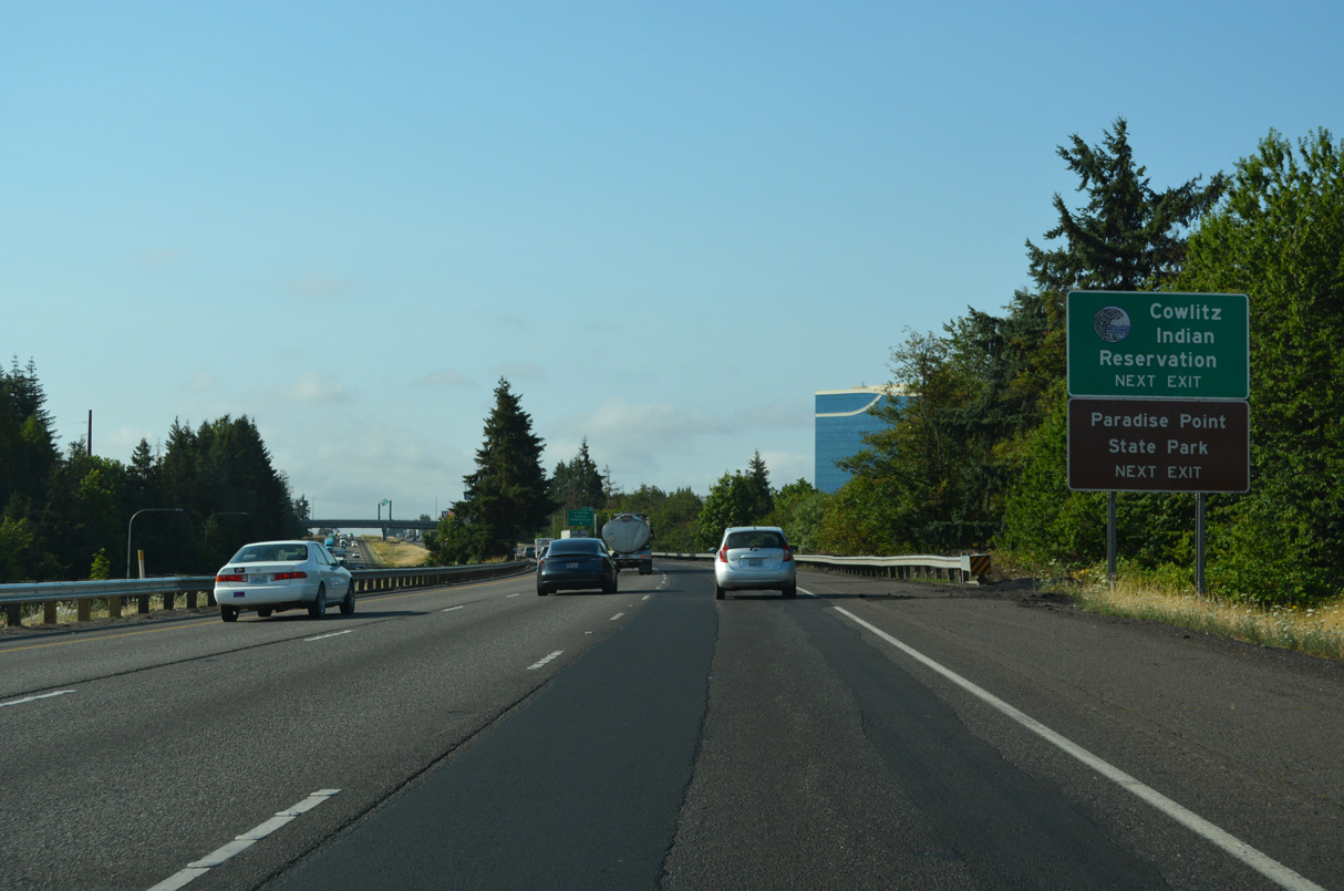
Paradise Park Road stems north from La Center Road nearby to Paradise Park State Park. The Cowlitz Indian reservation lines the west side of Interstate 5 at Exit 16.
07/20/23
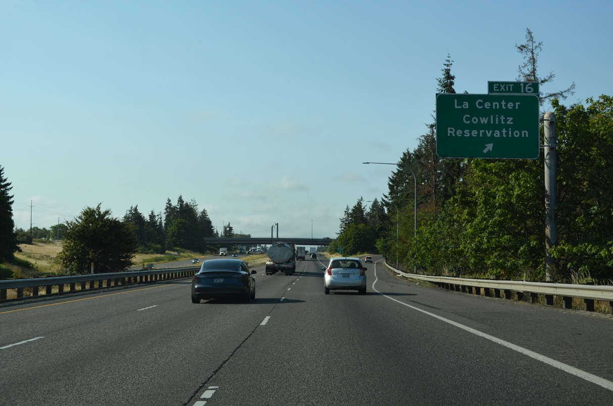
Exit 16 departs Interstate 5 south for La Center Road (NW 319th Street) east and Cowlitz Way west to the adjacent ilani casino.
07/20/23
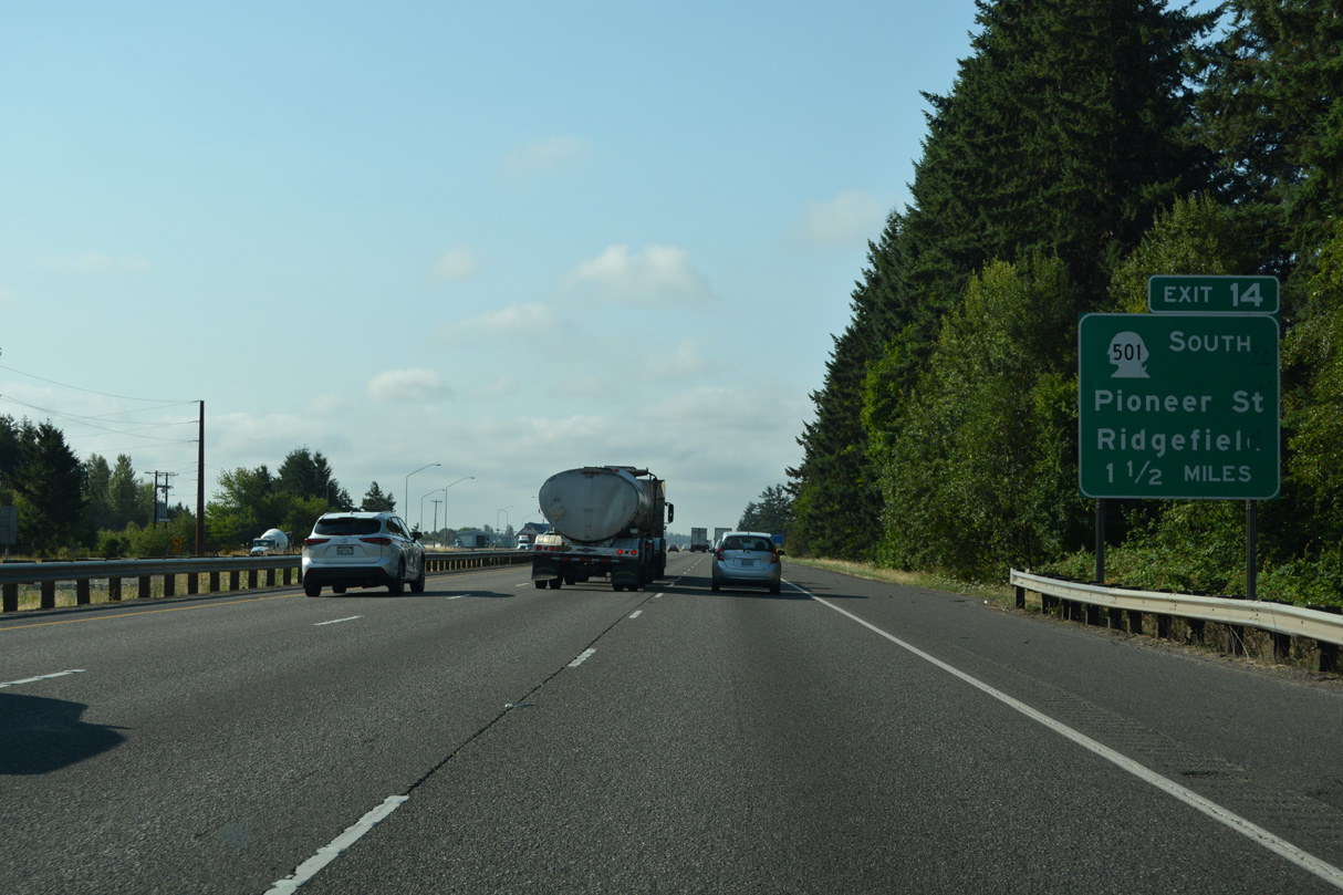
Interstate 5 enters the city of Ridgefield ahead of Exit 14 with SR 501 (Pioneer Street) west. Split into two segments, the northern section of SR 501 travels 2.97 miles west to the Ridgefield city center. The southern section spurs 9.72 miles northwest from Exit 1 C to Shillapoo North Wildlife Area.
07/20/23
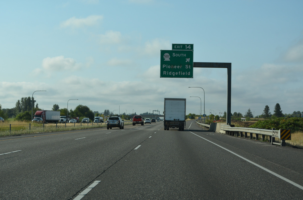
A diamond interchange (Exit 14) links Interstate 5 south with SR 501 (Pioneer Street) west at Ridgefield. Roundabouts join Pioneer Street east with S 65th Avenue and NE 259th Street. 1.4 miles east of I-5, N 85th Avenue is Old U.S. 99/830.
07/20/23
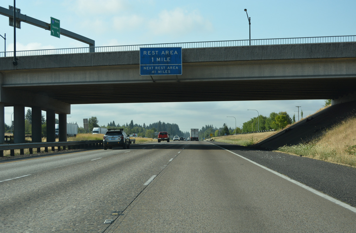
The Gee Creek Rest Area lies one mile south of Pioneer Street along Interstate 5.
07/20/23
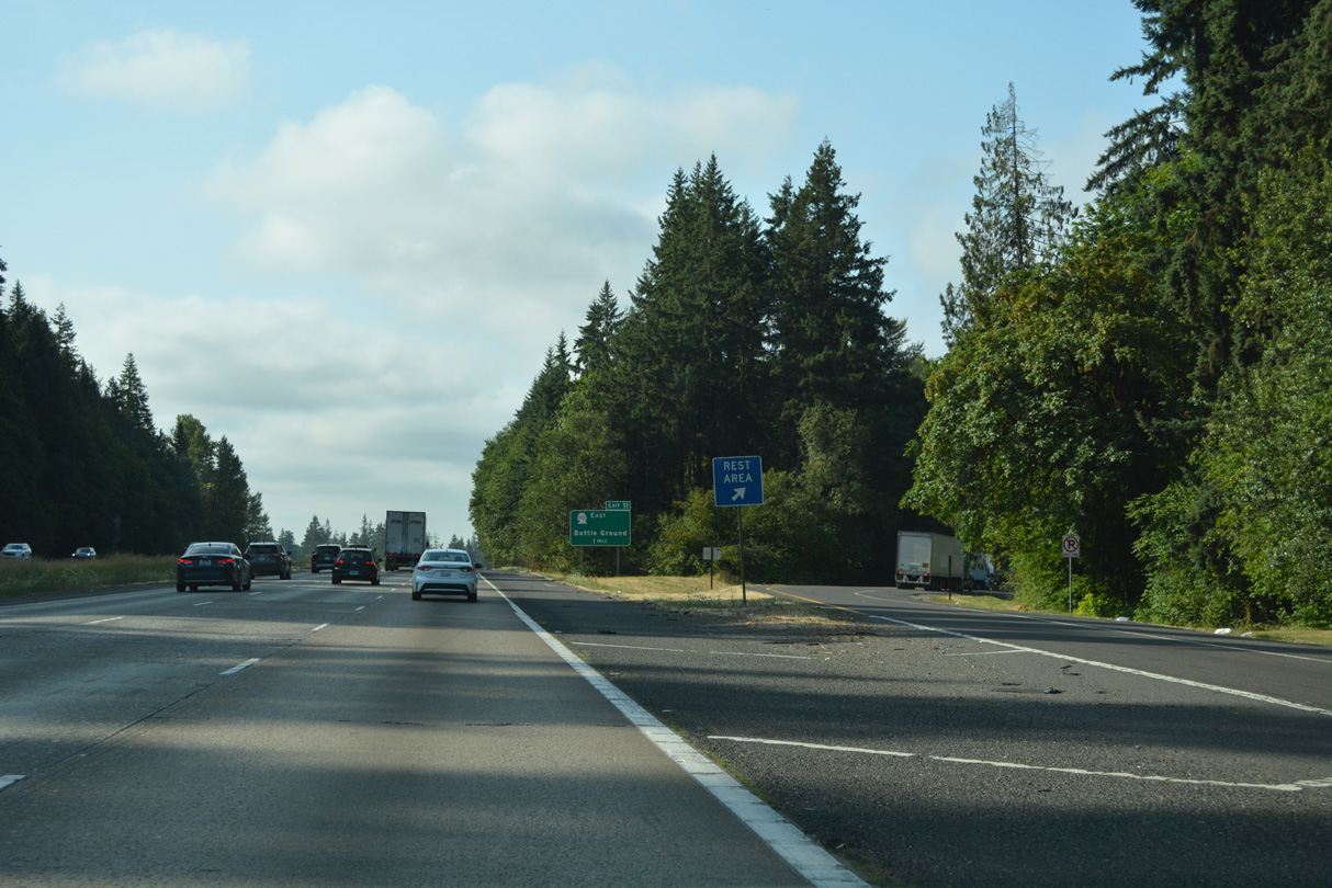
Located just south of the Ridgefield city limits, the Gee Creek Rest Area is within a wooded area adjacent to Gee Creek.
07/20/23
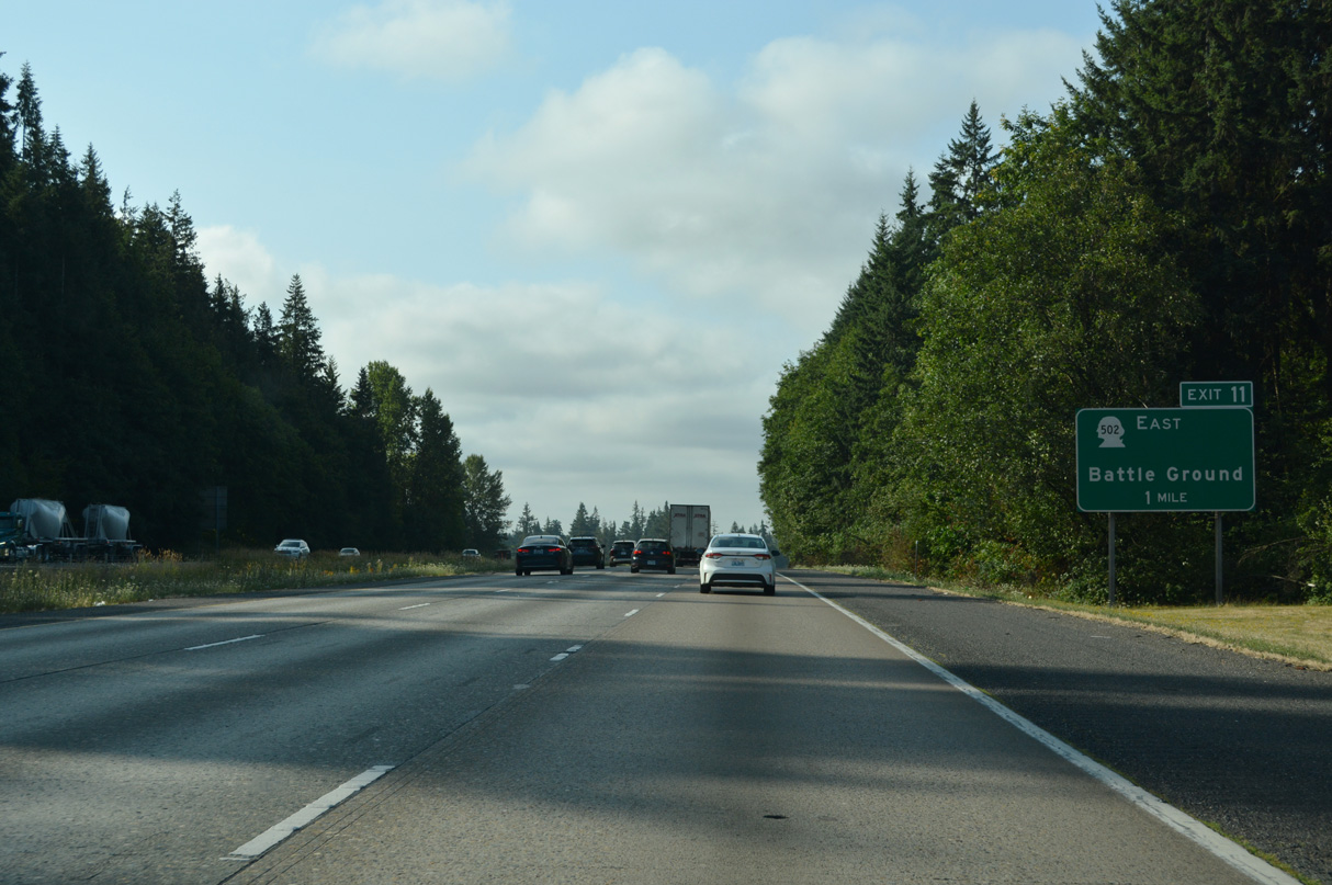
Heading south from the Gee Creek Rest Area, Interstate 5 continues to a parclo interchange (Exit 11) with SR 502 (NE 219th Street) east.
07/20/23
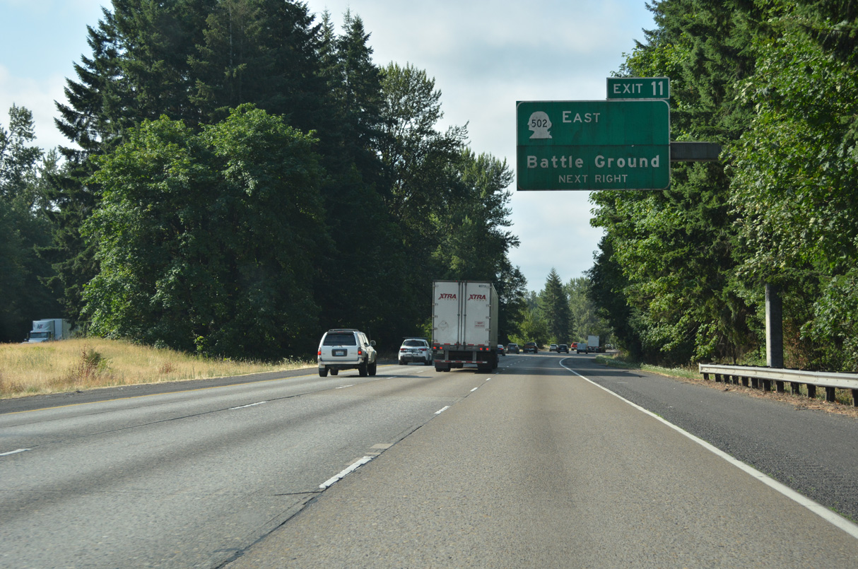
Opened on October 15, 2008 (WSDOT, 2008), Exit 11 improved access to the city of Battle Ground and Ball Ground Lake State Park.
07/20/23
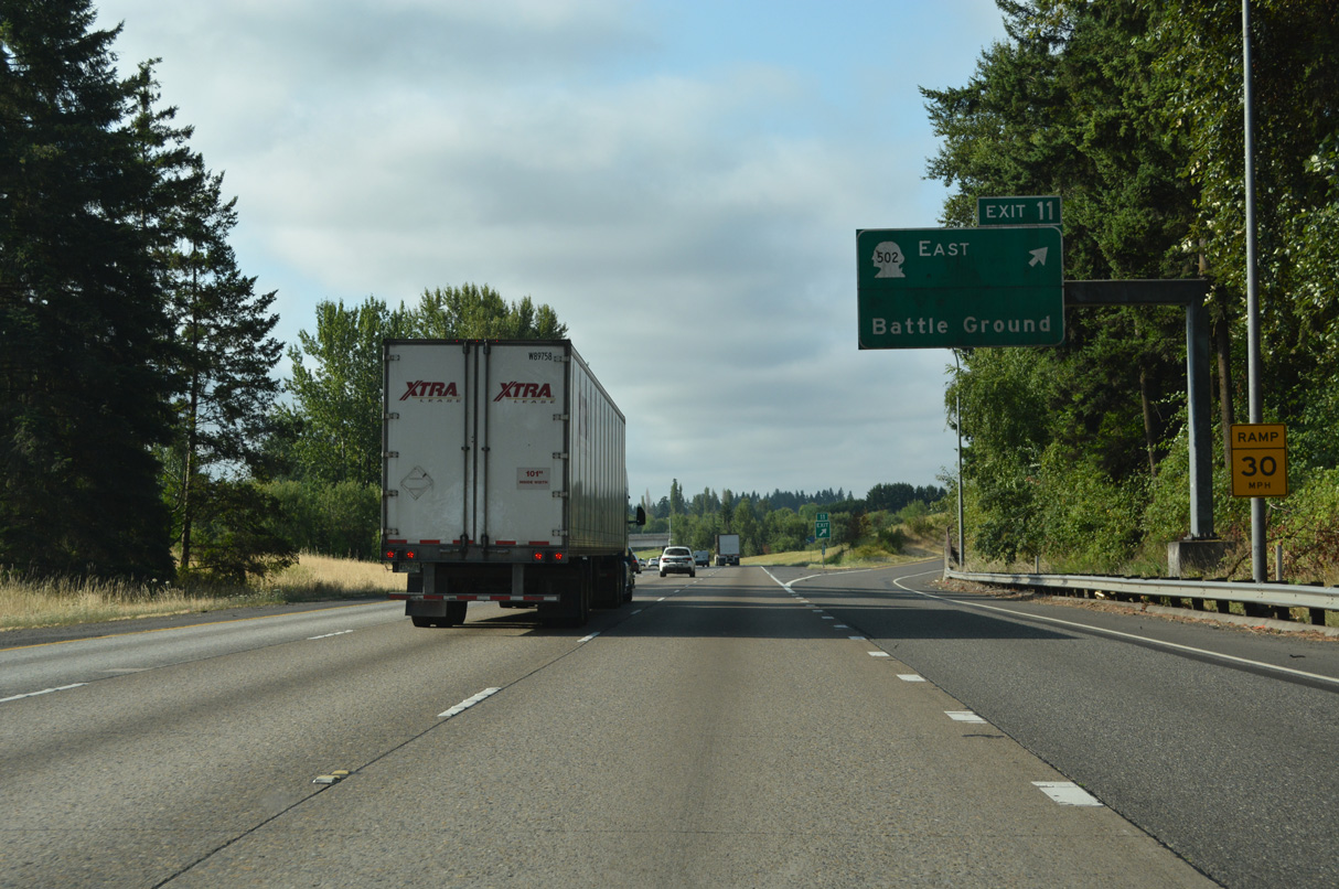
SR 502 was truncated north from NE 10th Avenue (Old U.S. 99/830) to NE 219th Street. The state route spurs 6.12 miles east from Exit 11 to SR 503 (SW 10th Avenu) at W Main Street in Ball Ground.
07/20/23
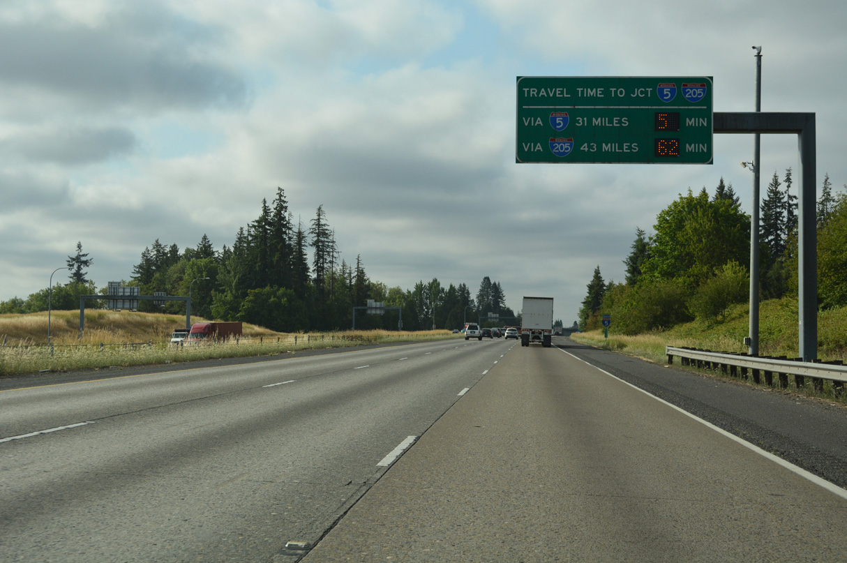
Travel times for regional traffic headed south of Portland reference the south junction of I-5/205 at Tualatin, Oregon.
07/20/23
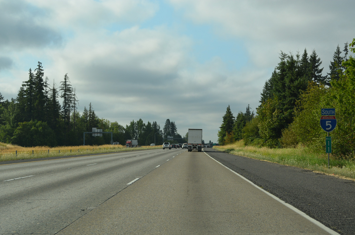
Confirming marker posted south at mile marker 11.
07/20/23
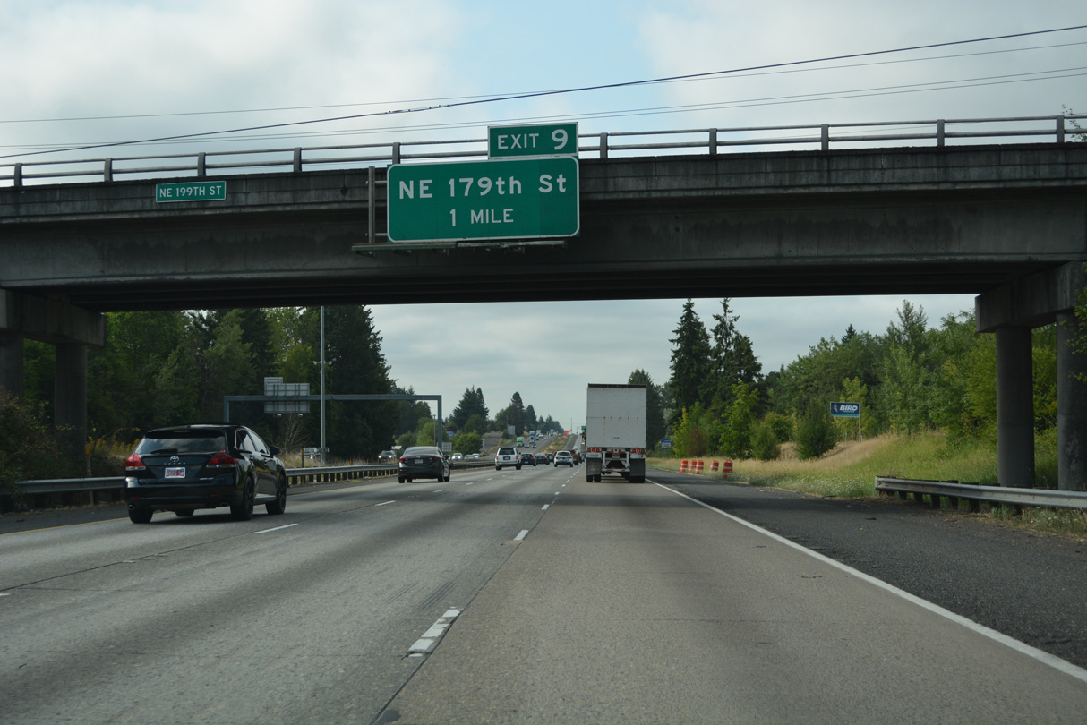
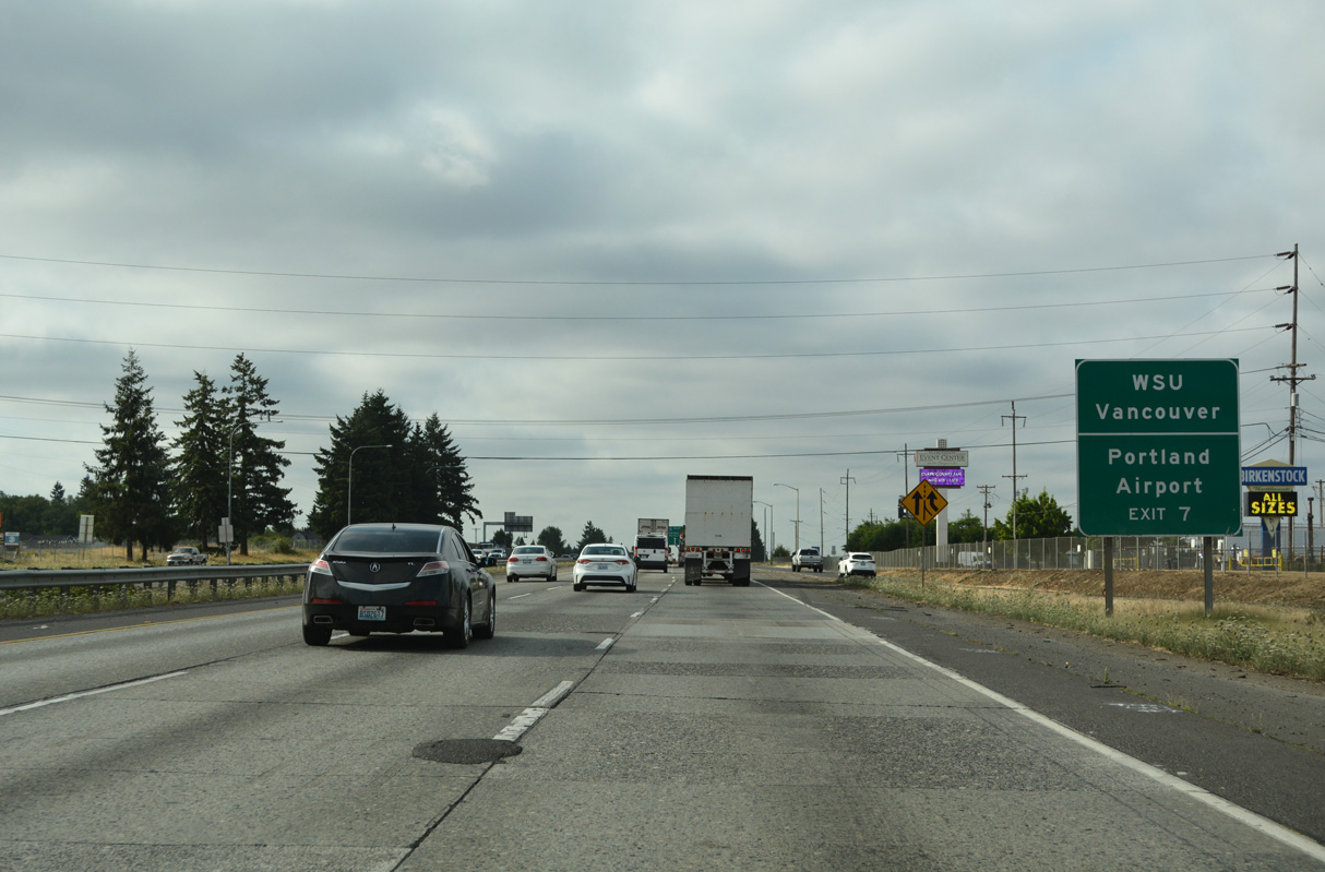
The diamond interchange (Exit 9) with NE 179th Street at Baker serves the adjacent Clark County Fairgrounds. NE 179th Street travels east to the census designated place of Meadow Glade.
07/20/23
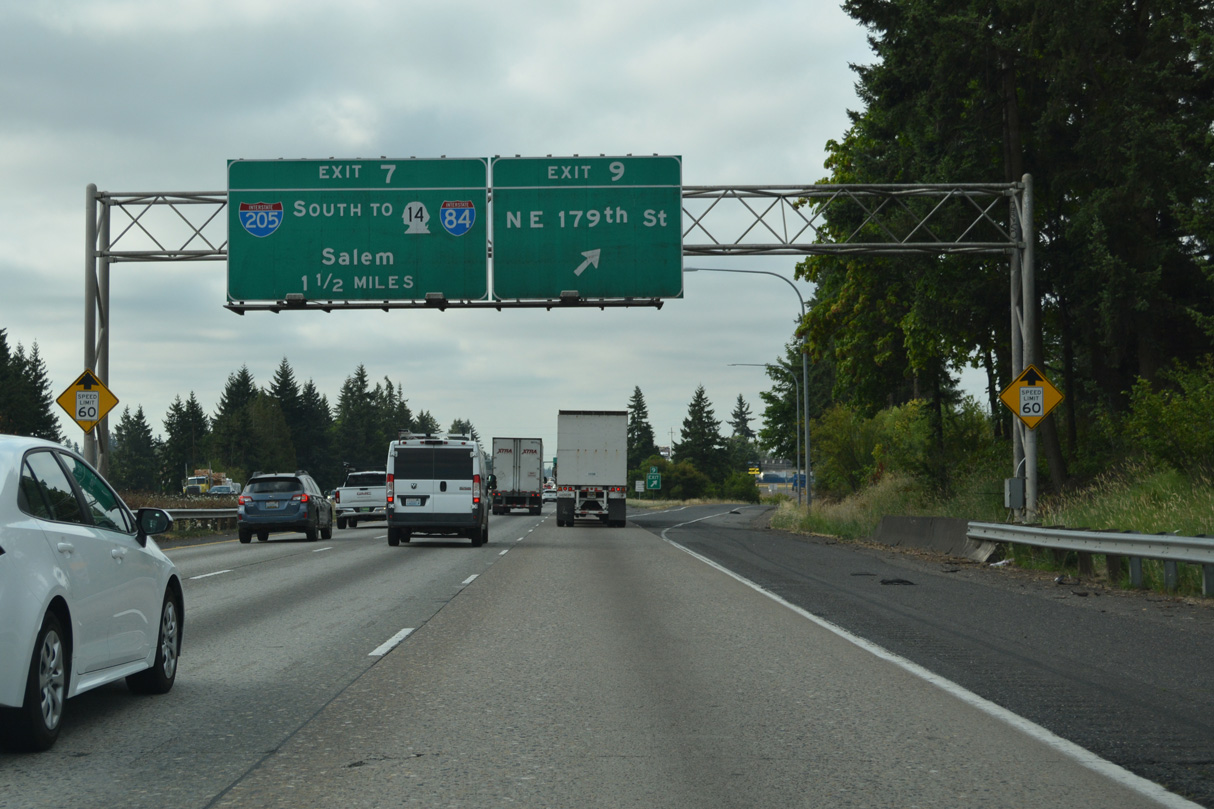
Interstate 205 branches southeast from I-5, 1.5 miles south of Exit 7 / NE 179th Street. Completed in Washington by 1983, Interstate 205 travels 10.57 miles south to the Glenn Jackson Bridge over the Columbia River.
07/20/23
The first exit from I-205 connects with NE 134th Street between I-5 and NE 20th Avenue (Old U.S. 99/830). The arterial east becomes Salmon Creek Avenue ahead of the Washington State University (WSU) Vancouver campus.
07/20/23
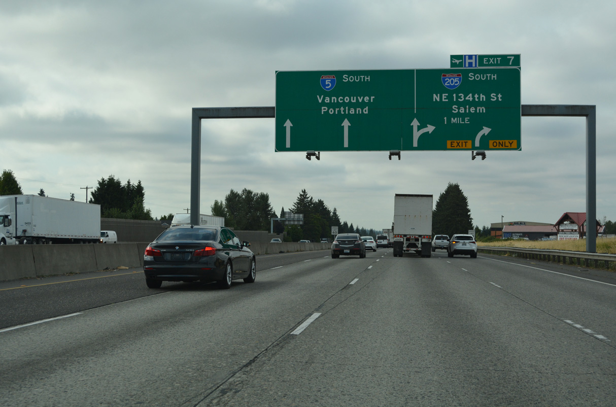
Guide signs for Exit 7 formerly referenced the connections from I-205 to SR 14 east to Camas and Interstate 84 east to Hood River. The Oregon capital city is along the continuation of I-5 south from Tualatin.
07/20/23
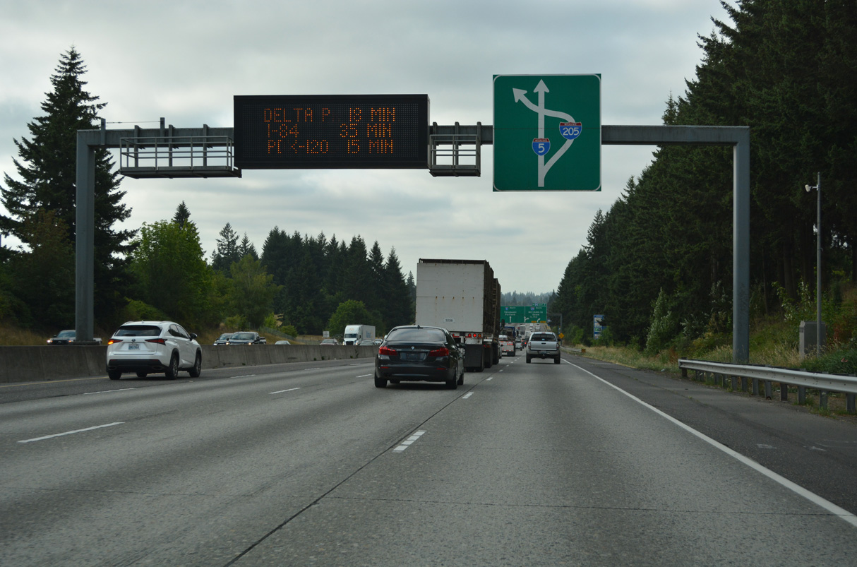
Interstate 205 comprises a suburban bypass of Portland, Oregon.
07/20/23
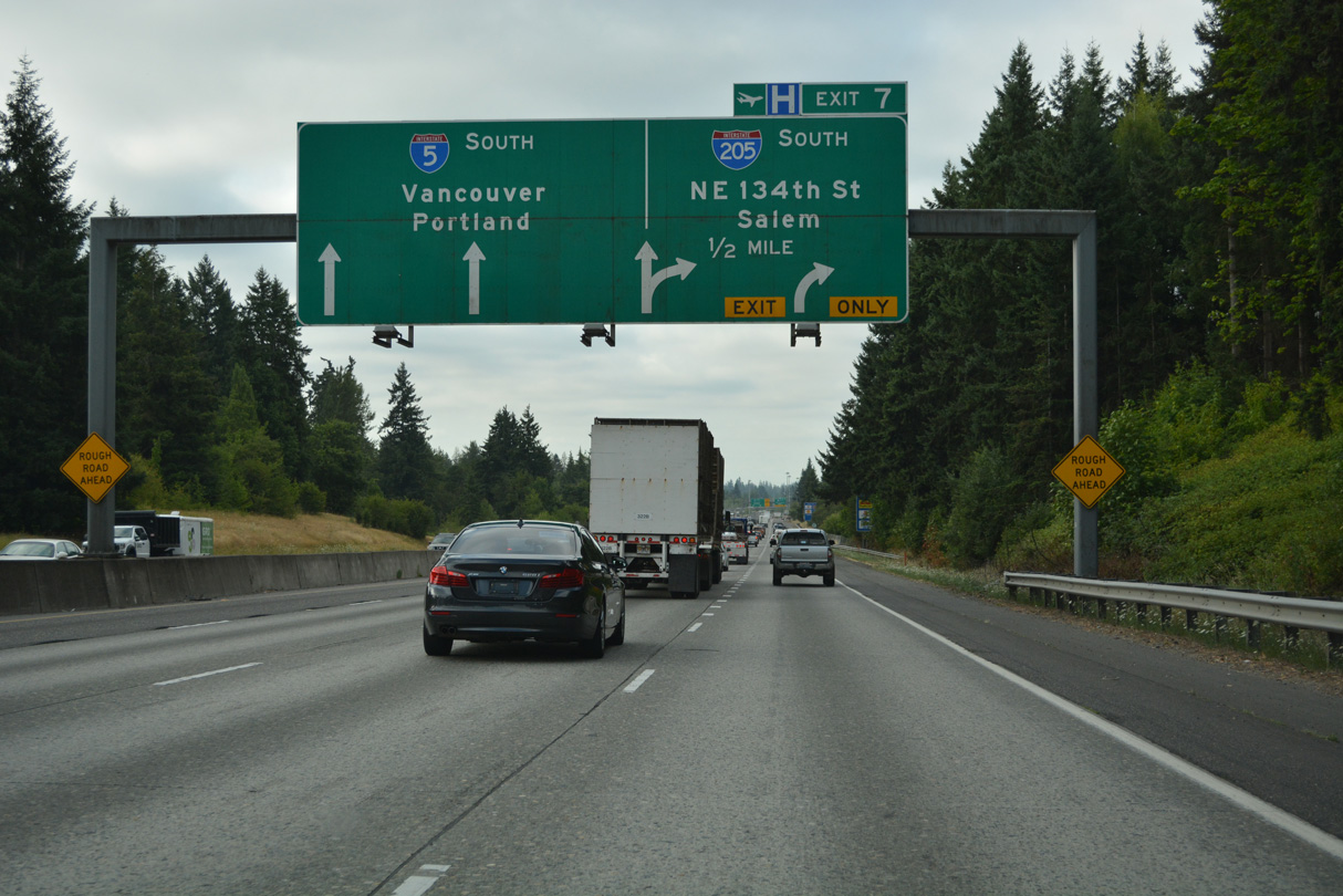
I-5/205 part ways at a wye interchange (Exit 7) and the census designated place of Salmon Creek. Interstate 5 briefly reduces to four overall lanes at the adjacent half diamond interchange with NE 134th Street.
07/20/23
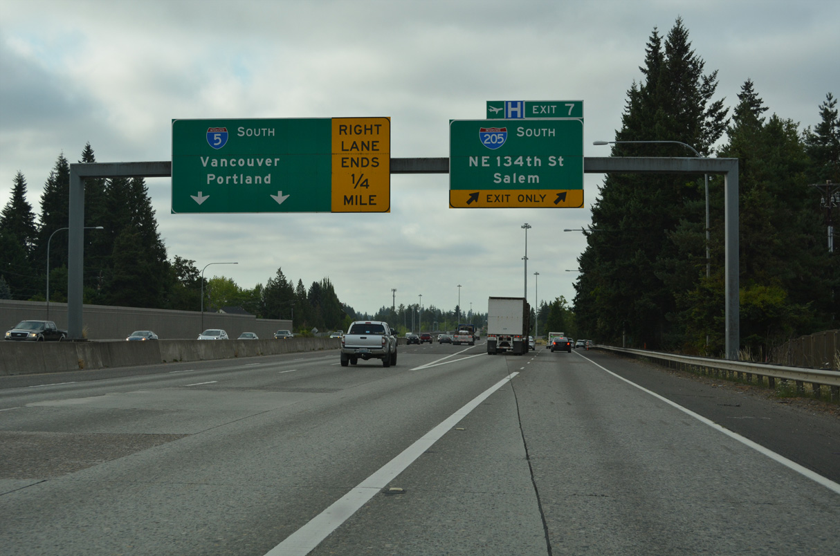
Interstate 205 angles southeast 6.26 miles to the freeway along SR 500 at the Vancouver city line. The freeway reaches Portland International Airport (PDX) in 12 miles and I-84 in 14 miles.
07/20/23
Leaving the exchange with SR 14, Interstate 5 south passes under a BNSF Railroad line ahead of the Interstate Bridge across the Columbia River.
08/27/06
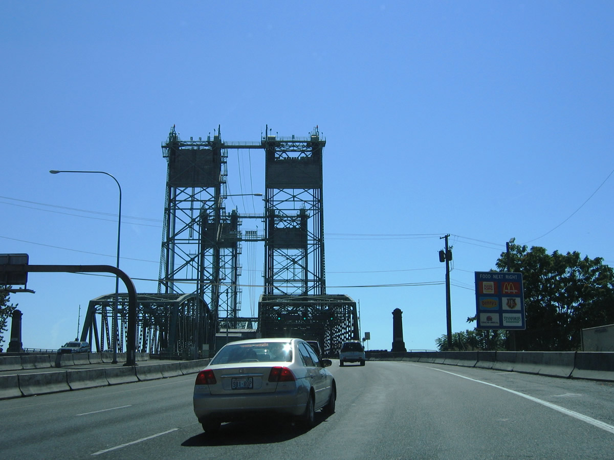
The Interstate Bridge spans the Columbia River between Vancouver, Washington and Hayden Island in Oregon. The 3,538 foot long vertical lift bridges travel 72 feet above the river ("Interstate Bridge", 2025, July 20).
08/27/06
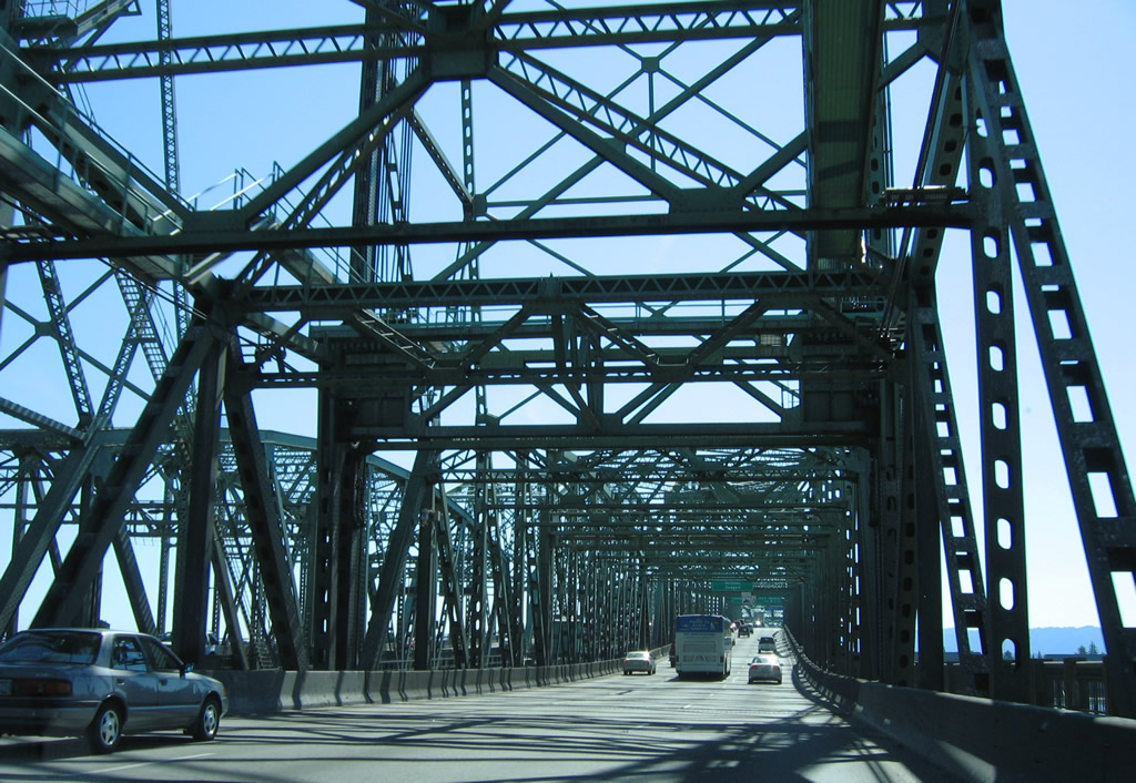
The northbound bridge across the Columbia River dates back to 1917 while the southbound crossing was built in 1958. Tolls were charged for the Interstate Bridge until 1966 ("Interstate Bridge", 2025, July 20).
08/27/06
Entering the city of Portland, Oregon on Interstate 5 south.
08/27/06

References:
Bozanich, M. (n.d.) US 99 trunk. Highways of Washington State. Retrieved September 16, 2025, from https://www.angelfire.com/wa2/hwysofwastate/us099trunk.html
Washington Department of Transportation (WSDOT). (2008) I-5 - SR 502 - Interchange - Complete October 2008 WSDOT. http://www.wsdot.wa.gov/projects/sr502/interchange/
Interstate Bridge. (2025, July 20) In https://en.wikipedia.org/w/index.php?title=Interstate_Bridge&oldid=1301490726
Photo Credits:
- AARoads: 08/27/06, 09/02/06
- Brent Ivy: 07/20/23
Connect with:
Page Updated Wednesday September 17, 2025.