
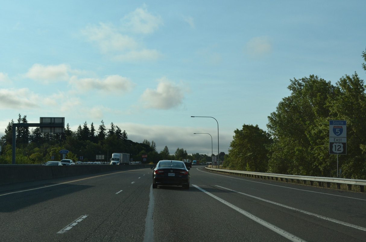
Interstate 5 South - Centralia to Vader
 East
East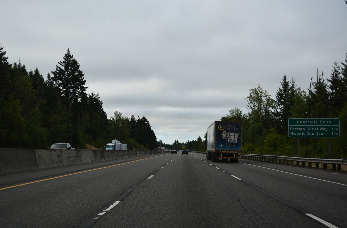
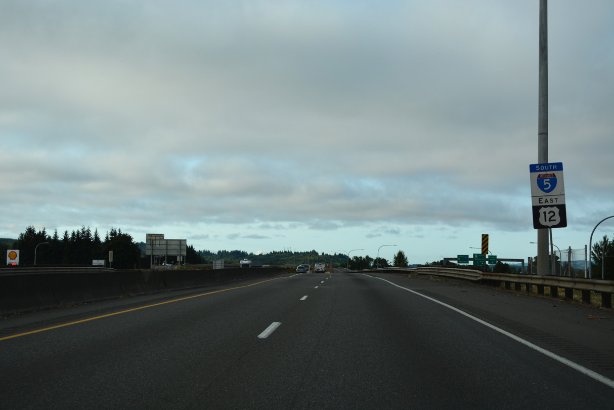
Old U.S. 99 angles southeast from the Thurston County line along Harrison Avenue through unincorporated Fords Prairie to meet I-5/U.S. 12 at the first of two exits within the city of Centralia. U.S. 99 shifted onto the eventual I-5, from Exits 79 to 102, in the mid 1950s (Bozanich, n.d.).
07/20/23
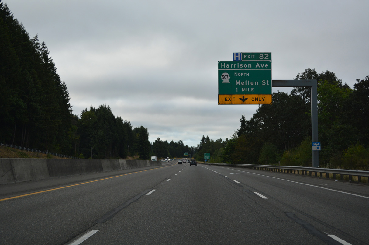
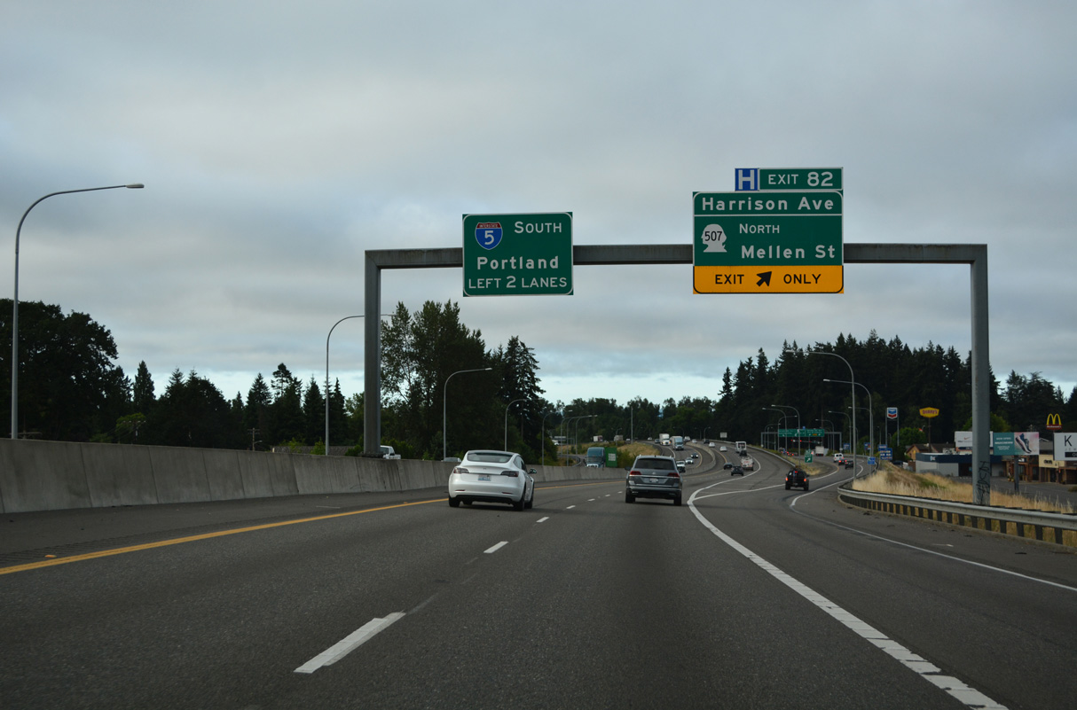
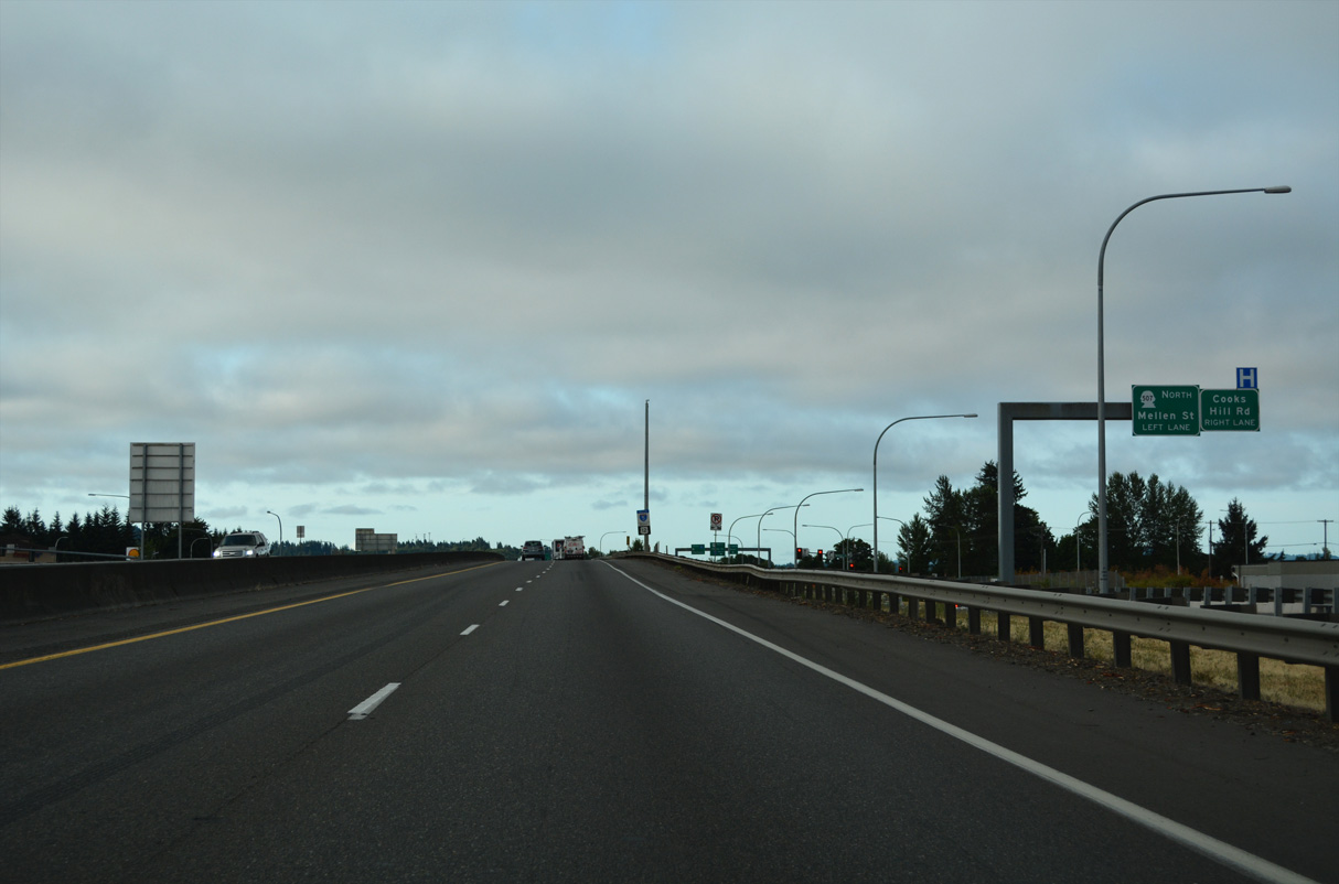
Service roads from the split diamond interchange at Exit 82 extend south to SR 507 (Mellen Street). SR 507 is a 43.81 mile long route from I-5 and Centralia northeast to Tenino, Rainier, Yelm, and SR 7 south of Tacoma.
07/20/23
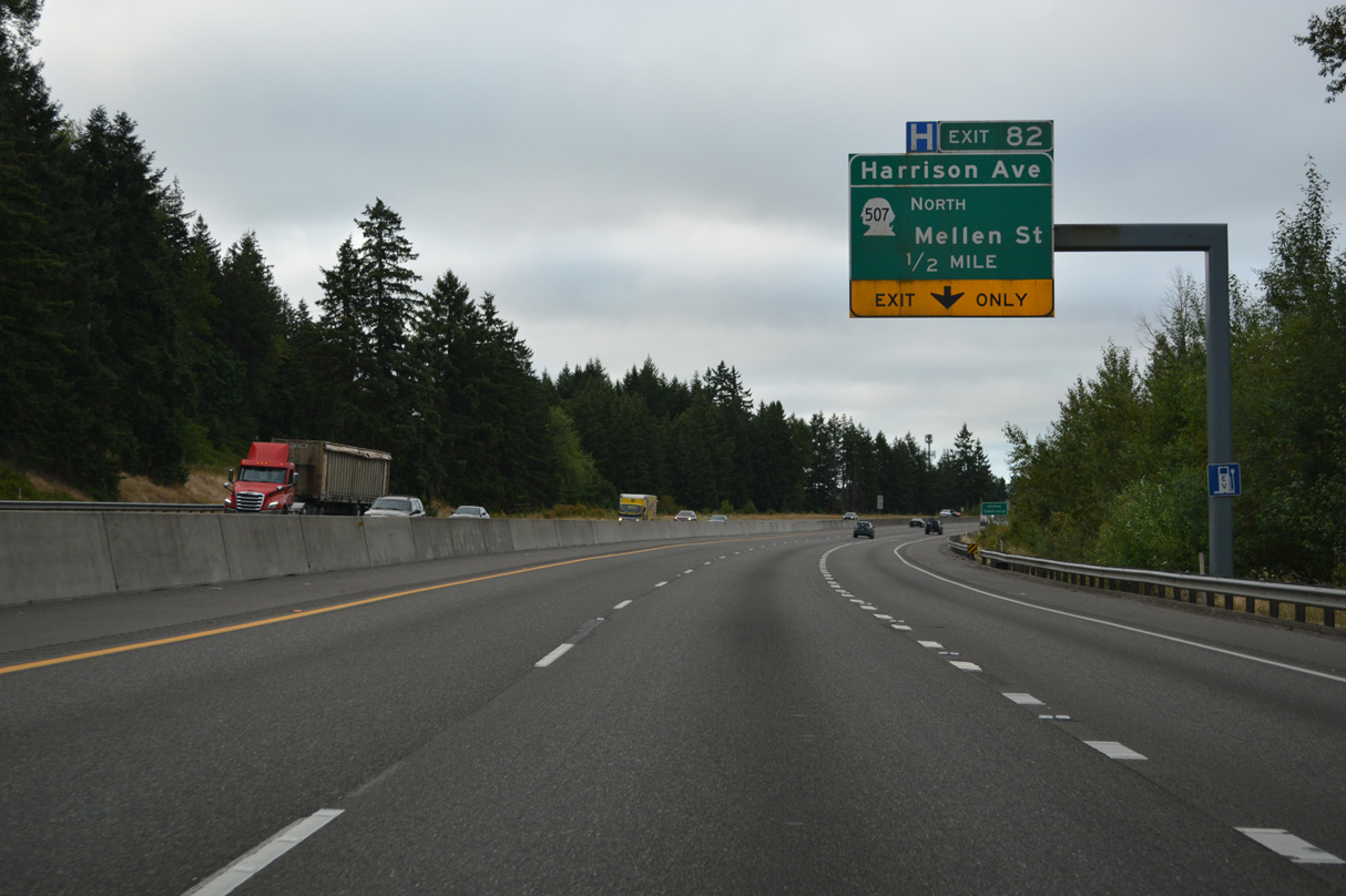
Harrison Avenue (Old U.S. 99) continues east from Exit 82 to become Main Street en to the Centralia city center.
07/20/23
SR 507 follows a combination of Mellen, Alder, and Cherry Streets to the couplet of Tower Avenue north / Pearl Street south. The couplet is part of Old U.S. 99 into the city center.
07/20/23
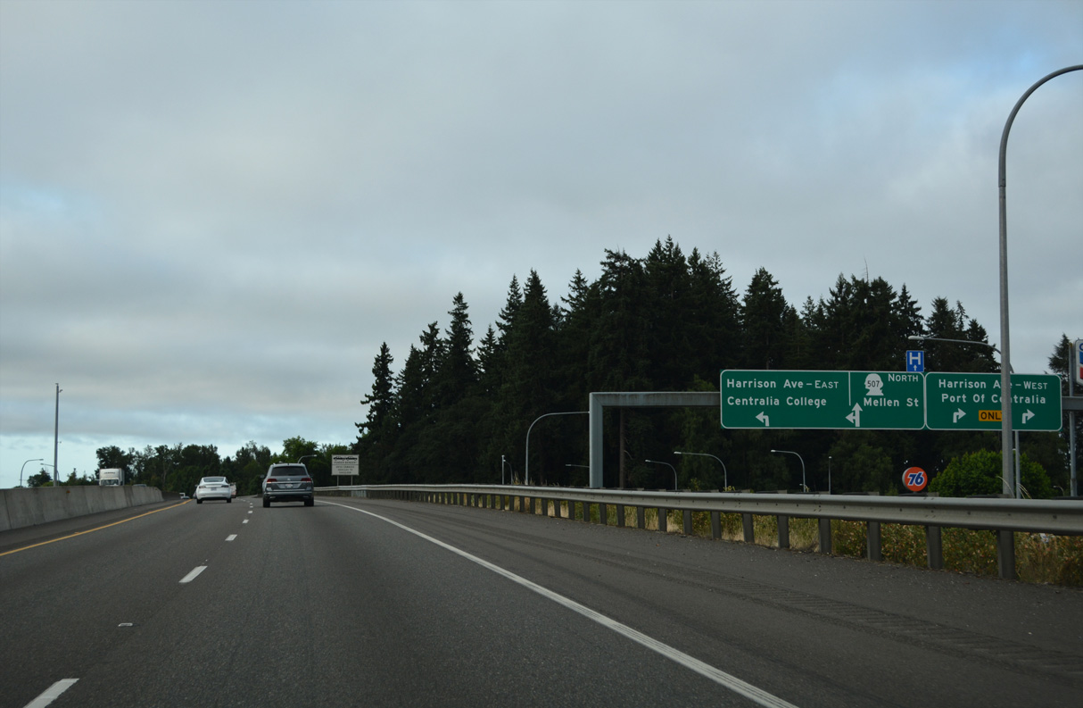
The Centralia Factory Outlets are located along Harrison Avenue on both sides of I-5/U.S. 12. Points of interest for Exit 82 include the Port of Centralia and Centralia College.
07/20/23
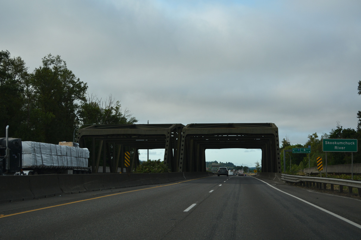
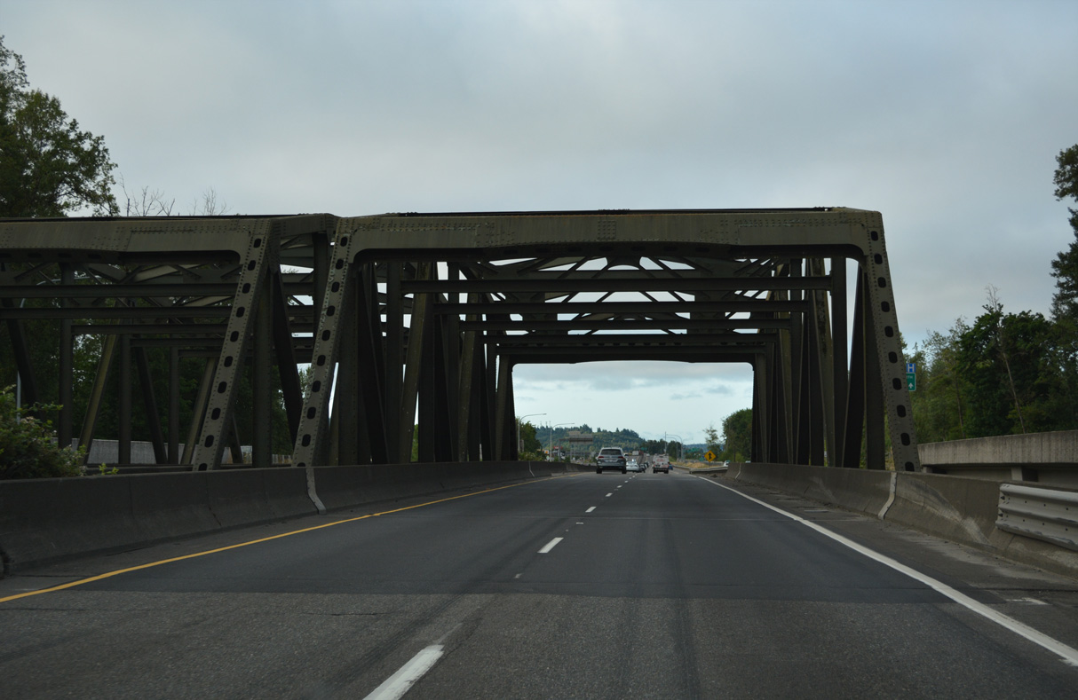
Built originally for the expressway along U.S. 99, the Skookumchuck River truss bridges on I-5/U.S. 12 have been in service since 1951.
07/20/23
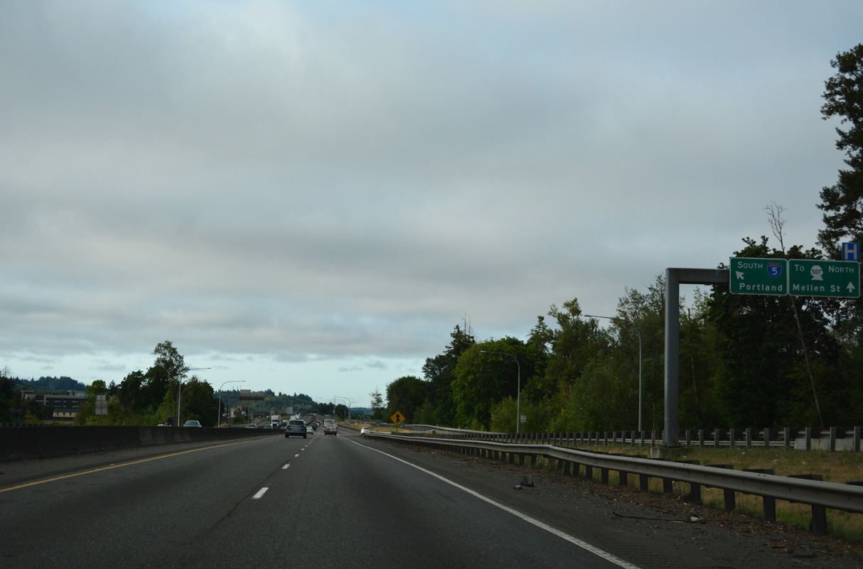
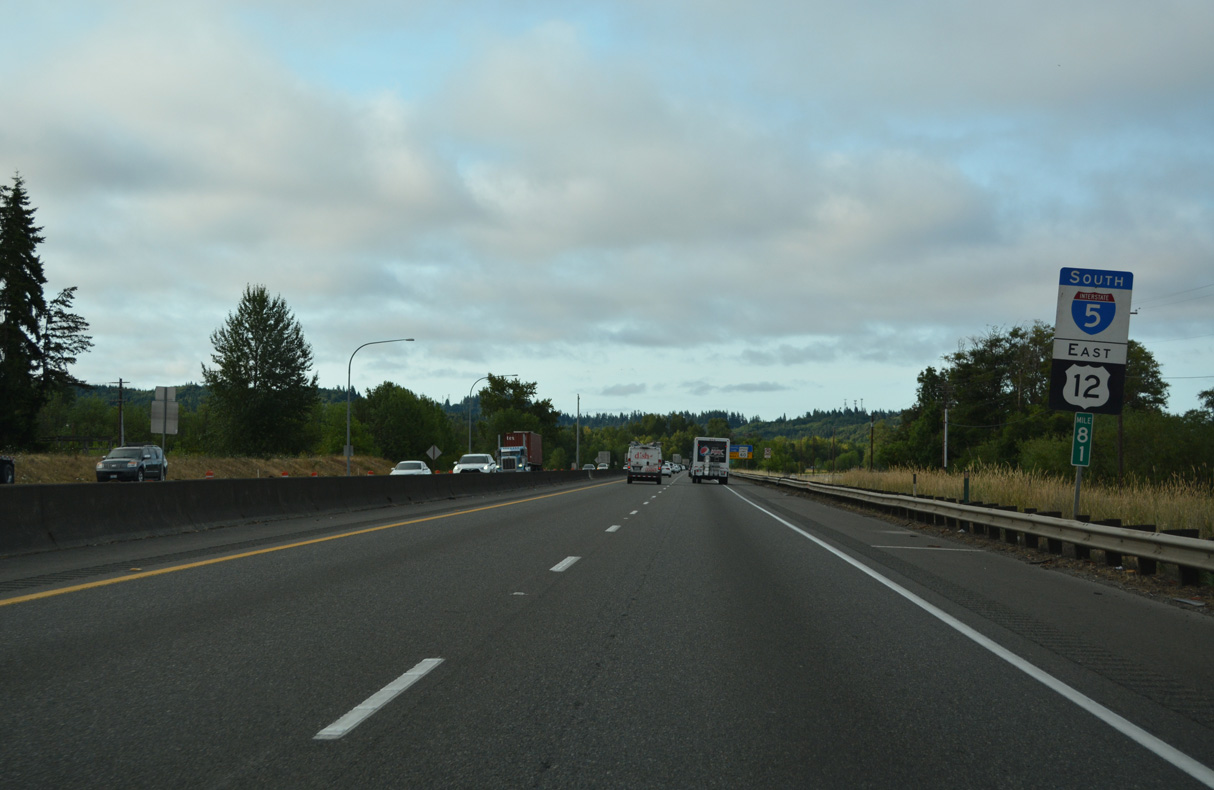
I-5/U.S. 12 travel south between Plummer Lake and the Chehalis River ahead of SR 507 (Mellon Street). Exit 81 formerly departed along this stretch for SR 507 directly.
07/20/23
Airport Road and Ellsbury Street (SR 507) accompany I-5/U.S. 12 south from Mellen Street to the ramps at Exit 81.
07/20/23
Southbound I-5/U.S. 12 vacate the city of Centralia and parallel the Chehalis River and flood plain.
07/20/23
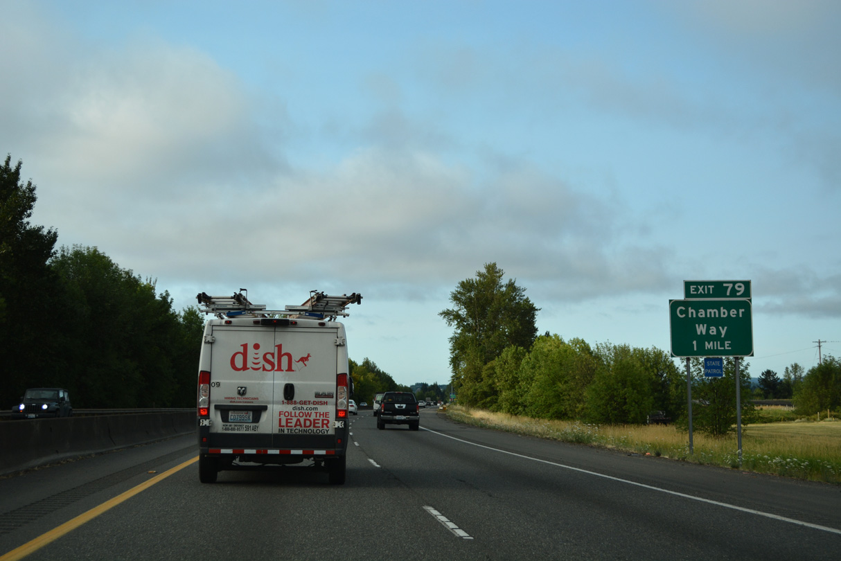
Exit 79 to Chamber Way is the first of three for Chehalis from I-5/U.S. 12 south. Named Chamber of Commerce Way for the Twin Cities Chamber of Commerce (Bozanich, n.d.), Chamber Way connects I-5/U.S. 12 with the Twin City Town Center West retail center next to Chehalis-Centralia Airport (CLS) and National Avenue (Historic U.S. 99).
07/20/23
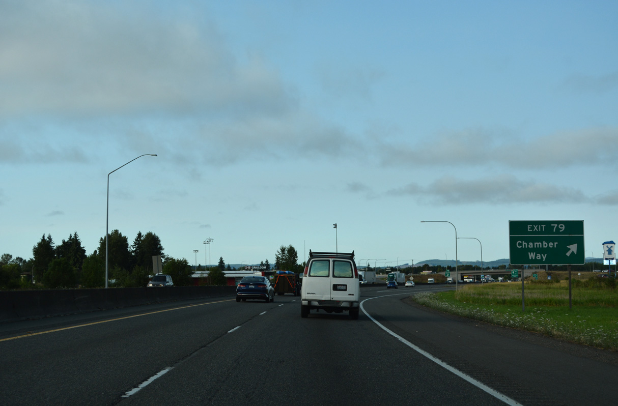
Historically, the original expressway along U.S. 99 from Exit 202 / Tumwater southward ended here in Chehalis. Later Chamber Way represented the northern leg of Business Loop I-5 (Bozanich, n.d.).> Exit 79 provides access to the Chehalis city center via National Avenue south.
07/20/23
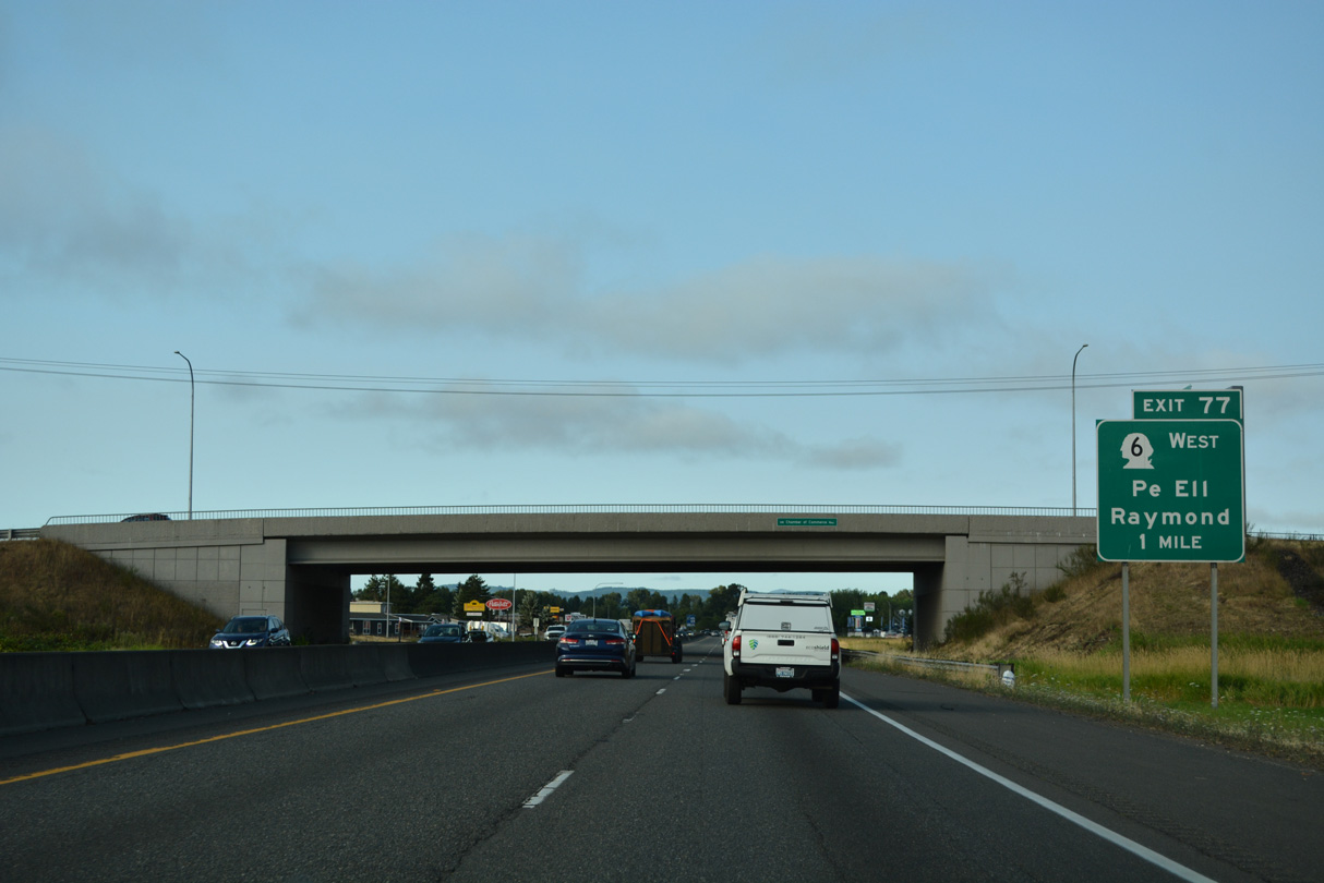
Main Street extends west from the Chehalis city center to become SR 6 at a diamond interchange (Exit 77) with I-5/U.S. 12.
07/20/23
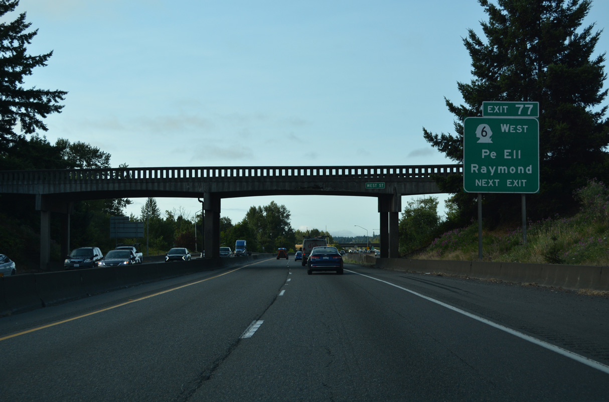
Exit 77 leaves I-5/U.S. 12 south after the West Street overpass. SR 6 runs 51.37 miles west to Rainbow Falls State Park, Pe Ell, and around P and E Ridge to U.S. 101 at Raymond.
07/20/23
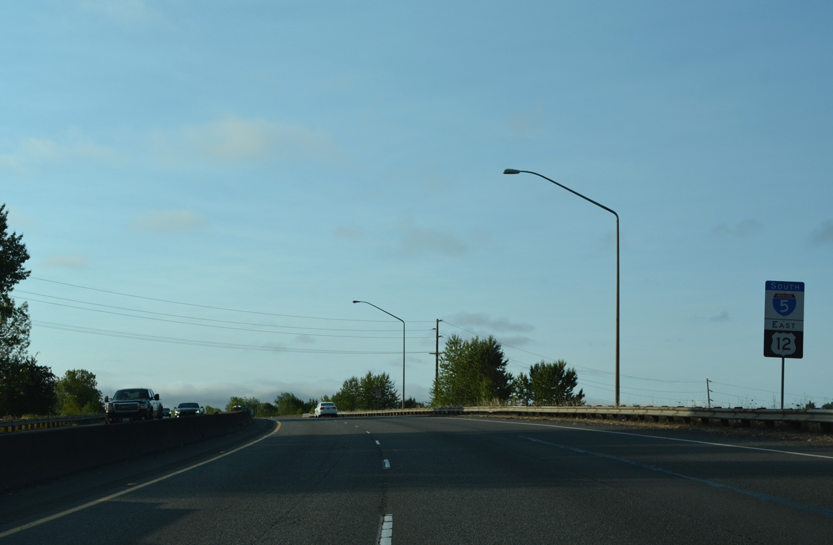
A one piece reassurance sign for I-5/U.S. 12 posted south of SR 6.
07/20/23
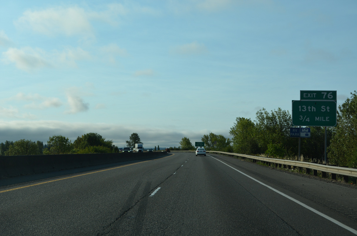
Curving southeast, I-5/U.S. 12 progress to the diamond interchange (Exit 76) with 13th Street in south Chehalis.
07/20/23
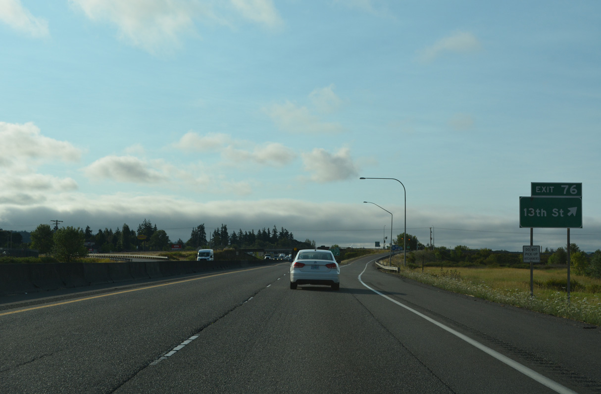
13th Street leads northeast from Exit 76 to Market Boulevard (old U.S. 99) and south as Rice Road to Stan Hedwall Park.
07/20/23
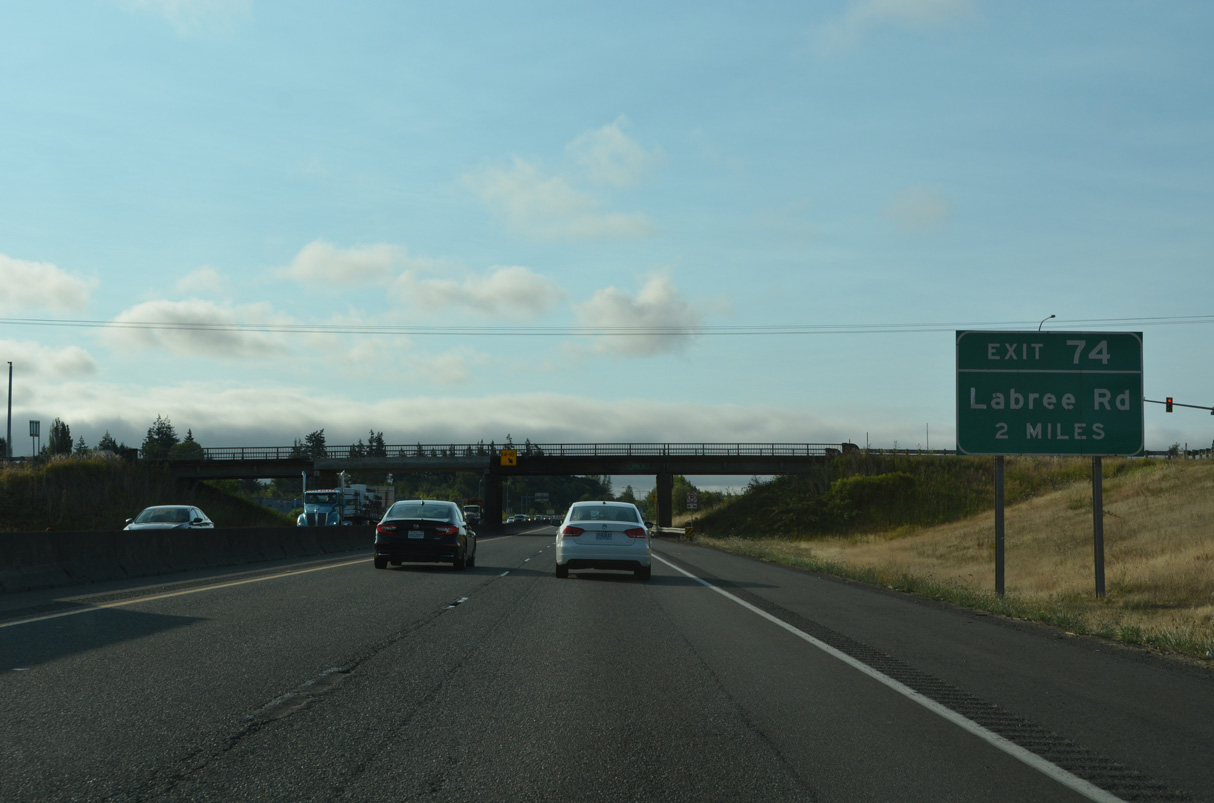
A diamond interchange (Exit 74) opened at LaBree Road on June 2, 2009 as part of a project expanding Interstate 5 to six overall lanes from Exit 74 south to Exit 72 / Rush Road.
07/20/23
The ensuing stretch of I-5/U.S. 12 south from Chehalis separates agricultural areas to the south with a large industrial park to the east.
07/20/23
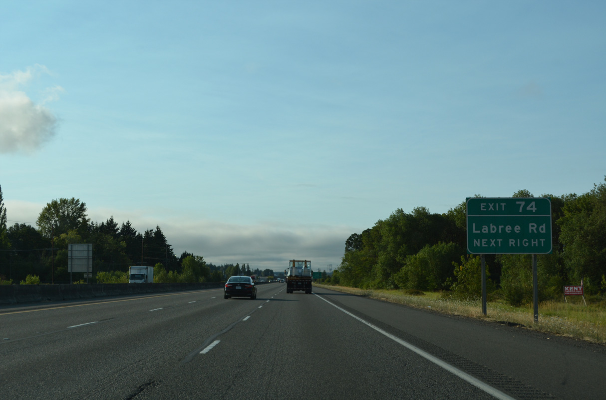
Labree Road links I-5/U.S. 12 with Hamilton Road to the south of Exit 74 and Maurin and Bishop Roads to the east.
07/20/23
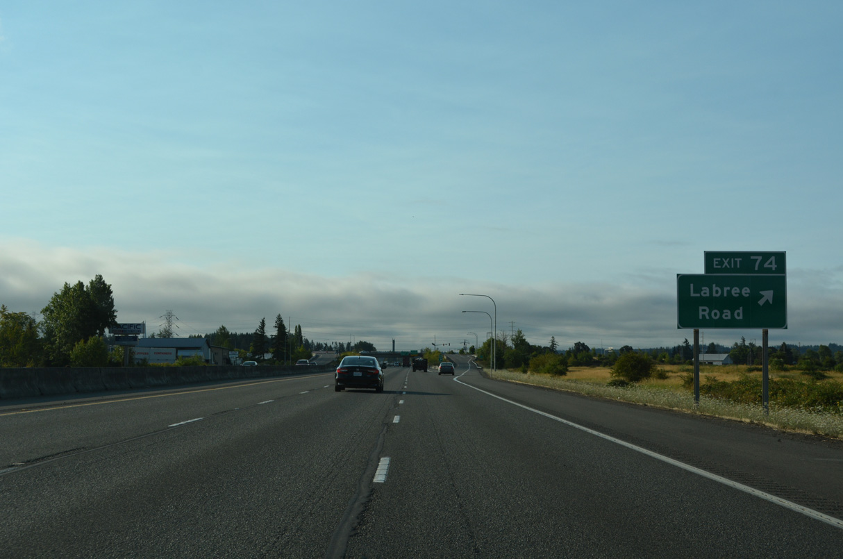
The exchange with Labree Road serves the Fred Meyer Stores Retail Service Distribution Center and the Chehalis Generation Facility to the east.
07/20/23
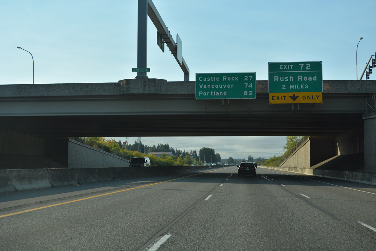
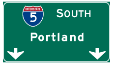
Castle Rock is the next control city for I-5 south. Vancouver joins Portland on this distance sign at the LaBree Road overpass.
07/20/23
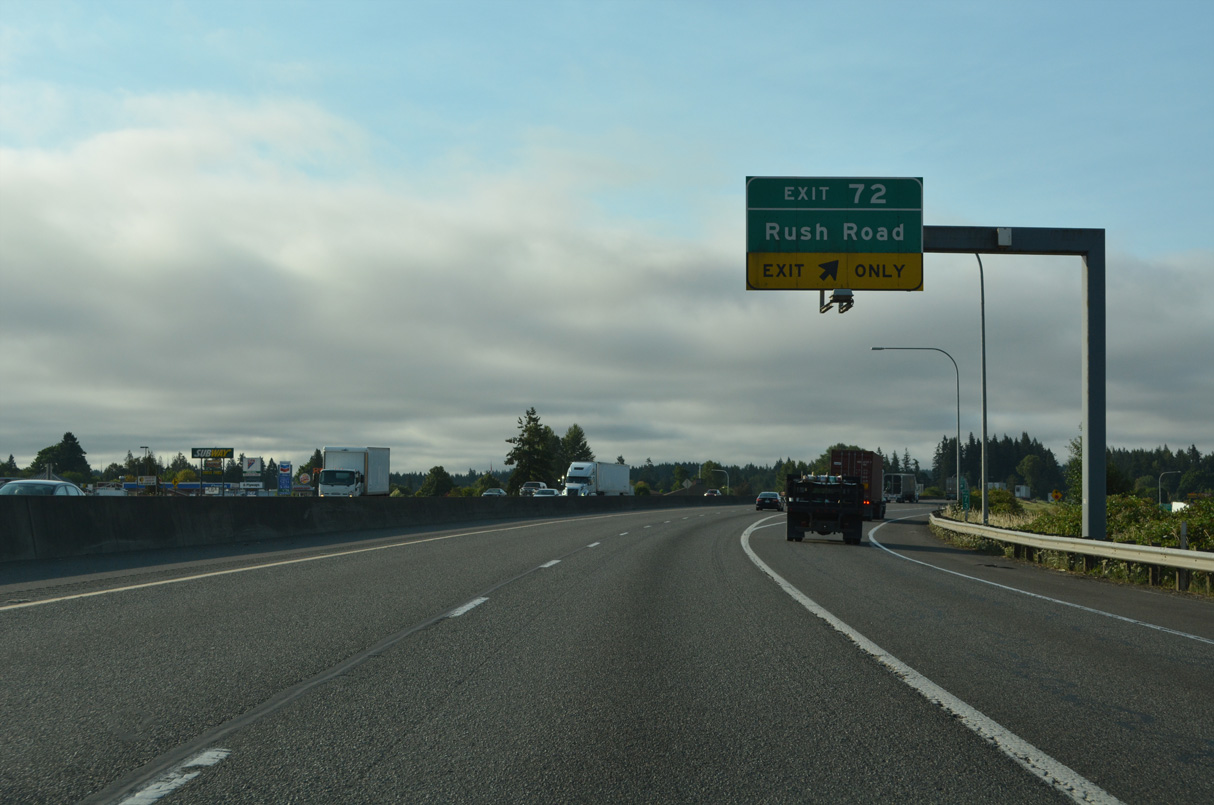
Hamilton Road comprises the west side frontage road for I-5/U.S. 12 southeast to Rush Road by Exit 72.
07/20/23
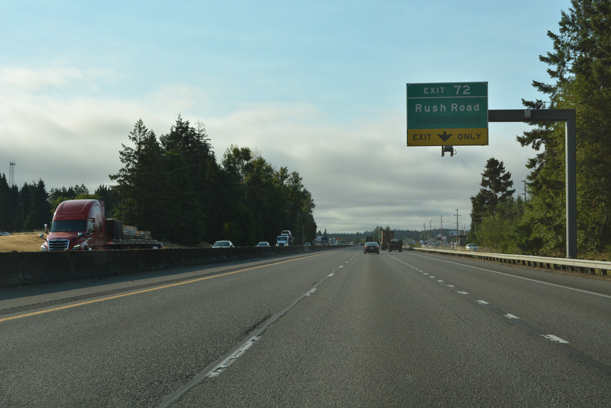
Rush Road travels south from Jackson Highway (Old U.S. 99) to the first of two Napavine exits on I-5/U.S. 12 south.
07/20/23
Rush Road continues south from Exit 72 to become 2nd Avenue in Napavine. Napavine was served by SR 603 until 1992. SR 603 traveled between Exit 63 and SR 6 near Littell (AARoads Wiki, 2023b).
07/20/23
Interstate 5 passes through the Napavine city limits within the vicinity of both Exits 72 and 71.
07/20/23
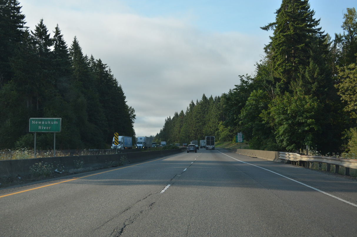
The Newaukum River flows northwest from Newaukum Prairie into the Chehalis River at Chehalis.
07/20/23
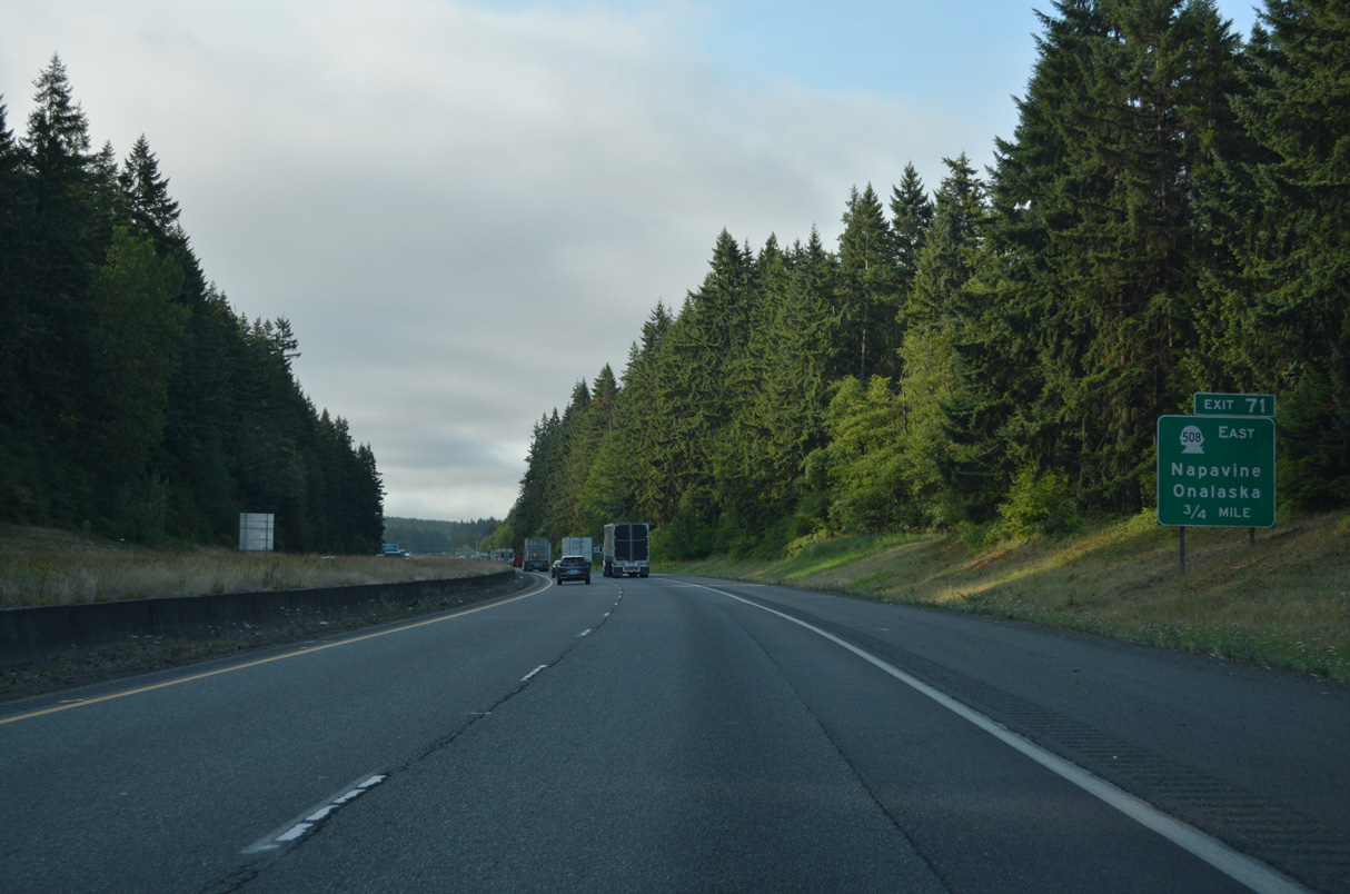
Forest Napaville Road stems east from Stella Street in Napavine to become SR 508 at Exit 71.
07/20/23
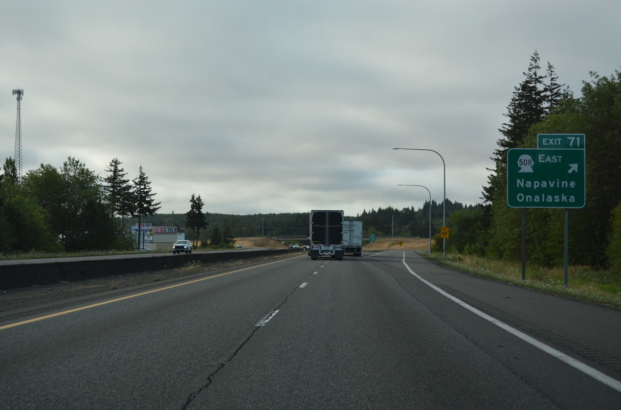
SR 508 stretches 32.84 miles east from I-5/U.S. 12 at Napavine to Onalaska, Cinebar, and SR 7 at Morton.
07/20/23
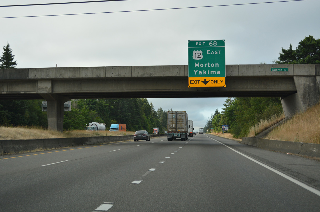
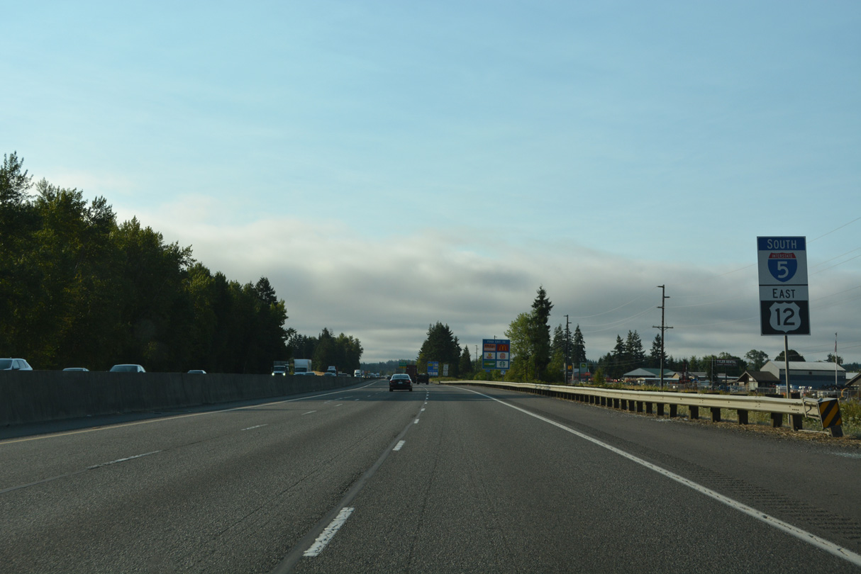
An auxiliary lane extends 2.1 miles south from the SR 508 entrance ramp to the parclo interchange (Exit 68) where U.S. 12 east separates from Interstate 5. U.S. 12 resumes an eastward course, crossing the Cascade Range via White Pass east of Morton.
07/20/23
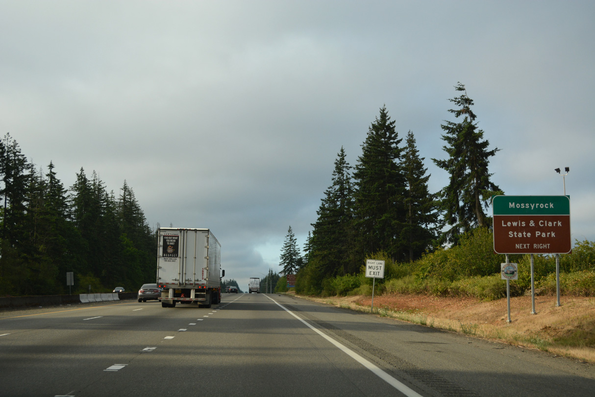
Lewis & Clark State Park lies south of U.S. 12 and Marys Corner along Jackson Highway (Old U.S. 99). U.S. 12 east reaches Mossyrock in 23 miles.
07/20/23
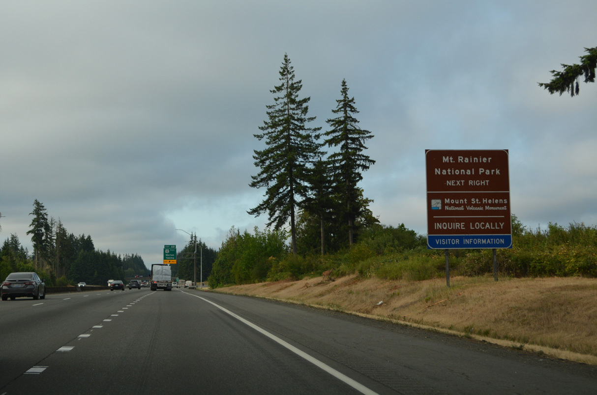
U.S. 12 passes north of Mount St. Helens National Volcanic Monument at Randle and just south of Mount Rainier National Park. Mount Rainier can be accessed via SR 7 on the west end, or SR 123 on the east end.
07/20/23
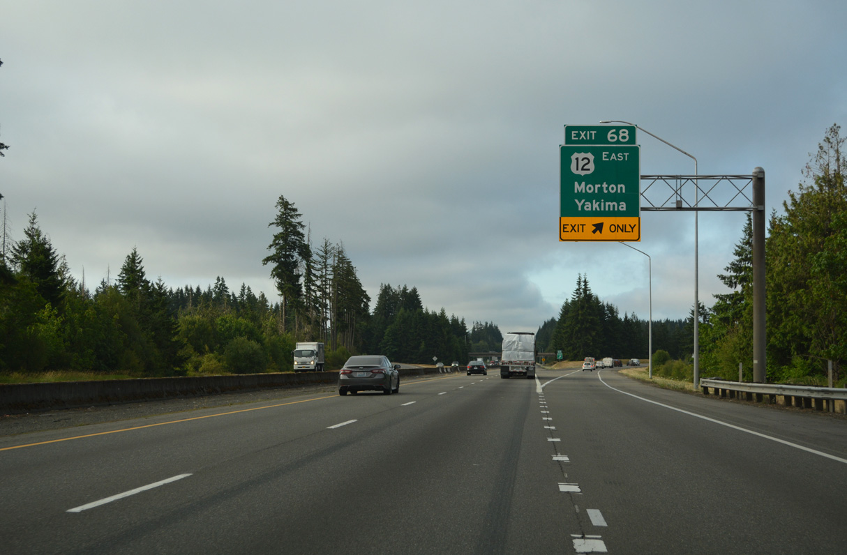
Morton is 30 miles east from Exit 68. 137 miles away, Yakima lies beyond the Cascade crest in the dry side of Washington State, where annual rainfall totals are a fraction of those of the west side. U.S. 12 overtook what was U.S. 410 from near Naches east to Idaho in 1967.
07/20/23
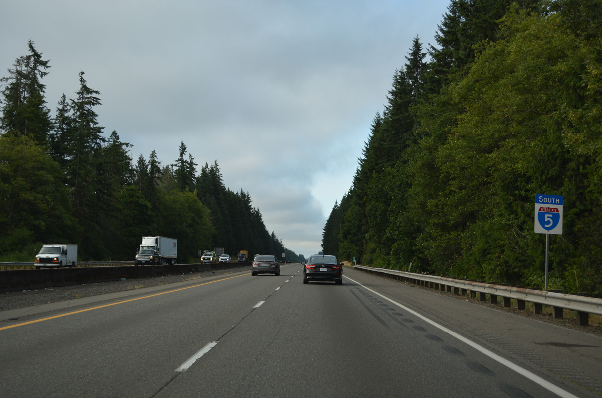
Interstate 5 proceeds south from the Napavine and Jackson Prairie area. Old U.S. 99 remains to the east along Jackson Highway south toward Toledo and SR 505.
07/20/23
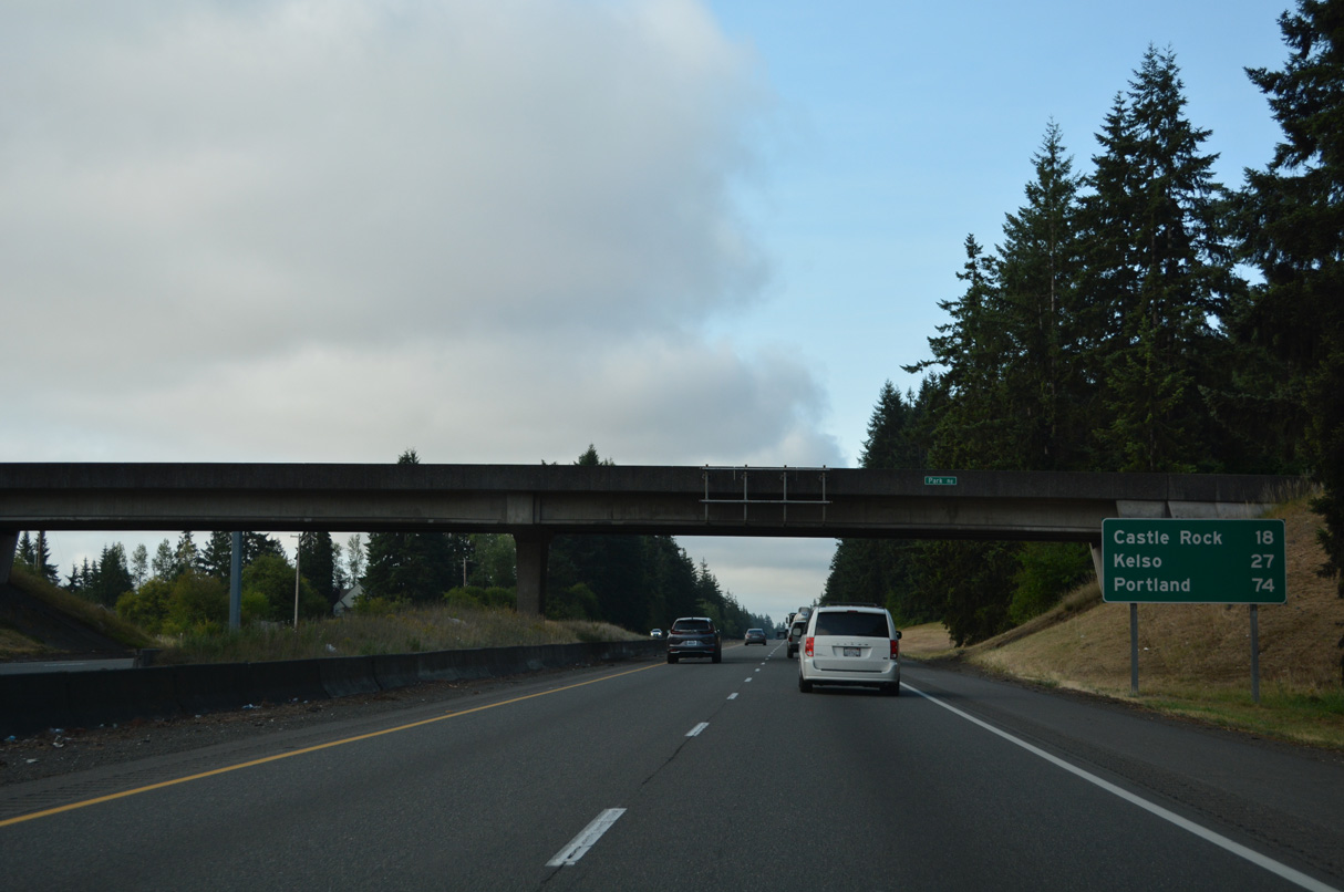
Passing under Park Road near St. Urban on Interstate 5 south, 18 miles north of Castle Rock and 27 miles out from Kelso.
07/20/23
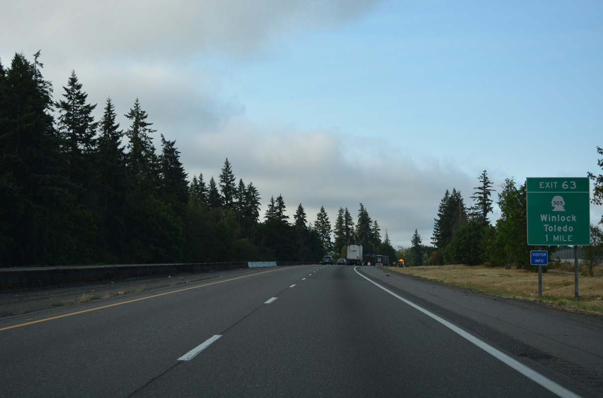
SR 505 crosses paths with Interstate 5 at Pikes Hill and Exit 63. A 19.29 mile long highway, SR 505 links I-5 with Winlock to the west and SR 504 west of Kid Valley.
07/20/23
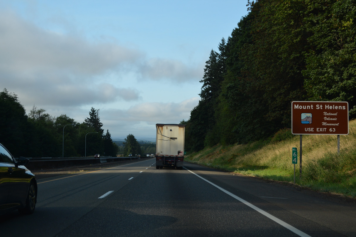
SR 504 east from SR 505 is the main route to Mount St. Helens National Volcanic Monument.
07/20/23
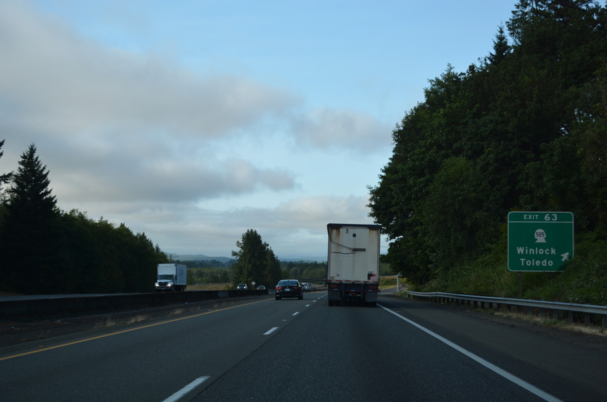
SR 505 (Toledo-Winlock Road) replaced SR 603 from the diamond interchange (Exit 63) with Interstate 5 northwest to Kerron Street in Winlock. SR 603 north from Winlock to SR 6 was dropped from the system in 1992 (AARoads Wiki, 2023b).
07/20/23
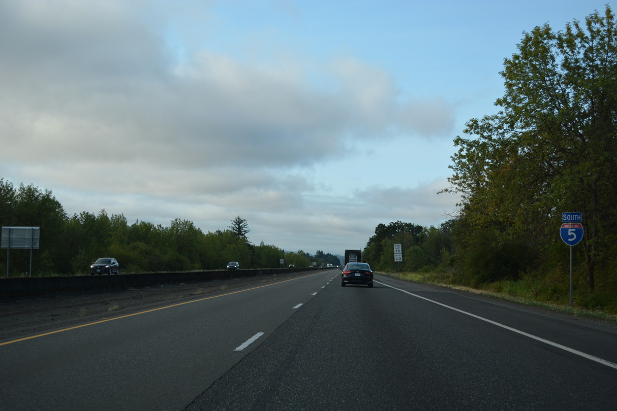
Interstate 5 lowers onto Drews Prairie from Pikes Hill west of Toledo.
07/20/23
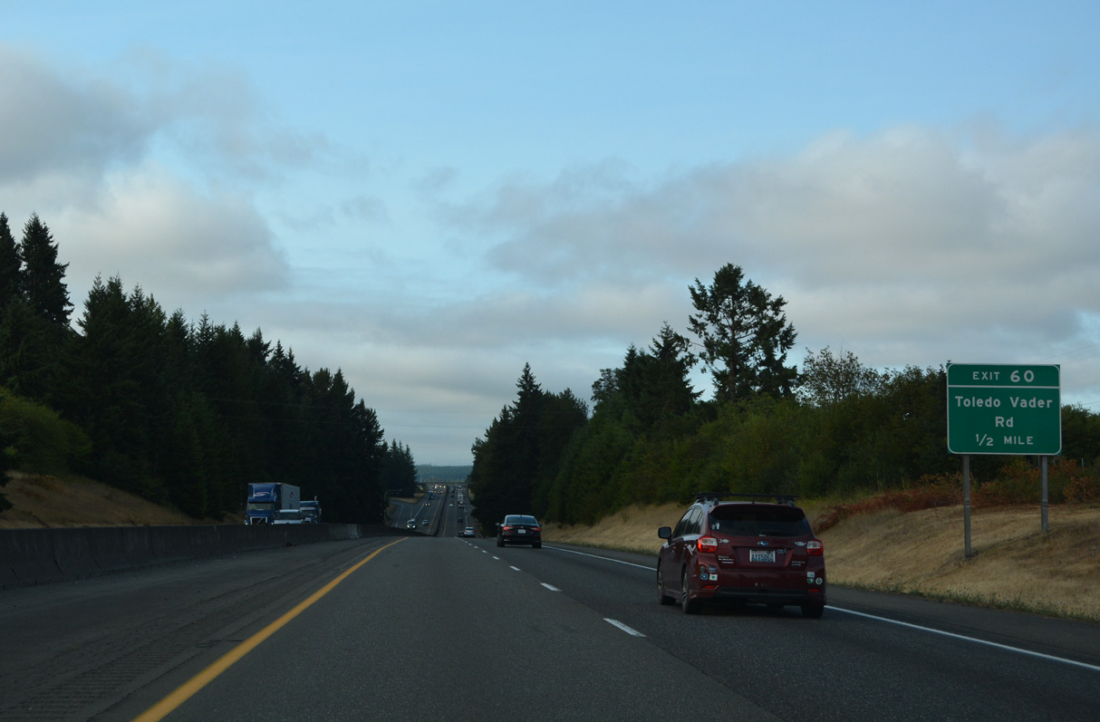
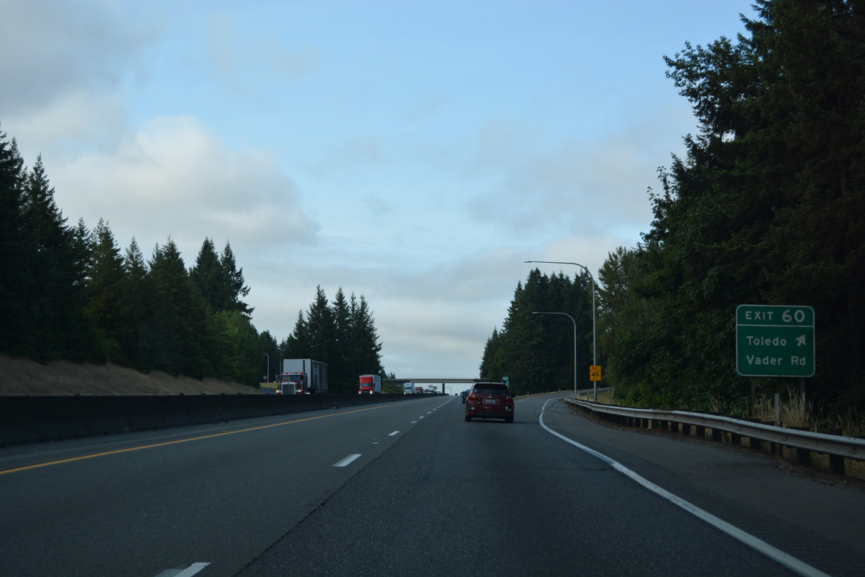
Toledo-Vader Road winds east from Exit 60 to Ash Street in the city of Toledo. This road was a part of the original SR 505 from I-5 east to Toledo. When SR 505 replaced SR 603 west from Exit 63, Toledo-Vader Road was dropped from the state highway system (Bozanich, n.d.).
07/20/23
Unsigned from I-5, SR 506 parallels Interstate 5 south from the diamond interchange at Exit 60 to Exit 59.
07/20/23
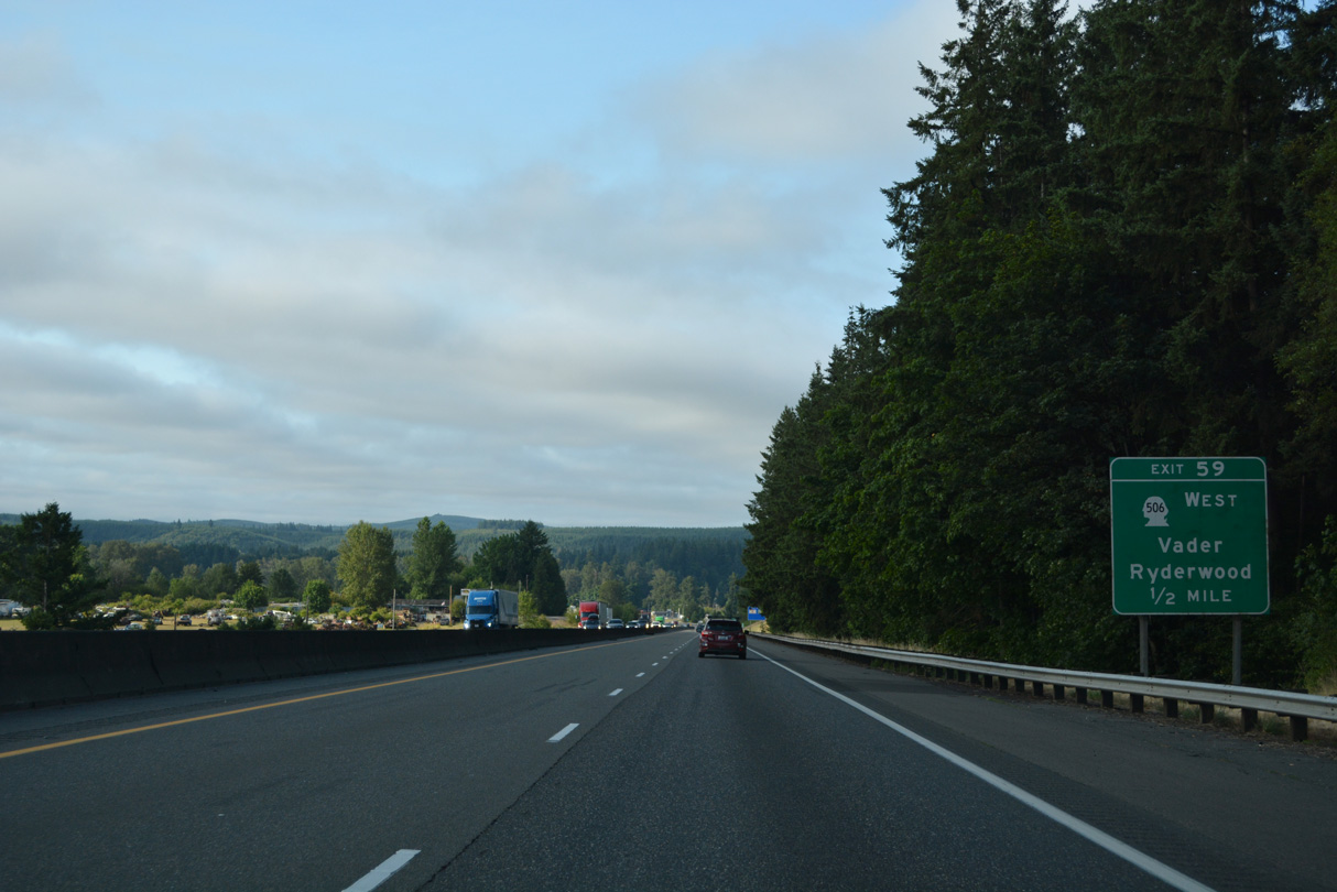
SR 506 turns west from Exit 59 to Vader and Ryderwood. The state route measures 11.53 miles in length.
07/20/23
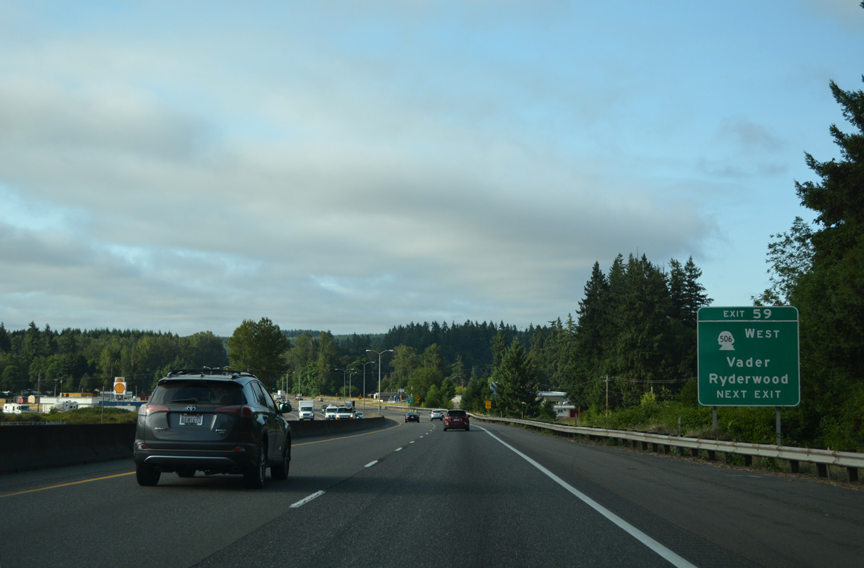
Right in right out (RIRO) ramps join Interstate 5 south with SR 506 at Exit 59. Cowlitz Loop provides access to the northbound frontage road (Cowlitz Ridge Road) back to Toledo-Vader Road and local Mulford Road east.
07/20/23
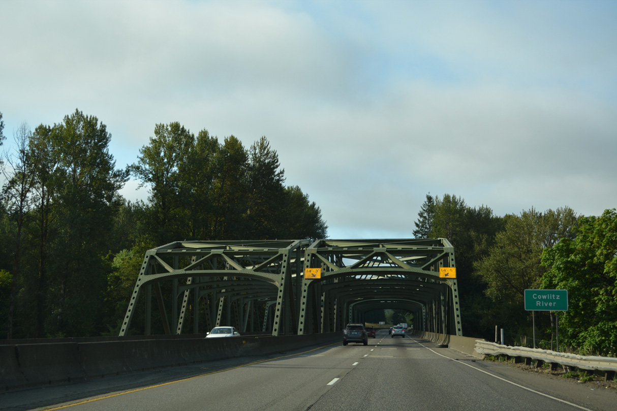
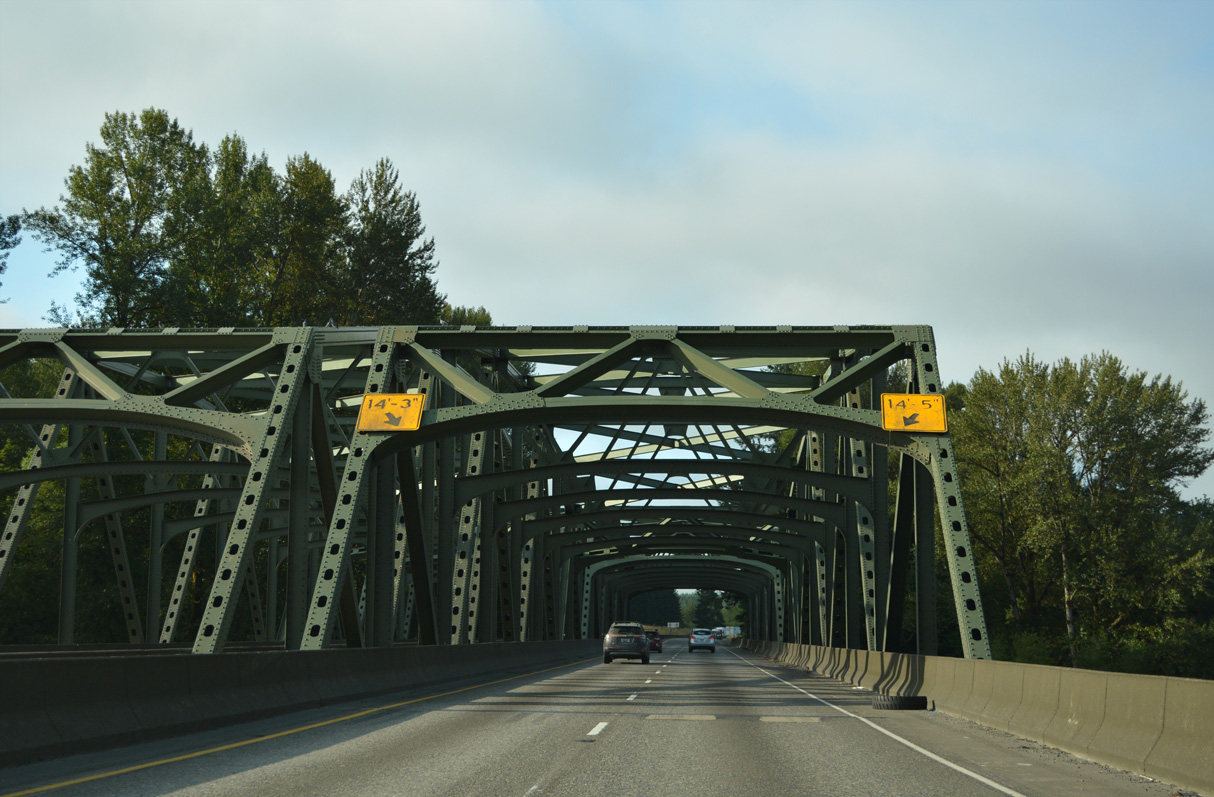
A pair of truss bridges take Interstate 5 across the Cowlitz River south of Exit 59. The bridges were constructed as a part of a U.S. 99 expressway from Chehalis south to near the Toutle River in 1953 (Bozanich, n.d.).
07/20/23
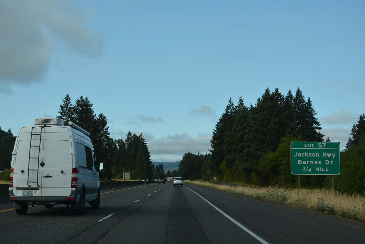
Old U.S. 99 (Jackson Highway) meanders southwest from Toledo and SR 505 to the diamond interchange at Exit 57.
07/20/23
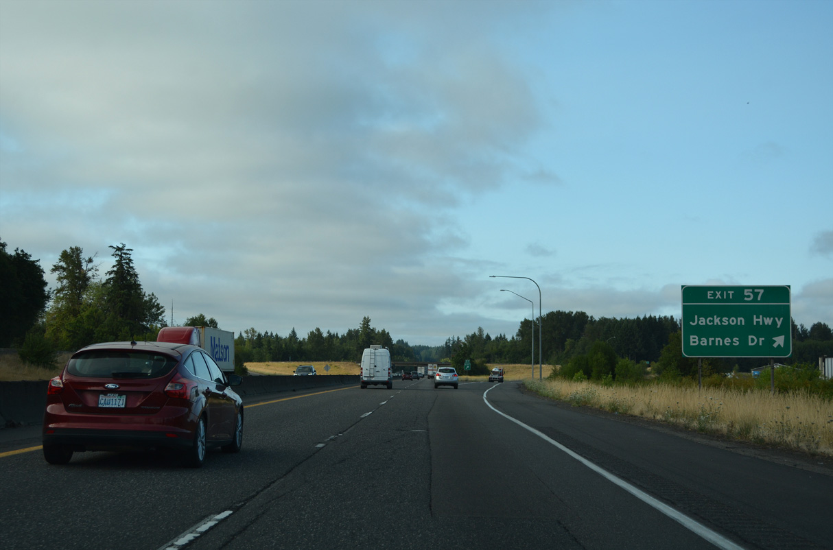
Barnes Drive leads southwest from Exit 57 as part of Old U.S. 99 toward the Cowlitz River.
07/20/23
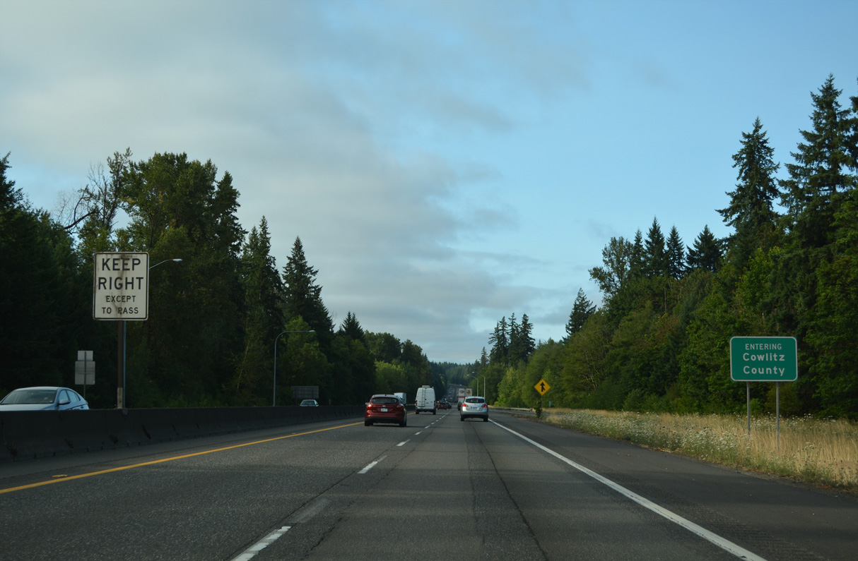
Interstate 5 enters Cowlitz County at the Barnes Drive entrance ramp. 57.20 miles of the freeway remain within Washington state.
07/20/23
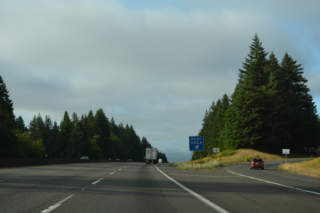
I-5 south expands to three overall lanes from the Lewis County line to Interstate 205 at Exit 7. The Toutle River Rest Areas line both sides of the freeway west of the Wilkes Hills.
07/20/23
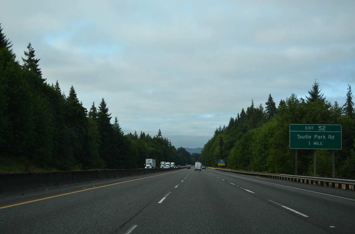
Barnes Drive (Old U.S. 99) returns to Interstate 5 at Exit 52 with Old Pacific Highway.
07/20/23
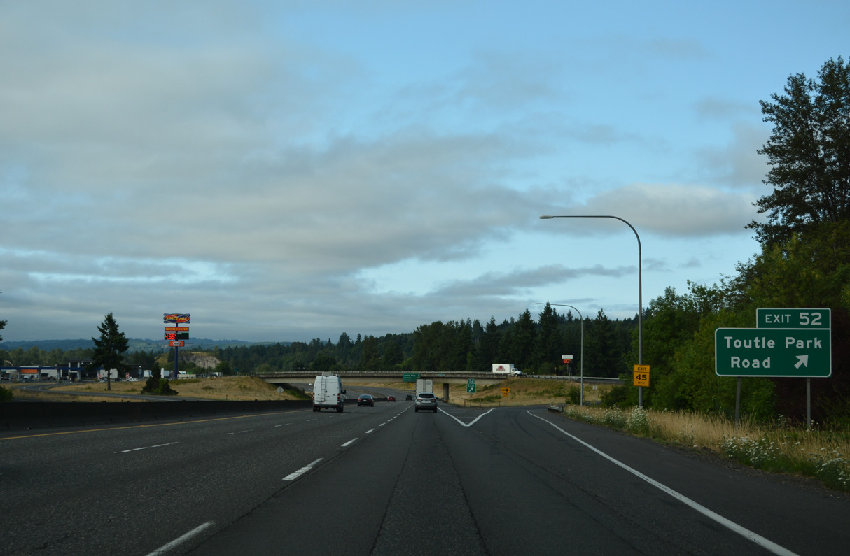
Exit 52 departs Interstate 5 south for Barnes Drive north and Old Pacific Highway south. Toutle Park Road spurs east along the Toutle River.
07/20/23
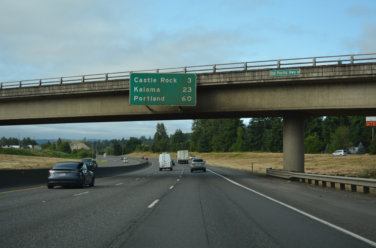
Continuing south, Interstate 5 reaches Castle Rock in three miles, Kalama in 23 miles, and Portland, Oregon in 60 miles.
07/20/23
Interstate 5 converges with the Cowlitz River again after the diamond interchange (Exit 52) with Barnes Drive.
07/20/23

References:
Bozanich, M. (n.d.) US 99 trunk. Highways of Washington State. Retrieved September 16, 2025, from https://www.angelfire.com/wa2/hwysofwastate/us099trunk.html
AARoads Wiki. (2023a). Washington State Route 411. AARoads Wiki. Retrieved September 16, 2025, from https://wiki.aaroads.com/wiki/Washington_State_Route_411
AARoads Wiki. (2023b). Washington State Route 505. AARoads Wiki. Retrieved September 16, 2025, from https://wiki.aaroads.com/wiki/Washington_State_Route_505
Bozanich, M. (n.d.) State Route 505. Highways of Washington State. Retrieved September 16, 2025, from https://www.angelfire.com/wa2/hwysofwastate/sr505.html
Photo Credits:
- Brent Ivy: 07/20/23
Page Updated Tuesday September 16, 2025.