
Interstate 5 South - Mount Vernon to Arlington
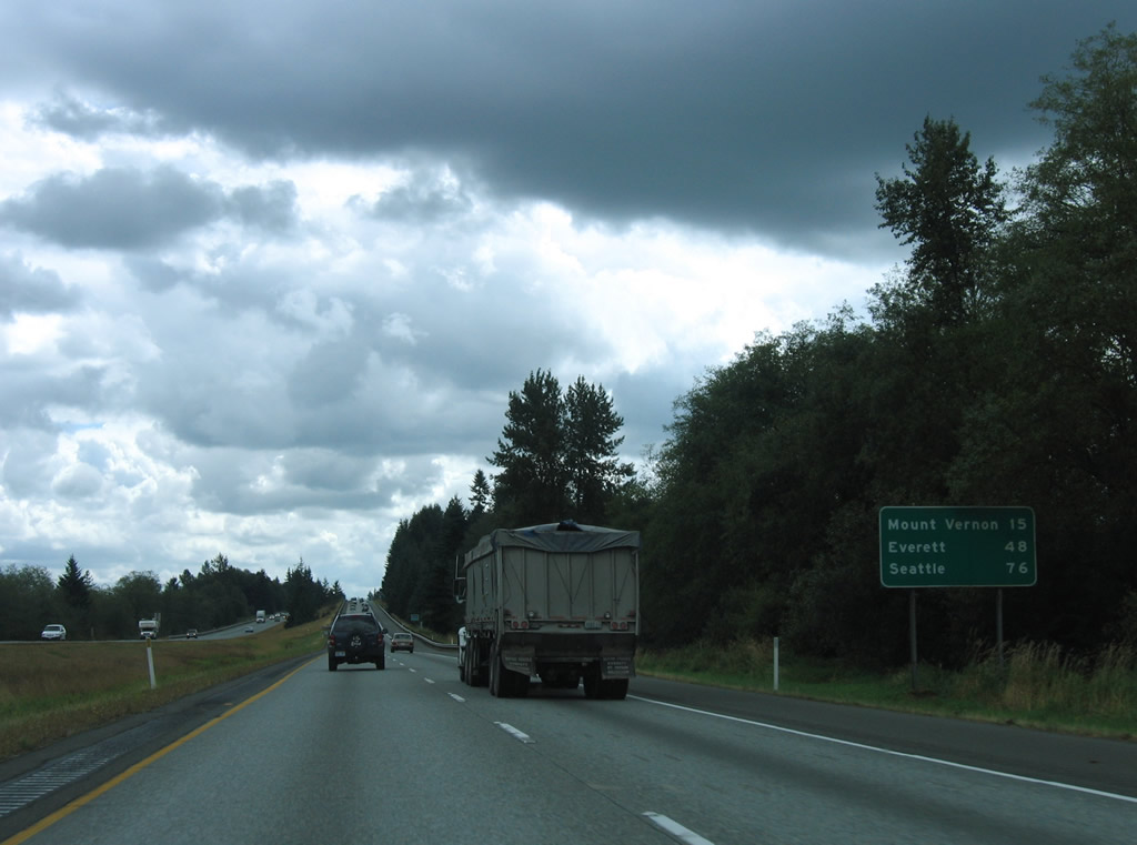
Interstate 5 leaves the Lake Samish area and Whatcom County. The freeway travels 24.98 miles through Skagit County, serving the county seat of Mt. Vernon in 15 miles.
08/30/06
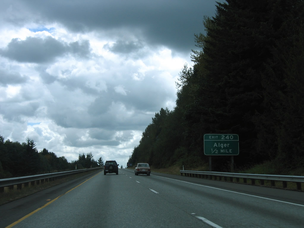
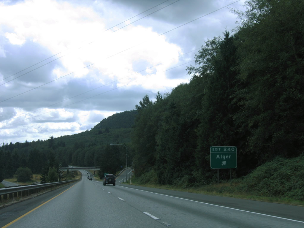
Lake Samish Road heads south from Nulle Road and W Lake Samish Drive in Whatcom County to meet Interstate 5 at a diamond interchange (Exit 240) near Alger.
08/30/06
Lake Samish Road continues east from Exit 240 to Old SR 99 (former U.S. 99) and Alger Cain Lake Road at Alger. Alger Cain Lake Road winds northward to Glenhaven and Lake Whatcom.
08/30/06
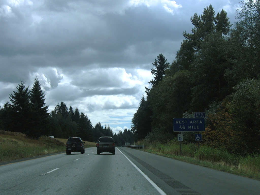
The second southbound rest area on Interstate 5 lies on the plateau east of Chuckanut Mountain and west of Friday Creek. The companion Bow Hill Rest Area along northbound is located at the same location.
08/30/06
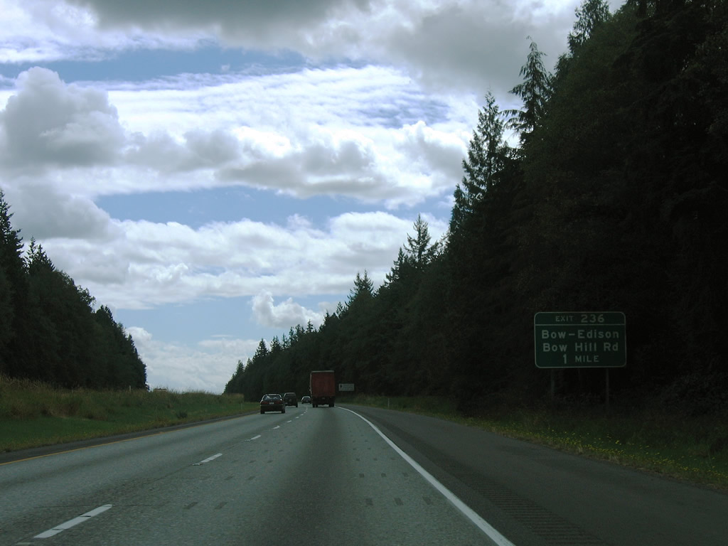
Advancing south, I-5 connects with Bow Hill Road at a diamond interchange (Exit 236) in one mile. Bow Hill Road links the freeway with the rural communities of Bow, Edison Station, and Edison to the west.
08/30/06
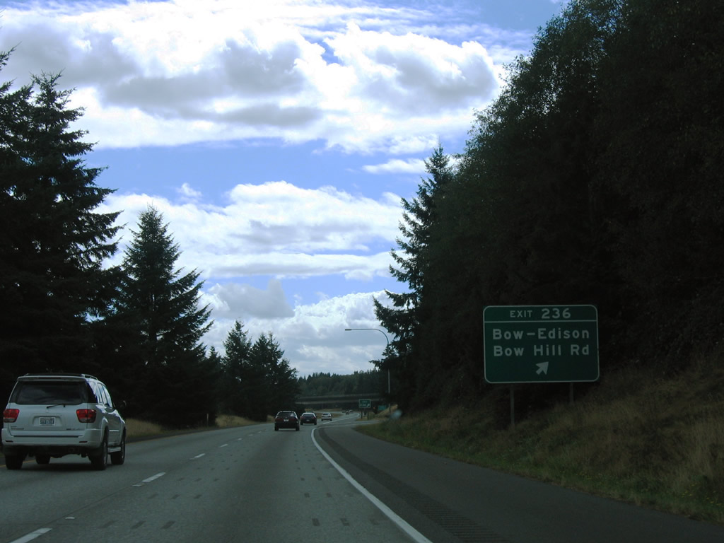
Bow Hill Road lowers onto Jarman Prairie near Belfast to the east, meeting old U.S. 99 opposite from Prairie Road. Bow Hill Road was once a part of SR 237 west of Edison Station. All 9.07 miles of that state route, between SR 11 and SR 20, were decommissioned in 1991 (AARoads Wiki, 2023).
08/30/06
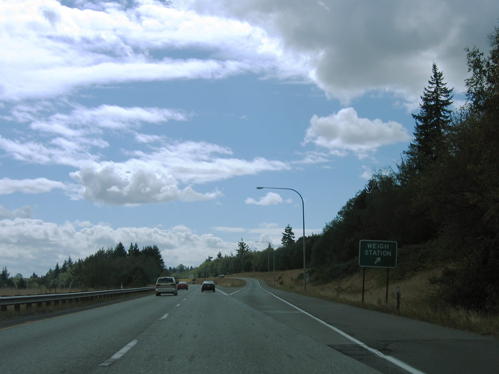
A southbound side weigh station facility follows the entrance ramp from Bow Hill Road.
08/30/06
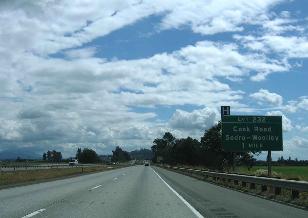
Interstate 5 lowers to Butler Flat ahead of Exit 232 with Cook Road.
08/30/06
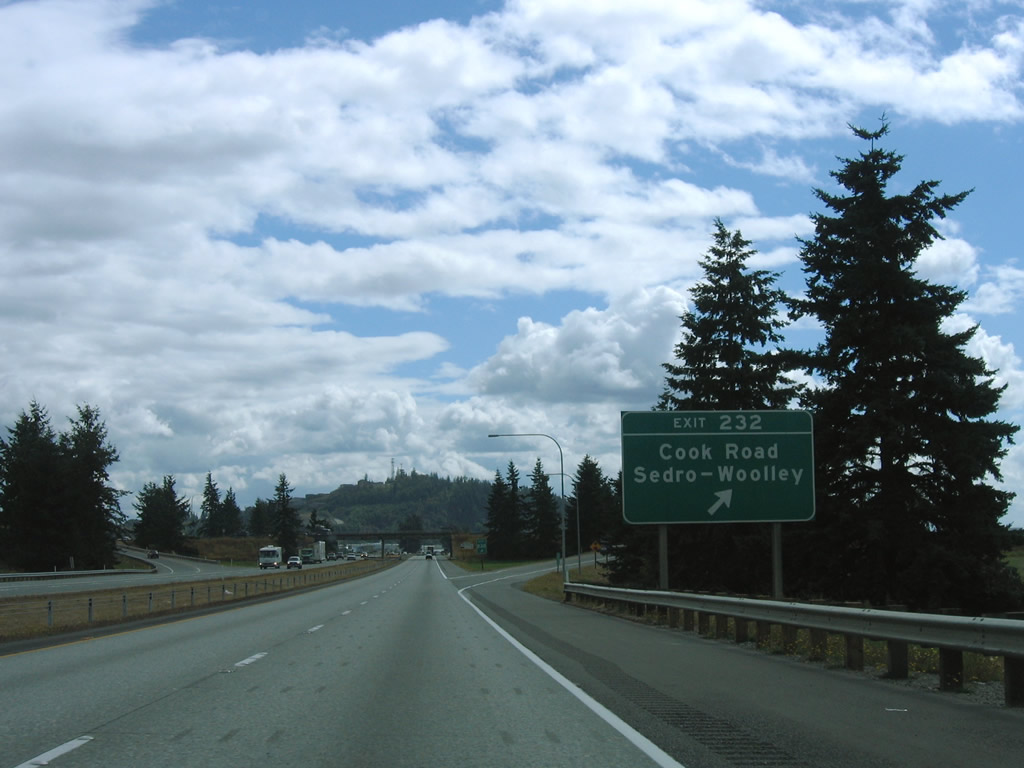
Cook Road travels between SR 11 (Chuckanut Drive) near Allen and SR 9/20 (North Cascade Highway) at Ferry Street in Sedro-Woolley. A diamond interchange joins the rural highway with Interstate 5 at Exit 232.
08/30/06
WSDOT often posts reassurance shields for U.S. and state routes within a green box sign. Occasionally Interstate shields receive the same practice, as was the case with this I-5 marker south of Cook Road. The assembly was replaced by 2014.
08/30/06
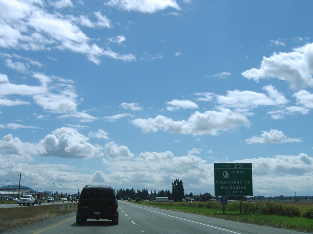
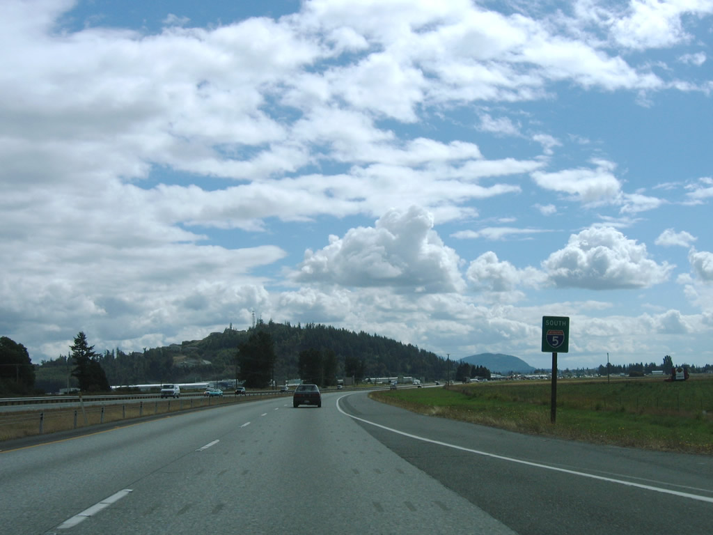
SR 11 angles southeast from Edison Station and Allen to end at Exit 231. SR 11 was once a part of U.S. 99 Alternate leading northwest to Bellingham.
08/30/06
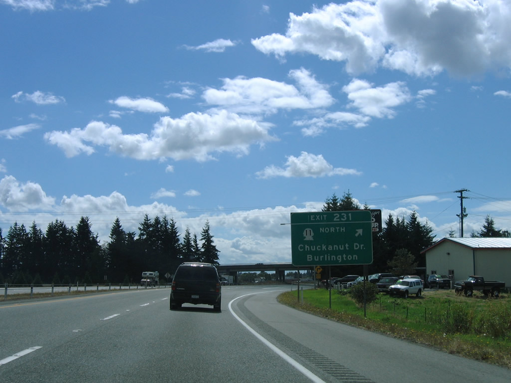
A folded diamond interchange with roundabouts joins I-5 with SR 11 (Chuckanut Drive) north and Burlington Boulevard (old U.S. 99) south at Exit 231. Old U.S. 99 parallels Interstate 5 to the east from Cook Road southward to SR 20 (Avon Avenue) at the Burlington city center.
08/30/06
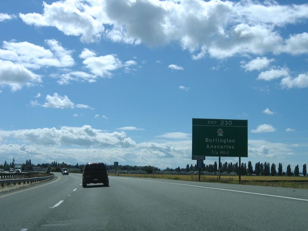
The second Burlington exit joins I-5 with SR 20 (Avon Cutoff / North Cascades Highway). SR 20 travels 436.13 miles across the state from U.S. 101 at Discovery Bay to U.S. 2 at Newport near the Idaho state line.
08/30/06
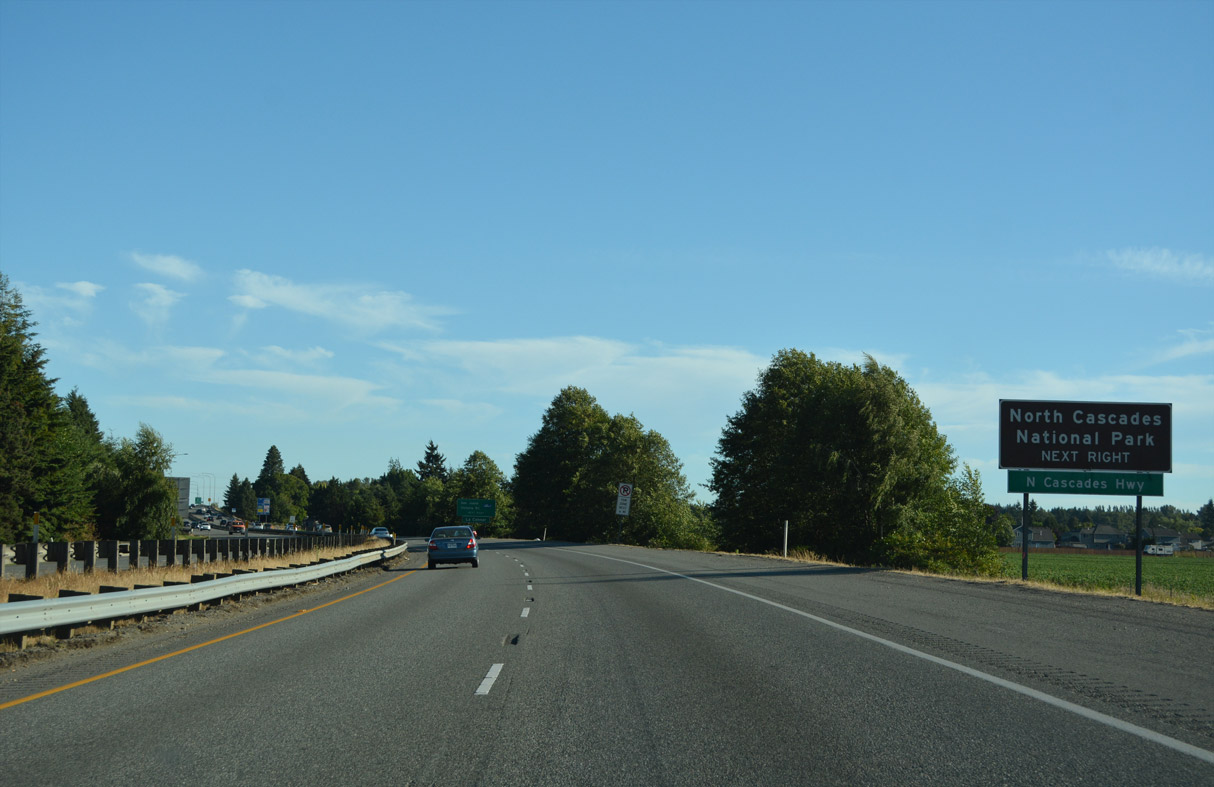
East from Burlington, SR 20 continues to Sedro-Woolley, Lyman, Hamilton, Concrete and North Cascades National Park.
07/19/23
Leading west to the Swinomish Indian Reservation and south across Deception Pass onto Whidbey Island, SR 20 provides the first route to Island County.
07/19/23
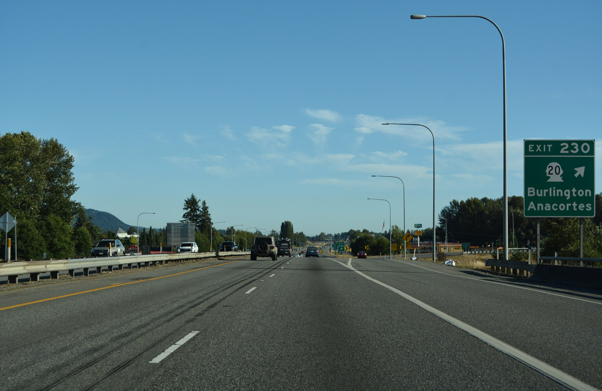
A folded diamond interchange links I-5 south and SR 20 (Avon Cutoff) at Exit 230. Avoiding Downtown, SR 20 follows Rio Vista Avenue east, Burlington Boulevard (Old U.S. 99) north, and Avon Avenue east to North Cascades Highway.
07/19/23
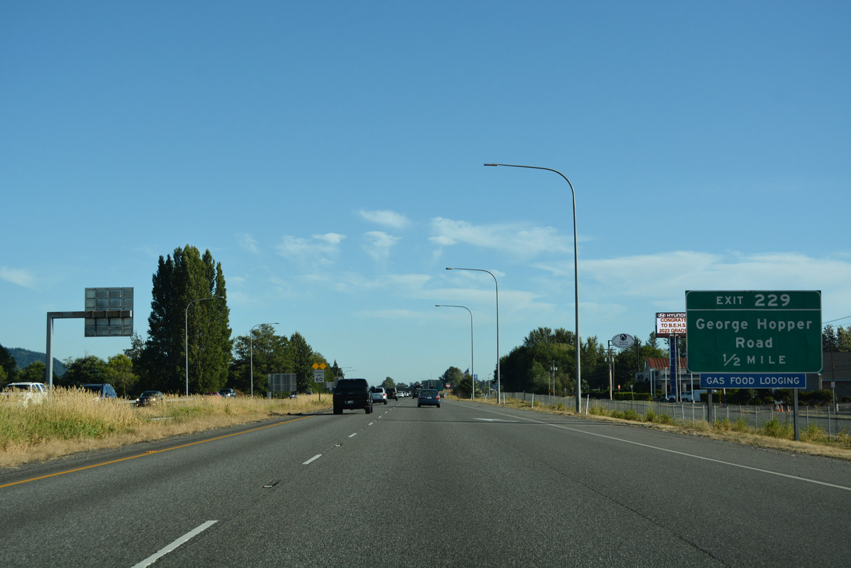
Goldenrod Road accompanies Interstate 5 south across Gages Slough to the diamond interchange (Exit 229) with George Hopper Road. Old U.S. 99 remains to the east along Burlington Boulevard, serving Cascade Mall.
07/19/23
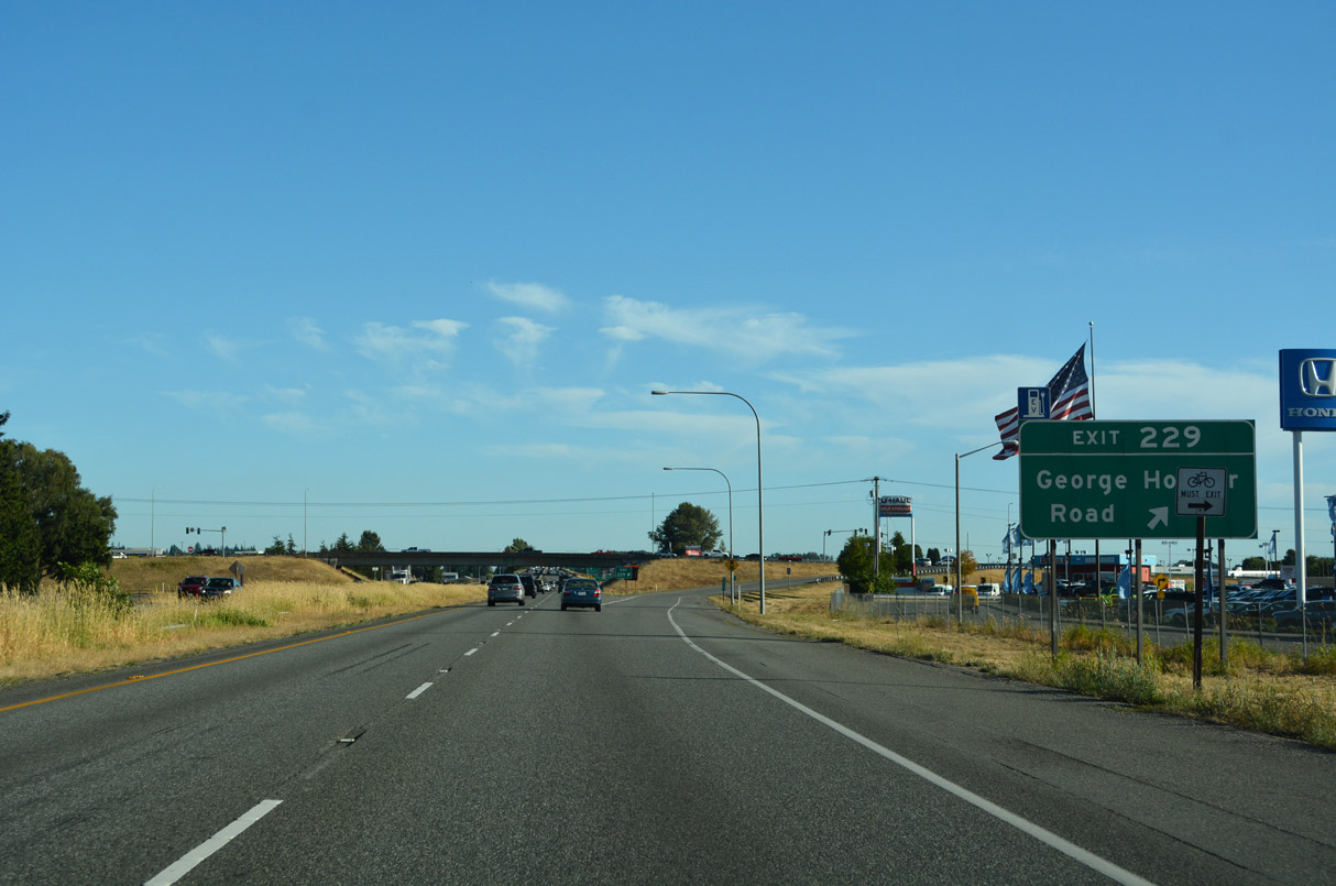
George Hopper Road mainly serves an assortment of businesses including car dealerships and big box retail. The road arcs eastward from Old U.S. 99 to an industrial area as Port Drive.
07/19/23
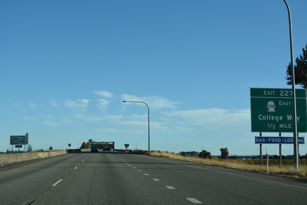
SR 538 (College Way) begins at the first of three exits for Mount Vernon in one half mile. 3.61 miles in length, SR 538 leads east from Exit 227 to Skagit Valley College and SR 9 at Baker Heights.
07/19/23
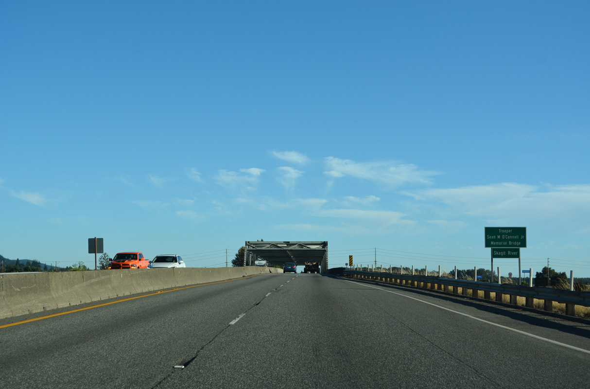
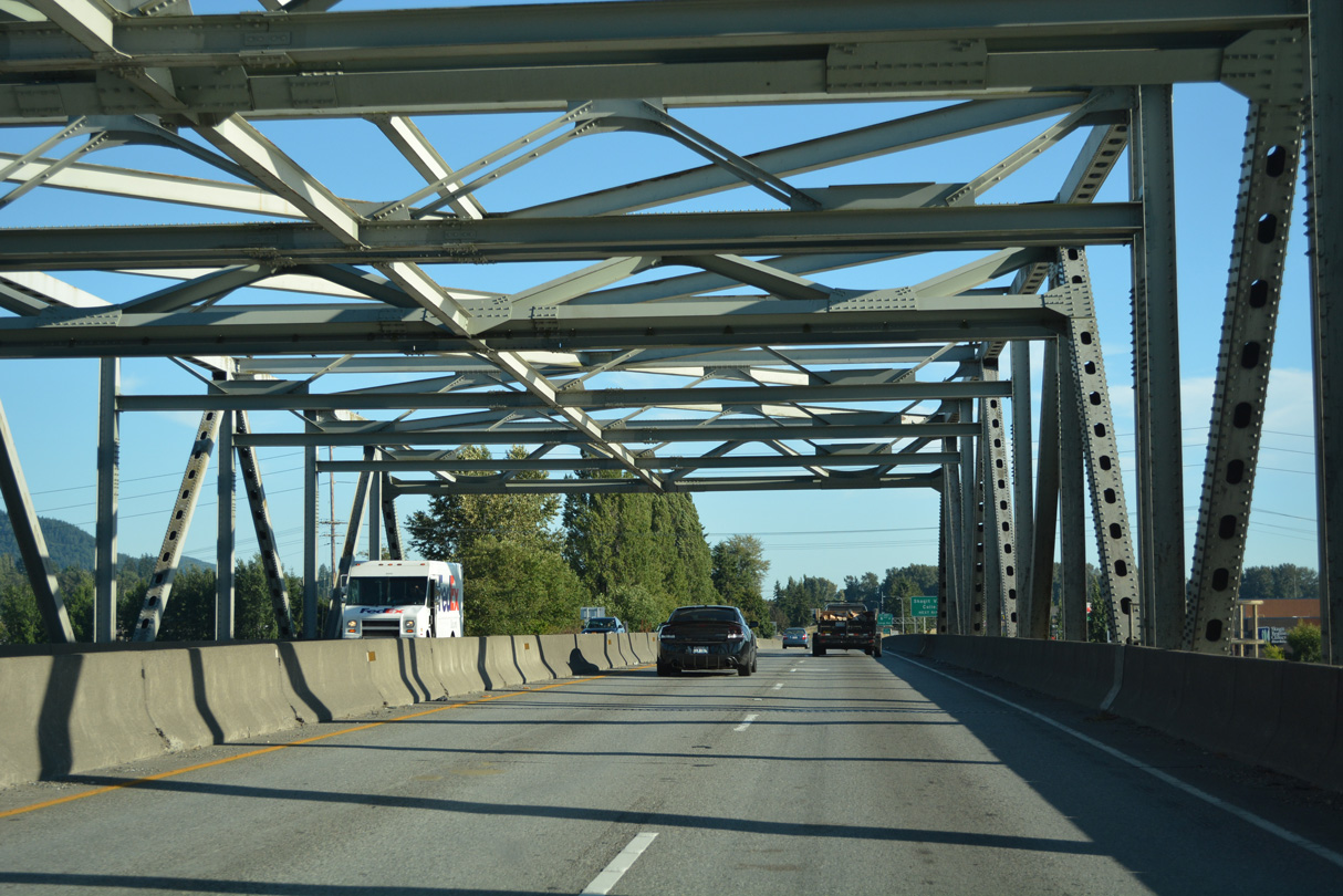
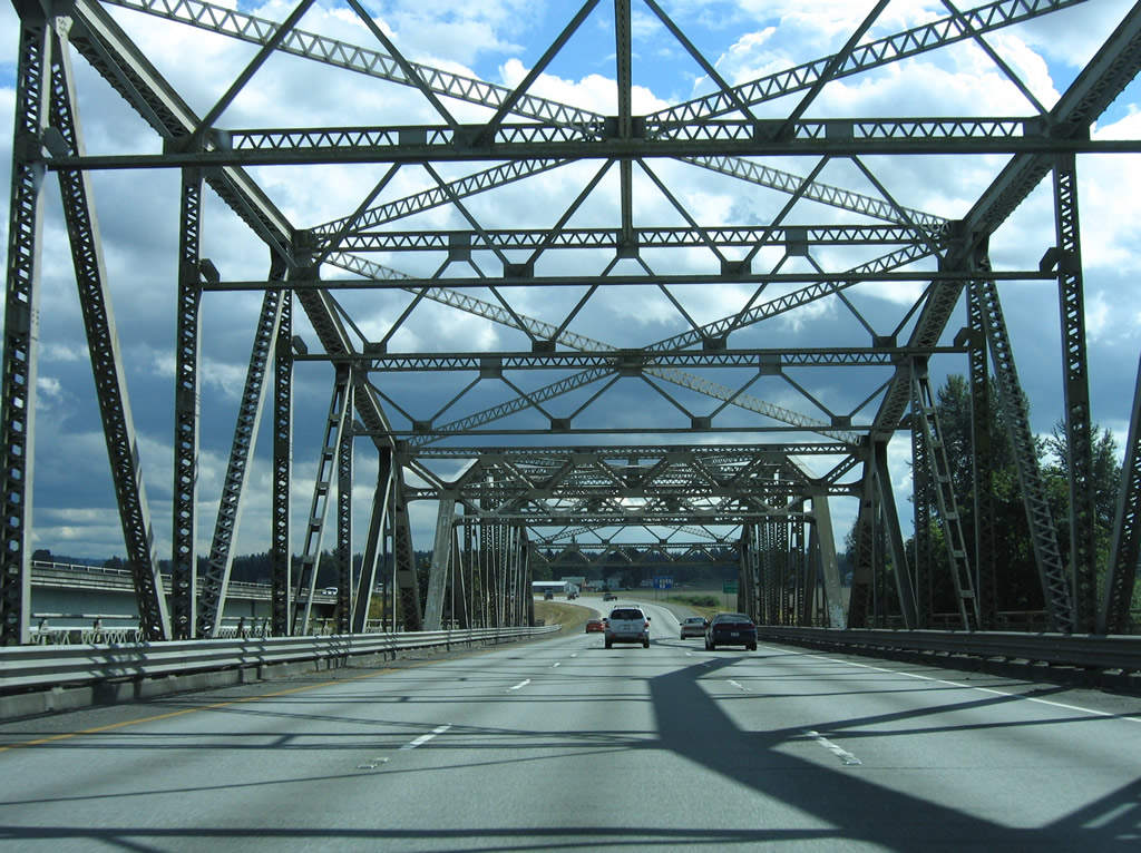
Crossing the Skagit River on a steel truss bridge, Interstate 5 leaves Burlington and enters the county seat of Mount Vernon.
07/19/23
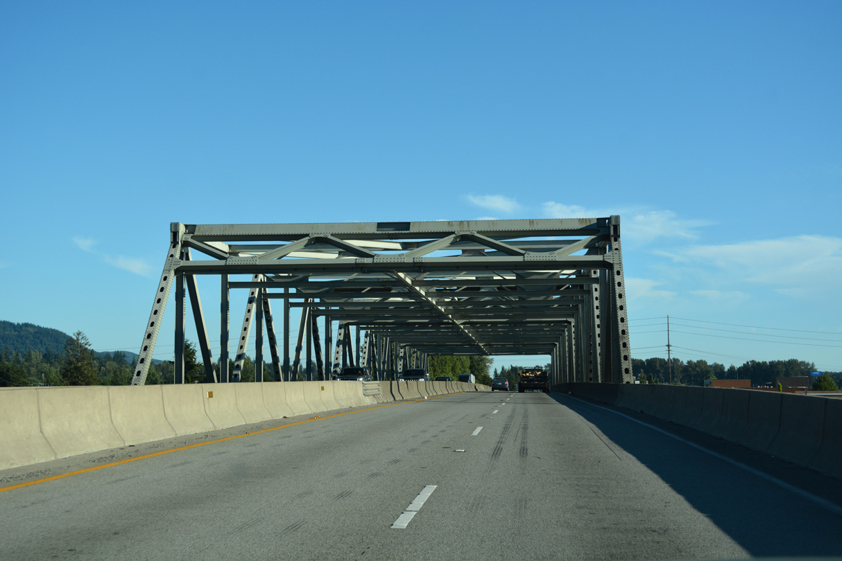
The bridge spanning the Skagit River on Interstate 5 was built in 1955.
07/19/23
The Skagit River bridge partially collapsed on May 23, 2013 when a semi-truck hit several crossbeams of the truss, causing a support failure of the north span of the crossing. Restoring the bridge to service on June 19, 2013, temporary steel prefabricated modular spans filled the 160 foot gap caused by the collapse. A permanent span was subsequently installed on September 15, 2013 (Long, 2013).
07/19/23
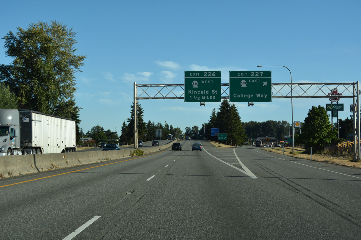
College Way leads east from Exit 227 as SR 538 along a commercial arterial to Skagit College. Hosting a variety of businesses north and south of College Way, Freeway Drive lines the west side of Interstate 5.
07/19/23
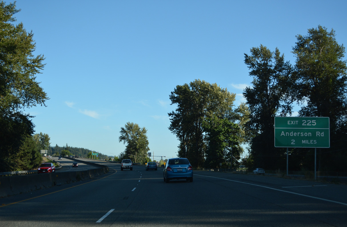
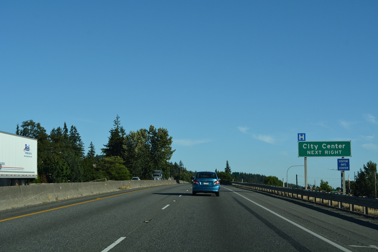
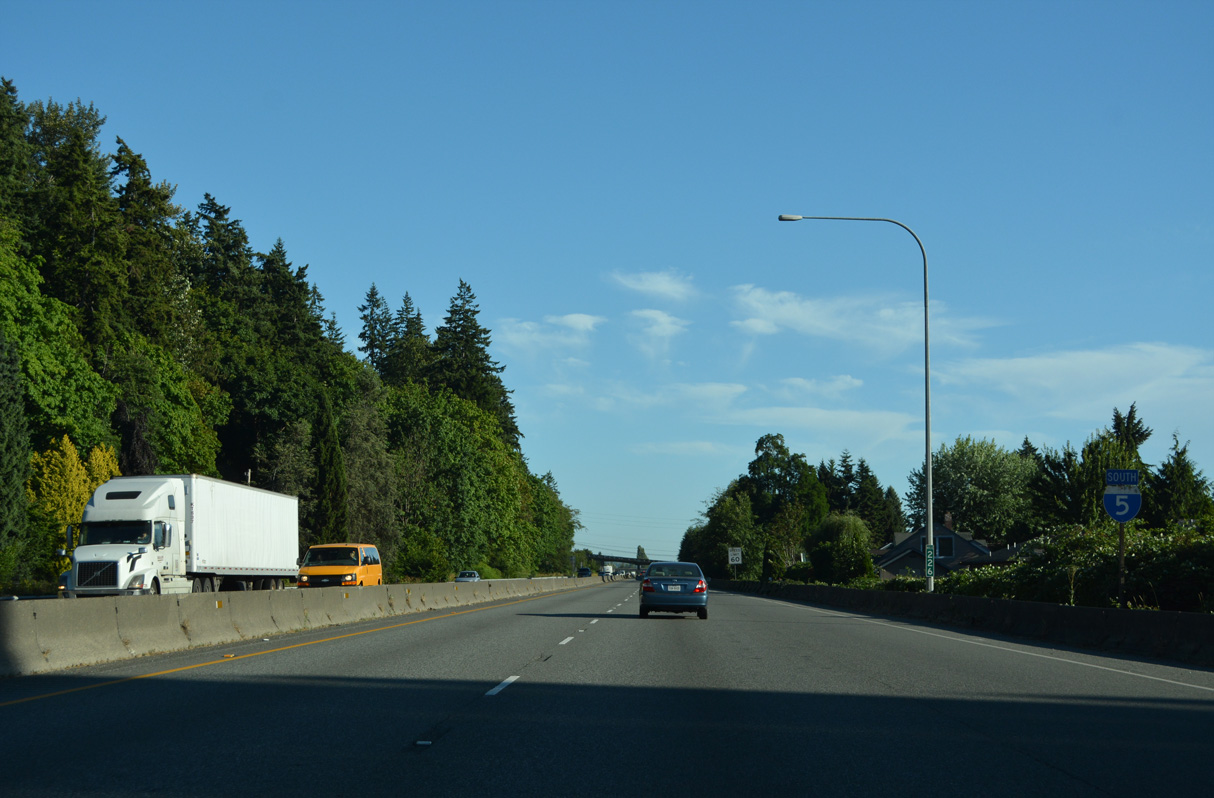
Constructed in the mid-1950s, Interstate 5 maintains just four lanes with a barrier median south past the Mount Vernon city center. The last exit for the city is to Anderson Road in two miles.
07/19/23
Forthcoming Exit 226 joins Interstate 5 with SR 536 (Kincaid Street) west to the adjacent Mount Vernon city center and Broad Street east.
07/19/23
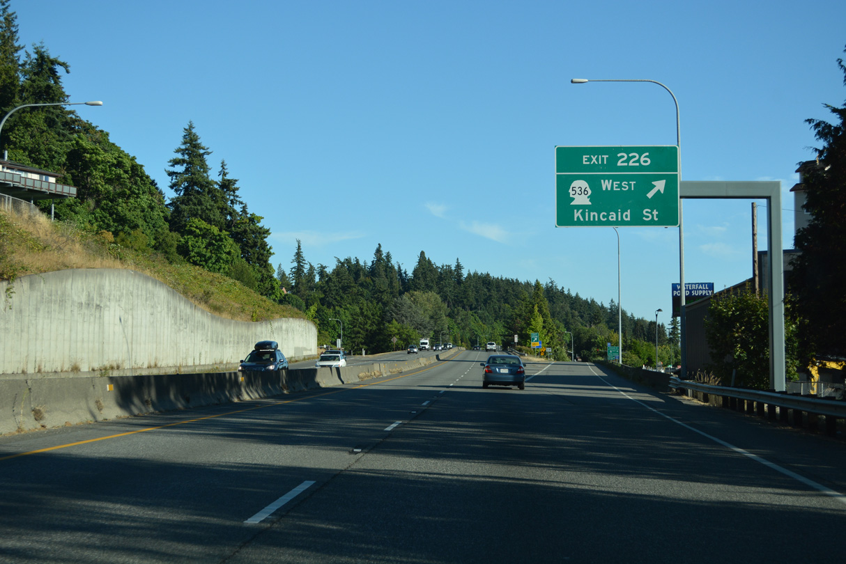
5.38 miles in length, SR 536 travels west from Mount Vernon to SR 20 near Fredonia. Skagit Station provides multimodal transportation options nearby off Kincaid Street.
07/19/23
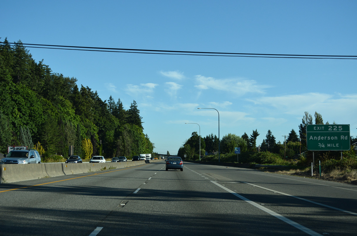
Anderson Road serves the industrial south side of Mount Vernon via the diamond interchange at Exit 225.
07/19/23
Blackburn Road passes over Interstate 5 west from nearby Hillcrest Park beyond this confirming marker.
07/19/23
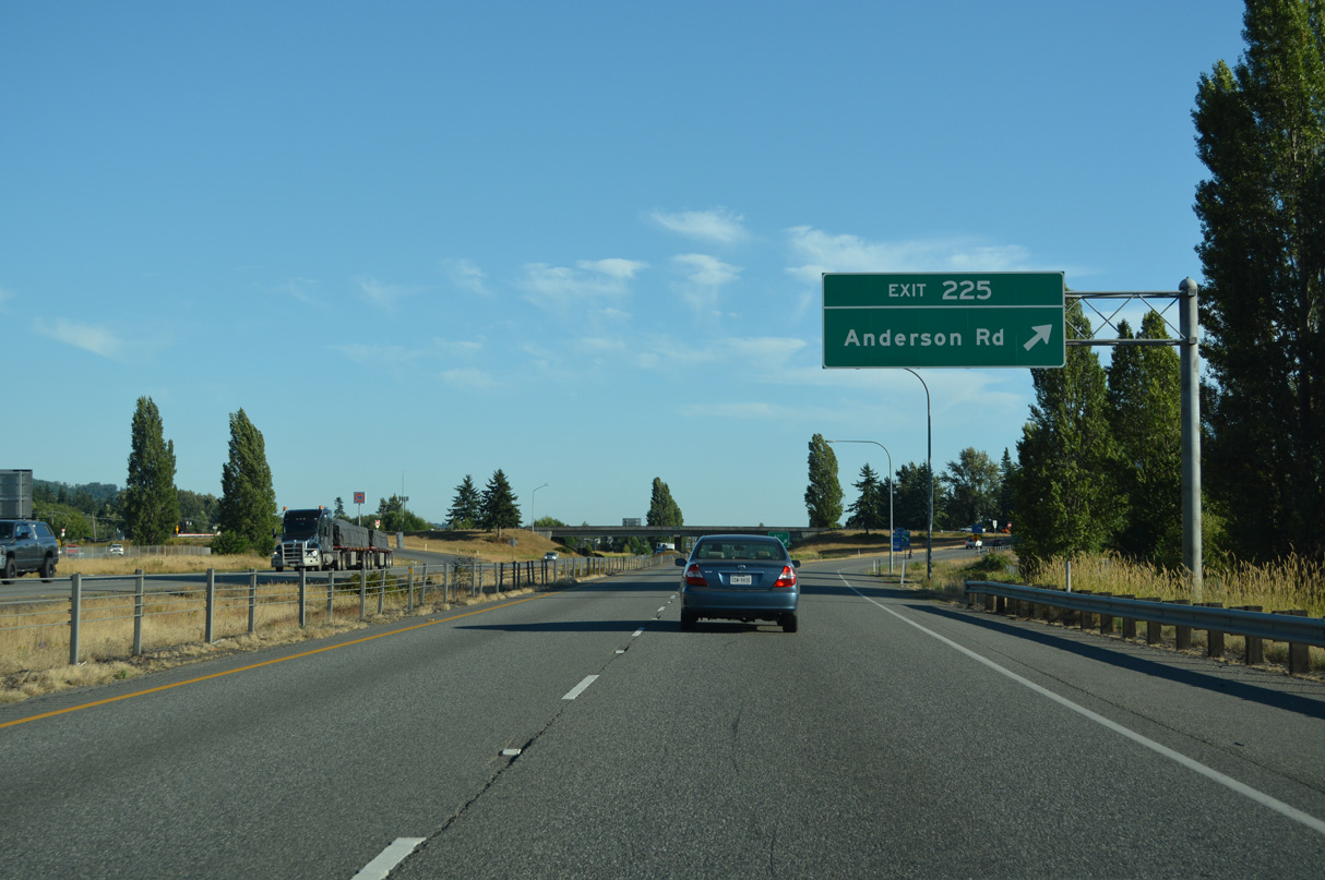
Anderson Road connects the four lane freeway with parallel Old U.S. 99 to the west of Exit 225 and Blodgett Road to the east.
07/19/23
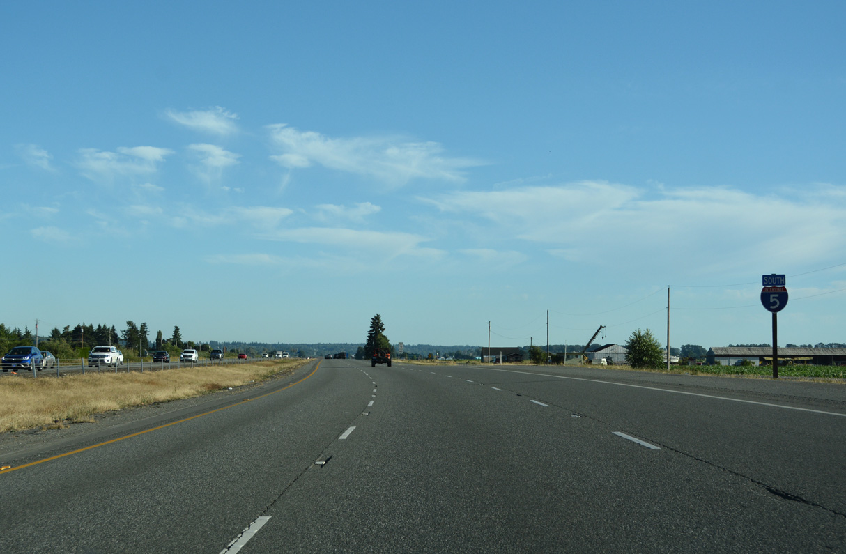
I-5 confirming marker posted south of the half diamond interchange (Exit 224) with Old Highway 99 S (Historic U.S. 99).
07/19/23
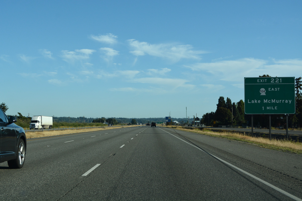
SR 534 west and Pioneer Highway (former SR 530) north come together at a diamond interchange (Exit 221) near Conway in one mile.
07/19/23
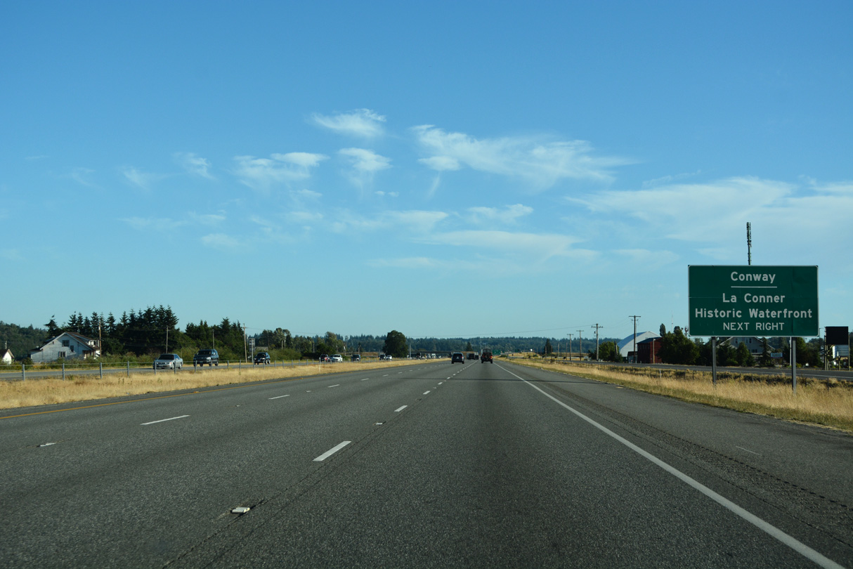
Fir Island Road stems west from a roundabout with Pioneer Highway at Conway nearby to Best Road north for La Conner.
07/19/23
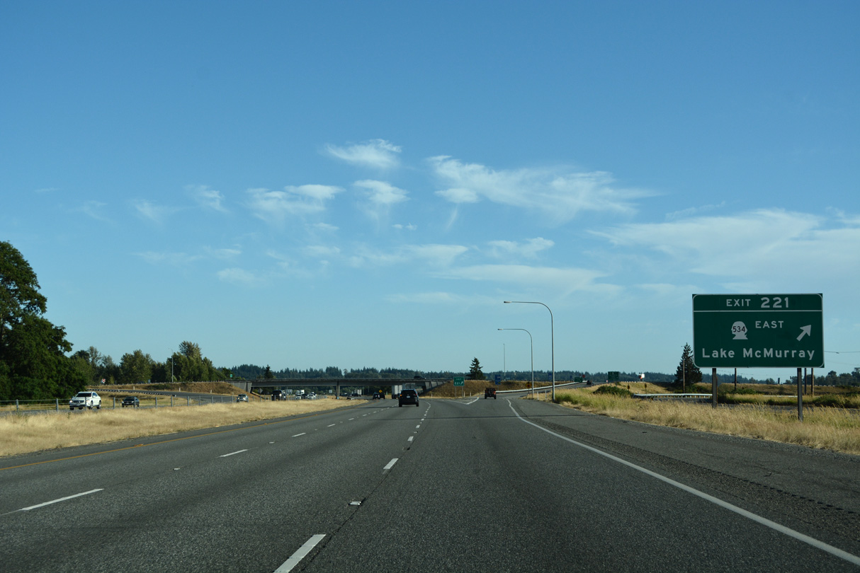
SR 534 travels 5.08 miles east from Interstate 5 to SR 9 at Lake McMurray.
07/19/23
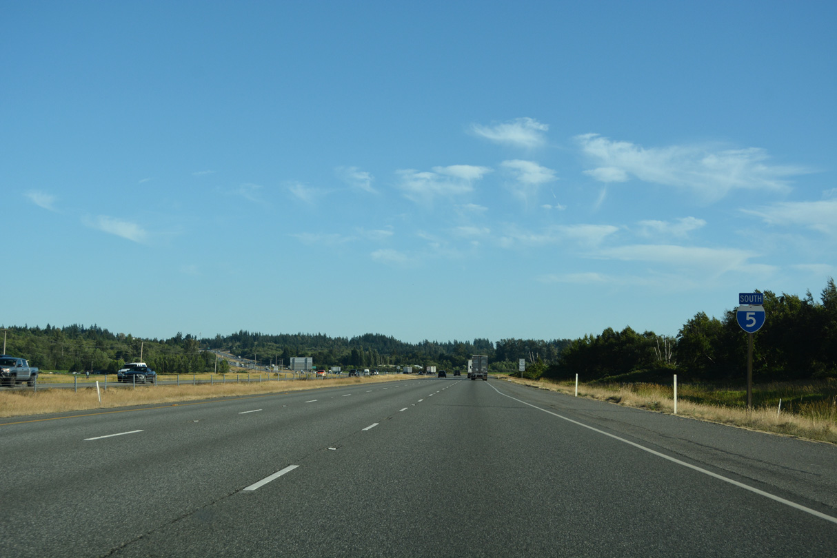
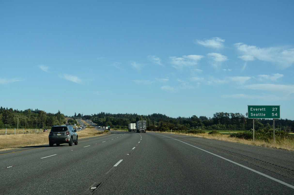
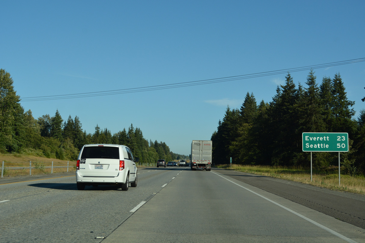
Shifting southeastward again, Interstate 5 travels 27 miles to Everett and 54 miles to Seattle.
07/19/23
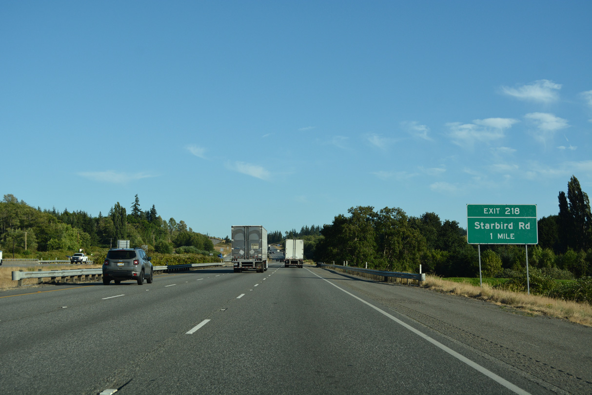
Starbird Road meets Interstate 5 at a rural diamond interchange in southern Skagit County. Starbird becomes Milltown Road west to Pioneer Highway (former SR 530) at Milltown.
07/19/23
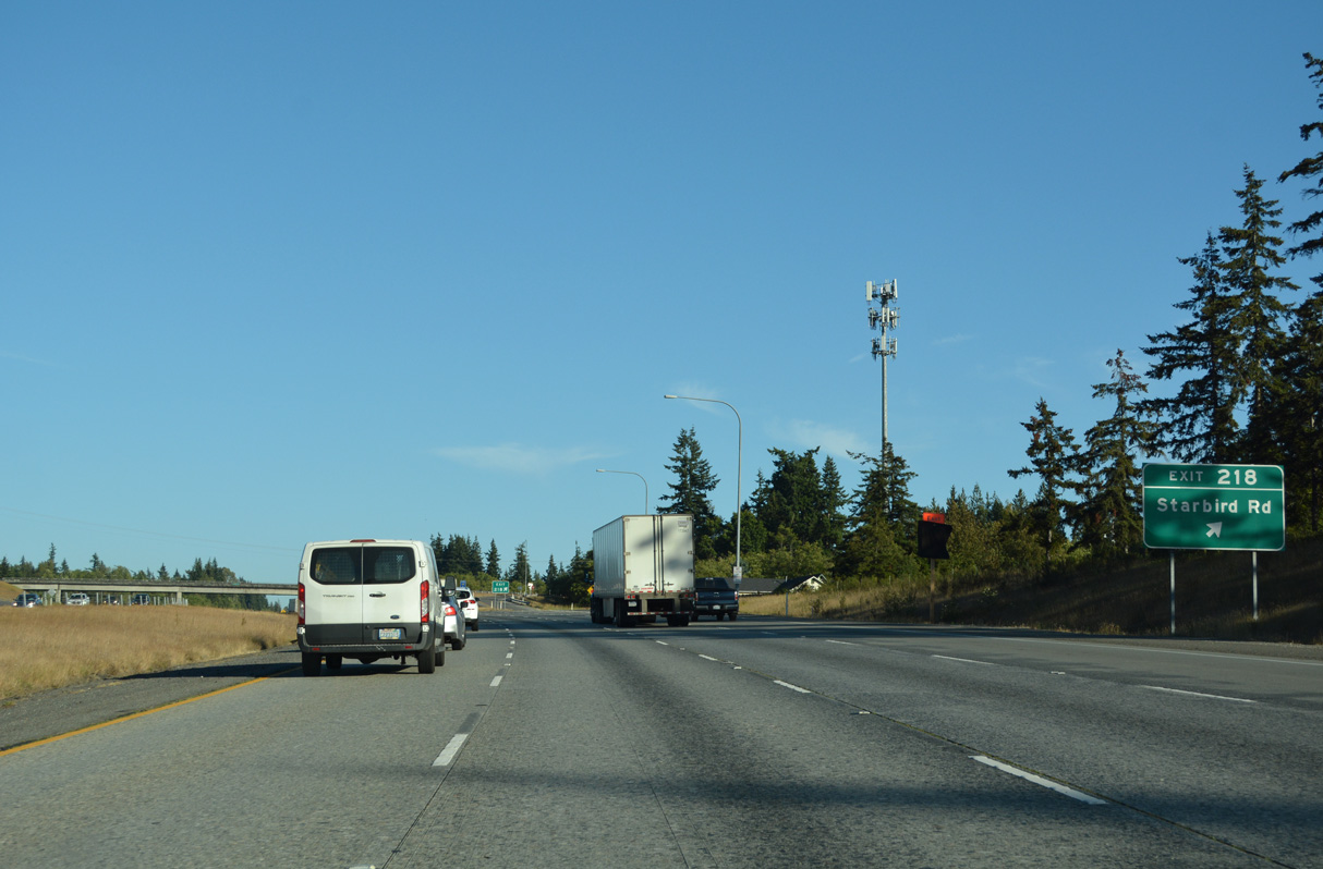
Exit 218 leaves Interstate 5 south for Starbird Road east and Milltown Road west. Pacific Highway (Old U.S. 99) stems south from Starbird Road and the west side of I-5 into Snohomish County.
07/19/23
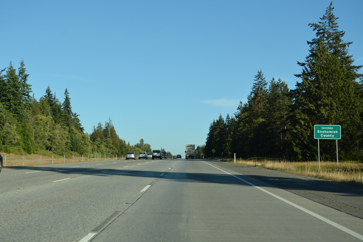
Leaving Skagit County, the next 39.89 miles of Interstate 5 south travel across Snohomish County.
07/19/23
Interstate 5 enters Snohomish County 23 miles north of the county seat and 50 miles from Seattle.
07/19/23
300th Street NW heads east from Pioneer Highway (old SR 530) to meet Interstate 5 at a diamond interchange (Exit 215) in one mile.
07/19/23
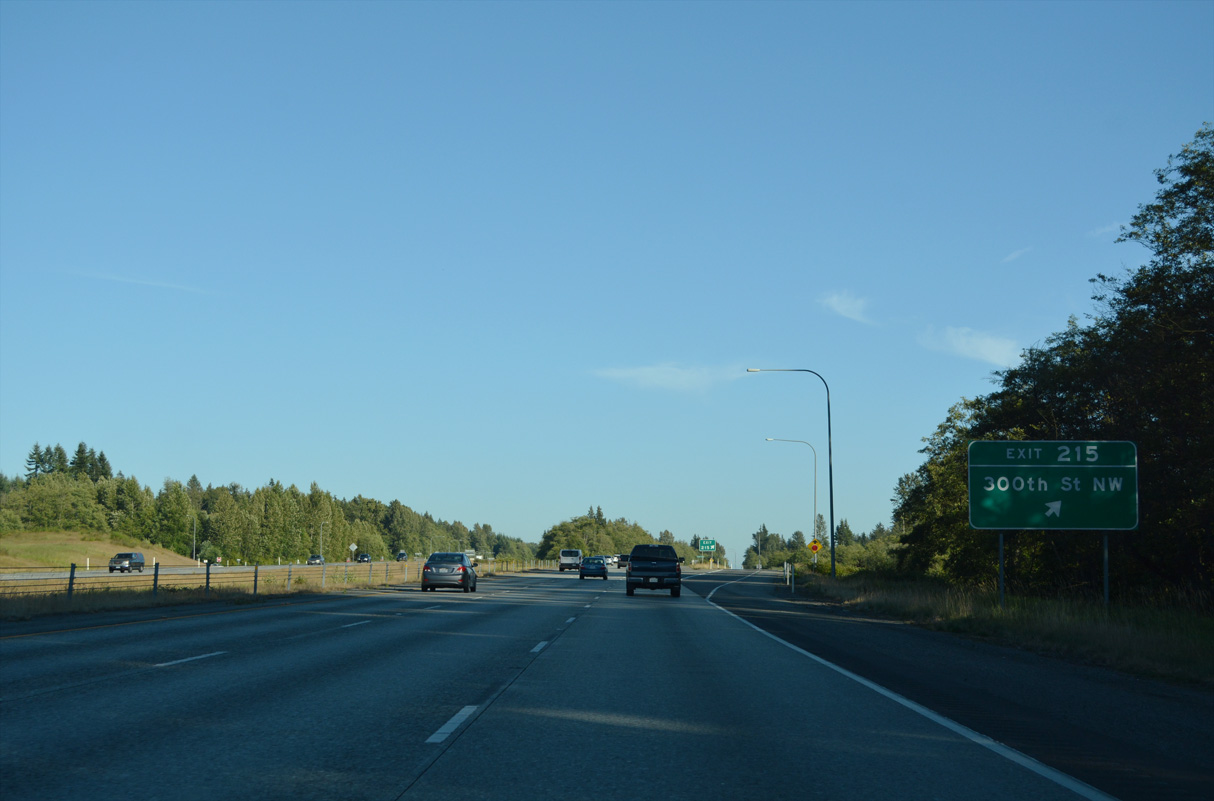
Old U.S. 99 ties into 300th Street NW nearby. Eastward from Exit 215, 300th Street NW ends at a rural residential area.
07/19/23
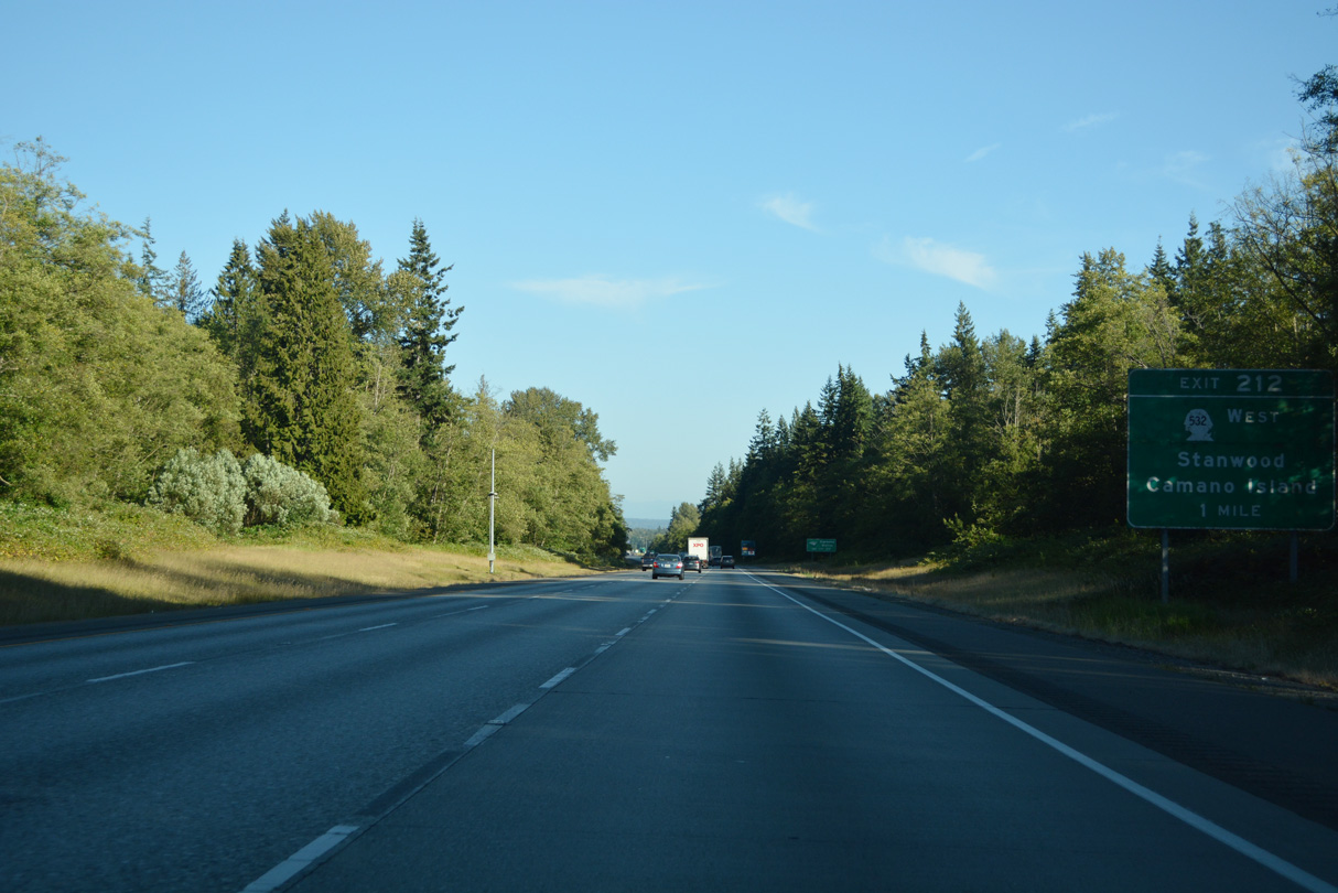
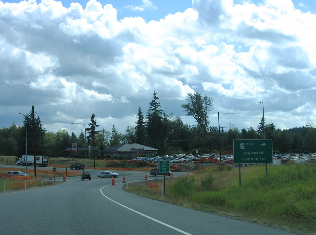
SR 532 begins at the diamond interchange (Exit 212) with 268th Street NW. The 10.09 mile long route spurs west from Interstate 5 to Camano Island in Island County.
07/19/23
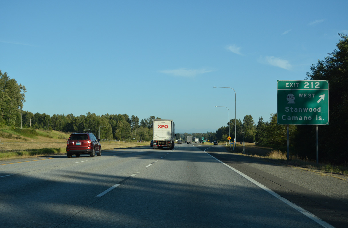
SR 532 travels five miles west from Exit 212 to the city of Stanwood. 268th Street NW extends east from Exit 212 to Bryant and SR 9.
07/19/23
SR 532 ends at Terrys Corner on Camano Island at the split of North Camano and East Camano Drive. The local roads lead to Utsalady and Camano State Parks respectively.
08/30/06
The roadways along Interstate 5 separate on the descent south to Pilchuck Creek.
08/30/06
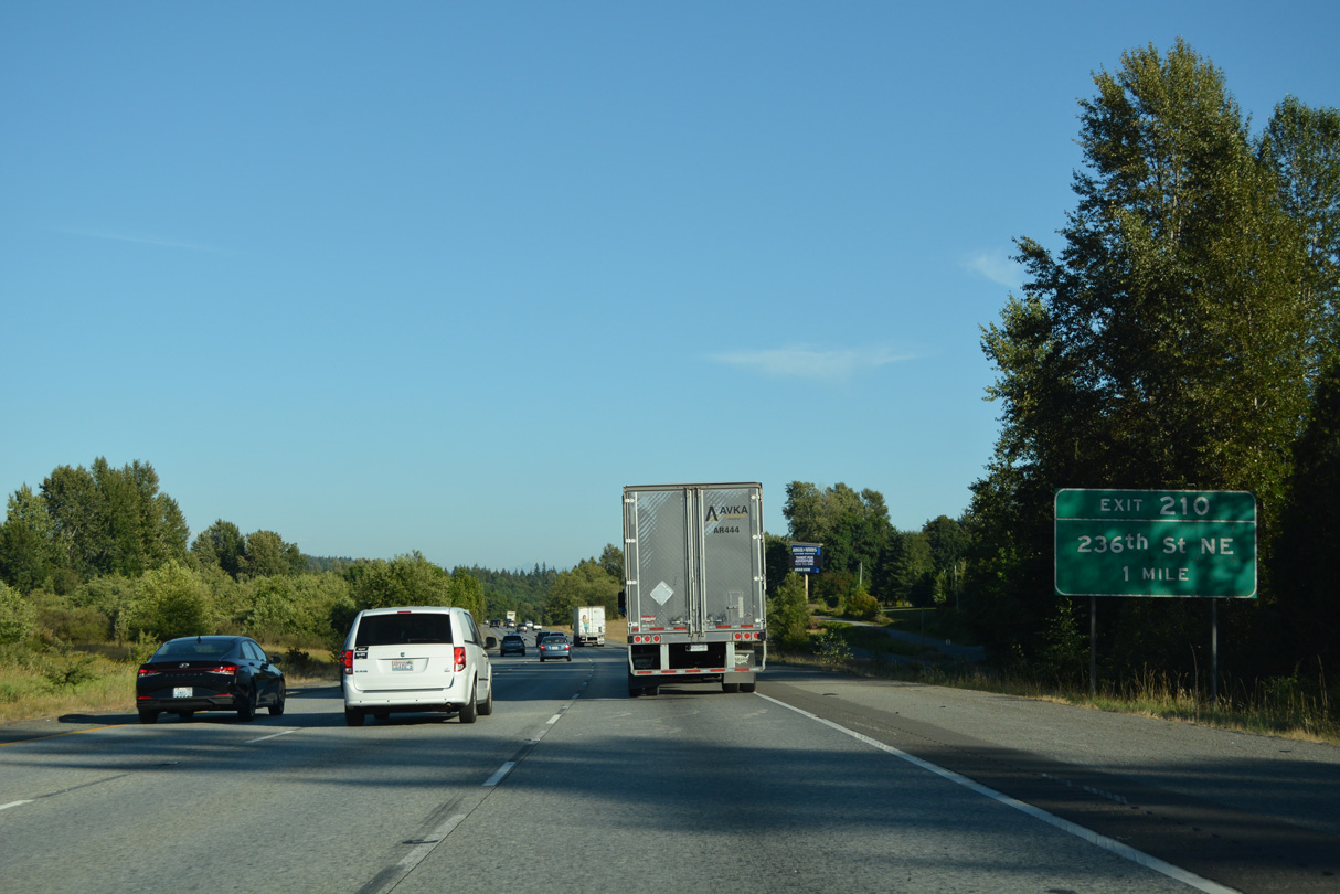
236th Street NE crosses paths with Interstate 5 at a rural diamond interchange (Exit 210) east of Silvana.
07/19/23
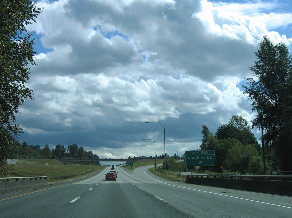
Interstate 5 spans Pilchuck Creek ahead of Exit 210. 236th Street NE links the freeway with Pioneer Highway (old SR 530) north of Silvana. Eastward, 236th Street NE ends at 35th Ave NE amid a mixture of homes and forest stands.
08/30/06
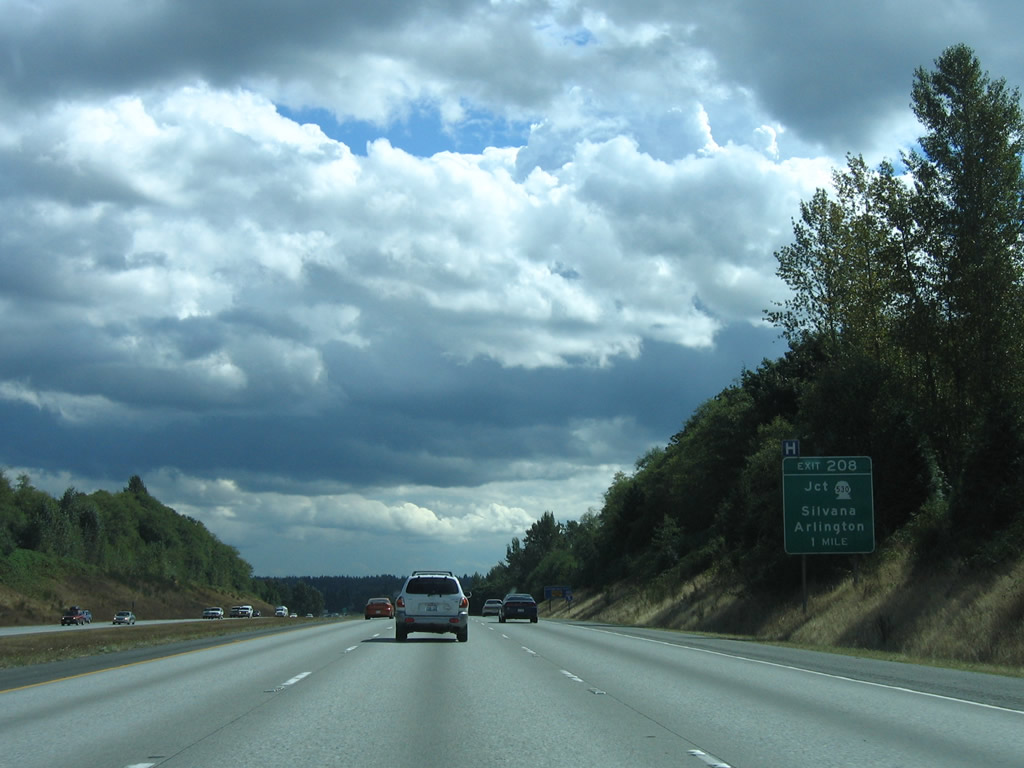
SR 530 begins east at Exit 208 on The Island, the area between the Stillaguamish River and Portage Creek west of Arlington and east of Silvana.
08/30/06
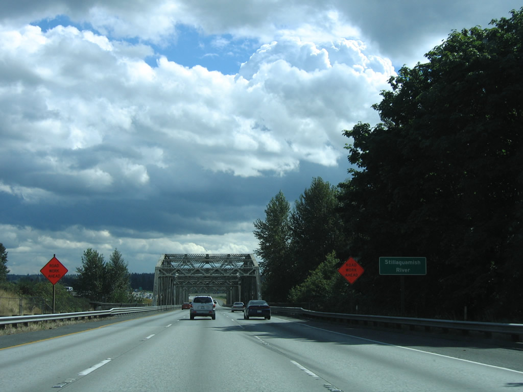
Interstate 5 crosses the Stillaguamish River one half mile north of Exit 208.
08/30/06
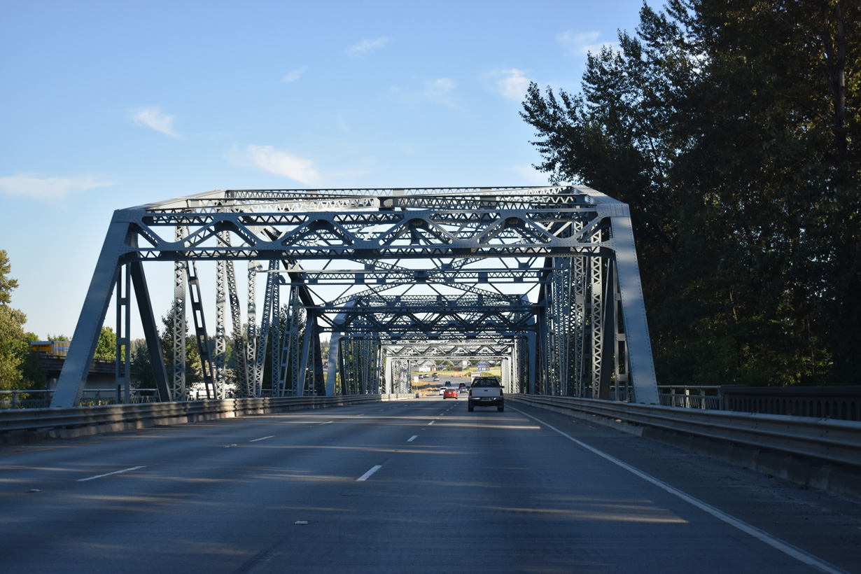
Opened in 1933 for U.S. 99, a steel through truss bridge takes Interstate 5 south across the Stillaguamish River.
07/19/23
Interstate 5 northbound crosses the Stillaguamish River over a nondescript bridge built in 1971.
08/30/06
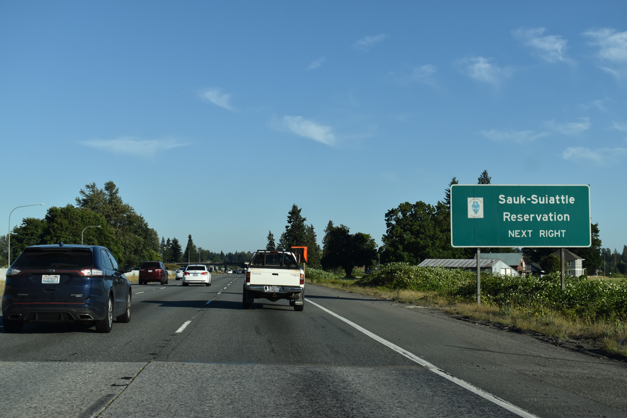
SR 530 constitutes a 50.45 mile long highway from the diamond interchange at Exit 208 east through Arlington to Darrington, the Sauk-Suiattle Reservation and SR 20 at Rockport.
08/30/06
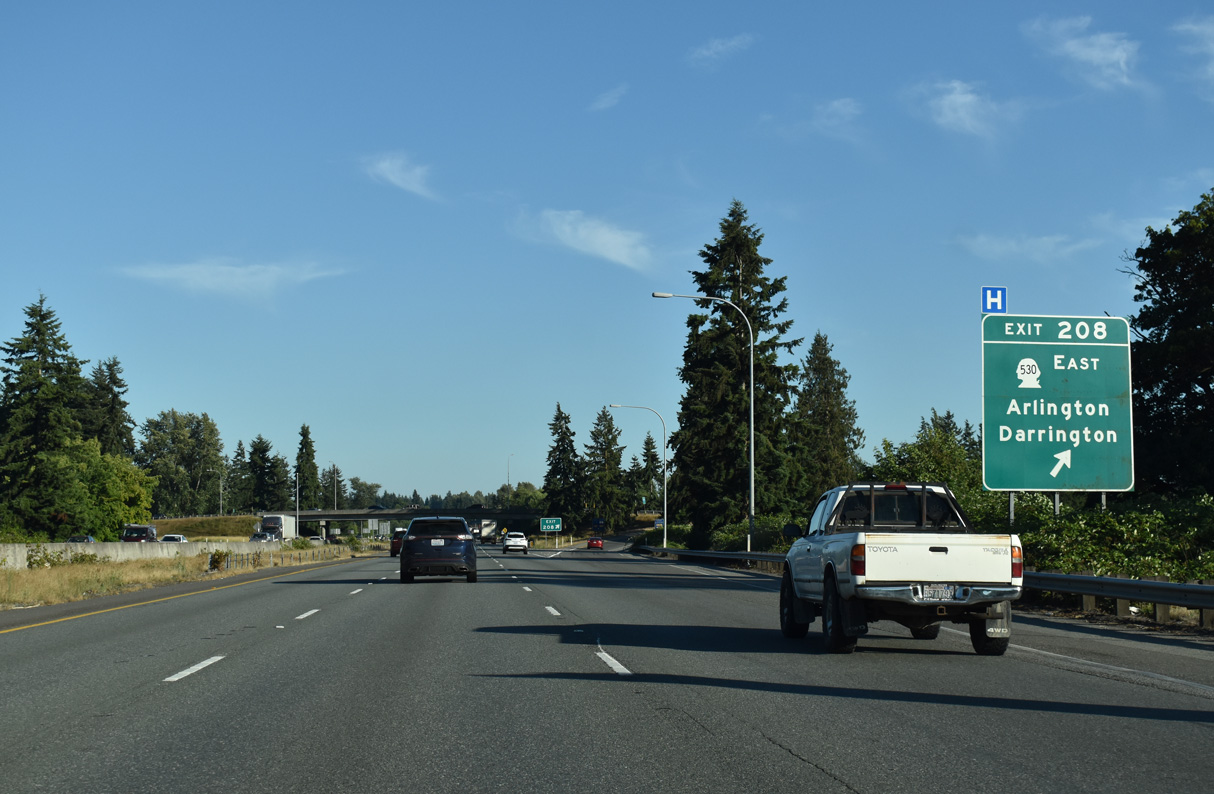
Part of SR 530 until 1991 (AARoads Wiki, 2023), Pioneer Highway extends west from Exit 208 to Silvana and East Stanwood.
07/19/23
Interstate 5 straddles the west Arlington city line south from Exit 208 to 164th Street NE beyond Exit 206.
07/19/23
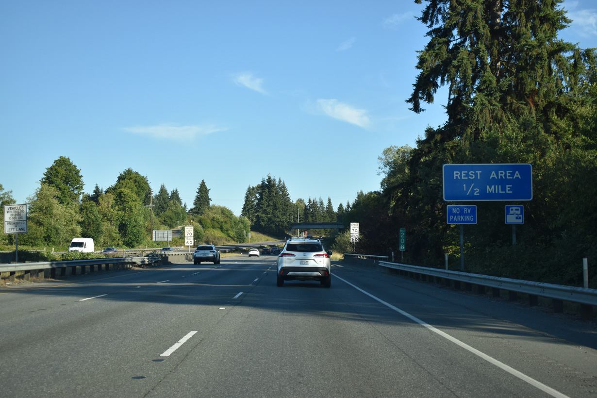
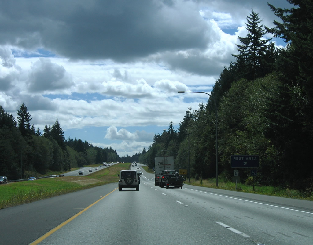
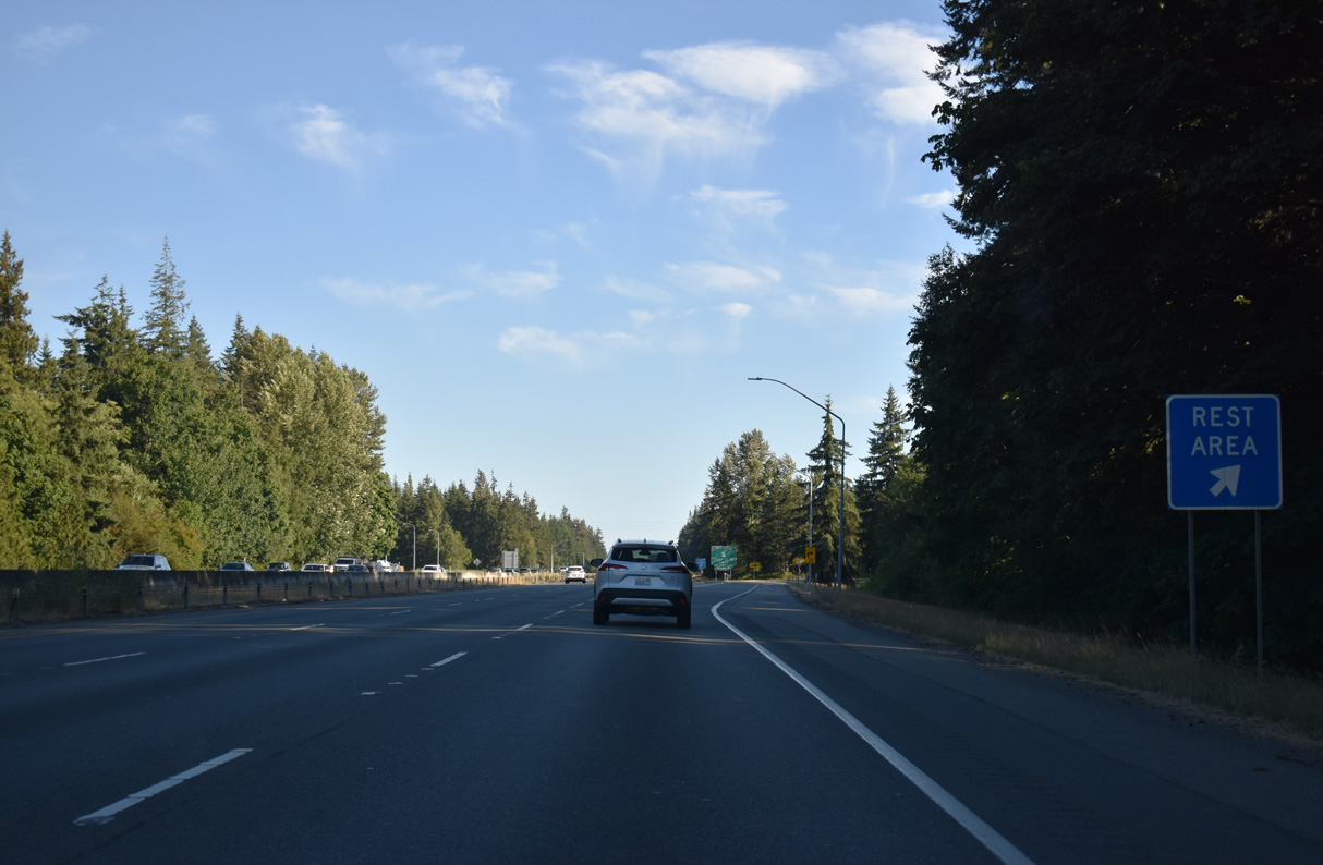
The third set of Interstate 5 rest areas south of Blaine line both sides of freeway at Smokey Point.
07/19/23
114 miles away, the ensuing rest area beyond the Smokey Point Rest Area is the Maytown Rest Area south of Tumwater.
07/19/23
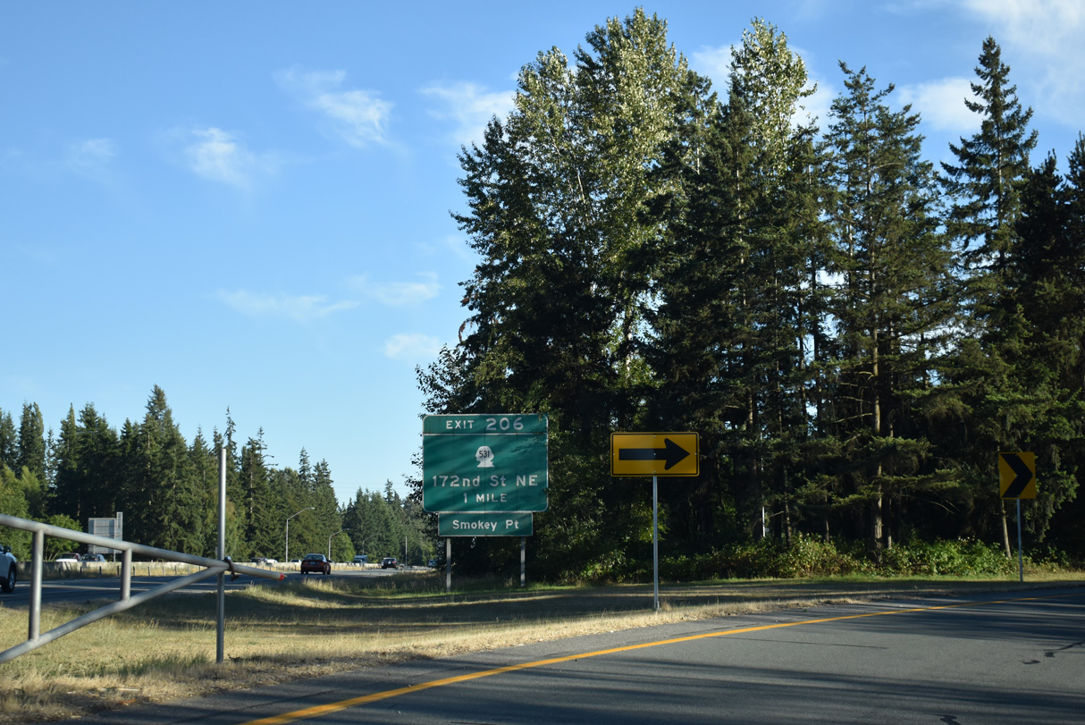
SR 531 joins Interstate 5 with Lakewood to the west and Arlington to the east from forthcoming Exit 206.
07/19/23
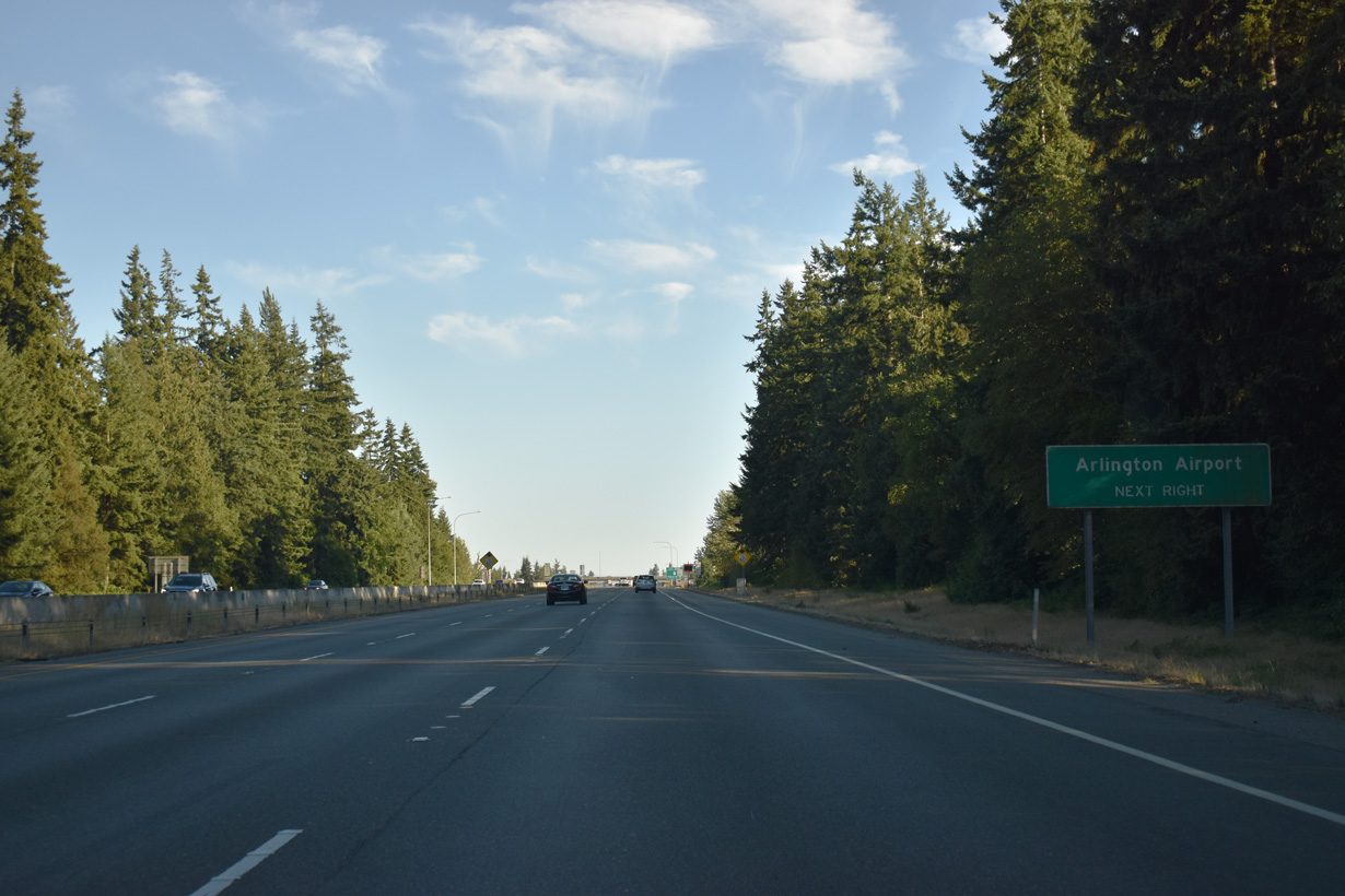
Located 1.7 miles east of the parclo interchange at Exit 206, Arlington Municipal Airport (AWO) is home to the WSDOT Aviation Division.
07/19/23
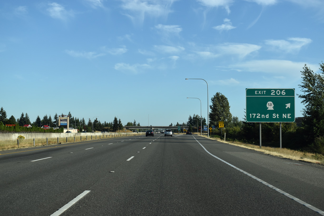
Interstate 5 meets SR 531 (172nd Street NE) between suburban and retail areas at Smokey Point. The 9.88 mile long route runs west from SR 9 through Arlington to Wenberg County Park.
07/19/23

References:
AARoads Wiki. (2023, September 8). Washington State Route 237. AARoads Wiki. Retrieved September 7, 2025, from https://wiki.aaroads.com/wiki/Washington_State_Route_237
Long, P. (2013, September 16). I-5 Skagit River Bridge at Mount Vernon collapses on May 23, 2013. HistoryLink.org. https://www.historylink.org/File/10584
AARoads Wiki. (2024, December 18). Washington State Route 530. AARoads Wiki. Retrieved September 7, 2025, from https://wiki.aaroads.com/wiki/Washington_State_Route_530
Photo Credits:
- AARoads: 08/30/06
- Brent Ivy: 07/19/23
Page Updated Sunday September 07, 2025.