
Interstate 15 North - Las Vegas
 North
North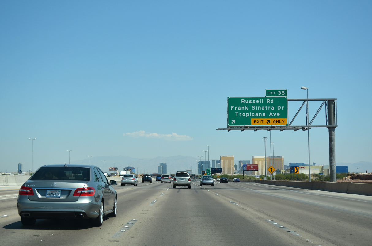
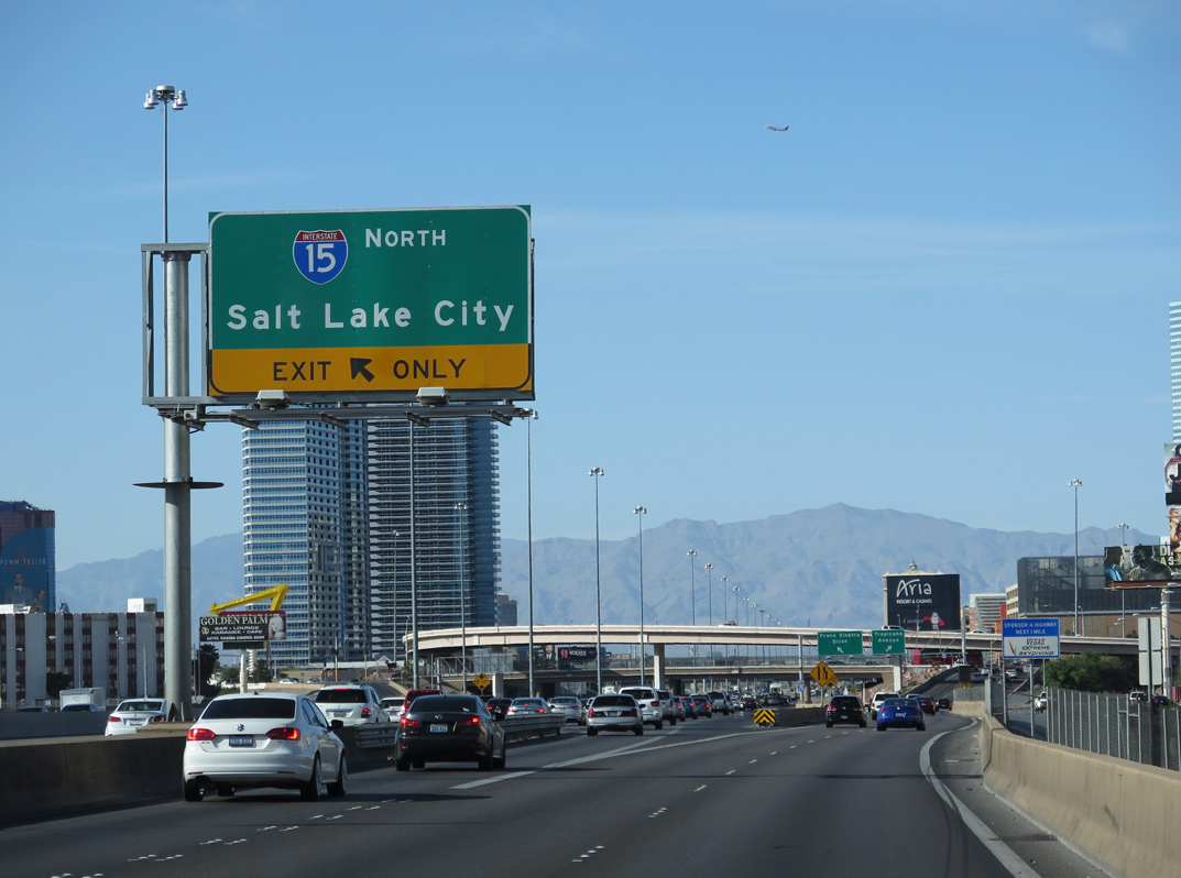
Passing over the systems interchange (Exit 33) with I-215/CC-215, the first of two ramps depart I-15 north for Frank Sinatra Drive north and Tropicana Avenue at Russell Road (Exit 35).
07/15/17
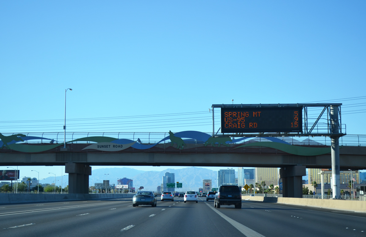
Traffic merges in from I-215 and Las Vegas Boulevard ahead of the overpass for Sunset Road. Sunset Road lines the south boundary of Harry Reid (former McCarran) International Airport (LAS).
07/20/14
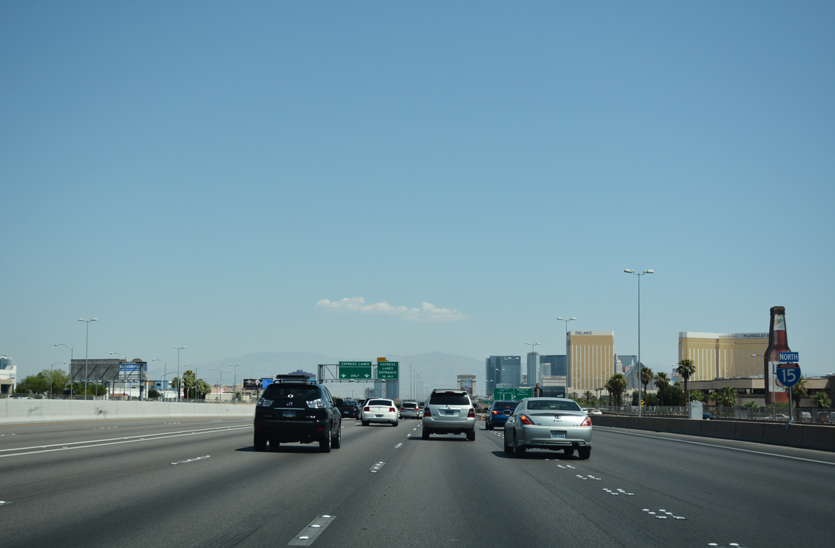
I-15 advances north between Allegiant Stadium and Mandalay Bay at the south end of the Las Vegas Strip. Mandalay Bay represents the southernmost casino resort along the Strip while Allegiant Stadium is home to the Las Vegas Raiders NFL team.
07/15/17
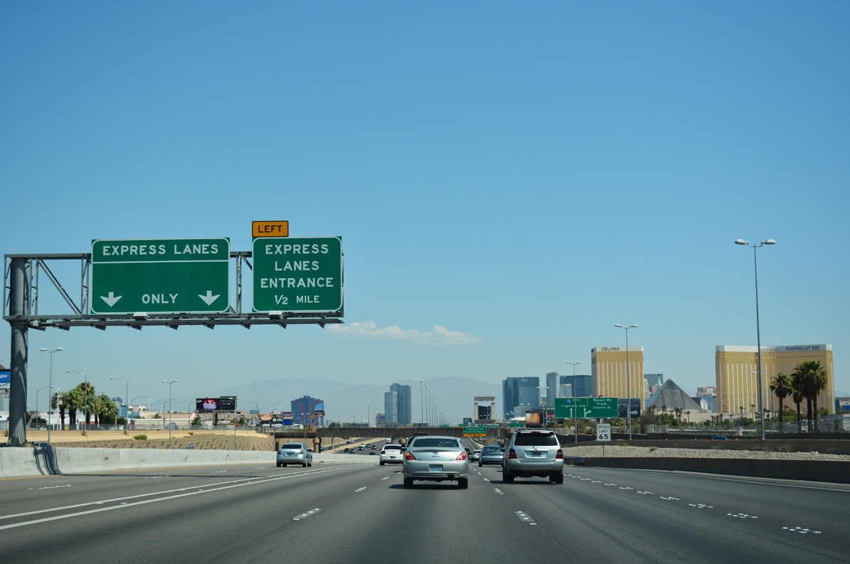
The Las Vegas Freeway maintains a 65 mph speed limit along the ensuing stretch.
07/15/17
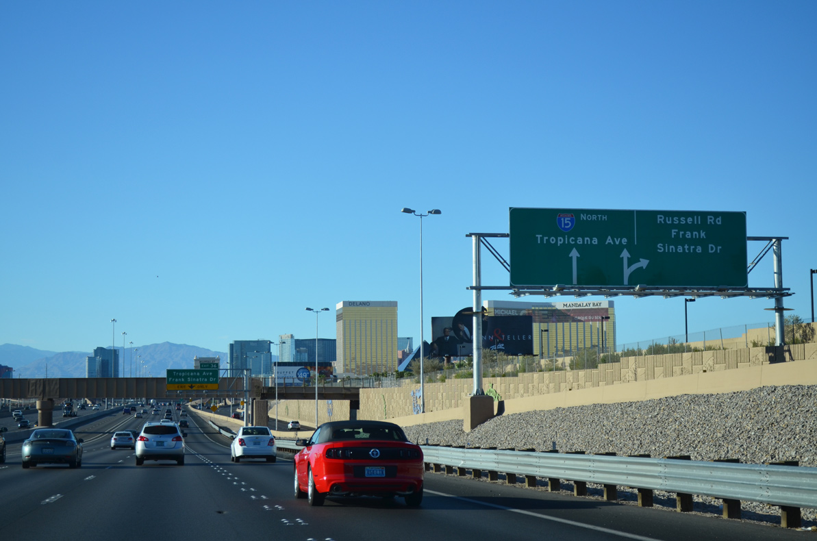
Lanes partition ahead along the collector distributor ramp to Russell Road (Exit 35) and Frank Sinatra Drive north.
07/20/14

A Union Pacific rail line spans Interstate 15 ahead of Tropicana Avenue (Exit 36). The spur emanates from Boulder City and connects to the main line 0.50 miles west of the freeway.
07/15/17
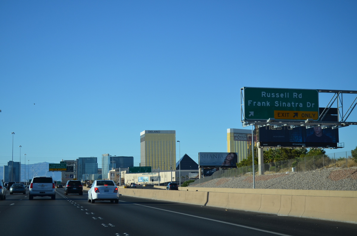
Frank Sinatra Drive lines the east side of I-15 on a 2.50 mile course to Sammy Davis Jr. Drive near the Mirage casino resort.
07/20/14
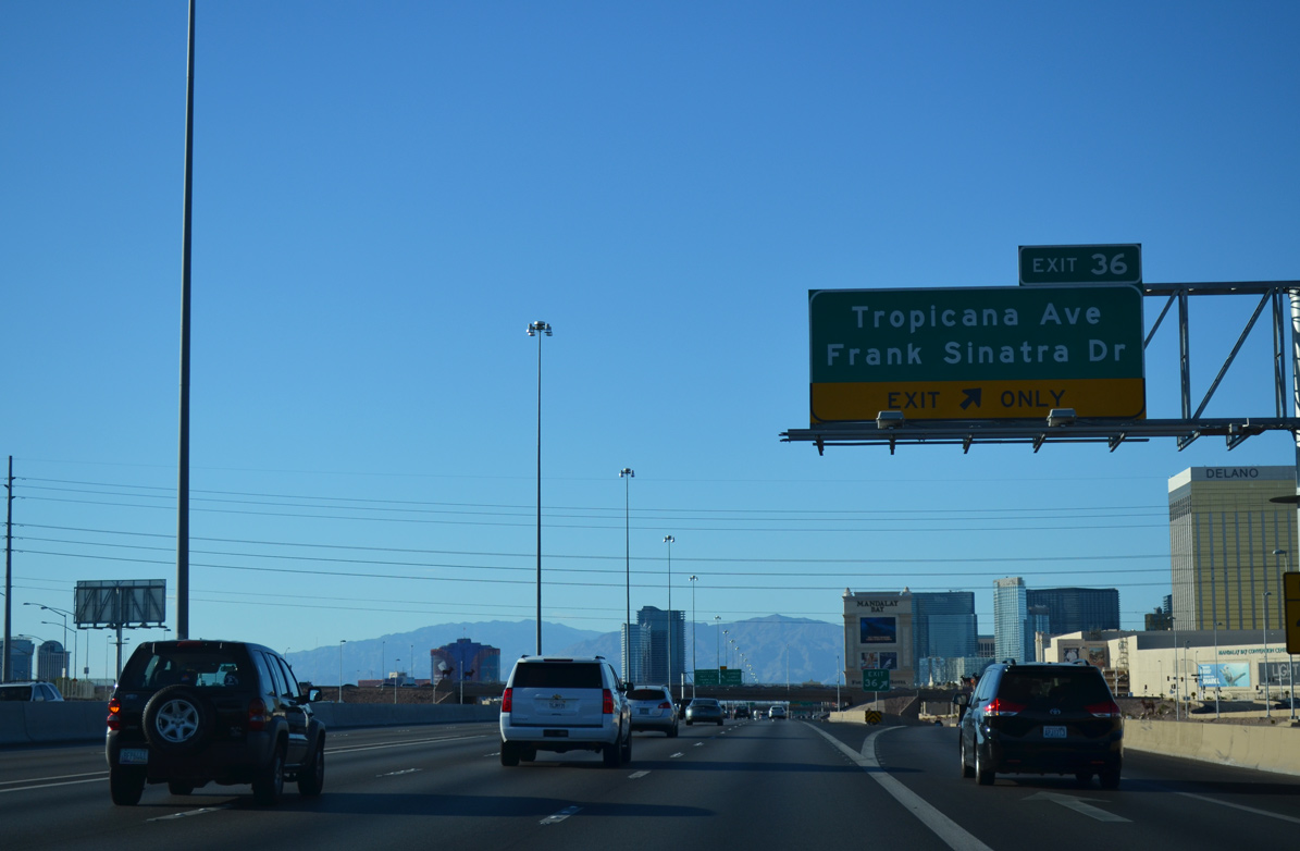
A single lane ramp departs for Tropicana Avenue (Exit 36) ahead of the Russell Road under pass. Tropicana Avenue extends east and west of Interstate 15 to serve the south Las Vegas Strip and Spring Valley.
Tropicana Avenue also doubles as SR 593 through the upcoming exchange, following the arterial between Dean Martin Drive and Las Vegas Boulevard. A separate section continues along Tropicana Avenue through Henderson.
07/20/14
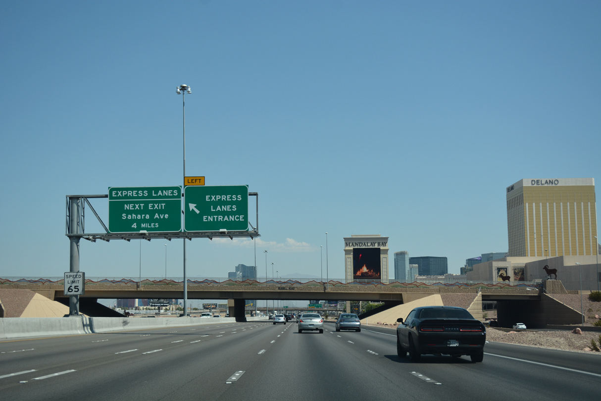
The local express lanes allow for a bypass of the ingress/egress points along I-15 north for the next four miles. The lanes tie into the northbound mainline ahead of Sahara Avenue (Exit 40).
07/15/17
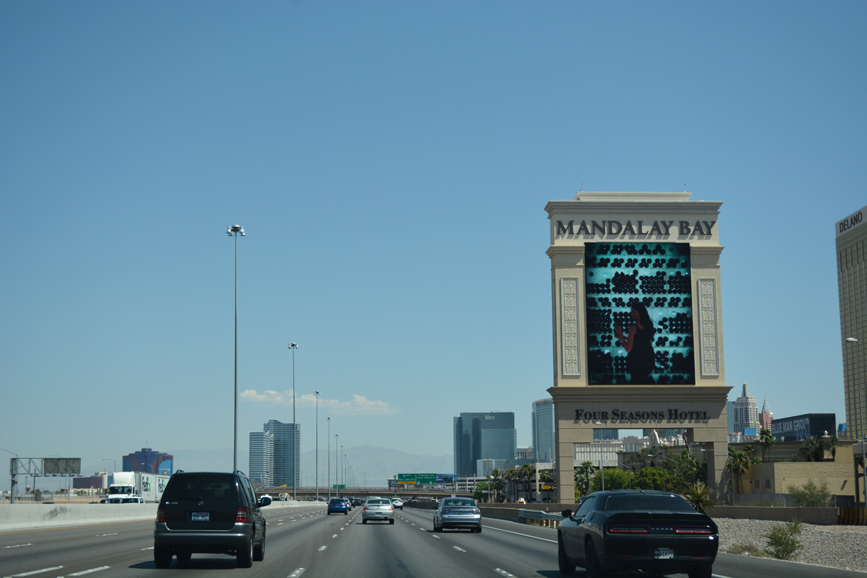
I-15 north passes between the Mandalay Bay casino resort and the future Las Vegas Stadium. Las Vegas Stadium occupies nearly 62 acres between Russell Road and Hacienda Avenue and is anticipated to open late summer 2020, hosting the former Oakland Raiders football franchise.
07/15/17
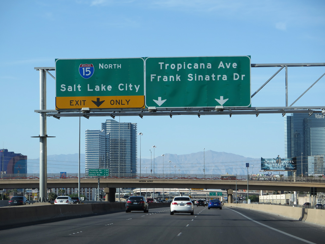
A slip ramp connects to Interstate 15 north beyond Hacienda Avenue as drivers advance to Tropicana Avenue (Exit 36).
03/29/15
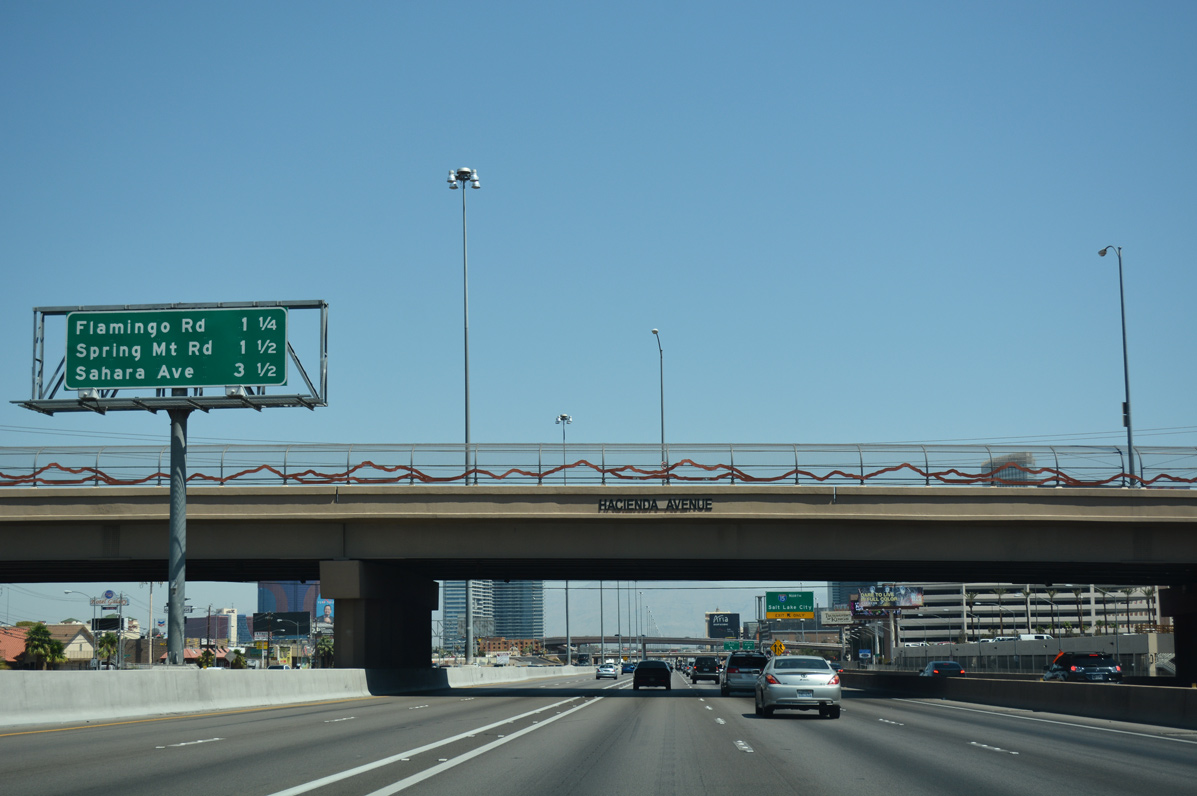
Hacienda Avenue arcs over Interstate 15 and the frontage road system 1.25 miles ahead of Flamingo Road (Exit 38). Sahara Avenue (Exit 40) represents the north end of the Las Vegas Strip in 3.5 miles.
07/15/17

Tropicana Avenue (SR 593) leads east to the Excalibur and New York-New York casino resorts and to Las Vegas Boulevard. Frank Sinatra Drive connects to nearby T-Moblie Arena and back entrances to the Park MGM casino resort and City Center casino complex.
07/15/17
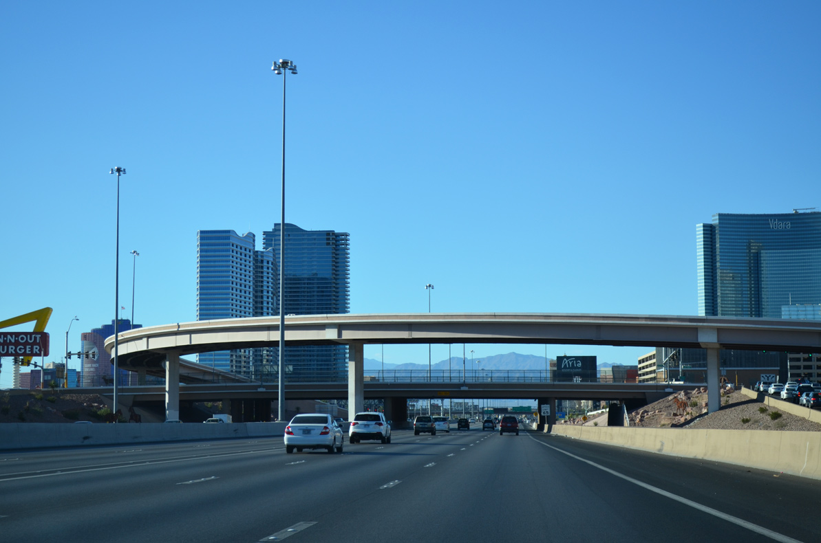
A study is underway to modify the current exchange between Interstate 15 and Tropicana Avenue (SR 593). Improvements considered include the addition of HOV ramps at Harmon Road, wider ramps, and a partial realignment of Dean Martin Drive through the diamond interchange.1
07/20/14
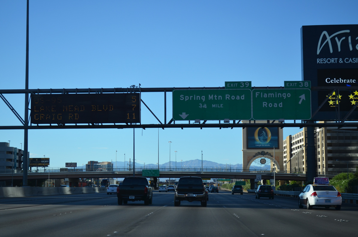
The Aria resort and casino and Panorama Towers flank both sides of Interstate 15 as motorists leave for Flamingo Road (Exit 38) ahead. Spring Mountain Road (Exit 39) connects the freeway to the central resort corridor in 0.75 miles.
07/20/14
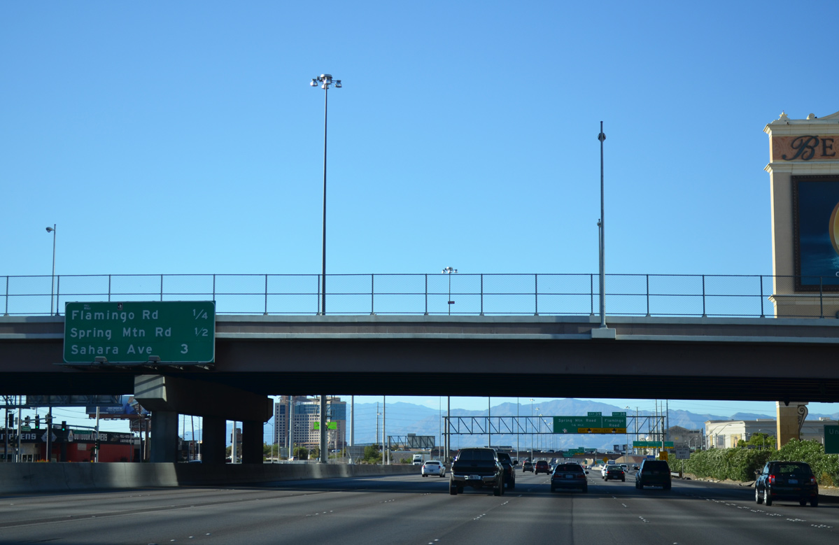
Harmon Road bisects the City Center complex, which includes the Aria, Vdara, and Cosmopolitan casino resorts. The local road continues east of Las Vegas Boulevard to the University of Nevada Las Vegas (UNLV) campus.
07/20/14

Flamingo Road (SR 592) ties into I-15 near the Bellagio and Ceasars Palace hotel and casino resorts one quarter mile south of Spring Mountain Road (Exit 39). SR 592 overlays Flamingo Road along two segments as the arterial stretches across the greater valley area.
07/15/17
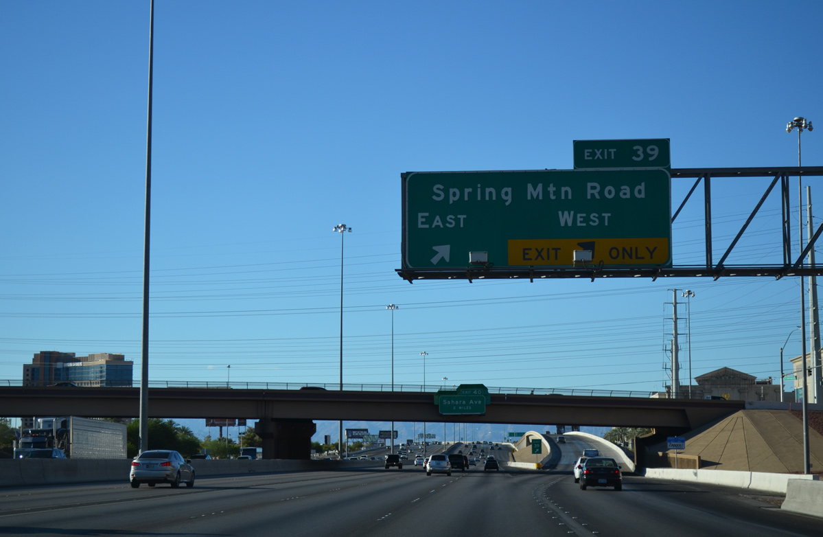
I-15 north passes under Flamingo Road at the egress point for Spring Mountain Road (Exit 39). Spring Mountain Road connects I-15 with the central hotel/casinos which include the Venetian, Palazzo, Mirage, TI and Wynn resorts.
07/20/14
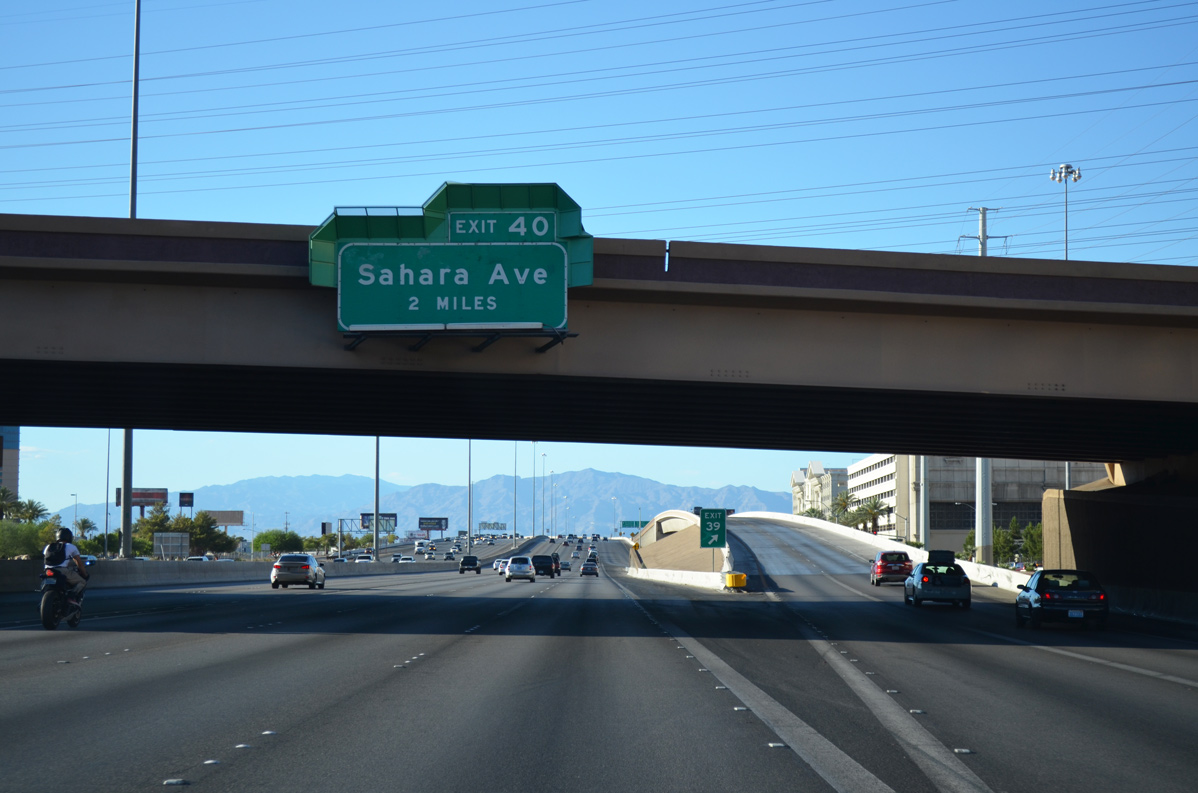
The freeway next meets Exit 40 / Sahara Avenue in two miles near the north end of the Strip.
07/20/14
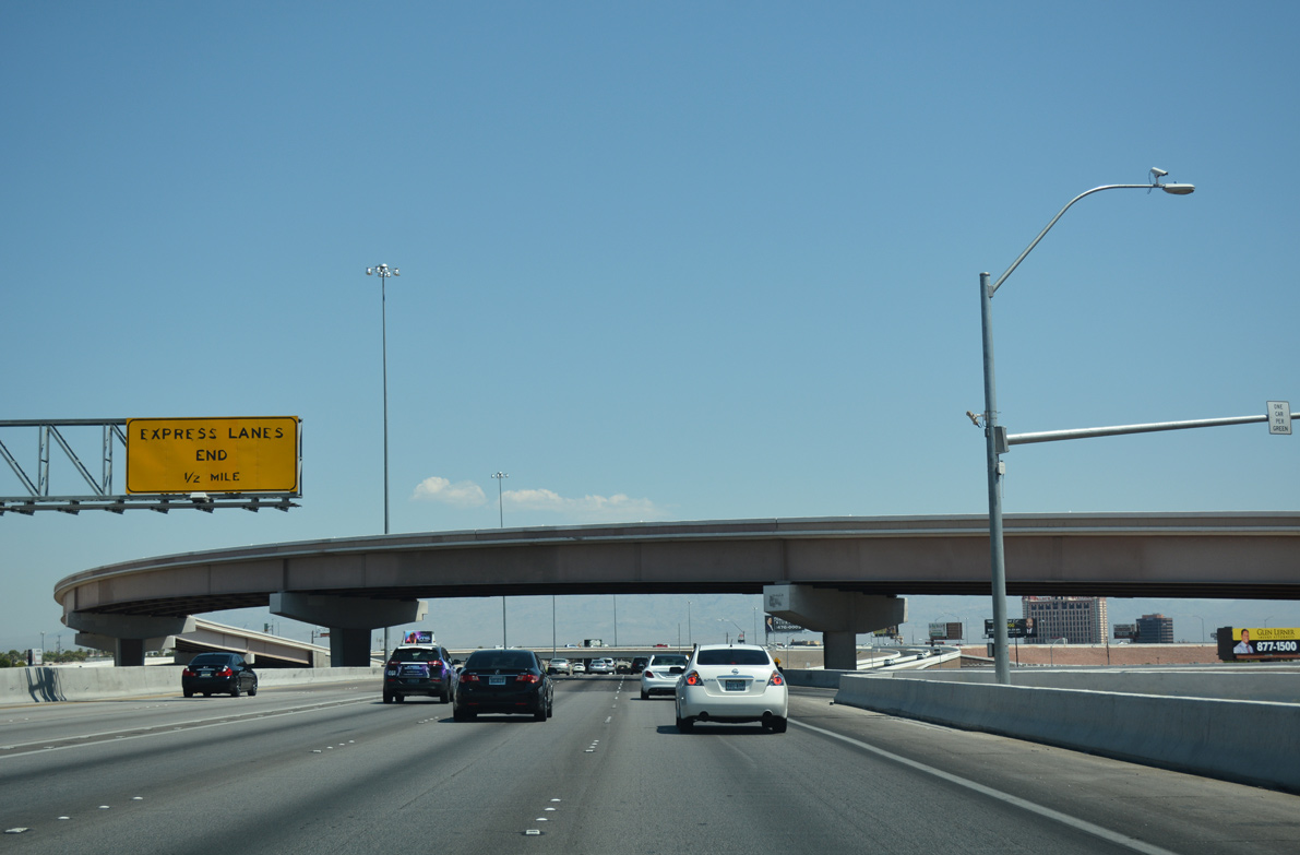
Interstate 15 crosses Spring Mountain Road (Exit 39) one half mile ahead of the present end of the local express lanes.
07/15/17
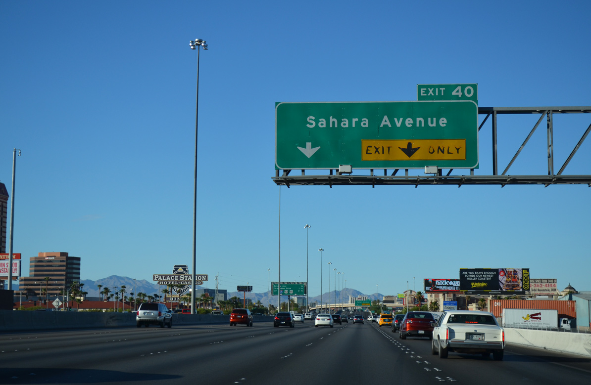
Interstate 15 angles northeast and reaches the Las Vegas limits anead of Exit 40 for Sahara Avenue.
07/20/14
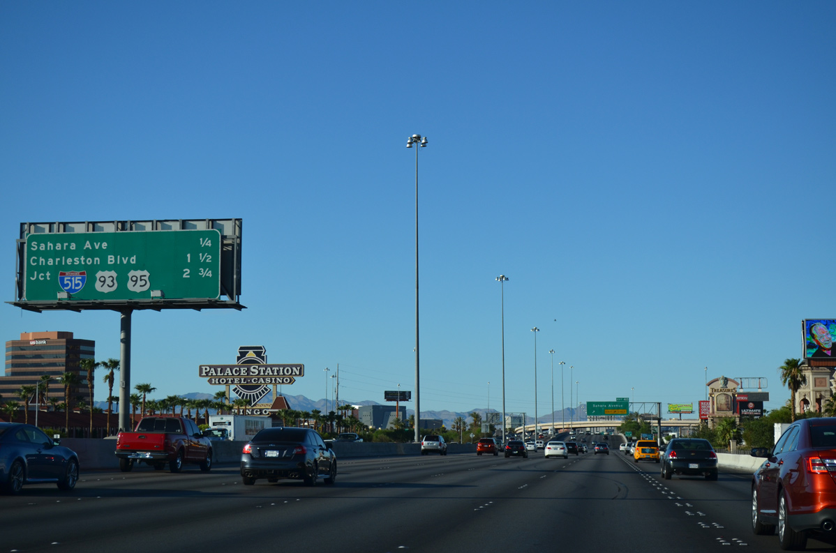
Interstate 515 and U.S. 93-95 south join I-15 with Downtown Las Vegas in 2.75 miles.
07/20/14
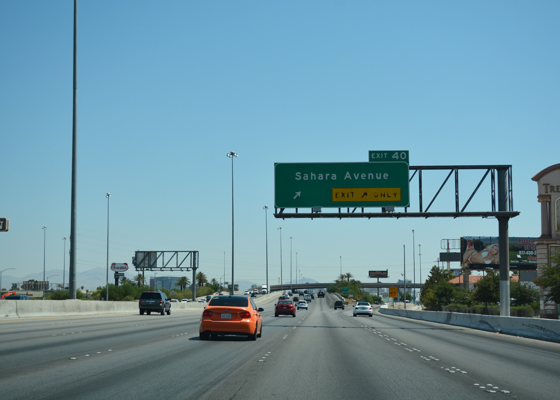
Two lanes leave I-15 at Exit 40 for Sahara Avenue and the north end of the Strip, which includes Circus Circus, SLS, and Strat casino/hotels. Sahara Avenue also joins I-15 with Summerlin in the west part of the metro area.
07/15/17
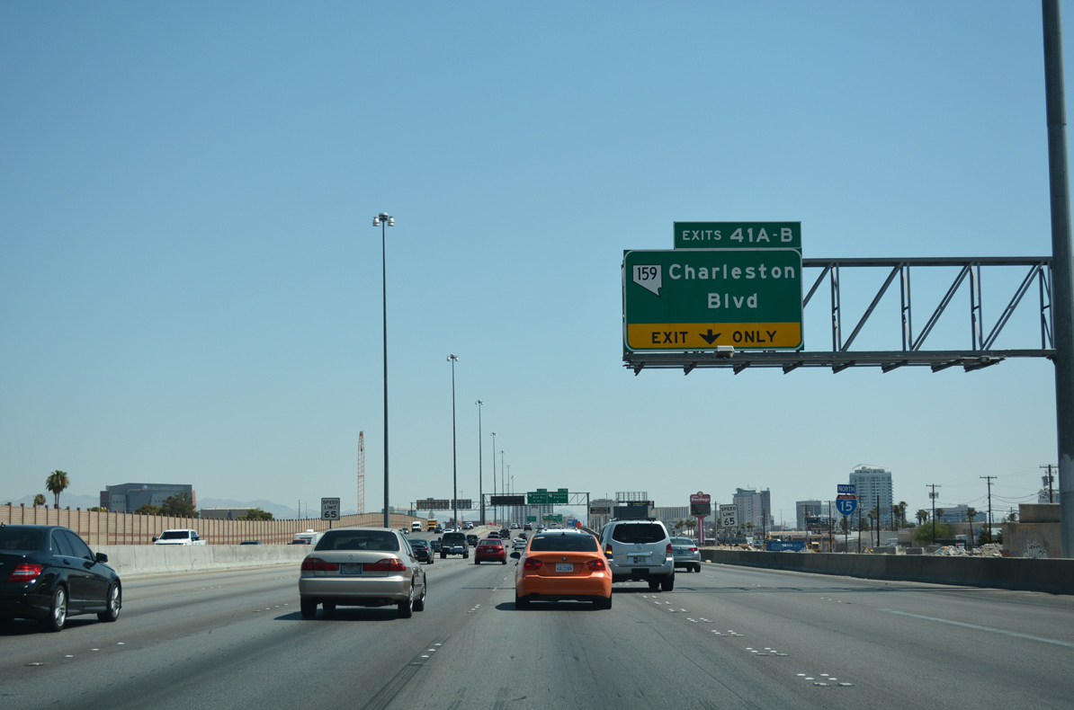
Interstate 15 north passes to the east of the Glen Heather Estates neighborhood on the drive to Charleston Boulevard (Exits 41AB).
07/15/17
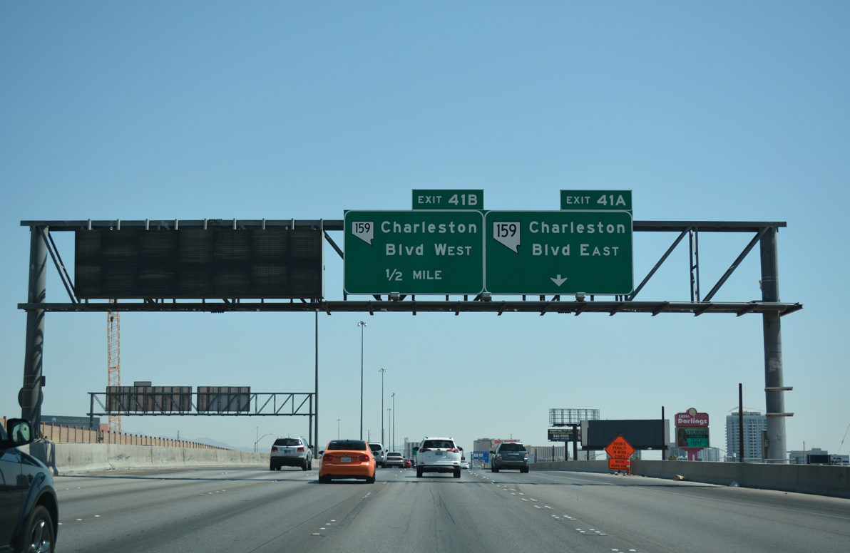
SR 159 east overlays Charleston Boulevard (Exit 41A) on a 5.4 mile linear course to Nellis Boulevard (SR 612) in eastern reaches of Las Vegas.
As part of Project NEON, the ensuing interchange with Charleston Boulevard was reconstructed, with an anticipated completion by late 2019.2
07/15/17
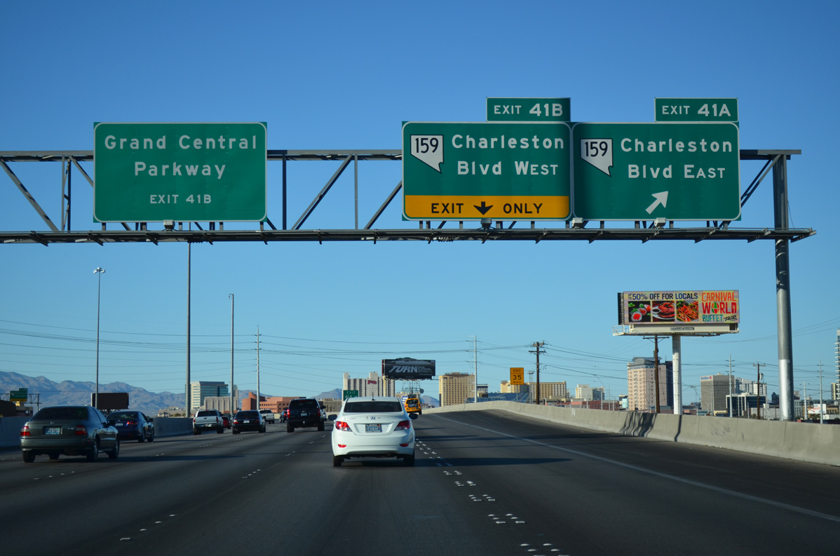
Charleston Boulevard extends west from Exit 41B along an urban corridor to Summerlin and the Red Rock National Conservation Area.
Grand Central Parkway stems north from Charleston Boulevard to parallel I-15 into Downtown.
07/20/14
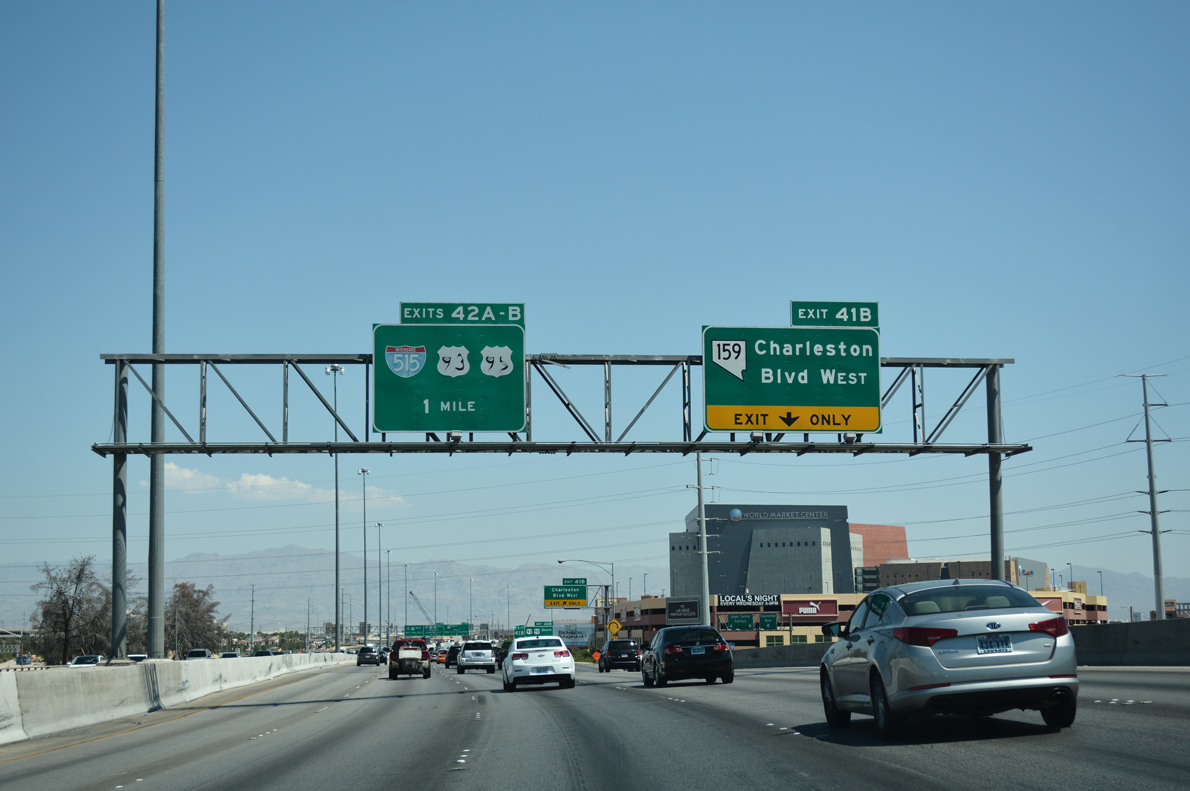
I-15 north spans Charleston Boulevard one mile out from the systems exchange with I-515 and U.S. 93-95 south (Exit 42A) to Downtown and Henderson.
07/15/17
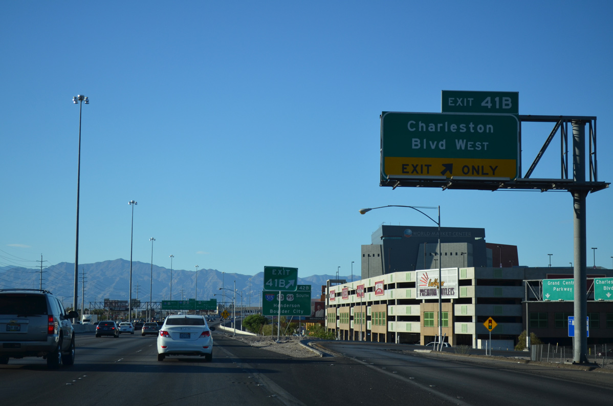
The right in-right out (RIRO) ramps for Exit 41B along I-15 north were removed as part of the Project NEON reconstruction project. Traffic bound for Charleston Boulevard west was consolidated to depart in unison with eastbound traffic.
07/20/14
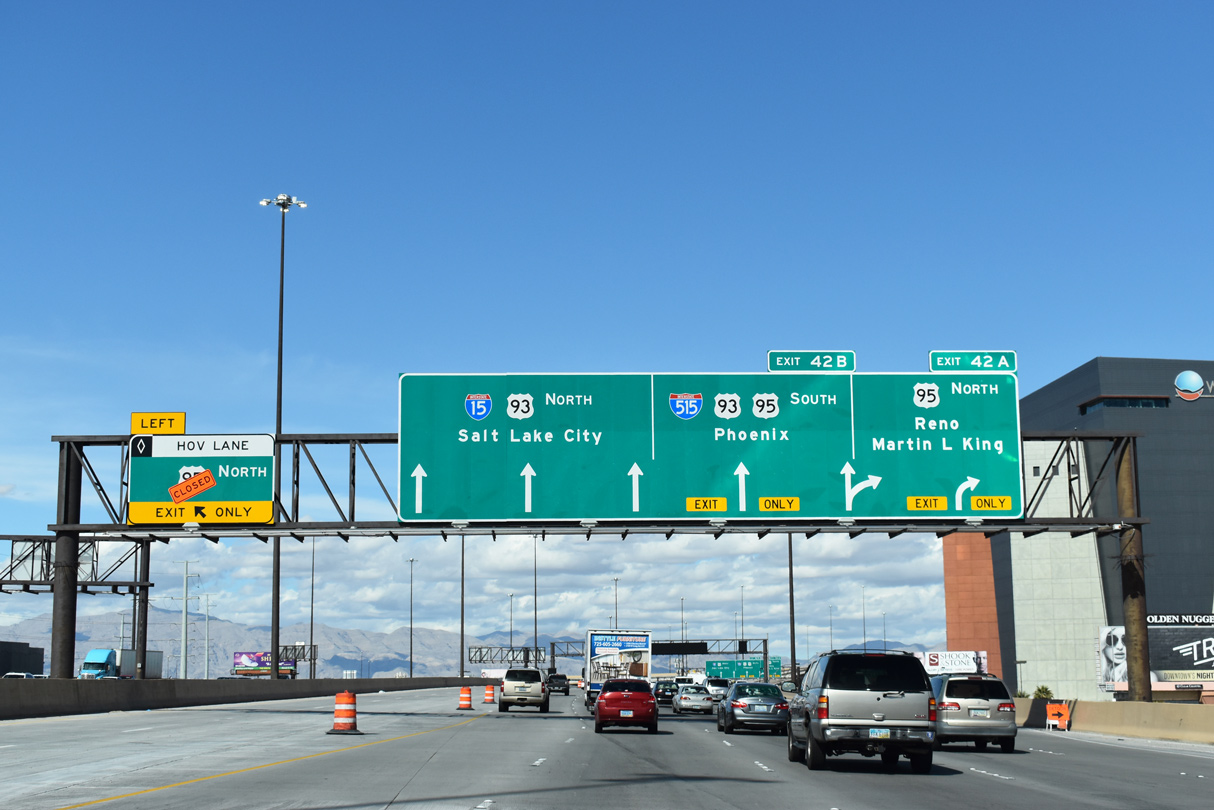
I-15 advances north to the exchange with I-515 and U.S. 93/95 (Oran K. Gragson Freeway), locally known as the Spaghetti Bowl interchange. I-515 joins the freeway with Downtown Las Vegas and Henderson. A ramp leaves ahead for the HOV lane connection between I-15 and U.S. 95 north.
03/04/19
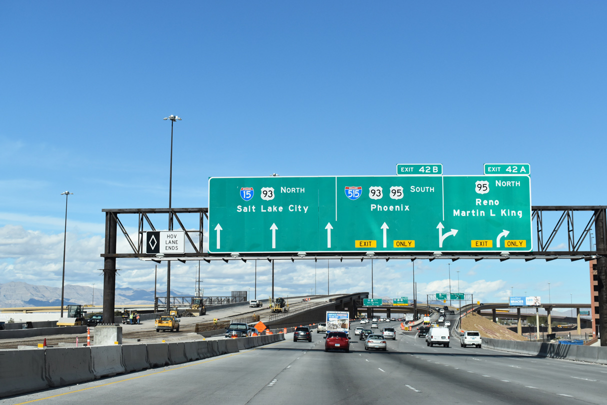
Exit 42A departs for U.S. 95 north (Oran K. Gragson Freeway) and the local Martin Luther King Boulevard at the first ramp of the exchange. Martin Luther King Boulevard extends to the northern Las Vegas neighborhoods while U.S. 95 follows the Oran K. Gragson Freeway through northwestern reaches of the valley area. U.S. 95 angles northwest to Tonopah and Fallon, with connections to Reno via U.S. 50 and U.S. 50 Alternate.
03/04/19
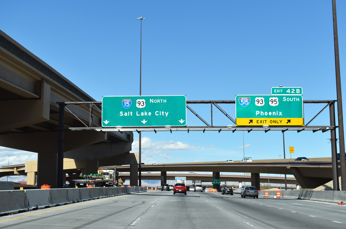
Traffic leaves along a two lane ramp for I-515 and U.S. 93-95 south to Henderson and Boulder City. I-515 extends 14.444 miles3 south along the Oran K. Gragson Freeway to the exchange with I-215 and I-11. U.S. 93 joins Las Vegas with Phoenix, Arizona (via U.S. 60) 303 miles to the southeast.
U.S. 93 north follows I-15 for the next 14 miles to the Garnet interchange (Exit 64).
03/04/19
Photo Credits:
- Brent Ivy: 07/15/17, 03/04/19
- Alex Nitzman: 07/20/14
- Andy Field: 03/29/15, 07/15/17
Connect with:


Page Updated Saturday April 30, 2022.