
I-15/U.S. 6 South - Springville to Santaquin
 South
South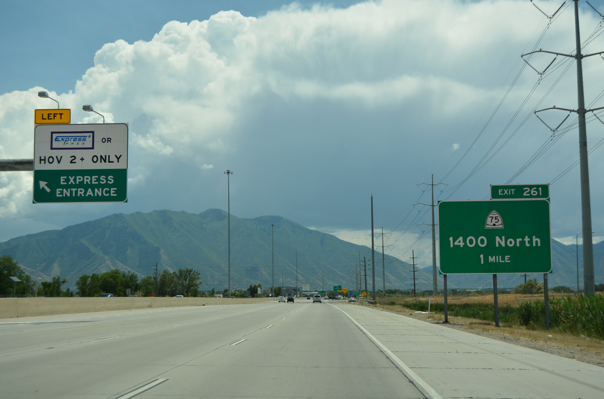
07/03/16

07/11/15
07/03/16
07/03/16
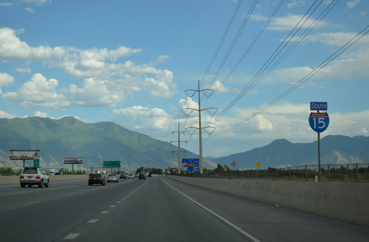
Operated by Rocky Mountain Power, a 345kV power line runs alongside Interstate 15 south by Provo Bay.
07/04/16
07/04/16
07/03/16
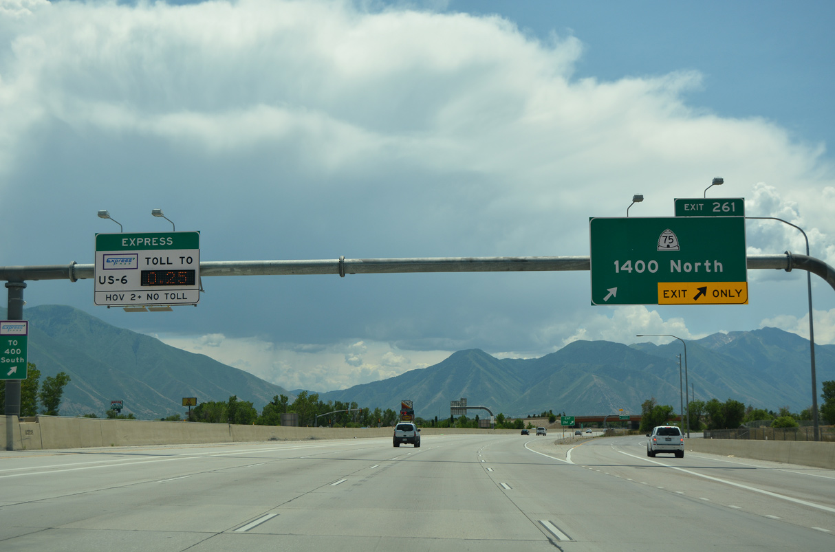
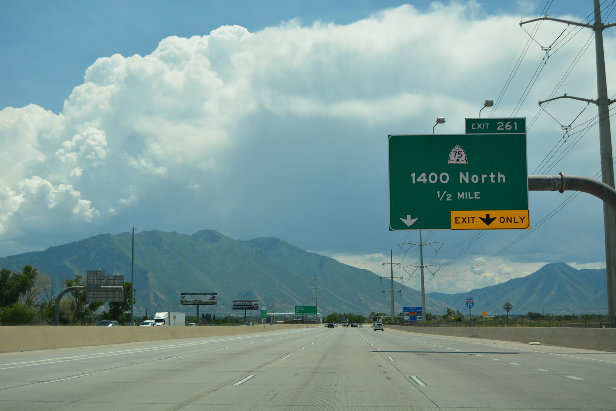
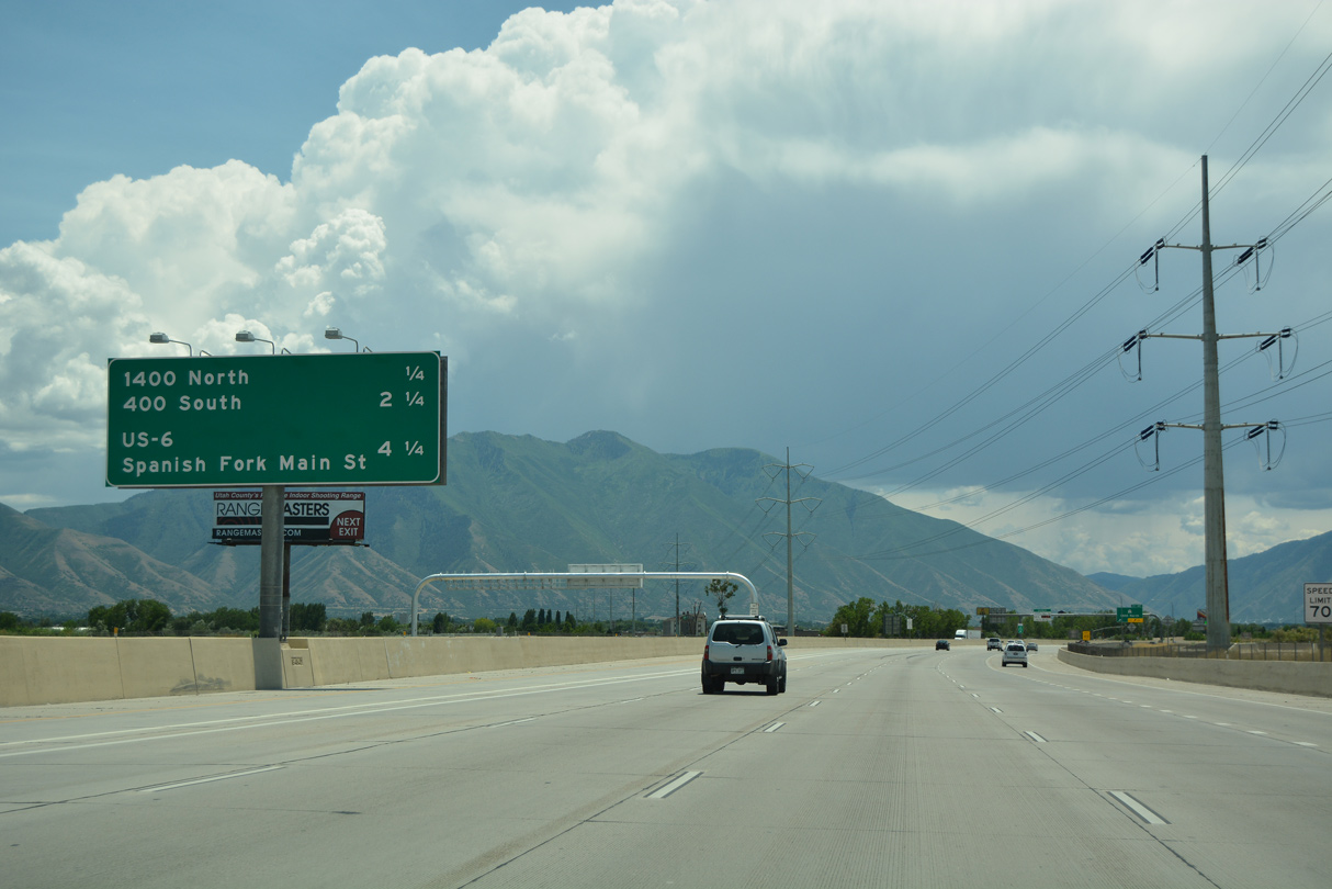
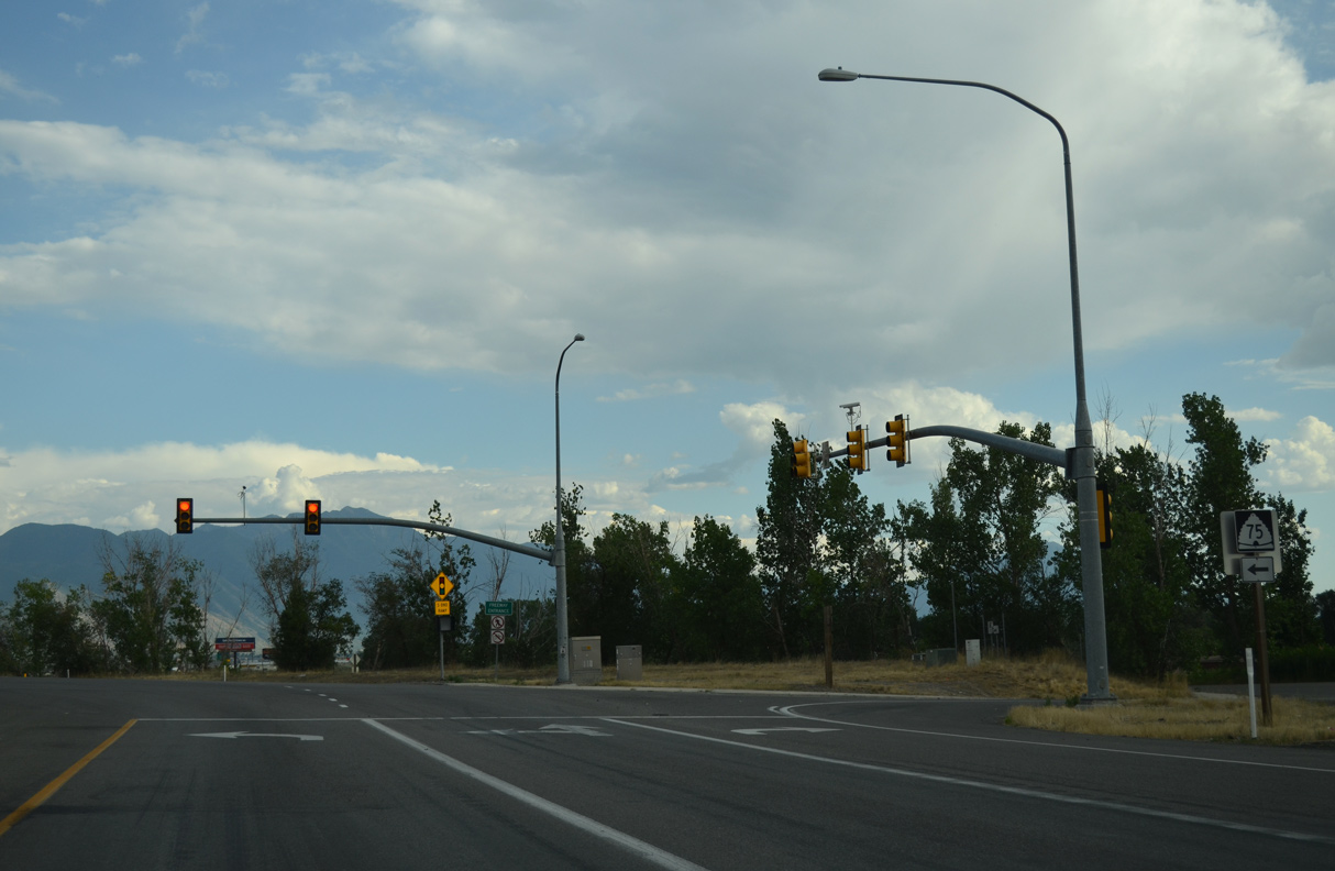
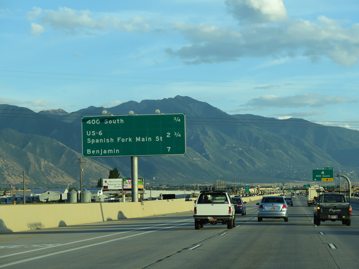
SR 75 (1400 North) stems 2.03 miles east across from north Springville from the diamond interchange at Exit 261 to U.S. 89 (Main Street).
07/03/16
07/03/16
07/04/16
The decorative overpass for SR 75 (1400 North) acts as a gateway for I-15 south into Springville, "The Art City." Incorporated on April 4, 1853, Springville was home to 35,268 as of the 2020 Census.
07/03/16
07/03/16
07/03/16
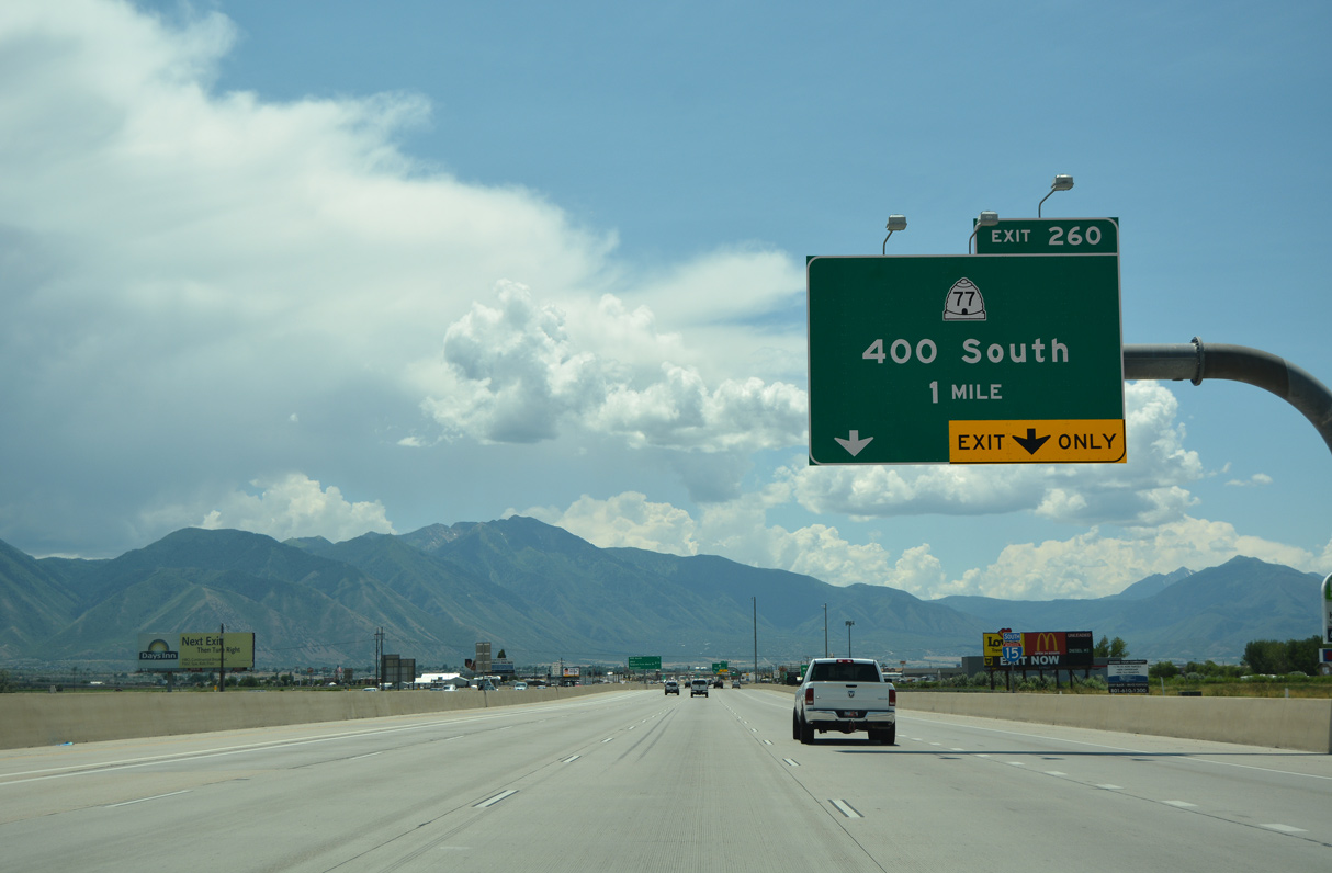
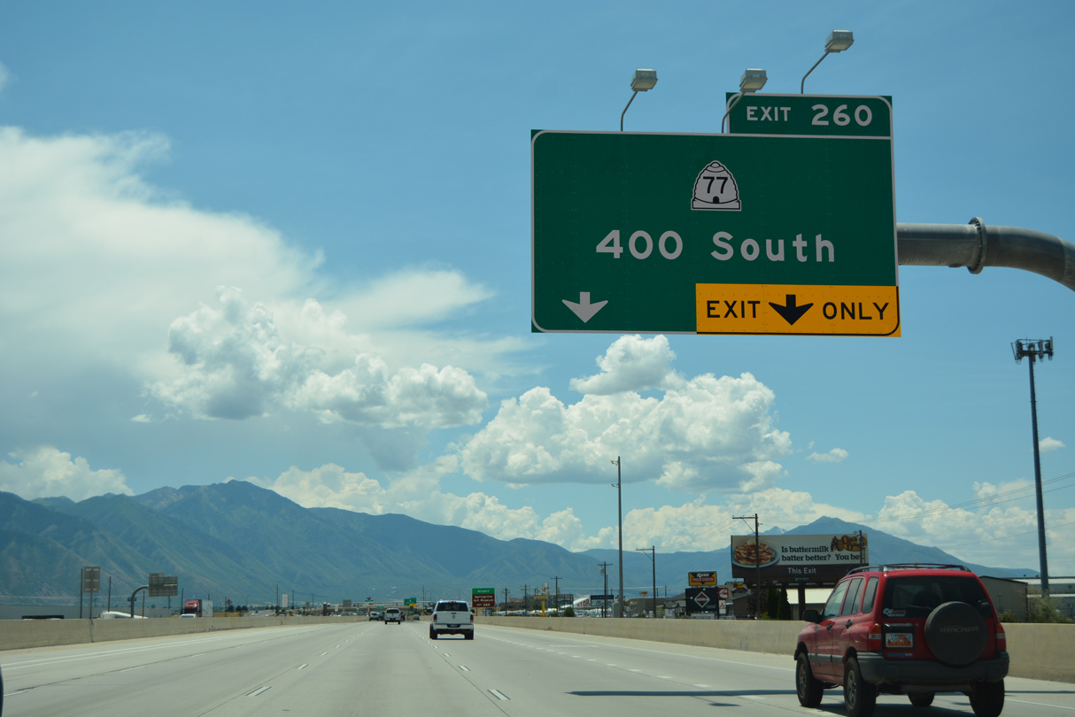
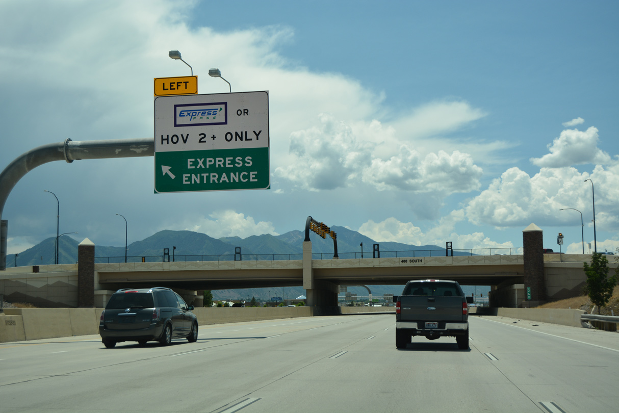
SR 77 (400 South) heads west from U.S. 89 (Main Steret) near the Springville business district and Museum of Art to meet I-15 at a SPUI (Exit 260).
07/03/16
07/03/16
07/03/16
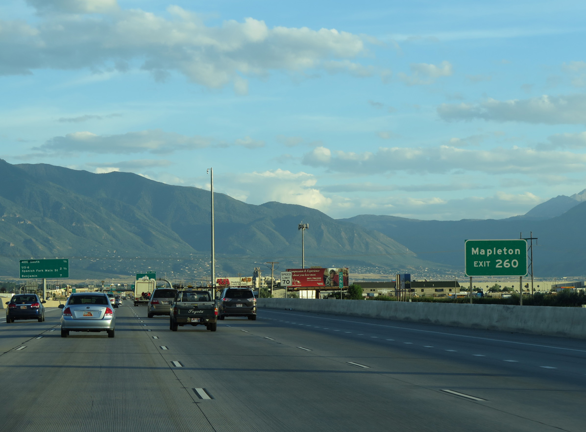
The city of Mapleton lies southeast of Springville along U.S. 89. Incorporated on April 1, 1948, Mapleton had a population of 11,799 as of the 2020 Census.
07/11/15
07/11/15
07/11/15
Measuring 9.10 miles in length, SR 77 travels west from Springville toward Provo Bay and south to Barney Corner and SR 147 north of Benjamin.
07/03/16
07/03/16
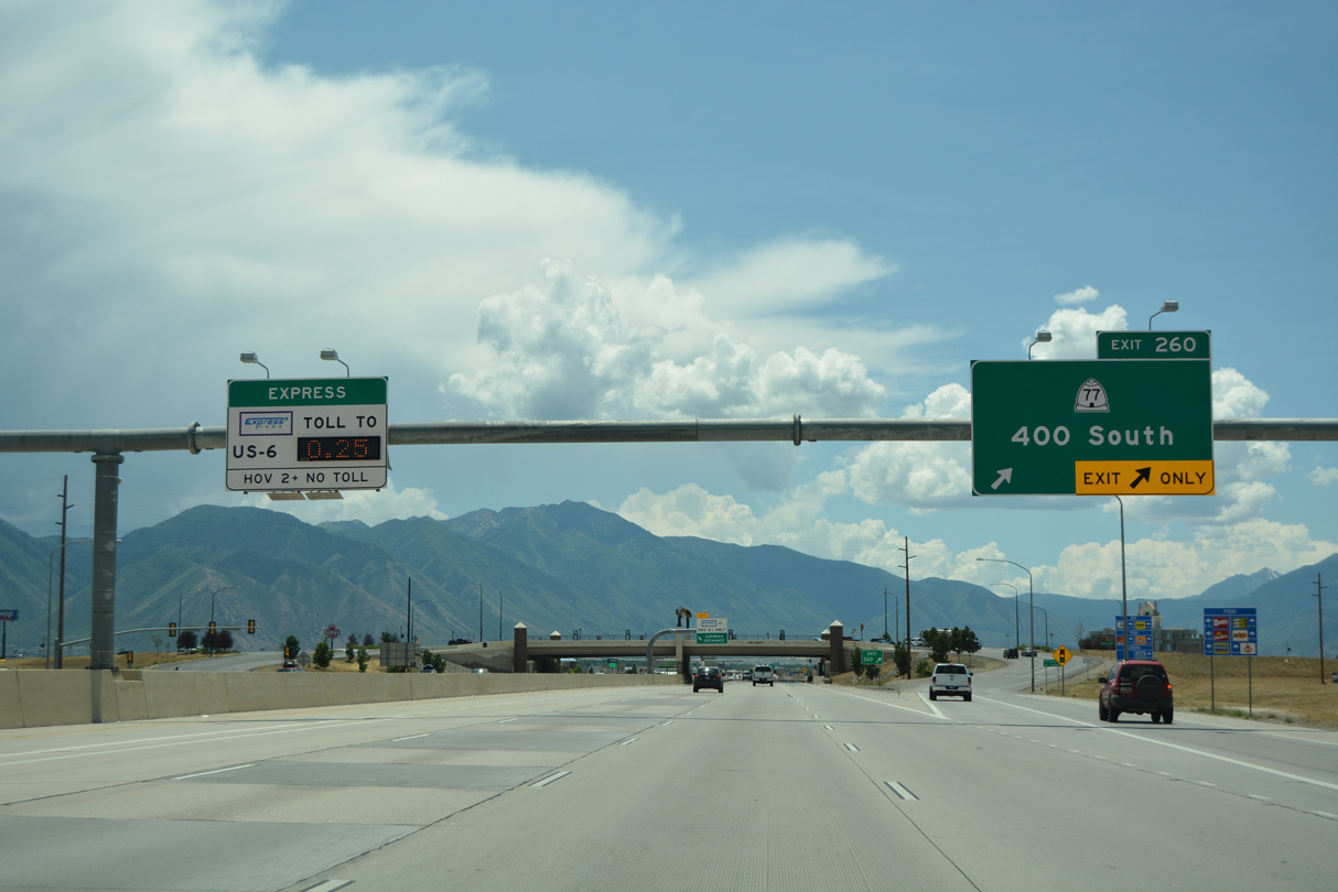
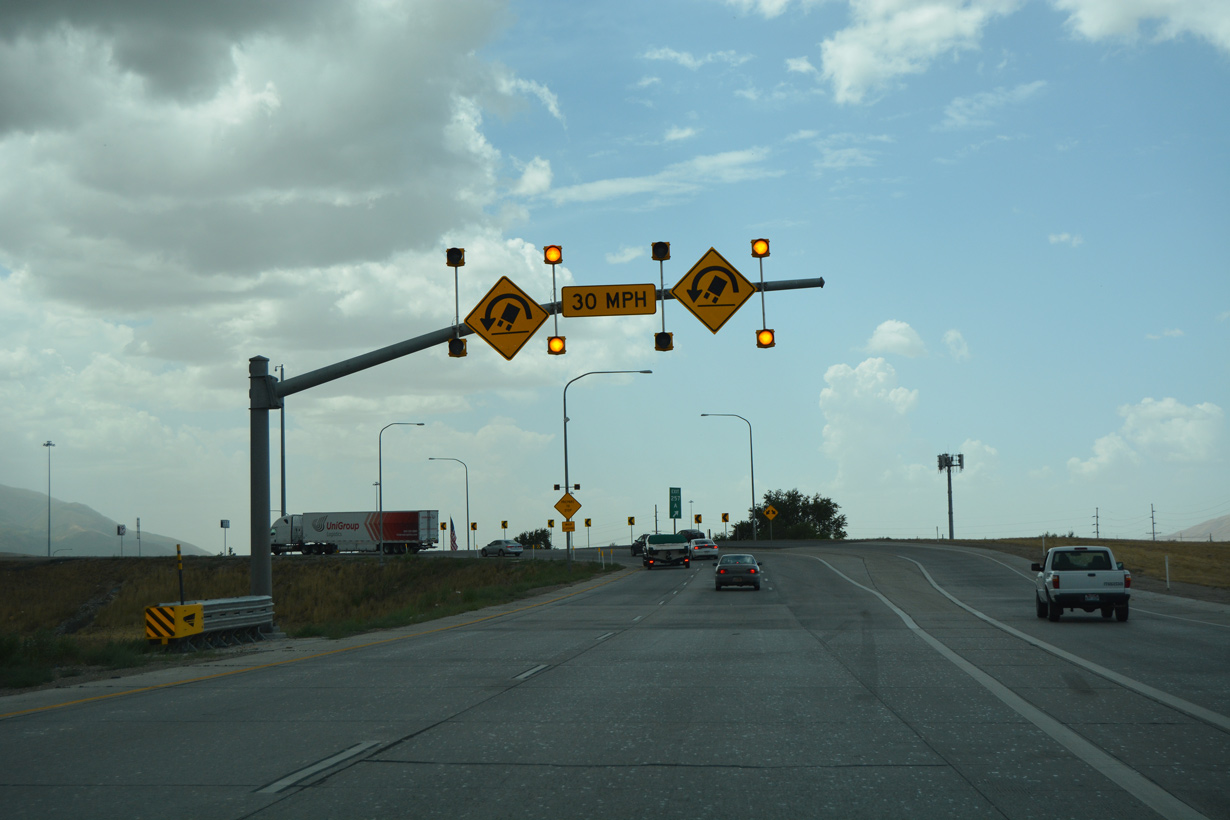
The diamond interchange (Exit 260) with SR 77 (400 South) was converted to a SPUI in 2010.
07/03/16
07/03/16
07/03/16
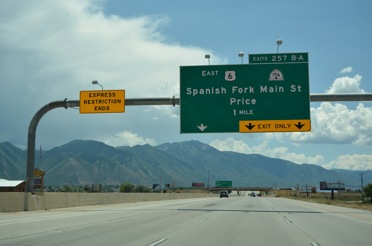
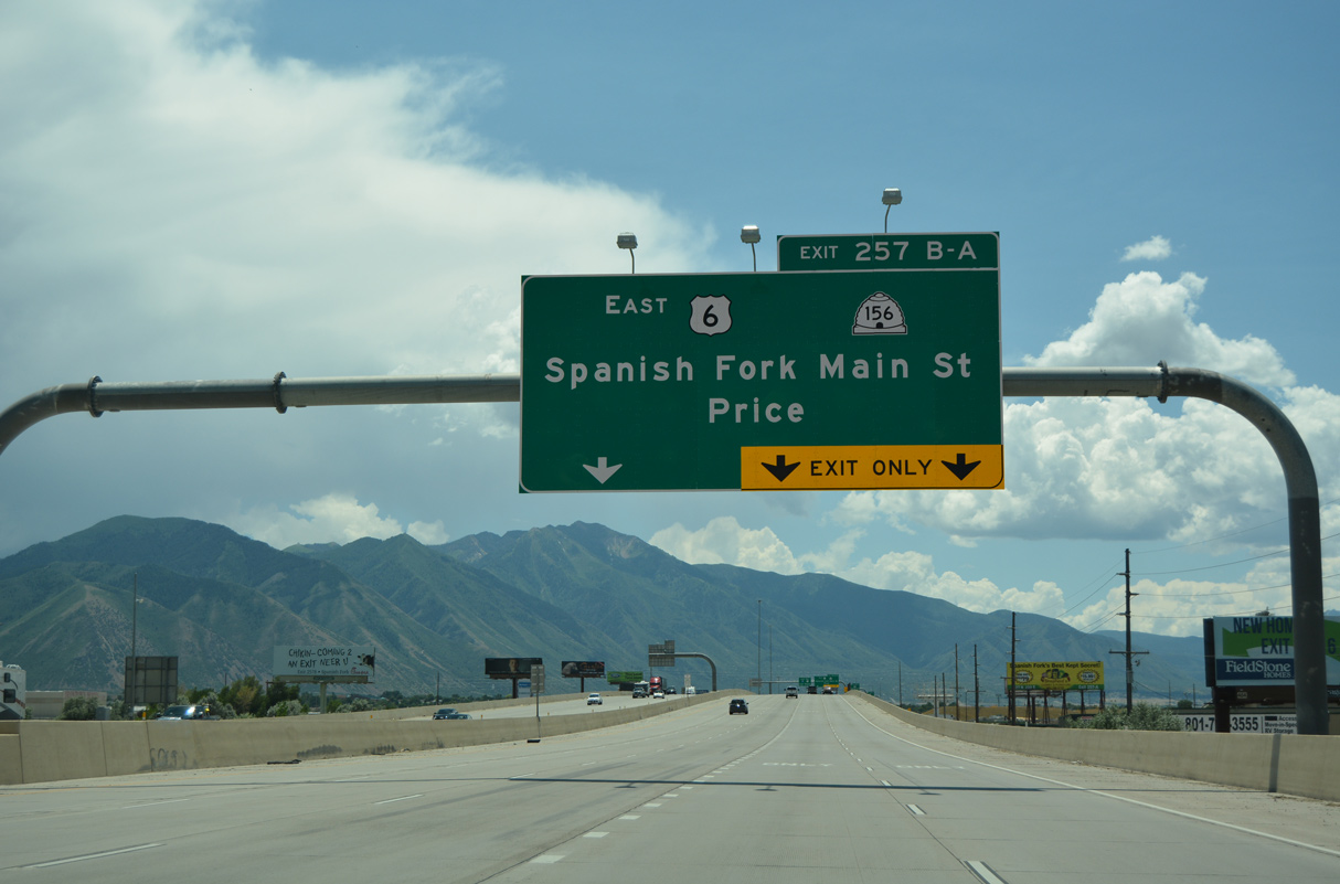
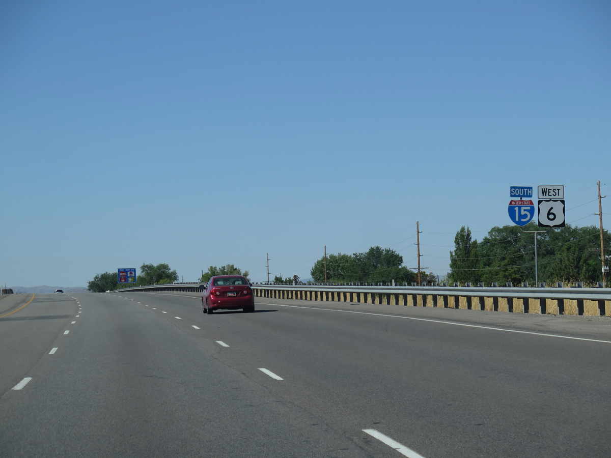
U.S. 6 is a major highway across Utah, joining Spanish Fork with Price and Green River to the southeast and with Delta southwest beyond an overlap with I-15.
07/03/16
07/03/16
07/11/15
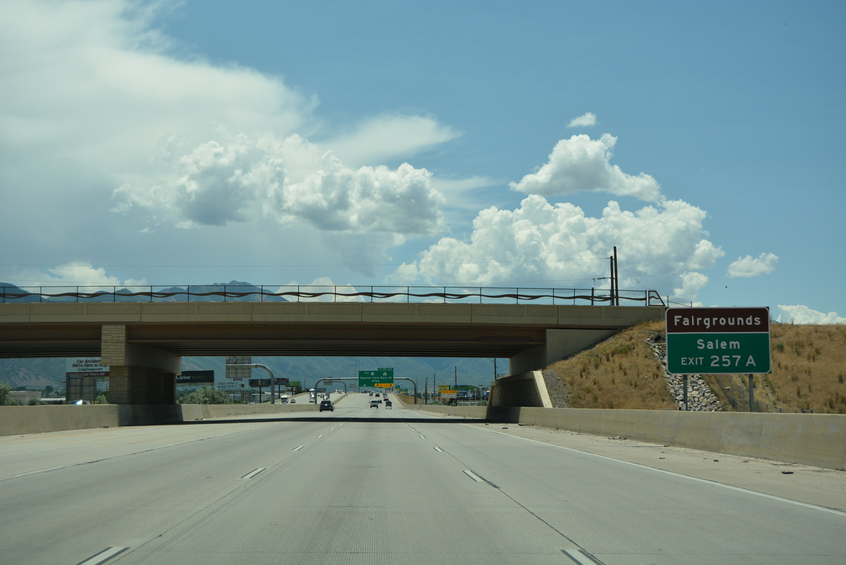
Main Street extends south from SR 156 along SR 198 (old U.S. 6/50/91) to the city of Salem. "The City of Peace" was incorporated on May 10, 1920 and home to 9,298 as of the 2020 Census.
07/03/16
07/03/16
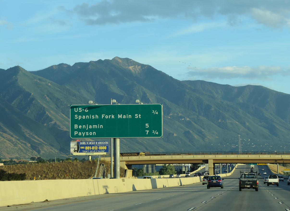
U.S. 6 angles southeast from I-15 along a controlled access arterial through Spanish Fork to Moark Junction ahead of Spanish Fork Canyon.
07/03/16
07/03/16

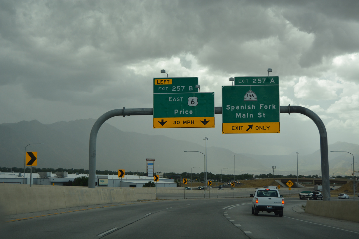
SR 156 lines Main Street south from the adjacent diamond interchange (Exit 257A) to U.S. 6. The state route heads 1.39 miles south through Downtown Spanish Fork to SR 198 (300 South).
07/03/16
07/03/16
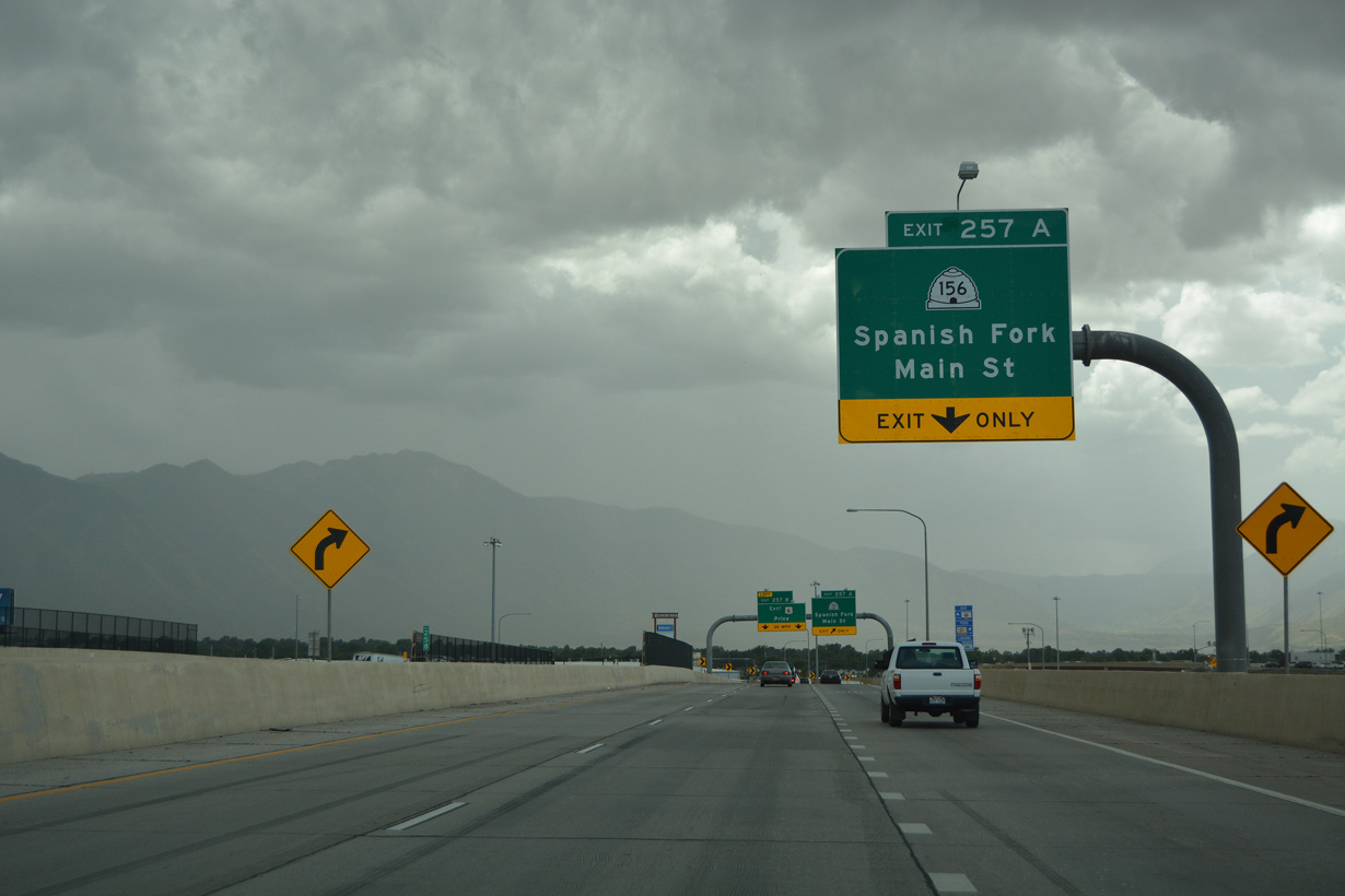
The trumpet interchange (Exit 257B) linking I-15 with U.S. 6/former SR 214 southeast at Spanish Fork was reconfigured in 2012 as ramps for SR 156 (Main Street) were realigned to eliminate a weaving traffic pattern between the two exchanges.
08/10/16
08/10/16
U.S. 6 traverses Spanish Fork Canyon across the Wasatch Range to Soldier Summit and Price Canyon south across the Book Cliffs to Helper and Price.
08/10/16
08/10/16
08/10/16
 West
West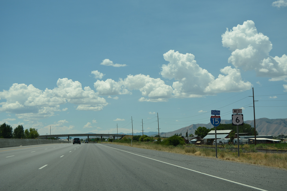
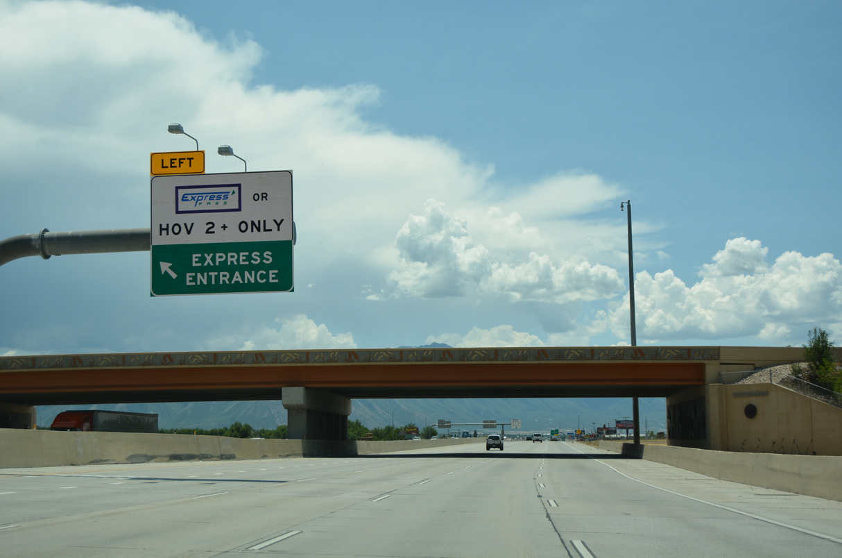
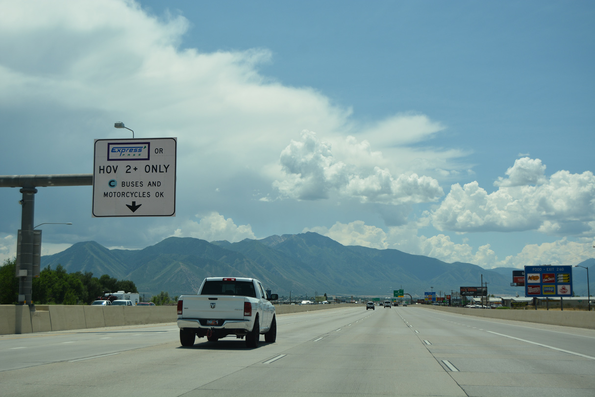
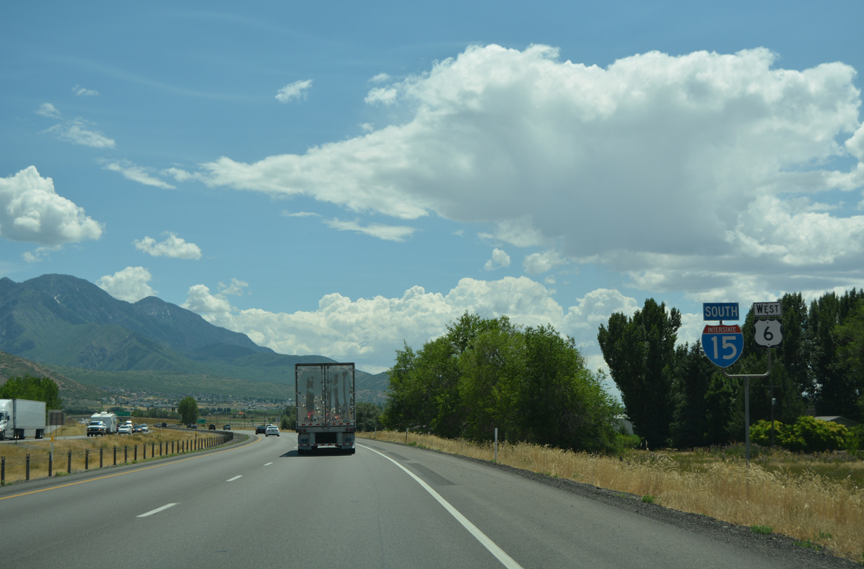
U.S. 6 overlaps with I-15 southwest for 23.97 miles to Santaquin.
07/03/16
07/03/16
The Interstate 15 expansion project in 2011 ended ahead of the SR 147 (6400 South) overpass, five miles from Payson.
07/03/16
07/03/16
07/03/16
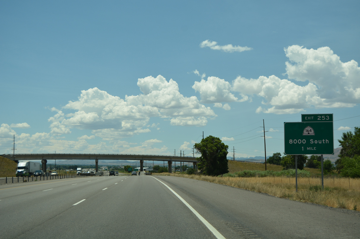
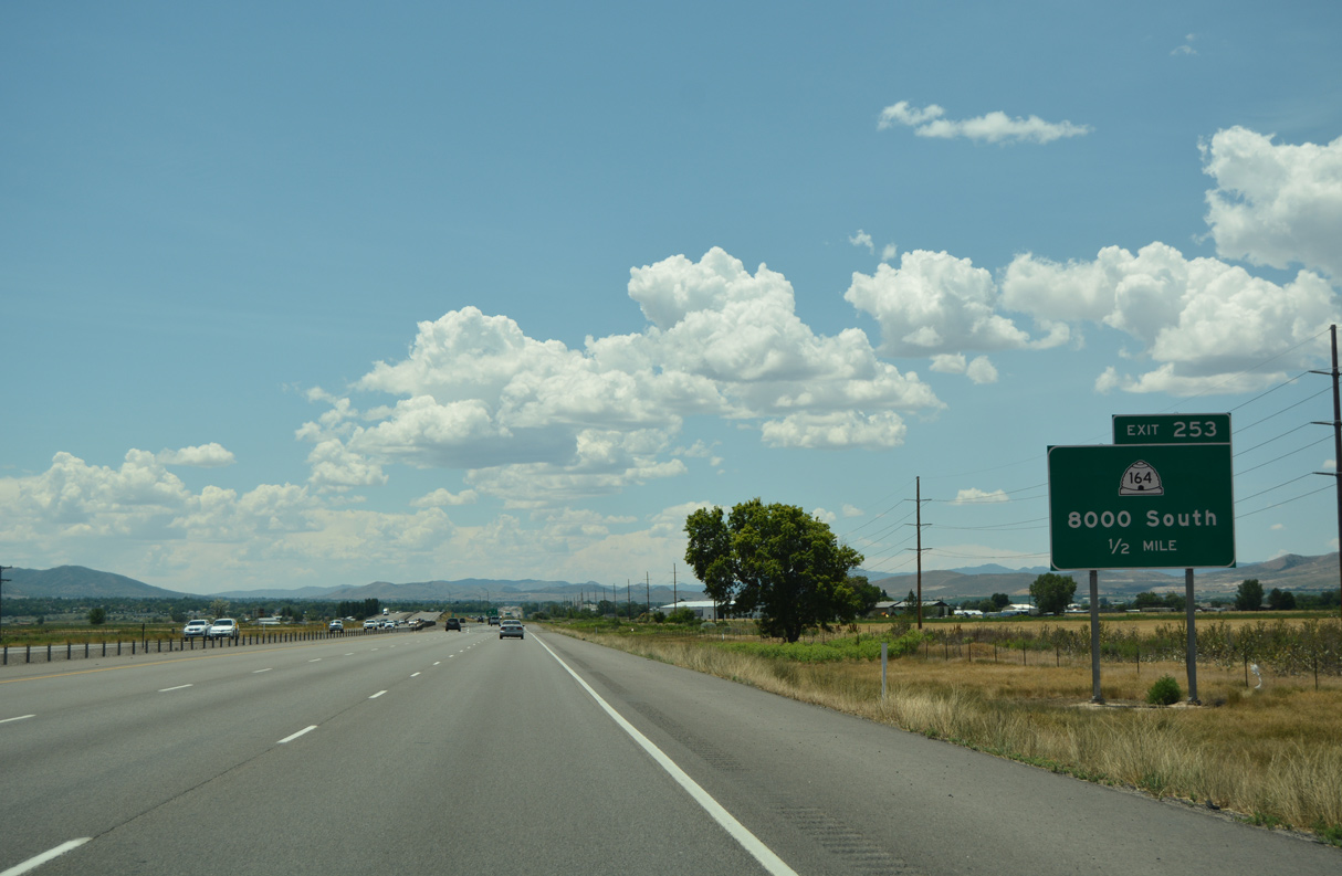
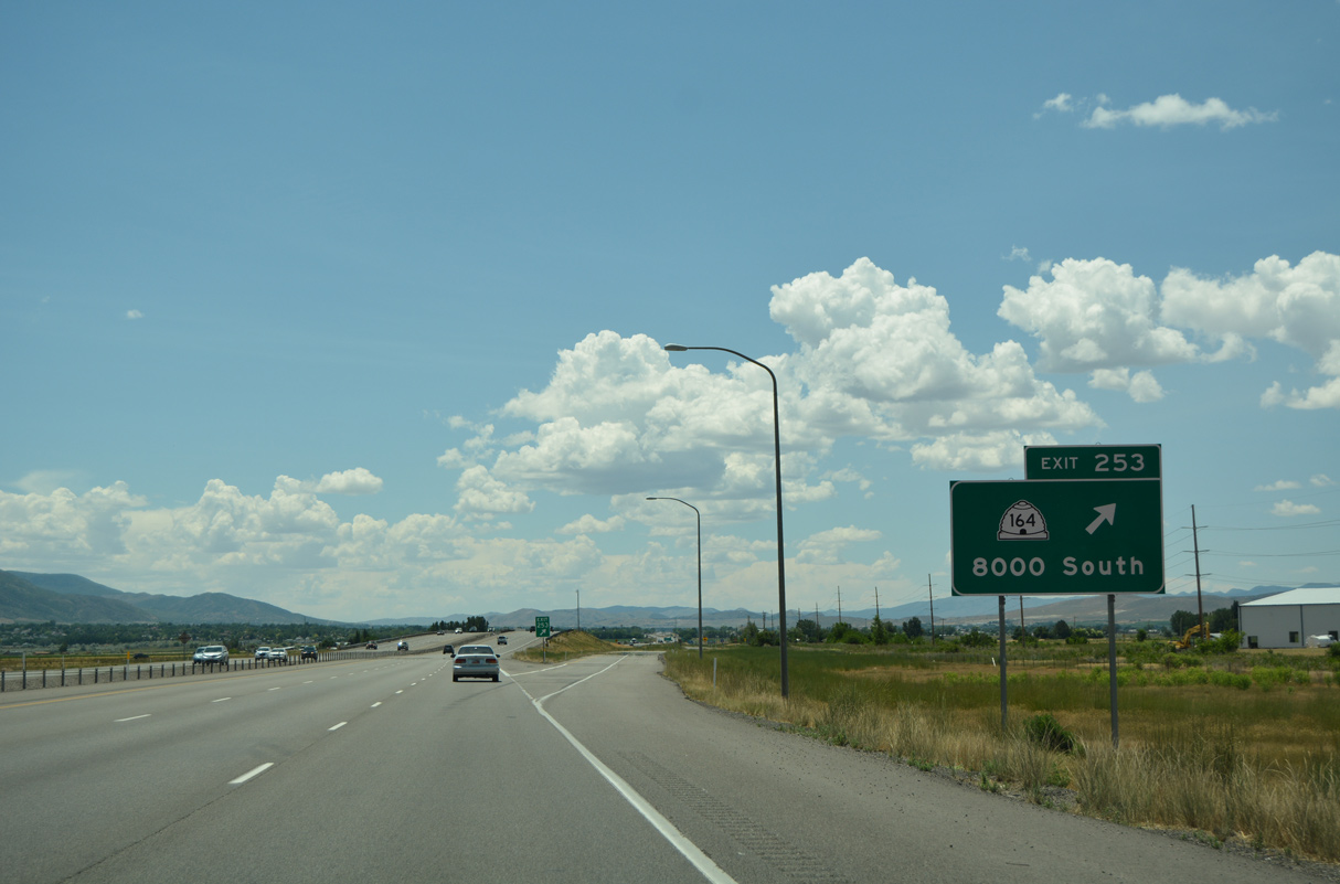
SR 164 branches southwest from SR 198 (Main Street) in Spanish Fork 2.74 miles to the diamond interchange at Exit 253.
07/03/16
07/03/16
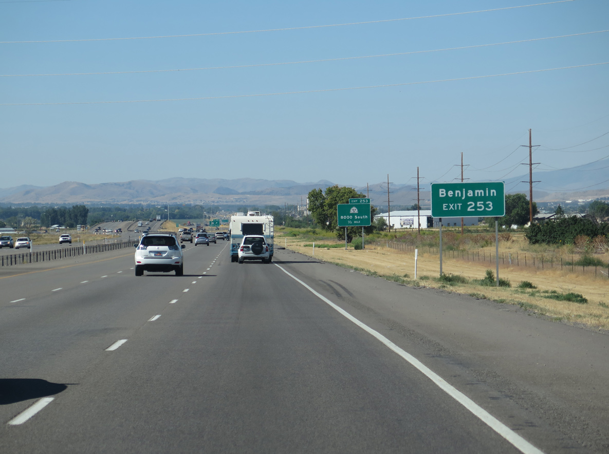
The community of Benjamin lies west of Interstate 15 along SR 115 (7300 South) and 8000 South beyond Exit 253.
08/12/16
08/12/16
SR 164 (8000 South) runs along the Spanish Fork and Salem city line east to Arrowhead Trail.
07/03/16
07/03/16
8000 South west connects with SR 115 (3200 West) in 1.46 miles.
07/03/16
07/03/16

08/12/16

07/03/16
SR 115 is a 8.26 mile long route from SR 198 (Main Street) in Spanish Fork west to Benjamin and south to SR 198 (100 North) in Payson.
07/03/16
07/03/16
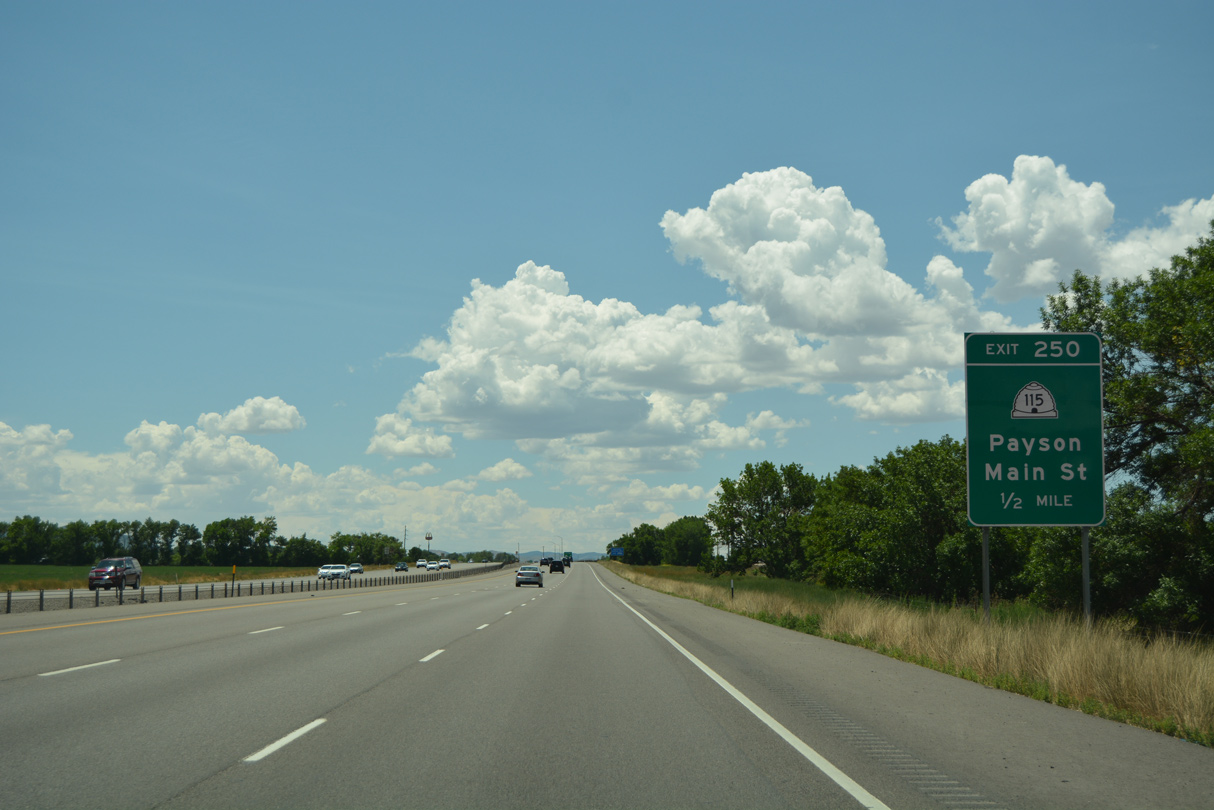
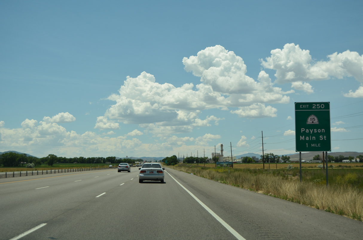
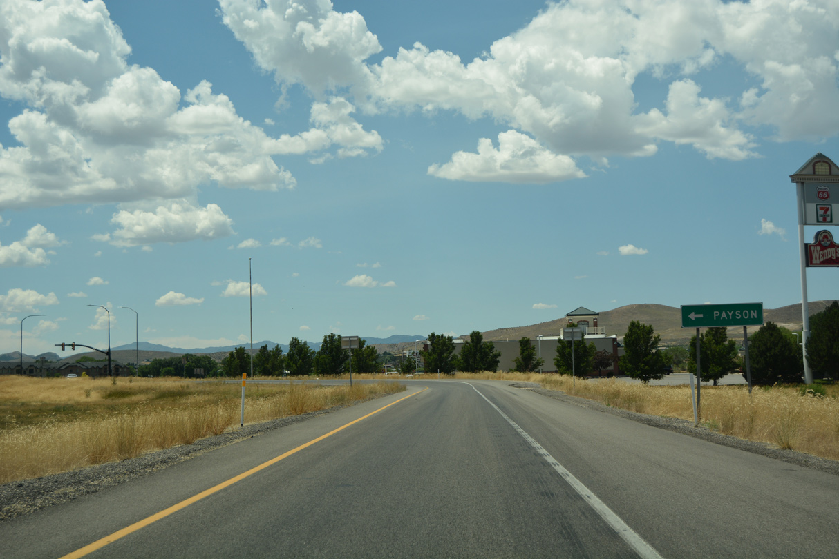
The diamond interchange with SR 115 (Main Street) is the first of two exits in the city of Payson. Payson, "Come for a Day, Stay for a Lifetime", had a population of 21,101 as of the 2020 Census and incorporated on January 21, 1853.
07/03/16
07/03/16
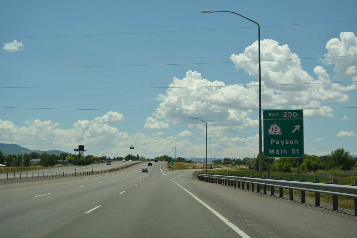
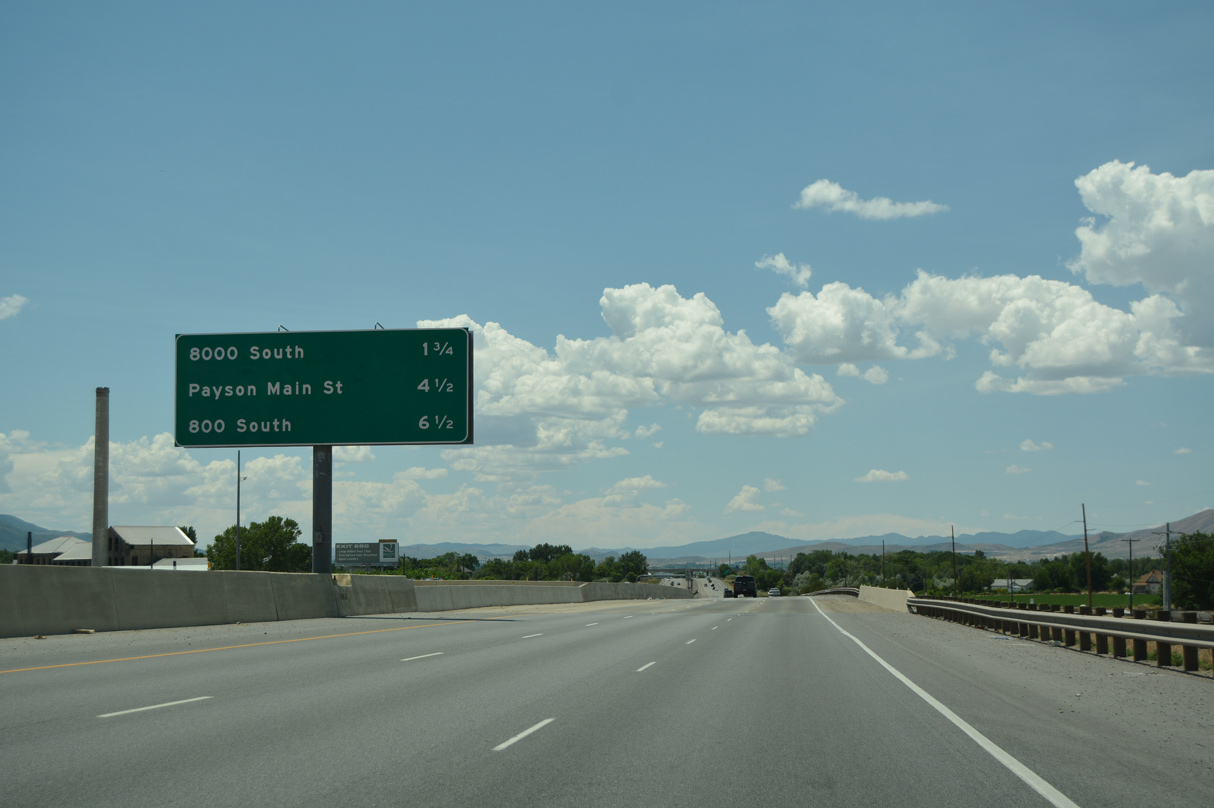
SR 115 (Main Street) ties into SR 198 (old U.S. 6/50/91), 0.83 miles south of Exit 250 at Downtown Payson. SR 198 parallels I-15 southwest to Exit 244.
07/03/16
07/03/16
07/03/16
08/12/16

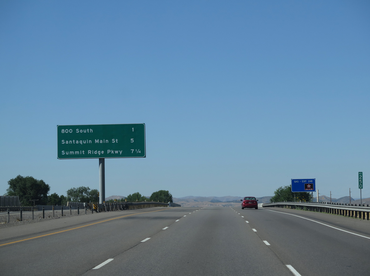
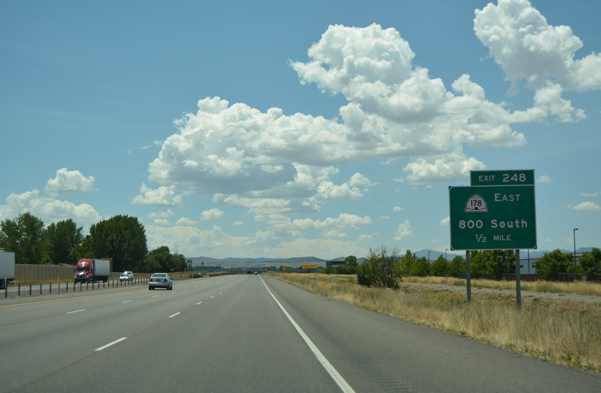
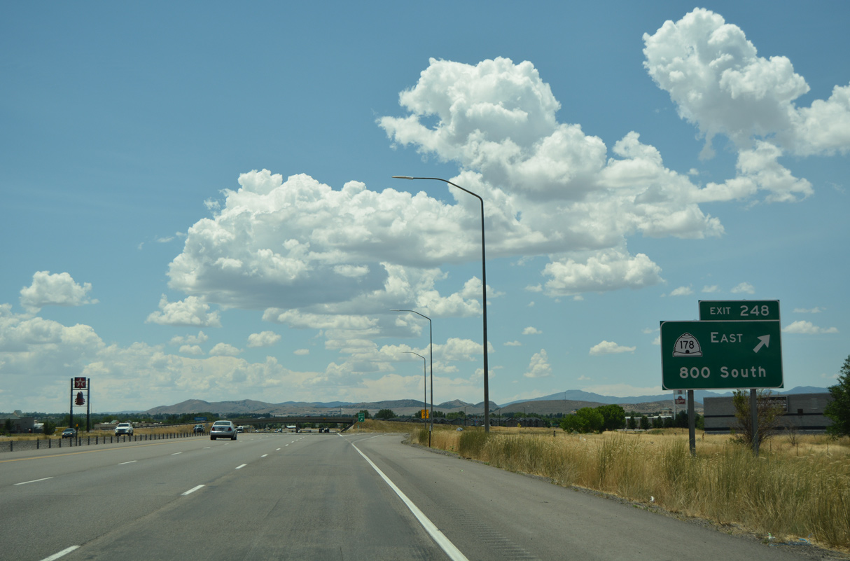
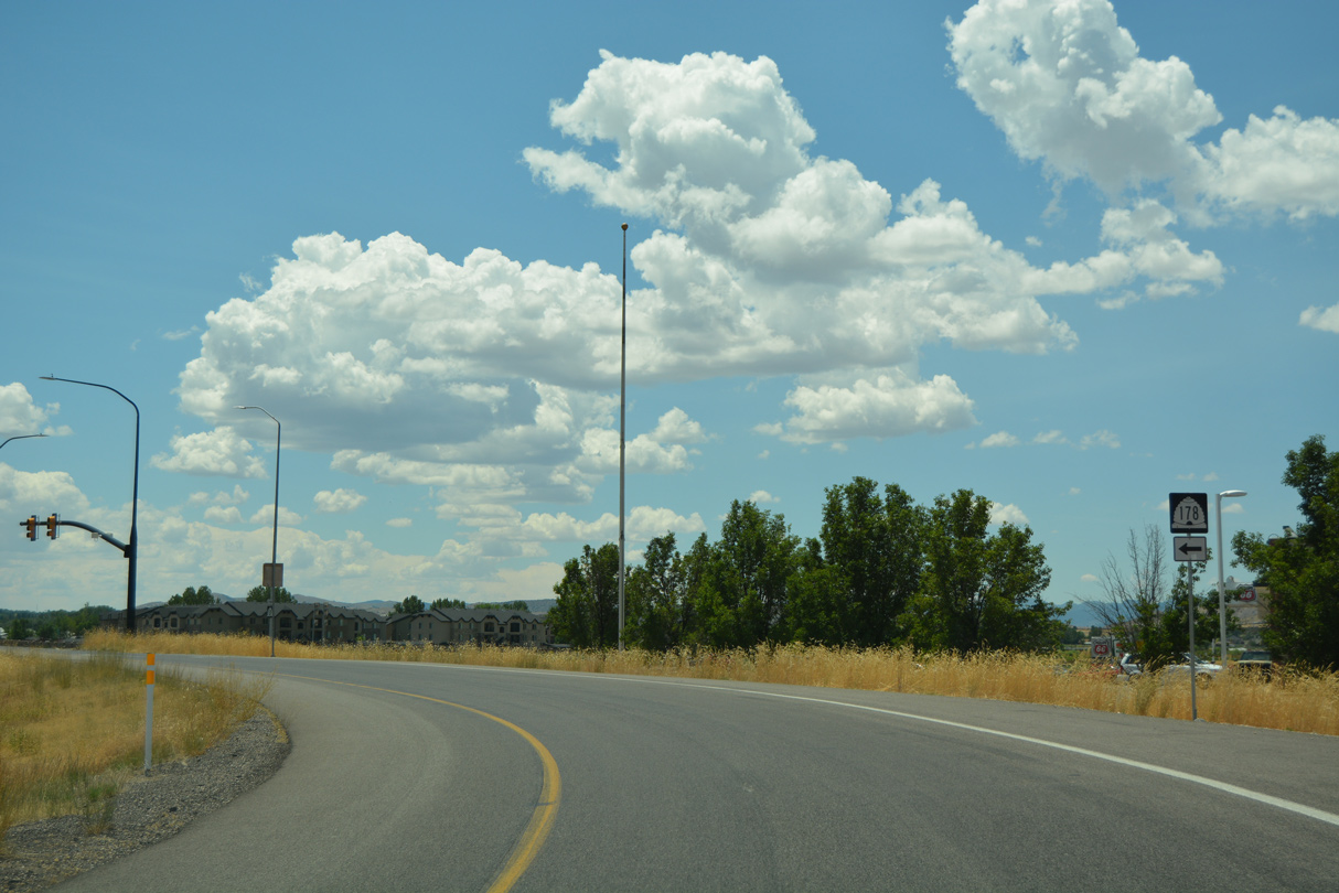
SR 178 (800 South) links I-15 with SR 198 (State Street), 1.20 miles east from Exit 248.
07/03/16
07/03/16
08/12/16
07/03/16
800 West extends 0.22 miles west from the diamond interchange (Exit 248) with SR 178 to American Way. American Way parallels I-15 north to an industrial park and south to condominiums and town homes.
07/03/16
07/03/16
07/03/16
07/03/16
07/03/16
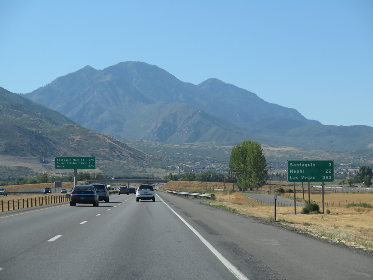
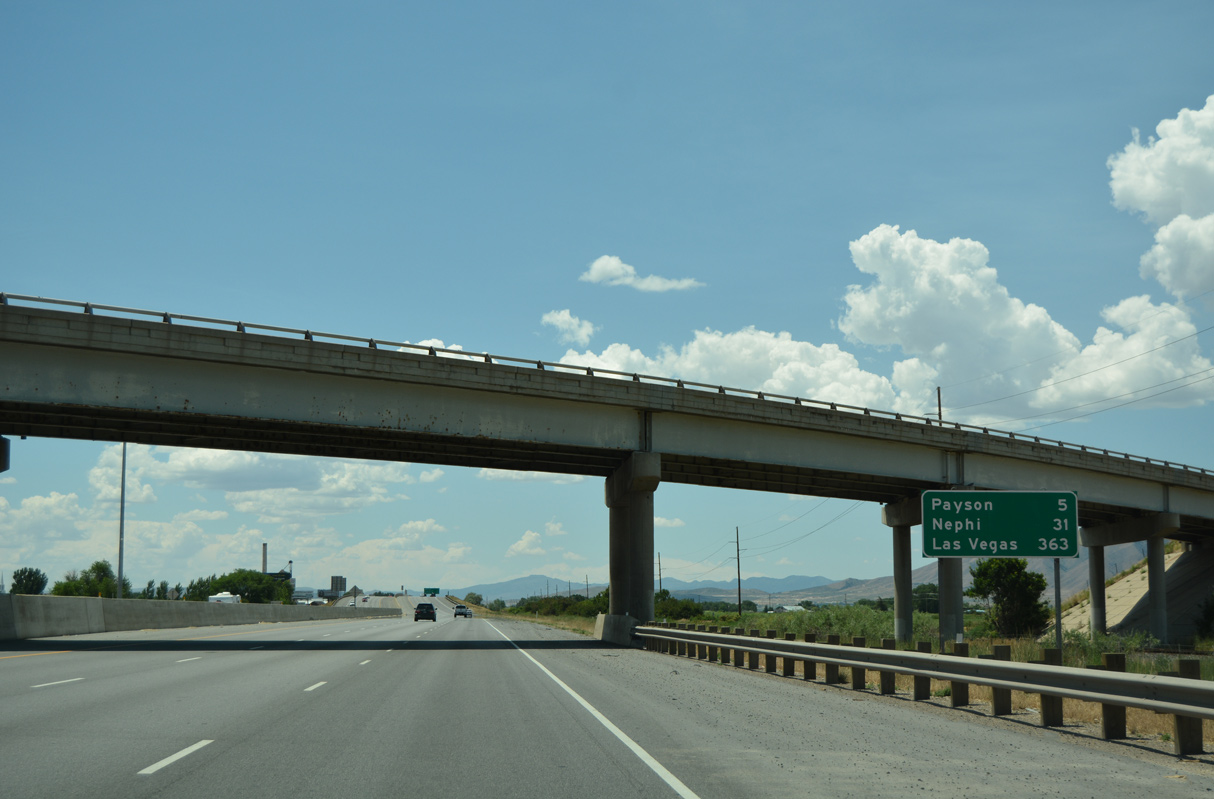
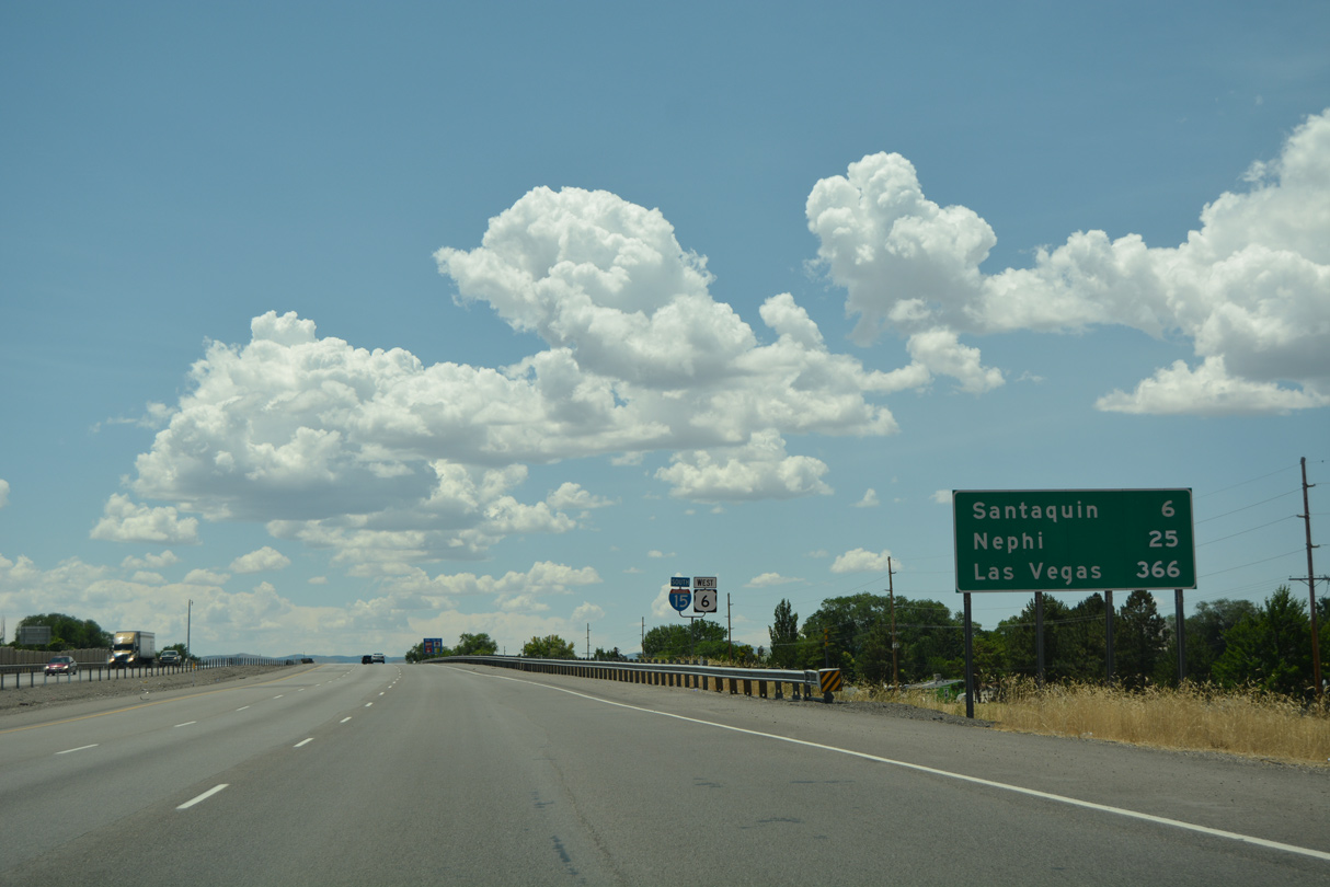
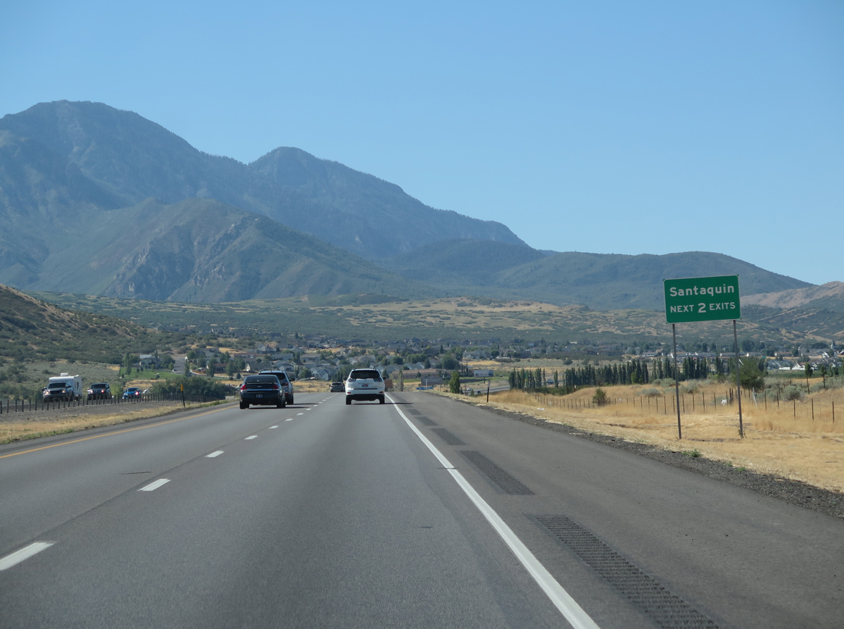
I-15 proceeds south three miles to the city of Santaquin. "A Breath of Fresh Air", Santaquin was home to 13,725 as of the 2020 Census and incorporated on January 4, 1932.
08/12/16
08/12/16
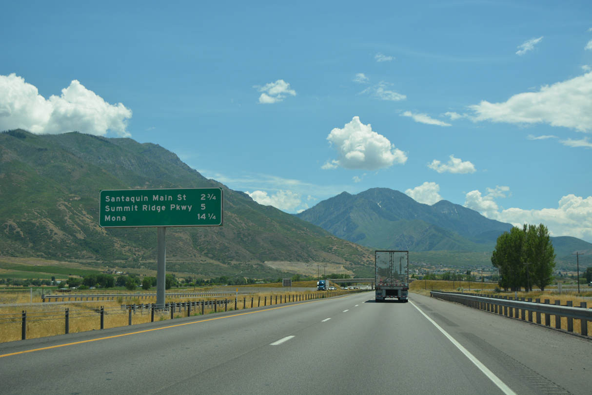
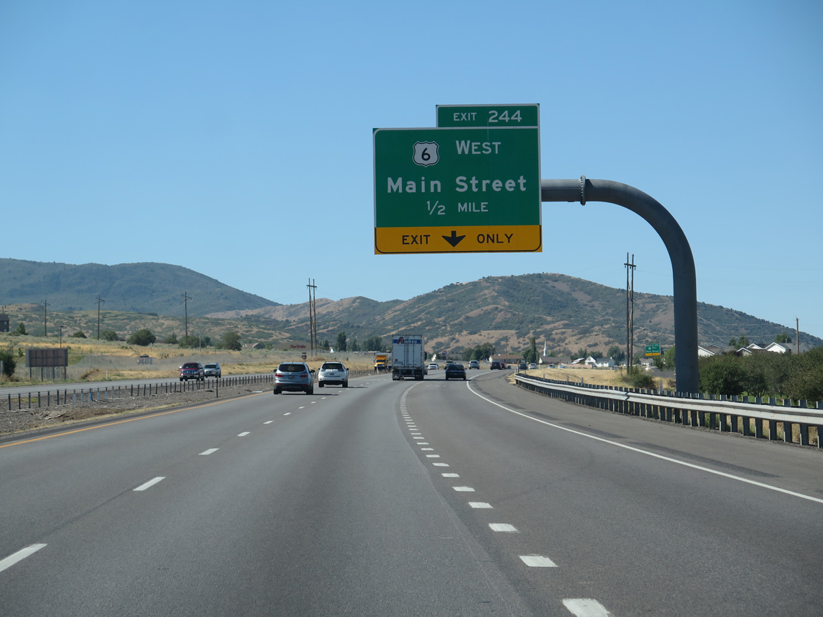
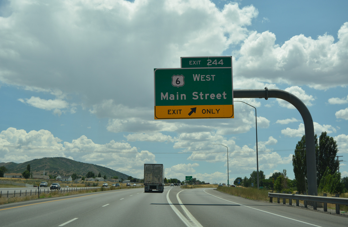
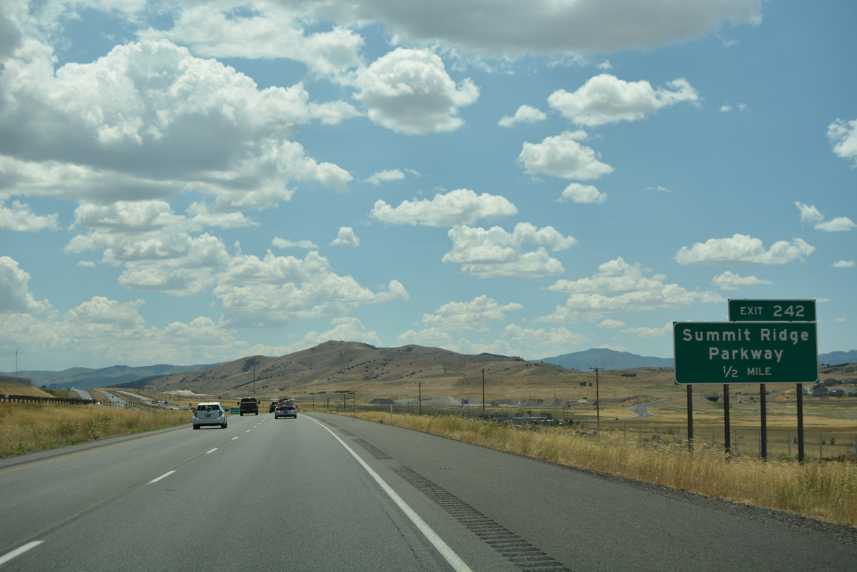
SR 198 (old U.S. 6/50/91) converges with I-15/U.S. 6 at Exit 244 for Main Street in 2.75 miles. Summit Ridge Parkway is the second Santaquin exit, and the last for the Wasatch Front metropolitan area.
07/03/16
07/03/16
08/12/16
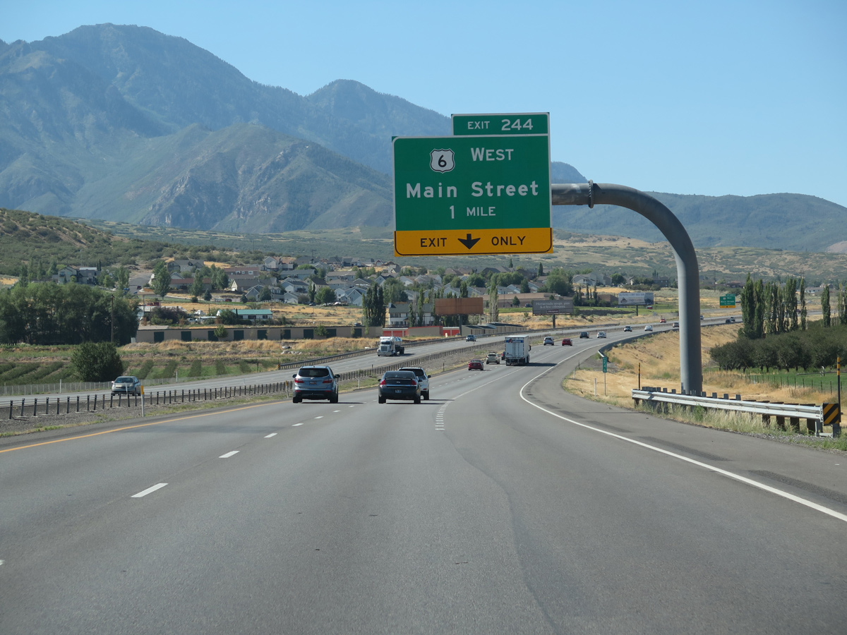
U.S. 6 overtakes Main Street west from SR 198 and Exit 244 across Santaquin. U.S. 6 continues southwest to Delta, where it combines with U.S. 50 west toward Nevada.
08/12/16
08/12/16
Prior to the completion of I-70 between Salina and Green River through the San Rafael Reef in 1976, U.S. 6 between Delta and Price was also designated as U.S. 50.
08/12/16
08/12/16
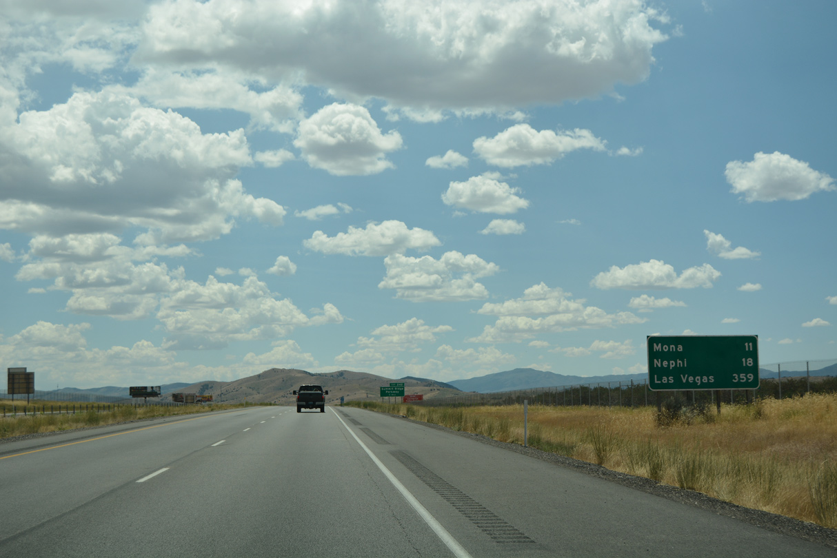
SR 198 runs 15.75 miles northeast to U.S. 6 at Spanish Fork from the diamond interchange (Exit 244) with Main Street. Traveling beyond Delta toward Ely, Nevada, U.S. 6 passes through some of the most desolate areas of the Great Basin, with few motorist services.
07/03/16
07/03/16
South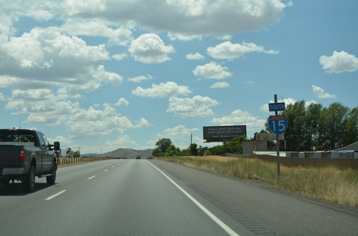
07/03/16
07/03/16
07/03/16
07/03/16
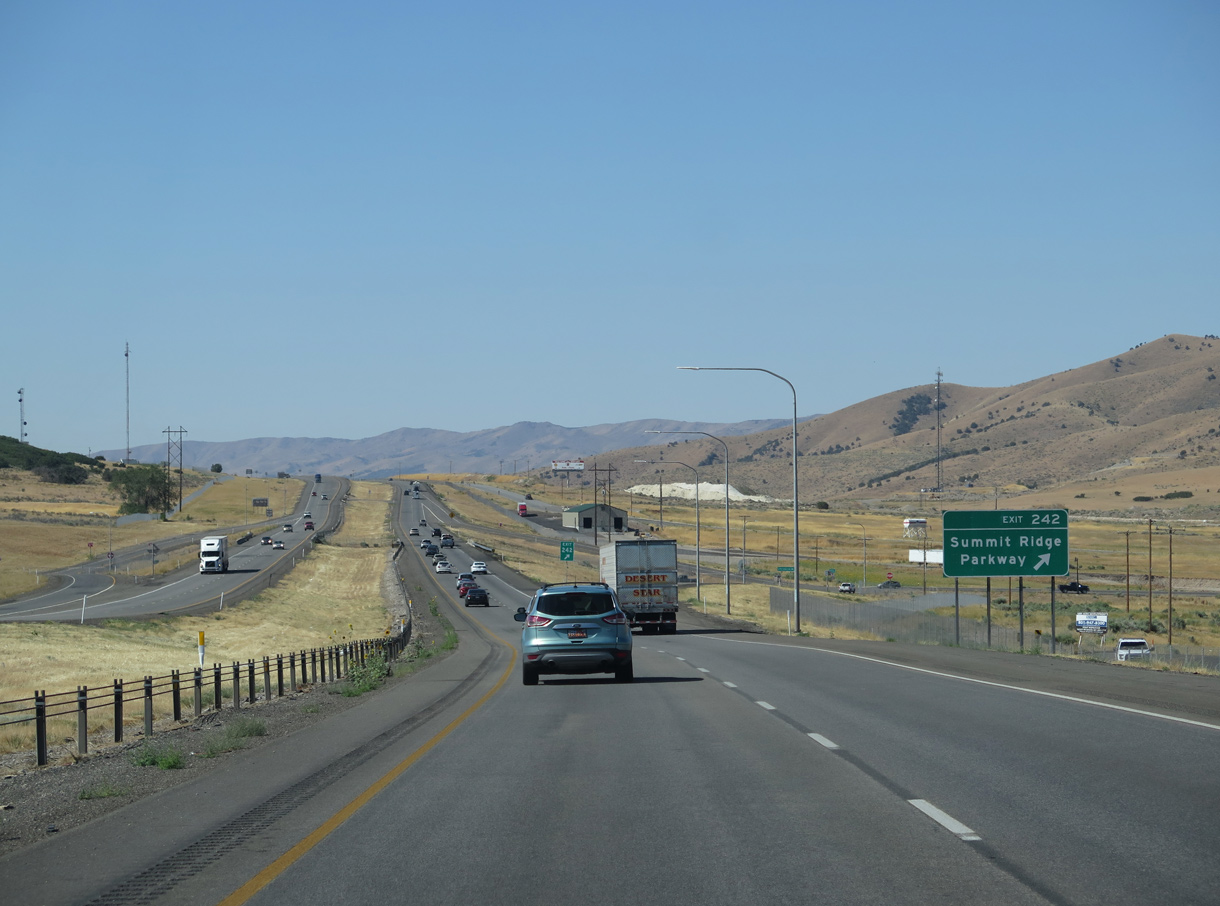
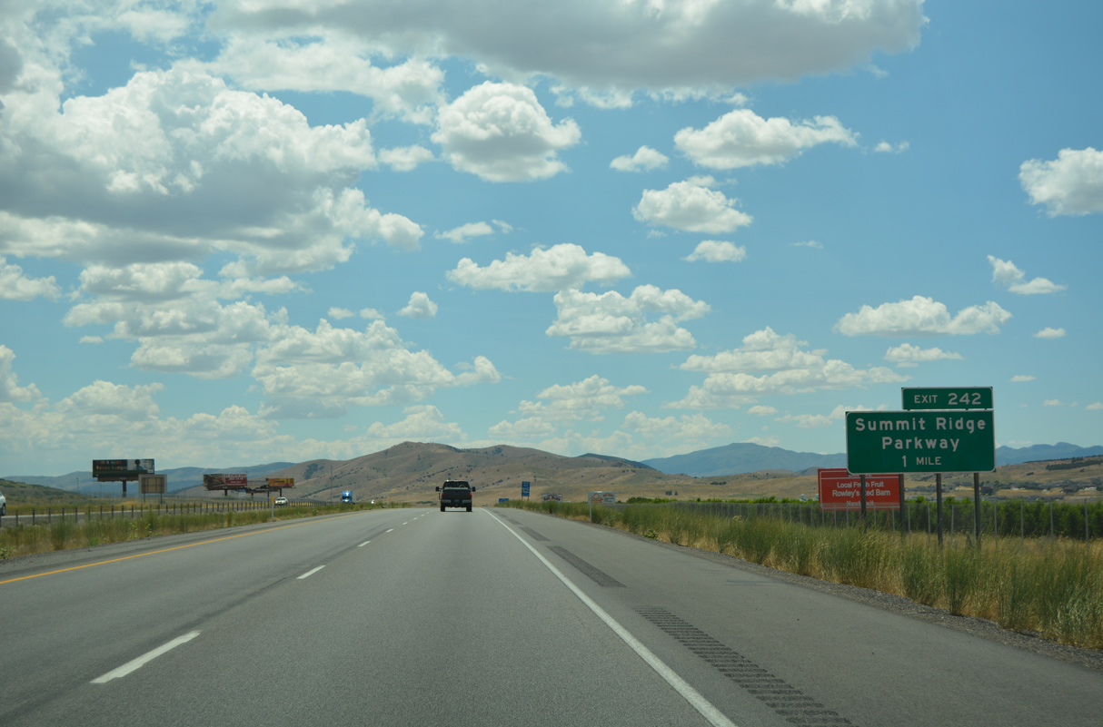
Summit Ridge Parkway loops west and north through suburban areas of Santaquin for 3.57 miles between the diamond interchange at Exit 242 and U.S. 6.
08/12/16
08/12/16

Photo Credits:
- Alex Nitzman: 07/03/16, 07/04/16
- Andy Field: 07/11/15, 08/12/16
- ABRoads: 08/10/16
Connect with:
Page Updated Friday February 18, 2022.