
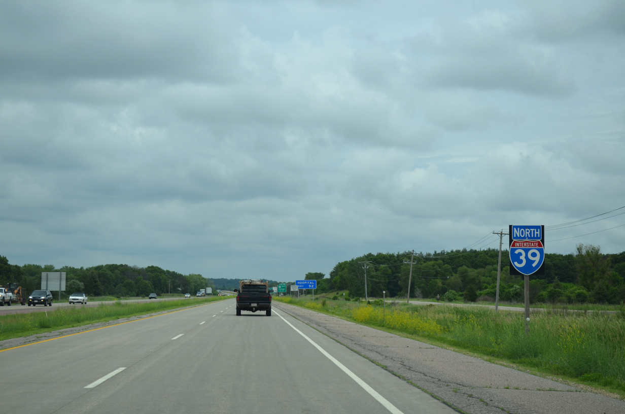
Interstate 39 North - Portage to Westfield

 North
North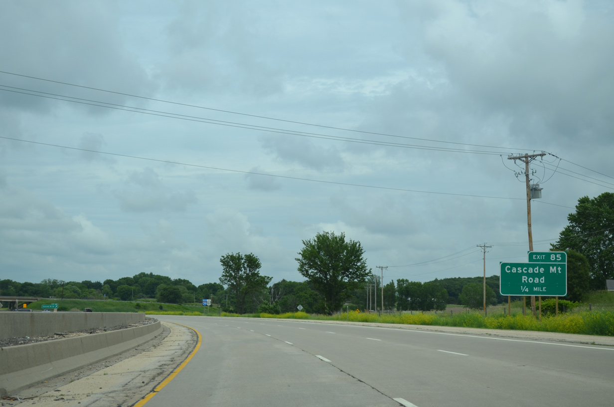
Leading away from I-90/94, I-39 quickly approaches a parclo B2 interchange (Exit 85) with Cascade Mountain Road.
06/15/15
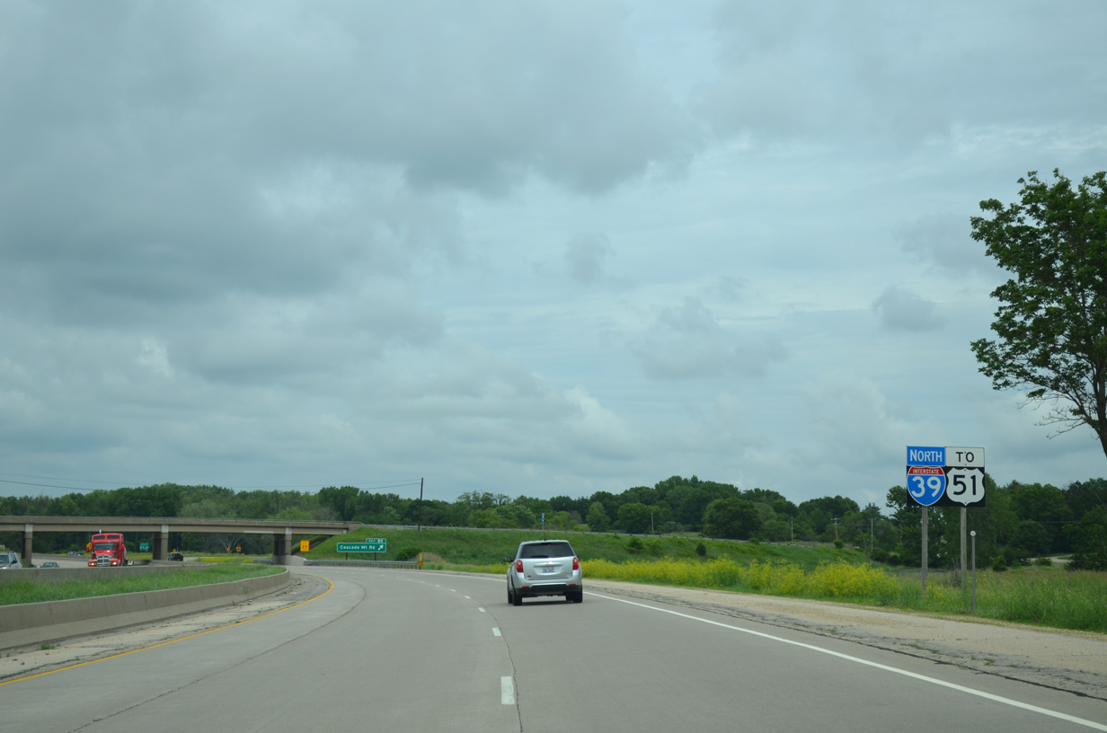
The first solo confirming shield for I-39 coincides with a U.S. 51 trailblazer ahead of Cascade Mountain Road.
06/15/15
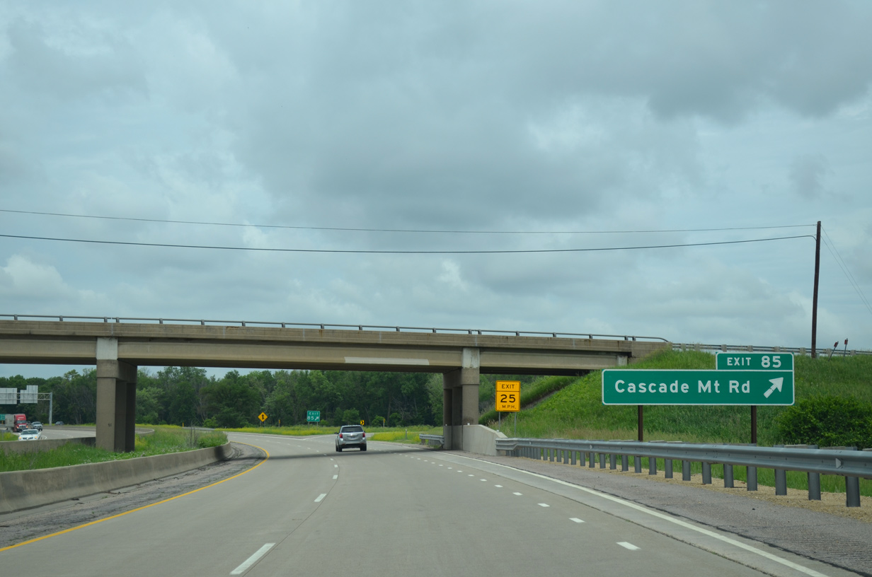
Cascade Mountain Road meanders west from Exit 85 alongside I-90/94 to Wis 33 and east to parallel County U within the town of Caledonia.
06/15/15
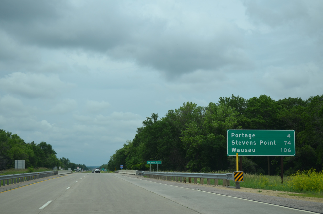
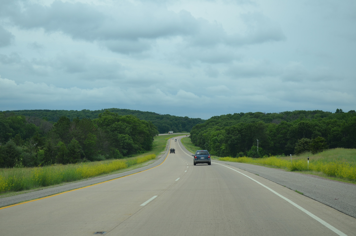
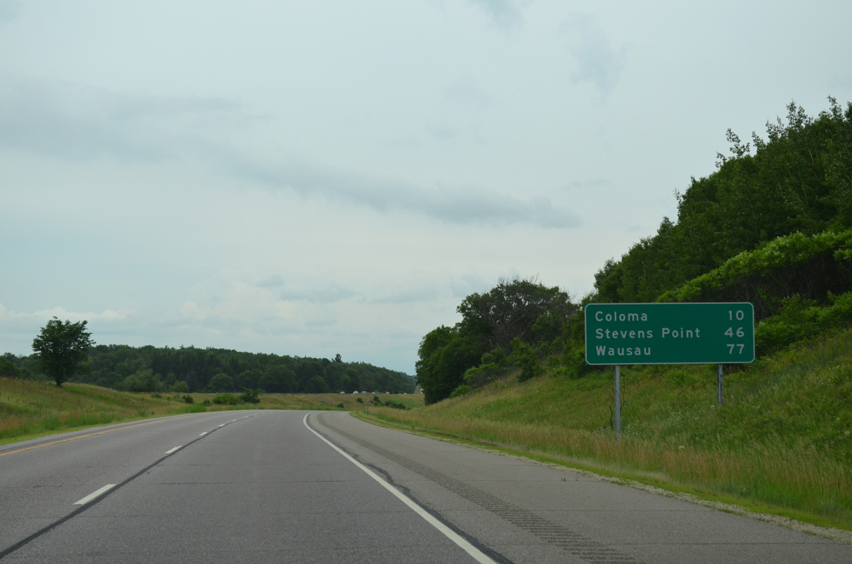
Interstate 39 traverses an area of lowlands from the Baraboo River to the Wisconsin River and city of Portage. Stevens Point lies 74 miles ahead, followed by Wausau in 106 miles.
06/15/15
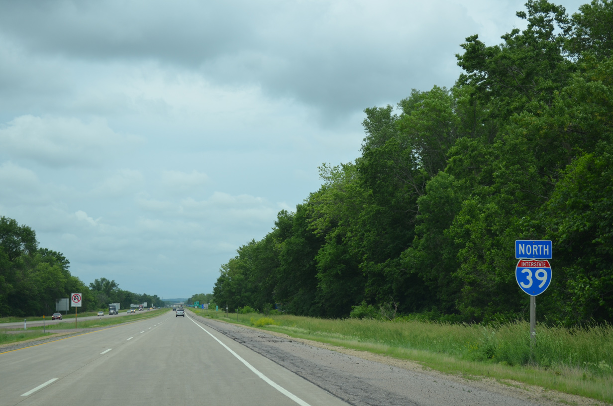
A rare cutout shield for Interstate 39 stands north of the Baraboo River. 16,100 vehicles per day (vpd) were recorded on this rural stretch of freeway in 2014.
06/15/15
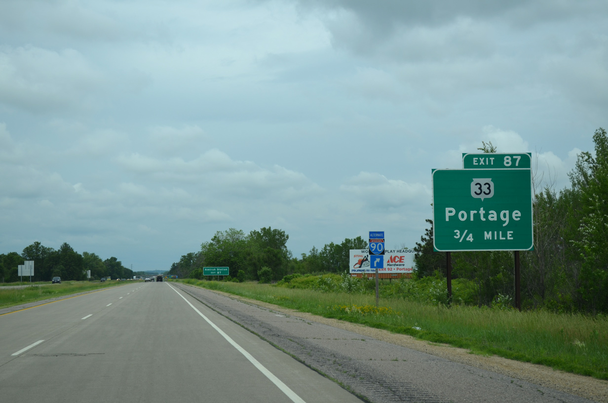
Wis 33 meanders 13 miles east from the Sauk County seat of Baraboo to meet Interstate 39 at Exit 87 in 0.75 miles.
06/15/15
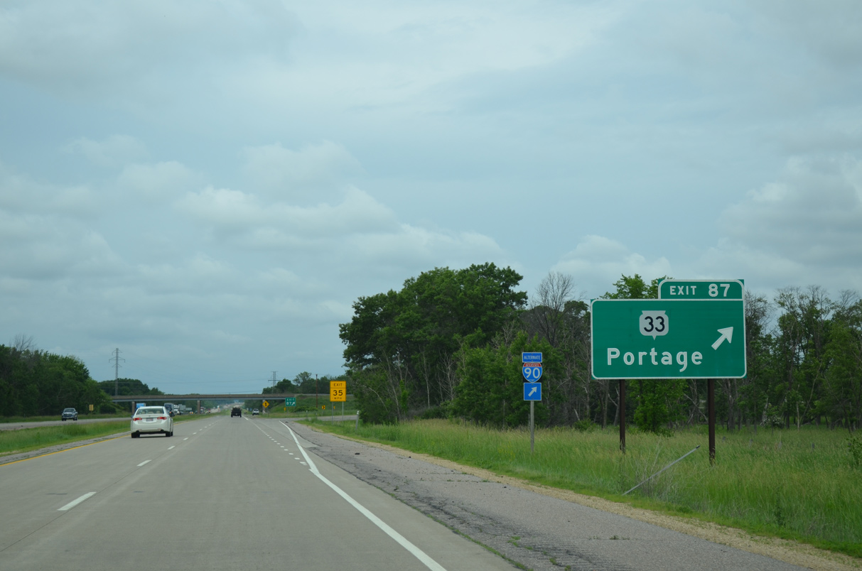
Entering the parclo A2 interchange (Exit 87) with Wis 33 on I-39 north. Wis 33 angles northeast and crosses the Wisconsin River to Cook Street and Downtown Portage. STH-33 runs across the width of the state for 200.8 miles between La Crosse and Port Washington.
06/15/15
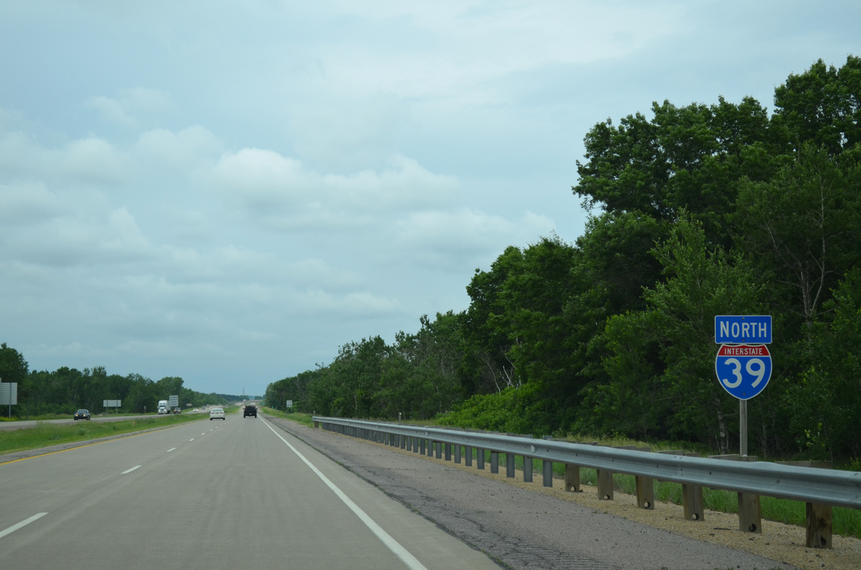
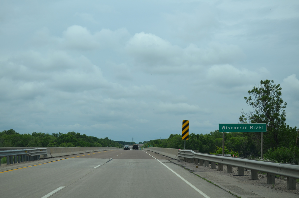
Northbound travelers along I-39 pass through Pine Island State Wildlife Area ahead of the Wisconsin River.
06/15/15
The bridges across the Wisconsin River for Interstate 39 were built in 1964 for Wis 78. They were reconstructed in 1990.
06/15/15
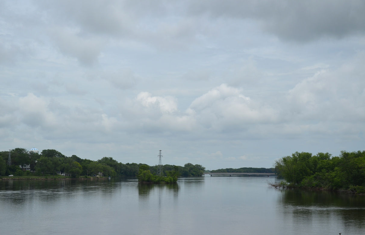
Wis 33 spans the Wisconsin River in the distance beyond a series of islands closer to Interstate 39.
06/15/15
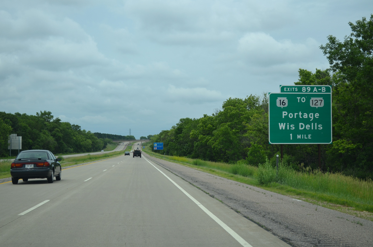
I-39 encircles the west side of Portage to a six-ramp parclo interchange (Exits 89A/B) with Wis 16 and 127.
06/15/15
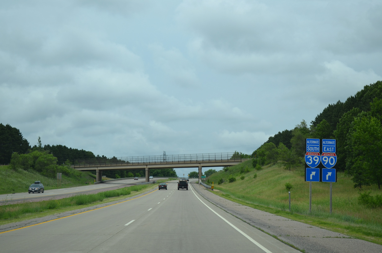
Alternate routes for I-39 and I-90 utilize Wis 16 east back into Portage. Wis 16 is the former alignment of U.S. 16. U.S. 16 was truncated west from the state in 1978.
06/15/15
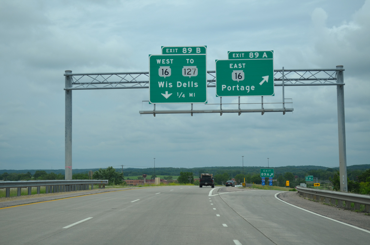
Exit 89A leaves Interstate 39 north for Wis 16 east. The trunk highway passes through an industrial area and by Portage Municipal Airport (C47) ahead of Silver Lake. Wisconsin Street takes the route southeast through the Portage street grid to Downtown.
06/15/15
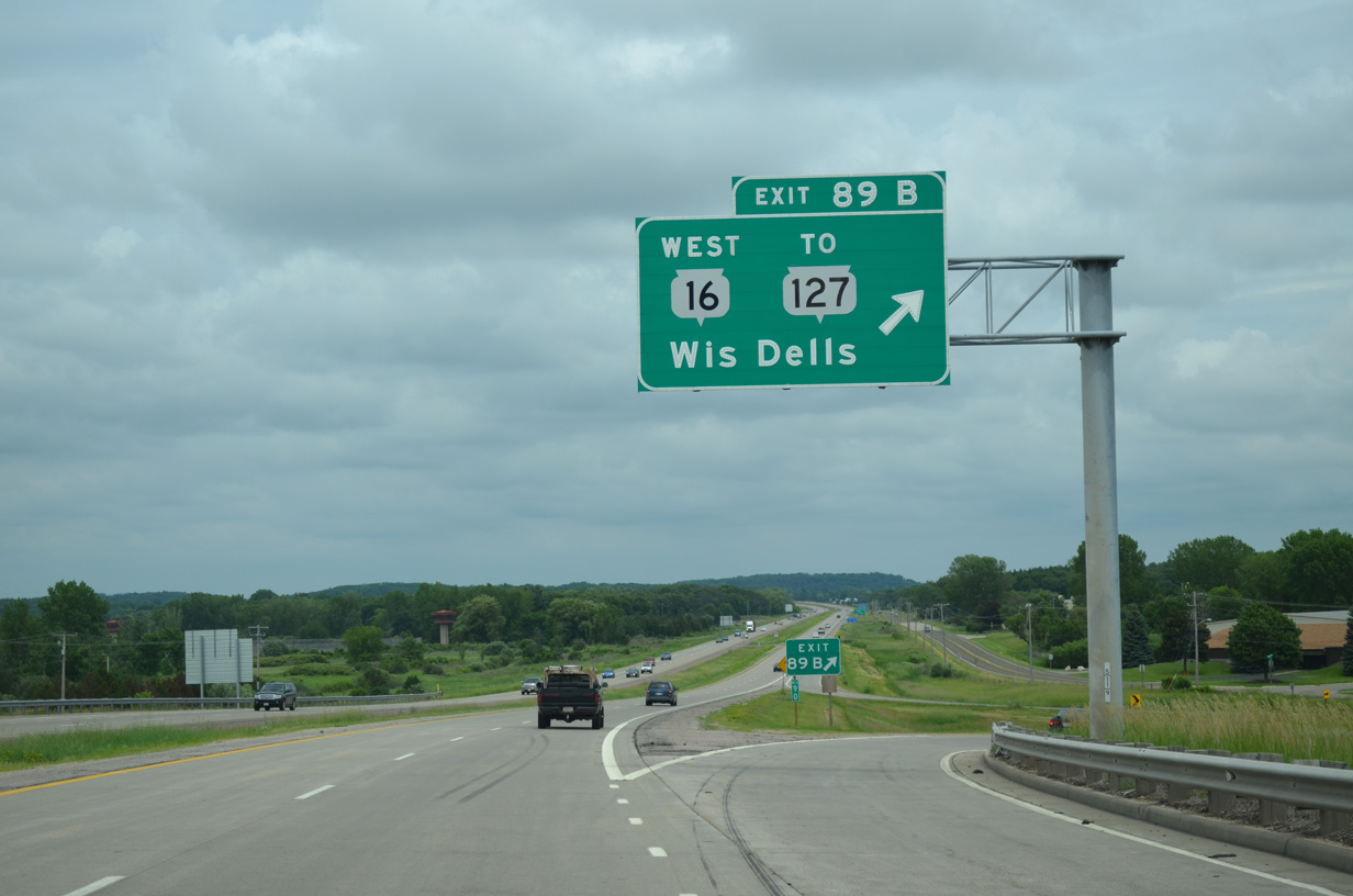
Wis 127 begins and separates from Wis 16 on the west side of Exit 89. The two routes reconvene outside Wisconsin Dells.
06/15/15
County CX forms an east side frontage road to Interstate 39 between Exits 89 and 92.
06/15/15
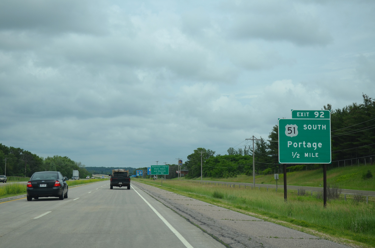
U.S. 51 bisects the city of Portage north from Downtown on a commercial arterial (New Pinery Road) to the merge with Interstate 39 at Exit 92.
06/15/15
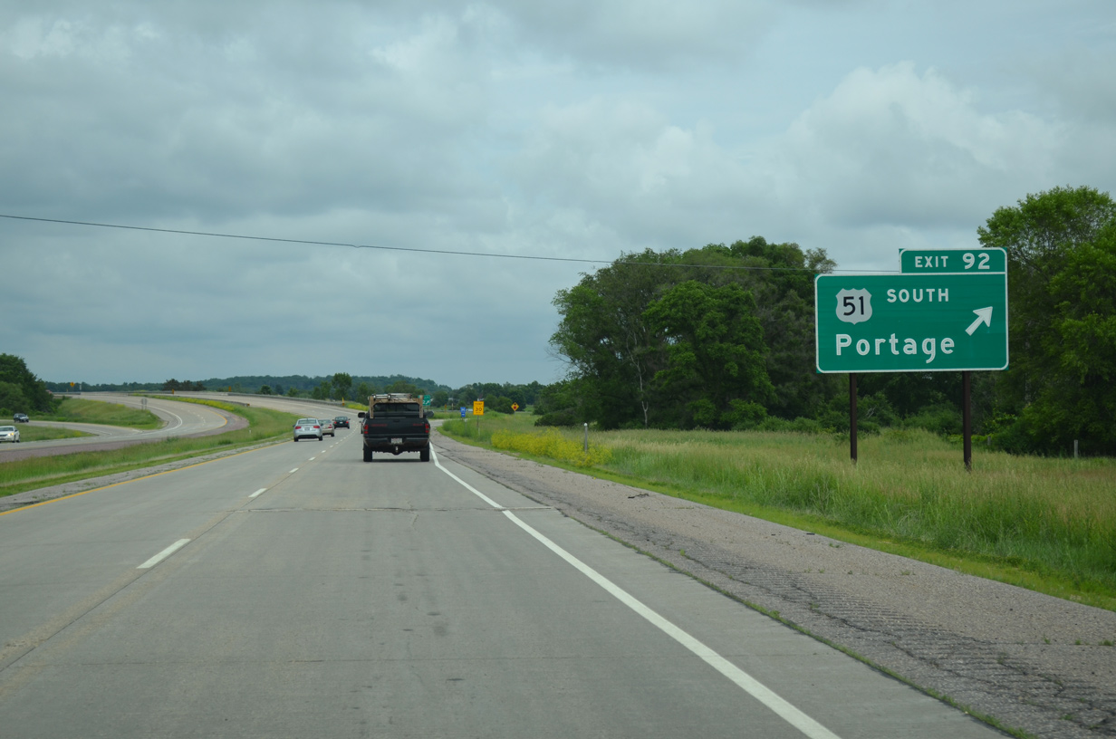
Exit 92 consists of a modified diamond interchange with U.S. 51 south and the local McMahon Road west. The exit originally consisted of a trumpet.
CTH-CX continues north from Exit 92 as the pre-freeway alignment of U.S. 51 to Endeavor.
06/15/15
 North
North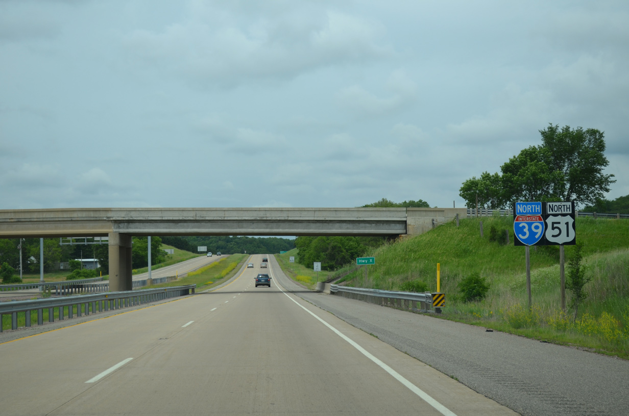
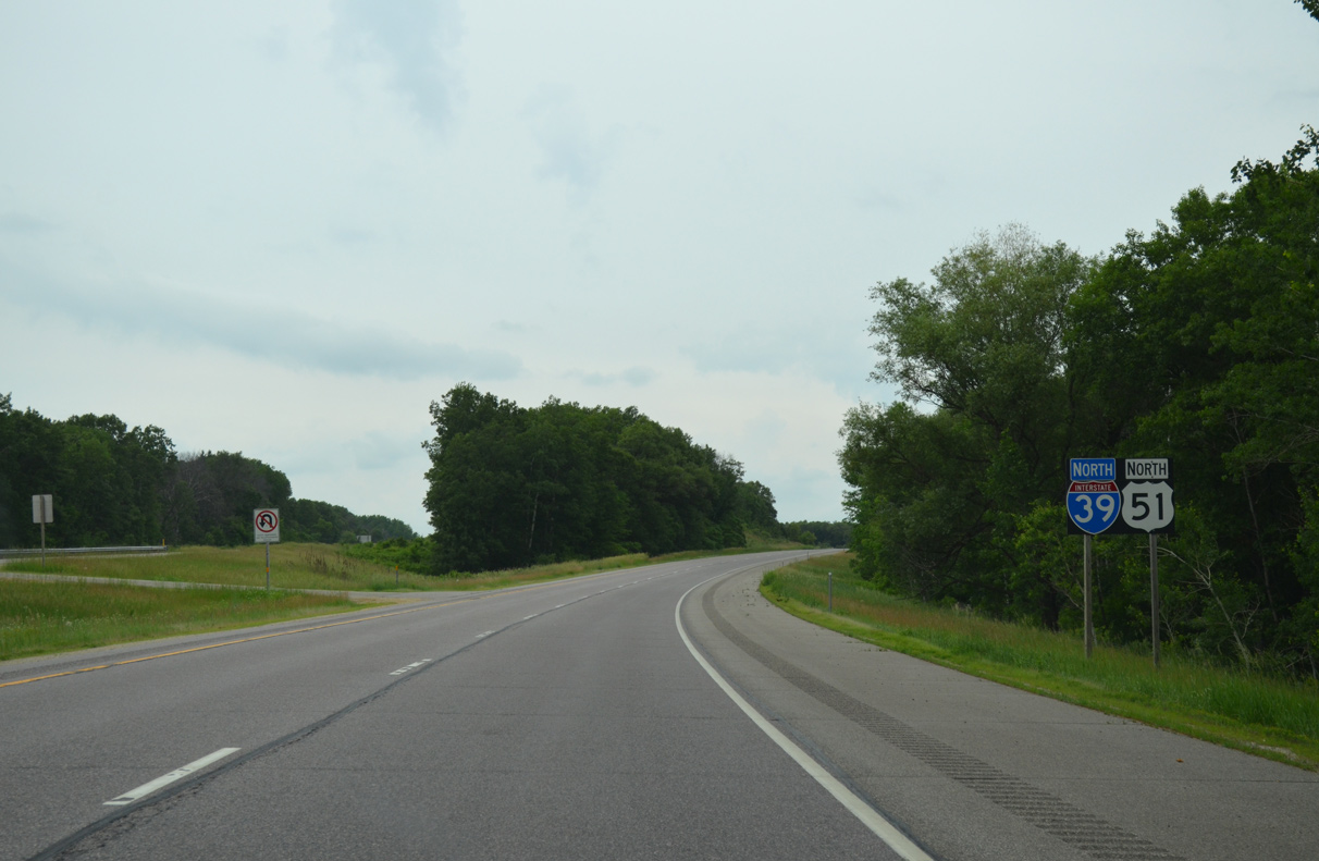
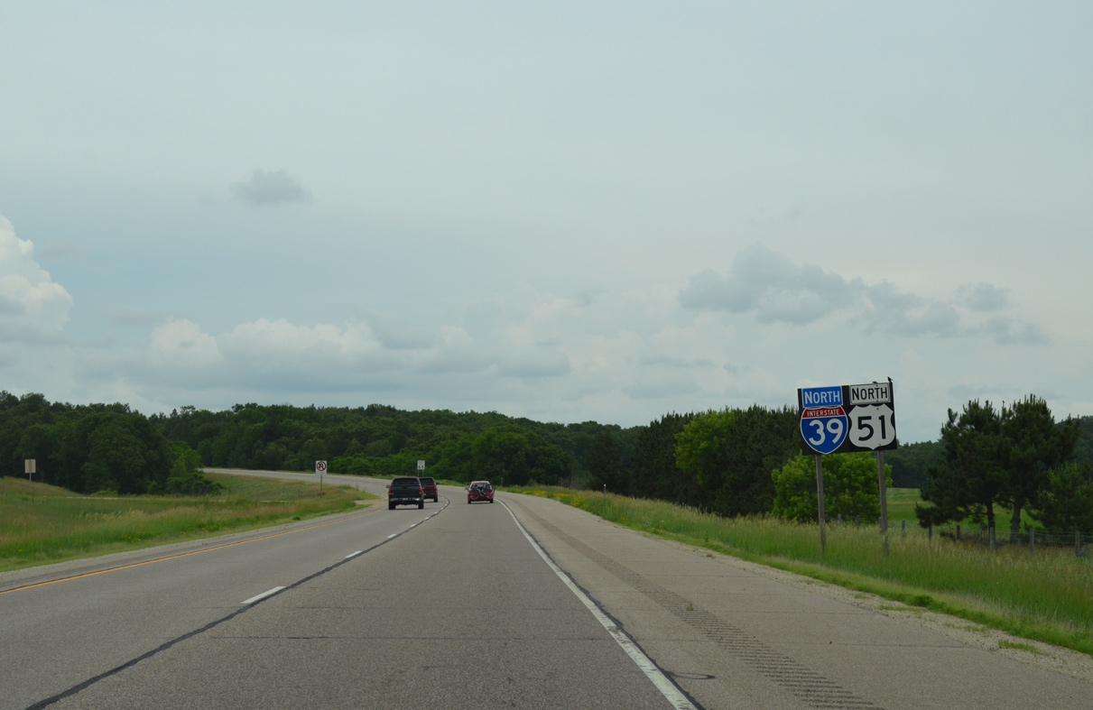
U.S. 51 runs along the remainder of Interstate 39 north.
06/15/15
The next destination for I-39/U.S. 51 is the village of Endeavor in nine miles. Stevens Point is now an hour away.
06/15/15
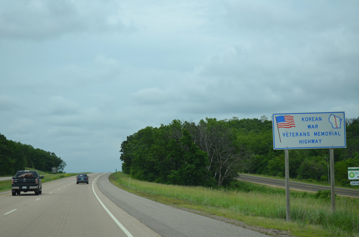
All of U.S. 51 within Wisconsin honors Korean War Veterans. Similarly U.S. 10 across the state honors Vietnam War Veterans.
06/15/15
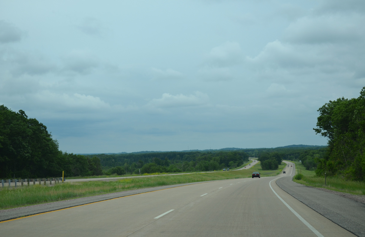
A roadway separation occurs along I-39/U.S. 51 across a series of hills west of Anacker.
06/15/15
The freeway lowers across an area of wetlands preceding Neenah Creek at milepost 95.
06/15/15
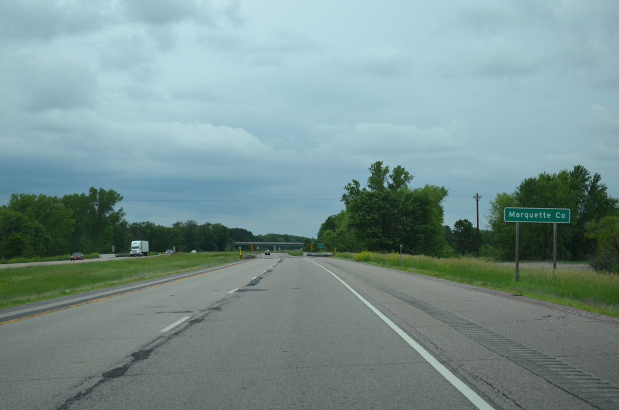
County CX (old U.S. 51) parallels I-39/U.S. 51 just to the east as both cross the Marquette County line.
06/15/15
I-39/U.S. 51 bee line north toward the rural diamond interchange (Exit 100) with Wis 23 west and County P.
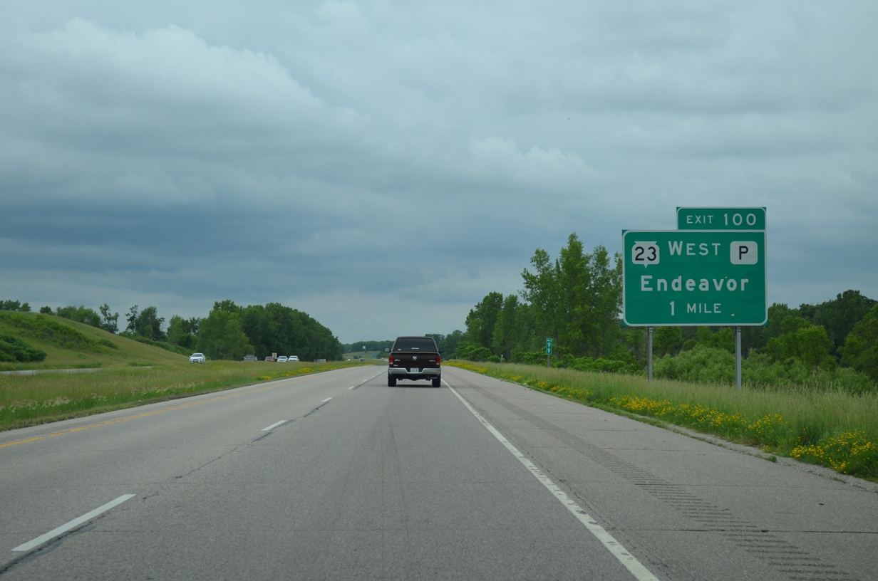
06/15/15
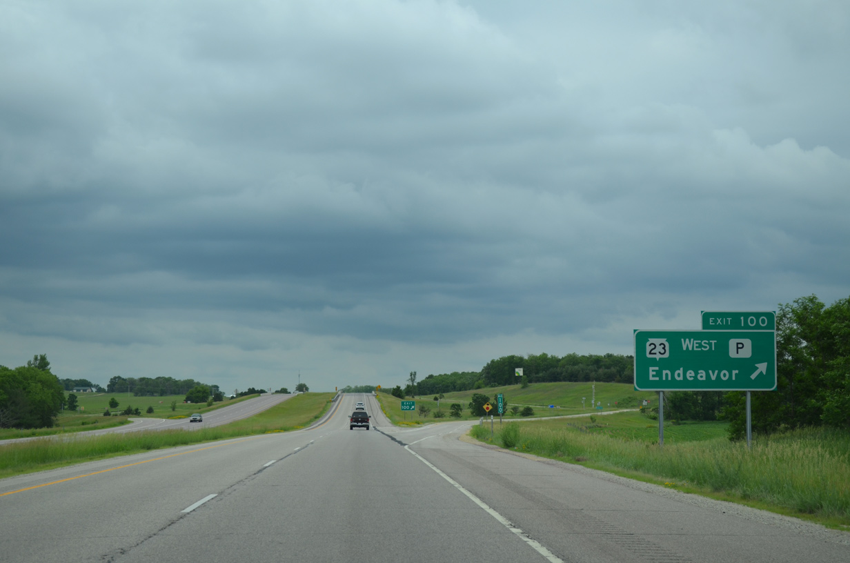
Exit 100 departs I-39/U.S. 51 north for Wis 23 west to Briggsville and Wisconsin Dells. County P links all three routes with adjacent County CX north into Endeavor.
06/15/15
North 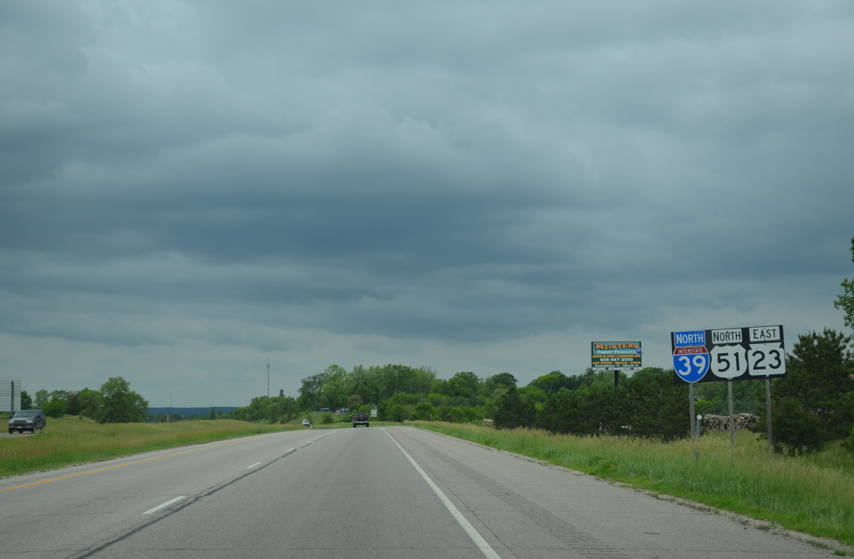
Wis 23 east combines with I-39/U.S. 51 for 6.4 miles. Construction of I-39 directly overlaid the original alignment of U.S. 51/Wis 23 north from the village of Endeavor.
06/15/15
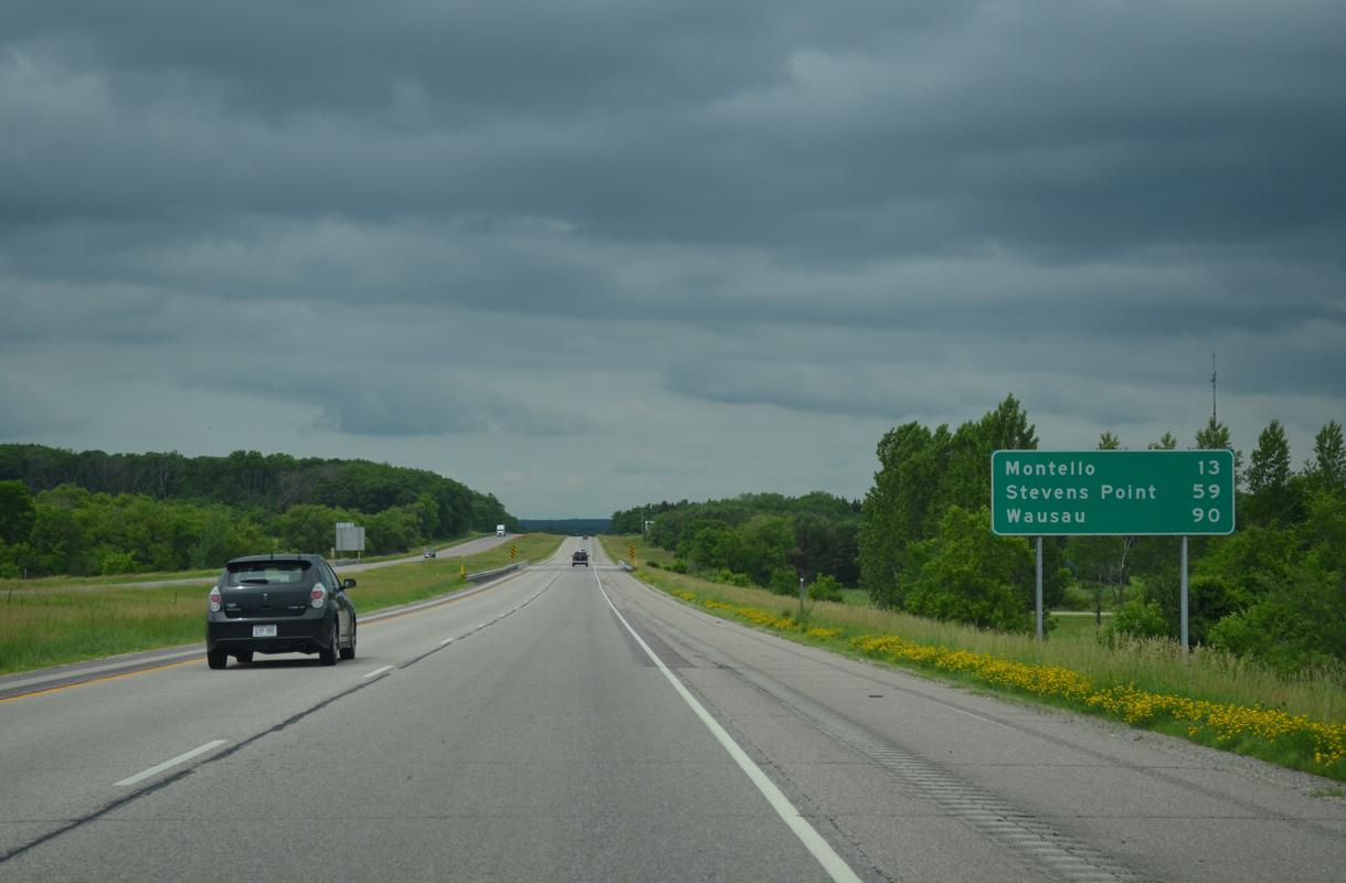
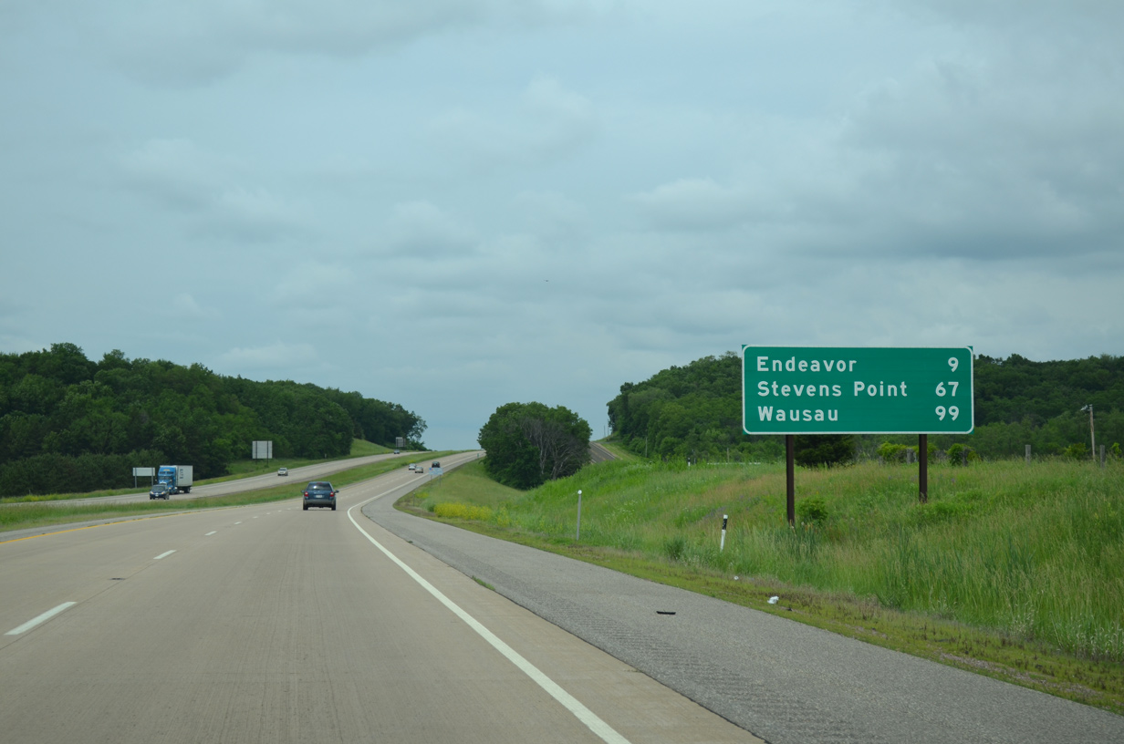
The Marquette County seat of Montello lies ten miles ahead via I-39 and the continuation of Wis 23 east. Stevens Point follows in 59 miles.
06/15/15
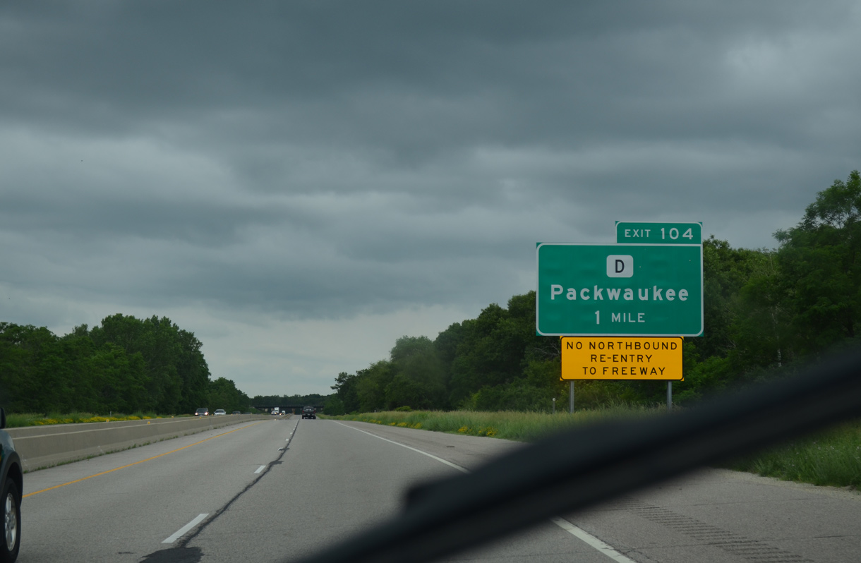
I-39-U.S. 51/Wis 23 travels along an area of wetlands by Buffalo Lake to a half diamond interchange (Exit 104) with County D.
06/15/15

Marquette County D follows a rural course west from Exit 104 to County A near Oxford and east to the community of Packwaukee on Buffalo Lake.
06/15/15
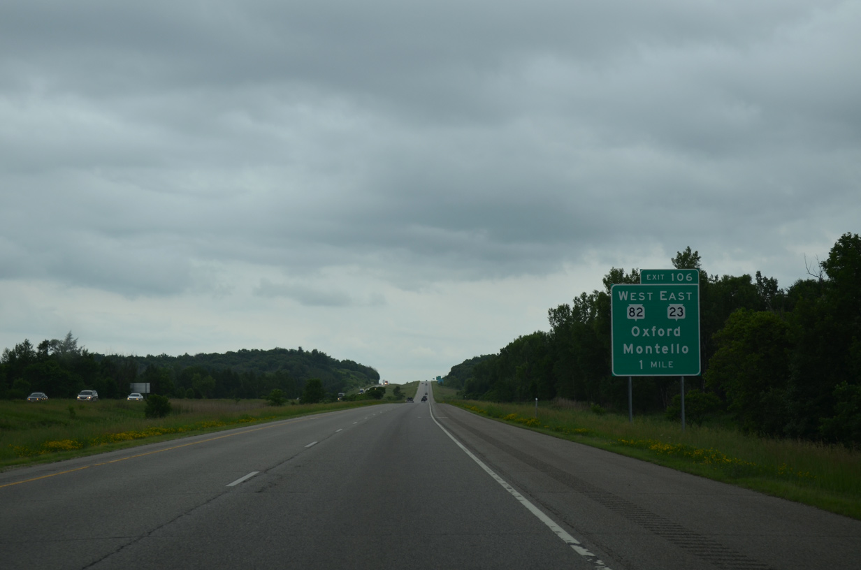
Wis 23 east separates from I-39/U.S. 51 north in one mile near Montello Corners. The forthcoming diamond interchange represents the east end of Wis 82.
06/15/15
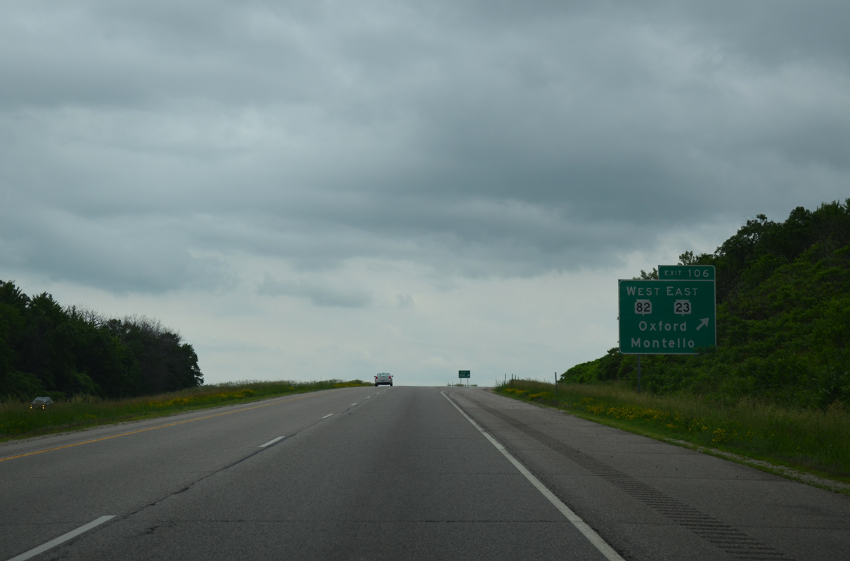
Northbound I-39/U.S. 51 at Exit 106 and the split with STH-23. STH-23 ventures eight miles to Montello and 55 miles to Fond du Lac. STH-82 heads west four miles to Oxford and 29 miles to Mauston. The trunk highway totals 116 miles from here to Lansing, Iowa.
06/15/15
North
10,800 vehicles per day (vpd) were recorded on I-39/U.S. 51 north between Exit 106 and Westfield in 2014.
06/15/15
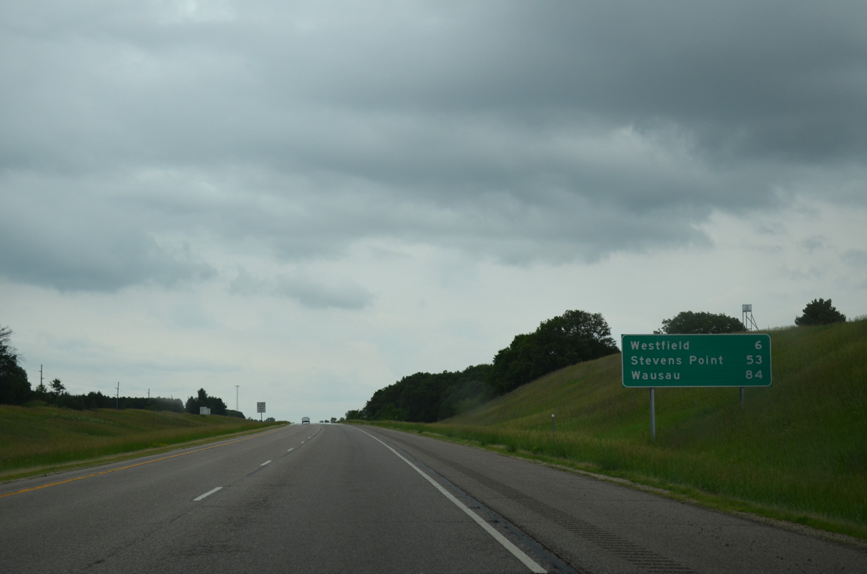
Motorists travel another 5.9 miles north to County J in the village of Westfield. I-39 remains rural otherwise on the 53 mile drive to Stevens Point.
06/15/15
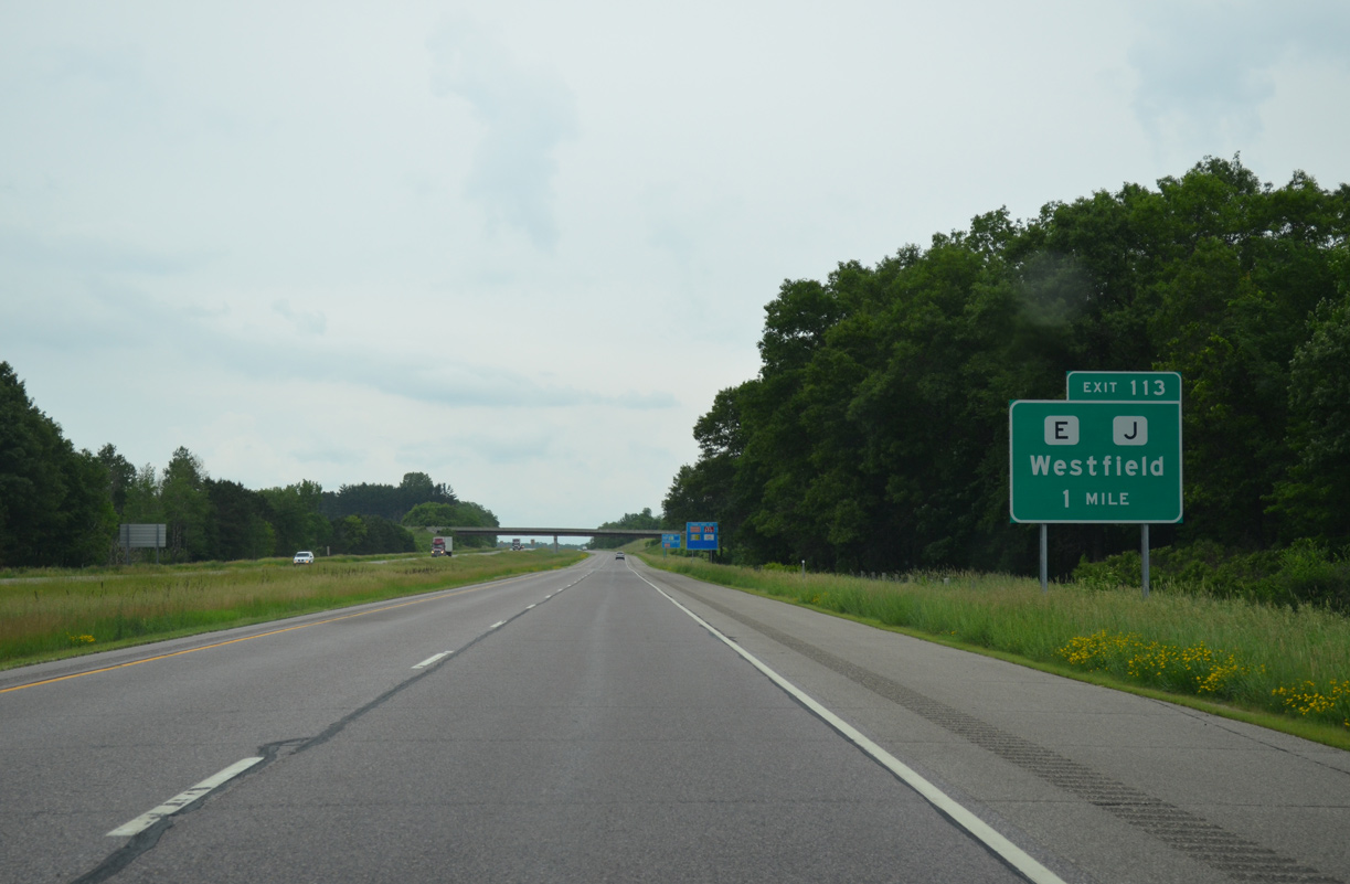
County M follows old U.S. 51 to the west of I-39 to Westfield. Forthcoming Exit 113 departs in one mile for County E/J (2nd Street) east of the village center.
06/15/15
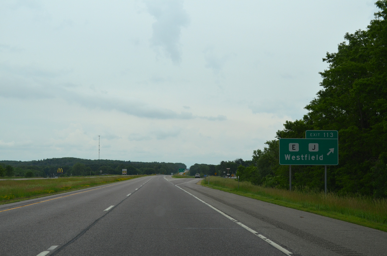
Northbound I-39/U.S. 51 reaches the diamond interchange (Exit 113) with County E/J at Westfield. CTH-E and CTH-J separate just east of Exit 113 on respective courses to Neshkoro and Harrisville.
06/15/15
The roadways for Interstate 39 separate across a hillside as the freeway leaves the village limits of Westfield. County CH parallels to the west as old U.S. 51.
06/15/15
A 10.4 mile exit less stretch takes I-39 north to the village of Coloma. Stevens Point and Wausau follow in 36 and 67 miles respectively.
06/15/15
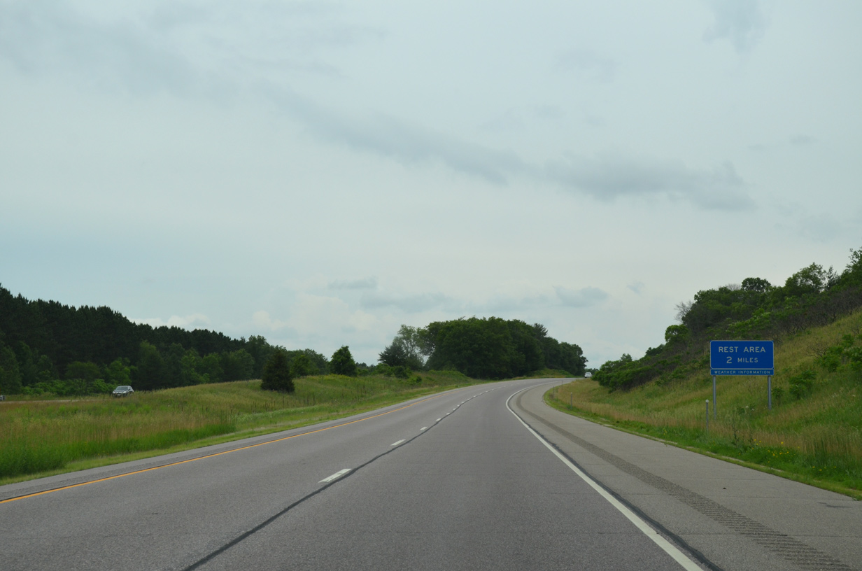
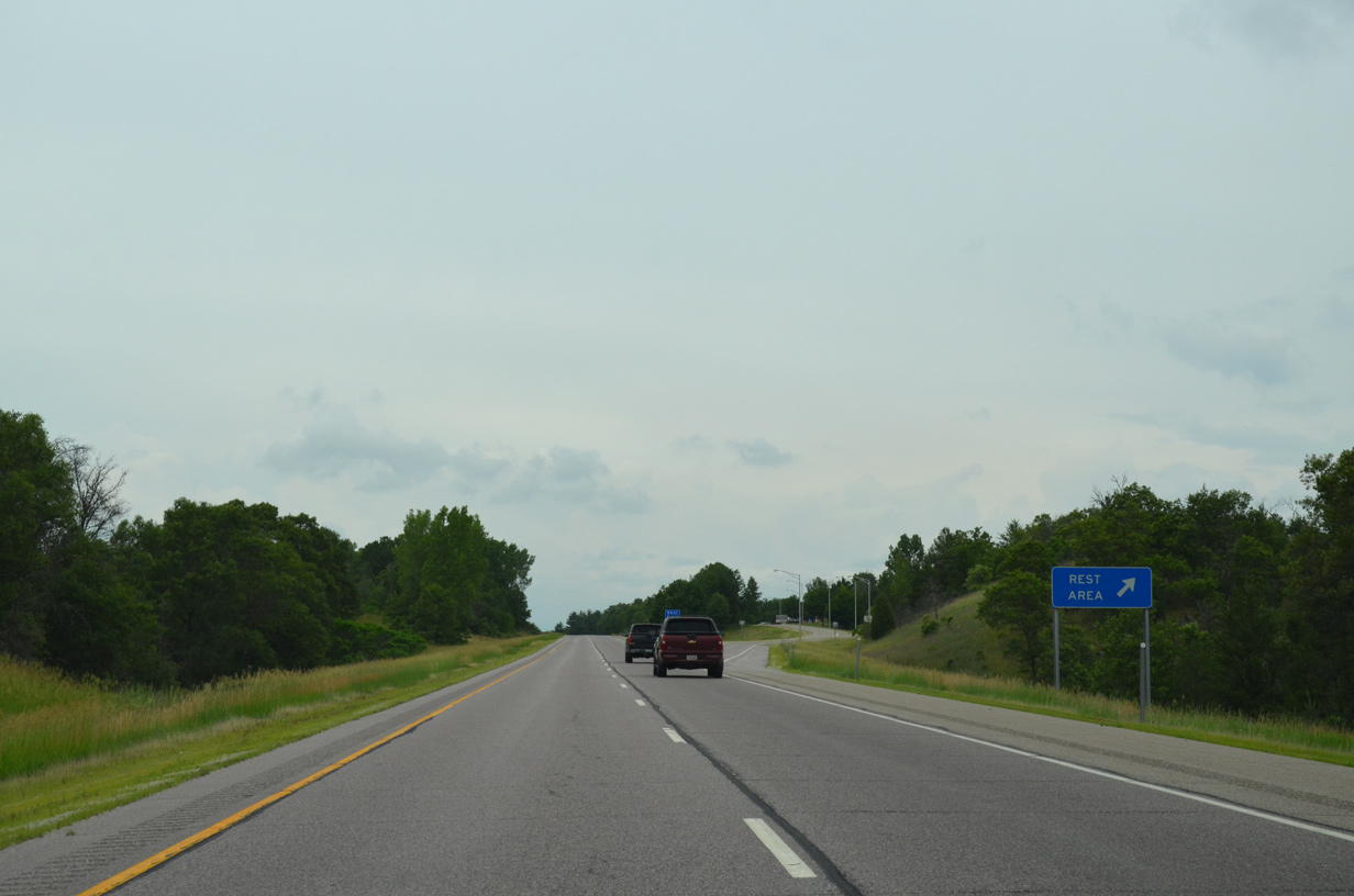
The Westfield rest area lies two miles ahead. The facility accommodates 40 cars and 30 trucks.
06/15/15
The last rest area for Interstate 39 north opened in 1987 when U.S. 51 was expanded to four lanes.
06/15/15
County Z passes under the freeway as I-39/U.S. 51 depart from the rest area ahead of these confirming markers.
06/15/15
A lengthy S-curve shifts I-39 westward toward Wood Lake to overtake the original U.S. 51 alignment north by the southbound Columa rest area.
06/15/15
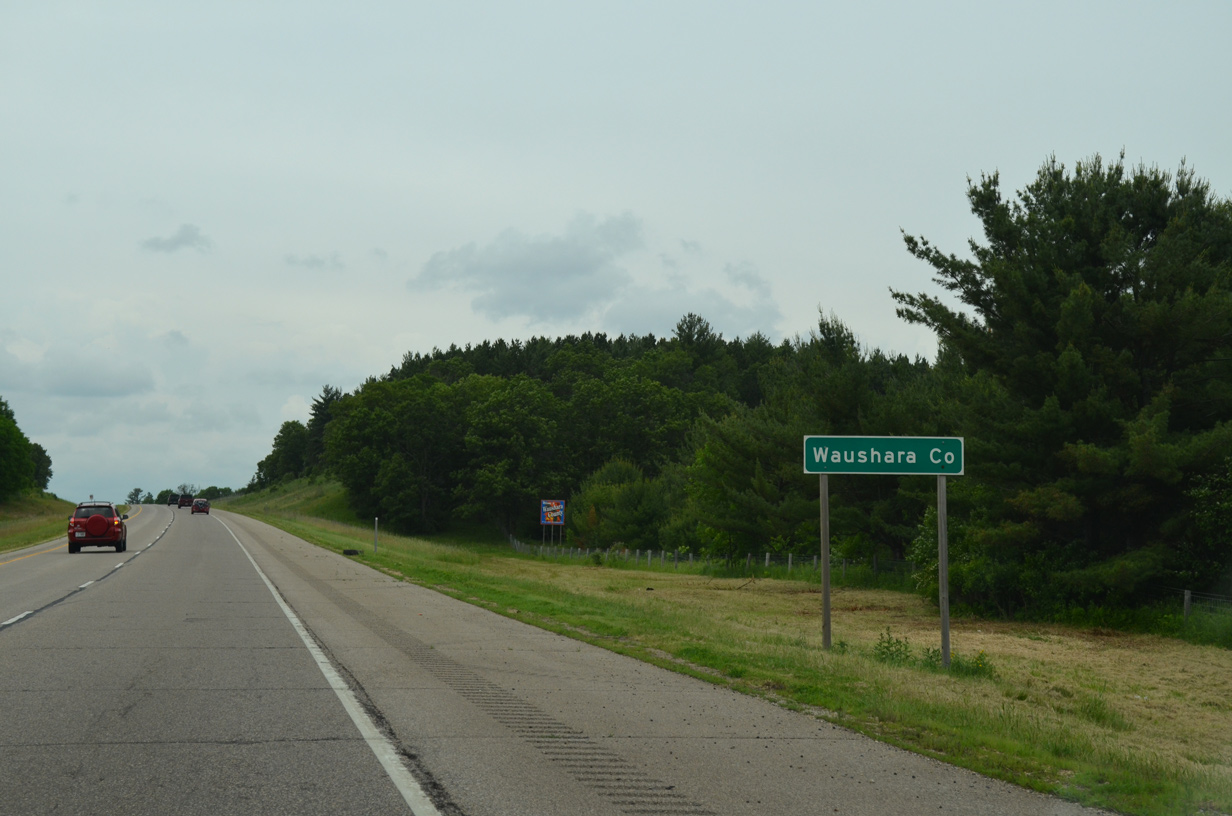
The freeway crosses the Waushara County line just north of Chaffee Creek within the Upper Fox Headwaters State Natural Area.
06/15/15
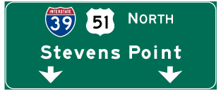

Photo Credits:
- ABRoads: 06/15/15
Connect with:
Page Updated Thursday April 28, 2016.