
Interstate 40 East - California to Kingman
 East
East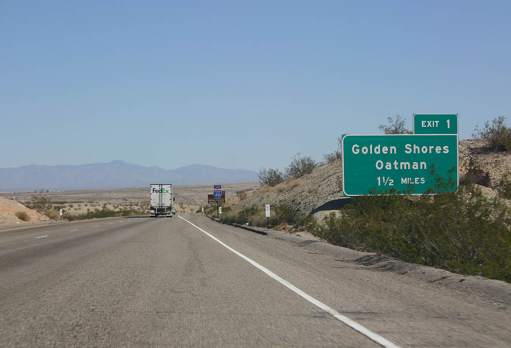
The first sign for Exit 1 in Arizona precedes the Colorado River Bridge in California. Oatman Highway is part of former SR 95, which was decommissioned in 1992 north to Arizona Village due to right of way issues through the Golden Shores area.
03/03/07
03/03/07
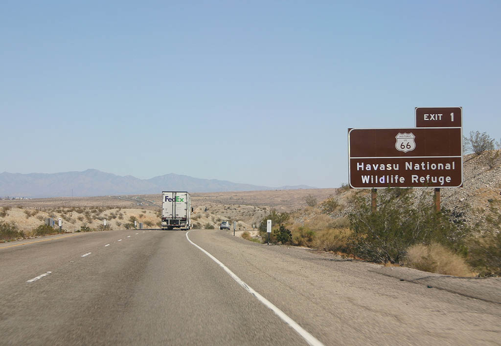
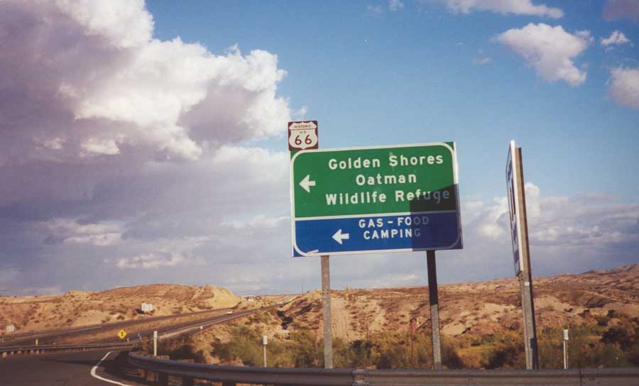
Oatman Highway north to Oatman in the Black Mountains is the original alignment of U.S. 66. Havasu National Wildlife Refuge spreads to the northwest around Topock Marsh.
03/03/07
03/03/07
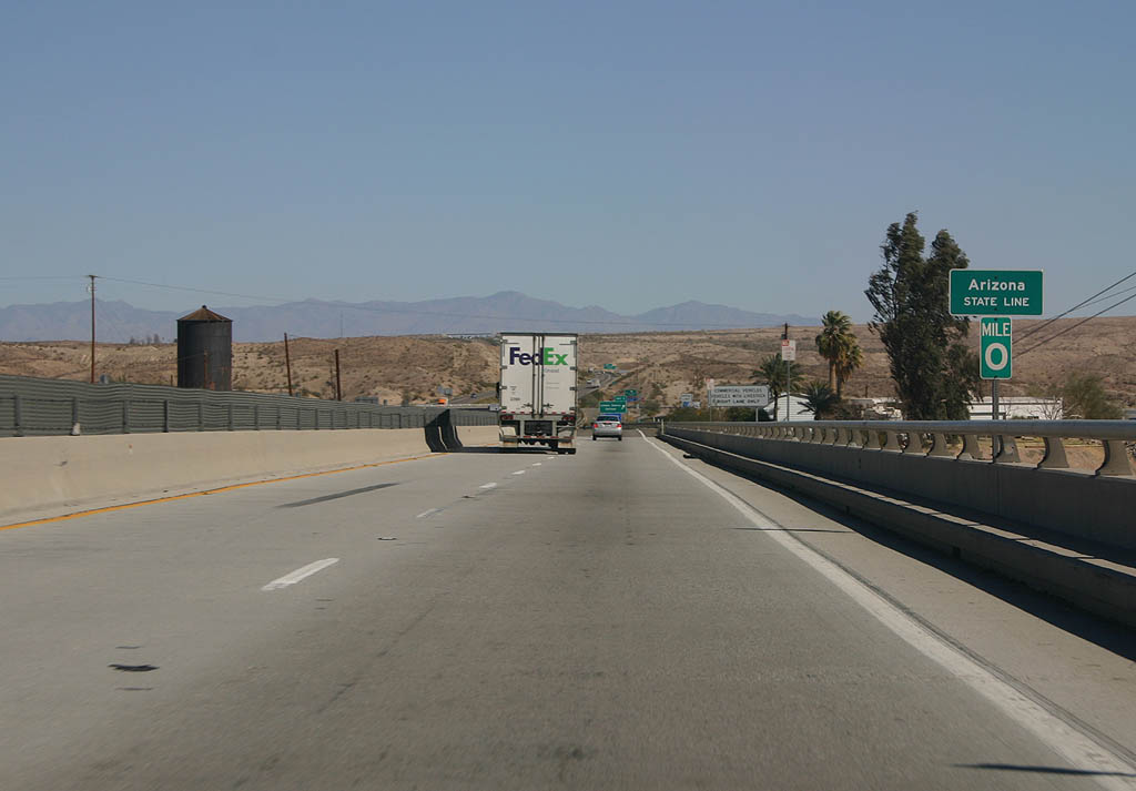
The Colorado River Bridge was constructed in 1966, leading to the removal of the old Red Rock Bridge that carried former U.S. 66. Ironically, the original Old Trails Bridge still exists.
03/03/07
03/03/07
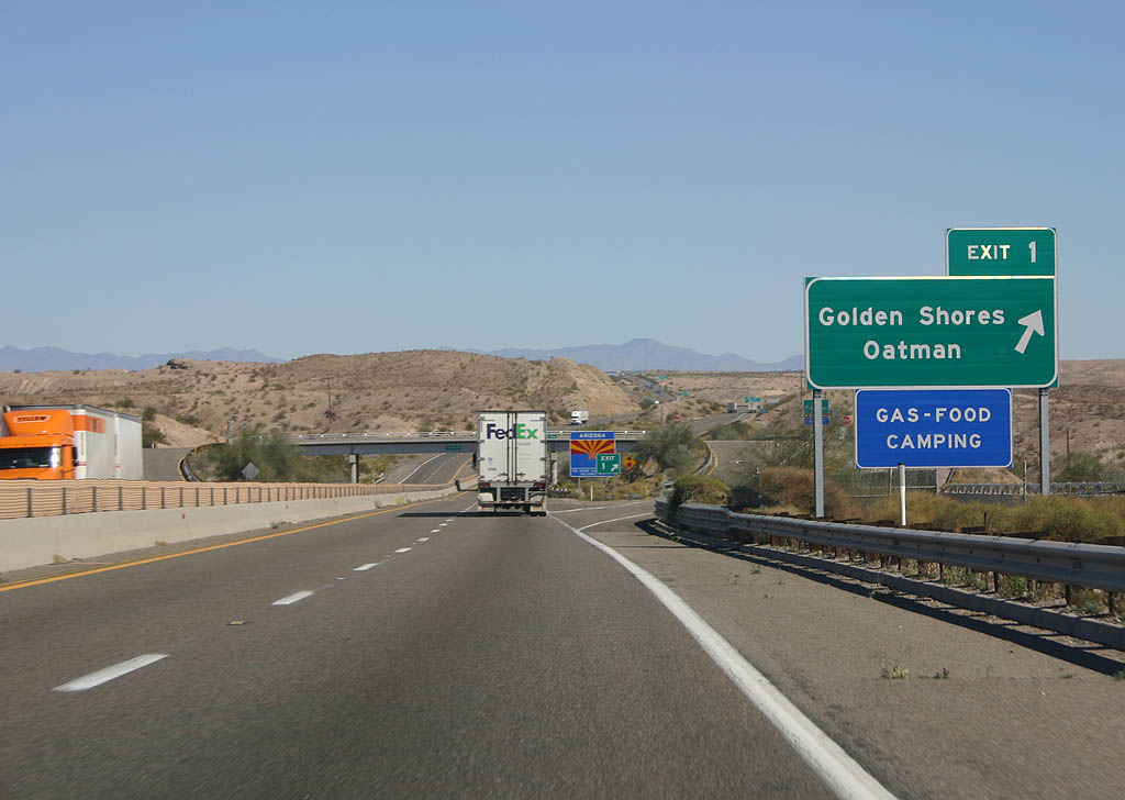
Exit 1 departs from I-40 east immediately after the Colorado River for Oatman Highway (CR 10) north to Golden Shores and Historic U.S. 66 northeast to Oatman.
03/03/07
03/03/07
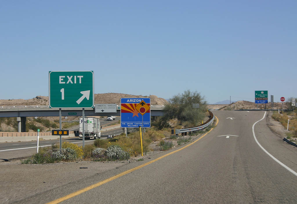
The Arizona welcome sign stands within the diamond interchange at Exit 1.
03/03/07
03/03/07
Historic U.S. 66 (Oatman Highway) initially runs west alongside I-40 to Topock before turning north around Topock Bay to Golden Shores. The original route of U.S. 66 rejoins I-40 outside Kingman.
11/11/00
11/11/00
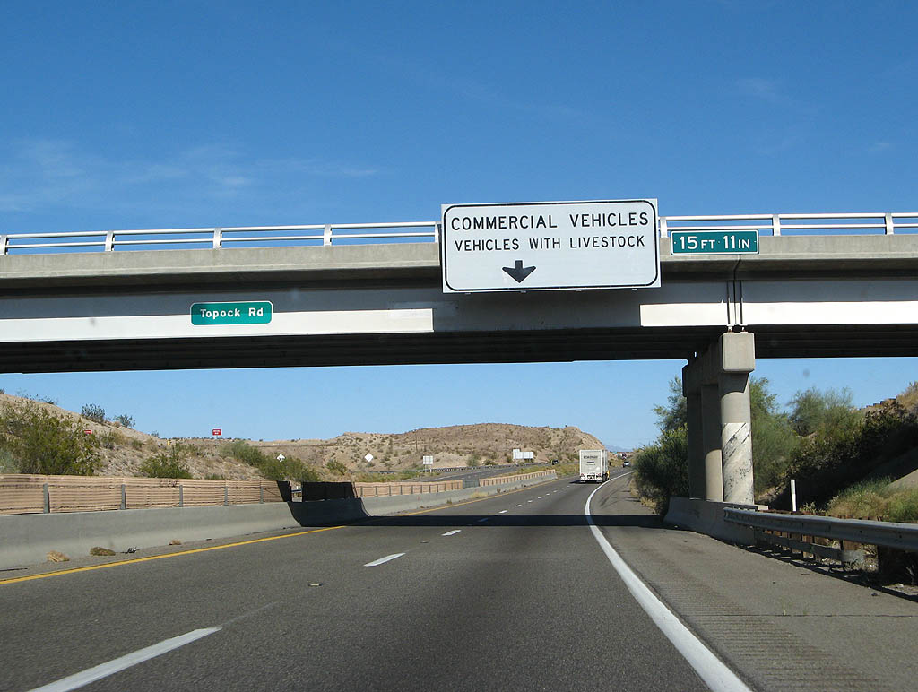
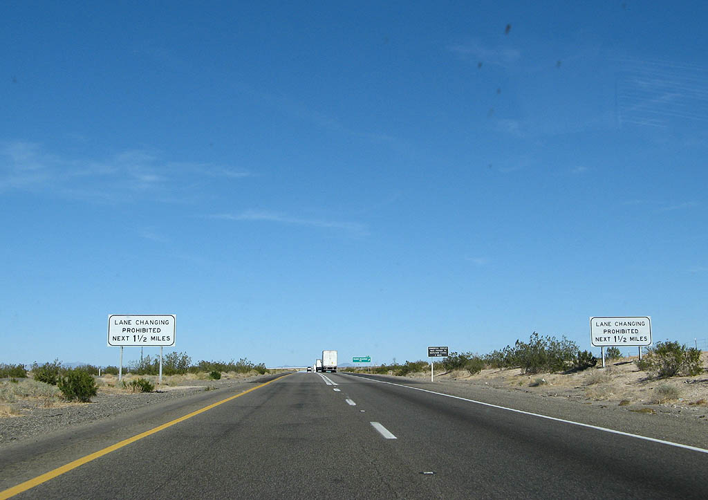
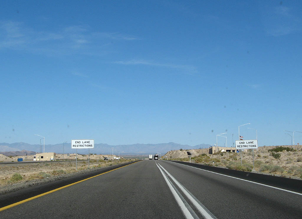
A lane restriction for trucks commences east from Exit 1 to the Topock Port of Entry beyond Exit 2.
03/30/07
03/30/07
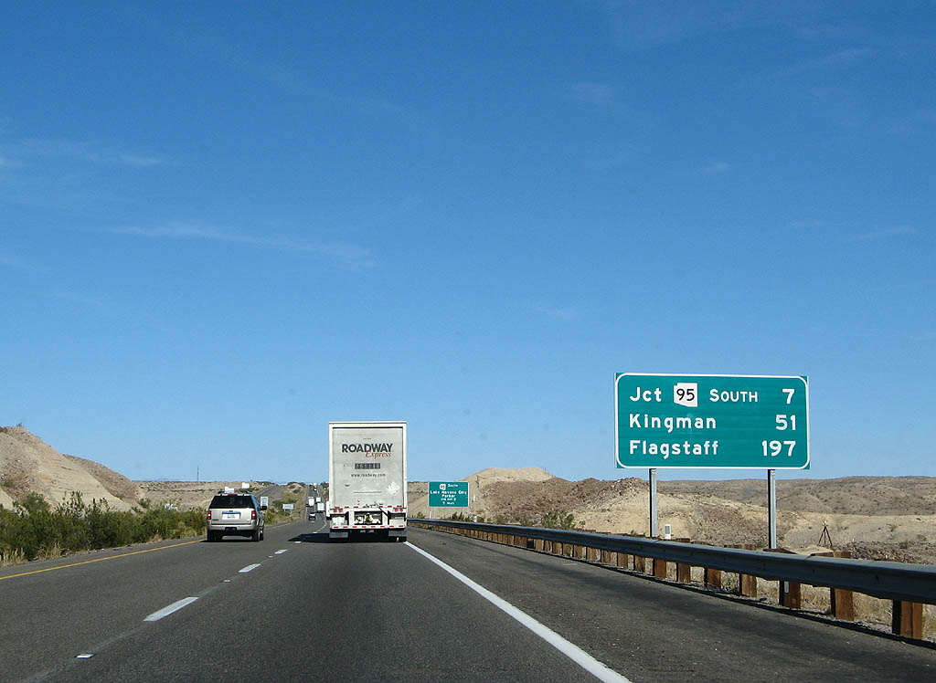
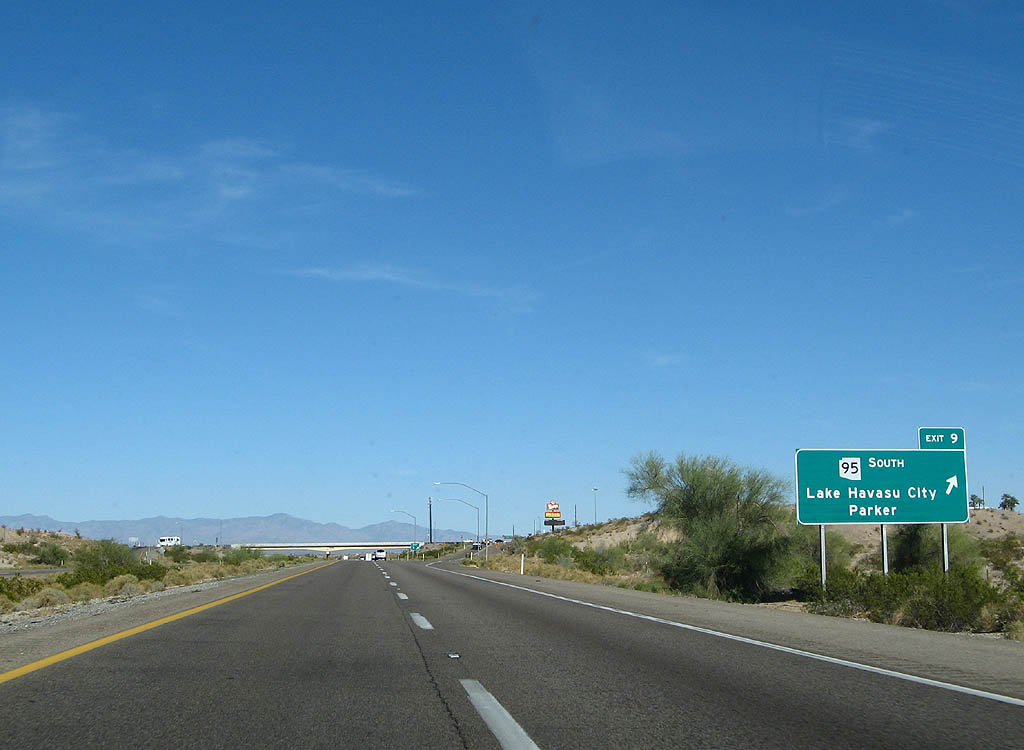
Distance sign to the southern branch of SR 95 at Exit 9, Kingman and Flagstaff.
03/30/07
03/30/07
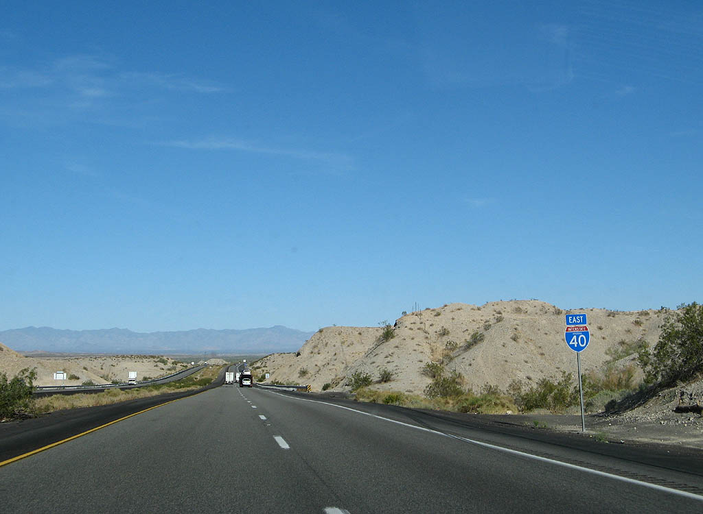
Prior to 1992, SR 95 overlapped with Interstate 40 east from Topock to Exit 9, where the state route heads south to Lake Havasu City.
03/30/07
03/30/07

A diamond interchange joins Interstate 40 with Needle Mountain Road at Exit 2.
03/30/07
03/30/07
Weigh in motion sensors operate along eastbound Interstate 40 at the forthcoming Topock Port of Entry.
03/30/07
03/30/07
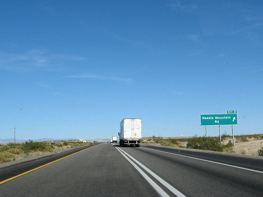
Exit 2 departs for Needle Mountain Road. Commercial traffic is prohibited from taking this exit.
03/30/07
03/30/07
Continuing east from Mohave Valley to the Topock Port of Entry.
03/30/07
03/30/07
The Arizona Department of Transportation (ADOT) recorded 19,184 vehicles per day (vpd) along Interstate 40 east of Exit 2 in 2019.
03/30/07
03/30/07
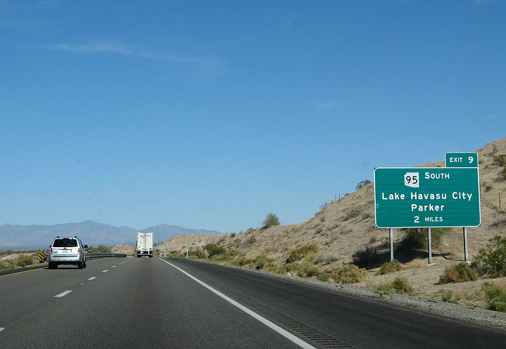
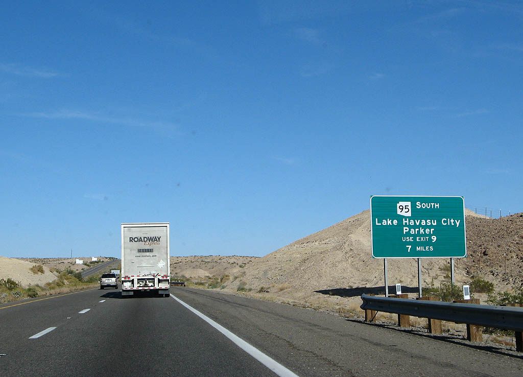
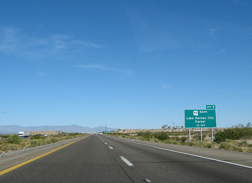
SR 95 stems south from the diamond interchange at Exit 9 to Lake Havasu City and Parker along the Colorado River.
03/30/07
03/30/07
Separated by 23.20 miles, an implied overlap with Interstate 40 from Needles, California connects the two segments of SR 95.
03/30/07
03/30/07
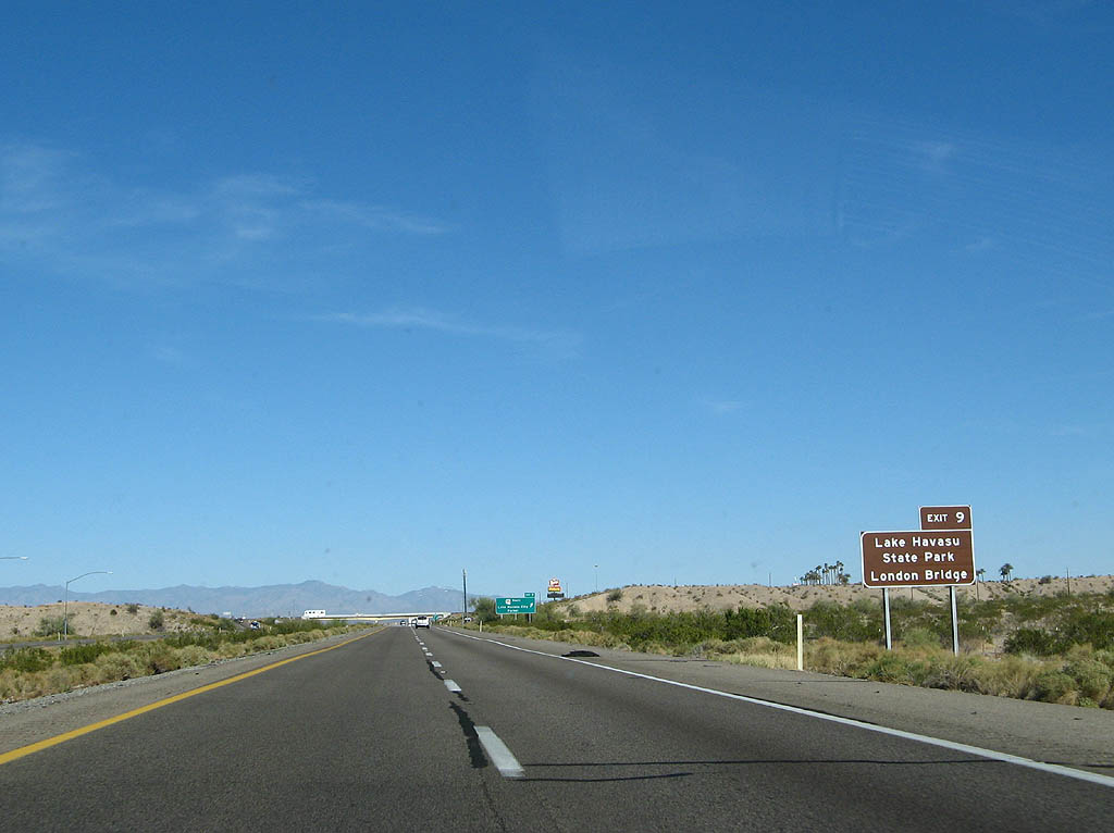
Points of interest along SR 95 south at Lake Havasu City include Lake Havasu State Park and the London Bridge.
03/30/07
03/30/07
SR 95 travels 92.80 miles south from Interstate 40 to Business Loop I-10 and U.S. 95 at Quartzsite.
03/30/07
03/30/07
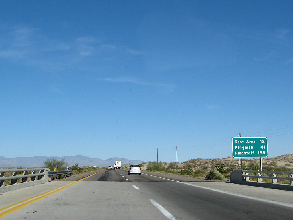
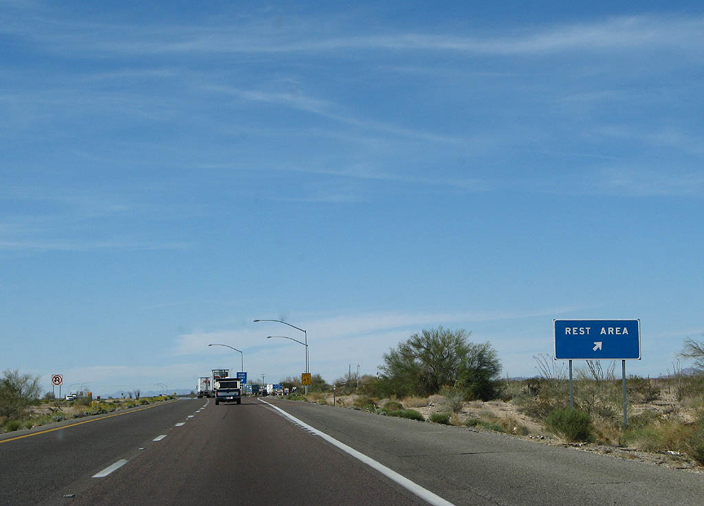
Interstate 40 arcs northeast around the periphery of the Black Mountains 12 miles to the Haviland Rest Area.
03/30/07
03/30/07
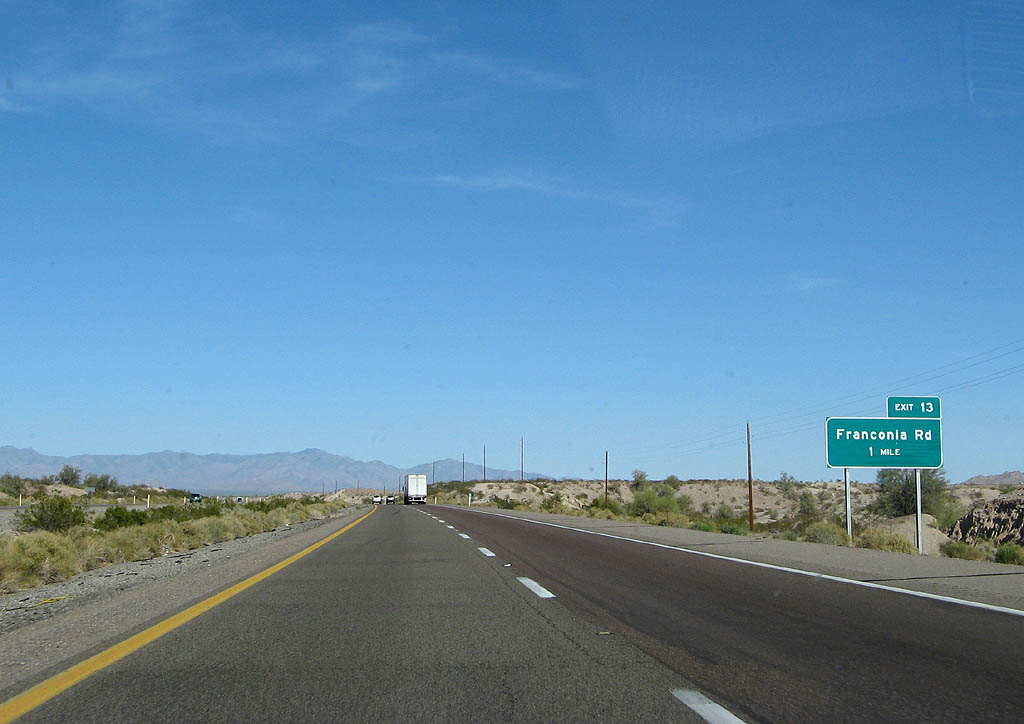
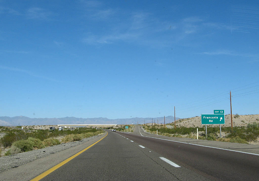
Interstate 40 follows Sacramento Wash east to a diamond interchange (Exit 13) with Franconia Road.
03/30/07
03/30/07
Franconia Road leads north to the BNSF Railroad siding of Franconia. I-40 along this stretch directly replaced the 1952 realignment of U.S. 66.
03/30/07
03/30/07
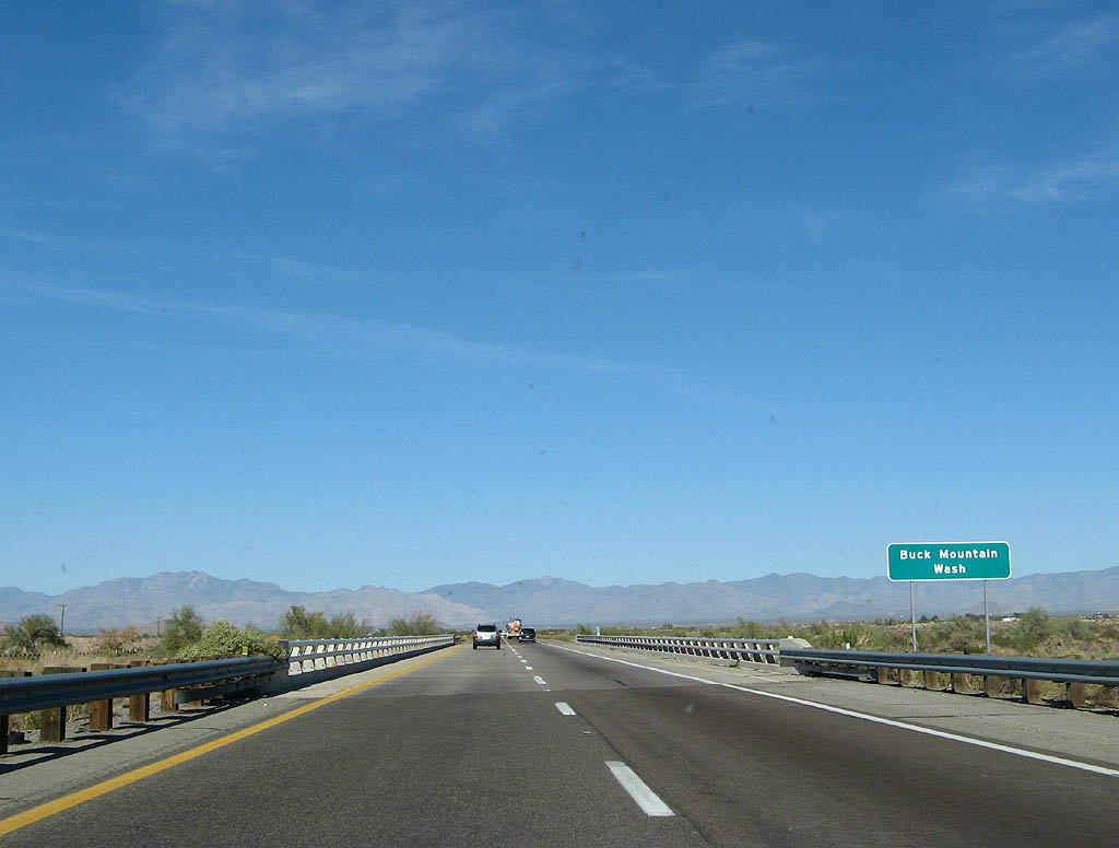
Interstate 40 east crossing Buck Mountain Wash.
03/30/07
03/30/07
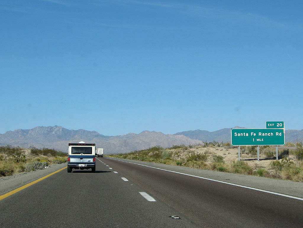
One mile from Exit 20 for Santa Fe Ranch Road.
03/30/07
03/30/07
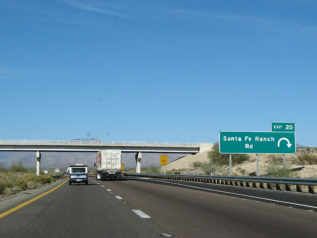
A folded diamond interchange joins Interstate 40 with Santa Fe Ranch Road at Exit 20.
03/30/07
03/30/07
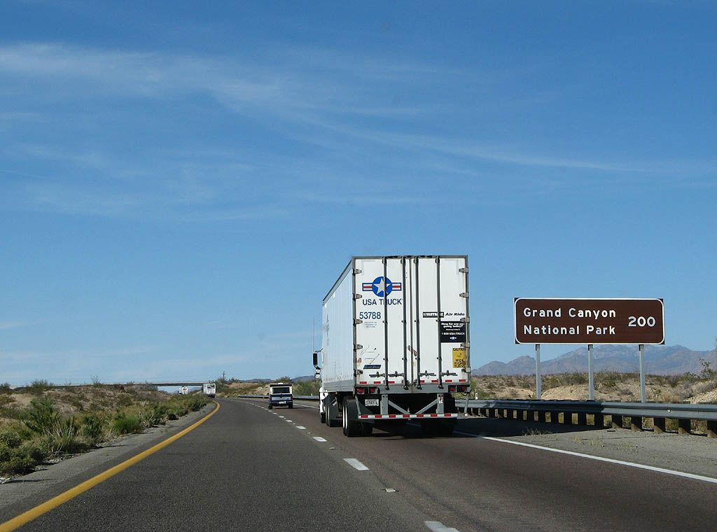
Distance sign to Grand Canyon National Park (200 miles). Grand Canyon NP signs are common along Interstate 40.
03/30/07
03/30/07
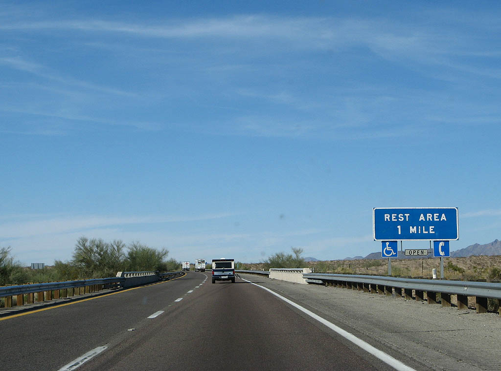
Continuing north across Happy Jack Wash, I-40 reaches the Haviland Rest Area in one mile.
03/30/07
03/30/07
The Haviland Rest Area is located at mile marker 22. The succeeding facility is east of Kingman.
03/30/07
03/30/07
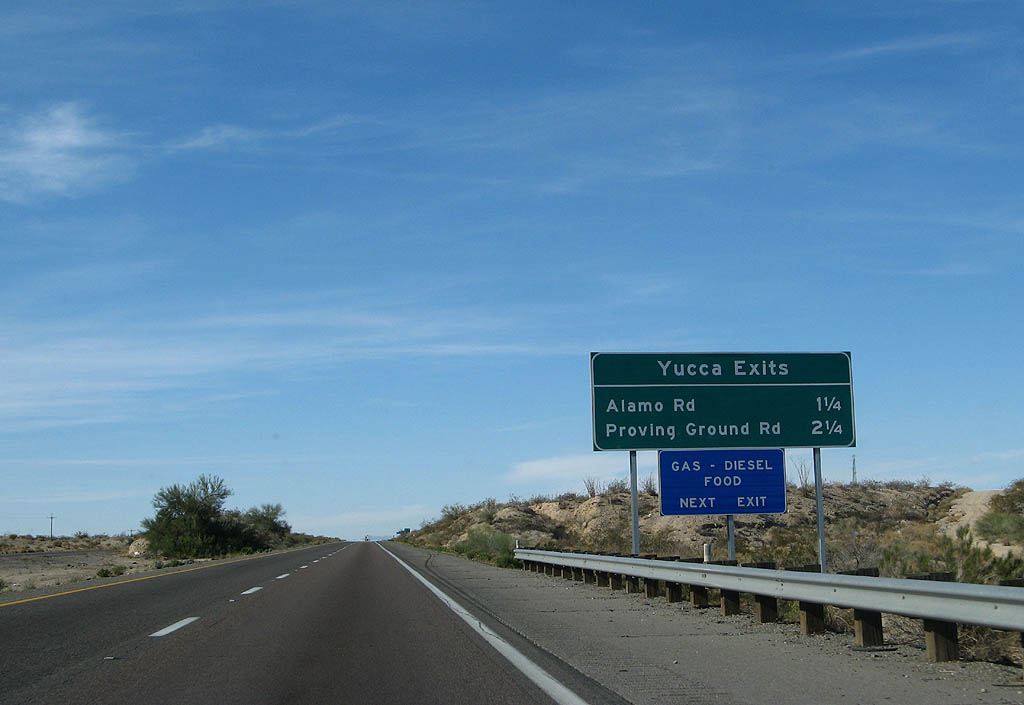
The next two exits from Interstate 40 serve the unincorporated community of Yucca.
03/30/07
03/30/07
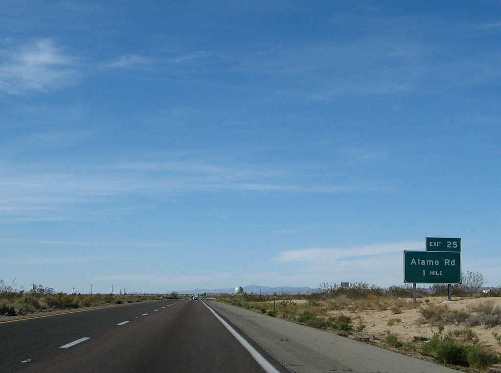
Alamo Road ties into Interstate 40 at a diamond interchange (Exit 25) south of the Yucca street grid.
03/30/07
03/30/07
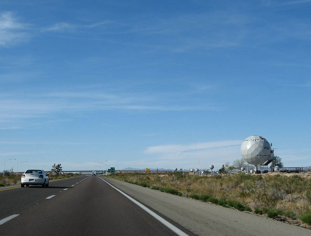
The Golf Ball house was built in 1976 as a cocktail bar for a land developer. The house is now part of a UFO museum/convenience store.
03/30/07
03/30/07
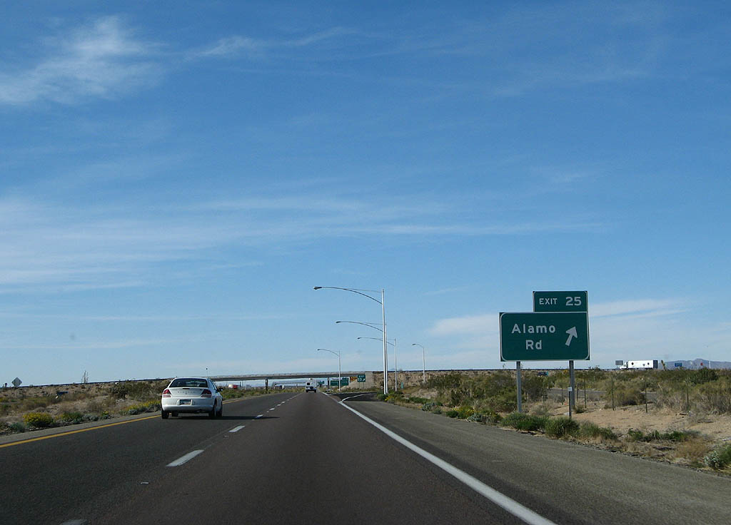
Exit 25 leaves Interstate 40 east for Alamo Road and adjacent frontage roads north to Yucca.
03/30/07
03/30/07
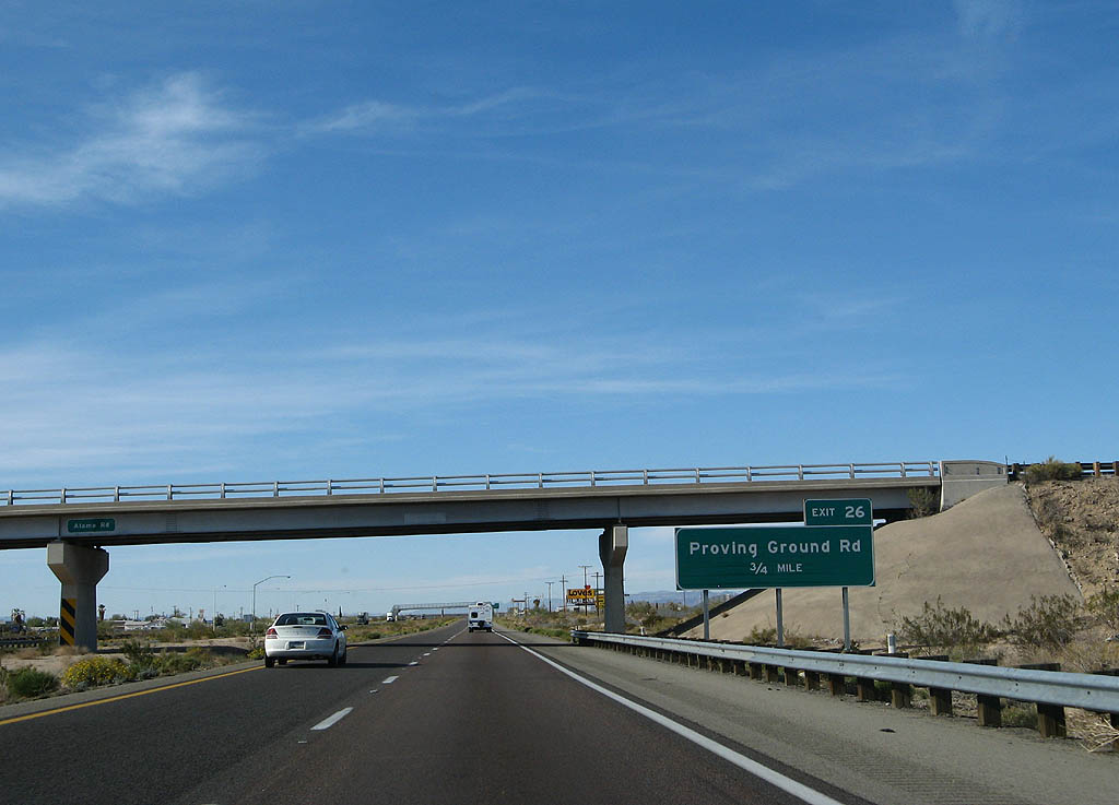
Interstate 40 advances 0.75 miles north from Alamo Road to a diamond interchange (Exit 26) with Proving Ground Road.
03/30/07
03/30/07
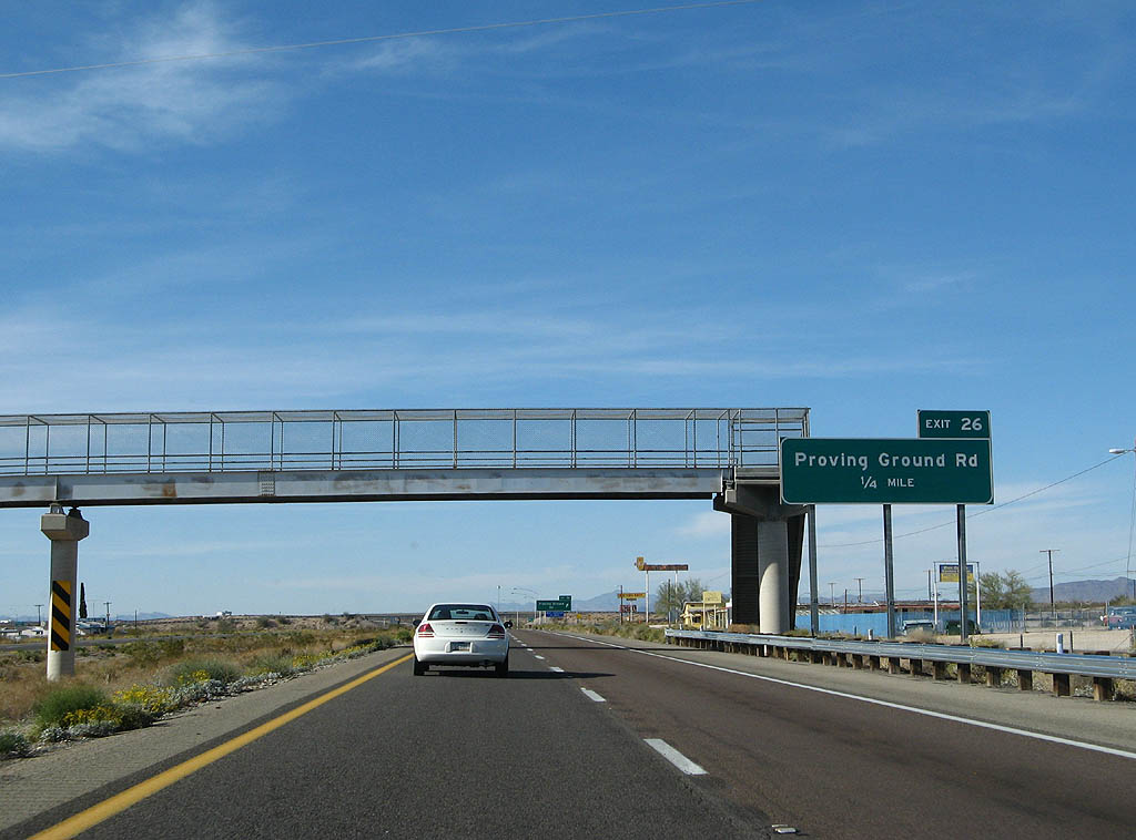
Proving Ground road is named after the Chrysler Arizona Proving ground, where vehicle tests are performed. The test track facility was previously owned and operated by Ford.
03/30/07
03/30/07
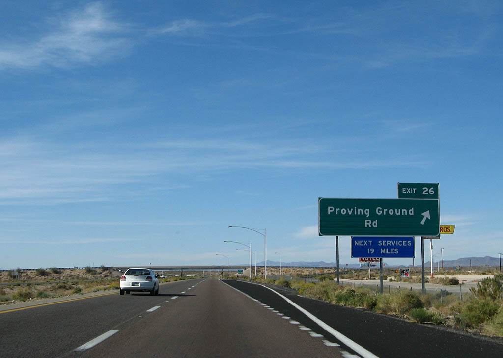
Exit 26 departs I-40 east for Proving Ground Road east to the adjacent facility and west to 1st Street into Yucca.
03/30/07
03/30/07
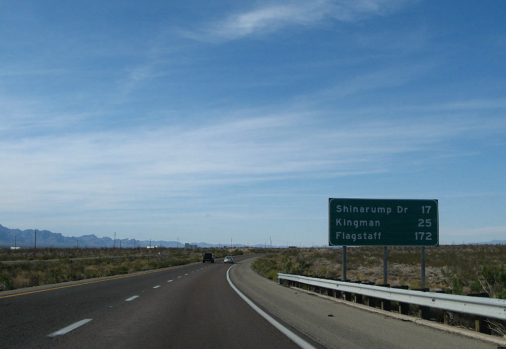
The city of Kingman lies 25 miles northeast from Yucca along Interstate 40.
03/30/07
03/30/07
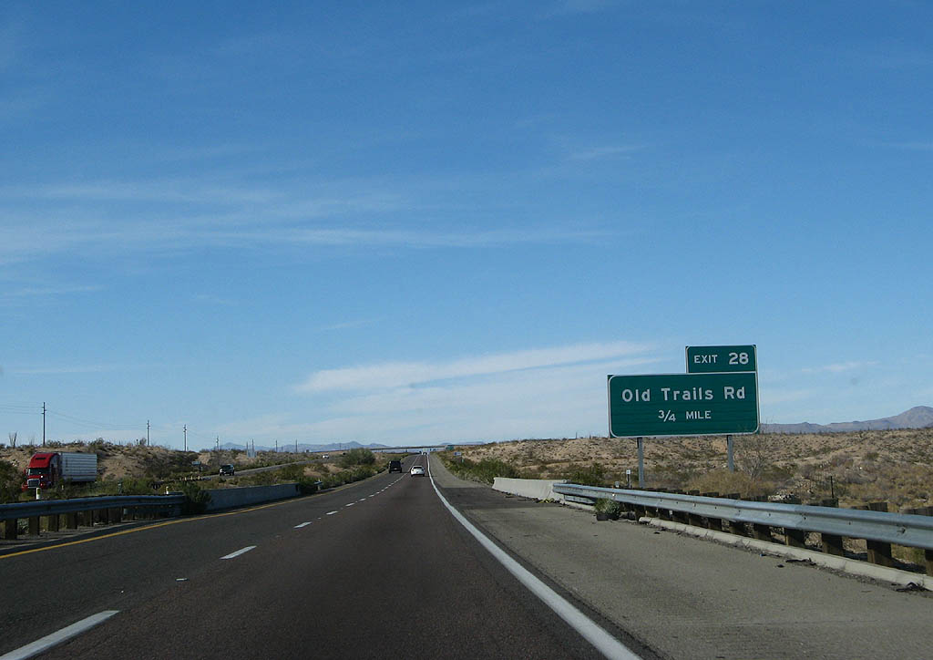
Interstate 40 crosses Rock Creek 0.75 miles ahead of Exit 28 for Old Trails Road.
03/30/07
03/30/07
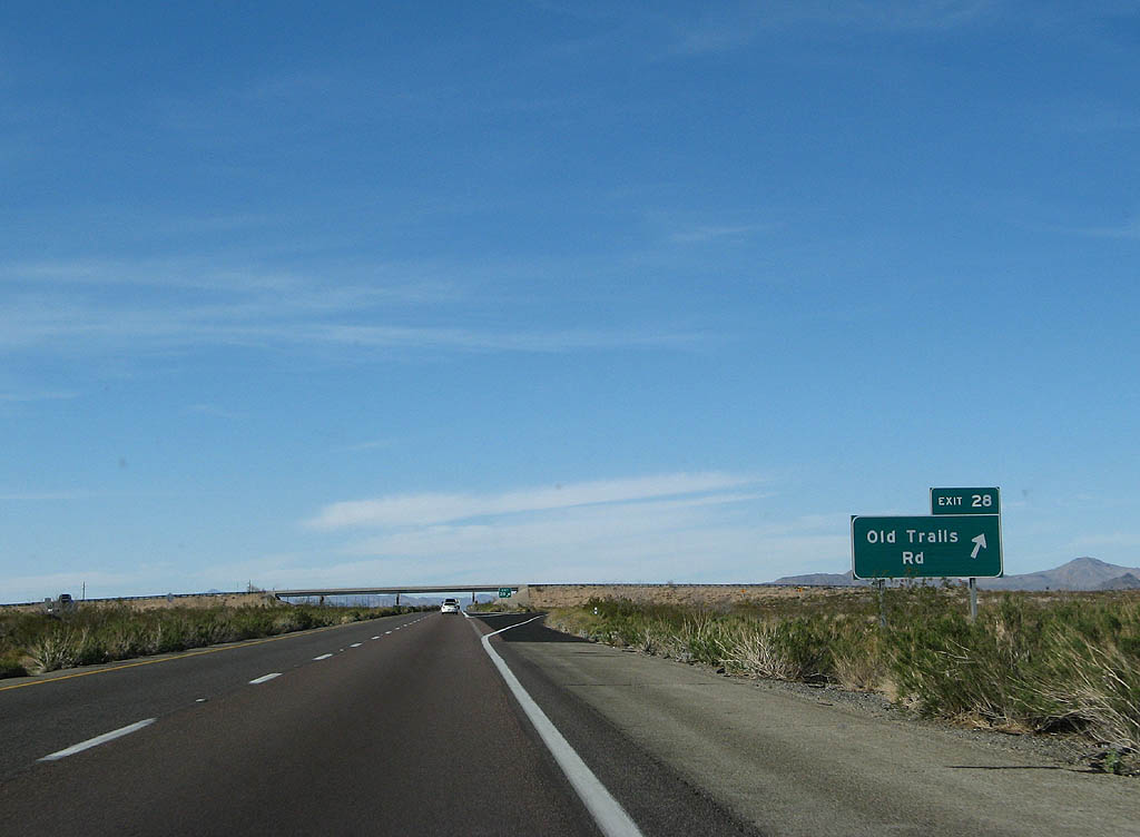
The diamond interchange with Old Trails Road is a ranch exit.
03/30/07
03/30/07
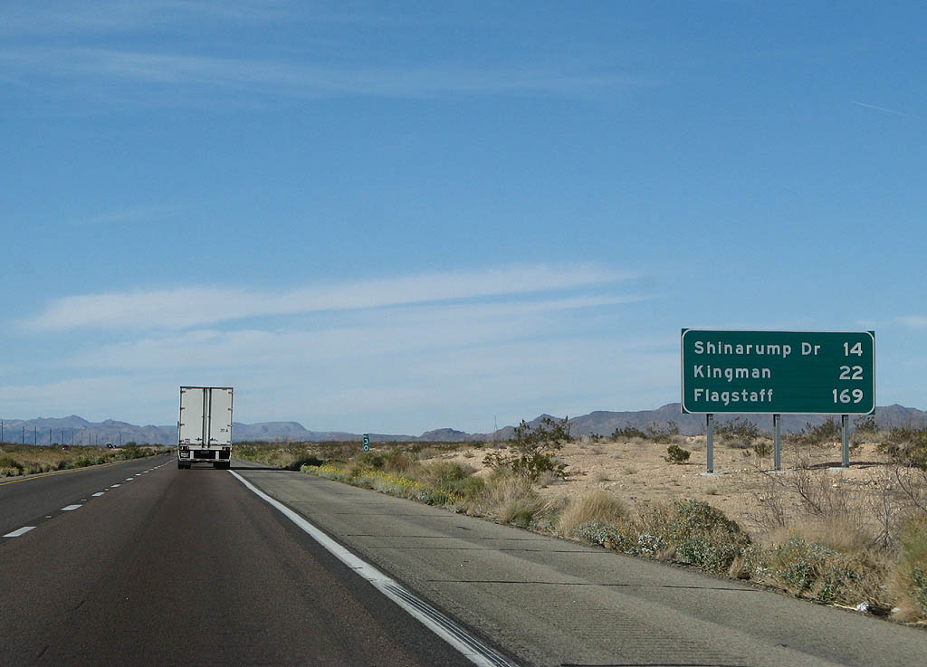
Historic U.S. 66 returns to I-40 at Shinarump Drive, 14 miles to the north. Flagstaff is 169 miles away.
03/30/07
03/30/07
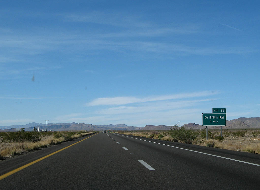
One mile south of the ranch exit for Griffith Road.
03/30/07
03/30/07
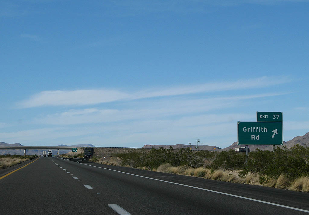
Griffith Road leads toward the BNSF Railroad siding of Griffith and the Griffith Energy Facility.
03/30/07
03/30/07

The Cerbat Mountains appear on the far northern horizon beyond this confirming marker.
03/30/07
03/30/07

Distance sign to Shinarump Drive (6 miles), Kingman (14 miles) and Flagstaff (161 miles).
03/30/07
03/30/07

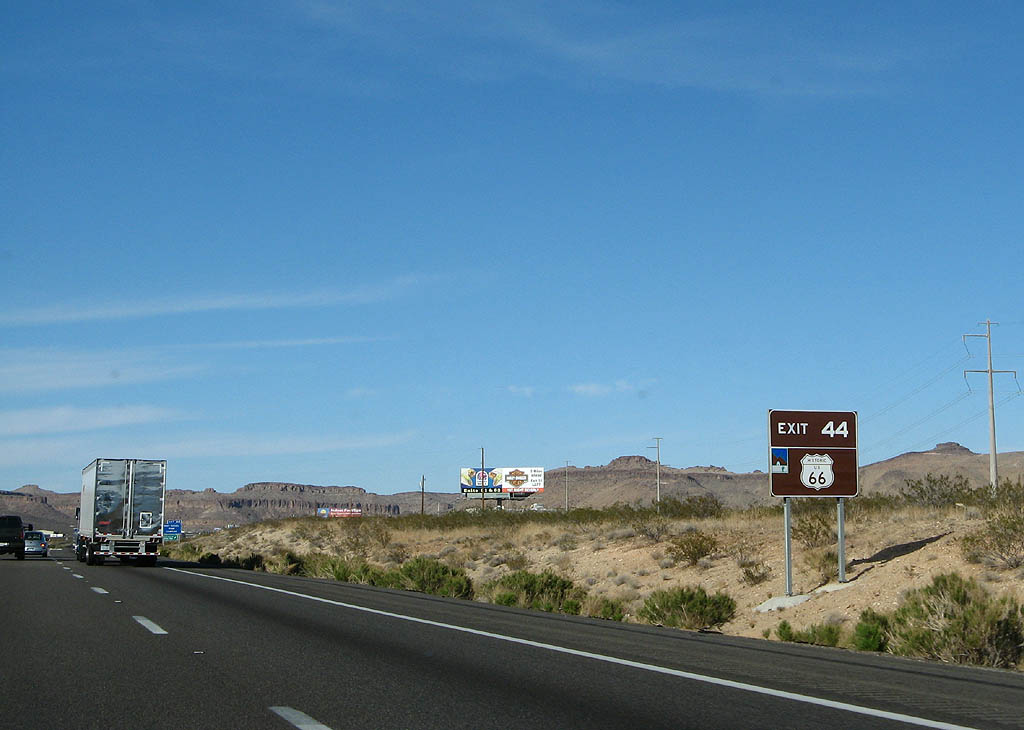
The diamond interchange at Exit 44 links Interstate 40 east with Shinarump Drive west to Oatman Highway and CR 233 and east to the continuation of Historic U.S. 66 along the east frontage road.
03/30/07
03/30/07
The pre-1952 alignment of Historic U.S. 66 angles southwest along Oatman Highway toward the Black Mountains. Historic U.S. 66 continues northeast to the BNSF Railroad siding of McConnico.
03/30/07
03/30/07
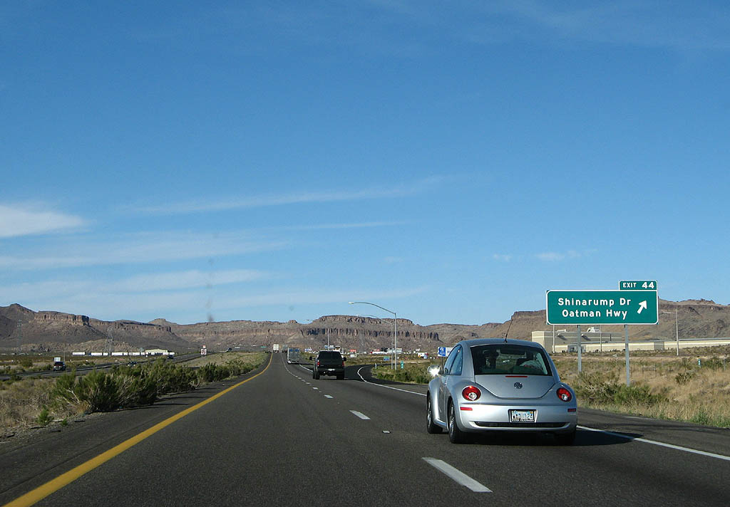
Exit 44 departs for Shinarump Drive and Historic U.S. 66 (Oatman Highway).
03/30/07
03/30/07
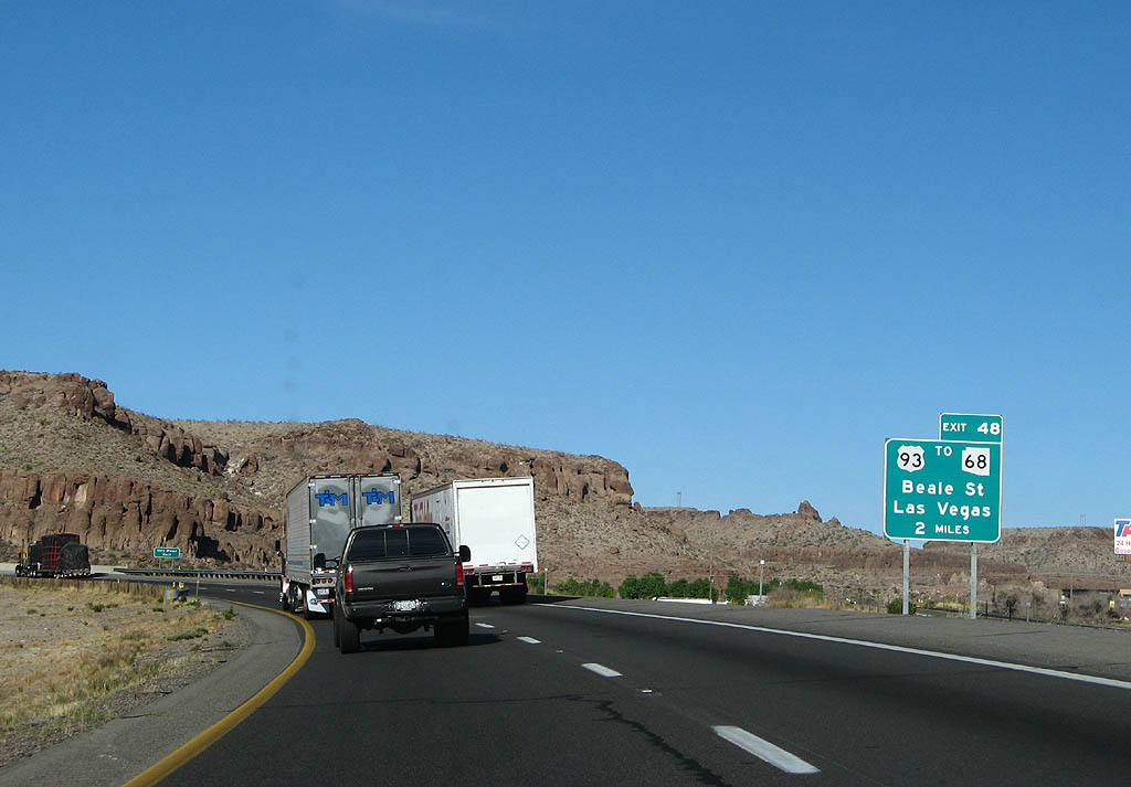
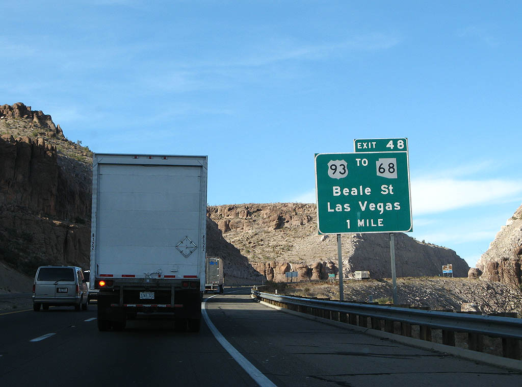
Interstate 40 converges with U.S. 93 at Beale Street in two miles.
03/30/07
03/30/07
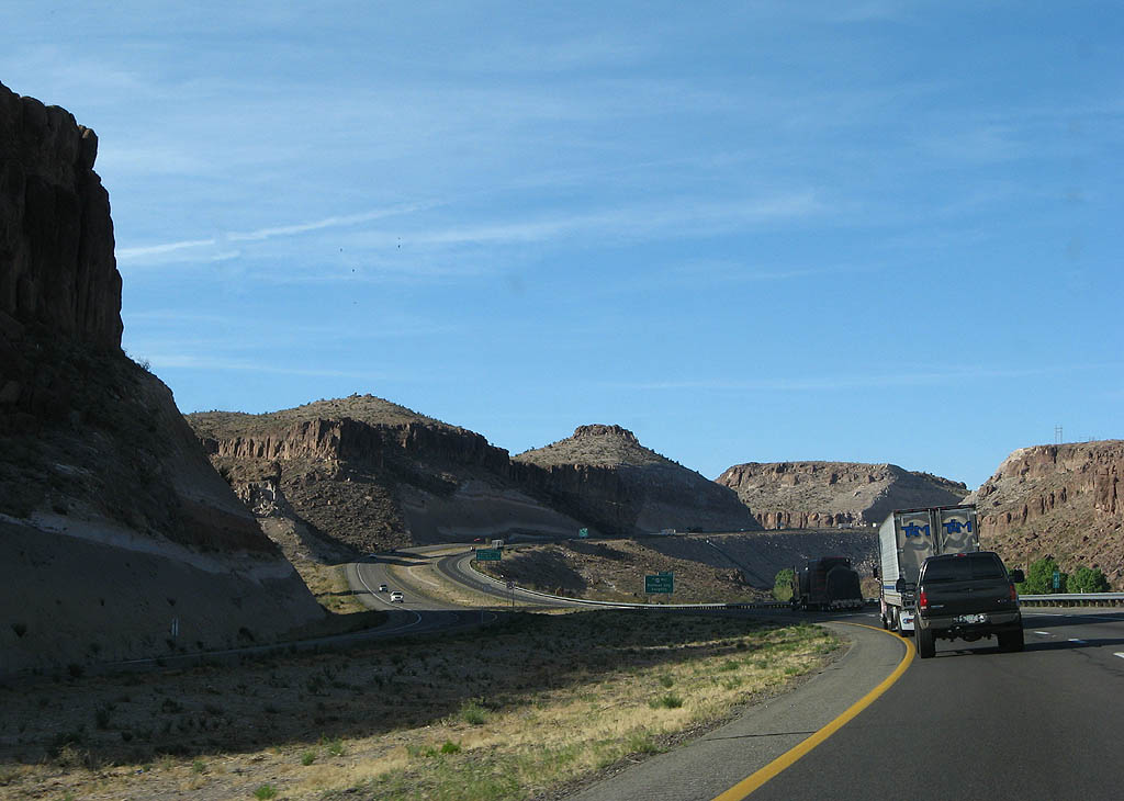
Interstate 40 Climbing between Box Canyon and Cook Canyon, Interstate 40 east enters the city of Kingman.
03/30/07
03/30/07
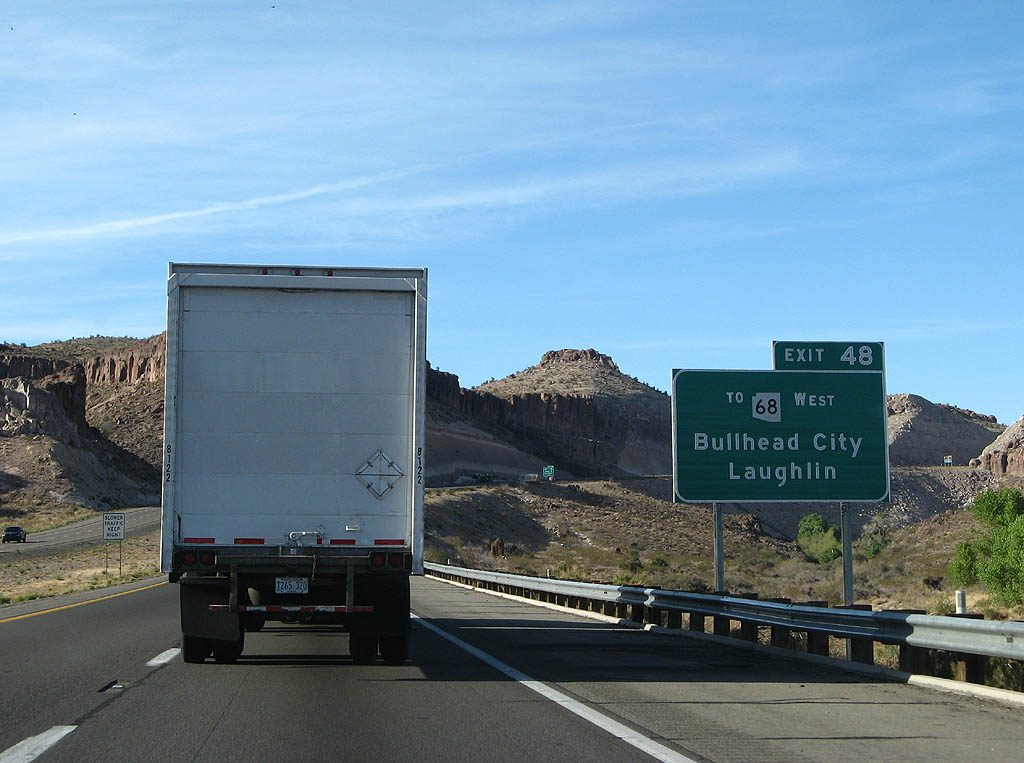
SR 68 branches west from a trumpet interchange with U.S. 93 in four miles to Bullhead City and Laughlin, Nevada.
03/30/07
03/30/07
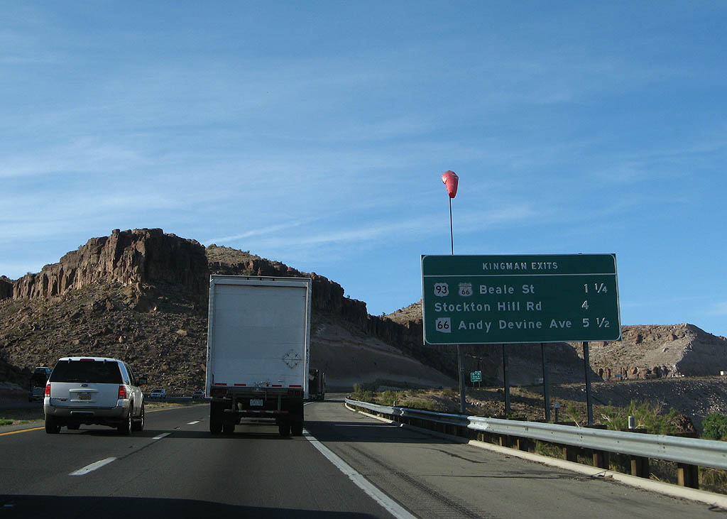
Three exits serve the city of Kingman from Interstate 40 east.
03/30/07
03/30/07
Beale Street east from Exit 48 is former U.S. 66/93 and was part of Business Loop I-40 until 2003.
03/30/07
03/30/07
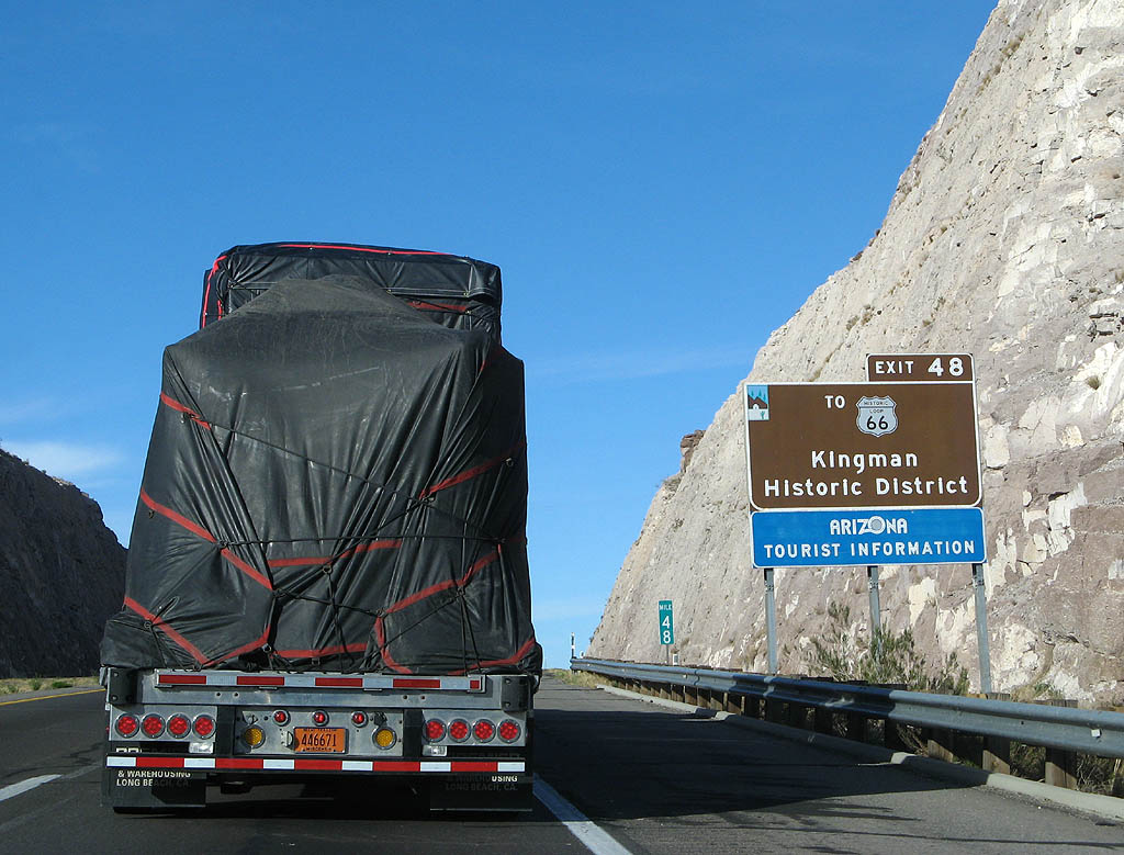
Historic U.S. 66 follows Andy Devine Avenue east through the Kingman business district and north past Powderhouse Canyon to become SR 66 at Michael Street.
03/30/07
03/30/07

U.S. 93 travels northwest from Beale Street in Kingman along a four lane highway to become part of Interstate 11 at the Mike O'Callaghan–Pat Tillman Memorial Bridge spanning the Colorado River by Hoover Dam.
03/30/07
03/30/07
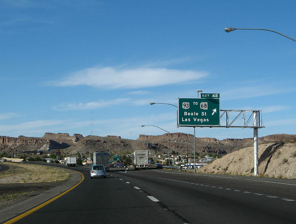
U.S. 93 south ties into Interstate 40 at a diamond interchange (Exit 48). Long range plans for Interstate 11 include adding a new exchange north beyond Exit 48.
03/30/07
03/30/07
Photo Credits:
- Kevin Trinkle: 03/03/07, 03/30/07
- Andy Field: 11/11/00
Connect with:
Page Updated Wednesday March 30, 2022.