
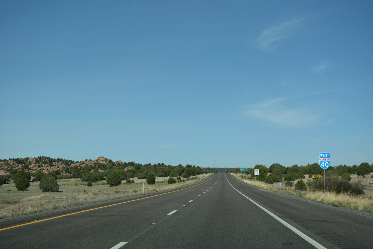
Interstate 40 West - Yavapai County to Kingman
 West
West
04/27/17
04/27/17
04/27/17
04/27/17
04/27/17
04/27/17
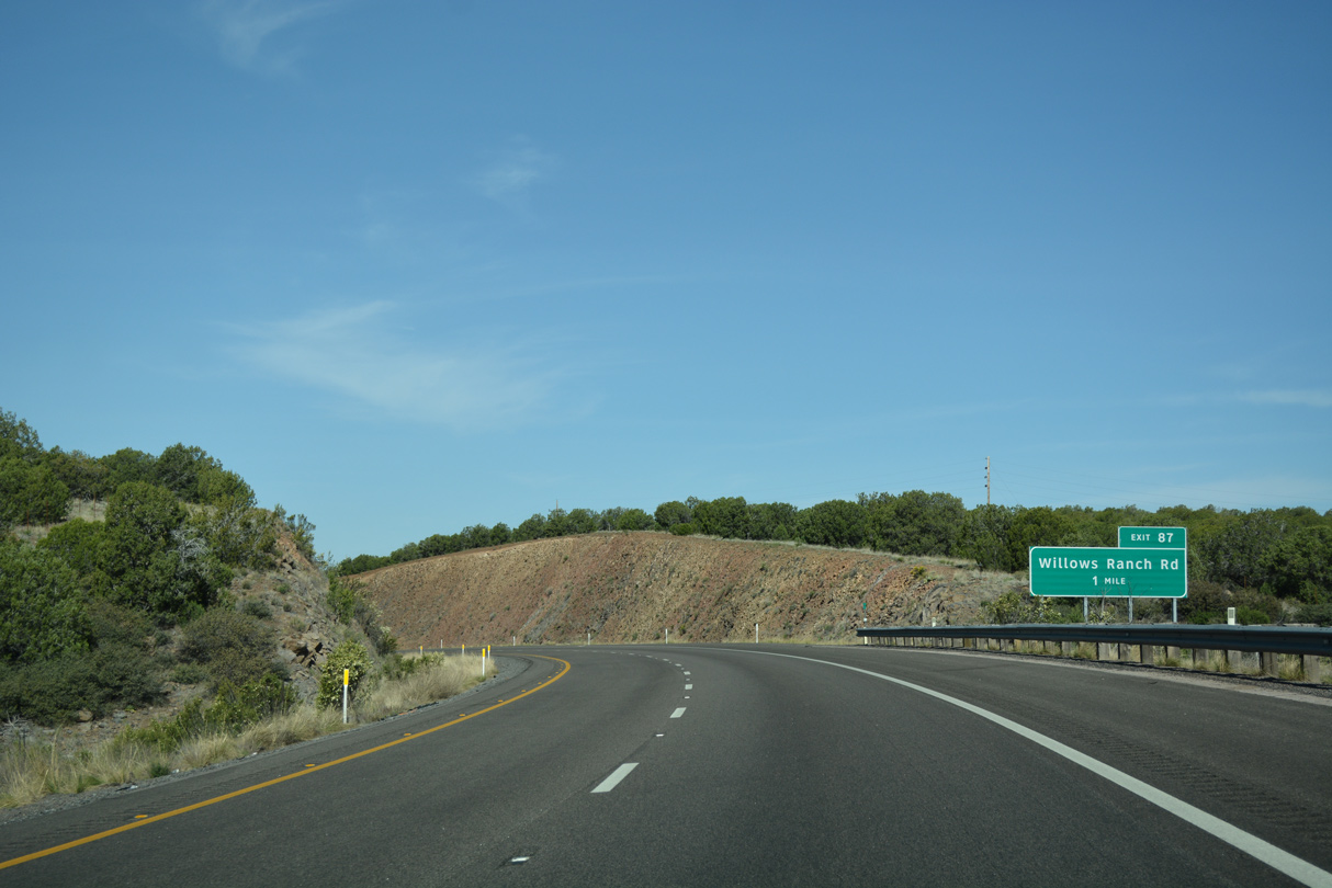
The roadways of Interstate 40 separate by over a half mile preceding the diamond interchange (Exit 87) with Willows Ranch Road.
04/27/17
04/27/17
04/27/17
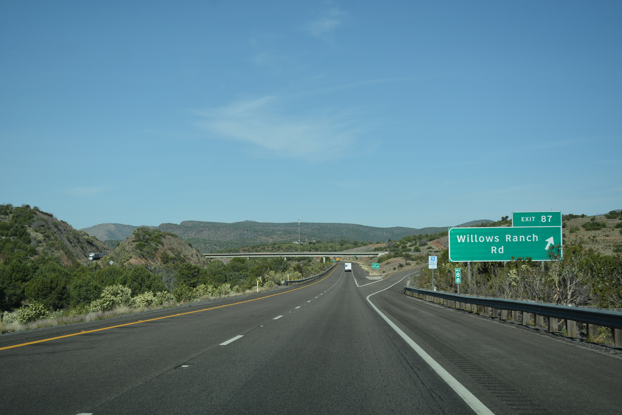
The exchange at Exit 87 connects Interstate 40 with unpaved ranch roads.
04/27/17
04/27/17
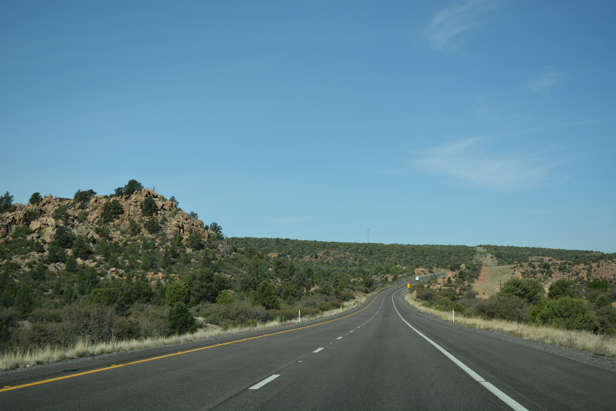
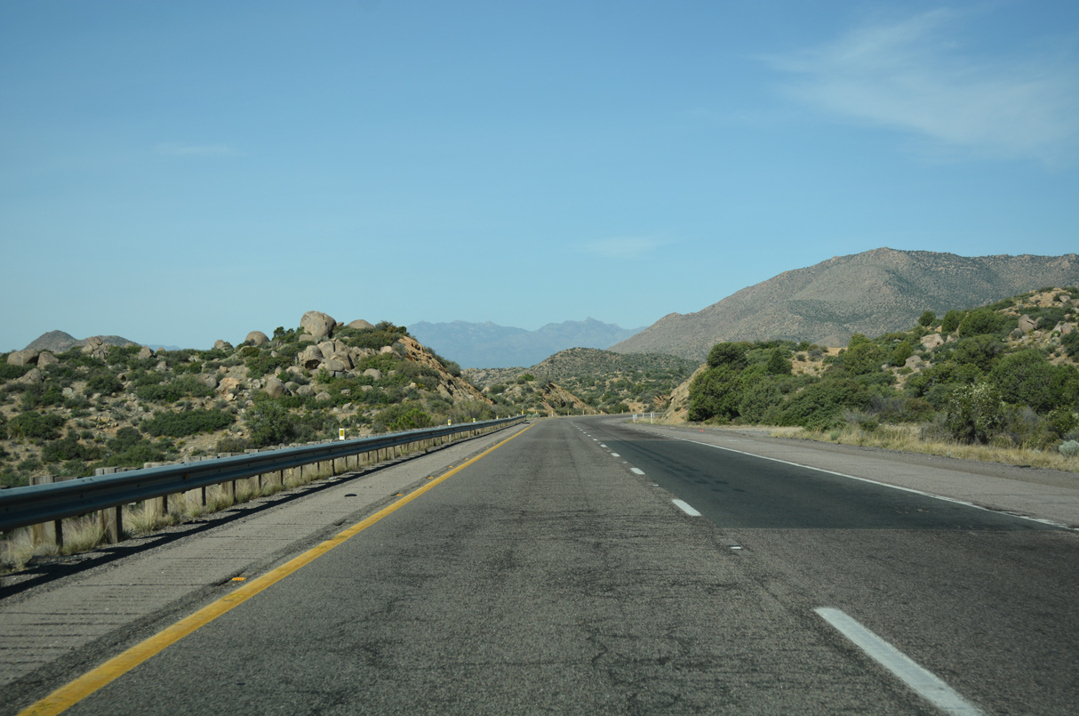
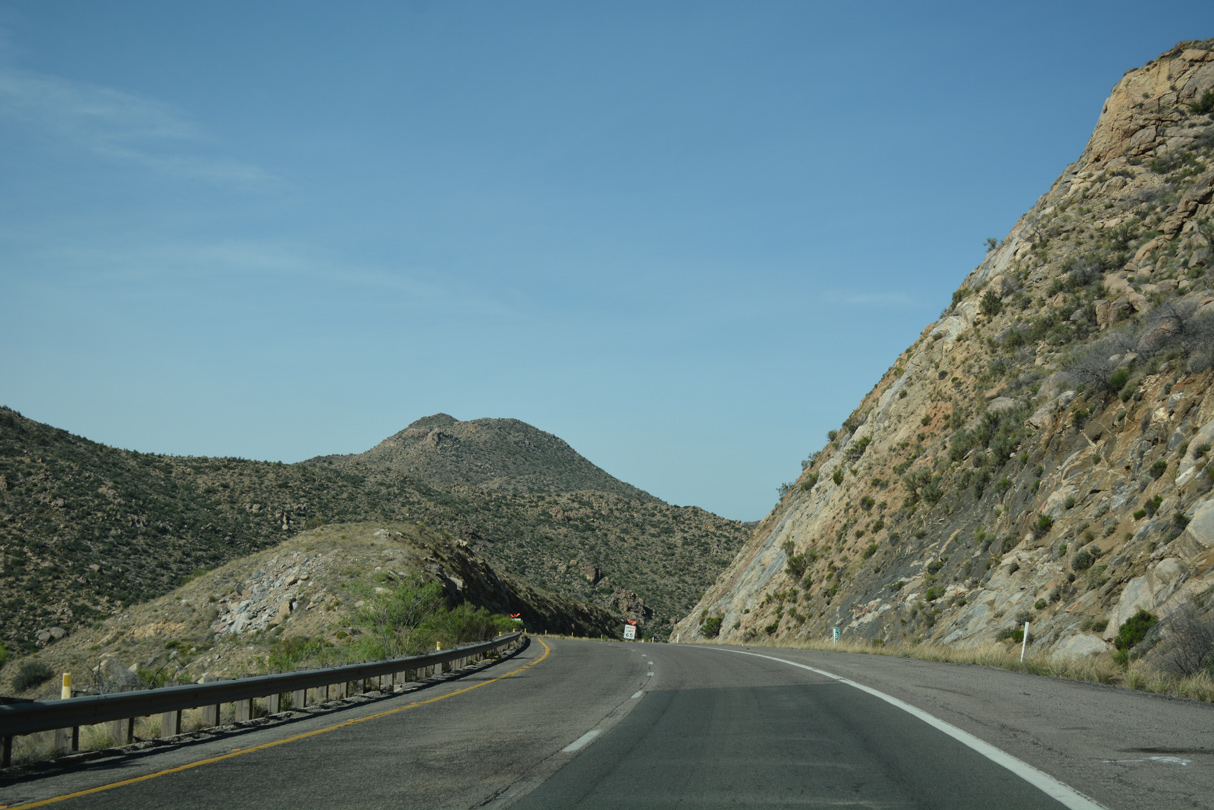
West from Exit 87, Interstate 40 travels north of the Aquarius Mountains along southern reaches of the Cottonwood Mountains.
04/27/17
04/27/17
04/27/17
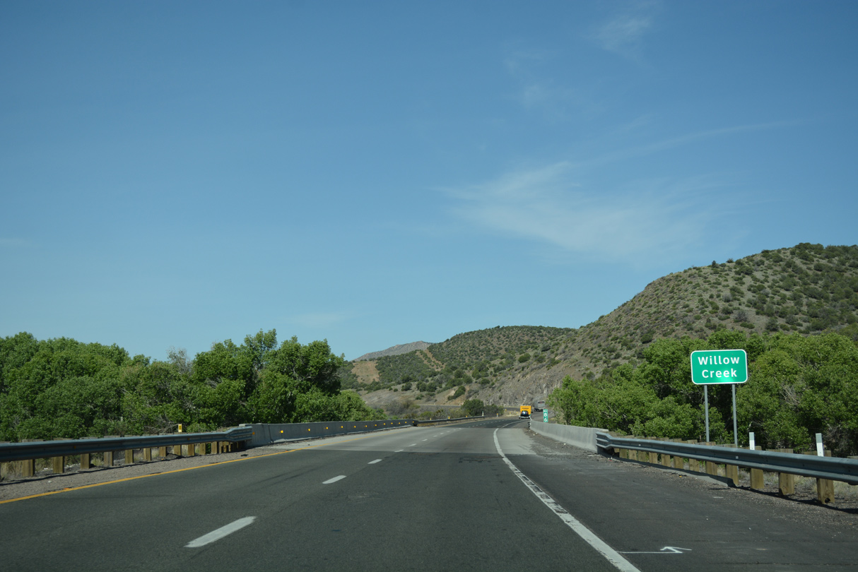
Crossing Willow Creek at mile marker 86, I-40 parallels the waterway west to Tin Mountain near mile marker 82.
04/27/17
04/27/17
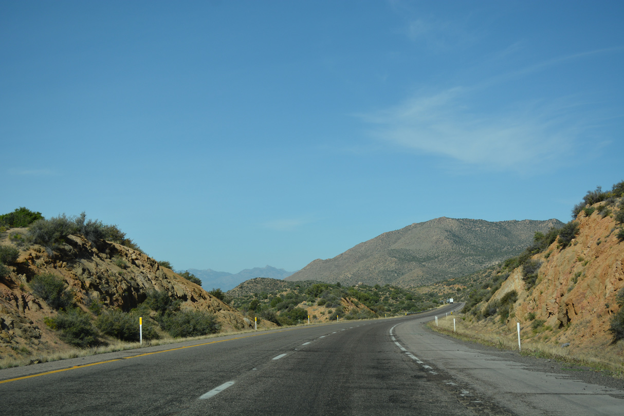
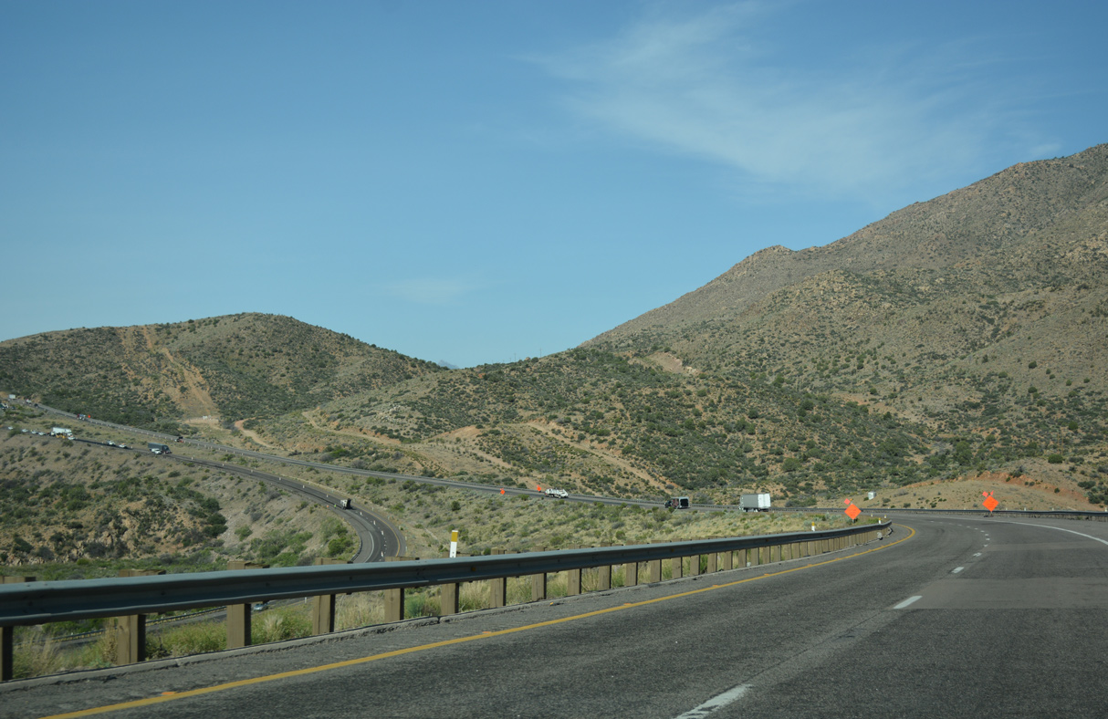
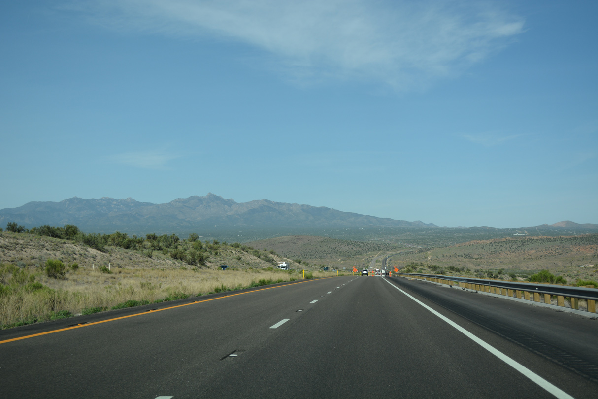
Navigating through several S-curves, a wide median separates the roadways of Interstate 40 across the Cottonwood Mountains.
04/27/17
04/27/17
04/27/17
04/27/17
04/27/17
04/27/17
04/27/17

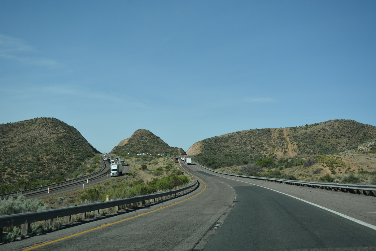
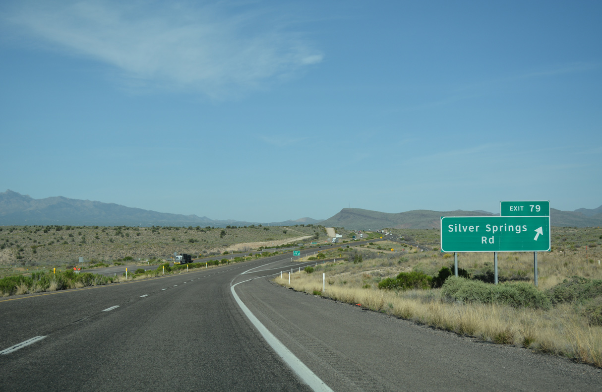
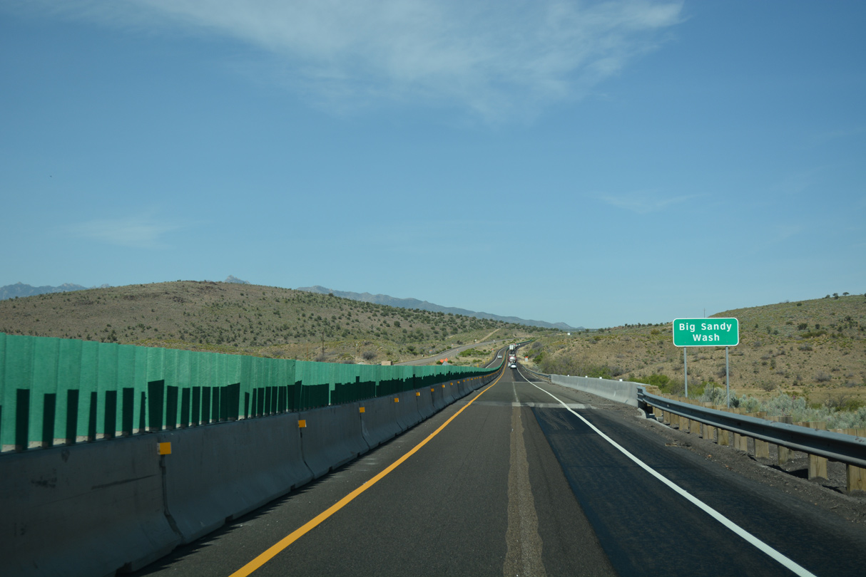
Forthcoming Silver Springs Road is a ranch exit southwest of Tin Mountain.
04/27/17
04/27/17
04/27/17
04/27/17
04/27/17
04/27/17
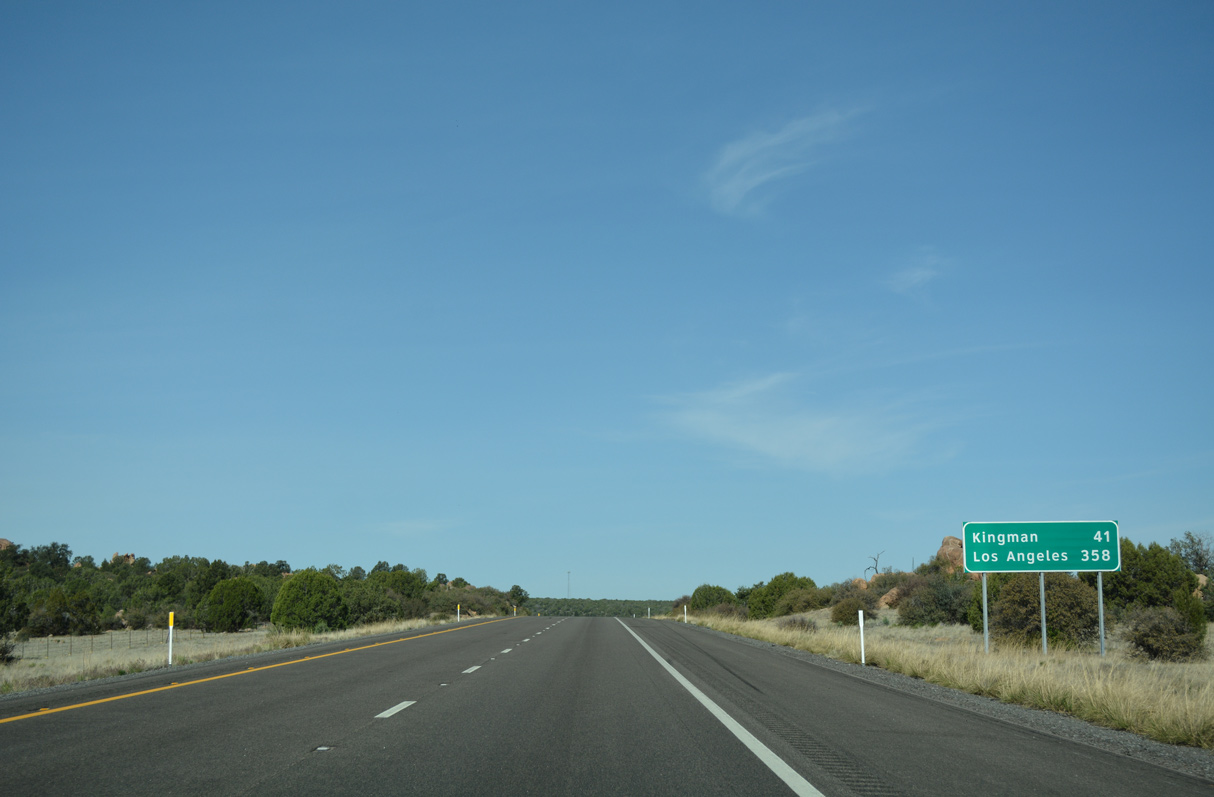
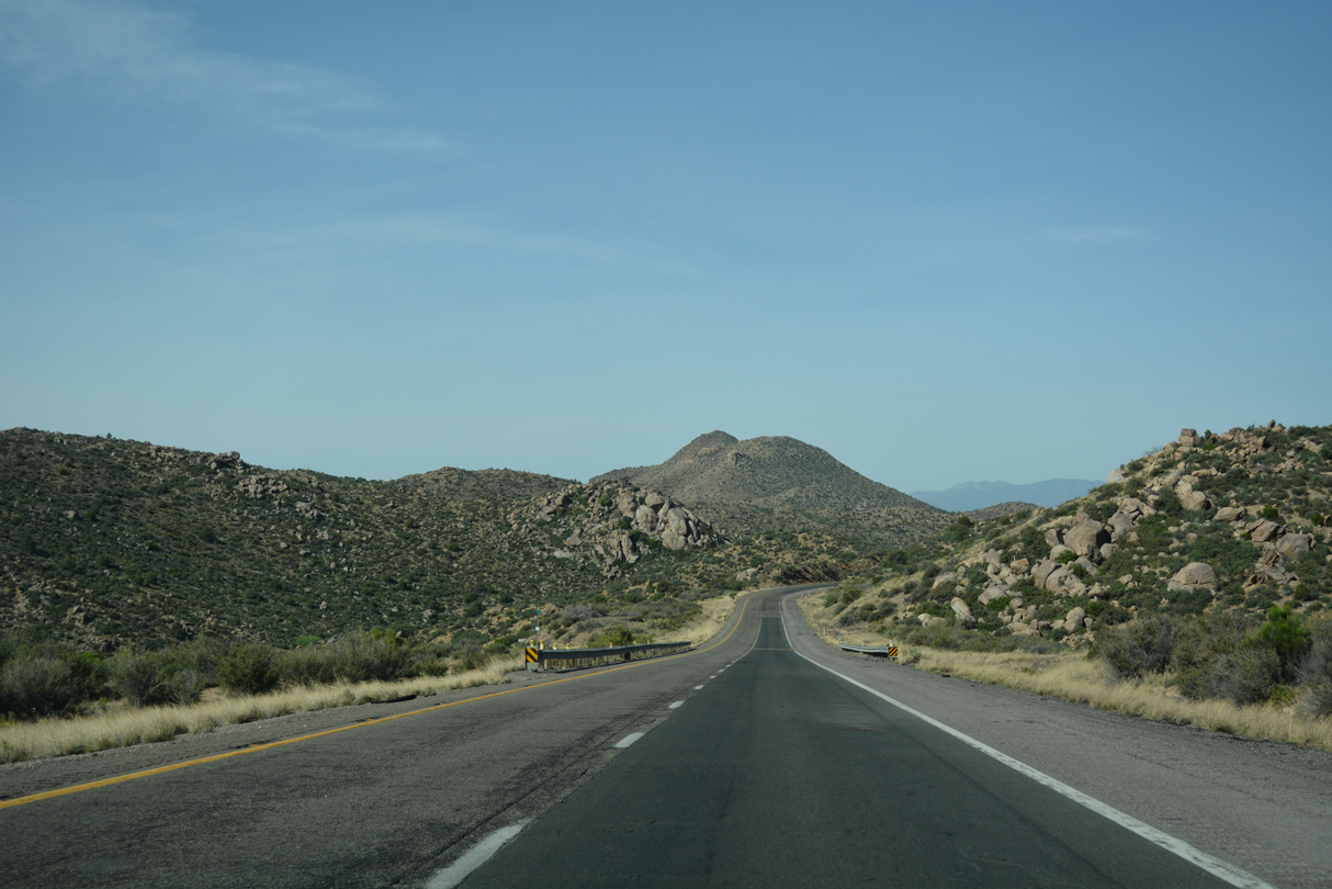
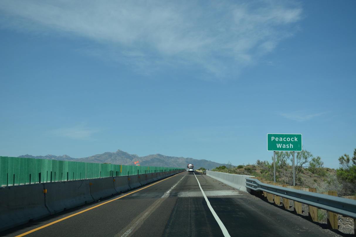
The Hualapai Mountains spread along the western horizon.
04/27/17
04/27/17
04/27/17
04/27/17
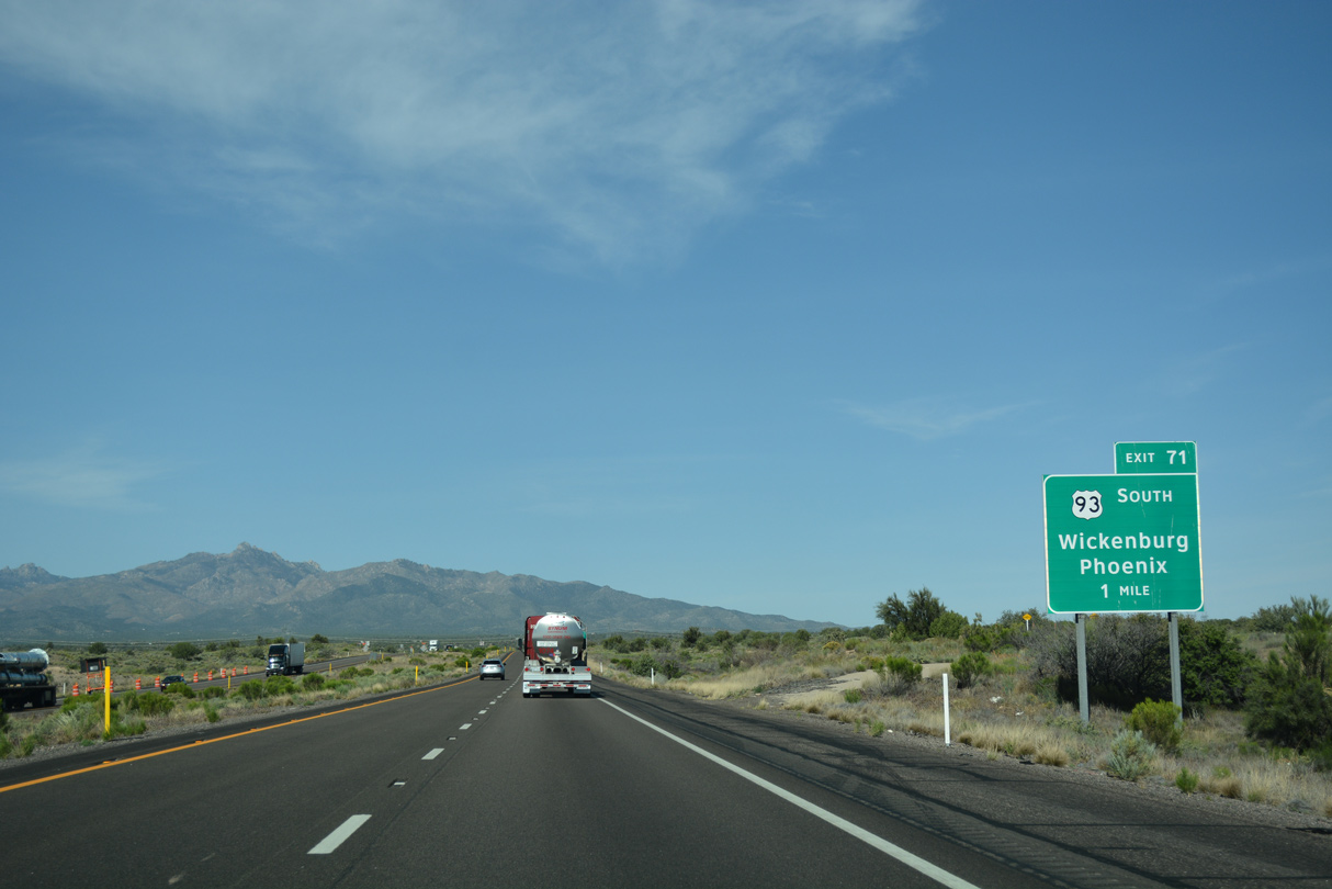
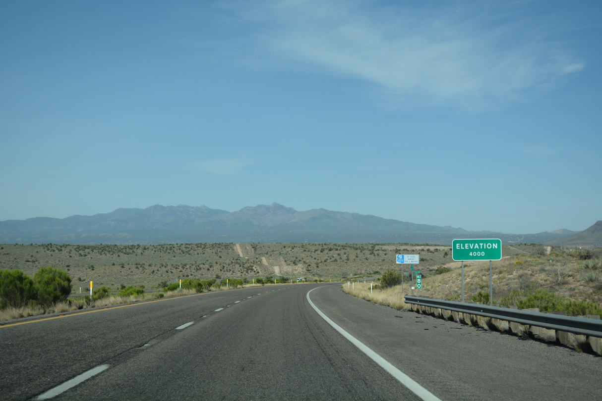
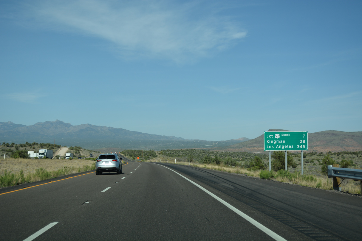
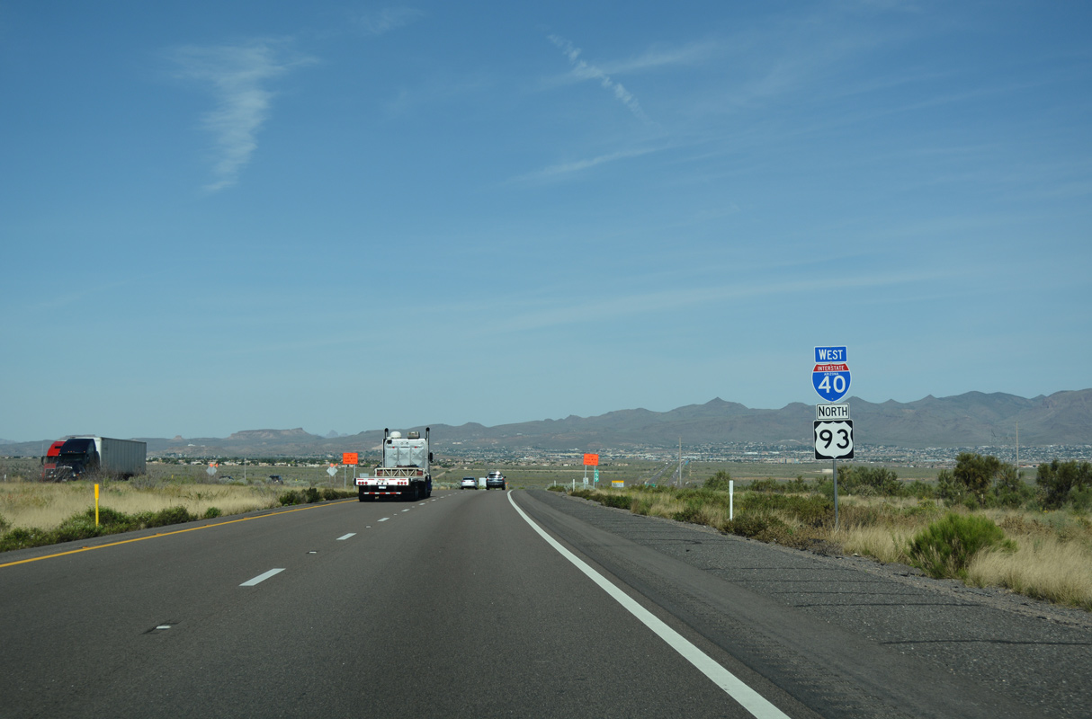
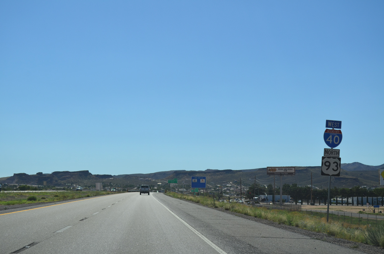
Traveling 201.96 miles from U.S. 60 at Wickenburg to I-11 across the Colorado River into Nevada, U.S. 93 north converges with Interstate 40 at Exit 71.
04/27/17
04/27/17
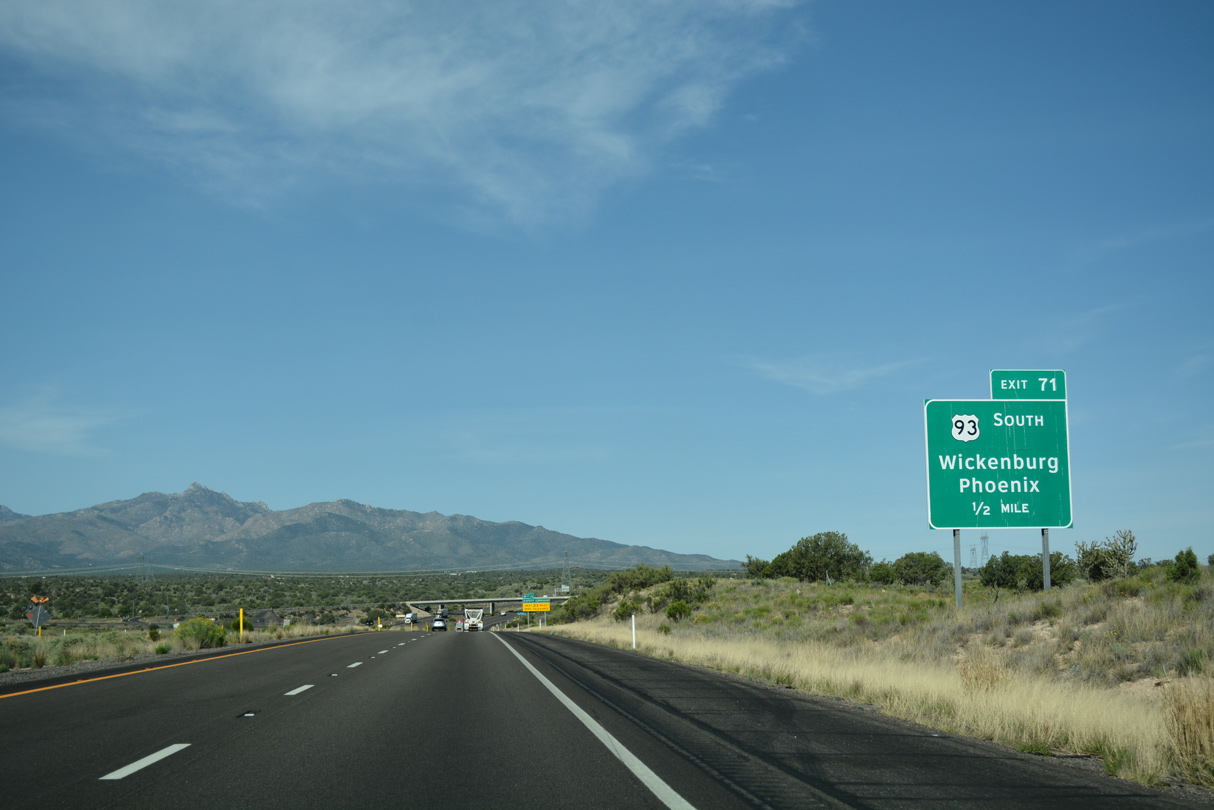
Connecting Kingman with Phoenix via U.S. 60, U.S. 93 runs 107.20 miles southeast from Exit 71 to Wickenburg.
04/27/17
04/27/17
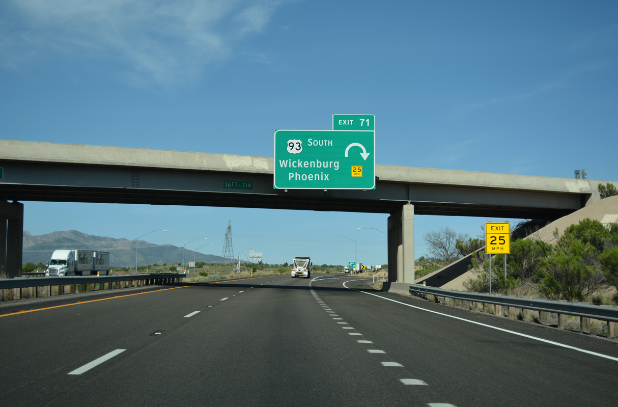
South from the trumpet interchange at Exit 71, U.S. 93 travels between the Hualapai and Aquarius Mountains along a remote stretch to the unincorporated community of Wikieup.
04/27/17
04/27/17
West  North
North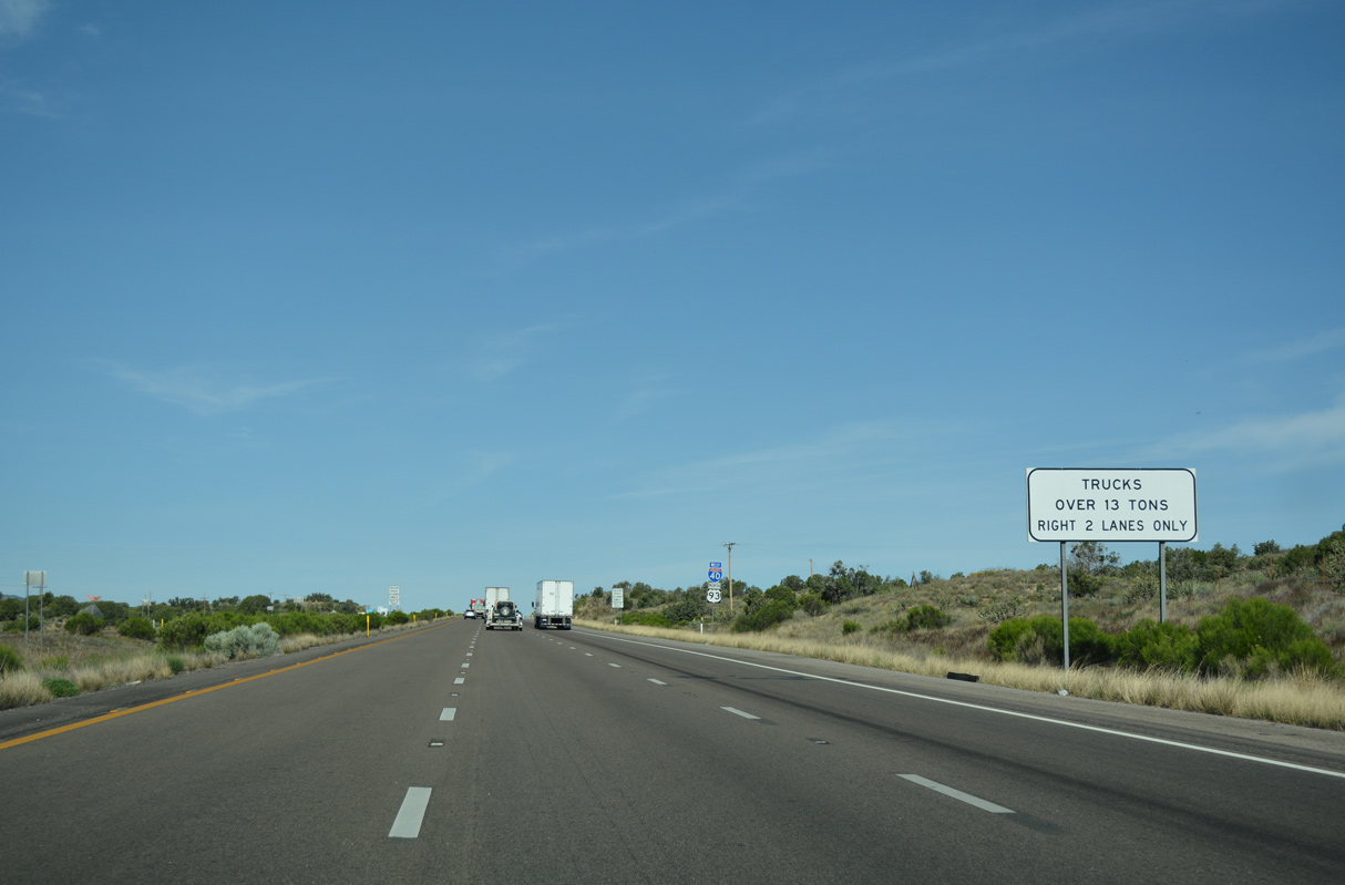
An auxiliary lane opens west from Exit 71 to Exit 66.
04/27/17
04/27/17
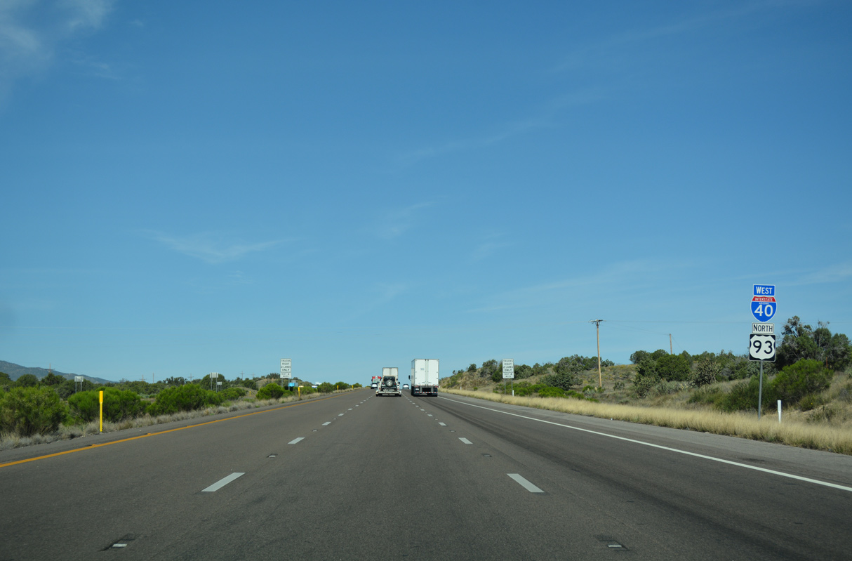
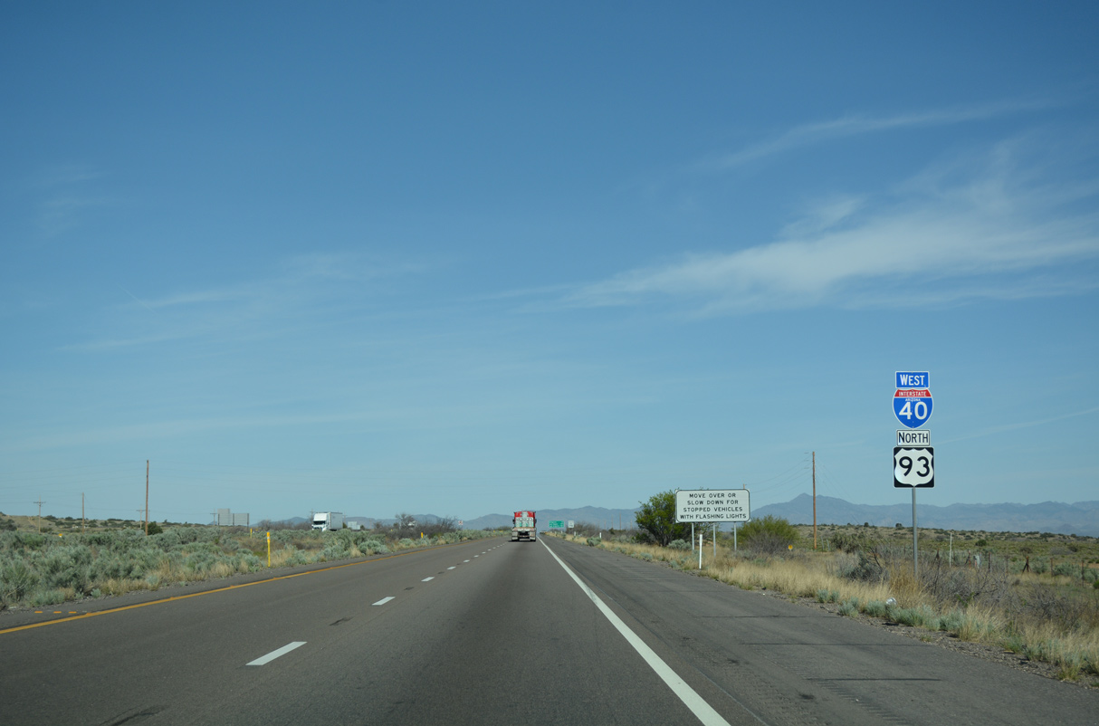
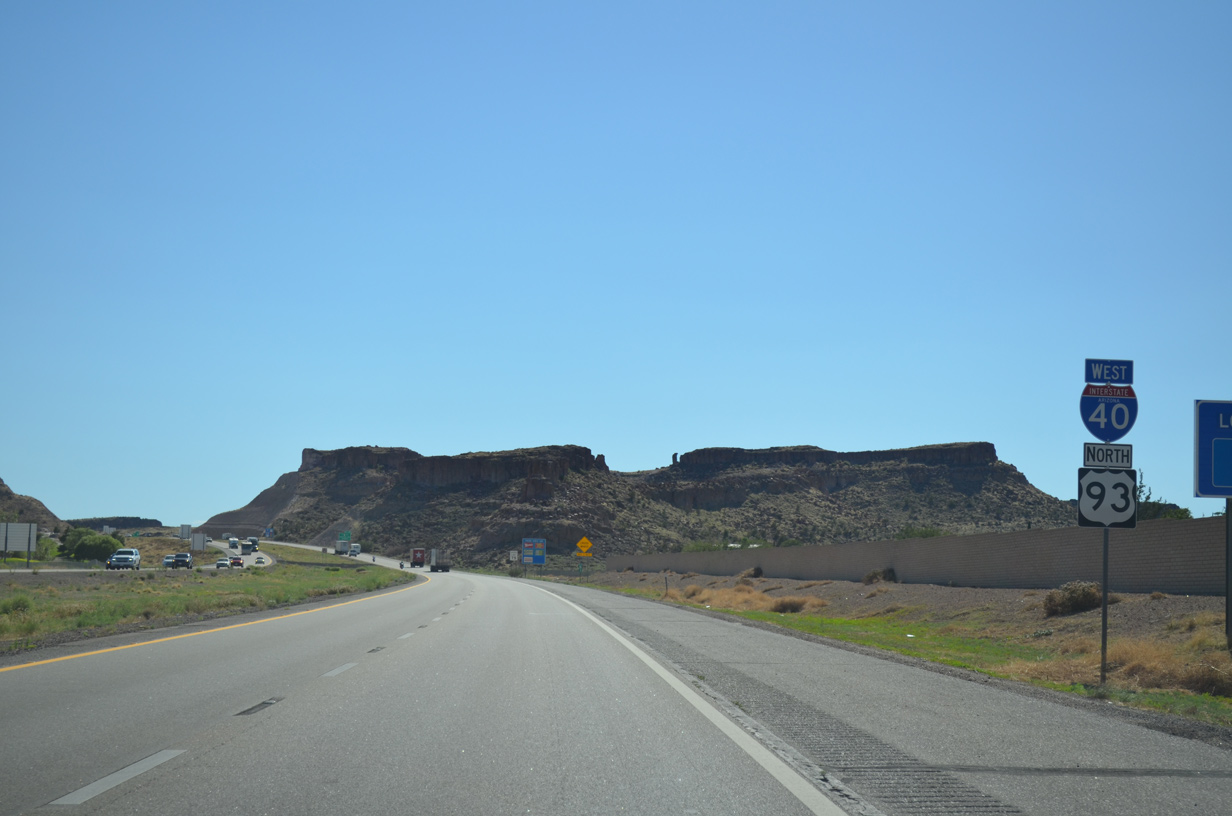
U.S. 93 north combines with Interstate 40 west for 22.53 miles into Kingman.
04/27/17
04/27/17
Las Vegas, Nevada lies 115 miles to the northwest via U.S. 93, I-11 and I-515/U.S. 95.
04/27/17
04/27/17
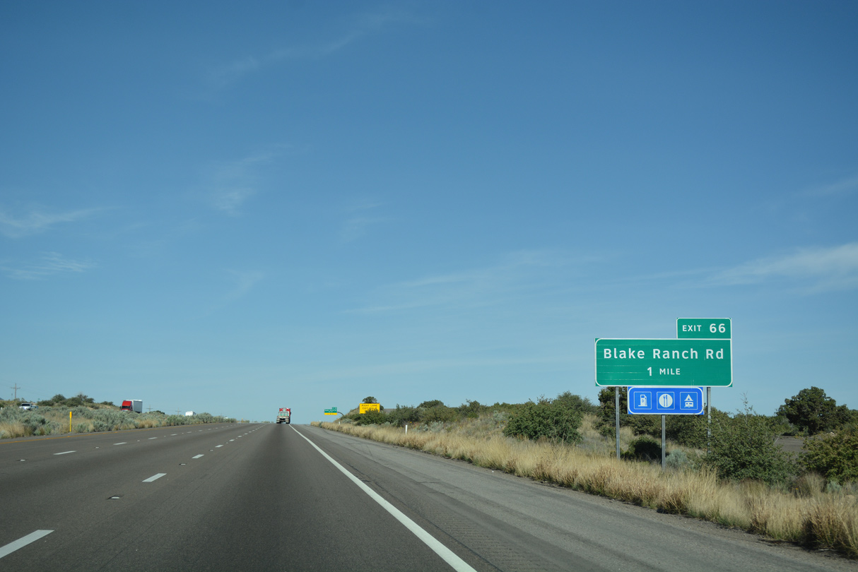
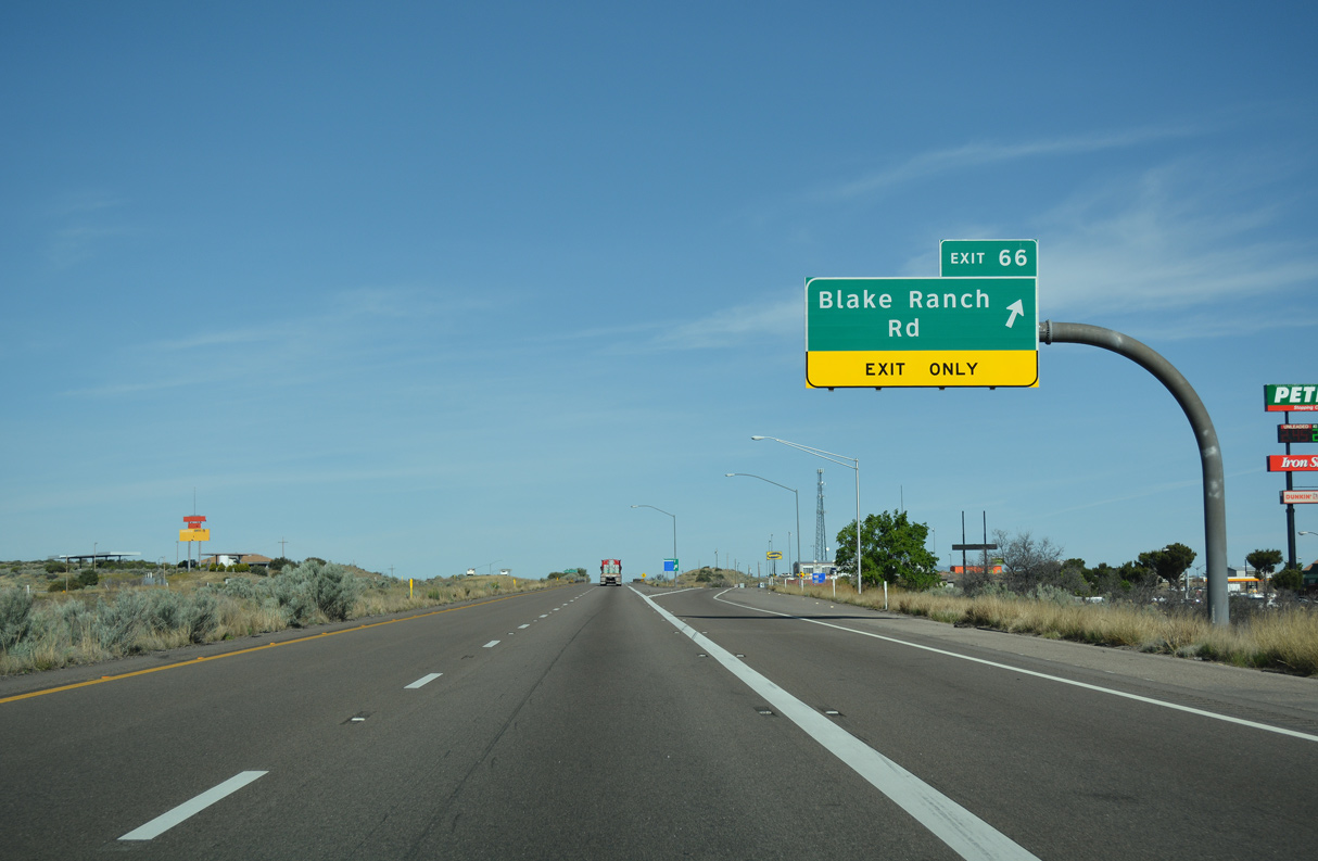
The first traveler services along Interstate 40 since Seligman are available along Blake Ranch Road at Exit 66.
04/27/17
04/27/17

A lane drop occurs westbound at the diamond interchange (Exit 66) with Blake Ranch Road.
04/27/17
04/27/17
04/27/17
04/27/17
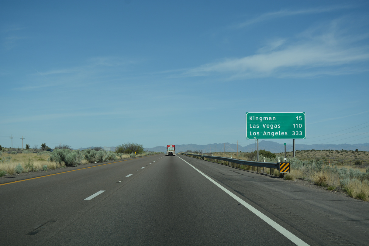
I-40/U.S. 93 advance 15 miles west to the city of Kingman.
04/27/17
04/27/17
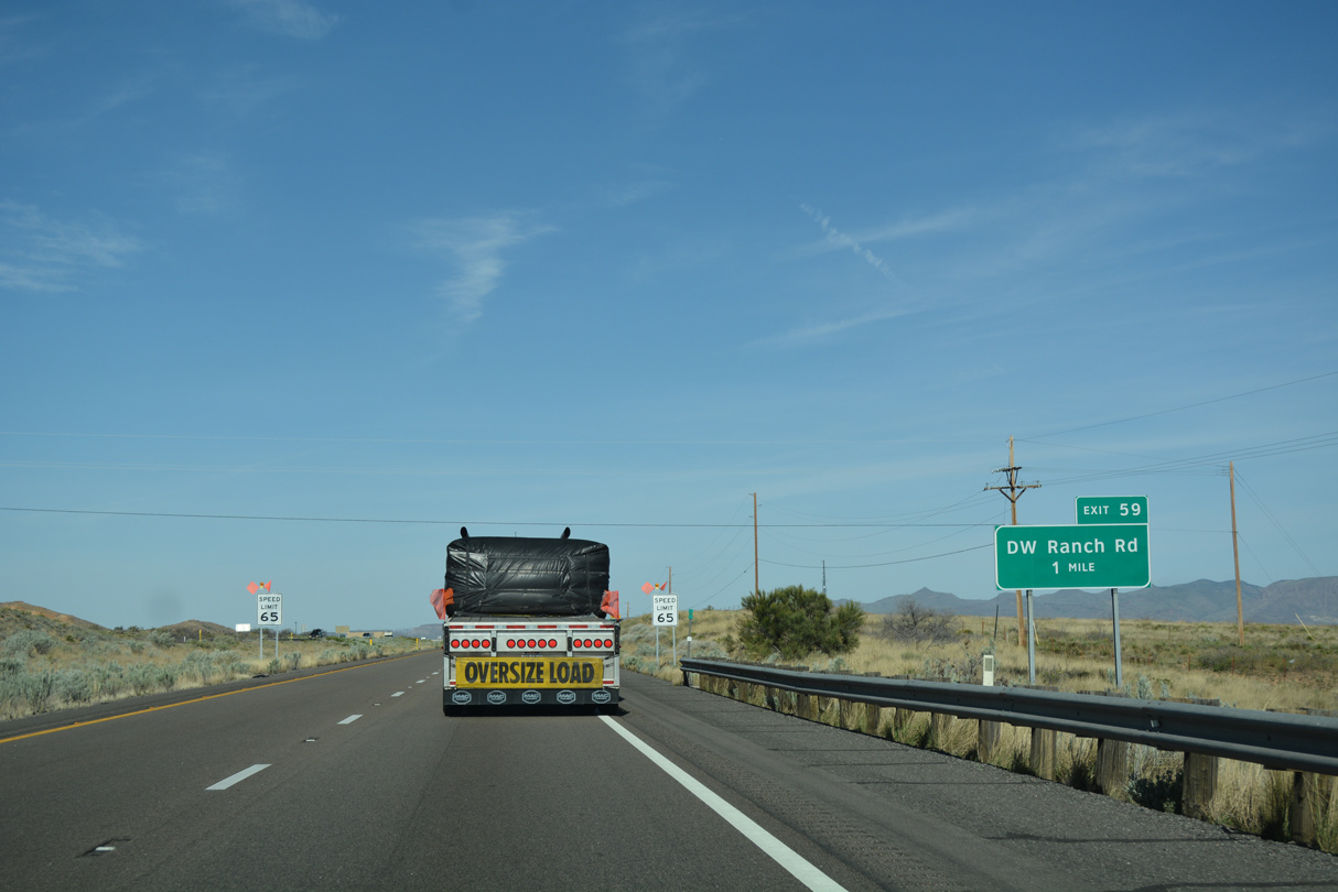
Traversing southern reaches of the Hualapai Valley, I-40/U.S. 93 next meet DW Ranch Road (CR 258) at Exit 59.
04/27/17
04/27/17
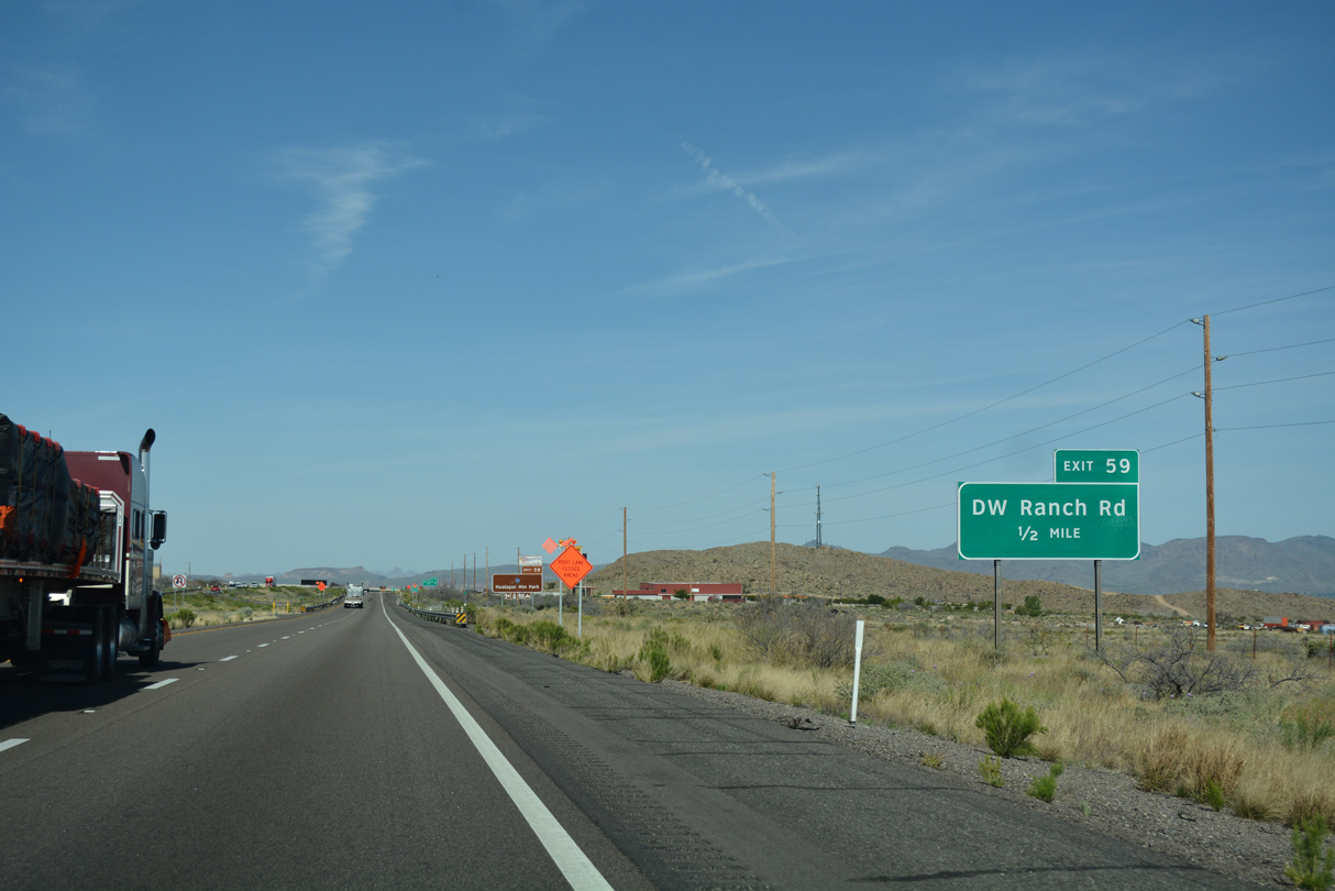
The diamond interchange (Exit 59) joining I-40/U.S. 93 with Mohave County Route 258 (DW Ranch Road) lies southeast of Rattlesnake Hill.
04/27/17
04/27/17
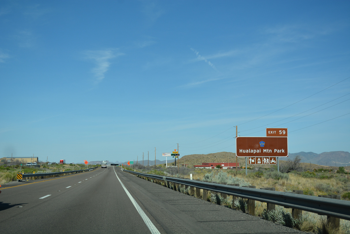
CR 258 (DW Ranch Road) heads south into the Hualapai Mountains where it connects with Hualapai Mountain Road southeast to Hualapai Mountain Park.
04/27/17
04/27/17
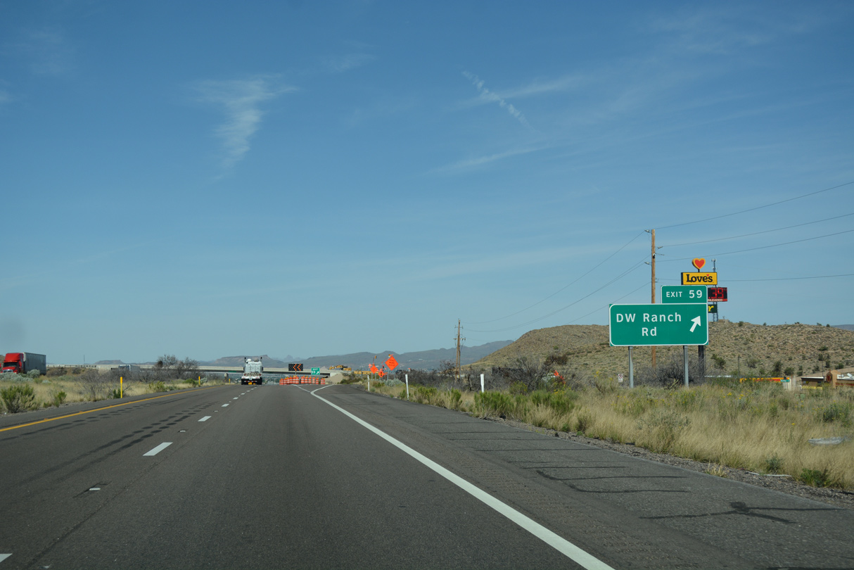
Minerva Lane ties into the exchange with DW Ranch Road from an adjacent truck stop to the north.
04/27/17
04/27/17
ADOT recorded 25,877 vehicles per day (vpd) along I-40/U.S. 93 between Exit 59 and 53 in 2019.
04/27/17
04/27/17
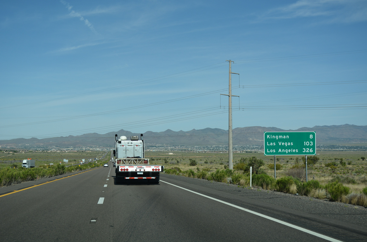
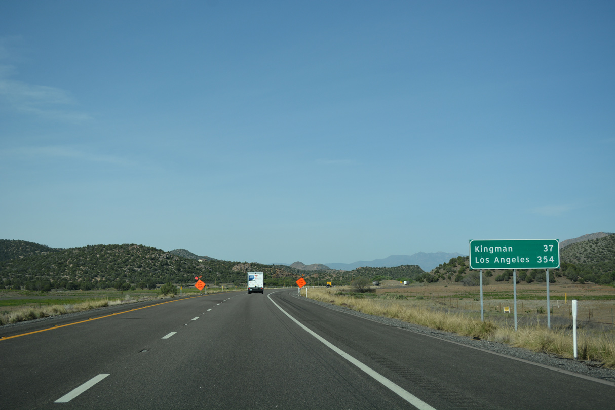
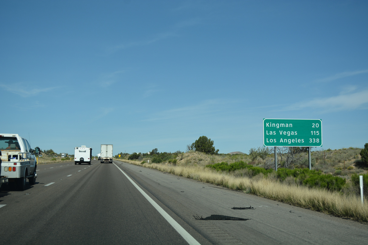
Los Angeles, California is 326 miles to the southwest via I-40, I-15 and I-10. Las Vegas is 95 miles beyond Kingman via U.S. 93.
04/27/17
04/27/17
The Cerbat Mountains rise north and west of Kingman.
04/27/17
04/27/17
Long Mountain and the Grandwash Cliffs appear far to the north across Hualapai Valley.
04/27/17
04/27/17
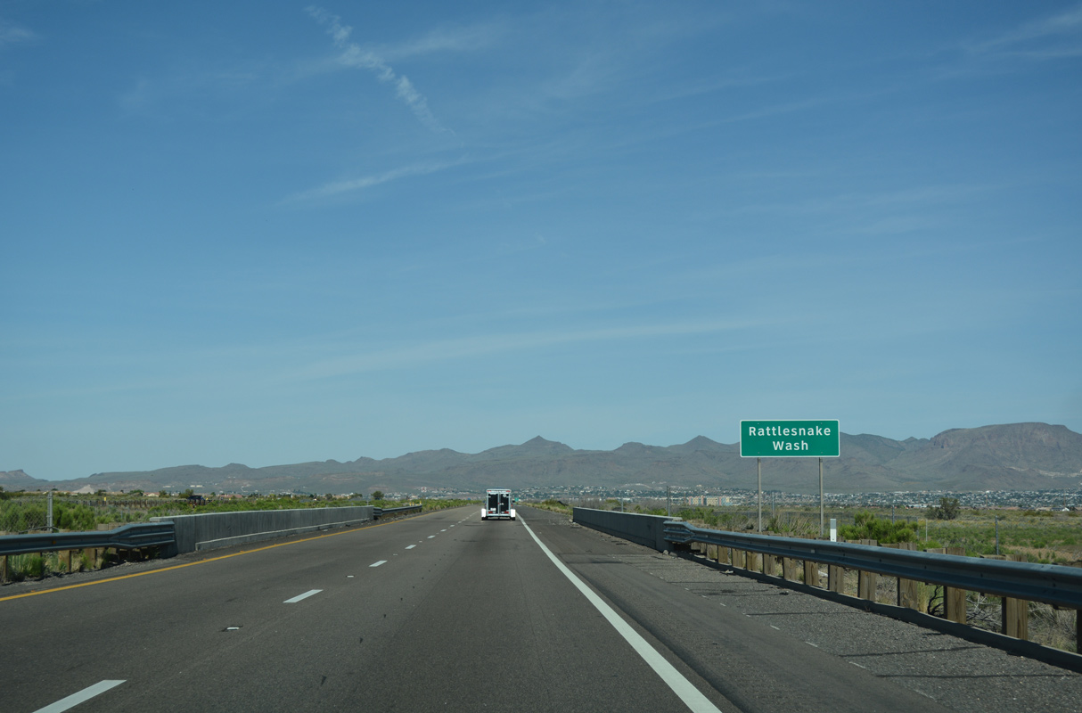
Interstate 40 and U.S. 93 enter the city of Kingman west ahead of Rattlesnake Wash.
04/27/17
04/27/17

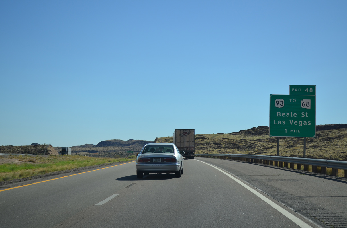
SR 68 branches west to Bullhead City and Laughlin, Nevada from U.S. 93 four miles northwest from Exit 48.
04/27/17
04/27/17
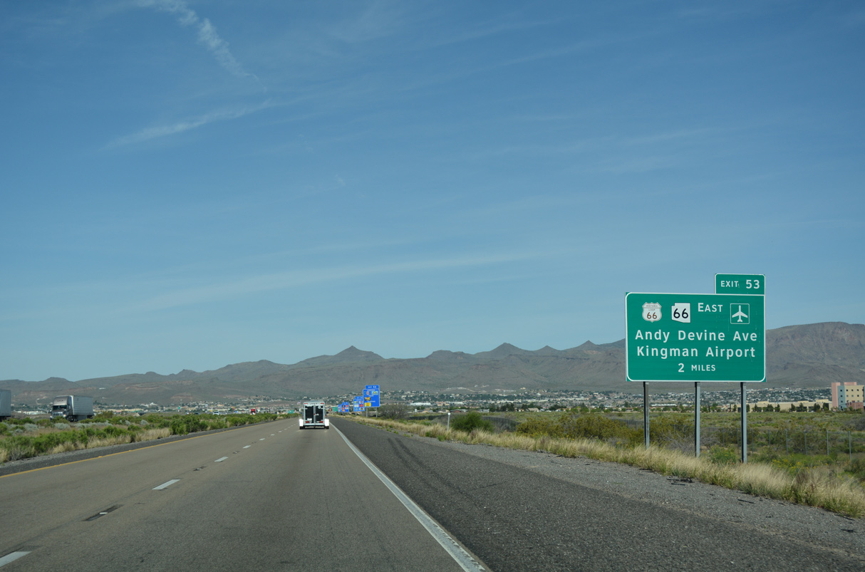
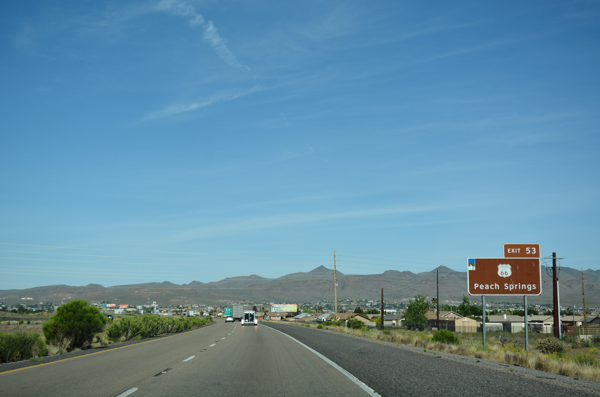
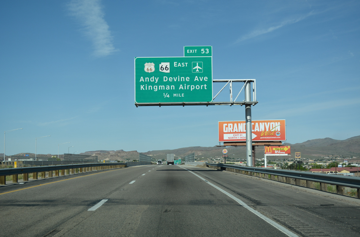
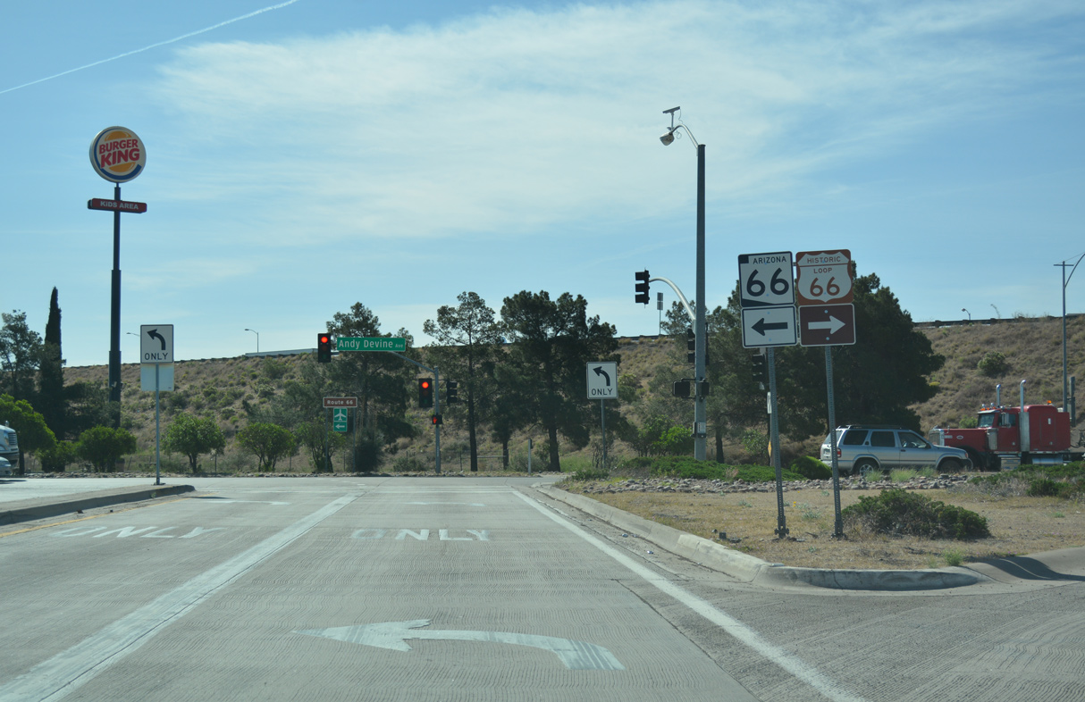
The first of three exits for Kingman from I-40 west is with Historic U.S. 66 (Andy Devine Avenue). Andy Devine Avenue was formerly designated Business Loop I-40 west from Exit 53 to Beale Street. The route returned to I-40 at Exit 48.
04/27/17
04/27/17
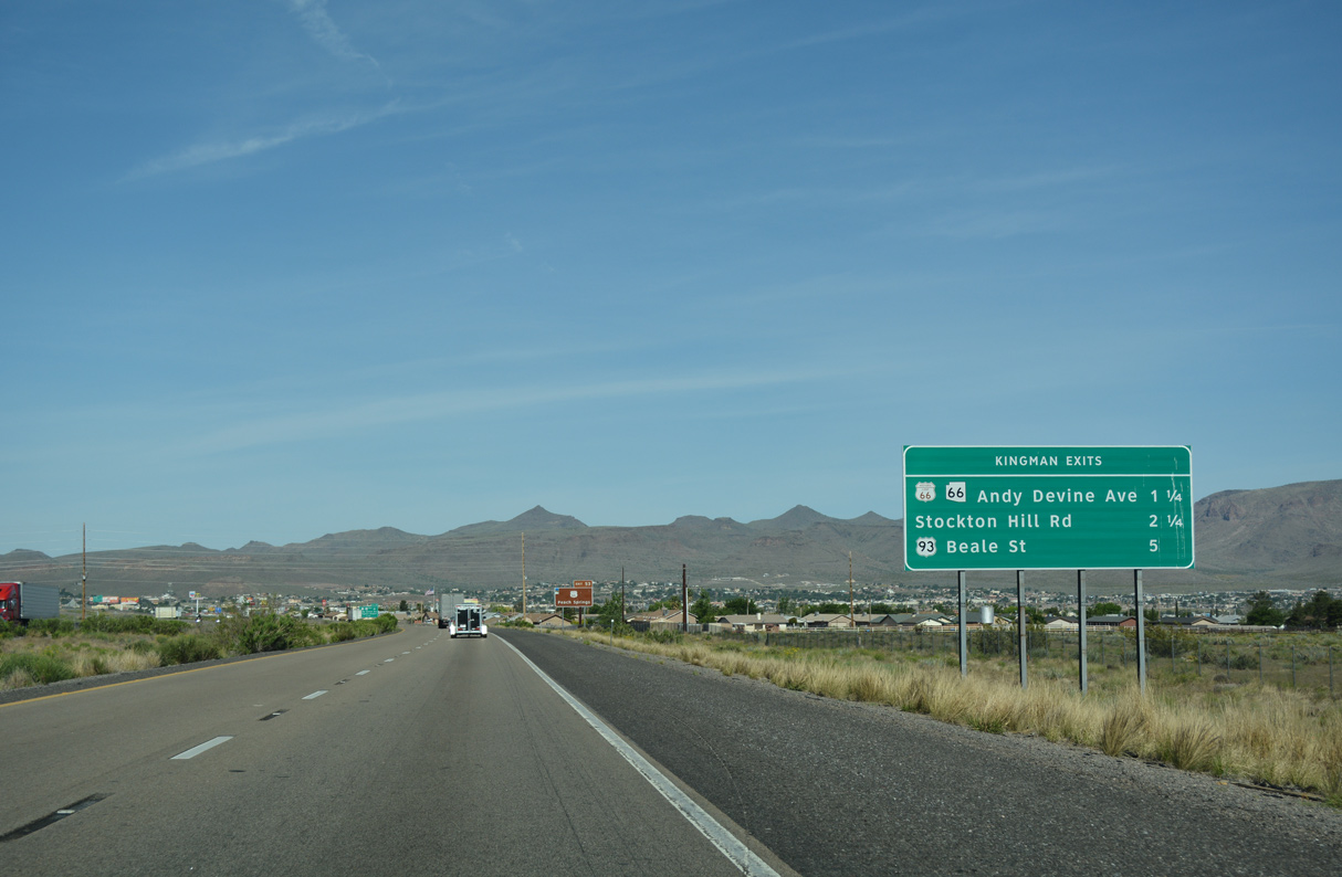
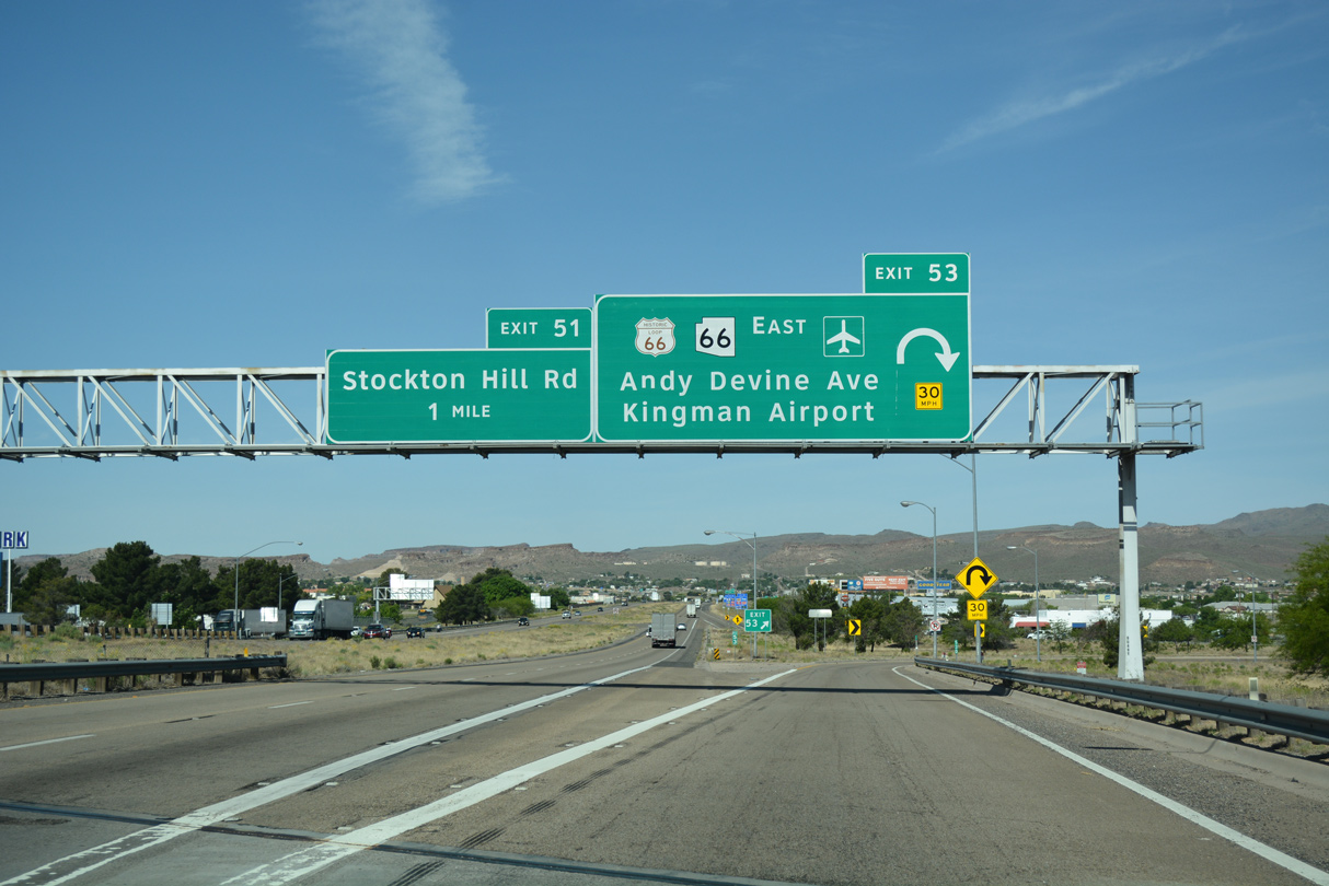
Stockton Hill Road (CR 20) ties into I-40/U.S. 93 at the subsequent exit west. The previous sign here displayed Business Loop I-40 in place of Historic U.S. 66.
04/27/17
04/27/17
Historic U.S. 66 circumvents the Peacock Mountains west from Hackberry to the village of Antaries, then continues southwest to the Valle Vista golf course community, Berry and Kingman.
04/27/17
04/27/17
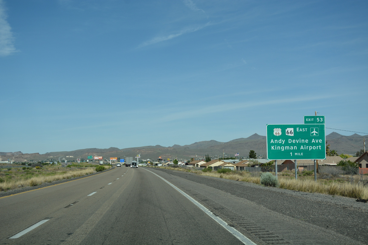
SR 66 (Andy Devine Avenue) constitutes a divided arterial northeast from Exit 53 to Kingman Airport (IGM).
04/27/17
04/27/17
SR 66 travels 66.74 miles from the parclo interchange at Exit 53 to the end of state maintenance at Pica Camp Road in the Aubrey Valley.
04/27/17
04/27/17
I-40/U.S. 93 spans a BNSF Railroad ahead of the loop ramp for SR 66 east and Historic U.S. 66 (Andy Devine Avenue).
04/27/17
04/27/17
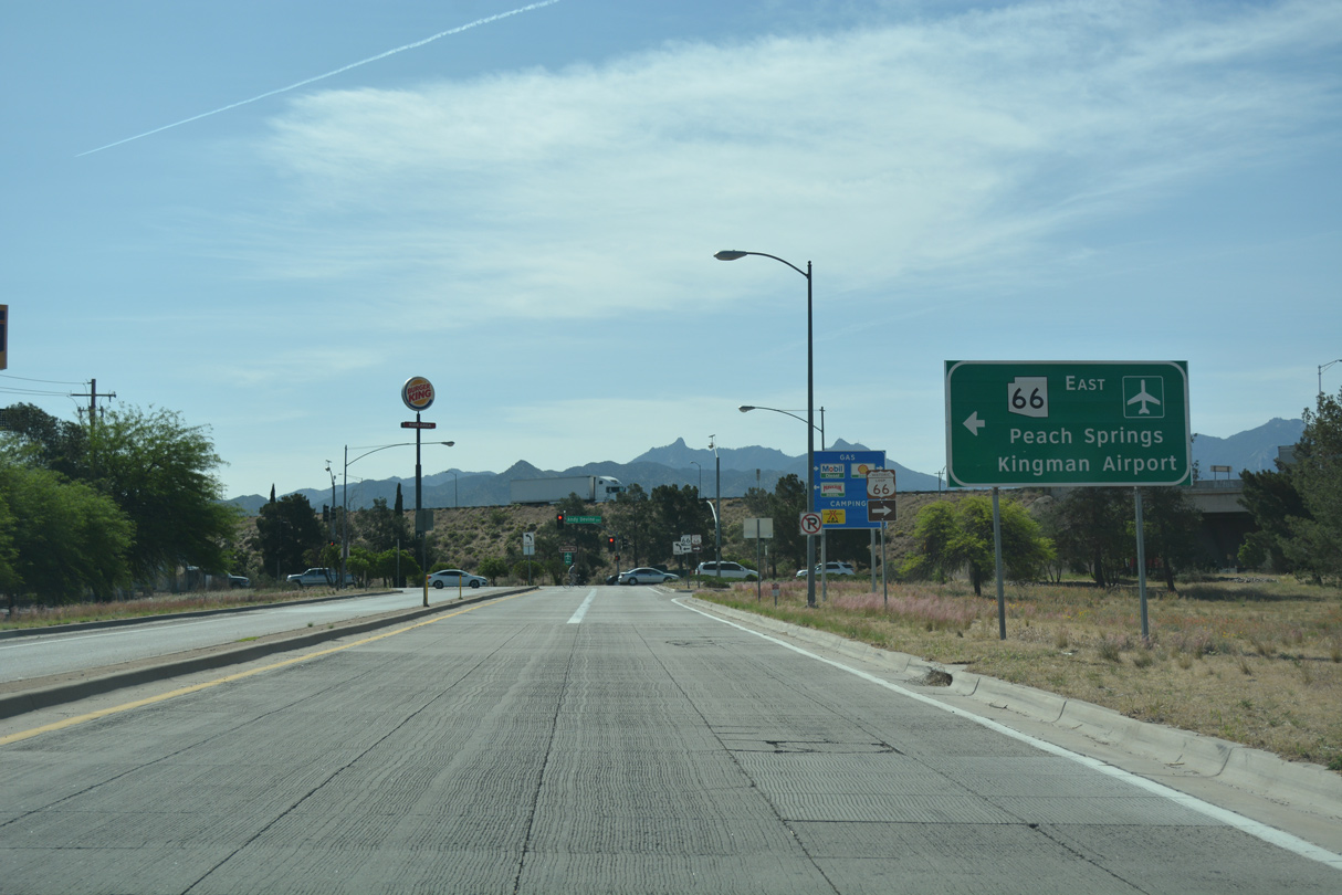
The community of Peach Springs is 46 miles to the northeast along SR 66 within the Hualapai Indian Reservation.
04/27/17
04/27/17
Business Loop I-40 at Kingman was decommissioned in 2003. The route extended 4.08 miles southwest from the nearby end of SR 66 at Michael Street.
04/27/17
04/27/17
I-40/U.S. 93 advances west past Veterans Centennial Recreation Complex after the Harrison Street underpass.
07/22/14
07/22/14
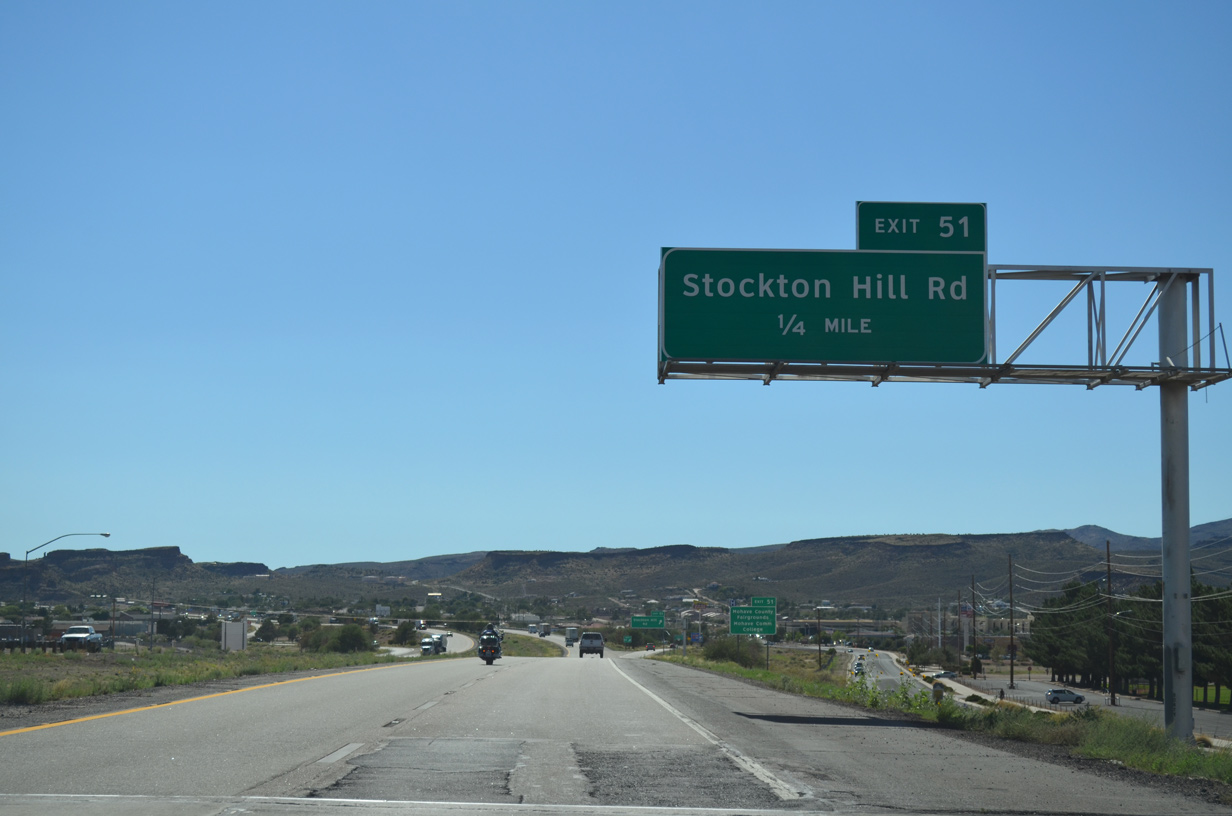
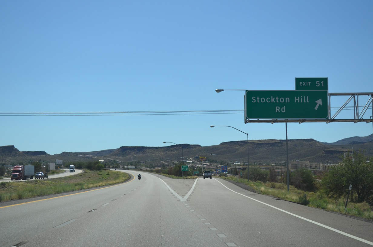
Stockton Hill Road meets I-40/U.S. 93 along a commercial strip at Exit 51.
07/22/14
07/22/14
Stockton Hill Road leads 1.50 miles south from the diamond interchange at Exit 51 to Historic U.S. 66 (Andy Devine Avenue) at Hualapai Mountain Road.
07/22/14
07/22/14
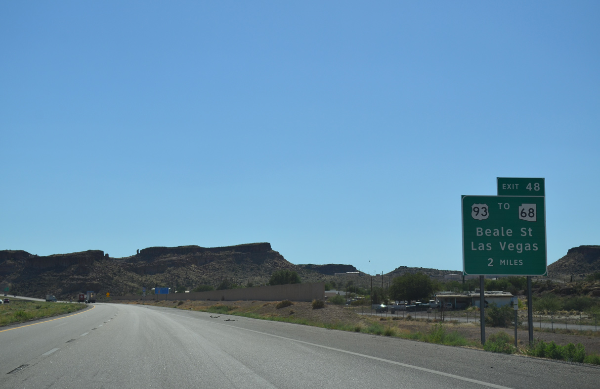
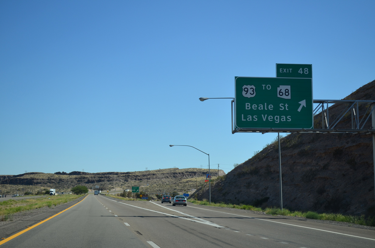
U.S. 93 parts ways with Interstate 40 at the succeeding exit for Beale Street (old Business Loop I-40).
07/22/14
07/22/14
I-40/U.S. 93 arc southward around Cerbat Cliffs Golf Course ahead of Clack Canyon.
07/22/14
07/22/14
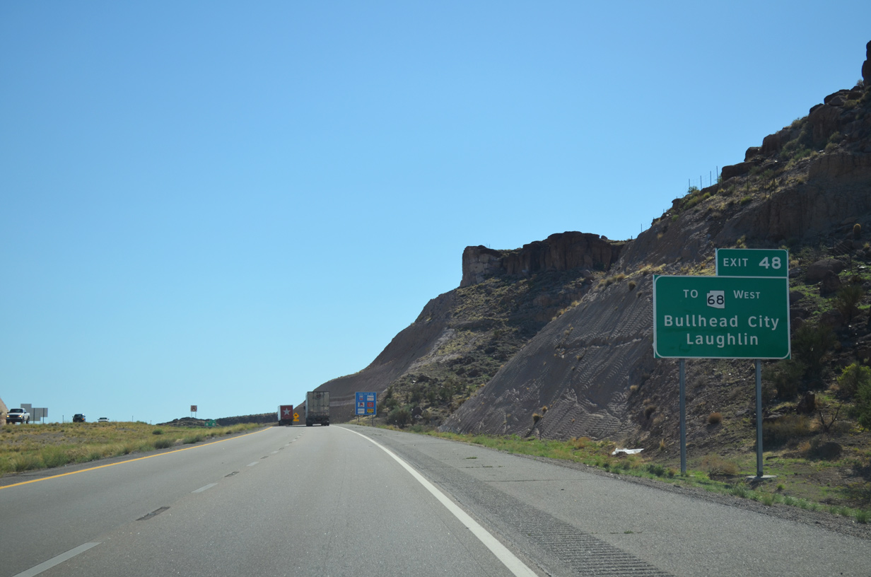
SR 68 constitutes a 27.52 mile long highway west from Golden Valley to SR 95 in Bullhead City. SR 95 connects with Nevada State Route 163 across the Colorado River into Laughlin.
07/22/14
07/22/14
Future road work for Interstate 11 will shift U.S. 93 northward from Beale Street onto a new alignment tieing into I-40 ahead of Exit 48.
07/22/14
07/22/14
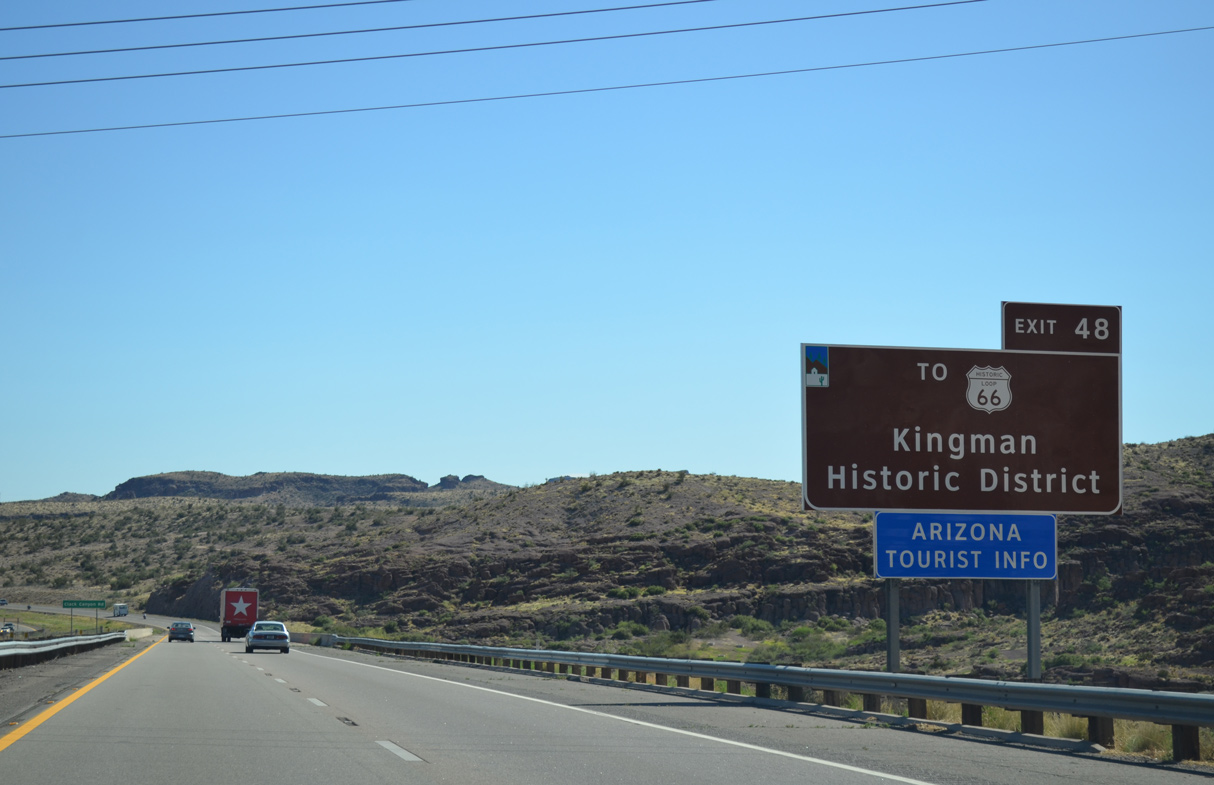
Beale Street extends 0.37 miles east from the diamond interchange at Exit 48 to Historic U.S. 66 (Andy Devine Avenue).
07/22/14
07/22/14

U.S. 93 travels northwest from Kingman to the Mike O'Callaghan–Pat Tillman Memorial Bridge spanning the Colorado River. There Interstate 11 begins.
07/22/14
07/22/14
I-11/U.S. 93 overlap northwest around Boulder City, Nevada to I-215/515 at Henderson. Eventually Interstate 11 will extend southeast to I-40 at Kingman.
07/22/14
07/22/14
Photo Credits:
- ABRoads: 04/27/17
- Alex Nitzman: 07/22/14
Connect with:
Page Updated Tuesday March 29, 2022.