
Interstate 70 East - Kansas City


 East
East  North
North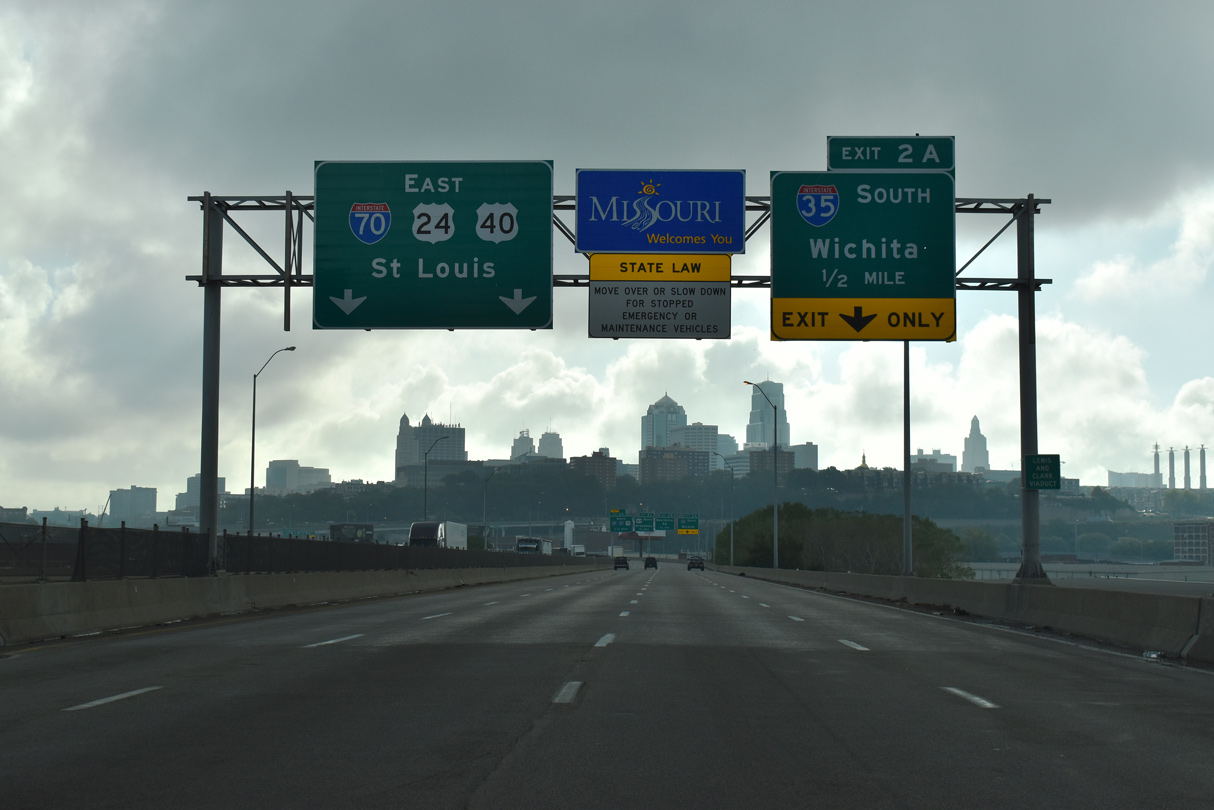
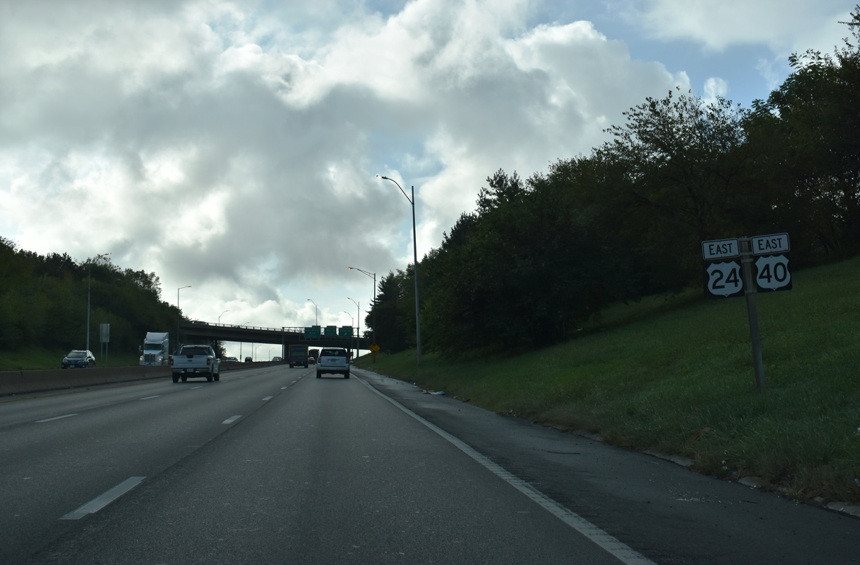
I-70/U.S. 24-40-169 enter Kansas City, Missouri along the Lewis and Clark Viaduct extending east from the Kansas River to the North Loop at Paradise Hill. I-70 stretches 200.50 miles east across the width of the Show Me State to the Mississippi River.
10/07/21
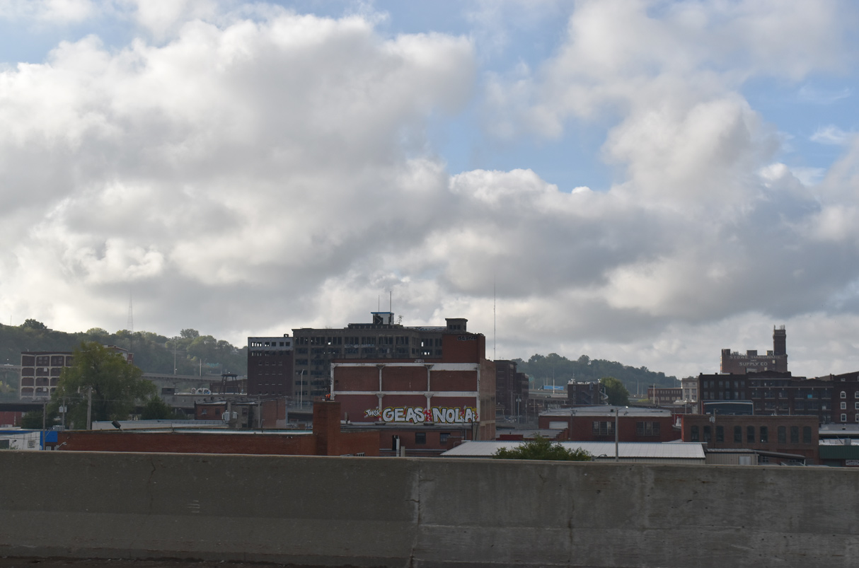
The West Bottoms industrial area south of the Missouri River lies at around 750 feet above sea level. The Central Business District rises beyond the bluffs at an average elevation of 850 to 950 feet above sea level.
06/19/15
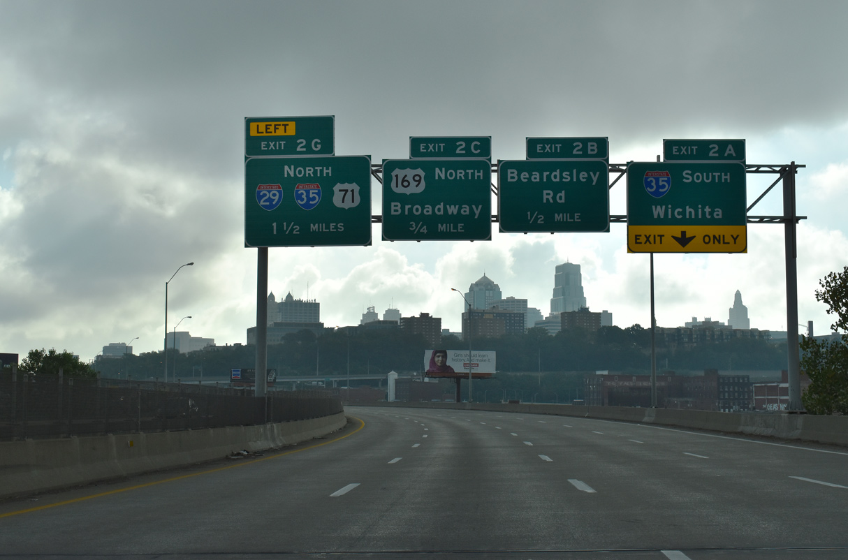
Collectively the Lewis and Clark Viaducts along I-70/U.S. 24-40-169 accommodate seven overall lanes. Lane drops occur at Exit 2A for Interstate 35 south to Westside South and Wichita and Exit 2C for U.S. 169 north and Broadway.
10/07/21
The West Bottoms industrial area spreads southward from the Lewis and Clark Viaduct to parallel Interstate 670.
10/07/21
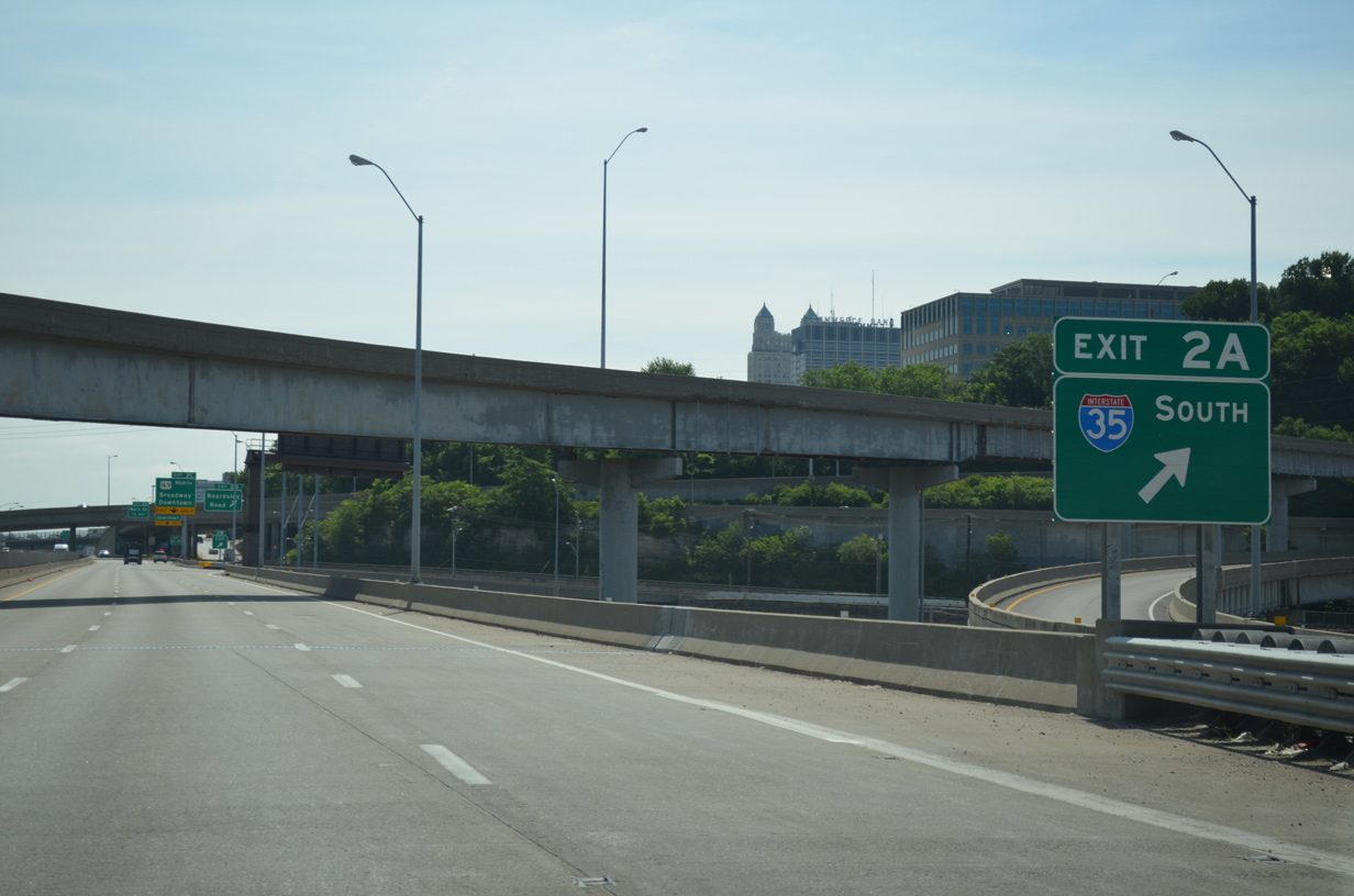
The flyover at Exit 2A links with I-35 south along the west leg of the Alphabet Loop was built in 1967. This ramp was closed for repairs in April 2015 after inspectors discovered structural deterioration.1
10/07/21
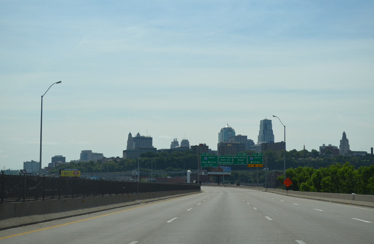
Interstate 35 leads southwest from Kansas City along the Turkey Creek Expressway through Kansas City, Kansas to Mission and Merriam.
06/19/15
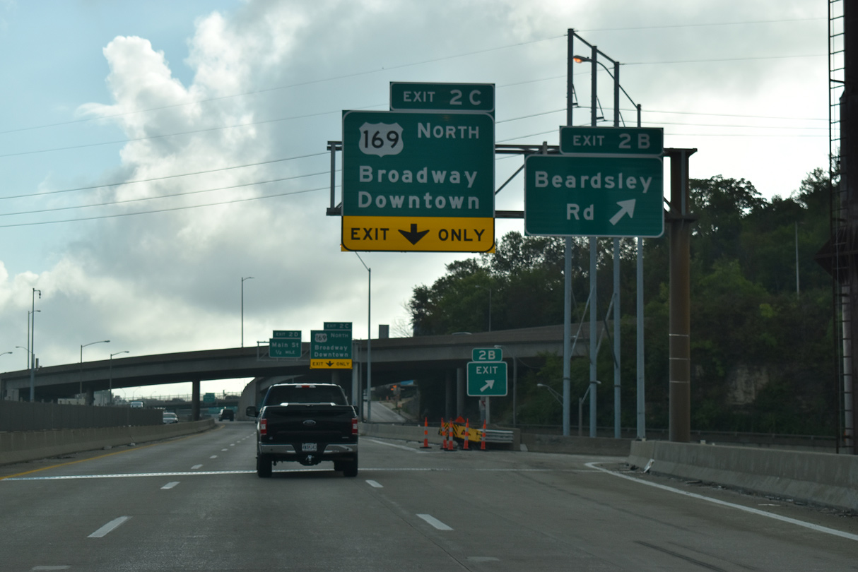
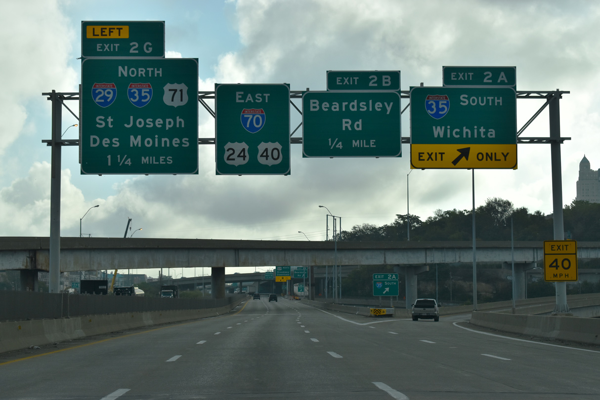
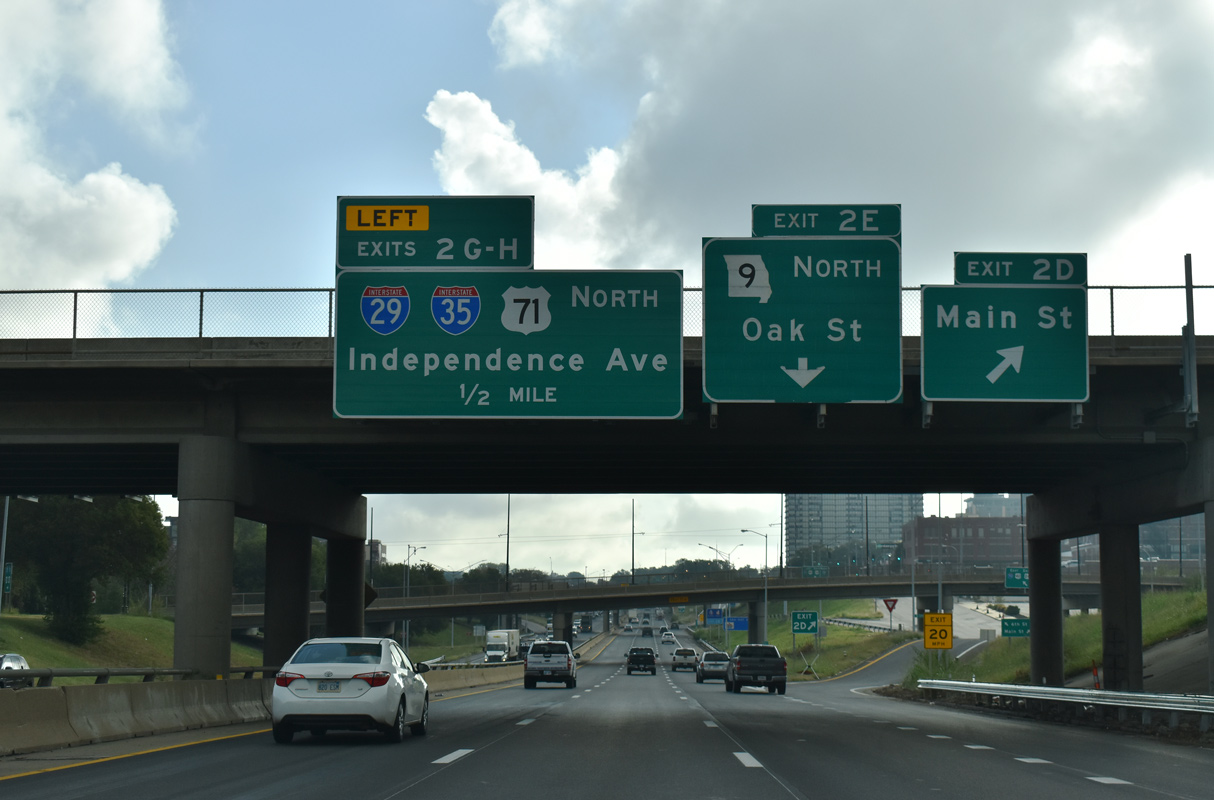
Exit 2B departs from within the three wye interchange for I-35 for Beardsley Road south to West Terrace Park and the Westside North community. U.S. 169 north splits from I-70 east at the subsequent off-ramp (Exit 2C).
10/07/21
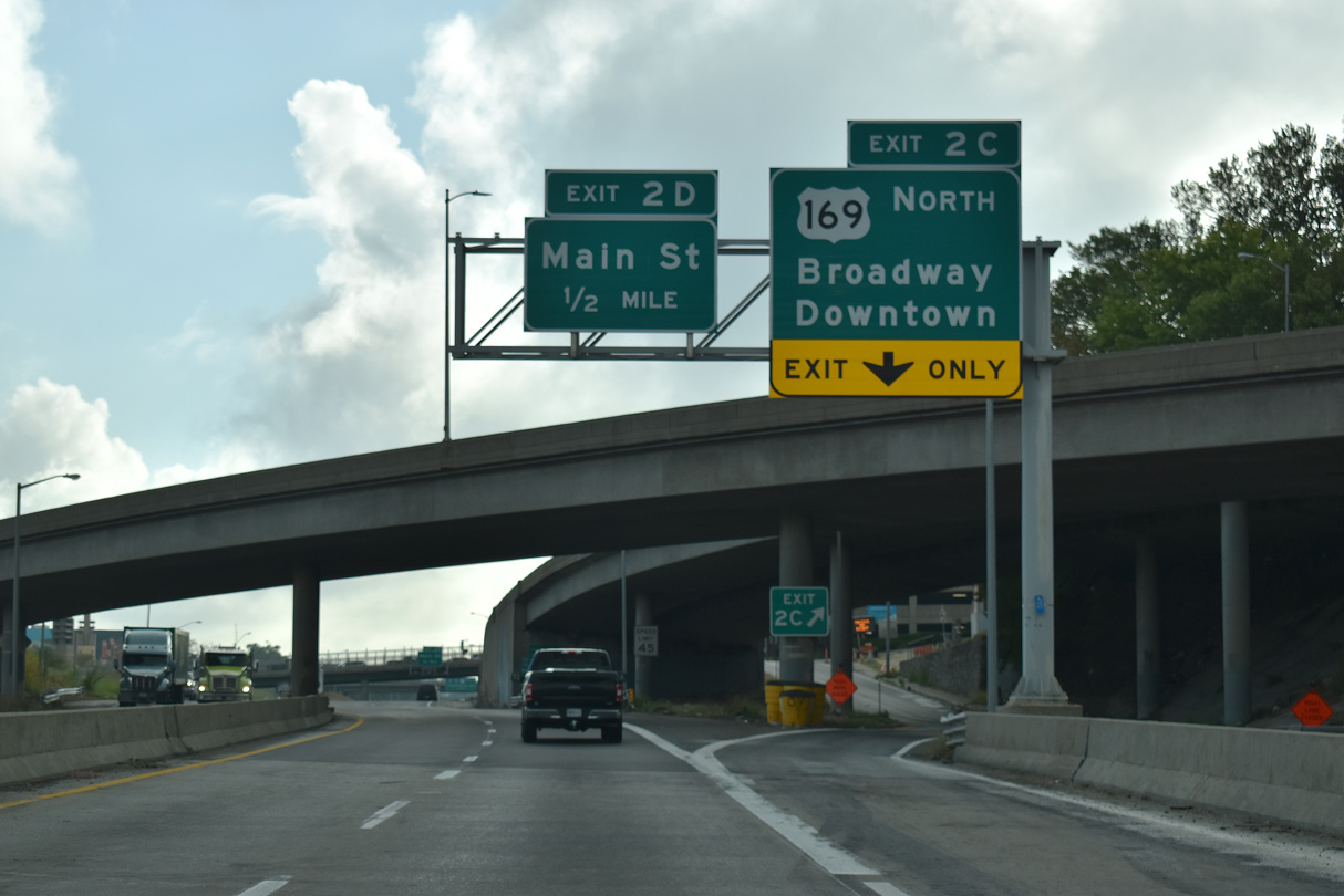
Exit 2C consists of a slip ramp onto parallel 6th Street east ahead of Broadway at Downtown. U.S. 169 turns north to North Kansas City across the Missouri River over the John Jordan "Buck" O'Neil Memorial Bridge, which is being replaced during a 2021-24 project. U.S. 169 extends from the Kansas City area to St. Joseph.
10/07/21
 North East
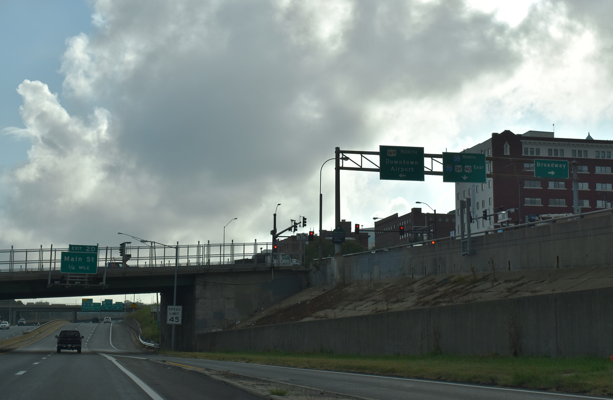
A single lane ramp brings the northbound mainline of Interstate 35 onto I-70/U.S. 24-40 east at the U.S. 169 (Broadway) overpass.
10/07/21
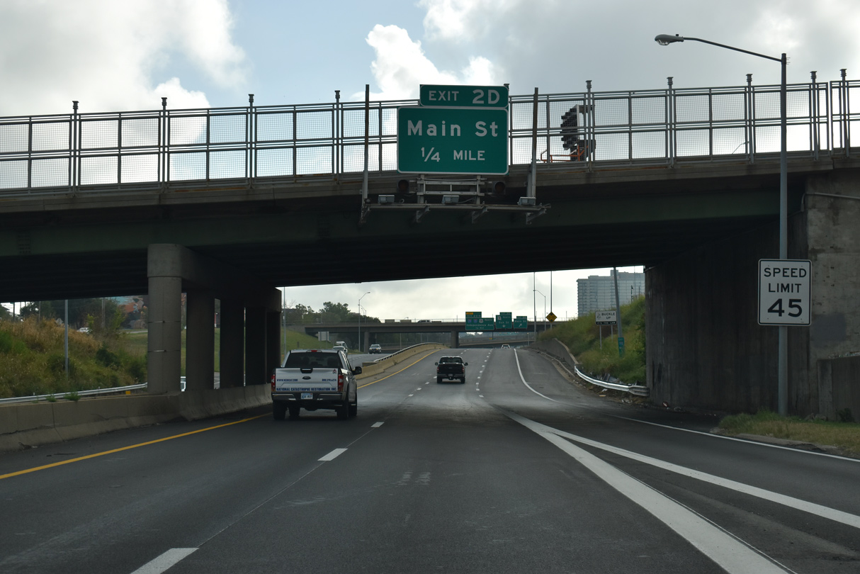
A diamond interchange connects I-35/70 and U.S. 24/40 with Main Street via E 6th Street at Exit 2D.
10/07/21
I-35 north and I-70 east combine for just 0.813 miles between the Central Business District and River Market. The south end of Route 9 ties the North Loop at Exit 2E for Oak Street.
10/07/21
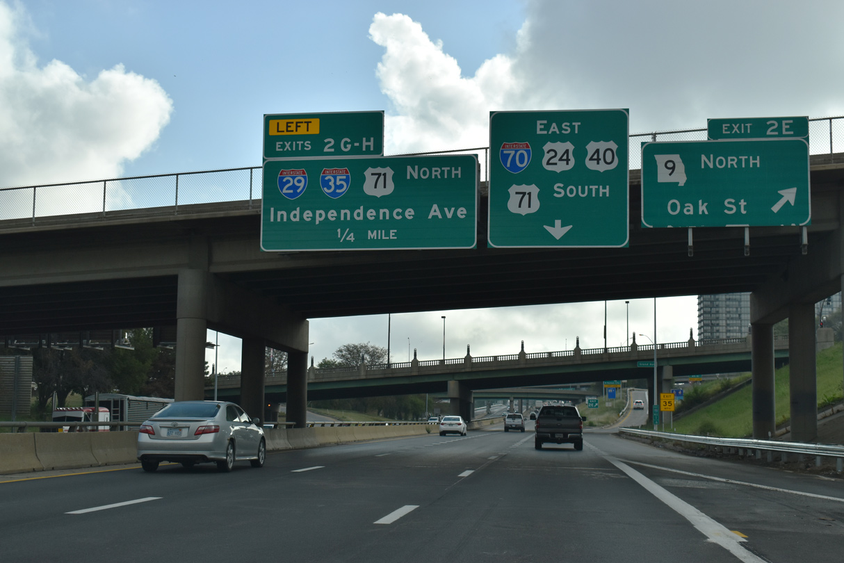
Exit 2E ascends from I-35/70 east for Route 9 across the Heart of America Bridge to North Kansas City. Back to back ramps follow from the North Loop for I-29/U.S. 71 north to St. Joseph and Independence Avenue (old U.S. 24) east to Pendleton Heights.
10/07/21
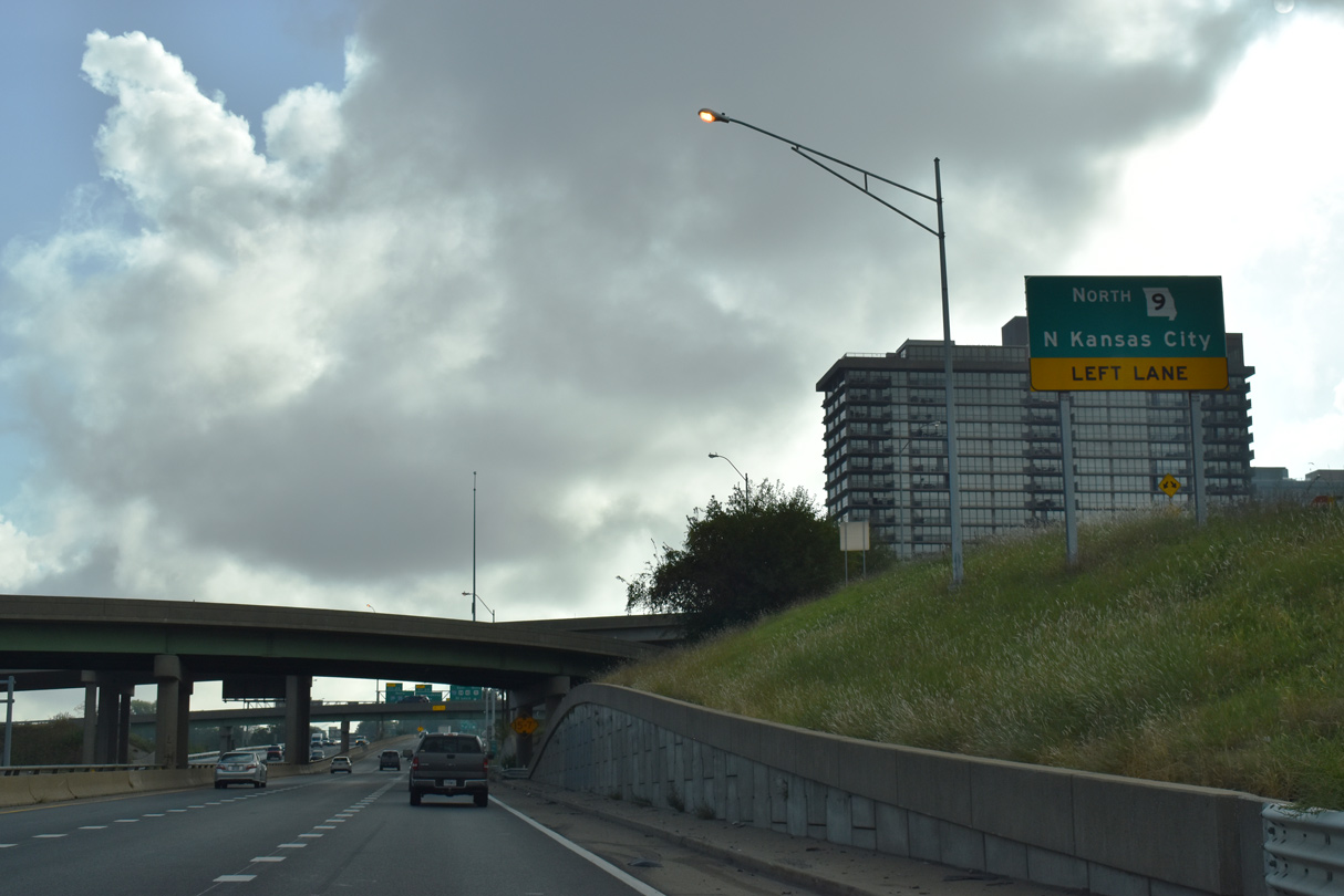
Route 9 constitutes a 14.28 mile urban highway north across the Missouri River to North Kansas City, Riverside and Barry Road near I-29 at Exit 8.
10/07/21
The Heart of America Bridge spans I-35-70/U.S. 24-40 northward between the River Market and Columbus Park Industrial areas to the Missouri River. The girder bridge opened to traffic in 1987 as a replacement for the vehicle deck of the adjacent ASB Bridge.
06/19/15

I-35 north makes a TOTSO movement at the directional T-interchange (Exit 2G) with I-29/U.S. 71 (Midtown Freeway). I-29/35-U.S. 71 combine 4.62 miles through North Kansas City to the Antioch Acres neighborhood in Kansas City.
10/07/21
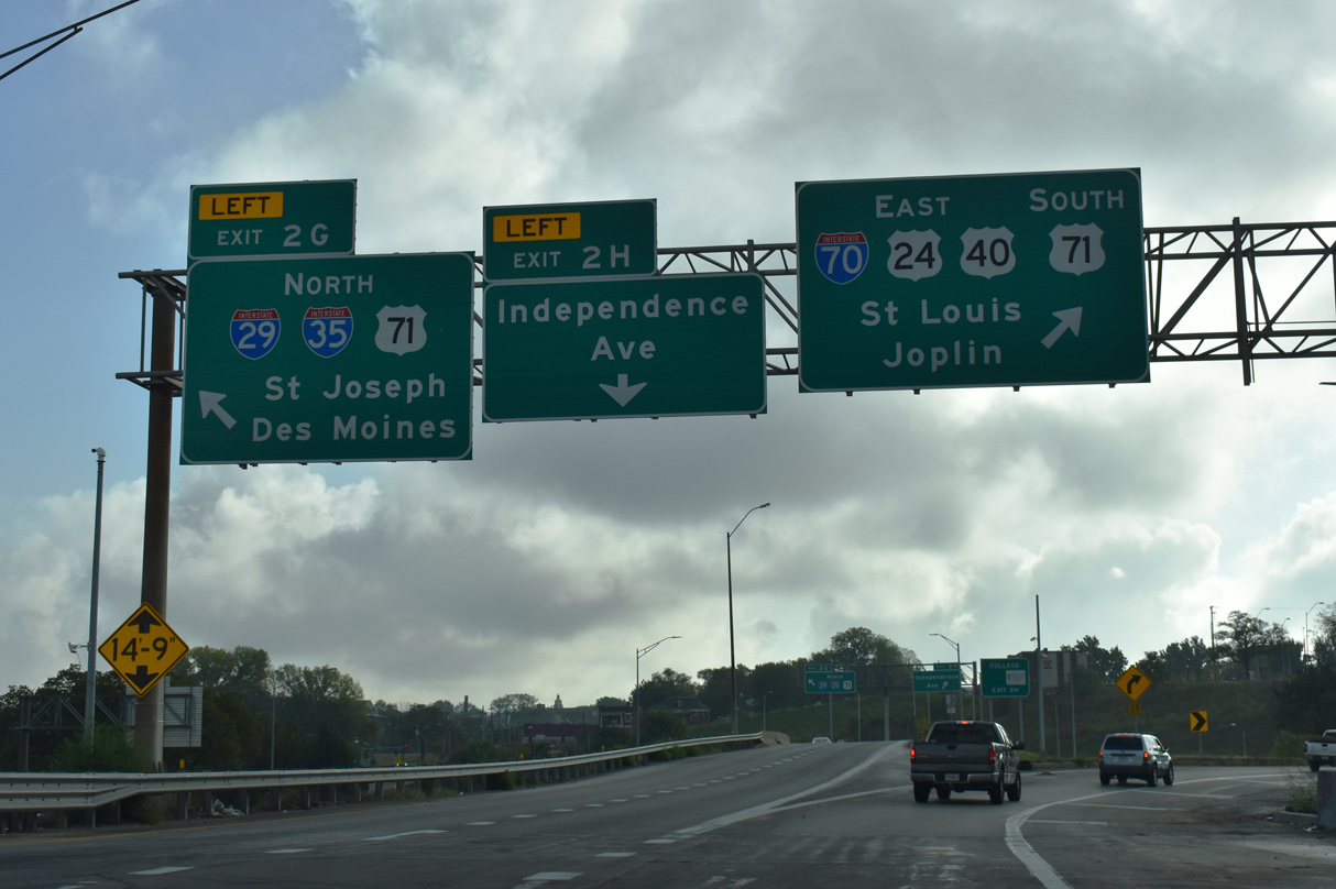
I-70 eastbound reduces to a single lane TOTSO ramp for the continuation of along the East Loop. U.S. 71 extends south from the Alphabet Loop as a varying freeway and at-grade boulevard to South Kansas City and Three Trails Crossing Highway interchange with I-435, I-470 and I-49 south.
10/07/21
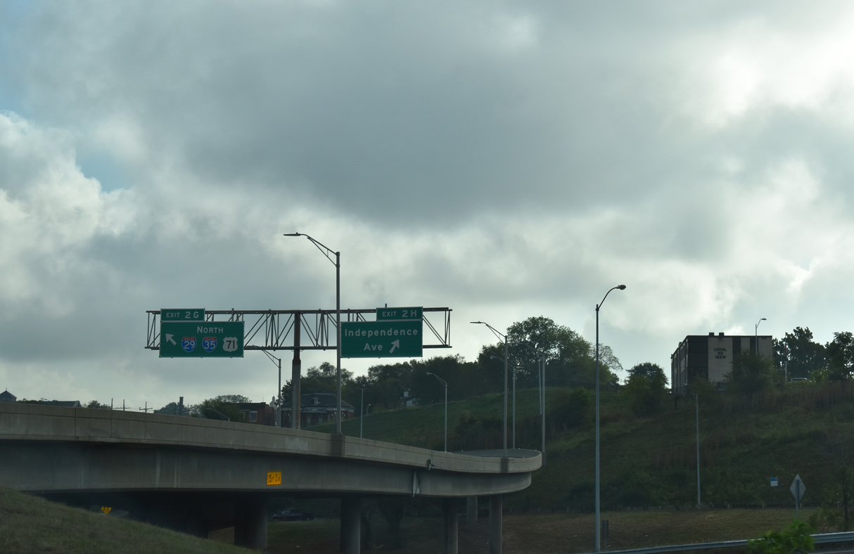
I-29/35 north immediately separate into single lane ramps for Independence Avenue (former U.S. 24) east and U.S. 71 (Midtown Freeway) north. U.S. 71 remains paired with I-29 to St. Joseph while I-35 follows the U.S. 69 corridor north to Des Moines, Iowa.
10/07/21
East  south
south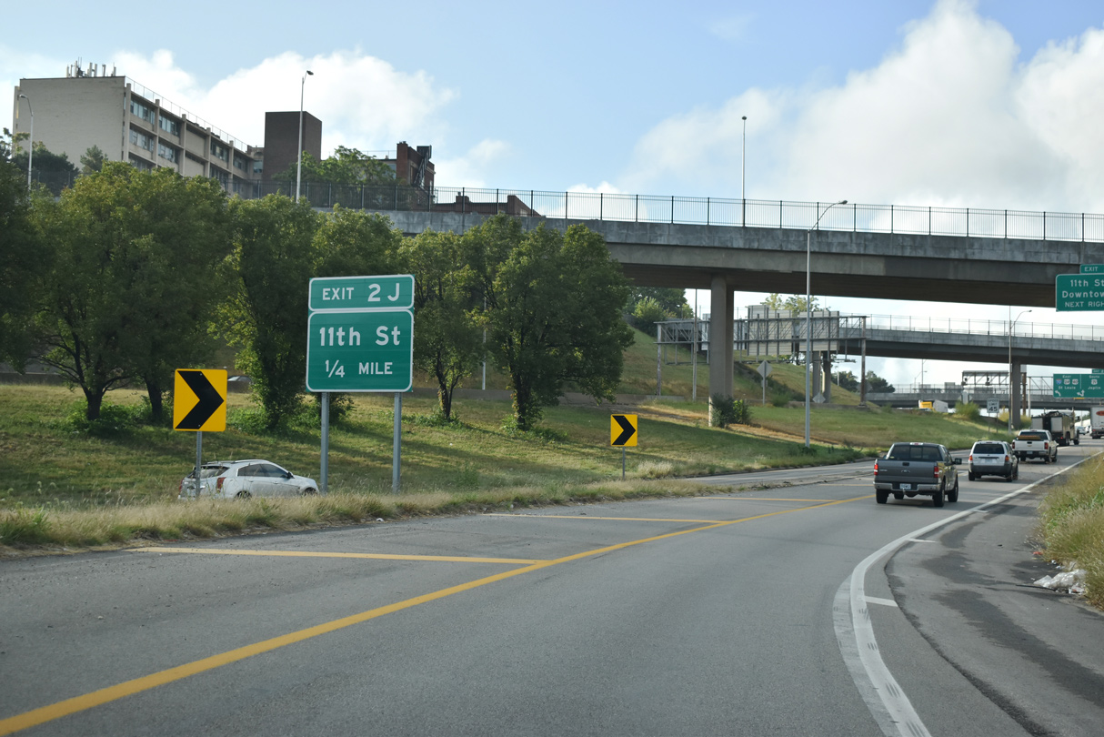
I-70/U.S. 24-40 east combines with U.S. 71 south with three lanes just ahead of Exit 2J for 11th Street.
10/07/21
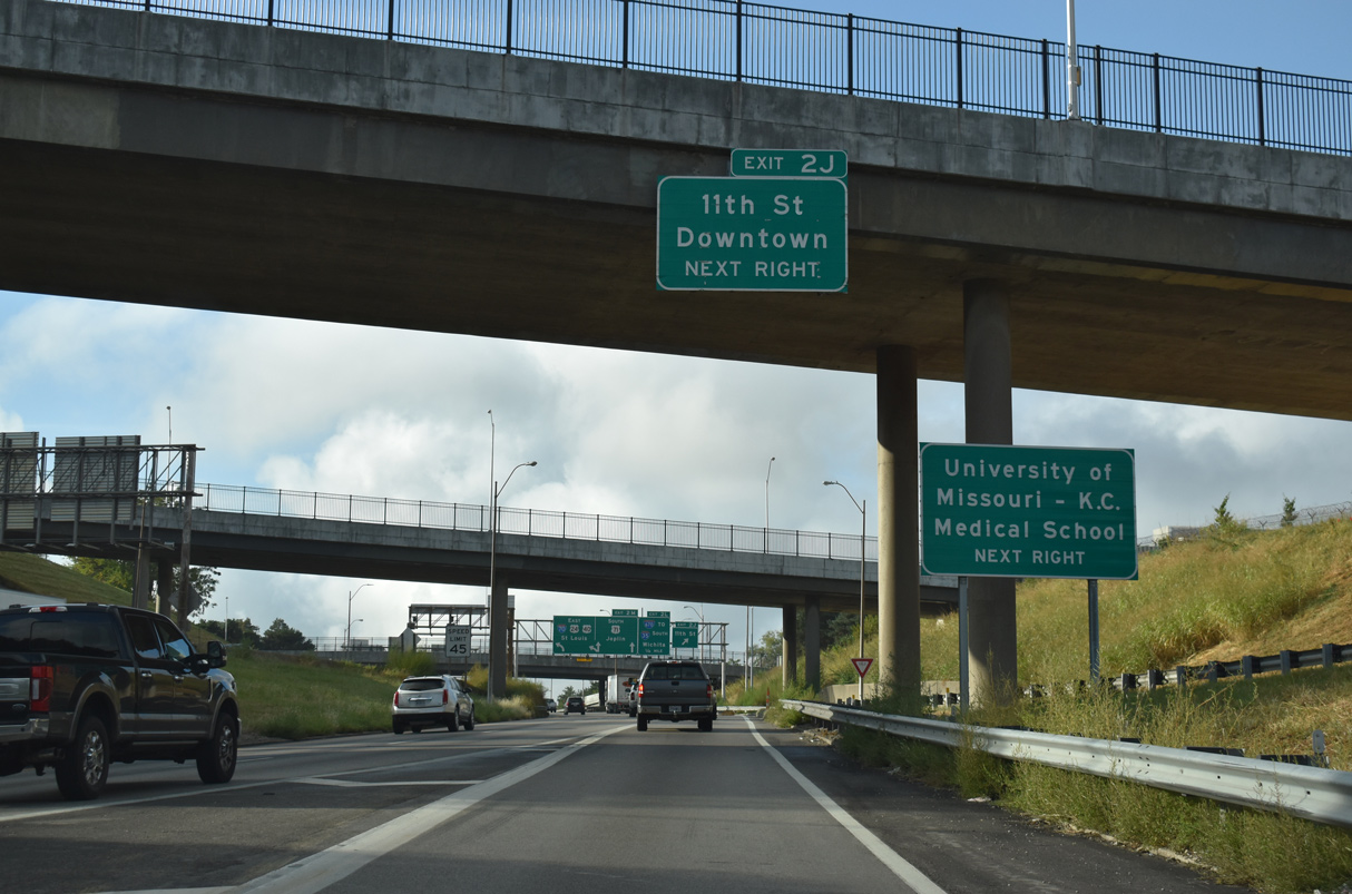
Exit 2J leaves the east leg of the Alphabet Loop for 11th Street west to Kansas City Hall and Charlotte Street south to the University of Missouri Kansas City - Hospital Hill Campus.
10/07/21
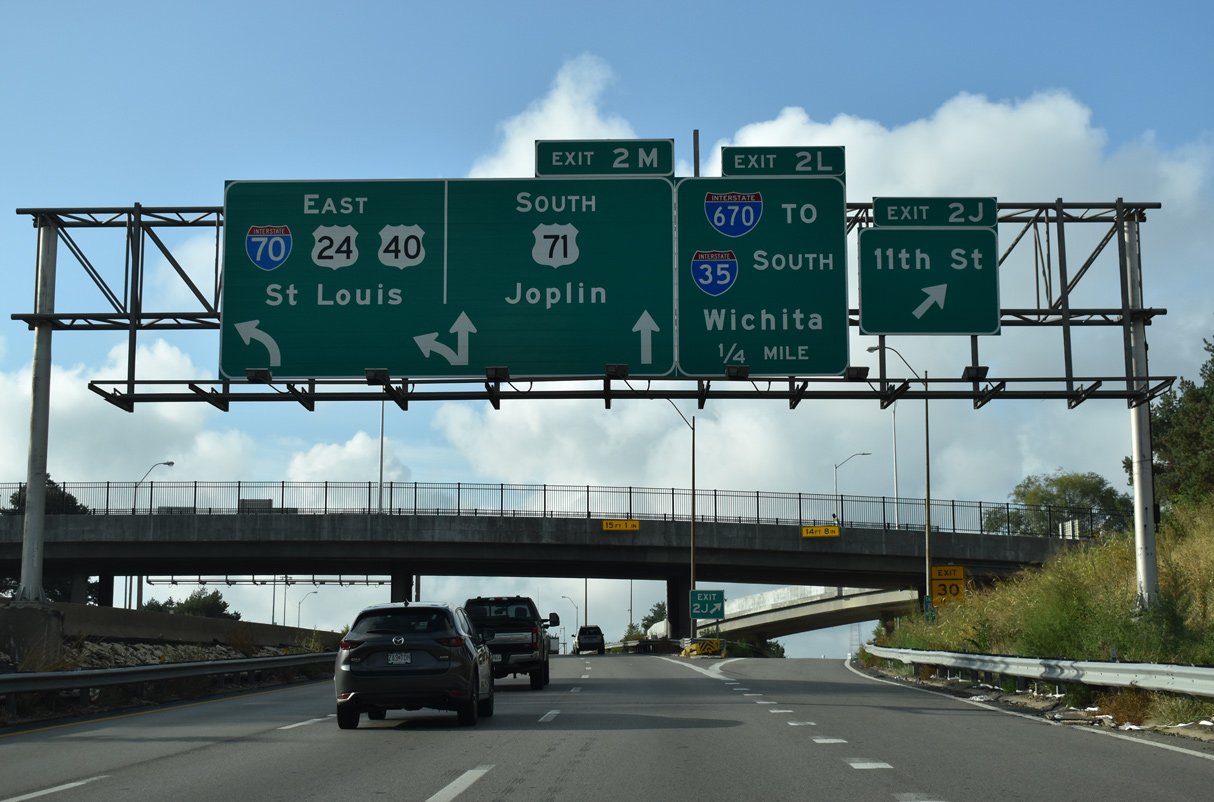
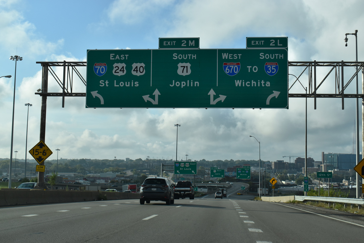
I-70 east and U.S. 71 south overlap for just 0.347 miles to Exit 2M. The east leg of the Alphabet Loop travels below grade between the Central Business District and Paseo West, with Exit 2J representing the lone local off-ramp.
10/07/21
U.S. 71 continues the freeway mainline south through the Hospital Hill community. Following Bruce R. Watkins Drive, U.S. 71 varies between a limited access highway and at-grade boulevard south to the Three Trails Crossing interchange with I-49, I-435, I-470 and U.S. 50.
10/07/21
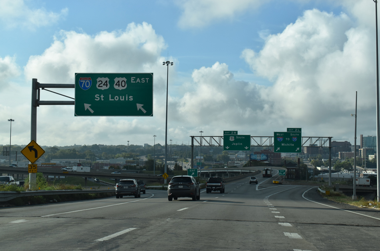
Two lanes separate from the Alphabet Loop for I-70/U.S. 24-40 east. Interstate 70 shifts south from Independence Plaza to Ingleside through eastern Kansas City.
10/07/21
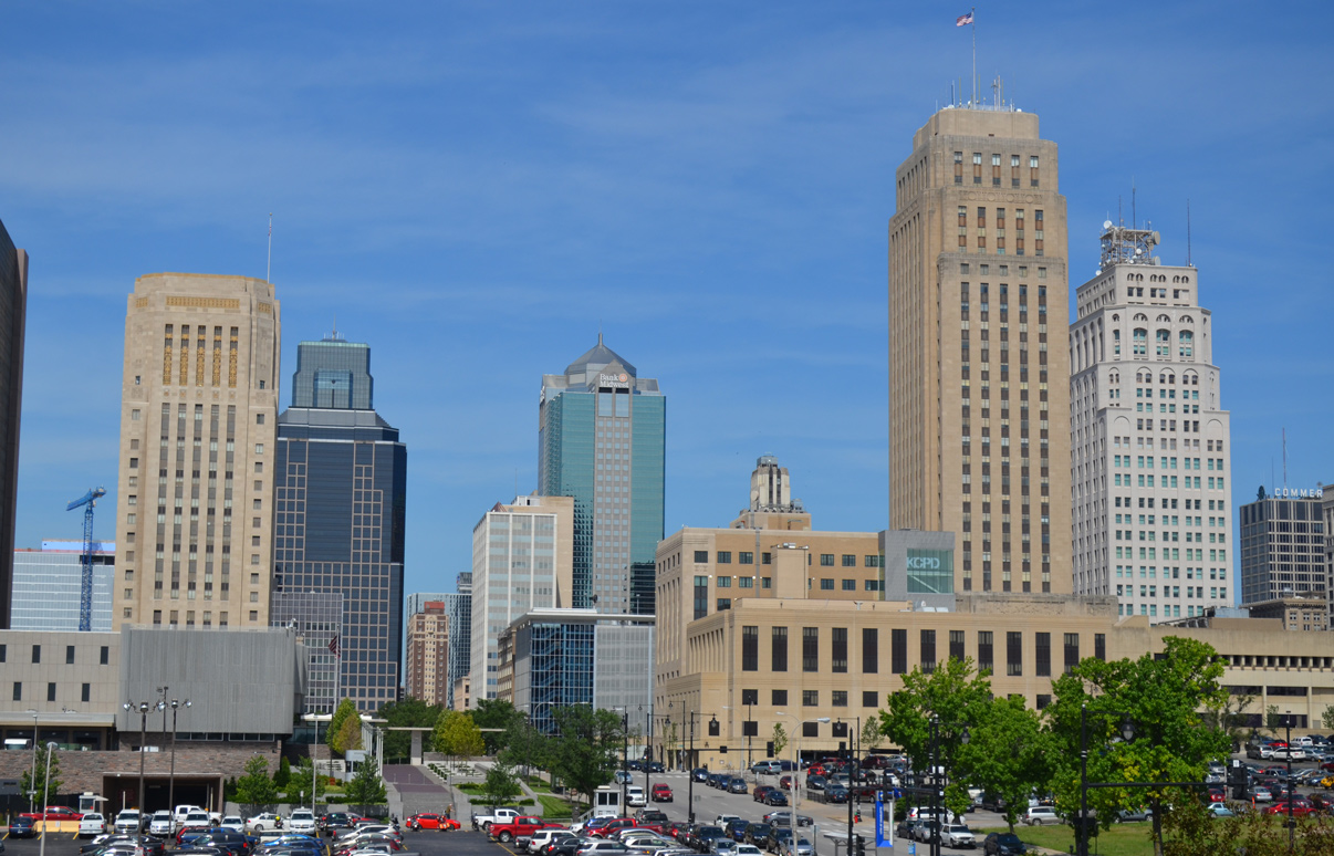
City Hall rises as part of the Kansas City skyline to the west at Locust and 11th Streets.
06/19/15
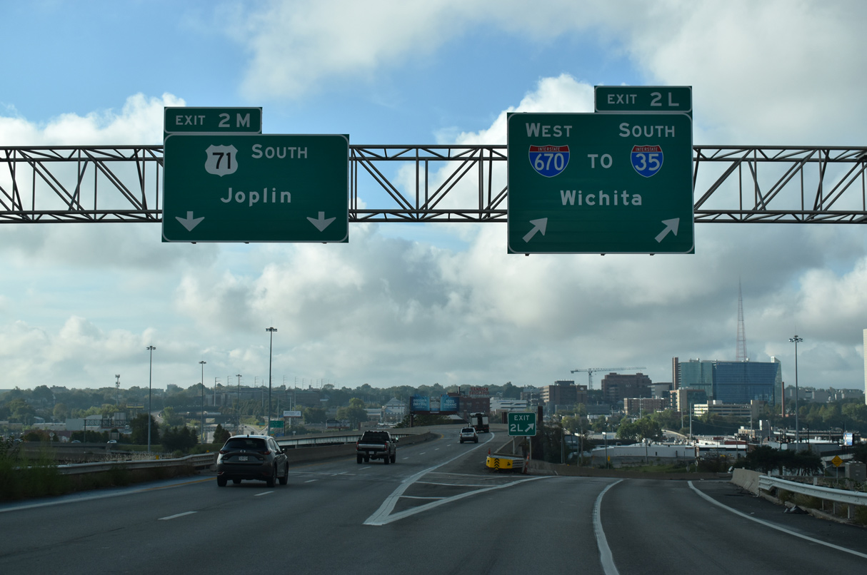
Beyond the separation of I-70/U.S. 24-40 east, Exit 2L partitions from U.S. 71 / Exit 2M for Interstate 670 west along the south leg of the Alphabet Loop back to I-35.
10/07/21
East
The I-70 eastbound mainline reduces to a single lane at the entrance ramp from 13th Street. Traffic continues from there to combine with the east end of Interstate 670 above The Paseo, one quarter mile from Exit 3B to Brooklyn Avenue.
10/07/21

A half diamond interchange (Exit 3B) connects I-70/U.S. 24-40 east with Brooklyn Avenue for the Forgotten Homes and Independence Plaza communities.
10/07/21
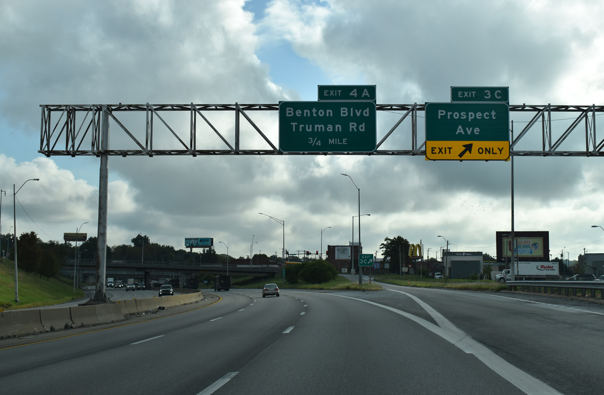
Exit 3C separates from I-70 just east of Brooklyn Avenue to 14th Street at Prospect Avenue Prospect Avenue heads south to the Washington Wheatley neighborhood and north to Independence Plaza.
10/07/21
Entering the Benton Curve, I-70/U.S. 24-40 turn sharply south from the Crosstown Freeway onto the Southeast Freeway at Exit 4A with Benton Plaza north.
10/07/21
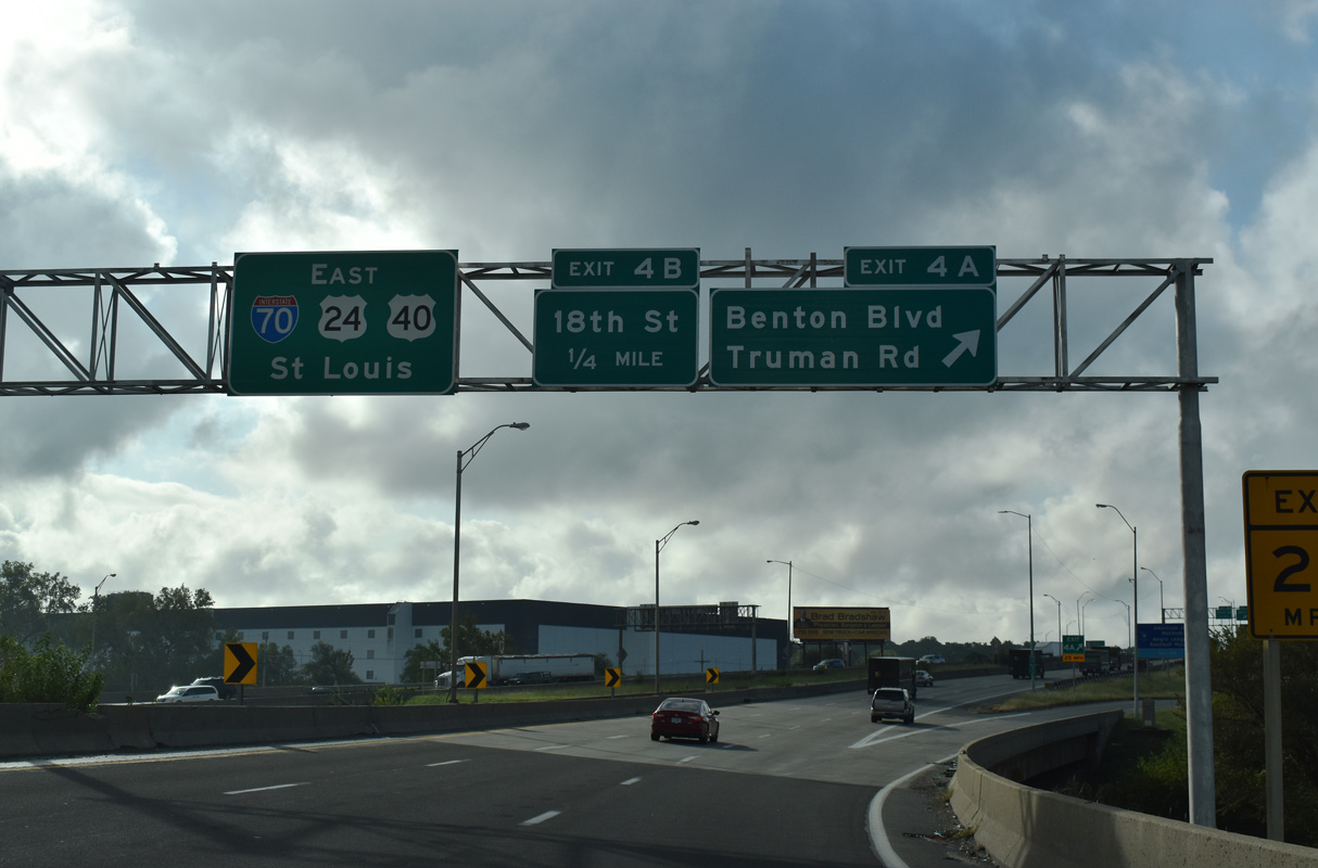
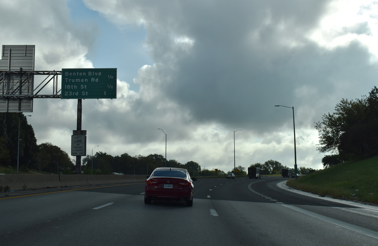
Exit 4A loops away from I-70 east to Benton Boulevard north and Truman Road. A wide grassy median on this stretch remains from an unconstructed freeway spur east to 9th Street at the Lykins neighborhood.
Leftover from the former Benton Boulevard eastbound on-ramp, an abandoned overpass also lies between the roadways.
10/07/21
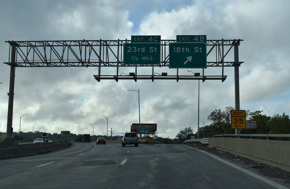
Three lanes continue south across a KCT Railroad corridor to the parclo interchange (Exit 4B) with 18th Street. 18th Street links I-70 with the East Community Team neighborhoods to the east.
10/07/21
I-70/U.S. 24-40 advances southward to Exit 5B for 31st Street and the Ingleside community.
10/07/21
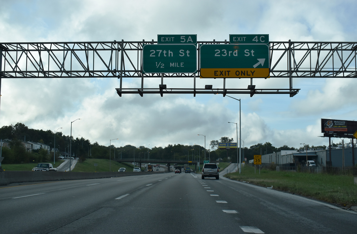
A diamond interchange connects Interstate 70 with 23rd Street west to Washington Wheatley and east to Blue Valley Park.
10/07/21
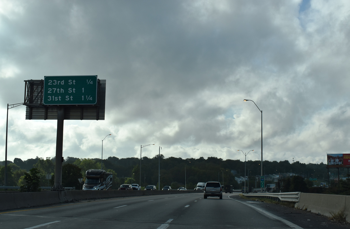
I-70/U.S. 24-40 angle southeast across the street grid to Exit 5A for 27th Street and Exit 5B for 31st Street before resuming an eastward course to the South Blue Valley community.
10/07/21
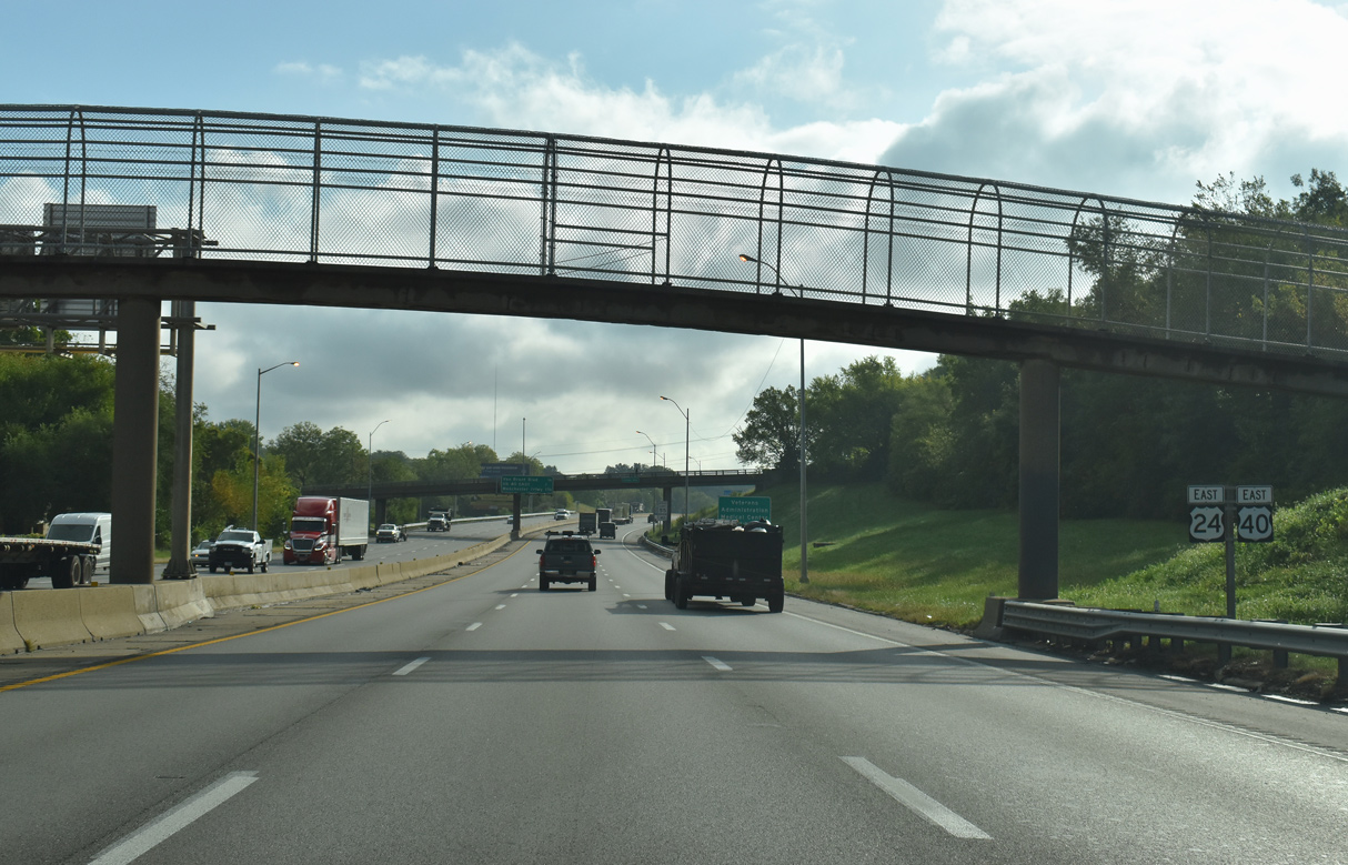
The first confirming marker for I-70 east in the state of Missouri preceded the Cleveland Avenue overpass. It was replaced with this assembly for U.S. 24/40.
10/07/21

The half diamond interchange (Exit 5A) with 27th Street lies just north of the planned directional T interchange with the unbuilt Southeast Trafficway. The expressway was a part of the 1956 Kansas City Expressway Plan.2
10/07/21
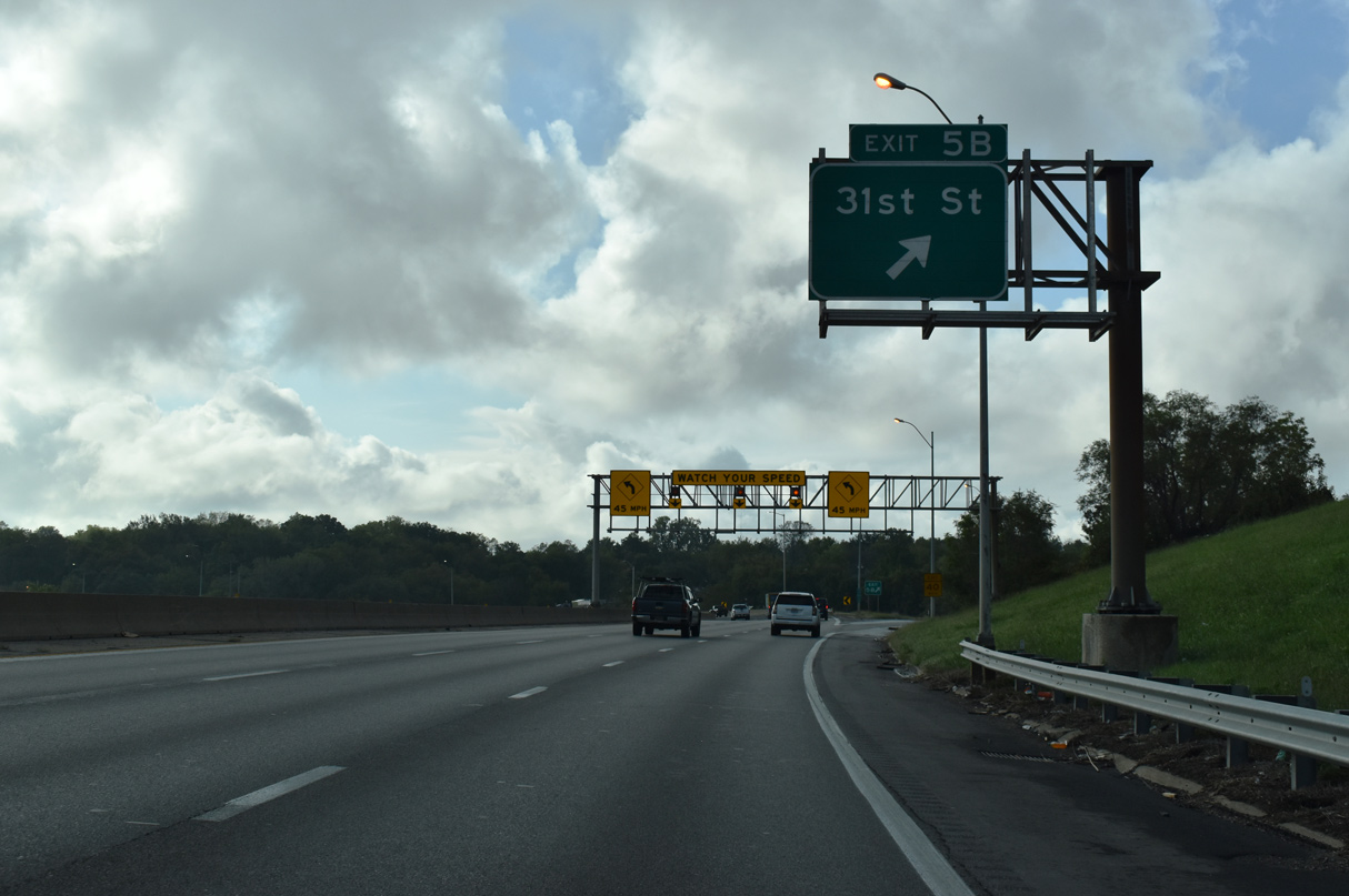
A lengthy off-ramp leftover from the unbuilt Southeast Freeway, Exit 5B ties into Myrtle Avenue, one block ahead of 31st Street at Ingleside.
10/07/21
Although the Southeast Trafficway was never built, the 45 mile per hour Jackson Curve remains from the planned route south to Swope Parkway.2
10/07/21
I-70/U.S. 40 transition from the Southeast Freeway to the Missouri Freeway east from the Benton Curve.
10/07/21
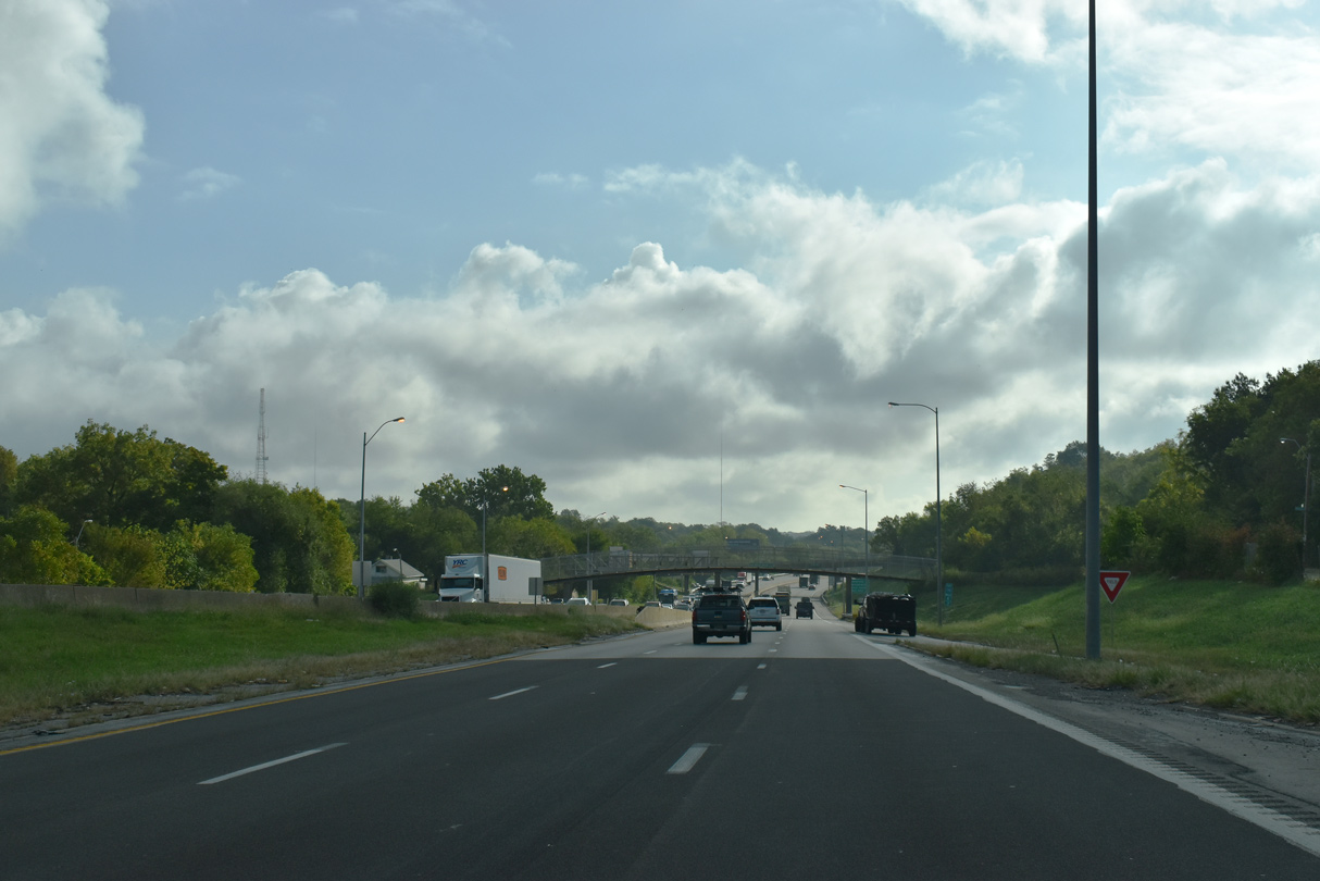
I-70/U.S. 40 transition from the Southeast Freeway to the Missouri Freeway east from the Benton Curve.
10/07/21
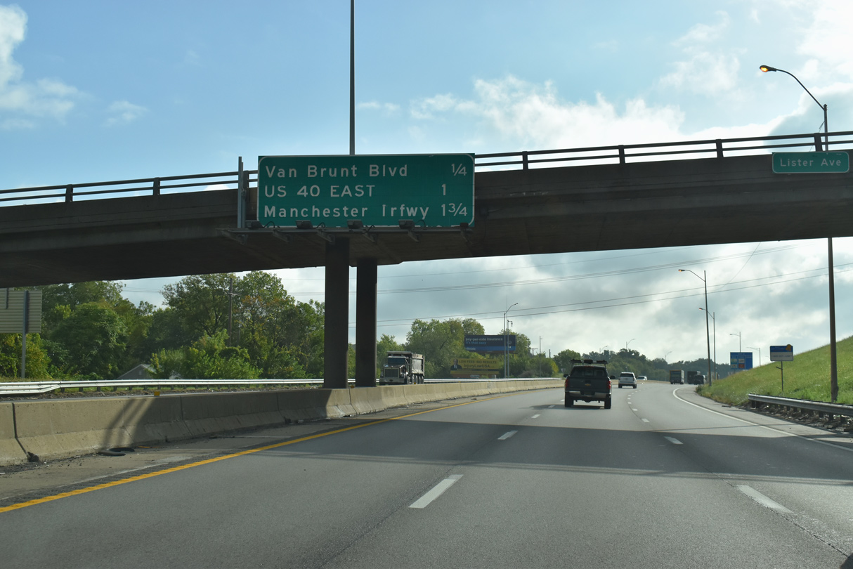
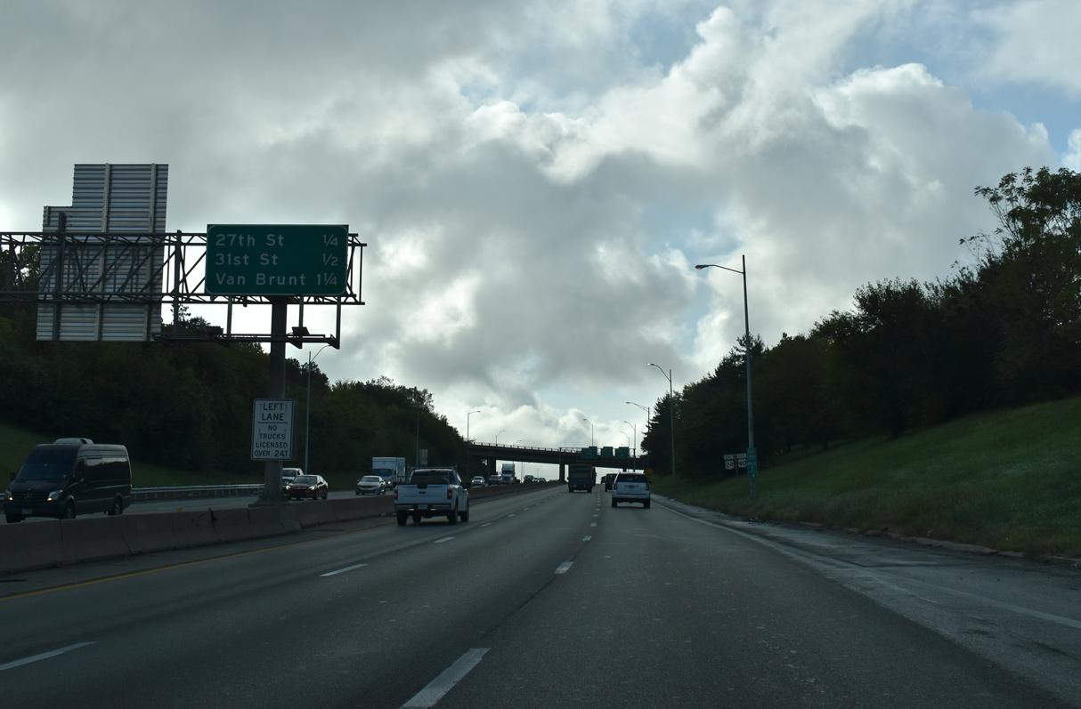
A diamond interchange lies a quarter mile ahead with Van Brunt Boulevard. U.S. 40 partitions with I-70 at the suceeding exit for 31st Street.
10/07/21
Van Brunt Boulevard constitutes a tree lined parkway north from Exit 6 to South Blue Valley and south from Knoches Park as S. Emanuel Cleaver II Boulevard to the Kansas City VA Medical Center and Oak Park Southeast.
10/07/21
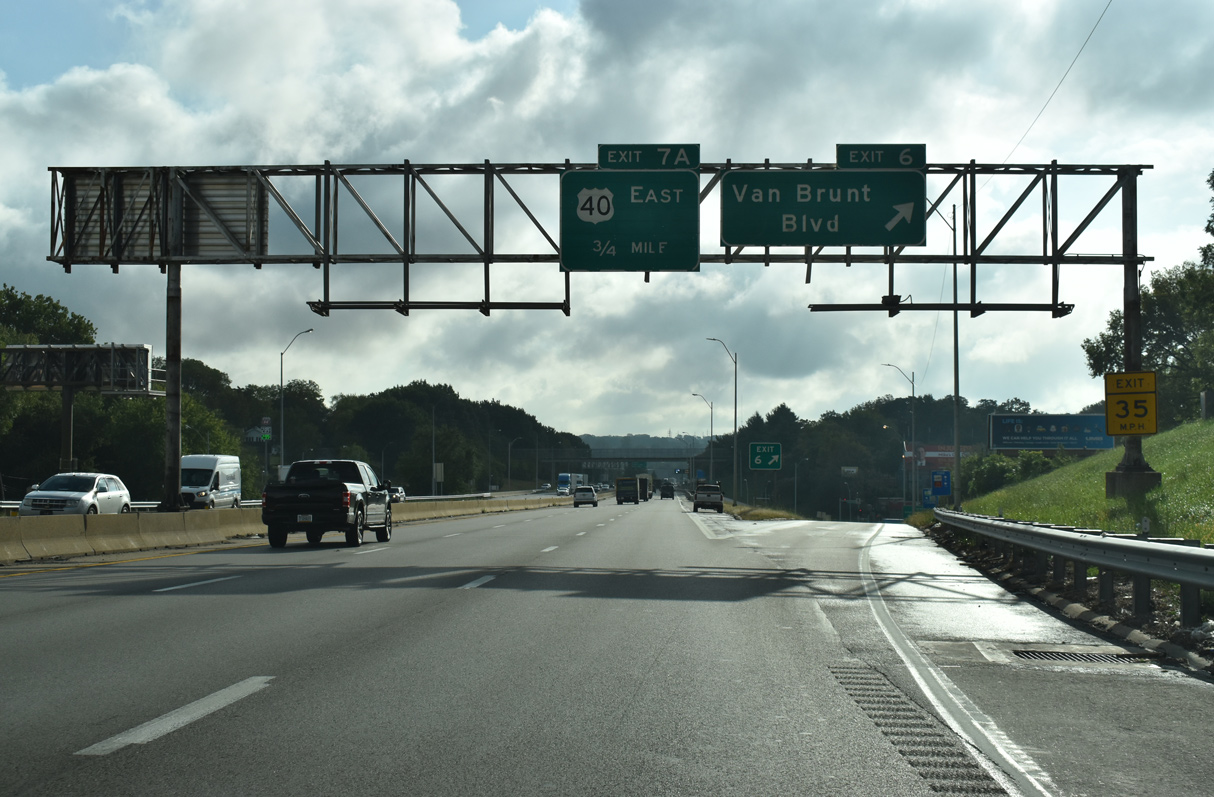
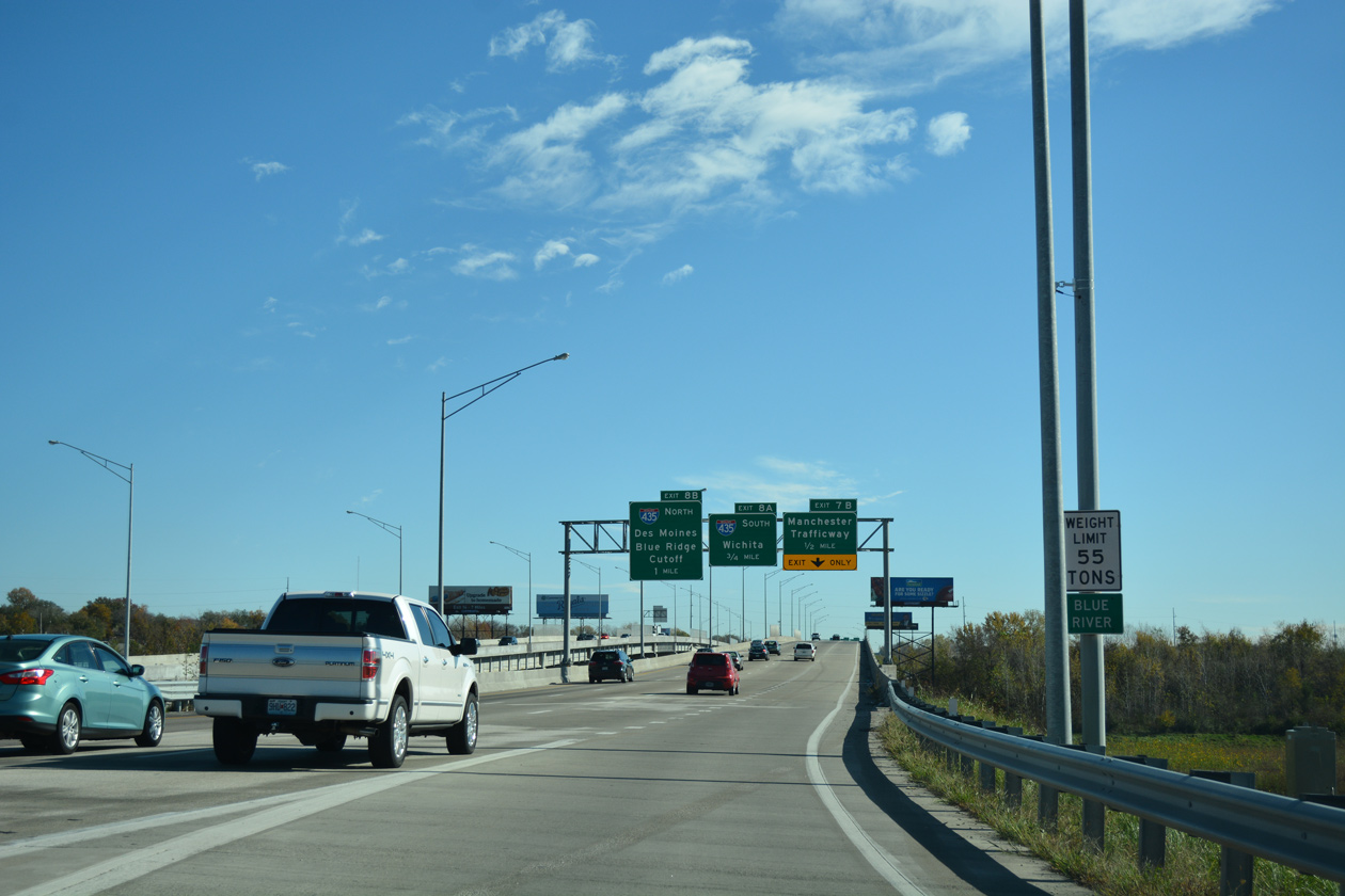
U.S. 40 branches away from I-70/U.S. 24 as a local arterial to the Blue Valley Industrial area and Western Blue Township to the north. The cloverstack interchange (Exits 8A/B) with the Kansas City Beltway follows.
10/07/21
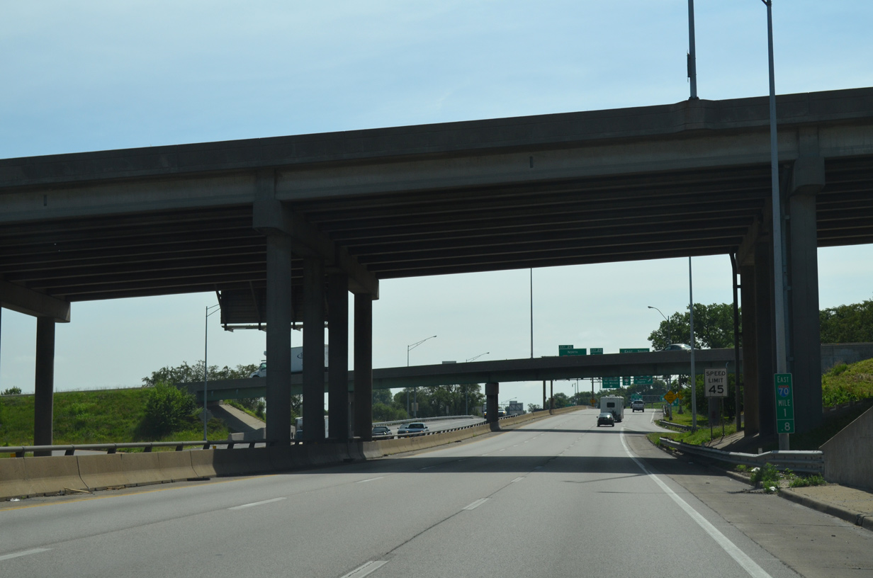
Reassurance markers posted just prior to the split of U.S. 40 east from I-70/U.S. 24. I-70 and U.S. 40 combine again at Exit 24.
10/07/21
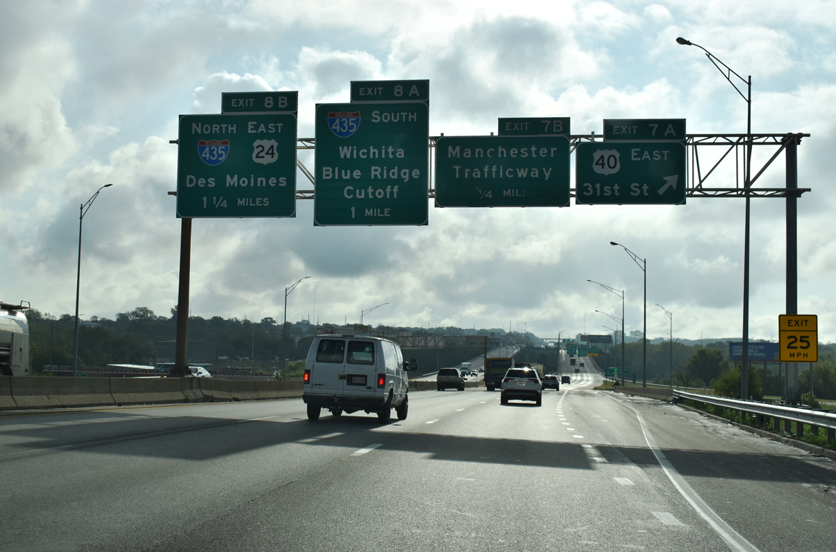
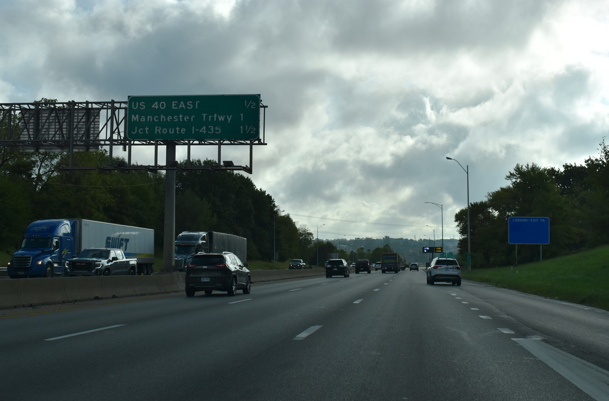
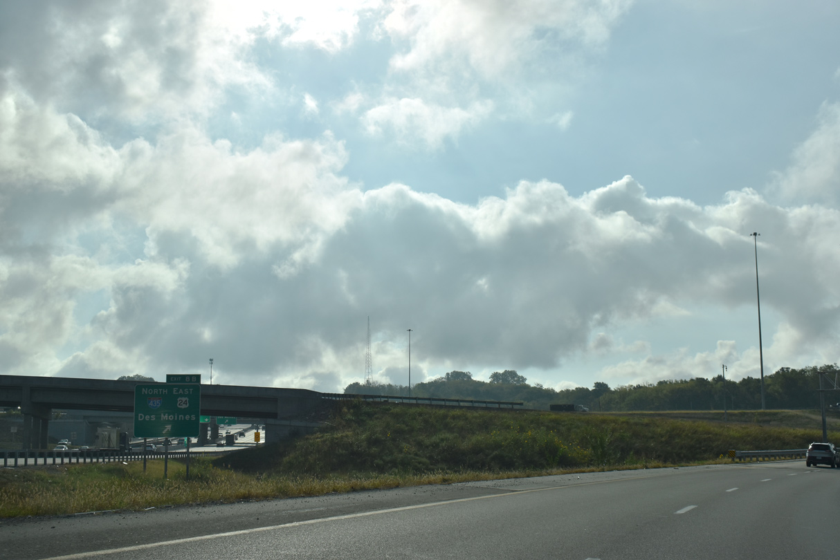
The Blue River viaduct comes into view as I-70/U.S. 24 and U.S. 40 separate at the parclo B2 interchange with 31st Street at the Leeds community. Forthcoming Interstate 435 travels north to I-35 at Claycomo for Des Moines, Iowa.
10/07/21
East 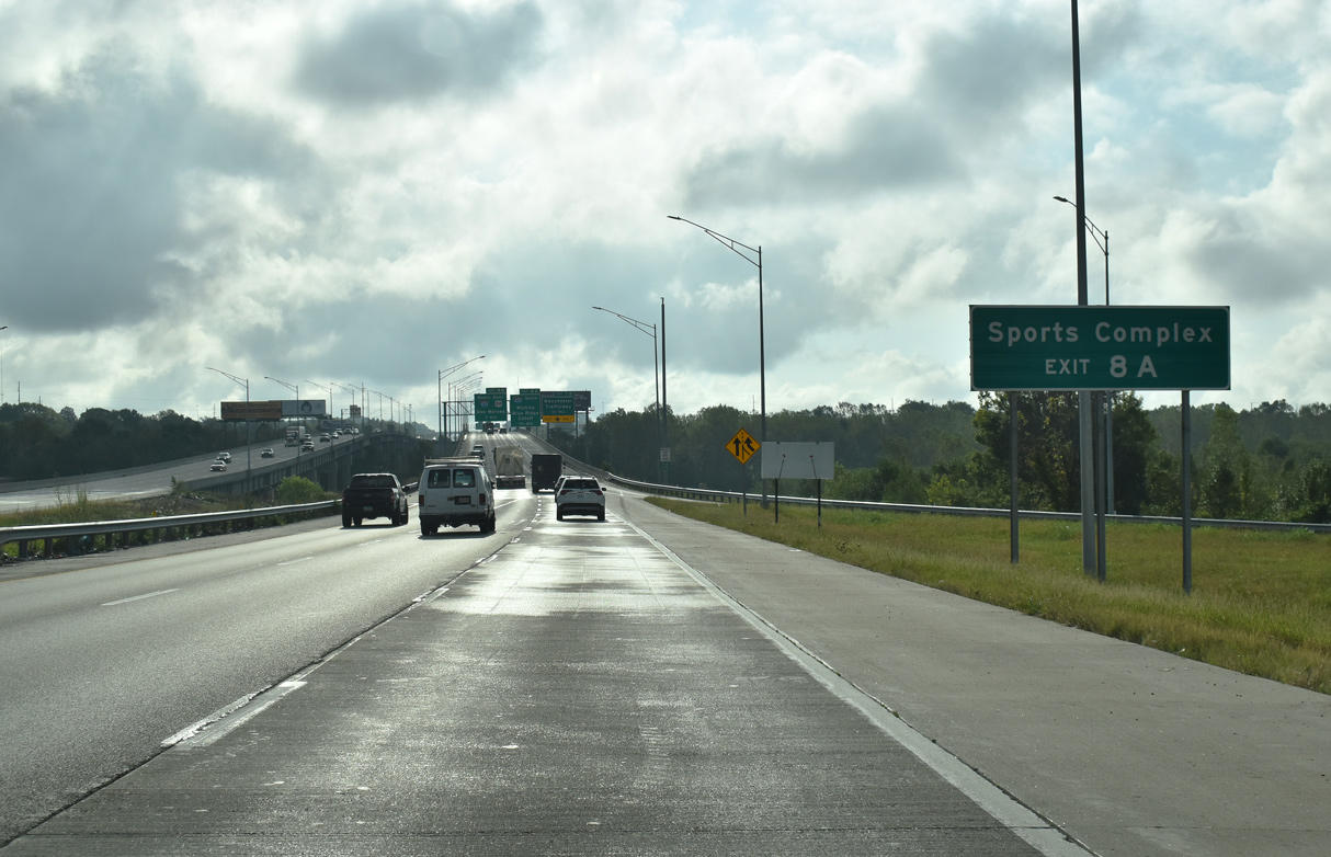
Accessible from Exit 8A, Kauffman Stadium (home of the KC Royals) and Arrowhead Stadium (home of the KC Chiefs) lie east of I-435 and south of I-70.
10/07/21
The early 1950s bridges spanning the Blue River, BNSF and Kansas City Southern Railroads were replaced between February 2014 and December 2015.
11/03/16
Also rebuilt in 2014/15, a folded diamond interchange (Exit 7B) joins I-70 with Manchester Trafficway just east of the Blue River viaduct.
10/07/21
The 2014-15 project replacing the Blue River viaduct expanded I-70 to eight overall lanes with the addition of an auxiliary lane in each direction.
11/03/16
Exit 7B ties into Manchester Trafficway between a mobile home park and industrial areas of Leeds. Construction from March 7, 2019 to October 5, 2020 rebuilt the succeeding exchange with I-435 into a partial turbine interchange.
10/07/21
Funded by ARRA, a $32.4 million project added the collector distributor roadway extending east from Exit 8A to Blue Ridge Cutoff. Coupled with the addition of a ramp from U.S. 40 west to I-70 east back at Exit 7, work ran from 2010 to 2012.3
10/07/21
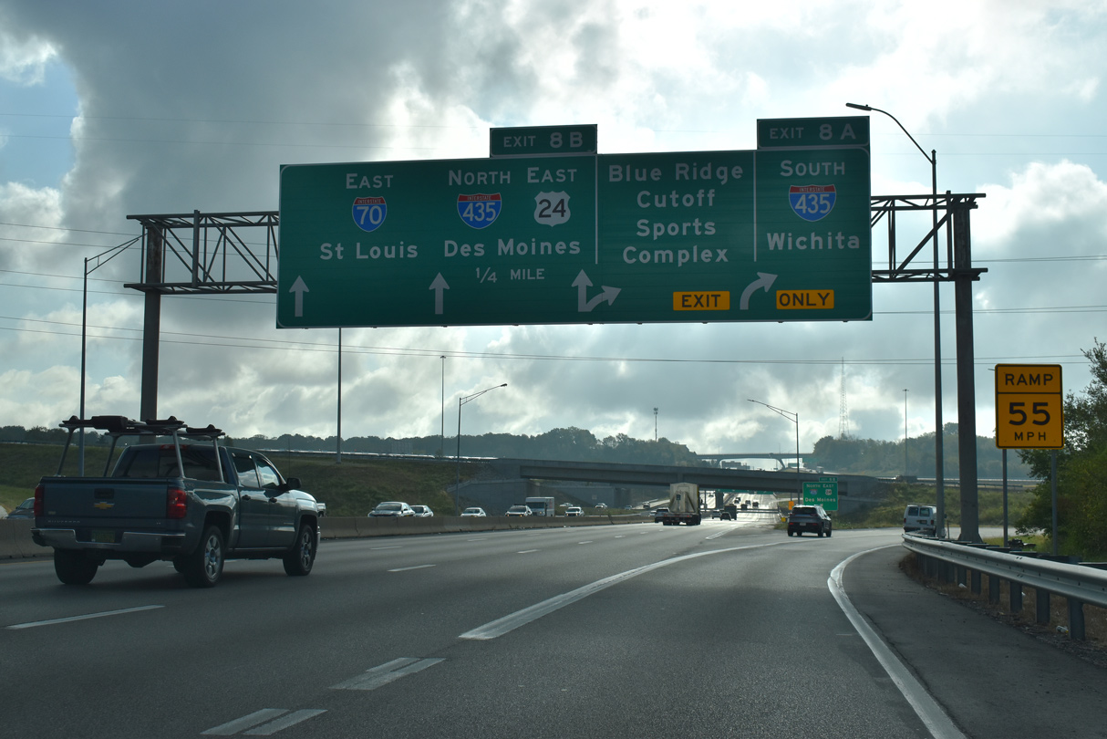
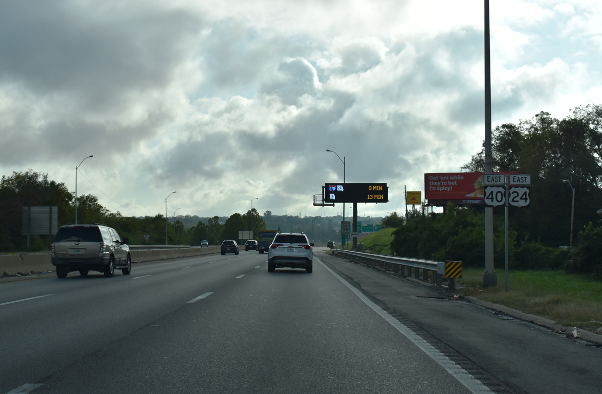
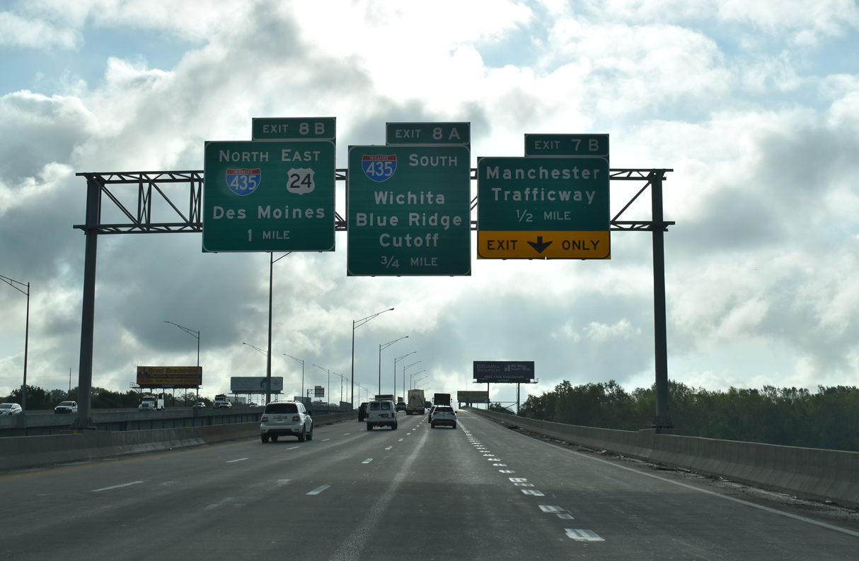
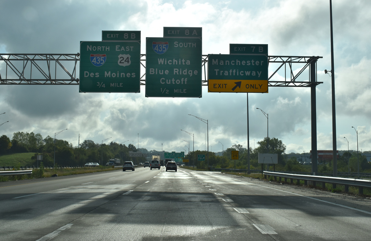
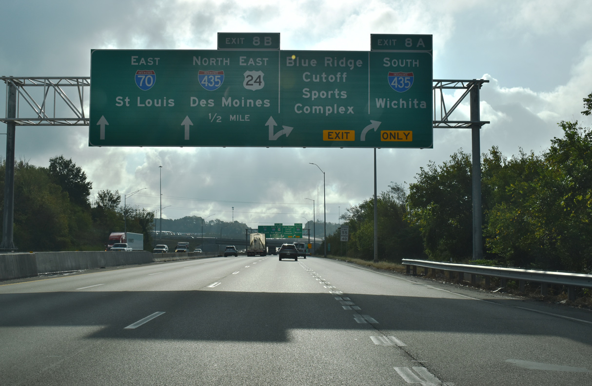
Two lanes leave I-70/U.S. 24 at Exit 8A for Interstate 435 south to Raytown, Grandview, I-49 south to Joplin and Overland Park, Kansas.
10/07/21
Exit 8B leaves I-70 east for the outer loop of Interstate 435 to the Kansas City Northland and Kansas City International Airport (MCI). The 2018 realignment of U.S. 24 off Independence Avenue includes I-435 north to Winner Road.
10/07/21
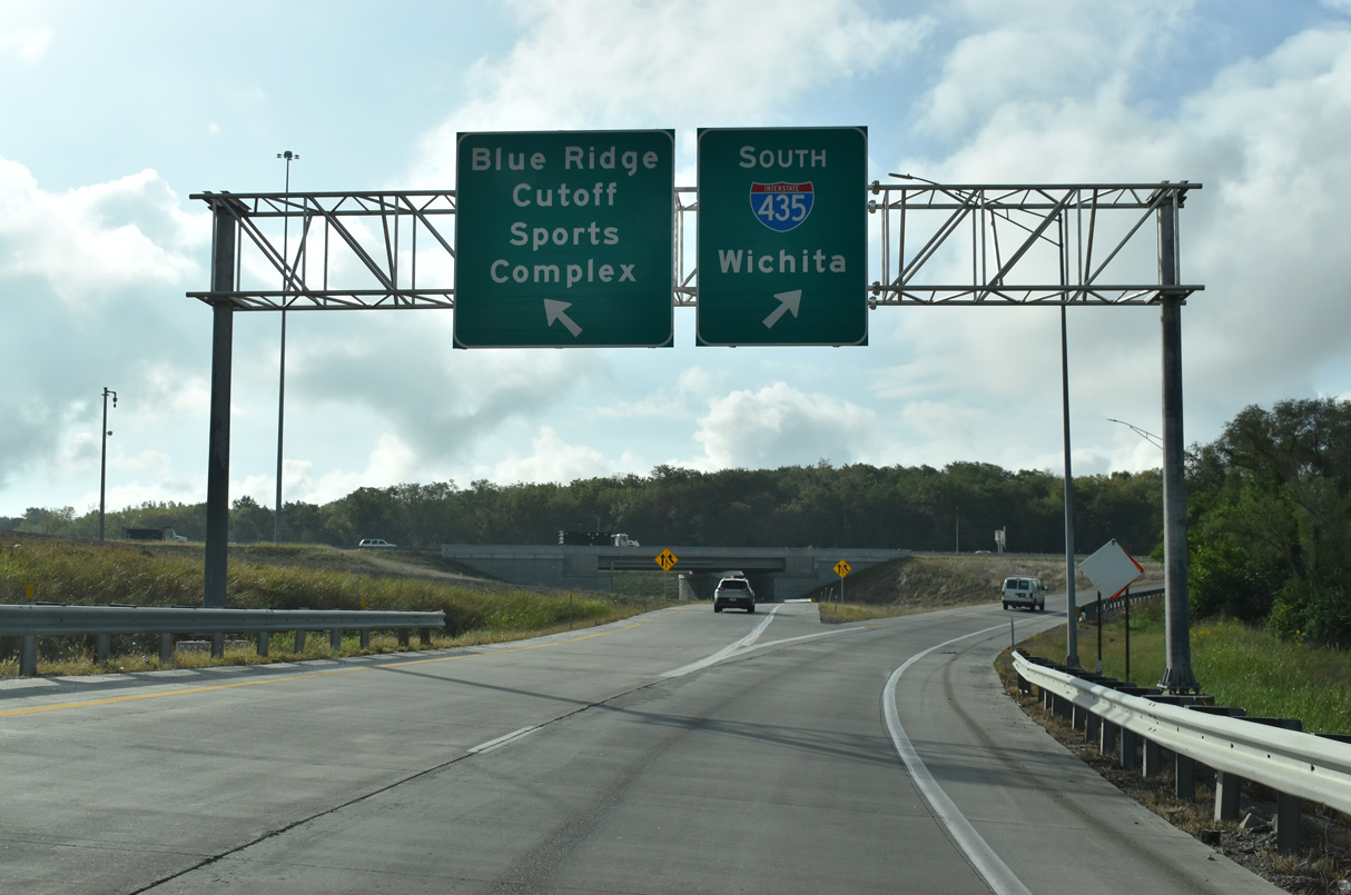
Traffic partitions for I-435 south for I-35 to Wichita, Kansas and the c/d roadway for Blue Ridge Cutoff to both the Royals and Chiefs sports complex.
10/07/21
East 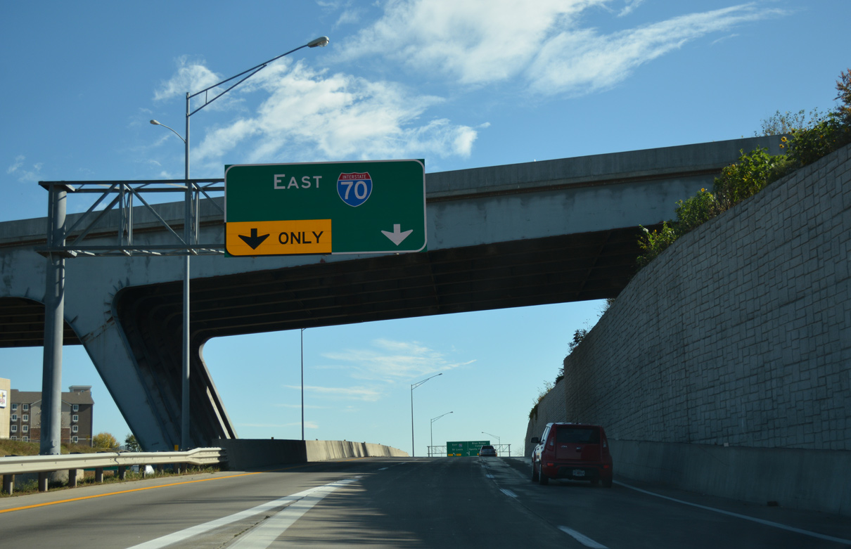
Stadium Way spans the eastbound c/d roadway from Exit 8A ahead of Blue Ridge Cutoff.
11/03/16

Traffic partitions along the c/d roadway at the diamond interchange with Blue Ridge Cutoff.
11/03/16
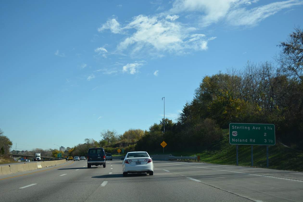
The ensuing exit from Interstate 70 east departs in 1.75 miles for Sterling Avenue.
11/03/16
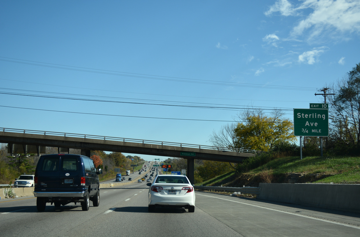
Sterling Avenue heads north into the city of Independence and south to the Sterling Gardens neighborhood in Kansas City and Raytown.
11/03/16
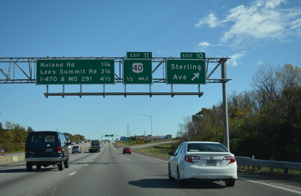
U.S. 40 crosses paths with Interstate 70 again at a diamond interchange (Exit 11) just east of Sterling Avenue.
11/03/16
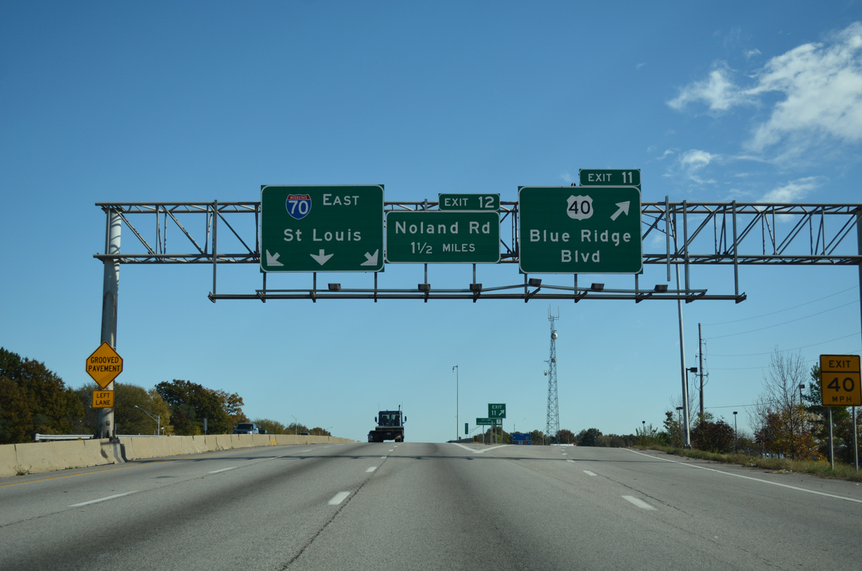
Exit 11 connects with U.S. 40 just west of Blue Ridge Boulevard. U.S. 40 shifts south of I-70 along the Independence / Kansas City line.
11/03/16
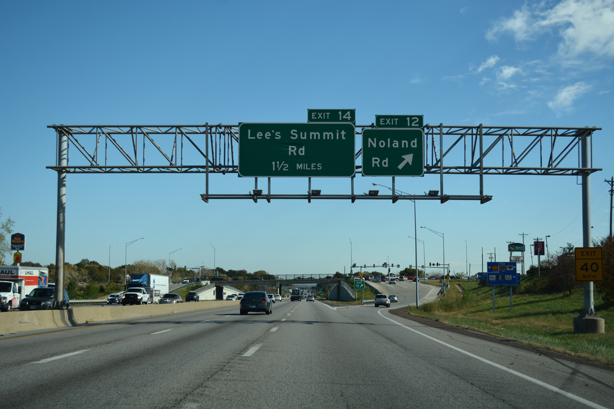
Noland Road constitutes a commercial boulevard leading north from I-70 to the Independence city center. South from Exit 12 and parallel U.S. 40, Noland Road becomes Highway V into the Blue Vue Hills neighborhood of Kansas City.
11/03/16
Interests to Independence Center mall are directed to remain along I-70 east to Little Blue Parkway north in lieu of E 39th Street from forthcoming Lee's Summit Road.
11/03/16
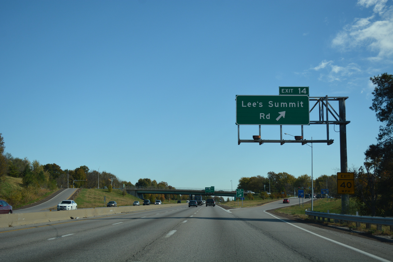
Lee's Summit Road runs south from Exit 14 to Little Blue Trace County Park and the city of Lee's Summit. The road north parallels Route 291 to U.S. 24 within Independence.
11/03/16
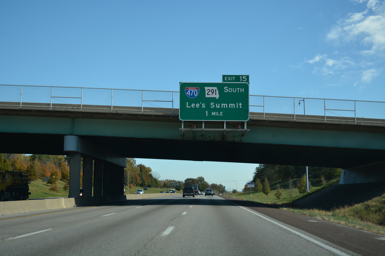
A cloverleaf interchange (Exit 15) joins Interstate 70 with the north end of I-470 and Route 291 in one mile.
11/03/16
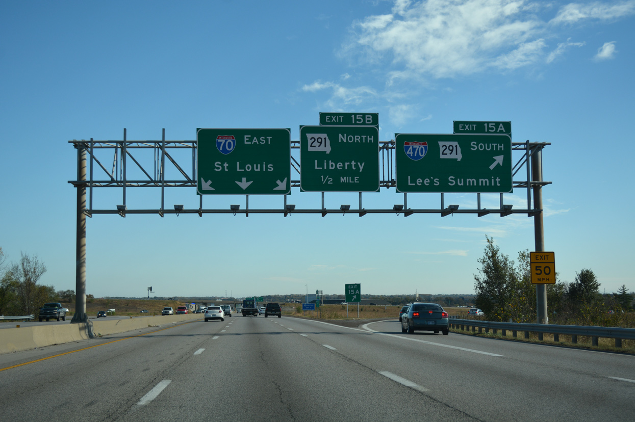
I-470 and Route 291 overlap south to Lee's Summit. I-470 turns west from there to South Kansas City.
11/03/16
Route 291 extends north from I-70/470 through eastern reaches of Independence. The state route crosses the Missouri River to the village of River Bend and the Clay County seat of Liberty.
11/03/16
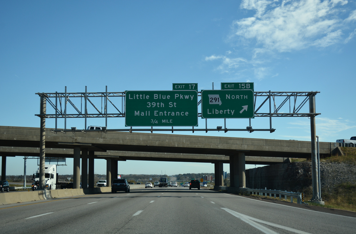
Continuing east from Exit 15, Interstate 70 reaches the city of Blue Springs at Woods Chapel Road in 2.5 miles.
11/03/16
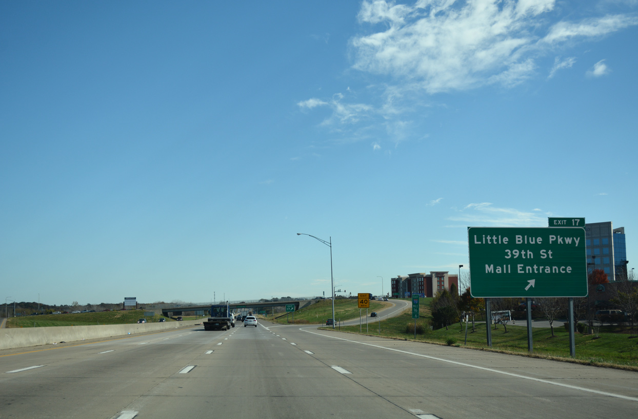
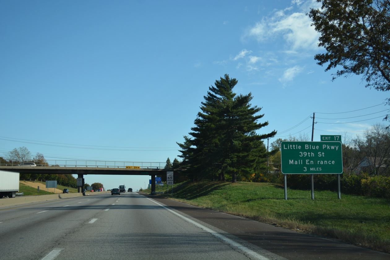
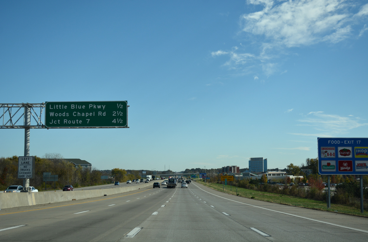
Retail lines both sides of Interstate 70 from Silverstein Eye Centers Arena and the Little Blue River to the diamond interchange (Exit 17) with Little Blue Parkway.
11/03/16
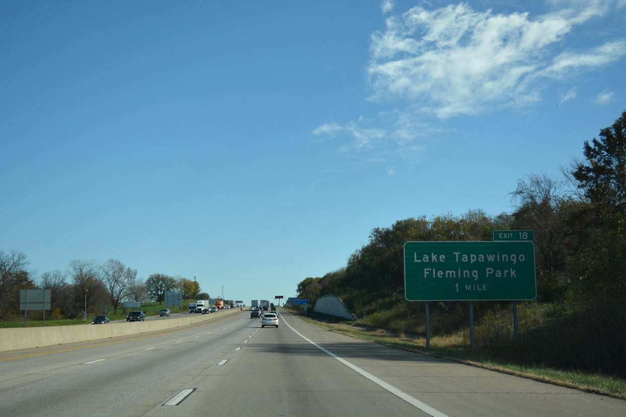
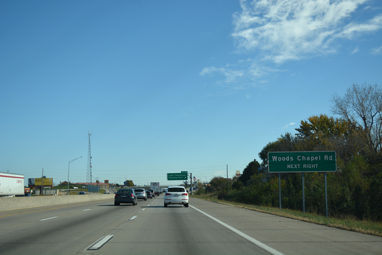
Woods Chapel Road connects with Interstate 70 north from the city of Lake Tapawingo at Exit 18.
11/03/16
Woods Chapel Road heads south from I-70 to U.S. 40. A second branch of the road arcs southwest across Blue Springs Lake and Fleming Park to I-470 at Lee's Summit.
11/03/16
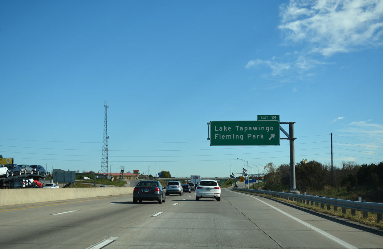
A diverging diamond interchange (DDI) connects I-70 with Woods Chapel Road south and R.D. Mize Road north back into Independence.
11/03/16
References:
- "Bridge ramp linking EB I-70 to I-35 in KC ordered closed." KMBC (Kansas City, MO), April 14, 2015.
- "Re: Kansas City" online posting by intelati49, AARoads Forum, July 16, 2015.
- I70_I435 project web site,
http://www.modot.org/kansascity/ major_projects/i70_i435.htmMoDOT - Kansas City District. Accessed October 20, 2016.
Photo Credits:
- ABRoads: 06/19/15, 10/07/21
- Alex Nitzman: 11/03/16, 10/07/21
Connect with:
Page Updated Thursday October 21, 2021.