
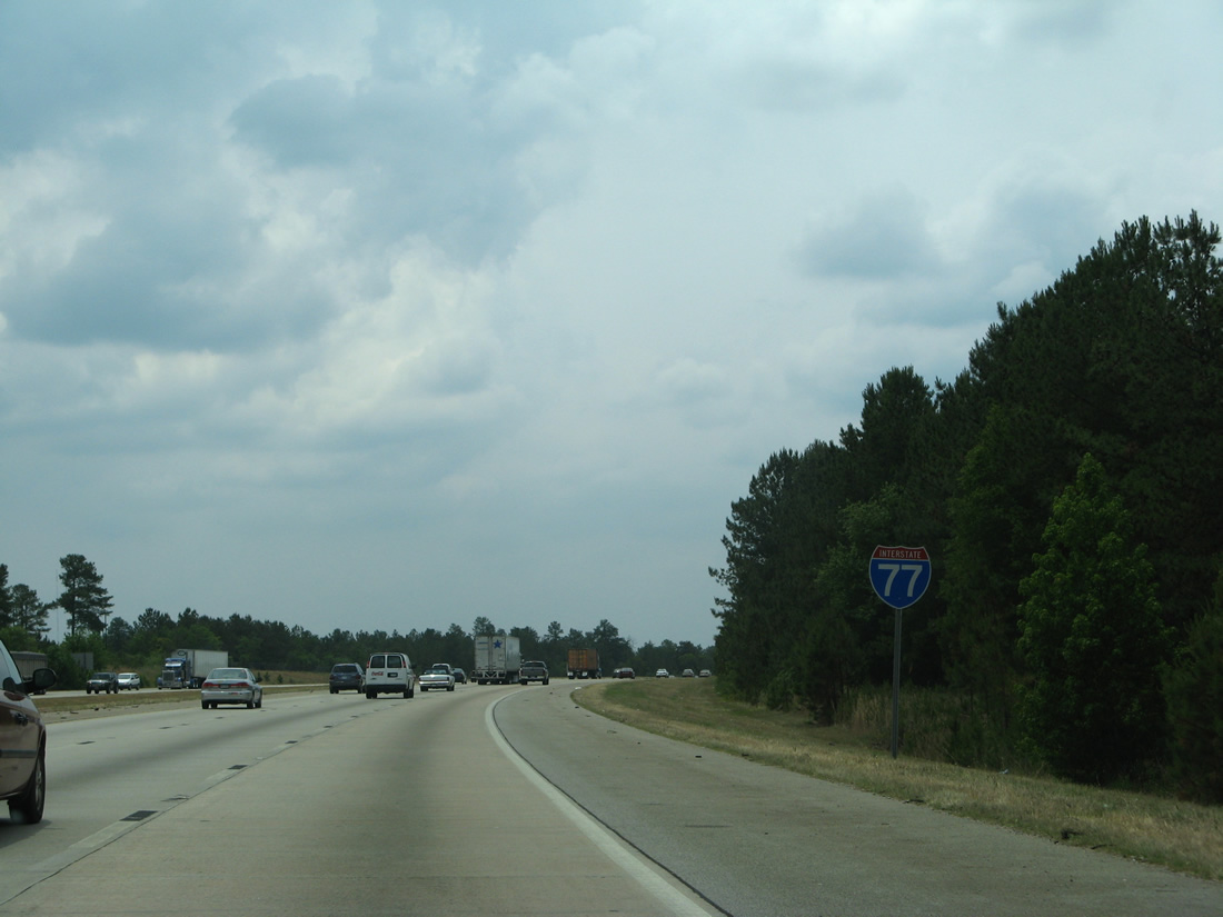
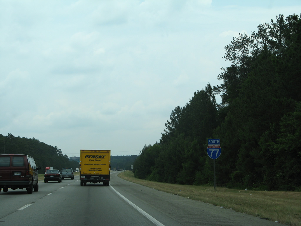
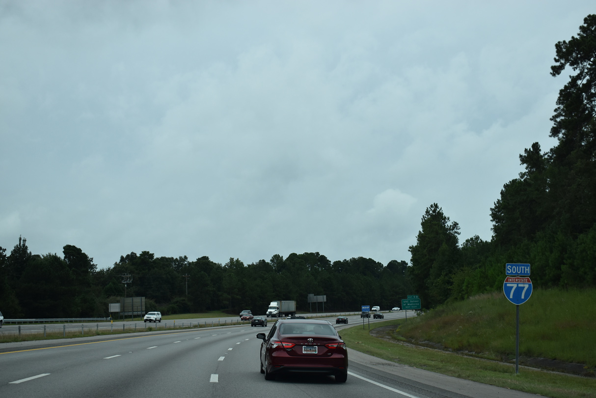
Interstate 77 South - Blythewood to Cayce
 South
South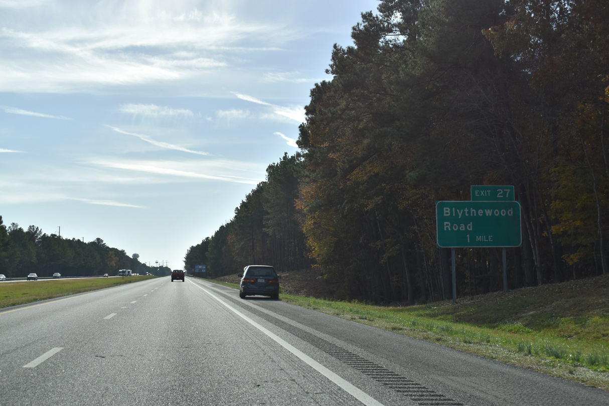
Interstate 77 proceeds south by Cobblestone Park Golf Club to Exit 27 for Blythewood Road (Road 59).
11/21/21
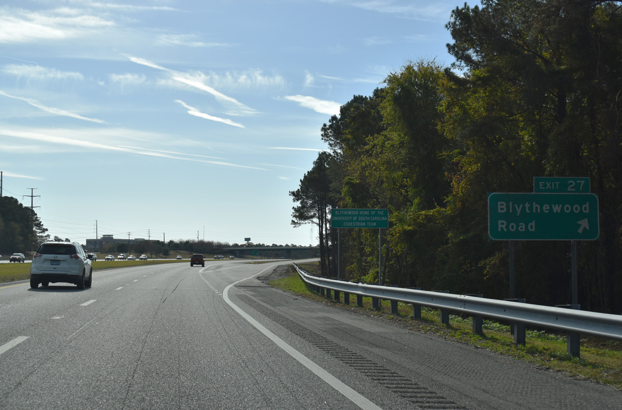
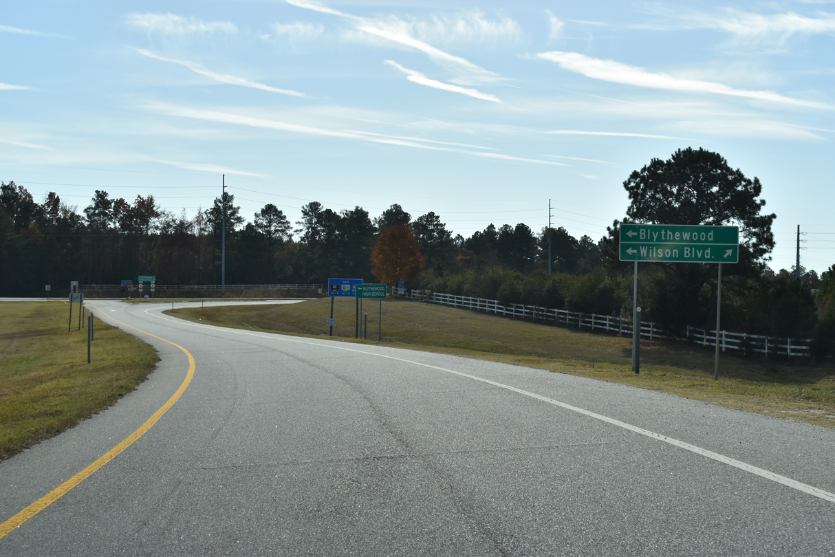
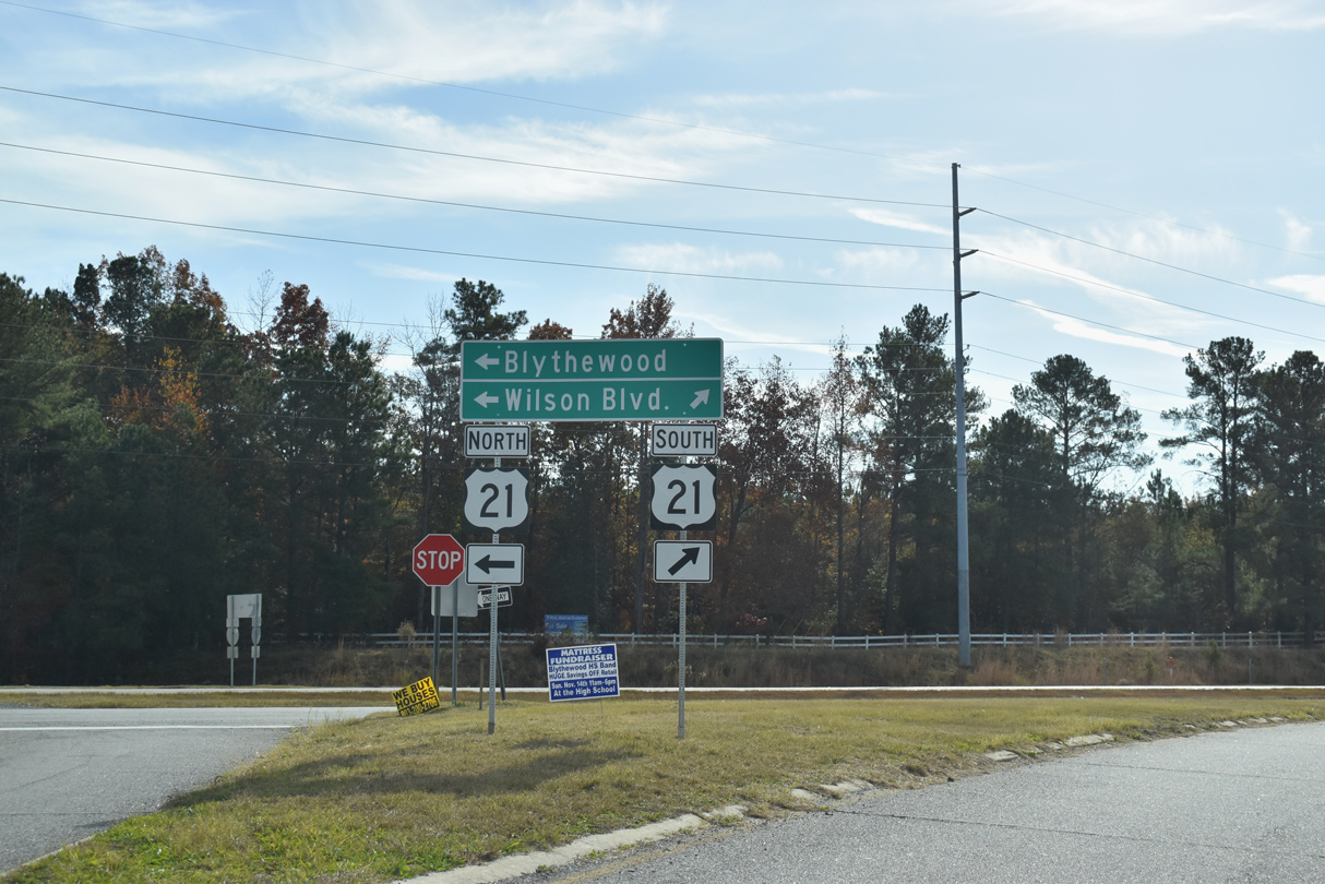
Blythewood Road (Road 59) connects Interstate 77 with U.S. 21 (Wilson Boulevard), 0.62 miles to the east in Blythewood. Blythewood Road continues 4.20 miles west from the diamond interchange at Exit 27 to U.S. 321 (Winnsboro Road).
11/21/21

The final 13 interchanges along Interstate 77 south to I-26 serve the city of Columbia.
11/21/21
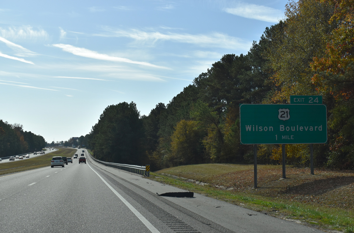
U.S. 21 (Wilson Boulevard) shifts southwest from Blythewood and S.C. 555 (Farrow Road) to a six-ramp parclo interchange (Exit 24) with I-77.
11/21/21
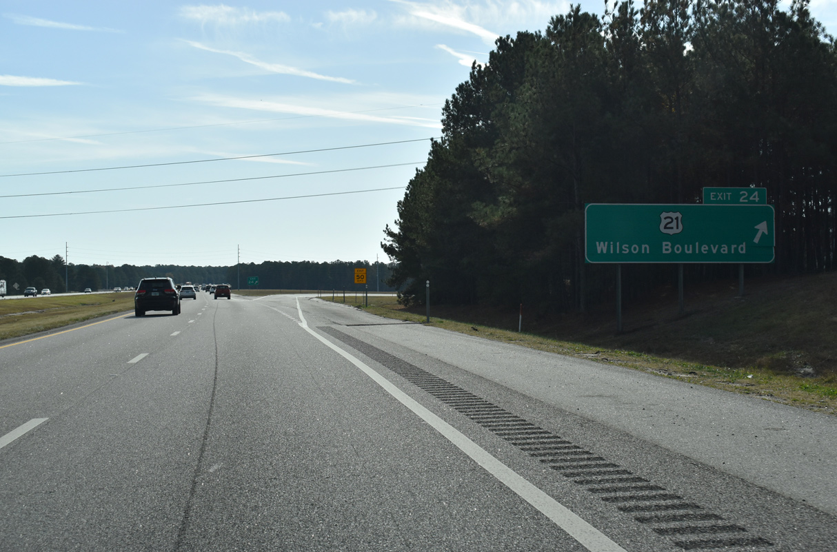
Exit 24 departs Interstate 77 south for U.S. 21 (Wilson Boulevard). U.S. 21 follows N Main Street south to Elmwood Street outside Downtown Columbia.
11/21/21
Interstate 77 expands to a six lane freeway south from Exit 24.
06/01/07
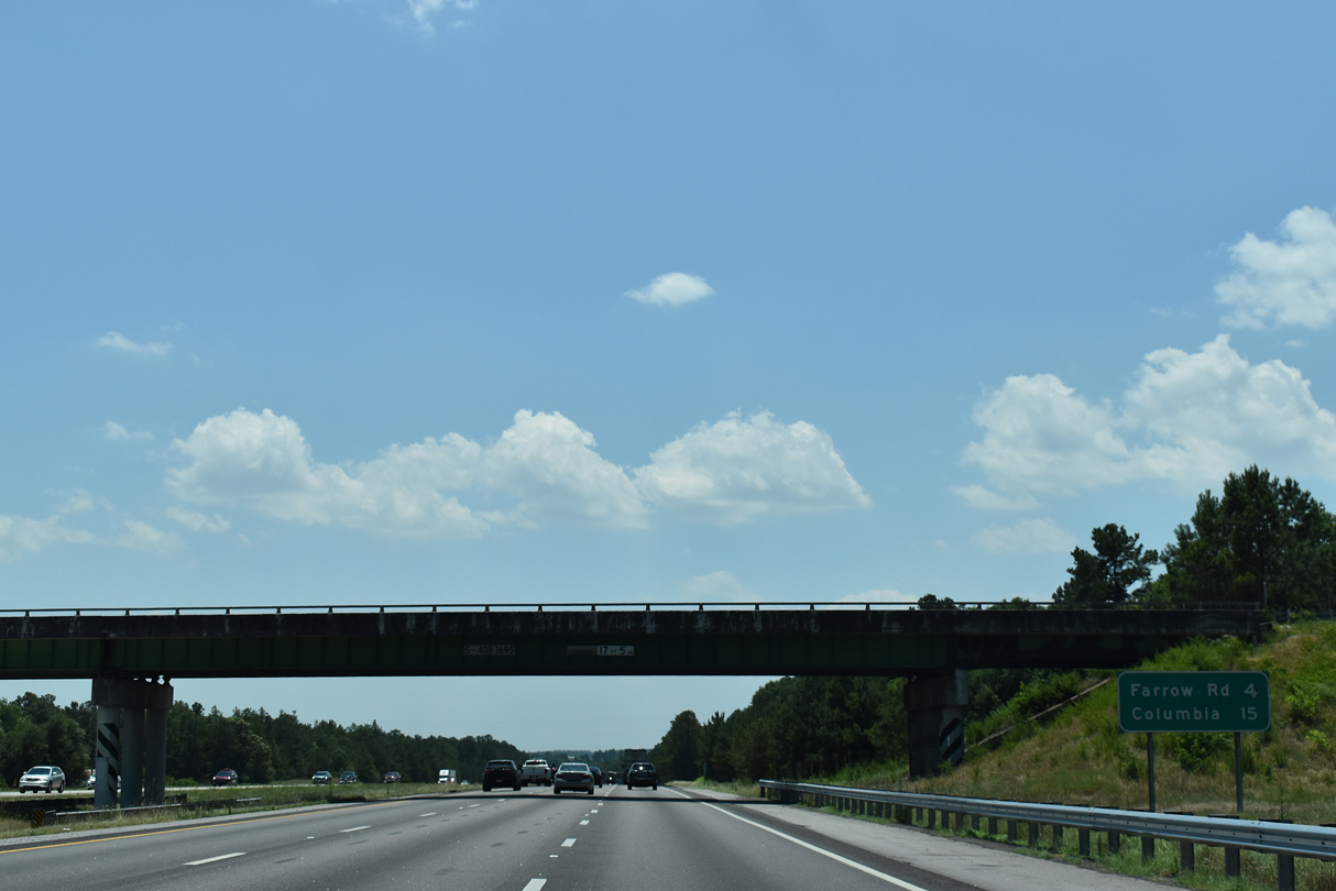
Farrow Road turns southwest and crosses Interstate 77 in four miles. This distance sign omits the diamond interchange (Exit 22) with Killian Road.
05/26/19
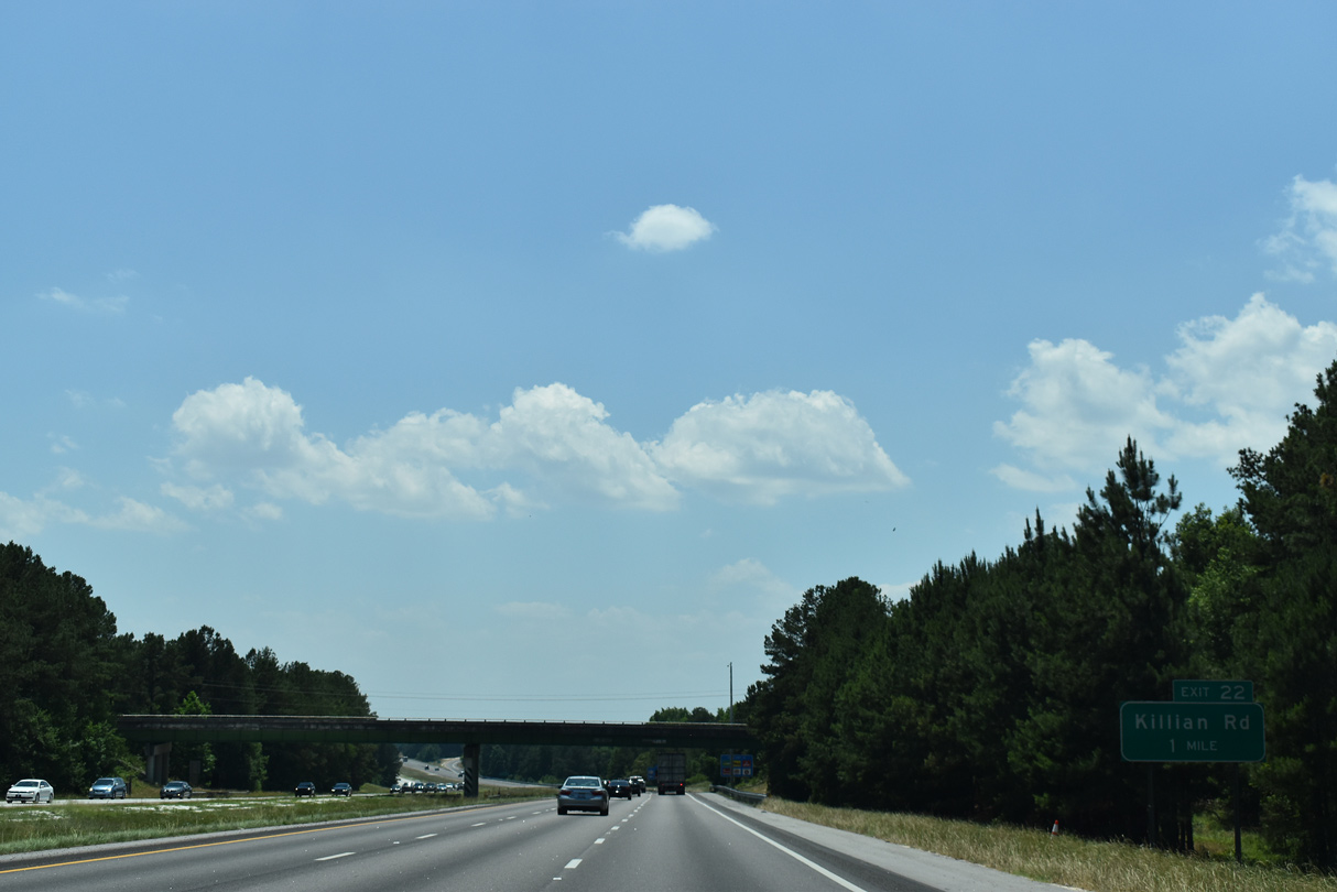
Killian Road constitutes a suburban arterial within the vicinity of Interstate 77. A number of car dealerships and retail were built along Killiam Road since 2008, with development continuing along a realignment of the road east to Clemson Road.
05/26/19
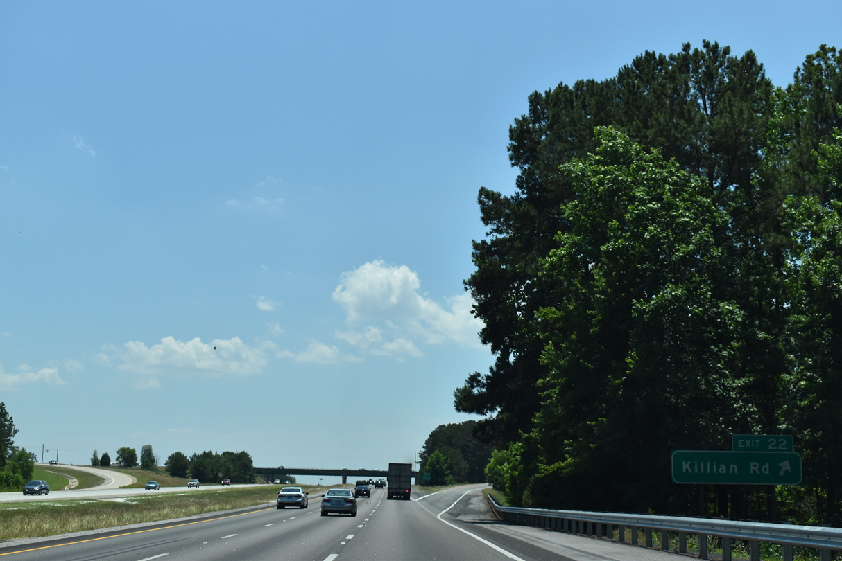
East from Exit 22, Killian Road becomes Clemson Road beyond the intersection with S.C. 555 (Farrow Road). Clemson Road and the realignment of Killian Road were constructed as part of a $9.2 million project completed in 2006.1 The four lane belt route leads southeast to U.S. 1 (Two Notch Road) near Pontiac.
05/26/19
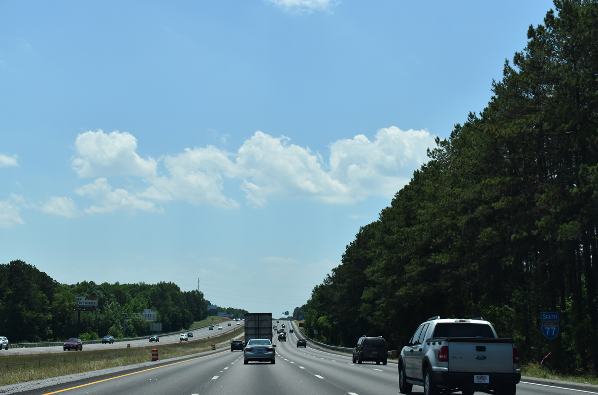
The speed limit along the remainder of Interstate 77 south from just ahead of Exit 19 is 60 miles per hour.
05/26/19
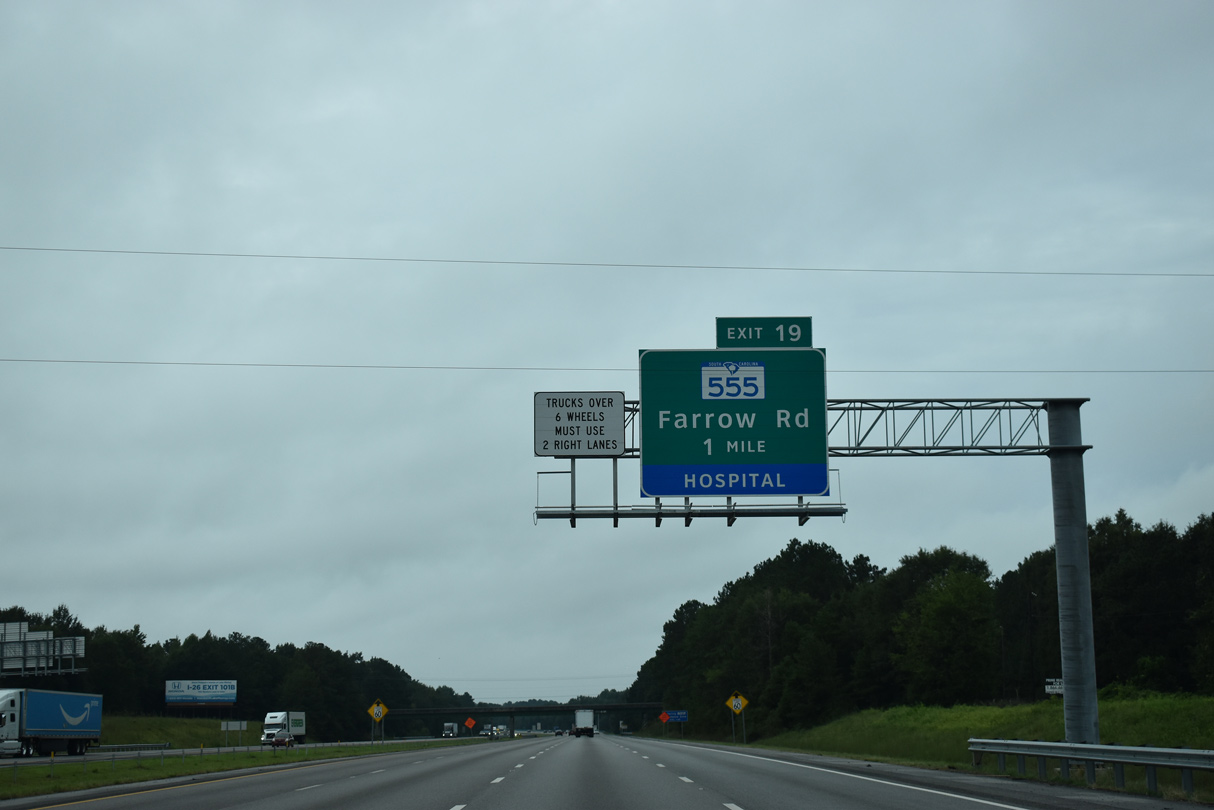
S.C. 555 (Farrow Road) converges with I-77 at a folded diamond interchange (Exit 19) east of Carolina Research Park and Midlands Technical College. Exit 19 also serves the South Carolina Archives & History Center.
09/20/21
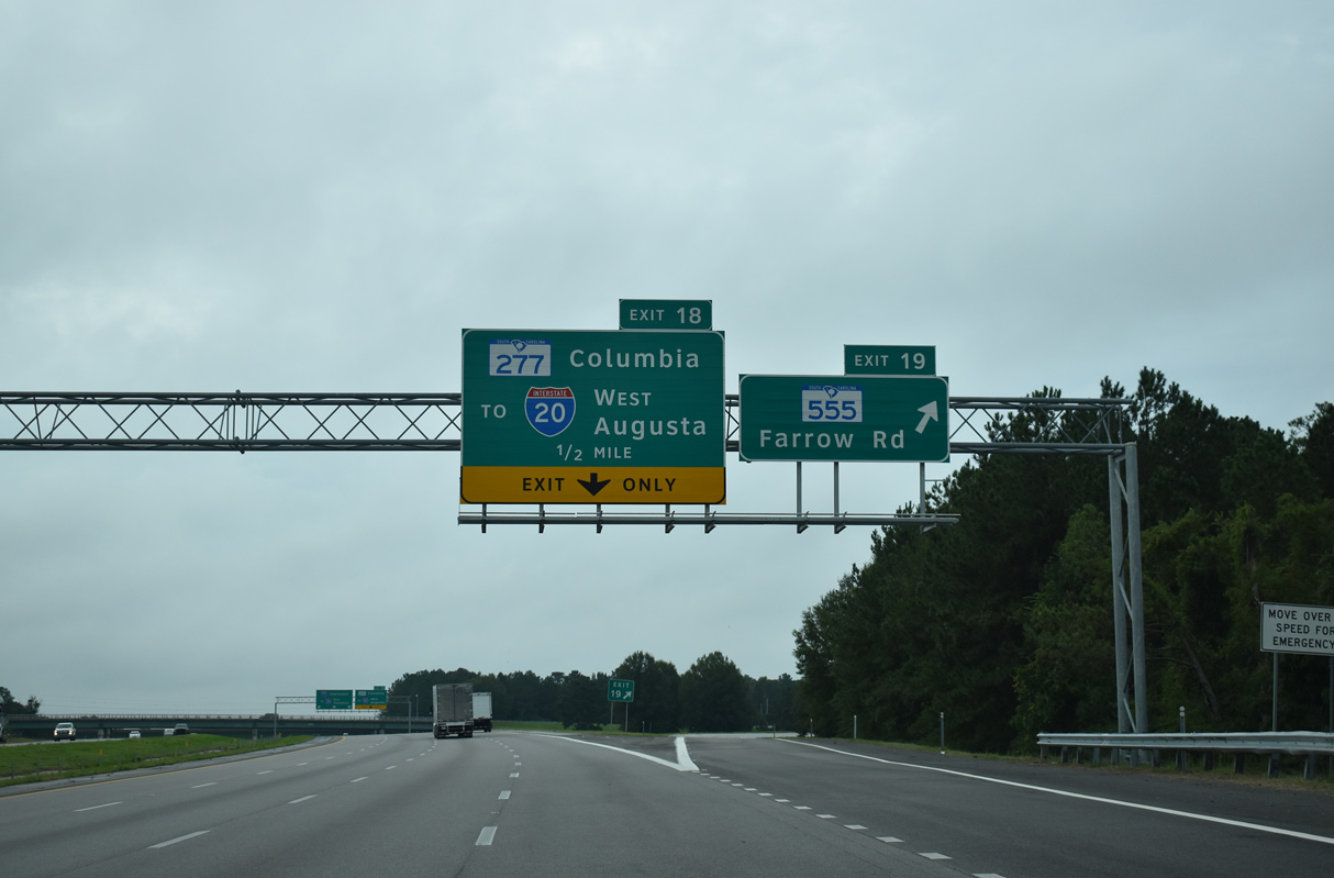
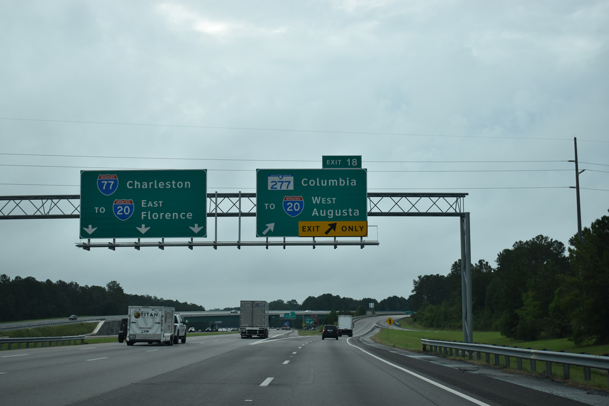
S.C. 555 (Farrow Road) continues 8.02 miles southwest from Exit 19 into Columbia. S.C. 277 (Northeastern Freeway) begins at Exit 18 and parallels Farrow Road southwest to Bull Street in central Columbia.
09/20/21
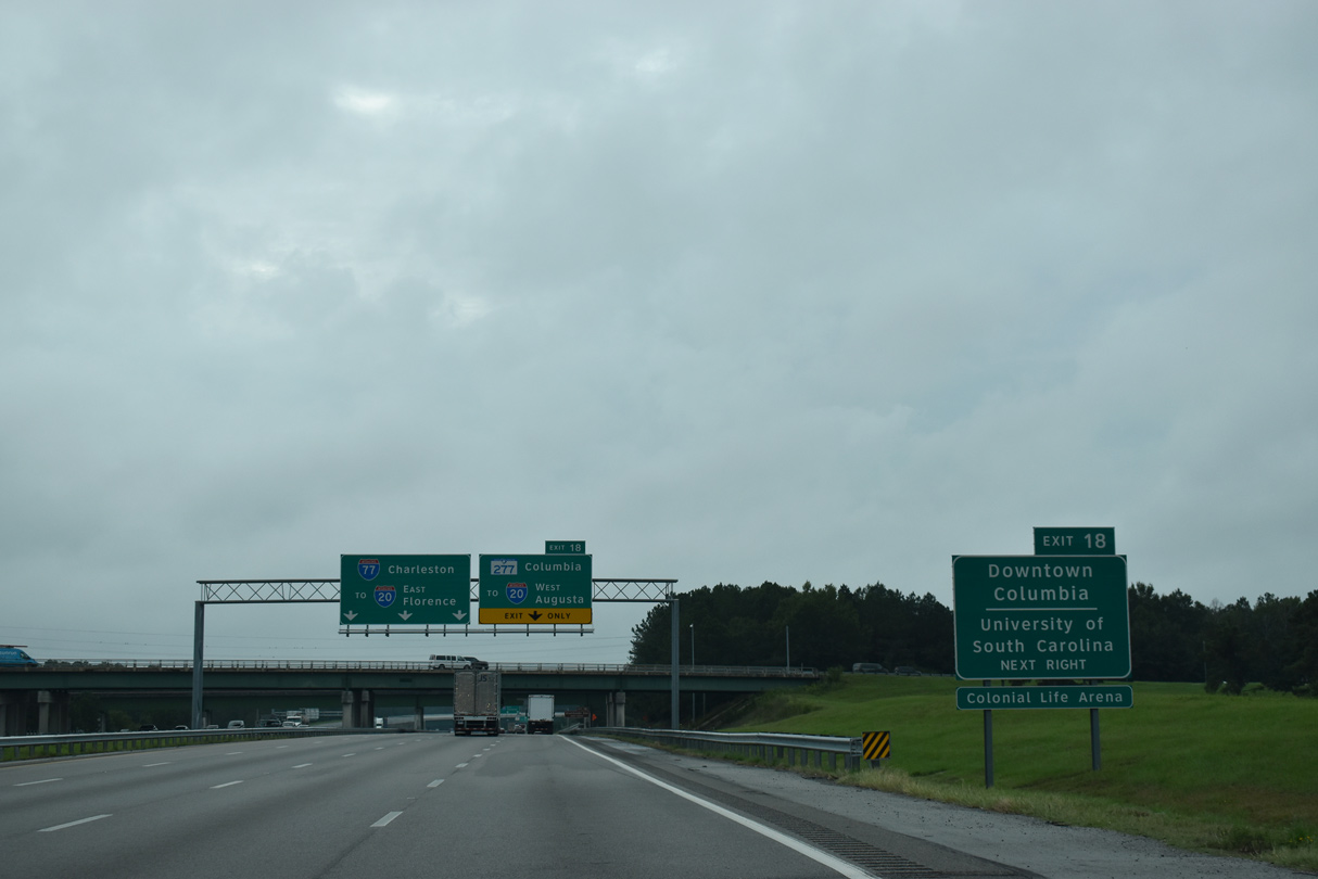
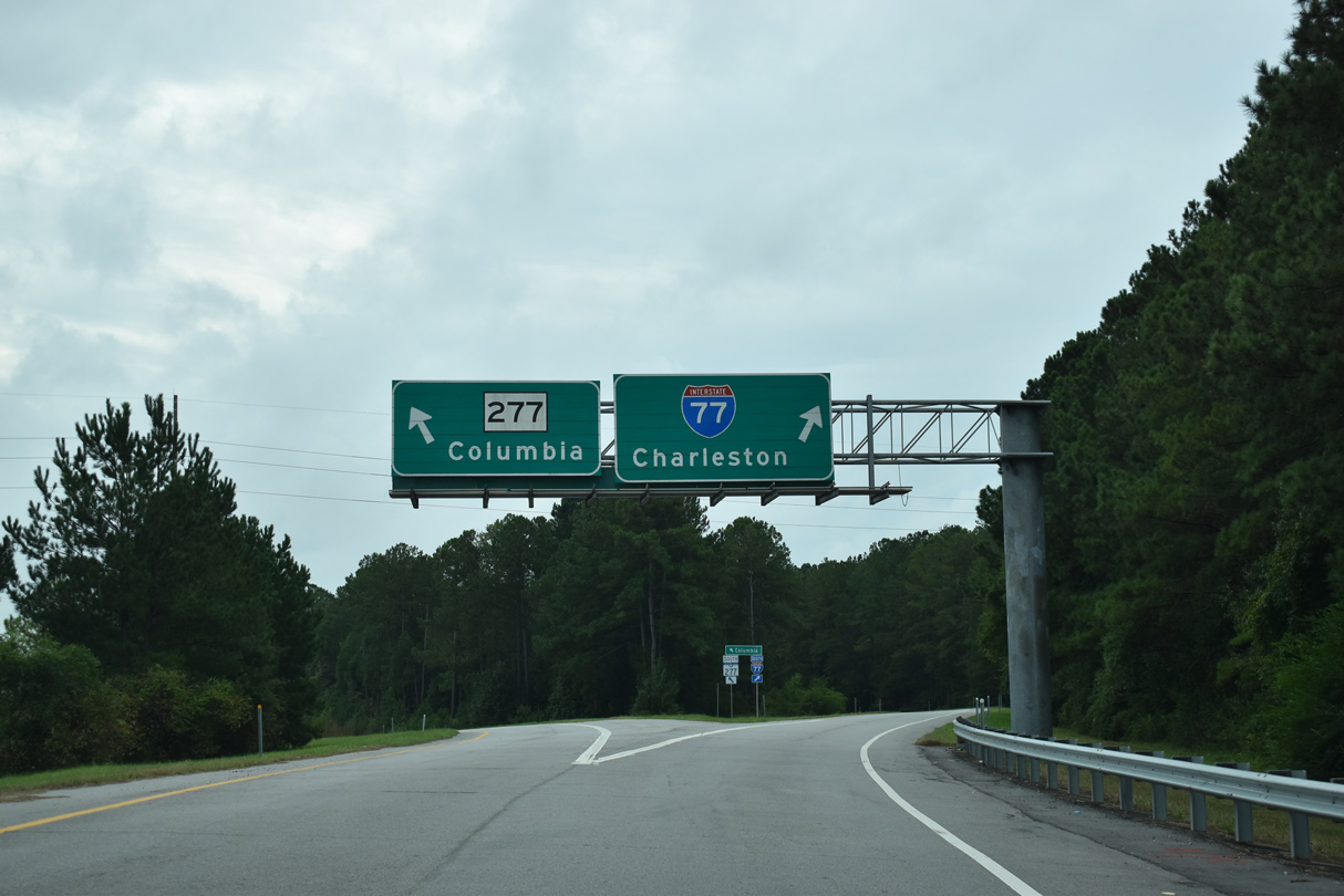
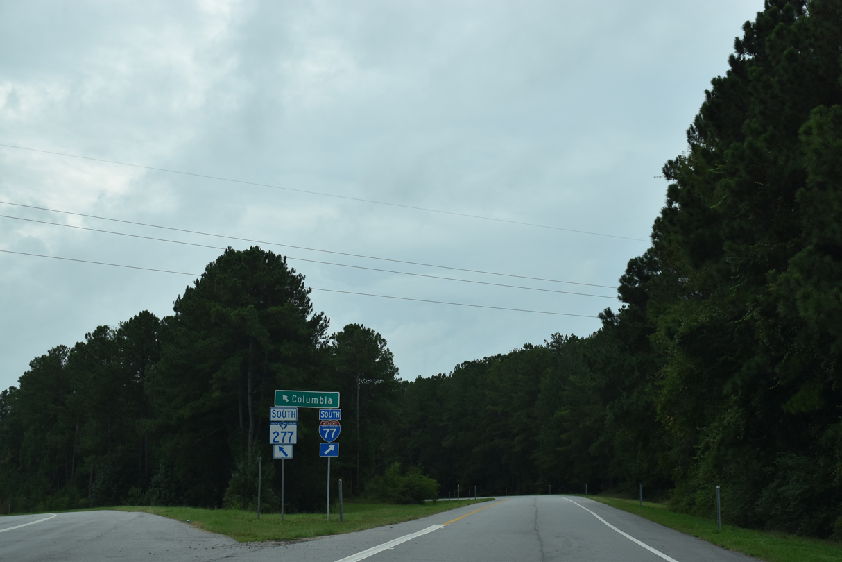
Two lanes partition from I-77 south at Exit 18 for S.C. 277 to Downtown Columbia and the University of South Carolina.
09/20/21
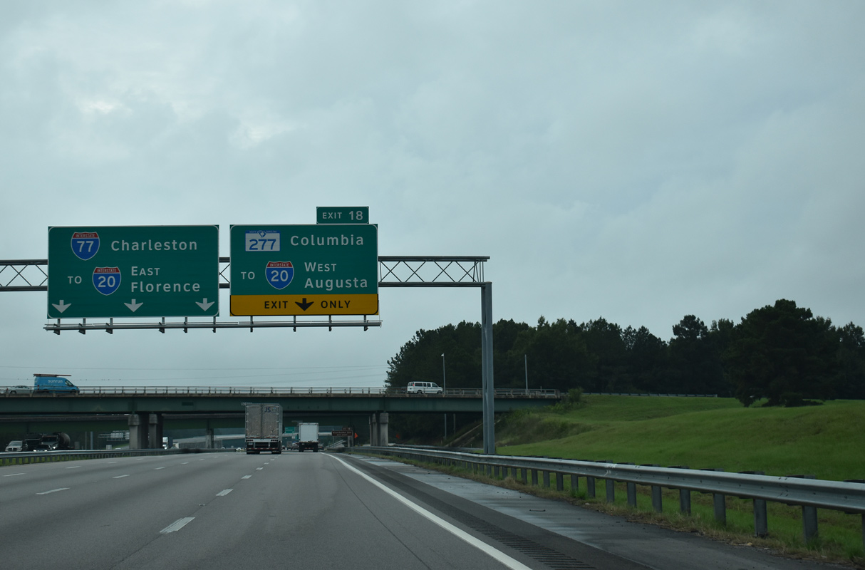
S.C. 277 provides a cutoff from I-77 south 1.11 miles to I-20 west for Lexington and Augusta, Georgia. Interstate 77 meets I-20 directly east of Dentsville in 2.90 miles.
09/20/21
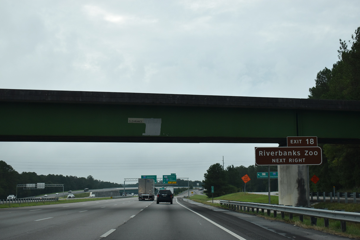
S.C. 277 south to U.S. 76 (Elmwood Avenue) links with Interstate 126 to the Riverbanks Zoo.
09/20/21
S.C. 277 was never slated to become Interstate 277, but it was proposed to continue further southwest than Bull Street.
09/20/21
The entrance ramp from S.C. 555 (Farrow Road) splits into separate ramps ahead of the wye interchange with S.C. 277.
09/20/21
Since removed, a U.S. 1 trailblazer referenced the succeeding exit for Two Notch Road on Interstate 77 south beyond the exchange with S.C. 277/555.
09/20/21
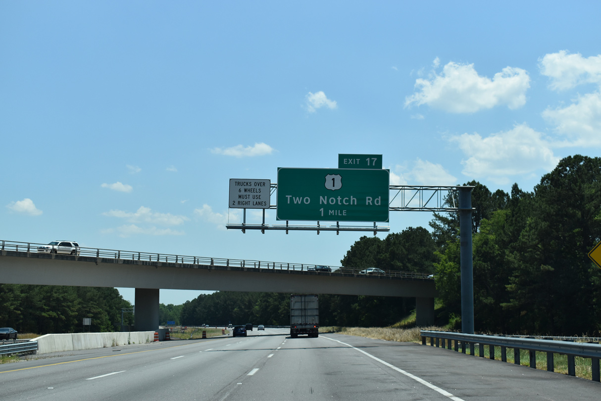
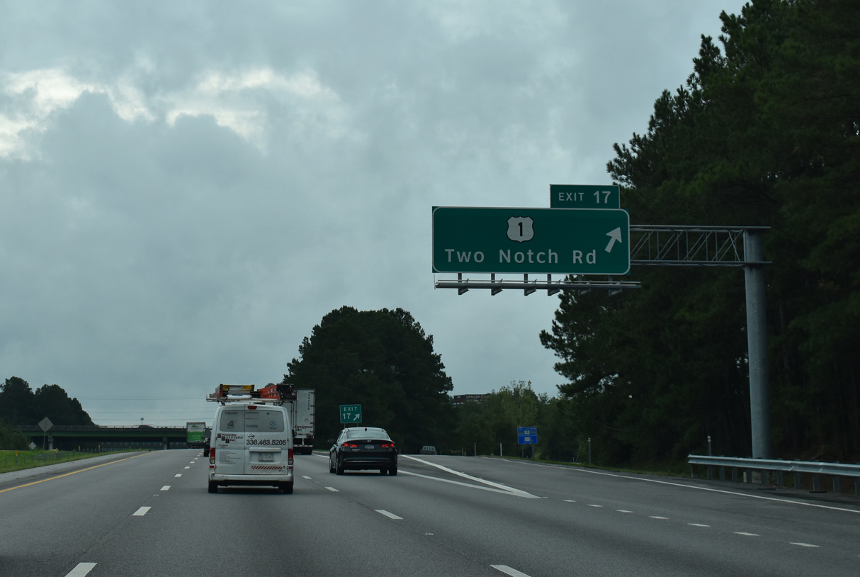
A parclo interchange joins Interstate 77 with U.S. 1 (Two Notch Road) at forthcoming Exit 17. Two Notch Road leading southwest to Dentsville, Arcadia Lakes and Forest Acres is an older commercial boulevard.
05/26/19
Interstate 77 south from S.C. 277 across Jackson Creek was widened to six lanes in 2018.
05/26/19
U.S. 1, better known locally as Two Notch Road, continues east from Exit 17 along a heavily developed commercial corridor to Sesquicentennial State Park and Pontiac.
09/20/21
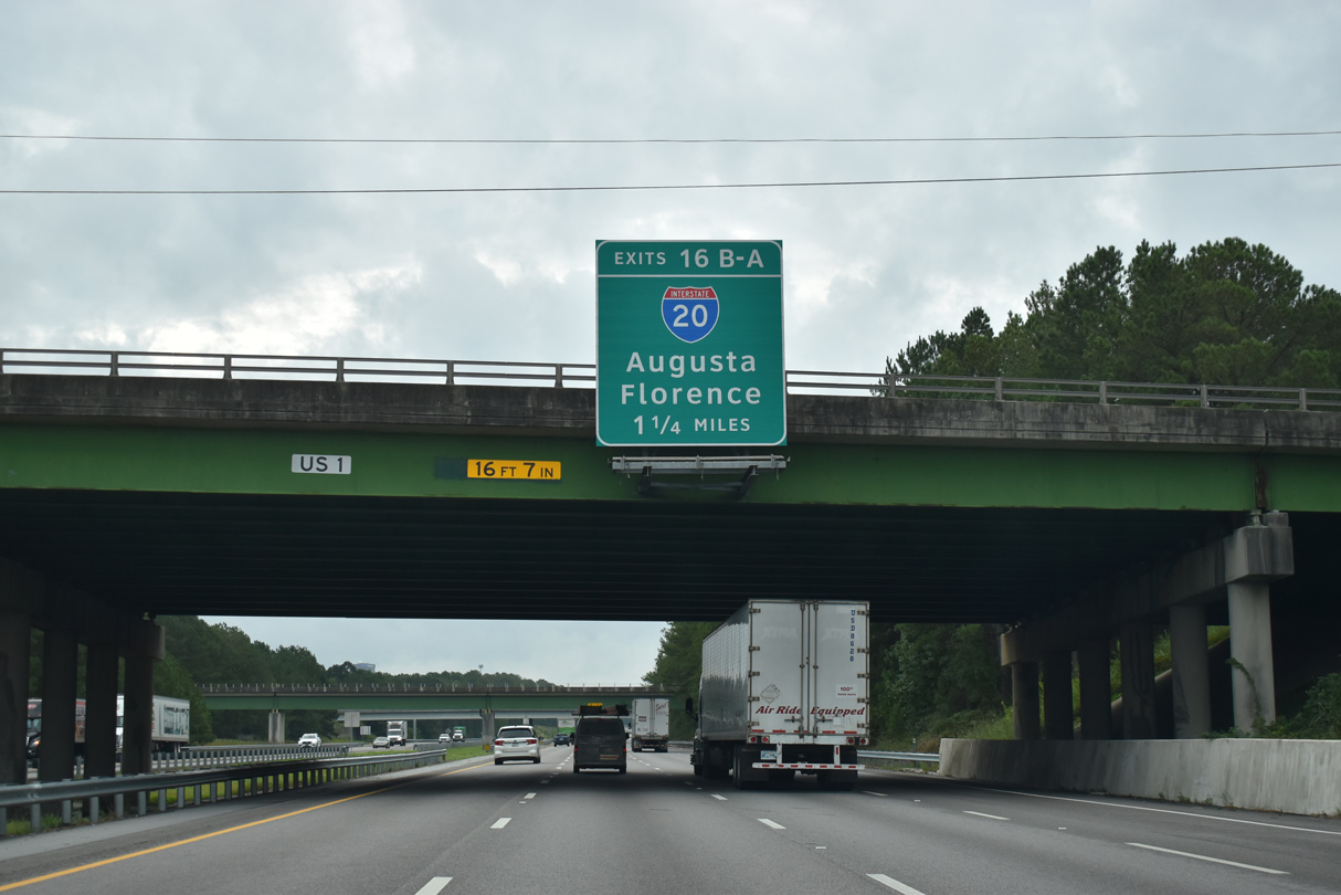
I-77 and I-20 come together at a three level systems interchange (Exits 16B/A) in 1.25 miles.
09/20/21
The confirming marker posted beyond the Trenholm Road Extension (Road 33) overpass for Interstate 77 south was removed by 2011.
06/01/07

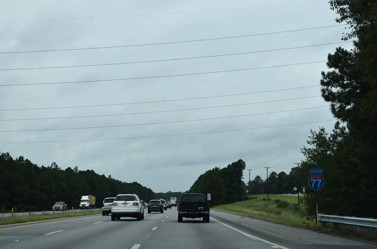
I-77 advances south across Windsor Lake to Exit 16. Interstate 20 travels 141.51 miles in the Palmetto State, from the Savannah River at North Augusta to I-95/Business Spur I-20 at Florence.
09/20/21
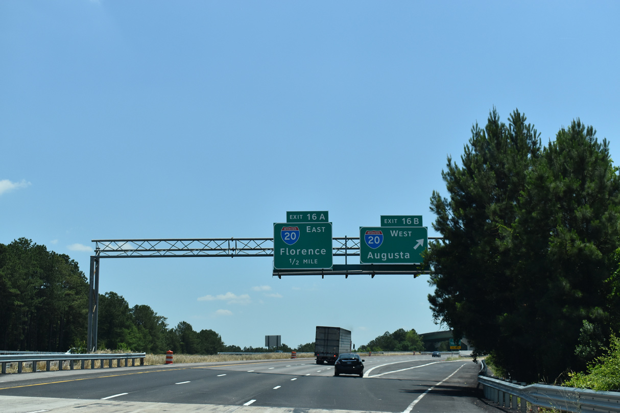
Exit 16B leaves I-77 south for Interstate 20 west by Dentsville and into northern reaches of Columbia. Eight interchanges connect I-20 with the capital city over the course of 12 miles.
05/26/19
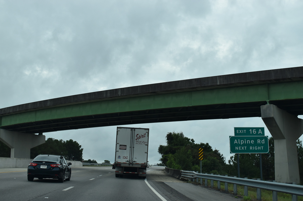
Exit 16A loops from I-77 south onto a collector distributor roadway along Interstate 20 east to the adjacent diamond interchange with Alpine Road (Road 63).
09/20/21
Interstate 20 progresses east from Exit 16A by the Northeast suburbs to Pontiac, Elgin, Lugoff and Camden. I-20 concludes at Interstate 95 in 65 miles.
09/20/21
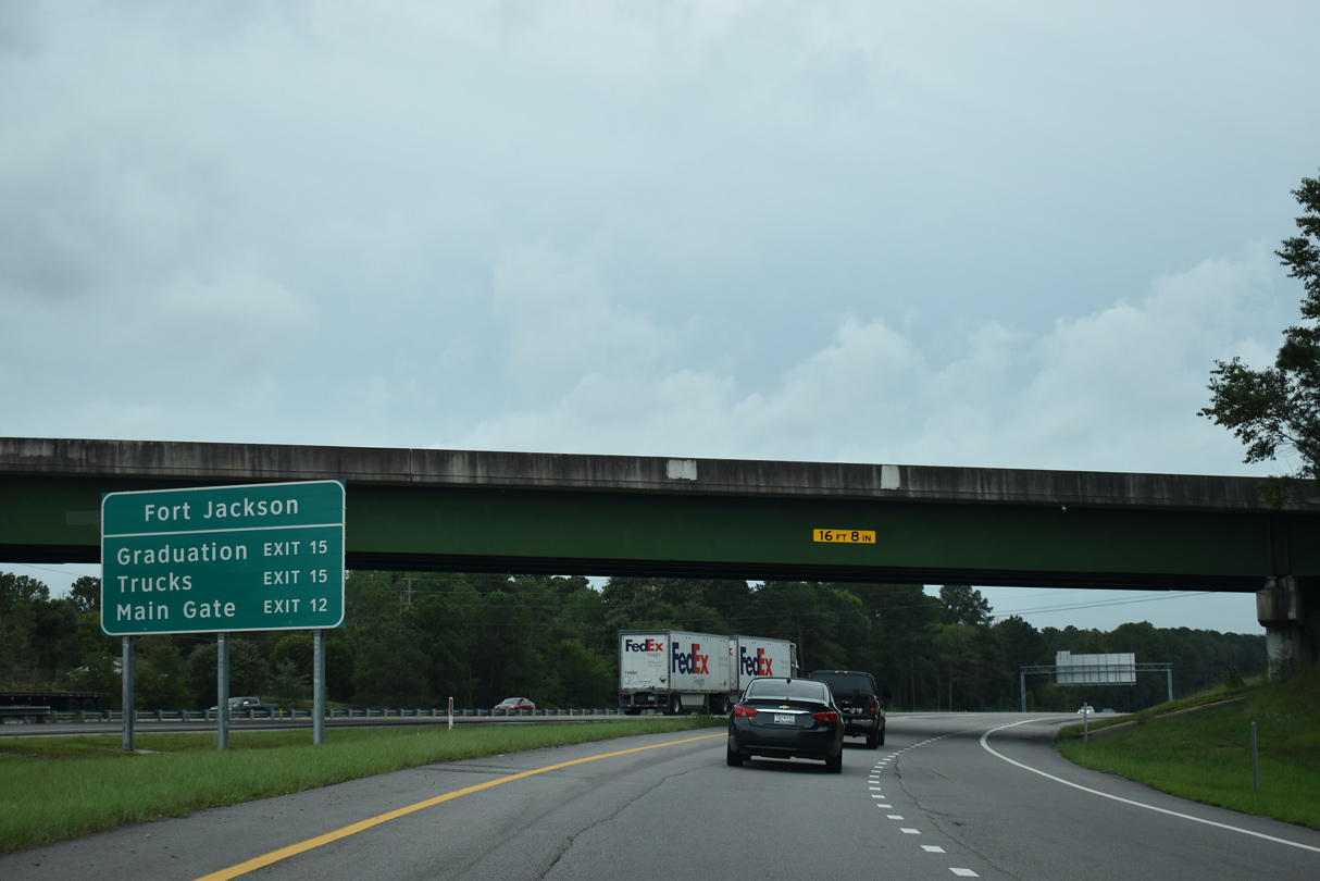
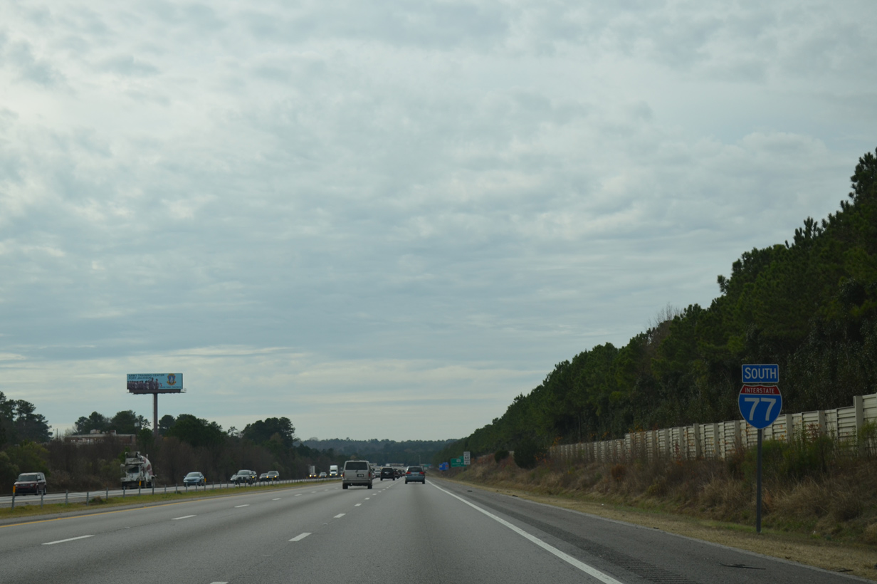
Interstate 77 (Southeastern Beltway) turns southwest along the western boundary of Fort Jackson from Exit 15 for S.C. 12 to Exit 10 for S.C. 760. The main gate lies east of Exit 12 along Strom Thurmond Boulevard. Boyden Arbor Road leads south to Gate 4 beyond Exit 15.
09/20/21
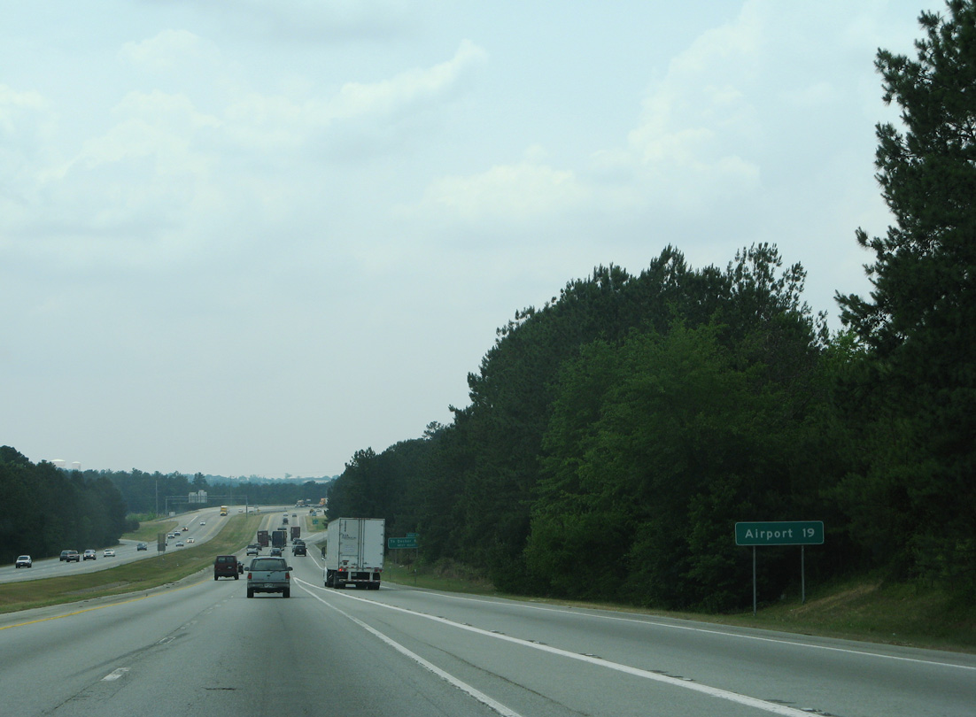
19 miles from I-20 via I-77 south, Columbia Metropolitan Airport (CAE) is located west of I-26 between S.C. 302 and S.C. 602.
06/01/07
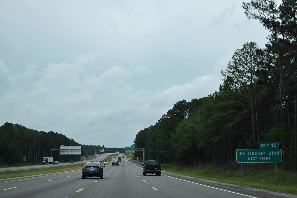
Decker Boulevard stems north from a wye interchange (Exit 13) with I-77 to Dentsville and Arcadia Lake.
09/20/21
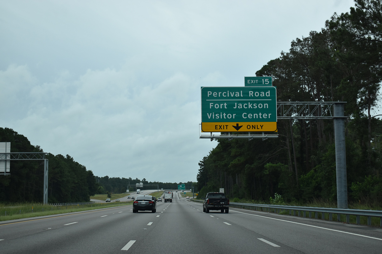
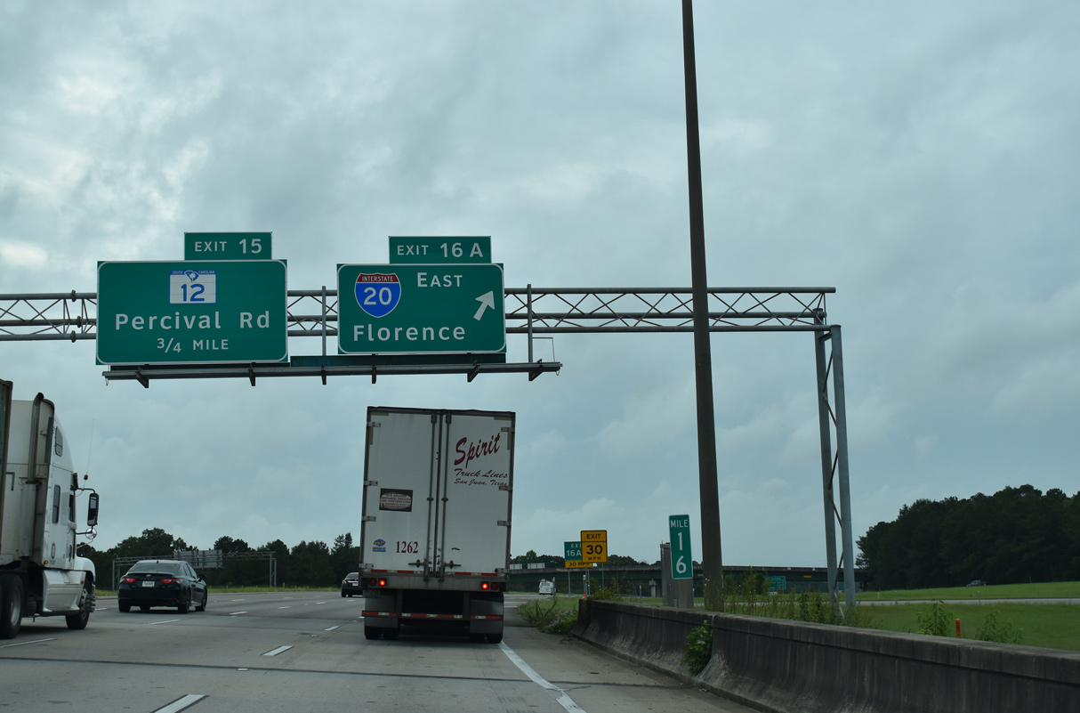
S.C. 12 (Percival Road) runs alongside the Southeastern Beltway from Exit 15 to Decker Boulevard.
09/20/21
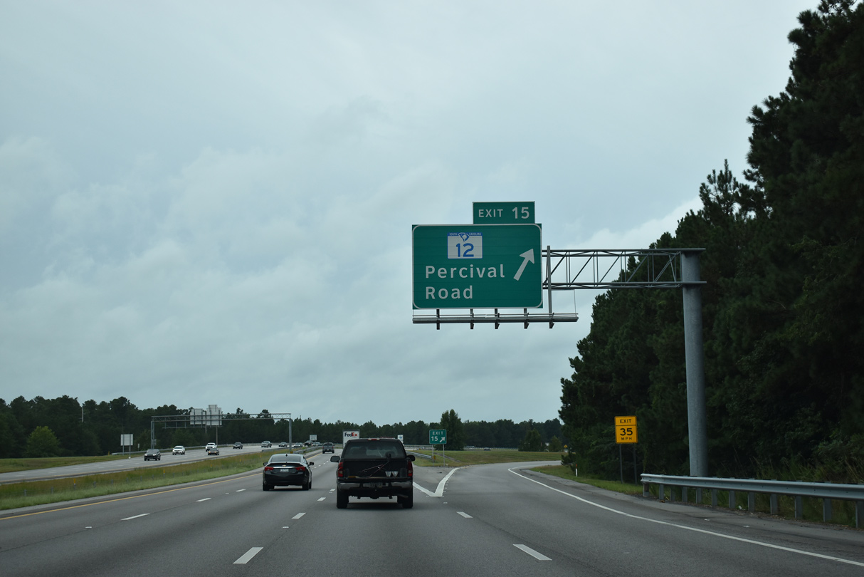
Beginning at U.S. 601 in rural Kershaw County, S.C. 12 leads west along the north boundary of Fort Jackson to a folded diamond interchange (Exit 15) with Interstate 77. The 28.25 mile long highway parallels I-77 southward to Forest Drive (S.C. 12 Spur).
09/20/21
Interstate 77 formally enters the Columbia city limits at the S.C. 12 (Percival Road) under crossing. Fort Jackson lies wholly within Cola.
09/20/21

Decker Boulevard (Road 151) south ties into Interstate 77 at Boyden Arbor Pond ahead of this shield assembly.
12/21/13
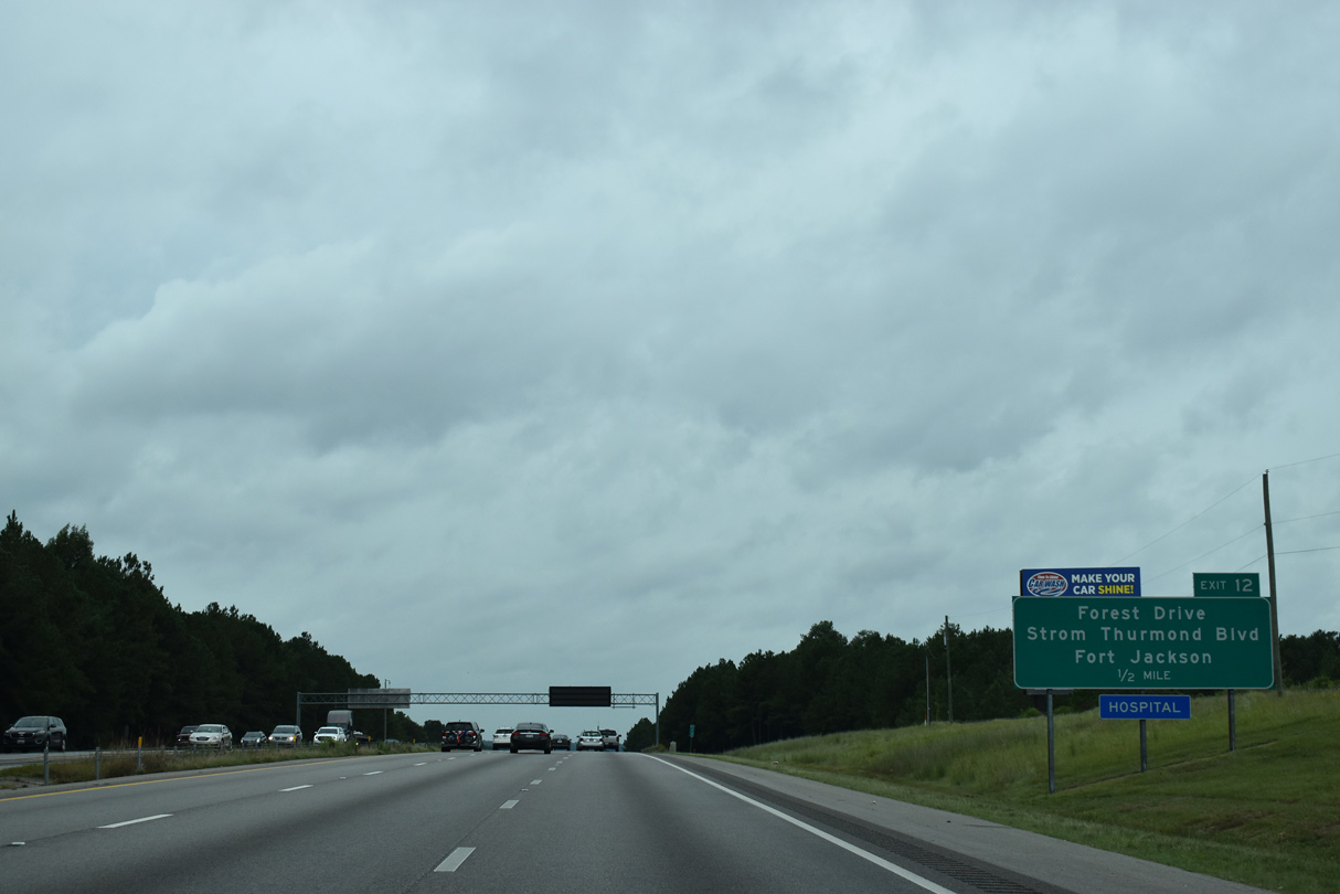
Forest Drive (S.C. 12 Spur) east from Forest Acres and Strom Thurmond Boulevard west from the Fort Jackson main gate come together at a diamond interchange (Exit 12) in one mile.
09/20/21
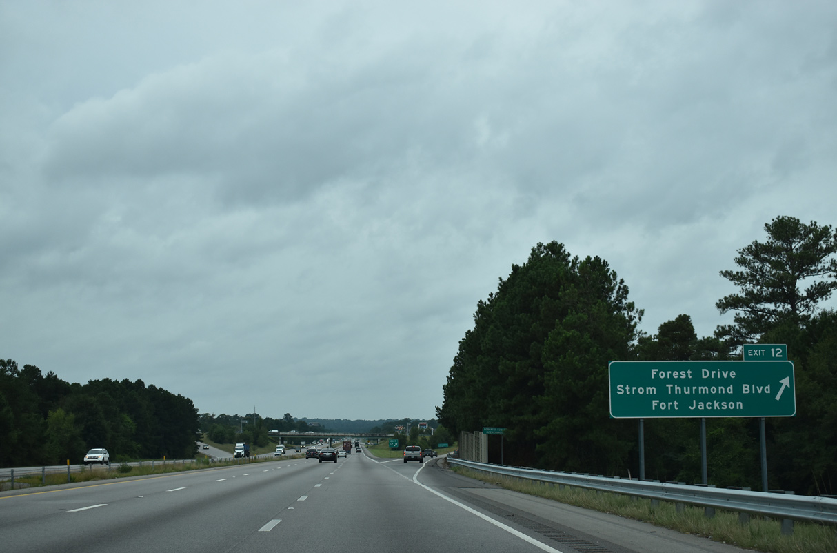
An unsigned route, S.C. 12 Spur lines Strom Thurmond Boulevard and Forest Drive west 0.47 miles from Fort Jackson to S.C. 12 (Percival Road). S.C. 12 continues west along Forest Drive to the city of Forest Acres and on Taylor Street through the Columbia central business district.
09/20/21
A sound wall separates parallel Shady Lane and adjacent residential areas surrounding Lake Katharine from Interstate 77 south.
12/21/13
S.C. 760 constitutes a 1.19 mile long arterial from Gate 1 to Fort Jackson west to U.S. 76/378 (Devine Street) at Cross Hill Road (U.S. 76 Connector) in Columbia.
09/20/21
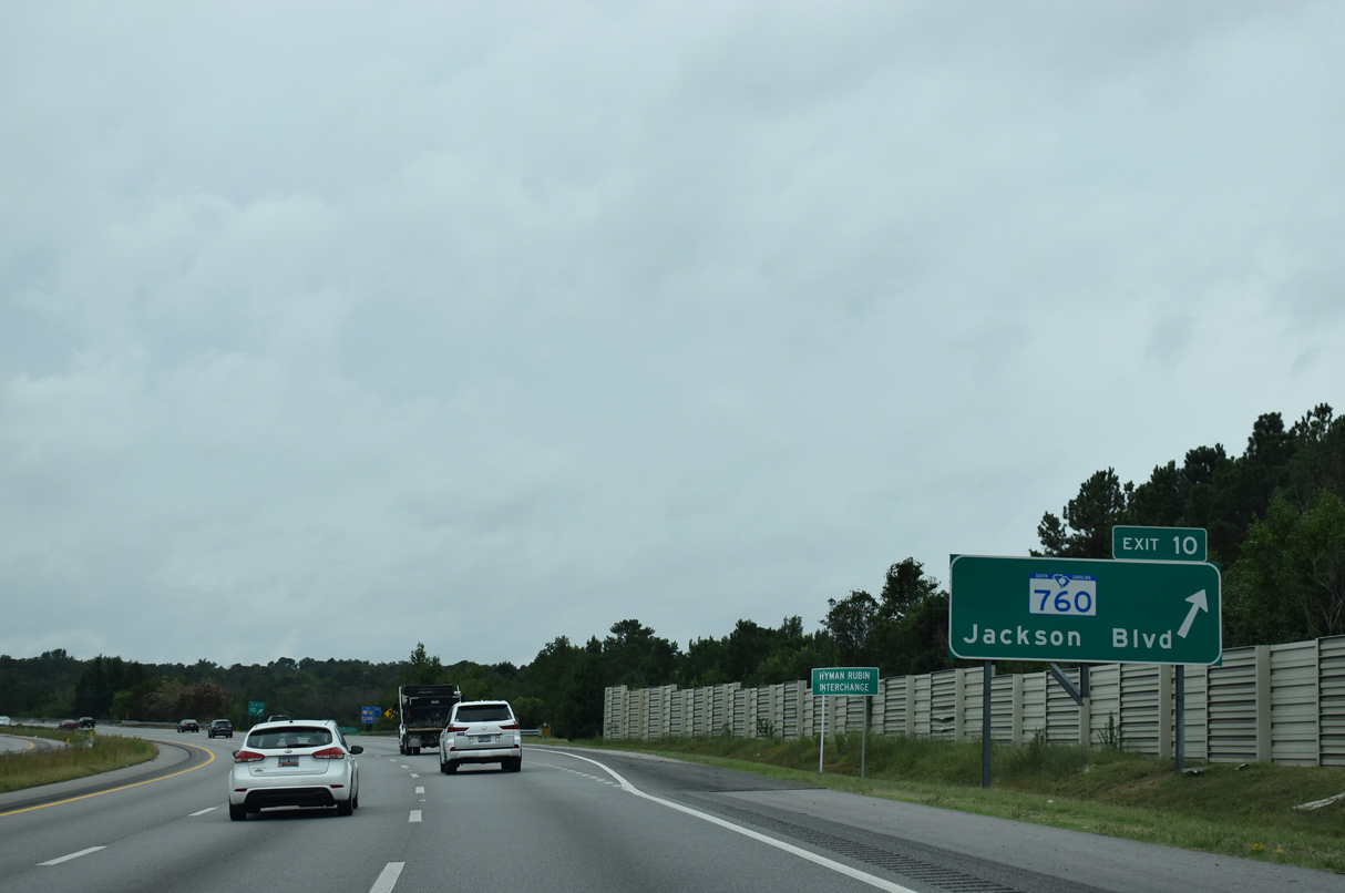
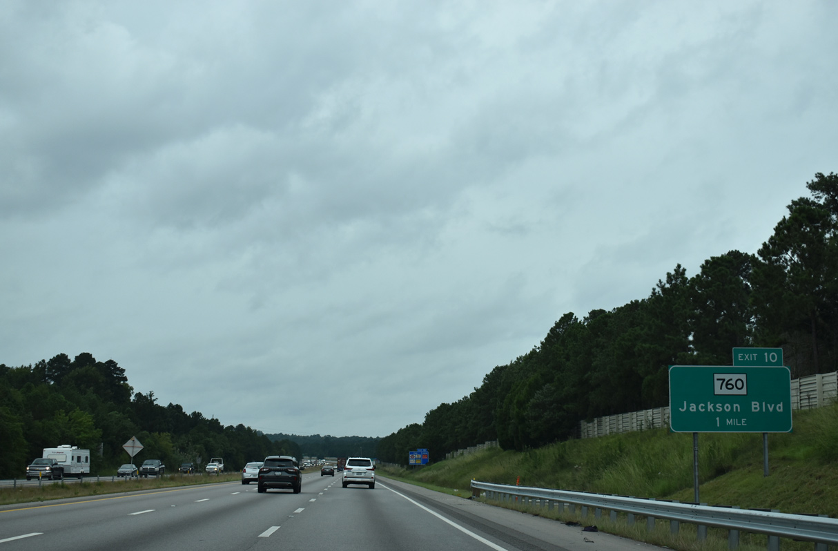
I-77 curves southeast into the diamond interchange (Exit 10) with S.C. 760 (Jackson Boulevard). S.C. 760 west to U.S. 76 Connector along Wildcat Road and Rosewood Drive leads to the Beltline Campus of Midlands Technical College and S.C. 16 (Beltline Boulevard).
09/20/21
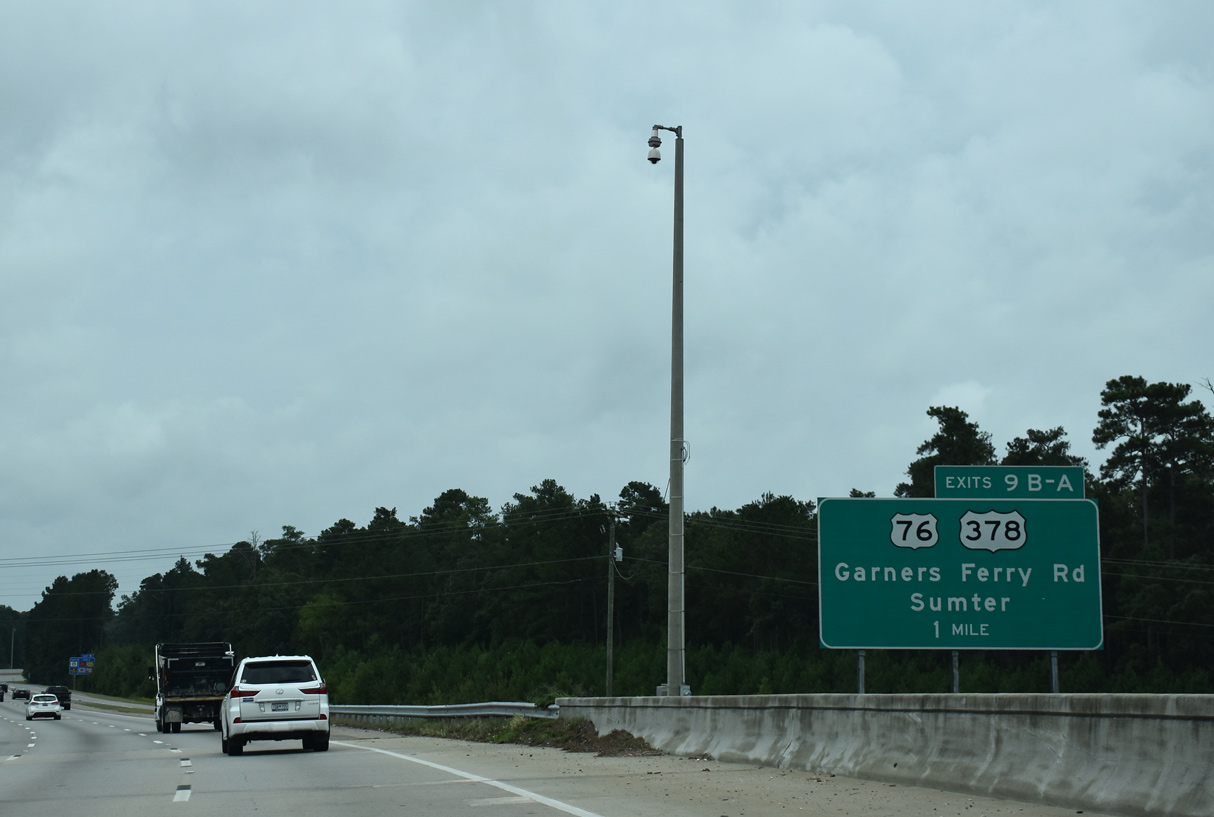
U.S. 76/378 angle southeast from S.C. 760 (Fort Jackson Boulevard) along Garners Ferry Road to S.C. 262 (Leesburg Road) and I-77 by WJB Dorn VA Medical Center.
09/20/21
Interstate 77 turns southward again ahead of succeeding parclo interchanges for S.C. 262 (Leesburg Road) and U.S. 76/378 (Garners Ferry Road).
09/20/21
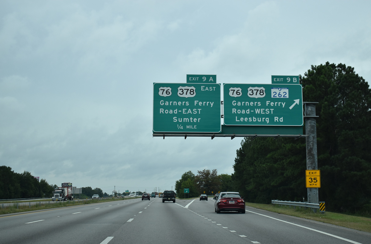
Exit 9B connects I-77 south with S.C. 262 (Leesburg Road). 14.71 miles in length, S.C. 262 runs east from adjacent U.S. 76/378 (Garners Ferry Road) along the southern boundary of Fort Jackson to U.S. 601 near Leesburg.
09/20/21

U.S. 76/378 overlap 39.7 miles east from Exit 9A to Sumter. Beyond their separation, U.S. 76 branches northeast to Timmonsville and Florence while U.S. 378 continues east to Conway.
09/20/21
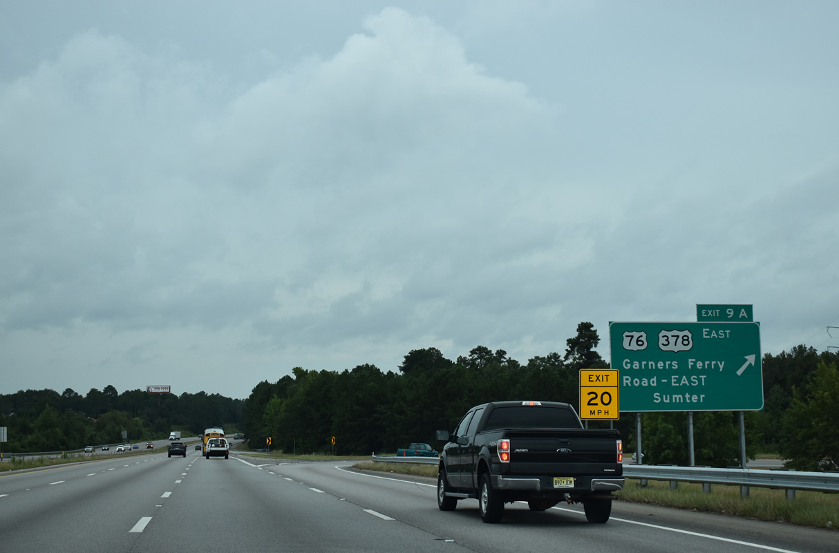
U.S. 76/378 (Garners Ferry Road) constitutes a busy retail corridor 1.5 miles southeast from Exit 9A. U.S. 76/378 east leave the last of the Columbia suburbs at Horrell Hill in 7.3 miles.
09/20/21
Interstate 77 (Southeastern Beltway) arcs westward around the Heritage Woods subdivision and over CSX and Norfolk Southern Railroad lines on the ensuing stretch.
09/20/21
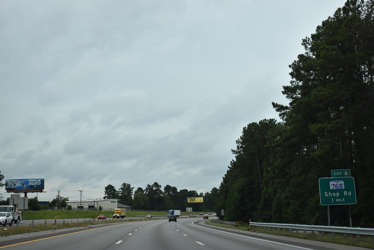
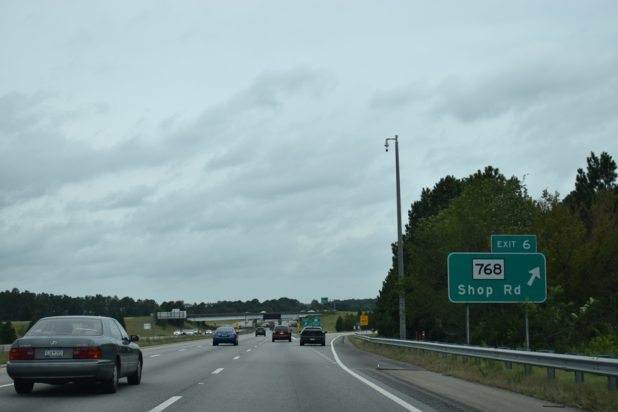
A three quarter cloverleaf interchange joins I-77 with S.C. 768 (Shop Road) at Exit 6.
09/20/21

Shop Road is an arterial route northwest to George Rogers Boulevard at the State Fairgrounds and southeast to Longwood Road outside the Columbia city limits.
09/20/21
S.C. 768 follows a 4.88 mile route west from U.S. 76/378 (Garners Ferry Road) along Pineview Road, Shop Road and S Beltline Boulevard to S.C. 48 (Bluff Road).
09/20/21
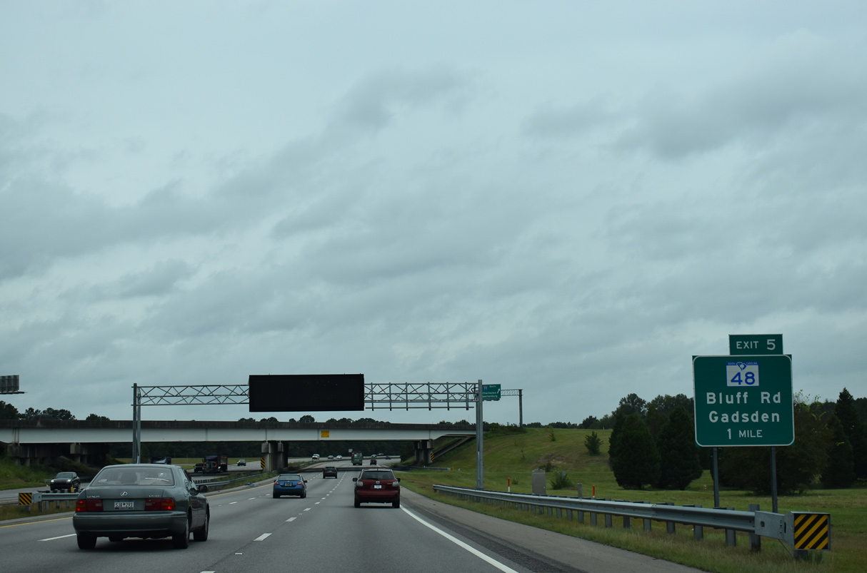
Advancing west, I-77 (Southeastern Beltway) meets S.C. 48 (Bluff Road) at a six-ramp parclo interchange (Exit 5).
09/20/21
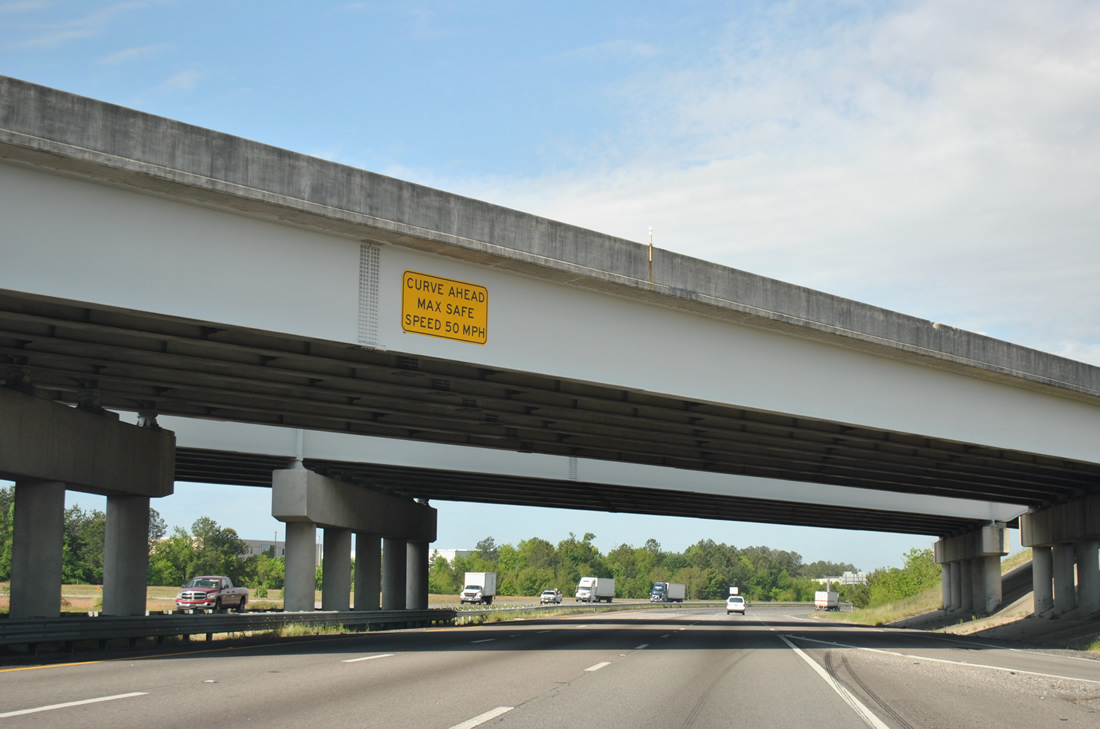
Interstate 77 makes an S-curve from the exchange with S.C. 768 (Shop Road) to Gills Creek.
04/16/12

An auxiliary lane opens along I-77 southbound to Exit 5. S.C. 48 heads 5.45 miles north to the State Capitol, the Main Street District and U.S. 21-76-176-321 (Elmwood Avenue) along Assembly Street.
09/20/21
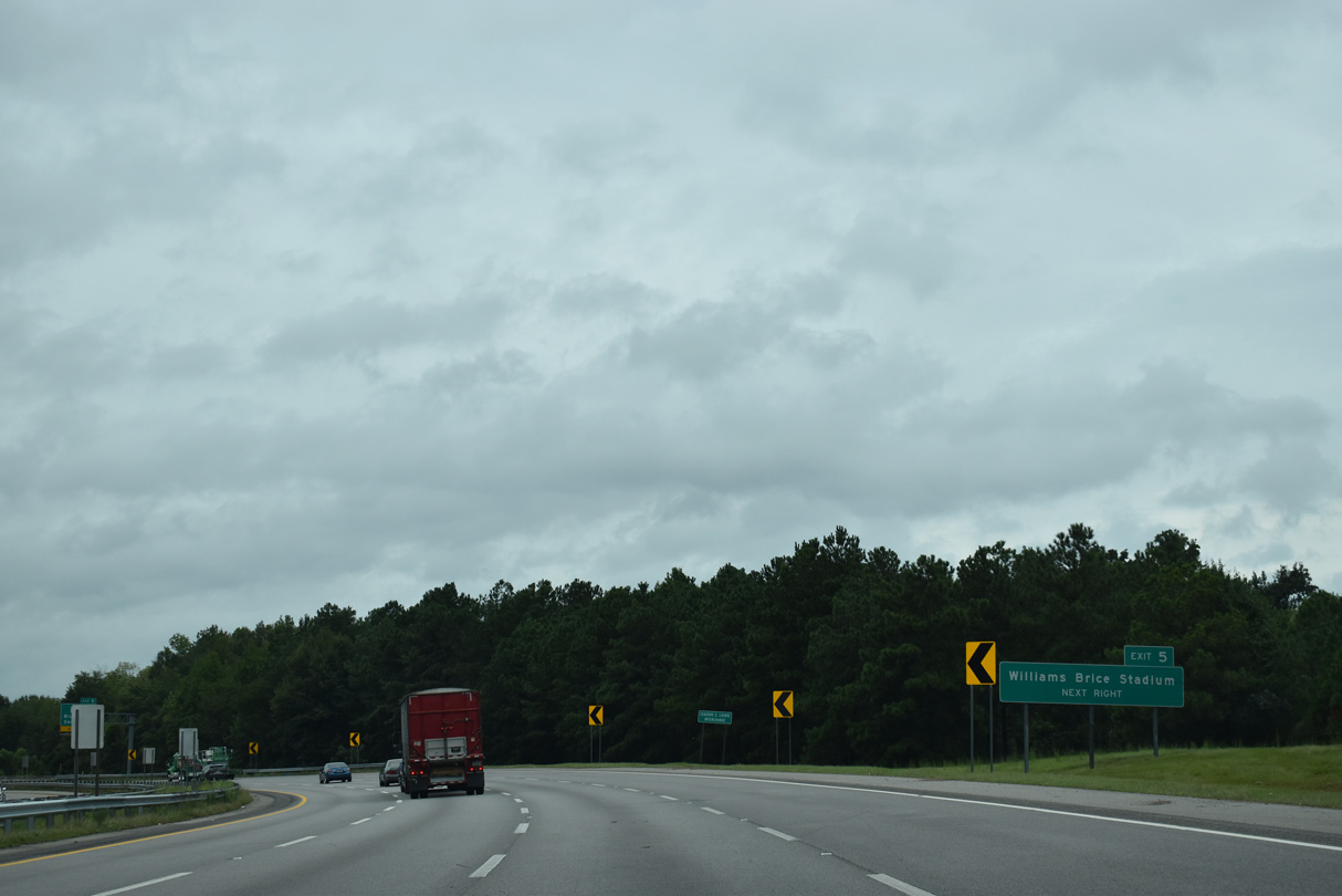
S.C. 48 links the industrial south side of Columbia with Williams Brice Stadium (home of the USC Gamecocks).
09/20/21
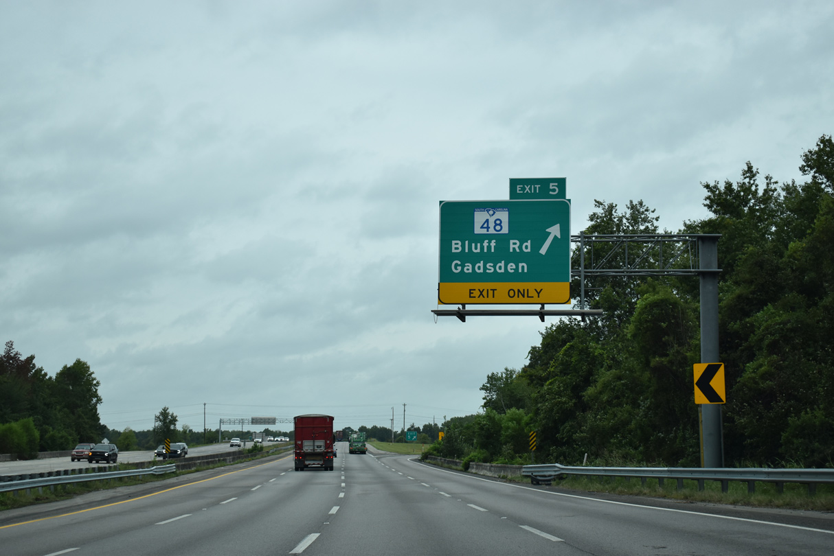
S.C. 48 runs 28.98 miles overall from Columbia east to Gadsden and U.S. 601 at Wateree.
09/20/21
Interstate 77 traverses a flood plain through southeastern reaches of the Cayce city limits between Exit 5 and the Congaree River.
04/16/12
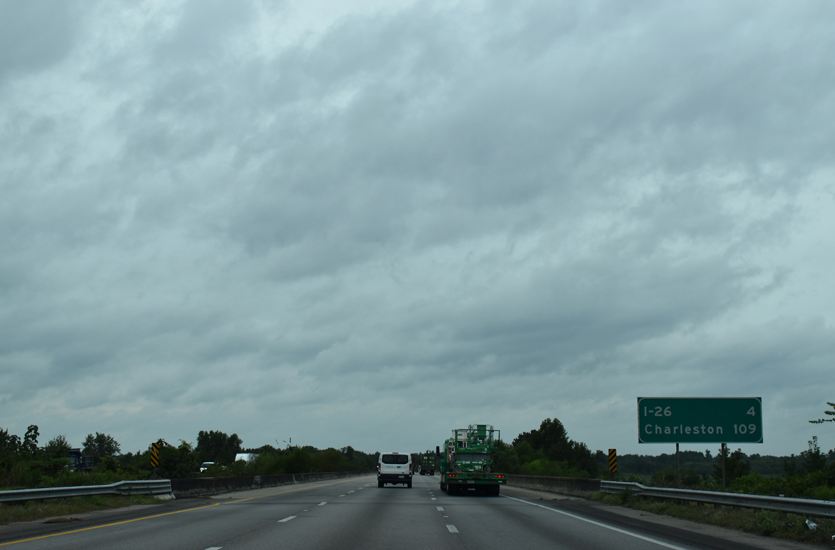
The final distance sign on I-77 south precedes a flood relief bridge four miles from Interstate 26. Located at the east end of I-26, Charleston is 109 miles away.
09/20/21
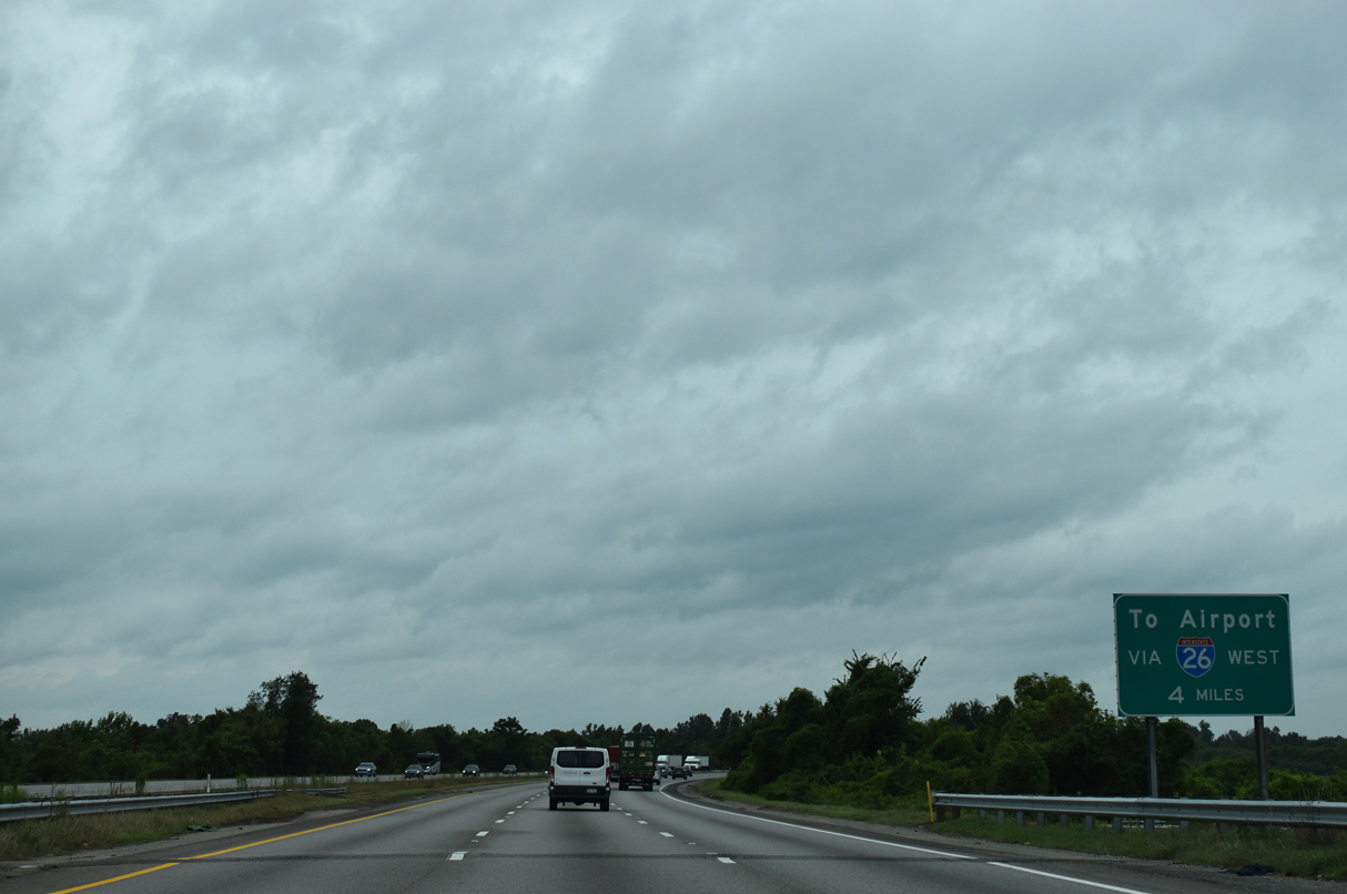
Interstate 26 heads north from the end of I-77 to S.C. 302 (Edmund Highway), which links with John N. Hardee Expressway (Road 378) to Columbia Metropolitan Airport (CAE).
09/20/21
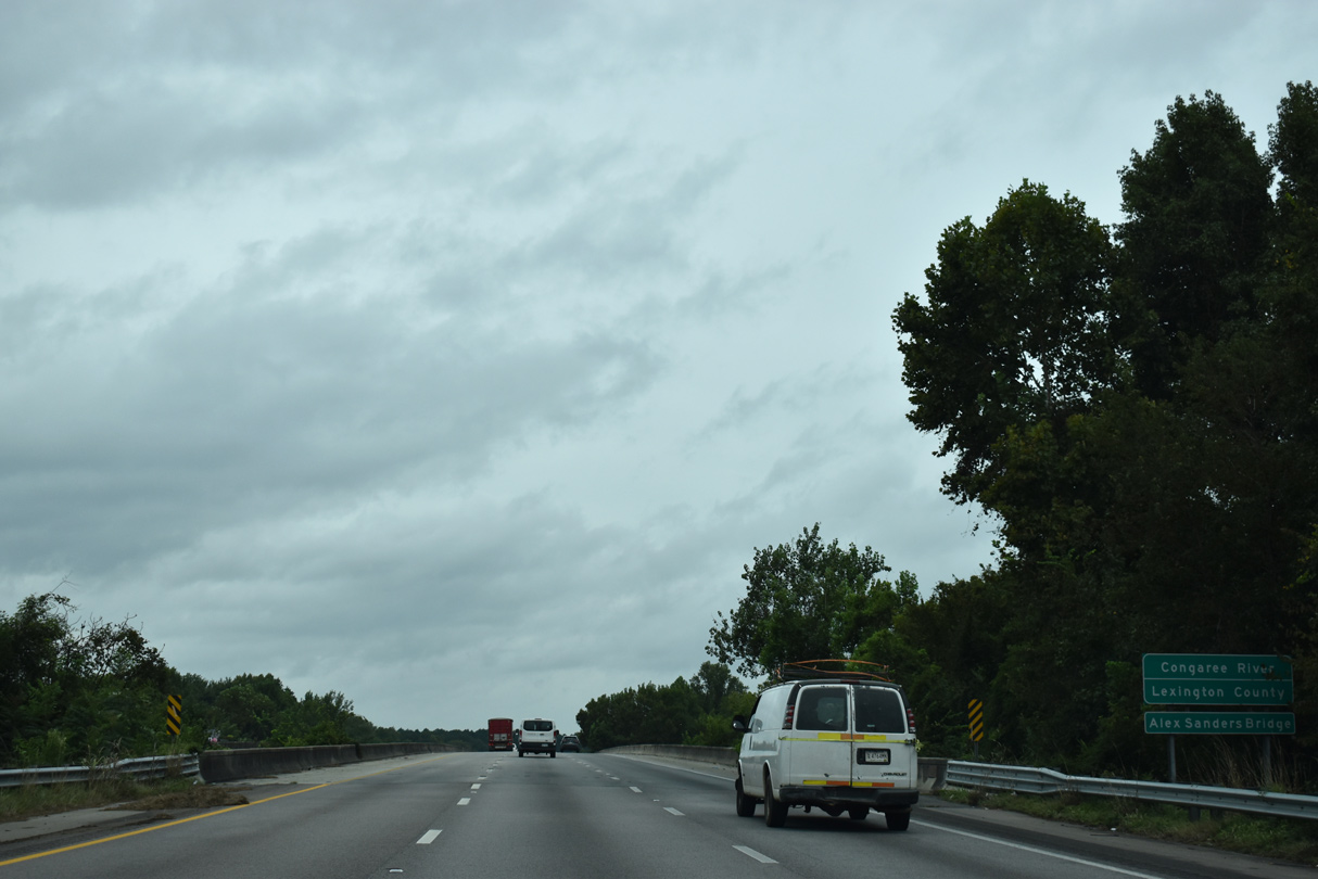
The Congaree River flows south between Columbia and West Columbia from the confluence of the Saluda and Broad Rivers. The river separates Richland and Lexington Counties southward to Calhoun County.
09/20/21
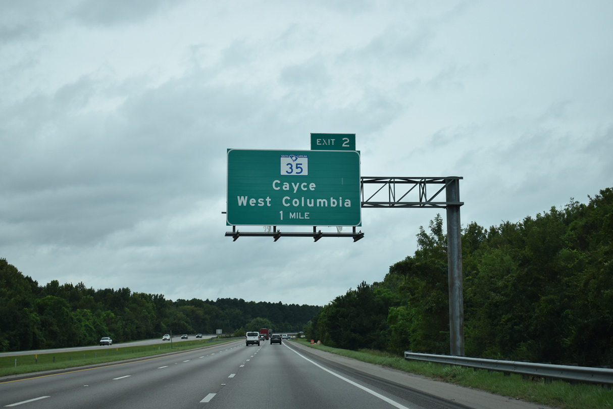
S.C. 35 begins at the forthcoming diamond interchange (Exit 2) with 12th Street Extension. S.C. 35 extends 5.63 miles north through central Cayce to U.S. 378 (Sunset Boulevard) in West Columbia.
09/20/21
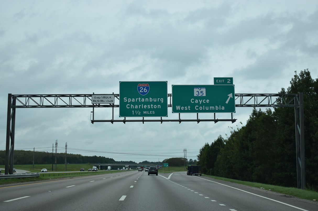
Linking I-77 at Exit 2 with S.C. 2 (Frink Street) in Cayce, 12th Street Extension along S.C. 35 was completed in October 2003. The four lane boulevard was subsequently lengthened further south to an industrial park and Old Wire Road.
09/20/21
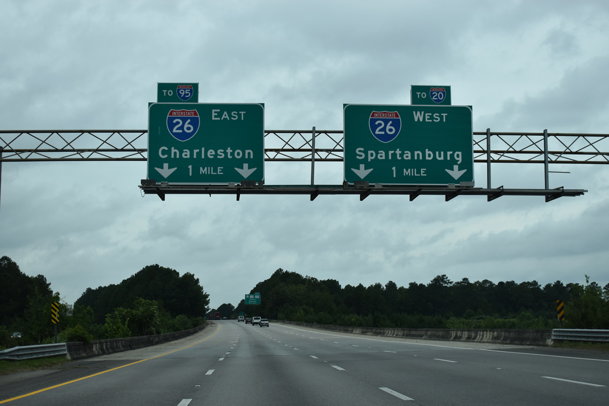
The roadways for I-77 separate ahead of a three-level interchange (Exit 1) with Interstate 26 and U.S. 21-176-321 (Charleston Highway).
09/20/21
Interstate 77 southbound crosses over a CSX railroad line ahead of Exit 1 for U.S. 21-176-321 (Charleston Highway). U.S. 21-176-321 overlap northward into Cayce and Downtown Charleston.
09/20/21
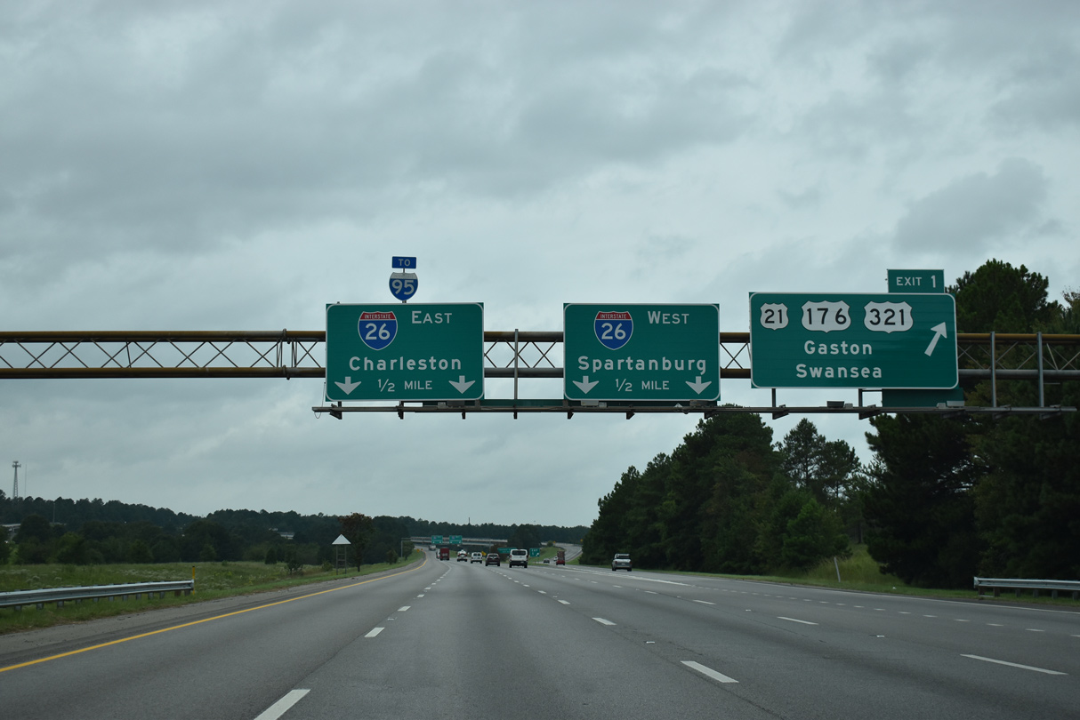
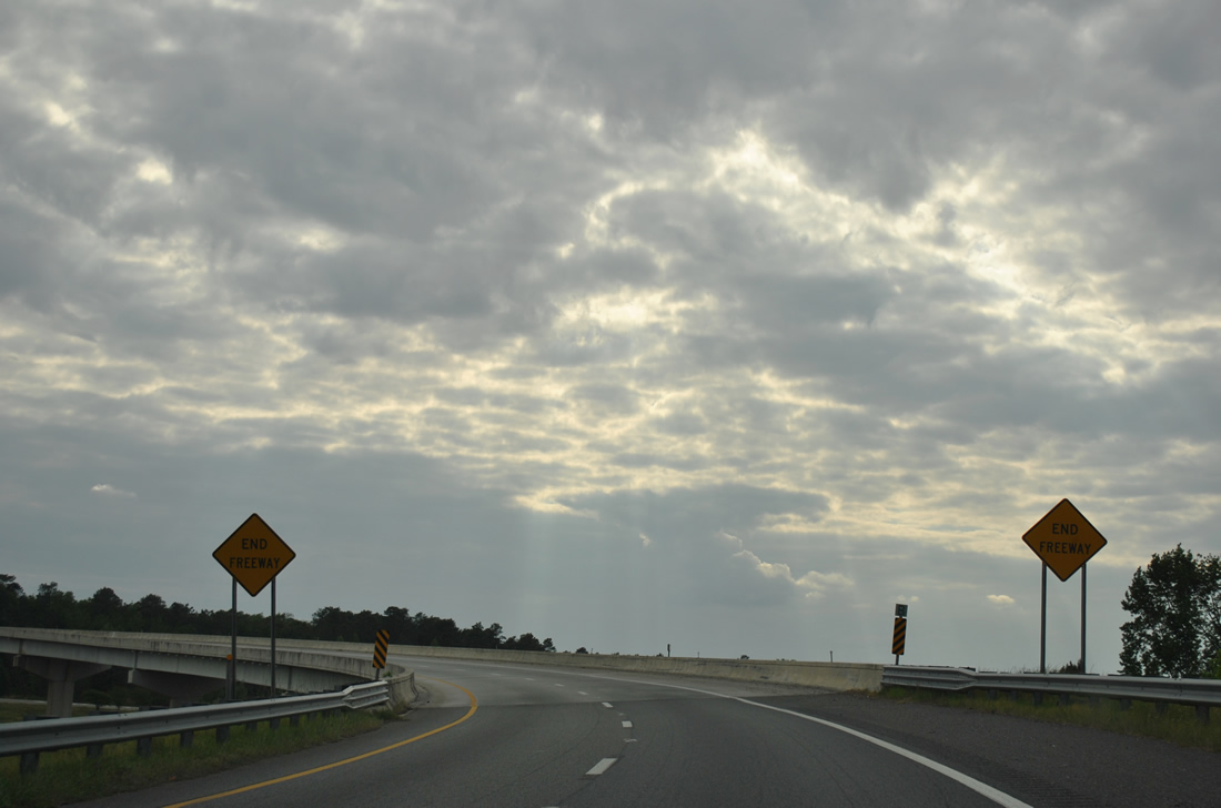
Interstate 77 concludes beyond Exit 1 with two lanes joining I-26 west for Cayce, West Columbia and I-20 at St. Andrews and I-26 east to Orangesburg and I-95 in Orangeburg County.
09/20/21
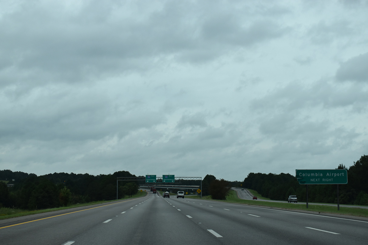
Columbia Metropolitan Airport (CAE) lies five miles to the west of the exchange joining I-77 with I-26.
09/20/21
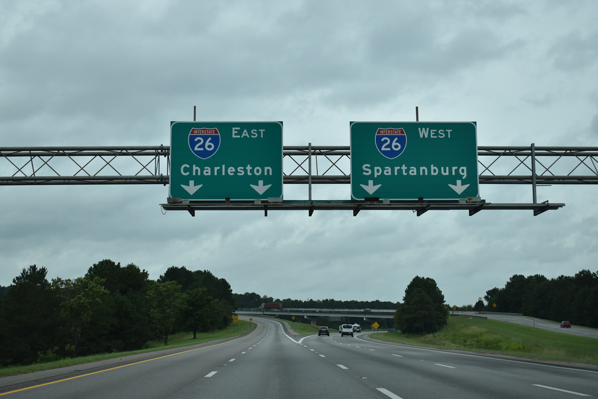
220.95 miles long in the Palmetto State, I-26 travels 105 miles southeast to Charleston and 95 miles northwest to Spartanburg.
09/20/21
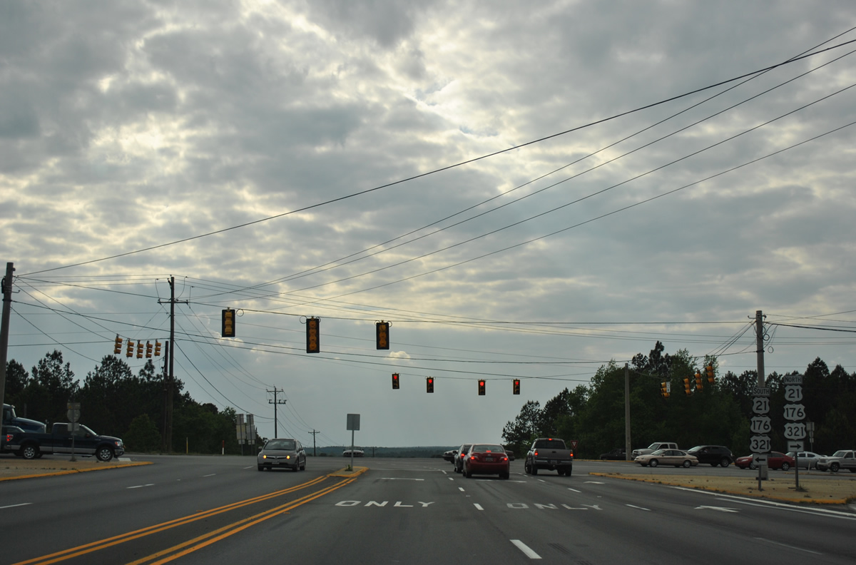
The flyover along Exit 1 joins the south end of I-77 with U.S. 21/176/321 (Charleston Highway) at Fish Hatchery Road (Road 73) in south Cayce.
04/15/12
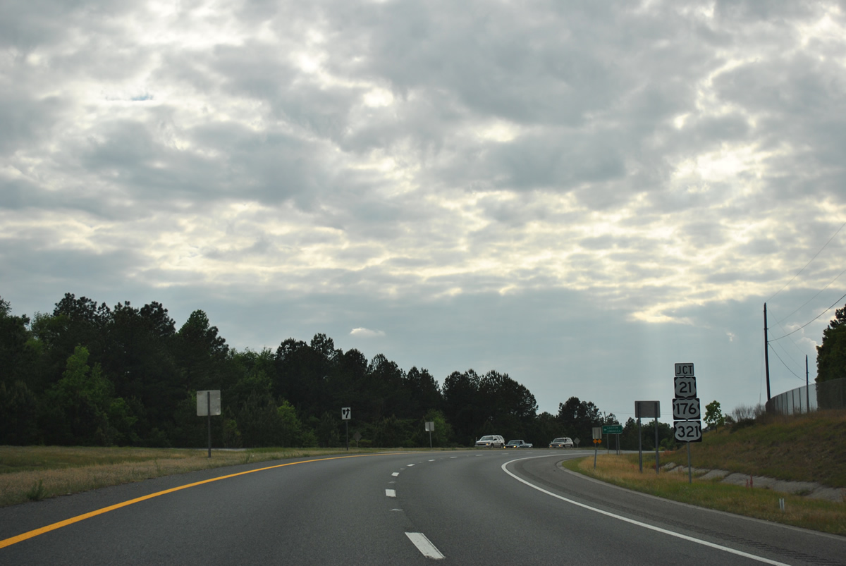
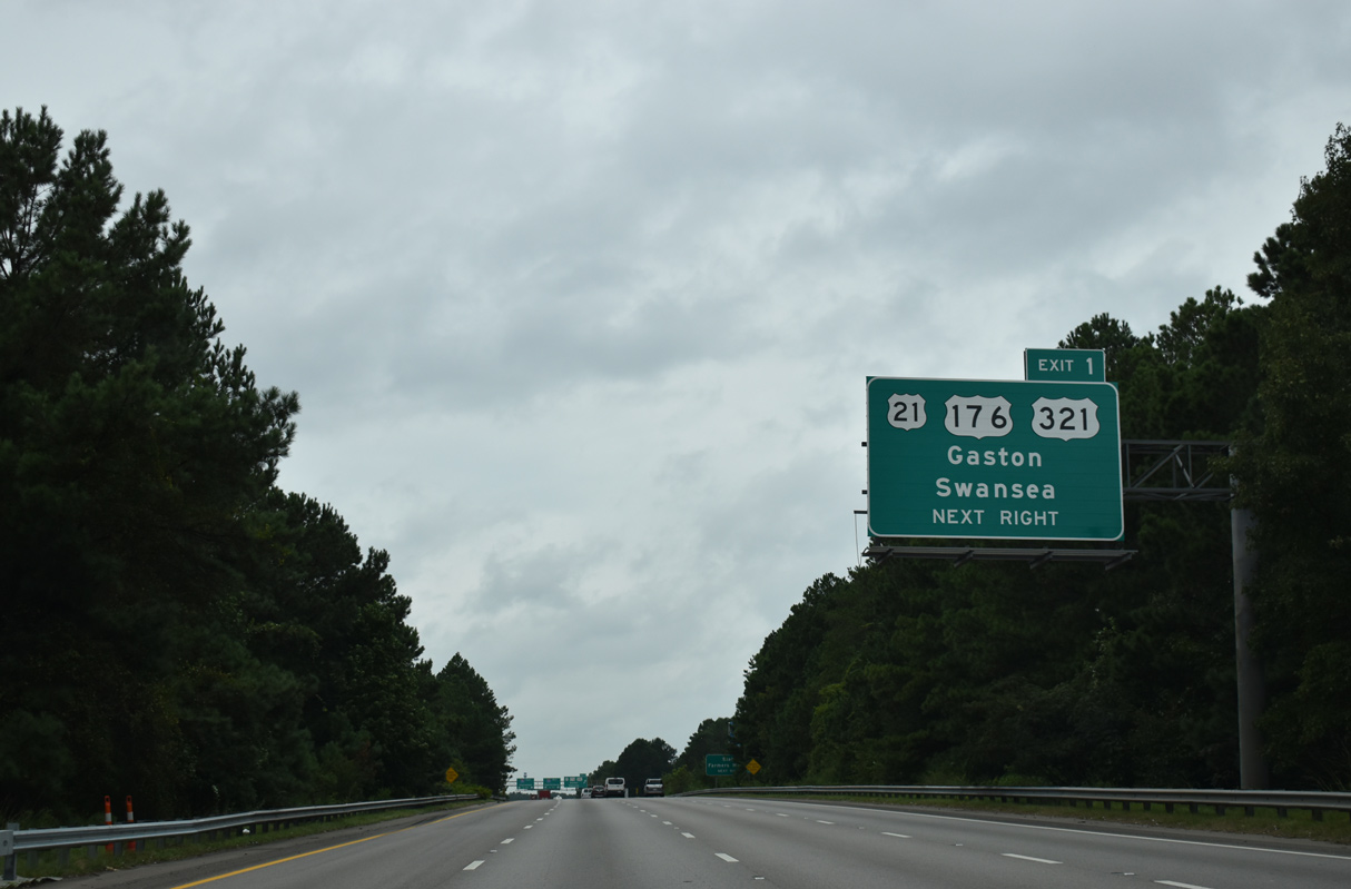
U.S. 21/176 (Charleston Highway) branch southeast from U.S. 321 in 2.50 miles beyond the South Carolina State Farmers Market. U.S. 321 continues south to the towns of Gaston and Swansea.
04/15/12
Fish Hatchery Road (Road 73) meanders 14.93 miles southwest from the ramp joining I-77 with Charleston Highway to the town of Pine Ridge, the Cohen Campbell Fisheries Center and S.C. 302 near Pelion.
04/15/12


References:
- "New Bridge is Nearly Complete." The State (Columbia, SC), March 17, 2005.
Photo Credits:
- ABRoads: 11/21/21
- Andy Field: 06/01/07
- Brent Ivy: 05/26/19, 09/20/21
- Alex Nitzman: 12/21/13
- AARoads: 04/15/12, 04/16/12
Connect with:
Page Updated Thursday December 30, 2021.