
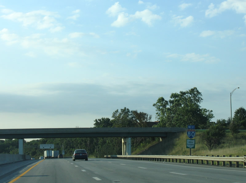
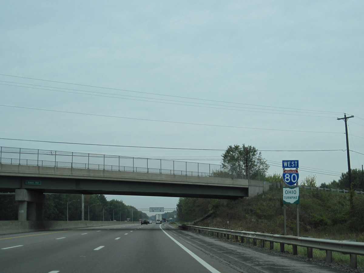
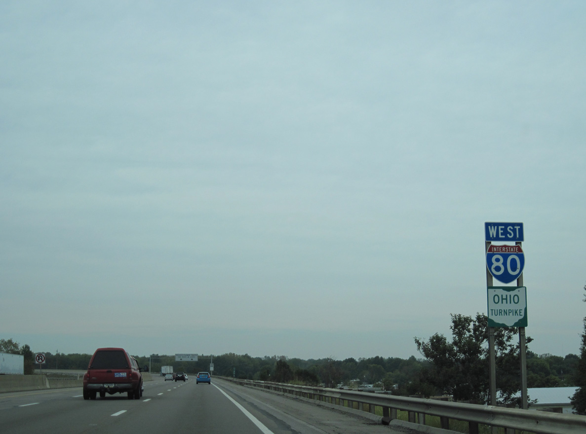
Interstate 80 / Ohio Turnpike West - Lordstown to Elyria

 West
West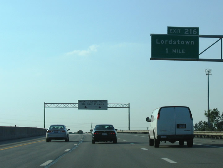
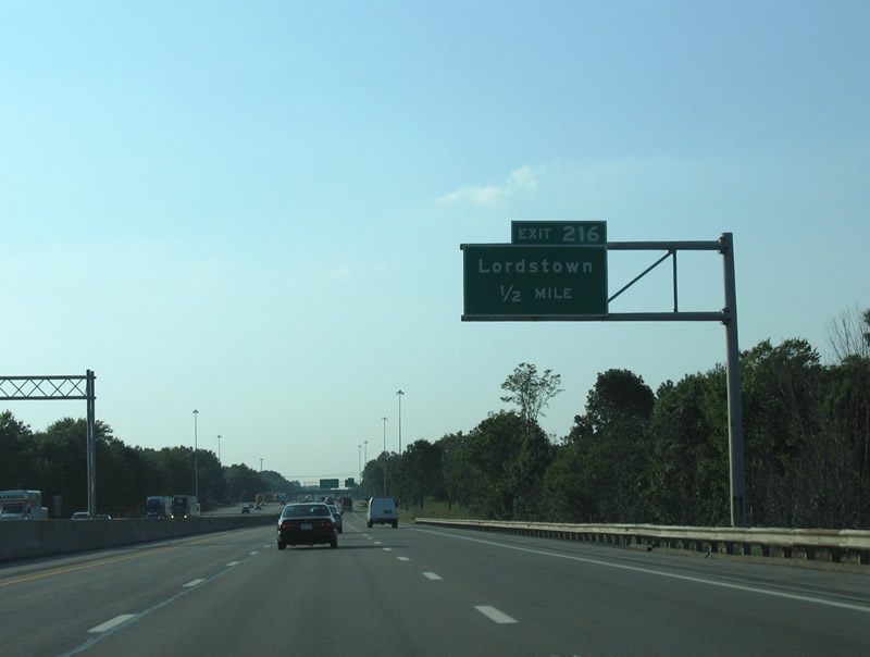
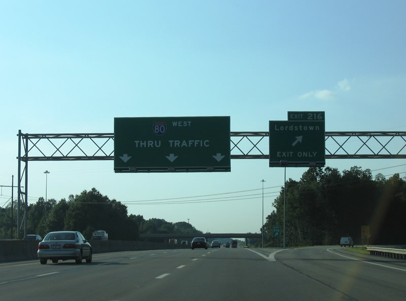
The first exit along the Ohio Turnpike on Interstate 80 joins the toll road with the village of Lordstown and the Lordstown Motors Corporation complex.
09/01/05
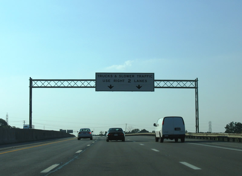
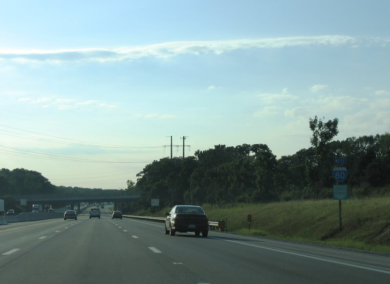
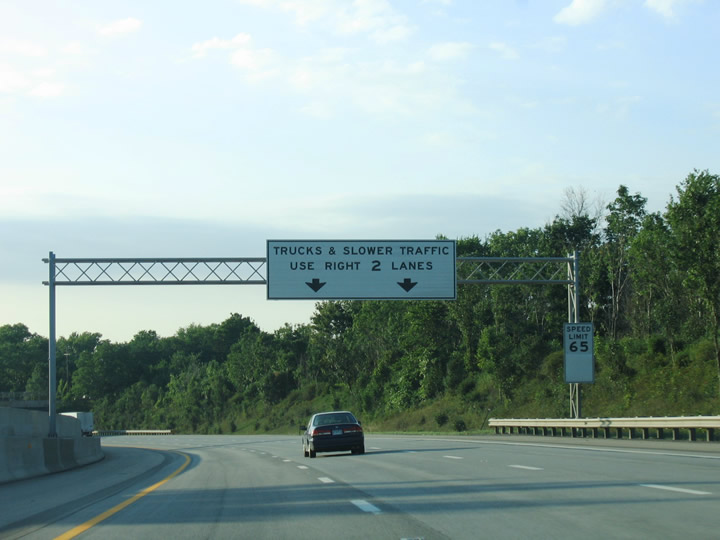
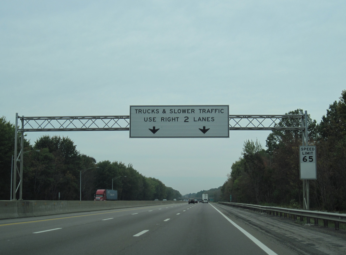
Semi trucks are restricted from the left lane along six lane sections of the Ohio Turnpikes.
09/01/05
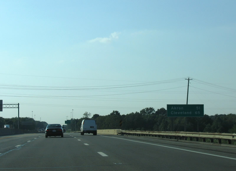
Distance sign posted at the SR 45 (Salem Warren Road) underpass, referencing Akron via SR 8 south and Cleveland via Interstate 77 north.
09/01/05
Exit 216 constitutes a wye interchange with ramps to Hallock Young Road at the Lordstown Motors Corporation plant.
09/01/05
Hallock Young Road encircles the manufacturing plant west from SR 45 (Tod Avenue) to Ellsworth Bailey Road and the wye interchange at Exit 215.
09/01/05
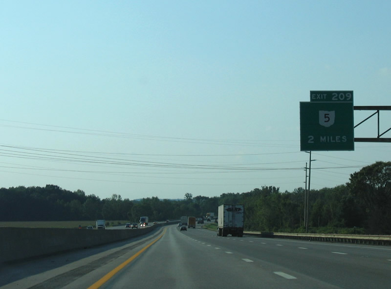
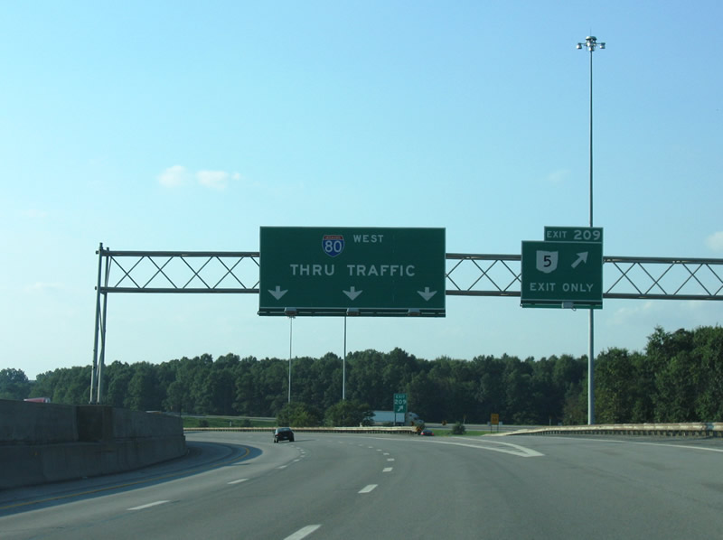
Continuing northwest into Newtown township in Trumbull County, the Ohio Turnpike next meets SR 5 at Exit 209.
09/01/05
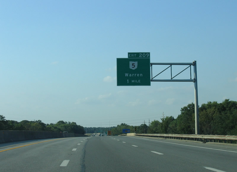
Exit 209 serves the city of Warren to the east via SR 5 to SR 82. SR 5/82 combine along the Warren Outerbelt at Leavittsburg.
09/01/05
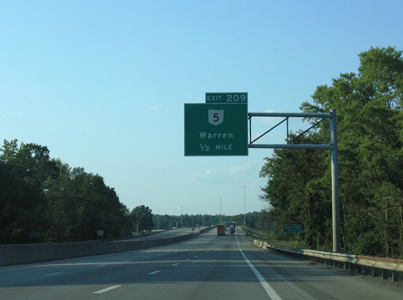
Interstate 80 crosses the Mahoning River a half mile south of the trumpet interchange (Exit 209) and access road to SR 5.
09/01/05
Passing north of the city of Newton Falls, SR 5 travels west frin the Ohio Turnpike to the Michael Kirwan Reservoir and Ravenna.
09/01/05
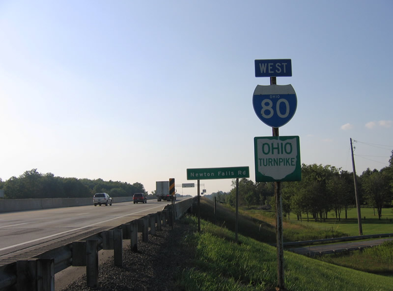
Confirming markers at the Newton Falls Road underpass near Braceville.
09/01/05
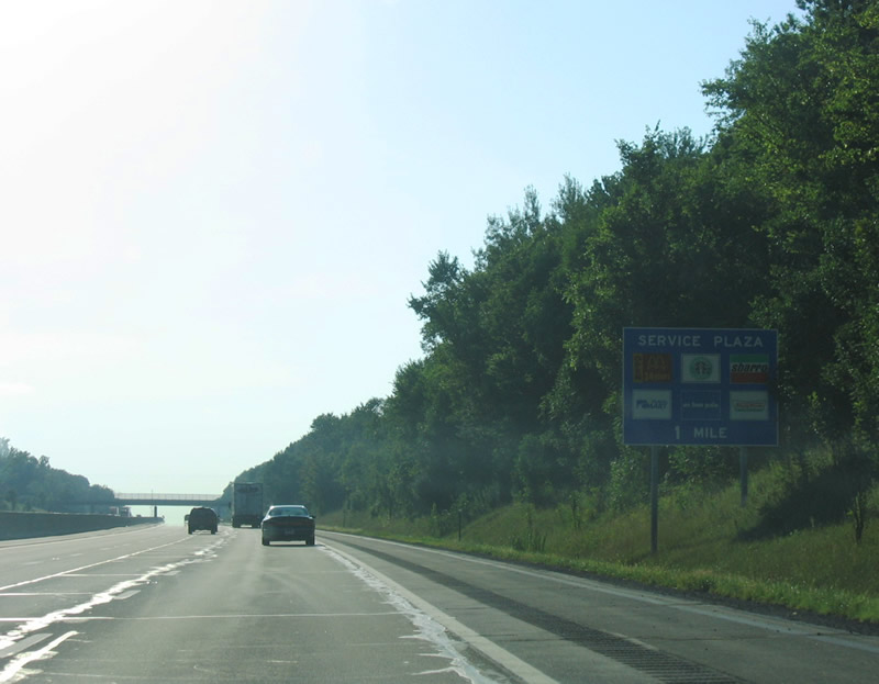
I-80 turns west into Portage County ahead of the village of Windham. A lengthy exit less stretch leads to the Portage Service Plaza in Freedom township.
09/01/05
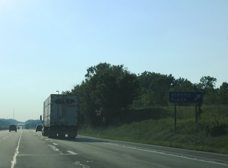
A variety of services ranging from travel information, food and gas are available at the Portage Service Plaza.
09/01/05
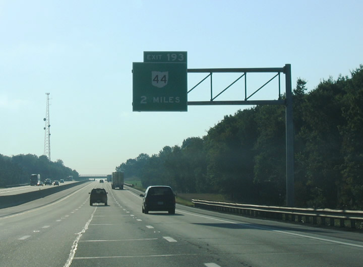
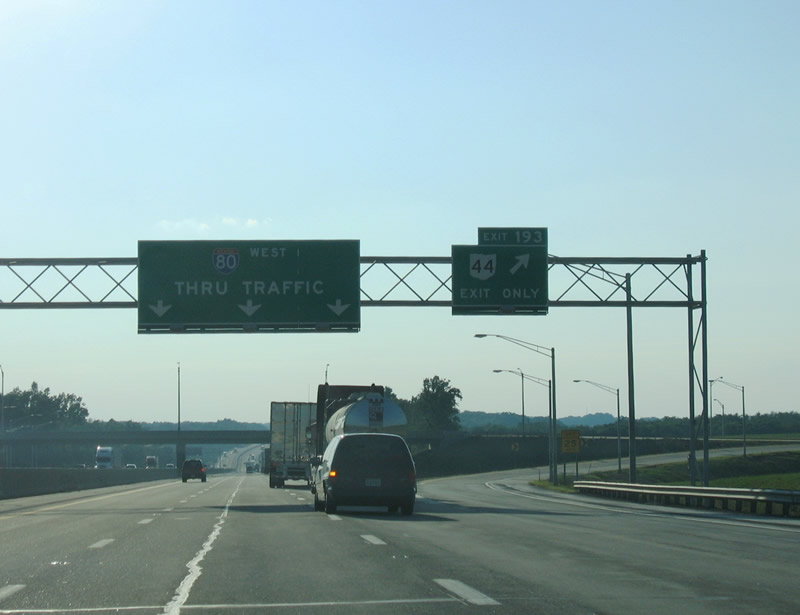
Exit 193 joins Interstate 80 (Ohio Turnpike) with SR 44 at Shalersville.
09/01/05
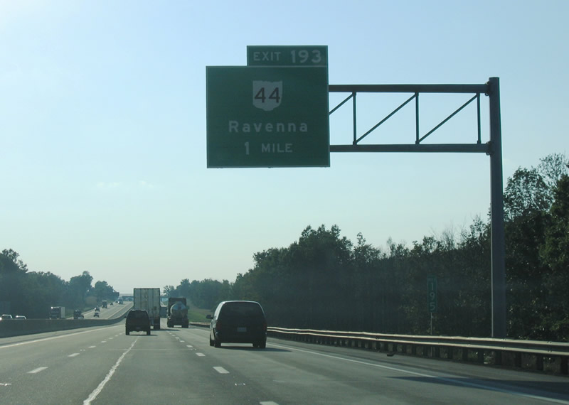
SR 44 provides the main route between the Ohio Turnpike and the Portage County seat of Ravenna. SR 44 meets SR 5 and SR 14 within the city.
09/01/05
SR 44 heads north from Exit 193 to Mantua at the Cuyahoga River. The state route travels overall between Waynesburg and Mentor at Lake Erie.
09/01/05
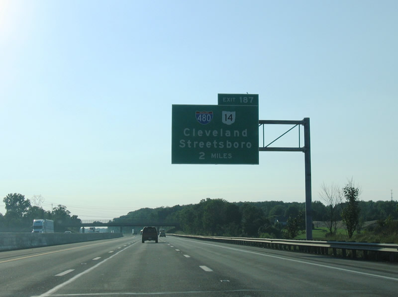
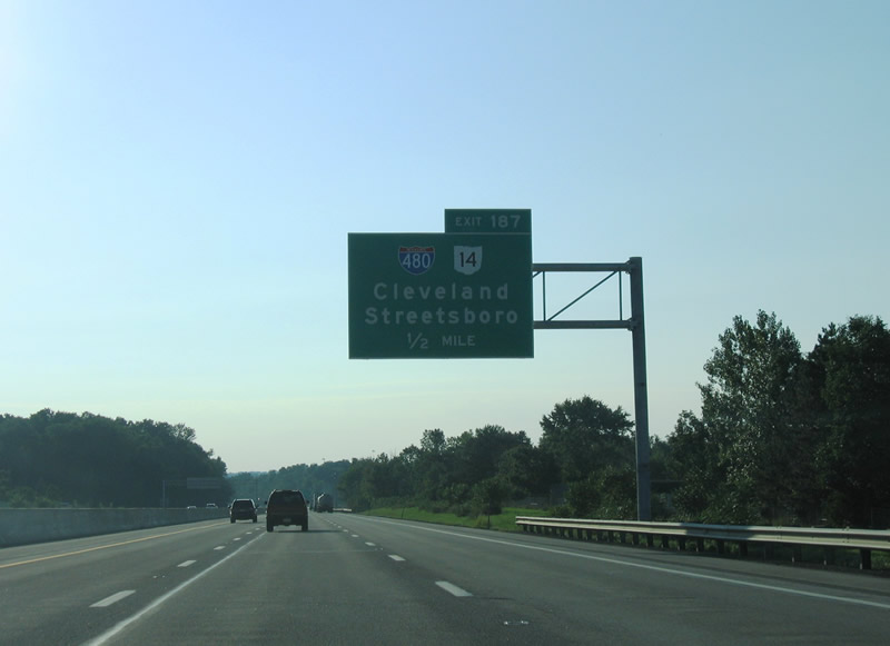
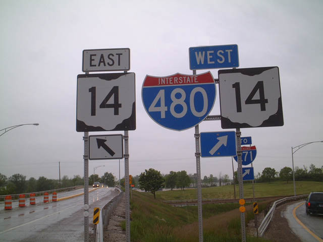
The first Cleveland area exit along the Ohio Turnpike is with Interstate 480 and SR 14. I-480 angles northwest from Streetsboro through the suburbs of Twinsburg and Macedonia to combine with Interstate 271 at Oakwood.
09/01/05
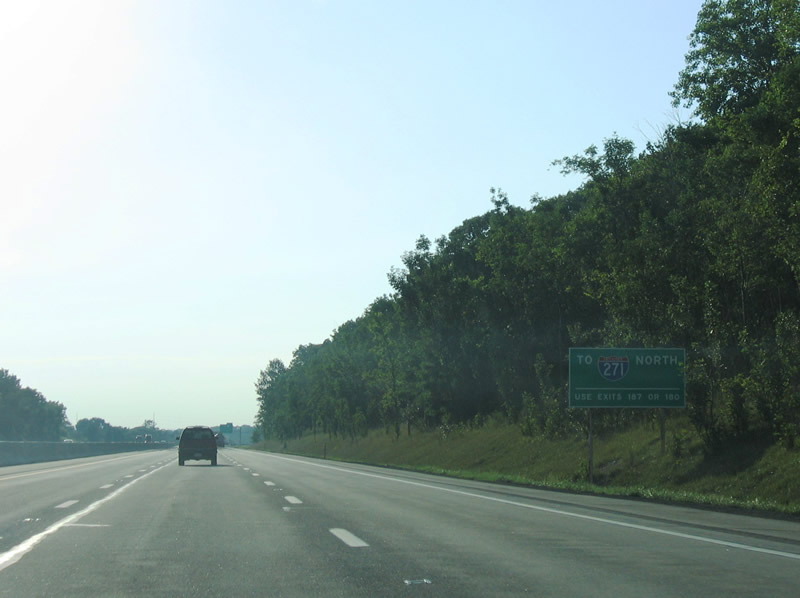
There is no direct access from the Ohio Turnpike to Interstate 271, a loop north to I-90 at Willoughby Hills and southwest to I-71 near Medina. I-480 west and SR 8 north at the succeeding exit links I-80 with I-271.
09/01/05
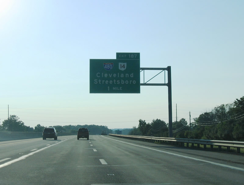
SR 14 extends southeast from I-480 at Exit 187 to SR 43/303 in Streetsboro en route to Ravenna. SR 43 runs south to Kent and north to Geauga Lake.
09/01/05
I-480/SR 14 overlap 12 miles west to Oakwood, where it shifts onto Broadway Avenue to Bedford. I-480 returns to the Ohio Turnpike at Exit 151 in North Ridgeville.
09/01/05
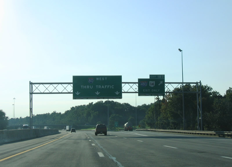
Entering the trumpet interchange (Exit 187) with the access road linking I-80 to I-480/SR 14.
09/01/05
I-480 historically was proposed as part of Interstate 80N, an urban loop north into Cleveland.
05/25/02
The Ohio Turnpike was expanded to six lanes west from the exchange with I-480 to SR 8 by 2014.
09/01/05
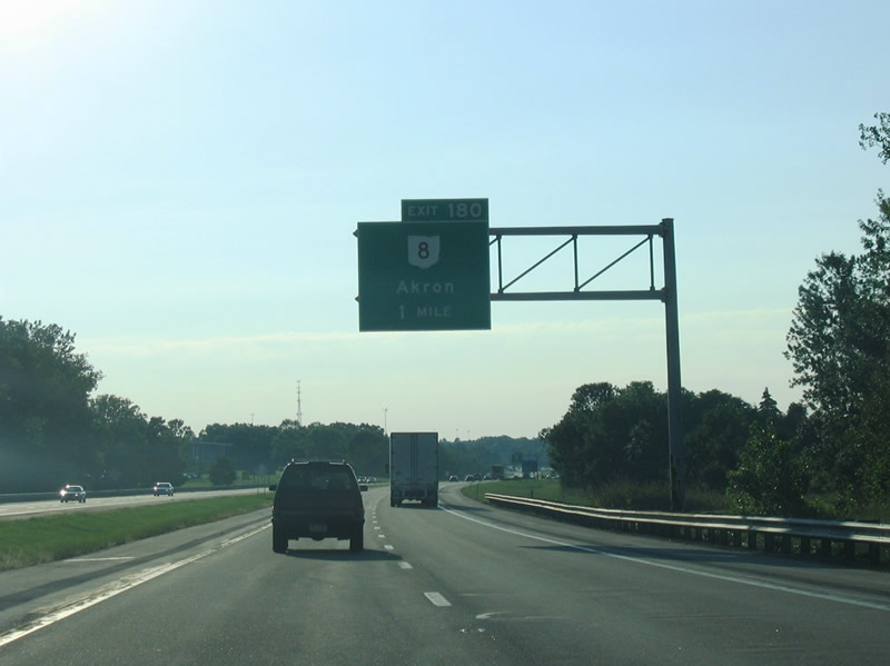
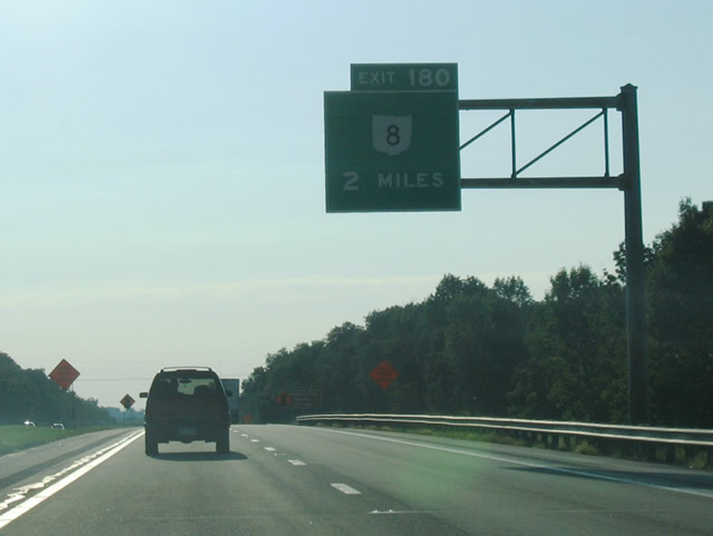
SR 8 constitutes a limited access highway south to the Central Interchange with I-76/77 in Akron and north to Interstate 271 at Macdeonia.
09/01/05
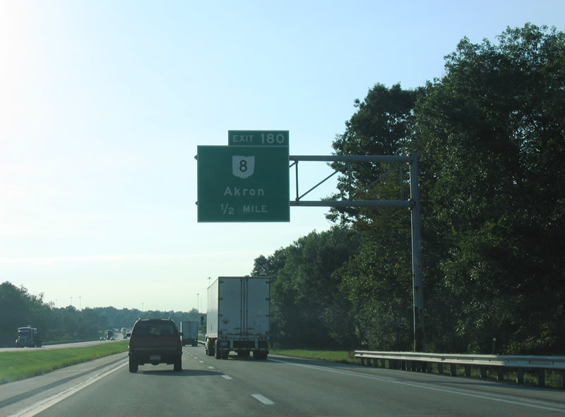
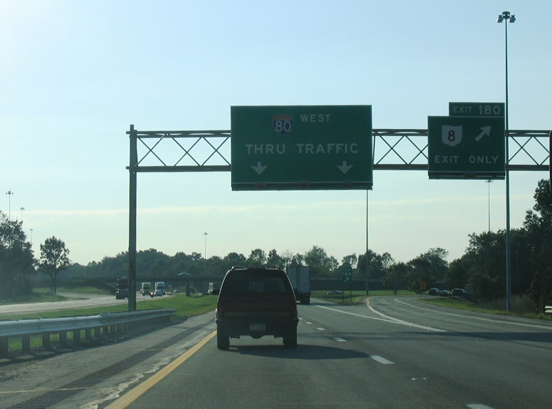
I-80 leaves the city of Hudson ahead of the trumpet interchange at Exit 180. SR 8 serves Cuyahoga Valley National Park to the north and the Blossom Music Center to the south.
09/01/05
SR 8 travels overall between Akron and Downtown Cleveland. The stretch 1.3 miles south from I-80 was upgraded to a freeway by 2011.
09/01/05
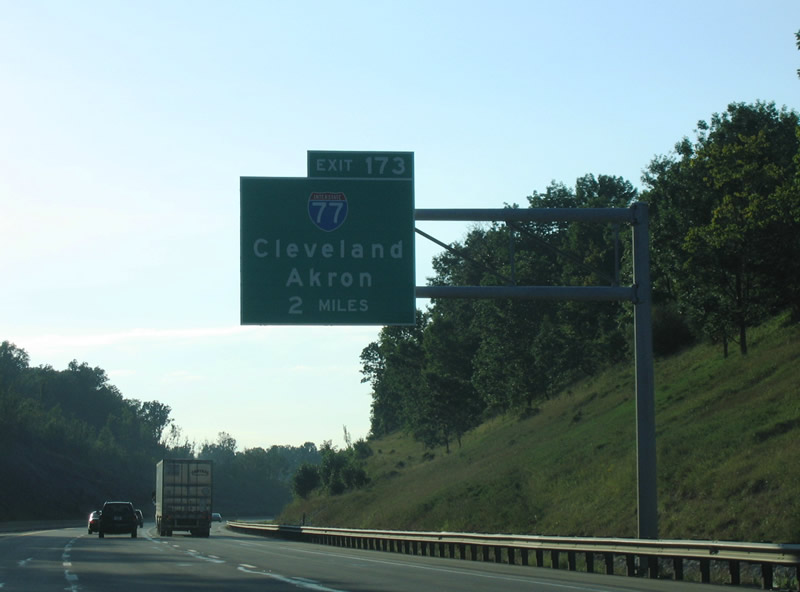
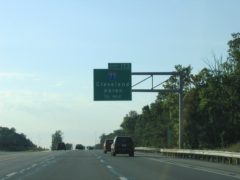
Interstate 77 provides a direct link to the city of Cleveland from the Ohio Turnpike at Exit 173. The Willow Freeway serves the southern suburbs of Brecksville, Richfield and Broadview Heights among others.
09/01/05
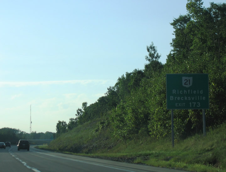
A limited access roadway connects the trumpet interchange at Exit 173 with SR 21 (Brecksville Road) in addition to I-77. The former route of U.S. 21, SR 21 parallels I-77 to the east from Richfield north through Brecksville and Independence.
09/01/05
Black Road spans I-80 a half mile from Exit 173 in Richfield township. Originating in Cleveland, I-77 runs south within Ohio to Akron, Canton, New Philadelphia, Cambridge and Marietta.
09/01/05
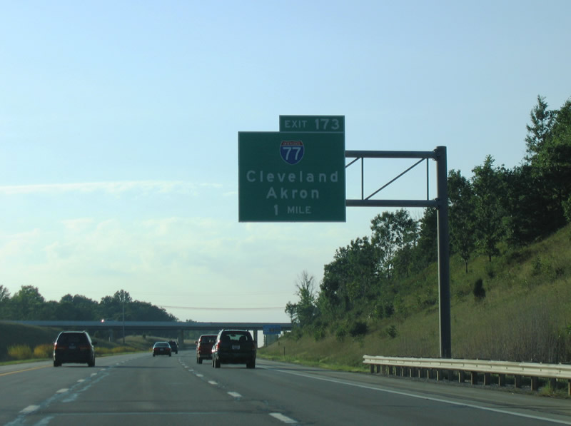
Interstate 77 (Willow Freeway) concludes 16 miles to the north at I-90 (Innerbelt Freeway) at Downtown Cleveland.
09/01/05

Exit 173 departs Interstate 80 (Ohio Turnpike) westbound for I-77 and SR 21. SR 21 overlaps with I-77 southward from Exit 145 to Exit 136 at Fairlawn en route to Barberton and Massillon.
09/01/05
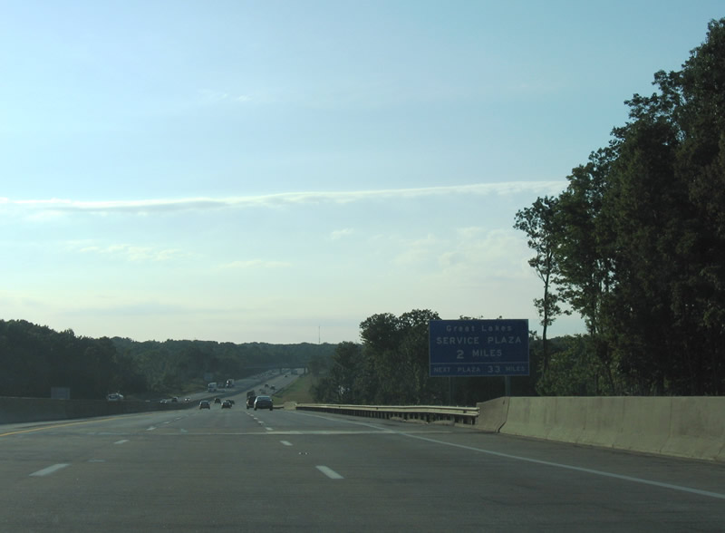
The Great Lakes Service Plaza lies two miles northwest of the Cuyahoga County line.
09/01/05
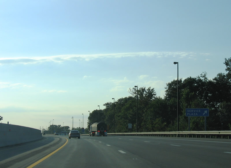
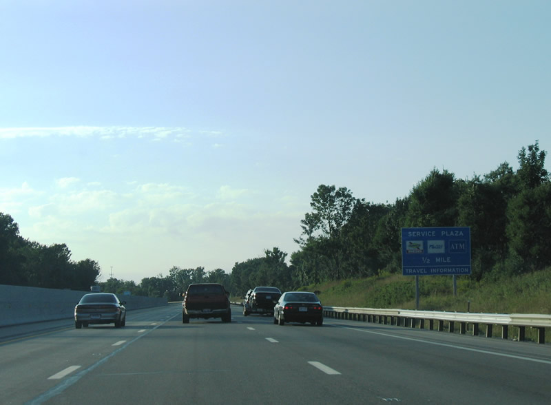
Interstate 80 enters the city of Broadview Heights at the Great Lakes Service Plaza.
09/01/05
Reassurance markers posted ahead of the Edgerton Road and SR 176 (Broadview Road) overpasses.
09/01/05
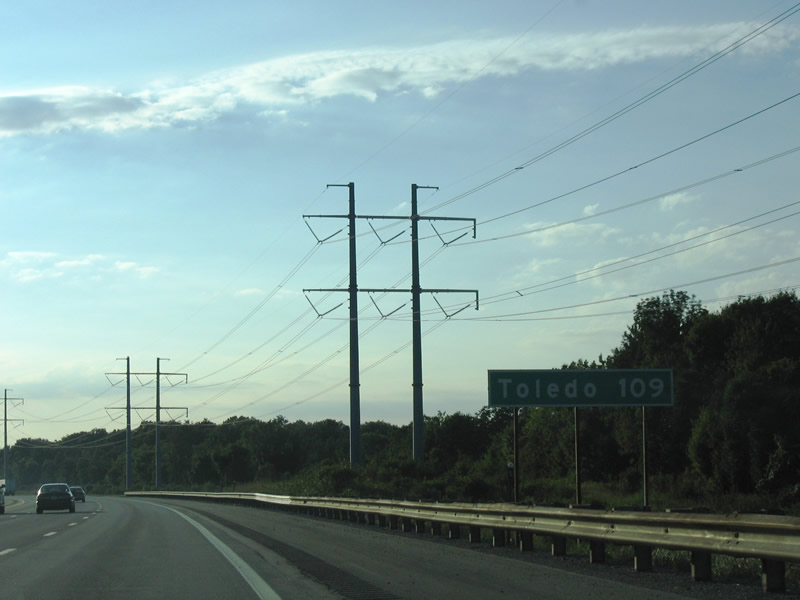
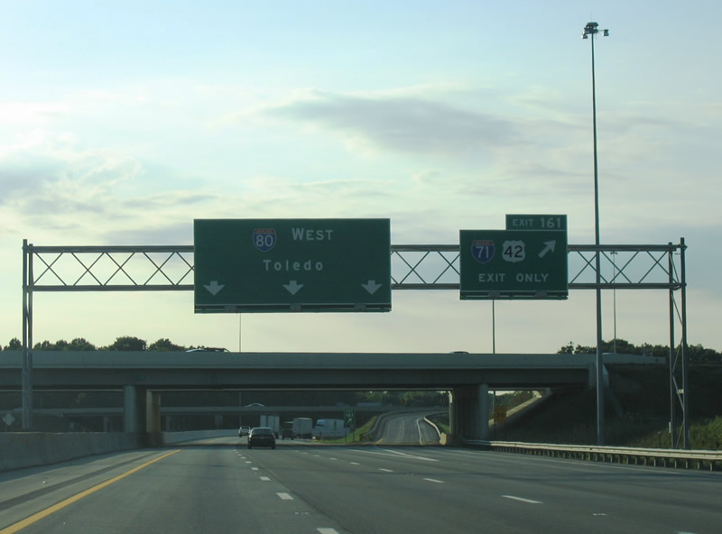
Interstate 80 heads 109 miles from the city of North Royalton to Toledo in northwestern Ohio.
09/01/05
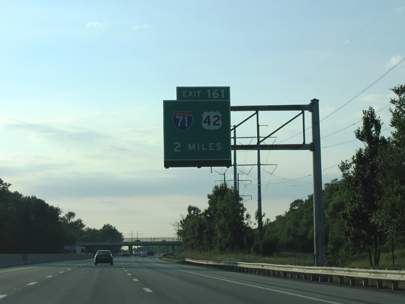
Interstate 71 and U.S. 42 converge at Middleburg Heights north of forthcoming Exit 161 and the city of Strongsville.
09/01/05
Interstate 71 arcs 14 miles northeast from the Ohio Turnpike to I-90 (Innerbelt Freeway) and I-490 at the Tremont neighborhood in Cleveland. U.S. 42 parallels along Pearl Road, 25th Street and Superior Avenue 14.5 miles to Public Square in Downtown Cleveland.
09/01/05
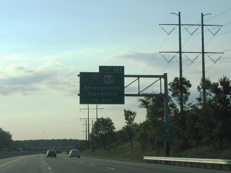
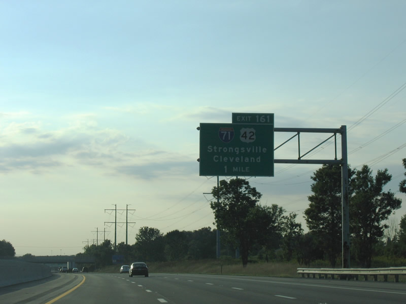
The trumpet interchange at Exit 161 ties into access roads for both I-71 and U.S. 42. The two routes parallel south to Brunswick and Medina. Cleveland-Hopkins International Airport (CLE) lies six miles north along I-71 at I-480.
09/01/05
Interstate 71 links the Cleveland area with the capital city of Columbus and Cincinnati. U.S. 42 parallels the freeway on roughly the same trajectory.
09/01/05
The access road linking with U.S. 42 (Pearl Road) at the Mill Stream Run Reservation in Strongsville passes over I-80 by this shield assembly.
09/01/05
Interstate 80 curves west ahead of the Rocky River East Branch.
09/01/05
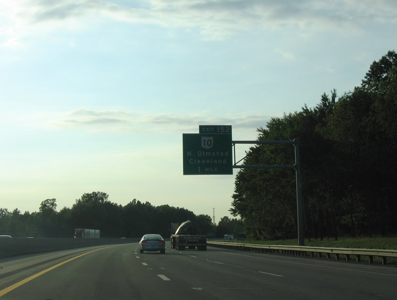
Interstate 480 returns to I-80 (Ohio Turnpike) west beyond Exit 152 with SR 10. SR 10 branches southwest from I-480 along a freeway to south Elyra and Oberlin.
09/01/05
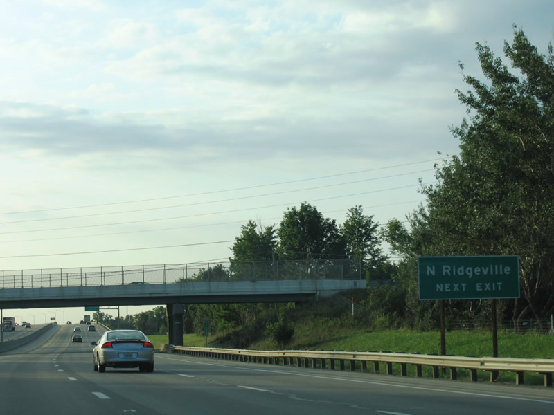
Crossing into Lorain County, I-80 enters the city of North Ridgeville.
09/01/05
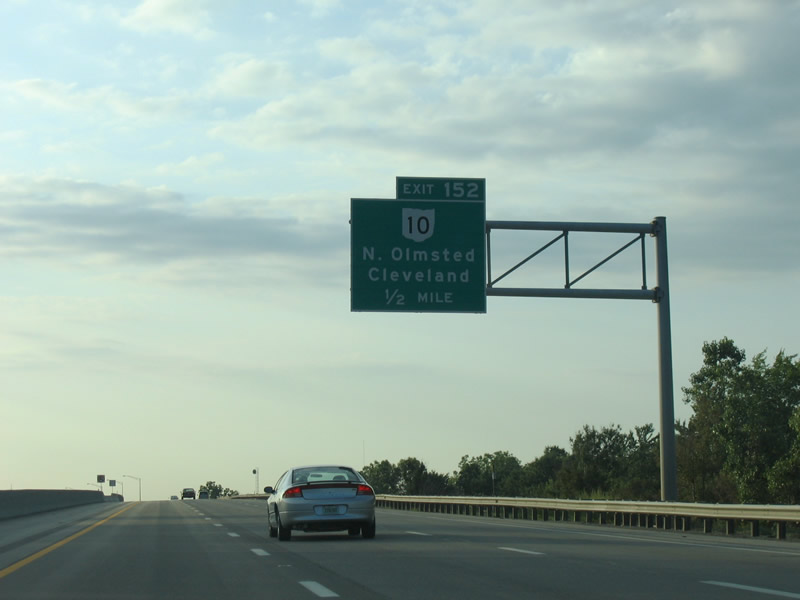
The trumpet interchange at Exit 152 connects the Ohio Turnpike with Lorain Road (SR 10C), 0.77 miles southeast of the exchange separating SR 10 east from Interstate 480.
09/01/05

SR 10 follows Lorain Road northeast from I-80 to North Olmstead, paralleling Interstate 480 (Outerbelt South Freeway) to Fairview Park.
09/01/05
A wye interchange joins the west end of Interstate 480 with I-80 just ahead of this confirming marker.
09/30/10
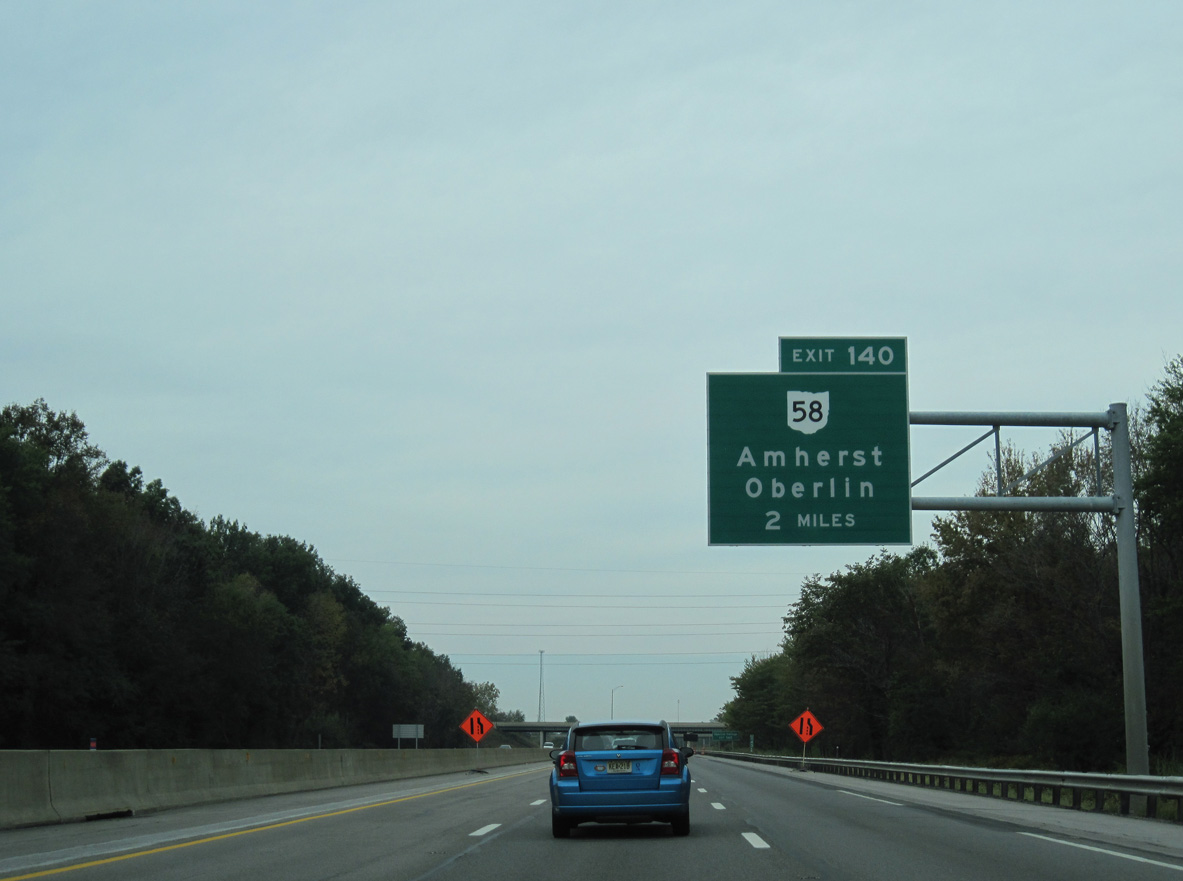
The Ohio Turnpike continues west through North Ridgeville into the city of Elyria.
09/30/10
The city of Amherst is the subsequent exit for the Ohio Turnpike beyond SR 57 in Elyria.
09/30/10
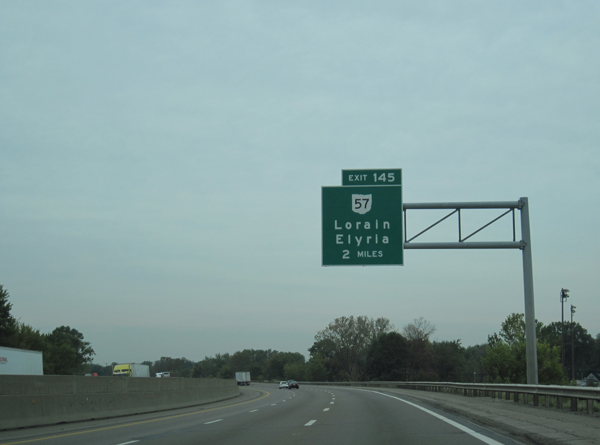
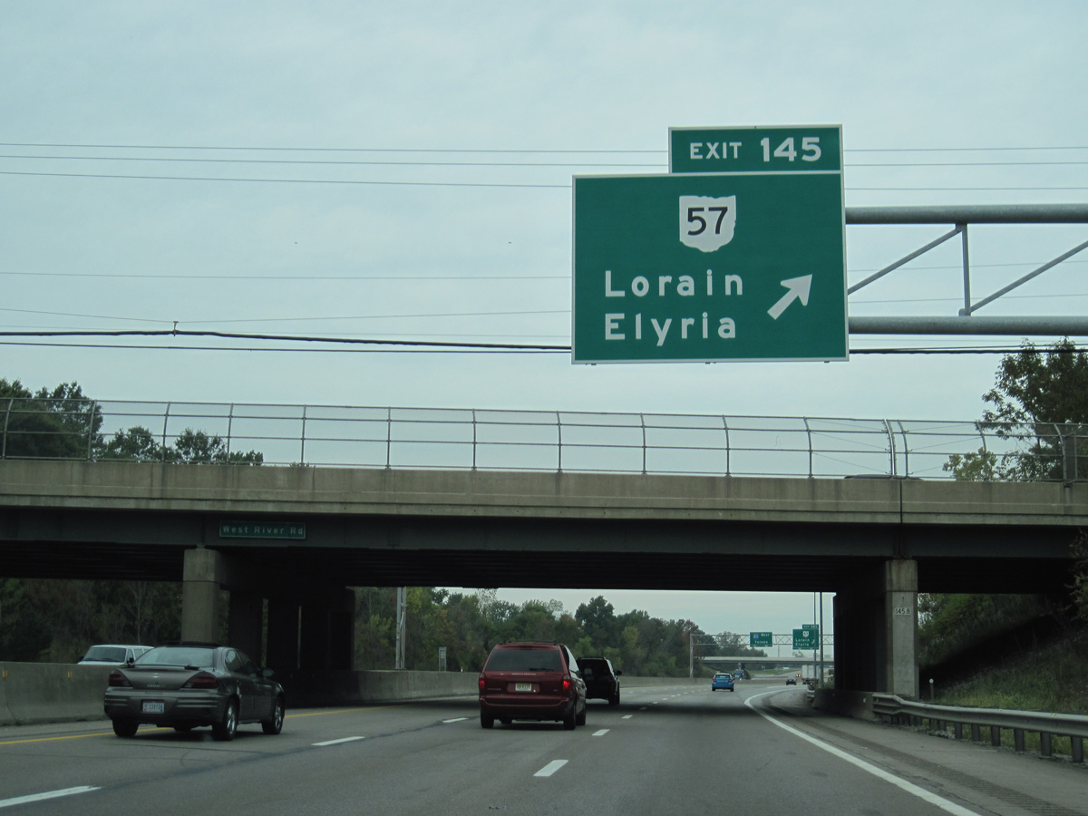
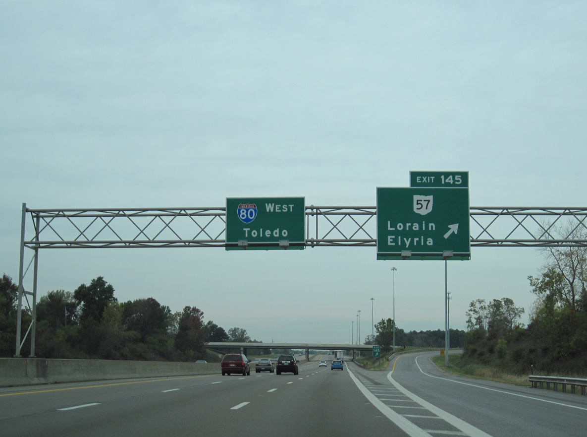
Interstate 80 runs alongside SR 57/113 (John F. Kennedy Memorial Parkway) west ahead of the Black River and the trumpet interchange at Exit 145.
09/30/10
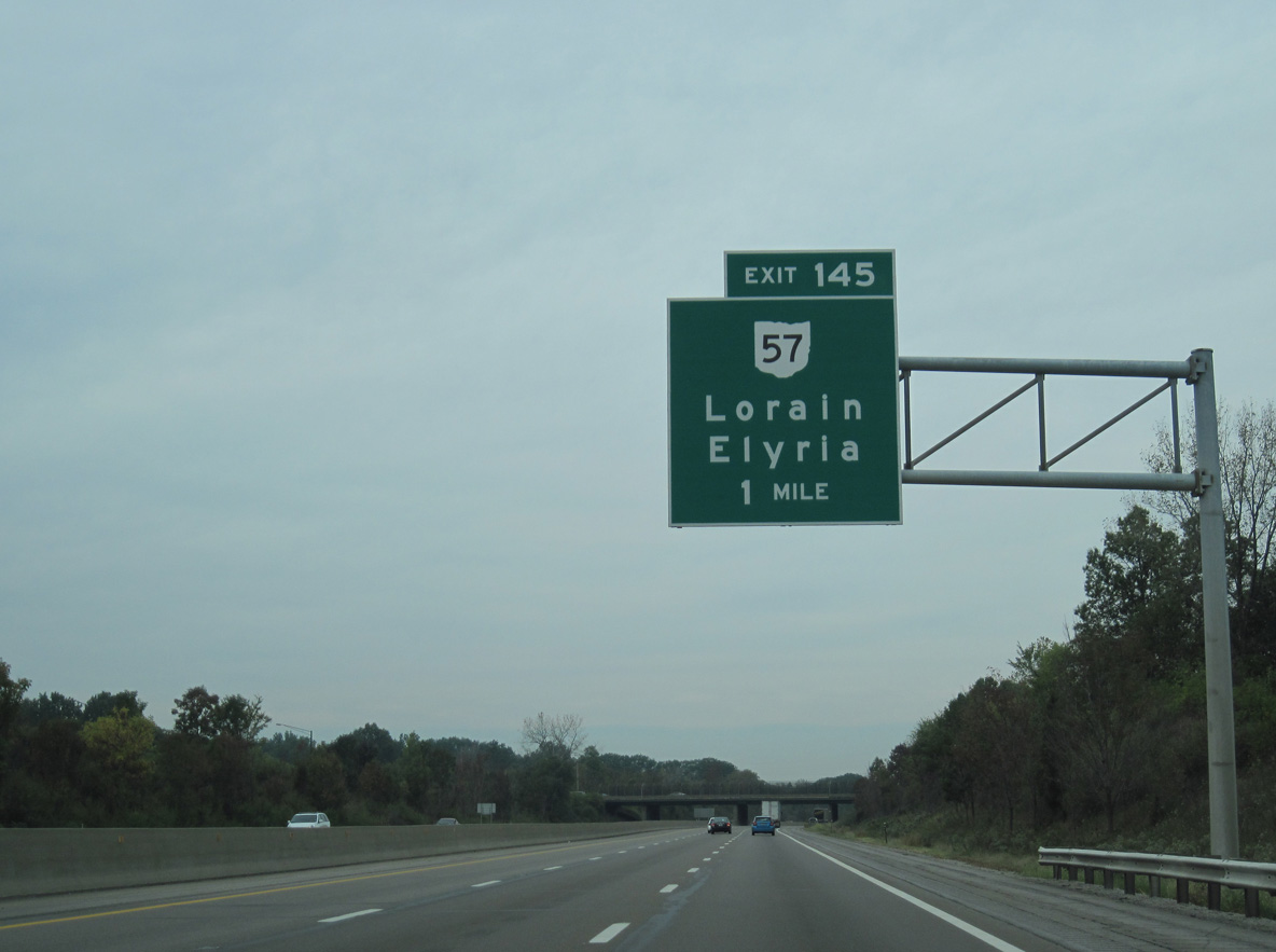
SR 57 comprises a commercial arterial north from adjacent Midway Mall en route to the city of Lorain.
09/30/10
South from Elyra and overlaps with U.S. 20/SR 113-301, SR 57 leads to Grafton and Medina.
09/30/10
SR 57 (Lorain Boulevard) north provides the closest access from I-80 (Ohio Turnpike) west to I-90/SR 2 east for Avon and Westlake.
09/30/10
Interstate 90 converges with I-80 at a wye interchange (Exit 142) in Elyria township.
09/30/10
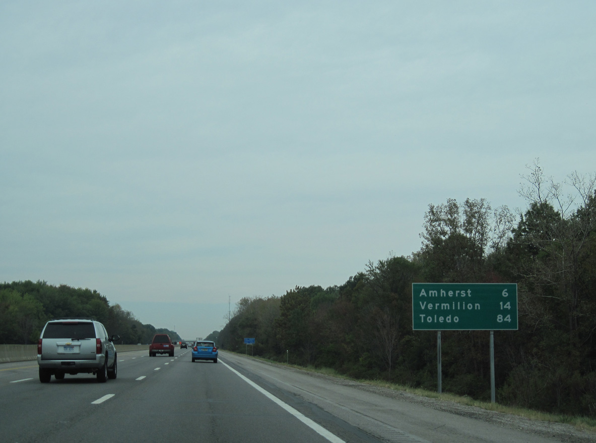
Toledo lies 84 miles to the west along the I-80/90 overlap.
09/30/10
The succeeding exit lies 1.3 miles beyond the merge with Interstate 90 west.
09/30/10
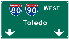
Photo Credits:
- AARoads: 09/01/05
- Andy Field: 05/25/02
- ABRoads: 09/30/10
Connect with:
Page Updated Wednesday September 01, 2021.